Wartime
Constructions
Anti-Aircraft Gun and machine-gun pillbox on
the Village Green, Hastings Road, and other
locations.
Two reports of equipment on the village green – (1)
Anti-aircraft gun. (2) pillbox machine gun post
It is reported that the anti-aircraft gun may have
been on a transporter to enable easy movement around
the county.
Anti-aircraft shell cases found on the green in 2017
from an archeology survey.
Simon Roberts remembers the demolition of the pillbox
by a gang of men with pneumatic drills. Kathryn
Franklin estimates the demolition in 1953.
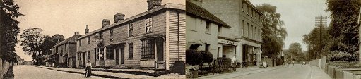
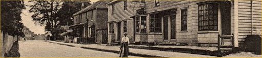
Very little material or photos.
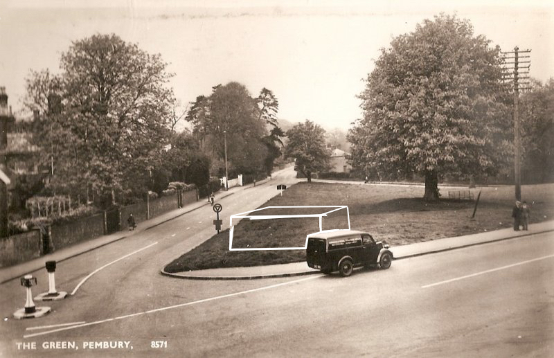
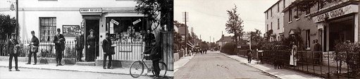
Above: An old postcard of the green
showing the position of the base. Supplied by
Simon Roberts
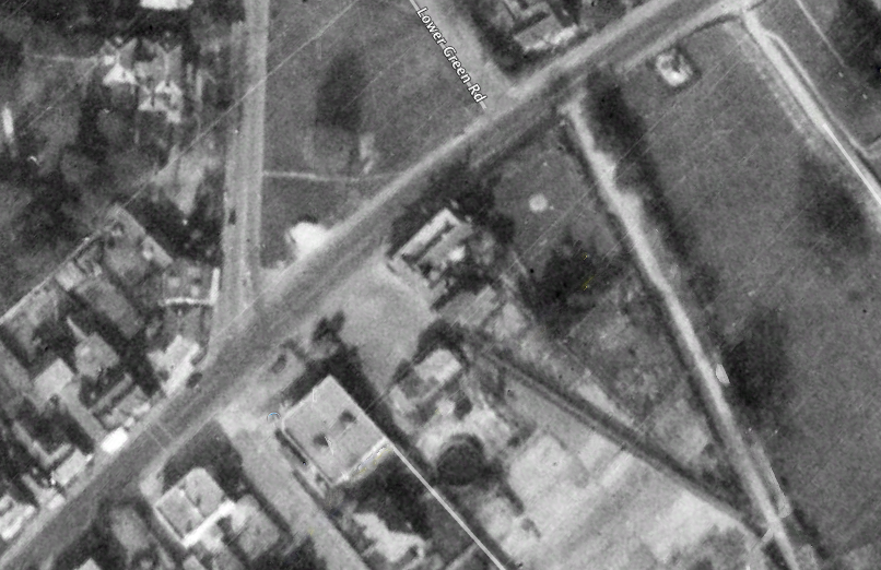
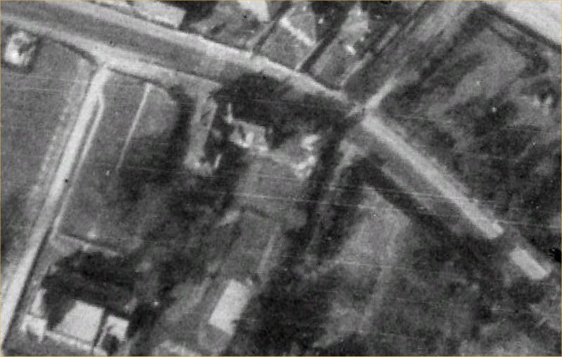
Above: Aerial view from 1940 showing the
pillbox opposite the Camden Arms car park.
Supplied by Simon Roberts – image originating
from Google Earth
Further Comments from Simon Roberts – “We lived in Pembury for
21 yrs from 1951 and moved in to our house at
Christmas with no central heating and gigantic ice
ferns on the inside of the windows every morning…
We were the new occupants of the large white house
next to the church just down the road from the
Camden Hotel. In those days the church had a
spire. I should like to add some information
here….and that is that there was a pillbox machine
gun post at the top right hand corner of the
green… I enclose a screen shot from Google
Earth from 1940 as well as one of your fotos of
the green where I’ve drawn in (rather roughly)
where I remembered the artifact having been.
I remember the thing being demolished by a gang of
men with pneumatic drills and that they spent at
least a couple of days at it….
Just for the record there was another one in one
corner of our garden looking down Hastings Rd.”
Below: the next 3 photos
describe the location of another machine-gun pillbox
known to Simon Roberts.
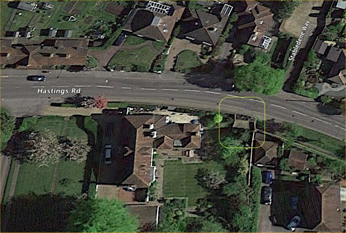
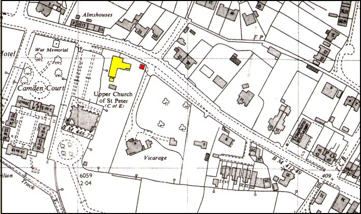
Above: the location on a modern aerial photo –
the far corner of the garden of 2 Hastings Road
Further Comments from Simon Roberts regarding this
photo –“Here is a screenshot of 2 Hastings Rd
(where once we lived) with a square drawn round the
location of the pillbox – from the road –it
looks rather as if it may still be there as I should
think the entire corner would have to be demolished
in order to get rid of it and the cost
would be prohibitive just as a matter of interest
and because the building was occupied by the MOD
the garden was covered with at least
three nissen huts.”
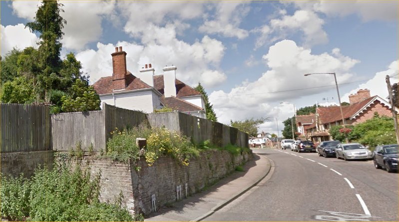
Above: the corner of the garden of 2 Hastings
Road – the site of the pillbox behind this fence.
Above: 1940 aerial photo of a that part of
Hastings Road. A structure can be seen at the
site of the pillbox.
Above: 1963 OS map of upper Hastings Road
highlighting Postillions.
Note the small square structure (pillbox) close to the
road. This feature does not appear on the 1938
OS map
In September 2018 the owners of Postillions kindly
granted this web site permission to take a few
photographs.
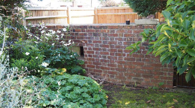
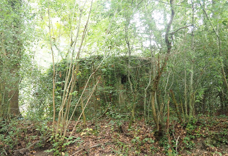
The structure is tucked into a tight corner of the
garden and greatly obscured by shrubs and foliage.
External photography is limited.
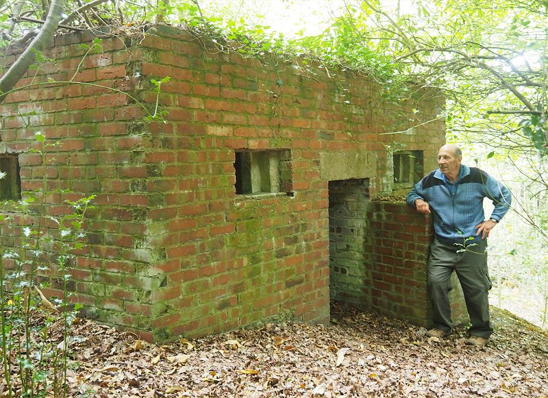
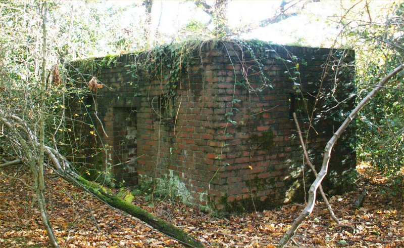
Before discussing the
images it is worth looking at the plan below and the
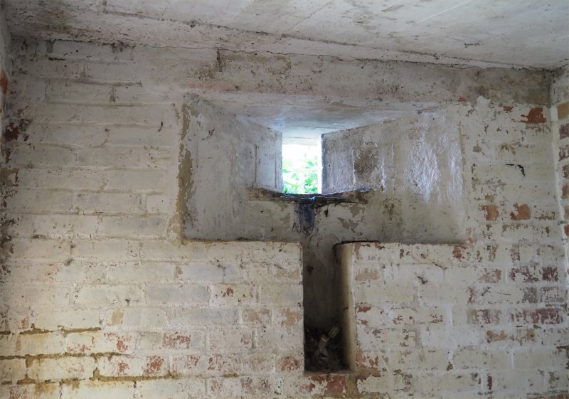
layout of the pillbox.
It is square, has one doorway, accessed by a modern
metal ladder, and 3 apertures for guns and
observation.
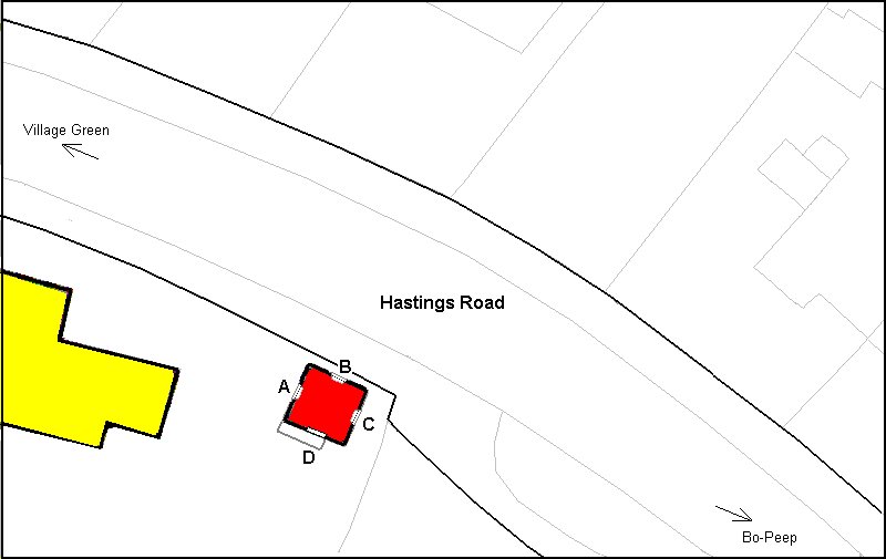
Above: a plan of the pillbox indicating the entrance
doorway (D) and the gun apertures.
The three apertures are
different in the structure and size. They are
identified in the photographs –
A – Has a long and
deep, vertical cut-away – higher than B. Faces
toward the High St and village green.
B – Similar to A but lower – has a red
border painted around it. Faces across Hastings
Road.
C – Small and blocked off – no incoming daylight due
to external increase in surrounding land. Faces
toward Bo-Peep.
Above: the best external view. Looking at
Face A
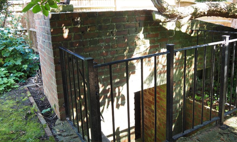
Above: the doorway / entrance accessed via a
ladder behind the railings. Face D on
plan.
Above: Looking out of A toward the High St and
Village Green.
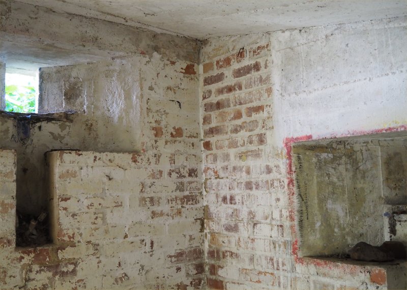
Above: Looking at the corner between A
& B.
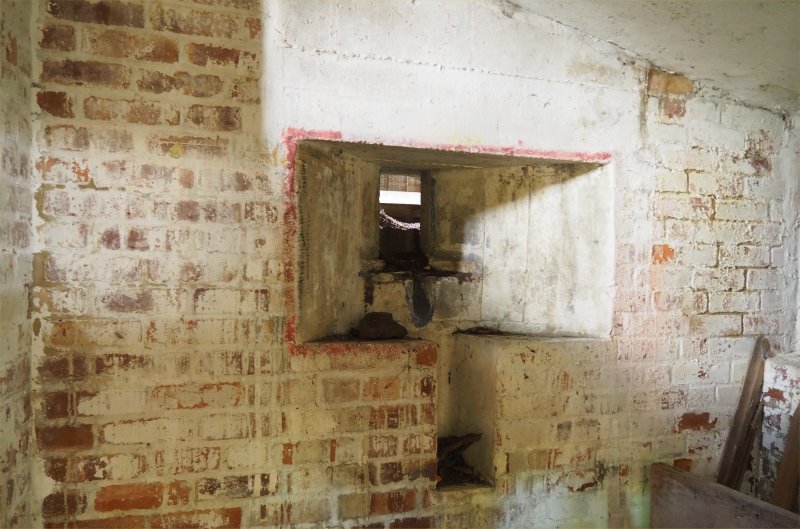
Above: Looking out of B across Hastings Road.
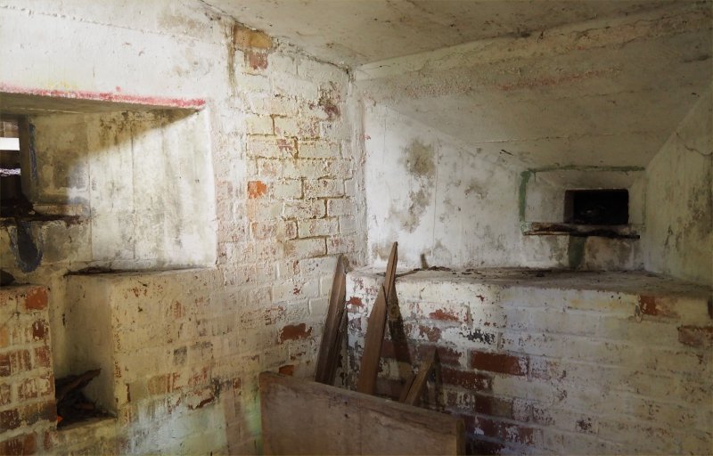
Above: Looking at the corner between B & C.
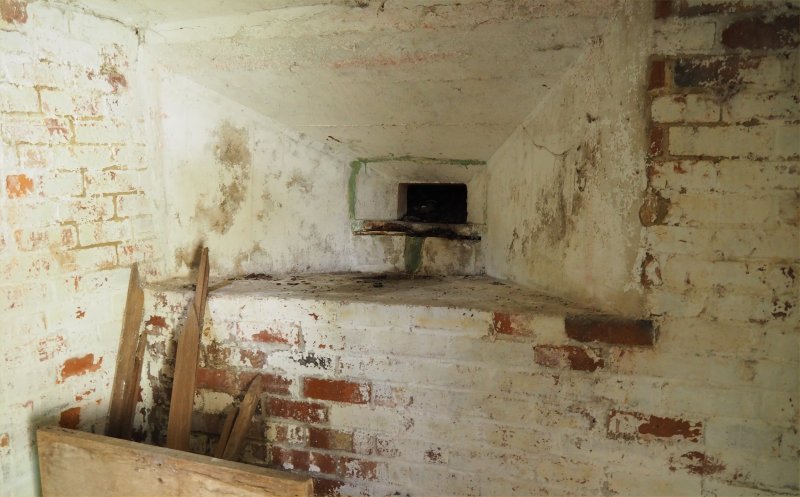
Above: Looking out of C down Hastings Road
toward Bo-Peep corner.
The photos above taken by
Tony Nicholls on 1 Sept 2018 by kind permission of the
owners.
The following photographs
are a result of Melvyn Cole’s superb knowledge of
Pembury’s undergrowth.
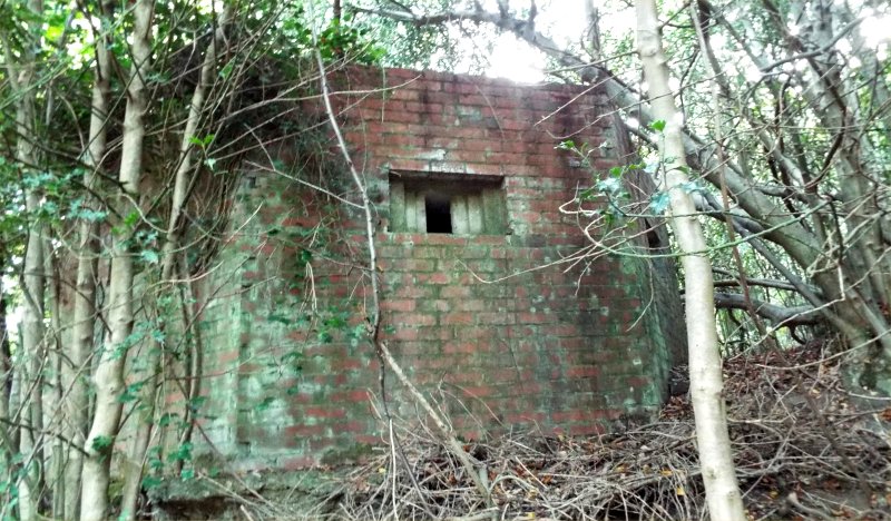
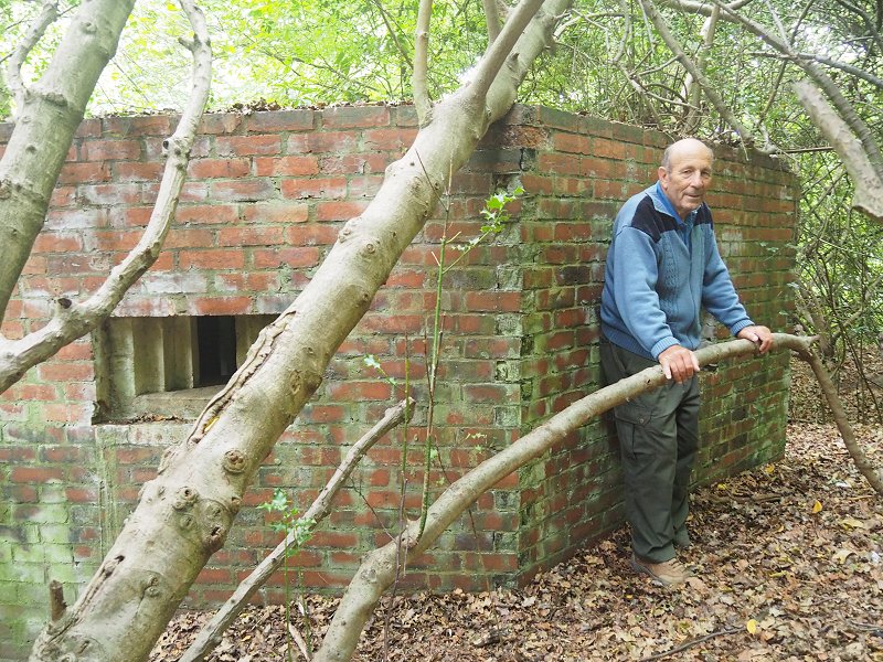
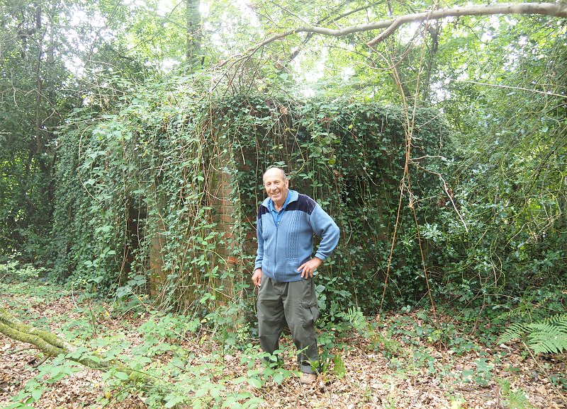
Pillbox at Blackhurst Lane near its junction with
Tonbridge Road. Photographed and
supplied by Melvyn Cole
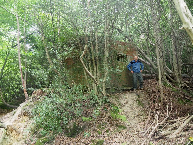
Blackhurst Lane pillbox and Melvyn Cole – photographed
Sept 2019 by Tony Nicholls
Blackhurst Lane pillbox and Melvyn Cole – photographed
Sept 2019 by Tony Nicholls
Blackhurst Lane pillbox and Melvyn Cole – photographed
Sept 2019 by Tony Nicholls
Pillbox at junction of Pembury Walks and Old Church
Road. Photographed and supplied by
Melvyn Cole
Pembury Walks pillbox – photographed Sept 2019 by Tony
Nicholls
Pembury Walks pillbox and Melvyn Cole – photographed
Sept 2019 by Tony Nicholls
Precise Grid Ref: – TQ 62642 42557
Latitude: 51.159150
Longitude: 0.324500
Further comment from Melvyn Cole –
“There is another just over the Pembury’s border
with Frant. Just past Dundale Farm, it was
originally disguised as a cottage.”
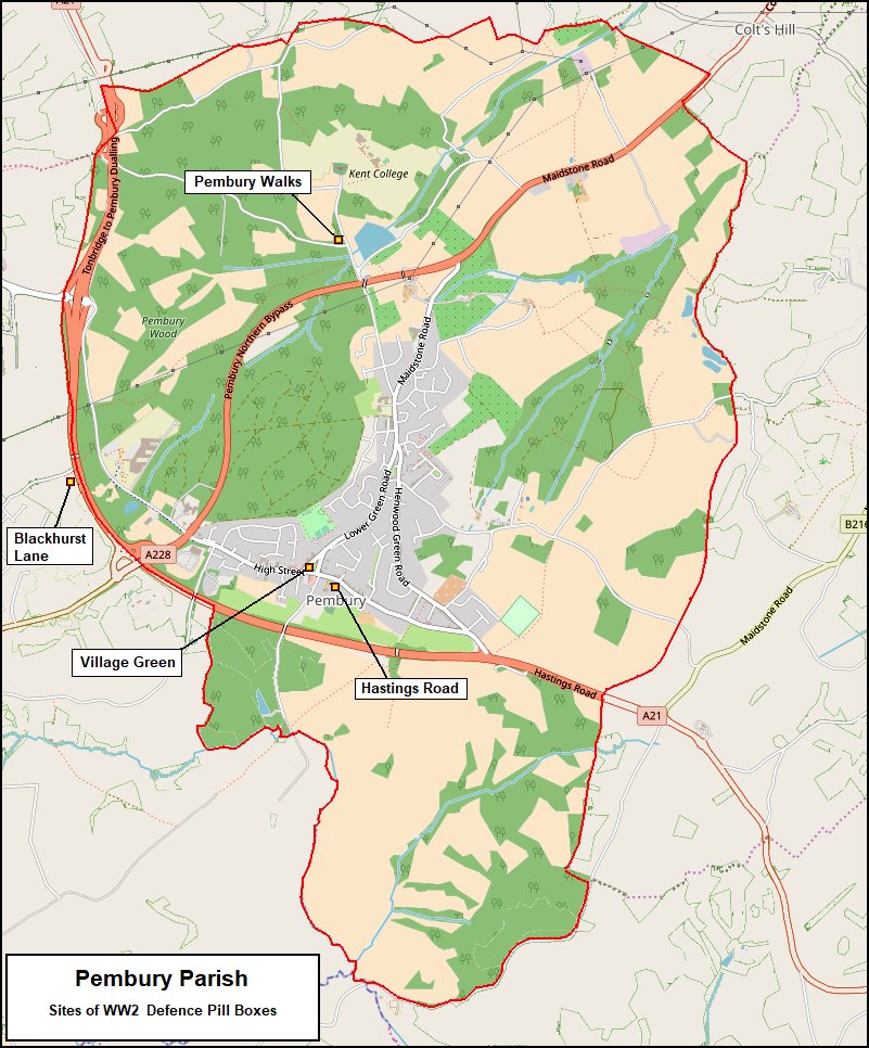
Above: A map of Pembury parish showing the
locations of the 4 known pill boxes
The map on the Tunbridge
Wells Planning Application web site gives very good
detail of two of the ‘lost’ pillboxes known to Melvyn
Cole.
Sections of the Tunbridge Wells Planning Maps are
shown below.
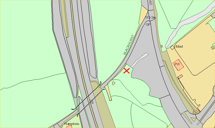
Above: Tunbridge Wells Council map showing the
truncated part of Blackhurst Lane.
This is now a footpath to the pedestrian bridge over
the A21. Bridge not shown.
The small structure to the left of Blackhurst Lane
(close to the A21 road) is an incorrect location.
Melvyn Cole places the pillbox in the region of the
red cross.
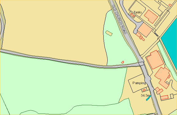
Above: Tunbridge Wells Council Map showing the
junction of Pembury Walks and Old Church Road.
Below: detail of
the above map showing greater detail of the pillbox.
There are various web
sites that show pillboxes – typically –
http://www.pillboxesuk.co.uk/
www.pillbox-study-group.org.uk/
https://commons.wikimedia.org/wiki/Category:Pillboxes_in_Kent
https://www.homefrontlegacy.org.uk/wp/case-studies/identifying-first-world-war-pillboxes-in-the-uk/
Be warned some of these
sites are tediously slow and awkward to navigate.
Most show pillboxes as concrete structures – very few
brick built.
Steve Morton found this
web site –
https://archaeologydataservice.ac.uk/archives/
that indicated 4 pillboxes in Pembury.
Below are extracts
relating to each unit. They are rather vague and
lack any useful detail.
Accuracy is dubious as they claim construction as
reinforced concrete, but recent photos show brick
construction.
Greater precision map
locations have been determined. Our
additional comments are shown in red.
-
PILLBOX (TYPE FW3/24) (ID: S0008299), Pembury,
Kent, England
E of Pembury, NE of Tunbridge Wells., Condition:
Removed (Grid ref: TQ 626 408)
Pembury nodal point
GHQ Line (East Sussex/Kent – East Branch)
Type 24 pillbox.
DEMOLISHED.
(Source: Field Visit 1997)
-
| Type of site |
PILLBOX (TYPE FW3/24) |
| Location |
E of Pembury, NE of Tunbridge
Wells.
assumed to be the one on
the village green as it is the only one
known to have been demolished. |
| Area |
Pembury, Kent, England |
| Grid reference |
TQ 626 408
Poor grid reference precision puts this
between Hastings Rd and Lower Green Rd.
.
This is location –
51.142946, 0.321464
TQ624407 on Village Green
|
| Period |
WW2 |
| Condition |
Removed
Destruction
witnessed by Simon Roberts c1952 |
| Materials |
Reinforced Concrete |
| Recorder |
Deere, Peter (Pillbox Study
Group) |
| Defence grouping |
Pembury nodal point – Defences of
Pembury Category ‘B’ nodal point. Cassini
ref. R0659. [Source: List of Nodal Points in
Eastern Command, 1940 – PRO WO 199/544].
GHQ Line (East Sussex/Kent – East Branch)
– Section of the GHQ Line running from
Crowborough to Tonbridge, passing east of
Tunbridge Wells. |
| DOB site reference: |
S0008299 |
| Event |
Field Visit, During
1997 Construction,
In the period 1940
1941
Destruction, Before 1997 (c1952) |
==================================================================================
-
NODAL POINT (ID: S0009215), Pembury, Kent,
England
Pembury, Condition: Unknown (Grid ref: TQ 62 40)
Pembury nodal point
GHQ Line (East Sussex/Kent – East
Branch) Pembury – Category ‘B’
nodal point. (Source:
Document 1940)
-
| Official Name |
Pembury nodal point |
| Type of site |
NODAL POINT |
| Location |
Pembury
Garden of 2
Hastings Road. Witnessed by Tony
Nicholls 2018
|
| Area |
Pembury, Kent, England |
| Grid reference |
TQ 62
40
Poor grid reference precision,
but nearest is 2 Hastings Road.
This is the location:
51.142460,
0.323829
TQ626407 |
| Period |
WW2 |
| Condition |
Unknown |
| Materials |
Unknown |
| Recorder |
(Defence of Britain Project) |
| Defence grouping |
Pembury nodal point – Defences of
Pembury Category ‘B’ nodal point. Cassini
ref. R0659. [Source: List of Nodal Points in
Eastern Command, 1940 – PRO WO 199/544].
GHQ Line (East Sussex/Kent – East Branch)
– Section of the GHQ Line running from
Crowborough to Tonbridge, passing east of
Tunbridge Wells. |
| DOB site reference: |
S0009215 |
| Reference |
1940 List of Nodal Points in
Eastern Command |
| Event |
Construction, During 1940 |
==================================================================================
-
PILLBOX (ID: S0009599), Pembury, Kent, England
Pembury., Condition: Extant but condition unknown
(Grid ref: TQ 6128 4135)
Pembury nodal point
GHQ Line (East Sussex/Kent – East
Branch)
Pillbox. (Source:
Book 1977)
-
| Type of site |
PILLBOX |
| Location |
Pembury.
Between
Blackhurst Lane & Tonbridge
Road. Witnessed
by Melvyn Cole 2010
|
| Area |
Pembury, Kent, England |
| Grid reference |
TQ 6128
4135
Good
Grid Reference –
Between
Blackhurst Lane & Tonbridge Road |
| Period |
WW2 |
| Condition |
Extant but condition unknown |
| Materials |
Reinforced Concrete |
| Recorder |
Bennett, D. H. (Kent Defence
Research Group) |
| Defence grouping |
Pembury nodal point – Defences of
Pembury Category ‘B’ nodal point. Cassini
ref. R0659. [Source: List of Nodal Points in
Eastern Command, 1940 – PRO WO 199/544].
GHQ Line (East Sussex/Kent – East Branch)
– Section of the GHQ Line running from
Crowborough to Tonbridge, passing east of
Tunbridge Wells. |
| DOB site reference: |
S0009599 |
| Reference |
1977 A Handbook of Kent’s
Defences |
| Event |
Construction, In the period
1940 1941 |
==================================================================================
- PILLBOX
(TYPE FW3/24) (ID: S0008298), Pembury, Kent,
England
Near A264 road, Pembury, NE of Tunbridge Wells.,
Condition: Extant but condition unknown (Grid ref:
TQ 605 402)
Pembury nodal point
GHQ Line (East Sussex/Kent – East
Branch) Type 24
pillbox. (Source: Field Visit 1997)
-
| Type of site |
PILLBOX (TYPE FW3/24) |
| Location |
Near A264 road, Pembury, NE of
Tunbridge
Wells.
NOT
Pembury – this is Tunbridge Wells |
| Area |
Pembury, Kent, England |
| Grid reference |
TQ 605
402
Poor grid
reference precision puts this at A264
near Halls Hole Road junction –
Tunbridge Wells!.
|
| Period |
WW2 |
| Condition |
Extant but condition unknown |
| Materials |
Reinforced Concrete |
| Recorder |
Deere, Peter (Pillbox Study
Group) |
| Defence grouping |
Pembury nodal point – Defences of
Pembury Category ‘B’ nodal point. Cassini
ref. R0659. [Source: List of Nodal Points in
Eastern Command, 1940 – PRO WO 199/544].
GHQ Line (East Sussex/Kent – East Branch)
– Section of the GHQ Line running from
Crowborough to Tonbridge, passing east of
Tunbridge Wells. |
| DOB site reference: |
S0008298 |
| Event |
Field Visit, During
1997
Construction, In the period 1940 1941 |
Note: The pillbox
at the junction of Pembury Walks and Old Church Road
is not registered with the four above.
Google Maps can be used
to pin-point a precise location. Click the
location on Google Map to get the Latitude &
Longitude.
Grid Reference Locations determined here –
https://gridreferencefinder.com/
or here – https://latlngfinder.com/b.php
The web site dealing with
Tunbridge Wells Planning Applications also has a good
map with interactive Longitude & Latitude.
Local Government web sites may change at any time so
there is a reluctance to provide a direct link here,
but –
navigate to the local planning applications web site a
find the ‘Property’ map.
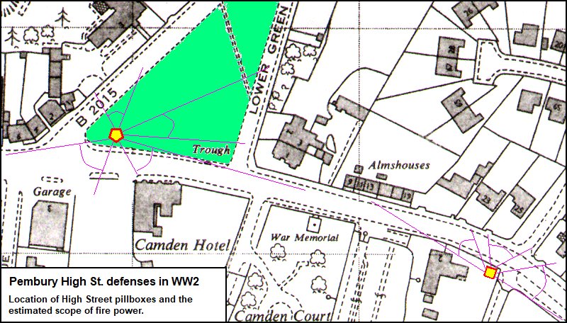
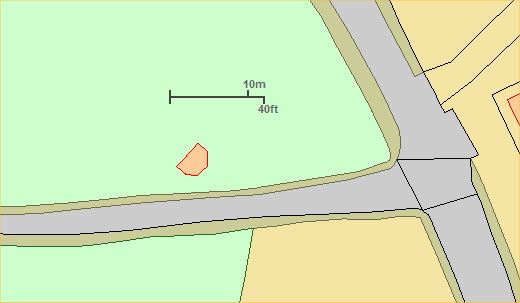
Above: a map created to estimate the scope of the
firepower and the view from the pillbox gun ports.
The orientation of the 5 sided pillbox on the village
green is copied from the aerial photo higher up this
page.
WW2 Road Blocks in
Pembury
This information has been
supplied by Robin Kenworthy who remembers the
locations around the village where road block
materials were stored.
The map below has been
compiled based on Robin Kenworthy’s recollections.
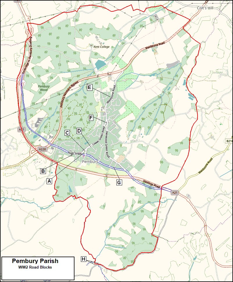
Above – Parish map of Pembury showing the locations of
material stores.
This map shows modern roads for greater understanding
and the route of the old 1940’s A21 is in blue.
Below – a chart of the location descriptions.
Key
|
Location of Sites for Storing
Road Block Materials
|
| A |
Road block at Church House (Postillions, bend
in Hastings Rd). Bandstand (pillbox on the
green) had five sides, aligned so two could fire
toward road block. Entrance of pillbox was
opposite shops. |
| B |
Square concrete block in High Street at the
corner of Sunhill Place and 31 High St. |
| C |
Sandbags and faggots (bundles of sticks, poles
& staves) around tree as camouflage at
bottom of Village Green. |
| D |
Amberleaze Drive – store of concrete blocks
and wire. |
| E |
Layby in Maidstone Road – now Stone
Court/Herons Way junction store of equipment,
concrete blocks & wire. |
| F |
Institute (corner of Lower Green Road &
Henwood Green Road) – sandbagged as Warden posts
in the entrance beside the house |
| G |
Sheen (corner of Stanham Rd & Hastings
Rd). Garages were sandbagged on the
inside to make an Air Raid Warden Post (Veranda
extension is new).
The old bus garage (Hayward Brothers Garage –
127 Hastings Rd) – The rear garages under the
apartments had been created by lowering the
floor and putting openings in the wall. |
| H |
Old Coach Rd crossing Dundle Rd – pill box
disguised as a house looking toward Farm.
Dragon’s Teeth (an array of concrete spikes set
into the ground) across the neighbouring field
and river. See photo in linked
document below. |
|
|
Complimentary notes
supplied by Robin Kenworthy – Click
here for document.
Other defenses –
Dragon’s Teeth at
Dundale.
Air Raid Shelters at Bo-Peep, Stanham Road,
Church Road, Pembury School, Pembury Hospital,
possibly The Mount.
Warden Posts at Stanham Road and The Institute (Lower
Green)
Bombs over
Pembury
Below is a map of the approximate locations of bombs
dropped during World War II (1939-1945).
Data gathered by Melvyn Cole and others from memories
and records of residents, local newspapers and archive
material.
There are also reports of someone being killed and
flying bombs passing over Pembury.
It is noted that during the war newspapers were not
allowed to print addresses or street locations of
fallen bombs.
Until a better part of the web site is found this map
seems best suited on this page.
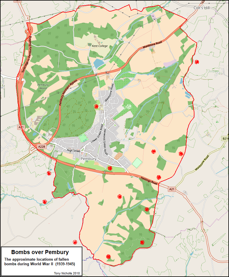
Above – a map of the locations of fallen bombs over
Pembury.
This is shown on a modern day map (modern road
layouts) to better indicate the locations.
Page compiled by Tony
Nicholls
Maps
created by Tony Nicholls
IMPORTANT !!!
This needs your help.
All contributions will be credited.
If you have any further information or corrections
please contact me –
Tony Nicholls email:
history@pembury.org