Pembury History

Localities - A21 General History

This page covers the main London to Hastings road known these days as the A21.

Note that ‘Hastings Road’ on other parts of this web site refers to the small section between the village green and Bo Peep corner.
The scope of this page is beyond that of the village of Pembury but as the A21 is such an integral part of accessing the village we feel a need to record its history.

The range of interest for the top part of this page will be roughly Kippings Cross to  Fairthorn / Pembury Walks / Castle Hill Farm.
The bottom part of the page covers the Tonbridge part of the road.

The old road from London to Hastings and Rye dates back to Saxon times and beyond, mostly following high ground where possible. This was to avoid low, wet, boggy areas during winter and to have good visibility of the landscape and good sight of landmarks.  Tonbridge had long been the sensible place to cross the flat & boggy Medway valley with Castle Hill leading the way south to the coast.  It is thought that Harold led his army this way toward Hastings to confront William in 1066, and later the Conqueror used the road to regularly access Normandy via Hastings and Rye. It was later used to transport fish from Hastings to Tonbridge & Sevenoaks, drive sheep from Romney Marsh to Tonbridge, cattle from Sussex to Tonbridge & Maidstone, and mail coaches to distant towns. It was a well used route. The stretch through Pembury is along a thin ridge.  Just traveling from Woodsgate Corner in the High Street to Bo-Peep Corner in Hastings Road it is easy to see the terrain dropping away in all directions. It is very common for towns and villages to be placed on hills and ridges – ‘high streets’ got their names for a very good reason.

For more information on the historic A21 / London to Hastings Road please see –

a)  the Milestone Location page for greater detail of milestones and distance measurement.
b)  the Wiki page   https://en.wikipedia.org/wiki/A21_road_(England)  for a very general guide to the road.


The map below is from John Ogilby’s road atlas of 1676 and is the first printed map of the London to Rye road.

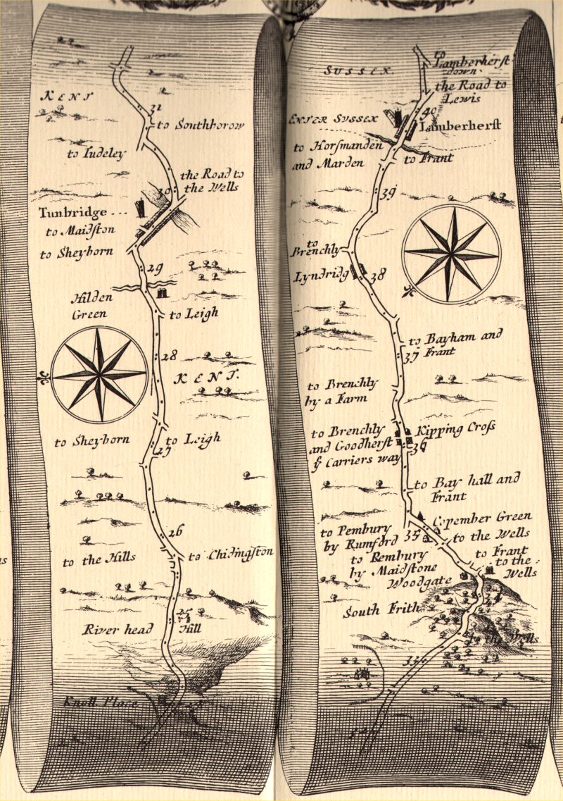
Above: a portion of the 1676 London to Rye map covering Riverhead to Lamberhurst.
Roads were traditionally shown on scrolls or strips, running head to toe for continuity.
Each strip had its own compass rose to indicate the orientation of the road on that strip. North was never assumed to be ‘up’.
The Milestones Page on this web site has a more detailed explanation of these types of maps.


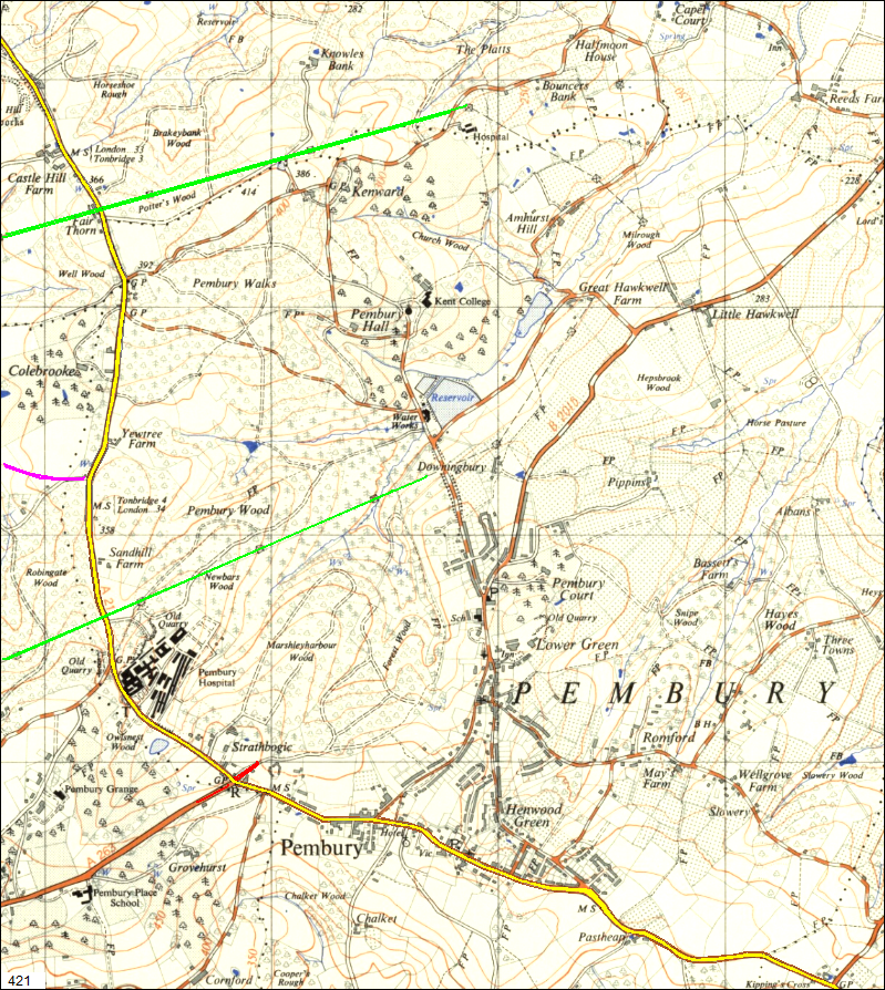
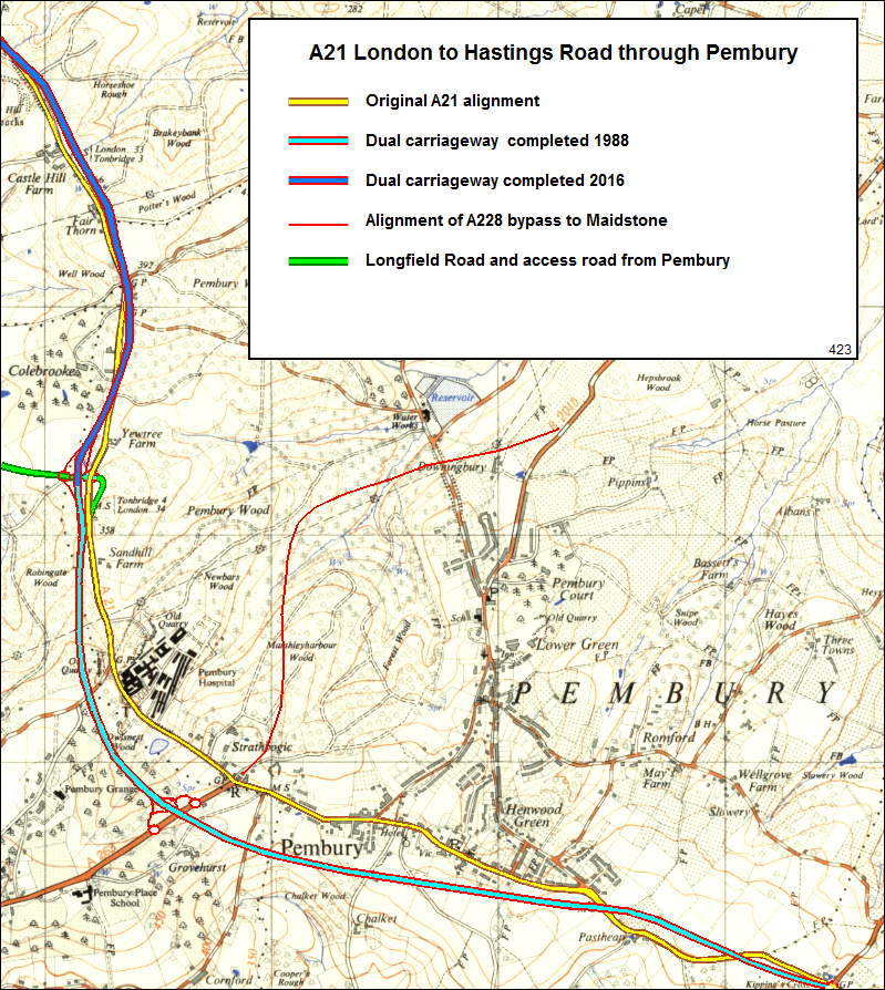
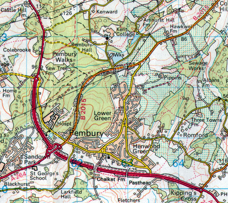
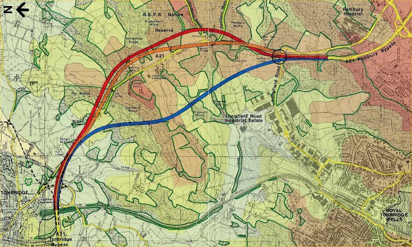
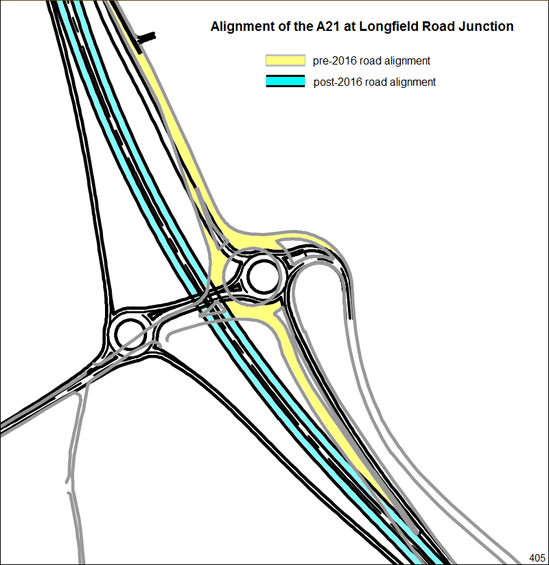
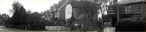
The first 3 maps below show the A21 alignment through Pembury, and its changes, over the years.


A 1937 map showing the A21, highlighted in yellow running through the village.

To help recognition with the 21st century some long term landmarks are highlighted –
the electricity pylons are marked in green,
what would be Longfield Road in marked magenta, and what would be the
A228 bypass to Maidstone is shown as a red stub.


The same 1937 map showing the overlay of the 1988 dual carriageway bypass.
The status of ‘A21’ is now given to the bypass. The High Street/Tonbridge Road is declassified.
Blackhurst Lane, just north of the hospital, is now truncated. This is the site of a footbridge.
The remaining parts of the road from Bo Peep to Kippings Cross are known as Old Hastings Road.
Two stubs of the old road exist as access roads to Kippings Cross Farm and Past Heap Farm.


The same 1937 map with an overlay of the 2016 dual carriageway to Tonbridge.
The alignment at the junction with Longfield Road was skewed to the west.


This map dates to 1990 just a few years after the completion of the 1988 bypasses.


Above :  an early 2000s map of 3 proposed routes (Red, Orange & Blue).  Yellow is the old A21 route.


Above :  early 2000s maps featuring 4 options for routing the A21


Above: The route to the west of Castle Hill would have involved tunnels.


Above : A detailed map of the new Longfield Road roundabout showing recorded antiquities.
The milestone (34) was recorded on maps from the 1988 Pembury bypass but had not been seen in recent years.


Detail of the Longfield Road junction before and after the 2016 development


Above: a four image animation sequence of the road layout


Copy of the A21 proposed dualling published in 2013


Image supplied by the Highways England July 2016 showing road closure 20 Aug 2016 to Spring 2017


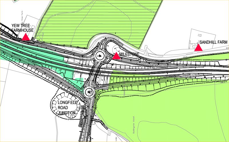
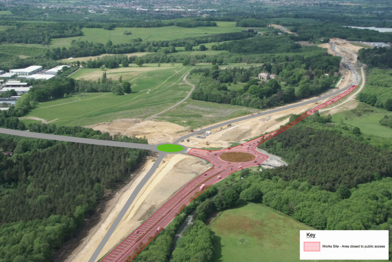
The A21 dualling project had the task of building a new footbridge across the A21 between the hospital and the footpath that was Blackhurst Lane. At a meeting in 2014 at the Mercure Hotel a reason for the bridge was given –  It was to replace an old bridge from years ago. The completion of the A21 bypass (1988) caused the truncation of Blackhurst Lane with the old A21, so a footbridge was constructed to enable pedestrians access from Blackhurst Lane to the hospital.   Around this time it is rumoured that a road traffic accident involved a vehicle crashing into the base of the bridge, resulting in its closure and eventual demolition.  Details of this incident are missing.  The Sevenoaks Chronicle quoted this in 2015 –  “At the Blackhurst Lane footbridge, there is a pedestrian crossing at the moment where there is a gap in the barrier but in the past there have been fatalities and as part of the scheme there will be putting in a footbridge. ” Sure enough, Google images show a gap in the central reservation armco barrier allowing pedestrian access across the A21 dual carriageway.


Above (2015) – footbridge location looking north, from the northbound carriageway.   Blackhurst Lane path joining from left. Path toward hospital on right.


Above (2015) – footbridge location looking south from the northbound carriageway.  Path from hospital on left. Path to Blackhurst Lane on right.


Above (2015) – footbridge location looking south from the northbound carriage way. Details of the old footpath are more obvious.


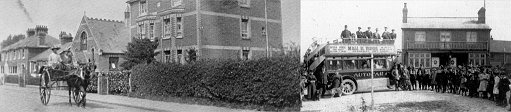
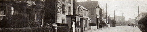
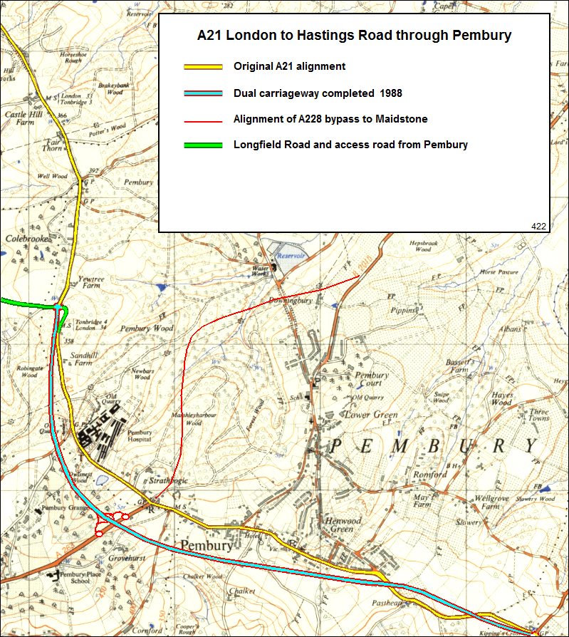
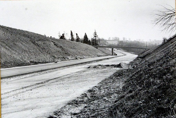
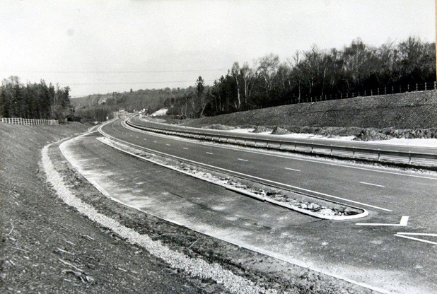
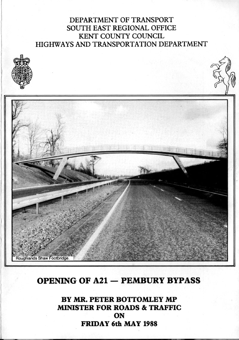
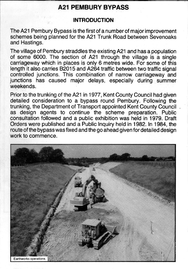
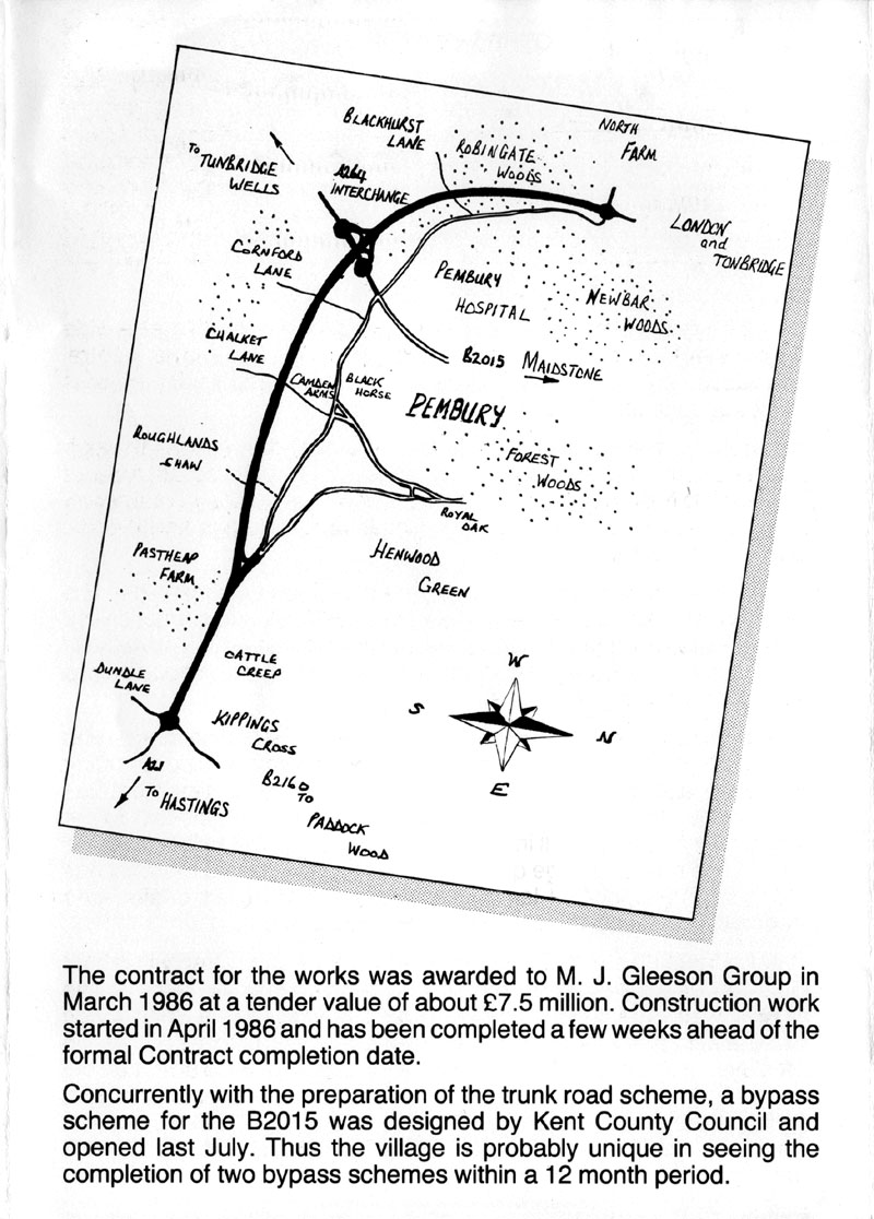
1988 A21 Pembury Bypass

The 6 images below were scanned from a 1988 pamphlet belonging to John Hawker.


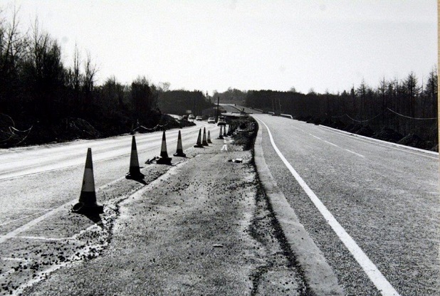
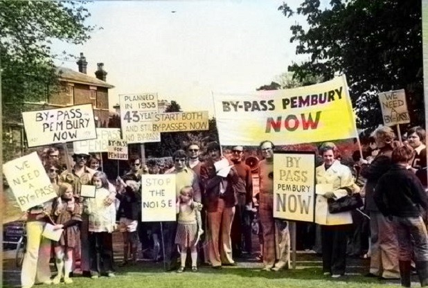
A21 Bypass 1987 – 1988     The following 5 photographs appeared on the Kent Live web site in March 2017.

They have been reproduced here with kind permission of the Kent and Sussex Courier


Woodsgate Corner being prepared for the bypass toward Maidstone
(Kent and Sussex Courier)


Dualling of the A21 south of Pembury believed to be in 1988  (Kent and Sussex Courier)


Construction of the Northern Pembury By Pass, believed to be around 1987
(Kent and Sussex Courier)


Construction of the A21 Pembury by-pass, near Longfield Road in March 1988
(Kent and Sussex Courier)


Protesters on the Pembury village green in 1976 (Kent and Sussex Courier)


Video of the 2015, 2016, 2017  Roadworks

The first video below was made by David Doré as a memory of the old route along the A21 from Tonbridge to Pembury.  The journey takes us from the slip road at Tonbridge along the old alignment of the A21 to the Longfield Road roundabout, and off down Tonbridge Road toward the hospital.

When we got sight of the video we asked David to do another, and another, and another.  The changing landscape  during 2015 and 2016 will soon be forgotten when the diggers have gone, the grass returns and the trees have regrown.  Our memories will fade and we will have difficulty recalling how it was.  As a history web site, looking to the past, we are jumping the gun and pre-loading our history requirements in the making of these videos.

Many thanks to David Doré for the making and the supply of such remarkable records.


The old A21 – a last look. from David Doré on Vimeo.

This section of the old A21 between Tonbridge and Pembury in 2015.


A21 July 2016 from David Doré on Vimeo.

 A return trip from Longfield Road to Tonbridge, then down the first part of Longfield Road, and back to the A21.
Thanks to David for accepting our request for making this video.


Wasteland from David Doré on Vimeo.              Engineering work during August 2016


A.21 – Tonbridge Road from David Doré on Vimeo.           August 2016


A.21 Aerial from David Doré on Vimeo.
A wonderful aerial view taken by David on Sunday 14th August 2016


A.21 Northbound – new slip & roundabout   from David Doré on Vimeo.        21 Aug 2016


A.21 Southbound – new slips & roundabout    from David Doré on Vimeo.         21 Aug 2016


A21 October Flyover Update      from David Doré on Vimeo.     7 Oct 2016


A.21 Northbound – Christmas 2016     from David Doré on Vimeo.     22 Dec 2016
Joining the roundabout at the northbound slip road.


A.21  February 2017      from David Doré on Vimeo.          18 Feb 2017


A.21 Flyover spans   from David Doré    on Vimeo.      24 March  2017


Tonbridge Road opens       from David Doré      on Vimeo.       1 May 2017


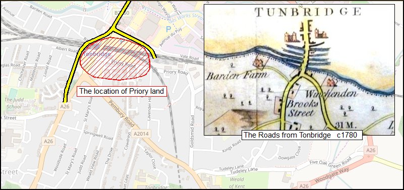
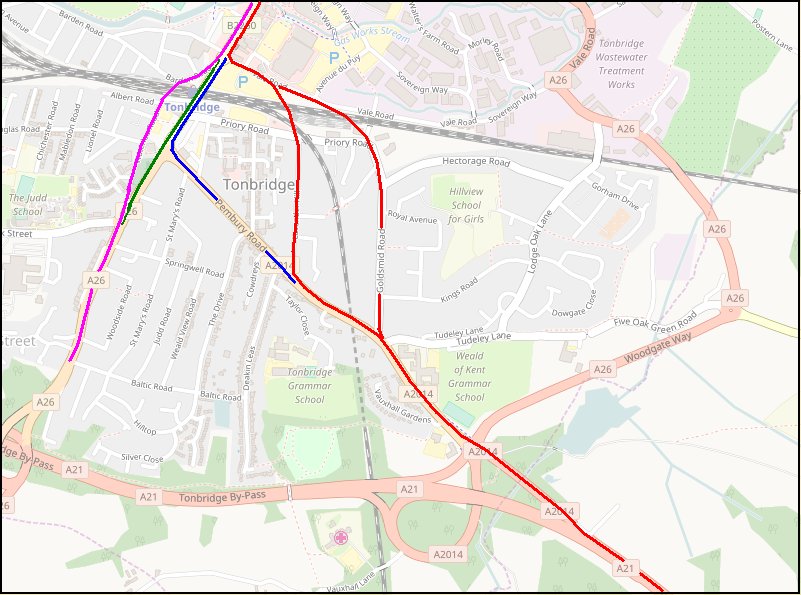
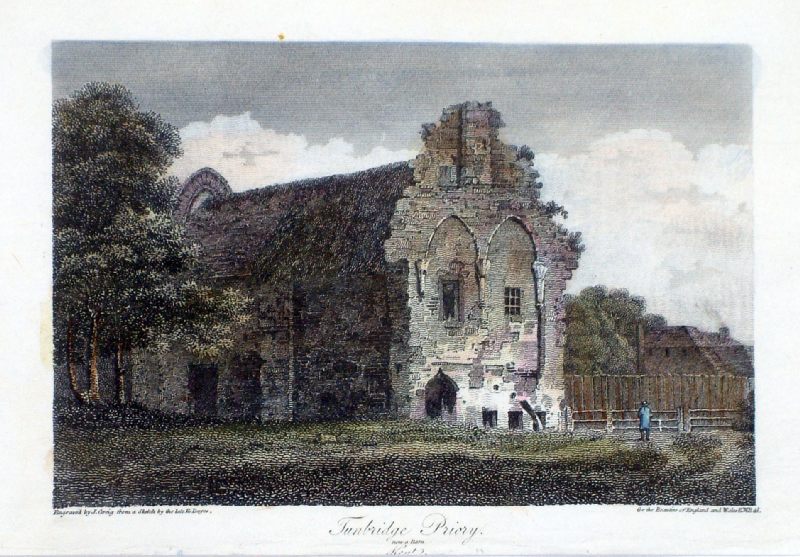
The Old London to Hastings Road through Tonbridge

This is outside the scope of Pembury history and is located at the bottom of the page out of the way.  With much of the 2016-2017 publicity of the road widening calling it the Pembury-Tonbridge Road there was a glimmer of interest in following the history of the A21 into Tonbridge.

In really ancient times the road, heading south, came past Tonbridge Castle and along the High Street toward Tonbridge Priory.  The St. Mary Magdalene Priory was built in 1124, destroyed by fire in 1337, rebuilt again, and closed in 1523. It stood, decaying until the 1840s.  The priory location is roughly in the area of Tonbridge railway station, its tracks and car parks.  From Tonbridge Castle the roads passed either side of the priory grounds – left to get to Pembury & Hastings and to the right to get to Southborough, Crowborough & Tunbridge Wells.   In 1840 or 1841 the South Eastern Railway acquired the priory grounds, demolished the old buildings and built the station, tracks, sidings and workshops. A new bridge was built across the railway in line with the existing High Street. The routes to Pembury and Southborough were now taken across the old priory land, rather than around it.

The following maps help to illustrate the routes of the old roads before and after the railways in the 1840s.  The railway was opened in 1842.


Above:       Tonbridge routes before to the railways.
The inset map is from Edward Hasted’s survey and map c1780.
The left fork ((A26) to Southborough) follows what is now Barden Road and Waterloo Road.
The right fork (to Pembury) follows Vale Road.


Above:     The Routes out of Tonbridge
Magenta –  The pre-railway route to Southborough          Green – The post-railway route to Southborough.
Red –  The pre-railway route to Pembury               Blue – The post-railway route to Pembury.

At the time of writing there is some uncertainty as to the precise red route (pre-1842) from Vale Road to the Vauxhall Inn.
It is highly likely that the portion of the old road annexed south of the railway tracks was kept in use from Priory Road.
Did the route become Lavender Hill or Goldsmid Road?


Above:  antique engraving c1810      “Tunbridge Priory.  now a barn.  Kent”.
Location roughly on today’s railway line, under the B2260 road bridge.     Demolished c1840


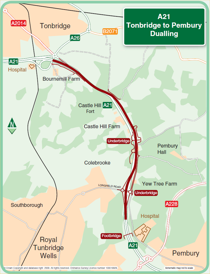
Historic Development of the A21

(Way out of scope of the Pembury History, but of some general interest)
The A21 London to Hastings Road of the 21st Century is little more than a series of town bypasses.
This list hopes to detail the detours from the original road, and runs in geographic order from London to Hastings.

Farnborough & Knockholt Bypass   1927

Badger’s Mount connection with M25   1986

Sevenoaks to Tunbridge Wells Turnpike (toll) road    1710

Sevenoaks Bypass   1966

Tonbridge & Hildenborough Bypass & Medway Valley Viaduct  1971

(Tonbridge to Pembury dualling)   2018

Pembury (North-South) Bypass.   1988

Kippings Cross Bypass  (in planning)

Lamberhurst Bypass  2005

Robertsbridge Bypass   1989

Battle Bypass   1950s

Unfinished – a work in progress


Refernce links –

https://www.sabre-roads.org.uk/wiki/index.php?title=A21           https://en.wikipedia.org/wiki/A21_road_(England) 
http://hastingschronicle.net/features/the-turnpike-roads/           https://www.farnborough-kent-village.org.uk/turnpike_road.html
http://www.sevenoakshistory.org.uk/Sevenoaks%20An%20Historical%20Dictionary.pdf


Compiled by Tony Nicholls       2015, 2016, 2017


A21 General History
                     
Pembury History


IMPORTANT !!!     This needs your help.  All contributions will be credited.  If you have any further information or corrections please contact me –
Tony Nicholls      email:    pemburyhistory@gmail.com