Pembury Milestone Location Maps
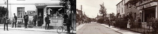
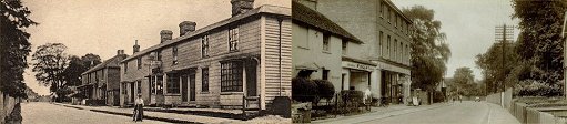
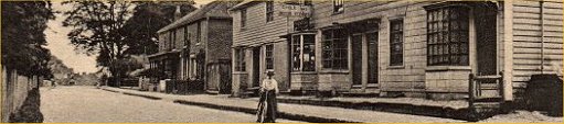
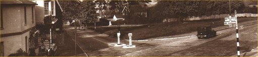
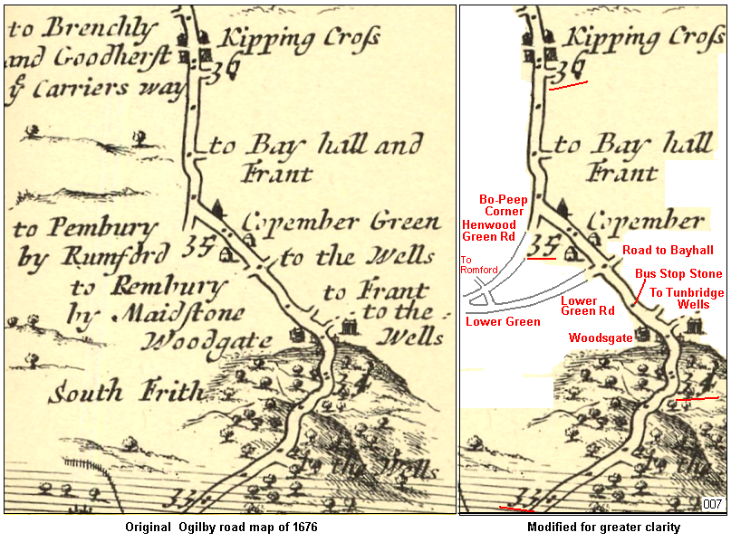 The map above shows the original map section to the left and an edited version, removing some of the visual clutter for greater clarity. Note that each of the full milestones is numbered 33 near Tonbridge to 36 at Kippings Cross. A few of the side roads have been extended and annotated to clarify the picture. On this map the road to Bayhall is marked as ‘to the Wells’. The road to Bayhall starts at Chalkett Lane on today’s maps. It is possible that in those days the road did extend to Tunbridge Wells. 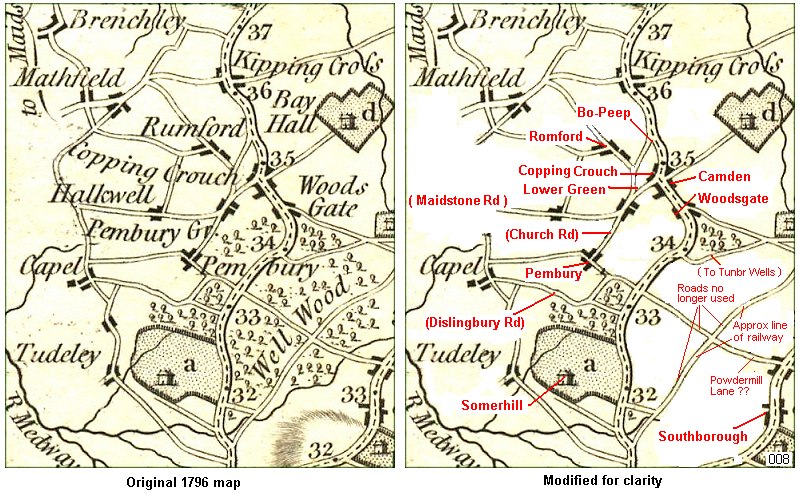 The map above is from 1796 and has a little more clarity of the surrounding counrtyside, but lacks the quarter mile markers. Again, a modified version has been produced to aid with today’s navigation. 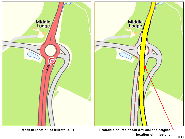 Above: the location of the milestone at the Longfield Road roundabout. The right hand map was drawn prior to the double roundabout at Longfield Road. The milestone dissapeared without trace. 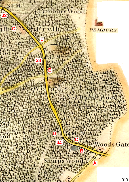 The milestones as recorded by Hasted on a 1780s map. Modern location indicators - A: Pembury Road B: Nottcutts Garden Centre C: Pembury Hospital D: ancient Blackhurst Lane junction E: Lonfield Rd F: Dislingbury Rd G: Castle Hill 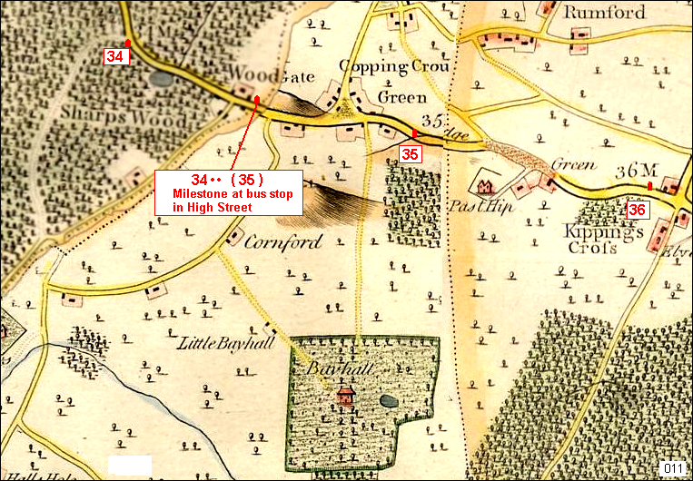 The map above is from Edward Hasted’s survey and is the digital blending of 3 maps that unfortunately split in the centre of Pembury. It shows where milestones 34, 35 and 36 were located in c1780. It also shows us where milestone 35 is located today. It is assumed to be milestone 35 but it has no inscription and is located halfway between 34 and 35. It is recorded by the Milestone Society as National ID: KE_LR35 GridRef: SZ 4862 7721 This milestone appears on the 1868 OS map ( and later maps) at the ‘bus stop’ location inscribed Tonbridge 5, Hastings 26. 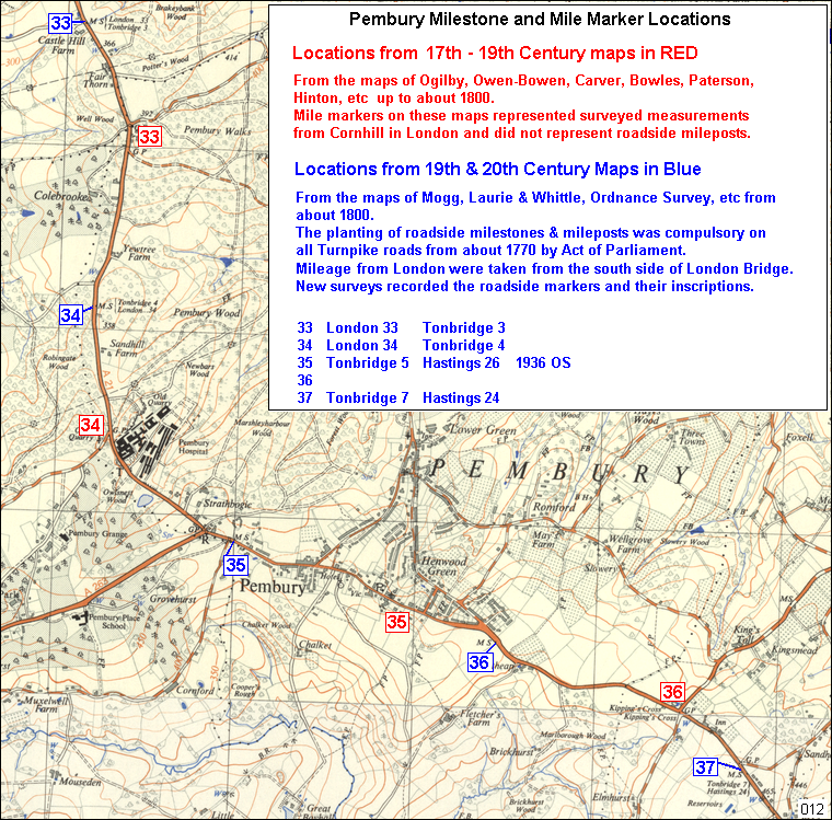 The map above shows the combination of the old and new locations of the milemarkers and milestones as they appear on old maps. The regular half a mile difference in location stems from the early maps surveyed from Cornhill in London, and the later surveys conducted from the south side of London Bridge. The roadside milestones were set in place during the late 1700s based on the London Bridge origin. 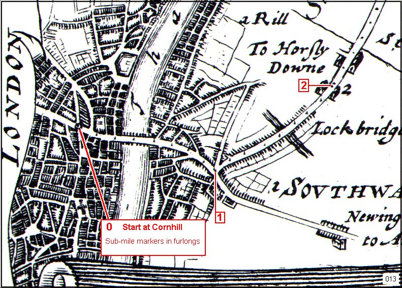 Above: from John Ogilby's maps or 1675/6 - how the half mile difference came about. 0, 1 and 2 are the miles markers. Early start points of 'Miles from London' into Kent started at Cornhill. Later start points were from the south side of London Bridge. At the time of these early 1676 maps the mile markers were placed on the map as indicators of distance. In reality, on the road, there were no mileposts or milestones. Milestones became compulsory with the advent of Turnpike roads and tolls. They were marked as 'MS' on maps. Early milestones had ther data carved into the stone, but quickly wore or were vandalised. Later models had iron plates. It was not until the late Victorian era that road junctions has Guide Posts (GP on maps). These indicated far away towns and sometimes rough milage from that point. Some were known as 'Finger Posts' with pointing hands. The early motoring era encouraged more guide posts with more information. Many originals still exist in quiet locations. 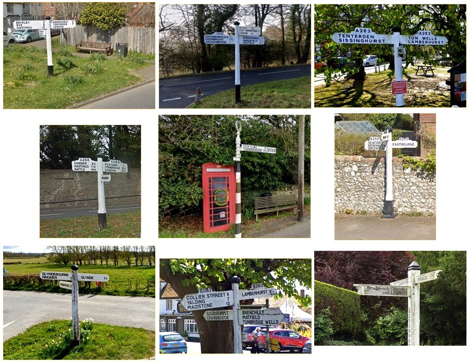 Above: typical olden guide posts. There are fewer of them these days. They are mostly on common land, village greens, and protected locally. 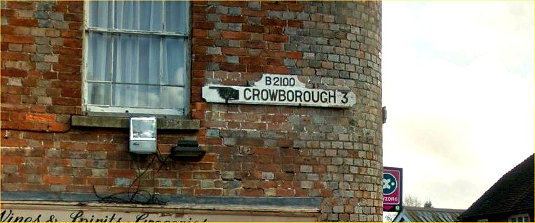 Above: an unusual wall mounted finger board in Rotherfield. For more on guide posts - https://knowyourroadsigns.uk/history-of-road-signs/ https://www.countrylife.co.uk/out-and-about/secret-history-milestone-roman-britain-industrial-revolution-beyond-190771 Link to main Milestone page. Page compiled, and maps modified, by Tony Nicholls. Milestone Location Maps
IMPORTANT !!! This needs your help. All contributions will be credited. If you have any further information or corrections please contact me – Tony Nicholls email: pemburyhistory@gmail.com |