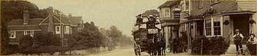
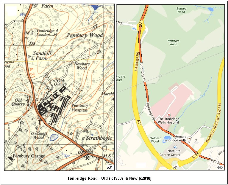
Tonbridge Road from Woodsgate Corner to the Longfield Road Junction.
From a historical perspective this is the old A21, or the old
Hastings to Tonbridge road. Our minds are easily clouded with the new
road system it may be necessary indicate the route of the old road.
The dual maps below are compiled to approximately the same scale and
scope and should make for easy comparison of old and new. The new map,
poached from Google Maps, has had a few features added in order to ease
comparisons.
..
The maps that follow cover the same basic area, but in greater detail, and at different times.
It will be necessary to do a lot of vertical scrolling.
There are many common features that aid navigation and comparison –
.. The pond and stream south of the Workhouse / Hospital
.. The junction of Blackhurst Lane just north of the Hospital. ( Blackhurst Lane truncated with the A21 bypass.)
.. The line of the electricity pylons on 20th century maps.
.. The paths to the north and west of Strathbogie house.
.. Milestone
locations. Greater detail on the Milestones
page. GP = Guide Post – usually at road junctions.
.. The shapes of fields and land divisions.
.. Bench Marks (B.M. xxx) survey points used year after year as known references.
.. Do Not Trust the small crosses, with reference numbers, along the middle of any road.
.. These are elevation points but they can vary from survey to survey.
..
The are mostly consistent in their locations, and some variations have
shown them to be untrustworthy.
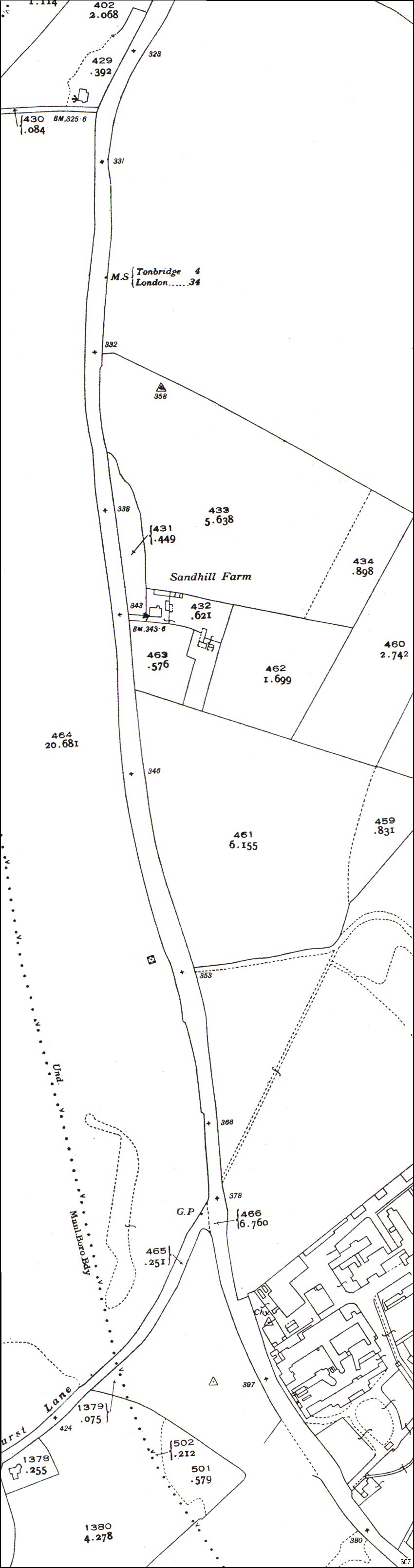
The first map below is from 1897 and covers the Longfield Road junction to the hospital, or workhouse as it was then.
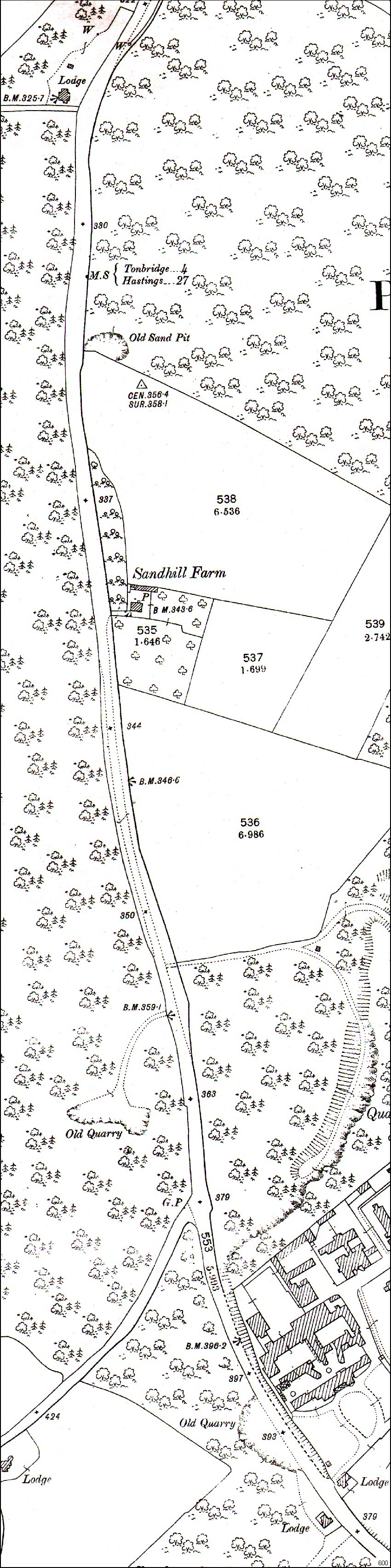
Above, 1897 Tonbridge Road north of the old Tonbridge Workhouse.
There are several indications of old industry on the 1897 map above-
(1) Sandpit just north of Sandhill Farm (an indication of sand deposits)
(2) “Old Quarry” (2 sites) opposite and northwest of the Workhouse –
indicating they were no longer used in the used in the 1880s.
(3) “Quarry” just north of the Workhouse, indicating it was still in use when the map was draughted.
Today anyone on the Tonbridge Road, just north of the hospital will see a
heavily excavated hillside – the remains of the quarry.
The photos below were taken by Melvyn Cole and show the old quarry.
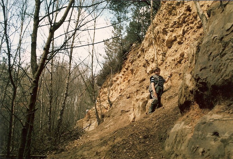
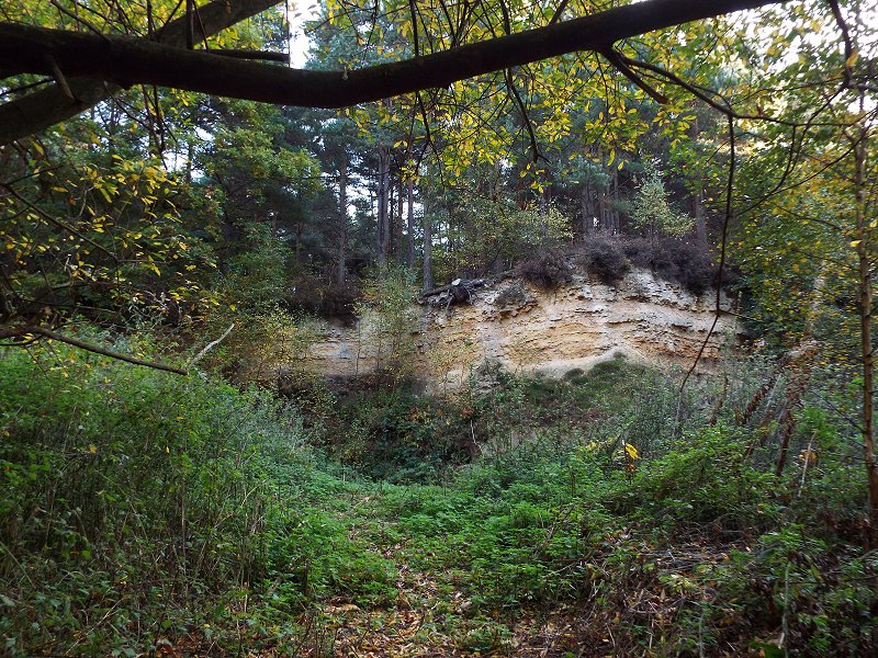
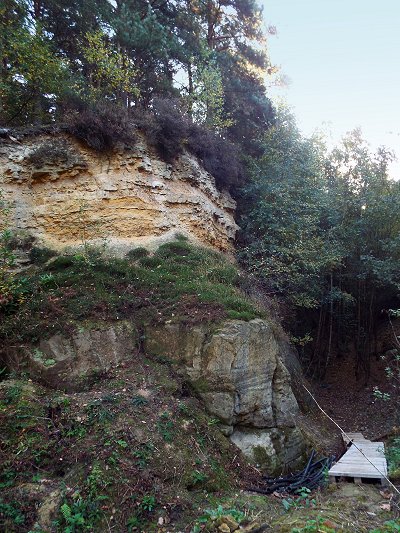
Photos above by Melvyn Cole
..
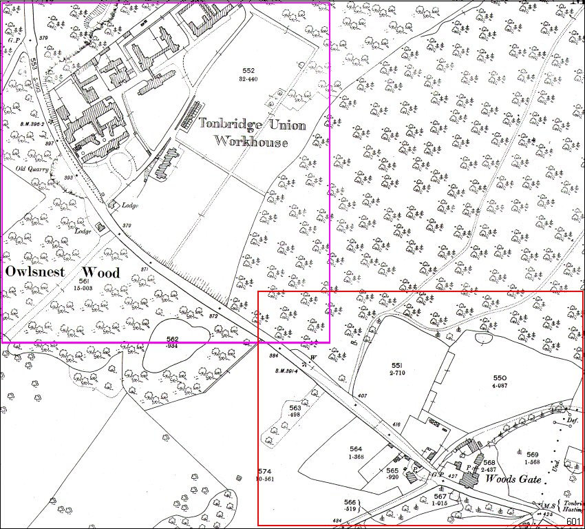
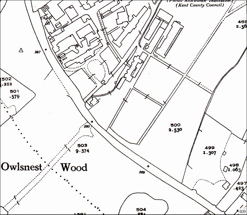
Above, 1897 Workhouse to Woodsgate showing the sections of the next 2 maps to follow.
..
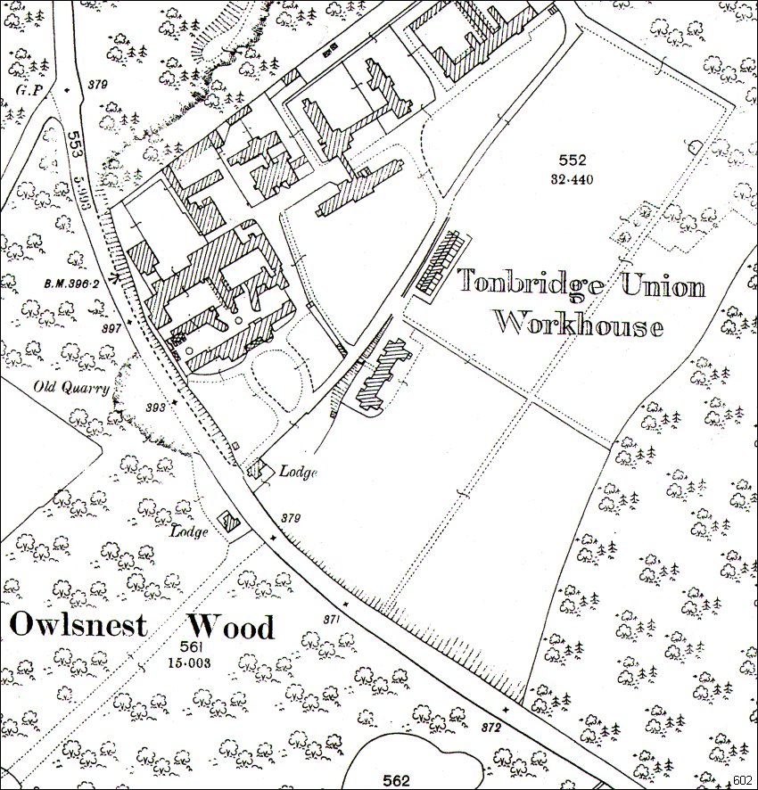
Above, 1897 Detail of Workhouse area.
..
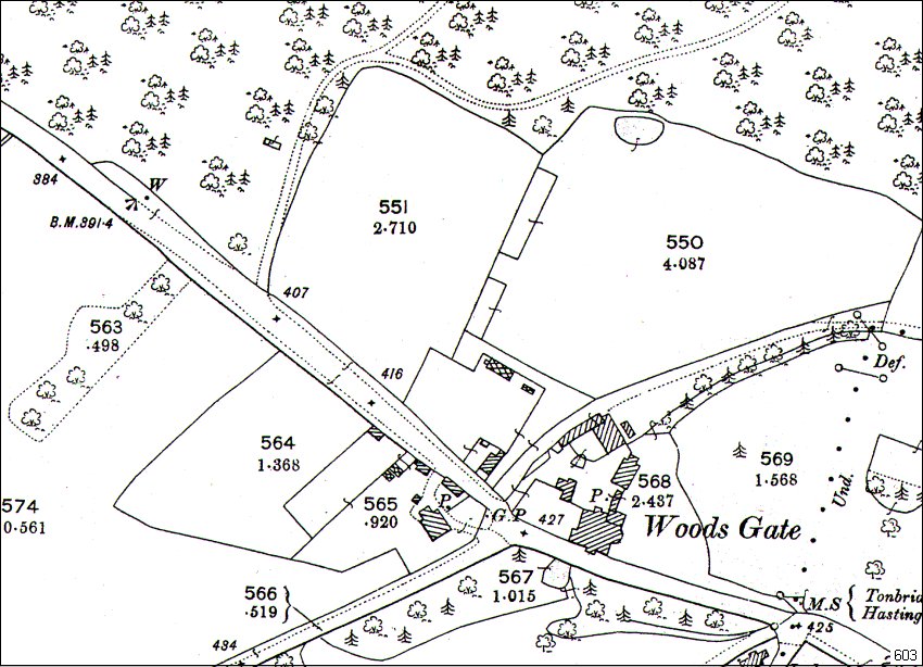
Above, 1897 Detail of Woodsgate area.
..
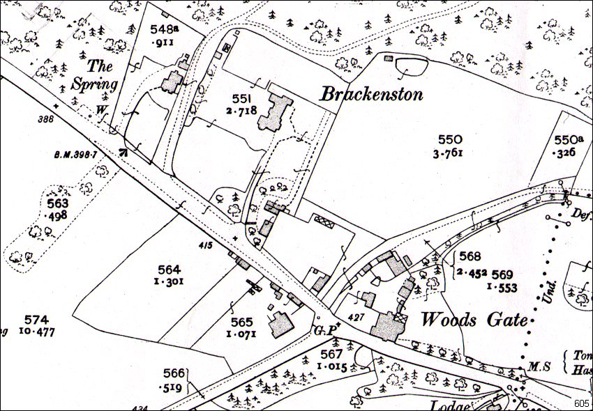
Above, 1909 Detail of Woodsgate Area showing ‘Brackeston’ house.
The buildings in the plots 564 & 565 disappear from the later 1946 maps.
..
Below, 1946 Longfield Road Junction to Hospital
Above, 1946 Longfield Road Junction to Hospital
..
Above, 1946 detail of Hospital area
..
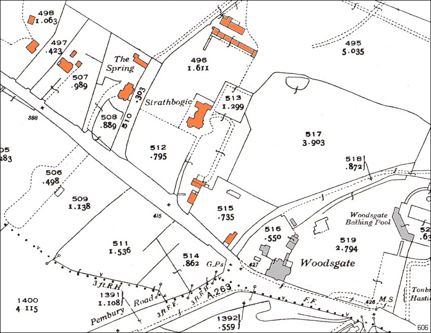
Above, 1946 detail of Woodsgate area showing ‘Strathbogie’ house, formally Brackenston.
The buildings shown on the 1909 map (605), to the west (left) of Tonbridge Road, are not shown here.
..
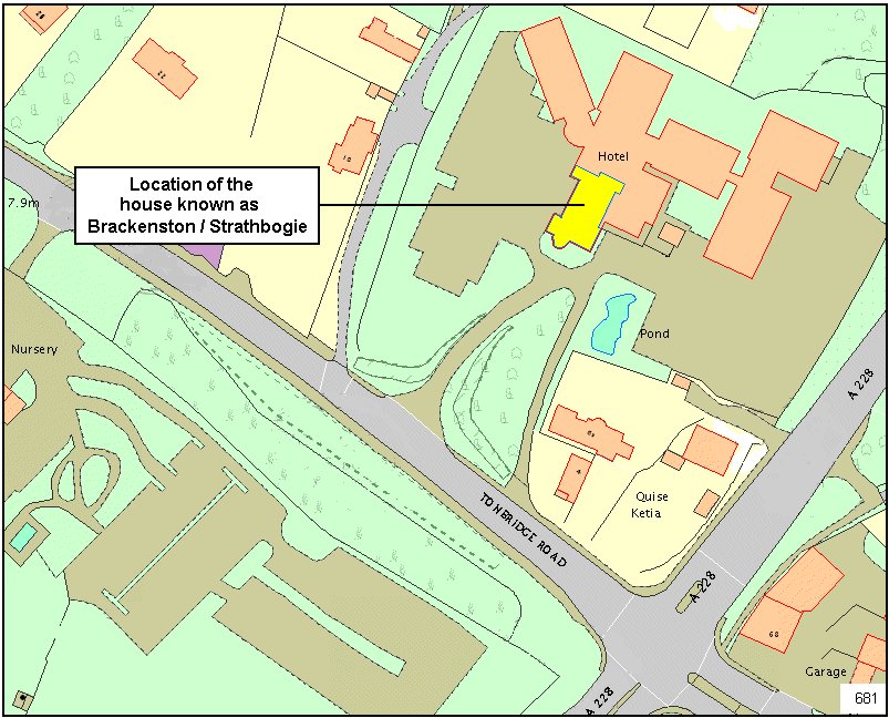
21st century map showing the house known as Breckenston / Strathbogie / The Dower House embedded in the modern hotel complex.
The 1946 maps shown above are marked in the library as 1936 / 38 . They are printed as being published by the OS in 1946 and may be a revised version of the surveys carried out in 1936. During the war (1939 – 45) there were no fresh issues of public maps – quite the reverse. All efforts were made to suppress geographical data to confuse an invading army. Therefore the data on the 1936 – 1946 maps must be viewed with caution unless there is 3rd party evidence to support features & buildings.
..
Tony Nicholls 2014