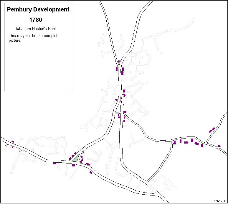
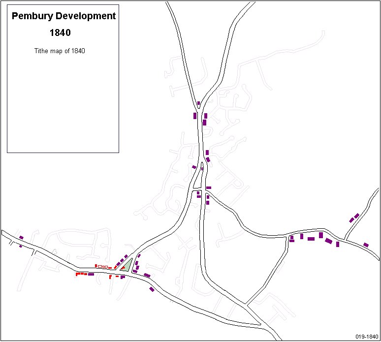
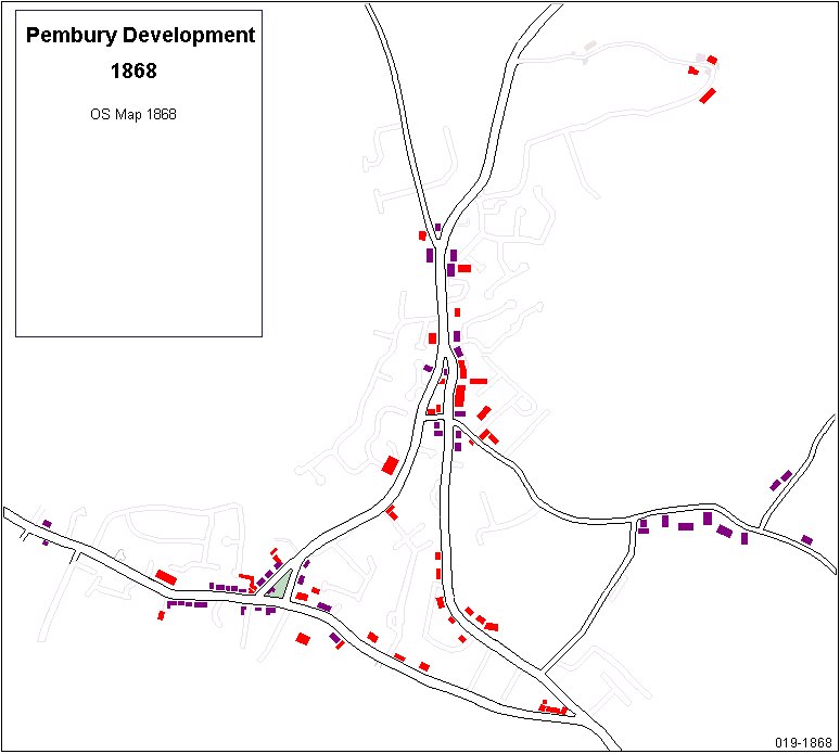
Pembury History

Localities - Urban Development


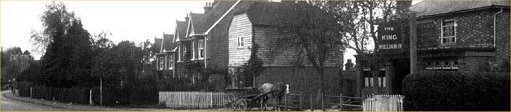
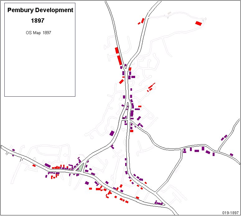
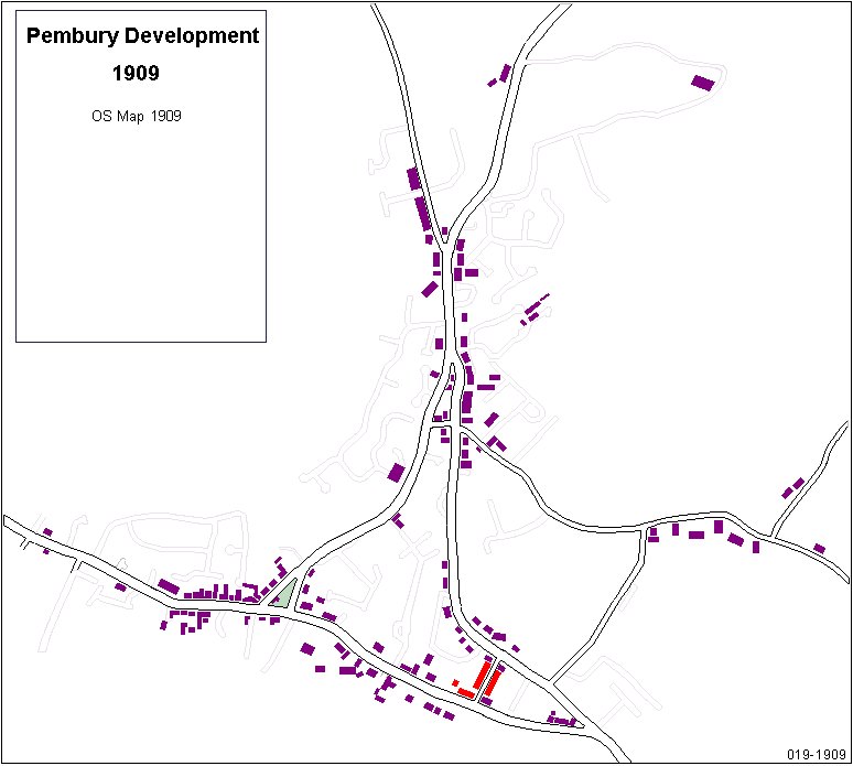
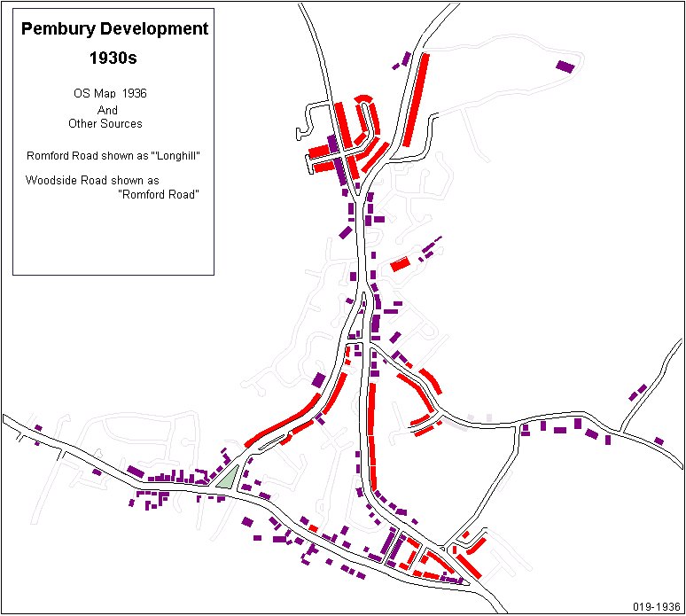
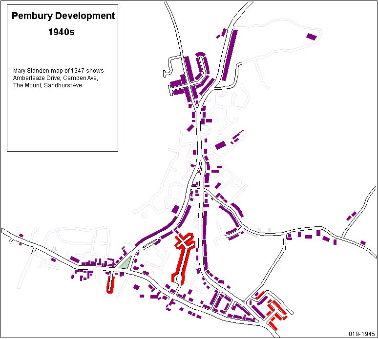
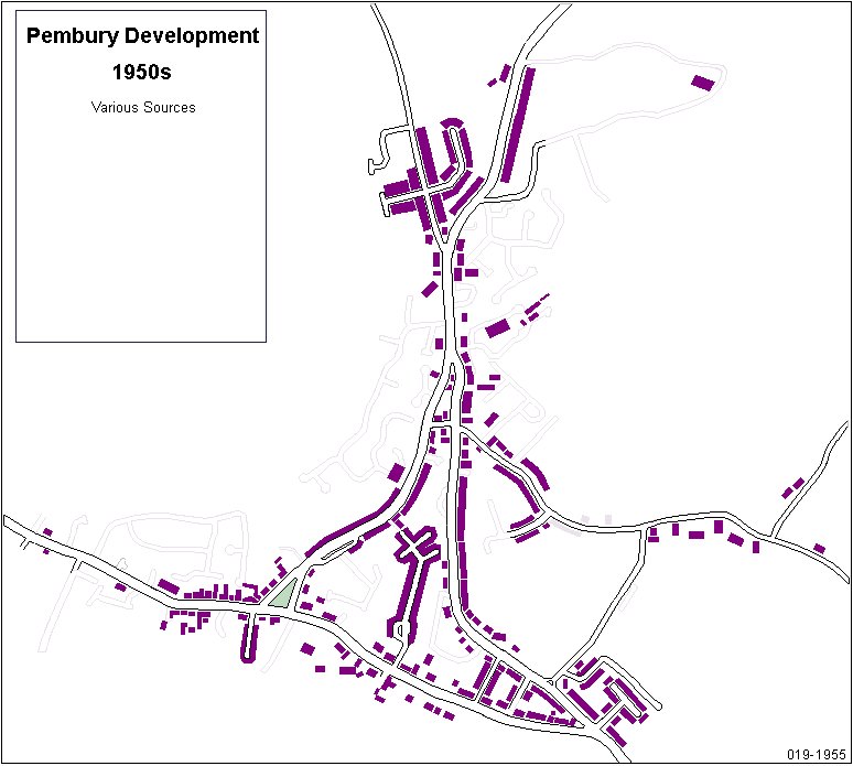
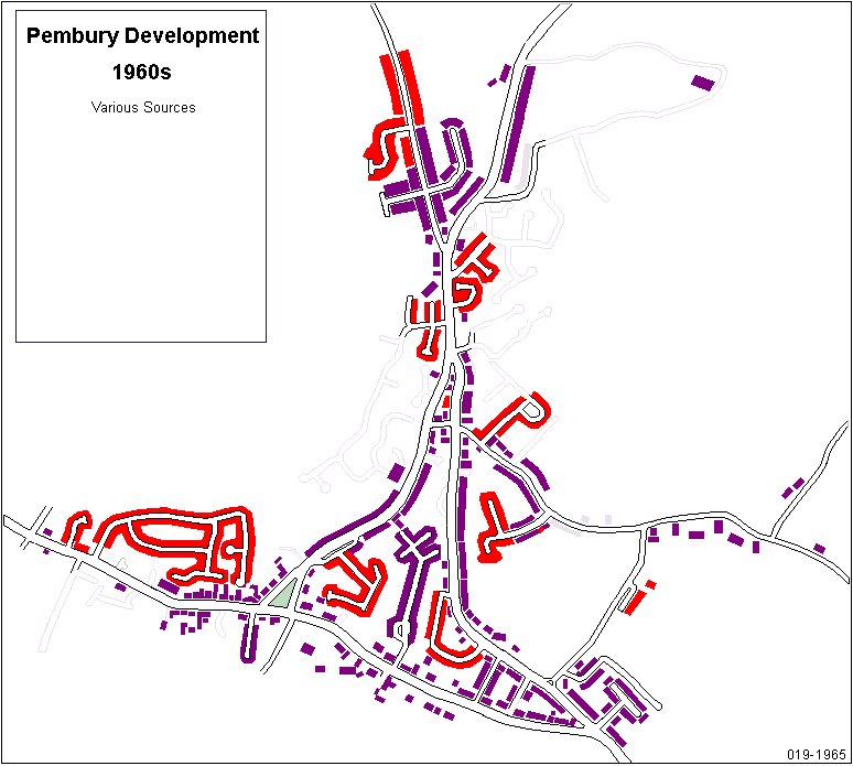
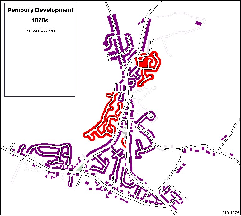
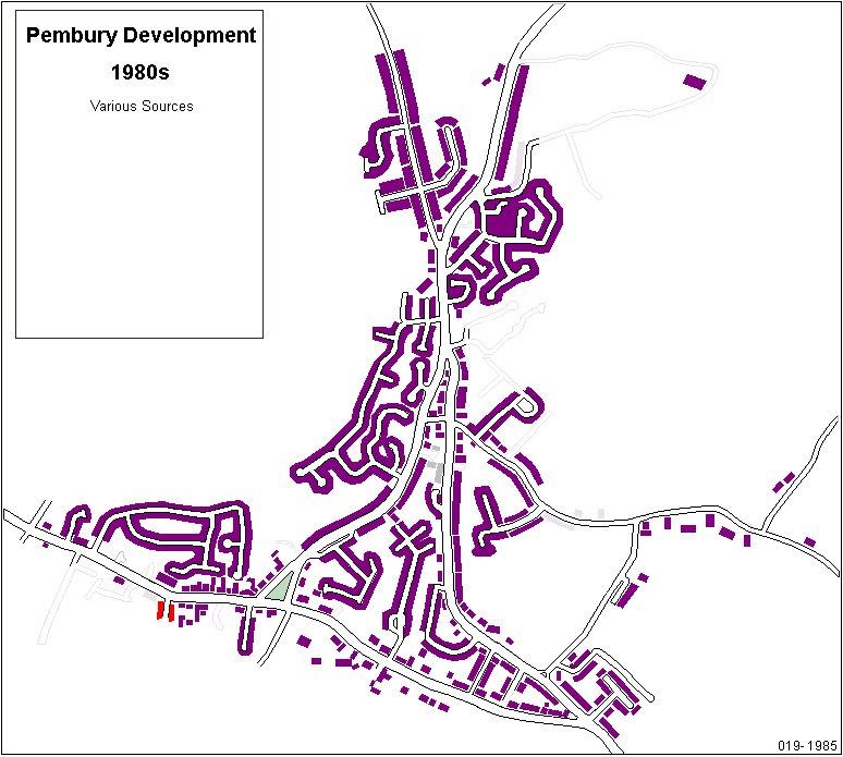
This page hopes to illustrate the rate of urban development in Pembury by showing a series of maps.
Every map is shown to the same scale and is derived from Open Street Maps – an internet mapping project.
The scope of this exercise does not cover the entire parish.  The maps cover the core of the village, omitting the extremities.
Every map shows a ghost layout of Pembury in 2015 as a basic reference.
The data has been extracted from old maps, contemporary descriptions and the memories of locals.
The maps march forward in time, each new map highlighting the new additions not shown on the previous map.
The duration between maps is dictated by the availability of source data.  Later maps advance by the decade.
Redevelopment of previously developed sites does not count in this exercise. As an example –
—   The old houses at Bo-Peep corner, Hastings Road, that were demolished and replaced are not considered as new development.
Isolated garden poaching developments will not be included.

This is a work in progress, with errors and omissions. Help is required.

These maps may be changing on a daily basis as new data comes in.


(Map of 2000s to include Penn’s Yard, High Street)


Help is needed with the last 3 or 4 maps to establish the missing roads and housing developments –

Cornford Park,  Beagles Wood Road/Petersfield/Brickfields/Batchelors,   Heron’s Way/The Gill/Snipe Close,
Polley Close,    Camden Ave,
Various stretches of High St, Hastings Rd, Lower Green Rd,  Henwood Green Rd,  Romford Rd,  Maidstone Rd.


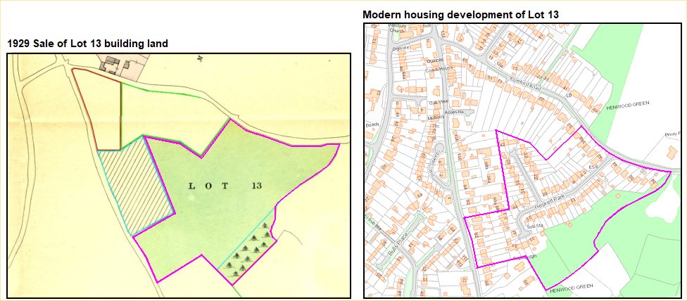
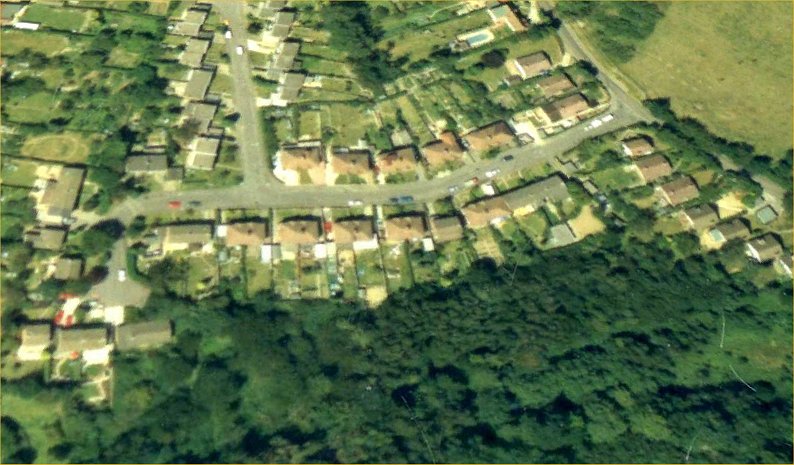
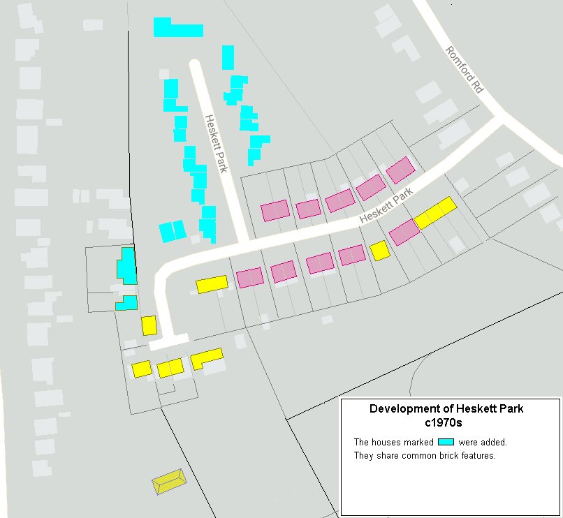
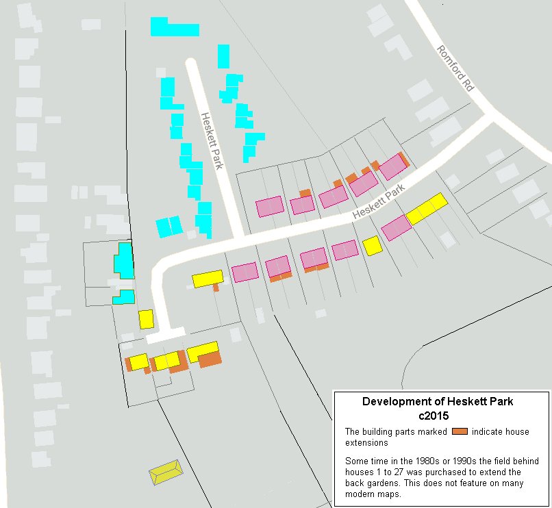
The maps below show an example of the development of one road – Heskett Park


In the Beginning – there was just bare land.
In earlier times this was registered as fields and pasture.

Above left – a portion of a 1929 land sale map (acquired by Jeni Beviere & Jane Grooms).
Above right – how that parcel of land fits with the modern housing development around Heskett Park.
Lot 13 is described as being on the Beagleswood Building Estate – “Ripe Freehold Building Land.  11a, 1r, 13p”   That is Acres, Roods, Poles.
We do not have documentation (yet) on who purchased Lot 13.

As a side issue, Joe Curd's writings on old Pembury take him down Romford Road describing the various fields.
He describes at the bottom of the hill   ..."  in the first world war the army took it over and dug trenches all over it, so from then on
it was always known as Trench Field (now of course, Heskett Park)
".


Above – Map of the original housing development on land owned by Herbert James Heskett.


Above – 1960 Aerial photograph of Heskett Park


Above – 1940 Aerial photograph of Heskett Park


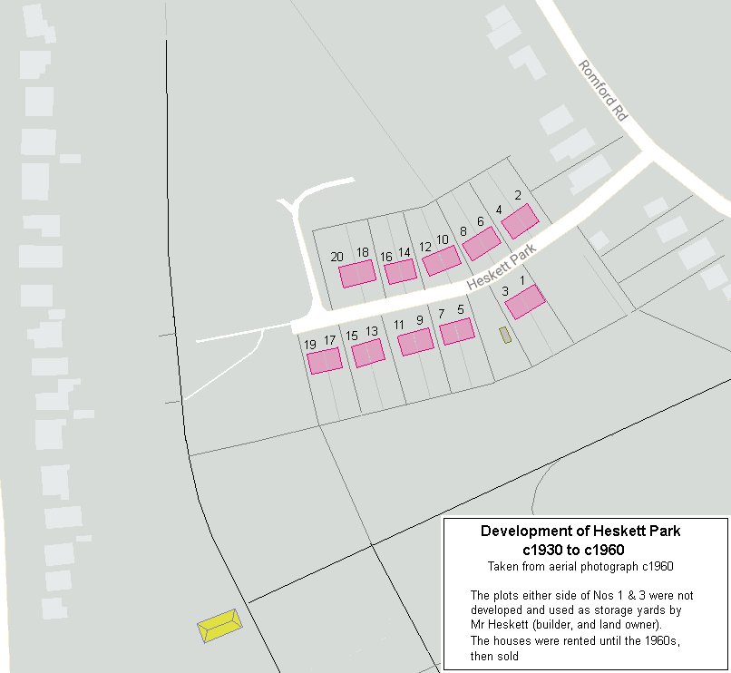
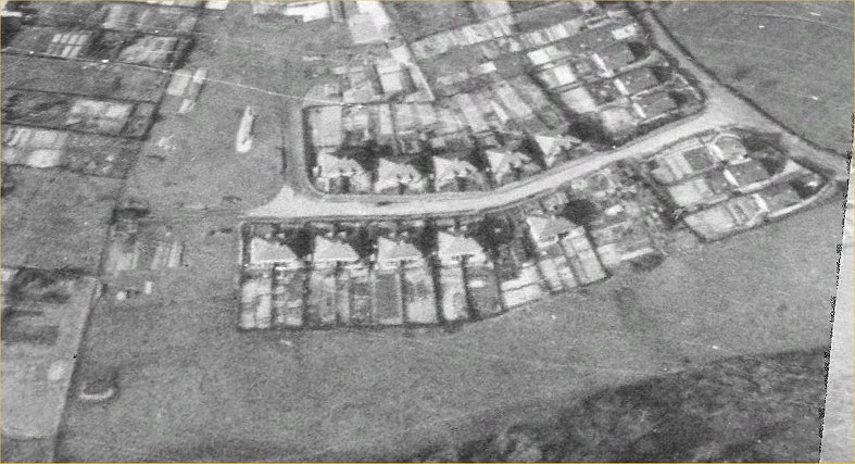
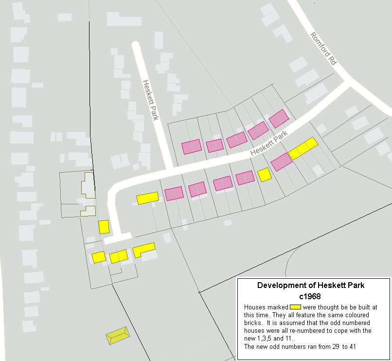
Sometime between 1963 and 1968 the land around the top part of Heskett Park (Nos 29 - 41) was sold
by Herbert James Heskett to Brickland House Limited for further house building.  See maps lower down this page.


Above – 1990 Aerial photograph of Heskett Park


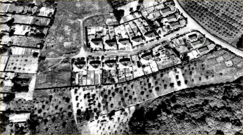
The following map is from around 1960 and shows a half developed Heskett Park.
This now shows a better carve up of the land for the later house plots.
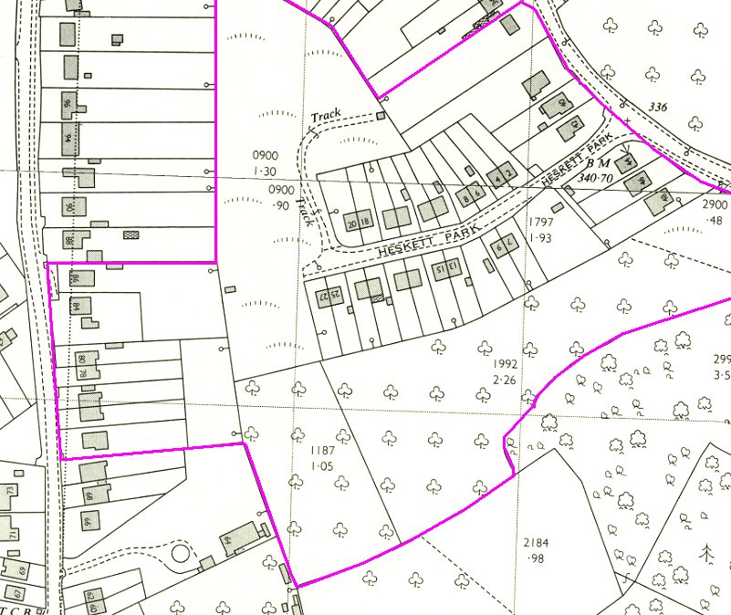
Map below shows the development of the lower portion


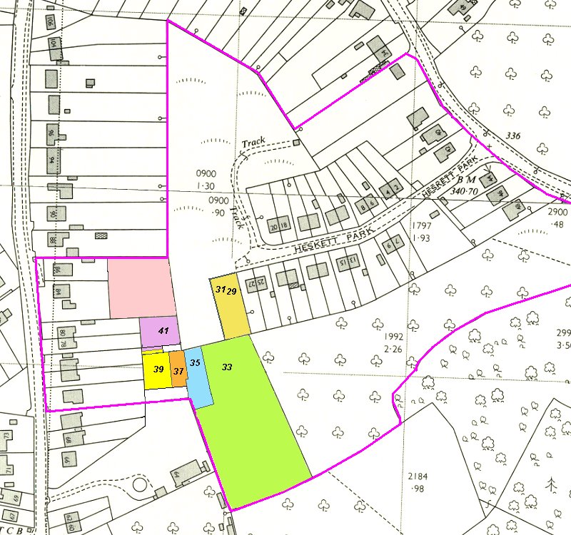
The field marked 1992 was later collectively purchased by the owners of Nos 1 - 27 and converted into long strip extensions of their gardens.


All maps compiled by Tony Nicholls


Many thanks to Melvyn Cole for helping kick-start this page.

Contributors to this page:  Melvyn Cole,  Kathryn Franklin,   …


If you have fresh information please contact me by email –

Tony Nicholls      pemburyhistory@gmail.com    or  history@pembury.org    and label the subject  Pembury Urban Development.


Localities - Urban Development
                     
Pembury History


IMPORTANT !!!     This needs your help.  All contributions will be credited.  If you have any further information or corrections please contact me –
Tony Nicholls      email:    pemburyhistory@gmail.com