Parish & Village themed Maps
The table below contains links to maps that display various historical features of the parish.
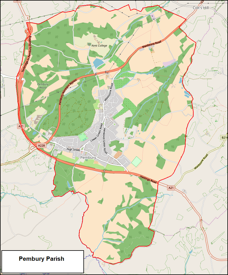
| 001 | Parish
Boundary
These maps were produced in 2010 by
Kathryn Franklin & Tony Nicholls in
an attempt to show the extent of the
Parish in ancient times and modern
times. Kathryn Franklin is best
qualified to explain the profiles and
changes. |
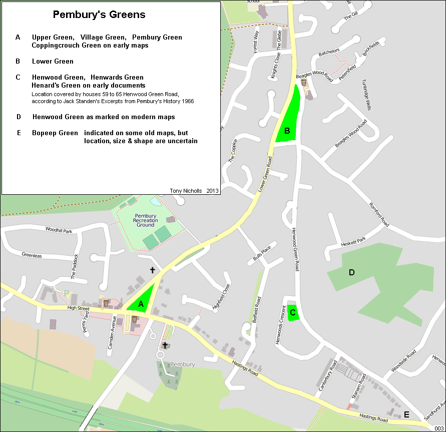
| 002 | Village
Greens The locations of
the ‘Greens’ …. This old map
(1819-1892) shows 4 Greens in Pembury – Pembury Green, Lower Green, Henwards Green , Bopeep Green. |
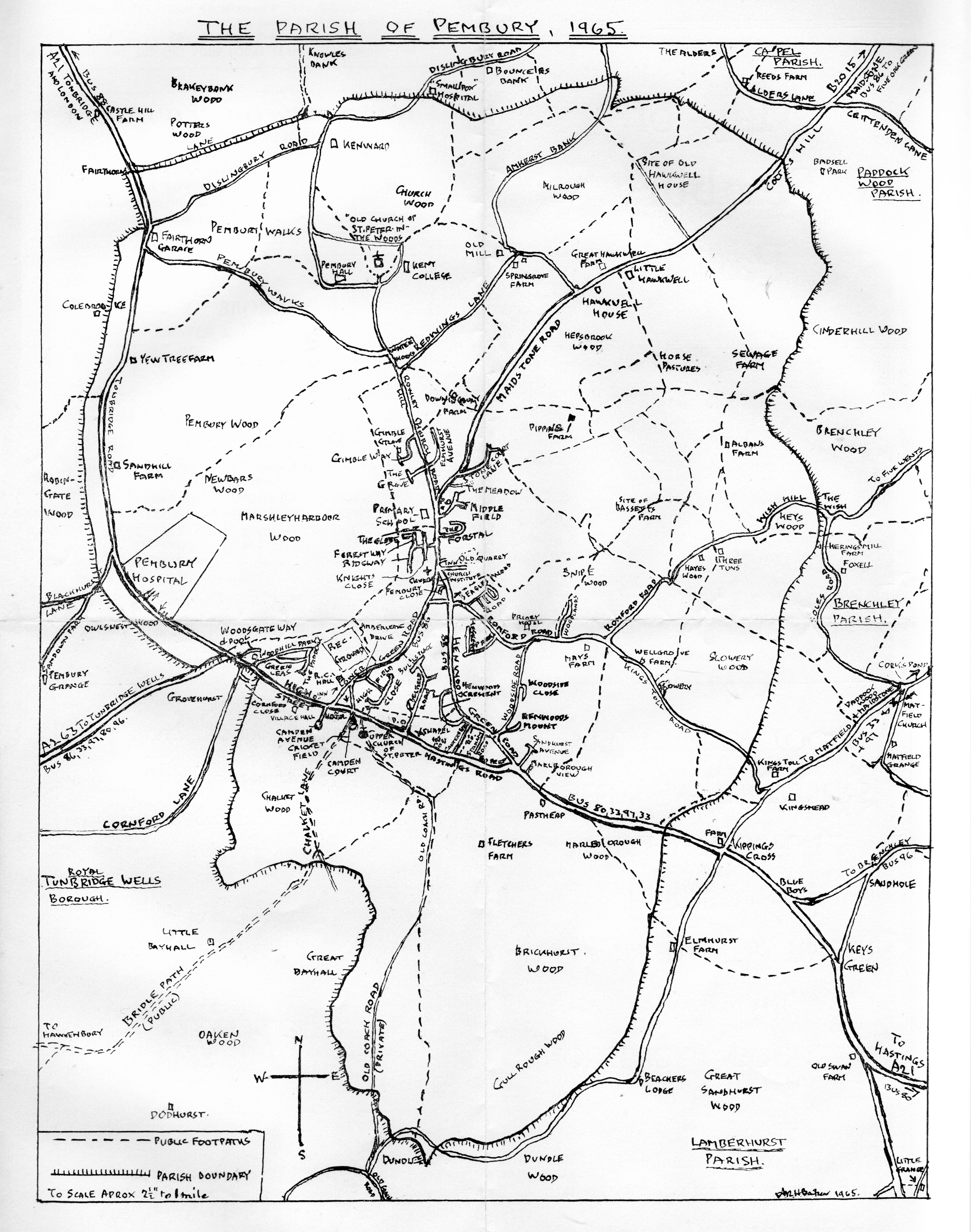
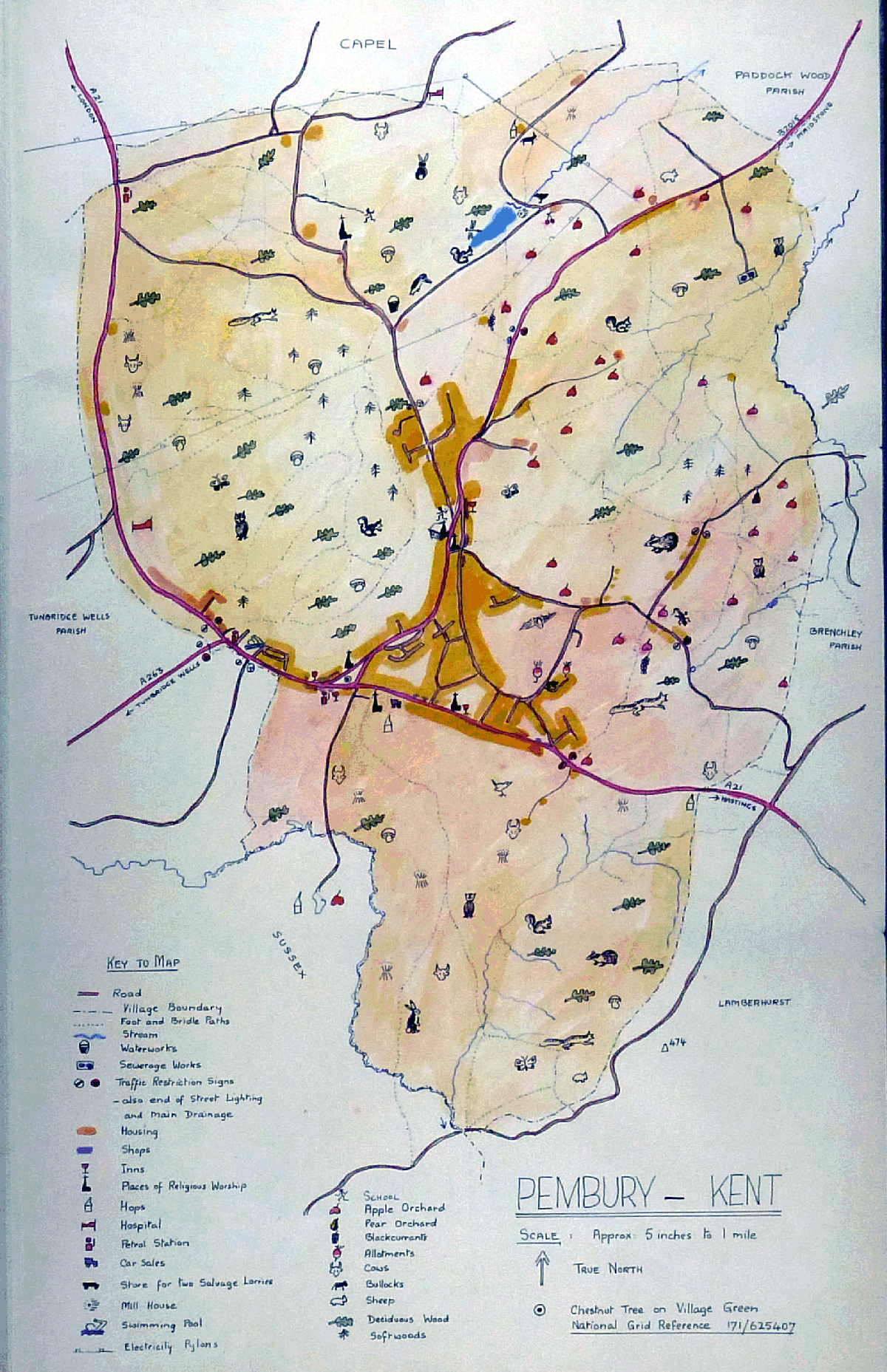
| 003 | Parish map
of 1966 (dated 1965)
From the Pembury Parish Guide 1966 by
A.R.H. Baker Small Map Large Map |
| 004 | Parish map of 1965 From the Women’s Institute Scrap Book of 1965 |
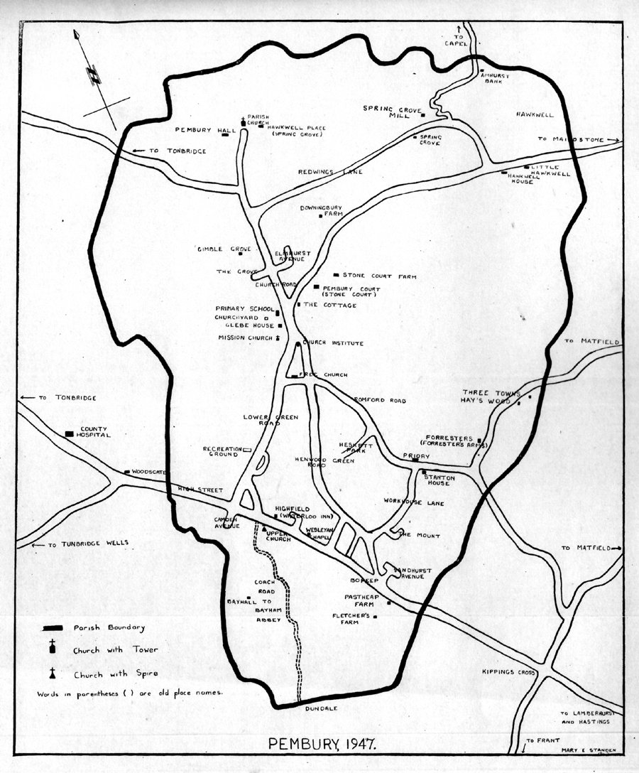
| 005 | Parish map
from Mary Standen’s History of
Pembury 1947 1947 Map Note the location of the Waterloo Arms in Hastings Road and Woodside Road named “Workhouse Lane”. Map 408 on the Localities / Hastings Road page shows Woodside Road named as “Romford Road” around 1938.Kathryn Franklin confirms that from 1822-1837 Stanton House was used as the Parish Workhouse until the Union Workhouse in Tonbridge Road took over responsibilities. Woodside Road must have retained the workhouse link for over 100 years in the minds of locals. |
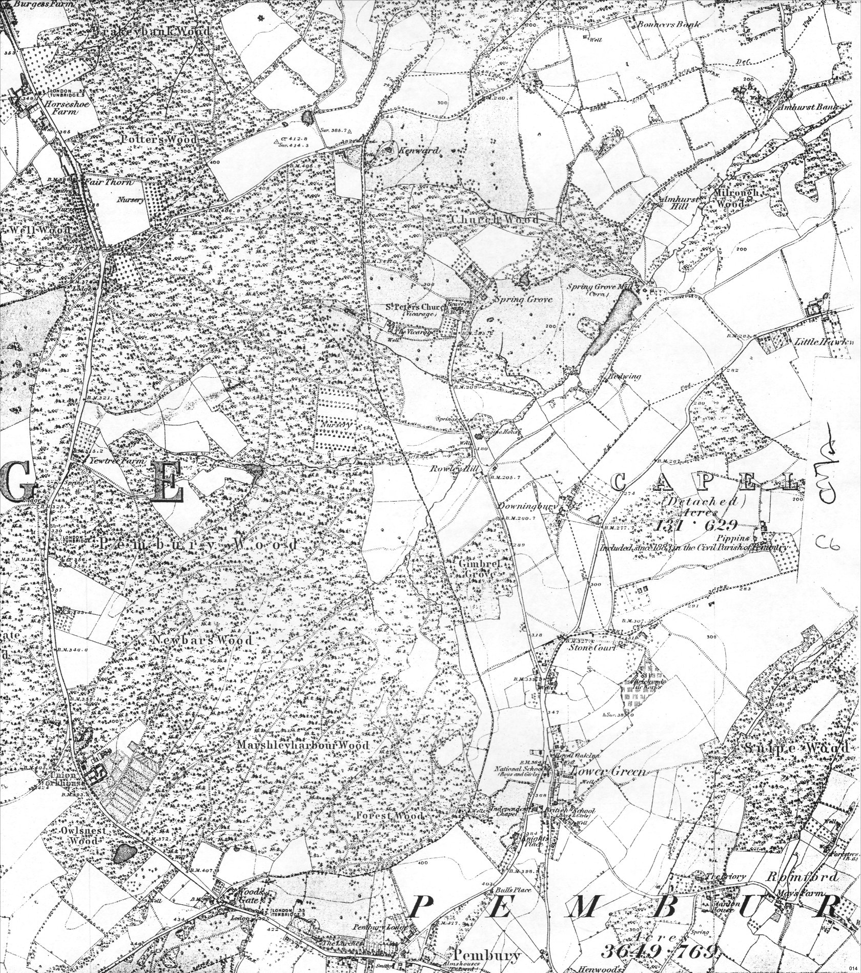
| 006 | Northern
part of Parish map from Edward Stanford’s
folding map of 1872 Small size map Medium size map Large size map |
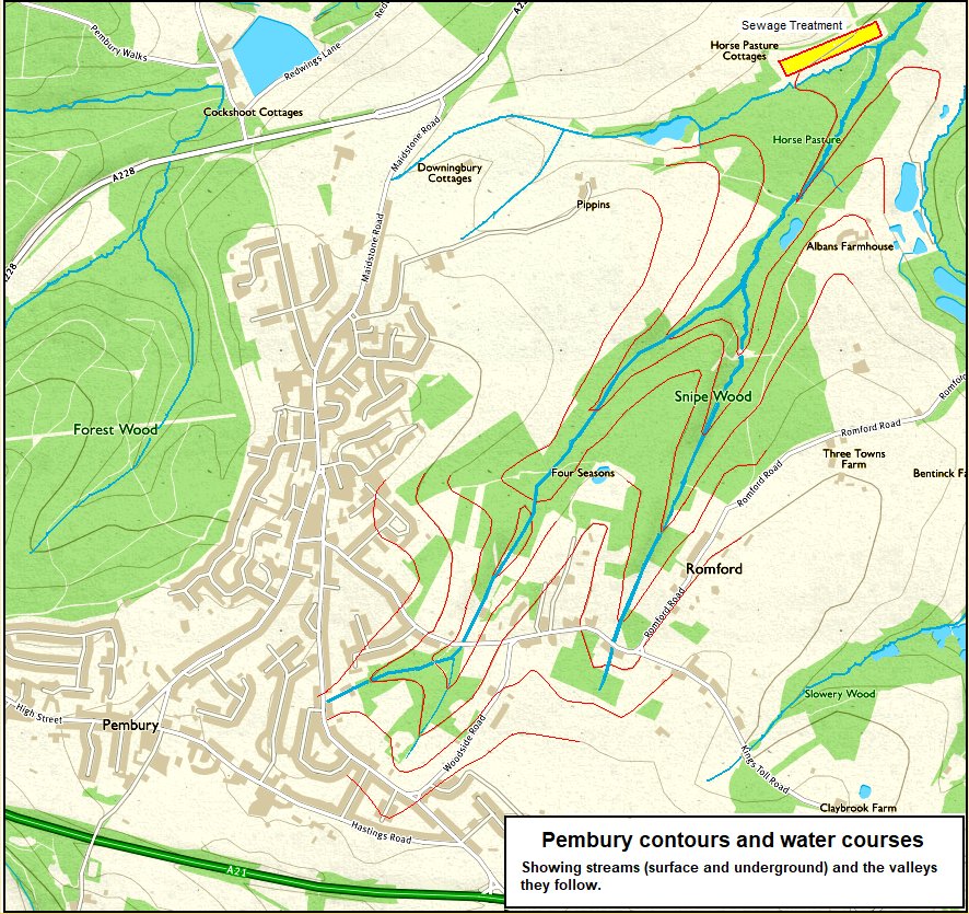
| 007 | Parish map showing contours, hills, valleys, streams and watercourses Map link |