Localities - Village Green
The Village Green, also known as Pembury Green, Upper Green and
Coppingcrouch Green over the years. It has maintained its current shape
and size for many hundreds of years. Today, in the 21 Century, it is
mostly grass with a few trees, some benches and various bits of
ornamental furniture. In the past, as indicated on the maps below, it
housed various buildings including a blacksmith’s workshop, furnace and a
primitive fire station. During the second World War (1939-1945) there
was a defensive pillbox and an anti-aircraft gun. The historic material
has disappeared, but this web page hopes to gather together any
information that records the history of the village green. All
contributions are welcome, and all contributions will be acknowledged
here.
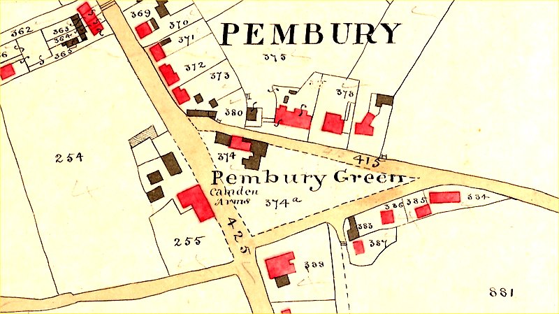
Above : Tithe map of 1840 showing the green and neighbouring buildings
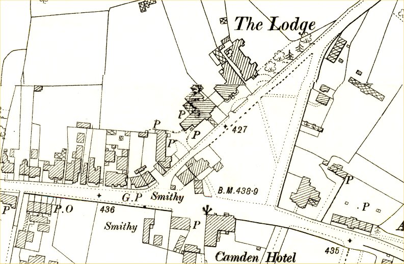
Above: The Green from a Ordnance Survey map c1891
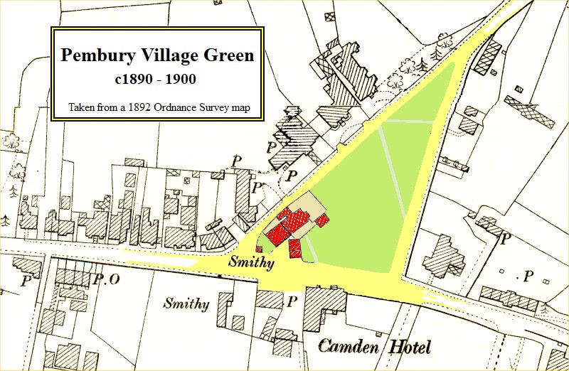
Above: The 1891 OS map with some clutter removed and colour added to improve clarity
The tiny blob at the very left corner of the green is the smithy’s furnace, often show covered in billboards.
A note on the dating of OS maps: this is a very flexible topic.
Maps have 3 key dates to their issuing – the date of the original
survey, the date of publication (and first printing) and the dates of
subsequent print re-issues (with or without fresh surveys). There is
rarely any clarity as to the accuracy of these dates and the data
contained on the map. The point of this rambling is to state that the
date given for a map is not an accurate indication of the features on
that map. A building appearing on a map dated 1891 may have been
removed or enlarged in 1889 prior to the map’s printing any time between
1891 and 1910.
Many, not all, of the photos and postcards below are from Melvyn Cole’s collection.
Some of these pictures appear on other web pages, but are repeated here for a more complete assessment of the green.
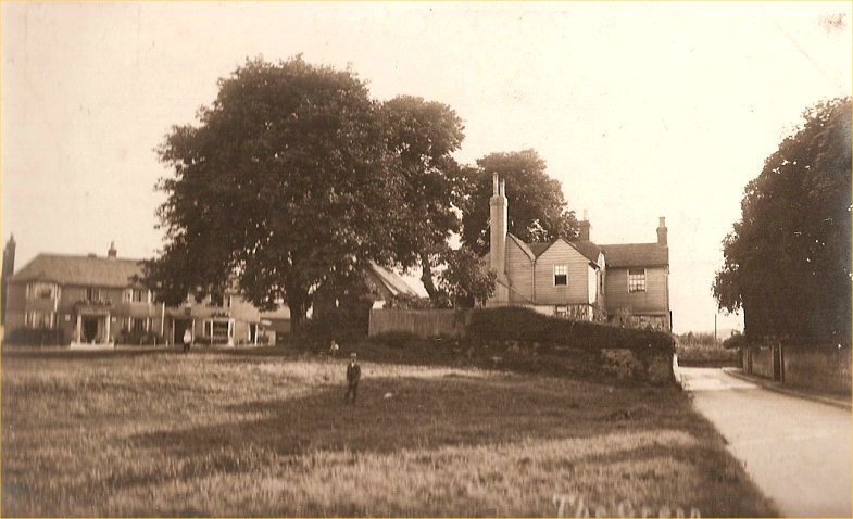
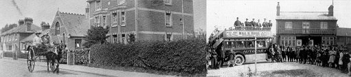
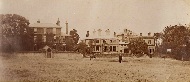
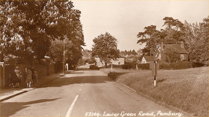
Above: c1910 view of houses on the green. The shed under the tree maybe the old fire station
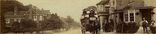
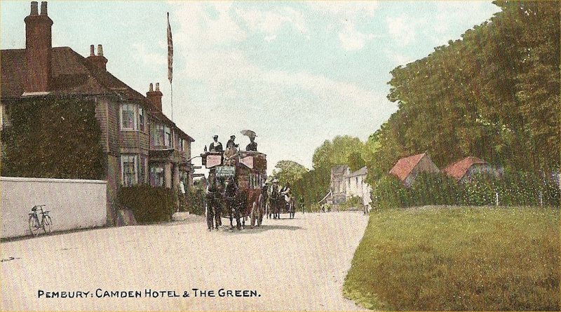
Above c1900 From The Camden
Above: c1915 view from The Camden
Two of these boys appear to be in the picture below, suggesting the photos were taken on the same day.
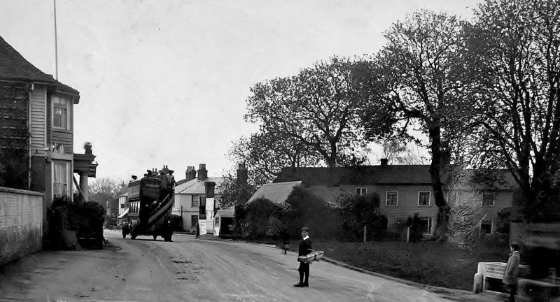
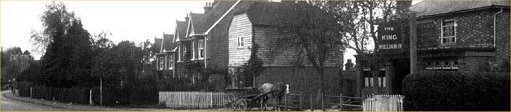
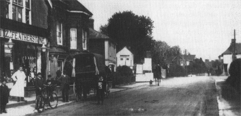
Above: c1915 view from Hastings Road (Donated by Kathy Wallwork & Kathryn Franklin)
One of the best views of the furnace chimney on the corner of the green, covered in posters and billboards.
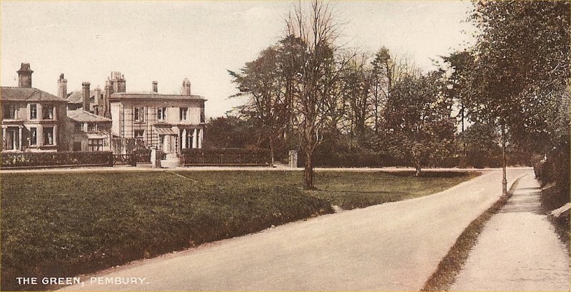
Above: A picture from one of Mary Standen’s books giving another view of the buildings on the green
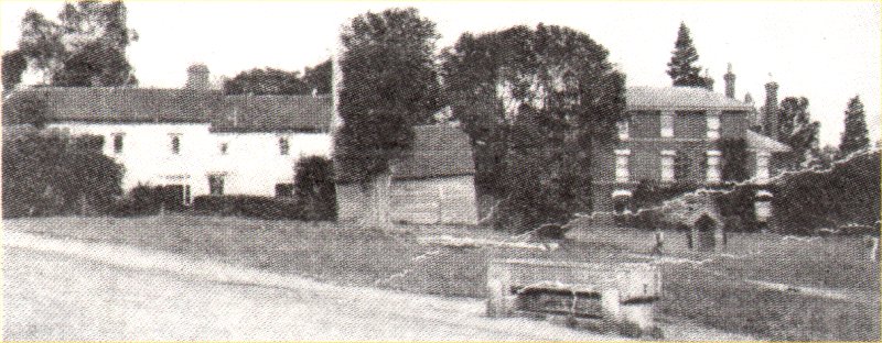
Above: from an early Postcard. The white gable ended building (centre of tree) is the back of the wheelwright’s.
In front of that building is a furnace chimney, covered in posters, billboards, notices and advertisements.
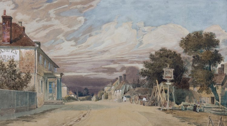
Above: 1840 painting showing the wheelwright corner of the green
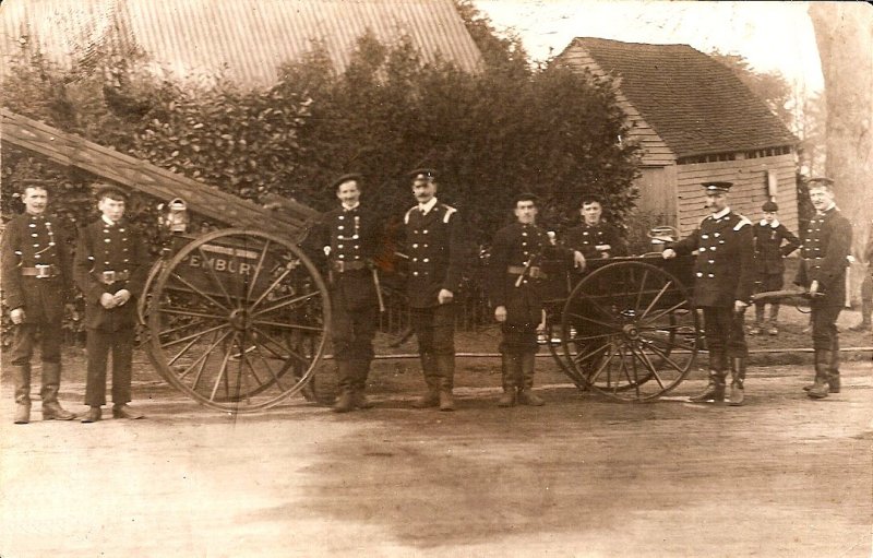
Above: c1910 Pembury Fire Brigade in front of what is assumed to be their fire station
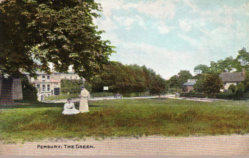
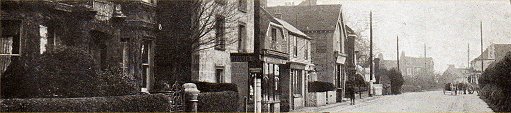
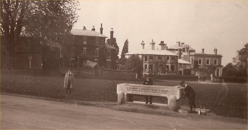
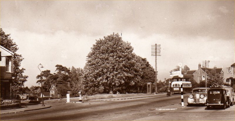
The Green pre-1909 (No drinking trough)
The dating, or order of dating, of some of these pictures is best established by studying the street furniture –
the presence or absence of telephone boxes, telegraph poles, signs – also the change of design of these features.
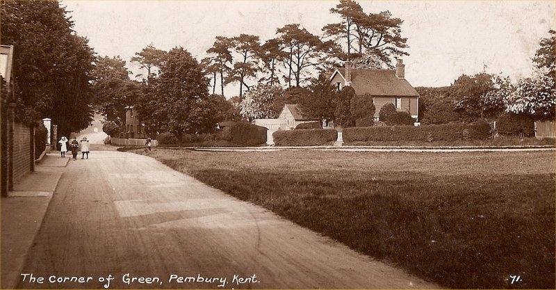
Above: shows a footpath across the green (toward The Lodge), shown on old maps, but lost today.
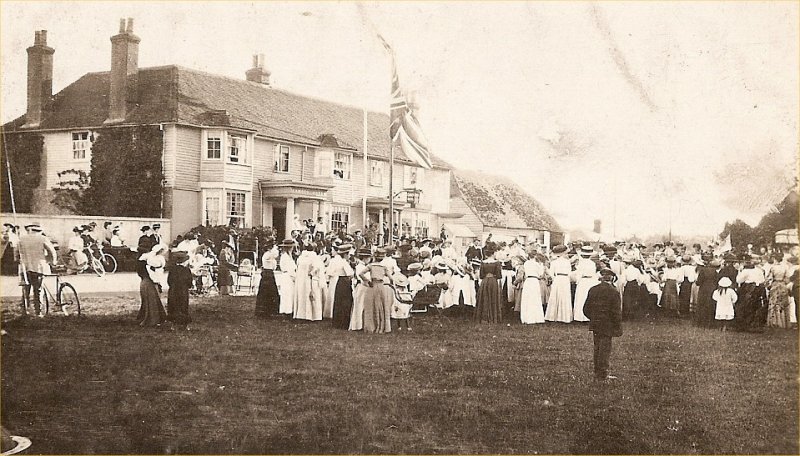
Above: c1900 celebrations
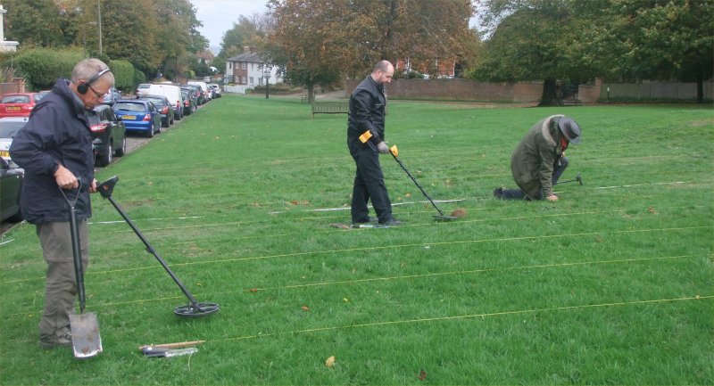
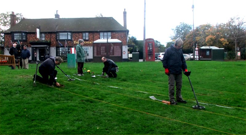
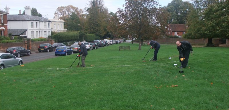
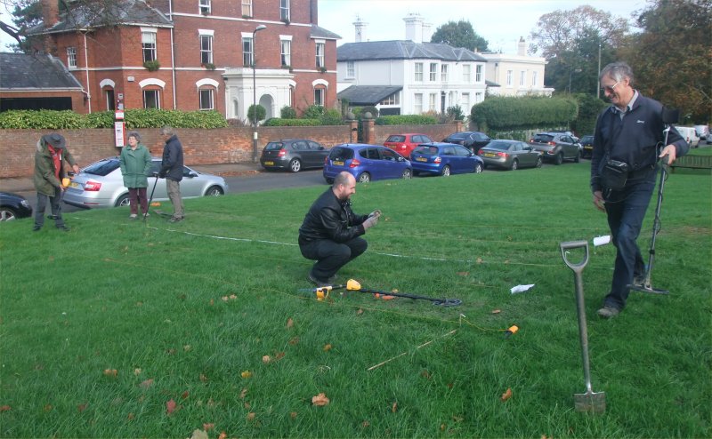
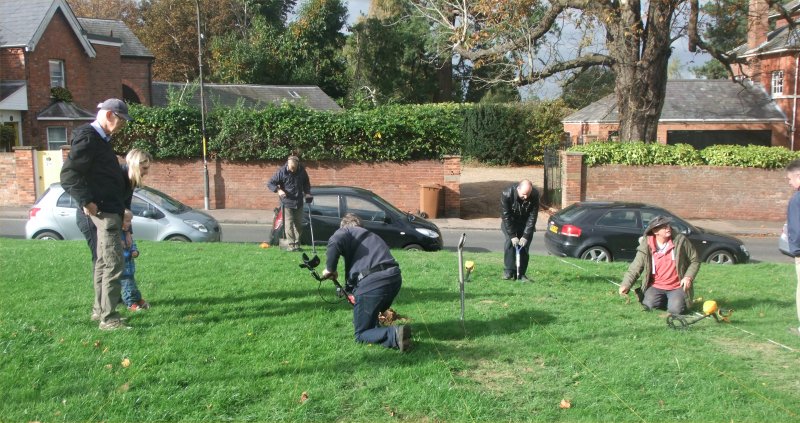
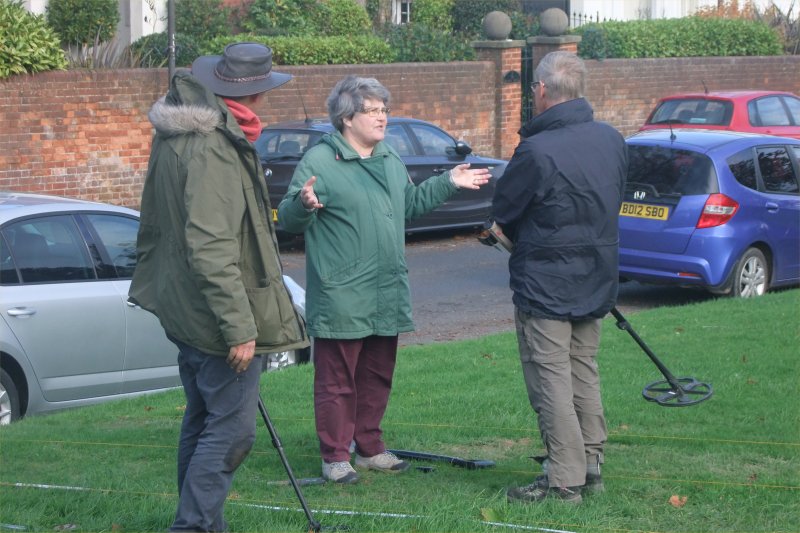
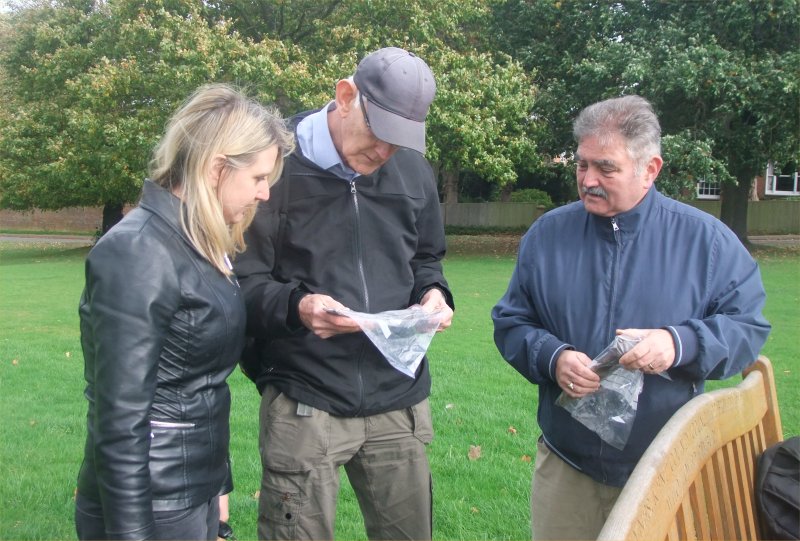
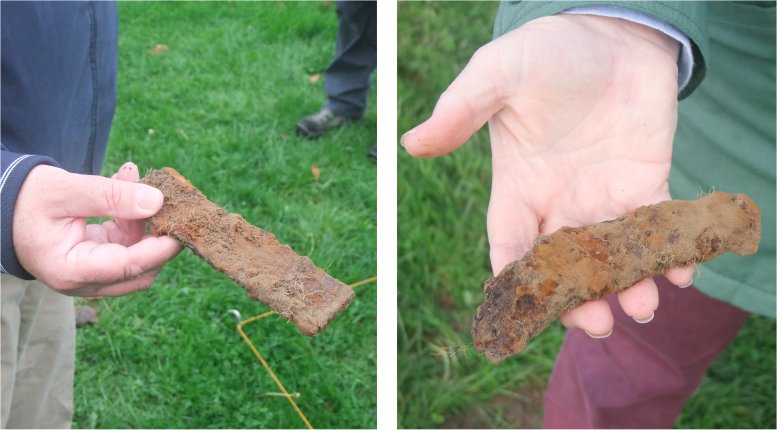
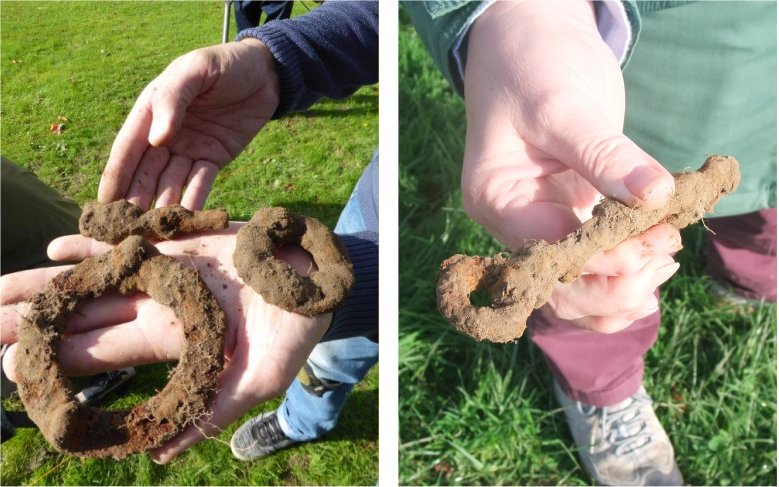
Archaeology on the green – October 2017
Still in progress – more pictures & text to come
The following text, prepared for the Winter 2017 Pembury Village News, acts as an introduction to this project.
Archaeology on the village green – Part 1
A year or so ago a few members of The
Pembury Society were discussing the village green and the blacksmith’s
workshop that occupied the top part of the green. There are quite a few
old maps and pictures that show a variety of buildings on the green
during the 1800s and through to the 1920s. Adjacent to the blacksmith’s
workshop was his furnace, a row of houses and a primitive fire station.
There was also a wheelwright nearby, but we are not quite sure of its
location. Some maps show two ‘Smithy’s close to the junction of the High
Street and Lower Green Road, and some writings refer to a wheelwright
in that area, so the jury is still out on the precise nature and
location of these cottage industries.
The discussion eventually led to the
possibility of getting some archaeological help to investigate the
village green. Pembury Parish Council, the owners of the land, granted
permission for a limited examination under the supervision of The
Pembury Society. We then invited the Southborough & High Brooms
Archaeological Society to come to Pembury to conduct a few surveys. This
they did. On the 8th, 22nd and 29th October a team of six spent many
hours doing systematic scans of a portion of the green adjacent to the
old smithy’s workshop and house, unearthing all sorts of finds. The
activity attracted interest from passing residents, some thinking we
were hunting for lost treasure or buried bodies. No such luck. There was
a lot of modern debris from the picnics, fairs and parties held on the
green, but quite a few interesting historical artefacts came to light.
These are currently being cleaned, examined and documented.
The next issue of the PVN will carry a
more detailed article by Kathryn Franklin on the historical
significance of the surveys and finds along with some history of the
village green. The Pembury Society hope to be able to promote more of
this investigative work, with results, pictures and maps to be displayed
at their meetings and on the Pembury History web site.
Tony Nicholls
The Southborough and High Brooms Amateur Archaeology Society visited Pembury Green on 3 occasions in 2017 –
Sunday 8th October
Detectorists : John Turley, Michael
Sawyer
Support group : Tony Palmer, Jenny Kneller, Simon Bamblett
Sunday 22nd October
Detectorists : John Turley, Michael Sawyer, Rick Stewart, Terry
Cheeseman Support group :
Tony Palmer, Di Drummond
Sunday 29th October
Detectorists : John Turley, Michael Sawyer, Rick Stewart, Terry
Cheeseman
Support group : Tony Palmer
Equipment:
John Turley : Minelab Advantage with 10” standard coil
Michael Sawyer: Minelab Safari with 11” standard coil
Terry Cheeseman : Garrett Ace 300i with 7”x 10” standard elliptical coil
Rick Stewart: MD 3010-II with Fuji Processor, and with an 8” standard coil
The survey was established based upon 12m by 1m strips of land
perpendicular to the Lower Green Road, with the strips being numbered
from 1 to 47, starting in the North by the bench and progressively
moving South toward the High Street. Strips 1 to 43 were complete 12 m
strips, but in the South-West Corner of the green near the main road,
the layout of the green meant that strips 44 to 47 were shorter than 12m
in length. Each strip was divided into 1m by 1m squares for recording
purposes, with the first square in a strip starting by the road, and all
finds were allocated an X ,Y value based on the strip number and
distance from the Lower Green Road.
All detectorists were instructed to search with their detectors in
all metal mode or with the discrimination set at minimum as applicable
to their machines, so that ferrous and non-ferrous targets would be
detected and recovered.
More to follow when search results become available
The Pembury Society and the Pembury Parish Council wish to thank all those helping with the project.
Southborough and High Brooms Amateur Archaeology Society – www.southborougharchaeology.org
Tony Nicholls 2017