Old
Maps 1720 - 1790
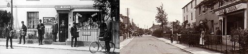
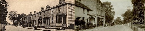
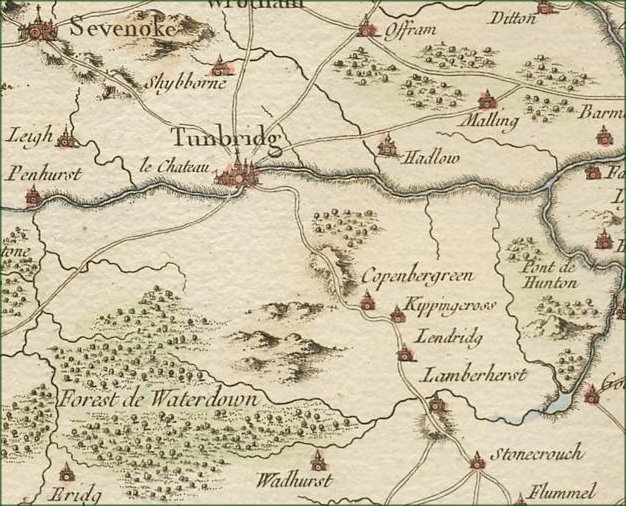
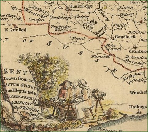
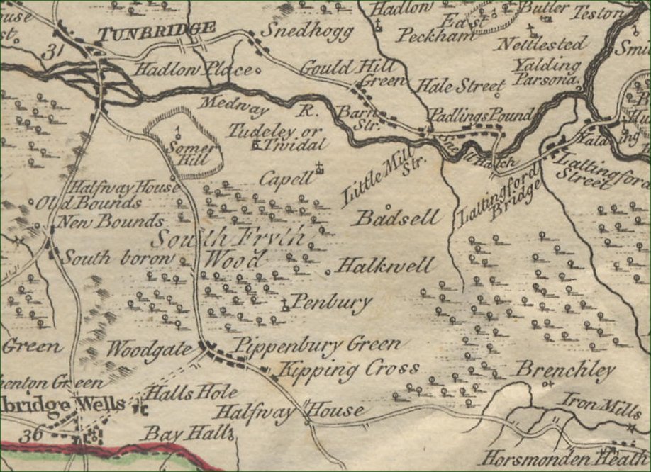
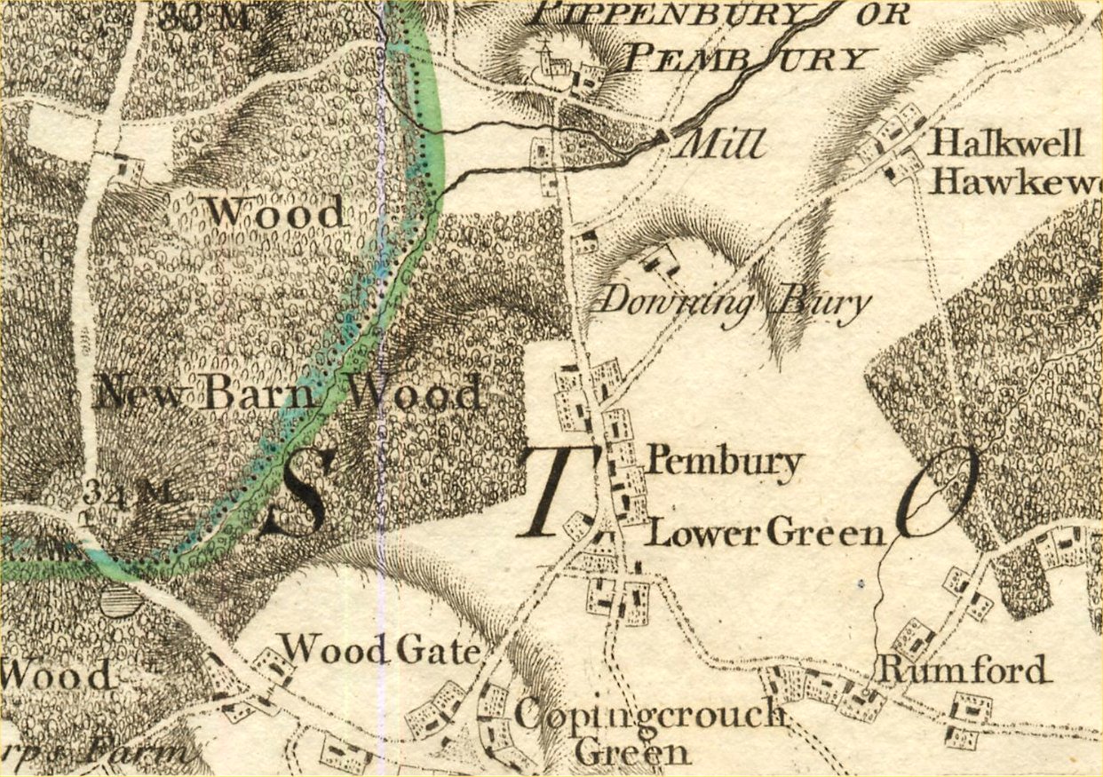
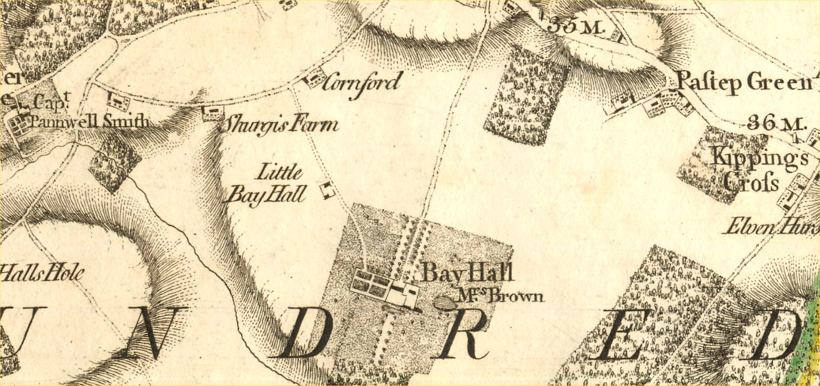
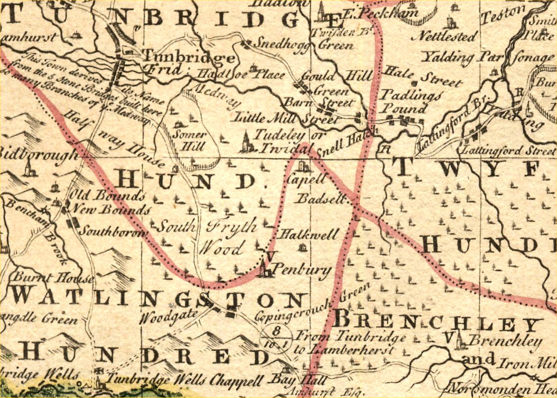
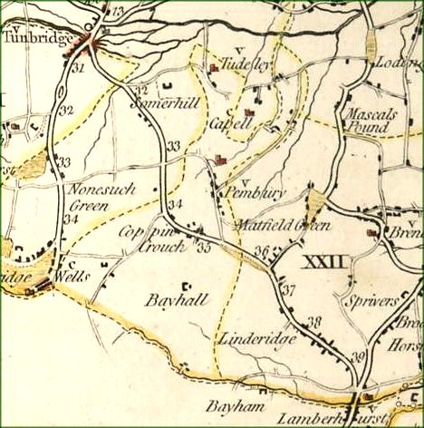
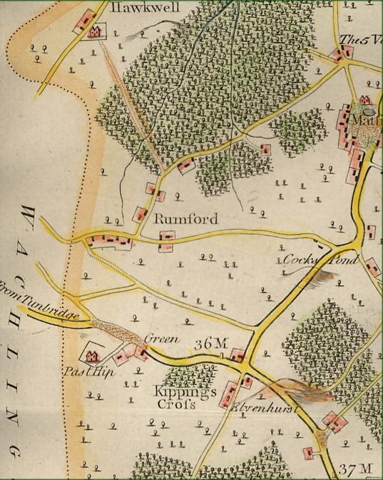
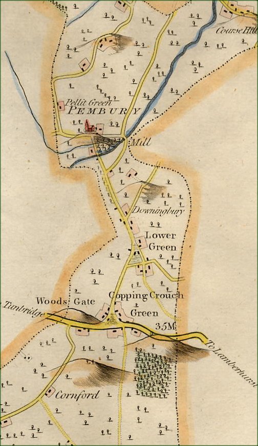
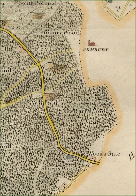
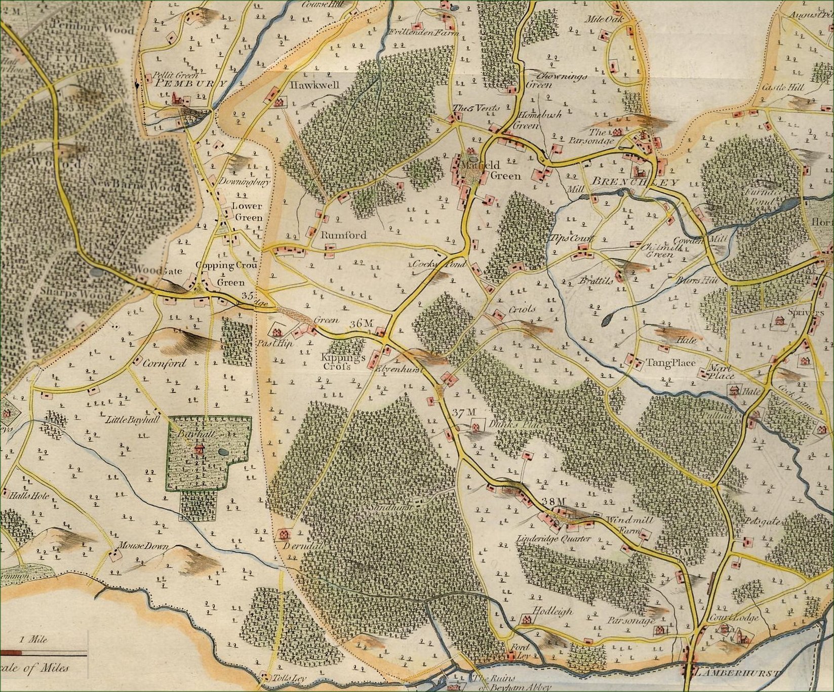
Old Maps of Pembury - 1720-1790The following files are maps scanned in by Tony Nicholls. Pembury Maps – General Maps – 1720-1790 These are sections of much larger maps, mostly of the county of Kent. Click image for enlarged detail.
Old Maps 1720 - 1790
IMPORTANT !!! This needs your help. All contributions will be credited. If you have any further information or corrections please contact me – Tony Nicholls email: pemburyhistory@gmail.com |