Past Pages
Antique Maps, Prints and Ephemera
Antique Maps - UK
London - Wards, Parishes, environs &suburbs
Related Sections: Maps - Road (Rail
& Canal), GW Bacon London maps.
London Maps
|
|
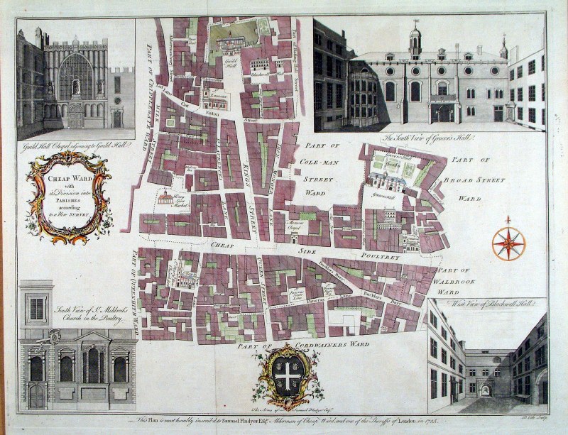 |
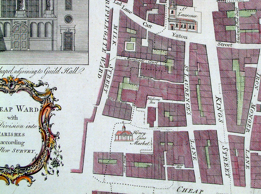
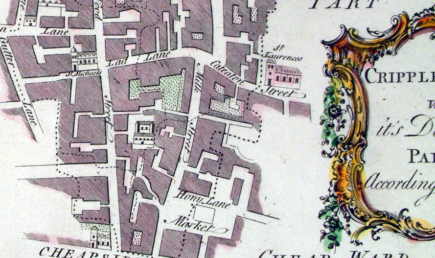
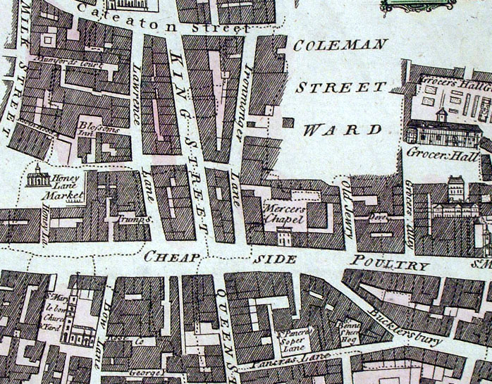
London Ward - Cheap Ward Cole / Maitland 1755 size: 500 x 390 mm Several folds. Ref AAM107 £85.00 (+P&P) click image for enlargement Detail |
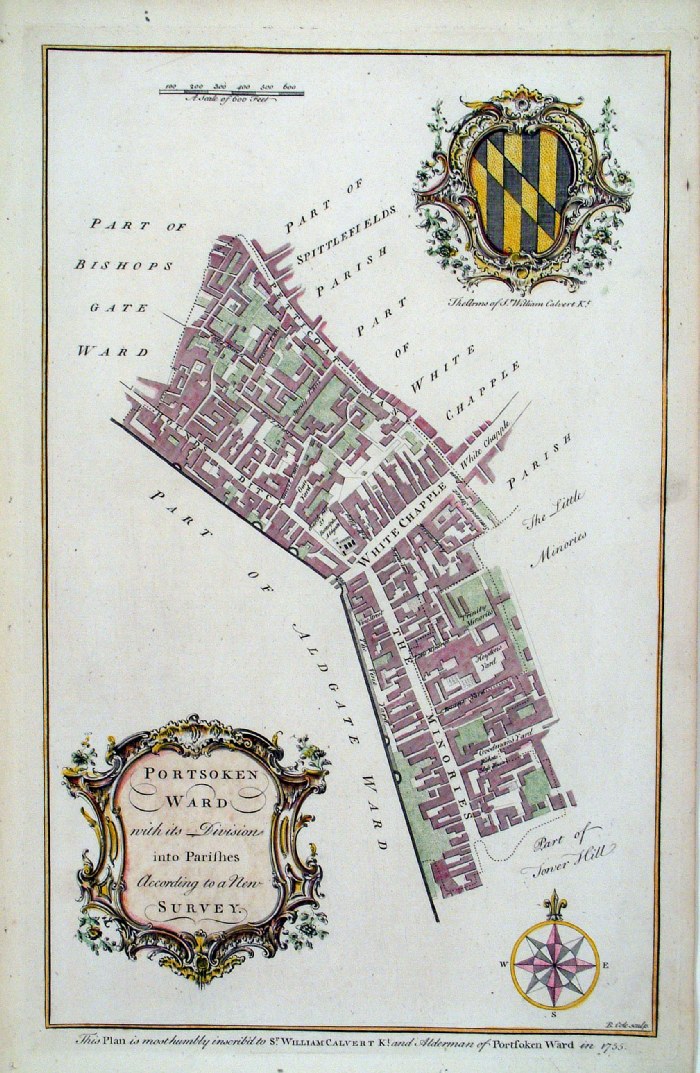 |
London Ward - Portsoken Cole / Maitland 1755 size: 250 x 380 mm Ref HDM005 £75.00 (+P&P) Detail click image for enlargement |
 |
London Ward - Portsoken
Cole / Maitland 1755 size: 250 x 380 mm uncoloured, very slightly aged patina Ref AKM001 £60.00 (+P&P) click image for enlargement |
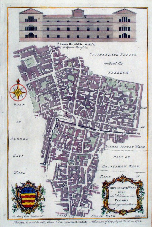 |
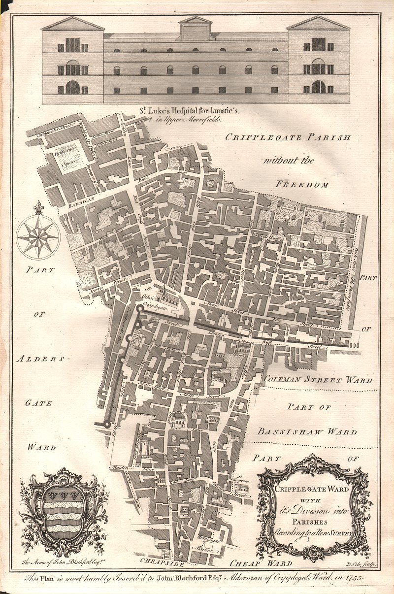
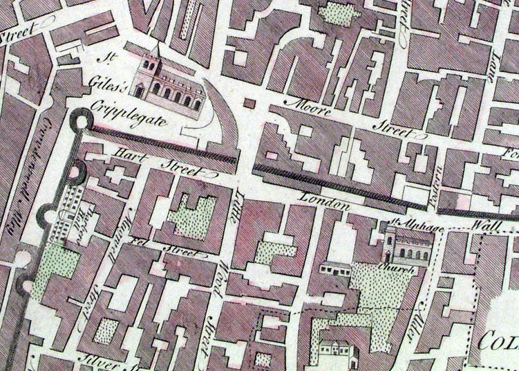
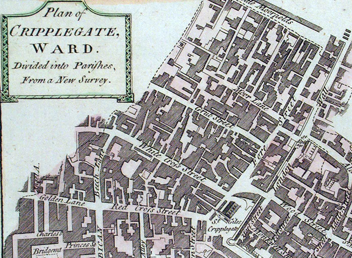
London Ward - Cripplegate Front elevation of St Lukes Hospital for Lunatics Cole / Maitland 1755 size: 250 x 380 mm Ref JKM056 £85.00 (+P&P) Detail 1 Detail 2 click image for enlargement |
 |
London Ward -
Cripplegate Front elevation of St Lukes Hospital for Lunatics Cole / Maitland 1755 size: 250 x 380 mm uncoloured, very slightly aged patina Ref AKM004 £60.00 (+P&P) click image for enlargement |
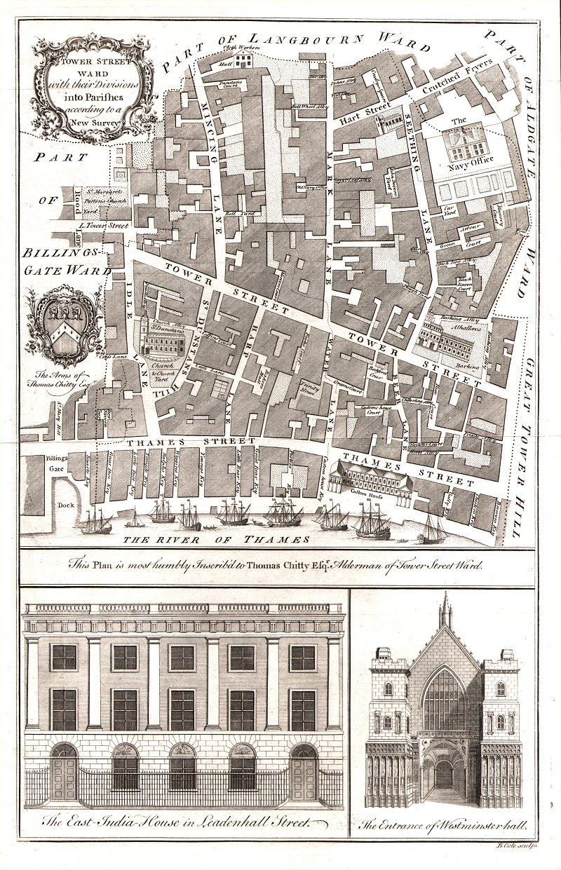 |
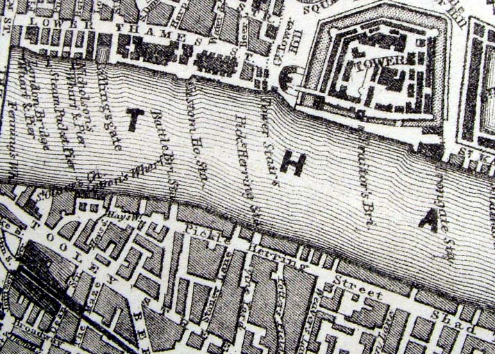
London Ward - Tower
Street Front elevation of East India House in Leadenhall and the Entrance of Westminster Hall Cole / Maitland 1755 size: 250 x 380 mm Ref AKM003 £80.00 (+P&P) click image for enlargement |
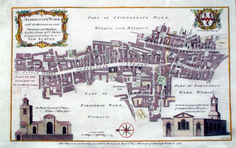 |
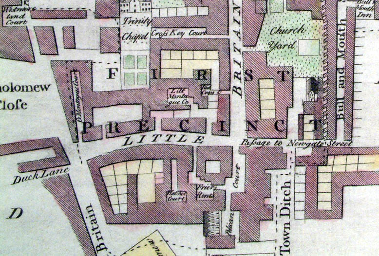
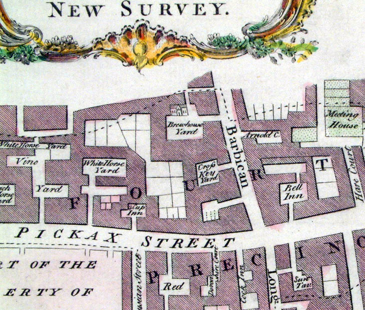
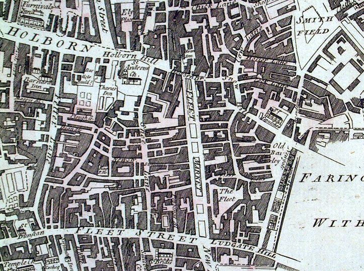
London Ward - Aldersgate Cole/Maitland 1755 size: 390 x 250 mm faint discolouration at middle-right. Ref JKM057 £70.00 (+P&P) Detail 1 Detail 2 click image for enlargement |
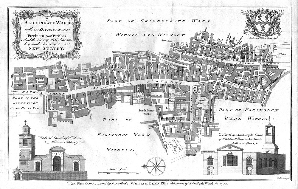 |
London Ward - Aldersgate Cole/Maitland 1755 size: 390 x 250 mm uncoloured, very slightly aged patina Ref AKM002 £60.00 (+P&P) click image for enlargement |
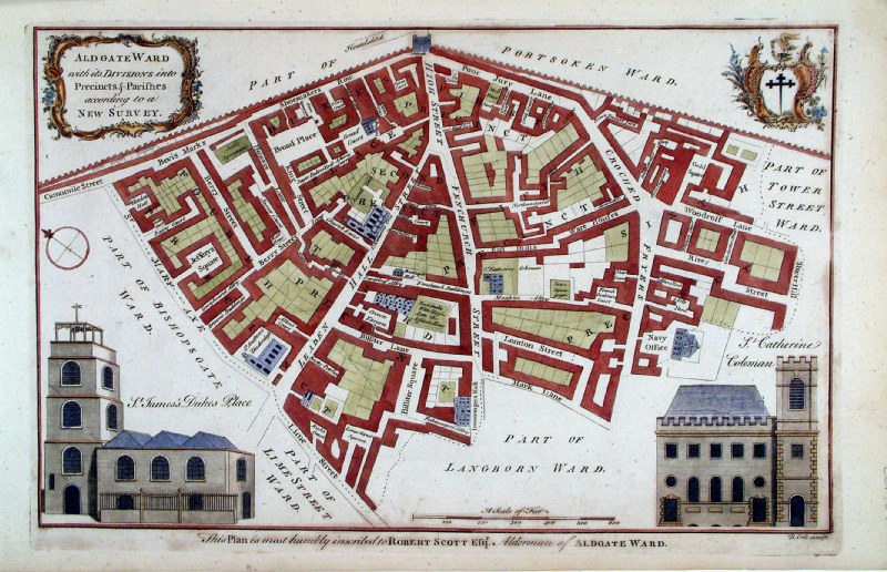 |
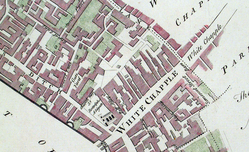
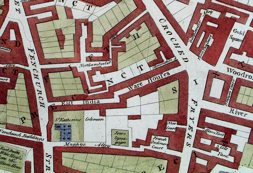
London Ward - Aldgate Cole / Maitland 1755 size: 400 x 320 mm Embossed Library stamp, some discolouration to bottom margin. Ref ECM022 £65.00 (+P&P) Detail click image for enlargement |
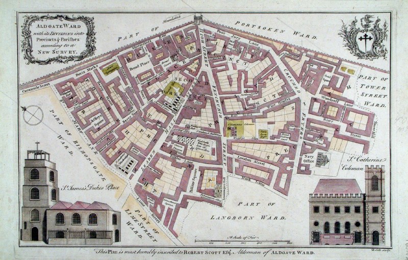 |
London Ward - Aldgate Cole / Maitland 1755 size: 400 x 320 mm Ref EKM091 £75.00 (+P&P) Detail click image for enlargement |
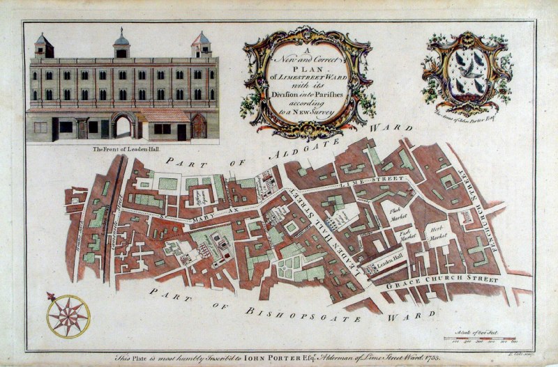 |
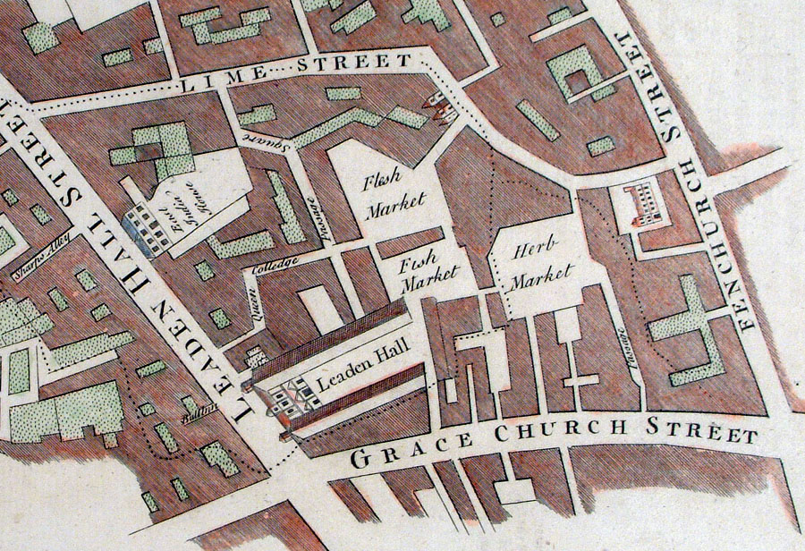
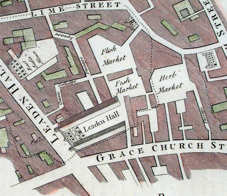
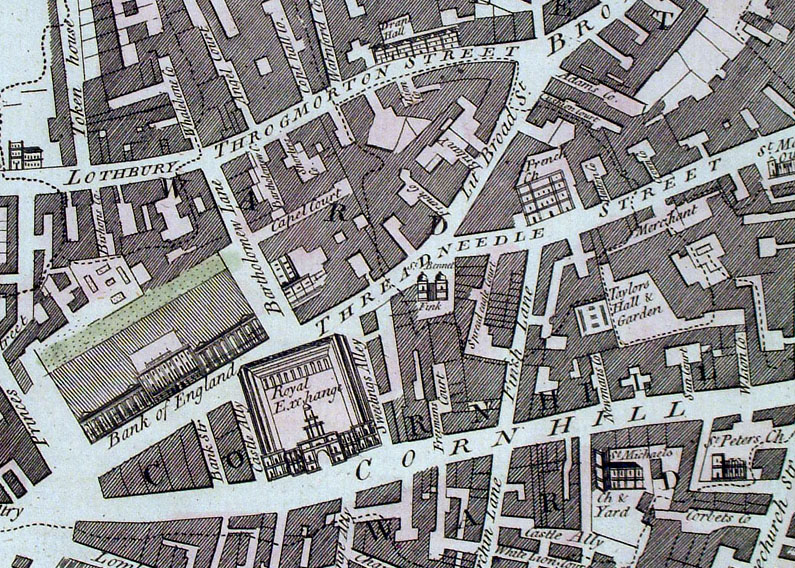
London Ward - Limestreet Cole / Maitland 1755 size: 370 x 350 mm Embossed Library stamp, some discolouration to bottom margin. Ref ECM023 £60.00 (+P&P) Detail click image for enlargement |
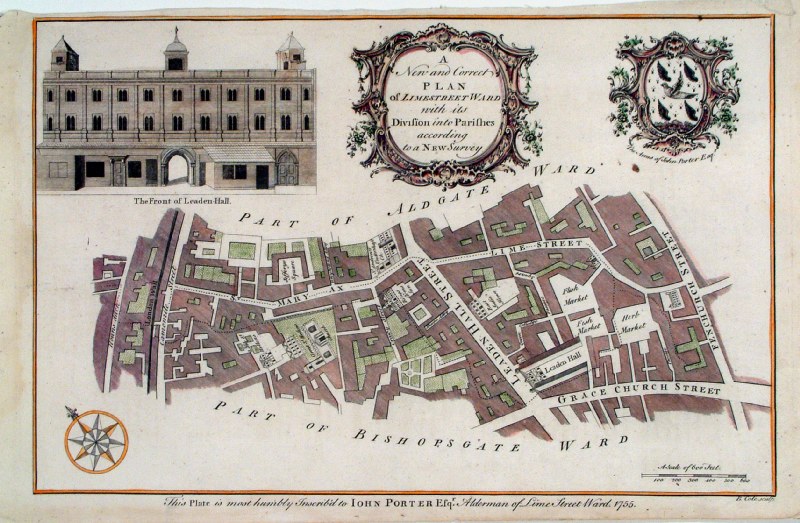 |
London Ward - Limestreet Cole / Maitland 1755 size: 370 x 350 mm Ref ECM036 £70.00 (+P&P) Detail click image for enlargement |
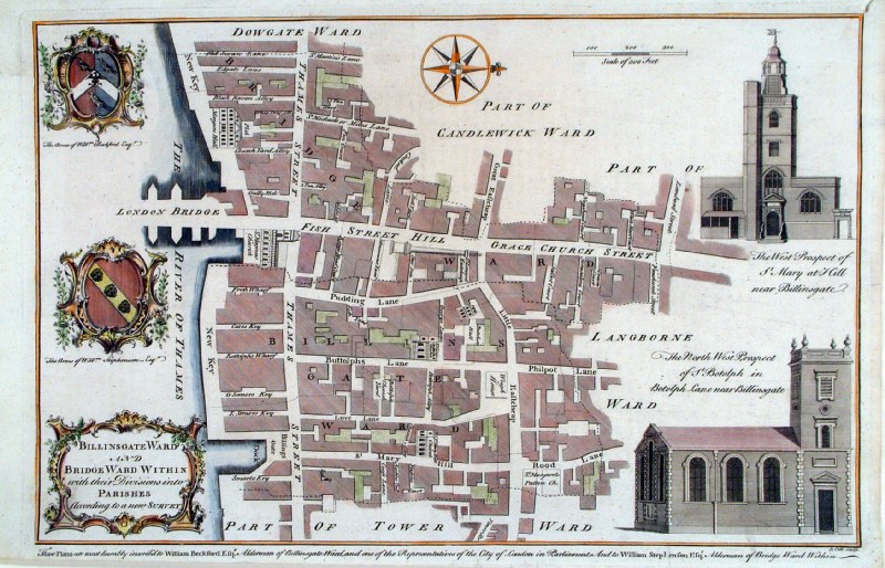 |
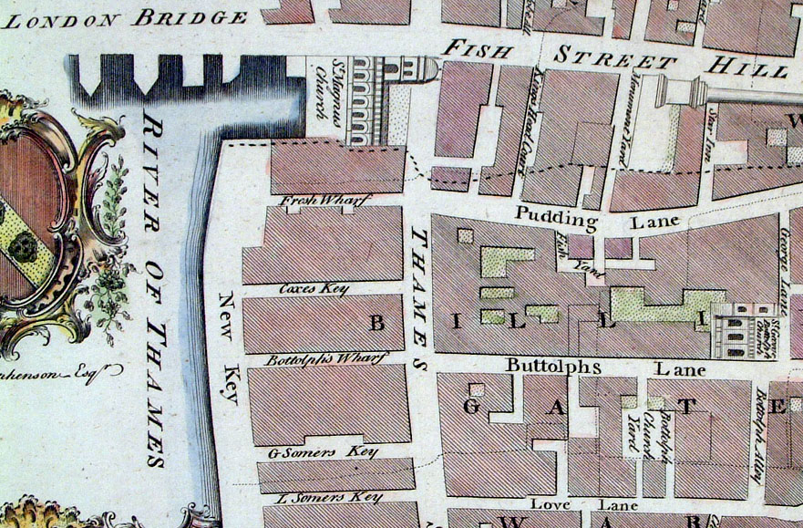
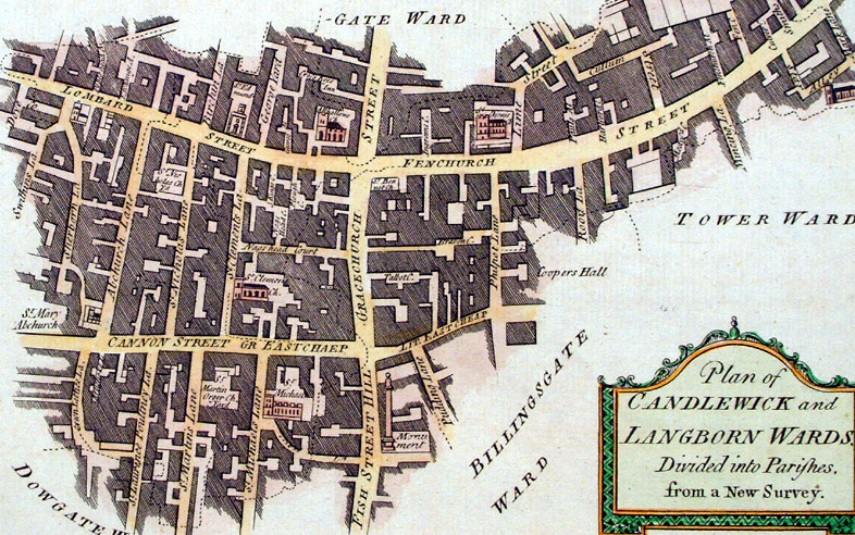
London Ward - Billingsgate Ward and
Bridge Ward Within Cole / Maitland 1755 size: 370 x 350 mm small split at lower margin, tight top-right corner Ref ECM035 £80.00 (+P&P) Detail click image for enlargement |
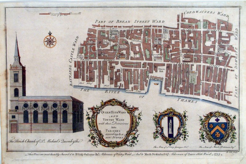 |
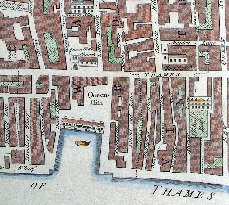
London Ward - Queen Hithe &
Vintry Cole / Maitland 1755 size: 380 x 250 mm Ref ECM026 £65.00 (+P&P) Detail Some discolouration to far left, a few minor creases. Ref KBM004 £70.00 (+P&P) Detail Faint diagonal crease. click image for enlargement |
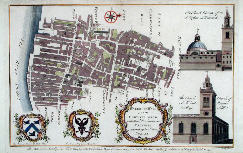 |
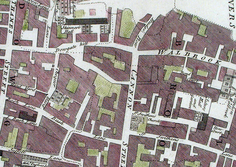
London Ward - Walbrook
and Dowgate wards Cole / Maitland 1755 size: 370 x 250 mm Ref AAM157 £90.00 (+P&P) Detail click image for enlargement |
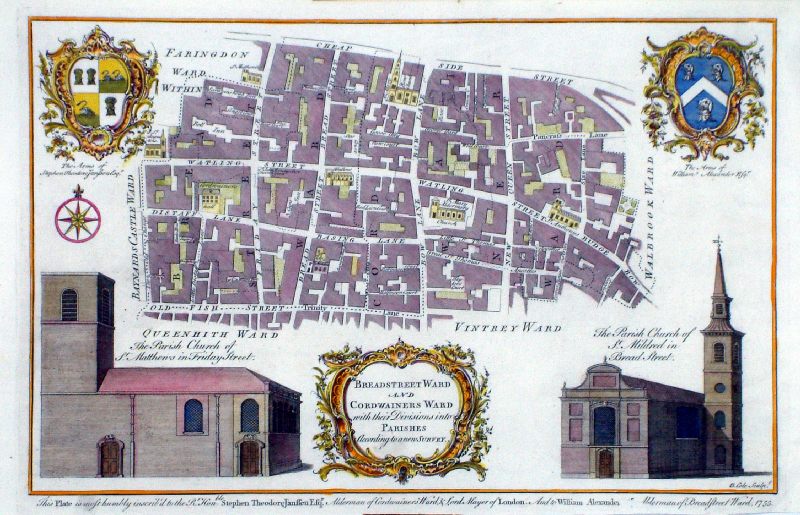 |
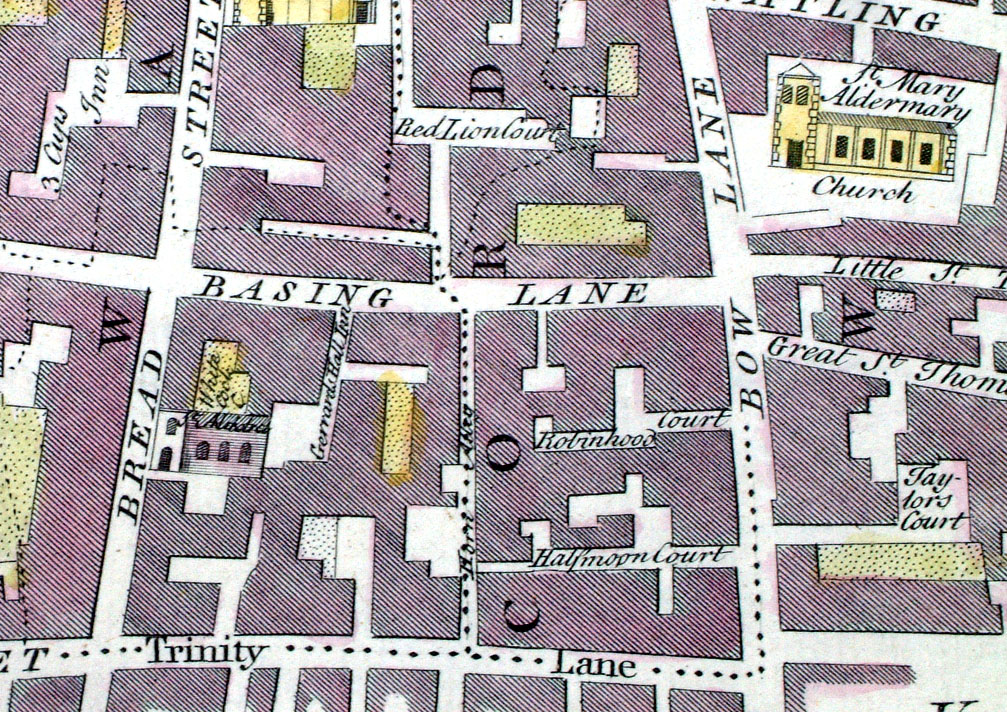
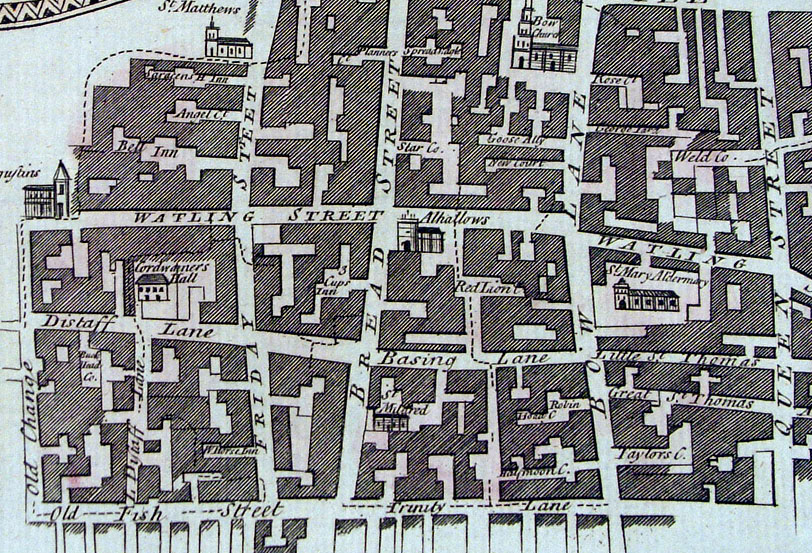
London Ward
- Breadstreet Ward and
Cordwainer Ward Cole / Maitland 1755 size: 380 x 250 mm Ref MBM014 £75.00 (+P&P) Detail click image for enlargement |
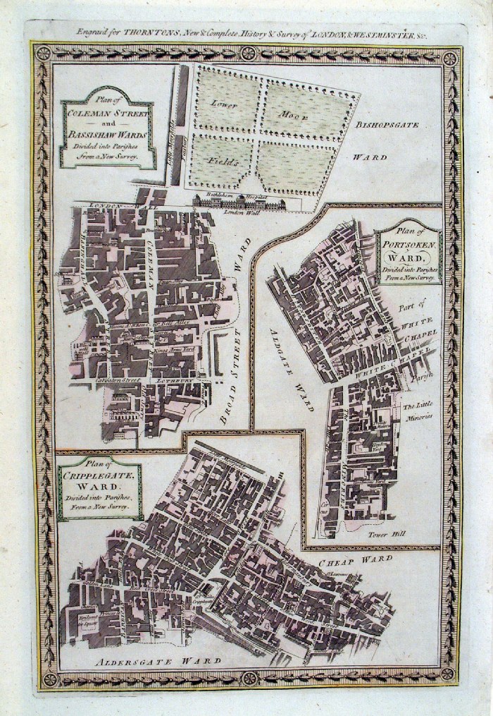 |
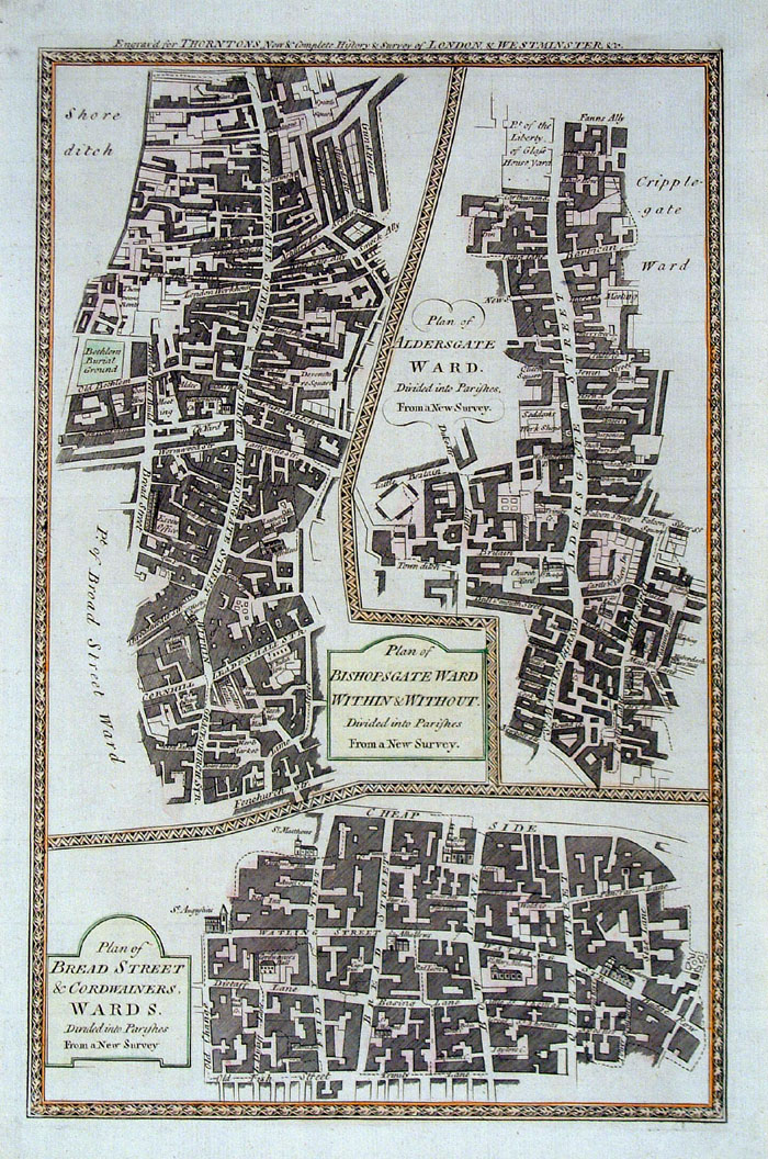
London Wards - Colman, Bassishaw,
Portsoken, Cripplegate Thornton 1784 size: 220 x 340 mm Ref ECM002 £35.00 (+P&P) Detail click image for enlargement |
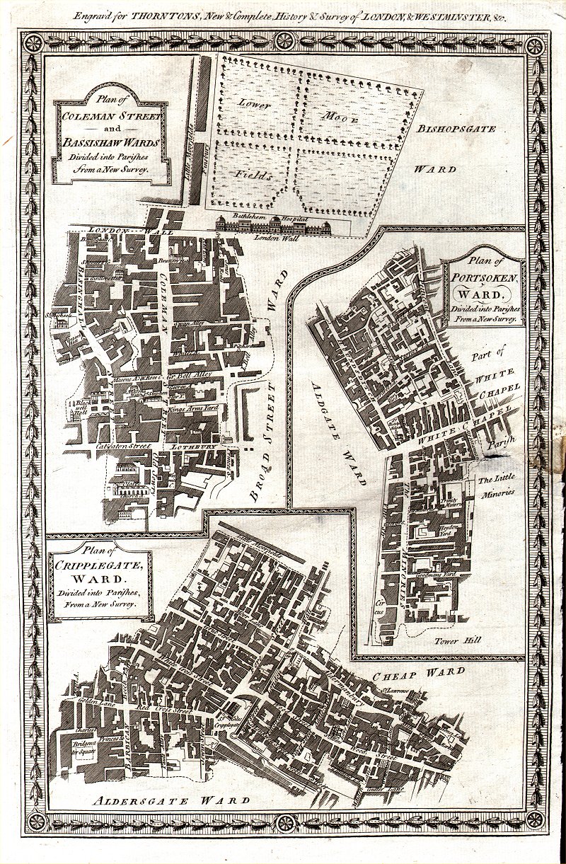 |
London Wards - Colman,
Bassishaw, Portsoken, Cripplegate Thornton 1784 size: 220 x 340 mm repair to middle right border & margin Ref AKM006 £28.00 (+P&P) click image for enlargement |
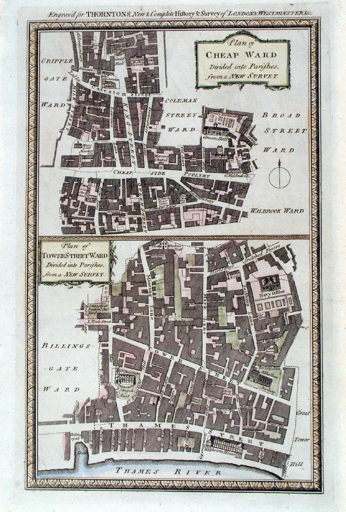 |
London Wards - Cheap Ward and Tower
Street Ward Thornton 1784 size: 220 x 340 mm Ref ECM003 £35.00 (+P&P) Detail click image for enlargement |
|
London Wards - Cheap, Tower
Street Thornton 1784 size: 220 x 340 mm Ref ECM004 £35.00 (+P&P) Detail click image for enlargement |
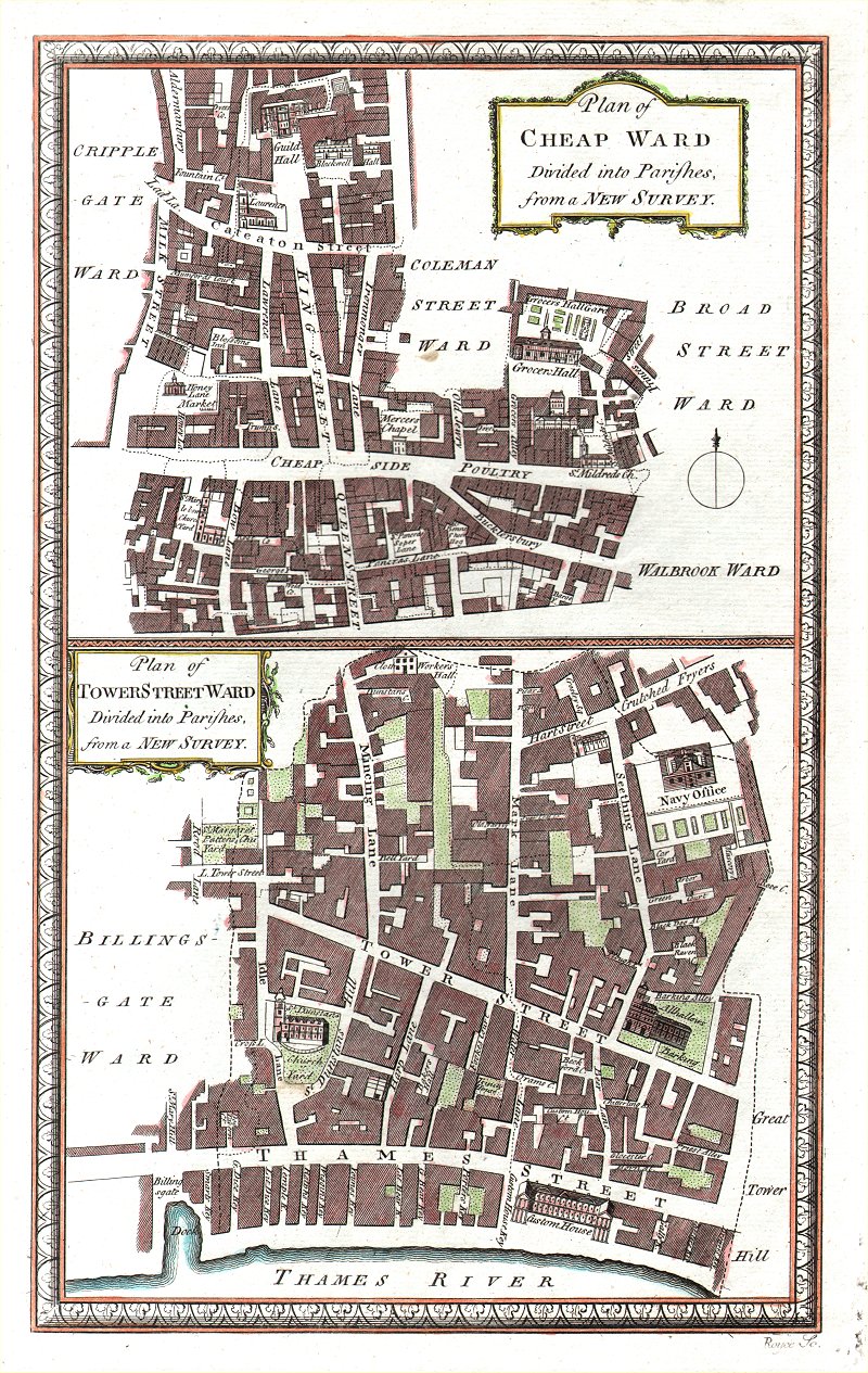 |
London Wards - Cheap,
Tower Street Thornton 1784 size: 220 x 340 mm Ref AKM008 £35.00 (+P&P) click image for enlargement |
 |
London Wards - Colman, Bassishaw,
Portsoken, Cripplegate Thornton 1784 size: 220 x 340 mm Ref ECM006 £35.00 (+P&P) Detail click image for enlargement |
 |
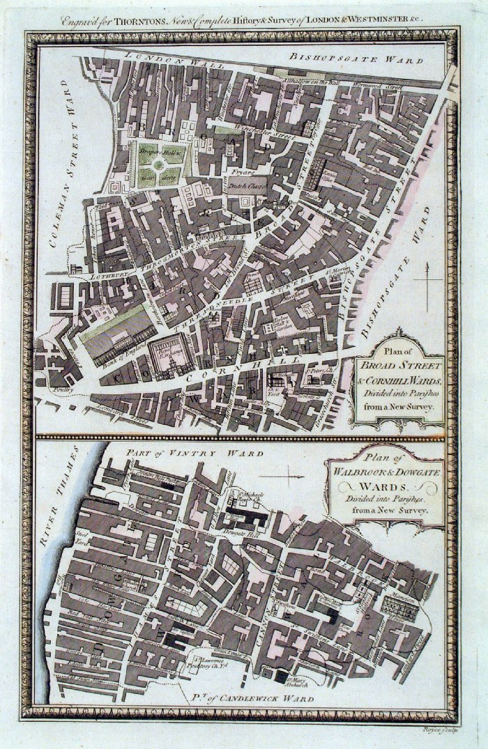
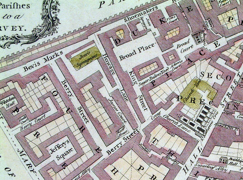
London Wards - Bishopsgate,
Bread Street & Cordwainers Thornton 1784 size: 220 x 340 mm Ref ECM008 £40.00 (+P&P) Detail click image for enlargement |
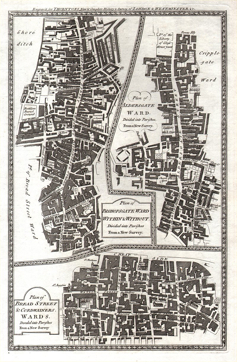 |
London Wards - Bishopsgate,
Bread Street & Cordwainers Thornton 1784 size: 220 x 340 mm Ref AKM007 £35.00 (+P&P) click image for enlargement |
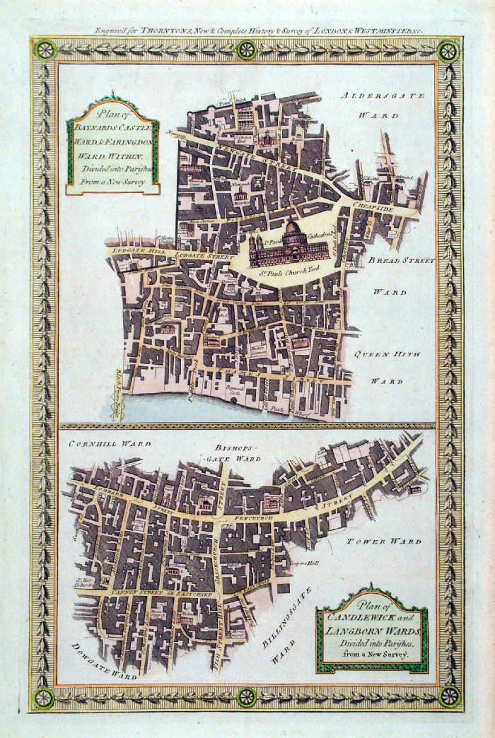 |
London Wards - Baynards
Castle, Farringdon Within, Candlewick,
Langborn. Thornton 1784 size: 220 x 340 mm Ref ECM027 £55.00 (+P&P) Detail click image for enlargement |
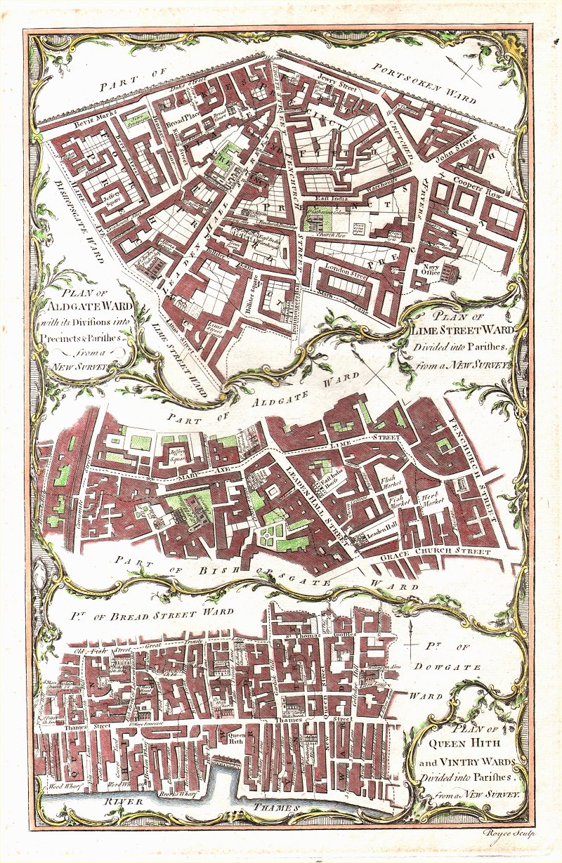 |
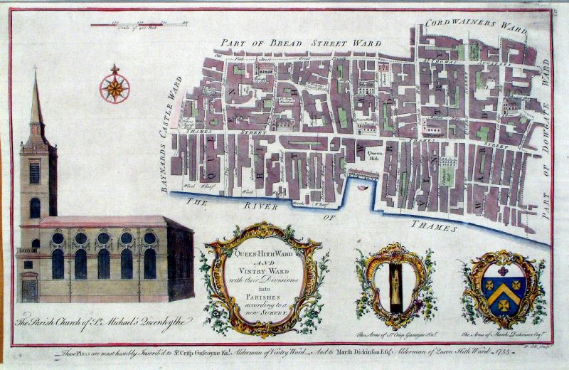
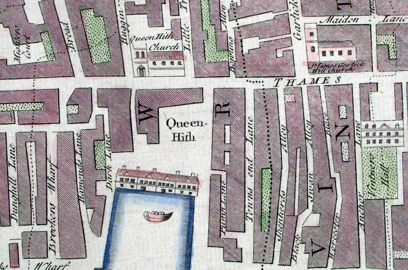
London Wards - Aldersgate,
Lime Street, Queen Hith & Vintry. Thornton 1784 size: 220 x 340 mm very faint foxing at borders. Ref AKM005 £45.00 (+P&P) click image for enlargement |
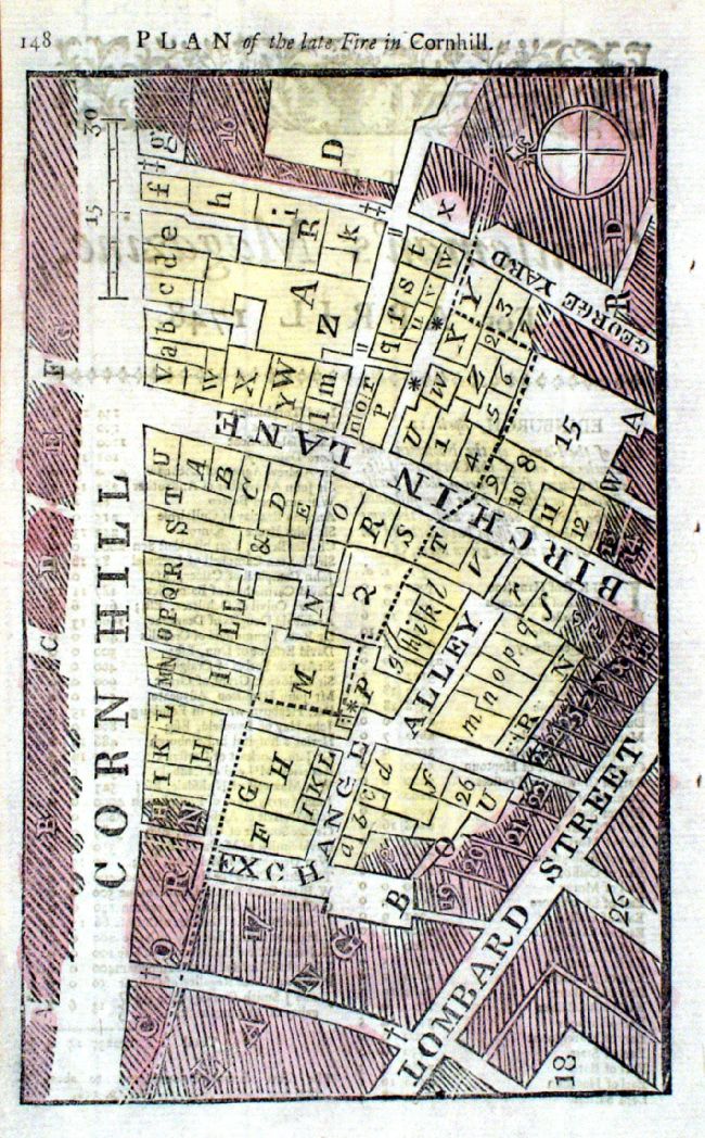 |
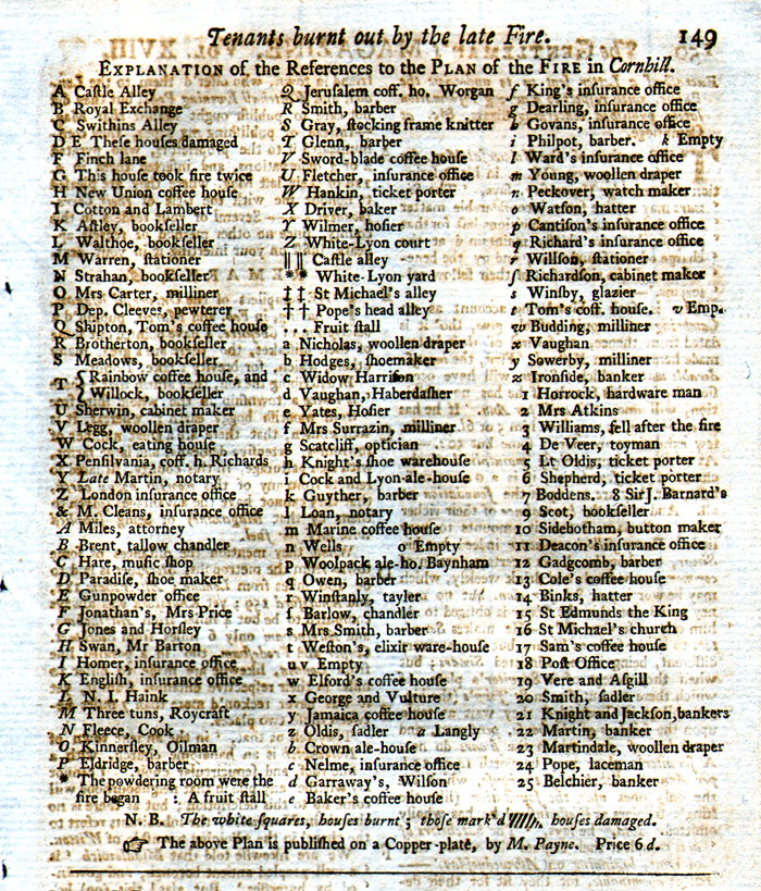
Plan of the Late Fire in Cornhill Gentlemans Magazine 1748 Comes with a page of text referencing properties: ' Tenants burnt out by the late fire' States tenant and nature of business, ie Baker, Barber etc. Cornhill List Copper Engraving. size: 120 x 200 mm Ref KHM003 £35.00 (+P&P) click image for enlargement |
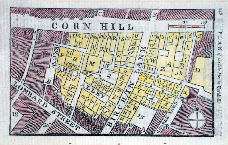 |
Plan of the Late Fire in Cornhill Gentlemans Magazine 1748 List Page Cornhill List not included. Copper Engraving. size: 120 x 200 mm Ref LAM011 £25.00 (+P&P) click image for enlargement |
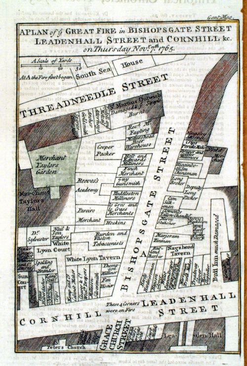 |
Plan of the Late Fire in Cornhill Gentlemans Magazine 1765 Copper Engraving. size: 120 x 170 mm Ref LAM012 £25.00 (+P&P) click image for enlargement |
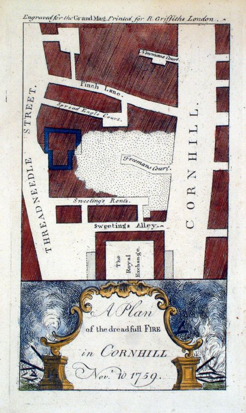 |
Plan of the Dreadful
Fire in Cornhill Nov 10 1759 Griffiths Grand Magazine 1759 Copper Engraving. size: 120 x 200 mm Ref LAM013 £40.00 (+P&P) click image for enlargement |
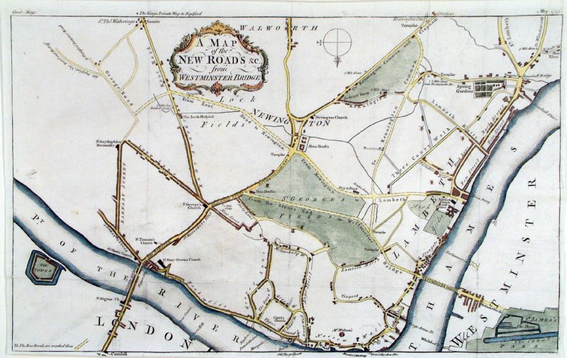 |
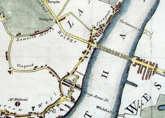
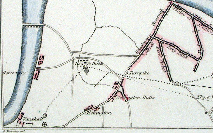
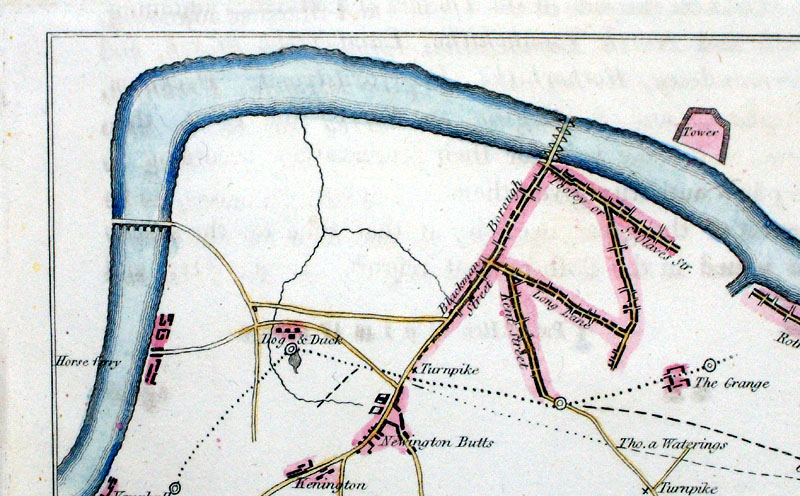
London Roads - Proposed new roads
south of Westminster Bridge A Map of the New Roads from the Westminster Bridge. Shows Milestones, Turnpikes, Houses, Inns and roadside Gallows. Gentleman's Magazine 1753 size: 365 x 225 mm Tight margins. Ref ECM025 £60.00 (+P&P) Detail click image for enlargement |
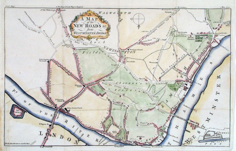 |
London Roads - Proposed new roads
south of Westminster Bridge A Map of the New Roads from the Westminster Bridge. Shows Milestones, Turnpikes, Houses, Inns and roadside Gallows. Gentleman's Magazine 1753 size: 365 x 225 mm Tight margins - repair to tear across lower-left side - visible in illustration. Ref HEM018 £30.00 (+P&P) Detail click image for enlargement |
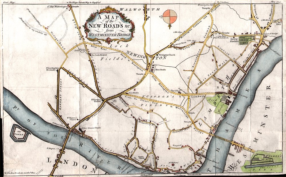 |
London Roads - Proposed
new roads south of Westminster Bridge A Map of the New Roads from the Westminster Bridge. Shows Milestones, Turnpikes, Houses, Inns and roadside Gallows. Gentleman's Magazine 1753 size: 365 x 225 mm Tight margins Ref AKM010 £60.00 (+P&P) click image for enlargement |
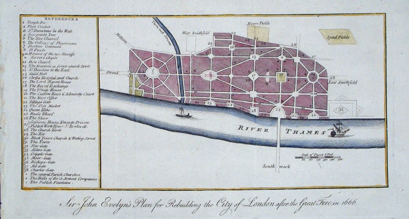 |
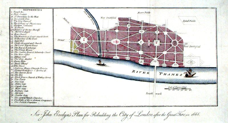
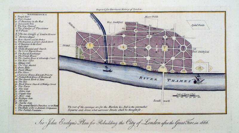
London Rebuilding plan
J.
Cooke for Walter Harrison 1775 'Sir John Evelyn's Plan for Rebuilding the City of London after the Great Fire in 1666' Side panel has 33 references to city locations. size: 300 x 170 mm, 2 folds Ref GHM065 £40.00 (+P&P) click image for enlargement |
 |
London rebuilding
Plan 'Sir John Evelyn's plan for rebuilding the City of London after the Great Fire in the year 1666' Downs / Hogg c1785 Copper engraving. size: 300 x 180 mm Ref IEM010 £38.00 (+P&P) click image for enlargement |
 |
London rebuilding
Plan 'Sir John Evelyn's plan for rebuilding the City of London after the Great Fire in 1666' anon c1785 Copper engraving. size: 310 x 170 mm, 2 folds Ref IEM011 £35.00 (+P&P) click image for enlargement |
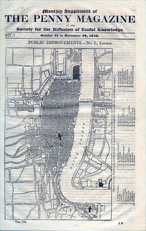 |
London - Public Improvements Map of London, Westminster and Southwark, in the time of Queen Elizabeth From the plan published by Aggas. Shows 39 Key landmarks in adjacent table. The Penny Magazine 1838 size: 170 x 260 mm Ref ECM034 £25.00 (+P&P) click image for enlargement |
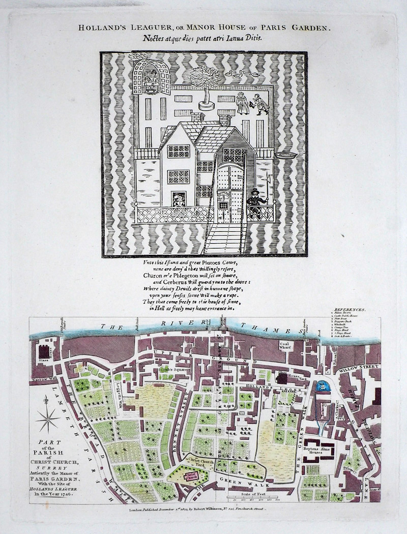 |
London - A Part of the
Parish of Christ Church Surrey, Antiently the Manor of Paris Garden with the site of Holland's Leaguer Wilkinson 1811 size: 260 x 330 mm View Above - plan of Holland's Leaguer or Manor House of Paris Garden. Ref RLM018 £48.00 (+P&P) click image for enlargement Detail |
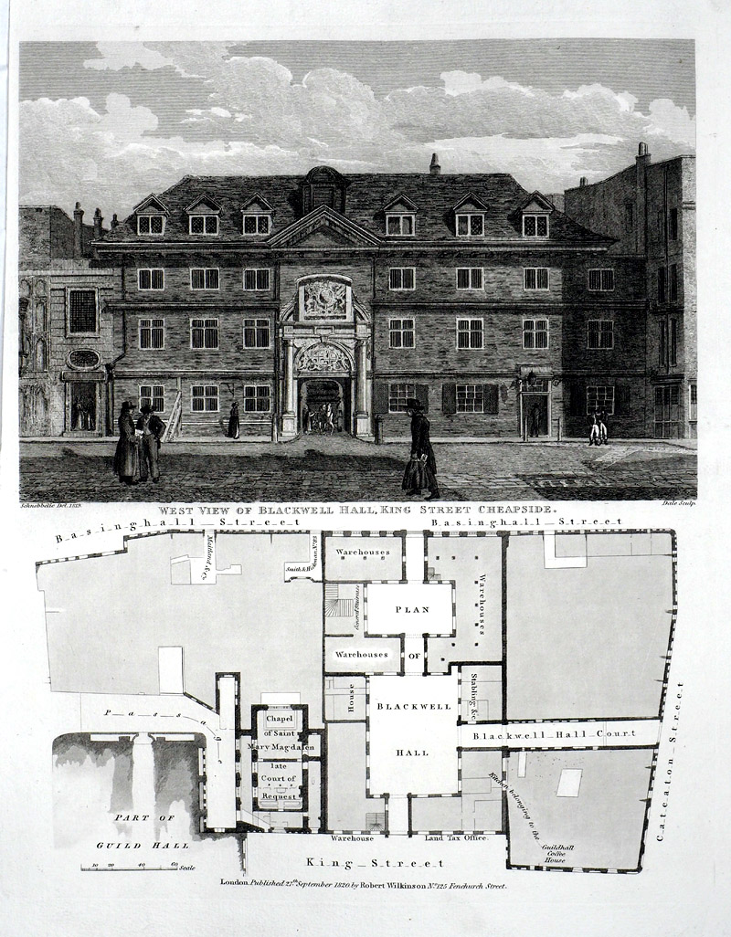 |
London - Map of the
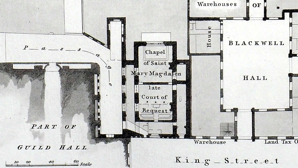
area covered bt Guild Hall, King Street, Caterton Street,Basinghall Street showing Blackwell Hall. View above - West View of Blackwell Hall, King Street, Cheapside. Wilkinson 1820 size: 250 x 330 mm, tigh left margin Ref SAM002 £48.00 (+P&P) click image for enlargement Detail |
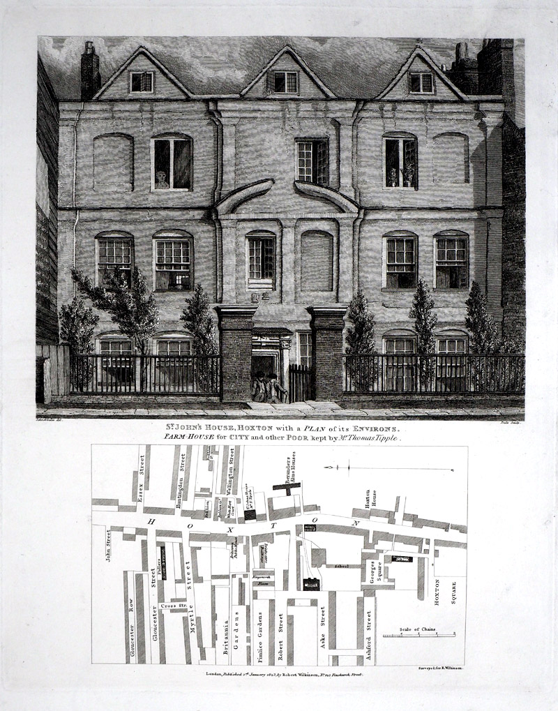 |
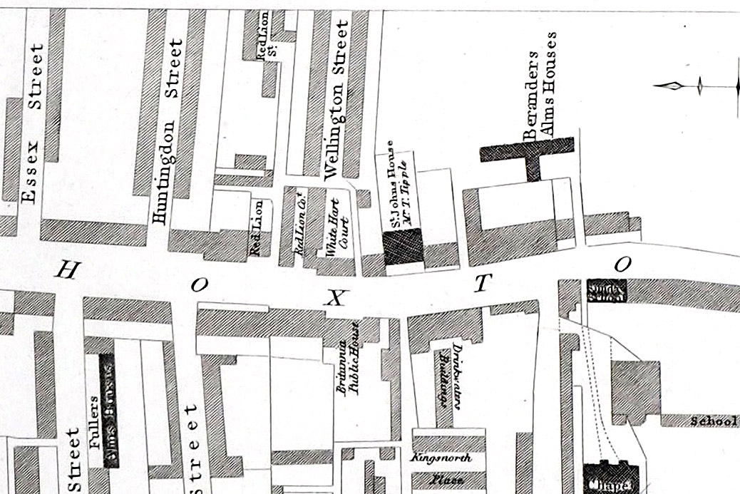
London - Hoxton View of St John's House, Hoxton. Farm House for City and other Poor kept by Mr Thomas Tipple. Wilkinson 1823 size: 250 x 310 mm Ref SAM003 £48.00 (+P&P) click image for enlargement Detail |
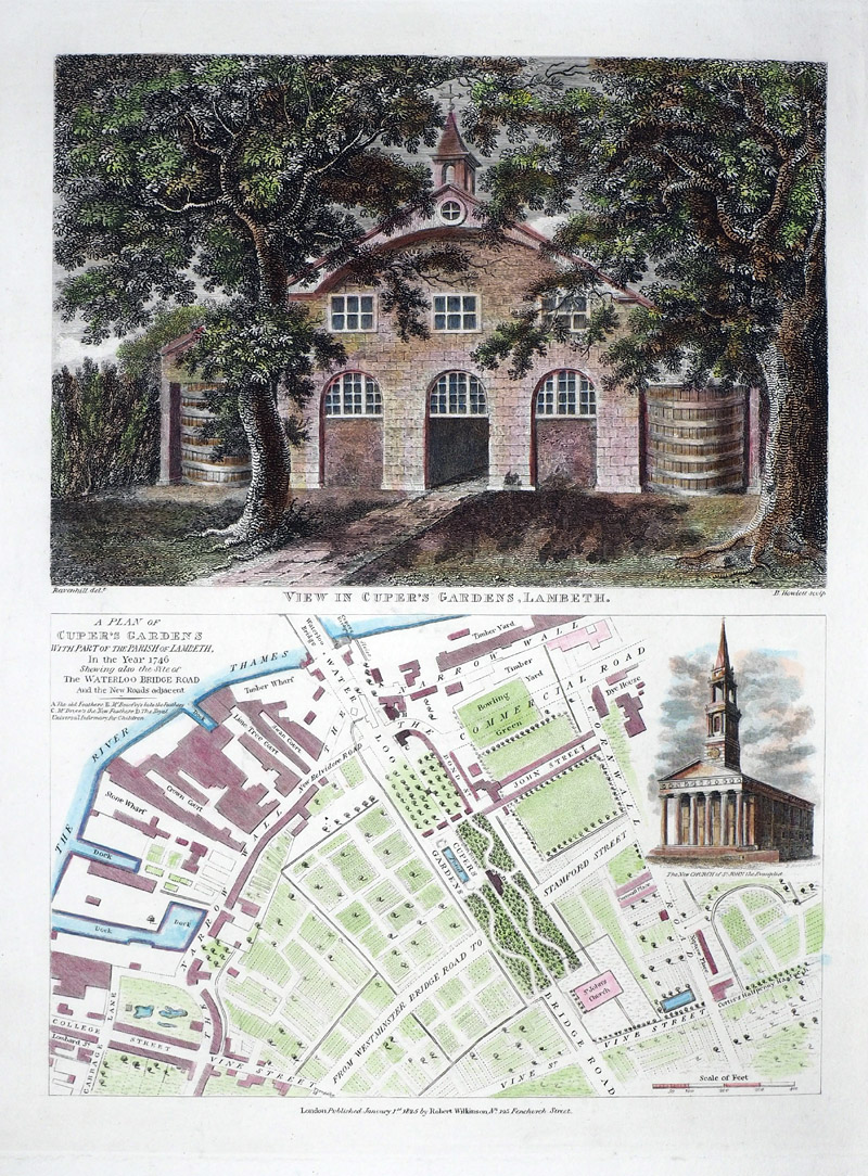 |
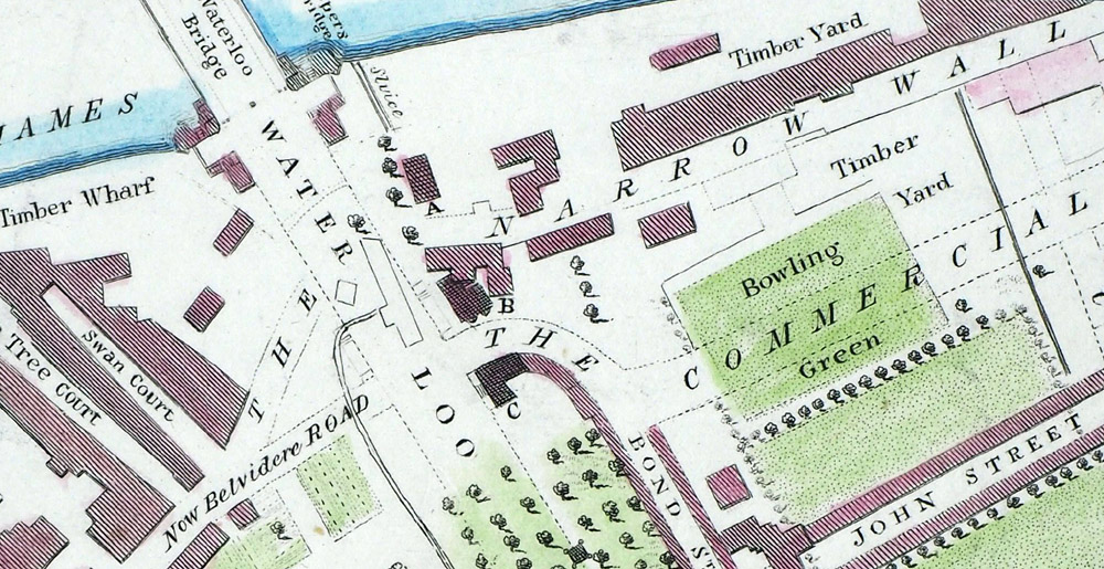
London - A Map of
Cuper's Gardens with part of the Parish of Lambeth In the Year of 1746 shewing also the site of The Waterloo Bridge Road. Wilkinson 1825 size: 240 x 320 mm Inset view of the New Church of St John Above - View of Cuper's Garden, Lambeth Ref RLM019 £60.00 (+P&P) click image for enlargement Detail |
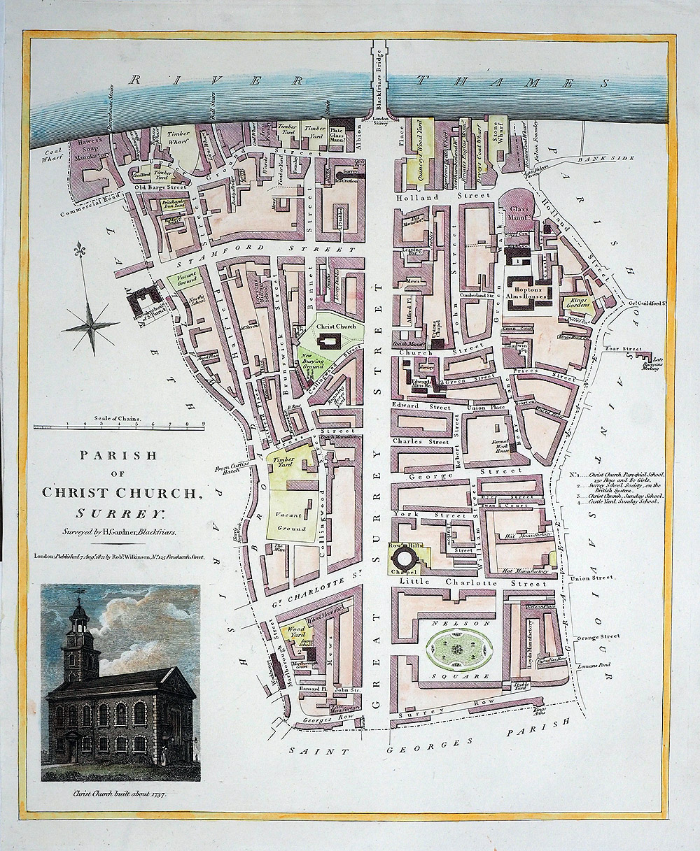 |
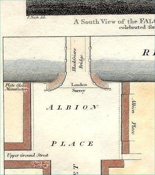
London - The Parish of Christ
Church, Surrey Surveyed by H.Gardner, Blackfriars Blackfriars Bridge shown at top of map. Wilkinson 1821 size: 270 x 330 mm View of Christ Church built about 1737 Ref RLM017 £70.00 (+P&P) click image for enlargement |
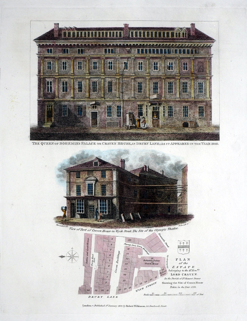 |
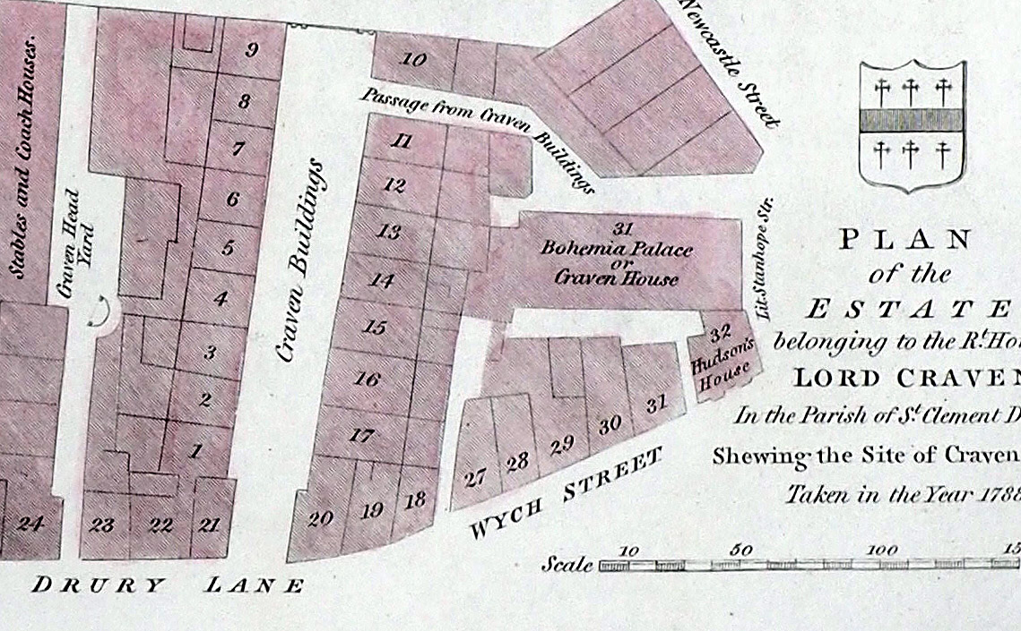
London - Plan of the
Estate of Lord Craven in the Parish of St Clement Danes, Shewing the site of Craven House. Wilkinson 1821 size: 270 x 330 mm View of Craven House in Wych Street - the site of Olympic Theatre View of Craven House in Drury Lane as it appeared in the year 1800 Ref RLM021 £40.00 (+P&P) Detail click image for enlargement |
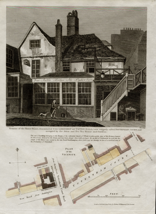 |
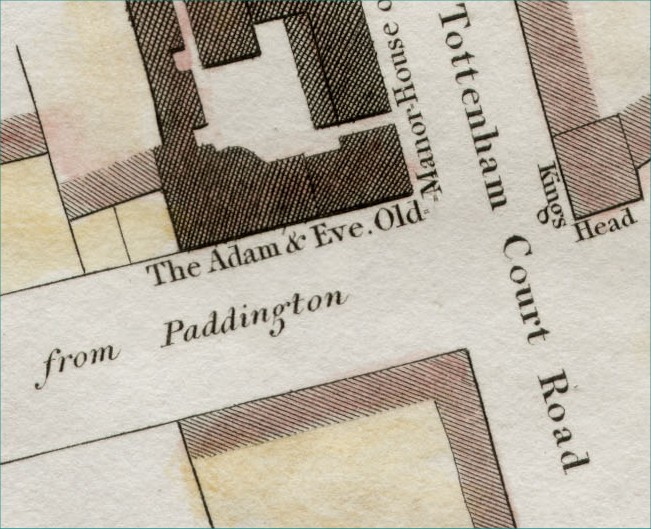
London - Tottenham Court Road Wilkinson 1813 size: 250 x 330 mm Remains of the Manor House, denominated The Lordship of Toten-Hall; now vulgarly called Tottenham Court, and occupied by the Adam and Eve Tea House and Gardens Ref EKM014 £48.00 (+P&P) click image for enlargement Detail |
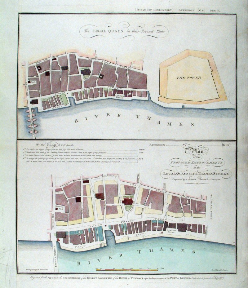 |
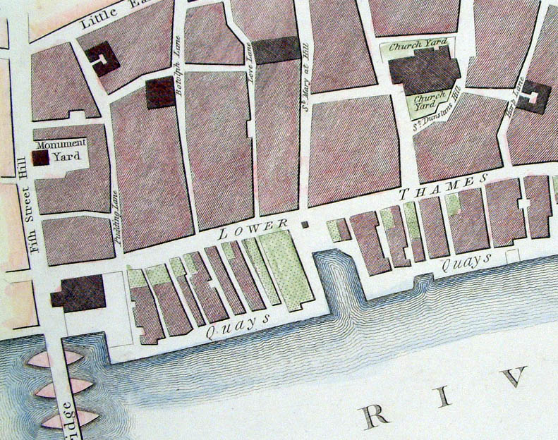
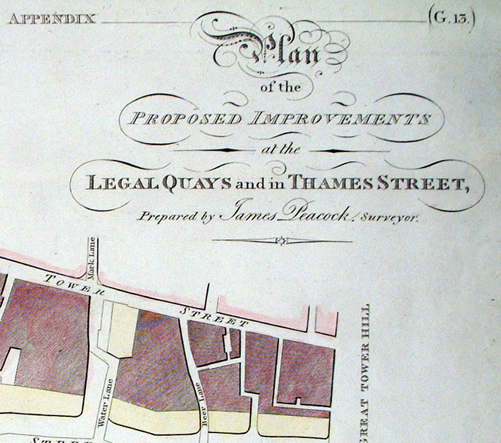
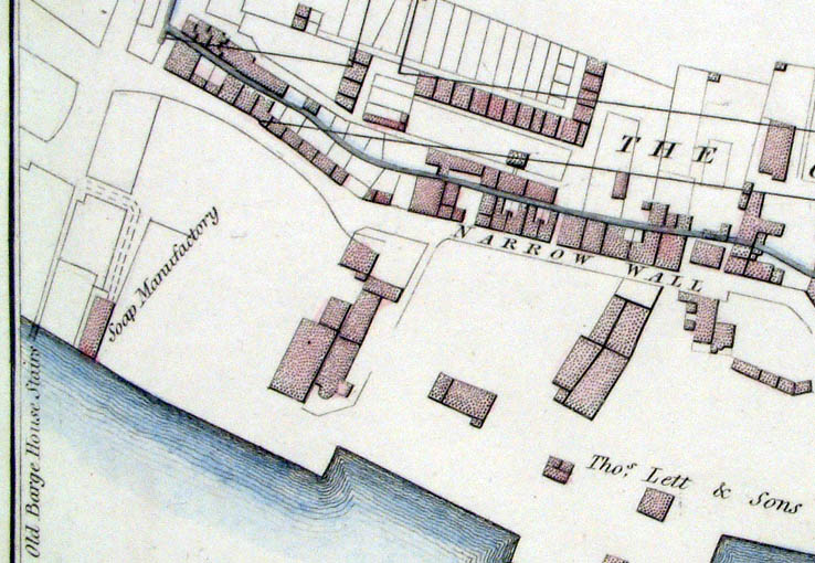
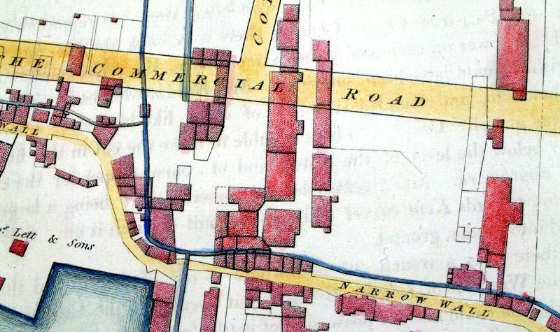
London - Thames Street and Great
Tower Street redevelopment. Top - 'The Legal Quays in their Present State' Bottom - 'Plan of the Proposed Improvements at the Legal Quays and in Thames Street, Prepared by James Peacock, Surveyor'. Engraved by R. Metcalf for the Surveyors Office, Guildhall. 1799 Copper engraving size: 400 x 480 mm, centre fold, crease and strengthened left margin. Ref HLM021 £75.00 (+P&P) click image for enlargement Detail 1 Detail 2 |
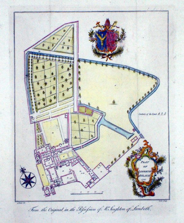 |
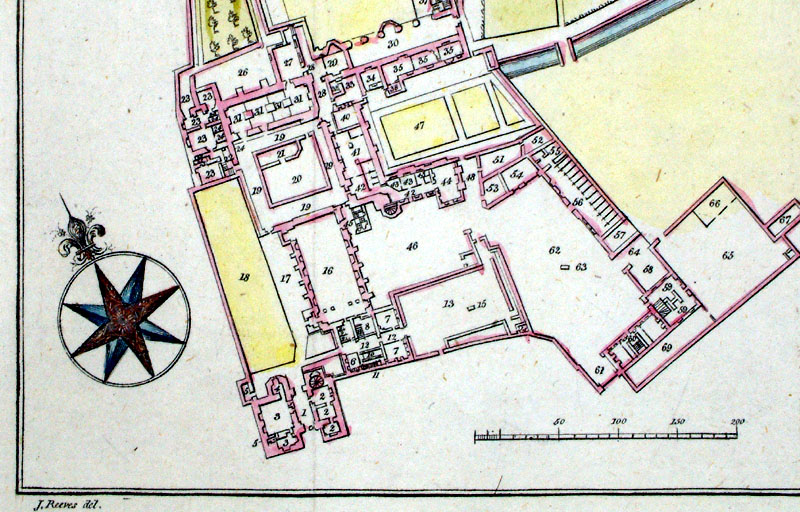
Plan of Lambeth Palace 1750 Reeves & Cook c1800 Copper engraving size: 200 x 230 mm, 2 folds Ref MBM003 £30.00 (+P&P) click image for enlargement Detail |
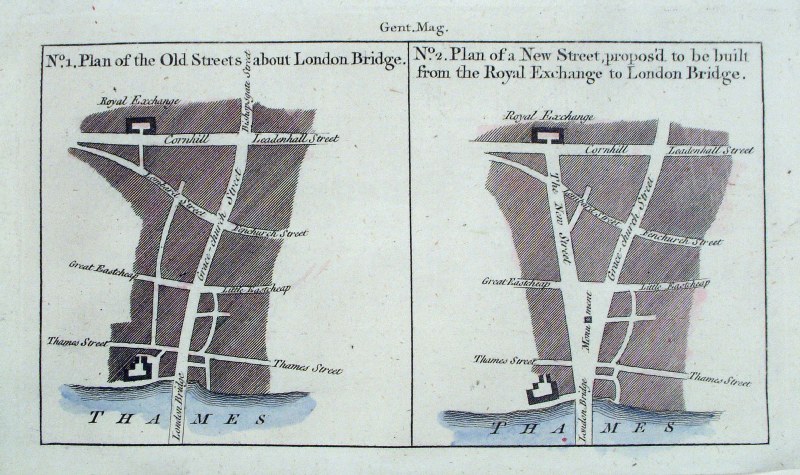 |
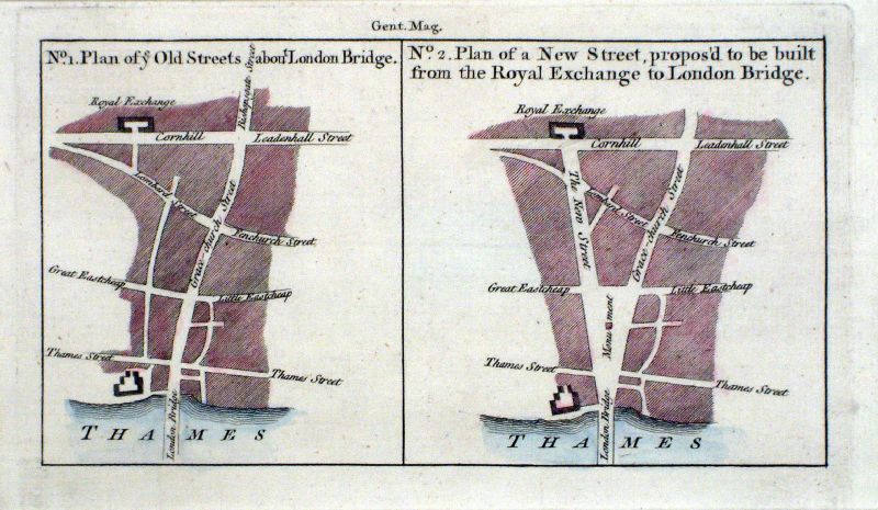
Plan of proposed street development around
London Bridge Gentleman's Magazine 1760 size: 190 x 115 mm Ref HBM015 £24.00 (+P&P) Ref KGM028 £24.00 (+P&P) click image for enlargement |
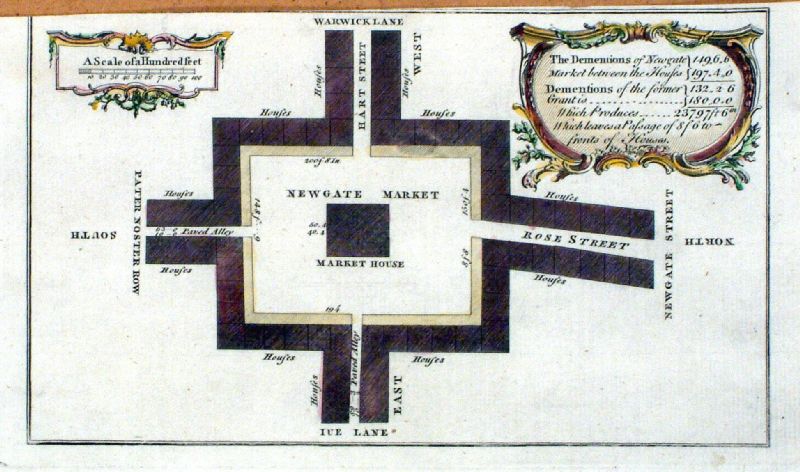 |
The Dementions of Newgate Market between the
houses ..... Baldwin, London Magazine 1755 size: 190 x 115 mm, cropped top margin. Ref KCM010 £24.00 (+P&P) click image for enlargement |
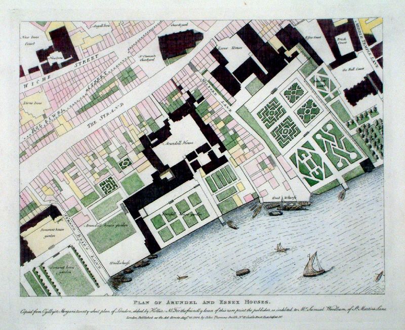 |
Plan of Arundel and Essex Houses (between
the Strand and the Thames) J.T. Smith 1809 size: 320 x 250 mm Ref KBM006 £35.00 (+P&P) click image for enlargement |
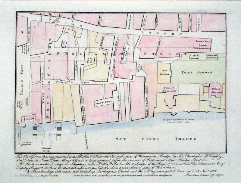 |
Westminster - Parliament Street J.T. Smith 1807 size: 320 x 250 mm A plan of the Parliament Street area between 1734 and 1748 showing the old street layout and the development of Parliament Street and its junction with Westminster Bridge. As references to the modern day layout we still have Derby Court, Derby Street, Cannon Row, (King) Charles street, Downing Street. Ref KBM007 £35.00 (+P&P) click image for enlargement |
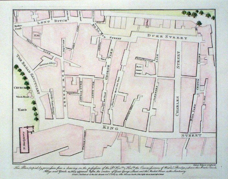 |
Westminster - King Street - Now Parliament Street J.T. Smith 1807 size: 320 x 250 mm A Plan of Westmister prior to the Development of Parliament Street. As references to the modern day layout we still have (King) Charles Street, Little Sanctuary, St Margarets, (Old) Queen Street, Storys Gate. George Yard could now be Great George Street. Ref KCM016 £40.00 (+P&P) click image for enlargement |
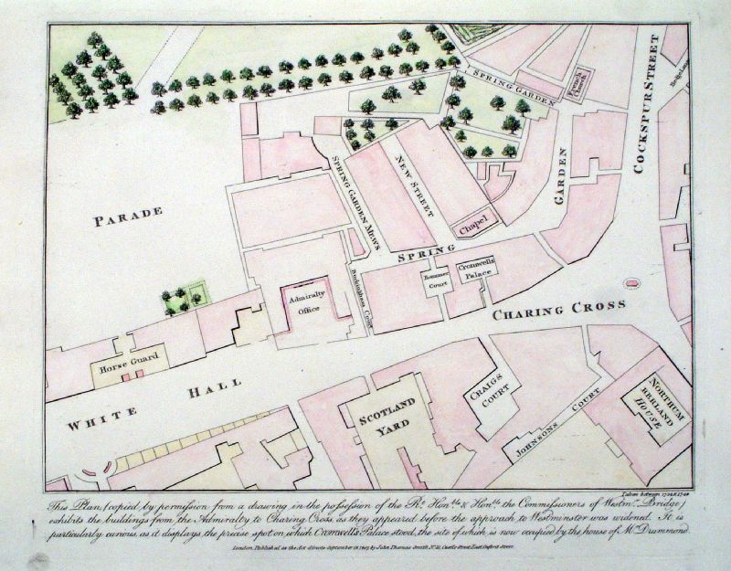 |
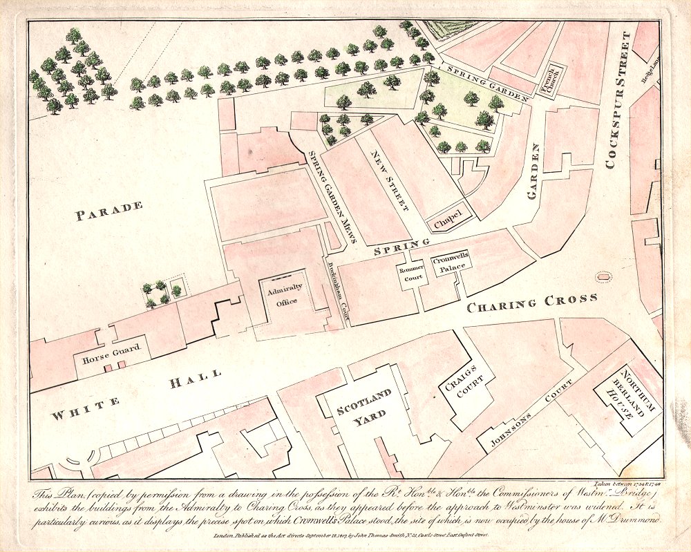
Plan of Charing Cross and Whitehall between 1734
& 1748 J.T. Smith 1809 size: 300 x 240 mm Ref KCM015 £30.00 (+P&P) Ref AKM009 £25.00 (+P&P) a few slight stains - lower right corner click image for enlargement |
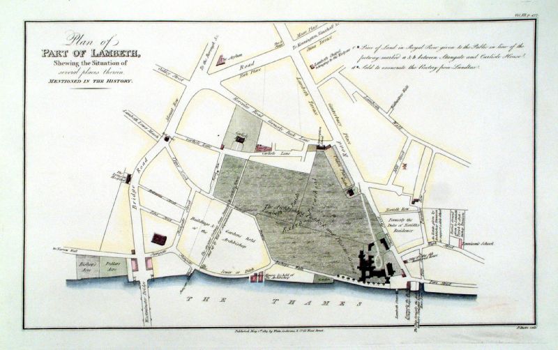 |
Plan of Lambeth
Bassire / White
& Cochrane 1813 Copper engraving. size: 400 x 260 mm Detail Ref JIM002 £35.00 (+P&P) click image for enlargement |
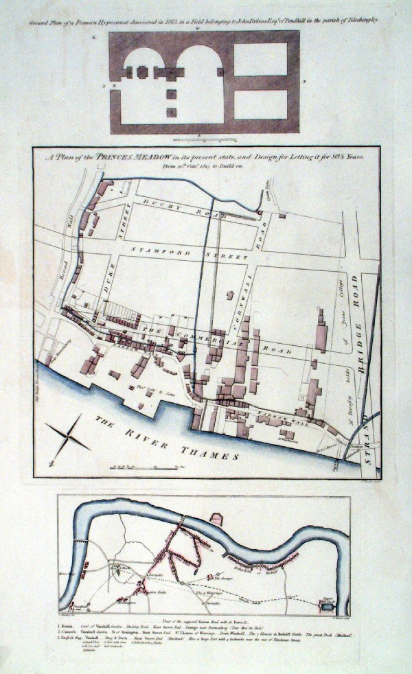 |
Plan of Princes Meadow in its present state and
Design for Letting it for 93 years. Lower map - Tract of the Supposed Roman Road with its forts Bassire / White & Cochrane 1813 size: 250 x 420 mm Detail 1 Detail 2 Notes: Princes Meadow map is oriented North facing the bottom. This south of the Thames on the site of the National Theatre. Strand Bridge Road was the name of Waterloo bridge during its design and construction. Ref JIM003 £35.00 (+P&P) click image for enlargement |
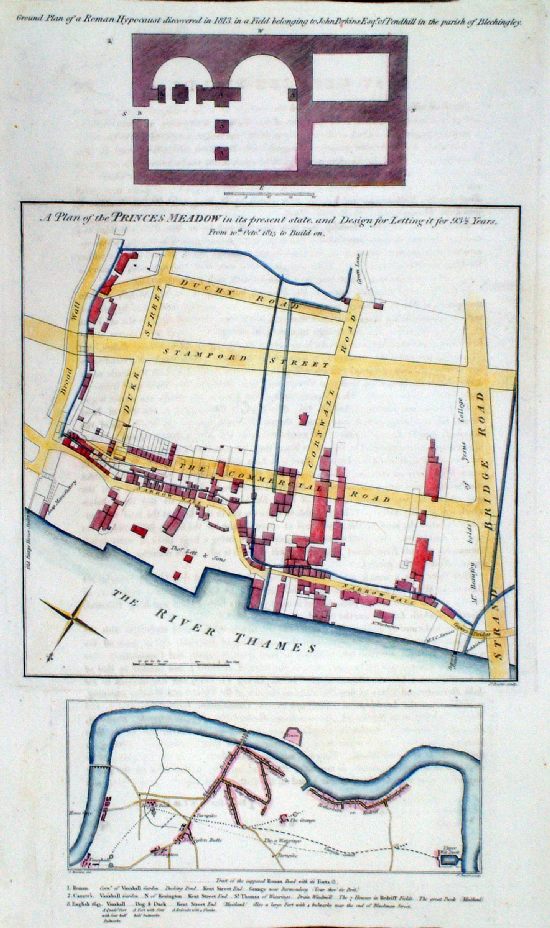 |
Plan of Princes
Meadow in its present state and Design for Letting it
for 93 years. Lower map - Tract of the Supposed Roman Road with its forts Bassire / White & Cochrane 1813 size: 250 x 420 mm Detail 1 Detail 2 Notes: Princes Meadow map is oriented North facing the bottom. This south of the Thames on the site of the National Theatre. Strand Bridge Road was the name of Waterloo bridge during its design and construction. Ref MBM002 £35.00 (+P&P) click image for enlargement |
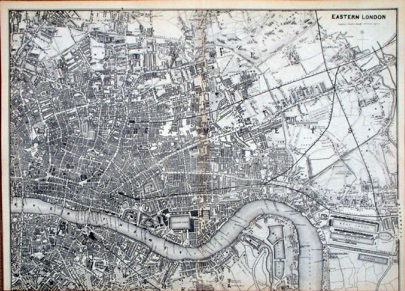 |
Eastern London Charles
Knight c1850 size: 360 x 260 mm trimmed lower margin Centre folds Ref ILM001 £22.00 (+P&P) click image for enlargement Detail 1 Detail 2 |
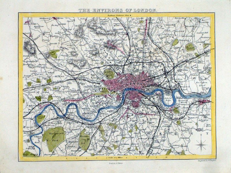 |
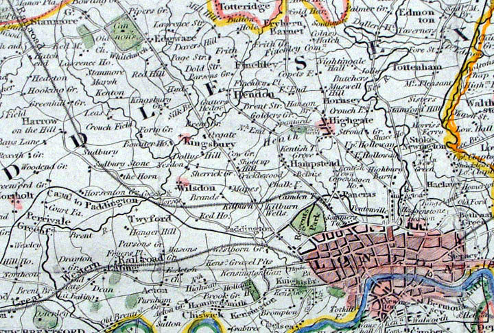
Environs of London Moule / Hughes / Virtue c1845 size: 230 x 180 mm Ref LFM021 £28.00 (+P&P) click image for enlargement |
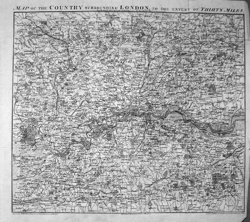 |
A Map of the Country Surrounding London
to the Extent of 30 Miles, Drawn and Engraved for Hughson's Description of London 1808 Shows the circuit of the London Penny Post, later to become the London Postal District. Extent: Chelsford (NE), Tunbridge (SE), Guildford (SW), Tring (NW), Ware (N), Reigate (S) size: 410 x 360 mm many folds, tight side margins (see illustration). Ref KBM002 £60.00 (+P&P) Detail 1 Detail 2 KBM002 has some light foxing, more creases and repairs to split folds, but a good reference copy. click image for enlargement |
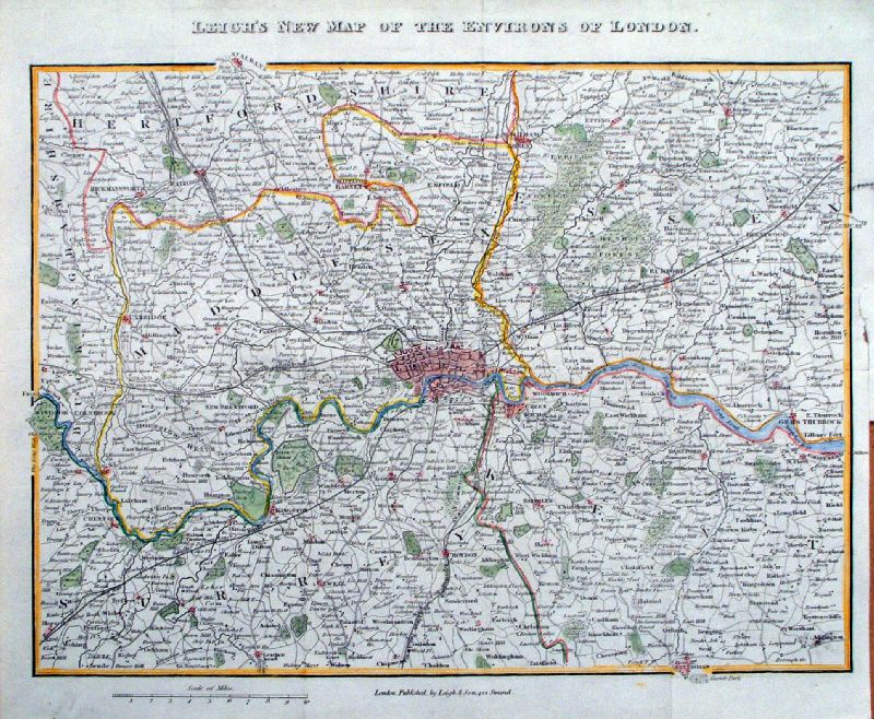 |
Leigh's New Map of the Environs of London Leigh 1841 size: 290 x 230 mm Detail 1 Detail 2 Ref IIM059 £35.00 (+P&P) click image for enlargement |
 |
Panorama of Remarkable Objects in London Leigh 1841 size: 290 x 230 mm strengthened lower-left margin Detail 1 Detail 2 Ref IIM060 £28.00 (+P&P) click image for enlargement |
|
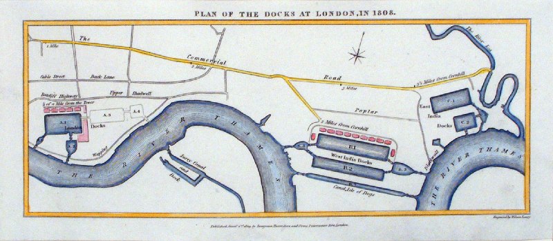
Plan of the Docks at London in
1808 Wilson Lowry
1809 Copper Engraving size: 250 x110 mm Ref HCM002 £24.00 (+P&P) click image for enlargement |
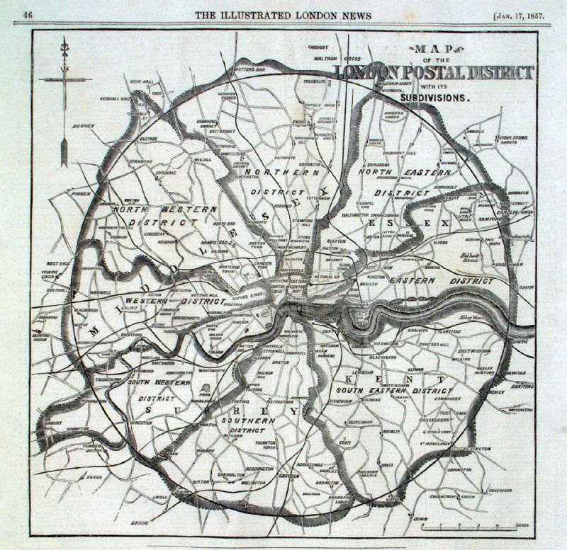 |
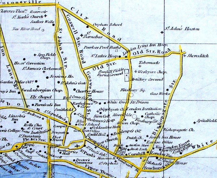
Map of London Postal Districts with its
subdivisions Illustrated London News Jan 1857 Storer 1828 size: 240 x 240 mm Ref JKM004 £40.00 (+P&P) click image for enlargement |
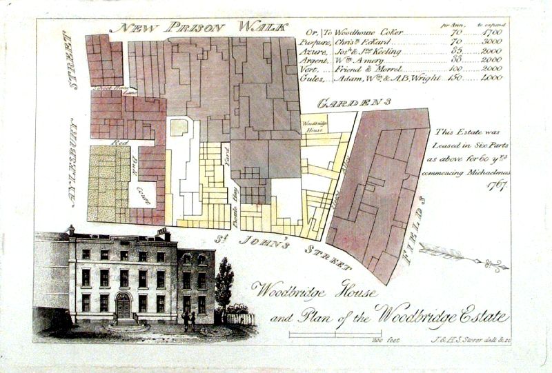 |
Plan of the Woodbridge Estate , St John's Street,
Clerkenwell Storer 1828 size: 150 x100 mm Ref IBM020 £20.00 (+P&P) click image for enlargement |
|
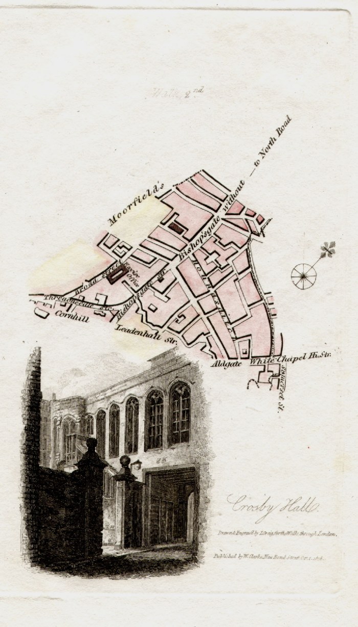
London - Bishopsgate, Cornhill,
Aldgate, Moorfields, Threadneedle Street Vignette illustration of Crosby Hall Hughson / Clark 1817 from David Hughson's Walks through London size: 90 x150 mm Walk 2 Ref GBM227 £22.00 (+P&P) click image for enlargement |
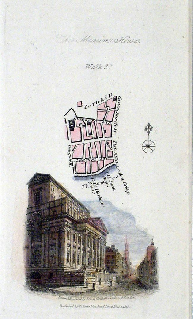 |
London - Cornhill, Lombard St, Thames St,
Gracechurch. Vignette illustration of Mansion House Hughson / Clark 1817 from David Hughson's Walks through London size: 90 x150 mm Walk 3 Ref JGM012 £20.00 (+P&P) click image for enlargement |
 |
London - Bank, London Wall,
Poultry, Threadneedle Street Vignette illustration of Bank from Lothbury Hughson / Clark 1817 from David Hughson's Walks through London size: 90 x150 mm Walk 4 Ref JGM013 £22.00 (+P&P) click image for enlargement |
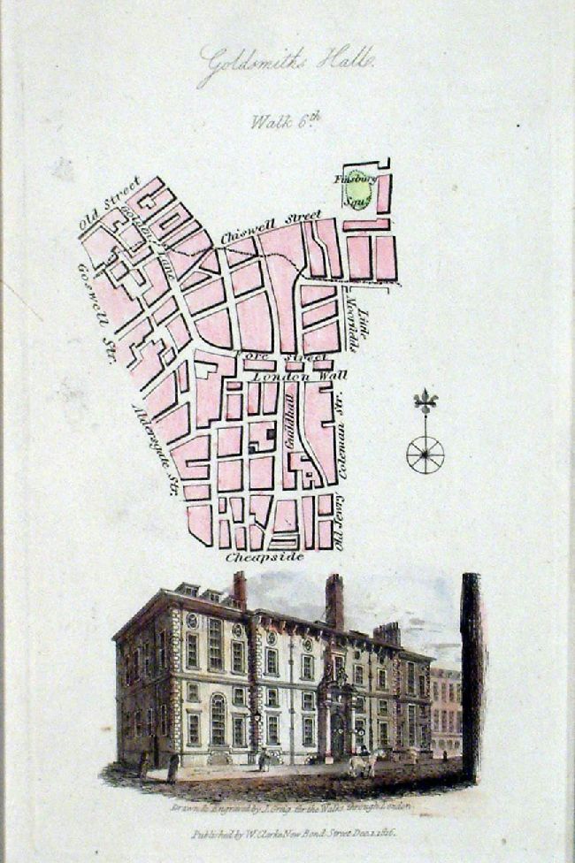 |
London - Cheapside, London Wall, Old St,
Finsbury Sq. Vignette illustration of Goldsmiths Hall Hughson / Clark 1817 from David Hughson's Walks through London size: 90 x150 mm Walk 6 Ref JGM014 £20.00 (+P&P) click image for enlargement |
|
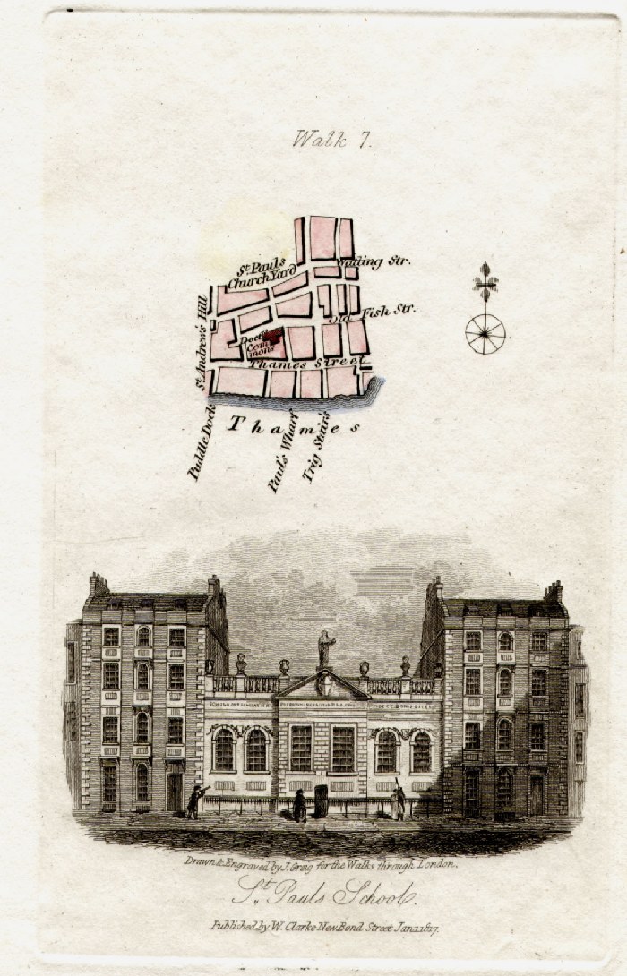
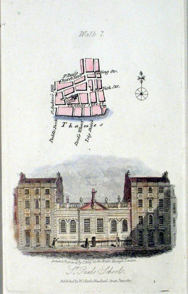
London - Thames Street, St Pauls
Churchyard Vignette illustration of St Paul's School Hughson / Clark 1817 from David Hughson's Walks through London size: 90 x150 mm Walk 7 Ref GBM230 £22.00 (+P&P) Ref JGM015 £22.00 (+P&P) click image for enlargement |
|
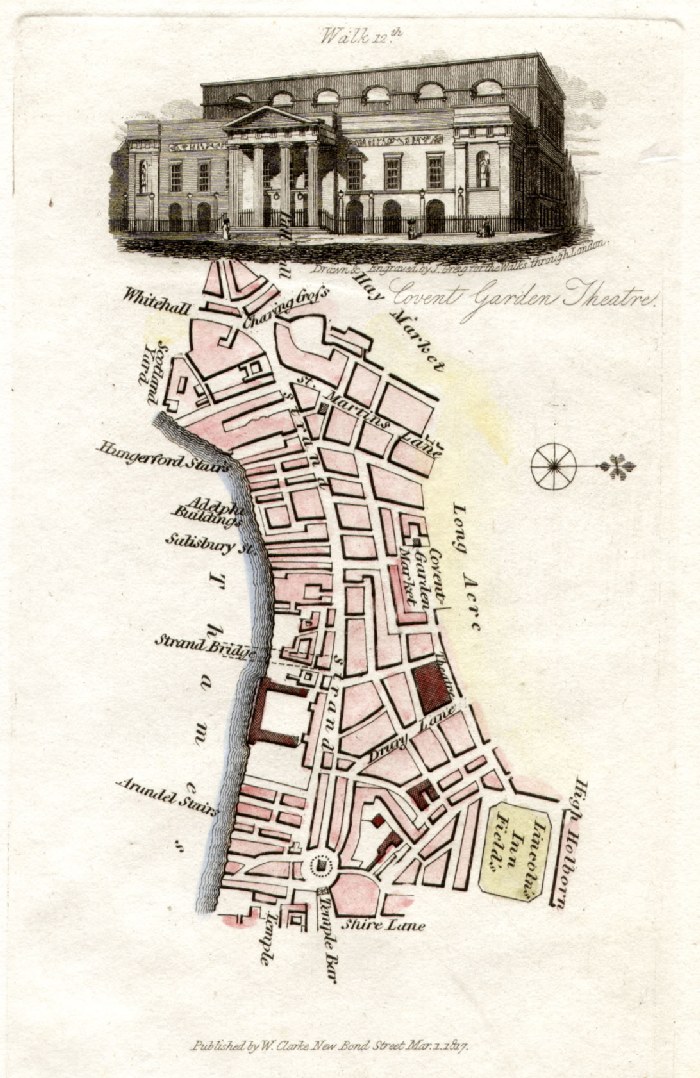
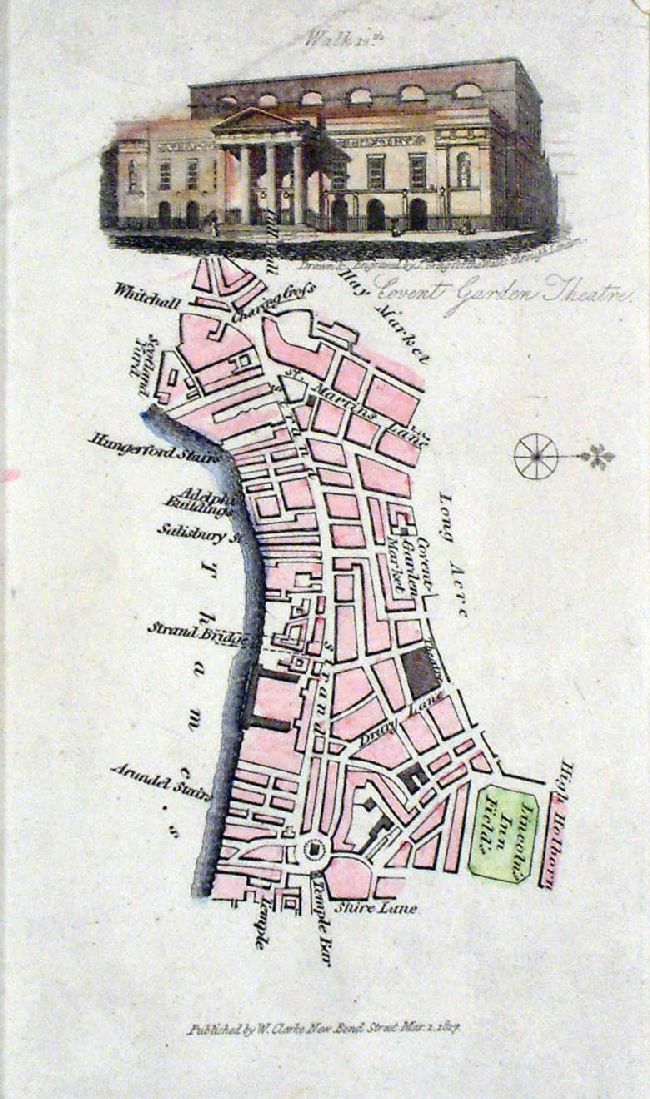
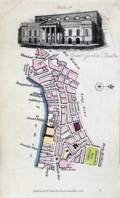
London - Covent Garden, Strand,
Charing Cross, Drury Lane Vignette illustration of Covent Garden Theatre Hughson / Clark 1817 from David Hughson's Walks through London size: 90 x150 mm Walk 12 Ref GBM235 £24.00 (+P&P) Ref JGM016 £20.00 (+P&P) crease - top left Ref JGM017 £24.00 (+P&P) Ref MAM002 £20.00 (+P&P) crease - top-right click image for enlargement |
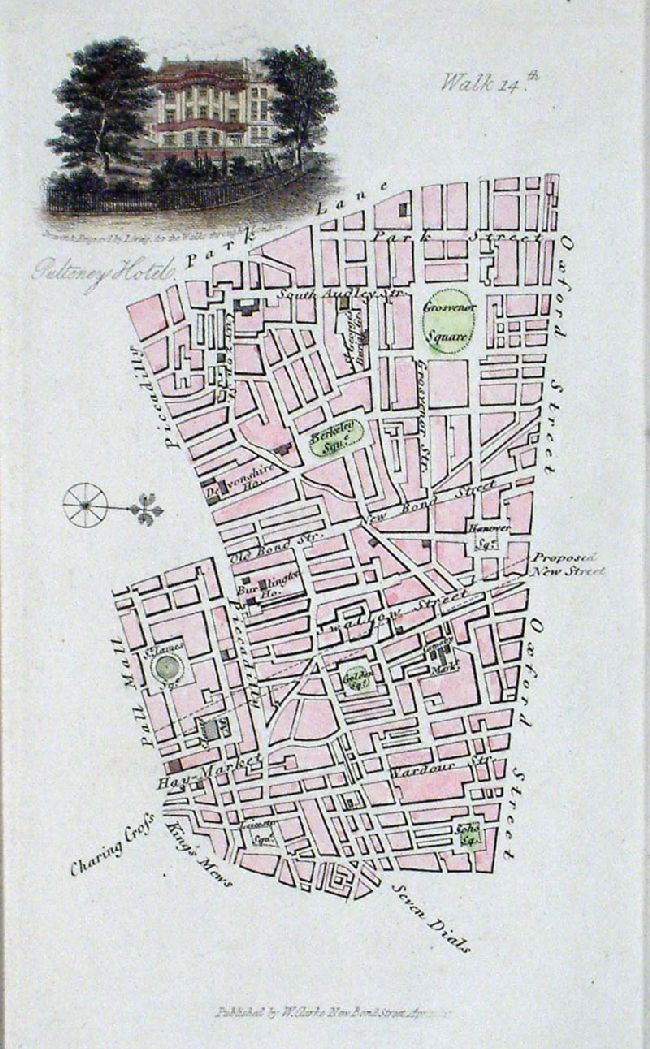 |
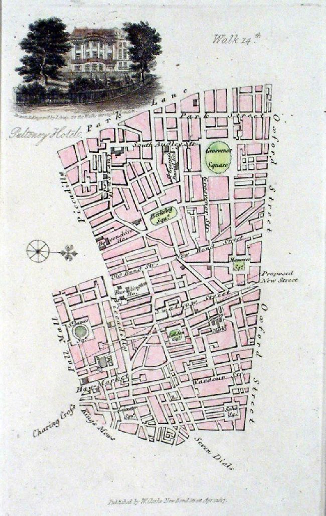
London - Soho, Hanover Sq,
Berkley Sq, Grosvnor Sq Vignette illustration of Pulteney Hotel Hughson / Clark 1817 from David Hughson's Walks through London size: 90 x150 mm Walk 14 Ref JGM019 £24.00 (+P&P) Ref JGM020 £24.00 (+P&P) click image for enlargement |
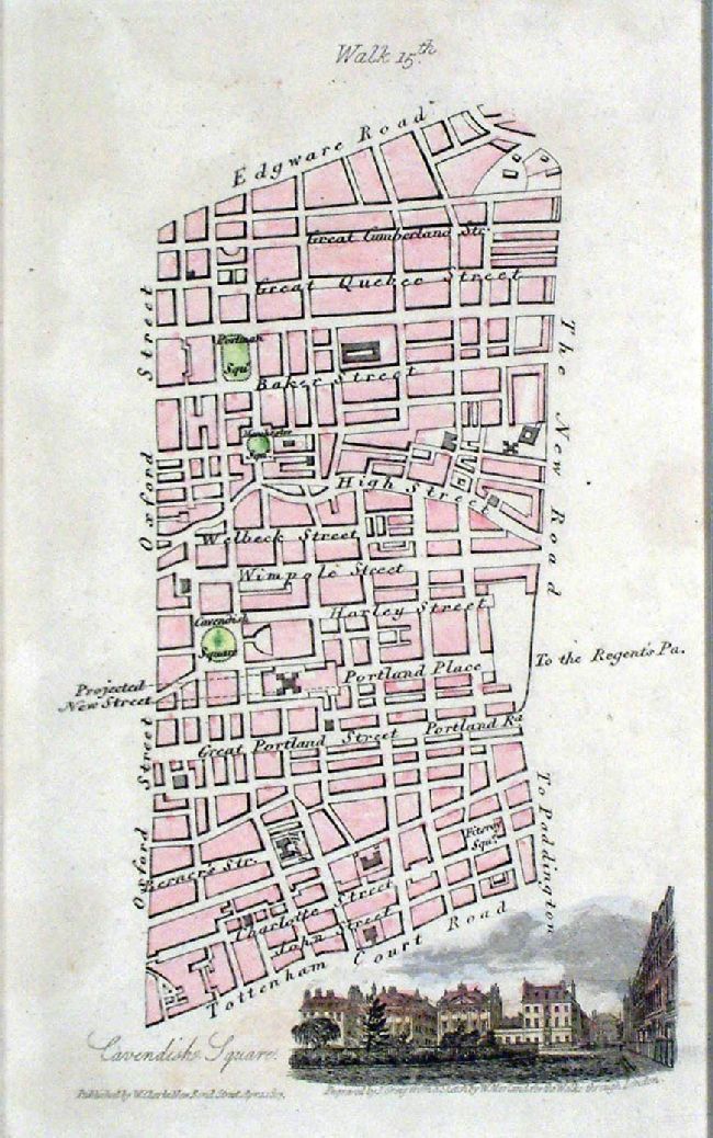 |
London - Oxford St, Edgeware Rd, Tottenham
Ct Rd Vignette illustration of Cavendish Square Hughson / Clark 1817 from David Hughson's Walks through London size: 90 x150 mm Walk 15 Ref JGM021 £22.00 (+P&P) click image for enlargement |
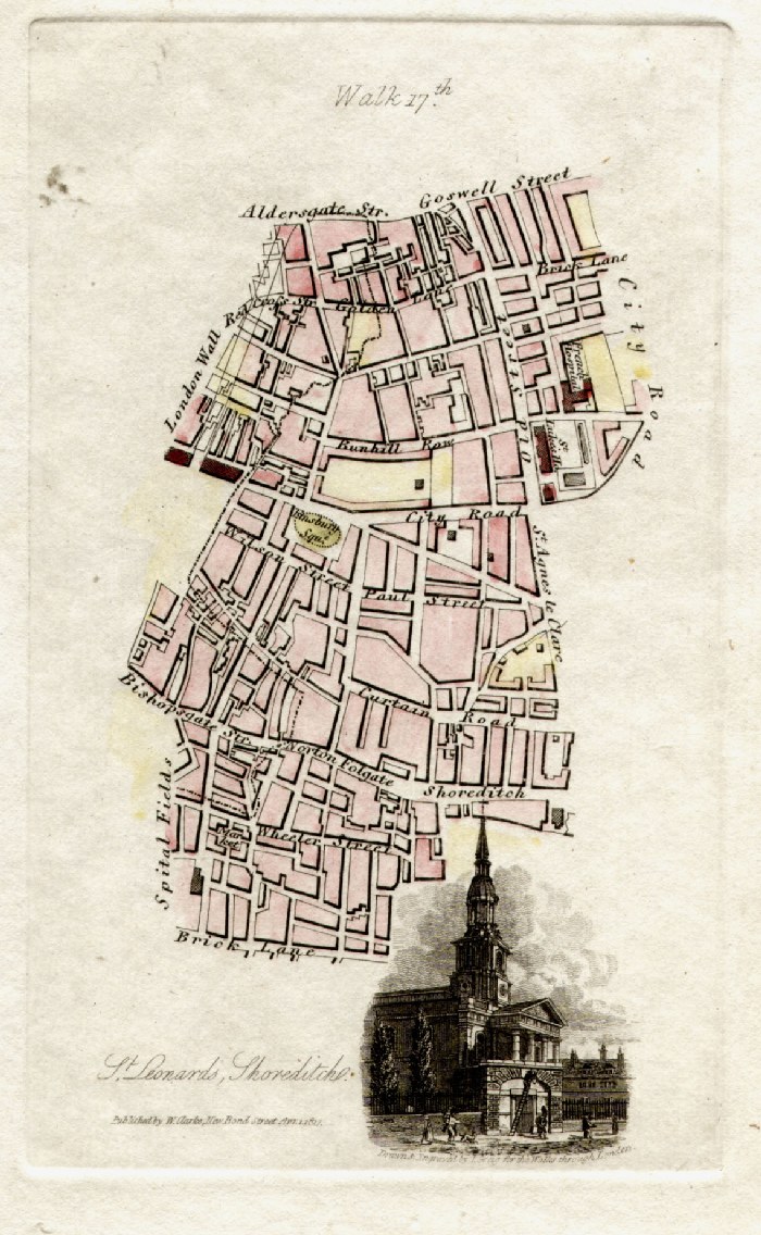 |
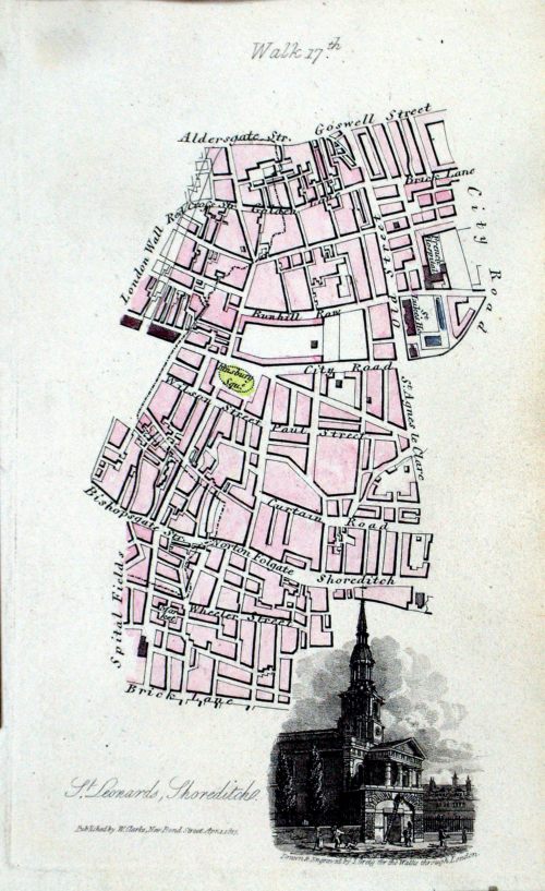
London - Bishopsgate,
Shoreditch, Old Street, Brick Lane, Spitalfields Vignette illustration of St Leonards Church, Shoreditch Hughson / Clark 1817 from David Hughson's Walks through London size: 90 x150 mm Walk 17 Ref GBM239 £22.00 (+P&P) Ref MAM007 £22.00 (+P&P) click image for enlargement |
|
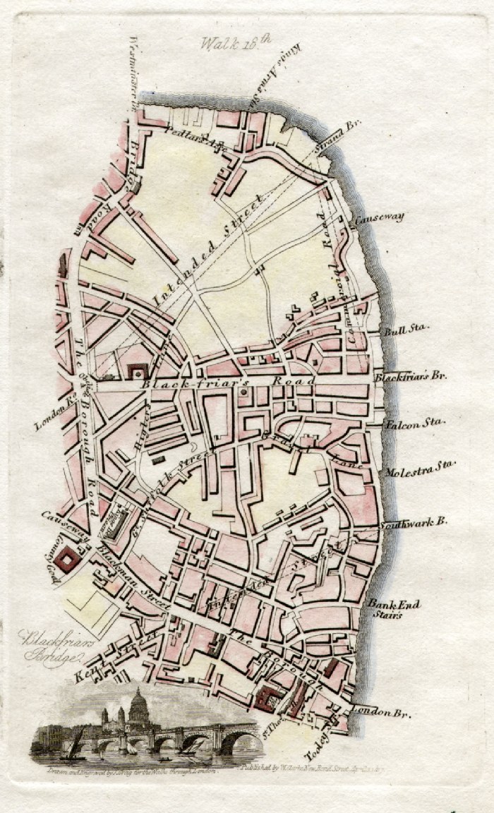
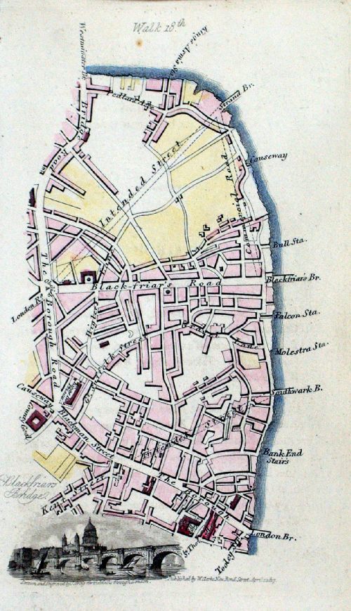
London - London Bridge, Borough,
Kennington Vignette illustration of Blackfriars Bridge & St Pauls Hughson / Clark 1817 from David Hughson's Walks through London size: 90 x150 mm Walk 18 Ref GBM240 £24.00 (+P&P) Ref MAM008 £24.00 (+P&P) click image for enlargement |
 |
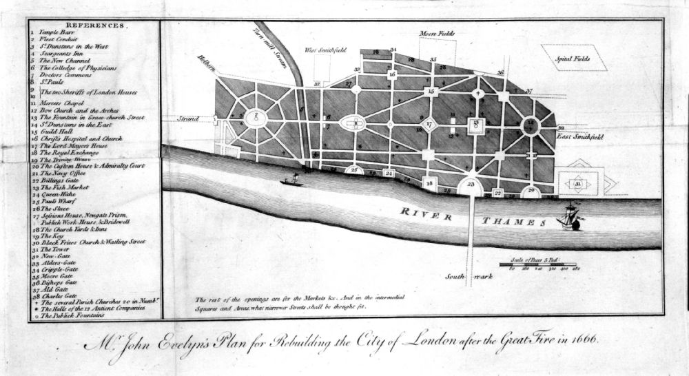
London Rebuilding plan
Harrison's
History of London 1775 'Sir John Evelyn's Plan for Rebuilding the City of London after the Great Fire in 1666' Side panel has 38 references to city locations. Copper engraving size: 300 x 170 mm Ref HBM013 £40.00 (+P&P) click image for enlargement |
 |
London Rebuilding
plan
Noorthouck's History of London 1772
'Sir John Evelyn's Plan for Rebuilding the City of London after the Great Fire in 1666' Side panel has 38 references to city locations. Copper engraving size: 300 x 170 mm, several folds & repairs at folds Ref NLM002 £30.00 (+P&P) Detail click image for enlargement |

|
Hammersmith Salter /
Day 1855 'Plan of Vale Place & c - The Property of the Trustees of the Parishes of Hammersmith and Fulham' litho size: 130 x 210 mm Ref HKM028 £22.00 (+P&P) click image for enlargement |
|
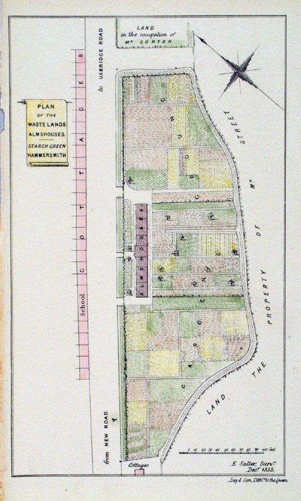
Hammersmith Salter /
Day 1855 'Plan of the Waste Lands Almshouses - Starch Green Hammersmith' litho size: 130 x 210 mm Ref HKM027 £22.00 (+P&P) click image for enlargement |
|
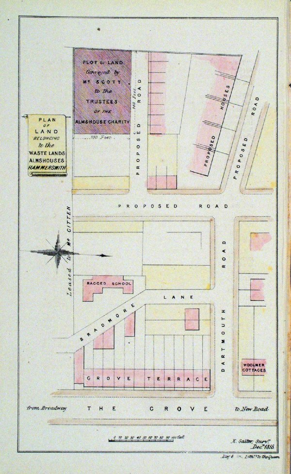
Hammersmith Salter /
Day 1855 'Plan of the Land belonging to the Waste Lands Almshouses Hammersmith' litho size: 130 x 210 mm Ref HKM026 £22.00 (+P&P) click image for enlargement |
|
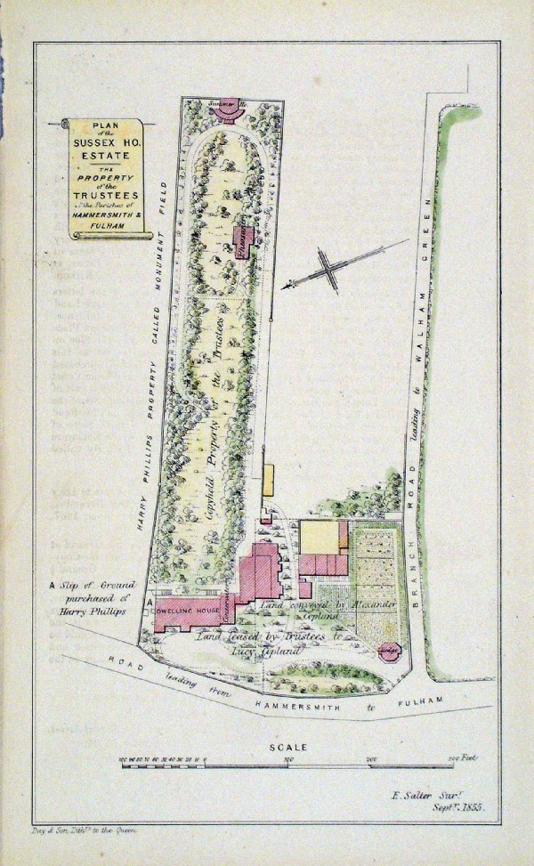
Hammersmith Salter /
Day 1855 'Plan of the Sussex House Estate - The Property of the Trustees of the Parishes of Hammersmith and Fulham' litho size: 130 x 210 mm Ref HKM029 £22.00 (+P&P) click image for enlargement |
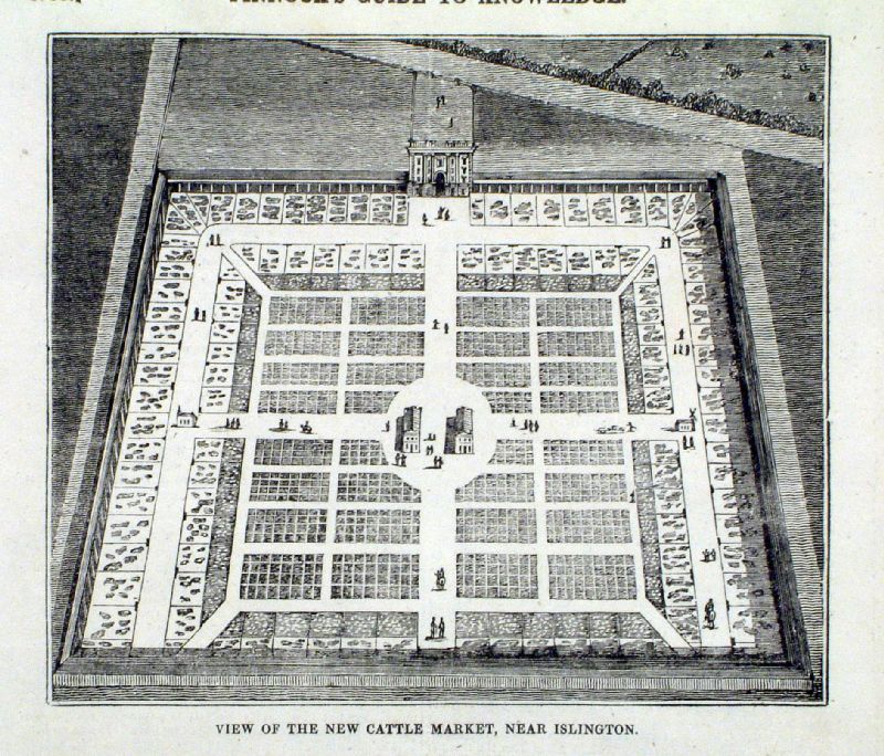 |
View of the New Cattle Market, near Islington Pinnock 1833 size: 230 x 175 mm Ref JCM012 £25.00 (+P&P) click image for enlargement |
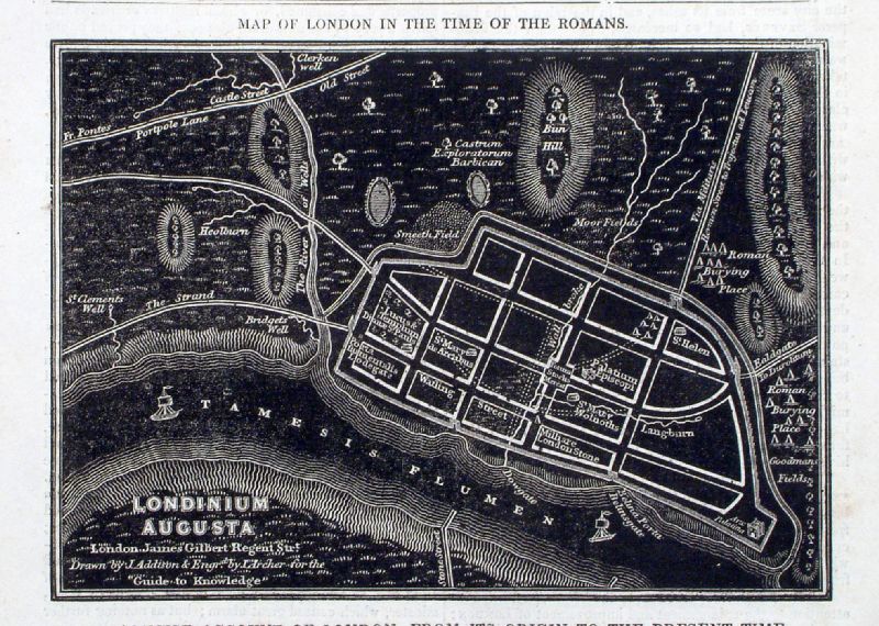 |
Map of London in the Time of the Romans Pinnock / Addison / Archer 1832 map size: 170 x 120 mm - page size: 180 x 260 mm Ref JCM014 £20.00 (+P&P) click image for enlargement |
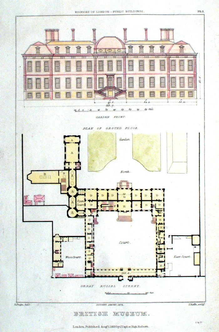 |
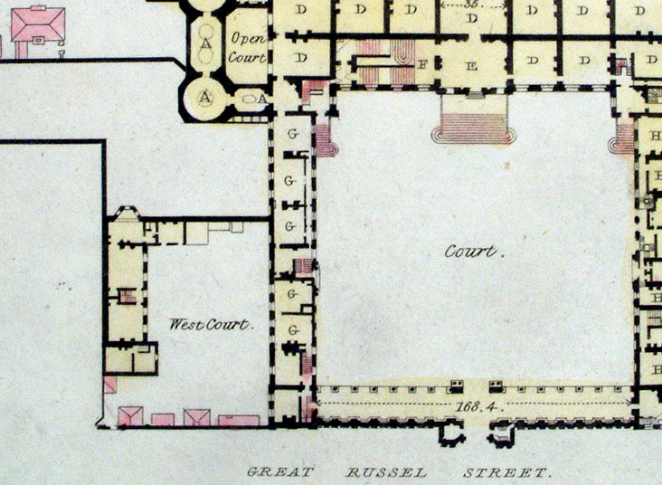
British Museum - Plan of Ground Floor
Pugin / Roffe 1823 Steel engraving size: 120 x 190 mm Detail Ref JCM011 £25.00 (+P&P) click image for enlargement |
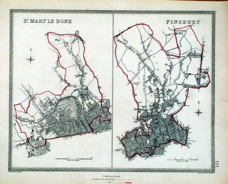 |
St Mary Le Bone and Finsbury Lewis / Walker 1835 size: 250 x 200 mm Ref JKM007 £28.00 (+P&P) click image for enlargement |
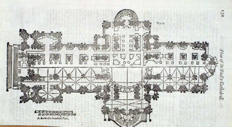 |
Plan of St Paul's Cathedral
Gents Magazine 1750 Copper Engraving size: 110 x 200 mm Ref JKM036 £18.00 (+P&P) click image for enlargement |
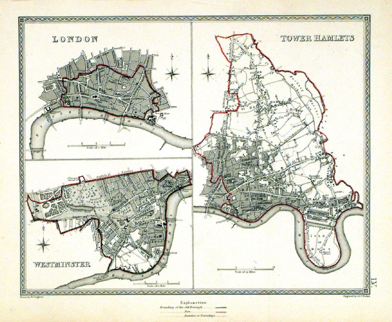 |
London . Westminster . Tower Hamlets
Depicting electoral divisions and polling places. Samuel Lewis 1835 engraved by J & C Walker Steel engraving Size: 250 x 200 mm, Original colouring of boundaries. Antique Map Ref KJM055 £20.00 (+P&P) click image for enlargement |
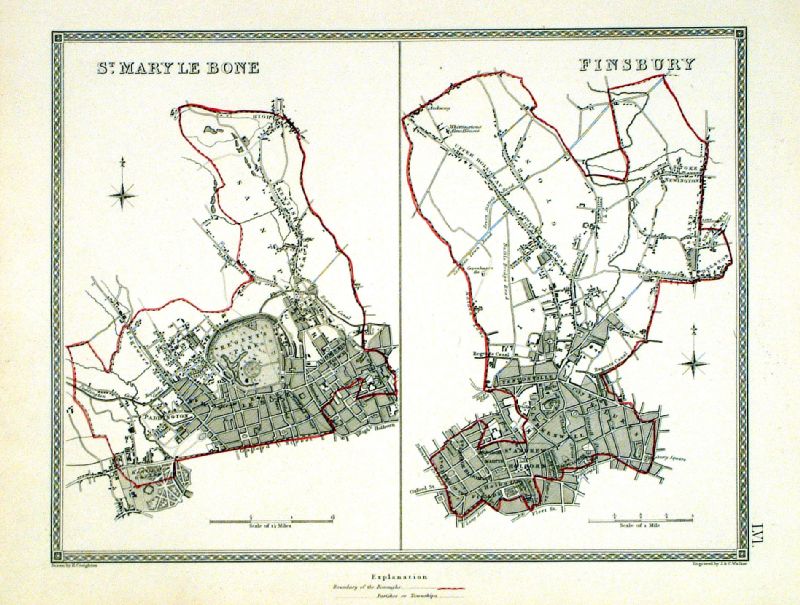 |
St Mary Le Bone . Finsbury Depicting electoral divisions and polling places. Samuel Lewis 1835 engraved by J & C Walker Steel engraving Size: 250 x 200 mm, Original colouring of boundaries. Antique Map Ref KJM056 £20.00 (+P&P) click image for enlargement |
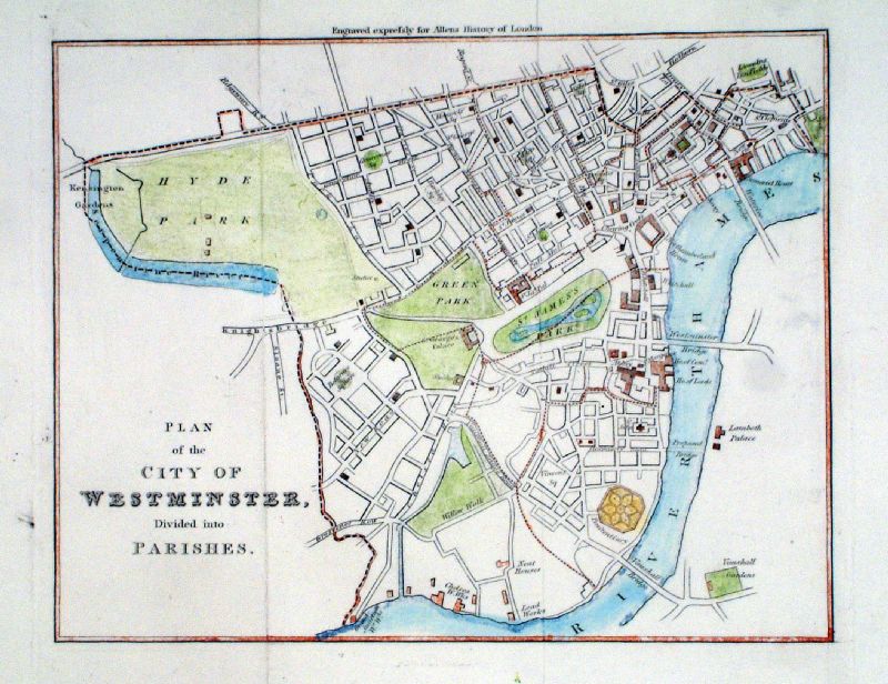 |
The City of
Westminster divided into its Parishes Allen c1830 Size: 220 x 190 mm, 2 folds Antique Map Ref LAM009 £18.00 (+P&P) click image for enlargement |
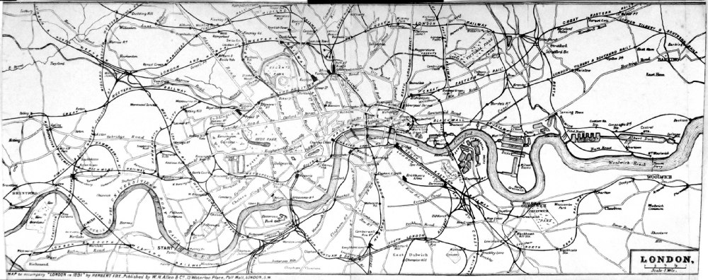 |
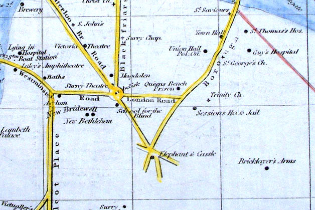
London in 1891 Herbert Fry Publ: W.H. Allen, London 1891 Detail size: 450 x 180 mm, 3 folds, very tight cropping at borders. Shows railways, canals, docks and course of the University Boat Race. Ref PCM001 £35.00 (+P&P) click image for enlargement |
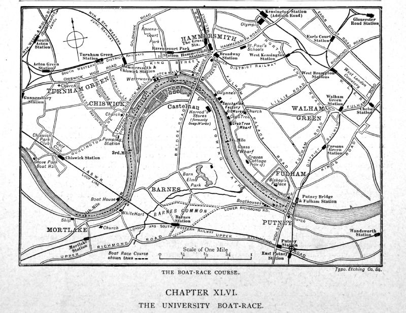 |
The Boat Race
Course - The University Boat Race (Mortlake
to Putney Bridge) Greater London Cassell c1890 Typo Etching size: 160 x 120 mm Ref OJM008 £18.00 (+P&P) click image for enlargement |
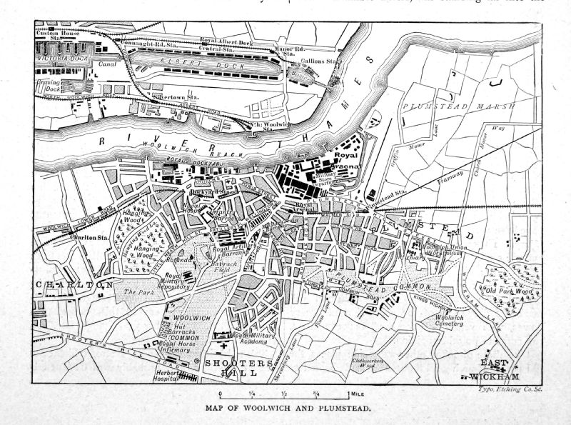 |
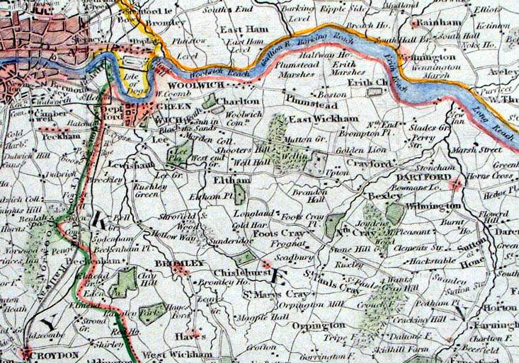
Map of Woolwich &
Plumstead Greater London Cassell c1890 Typo Etching size: 160 x 120 mm Ref OJM009 £18.00 (+P&P) click image for enlargement |
|
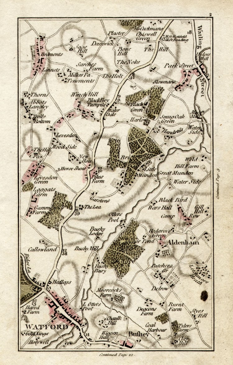
Watford, Bushey,
Aldenham Cary
1786 from Cary's Actual Survey of the Country 15 miles round London Copper Engraving, size: 110 x 170 mm Page 2 Ref GFM002 £28.00 (+P&P) click image for enlargement |
|
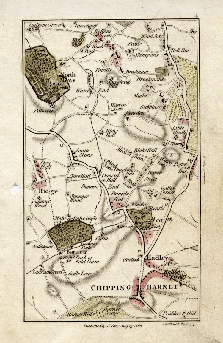
Chipping Barnet, Hadlet, North Mimms
Cary 1786 from Cary's Actual Survey of the Country 15 miles round London Copper Engraving, size: 110 x 170 mm Page 4 Ref GFM004 £28.00 (+P&P) click image for enlargement |
|
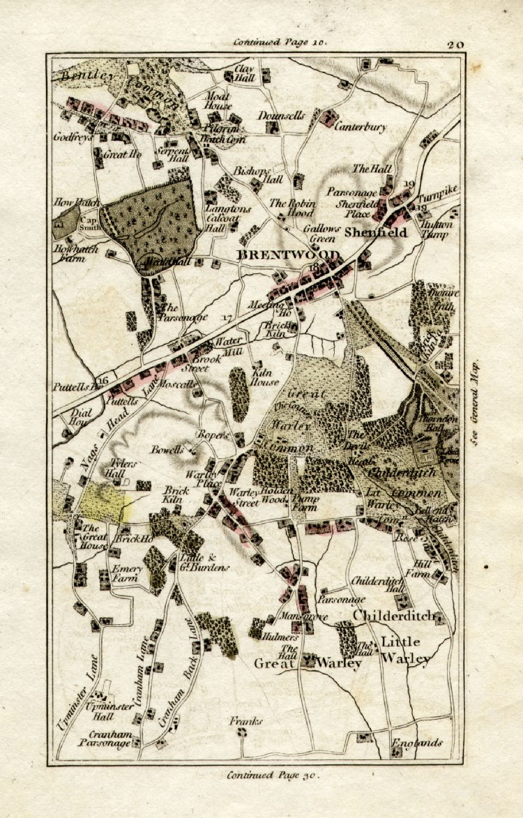
Brentwood, Shenfield, Warley
Cary 1786 from Cary's Actual Survey of the Country 15 miles round London Copper Engraving, size: 110 x 170 mm Page 20 Ref GFM020 £28.00 (+P&P) click image for enlargement |
|
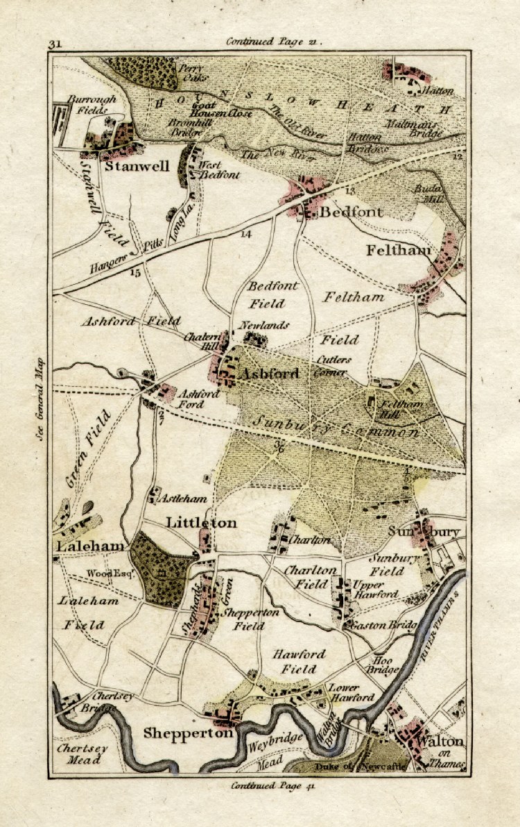
Shepperton, Walton, Stanwell, Feltham
Cary 1786 from Cary's Actual Survey of the Country 15 miles round London Copper Engraving, size: 110 x 170 mm Page 31 Ref GFM031 £28.00 (+P&P) click image for enlargement |
|
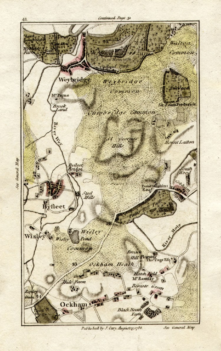
Weybridge, Byfleet, Ockham, Wisley
Cary 1786 from Cary's Actual Survey of the Country 15 miles round London Copper Engraving, size: 110 x 170 mm Page 41 Ref GFM041 £28.00 (+P&P) click image for enlargement |
 |
Wrotham, Ightam, Ash
(New Ash) Cary 1800 from Cary's Actual Survey of the Country 15 miles round London Copper Engraving, size: 110 x 170 mm Page 50 Ref OBM002 £28.00 (+P&P) click image for enlargement |
 |
Hampstead,
Paddington, Hammersmith, Chelsea, Kensington
Cary 1800 from Cary's Actual Survey of the Country 15 miles round London Copper Engraving, size: 110 x 170 mm Page 24 Ref OBM004 £28.00 (+P&P) click image for enlargement |
 |
Thurrock,
Stifford, North & South Ockenden
Cary 1800 from Cary's Actual Survey of the Country 15 miles round London Copper Engraving, size: 110 x 170 mm Page 30 Ref OBM005 £28.00 (+P&P) click image for enlargement |
| All Genuine Antiquarian Maps - No Reproductions or Modern Copies | |
| Maps of the River Thames
through London and other counties may be
at UK - Rivers |
|
 |
GW Bacon maps of London and London Suburbs |
2023