Past Pages
Antique Maps, Prints and Ephemera
Antique Maps from US Army Engineer Reports
These maps originate from US
Army
Engineers Reports, published by the US Government in
Washington.They illustrate details of various Military and Civil Engineering Projects to improve navigation and transport.
The publications were intended for Army and Government distribution and were not available on the open market.
The maps are scarce and contain local, historic information unavailable elsewhere.
As expected from military surveys, the detail is precise and accurate.
These maps are eagerly sought by local historians, libraries and collectors.
Arranged
Alphabetically
in order of State. Alabama - Wyoming
Check adjoining states for overlapping or shared features.
Many of these rivers border several states - please check thoroughly.
Check adjoining states for overlapping or shared features.
Many of these rivers border several states - please check thoroughly.
United States - US Army Engineering MapsNote that the images here may vary in quality and suffer in quality.Many of the maps are very large and are awkward to photograph. Some suffer from uneven lighting over a large area - this is not staining nor a feature of the map. They also suffer from optical distortion of the camera used for the raw photography. Many items carry 'detail' images to give a better representation and clarity of the detail. Most maps were folded for publication. For shipment purposes all maps are placed back on their original published folds. |
|
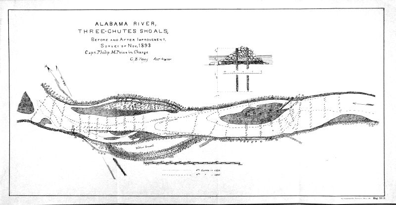 |
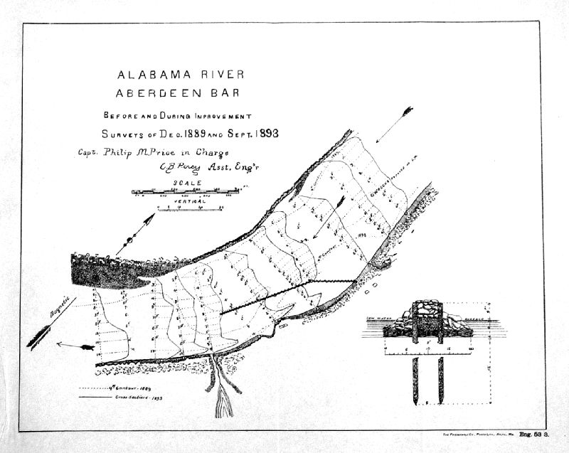
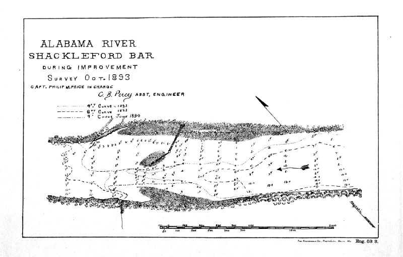
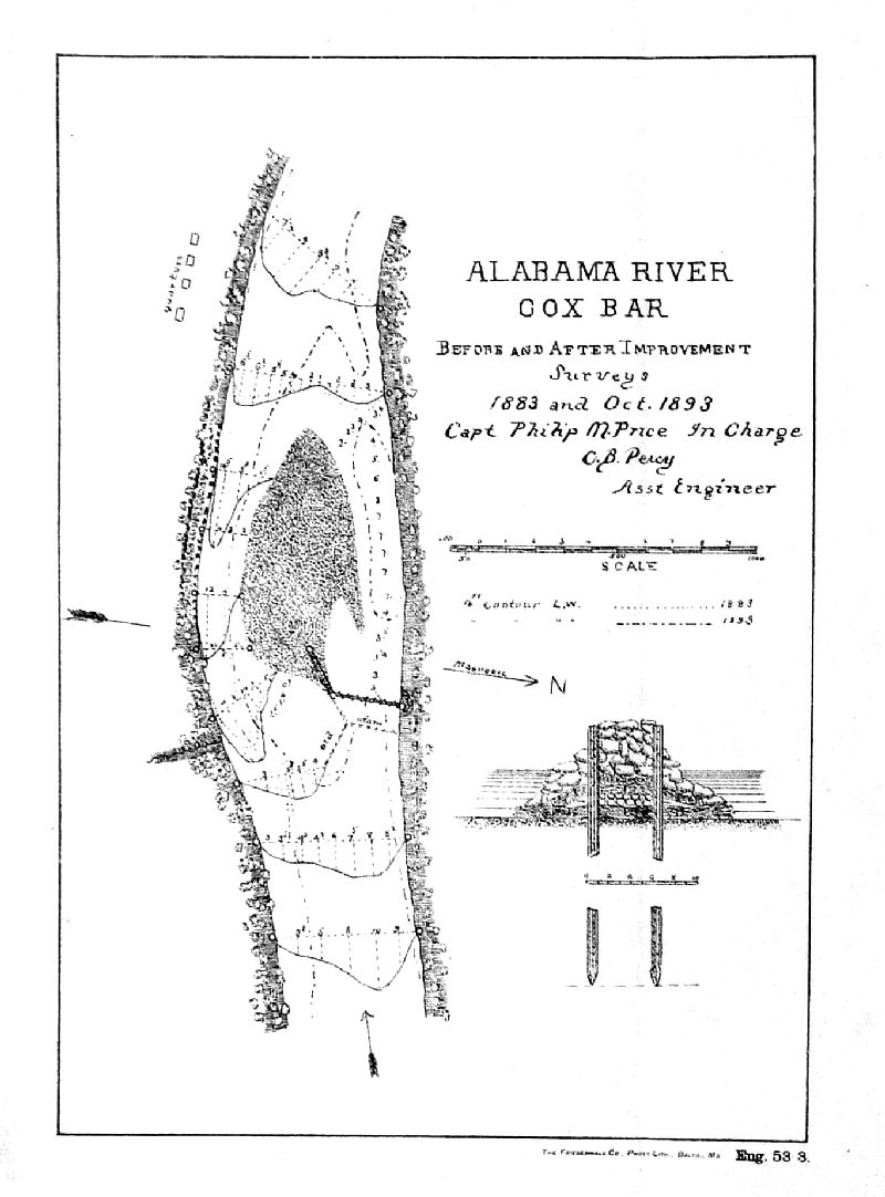
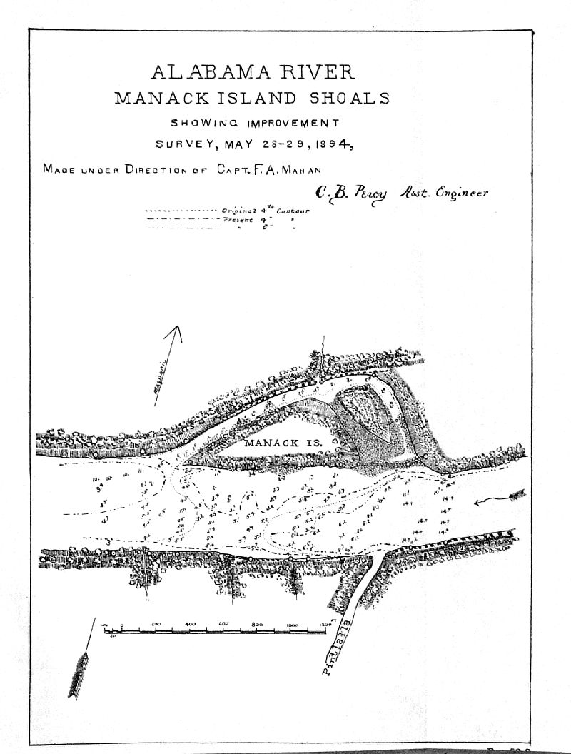
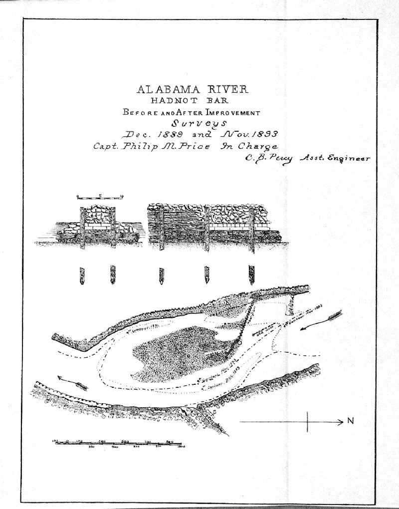
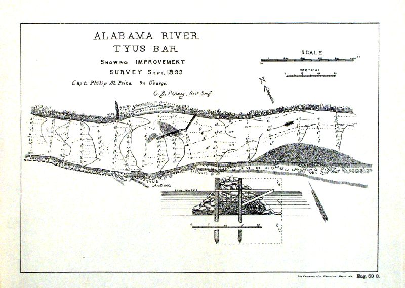
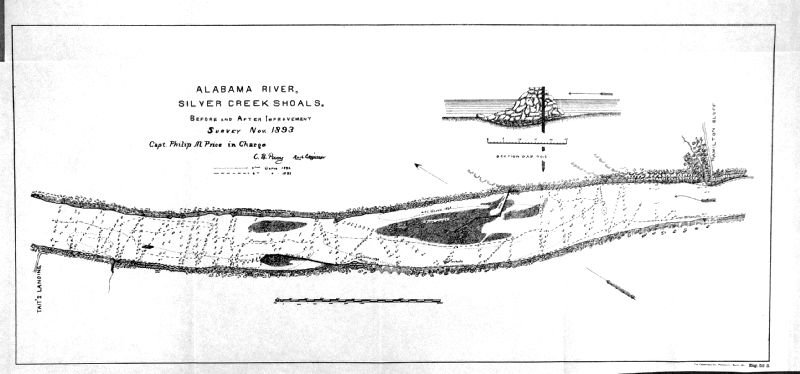
Alabama River Improvements (Alabama) ( 8
sheets) US Army Engineers 1894 Litho by Friedenwald Sheet 1 Three-Chutes 510 x 240mm Sheet 2 Aberdeen Bar 270 x 210mm Sheet 3 Shackleford Bar 250 x 160mm Sheet 4 Cox Bar 170 x 210mm Sheet 5 Manack Island 170 x 220mm Sheet 6 Hadnot Bar 180 x 220mm Sheet 7 Tyus Bar 240 x 170mm Sheet 8 Silver Creek 440 x 220mm Antique Map Ref IFM120 (8 sheets) £35.00 (+P&P) click image for enlargement |
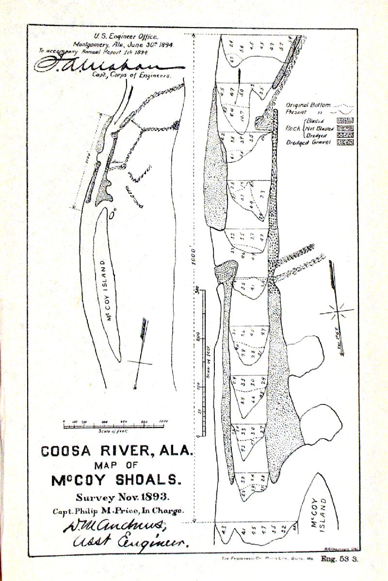 |
Coosa River, Alabama
Map of McCoy Schoals US Army Engineers 1894 Dredgin works near McCoy Island. Thought to be in the vicinity of Cedar Bluff & Weiss Lake Litho by Friedenwald size: 140 x 200 mm Antique Map Ref IFM123 £15.00 (+P&P) click image for enlargement |
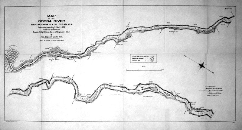 |
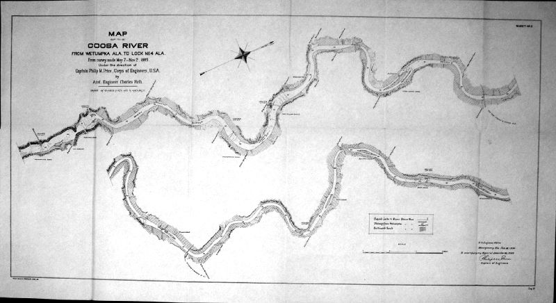
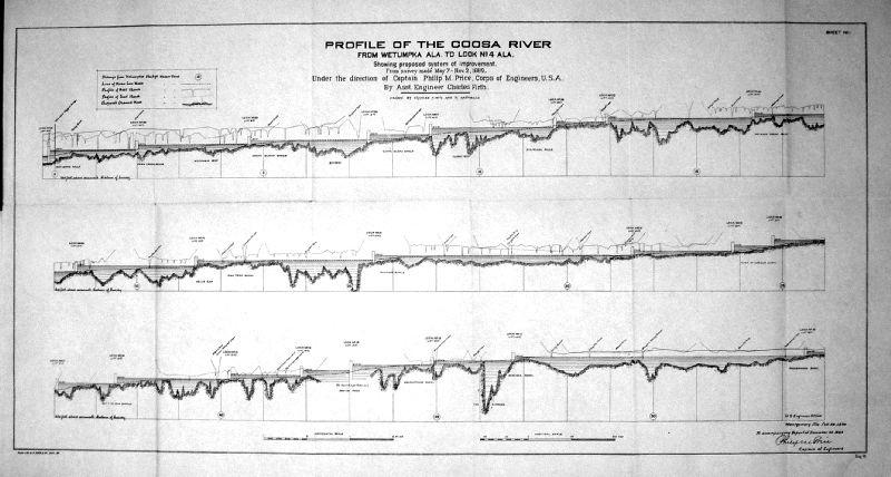
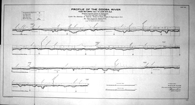
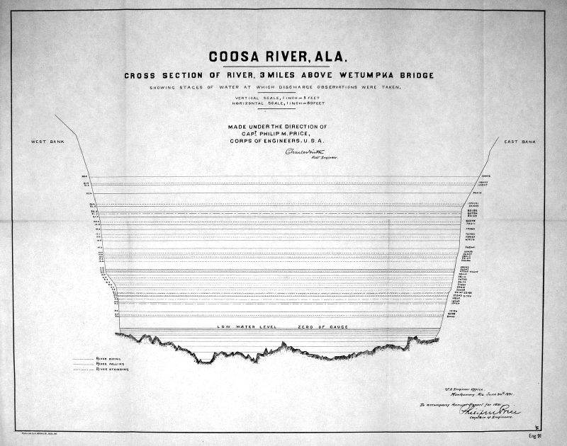
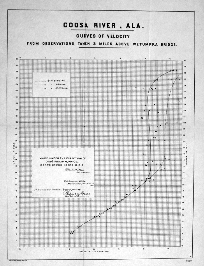
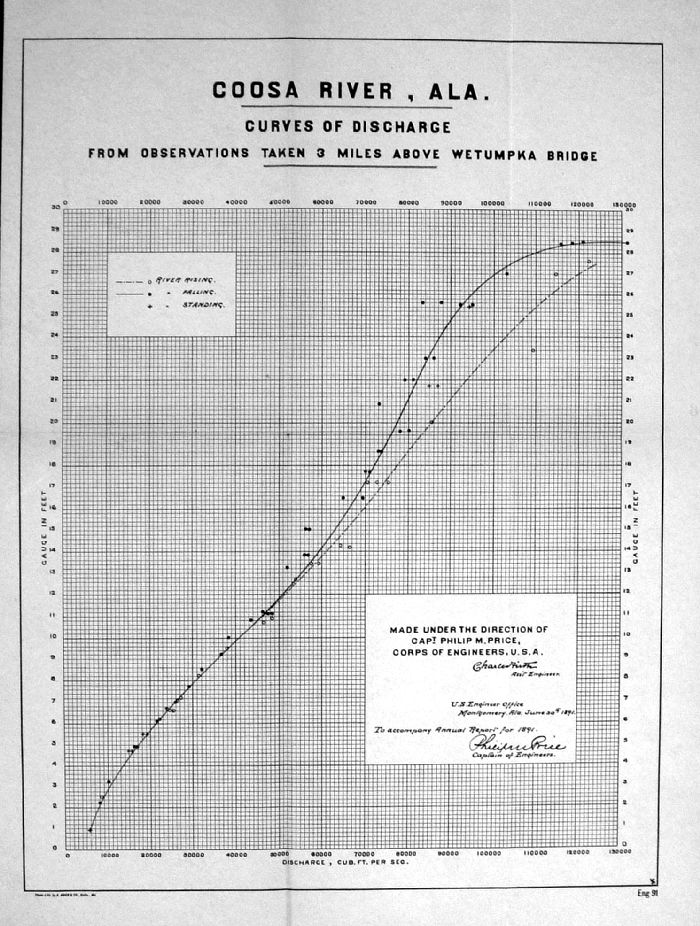
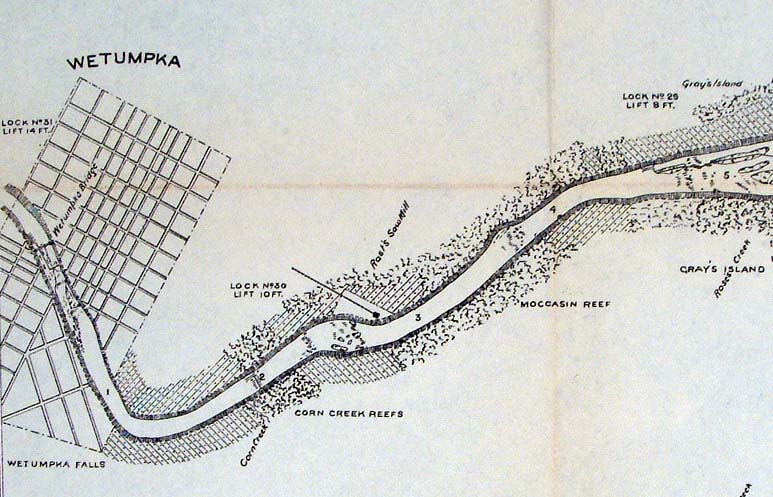
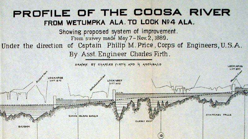
Coosa River at Wetumpka (Alabama) (9
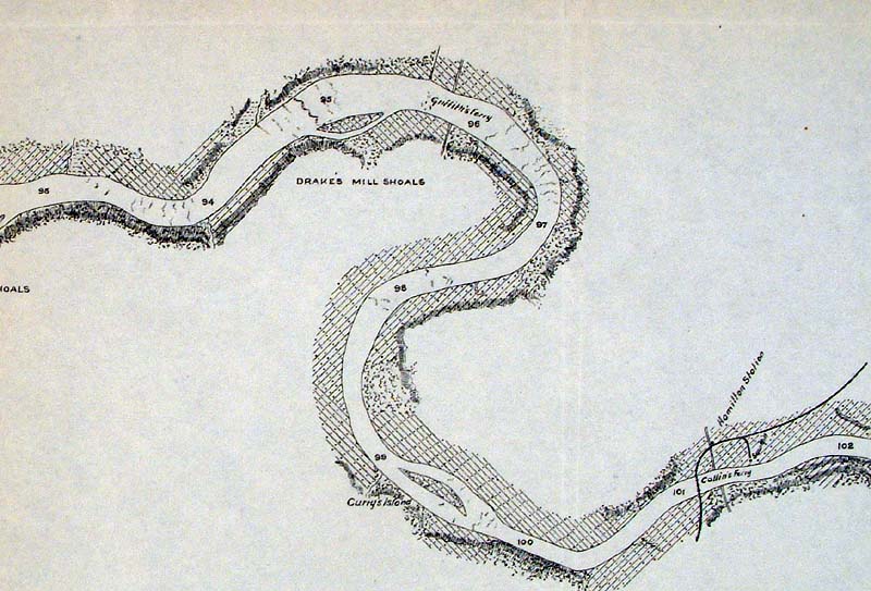
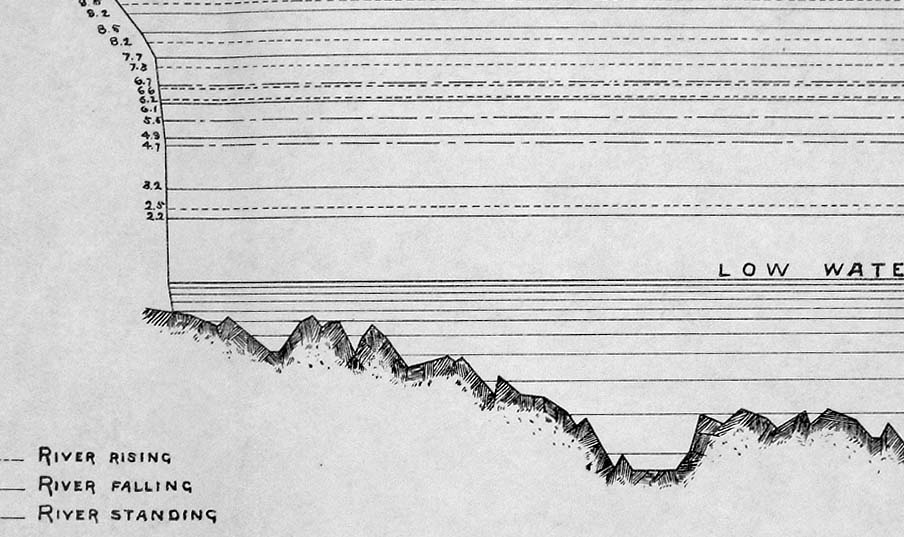
sheets) Wetumpka is about 15 miles north of Montgomery, Alabama The course of the river is shown north of Wetumpka toward Jordan Lake US Army Engineers 1892 Litho A. Hoen Sheet 1 Map of Wetumpka to Lock 4 - Part1 700 x 360mm Sheet 2 Map of Wetumpka to Lock 4 - Part2 700 x 360mm Sheet 3 Map of Wetumpka to Lock 4 - Part3 700 x 360mm Sheet 4 Profile of Wetumpka to Lock 4 - Part1 700 x 360mm Sheet 5 Profile of Wetumpka to Lock 4 - Part2 700 x 360mm Sheet 6 Cross section profile 540 x 430mm Sheet 7 Water Gauge Readings 400 x 300mm Sheet 8 Curves of Velocity 300 x 400mm Sheet 9 Curves of Volume 300 x 400mm Detail 1 Detail 2 Detail 3 Detail 4 Antique Map Ref IFM222 (9 sheets) £35.00 (+P&P) click image for enlargement |
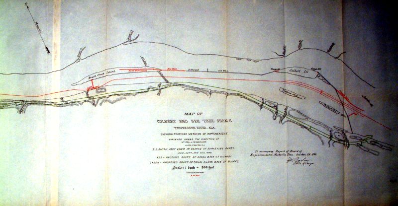 |
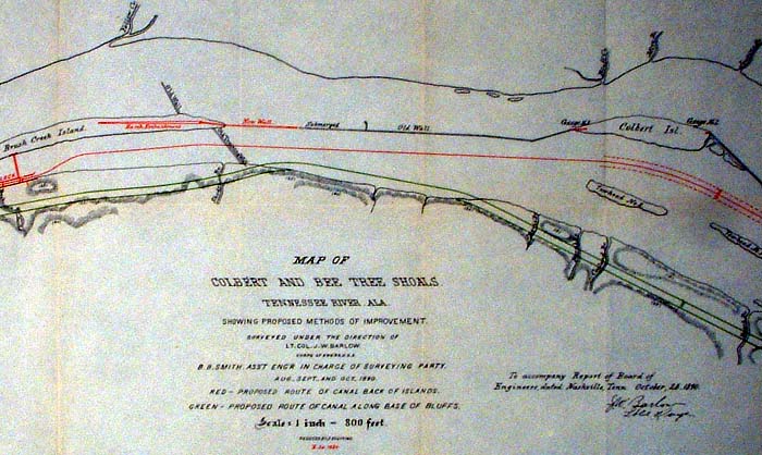
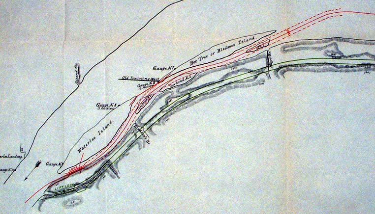
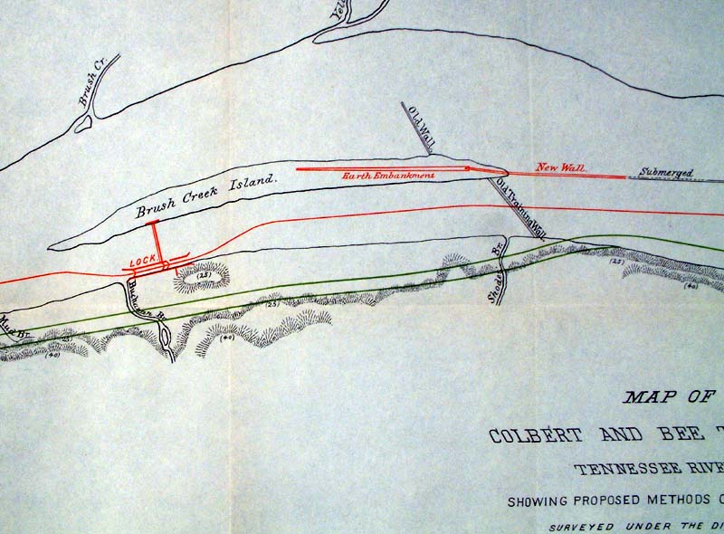
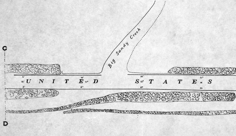
Colbert and Bee Tree Shoals, Tennessee River,
Alabama Florence, Alabama prior to river and urban development. The map shows 'Waterloo Landing' at the far left and a proposed new dam at the far right. This leads to the assumption that this area is now Florence with the map's span being the Wilson Dam to Waterloo on the Tennessee River. US Army Engineers 1892 This map was too large to photograph and display in one piece - see details. Litho size: 1350 x 400 mm Detail1 Detail2 Detail3 Antique Map Ref IFM196 £30.00 (+P&P) click image for enlargement |
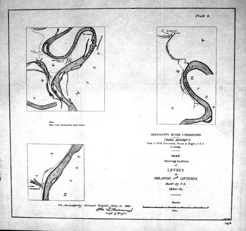 |
Map of Levees in Arkansas and
Louisiana (Mississippi River) US Army Engineers 1892 Litho size: 330 x 330 mm Antique Map Ref IFM161 £18.00 (+P&P) click image for enlargement Detail |
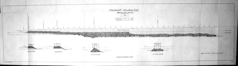 |
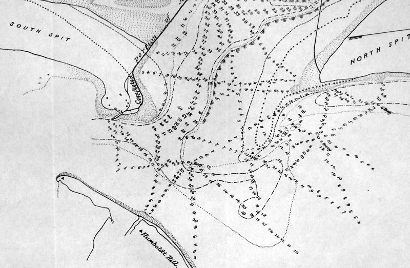
Humboldt Harbor, California US Army Engineers 1892 Litho size: 940 x 250 mm Antique Map Ref IFM241 £18.00 (+P&P) click image for enlargement Detail |
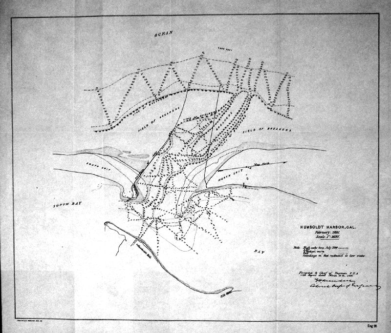 |
Humboldt Harbor, California US Army Engineers 1892 Litho size: 400 x 340 mm Antique Map Ref IFM240 £15.00 (+P&P) click image for enlargement Detail |
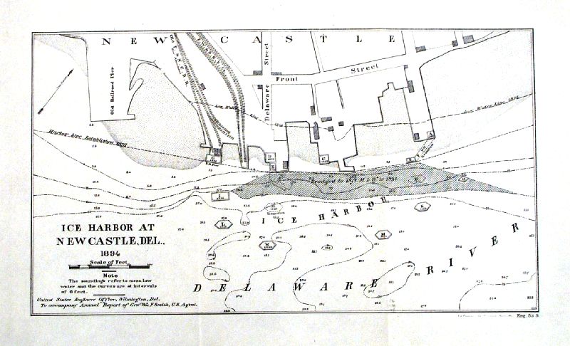 |
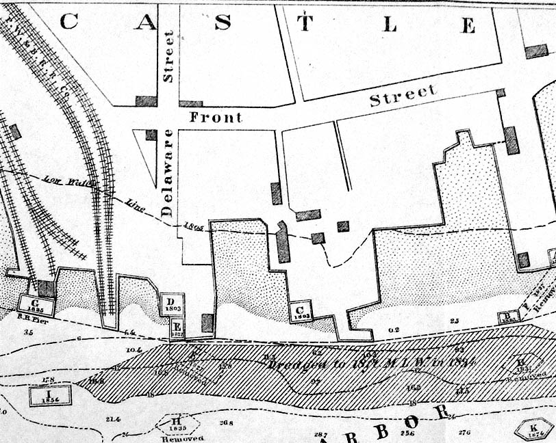
Ice Harbor at Newcastle, Delaware US Army Engineers 1894 River improvements and dredging. Litho by Friedenwald size: 330 x 200 mm Antique Map Ref IFM103 £28.00 (+P&P) click image for enlargement Detail |
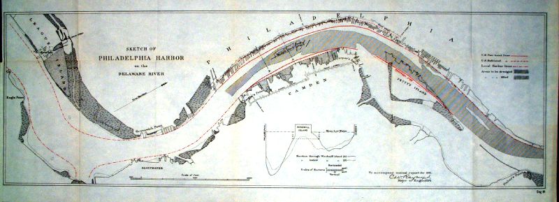 |
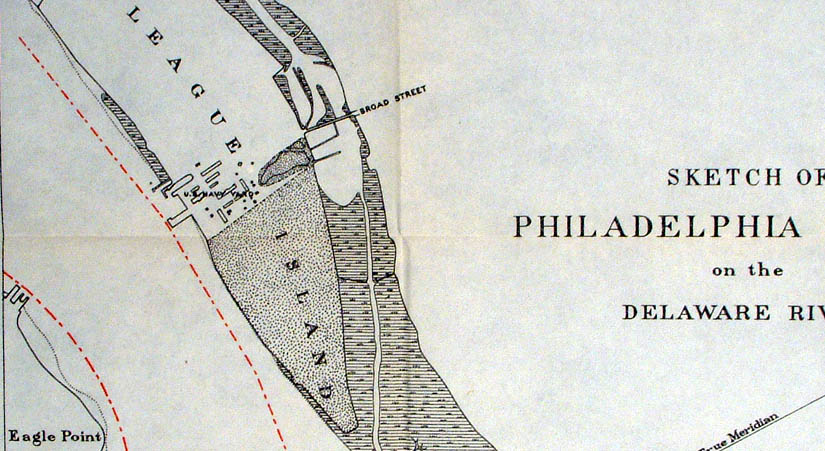
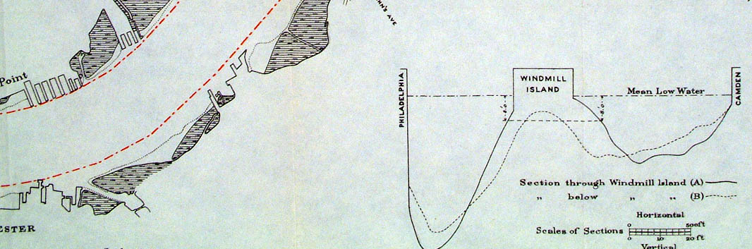
Philadelphia Harbor on the Delaware River US Army Engineers 1892 Proposed River improvements, embankment and dreadging. Litho size: 810 x 280 mm Antique Map Ref IFM125 £38.00 (+P&P) click image for enlargement Detail1 Detail2 Detail3 Detail4 |
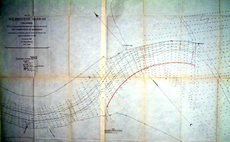 |
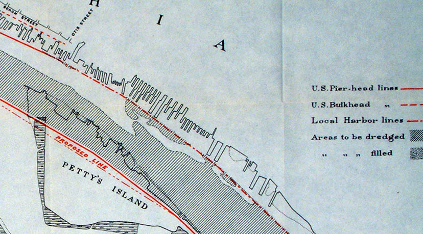
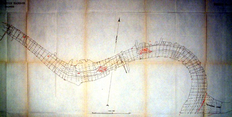
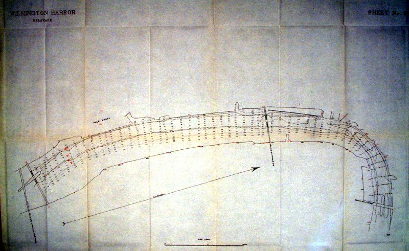
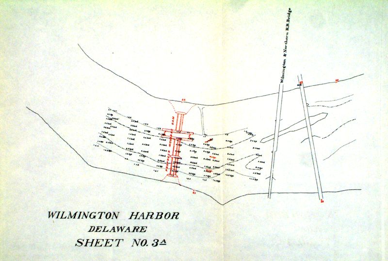
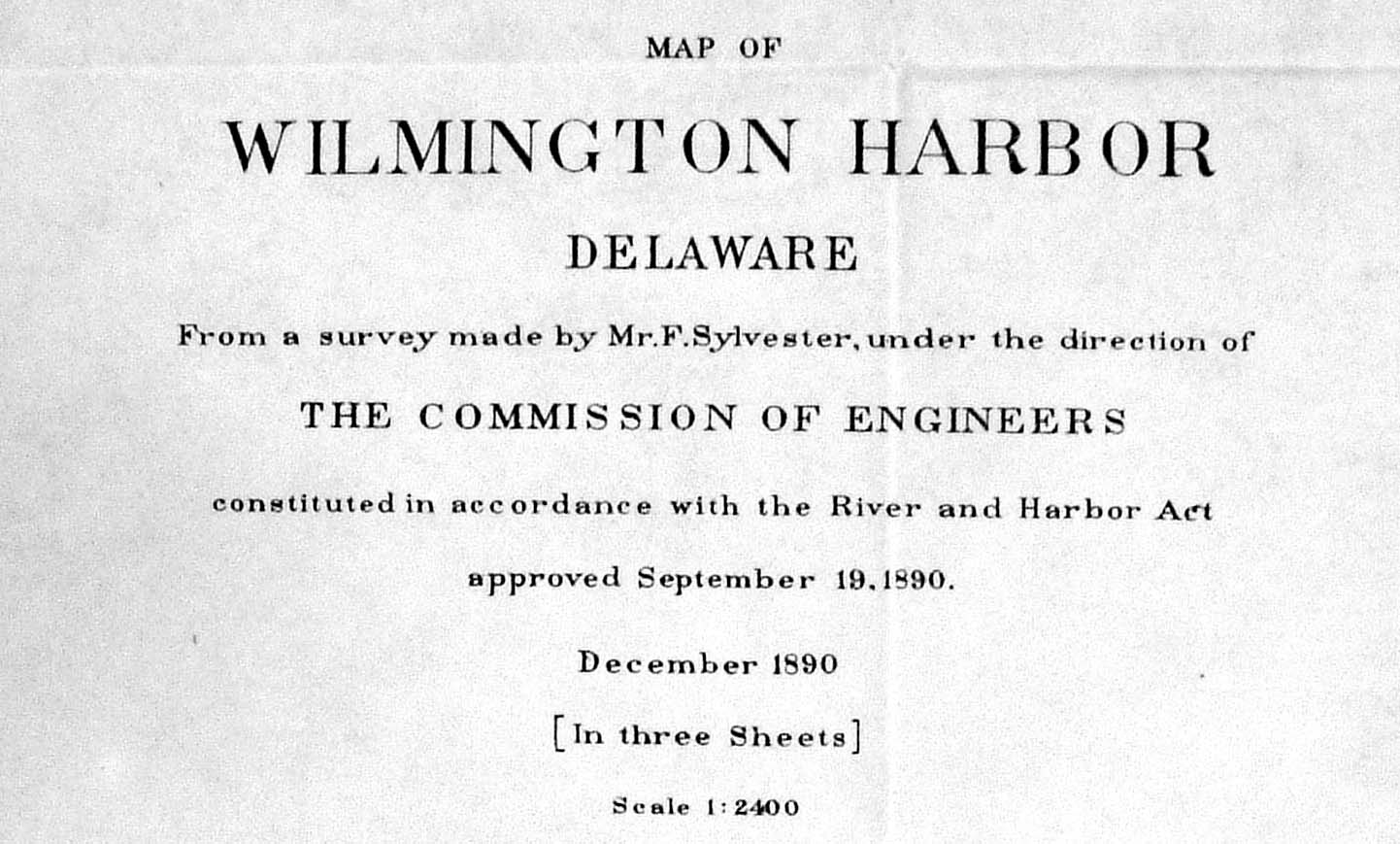
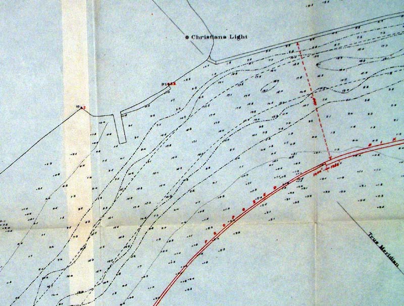
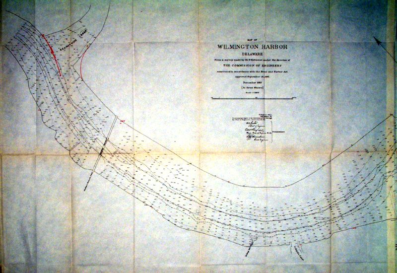
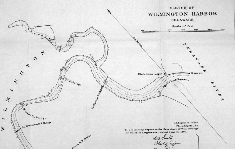
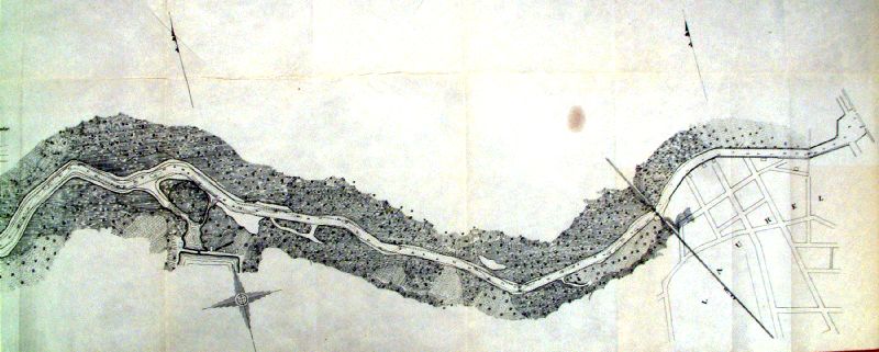
Wilmington Harbor, Delaware
in 4 sheets US Army Engineers 1892 Litho (note - illustration quality suffers due to size when photographing) Sheet 1 size: 1380 x 500 mm (too large for a single photo) Sheet 2 size: 960 x 440 mm Sheet 3 size: 720 x 450 mm Sheet 4 size: 290 x 210 mm Antique Map Ref IFM127 ( 4 sheets) £38.00 (+P&P) click image for enlargement Detail1 Detail2 Detail3 |
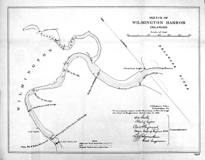 |
Wilmington Harbor, Delaware US Army Engineers 1892 Litho size: 380 x 290 mm Antique Map Ref IFM128 £32.00 (+P&P) click image for enlargement Detail |
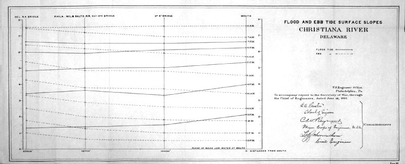 |
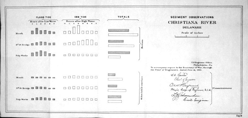
Christina River, Delaware ( 2 sheets ) US Army Engineers 1892 Sheet 1 - chart of Flood and Ebb Tide Surface Slopes 620 x 260mm Sheet 2 - chart of Flood Sediment Observations 560 x 260mm Antique Map Ref IFM129 (2 sheets) £15.00 (+P&P) click image for enlargement |
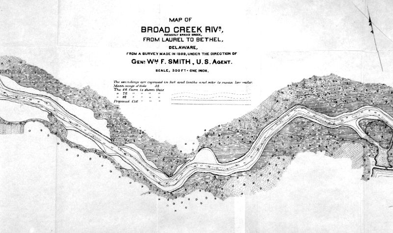 |
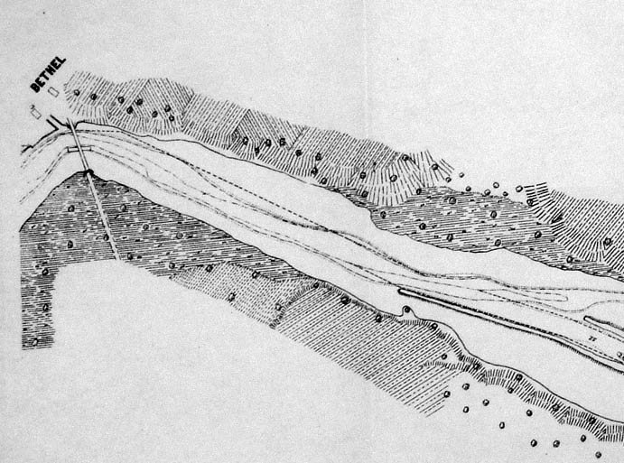
Broad Creek River, Delaware - from Laurel
to
Bethel US Army Engineers 1892 Survey for propsoed dredging. Litho 1330 x 260 Note this map is too large to show as a whole. Detail Left side Right side Antique Map Ref IFM130 £18.00 (+P&P) click image for enlargement |
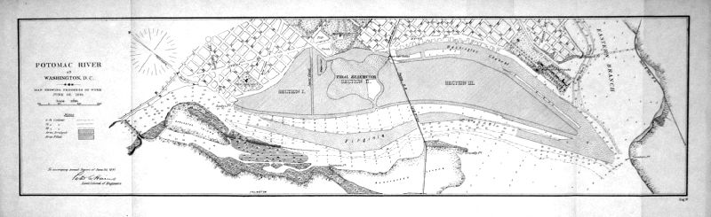 |
Potomac River at Washington DC (District
of
Columbia) US Army Engineers 1892 River improvements, embankment and dreadging. Litho size: 680 x 200 mm Antique Map Ref IFM131 £38.00 (+P&P) click image for enlargement Detail1 Detail2 |
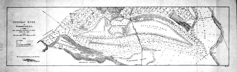 |
Potomac River at Washington DC (District
of
Columbia) US Army Engineers 1894 River improvements, embankment and dreadging. Litho by Friedenwald size: 680 x 200 mm Antique Map Ref IFM106 £38.00 (+P&P) click image for enlargement Detail1 Detail2 |
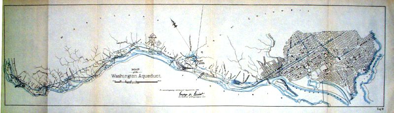 |
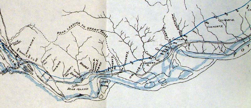
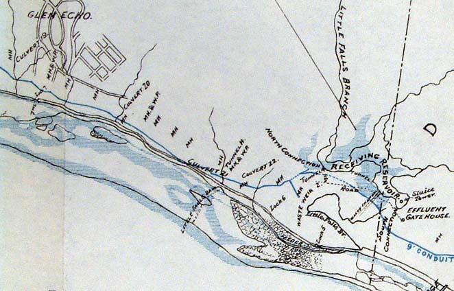
Map of Washington Aquaduct (DC) US Army Engineers 1892 Canals, aquaducts, drainage & sewage pipes Litho size: 760 x 220 mm , offest colour blue mismatch Antique Map Ref IFM170 £35.00 (+P&P) click image for enlargement Detail1 Detail2 Detail3 |
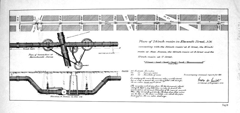 |
Plan of 24 inch main in Eleventh St, NW Water supply pipes down 11th St, Washinton DC US Army Engineers 1892 Litho size: 400 x 180 mm Antique Map Ref IFM171 £20.00 (+P&P) click image for enlargement Detail1 |
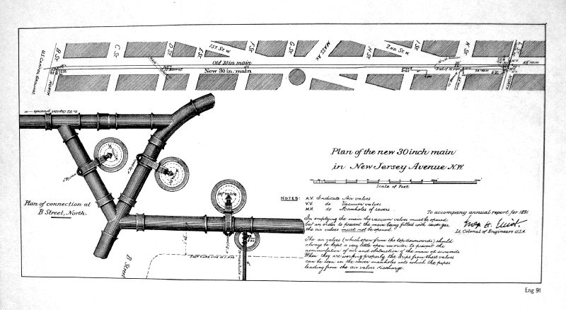 |
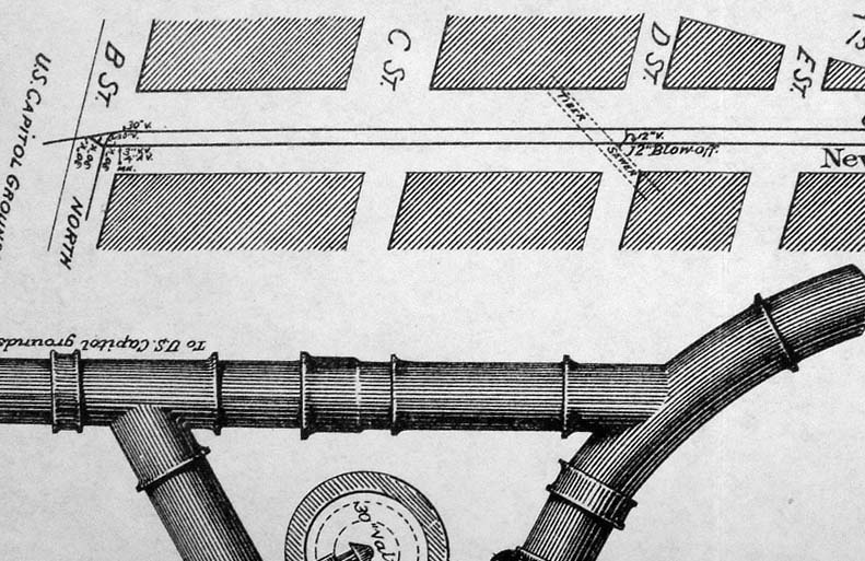
Plan of 30 inch main in New Jersey Avenue, NW Water supply pipes down New Jersey Ave, Washinton DC US Army Engineers 1892 Litho size: 330 x 180 mm Antique Map Ref IFM172 £20.00 (+P&P) click image for enlargement Detail1 |
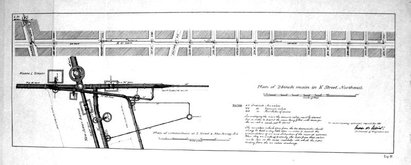 |
Plan of 24 inch main in K St, NE Water supply pipes down K St, Washinton DC US Army Engineers 1892 Litho size: 400 x 180 mm Antique Map Ref IFM173 £20.00 (+P&P) click image for enlargement Detail1 |
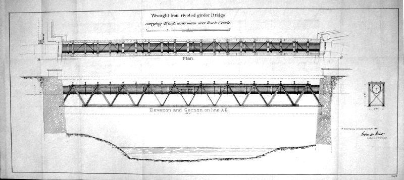 |
Wrought Iron Girder Bridge .. over Rock
Creek
(Washington DC) US Army Engineers 1892 Litho size: 700 x 310 mm Antique Map Ref IFM175 £16.00 (+P&P) click image for enlargement Detail1 |
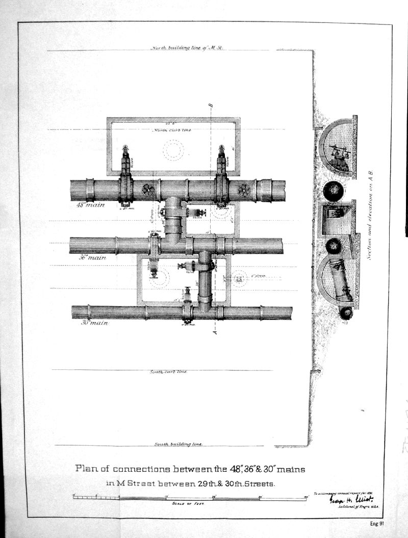 |
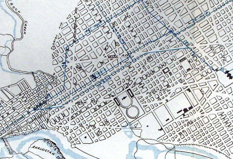
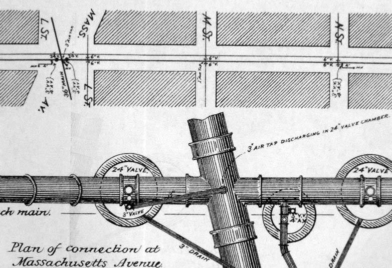
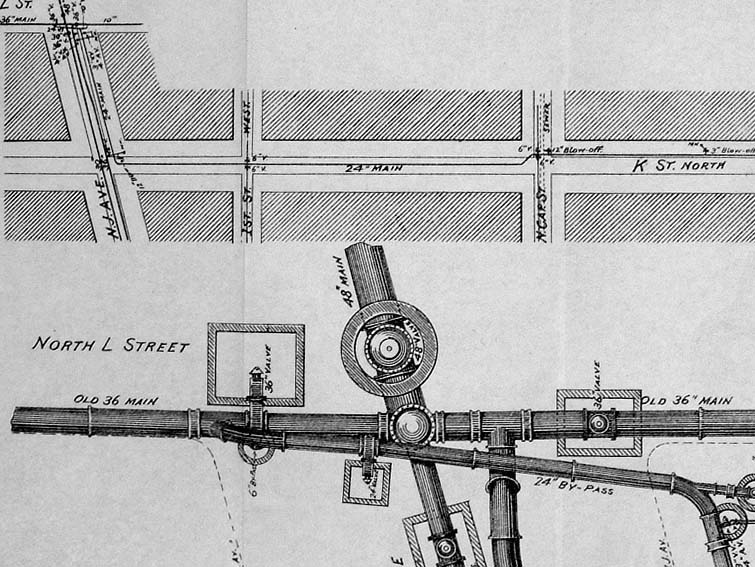
Plan of connections between the 48", 36" & 30"
mains in M Street between 29th & 30th Streets Washington DC US Army Engineers 1894 Litho size: 270 x 350 mm Antique Map Ref IFM174 £15.00 (+P&P) click image for enlargement |
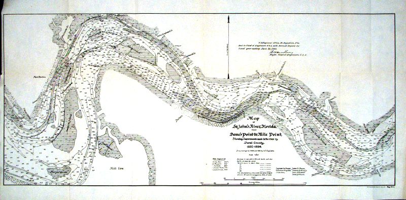 |
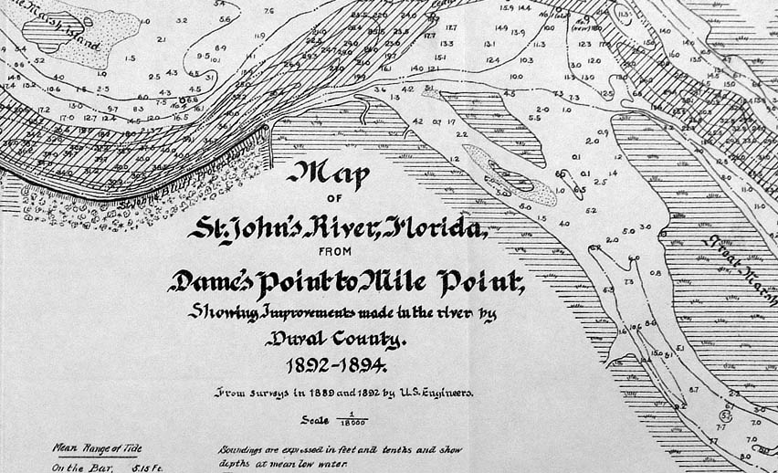
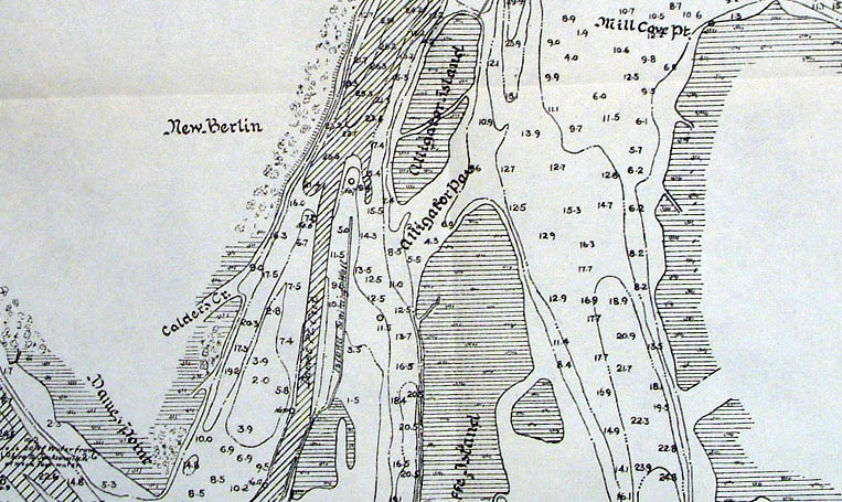
Map of St John's River, Florida, from Dames Point
to
Mile Point ( just east of Jacksonville, Florida - near Fort Caroline National Monument) US Army Engineers 1894 River improvements, and dredging. Litho by Friedenwald size: 700 x 320 mm Antique Map Ref IFM117 £32.00 (+P&P) click image for enlargement Detail1 Detail2 |
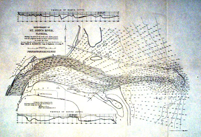 |
Improvement of St John's River, Florida ( just east of Jacksonville, Florida - near Mayport Naval Center) US Army Engineers 1894 River improvements, and dredging. Litho by Friedenwald size: 580 x 360 mm Antique Map Ref IFM116 £25.00 (+P&P) click image for enlargement Detail |
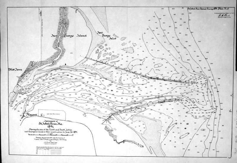 |
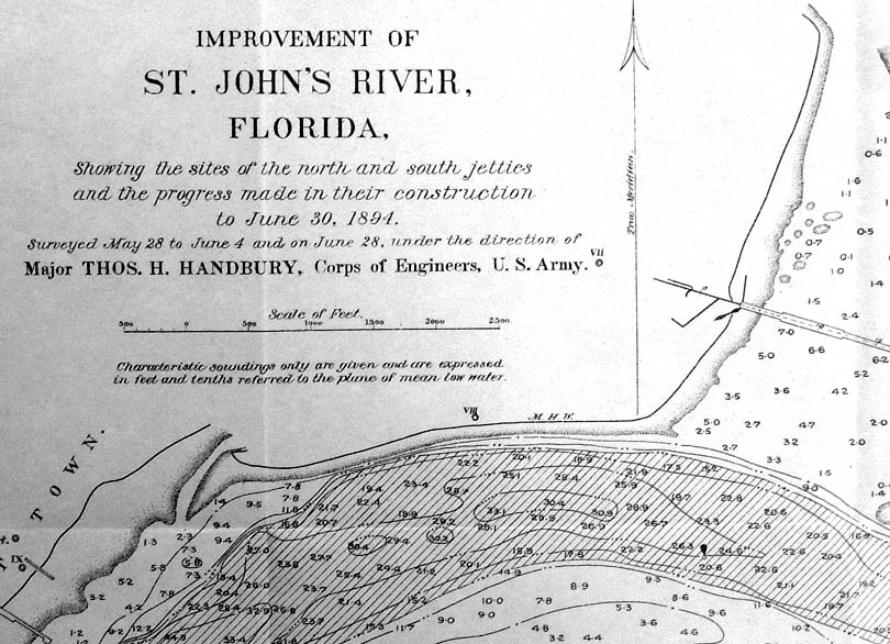
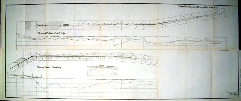
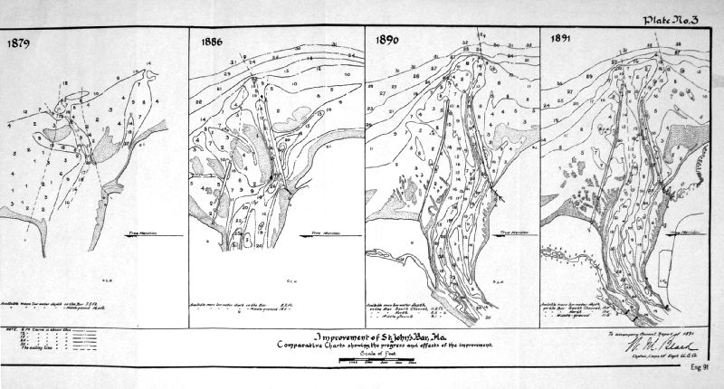
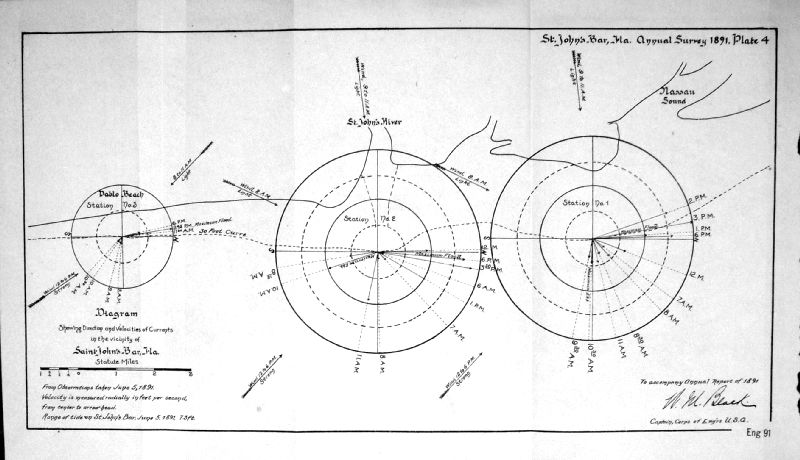
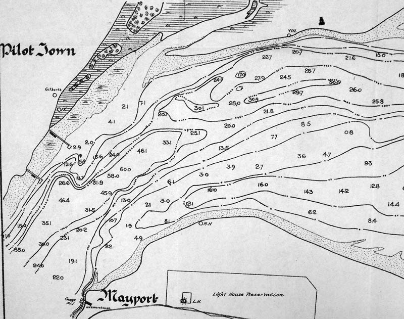
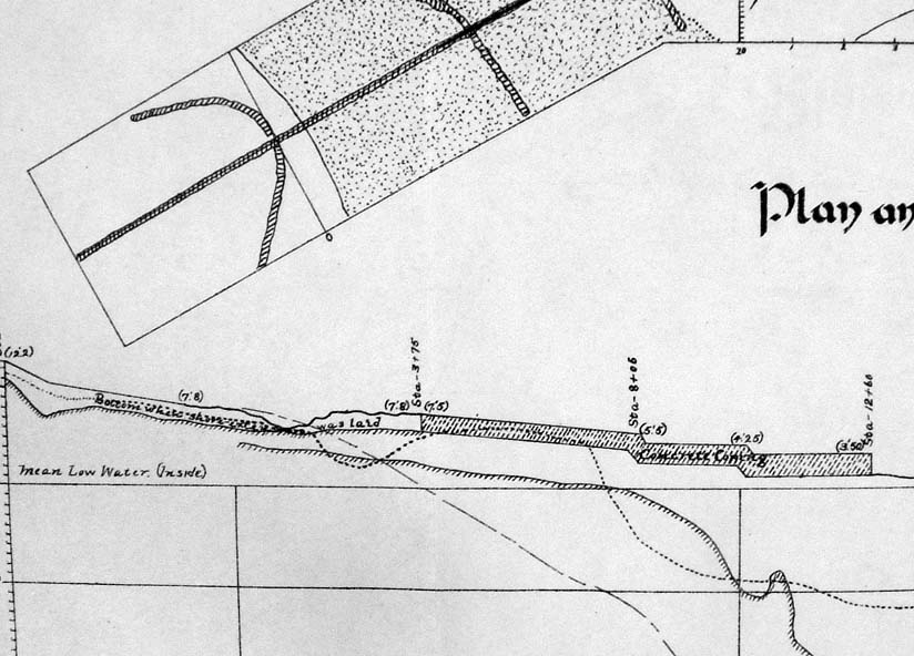
Improvement of St John's River,
Florida ( 4
sheets) ( just east of Jacksonville, Florida - near Mayport Naval Center) US Army Engineers 1892 Lithograph River improvements, and dredging. Sheet 1 - Mayport, Pilot Town, Fort George Island size: 520 x 350 mm Sheet 2 - Plan & Profile of North & South Jetties size: 960 x 400 mm Sheet 3 - Progress from 1878, 1886, 1890, 1891 size: 420 x 210 mm Sheet 4 - Polar diagrams of currents and winds size: 370 x 210 mm Antique Map Ref IFM207 ( 4 sheets) £25.00 (+P&P) click image for enlargement Detail 1 Detail 2 |
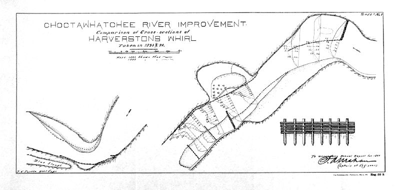 |
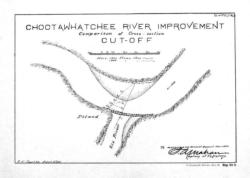
Choctawhatchee River Improvements ( 2
sheets ) US Army Engineers 1894 Thought to be in the vicinity of Caryville, Florida Litho by Friedenwald size: 380 x 180 mm (sheet 1), 240 x 170mm (Sheet 2) Antique Map Ref IFM118 (2 sheets) £15.00 (+P&P) click image for enlargement |
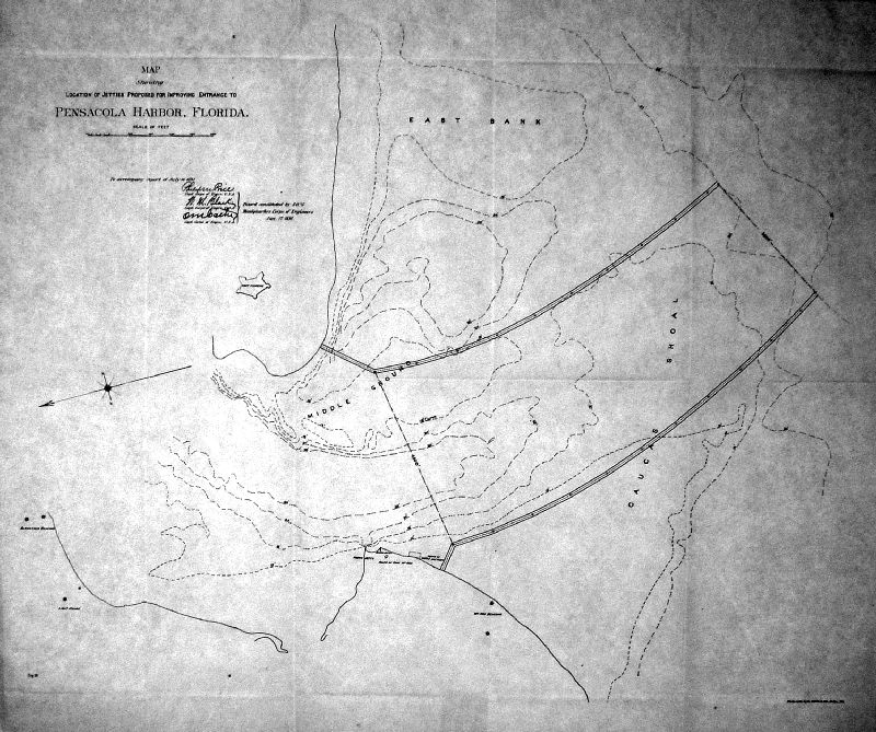 |
Pensacola Harbor, Florida ( Location of jetties proposed for improving harbor entrance) US Army Engineers 1892 River improvements, and dredging. Litho by Hoen size: 530 x 400 mm Antique Map Ref IFM223 £18.00 (+P&P) click image for enlargement Detail |
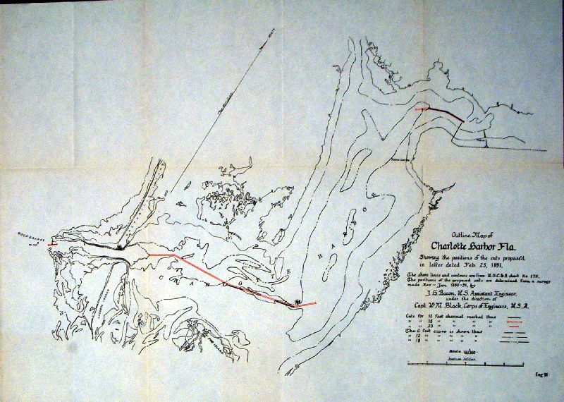 |
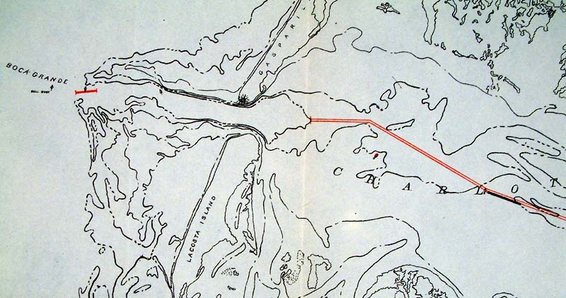
Charlotte Harbor, Port Charlotte, Florida ( showing proposed cuts for improving harbor entrance) maps covers area Pine Island, Boca Grande, Port Charlotte. US Army Engineers 1892 Litho by Hoen size: 470 x 330 mm Antique Map Ref IFM225 £25.00 (+P&P) click image for enlargement Detail |
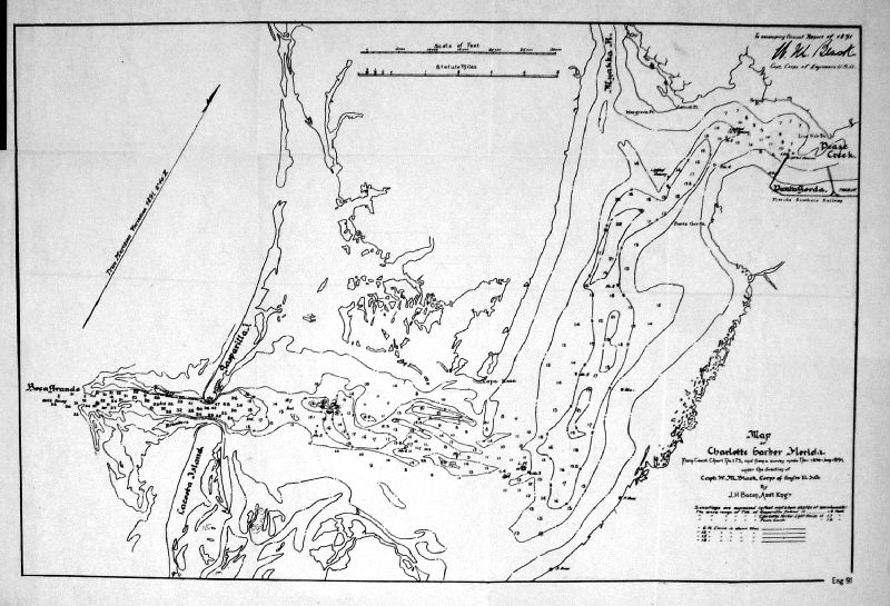 |
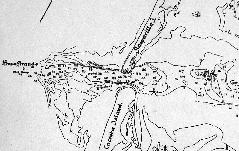
Charlotte Harbor, Port Charlotte, Florida ( general survey of 1890 - 1891) maps covers area Pine Island, Boca Grande, Port Charlotte, Pease Creek, Punta Gorda. US Army Engineers 1892 Litho size: 400 x 270 mm Antique Map Ref IFM204 £25.00 (+P&P) click image for enlargement Detail |
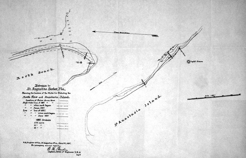 |
Entrance to St Augustine's Harbor,
Florida Shows North Beach and Anastasia Island US Army Engineers 1892 Litho size: 470 x 300 mm Detail Antique Map Ref IFM205 £18.00 (+P&P) click image for enlargement |
 |
Ocklawaha River, Florida From Lake Griffin, Leasburg to St John's River at Welaka US Army Engineers 1892 Litho size: 900 x 370 mm Detail 1 Detail 1 Detail 1 Antique Map Ref IFM206 £4.00 (+P&P) click image for enlargement |
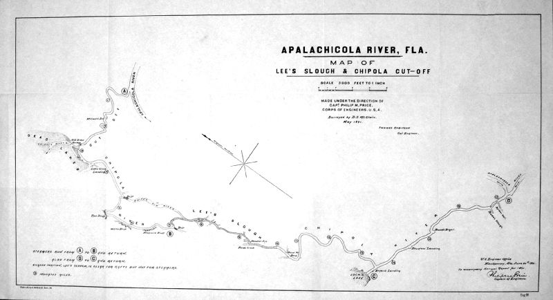 |
Apalachicola River, Florida (
Lee's
Slough and Chipola Cutoff) West of Tallahassie. Cut-off is close to Route 71 between Dalkeith and Wewahitchka US Army Engineers 1892 Litho size: 560 x 300 mm Detail Antique Map Ref IFM224 £18.00 (+P&P) click image for enlargement |
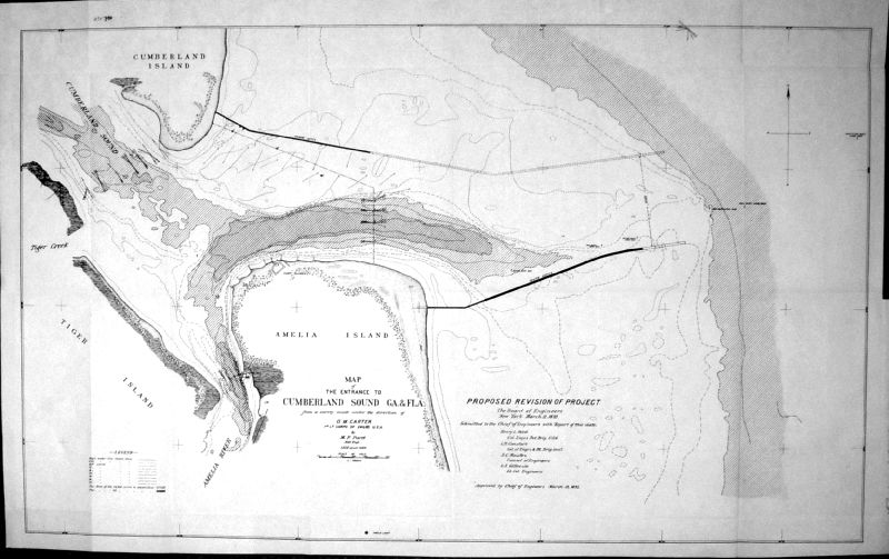 |
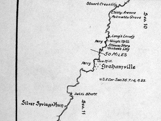
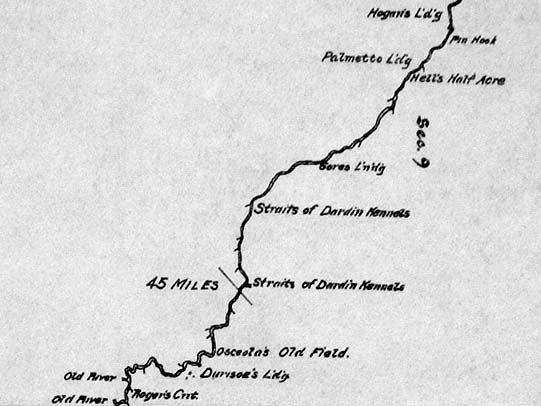
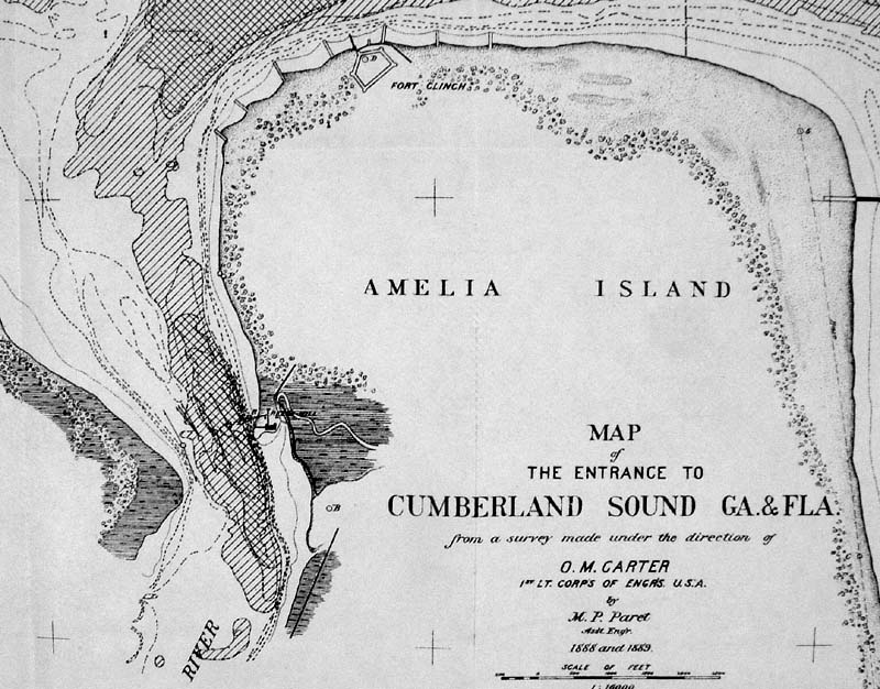
Entrance to Cumberland Sound, Florida and
Georgia Shows Amelia Island, Tiger Island, Cumberland Island US Army Engineers 1892 Litho size: 720 x 450 mm Detail Antique Map Ref IFM210 £25.00 (+P&P) click image for enlargement |
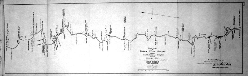 |
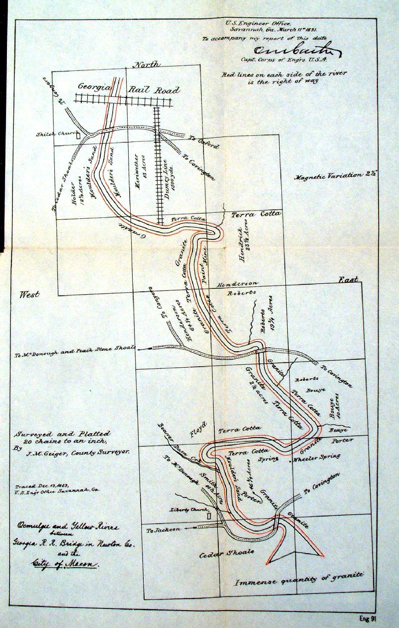
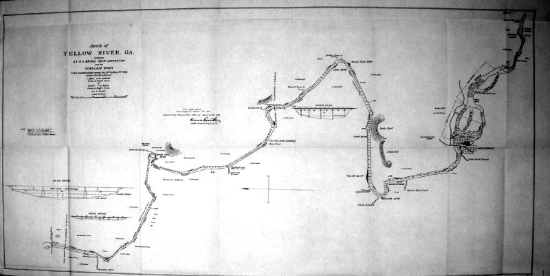
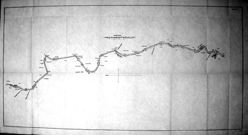
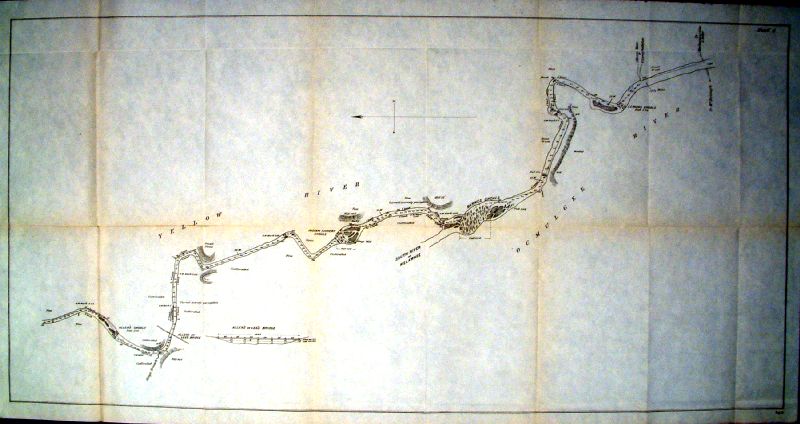
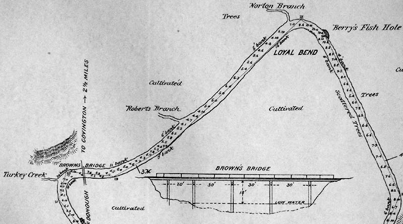
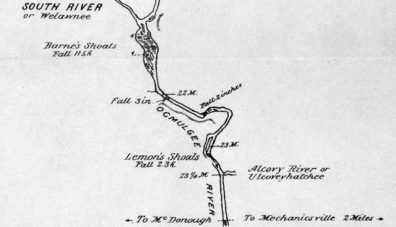
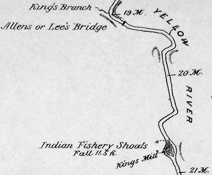
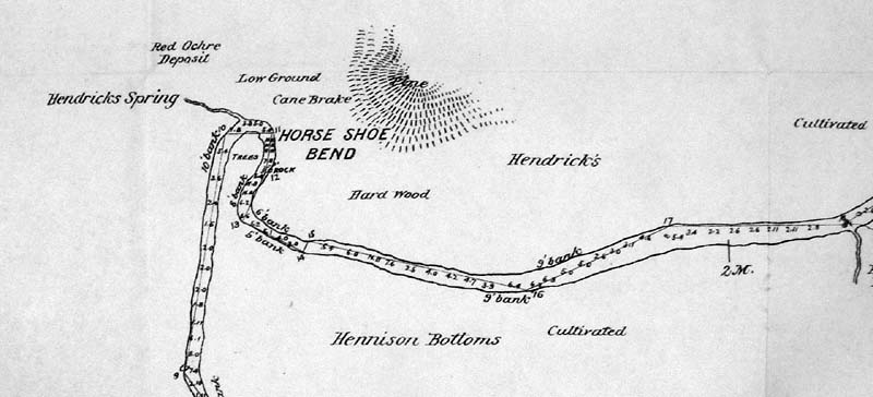
Yellow River, Georgia, between GA RR bridge near
Covington and the Ocmulgee River ( 5 sheets) Linear span of this distance is 16 miles - approx Covington to Jackson Lake US Army Engineers 1892 Litho Sheet 1 Index Map size: 700 x 210 mm Sheet 2 Part 1 size: 900 x 470 mm Sheet 3 Part 2 size: 900 x 470 mm Sheet 4 Part 3 size: 900 x 470 mm Detail 1 Detail 2 Detail 3 Detail 4 Detail 5 Detail 6 Antique Map Ref IFM209 ( 5 sheets) £28.00 (+P&P) click image for enlargement |
 |
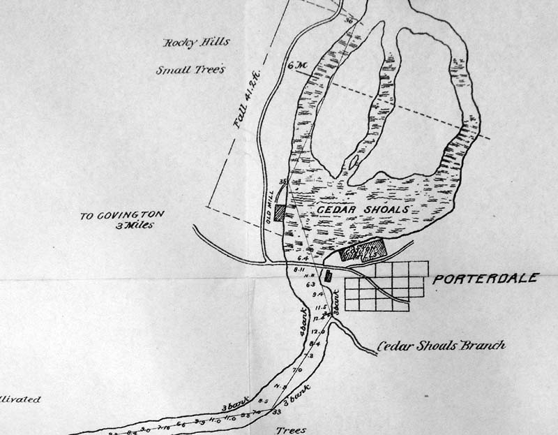
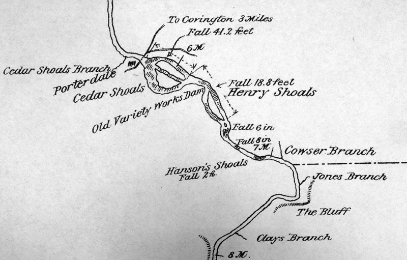
Yellow River between Georgia RR bridge and Newton
Co. (now between Almon and Porterdale, West of Covington, GA) US Army Engineers 1894 Litho size: 220 x 350 mm Antique Map Ref IFM208 £18.00 (+P&P) click image for enlargement |
 |
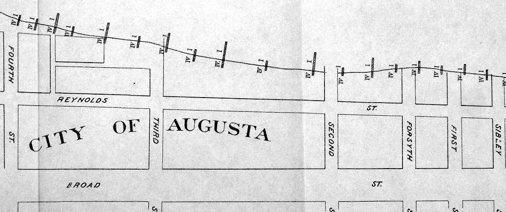
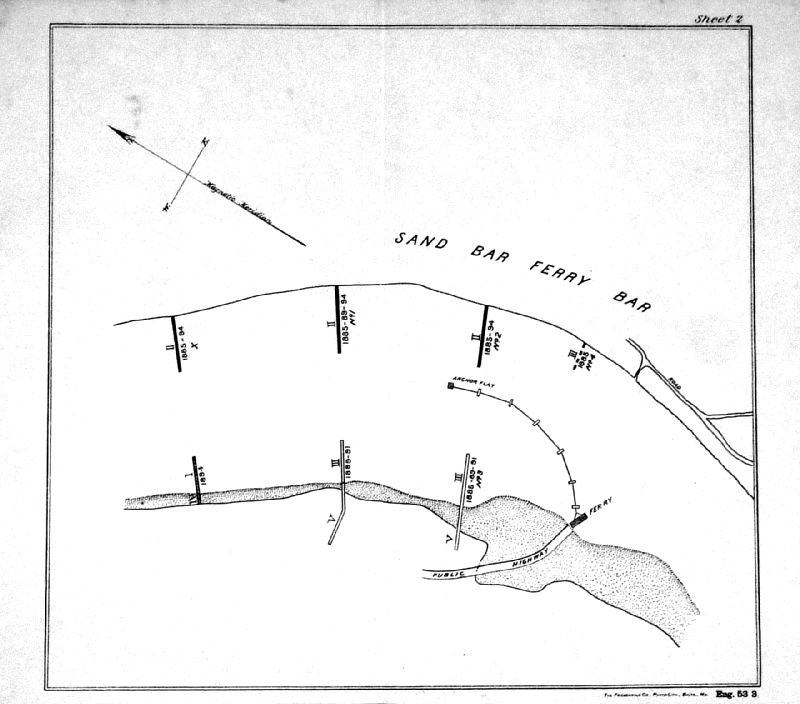
Improvement of Savannah River near Augusta,
Georgia (
in 2 sheets) US Army Engineers 1894 River improvements, shore protection and dams Litho by Friedenwald size: 800 x 230 mm (sheet 1), 250 x 230mm (sheet 2) Antique Map Ref IFM113 ( 2 sheets) £30.00 (+P&P) click image for enlargement Detail Sheet 2 |
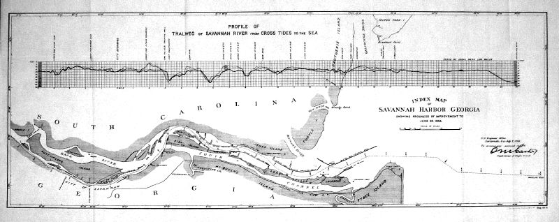 |
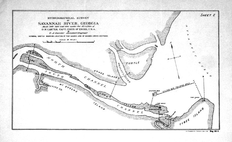
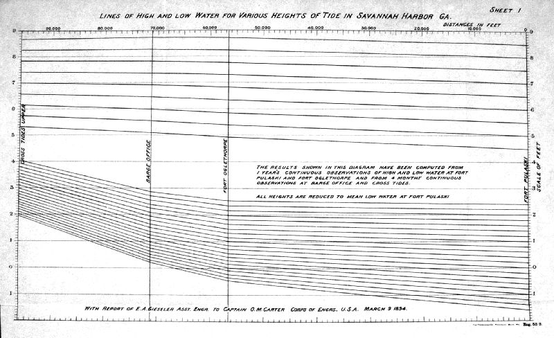
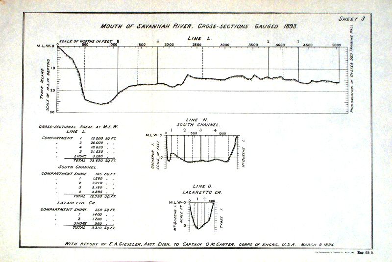
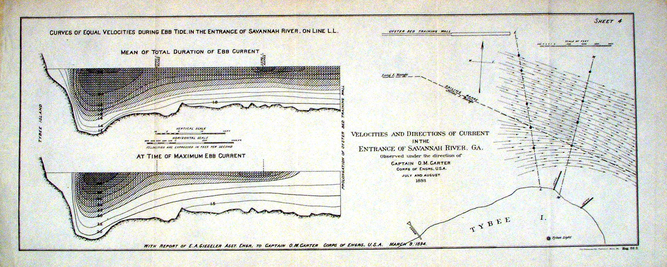
Index Map of Savannah Harbor, Georgia US Army Engineers 1894 Survey and Sea Walls Litho by Friedenwald size: 700 x 270 mm Antique Map Ref IFM112 £30.00 (+P&P) click image for enlargement Detail1 Detail2 |
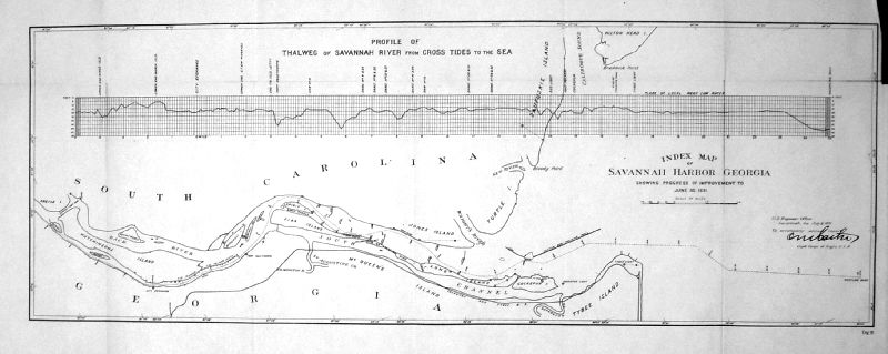 |
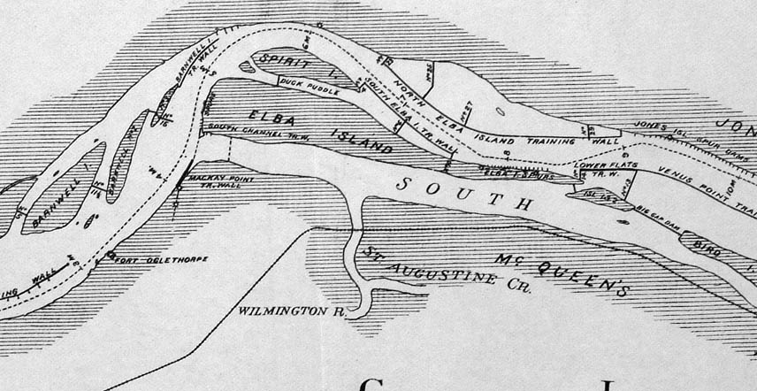
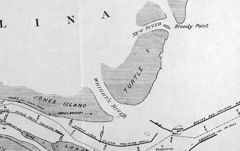
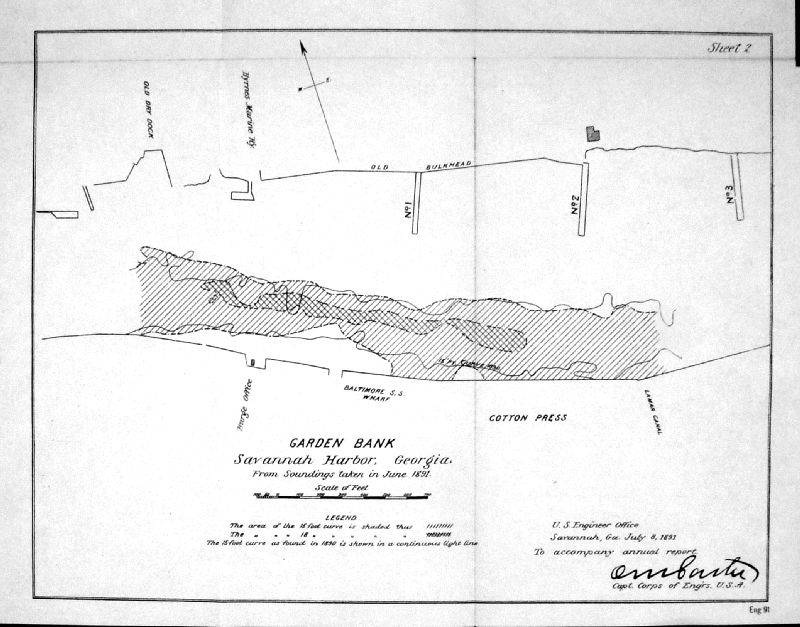
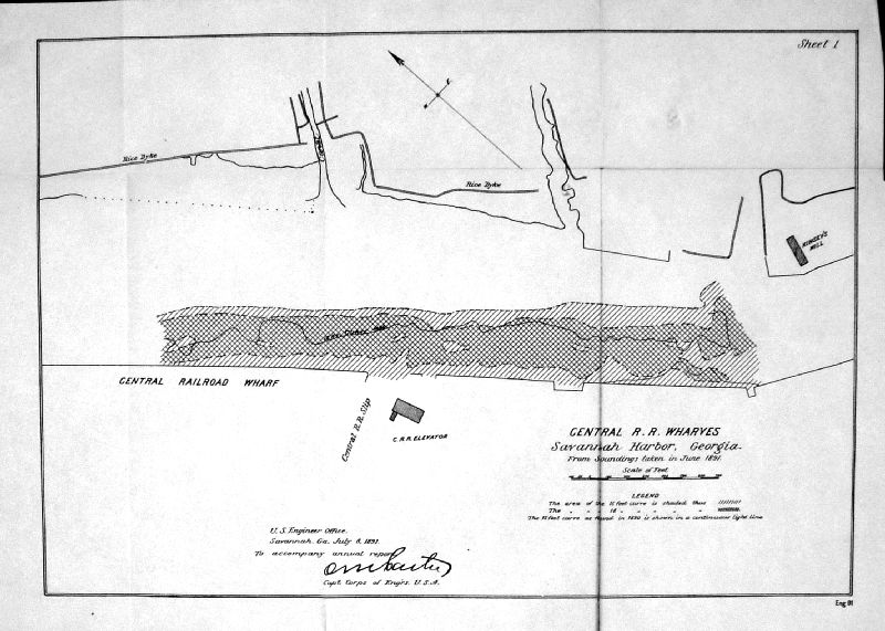
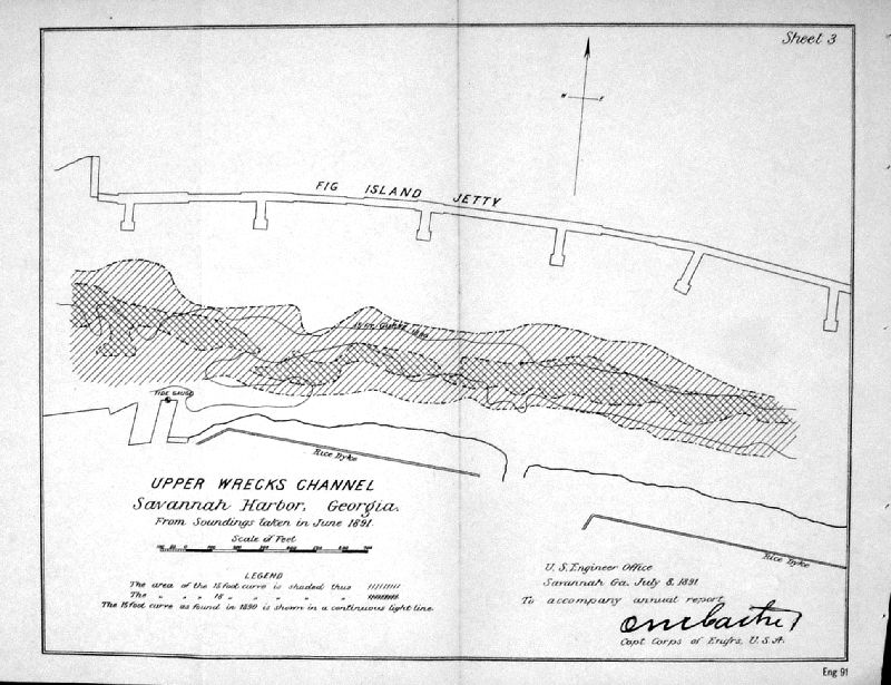
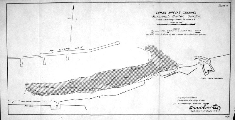
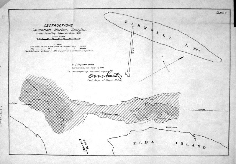
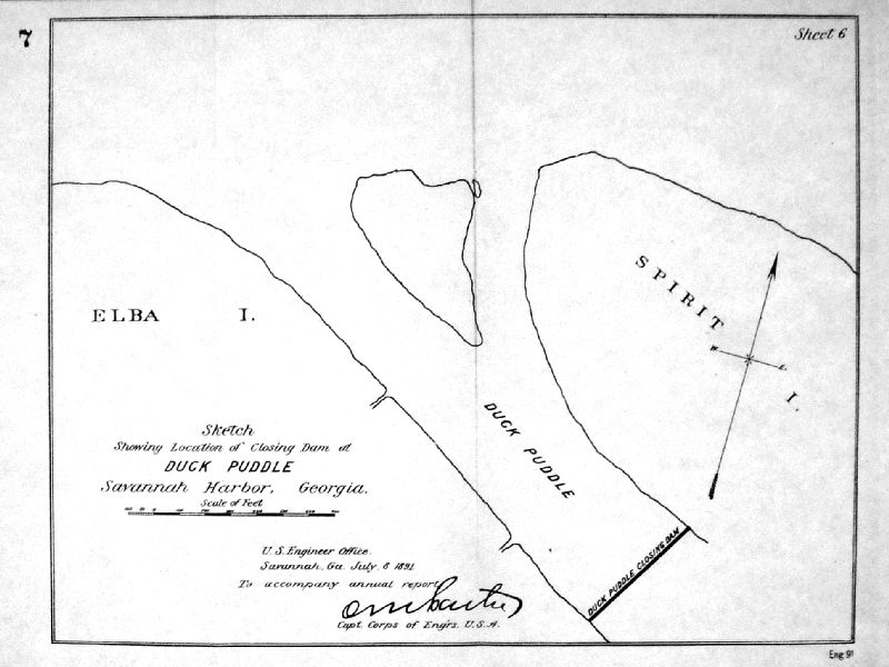
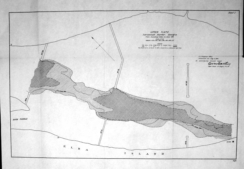
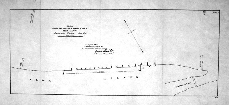
Savannah Harbor,
Georgia
( 13 sheets) US Army Engineers 1892 Survey and Sea Walls Litho Sheet 0 Index Map size: 700 x 260 mm Sheet 1 Central RR Warves size: 400 x 280 mm Sheet 2 Garden Bank size: 320 x 240 mm Sheet 3 Upper Wrecks Channel size: 280 x 210 mm Sheet 4 Lower Wrecks Channel size: 410 x 210 mm Sheet 5 Obstructions size: 360 x 240 mm Sheet 6 Dam at Duck Puddle size: 280 x 220 mm Sheet 7 Upper Flats size: 460 x 300 mm Sheet 8 Dams at Elba Island size: 440 x 200 mm Sheet 9 Lower Flats size: 300 x 270 mm Sheet 10 Dams at Jones Island size: 460 x 180 mm Sheet 11 Long Island Crossing size: 380 x 250 mm Sheet 12 Tybee Knoll size: 570 x 260 mm Antique Map Ref IFM211 (13 sheets) £30.00 (+P&P) click image for enlargement Detail |
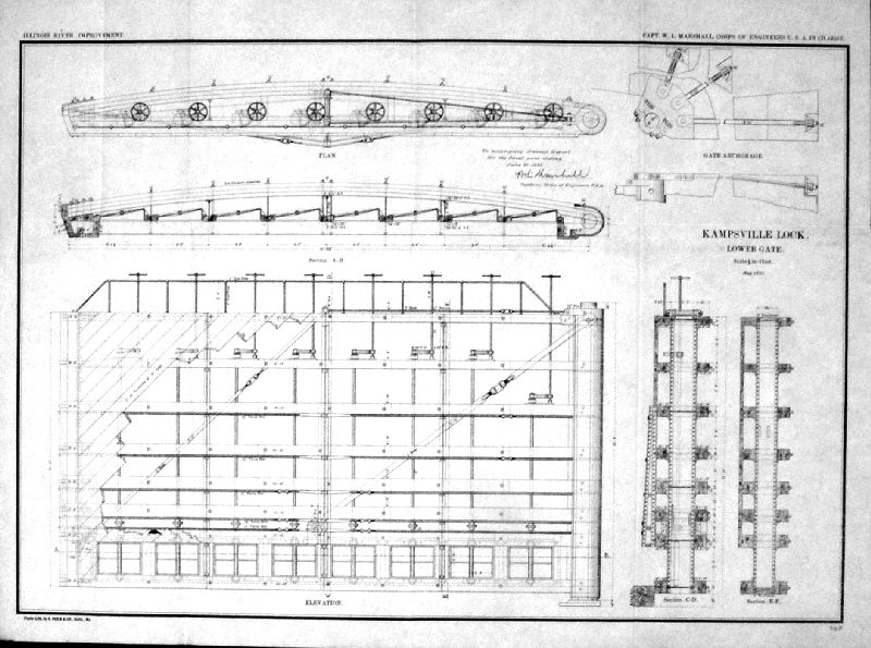 |
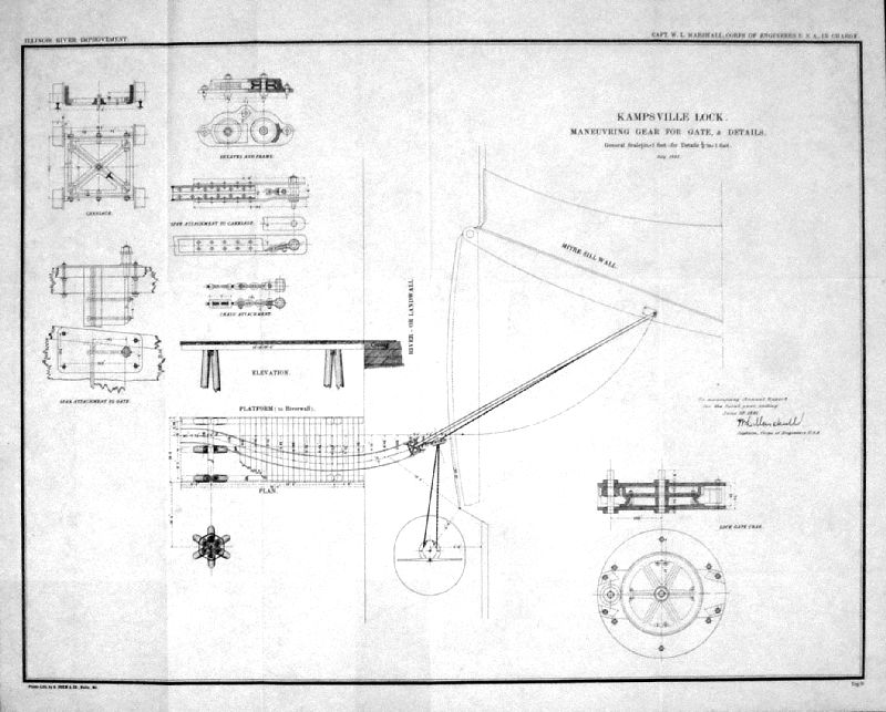
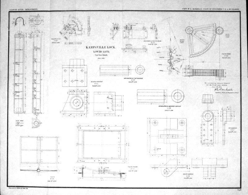
Kamspville Lock, Kampsville,
Illinois
(
3 sheets) US Army Engineers 1892 Litho Sheet1 size: 430 x 320 mm Sheet2 size: 430 x 330 mm Sheet3 size: 430 x 330 mm Antique Map Ref IFM202 ( 3 sheets ) £18.00 (+P&P) click image for enlargement |
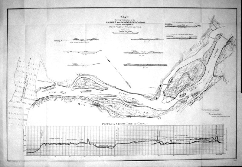 |
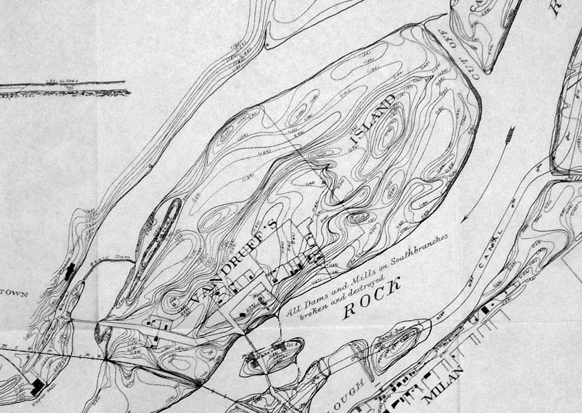
Illinois and Mississippi Canal around the rapids
in
Rock River at Milan, Illinois This is the junction of the Mississippi and Rock Rivers near modern Moline & Davenport US Army Engineers 1892 Litho size: 700 x 460 mm Antique Map Ref IFM203 £28.00 (+P&P) click image for enlargement Detail1 Detail2 |
 |
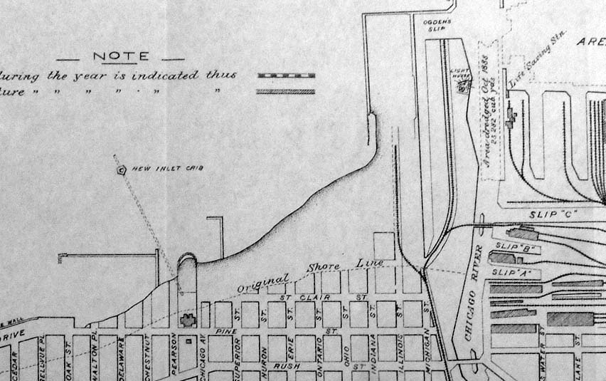
Chicago Harbor, Illinois US Army Engineers 1892 Litho size: 440 x 310 mm Antique Map Ref IFM200 £28.00 (+P&P) click image for enlargement Detail |
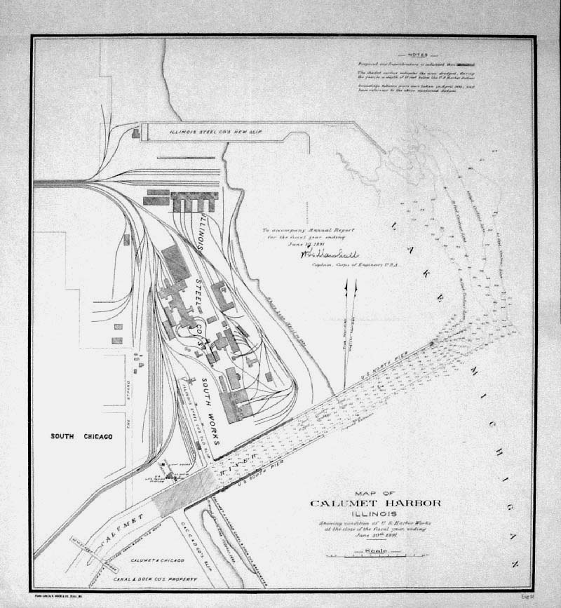 |
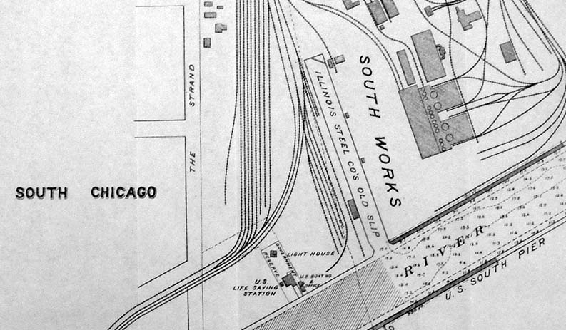
Calumet Harbor, Illinois US Army Engineers 1892 Showing South Chocago and Illinois Steel Works Litho size: 400 x 420mm Detail Antique Map Ref IFM201 £25.00 (+P&P) click image for enlargement |
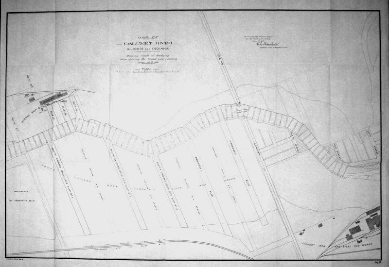 |
Calumet River Illinois and Indiana
Chicago ( 2 sheets) US Army Engineers 1892 Litho Sheet 1 size: 800 x 520 mm Detail Sheet 2 size: 480 x 300 mm Detail Antique Map Ref IFM199 ( 2 sheets) £25.00 (+P&P) click image for enlargement |
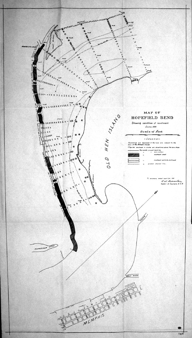 |
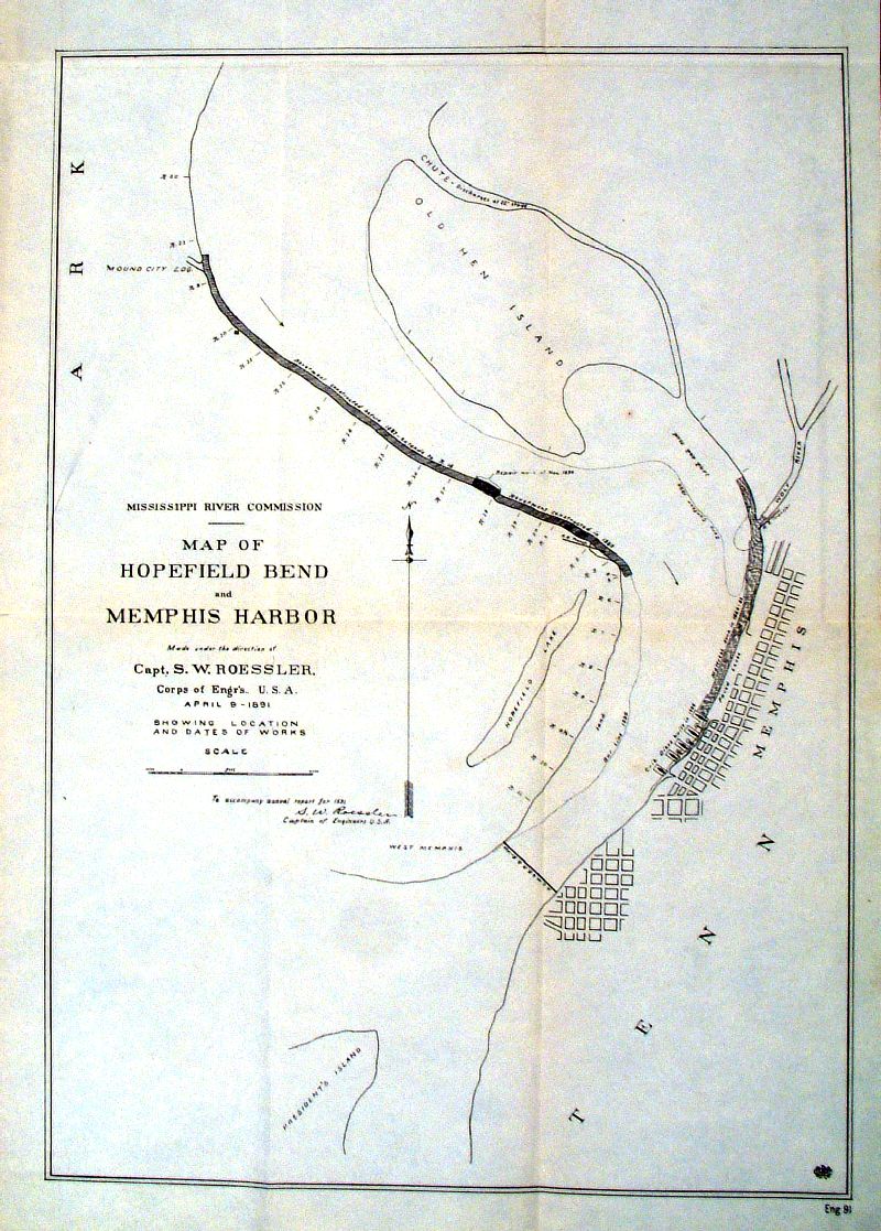
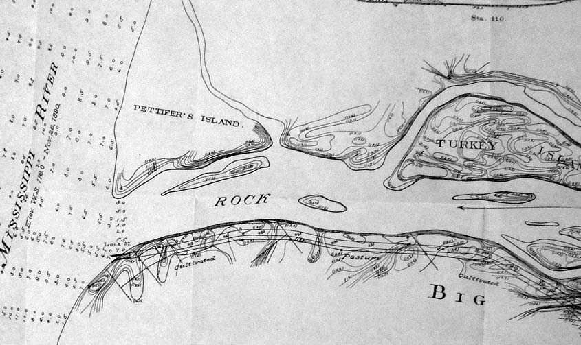
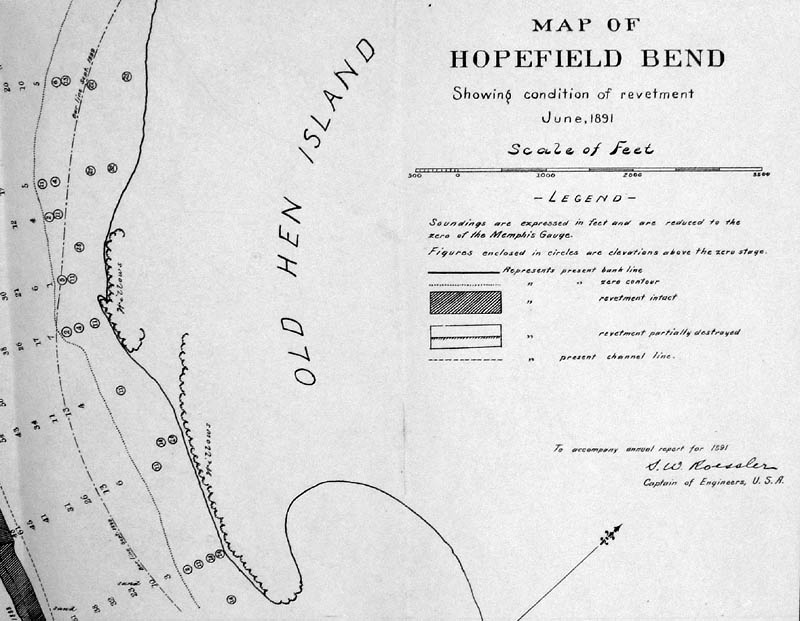
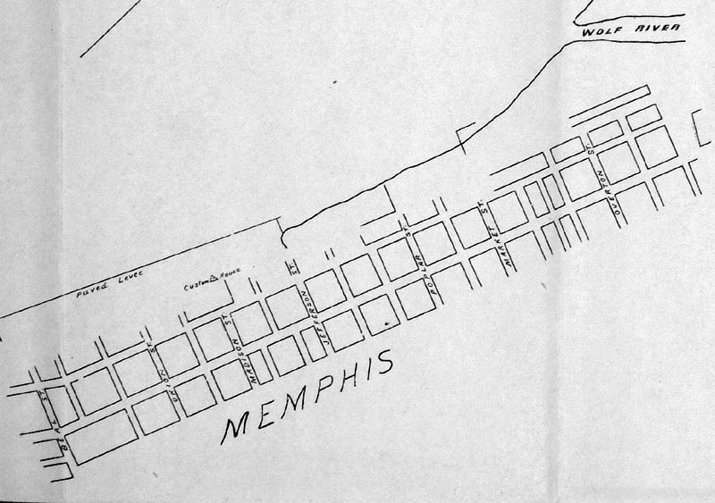
Hopfield Bend, Ohio River,
Illinois / Tennessee US Army Engineers 1892 Location of Mound City, Illinois and Memphis, Tennessee Litho size: 330 x 600 mm Detail1 Detail2 Detail3 Antique Map Ref IFM157 £32.00 (+P&P) click image for enlargement |
 |
Hopfield Bend and Memphis Harbor, Ohio River, Illinois / Tennessee US Army Engineers 1892 Location of Mound City, Illinois and Memphis, Tennessee Litho size: 300 x 410 mm Detail1 Antique Map Ref IFM158 £32.00 (+P&P) click image for enlargement |
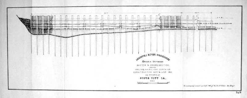 |
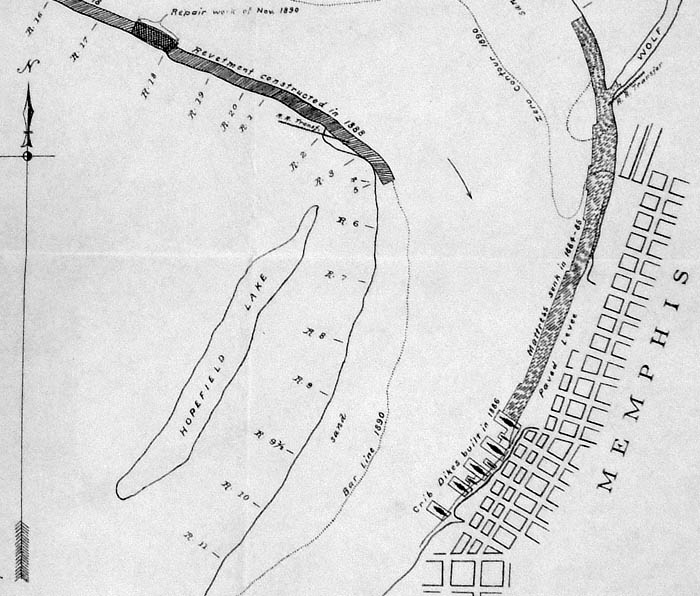
Cross section showing waling and willow curtains
constructed on dykes at Souix City, Iowa US Army Engineers 1892 Litho Sheet 1 ( cross section showing waling and willow curtains ) size: 480 x 180 mm Sheet 2 ( map of Missouri River & Souix City ) size: 250 x 190 mm Antique Map Ref IFM164 £25.00 (+P&P) click image for enlargement |
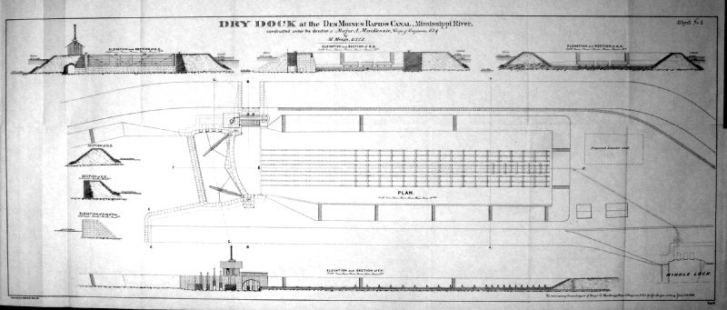 |
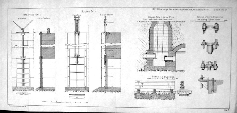
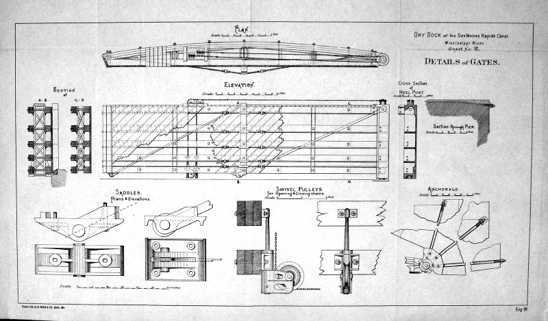
Dry Dock at Des Moines Rapids, Mississippi
River ( 3 sheets) Located between Hamilton and Montrose on the Mississippi, Iowa US Army Engineers 1892 Litho Sheet 1 size: 840 x 340 mm Sheet 2 size: 420 x 240 mm Sheet 3 size: 460 x 210 mm Antique Map Ref IFM184 £20.00 (+P&P) click image for enlargement |
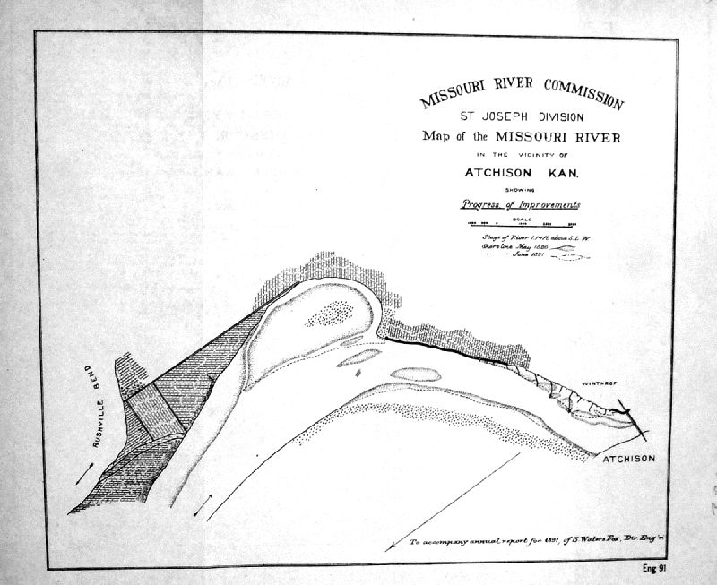 |
Missouri River at Atchison, Kansas Between Atchison, Kansas & Rushville, Missouri US Army Engineers 1892 Litho size: 260 x 210 mm Antique Map Ref IFM167 £16.00 (+P&P) click image for enlargement |
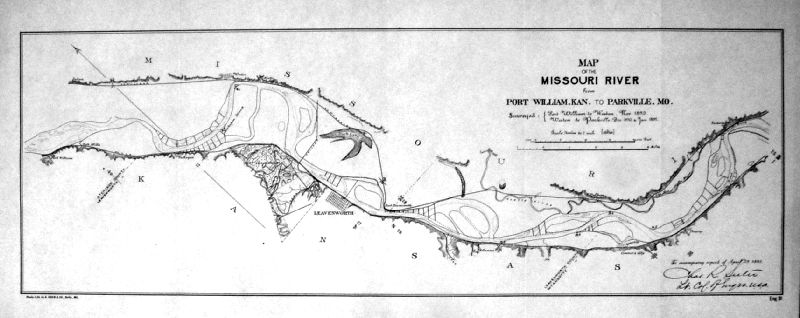 |
Missouri River between Port William (KA) and
Parkville
(MO) US Army Engineers 1894 Shows the towns of Port William, Leavenworth, Connors City Litho size: 510 x 190 mm Antique Map Ref IFM195 £18.00 (+P&P) click image for enlargement |
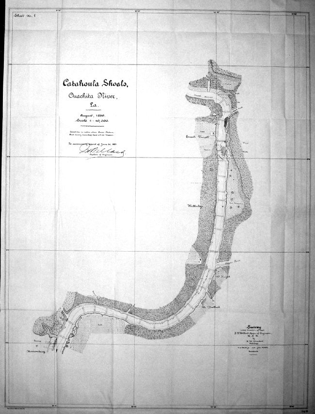 |
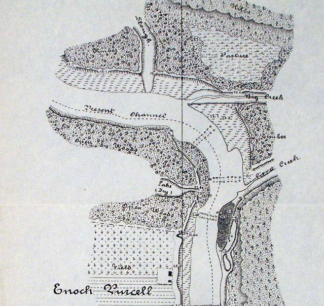
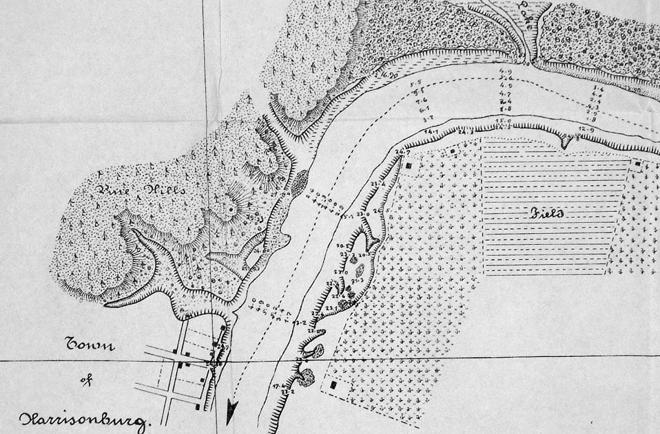
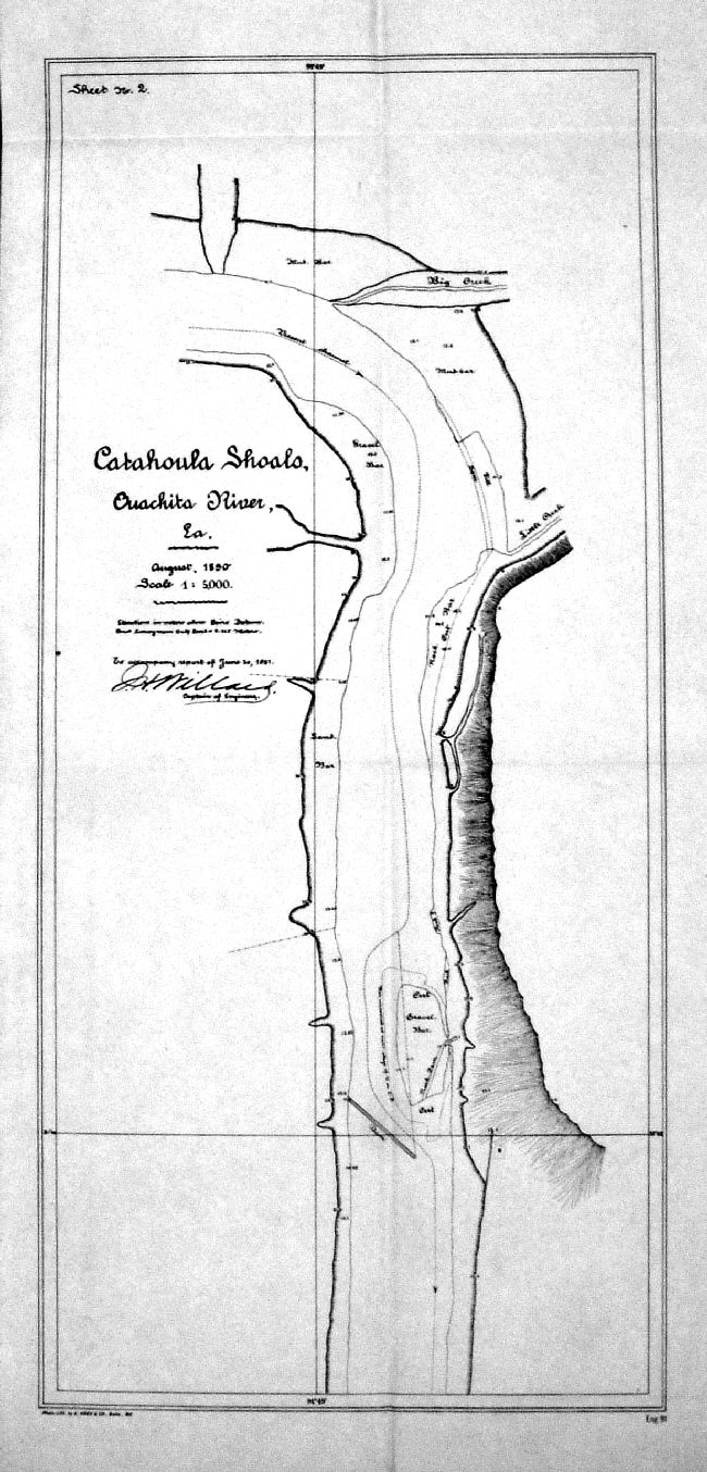
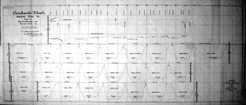
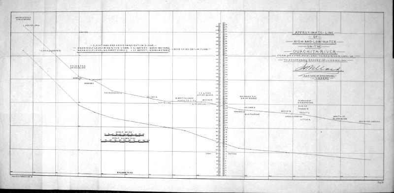
Catahoula Shoals, Ouachita River,
Louisiana ( 3 sheets ) US Army Engineers 1892 Map shows Harrisonburg at the far south Litho Sheet 1 size: 620 x 840 mm Detail 1 Detail 2 Sheet 2 size: 210 x 430 mm Sheet 3 size: 880 x 360 mm Antique Map Ref IFM176 £25.00 (+P&P) click image for enlargement |
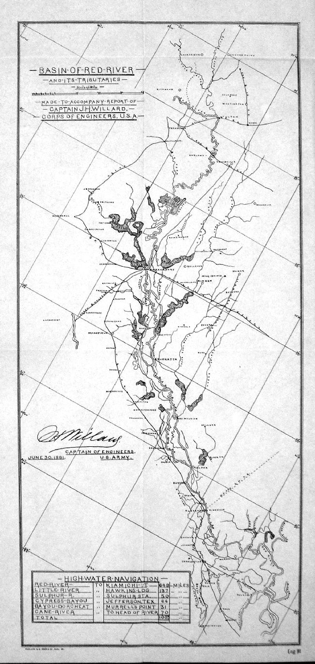 |
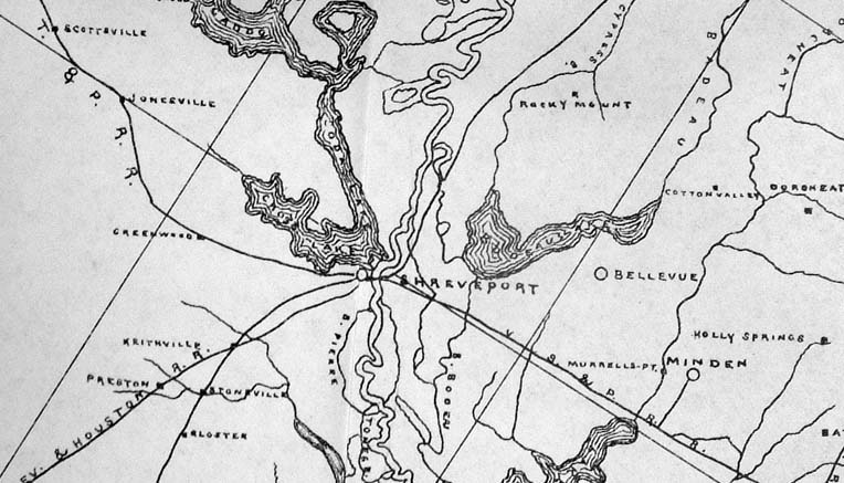
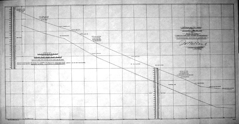
Basin of the Red River,
Louisiana ( 2 sheets) Covers area: Texarkana (AR), Shreveport, Alexandria, Bunkie, Washington US Army Engineers 1892 Litho Sheet 1 size: 210 x 450 mm Detail Sheet 2 size: 710 x 360 mm Antique Map Ref IFM177 £25.00 (+P&P) click image for enlargement |
 |
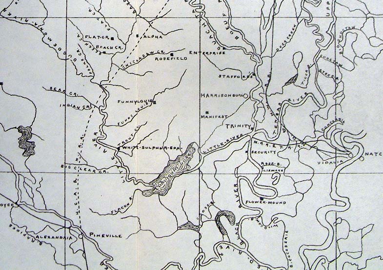
Basin of the Ouachita River,
Louisiana ( 2 sheets) Covers area: Little Rock (AR), El Dorado (AR), Monroe, Vidalia, Natchez (MS) US Army Engineers 1892 Litho Sheet 1 size: 230 x 440 mm Detail Sheet 2 size: 600 x 280 mm Antique Map Ref IFM178 £25.00 (+P&P) click image for enlargement |
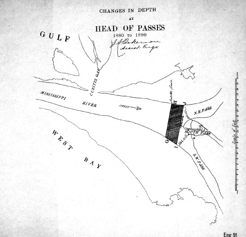 |
Mississippi River - Changes in Depth at Head of
Passes,
Louisiana at the very exit of the Mississippi to the Sea US Army Engineers 1892 Litho size: 220 x 210 mm Antique Map Ref IFM155 £16.00 (+P&P) click image for enlargement |
 |
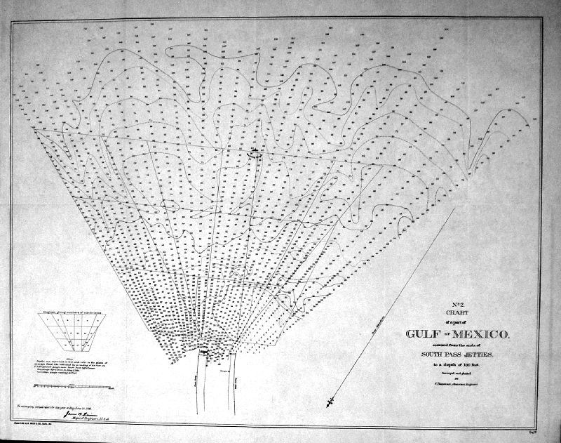
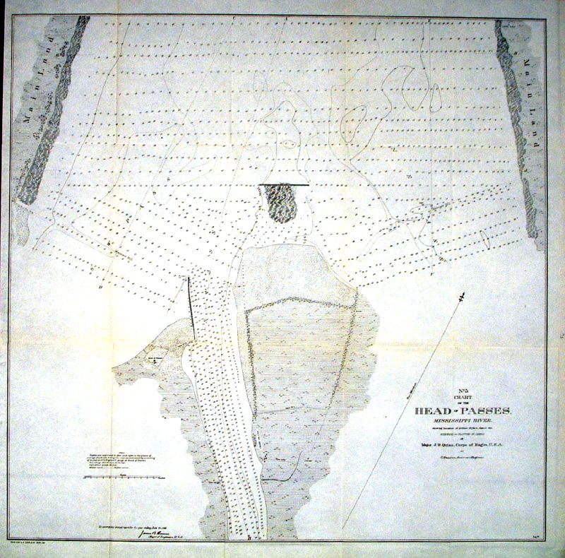
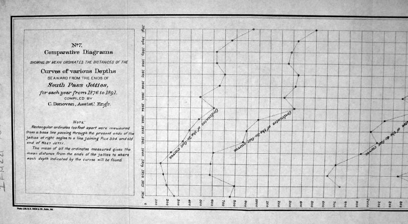
Charts of South Pass Mississippi
River ( 7 sheets) Estuary of the Mississippi between Louisiana and Mississippi US Army Engineers 1892 Litho Sheet 1 Chart 1 size: 1070 x 210 mm Sheet 2 Chart 2 size: 490 x 380 mm Sheet 3 Chart 3 size: 950 x 210 mm Sheet 4 Chart 4 size: 880 x 210 mm Sheet 5 Chart 5 size: 550 x 550 mm Sheet 6 Depth profiles size: 1300 x 320 mm Sheet 7 Depth Charts size: 960 x 200 mm Antique Map Ref IFM221 ( 7 sheets) £20.00 (+P&P) click image for enlargement |
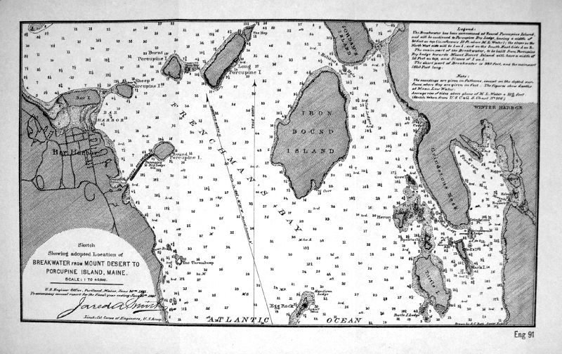 |
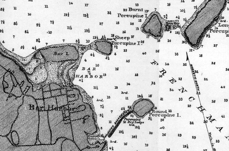
Breakwater from Mount Desert to Porcupine Island,
Maine Between Bar Harbor and Winter Harbor - Acadia National Park, SE of Bangor US Army Engineers 1894 Survey of Soundings Litho size: 330 x 200 mm Detail Antique Map Ref IFM149 £18.00 (+P&P) click image for enlargement |
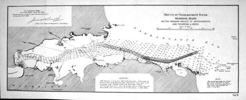 |
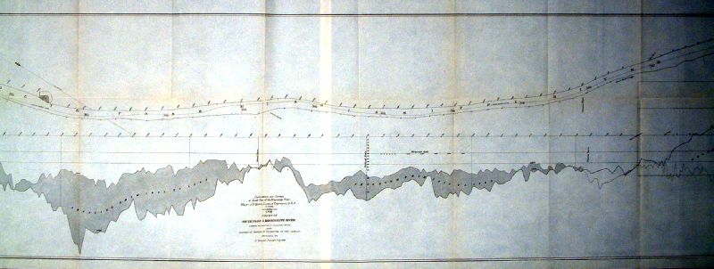
Mouth of the Narraguagus River, Milbridge, Maine US Army Engineers 1892 River improvements, soundings and dredging Litho size: 540 x 220 mm Antique Map Ref IFM148 £28.00 (+P&P) click image for enlargement Detail1 Detail2 |
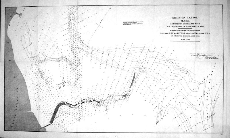 |
Kingston Harbor, Mass US Army Engineers 1894 Survey of Soundings Litho size: 650 x 380 mm Detail Antique Map Ref IFM153 £18.00 (+P&P) click image for enlargement |
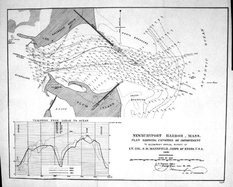 |
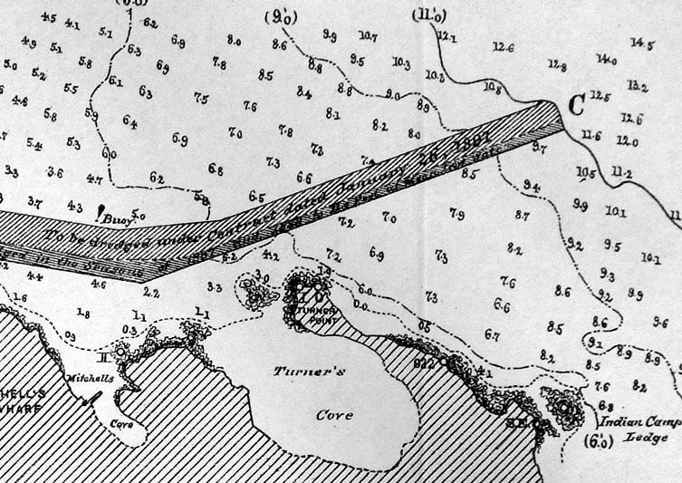
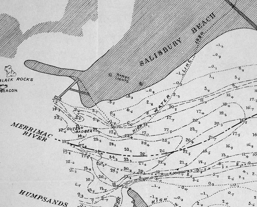
Newburyport, Mass Survey and soundings of channel between Salisbury Beach and Plum Island US Army Engineers 1892 Litho size: 410 x 330 mm Antique Map Ref IFM150 £28.00 (+P&P) click image for enlargement Detail1 |
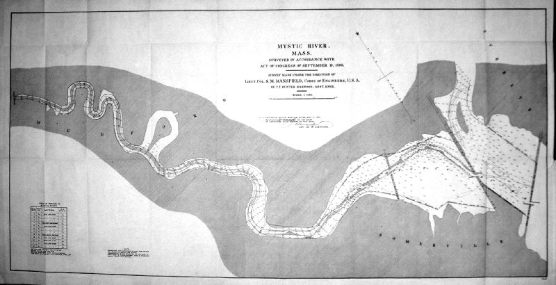 |
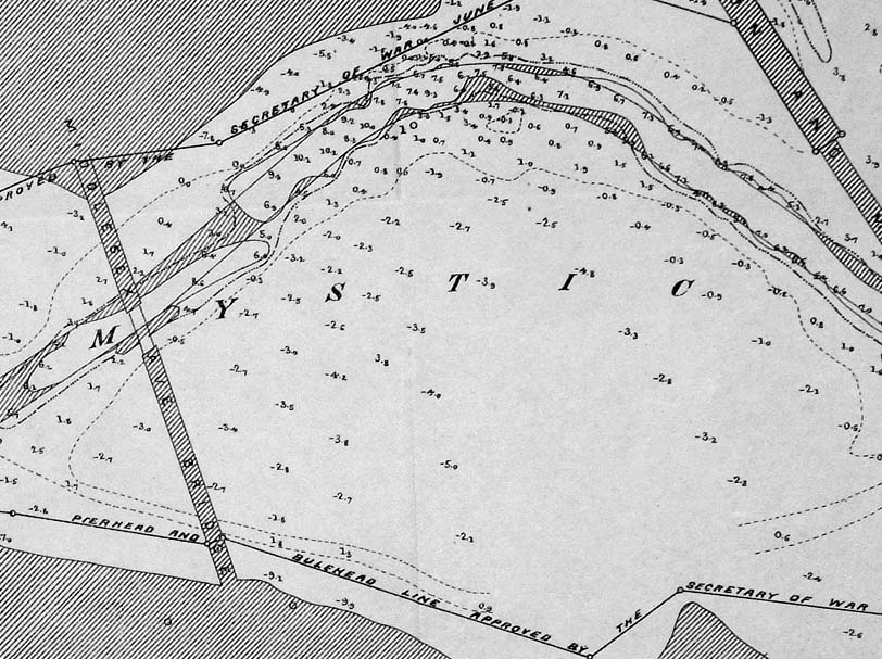
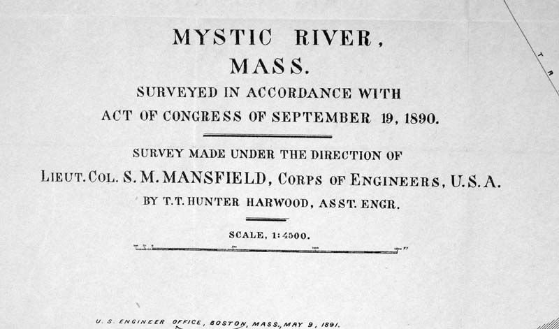
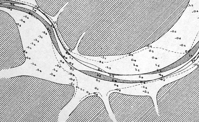
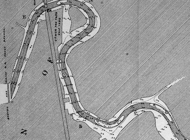
Mystic River, Mass bordering Medford, Somerville, Everett US Army Engineers 1892 Survey of Soundings Litho size: 940 x 480 mm Detail1 Detail2 Detail3 Antique Map Ref IFM151 £35.00 (+P&P) click image for enlargement |
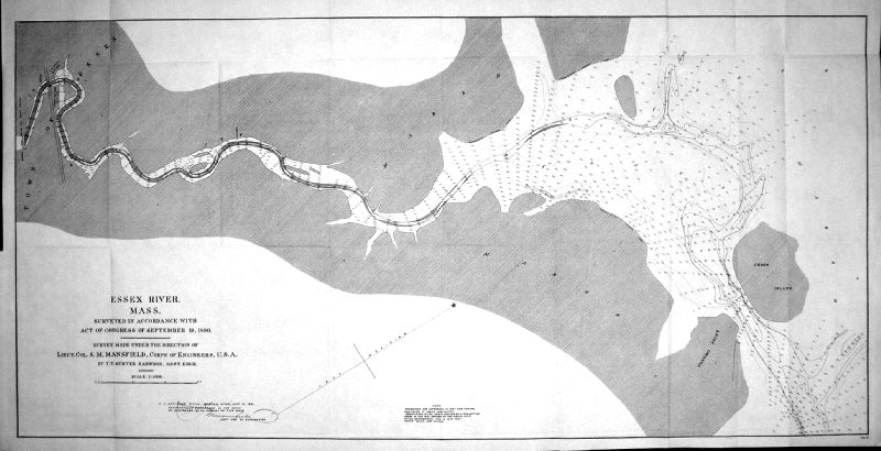 |
Essex River, Mass From Essex to Essex Bay US Army Engineers 1892 Litho size: 920 x 460 mm Detail1 Detail2 Antique Map Ref IFM152 £30.00 (+P&P) click image for enlargement |
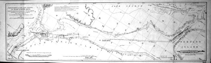 |
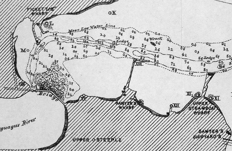
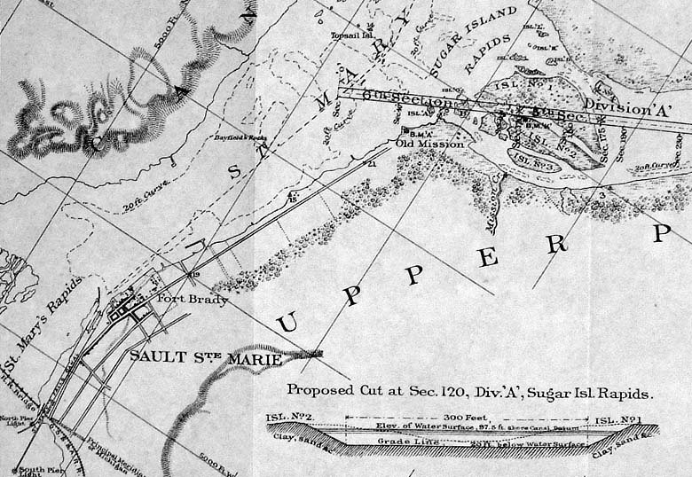
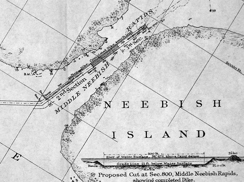
Improvement of Hay Lake Channel, St Mary's River,
Michigan Area covered : Saulte Ste Marie, Gardenville, Sugar Island to Neebish Island. Hay Lake now known as Lake Nicolet US Army Engineers 1892 Litho by Hoen size: 740 x 220 mm Antique Map Ref IFM215 £20.00 (+P&P) click image for enlargement Detail Sheet 2 |
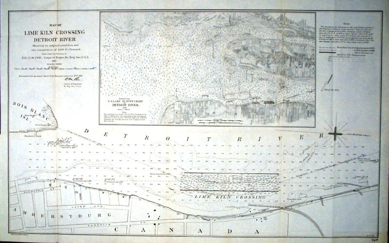 |
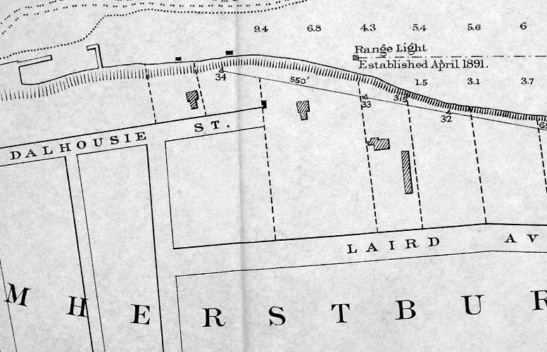
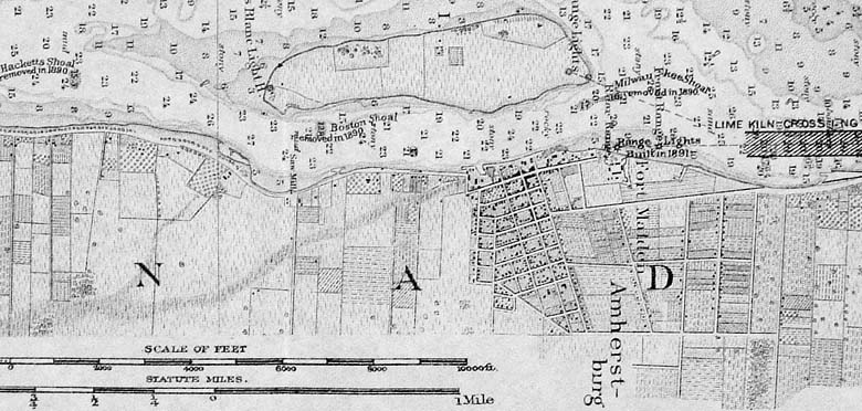
Lime Kiln Crossing on the Detroit River Area covered: Trenton, Gibraltar, Gross Isle (Michigan) - Amherstburg, Canada US Army Engineers 1892 Litho size: 750 x 460 mm Detail1 Detail2 Antique Map Ref IFM214 £24.00 (+P&P) click image for enlargement |
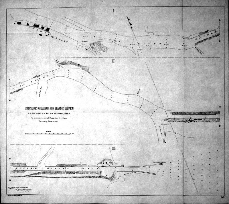 |
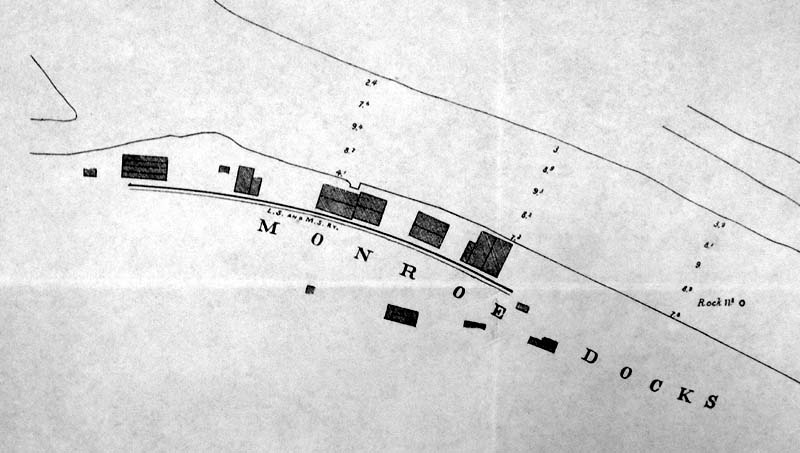
Monroe Harbor and Raisin River, Michigan US Army Engineers 1892 Litho size: 550 x 570 mm Antique Map Ref IFM249 £22.00 (+P&P) click image for enlargement Detail1 Detail2 |
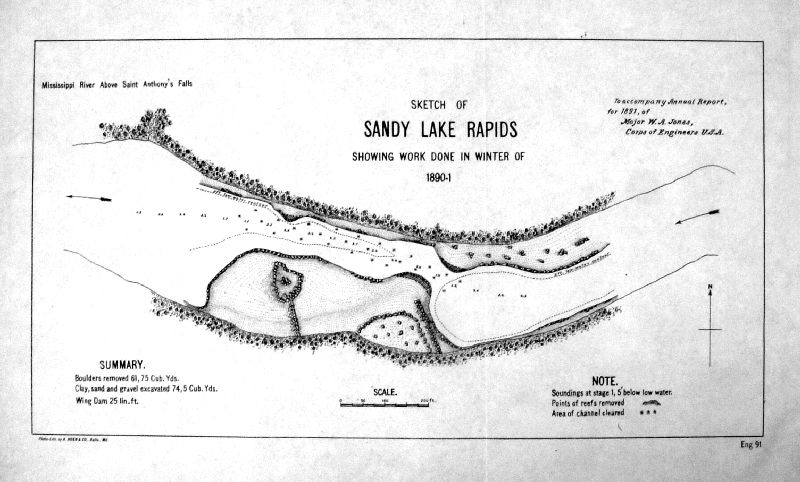 |
Sandy Lake Rapids, Mississippi
River Mississippi River above St Anthony's Falls (Minneapolis), Minnesota ( This is an indication that the location is somewhere upstream of Minneapolis ) US Army Engineers 1892 Litho size: 300 x 170 mm Antique Map Ref IFM190 £12.00 (+P&P) click image for enlargement |
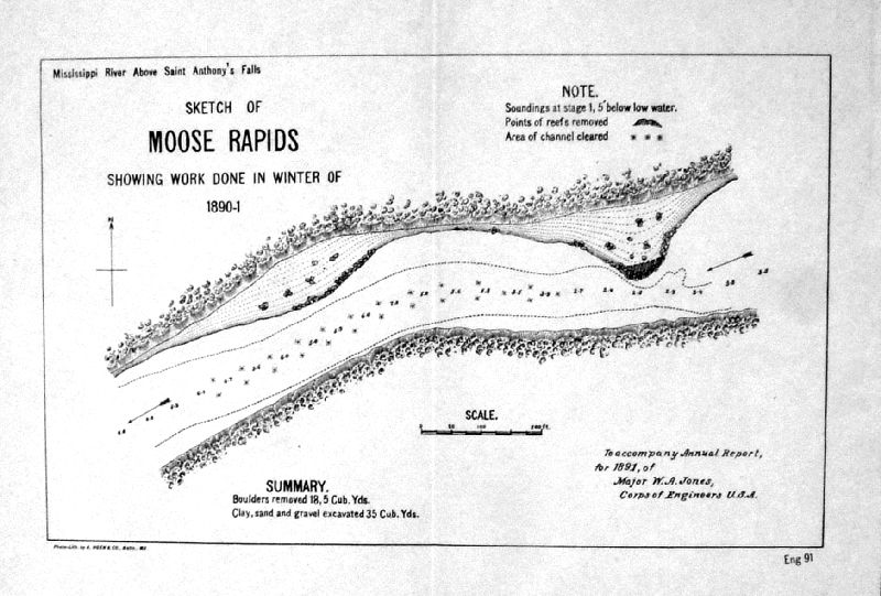 |
Moose Rapids, Mississippi River Mississippi River above St Anthony's Falls (Minneapolis), Minnesota ( This is an indication that the location is somewhere upstream of Minneapolis ) US Army Engineers 1892 Litho size: 240 x 160 mm Antique Map Ref IFM189 £12.00 (+P&P) click image for enlargement |
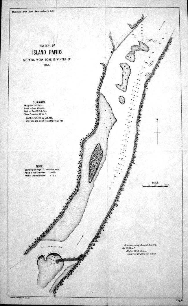 |
Island Rapids, Mississippi
River Mississippi River above St Anthony's Falls (Minneapolis), Minnesota ( This is an indication that the location is somewhere upstream of Minneapolis ) US Army Engineers 1892 Litho size: 250 x 400 mm Antique Map Ref IFM188 £12.00 (+P&P) click image for enlargement |
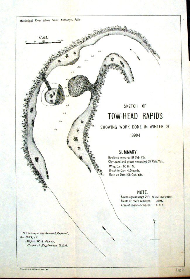 |
Tow Head Rapids,
Mississippi
River Mississippi River above St Anthony's Falls (Minneapolis), Minnesota ( This is an indication that the location is somewhere upstream of Minneapolis ) US Army Engineers 1892 Litho size: 180 x 240 mm Antique Map Ref IFM187 £12.00 (+P&P) click image for enlargement |
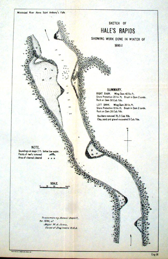 |
Hale's Rapids, Mississippi
River Mississippi River above St Anthony's Falls (Minneapolis), Minnesota ( This is an indication that the location is somewhere upstream of Minneapolis ) US Army Engineers 1892 Litho size: 200 x 300 mm Antique Map Ref IFM186 £12.00 (+P&P) click image for enlargement |
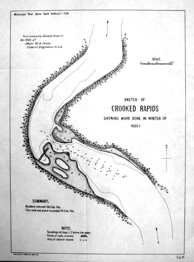 |
Crooked Rapids, Mississippi
River Mississippi River above St Anthony's Falls (Minneapolis), Minnesota ( This is an indication that the location is somewhere upstream of Minneapolis ) US Army Engineers 1892 Litho size: 210 x 270 mm Antique Map Ref IFM192 £12.00 (+P&P) click image for enlargement |
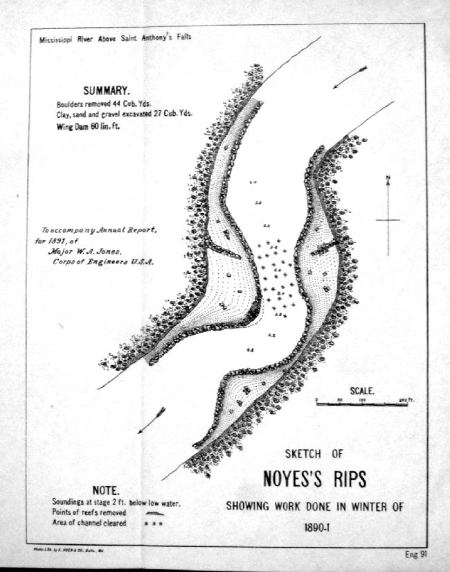 |
Noyes's Rip, Mississippi River Mississippi River above St Anthony's Falls (Minneapolis), Minnesota ( This is an indication that the location is somewhere upstream of Minneapolis ) US Army Engineers 1892 Litho size: 180 x 200 mm Antique Map Ref IFM194 £12.00 (+P&P) click image for enlargement |
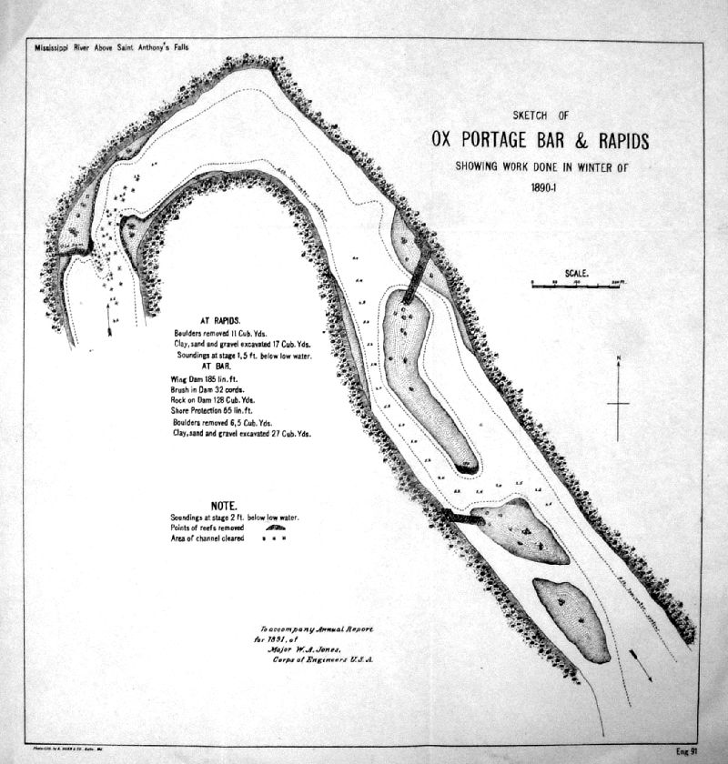 |
Ox Portage Bar & Rapids, Mississippi
River Mississippi River above St Anthony's Falls (Minneapolis), Minnesota ( This is an indication that the location is somewhere upstream of Minneapolis ) US Army Engineers 1892 Litho size: 270 x 280 mm Antique Map Ref IFM191 £12.00 (+P&P) click image for enlargement |
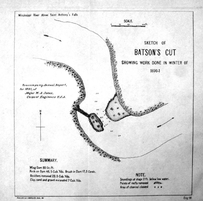 |
Batson's Cut, Mississippi River Mississippi River above St Anthony's Falls (Minneapolis), Minnesota ( This is an indication that the location is somewhere upstream of Minneapolis ) US Army Engineers 1892 Litho size: 200 x 200 mm Antique Map Ref IFM193 £12.00 (+P&P) click image for enlargement |
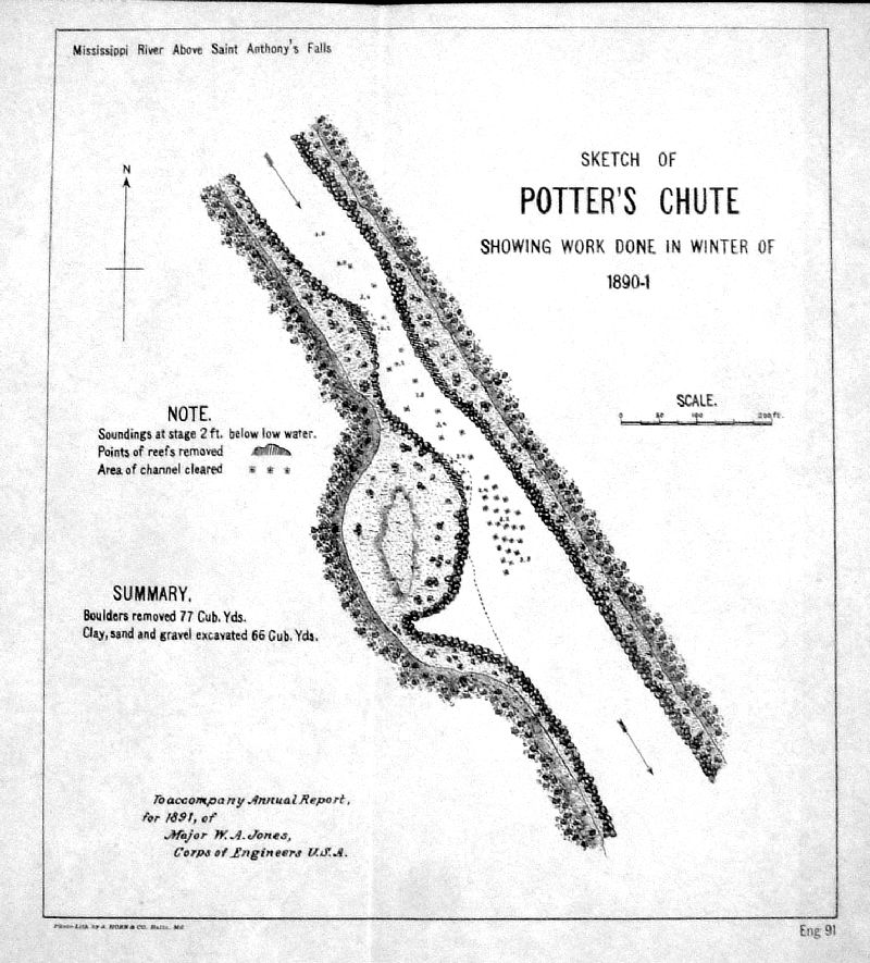 |
Potter's Shute, Mississippi River Mississippi River above St Anthony's Falls (Minneapolis), Minnesota ( This is an indication that the location is somewhere upstream of Minneapolis ) US Army Engineers 1892 Litho size: 200 x 210 mm Antique Map Ref IFM185 £12.00 (+P&P) click image for enlargement |
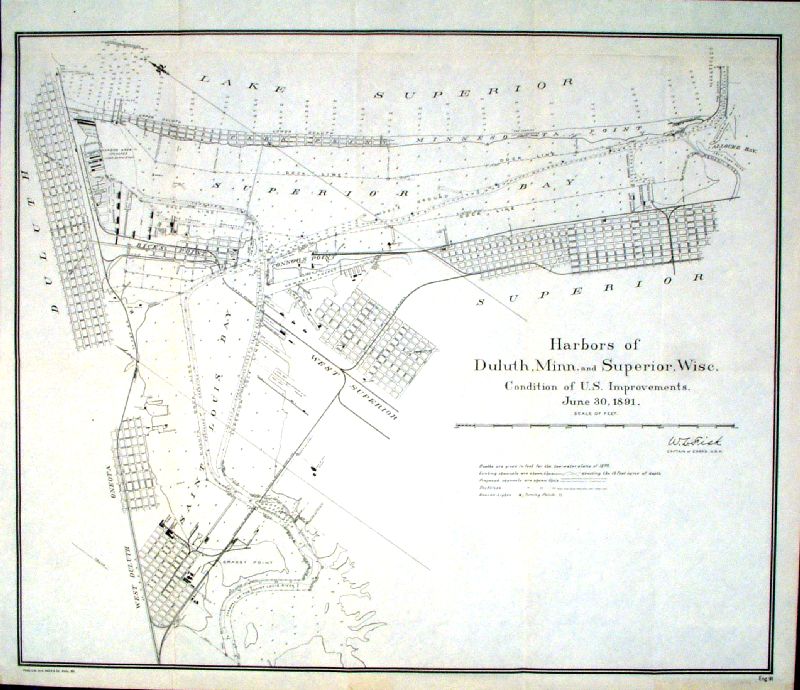 |
Harbors of Duluth, Minn and Superior, Wisc US Army Engineers 1892 Litho size: 510 x 430 mm Antique Map Ref IFM197 £24.00 (+P&P) click image for enlargement Detail1 |
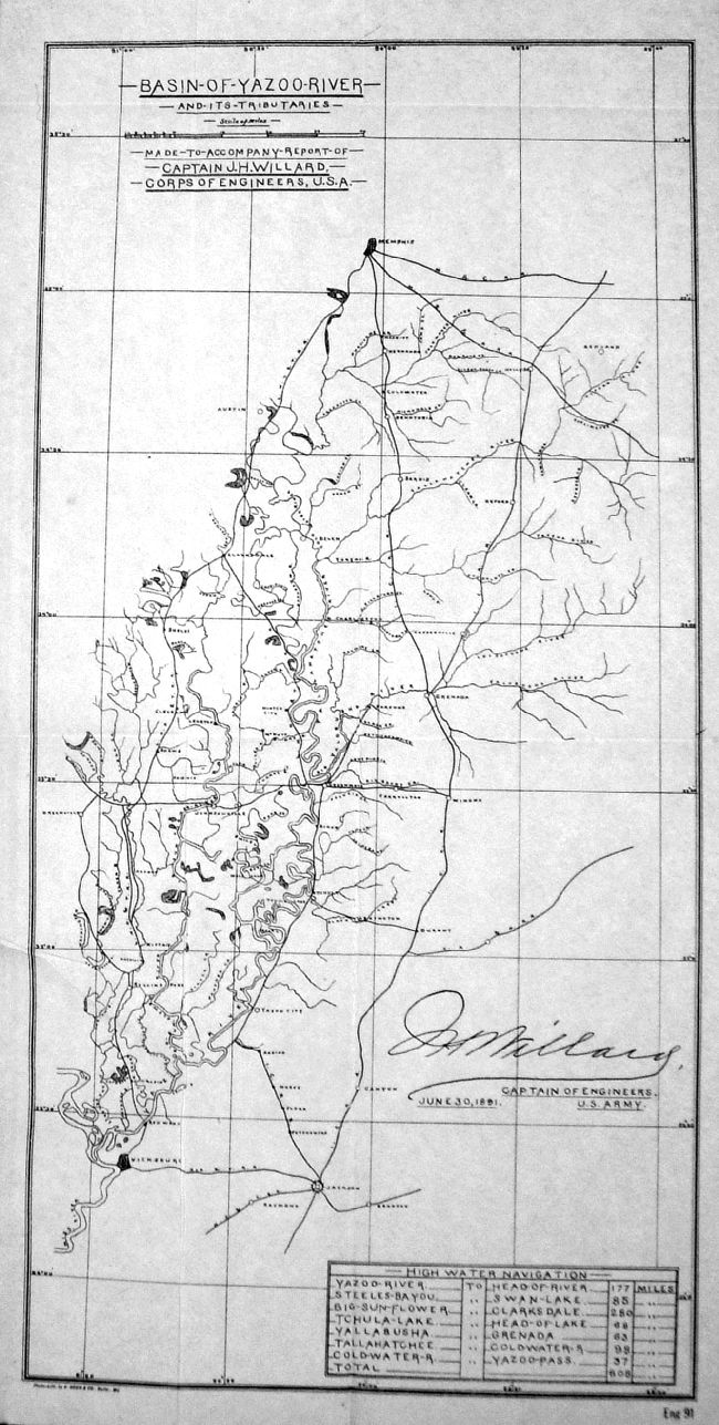 |
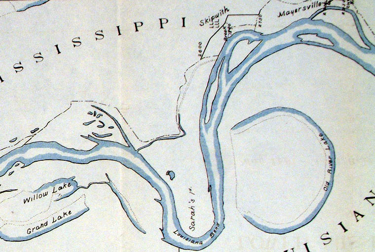
Basin of the Yazoo River, Mississippi
( 2 sheets) Covers area: Memphis (TN), Clarksdale, Greenwood, Yazoo, Vicksburg, Jackson US Army Engineers 1892 Litho Sheet 1 size: 230 x 440 mm Detail Small crease at left of sheet 1 Sheet 2 size: 600 x 230 mm Antique Map Ref IFM179 £25.00 (+P&P) click image for enlargement |
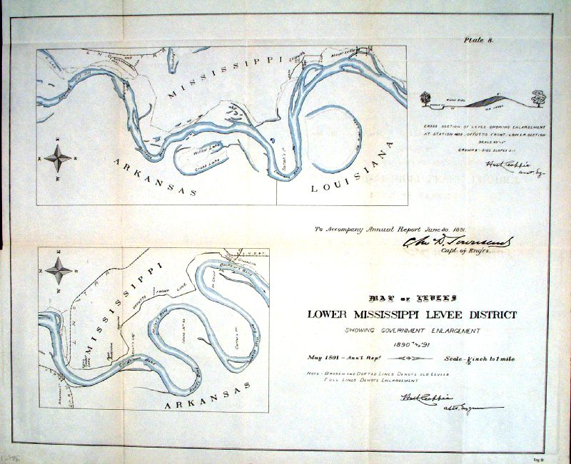 |
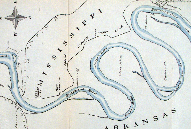
Lower Mississippi Levee District,
Mississippi (also borders Arkansas and Louisiana) US Army Engineers 1892 Litho size: 530 x 440 mm Antique Map Ref IFM159 £24.00 (+P&P) click image for enlargement Detail1 Detail2 |
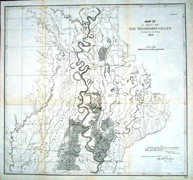 |
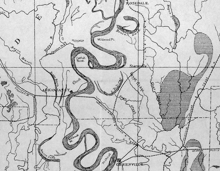
Map of part of the Mississippi Valley,
Mississippi / Arkansas shows flood plane area shaded. US Army Engineers 1892 Litho size: 510 x 470 mm Antique Map Ref IFM160 £22.00 (+P&P) click image for enlargement Detail1 Detail2 |
 |
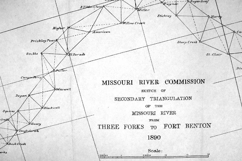
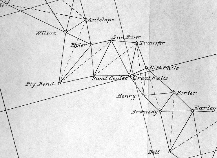
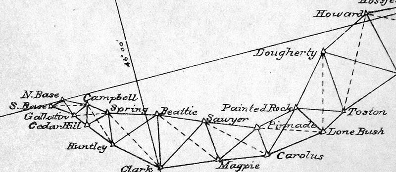
Secondary Triangulation of the Missouiri
River in
8 sheets US Army Engineers 1892 Sheet 1 - Tree Forks to Fort Benton (Montana) Sheet 2 - Frot Benton to Trovers Point (Montana) Sheet 3 - Trovers Point to Fort Buford (South Dakota) Sheet 4 - Fort Buford to Bismark (South Dakota) Sheet 5 - Bismark to Pierre (South Dakota) Sheet 6 - Pierre to Running Water (Nebraska) Sheet 7 - Running Water to Blair (Nebraska) Sheet 8 - Blair to Levenworth (Kansas) Litho size: 640 x 210 mm (sheet 1), other sheets various, but similar sizes. Antique Map Ref IFM163 ( 8 sheets) £30.00 (+P&P) click image for enlargement Detail 1 Detail 2 Detail 3 |
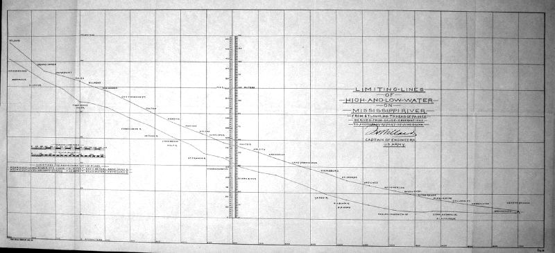 |
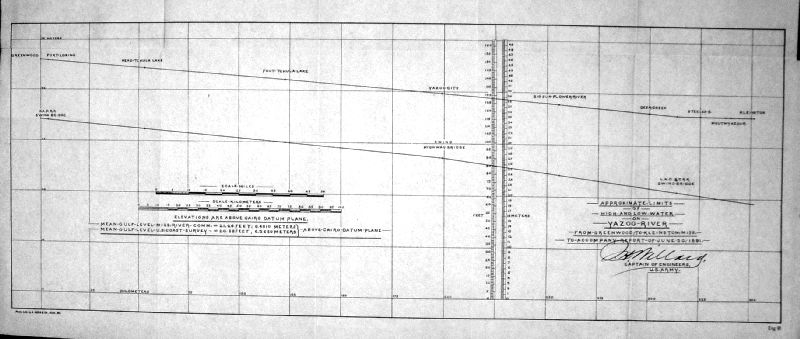
Limiting Lines of High and Low water on
Mississippi
River from St Louis,MO to Head of Passes (Sea) US Army Engineers 1892 Litho size: 810 x 360 mm Detail Antique Map Ref IFM181 £18.00 (+P&P) click image for enlargement |
 |
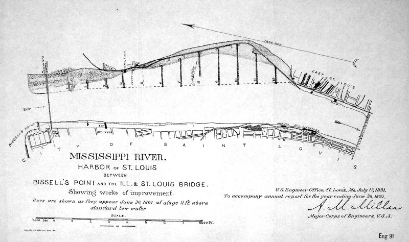
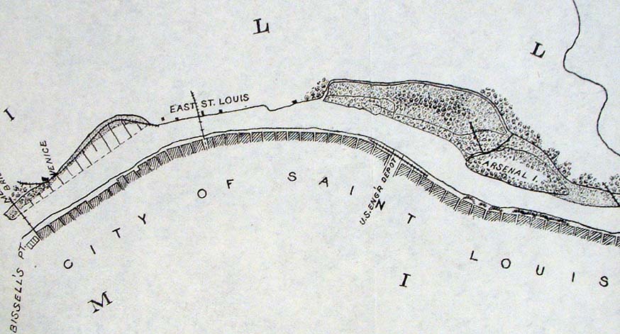
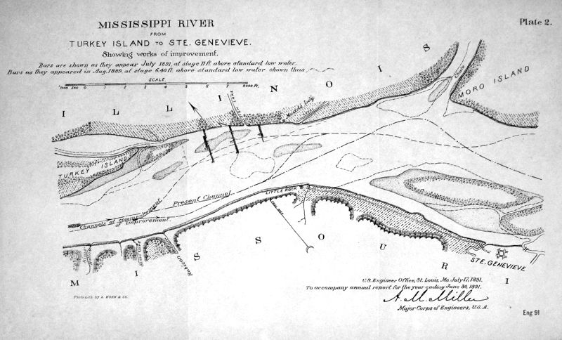
Missouiri River at St Louis and Sainte Genevieve
in
2 sheets US Army Engineers 1892 Sheet 1 - St Louis region Detail size: 560 x 220 mm Sheet 2 - Sainte Genevieve region size: 350 x 220 mm Antique Map Ref IFM182 ( 2 sheets) £30.00 (+P&P) click image for enlargement |
 |
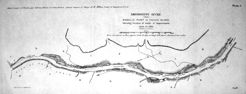
Mississippi River Harbor or St Louis, Missouri US Army Engineers 1892 Litho size: 340 x 200 mm Antique Map Ref IFM183 £20.00 (+P&P) click image for enlargement |
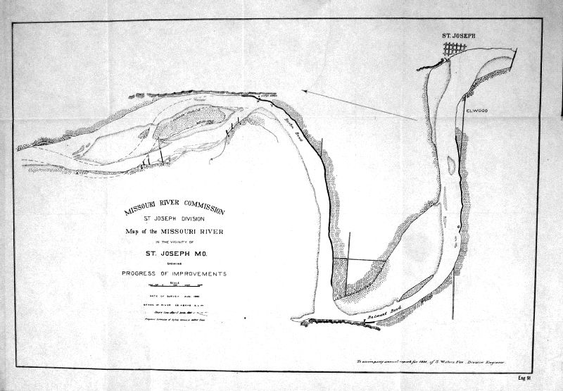 |
Missouri River in the Vicinity of St Joseph,
Missouri US Army Engineers 1892 Litho size: 420 x 290 mm Antique Map Ref IFM168 £20.00 (+P&P) click image for enlargement |
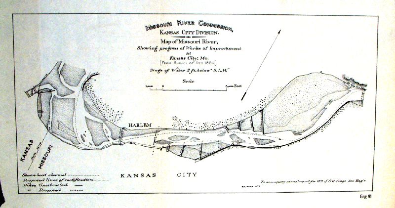 |
Missouri River at Kansas City, Missouri US Army Engineers 1892 Litho size: 290 x 160 mm Antique Map Ref IFM169 £18.00 (+P&P) click image for enlargement |
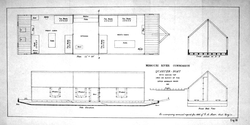 |
Plan of Quarter Boat used on Survey of Upper
Missouri
River 1890 US Army Engineers 1892 Litho size: 420 x 210 mm Antique Map Ref IFM162 £18.00 (+P&P) click image for enlargement |
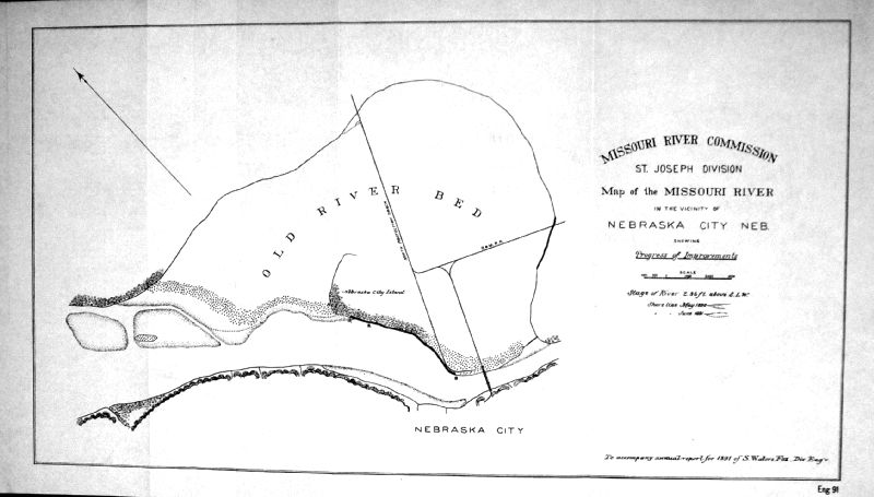 |
Missouri River in the Vicinity of Nebraska City,
Nebraska US Army Engineers 1894 Litho size: 380 x 220 mm Antique Map Ref IFM165 £18.00 (+P&P) click image for enlargement |
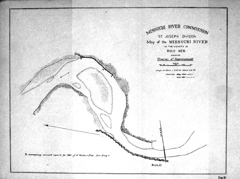 |
Missouri River in the Vicinity of Rulo, Nebraska (Southern Nebraska, close to Kansas border) US Army Engineers 1892 Litho size: 290 x 220 mm Antique Map Ref IFM166 £16.00 (+P&P) click image for enlargement |
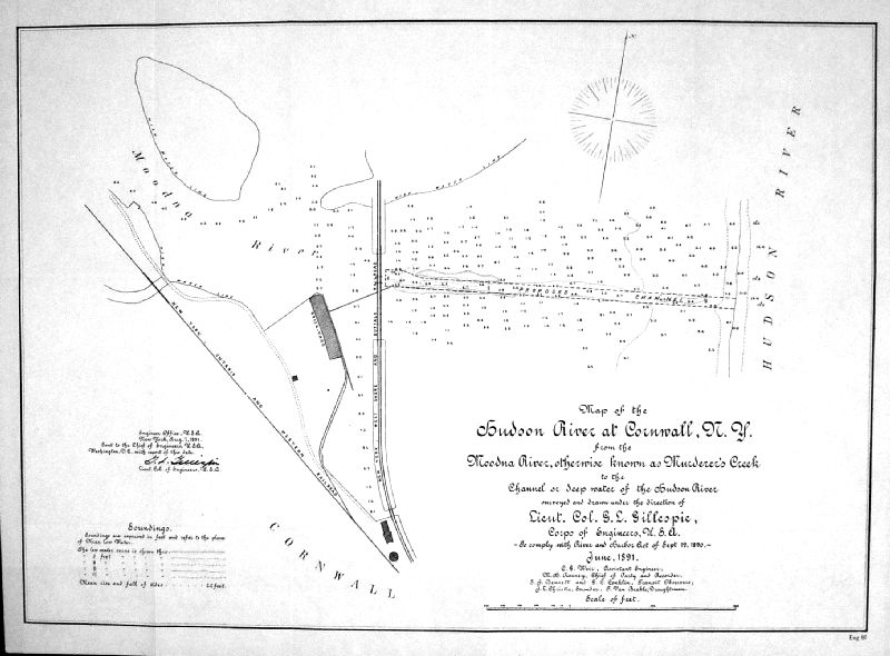 |
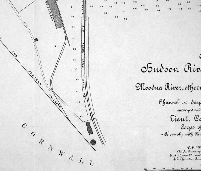
Hudson River at Cornwall, NJ from the Moodna River, otherwise known as Murderer's Creek to the channel, or deep water, of the Hudson River Thought to be Moodna Creek near Cornwall-On-Hudson / Cornwall Landing, near New Windsor US Army Engineers 1892 Survey of Soundings and proposed dredging Litho size: 470 x 350 mm Detail Antique Map Ref IFM154 £18.00 (+P&P) click image for enlargement |
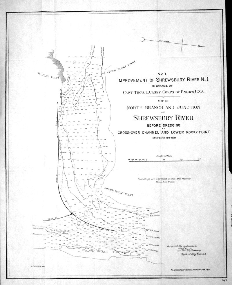 |
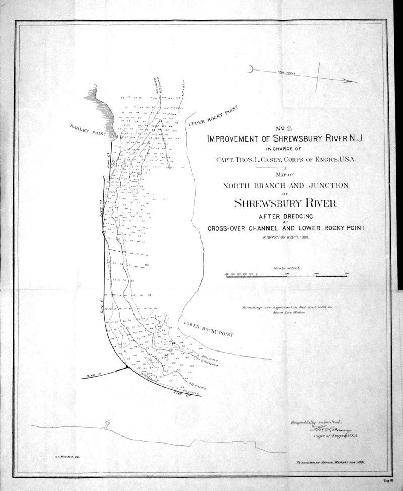
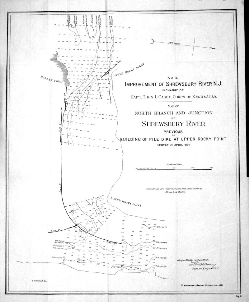
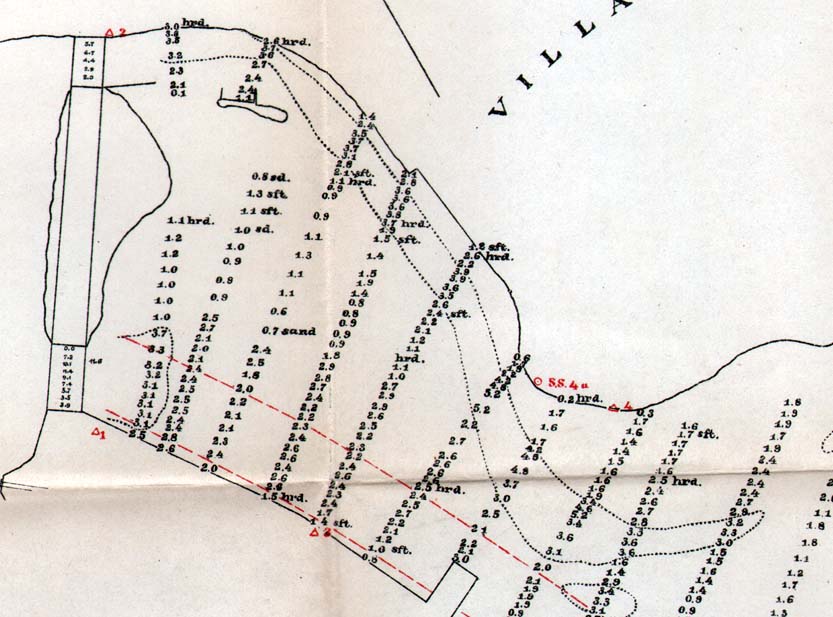
North Branch and Junction of Shrewsbury River, NJ
( 3 sheets ) US Army Engineers 1892 River location: Upper Rocky Point, Lower Rocky Point, Barley Point in the modern setting between Seabright, Monmouth Beach, Rumson, NJ Sheet 1 - Before Dredging 410 x 500mm Sheet 2 - After Dredging 410 x 500mm Sheet 3 - Building of Pile Dyke 410 x 500mm Antique Map Ref IFM129 (3 sheets) £25.00 (+P&P) click image for enlargement |
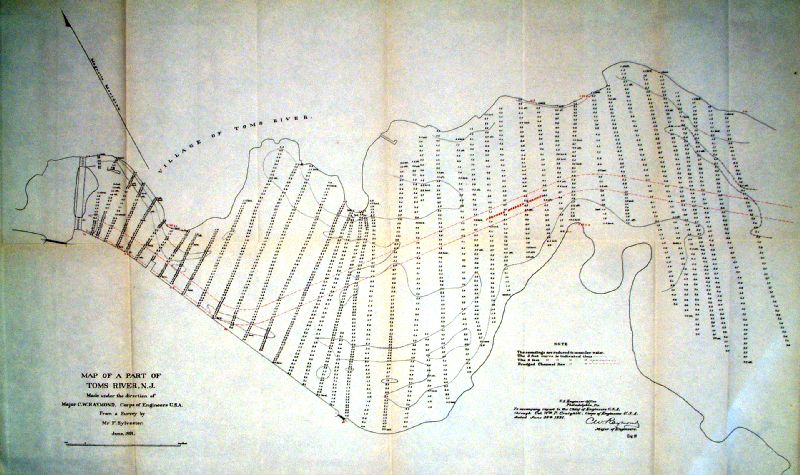 |
Part of Toms River, NJ US Army Engineers 1894 Survey of Soundings and proposed dredging. Litho size: 700 x 420 mm Detail Antique Map Ref IFM126 £18.00 (+P&P) click image for enlargement |
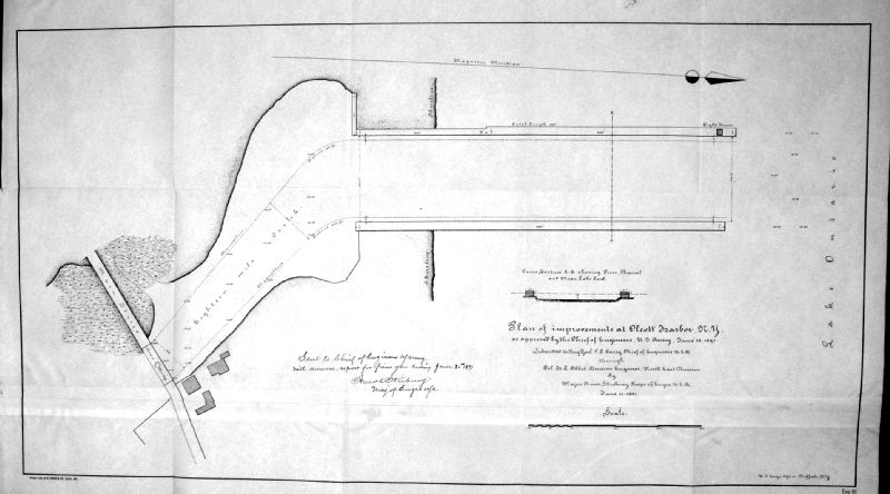 |
Olcott Harbor, New York ( on
Lake
Ontario) US Army Engineers 1892 Litho size: 580 x 330 mm Antique Map Ref IFM226 £18.00 (+P&P) click image for enlargement |
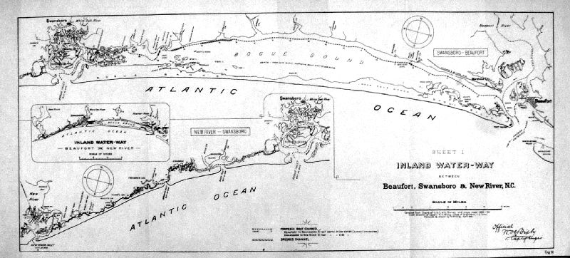 |
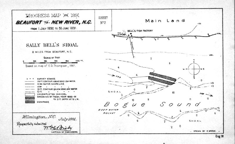
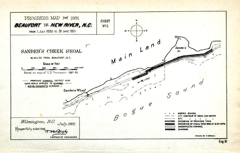
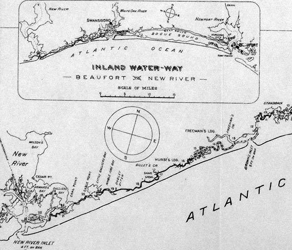
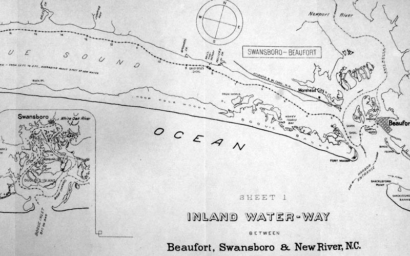
Inland Waterway between Beaufort, Swansboro &
New
River, NC ( 3 sheets) US Army Engineers 1892 Litho size: 470 x 210 mm Sheet 2 Sally Bell's Shoal size: 210 x 130mm Sheet 3 Sander's Creek Shoal size: 210 x 130mm Antique Map Ref IFM140 ( 3 sheets ) £28.00 (+P&P) click image for enlargement Detail1 Detail2 |
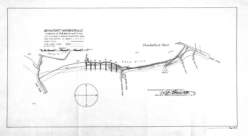 |
Beaufort Harbor, NC US Army Engineers 1894 Harbor improvements and stone jetties. Litho by Friedenwald size: 400 x 210 mm Antique Map Ref IFM105 £20.00 (+P&P) click image for enlargement |
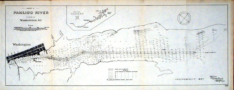 |
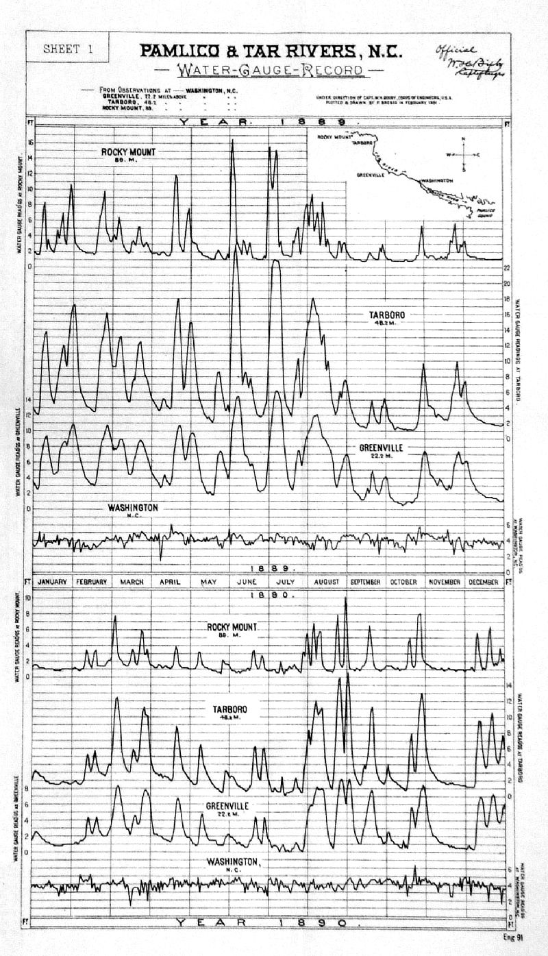
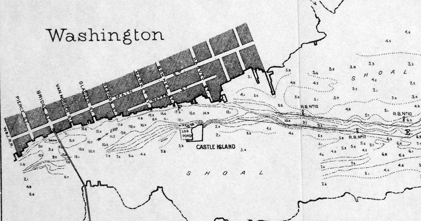
Pamlico River, Washington, North Carolina
( 3 sheets ) US Army Engineers 1892 Sheet 1 - 570 x 220mm - chart of Water Gauge Record 210 x 360mm Sheet 3 - Pamlico & Tar Rivers 220 x 130mm Antique Map Ref IFM138 (3 sheets) £25.00 (+P&P) click image for enlargement Detail |
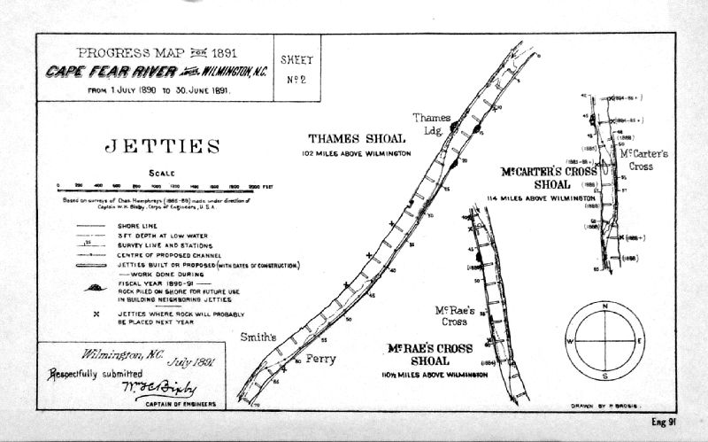 |
Cape Fear River, NC, above Wilmington,
NC (
2 sheets) US Army Engineers 1892 Survey for Jetties at Thames Shoal, McRaes Cross Shoal and McCarters Shoal Water Gauge Record for 1888 - 1890 Litho Sheet 1 Water Gauge Record size: 210 x 400 mm Sheet 2 Jetties at Shoals ... size: 210 x 140 mm Antique Map Ref IFM142 ( 2 sheets) £22.00 (+P&P) click image for enlargement |
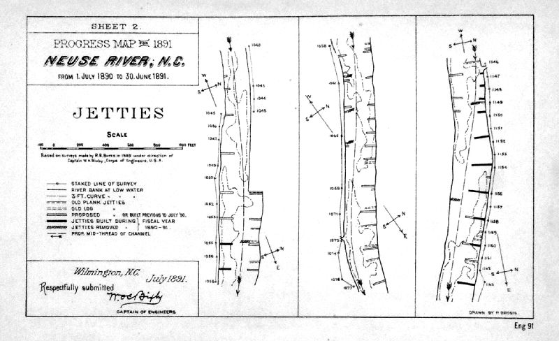 |
Neuse River
Jetties, NC Thought to be in the Goldsboro vicinity US Army Engineers 1892 Litho size: 220 x 130 mm Antique Map Ref IFM139 £15.00 (+P&P) click image for enlargement |
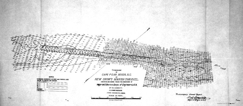 |
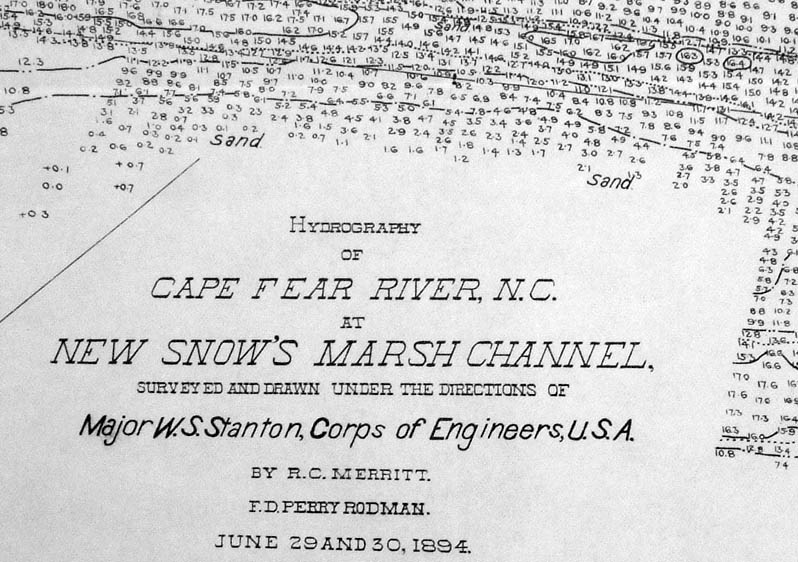
Hydrography of Cape Fear River, NC, at New Snow's
Marsh
Channel US Army Engineers 1894 Survey for dredging. Line of dredging cut clearly seen on plan. Thought to be 'Snows Cut' at Carolina Beach, south of Wilmington, NC. Litho by Friedenwald size: 830 x 450 mm Antique Map Ref IFM110 £28.00 (+P&P) click image for enlargement Detail |
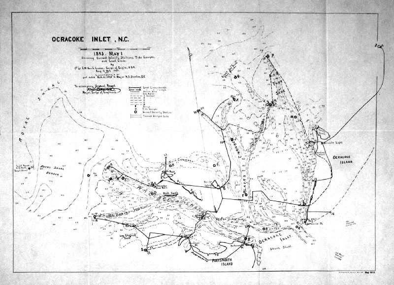 |
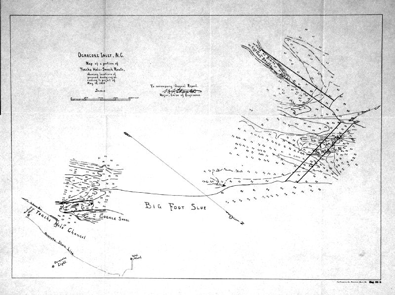
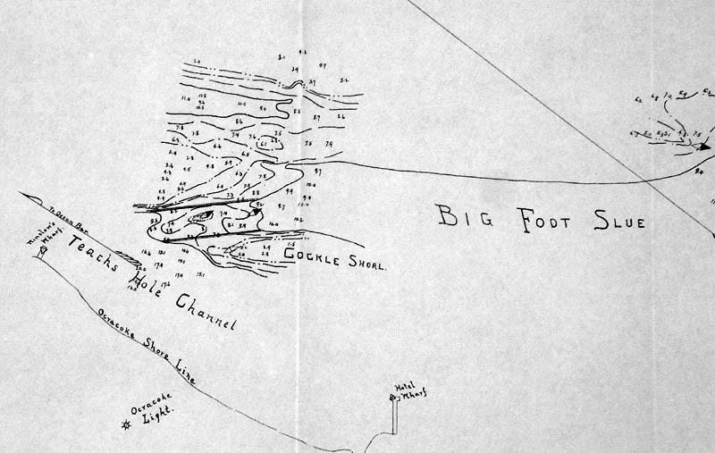
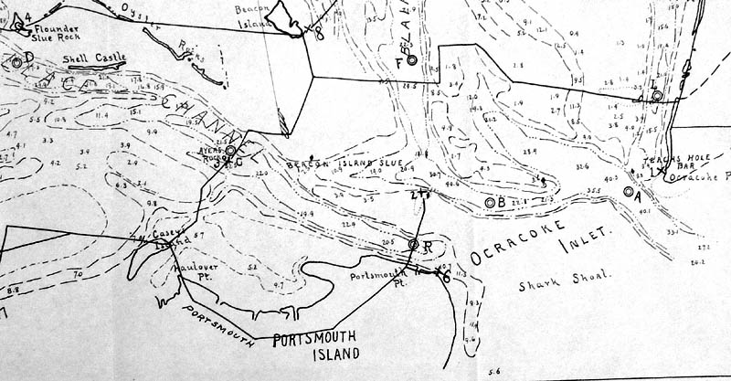
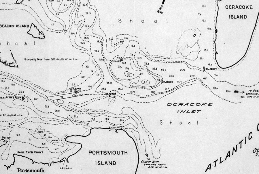
Ocrocoke Inlet, NC ( 2 sheets
) US Army Engineers 1894 Litho by Friedenwald size: 510 x 370 mm (sheet 1), Sheet 2 - Portion of Teaches Hole - Swash Route - 440 x 320mm Antique Map Ref IFM108 (2 sheets) £28.00 (+P&P) click image for enlargement Detail1 Detail2 |
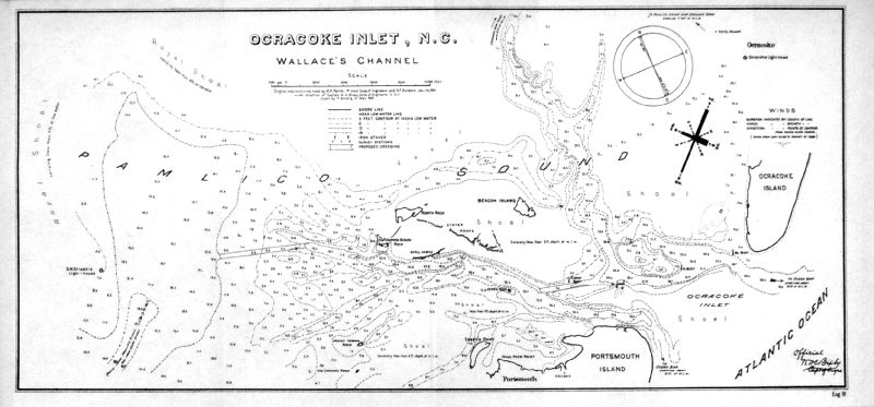 |
Ocrocoke Inlet, NC - Wallace's Channel US Army Engineers 1892 Survey showing proposed dredging Litho size: 450 x 220 mm Antique Map Ref IFM137 £25.00 (+P&P) click image for enlargement Detail1 |
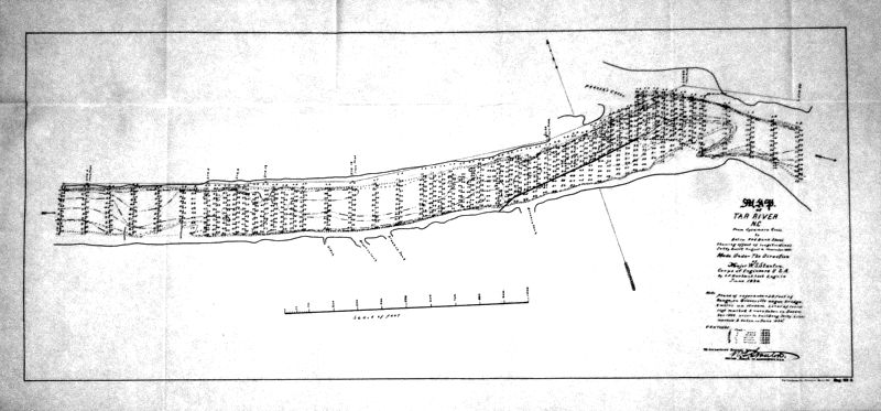 |
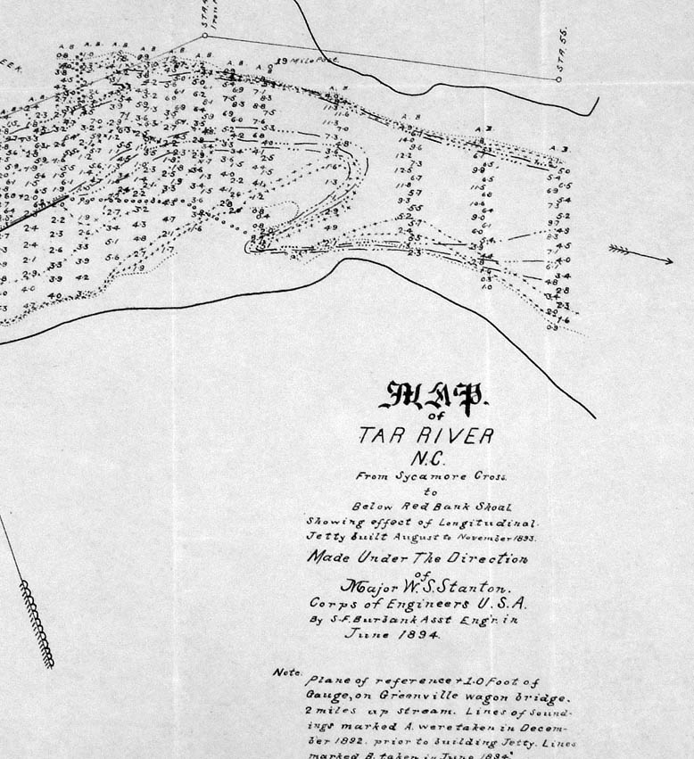
Map of Tar River, NC, from Sycamore Cross to below
Red
Bank US Army Engineers 1894 Tar River in the vacinity of Greenville, NC. Map indicates a 'Parker's Creek' Google Maps show a 'Parker's Landing' Litho by Friedenwald size: 830 x 450 mm Antique Map Ref IFM109 £25.00 (+P&P) click image for enlargement Detail |
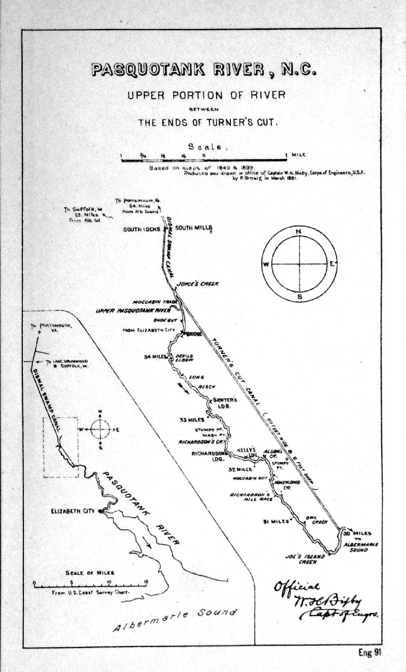 |
Pasquotank River, NC Upper Portion of River between the ends of Turner's Cut US Army Engineers 1892 Litho size: 140 x 220 mm Antique Map Ref IFM135 £18.00 (+P&P) click image for enlargement |
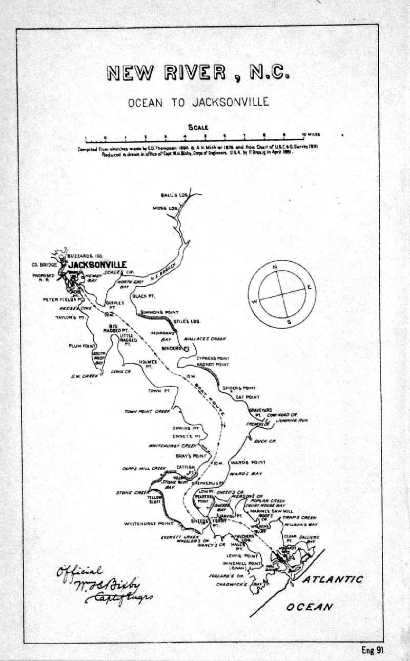 |
New River, NC Ocean to
Jacksonville US Army Engineers 1892 Litho size: 140 x 220 mm Antique Map Ref IFM141 £18.00 (+P&P) click image for enlargement |
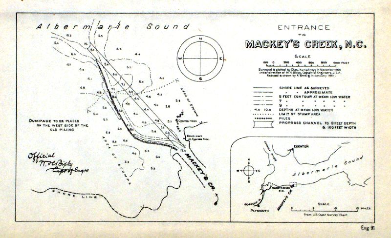 |
Entrance to Mackey's Creek, NC US Army Engineers 1892 Survey for dredging. Litho size: 220 x 130 mm Antique Map Ref IFM136 £18.00 (+P&P) click image for enlargement |
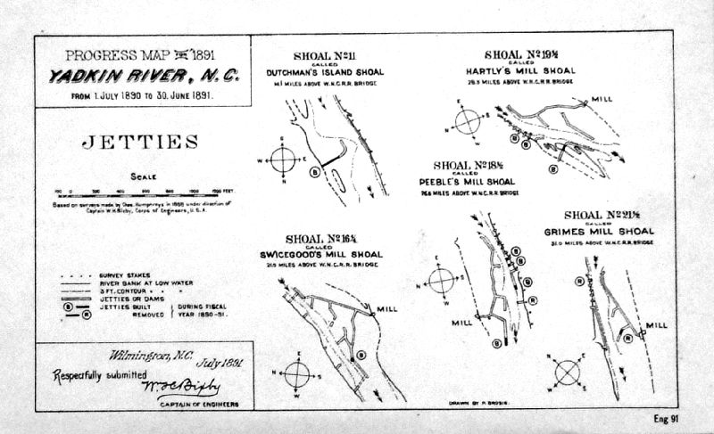 |
Yadkin River NC US Army Engineers 1892 Progress maps at Dutchman's Island, Hartly's Mill, Peeble's Mill, Swicegood's Mill, Grime's Mill Litho size: 220 x 130 mm Antique Map Ref IFM144 £15.00 (+P&P) click image for enlargement |
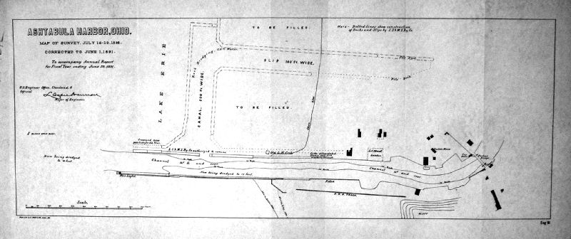 |
Ashtabula Harbor, Ohio US Army Engineers 1892 Litho by Hoen size: 480 x 190 mm Antique Map Ref IFM212 £15.00 (+P&P) Detail click image for enlargement |
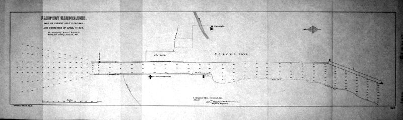 |
Fairport Harbor, Ohio US Army Engineers 1892 Litho by Hoen size: 700 x 190 mm Antique Map Ref IFM213 £15.00 (+P&P) click image for enlargement |
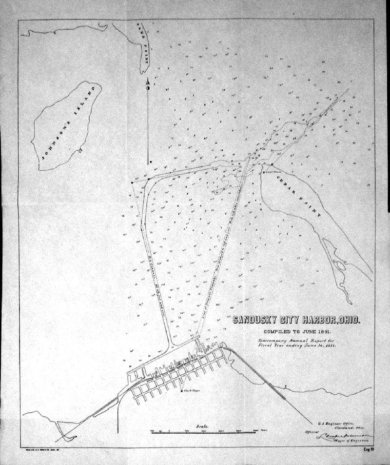 |
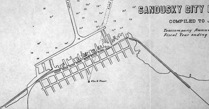
Sandusky City Harbor, Ohio US Army Engineers 1892 Lithograph size: 310 x 360 mm Antique Map Ref IFM246 £18.00 (+P&P) click image for enlargement Detail1 |
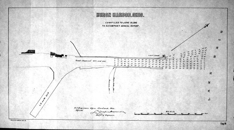 |
Huron Harbor, Ohio US Army Engineers 1892 Lithograph size: 380 x 210 mm Antique Map Ref IFM245 £15.00 (+P&P) click image for enlargement |
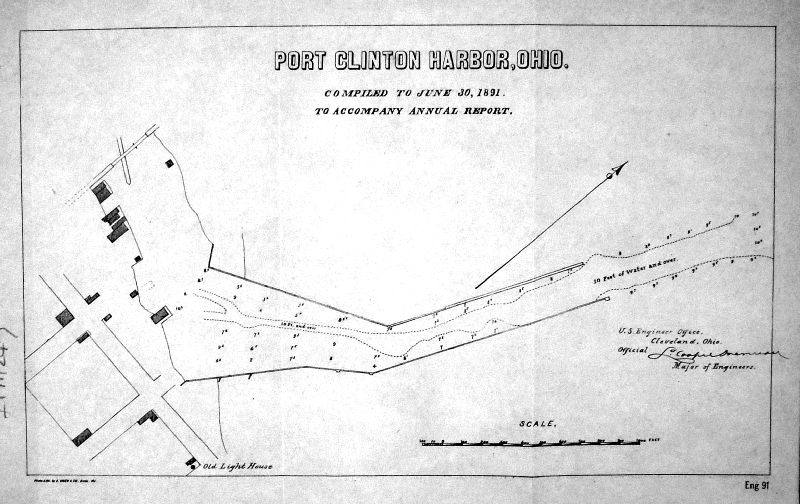 |
Port Clinton Harbor, Ohio US Army Engineers 1892 Lithograph size: 320 x 210 mm Antique Map Ref IFM247 £15.00 (+P&P) click image for enlargement |
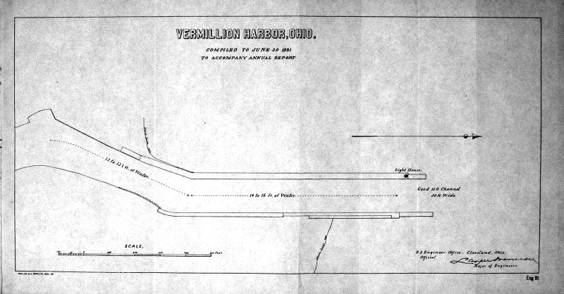 |
Vermillion Harbor, Ohio US Army Engineers 1892 Lithograph size: 410 x 210 mm Antique Map Ref IFM244 £15.00 (+P&P) click image for enlargement |
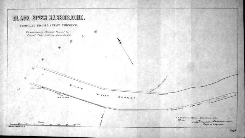 |
Black River Harbor, Ohio US Army Engineers 1892 Lithograph size: 380 x 210 mm Antique Map Ref IFM243 £15.00 (+P&P) click image for enlargement |
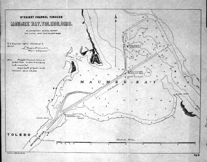 |
Maumee Bay, Toledo, Ohio US Army Engineers 1892 Litho by Hoen size: 300 x 240 mm Antique Map Ref IFM248 £18.00 (+P&P) click image for enlargement Detail |
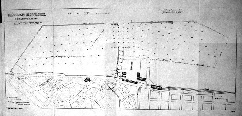 |
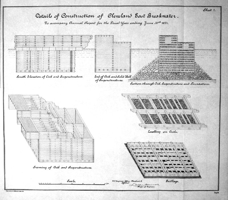
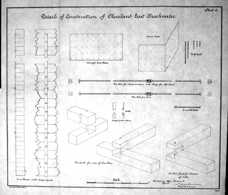
Cleveland Harbor,
Ohio ( 3
sheets) US Army Engineers 1892 Litho by Hoen Sheet 1 - Plan of Harbor size: 540 x 250 mm Sheet 2 - Construction of Breakwater size: 430 x 360 mm Sheet 3 - Construction of Breakwater size: 430 x 360 mm Antique Map Ref IFM242 (3 sheets) £18.00 (+P&P) Detail click image for enlargement |
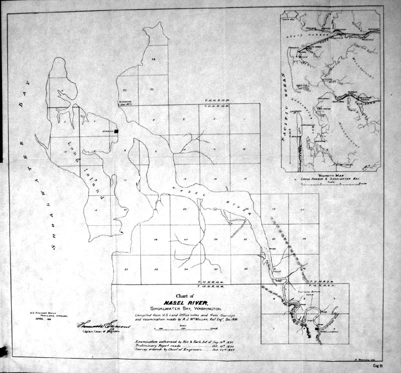 |
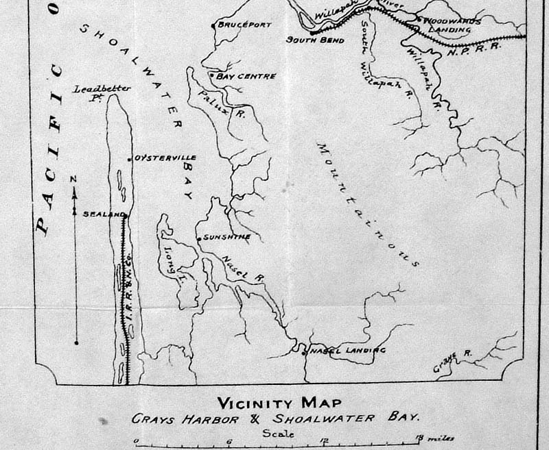
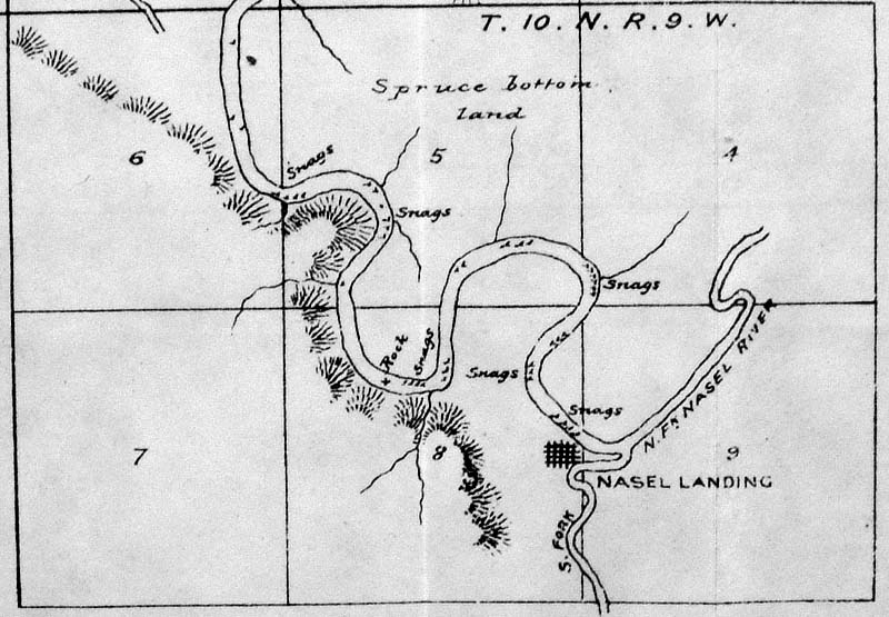
Nasel River, Shoalwater Bay, Oregon (
2
sheets) Today Nalelle / Willapa Bay US Army Engineers 1892 Lithograph size: 400 x 370 mm Antique Map Ref IFM230 £22.00 (+P&P) click image for enlargement Detail1 Detail2 Detail3 |
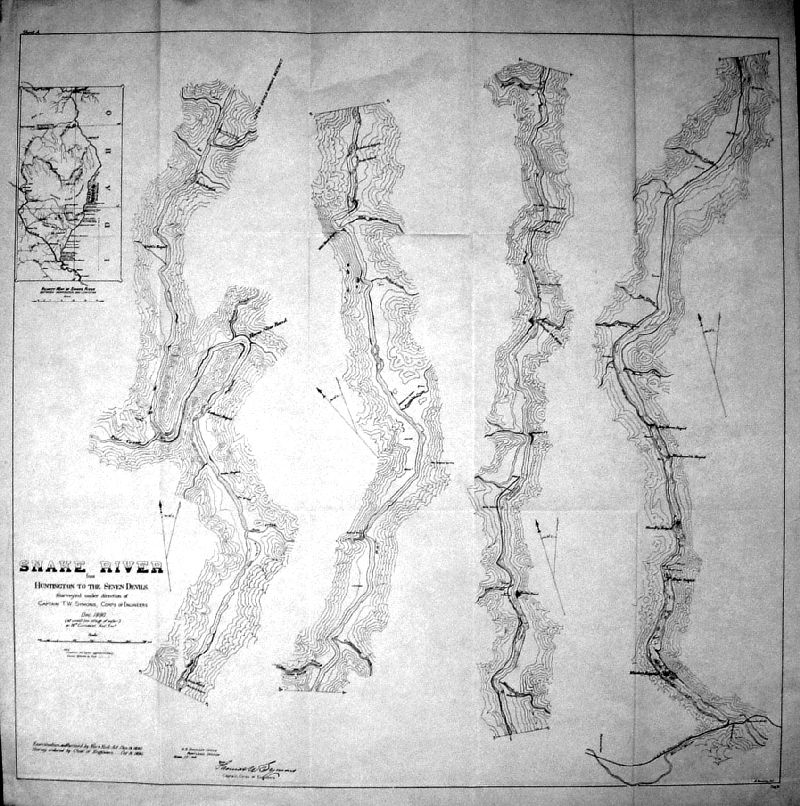 |
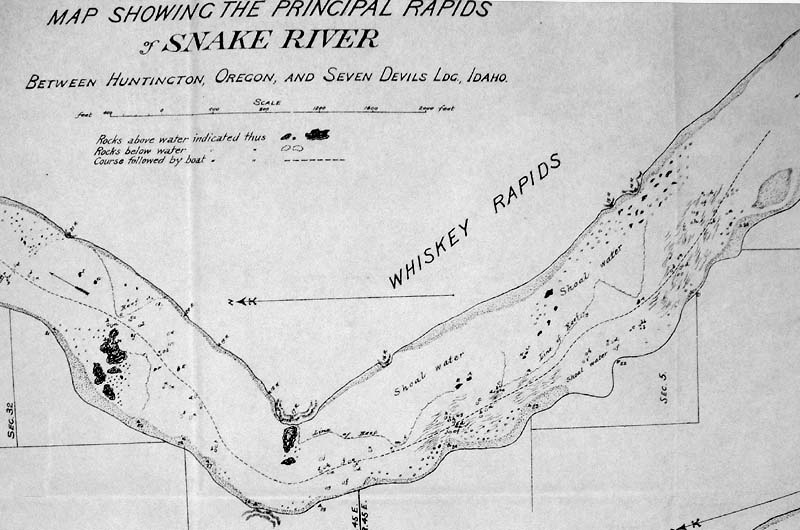
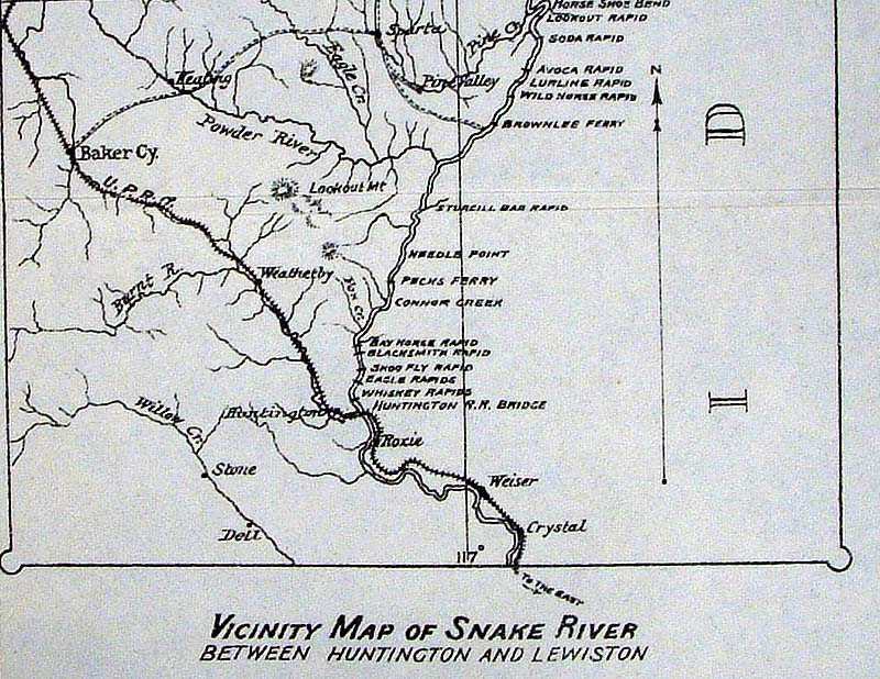
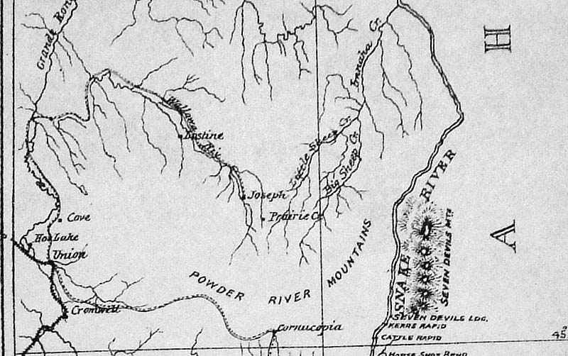
Snake River from Lewiston (Washington) to
Huntington
(Oregon) - 2 sheets Hells Canyon area of Oregon / Idaho US Army Engineers 1892 Lithograph Sheet 1 - Huntigton to Seven Devils size: 570 x 560 mm Sheet 2 - Principal Rapids size: 550 x 350 mm Antique Map Ref IFM231 ( 2 sheets) £28.00 (+P&P) click image for enlargement Detail1 Detail2 Detail3 Detail4 Detail5 |
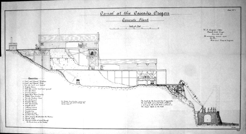 |
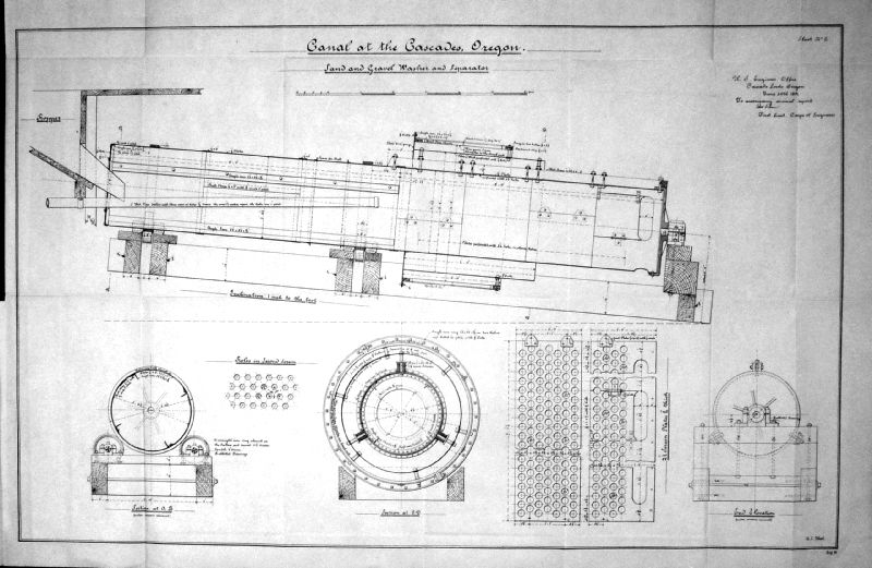
Canal at Cascades
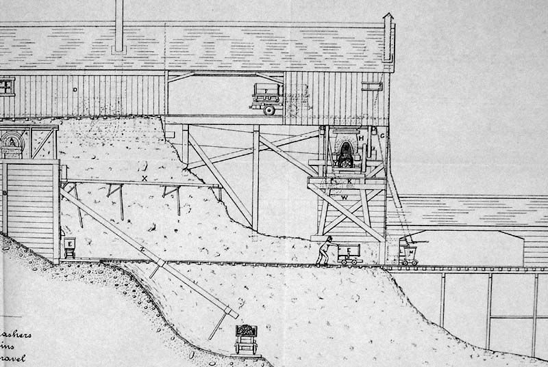
Oregon ( 5 sheets) Plans of the construction work at Cascade Locks between Stevenson and Bonneville on the Columbia River, Oregon US Army Engineers 1892 Lithographs Sheet 1 Concrete Plant size: 650 x 340 mm Sheet 2 Sand & Gravel Washer size: 670 x 430 mm Sheet 3 Concrete Mixing Plant size: 520 x 420 mm Sheet 4 Concrete & Cement cars size: 550 x 360 mm Sheet 5 Concrete Shute size: 470 x 460 mm Antique Map Ref IFM227 £25.00 (+P&P) click image for enlargement Detail1 Detail2 |
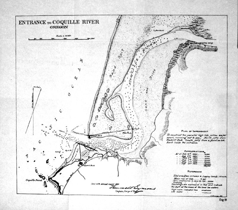 |
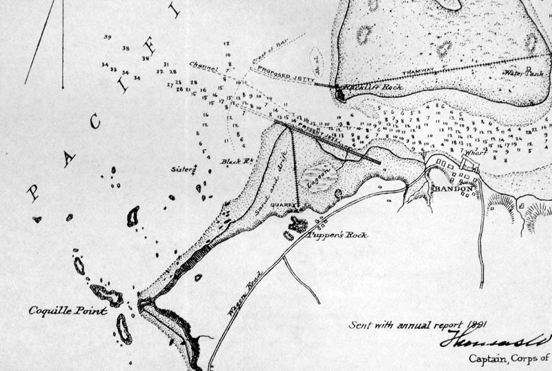
Entrance to Coquile River, Oregon US Army Engineers 1892 Litho size: 290 x 250 mm Detail Antique Map Ref IFM239 £15.00 (+P&P) click image for enlargement |
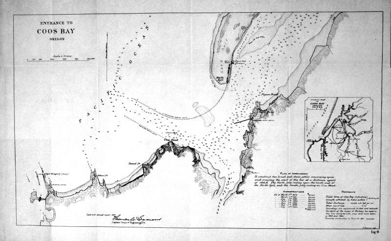 |
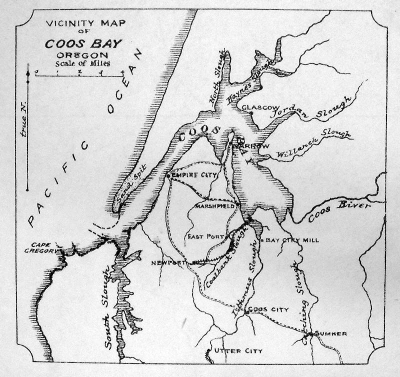
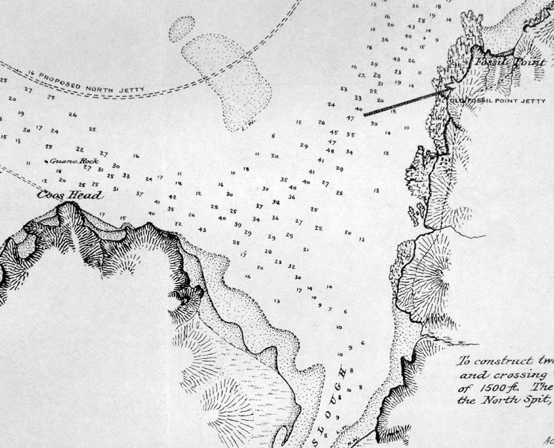
Entrance to Coos Bay, Oregon US Army Engineers 1892 Litho size: 460 x 270 mm Detail1 Detail2 Antique Map Ref IFM238 £18.00 (+P&P) click image for enlargement |
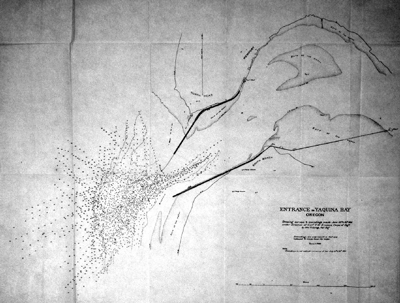 |
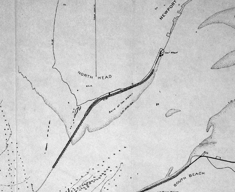
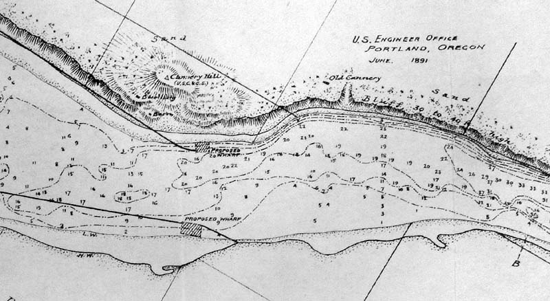
Entrance to Yaquina Bay, Oregon Area covered by Newport and South Beach, Oregon US Army Engineers 1892 Litho size: 600 x 460 mm Detail Antique Map Ref IFM235 £18.00 (+P&P) click image for enlargement |
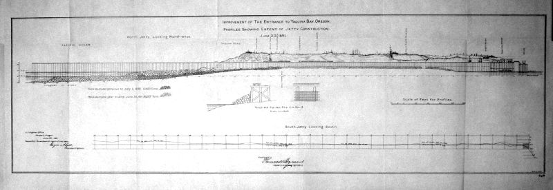 |
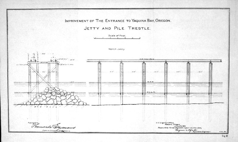
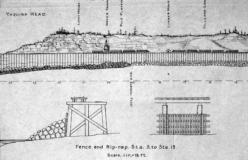
Jetty Improvements at Yaquina Bay ( 2
sheets) Location of Newport, Oregon US Army Engineers 1892 Lithographs Sheet 1 - Profiles of Jetty Construction size: 770 x 240 mm Sheet 2 - Jetty and Pile Trestle size: 330 x 210 mm Antique Map Ref IFM234 (2 sheets) £18.00 (+P&P) Detail click image for enlargement |
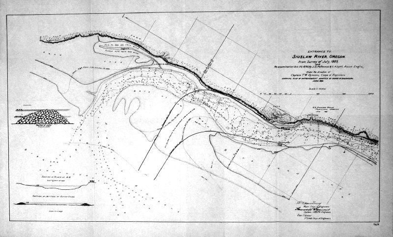 |
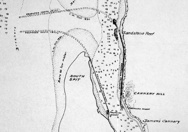
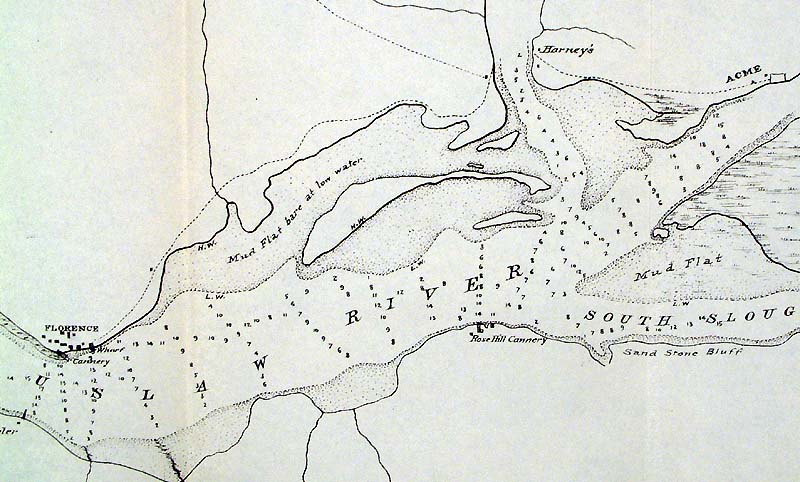
Entrance to Siuslaw River, Oregon Area now covered by Florence, Oregon US Army Engineers 1892 Litho size: 460 x 260 mm Detail1 Antique Map Ref IFM236 £18.00 (+P&P) click image for enlargement |
 |
Entrance to Siuslaw River, Oregon Area now covered by Florence, Oregon US Army Engineers 1892 Litho size: 560 x 590 mm Antique Map Ref IFM237 £26.00 (+P&P) click image for enlargement Detail1 Detail2 |
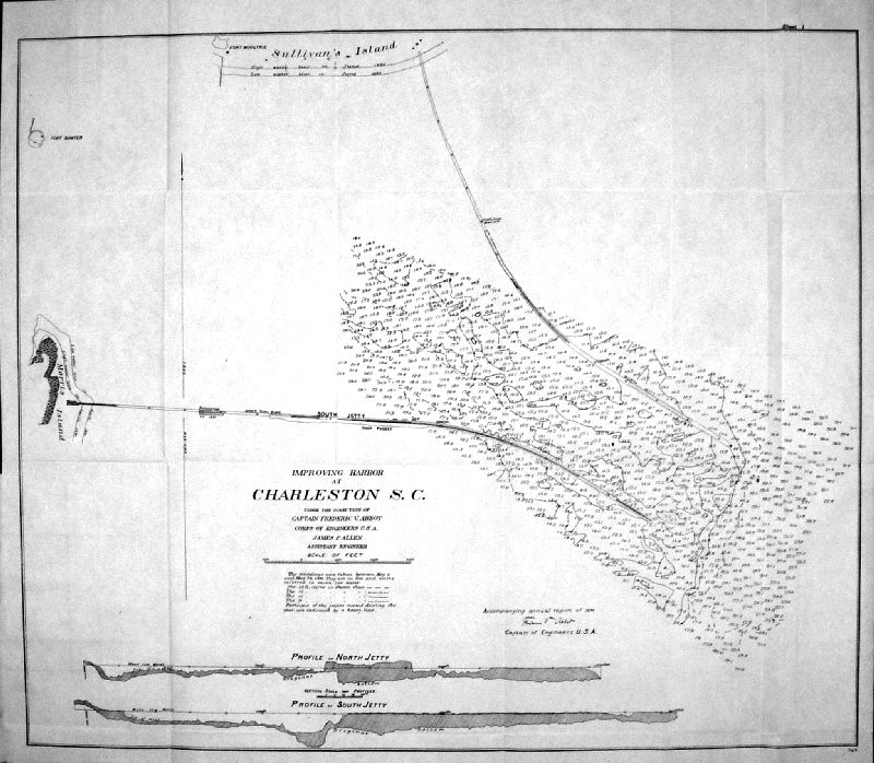 |
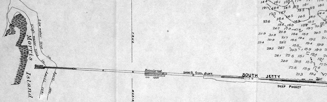
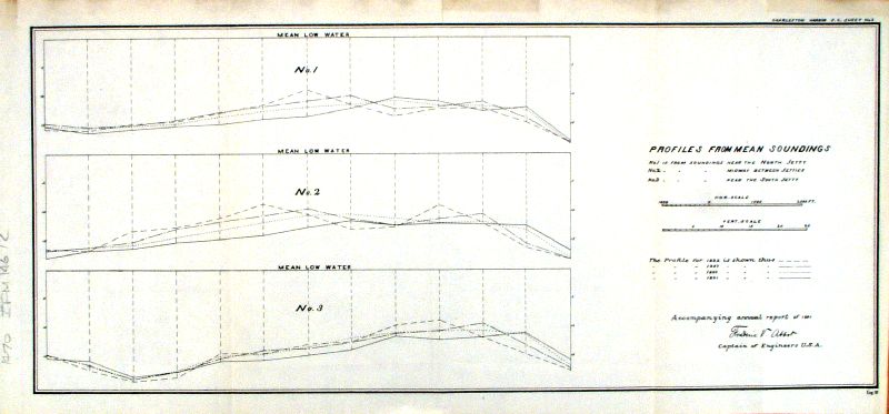
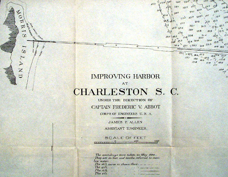
Improving Harbor at Charleston, SC ( 3
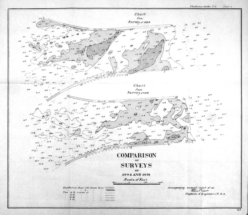
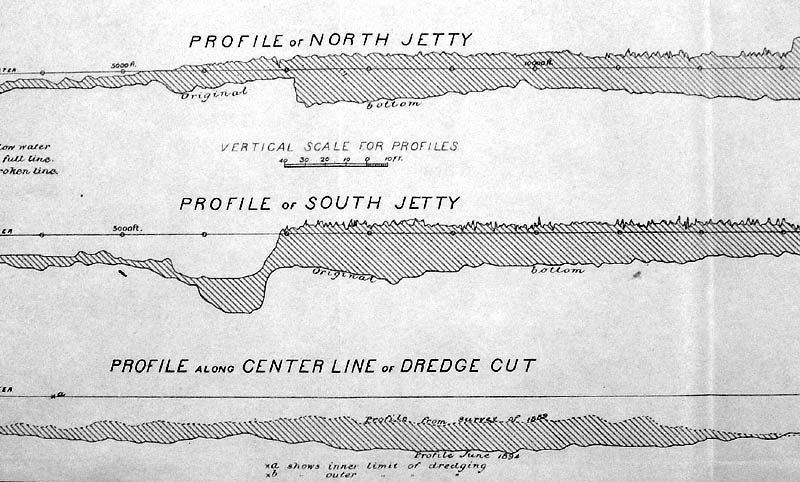
sheets) US Army Engineers 1892 Litho size: 600 x 520 mm (sheet 1), Sheet 2 - 470 x 220mm (Profiles of mean soundings) Sheet 3 - 400 x 350mm (Comparison of Surveys 1884, 1891) Antique Map Ref IFM146 £38.00 (+P&P) click image for enlargement Detail1 Detail2 Sheet 2 Sheet 3 |
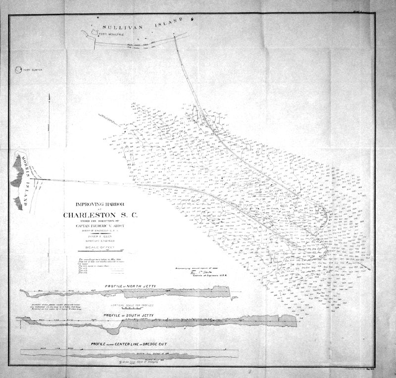 |
Improving Harbor at Charleston, SC ( 2
sheets) US Army Engineers 1894 Litho by Friedenwald size: 660 x 640 mm (sheet 1), 450 x 410mm (sheet 2) Sheet 2 shows Comparison of Surveys 1884, 1893, 1894 Antique Map Ref IFM115 £36.00 (+P&P) click image for enlargement Detail1 Detail2 Sheet 2 |
 |
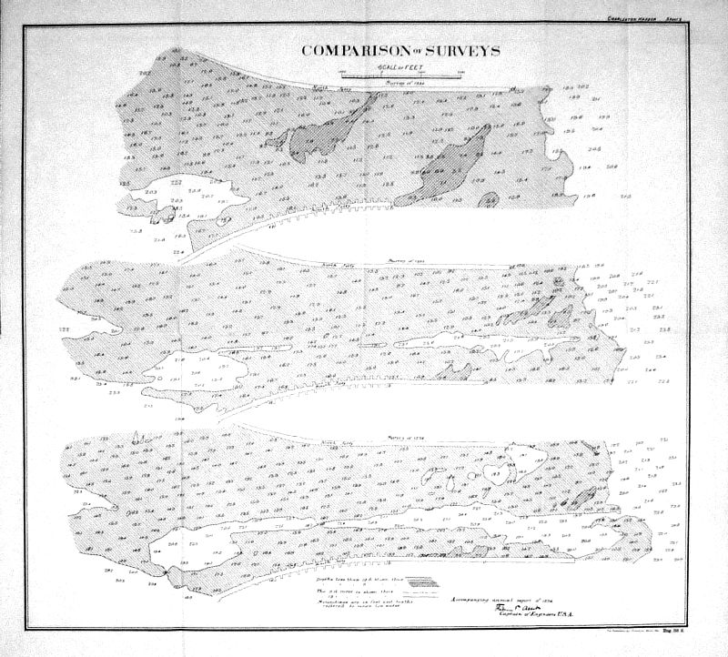
Improving Harbor at Charleston, SC ( 4
sheets) US Army Engineers 1894 Litho by Friedenwald size: 400 x 240 mm (sheet 1), 330 x 210mm (sheet 2), 320 x 220mm (sheet 3), 530 x 220mm (sheet 4) Antique Map Ref IFM114 (4 sheets) £35.00 (+P&P) click image for enlargement Sheet 1 Sheet 2 Sheet 3 Sheet 4 |
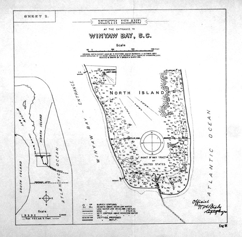 |
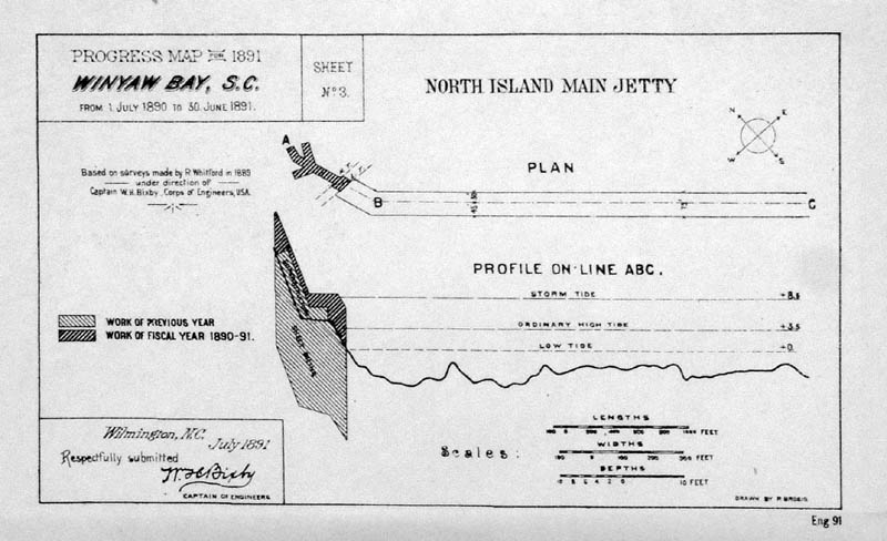
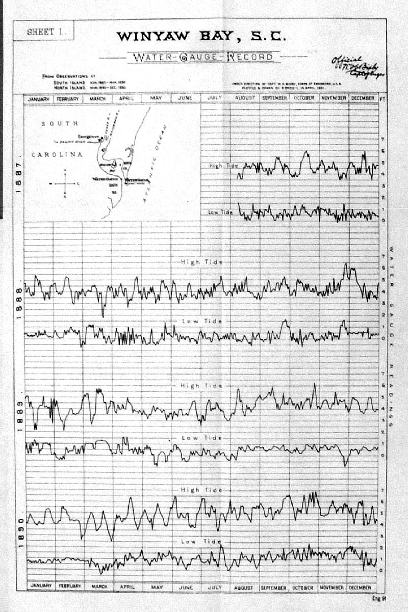
Winyaw Bay, SC ( 3
sheets) US Army Engineers 1892 Litho Sheet 1 North Island size: 220 x 220 mm Sheet 2 North Island Main Jetty 220 x 130 mm Sheet 3 Water Gauge Record 220 x 320 mm Antique Map Ref IFM145 ( 3 sheets ) £20.00 (+P&P) click image for enlargement |
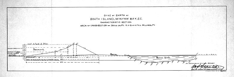 |
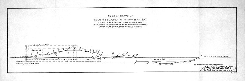
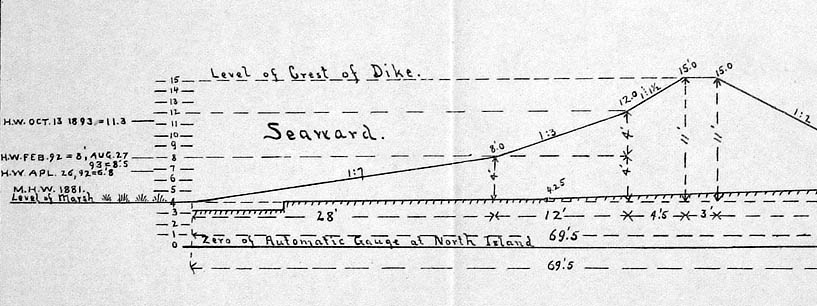
Dyke of Earth at South Island, Winyaw Bay, SC
(
2 sheets ) US Army Engineers 1894 Winyah Bay, South Carolina - south of Georgtown. Litho by Friedenwald size: 570 x 180 mm (sheet 1), 570 x 180mm (Sheet 2) Antique Map Ref IFM122 (2 sheets) £15.00 (+P&P) Detail click image for enlargement |
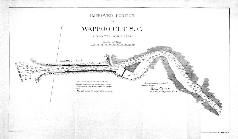 |
Improved Portion of Wappoo Cut, SC US Army Engineers 1894 Cut between the Stono River and Ashley River at Charleston, South Carolina Litho by Friedenwald size: 380 x 220 mm Antique Map Ref IFM121 £16.00 (+P&P) click image for enlargement |
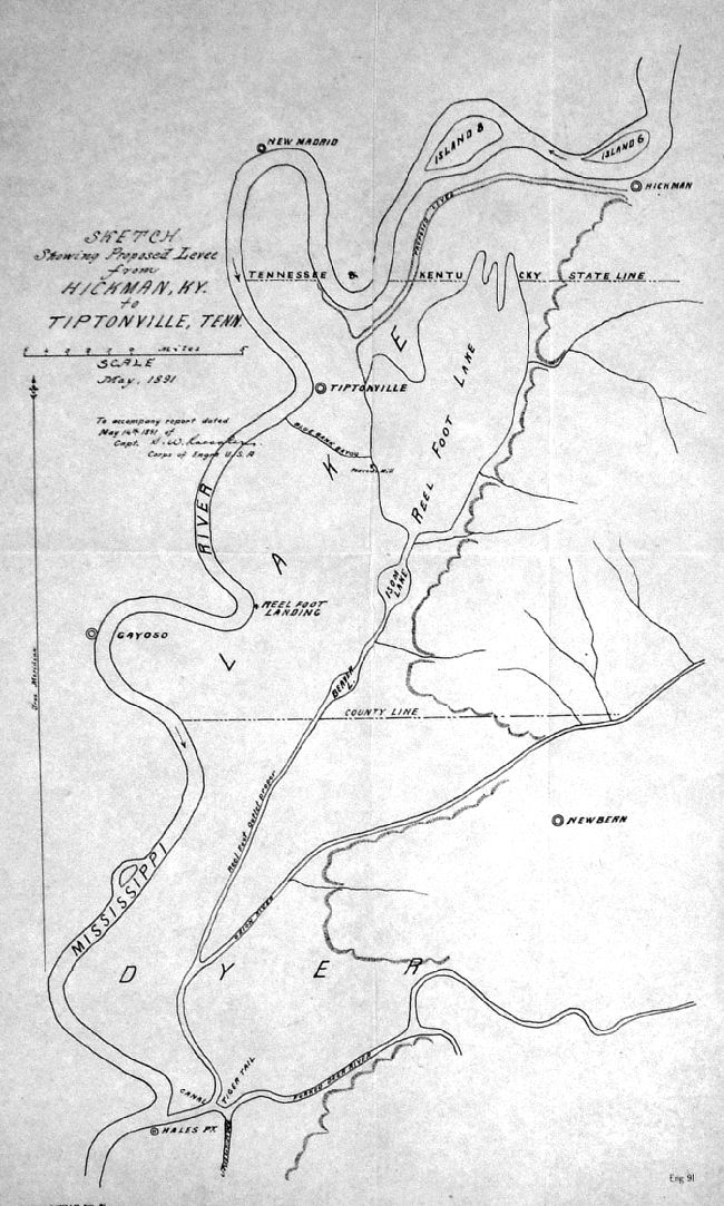 |
Mississippi River between Hickman (KY) to Hales
Point
(TN) Covers area: Hickman (TN), New Madrid (KY), Tiptonville, Newbern, Hales Point (East of Blytheville) US Army Engineers 1892 Litho size: 220 x 370 mm Antique Map Ref IFM180 £18.00 (+P&P) click image for enlargement |
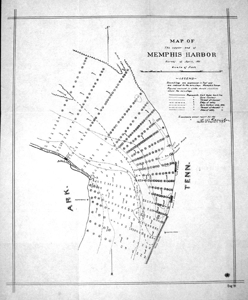 |
Map of Upper end of Memphis Bay,
Tennessee
in 2 sheets US Army Engineers 1892 River improvements, and dredging. Litho sheet 1 size: 270 x 330 mm sheet 2 size: 310 x 420 mm Antique Map Ref IFM107 (2 sheets) £30.00 (+P&P) click image for enlargement Detail |
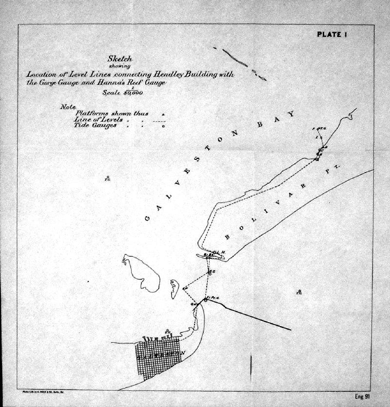 |
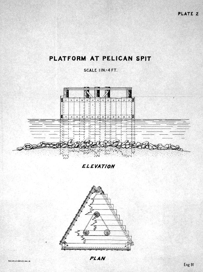
Galveston Texas US Army Engineers 1892 Litho By Hoen Sheet 1 (Location of Level Lines connecting Hendley Buildings with Hanns's Reef) size: 320 x 320 mm Sheet 2 - (Platform at Pelican Split) size: 250 x 290mm Antique Map Ref IFM217 ( 2 sheets ) £25.00 (+P&P) click image for enlargement |
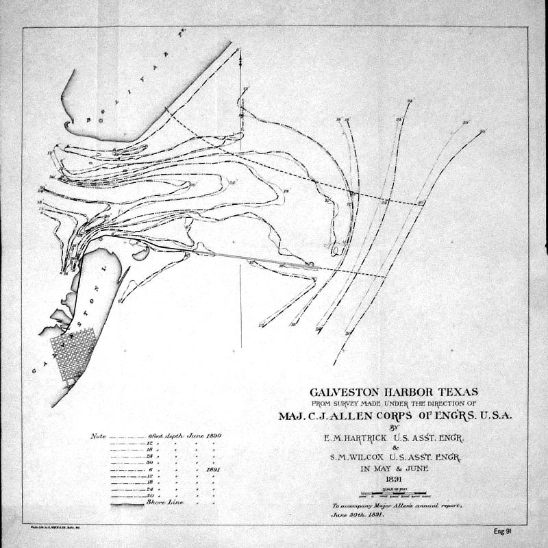 |
Galveston Harbor ( water depth
contours),
Texas US Army Engineers 1892 Litho By Hoen size: 370 x 370 mm Antique Map Ref IFM219 £18.00 (+P&P) click image for enlargement |
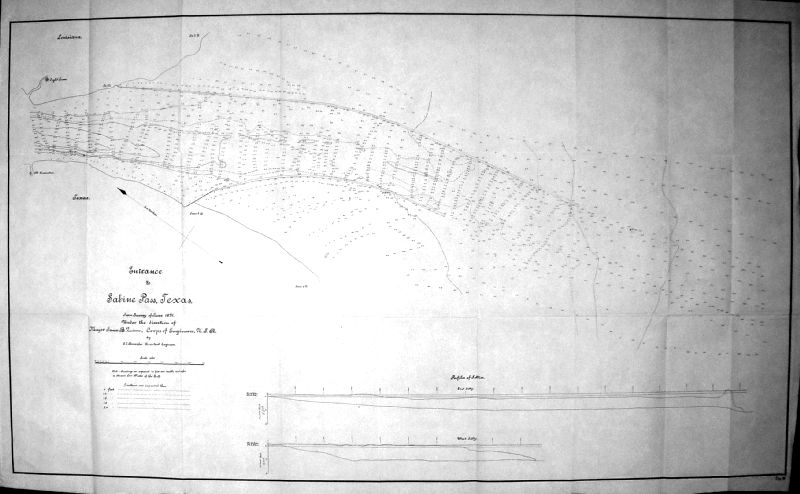 |
Sabine Pass, Texas ( south of Port
Arthur) US Army Engineers 1894 River improvements and dredging. Litho size: 1000 x 590 mm Antique Map Ref IFM220 £24.00 (+P&P) click image for enlargement Detail |
 |
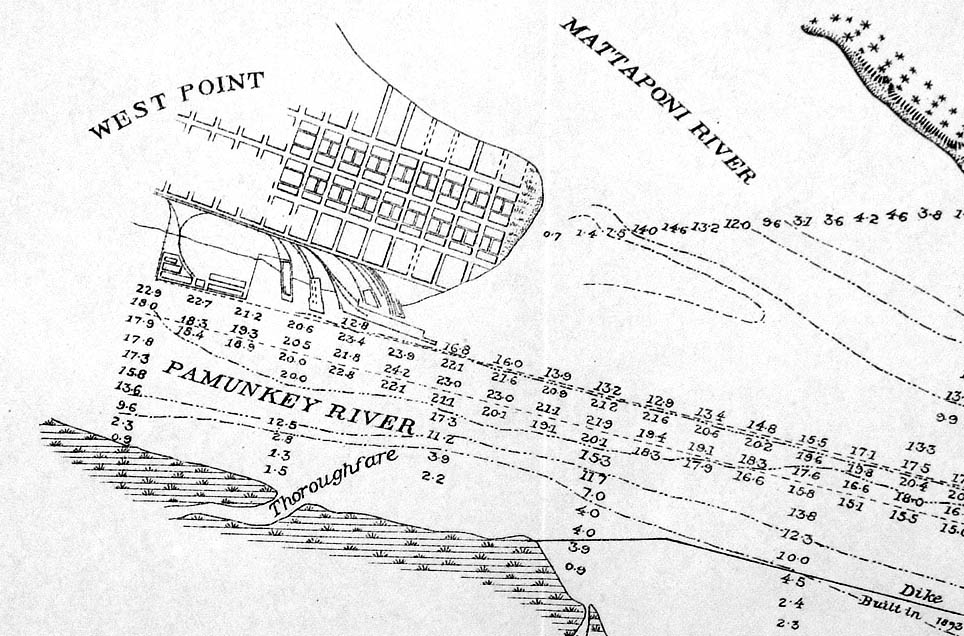
York River, Virginia - West Point Bar US Army Engineers 1894 River improvements and dredging. Junction of York River and Mattaponi River at West Point, Virginia Litho by Friedenwald size: 380 x 200 mm Antique Map Ref IFM104 £24.00 (+P&P) click image for enlargement Detail |
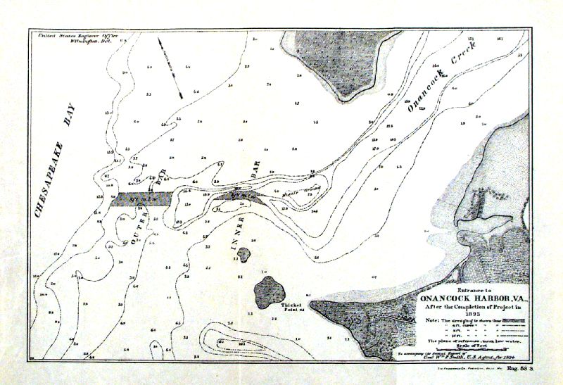 |
Onanock Harbor, Virginia ( Chesapeake Bay side of the Virginia Pennisular) US Army Engineers 1894 River improvements, and dredging. Litho by Friedenwald size: 280 x 200 mm Antique Map Ref IFM119 £18.00 (+P&P) click image for enlargement |
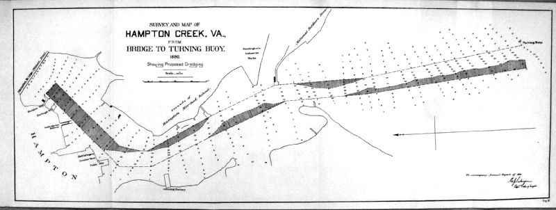 |
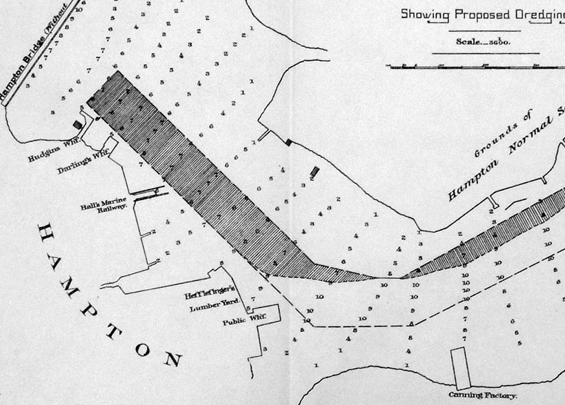
Hampton Creek, VA from Bridge to Turning
Buoy US Army Engineers 1892 Survey showing proposed dredging Litho size: 600 x 220 mm Antique Map Ref IFM133 £30.00 (+P&P) click image for enlargement Detail |
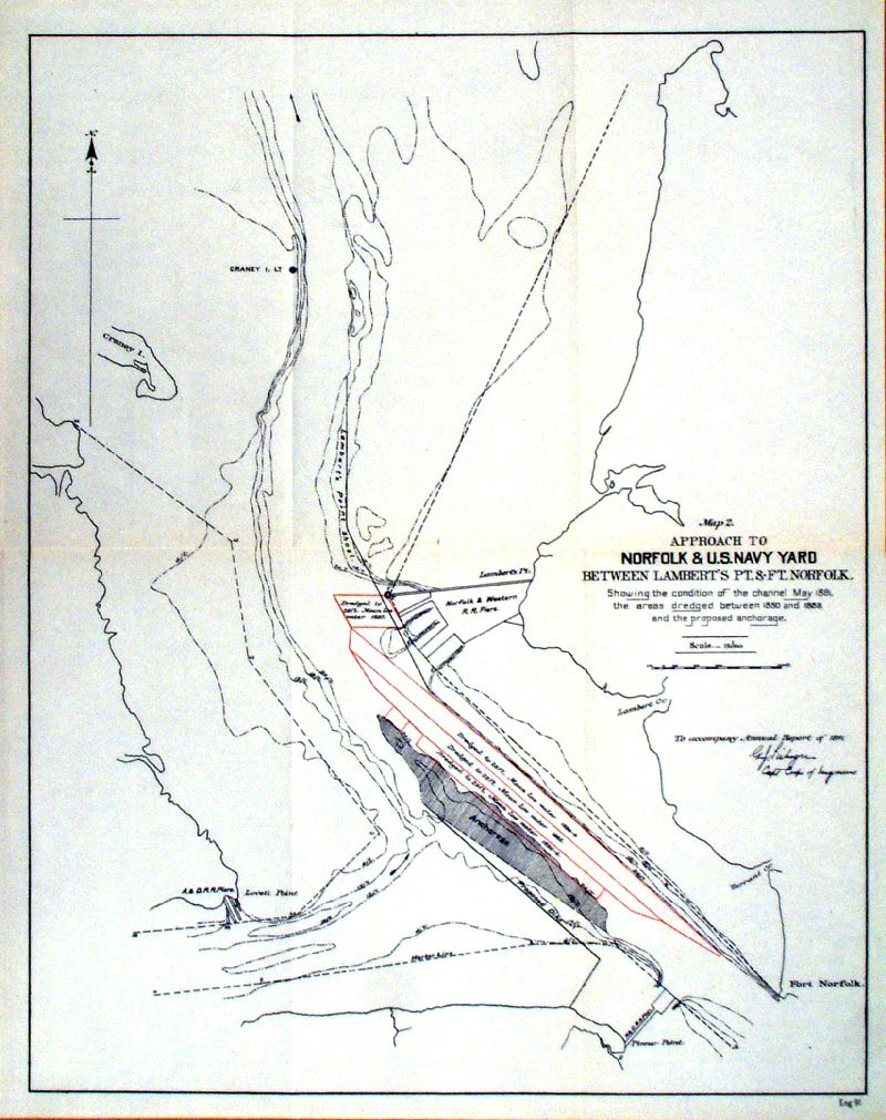 |
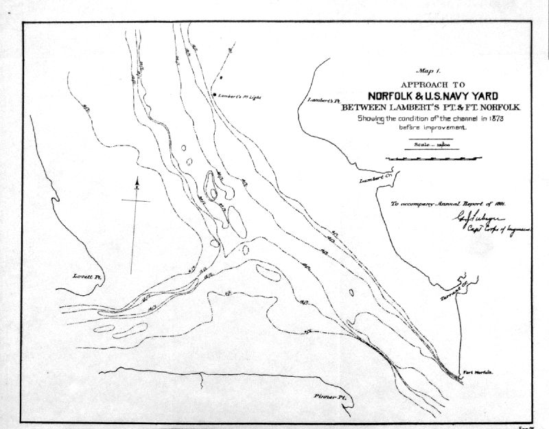
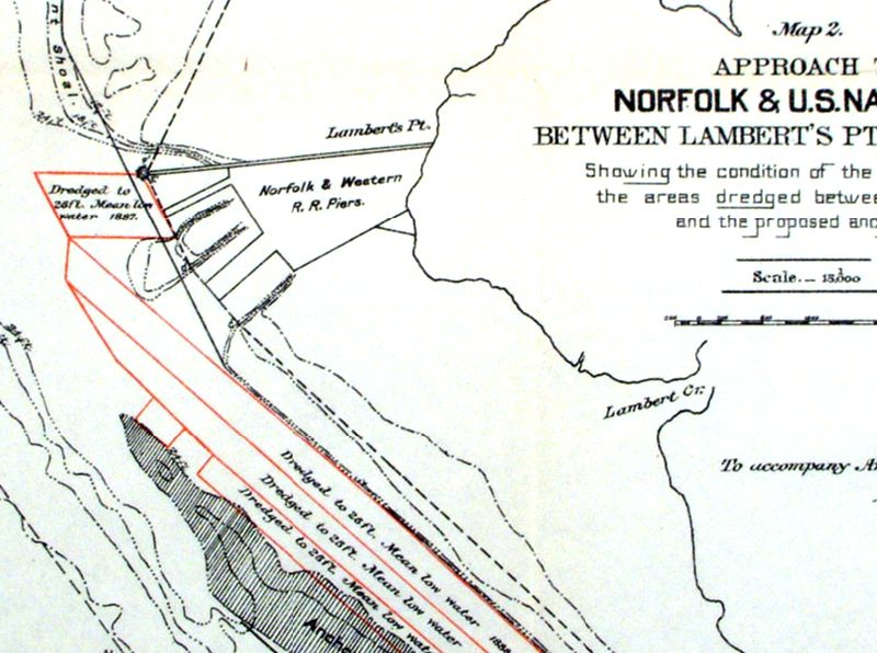
Norfolk & US Navy Yard between Lambert's Point
and
Fort Norfolk, Virginia US Army Engineers 1892 River improvements, and dredging. Litho size: 340 x 410 mm Sheet 2 size: 310 x 240mm Antique Map Ref IFM132 ( 2 sheets) £32.00 (+P&P) click image for enlargement Detail |
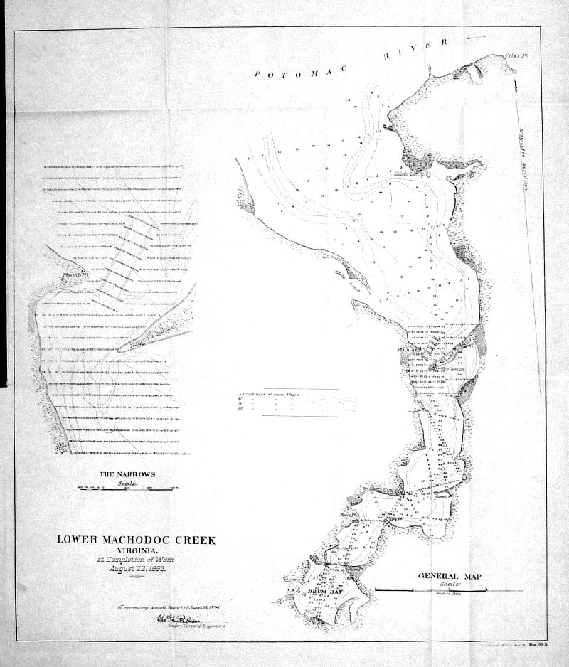 |
Lower Machodoc Creek, Virginia ( Potomac River near Coles Point, Tidwells, ) US Army Engineers 1894 River improvements, and dredging. Litho by Friedenwald size: 410 x 480 mm Antique Map Ref IFM107 £22.00 (+P&P) click image for enlargement Detail |
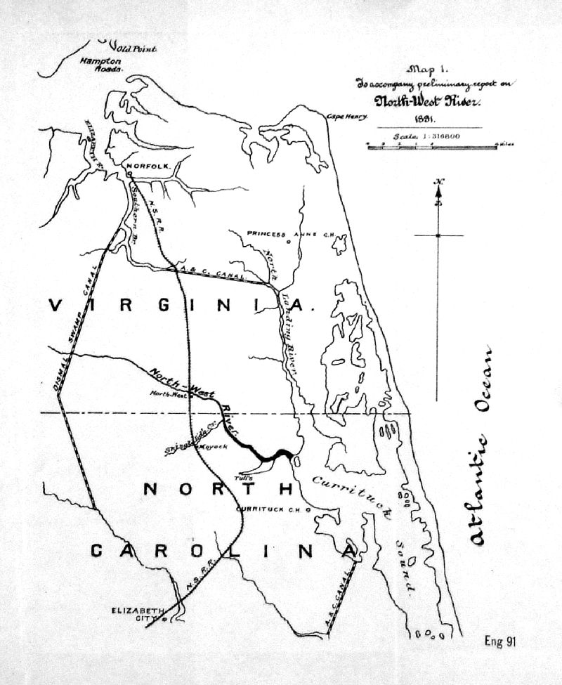 |
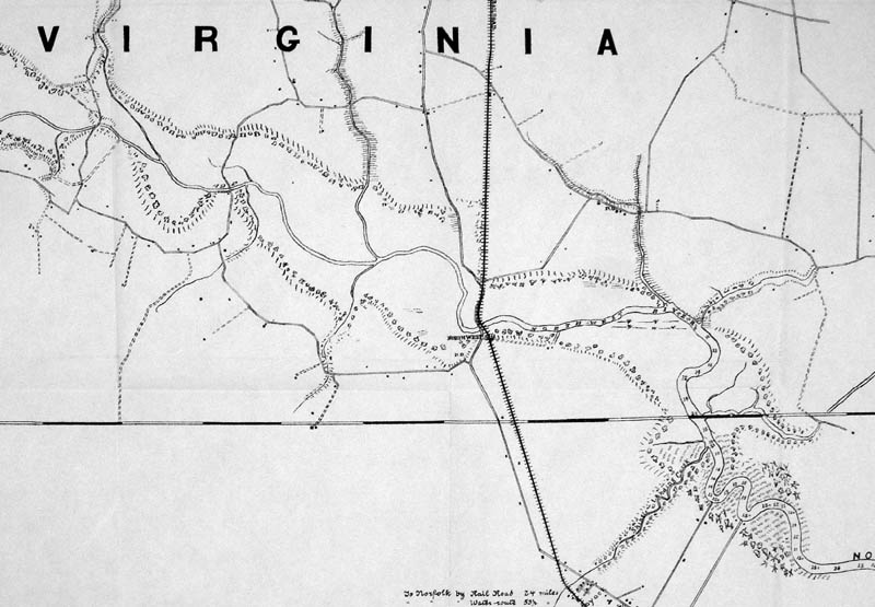
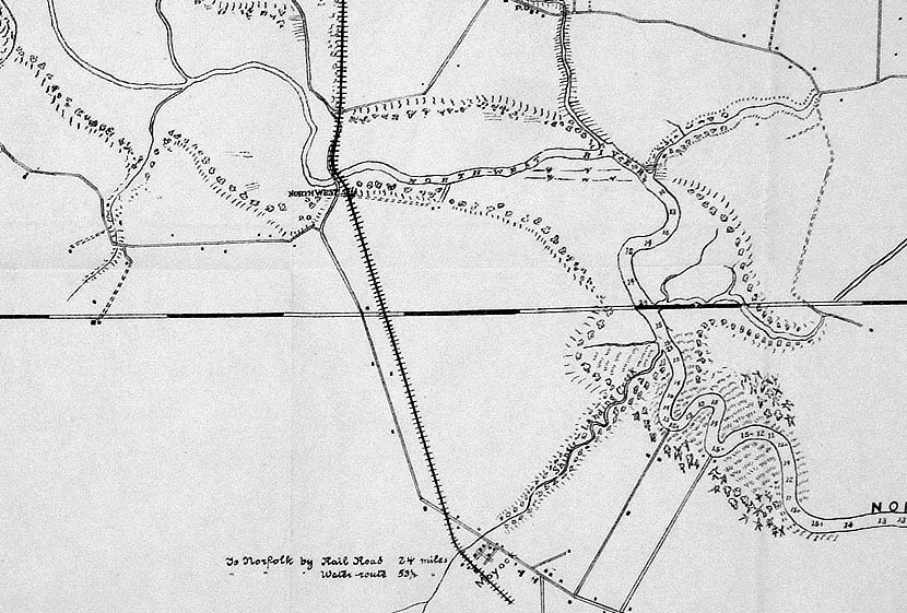
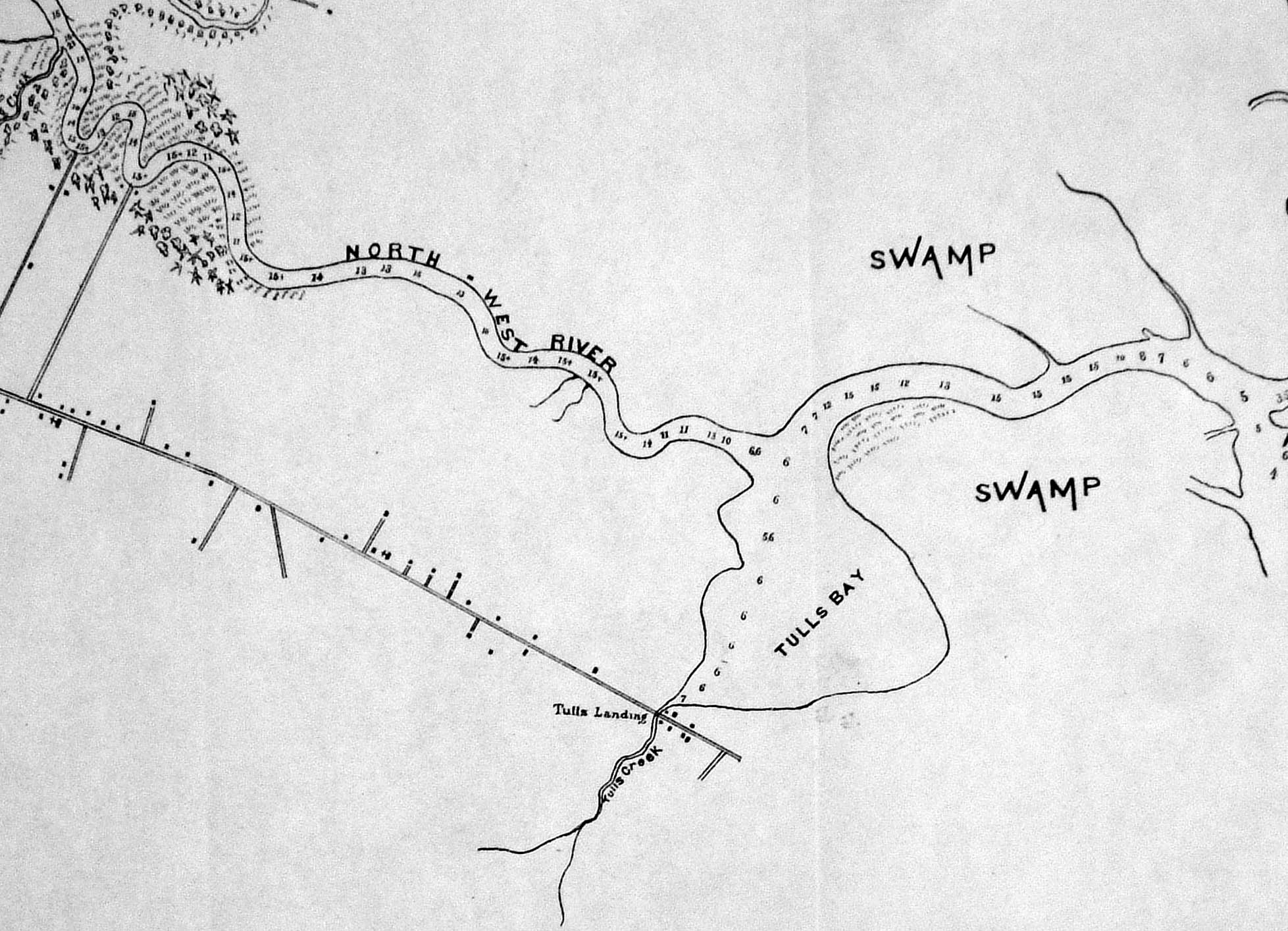
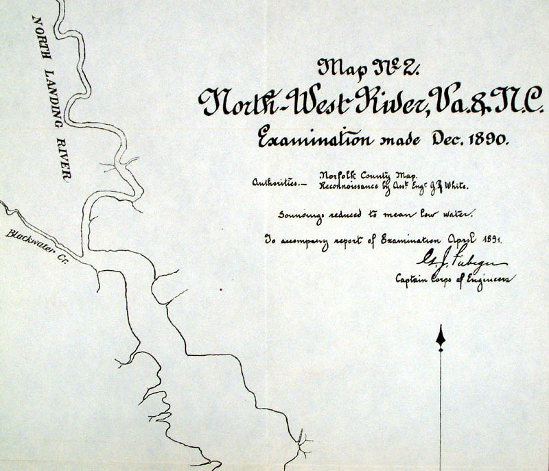
North West River - Virginia and North
Carolina -
in 2 sheets US Army Engineers 1892 North West River through the Dismal Swamp region Local towns: Moyock & Northwest. Between Chesapeak VA and Elizabeth City NC Litho Sheet 1 - size: 180 x 210 mm, Sheet 2 - size: 810 x 470 mm Antique Map Ref IFM134 ( 2 sheets) £30.00 (+P&P) click image for enlargement Detail1 Detail2 Detail3 Detail4 |
| Washington DC is listed
under
'D' - District of Columbia |
|
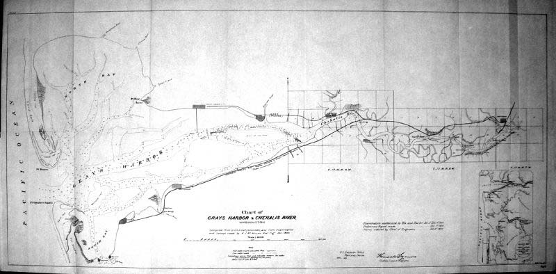 |
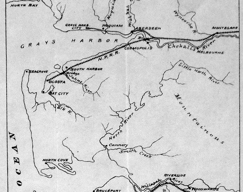
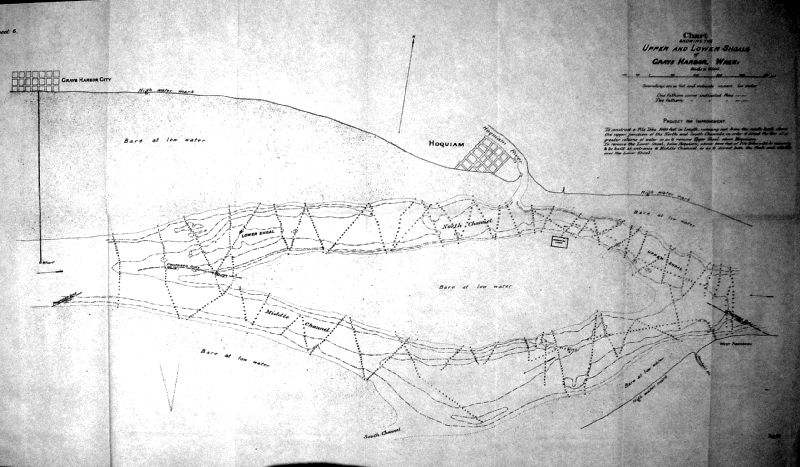
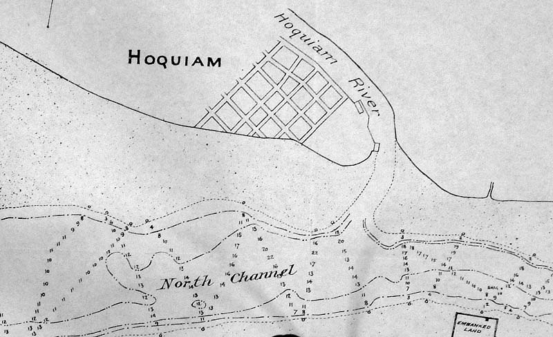
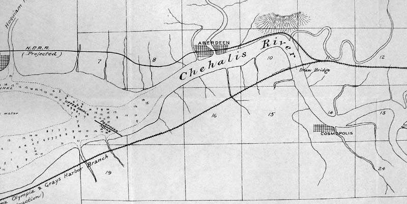
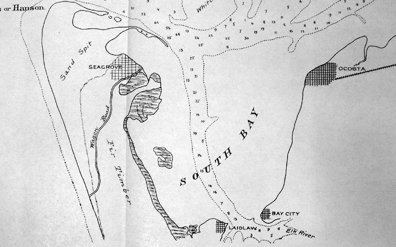
Gray's Harbor and Chehalis River,
Washington ( 6 sheets) US Army Engineers 1892 Lithograph Principal settlements shown: Seagrove, Bay City, Pt Brown, Grays Harbor City, Hoquiam, Aberdeen, Montesano Ocosta, South Harbor, Cosmopolis. Sheet 1 Harbor and Estuary size: 850 x 400 mm Sheet 2 Melbourne Shoal size: 500 x 260 mm Sheet 3 Bents Island Shoal size: 700 x 300 mm Sheet 4 Mouth of Peel's Slough size: 490 x 170 mm Sheet 5 Higgins Island Shoal size: 600 x 330 mm Sheet 6 Upper and Lower Shoals size: 700 x 400 mm Detail 1 Detail 2 Detail 3 Detail 4 Detail 5 Antique Map Ref IFM229 £30.00 (+P&P) click image for enlargement |
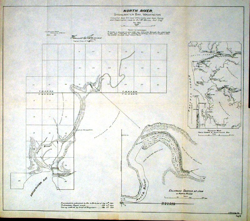 |
North River, Shoalwater Bay, Washington US Army Engineers 1892 Litho By Hoen size: 460 x 400 mm Antique Map Ref IFM233 £18.00 (+P&P) click image for enlargement Detail |
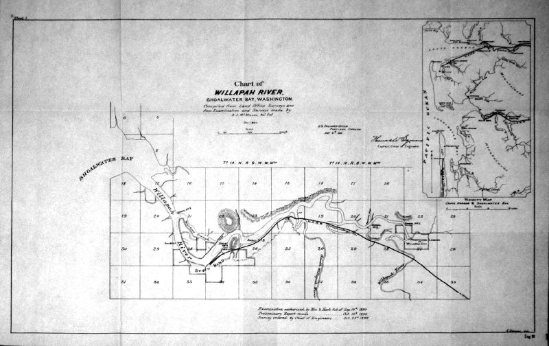 |
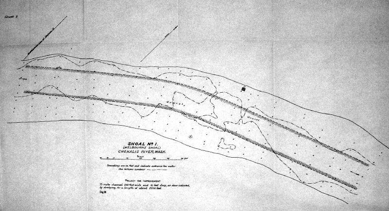
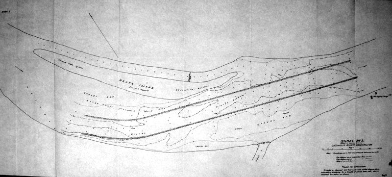
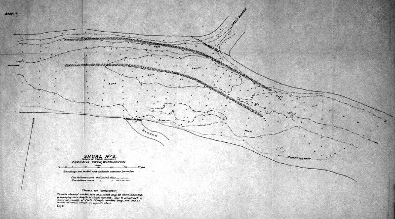
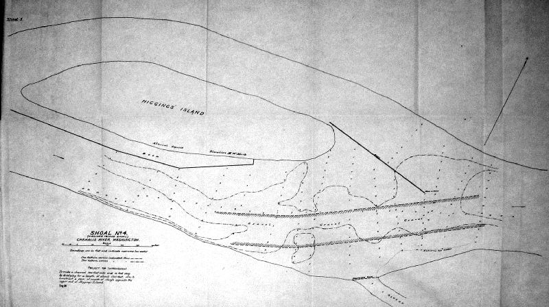
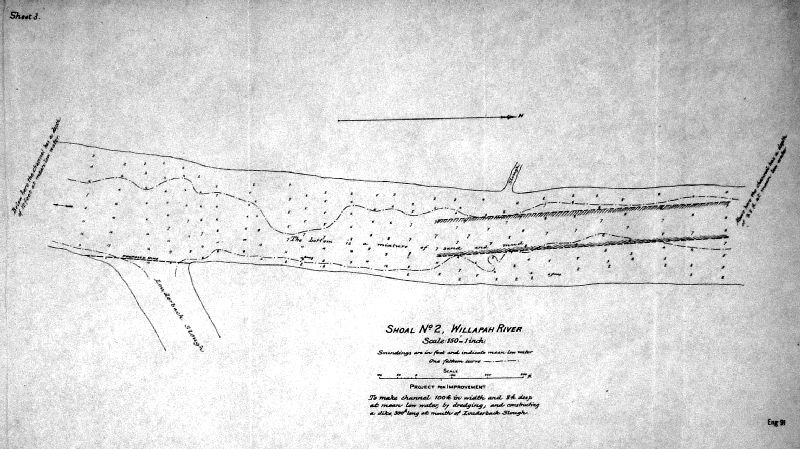
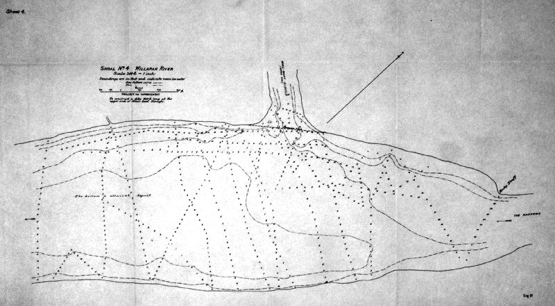
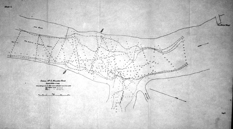
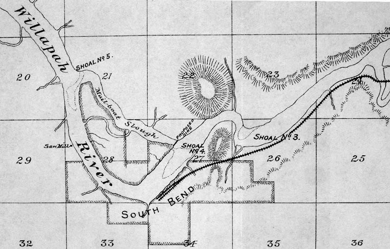
Willpah ( Willapa) River, Shoalwater
Bay,
Washington ( 5 sheets) Area now covered by Willapa, Raymond, South Bend, Washington US Army Engineers 1892 Lithograph Sheet 1 Vicinity Map size: 500 x 300 mm Sheet 2 Shoal No 1 size: 380 x 220 mm Sheet 3 Shoal No 2 size: 380 x 220 mm Sheet 4 Shoal No 3 size: 500 x 260 mm Sheet 5 Shoal No 4 size: 520 x 290 mm Detail Antique Map Ref IFM232 ( 5 sheets) £22.00 (+P&P) click image for enlargement |
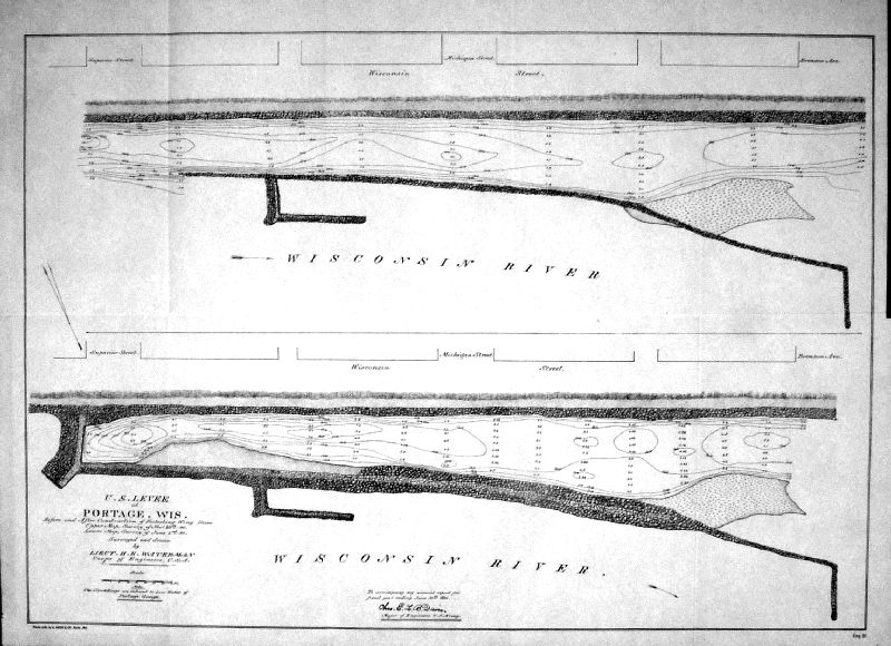 |
US Levee at Portage, Wisconsin US Army Engineers 1892 Litho size: 550 x 380 mm Antique Map Ref IFM198 £15.00 (+P&P) click image for enlargement |
| Notes on the Engineers Reports. These are painfully dull and uninteresting. They carry the details of costs and manpower of shovelling sand and hacking down trees. This reveals mind numbing statistics of the size, shape and nature of the trees, whether they were overhanging, under water or just stumps. Even tree stumps have military classifications! |
|
| All Genuine Antiquarian Maps - No Reproductions or Modern Copies |
2023