Past Pages
Antique Maps, Prints and Ephemera
Antique Maps of Asia ( A to N )
Arranged by: Continent, Country by alphabetFor islands in the Indian Ocean
close to Africa see the Africa map page.
Continent |
|
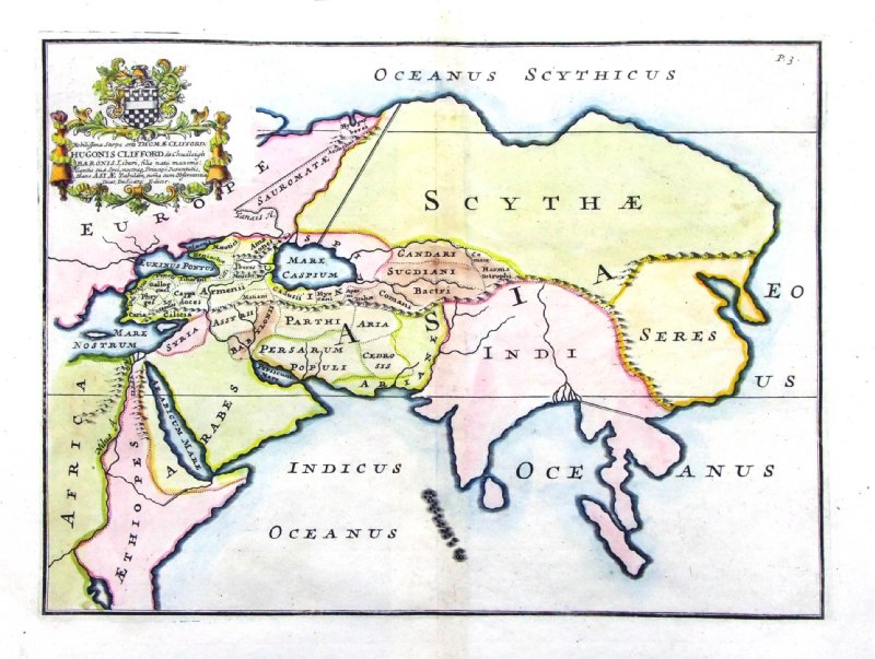 |
Ancient Asia
from De Situ Orbis by Pomponius Mela. Published by Philippum Bishop, Exeter, 1711 Copper engraving size 270 x 200 mm. Decorative cartouche contains the name of the sponsor/patron of this map. Ref PDM002 £60.00 (+P&P) click image for enlargement |
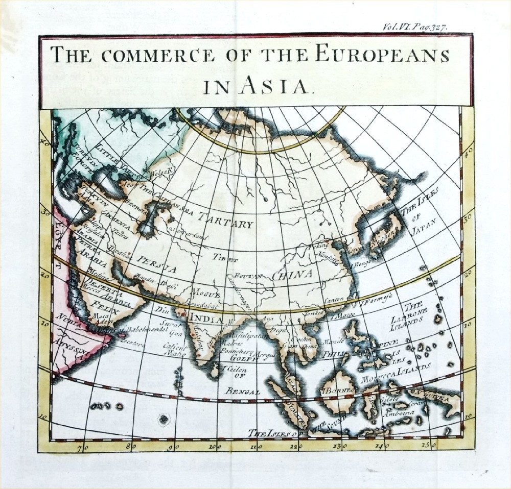 |
The Commerce of the
Europeans in Asia Pluch 1739 size: 160 x 160 mm, 2 folds Antique Map Ref PJM003 £30.00 (+P&P) click image for enlargement |
 |
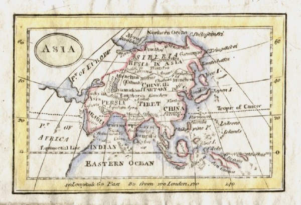
Asia
Neale
c1828 size: 260 x 200 mm Ref FAM040 £16.00 (+P&P) click image for enlargement |
 |
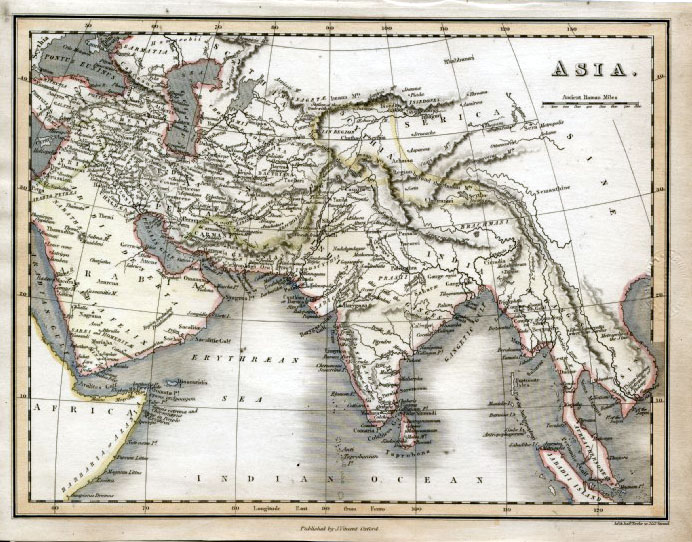
Asia
Thomas
Starling 1834
size:
150 x 95 mm Ref GBM309 £18.00 (+P&P) click image for enlargement |
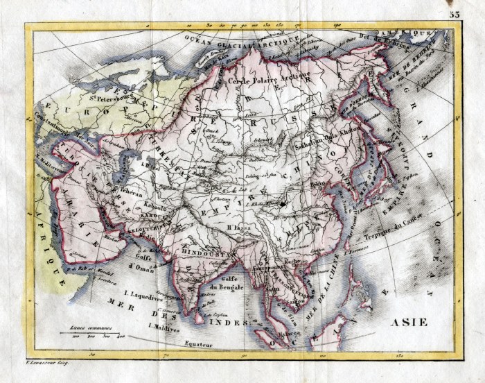 |
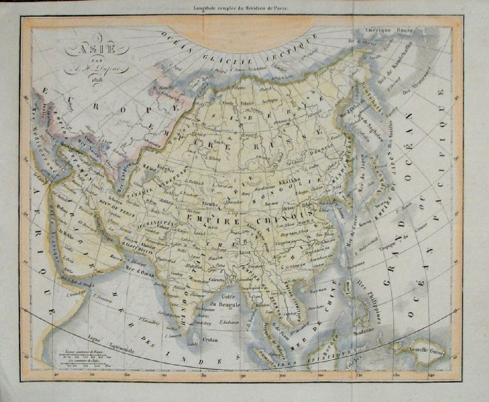
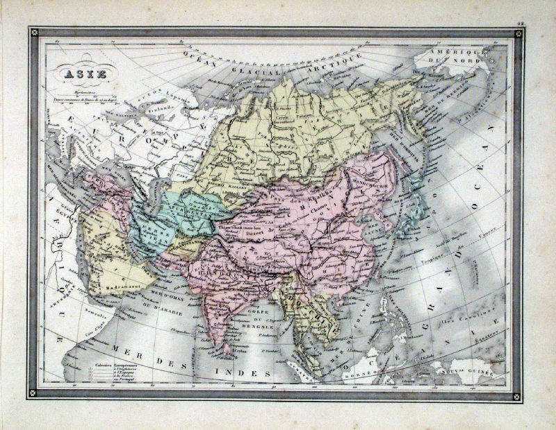
Asia V. Levasseur c1835 size: 170 x 130 mm Ref HAM085 £16.00 (+P&P) click image for enlargement |
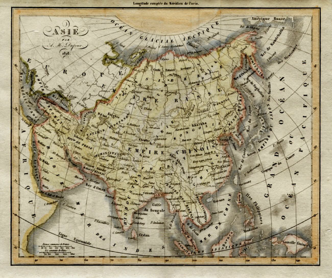 |
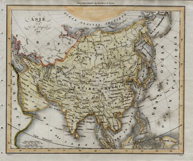
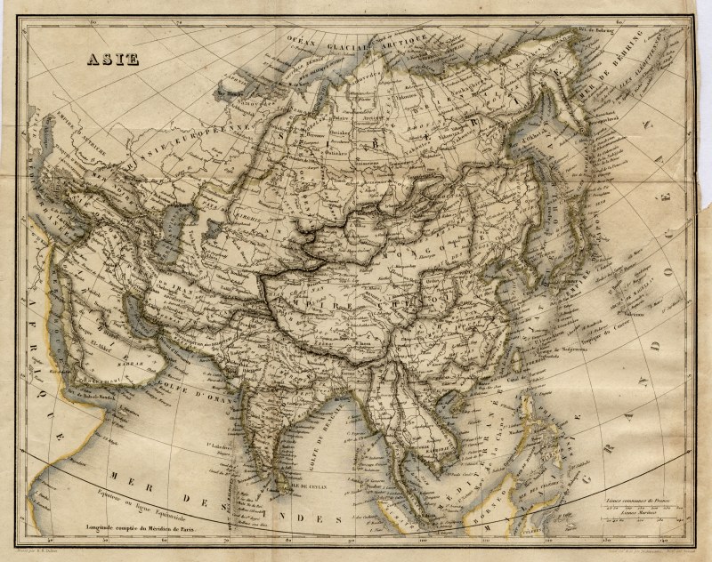
Asia
Dufour
1828
size:
240 x 200 mm Ref EKM099 £20.00 (+P&P) click image for enlargement |
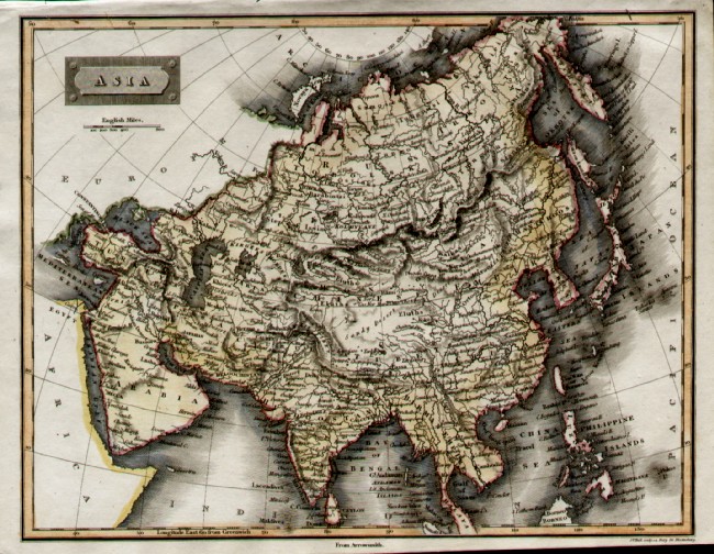 |
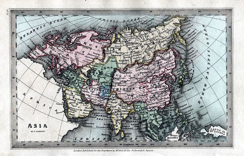
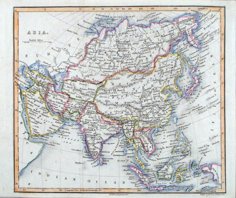
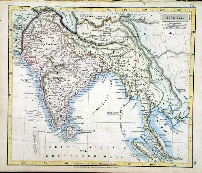
Asia Sidney Hall (from Arrowsmith)
c1840 size: 260 x 210 mm Ref EDM003 £16.00 (+P&P) click image for enlargement |
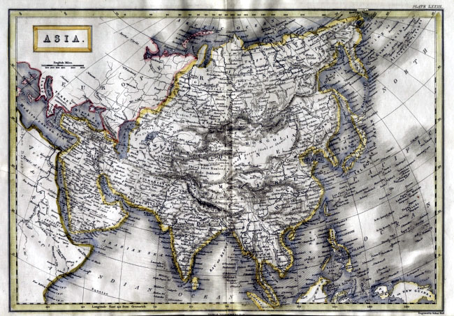 |
Asia Sidney Hall
c1854
size 400 x 270 mm Ref EKM130 £16.00 (+P&P) Detail click image for enlargement |
 |
Asia
Dufour
1828
size:
240 x 200 mm Ref EKM100 £18.00 (+P&P) click image for enlargement |
 |
Asia
Sidney
Hall 1860 size: 170 x 140 mm Ref HKM003 £18.00 (+P&P) click image for enlargement |
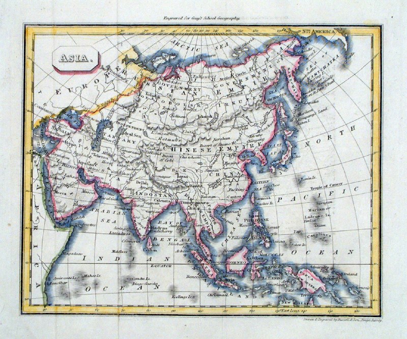 |
Asia
Russell/Guy
c1839 size: 170 x 140 mm Ref HAM209 £18.00 (+P&P) click image for enlargement |
 |
Asia
A.K. Johnston / William
Blackwood 1854 size: 320 x 250 mm, centre fold. Early full colour lithographic printing. Slight discolouration from handling at lower margin & border. Ref LKM009 £18.00 (+P&P) click image for enlargement |
 |
Asia
Chambers
1855
size:
300x 240 mm Ref FDM144 £14.00 (+P&P) click image for enlargement |
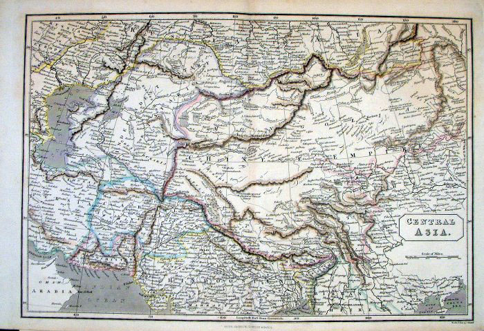 |
Central Asia Peter
Jackson c1850
size: 380 x 260 mm Centre Fold Ref FGM019 £20.00 (+P&P) click image for enlargement |
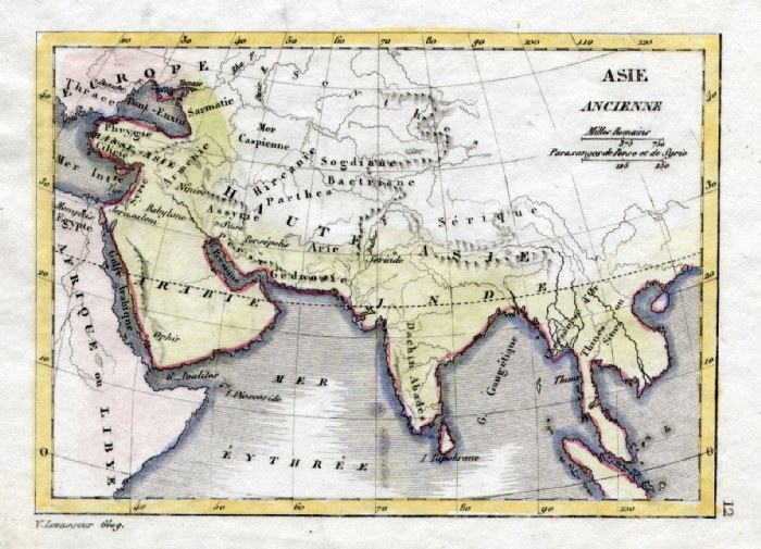 |
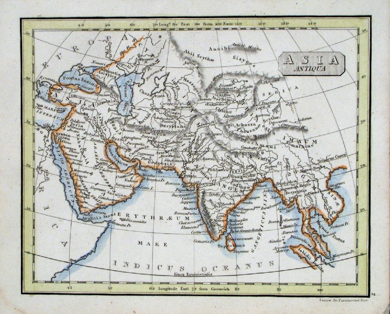
Ancient Asia V. Levasseur
c1835 size: 130 x 100 mm Ref HAM044 £16.00 (+P&P) click image for enlargement |
 |
Asia
Rapkin c1860 Ref EHM031 £16.00 (+P&P) size: 330 x 260 mm Trimmed upper-right corner, several folds click image for enlargement |
 |
Asia Dufour
1820 Ref EKM093 £16.00 (+P&P) size: 240 x 200 mm click image for enlargement |
 |
Asia John Dower /
Beeton c1868 Ref GAM051 £12.00 (+P&P) size: 240 x 190 mm, several folds click image for enlargement |
 |
Asia Dufour /
Renouard 1843 Ref GBM335 £12.00 (+P&P) size: 260 x 200 mm, several folds, trimmed upper-right margin, repair ar right margin. click image for enlargement |
 |
Ancient Asia
Fenner 1828 Ref GIM014 £12.00 (+P&P) size: 150 x 95 mm click image for enlargement |
 |
Asia Turner 1810 Ref GLM016 £10.00 (+P&P) size: 120 x 80 mm click image for enlargement |
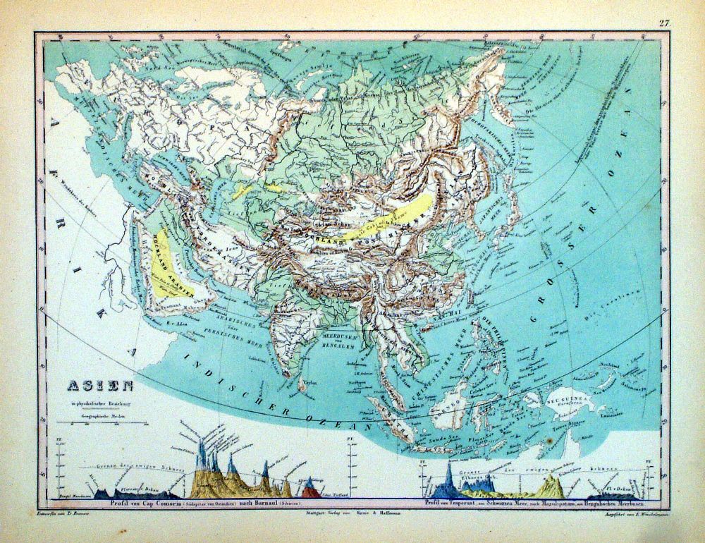 |
Asien Winkelmann / Krais & Hoffman for Humboldt's Kosmos 1861 inset of diagram of highest mountains size: 320 x 250 mm Ref LDM027 £18.00 (+P&P) click image for enlargement |
 |
Asie Vuillemin 1851 size: 270 x 210 mm a few faint spots of foxing Ref JDM069 £10.00 (+P&P) click image for enlargement |
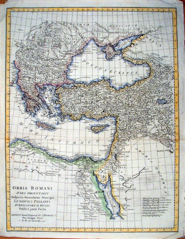 |
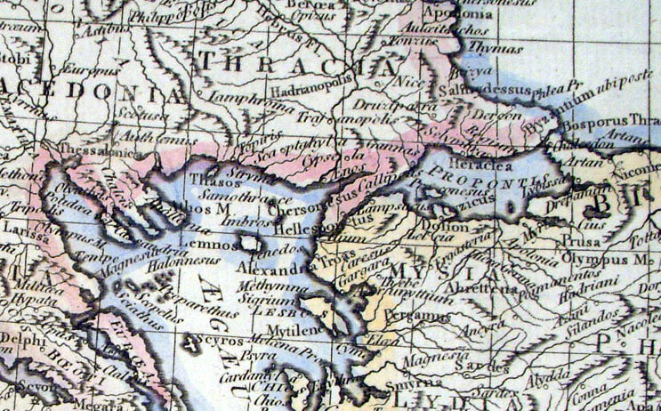
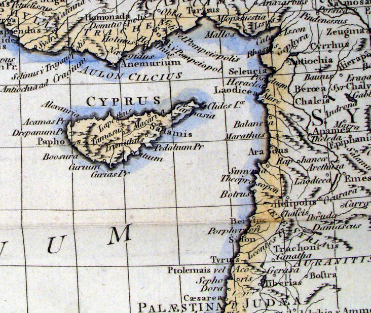
Orbis Romani pars Orientalis Auspicis Serenissmi Principis Ludovici Philippi ... Eastern part of the Roman Empire Harrison 1790 size: 410 x 510 mm, 2 folds Ref KBM014 £32.00 (+P&P) Detail 1 Detail 2 click image for enlargement |
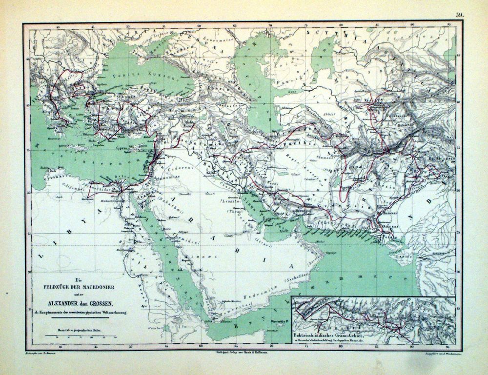 |
Die Feldzug der
Macedonier unter Alexander dem Grossen The Empire of Alexander The Great Winkelmann / Krais & Hoffman for Humboldt's Kosmos 1861 size: 320 x 250 mm Ref LDM036 £18.00 (+P&P) click image for enlargement |
Arabia ( also see Persia )
|
|
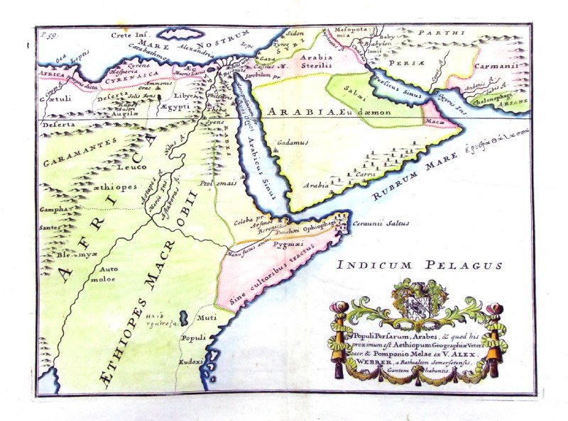 |
Ancient Arabia
Populi Persarum, Arabes ... from De Situ Orbis by Pomponius Mela. Published by Philippum Bishop, Exeter, 1711 Copper engraving size 270 x 200 mm, centre fold. Decorative cartouche contains the name of the sponsor/patron of this map. Ref PDM025 £60.00 (+P&P) click image for enlargement |
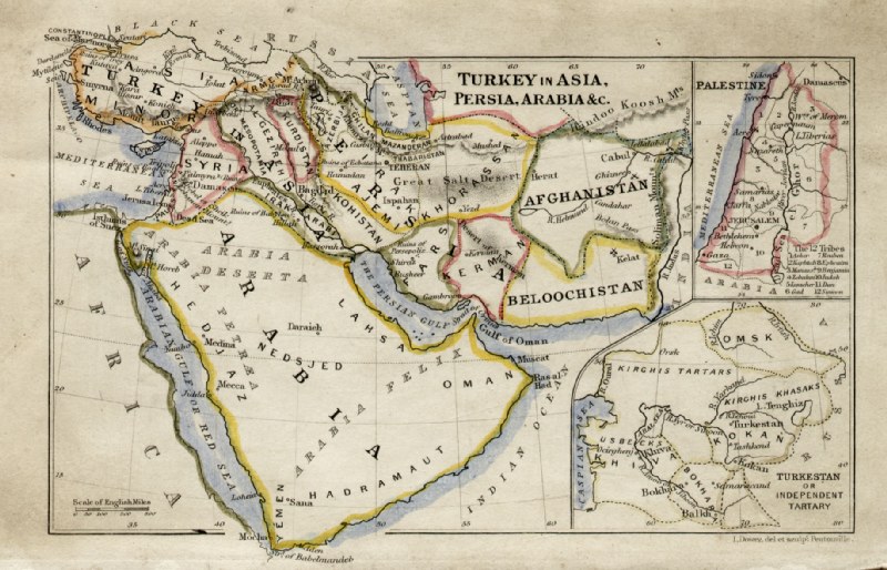 |
Arabia, Persia, Turkey in Asia
John Dower / James Cornwell
c1850 Ref GFM065 £16.00 (+P&P) size: 150 x 95 mm, slightly soiled surface, pencil marks on reverse. click image for enlargement |
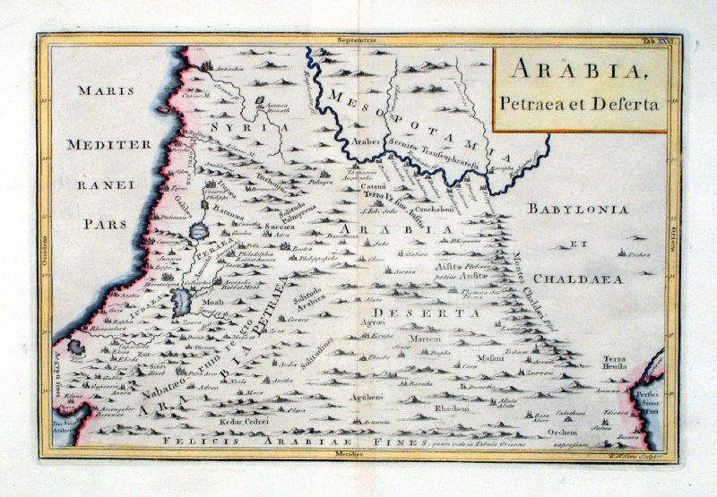 |
Arabia, Petraea et Deserta WH Toms Raw/Rivington 1796 Copper engraving size: 330 x 220 mm, centre fold Ref JKM099 £30.00 (+P&P) click image for enlargement |
Caucasus (Armenia, Azerbaijan, Georgia, Sarmatia)Central Asia |
|
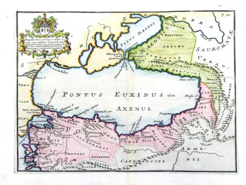 |
Ponticos,
Pontici, Pontus Euxinus Axenus ... from De Situ Orbis by Pomponius Mela. Published by Philippum Bishop, Exeter, 1711 Copper engraving size 270 x 200 mm. Decorative cartouche contains the name of the sponsor/patron of this map. Ref PDM011 £40.00 (+P&P) click image for enlargement |
 |
Ancient Caucusus
from De Situ Orbis by Pomponius Mela. Published by Philippum Bishop, Exeter, 1711 Copper engraving size 270 x 200 mm. Decorative cartouche contains the name of the sponsor/patron of this map. Ref PDM012 £40.00 (+P&P) click image for enlargement |
 |
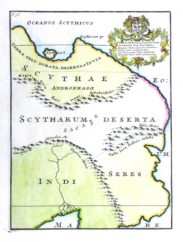
Ancient Central
Asia from De Situ Orbis by Pomponius Mela. Published by Philippum Bishop, Exeter, 1711 Copper engraving size 270 x 200 mm, centre fold, 2 small repairs. Decorative cartouche contains the name of the sponsor/patron of this map. Ref PDM022 £40.00 (+P&P) click image for enlargement |
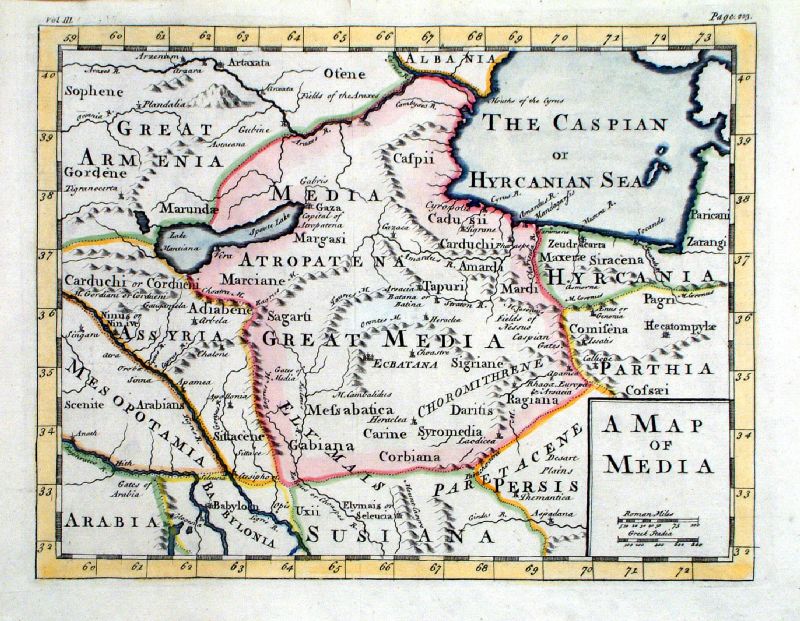 |
A Map of Media anon - origin and date unknown c1750? Copper engraving size: 290 x 230 mm, centre fold Ref KGM007 £35.00 (+P&P) click image for enlargement |
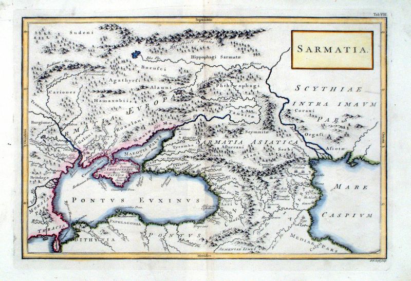 |
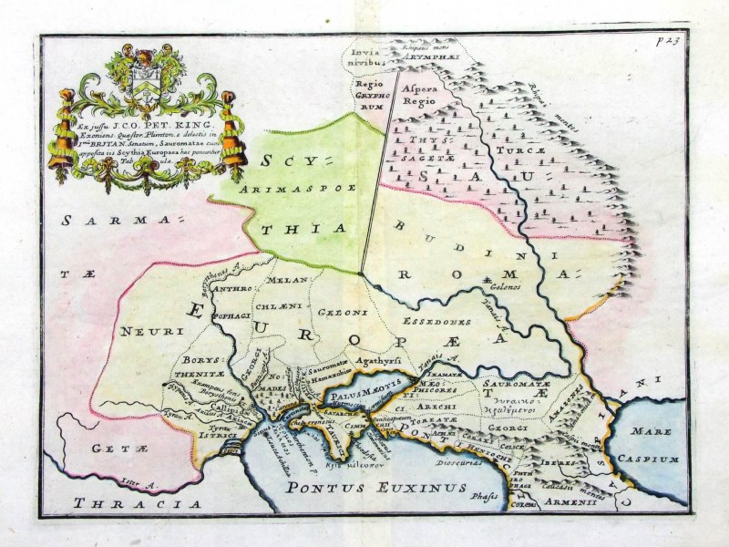
Sarmatia WH Toms Raw/Rivington 1796 Copper engraving size: 330 x 220 mm, centre fold Ref JKM081 £40.00 (+P&P) click image for enlargement |
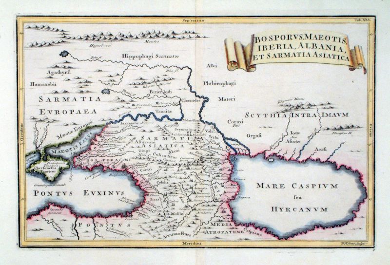 |
Bosphorus, Maeotis, Iberia, Albania,
et Samartia Asiatica WH Toms Raw/Rivington 1796 Copper engraving size: 330 x 220 mm, centre fold Ref JKM098 £35.00 (+P&P) click image for enlargement |
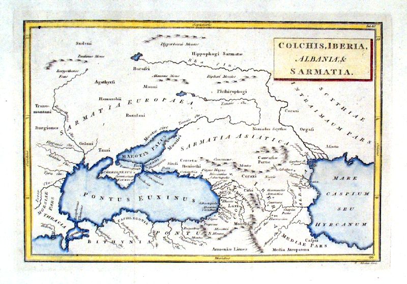 |
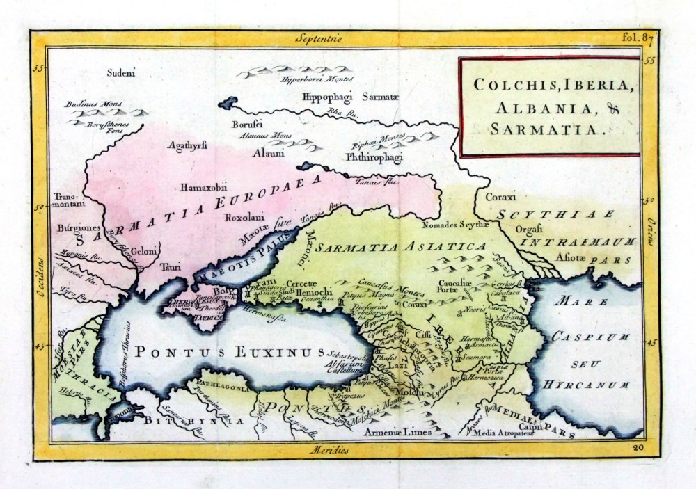
Colchis, Iberia,
Albania & Sarmatia
Baker c1810 size: 230 x 160 mm, centre fold Ref IBM014 £22.00 (+P&P) click image for enlargement |
 |
Colchis,
Iberia, Albania & Sarmatia Geograhia Antiqa Christophi Cellarii Christoph Cellarius 1745 Copper engraving size: 220 x 160 mm, 2 folds. Ref OKM018 £25.00 (+P&P) click image for enlargement |
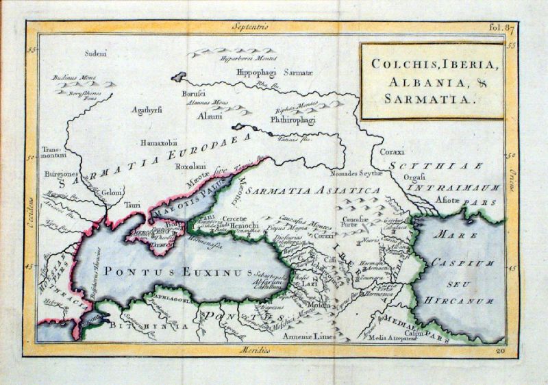 |
Colchis, Iberia,
Albania & Sarmatia
Celarius c1740 size: 230 x 160 mm, 2 folds Ref KBM012 £25.00 (+P&P) click image for enlargement |
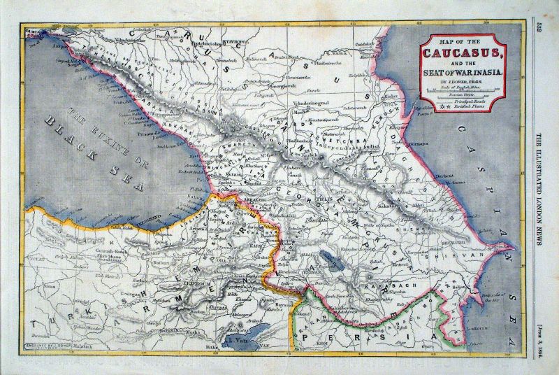 |
Map of the Caucusus, and the Seat of the War in
Asia John Dower / Illustrated London News 3rd June 1854 Ref KBM001 £28.00 (+P&P) size: 380 x 26 mm Detail click image for enlargement |
China |
|
 |
Ancienne Regio des
Sines Mallet 1685 Copper engraving size: 120 x 160 mm Ref LLM012 £90.00 (+P&P) click image for enlargement |
 |
Ancient China and
eastern Asia from De Situ Orbis by Pomponius Mela. Published by Philippum Bishop, Exeter, 1711 Copper engraving size 270 x 200 mm, centre fold Decorative cartouche contains the name of the sponsor/patron of this map. Ref PDM023 £65.00 (+P&P) click image for enlargement |
 |
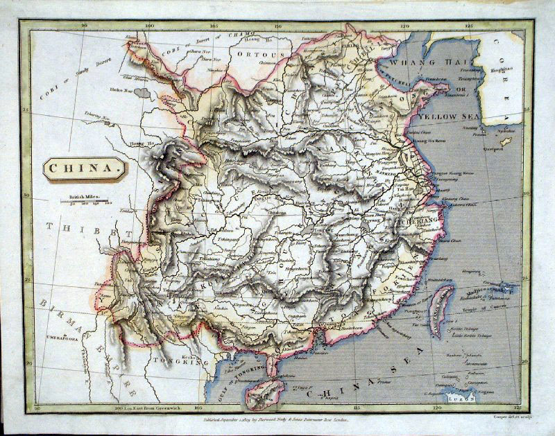
China Mylne & Lizars
c1820
size: 260x 200 mm Ref FGM006 £22.00 (+P&P) click image for enlargement |
 |
China
Cooper
1809 Ref GCM011 £24.00 (+P&P) size: 250 x 200 mm click image for enlargement |
 |
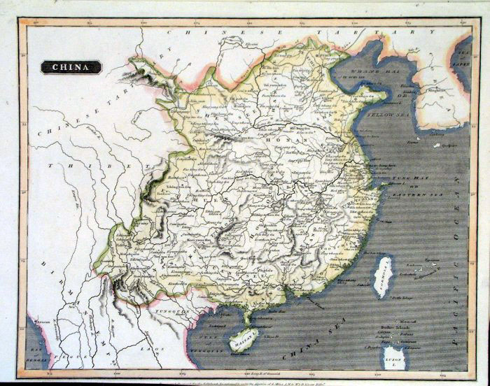
China
Findlay
/
Kelly
c1820
size:
260x 200 mm Ref FGM010 £22.00 (+P&P) click image for enlargement |
 |
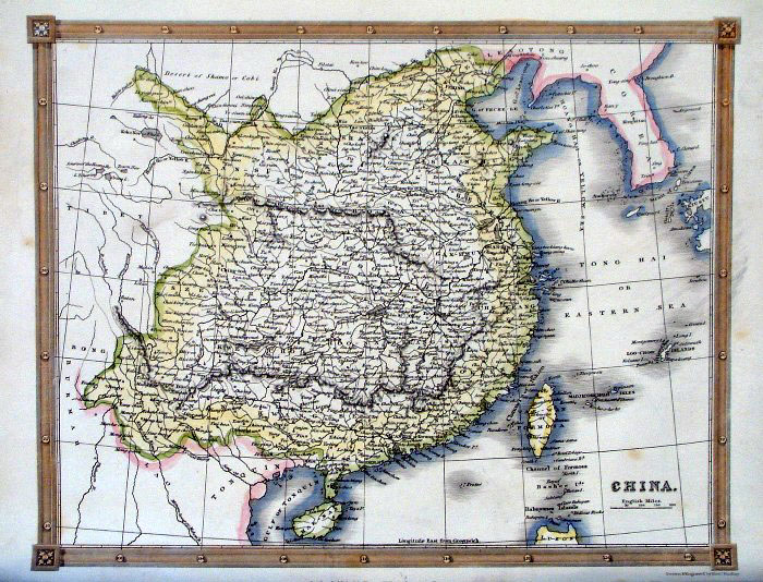
China
Thomas Kelly
1841 engraved by Alex Findlay size: 200x 260 mm Ref OHM033 £22.00 (+P&P) |
 |
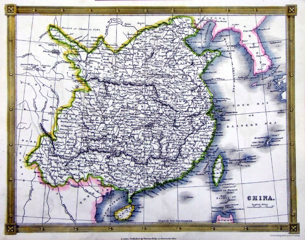
China
Chambers
1855
size:
300x 240 mm Ref FDM149 £24.00 (+P&P) click image for enlargement |
 |
China Edward
Stanford c1880
size: 340 x 270 mm Ref HHM060 £25.00 (+P&P) click image for enlargement |
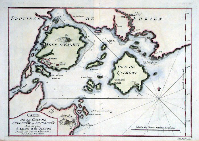 |
Chin-Chew, China (modern
day Quanzhou) Bellin 1748
size: 310x
220 mm Ref FLM011 £55.00 (+P&P) click image for enlargement |
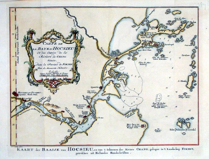 |
Bay of Hocsieu, China (modern
day Fuzhou) Schley c1755
size: 310x
220 mm Ref FLM013 £55.00 (+P&P) click image for enlargement |
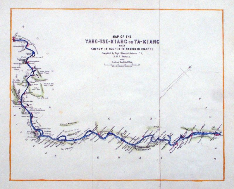 |
Map of the Yang-Tse-Kiang or Ta-Kiang from Han-Kow
in Hoopen to Nankin in Kiangsu. Compiled by Capt. Sherad Osborn Publ W & AK Johnston 1858 size: 250x 200 mm, 1 fold repair to tear (close to compass arrow) Ref ILM020 £25.00 (+P&P) Detail click image for enlargement |
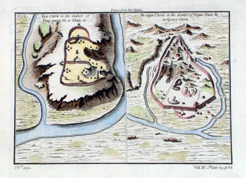 |
Kya chew in the district of Ping-Yang-Fu in Shan
Si Pu ngan Chew in the district of Ngan Shan fu in Quey chew anon (Child or Parr) c1750 size: 220x 160 mm Ref JDM048 £28.00 (+P&P) click image for enlargement |
 |
Lan-chew in Shen-si Kan-chew in Shen-si Chin Ywen Fu in Quey Chew Child c1750 size: 220x 160 mm Ref JDM046 £28.00 (+P&P) click image for enlargement |
Holy Land see Palestinesee Biblical Maps section |
|
India & Ceylon
|
|
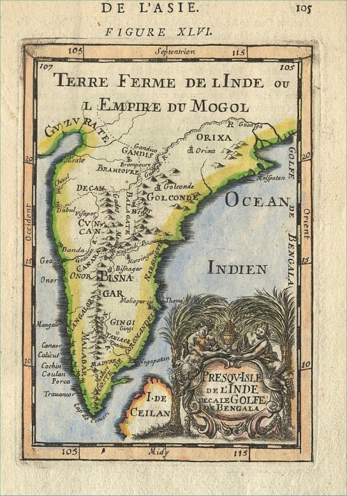 |
South India Mallet
c1683 size: 120 x 170 mm Ref CAM006 £55.00 (+P&P) click image for enlargement |
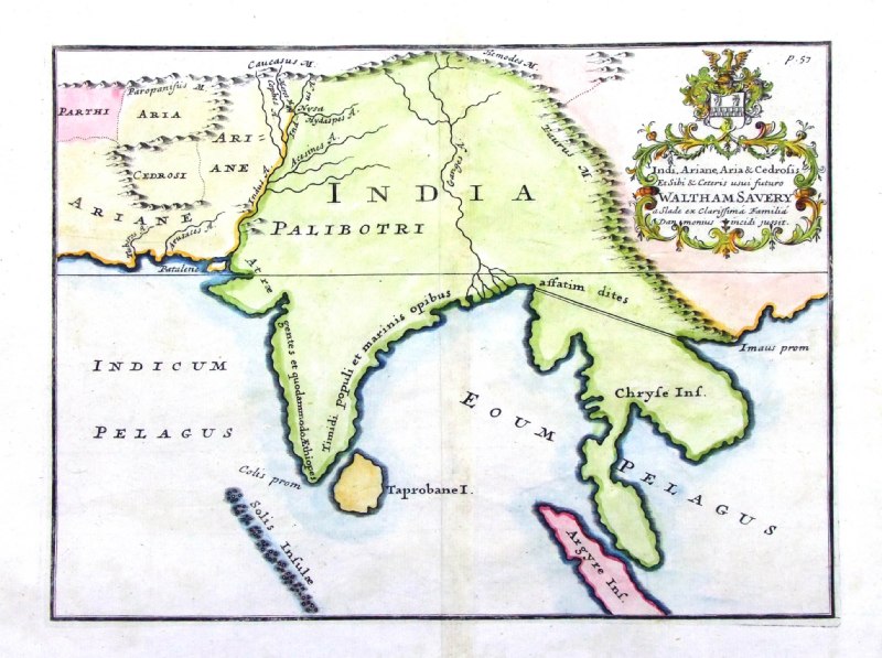 |
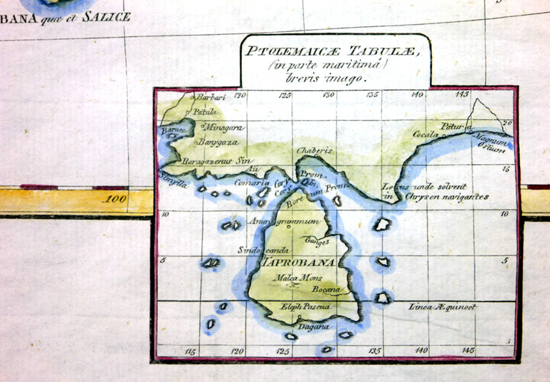
Ancient India
Indi, Ariane, Aria & Cedrosis .... from De Situ Orbis by Pomponius Mela. Published by Philippum Bishop, Exeter, 1711 Copper engraving size 270 x 200 mm, centre fold Decorative cartouche contains the name of the sponsor/patron of this map. Ref PDM024 £70.00 (+P&P) click image for enlargement |
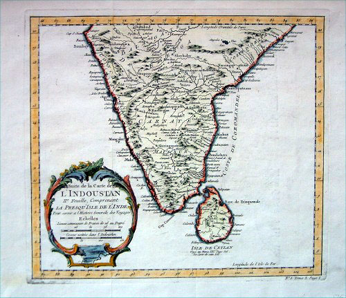 |
South India Bellin c1752
size: 270 x 230 mm Ref CAM011 £55.00 (+P&P) click image for enlargement |
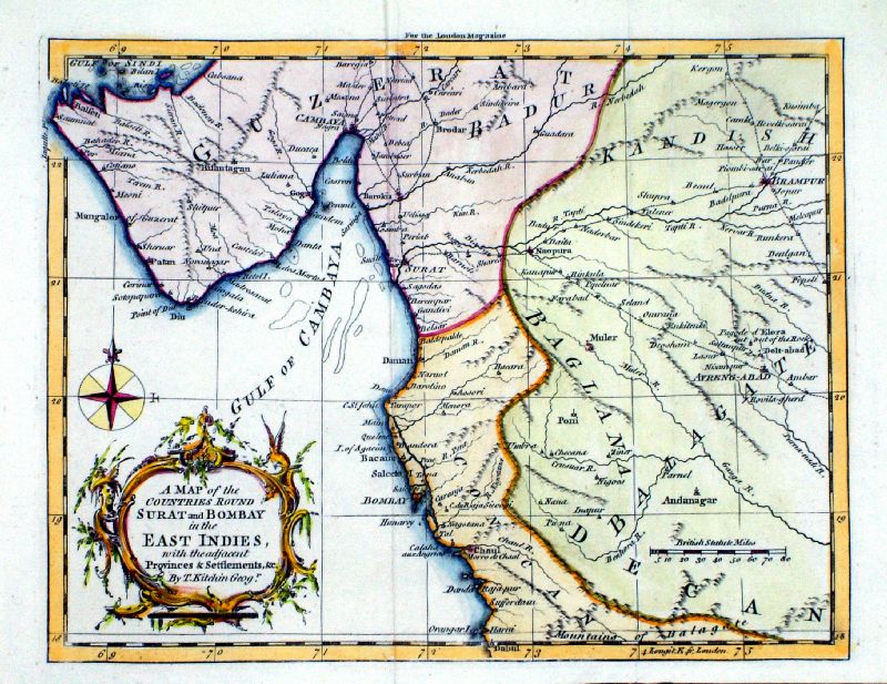 |
A Map of the
countries round Surat and Bombay in the East Indies Thomas Kitchin / London Magazine 1759 Copper engraving. size: 265 x 190 mm, 2 folds Ref LLM021 £85.00 (+P&P) Detail click image for enlargement |
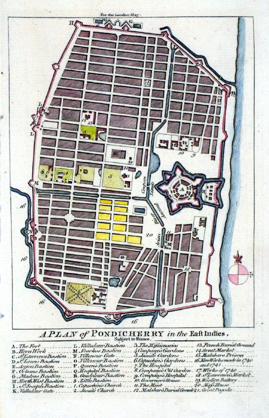 |
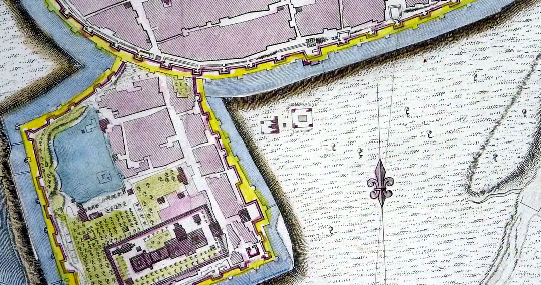
A Plan of Pondicherry
in the East Indies Thomas Kitchin / London Magazine 1759 Copper engraving. size: 125 x 190 mm Ref LLM039 £85.00 (+P&P) click image for enlargement |
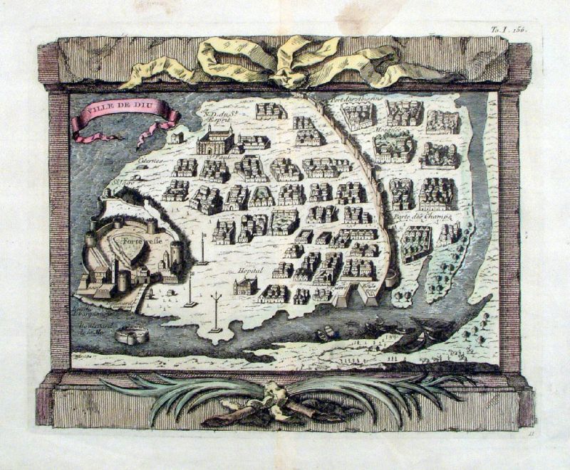 |
Ville de Diu
Bellin c1744 Copper engraving size: 270 x 220 mm Diu - Gujarat - West coast Note - orientation is south to the top of page. Ref IIM015 £65.00 (+P&P) click image for enlargement |
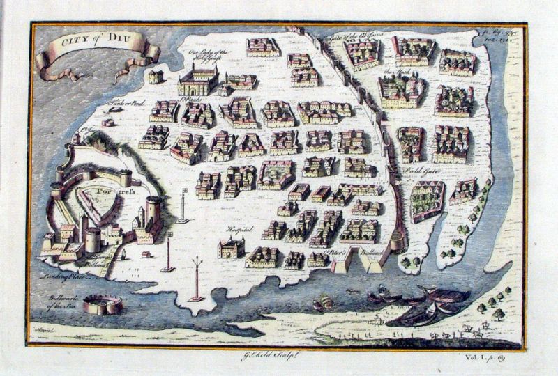 |
Ville de Diu
Child c1730 Copper engraving size: 230 x 160 mm Diu - Gujarat - West coast Note - orientation is south to the top of page. Ref JBM023 £65.00 (+P&P) click image for enlargement |
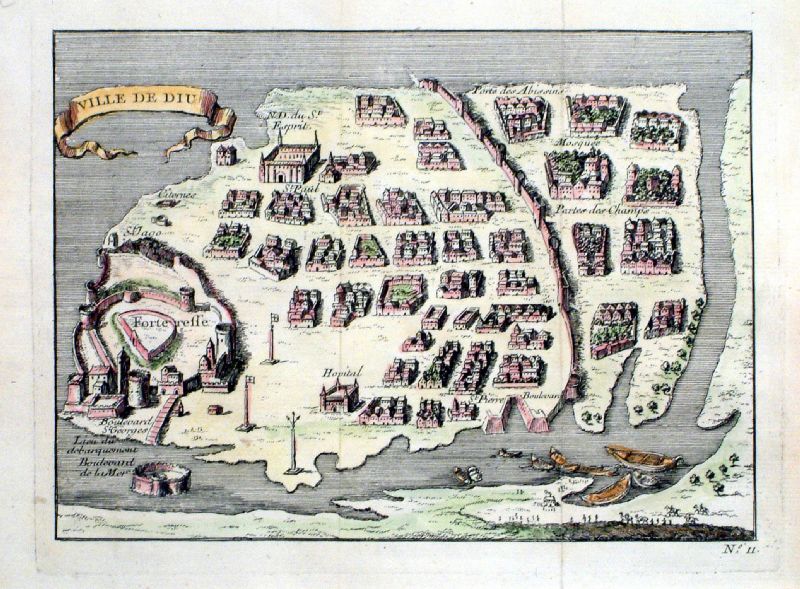 |
Ville de Diu
anon c1750 Copper engraving size: 230 x 160 mm Diu - Gujarat - West coast Note - orientation is south to the top of page. Ref KGM006 £60.00 (+P&P) click image for enlargement |
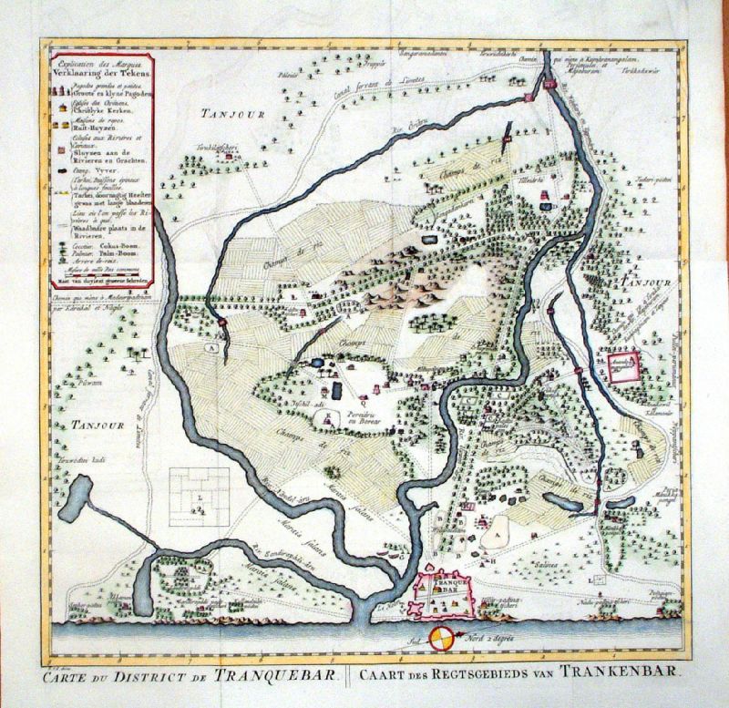 |
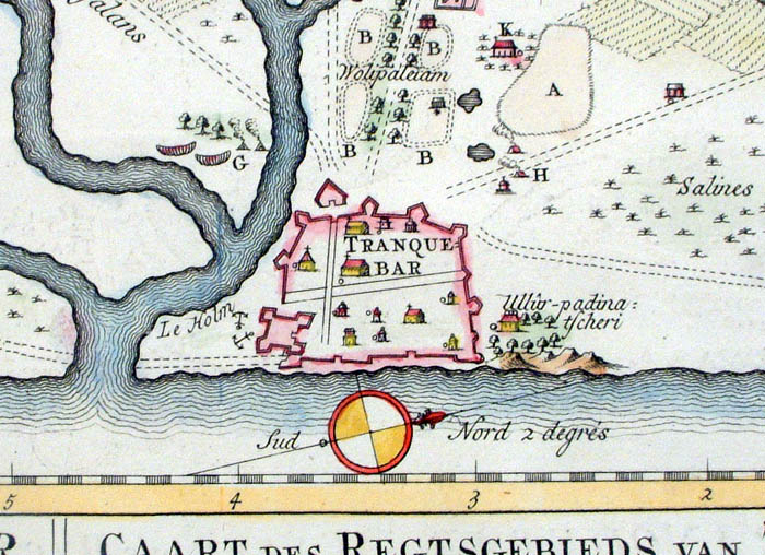
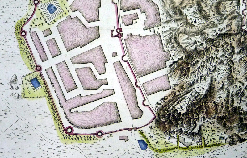
Carte du District de Tranquebar / Caart des
Regtsgebieds van Trankenbar Tranqebar and vincinity on the Coromandel coast. Schley c1750 Detail 1 Detail 2 Copper engraving size: 330 x 330 mm, several folds Ref KFM005 £90.00 (+P&P) click image for enlargement |
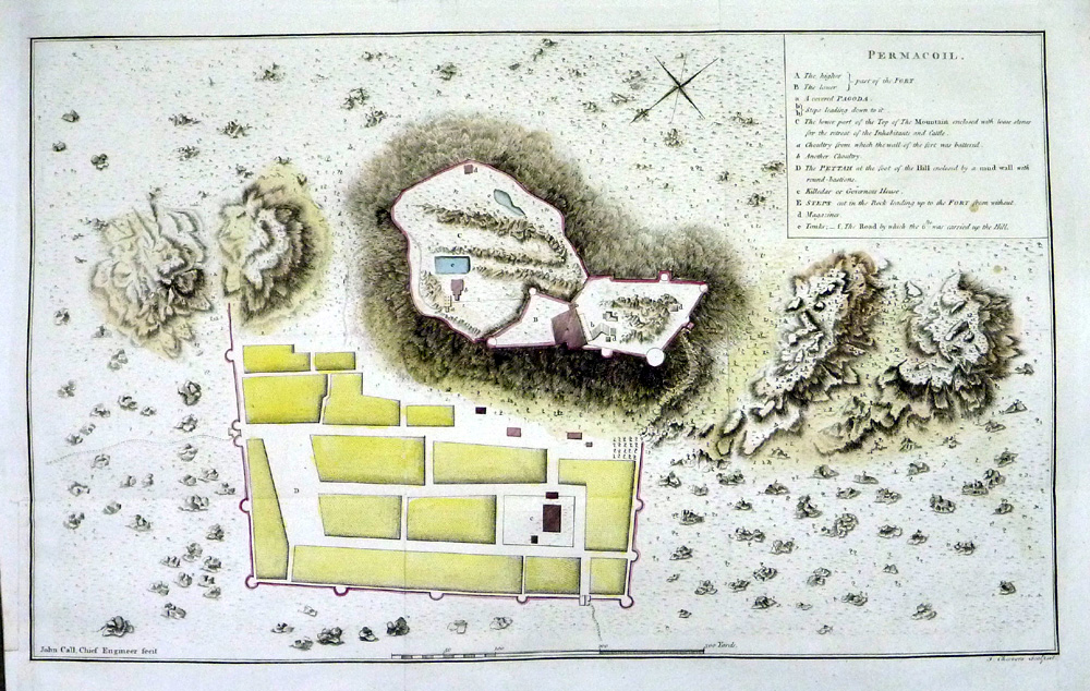 |
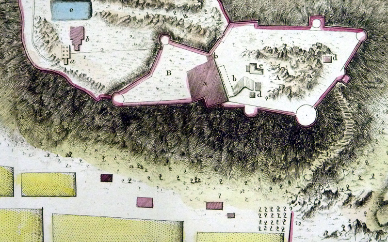
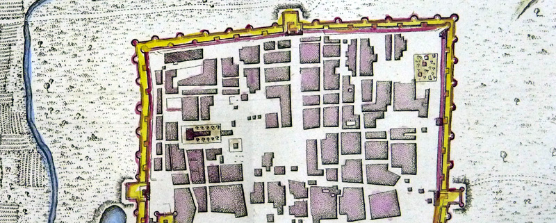
Permacoil J. Cheevers Detail 1 Copper engraving size: 460 x 290 mm, 2 folds, 1 small repair at left margin. From 'A History of the Military Transactions of the British Nation in Indostan' by Robert Orme 1803. Ref NFM020 £25.00 (+P&P) click image for enlargement |
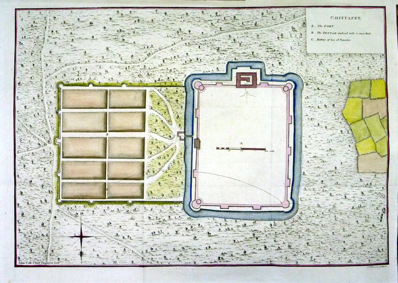 |
Chitapet J. Cheevers Detail 1 Copper engraving size: 460 x 290 mm, 2 folds, 1 small repair at left margin. From 'A History of the Military Transactions of the British Nation in Indostan' by Robert Orme 1803. Ref NFM019 £25.00 (+P&P) click image for enlargement |
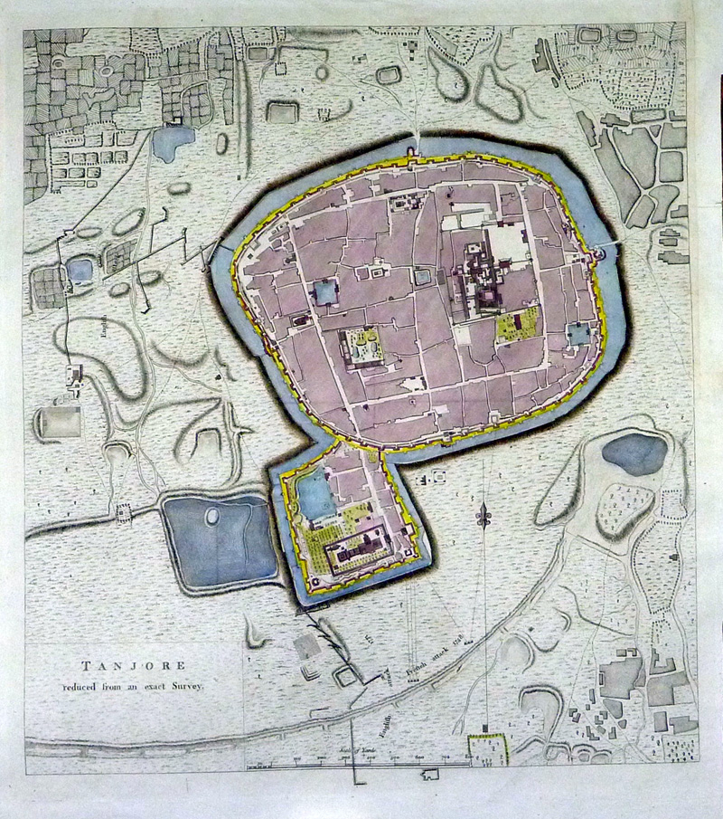 |
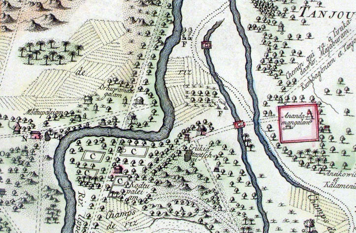
Tanjore reduced
from an exact survey.
( Thanjavur ) Detail 1 Detail 2 Copper engraving size: 360 x 400 mm, several folds, small repair to top-right margin. From 'A History of the Military Transactions of the British Nation in Indostan' by Robert Orme 1803. Ref NFM006 £45.00 (+P&P) click image for enlargement |
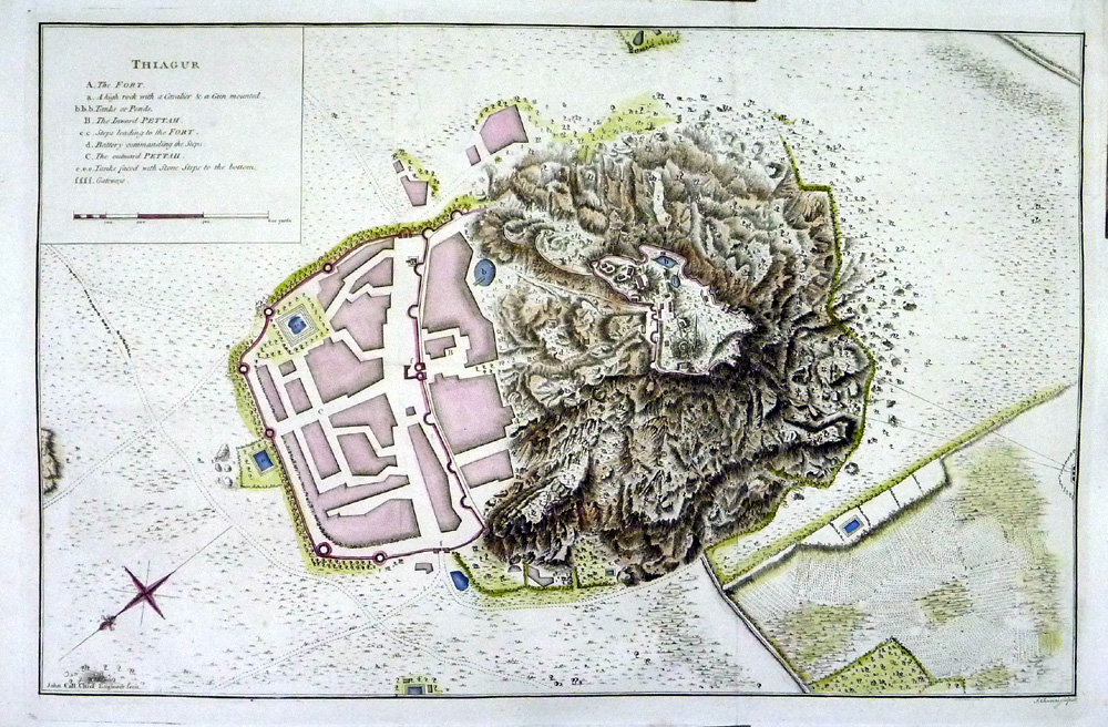 |
Thiagur J. Cheevers Detail 1 Copper engraving size: 460 x 300 mm, 3 folds, 1 small repair at right margin. From 'A History of the Military Transactions of the British Nation in Indostan' by Robert Orme 1803. Ref NFM008 £25.00 (+P&P) click image for enlargement |
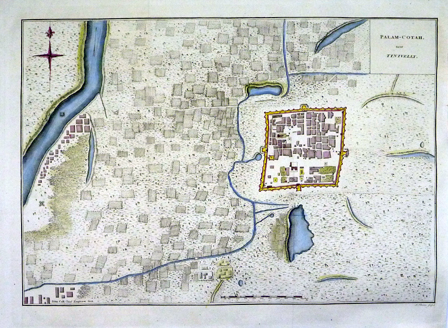 |
Palam-Cotah near
Tinivelly Cheevers Detail 1 Copper engraving size: 440 x 310 mm, several folds. From 'A History of the Military Transactions of the British Nation in Indostan' by Robert Orme 1803. Ref NFM015 £25.00 (+P&P) click image for enlargement |
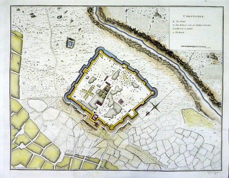 |
Carangoly Cheevers Detail 1 Copper engraving size: 380 x 300 mm, several folds. From 'A History of the Military Transactions of the British Nation in Indostan' by Robert Orme 1803. Ref NFM018 £25.00 (+P&P) click image for enlargement |
 |
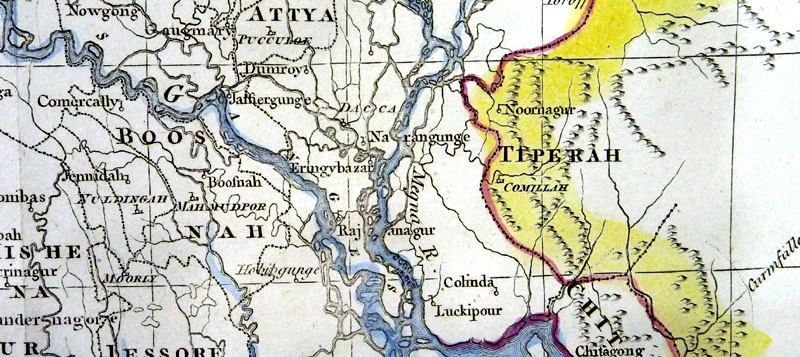
Bengal with its
divisions and adjacent countries Detail 1 Detail 2 Copper engraving size: 550 x 390 mm, several folds, repair to top right margin and 90mm tear. From 'A History of the Military Transactions of the British Nation in Indostan' by Robert Orme 1803. Ref NFM004 £50.00 (+P&P) click image for enlargement |
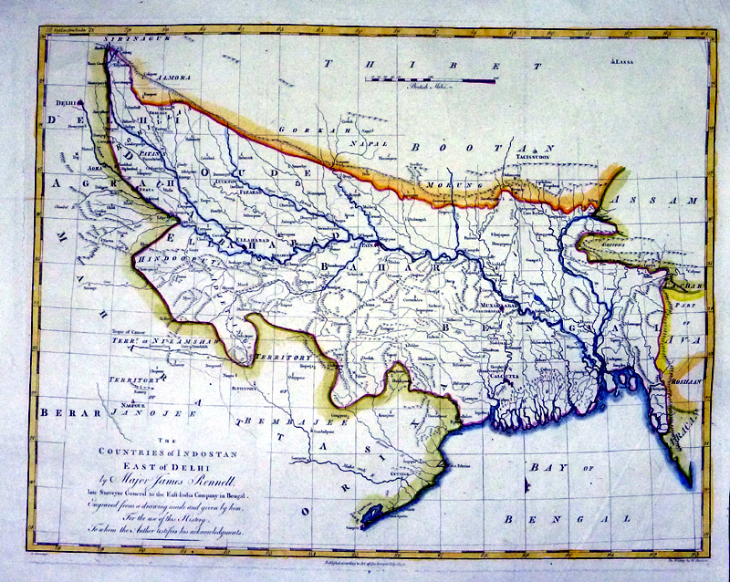 |
The Countries of
Indoostan, East of Delhi Cheevers / Harrison dated 1778 Detail 1 Detail 2 Copper engraving size: 400 x 310 mm, several folds, a few creases From 'A History of the Military Transactions of the British Nation in Indostan' by Robert Orme 1803. Ref NFM001 £40.00 (+P&P) click image for enlargement |
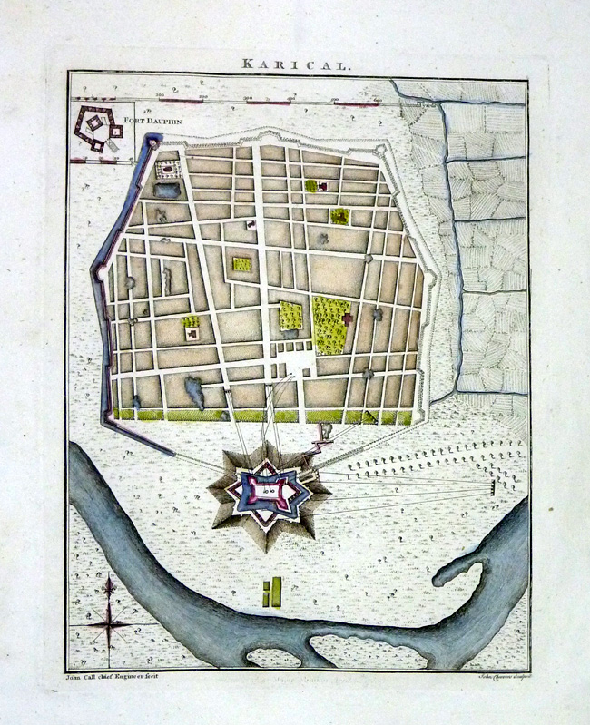 |
Karical Cheevers Detail Copper engraving size: 180 x 220 mm From 'A History of the Military Transactions of the British Nation in Indostan' by Robert Orme 1803. Ref NFM021 £20.00 (+P&P) click image for enlargement |
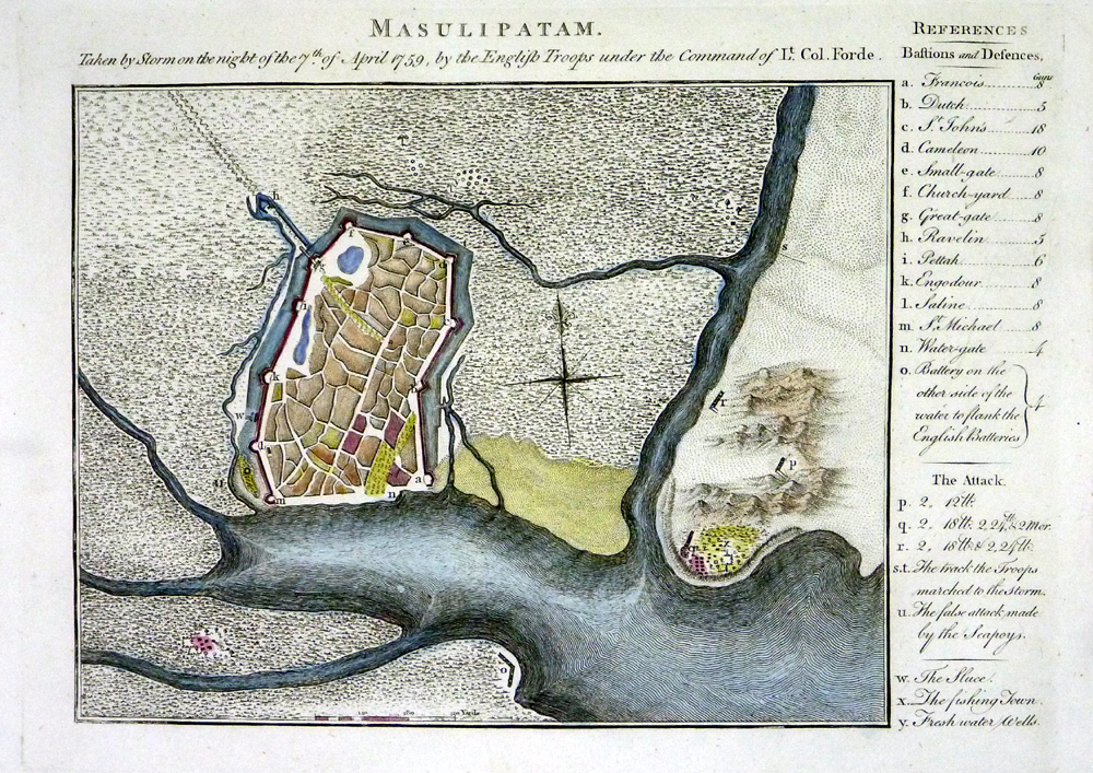 |
Masulipatam,
taken by storm on the night of 7th April 1759 Copper engraving size: 260 x 190 mm, repair at lower border. From 'A History of the Military Transactions of the British Nation in Indostan' by Robert Orme 1803. Ref NFM016 £20.00 (+P&P) click image for enlargement |
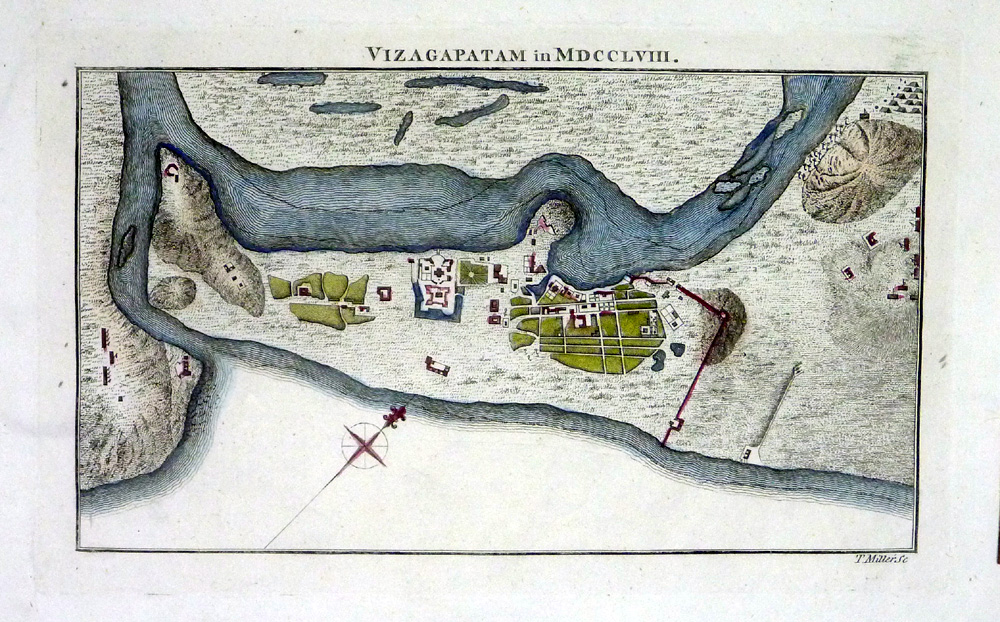 |
Vizagapatam in
MDCCLVIII Miller Copper engraving size: 230 x 140 mm From 'A History of the Military Transactions of the British Nation in Indostan' by Robert Orme 1803. Ref NFM010 £20.00 (+P&P) click image for enlargement |
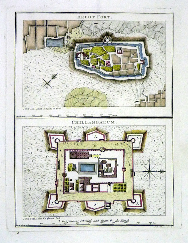 |
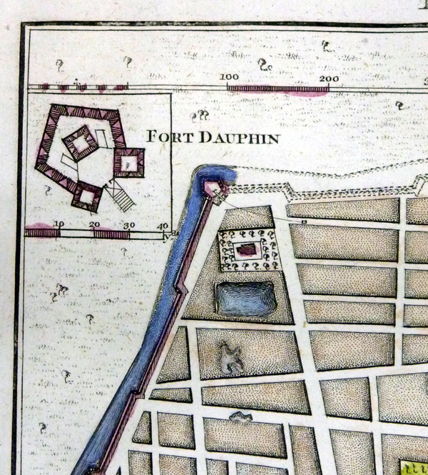
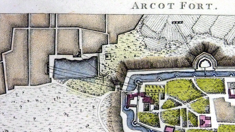
Arcot Fort (top)
Chillamburam (bottom) Cheevers Detail Copper engraving size: 180 x 230 mm From 'A History of the Military Transactions of the British Nation in Indostan' by Robert Orme 1803. Ref NFM022 £20.00 (+P&P) click image for enlargement |
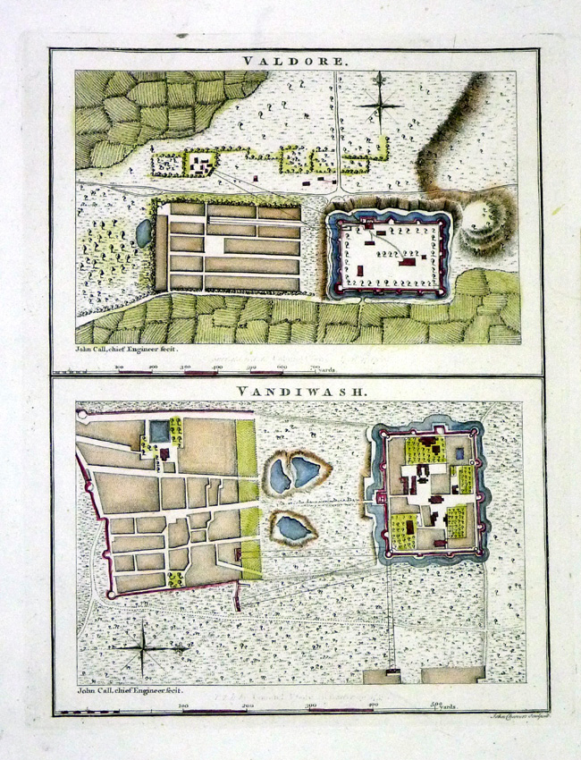 |
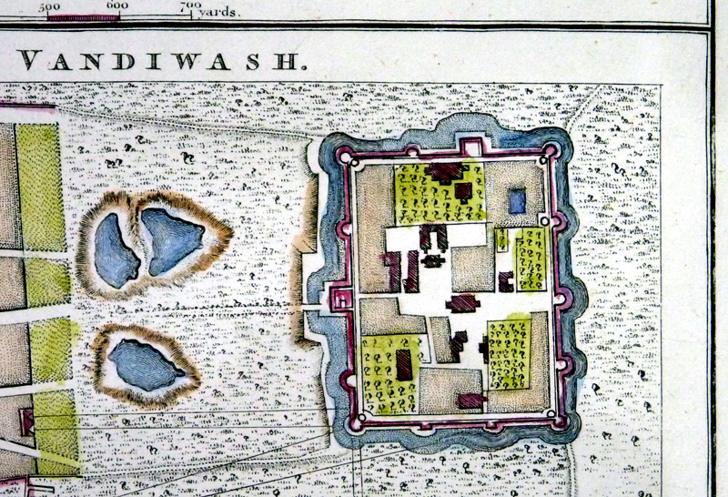
Valdore (top)
Vandiwash (bottom) Cheevers Detail Copper engraving size: 180 x 230 mm From 'A History of the Military Transactions of the British Nation in Indostan' by Robert Orme 1803. Ref NFM017 £20.00 (+P&P) click image for enlargement |
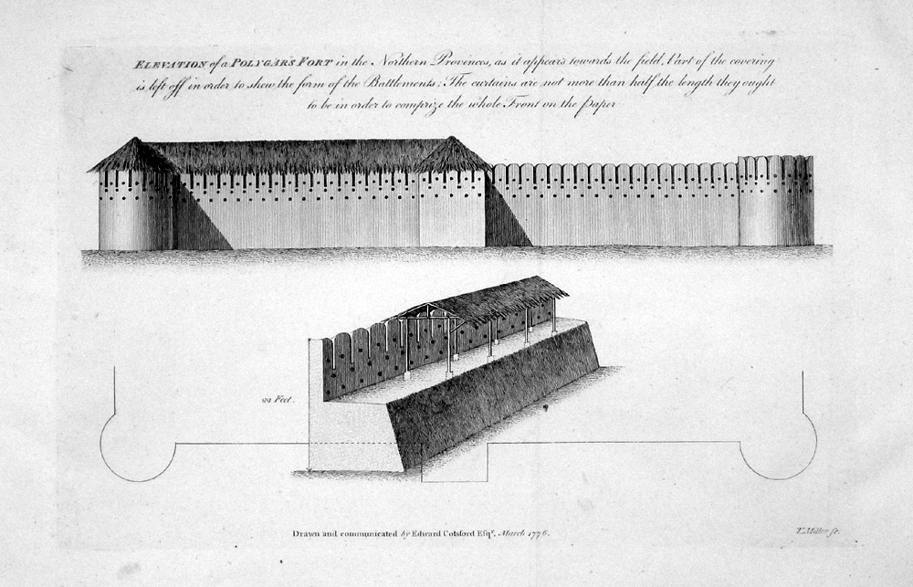 |
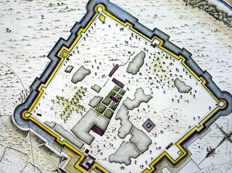
Elevation of a
Polygar's Fort in
the Northern Provinces Cotsford / Miller dated 1776 Copper engraving size: 340 x 230 mm, 2 folds From 'A History of the Military Transactions of the British Nation in Indostan' by Robert Orme 1803. Ref NFM009 £20.00 (+P&P) click image for enlargement |
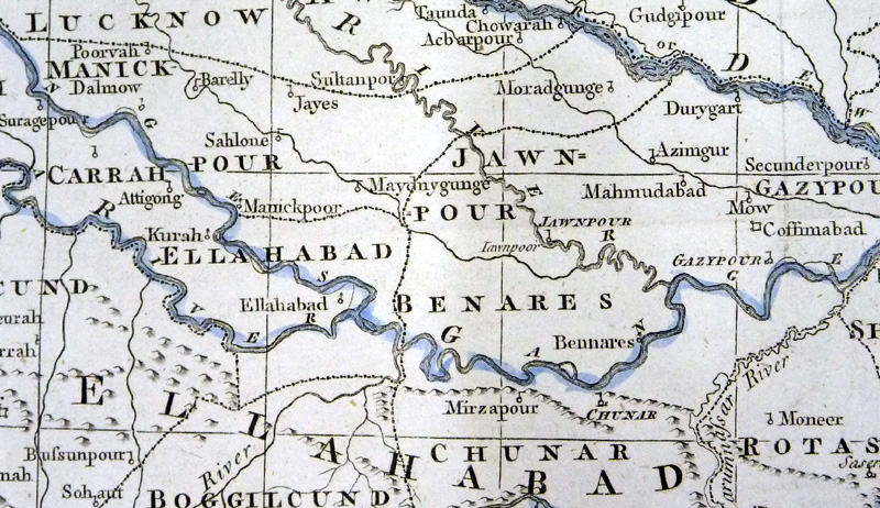
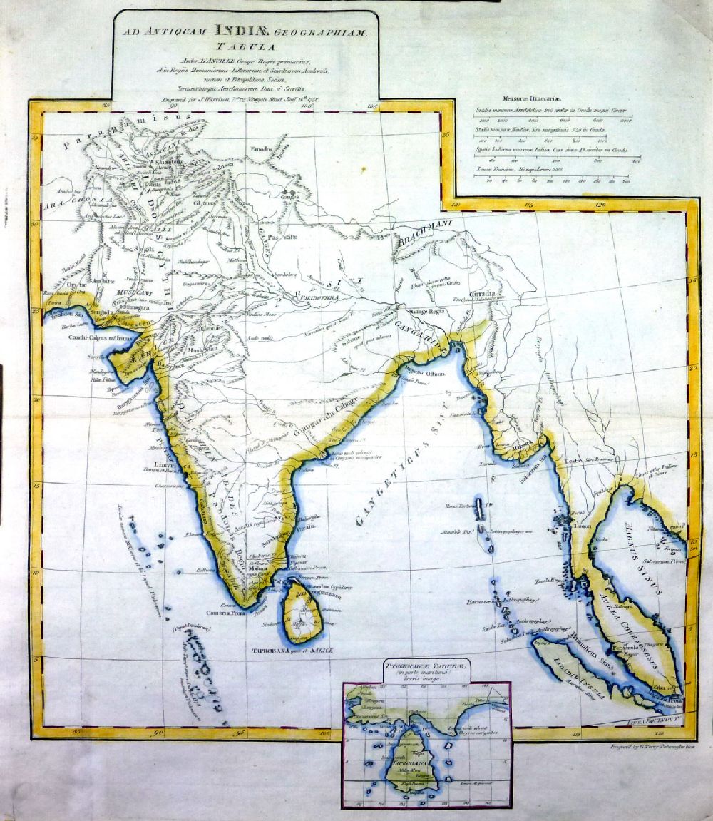 |
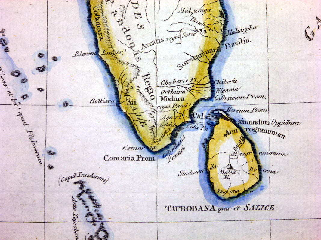
Ad Antiquam Indiae
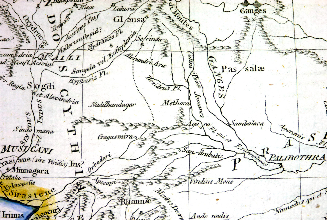
Geographiam Tabula Harrison 1788 Engraved by G. Terry Copper engraving size: 400 x 470 mm Ref NKM016 £40.00 (+P&P) Detail 1 Detail 2 Detail 3 click image for enlargement- apologies for optical distortion and uneven lighting caused during photography. |
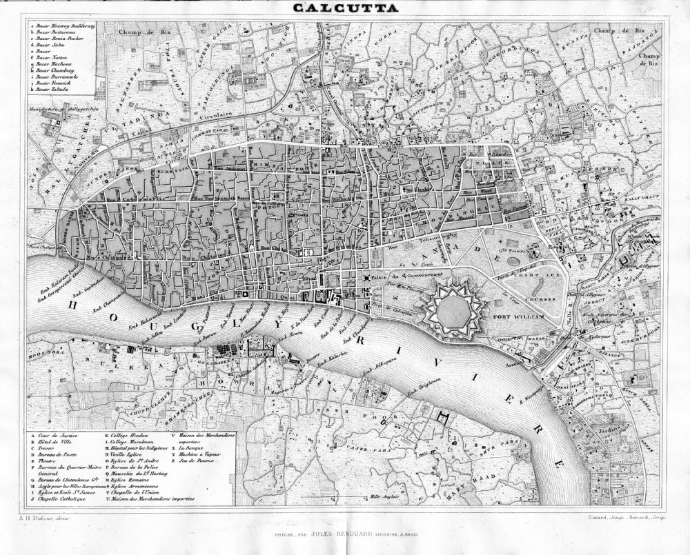 |
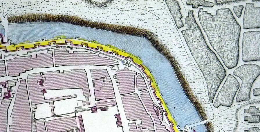
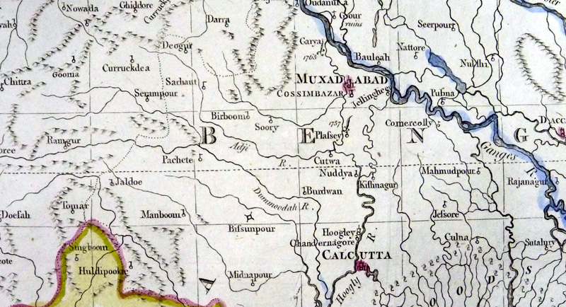
Calcutta
from Abrege de
Geographie by Adrien Balbie,
Paris 1838 Publie Par Jules Renouard. A.H. Dufour. Gavard Scuplt, Banard Scrip. Table of 26 locations. Steel engraving size: 270 x 200 mm centre fold. Ref PHM024 £45.00 (+P&P) Detail click image for enlargement |
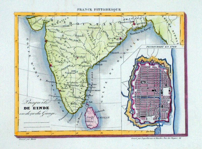 |
De L'
Inde with inset of Pondecherry in 1769 Monin 1835 Steel engraving size: 200 x 150 mm Ref LLM043 £30.00 (+P&P) click image for enlargement |
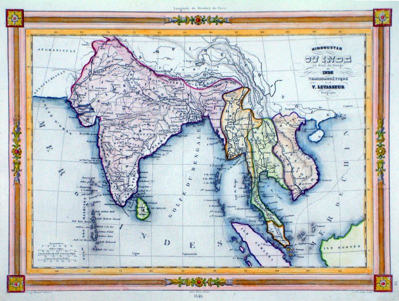 |
Hindoustan ou Inde en
decu du Gange et Inde Transgangtique Levasseur 1846 Steel engraving size: 320 x 250 mm Ref LLM007 £36.00 (+P&P) click image for enlargement |
 |
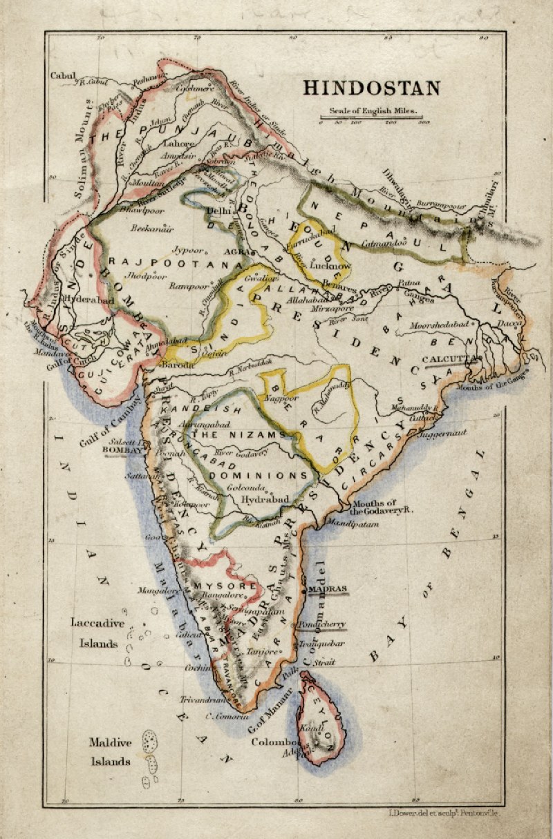
Hindoostan Tyrer /
Souter 1838 size: 250 x 210 mm Ref JLM021 £20.00 (+P&P) click image for enlargement |
 |
Cabool, Beloochistan, etc Gilbert / Archer c1850 Steel engraving size: 250 x 300 mm Ref KFM011 £30.00 (+P&P) click image for enlargement |
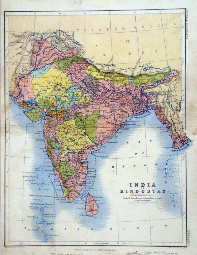 |
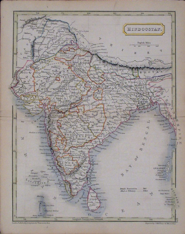
India or Hindoostan
A.K. Johnston / William
Blackwood 1854 size: 250 x 320 mm, centre fold. Early full colour lithographic printing. Fine ink notes on lower margin. Slight discolouration from handling at centre margin & border. Ref LKM005 £18.00 (+P&P) click image for enlargement |
 |
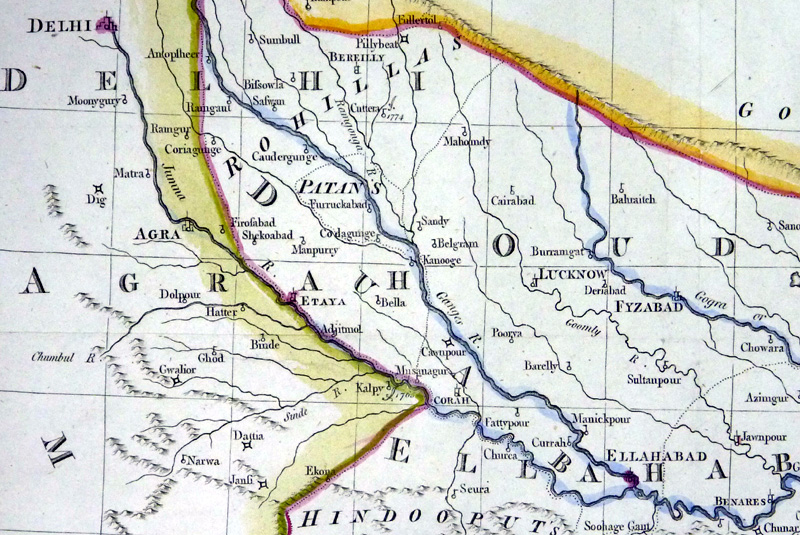
Northern India
Mackenzie 1868 size:
340 x 260 mm Ref FBM037 % £10.00 (+P&P) Strengthened centrefold. Discolouration on centrefold (not as severe as illustrated!) click image for enlargement |
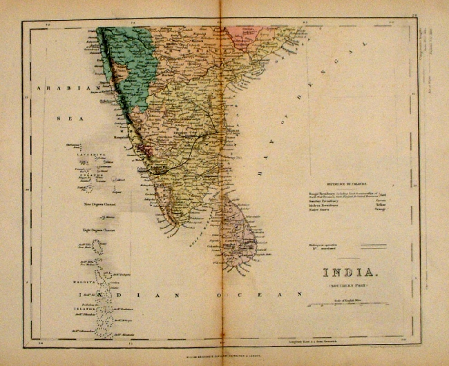 |
Southern India and Ceylon
Mackenzie
1868 size: 340 x
260 mm Ref FBM038 % £10.00 (+P&P) Strengthened centrefold. Discolouration on centrefold (not as severe as illustrated!) click image for enlargement |
 |
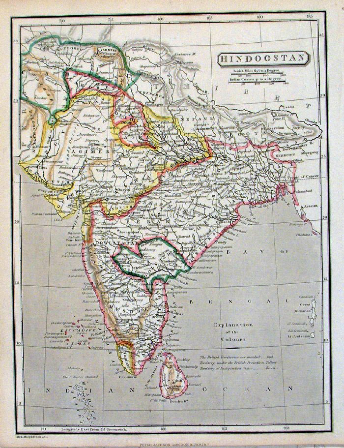
Hindoostan Sidney Hall 1854 size: 200 x 260mm Ref GBM202 % £20.00 (+P&P) click image for enlargement |
 |
Hindoostan Peter
Jackson
c1850
size: 200 x 270 mm Ref FGM020 £20.00 (+P&P) click image for enlargement |
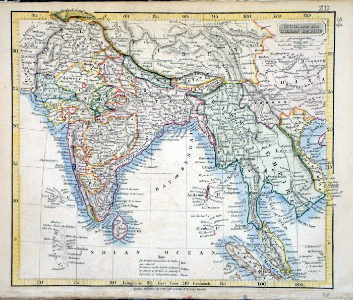 |
India and the Birman Empire
Samuel Arrowsmith 1836 Ref FHM129 £25.00 (+P&P) size: 240 x 210 mm click image for enlargement |
 |
Ancient India
Samuel Arrowsmith 1836 Ref FHM130 £25.00 (+P&P) size: 240 x 210 mm click image for enlargement |
 |
Asia John Dower /
James Cornwell c1850 Ref GFM066 % £14.00 (+P&P) size: 150 x 95 mm, slightly soiled surface, pencil marks on reverse. click image for enlargement |
 |
'Ceylon Pearl Fisheries' United States Coast and Geodetic Survey 1895 Map of designated pearl fishing grounds. Litho size: 220 x 390 mm Ref HLM045 £40.00 (+P&P) click image for enlargement |
Indonesia (including East Indies, Spice Islands) |
|
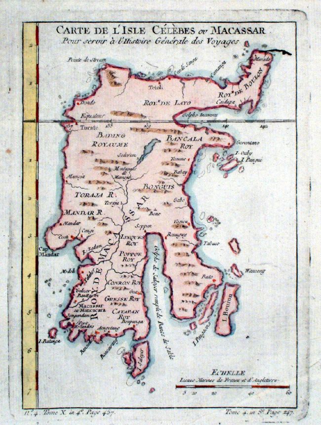 |
Celebes
(Sulawesi)
Bellin
1765
size: 170 x 230 mm Ref JKM010 £40.00 (+P&P) click image for enlargement |
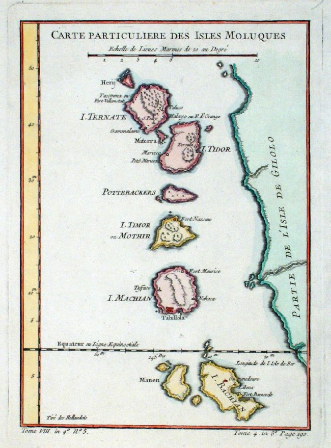 |
Moluccas
(Indonesia)
Bellin c1764 size: 160 x
230 mm Ref JKM009 £32.00 (+P&P) click image for enlargement |
Iraq - see Persia |
|
Japan |
|
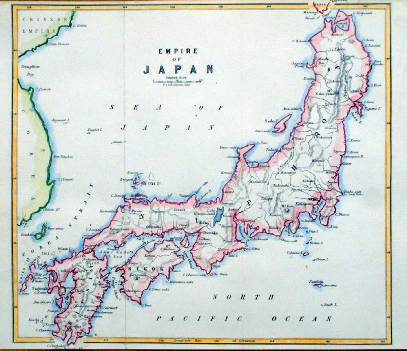 |
Empire of Japan Publ W
& AK Johnston 1859 size: 250x 200 mm, 2 folds Ref ILM018 £28.00 (+P&P) click image for enlargement |
 |
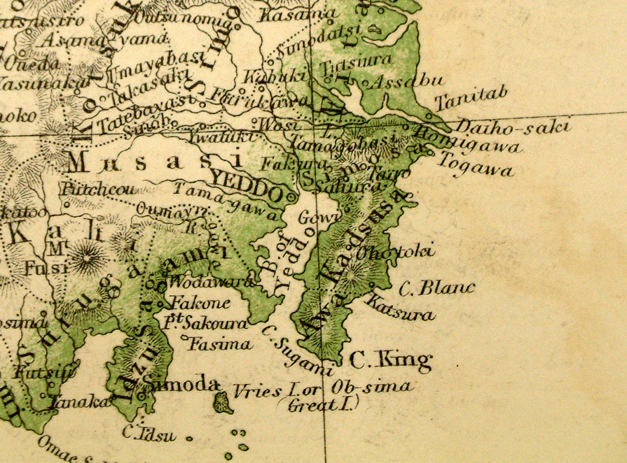
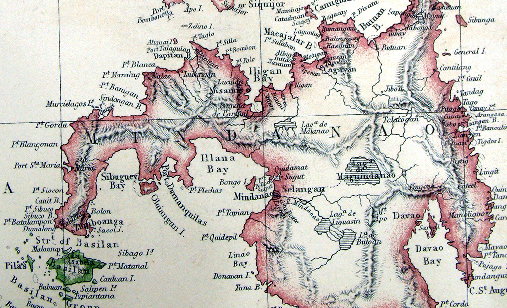
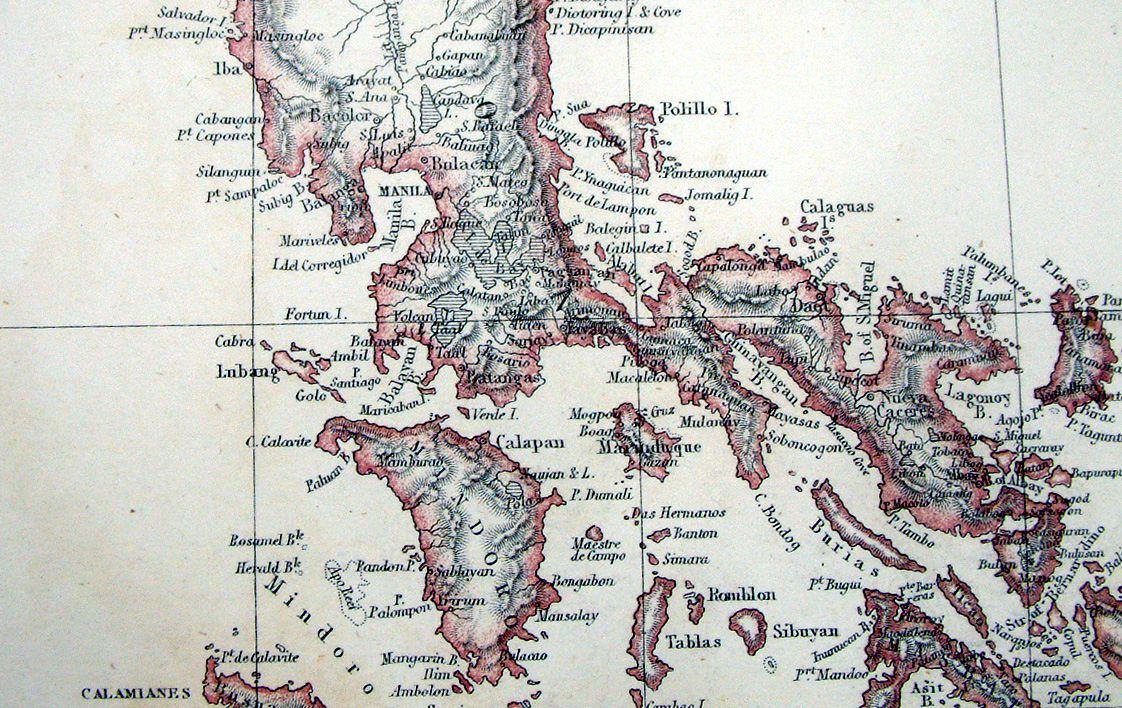
Japan
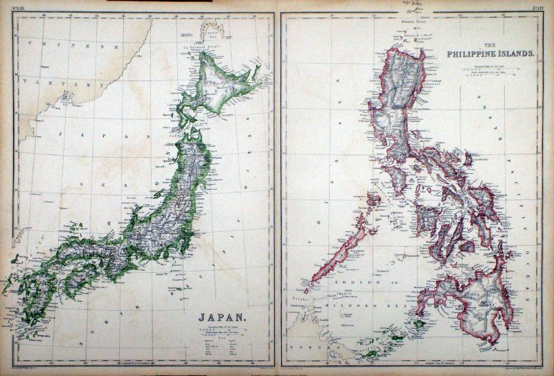
Philippines Islands Lowry / Blackie - Imperial Atlas 1860 size: 540 x 370 mm, centre fold Detail 1 Detail 2 Detail 3 Detail 4 Ref LLM005 £38.00 (+P&P) click image for enlargement |
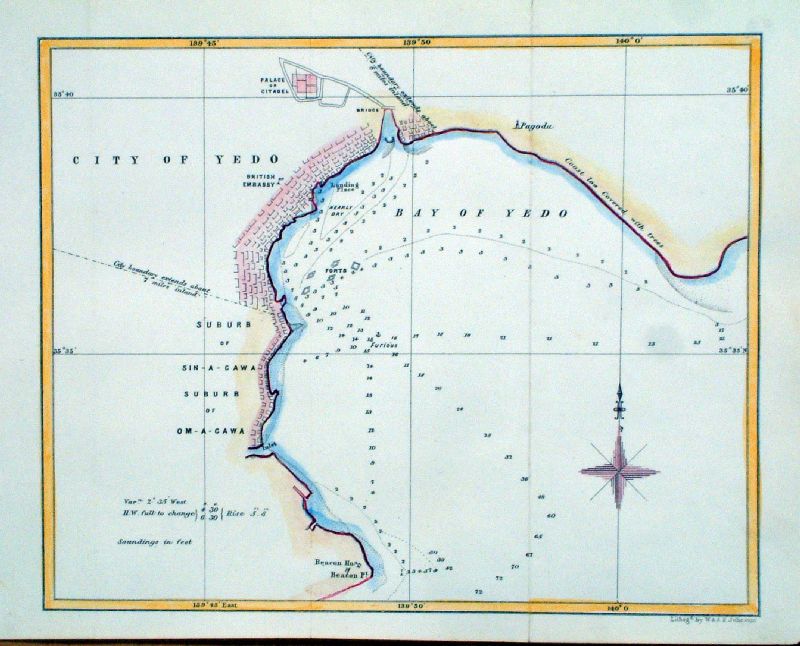 |
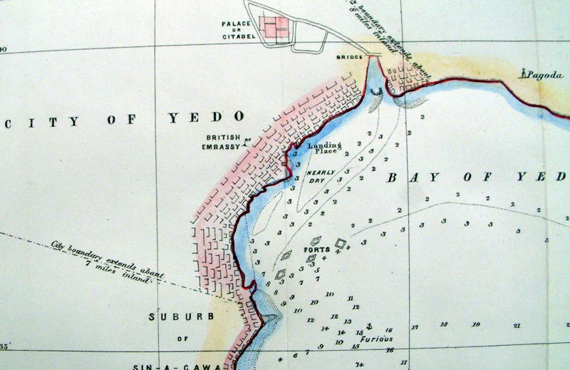
City of Yedo (Tokyo) Publ W & AK Johnston 1859 Lith. size: 250x 200 mm, 2 folds Ref ILM019 £35.00 (+P&P) Detail click image for enlargement |
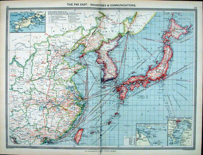 |
Japan, Korea and China - The Far
East, Industries and Communication. Harmsworth Univeral Atlas - London Geographical Institute c1906 size: 500x 380 mm centre fold - slight damage to lower centre fold Ref FLM085 £18.00 (+P&P) click image for enlargement |
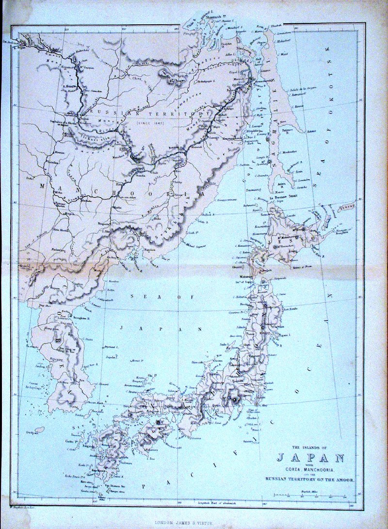 |
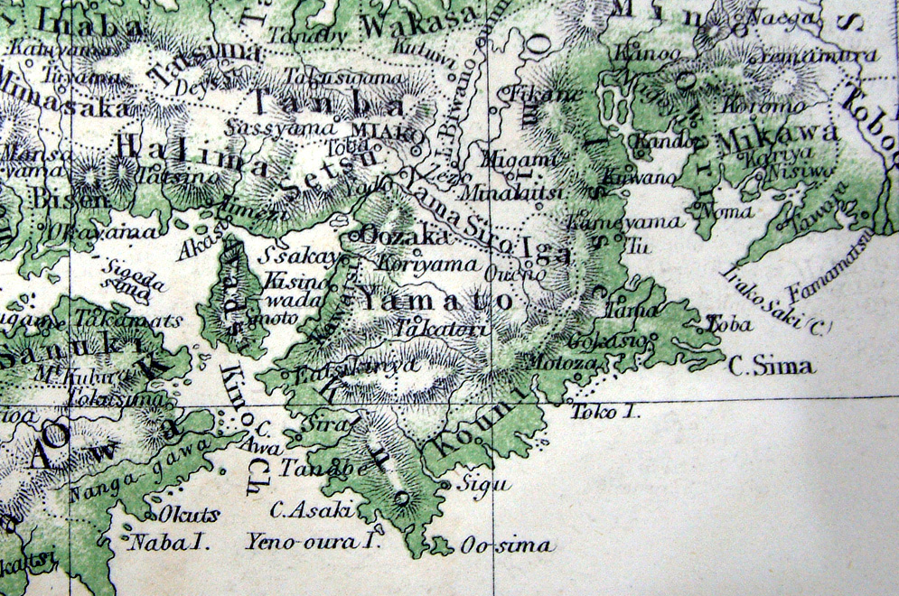
Japan
Hughes
/ Virtue c1880
size 230 x
320 mm, centre fold. 'The Islands of Japan with Corea, Machooria .... ' Ref GDM173 £18.00 (+P&P) click image for enlargement |
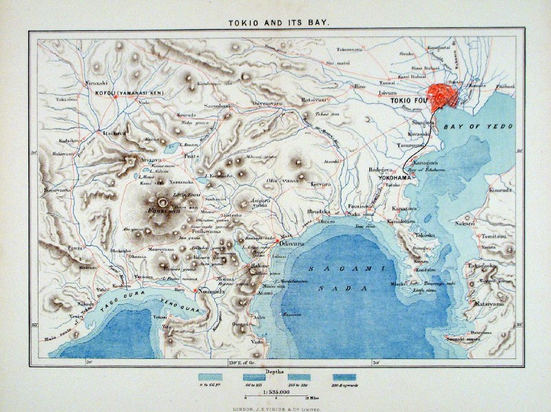 |
Tokio and its Bay J.S.
Virtue c1880 size: 240 x 300 mm, centre fold Ref HHM056 £26.00 (+P&P) click image for enlargement |
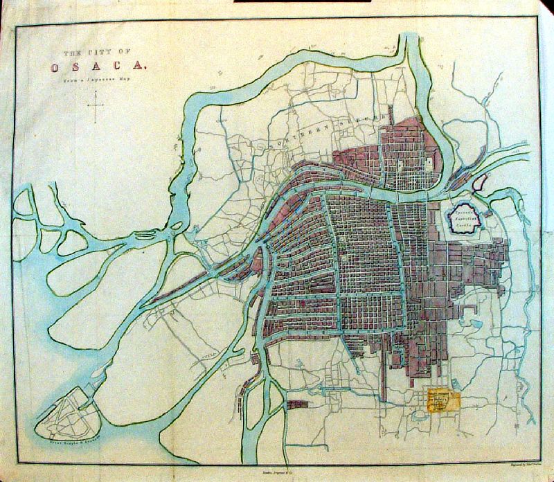 |
The City of Osaca from a Japanese Map Weller
/ Longman 1863 from Osaka, Japan Detail size: 430 x 370 mm, several folds and creases, tight margin at top-right. Note: optical distortion is a function of the photography, not the map. Ref LEM021 £50.00 (+P&P) click image for enlargement |
Malaysia / Malaya ( Singapore )
|
|
| All Genuine Antiquarian Maps - No Reproductions or Modern Copies |
2023
