Past Pages
Antique Maps, Prints and Ephemera
Antique Maps - World, Polar, Celestial & Misc
for Globes and Spheres
see Astronomy link lower down this page 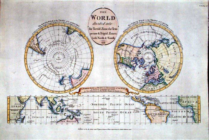 |
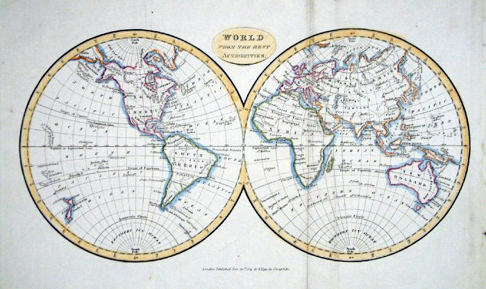
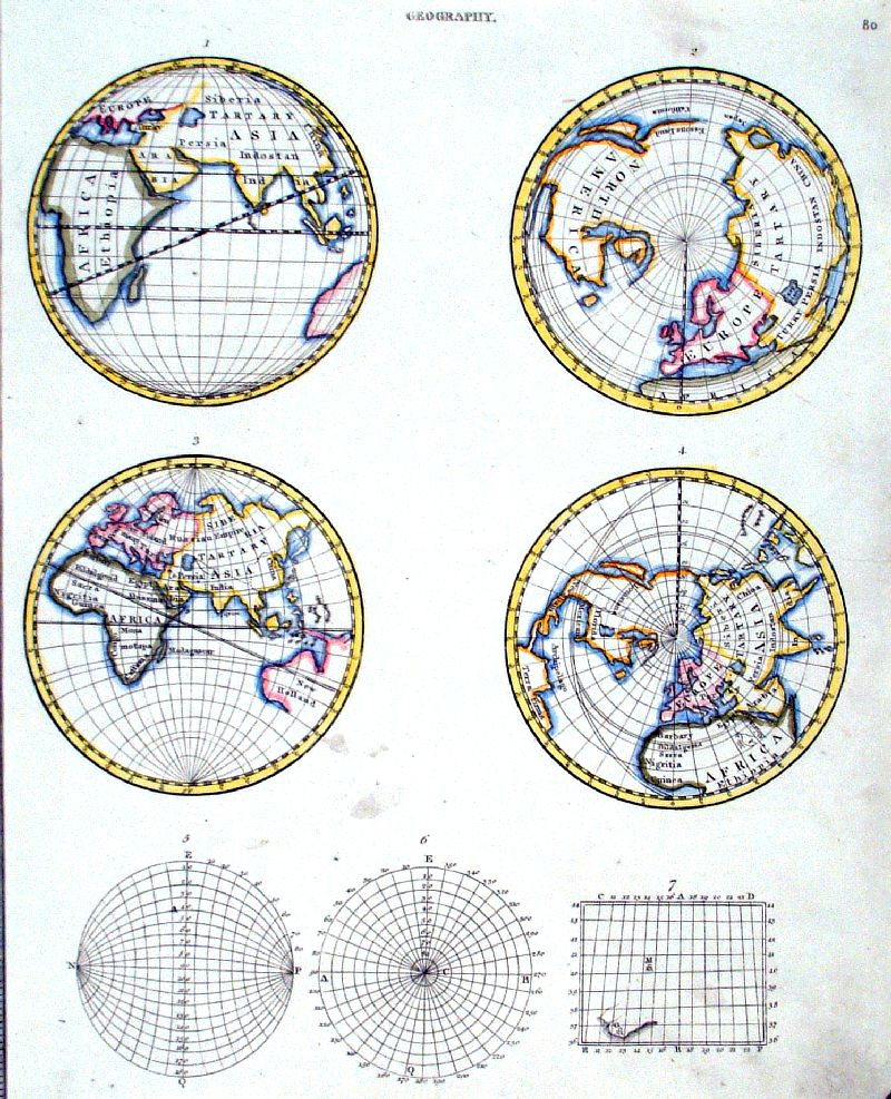
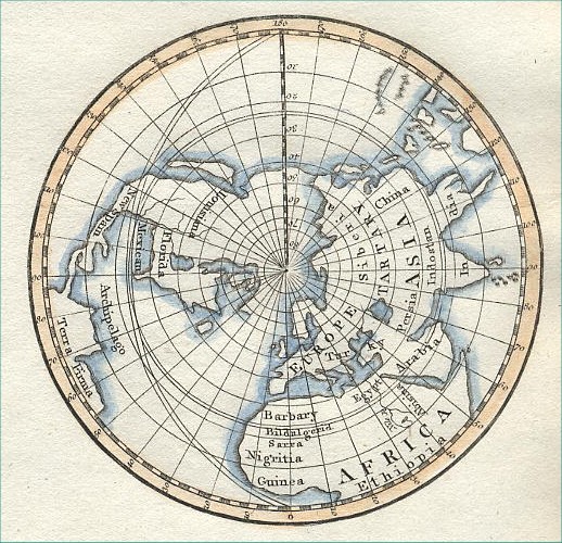
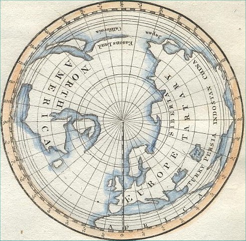
The World - Polar and Equator
Johnson 1791 size:
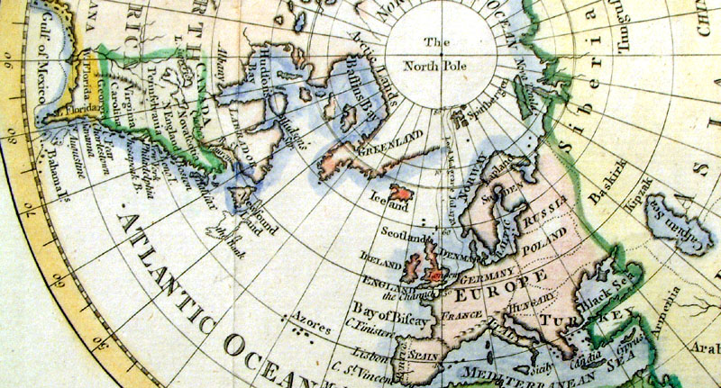
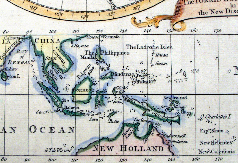
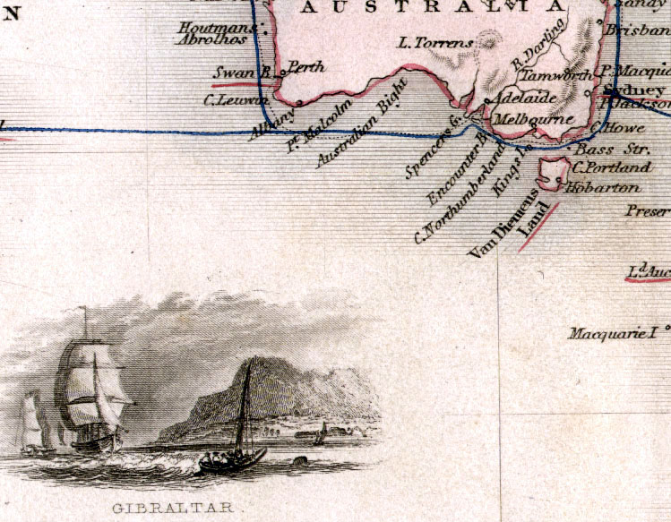
450 x 310 mm The World divided into the Torrid Zone , Temperate and Frigid Zones, Both North and South A very unusual map featuring the polar and equatorial regions. Ref GBM205 £180.00 (+P&P) Detail 1 Detail 2 Detail 3 size: 450 x 310 mm, 2 folds. click image for enlargement |
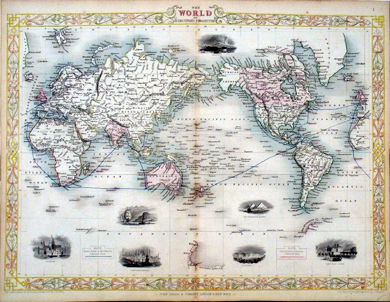 |
The World - Mercator Projection
Tallis
1852 size: 360 x 280 mm,
centre fold Ref GFM108 £200.00 (+P&P) Detail 1
Detail 2
|
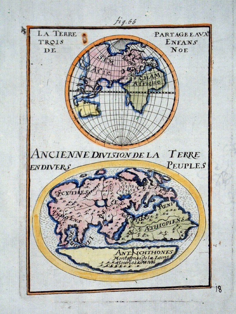 |
Ancient World Mallet
c1709 (German edition)
size 120 x 170 mm Engraving error - image is reversed, text is correct. Ref GHM002 £75.00 (+P&P) click image for enlargement |
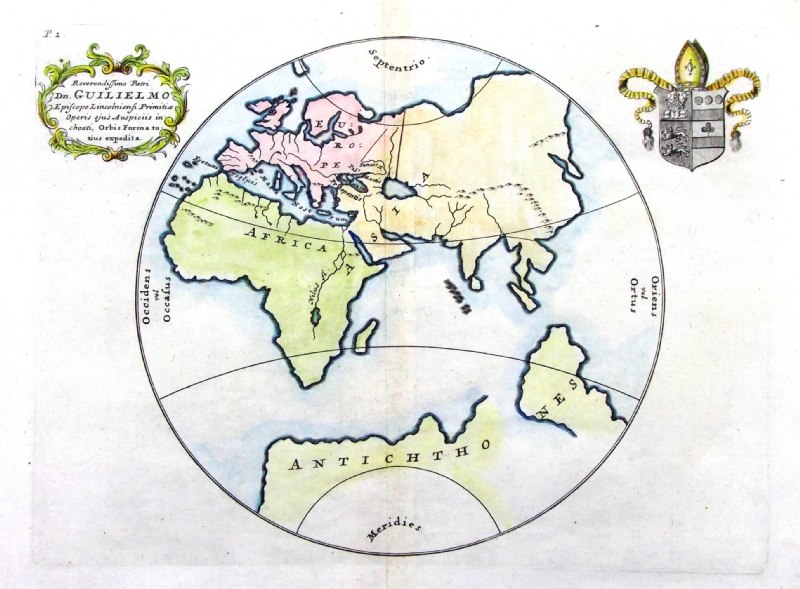 |
Ancient World
from De Situ Orbis by Pomponius Mela. Published by Philippum Bishop, Exeter, 1711 Copper engraving size 270 x 200 mm, centre fold Decorative cartouche contains the name of the sponsor/patron of this map. Ref PDM001 £50.00 (+P&P) click image for enlargement |
 |
The World - Quad Hemispheres Cundee 1809
size: 200 x 260 mm Unusual world projections. California shown as an island on two projections. Ref EFM002 £48.00 (+P&P) Second Copy - IBM001 Detail 1 Detail 2 click image for enlargement |
 |
The World - Double Hemispheres
Tegg 1814
size 310 x 190 mm A few creases and a small hole in Africa Ref FIM032 £28.00 (+P&P) click image for enlargement |
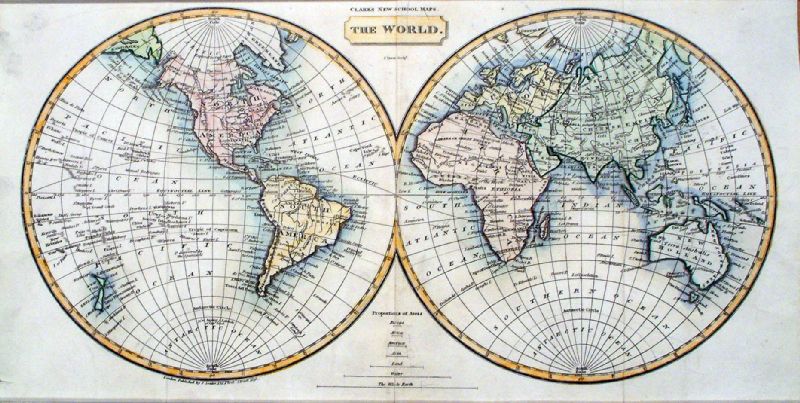 |
The World - Double Hemispheres
Tyrer / Souter 1838
Clark's New School Atlas size 390 x 200 mm, 3 folds A few light pencil marks Ref JLM019 £30.00 (+P&P) click image for enlargement |
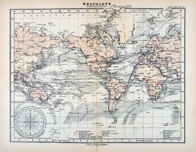 |
Weltkarte Steiler /
Perthes 1895 size: 300 x 240 mm, centre fold. shows German possessions and ocean currents Ref HHM067 £22.00 (+P&P) click image for enlargement |
 |
World Projections
Findlay / Tegg 1845
size 300 x 460 mm Ref ELM093 £16.00 (+P&P) click image for enlargement |
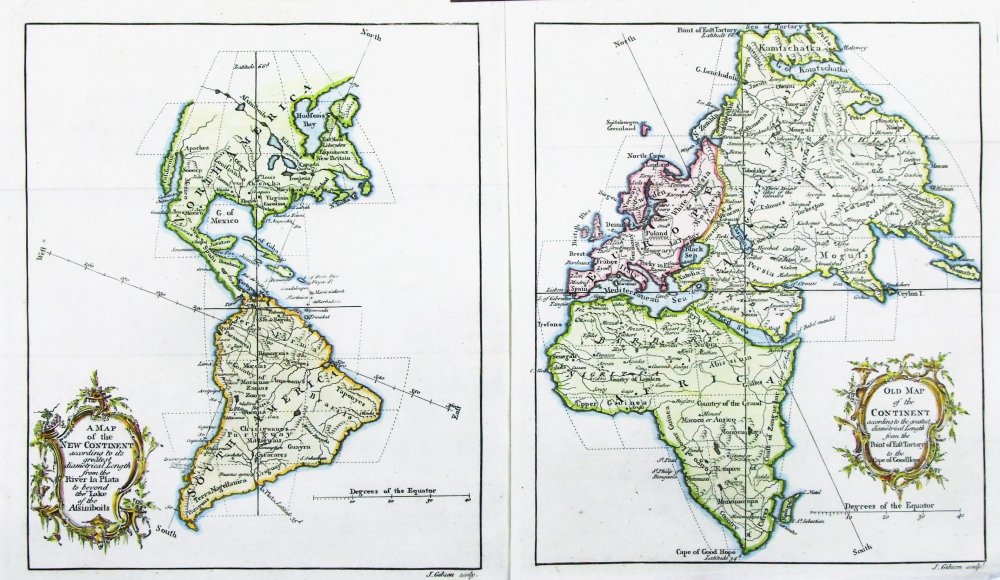 |
A Map of the New
Continent according to its greatest diametrical length
from the River Plata to beyond the Lake of the
Assiniboils and Old Map of the Continent according to the greatest diametrical Length from the point of East Tartary to the Cape of Good Hope. John Gibson, Gentleman's Magazine 1758 Unusual projections of the continents of the East and Western Hemispheres. Two maps, sold as the world, intended for display as a pair. Copper engraving size: (each map) 190 x 220 mm Detail 1 Detail 2 Ref PFM001 (2 maps) £70.00 (+P&P) click image for enlargement |
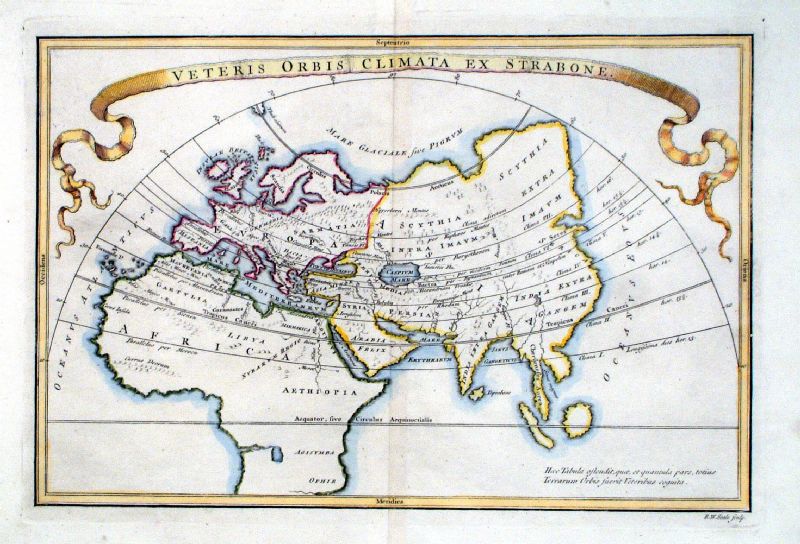 |
Vetus Orbis Climata Ex Strabone Richard Seale Raw/Rivington 1796 Copper engraving size: 330 x 220 mm, centre fold Ref JKM074 £35.00 (+P&P) click image for enlargement |
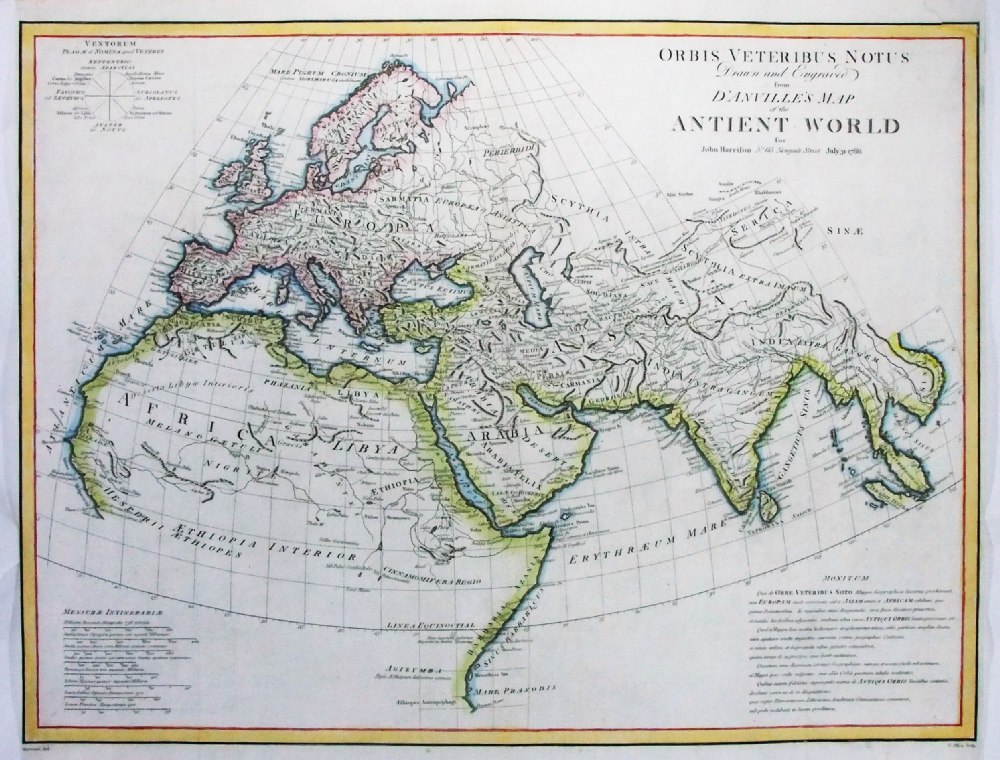 |
Orbis Veteribus
Notus drawn and engraved from Danville's Map of the Ancient World for John Harrison 1788 Drawn by Haywood, Engraved by Allen Detail Copper engraving size: 500 x 390 mm, centre fold, minor repair to top-right corner, tight side margins. Ref PGM023 £38.00 (+P&P) click image for enlargement |
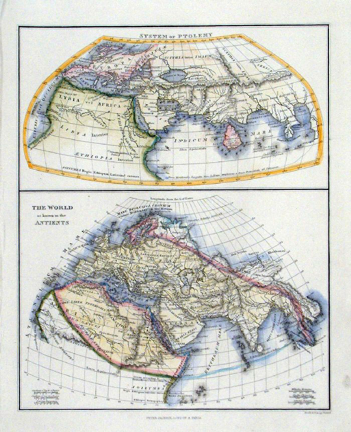 |
The World Known to the Ancients and The System of
Ptolemy Neele / Jackson c1840 size: 200 x 250 mm Ref FGM023 £18.00 (+P&P) click image for enlargement |
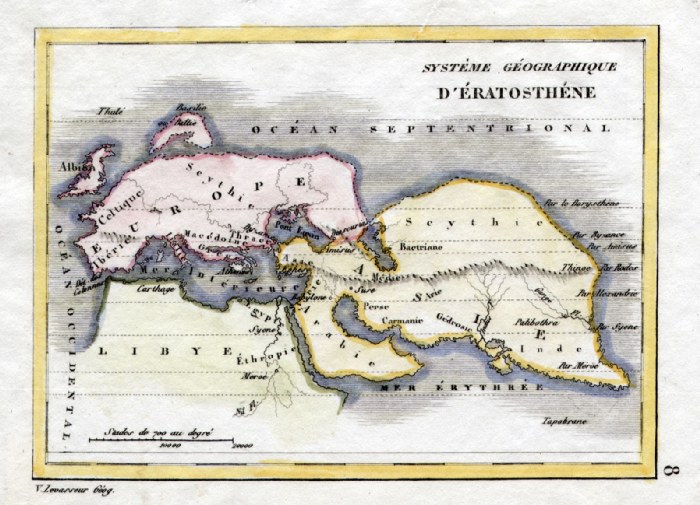 |
'System Geographique d'Eratosthene'
V. Levasseur c1835 size: 130 x 100 mm Ref HAM040 £18.00 (+P&P) click image for enlargement |
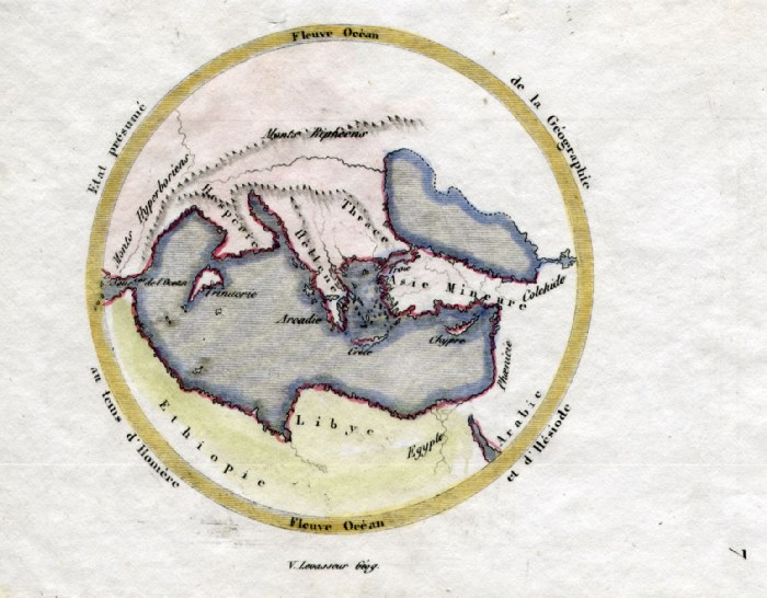 |
Ancient World V. Levasseur
c1835 size: 130 x 100 mm Ref HAM039 £18.00 (+P&P) click image for enlargement |
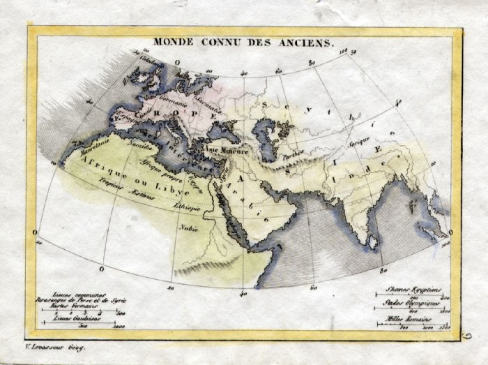 |
Ancient World V. Levasseur
c1835 size: 130 x 100 mm Ref HAM041 £14.00 (+P&P) click image for enlargement |
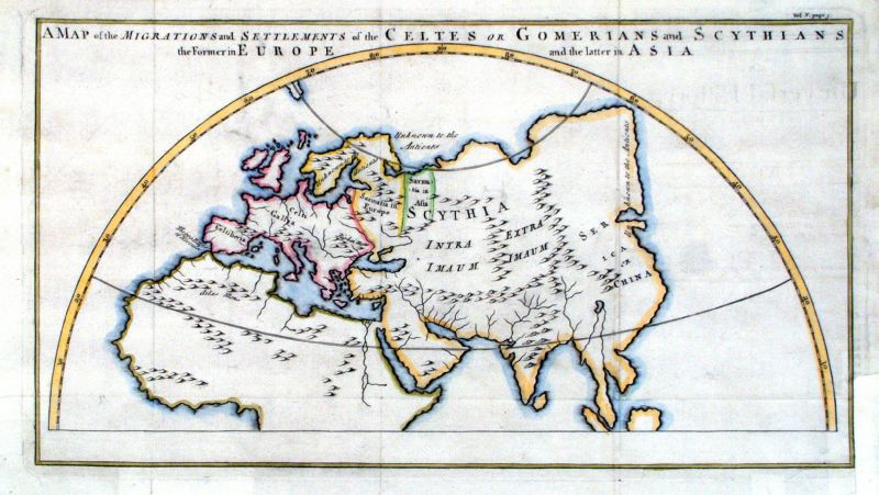 |
A Map of the Migrations and Settlements of the
Celtes or Gomerians and Sythians. The Former in Europe and the Latter in Asia anon 1779 size: 380 x 210 mm, several folds, several small repairs Ref JGM031 £35.00 (+P&P) click image for enlargement |
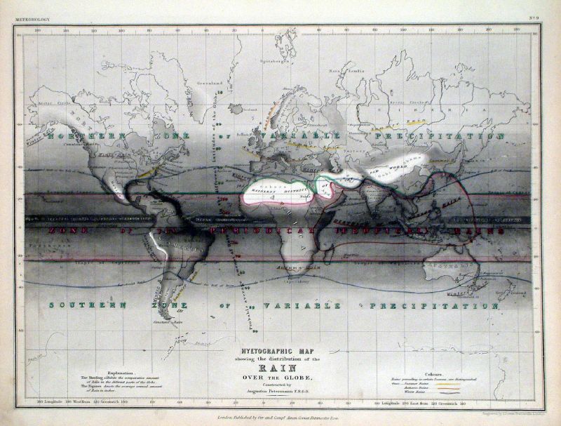 |
Hyetographic Map showing the distribution of Rain
over the Globe Petermann / Dower c1850 size: 300 x 220 mm Ref JGM030 £30.00 (+P&P) click image for enlargement |
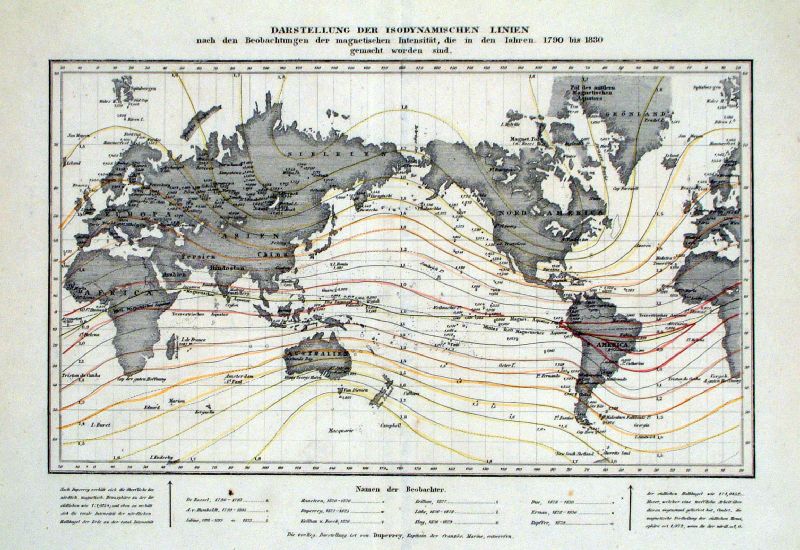 |
The World - Variations in Magnetism
between 1790 - 1830. 'Darstellung der Isodynamischen Linien ......' Duperrey c1830 size: 250 x 190 mm, centre fold Ref JGM032 £30.00 (+P&P) click image for enlargement |
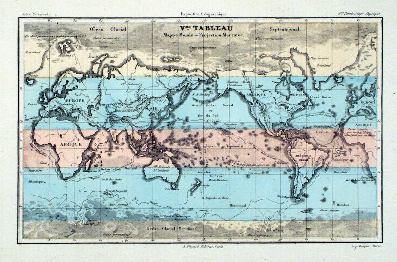 |
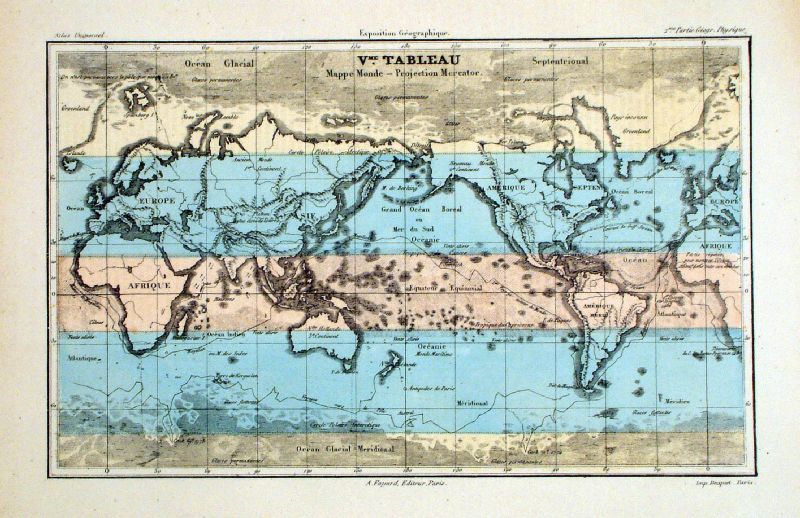
The World - Mercator Projection Fayard / Bequet 1877 size: 280 x 180 mm Centred on the Pacific. Ref JKM039 £18.00 (+P&P) Ref KGM051 £18.00 (+P&P) click image for enlargement |
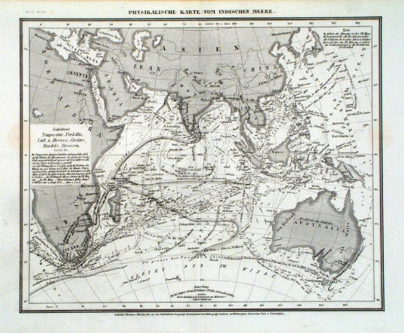 |
Physikalische Karte Vom Indischen Meere Physical map of the Indean Ocean Meyer 1853 size: 270 x 220 mm Ref JKM013 £22.00 (+P&P) click image for enlargement |
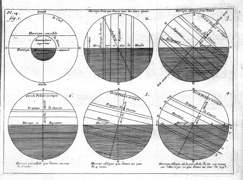 |
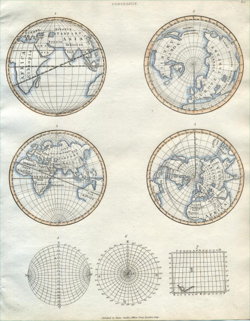
The World - various projections illustrating the
Horizon anon c1750 size: 210 x 160 mm, several folds Ref KGM048 £18.00 (+P&P) click image for enlargement |
 |
Untitled - Asia,
Europe & N. Africa G. Byrne c1780 size: 470 x 240 mm, several folds Ref MDM003 £28.00 (+P&P) click image for enlargement |
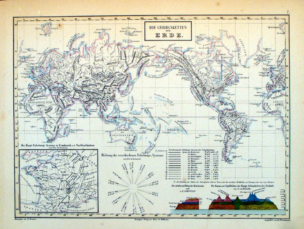 |
The World - Die
Gebirgsketten de Erde Mountain Ranges of the World Winkelmann / Krais & Hoffman for Humboldt's Kosmos 1861 inset of France and land sections size: 320 x 250 mm Ref LDM007 £18.00 (+P&P) click image for enlargement |
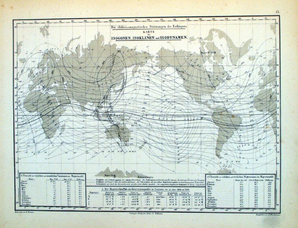 |
The World - Die
elektro-magnetischen Stromungen des Erdkorpers Kart der Isogen, Isoklinen und Isodynamen. Electrogamnetic Field and the variation in recent history. Winkelmann / Krais & Hoffman for Humboldt's Kosmos 1861 inset charts of annual deviations size: 320 x 250 mm Ref LDM013 £18.00 (+P&P) click image for enlargement |
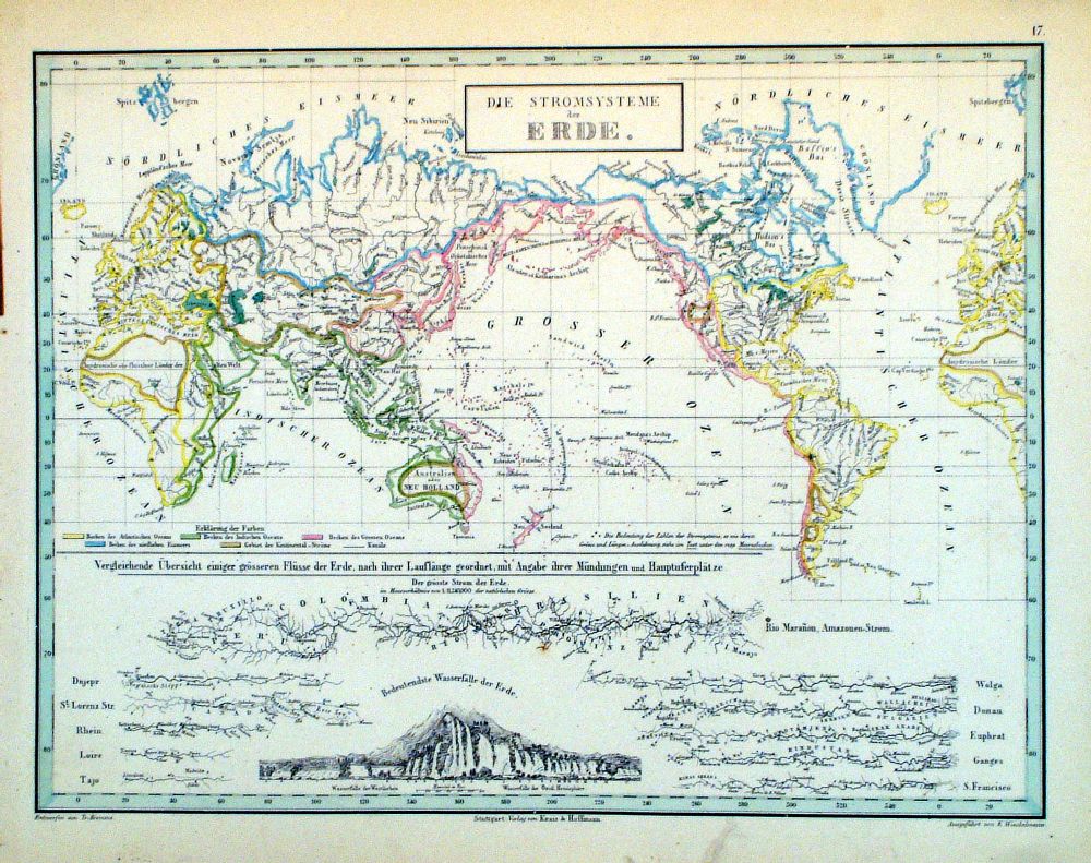 |
The World - Die
Stromsysteme de Erde Rainfall, Rivers and Waterfalls Winkelmann / Krais & Hoffman for Humboldt's Kosmos 1861 inset of comparative rivers and waterfalls size: 320 x 250 mm, mark / smudge at lower margin Ref LDM017 £18.00 (+P&P) click image for enlargement |
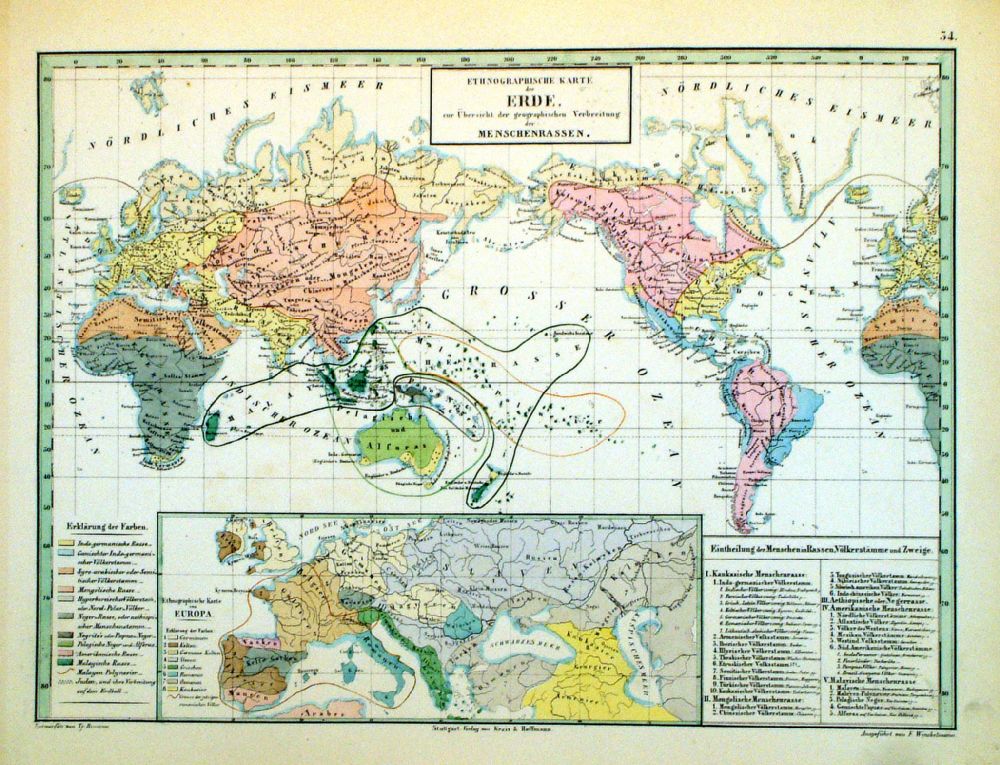 |
The World -
Ethnographishe Karte der Erde Ethnic Diversity. Winkelmann / Krais & Hoffman for Humboldt's Kosmos 1861 inset of Europe and Western Asia. size: 320 x 250 mm Ref LDM034 £18.00 (+P&P) click image for enlargement |
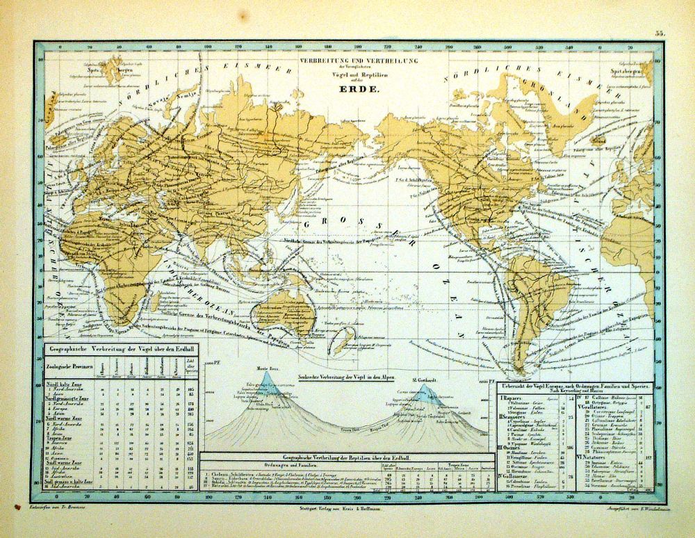 |
The World -
Verbreitung und Vertheilung der Vorzuglichsten Vogel und
Reptilien auf der Erde Distribution of birds and reptiles Winkelmann / Krais & Hoffman for Humboldt's Kosmos 1861 inset of comparison charts size: 320 x 250 mm Ref LDM033 £18.00 (+P&P) click image for enlargement |
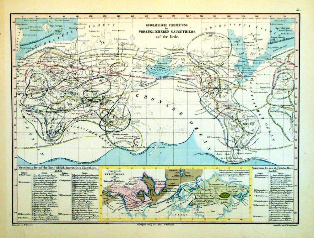 |
The World -
Geographische Verbreitung der Vorzuglicheren Saugethiere
auf der Erde Distribution of Mammals Winkelmann / Krais & Hoffman for Humboldt's Kosmos 1861 inset of Northern Hemisphere size: 320 x 250 mm Ref LDM032 £18.00 (+P&P) click image for enlargement |
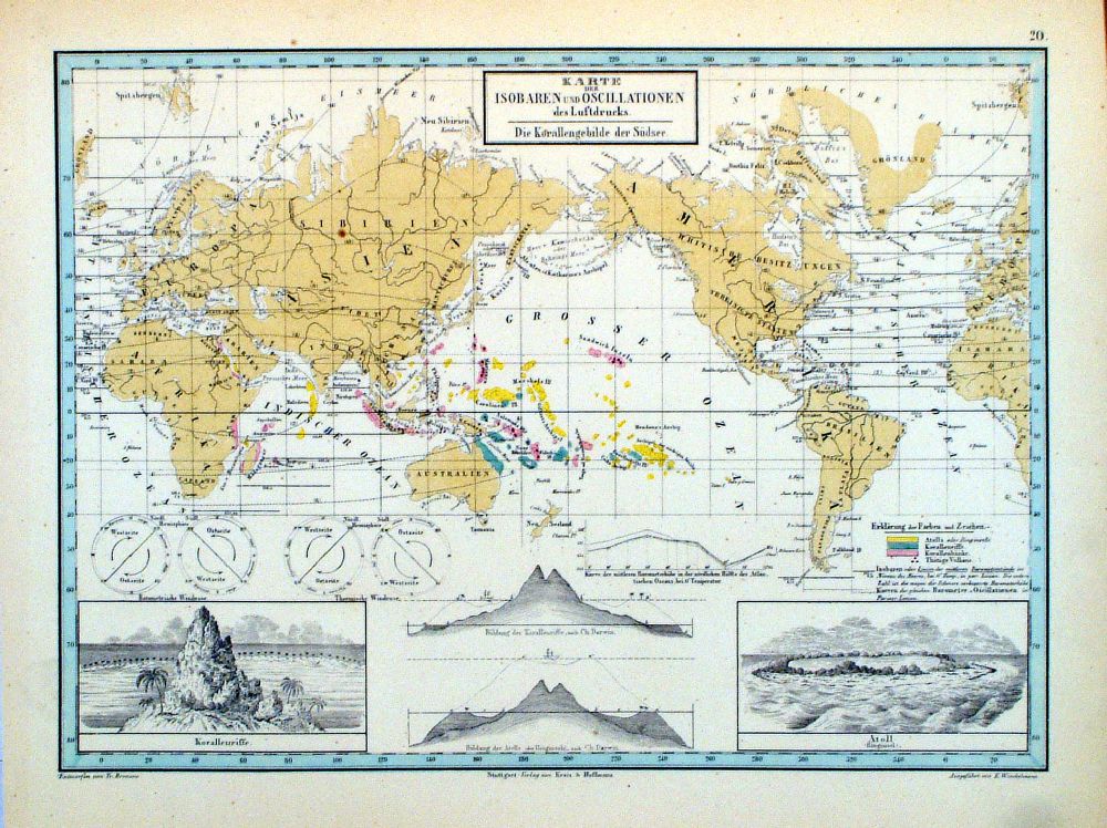 |
The World - Karte der
Isobaren und Oscillationen des Luftdrucks Changes in Air Pressure Winkelmann / Krais & Hoffman for Humboldt's Kosmos 1861 inset of corals and atolls size: 320 x 250 mm Ref LDM020 £18.00 (+P&P) click image for enlargement |
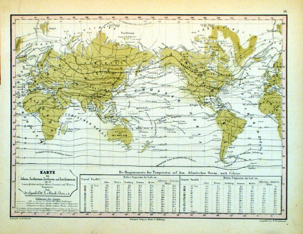 |
The World - Karte der
Jahres - Isothermen, Isotheren, und Isochimenen Temperature variations Winkelmann / Krais & Hoffman for Humboldt's Kosmos 1861 inset of Atlantic Ocean temperatures size: 320 x 250 mm Ref LDM019 £18.00 (+P&P) click image for enlargement |
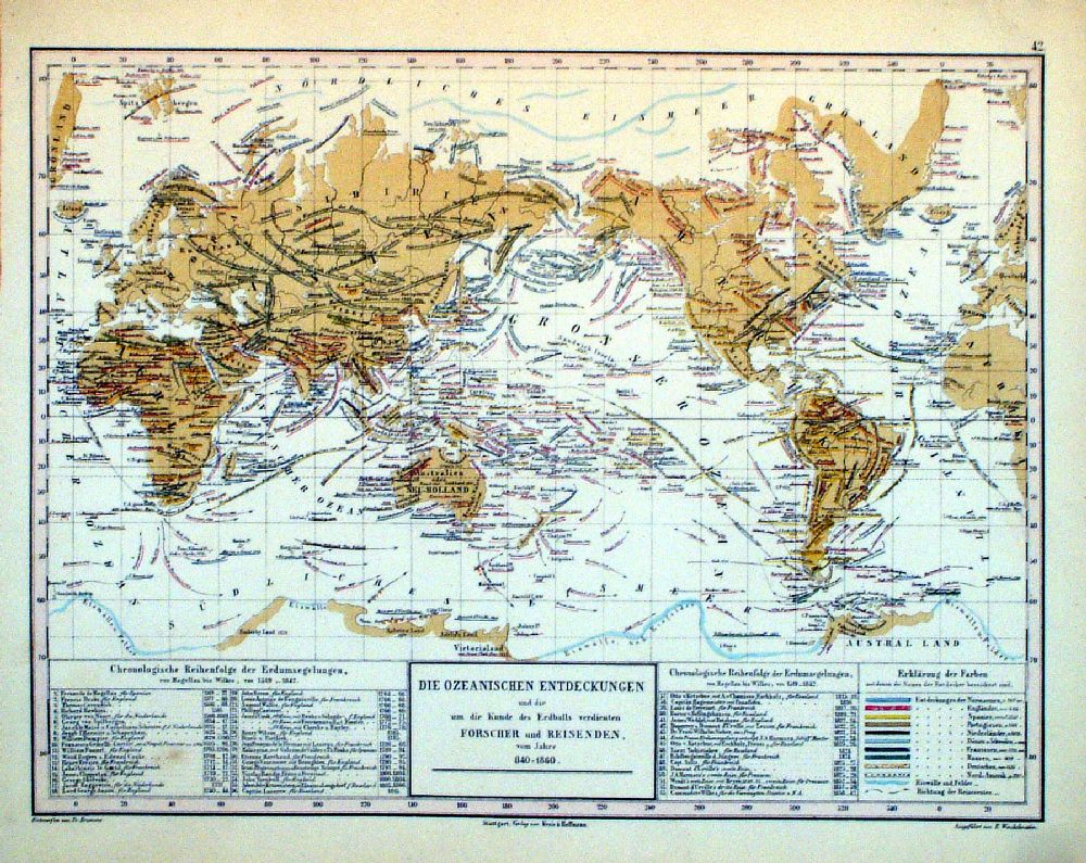 |
The World - Die
Ozeanischen Entdeckungen und die um die Kunde des
Erdballs verdienten Forscher und Reisenden Discoveries with dates, discoverer and direction of discoverer's travel. Winkelmann / Krais & Hoffman for Humboldt's Kosmos 1861 inset of chronology table of discoveries, starting AD1519 size: 320 x 250 mm Ref LDM039 £18.00 (+P&P) click image for enlargement |
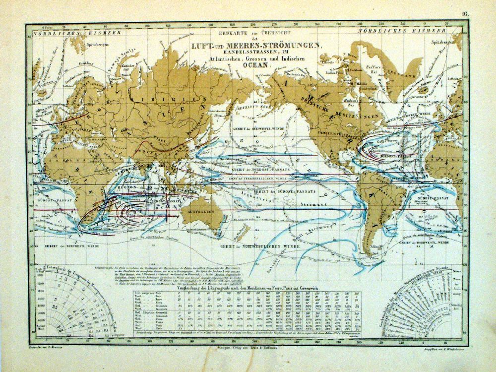 |
The World - Erdkarte
zur Ubersicht der Luft und Meeres-Stromungen, ..... Air and Sea Currents Winkelmann / Krais & Hoffman for Humboldt's Kosmos 1861 inset of Meridian Tables size: 320 x 250 mm, stain at centre of lower margin Ref LDM016 £18.00 (+P&P) click image for enlargement |
 |
The World - Die Erth Winkelmann / Krais & Hoffman for Humboldt's Kosmos 1861 insets of sphere diagrams size: 320 x 250 mm Ref LDM004 £18.00 (+P&P) click image for enlargement |
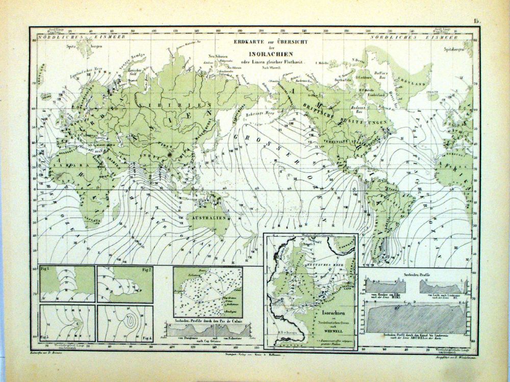 |
The World - Erdkarte
zur Ubersight der Isorachien oder Linien gleicher
Fluthzeit Lines of equal high tides. Winkelmann / Krais & Hoffman for Humboldt's Kosmos 1861 inset of British Isles and the English Channel size: 320 x 250 mm Ref LDM015 £18.00 (+P&P) click image for enlargement |
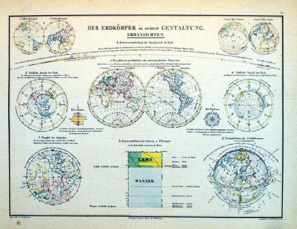 |
The World - Der
Erdkorper in seiner Gestaltung. The Earth's Body - various views andprojections. Winkelmann / Krais & Hoffman for Humboldt's Kosmos 1861 inset of diagram of water, land and continental proportions. size: 320 x 250 mm Ref LDM005 £18.00 (+P&P) click image for enlargement |
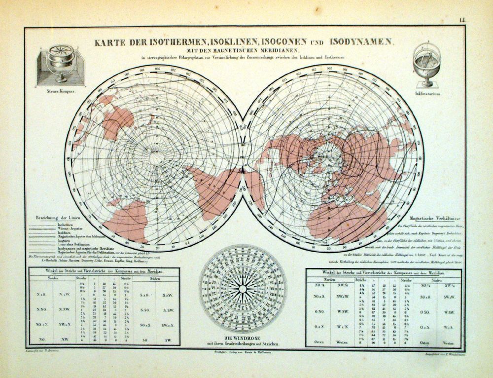 |
The World - Karte der
Isothermen, Isoklinen, Isogonen und Isodynamen mit den
Magnetischen Meridianen. Variations in Temperature and Magnetism from the Poles. Winkelmann / Krais & Hoffman for Humboldt's Kosmos 1861 inset of Compass size: 320 x 250 mm Ref LDM014 £18.00 (+P&P) click image for enlargement |
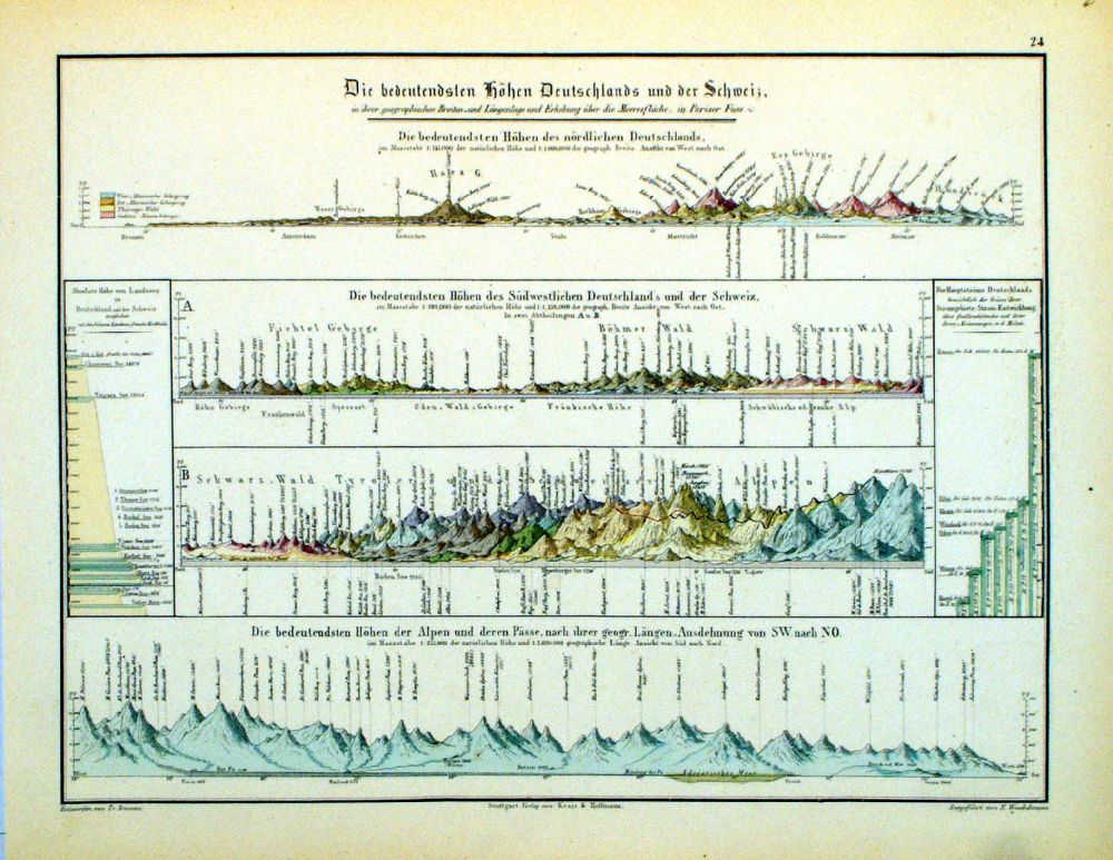 |
The World
- Die bedeutendsten Hohen Deutschlands und
der Schweitz Predominiantly German geological features Winkelmann / Krais & Hoffman for Humboldt's Kosmos 1861 size: 320 x 250 mm Ref LDM024 £18.00 (+P&P) click image for enlargement |
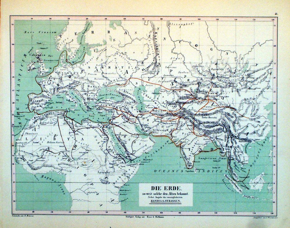 |
The Ancient World
- Die Erde o weit solche den Alten bekannt Winkelmann / Krais & Hoffman for Humboldt's Kosmos 1861 size: 320 x 250 mm Ref LDM038 £18.00 (+P&P) click image for enlargement |
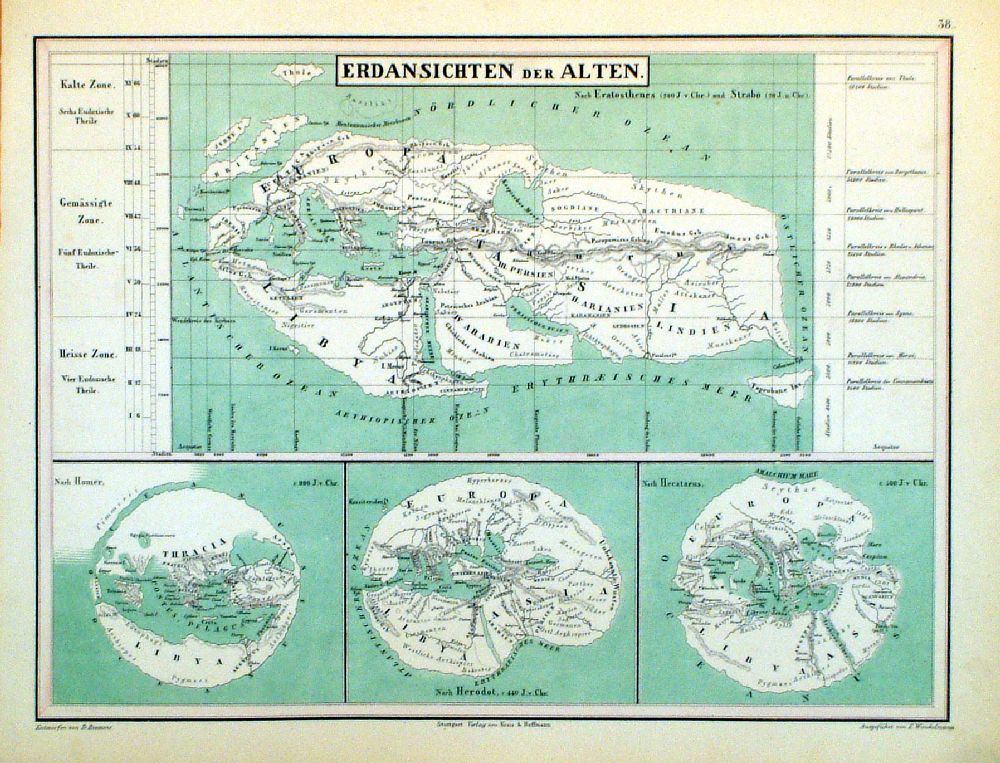 |
The Ancient World -
Erdansichten der Alten Winkelmann / Krais & Hoffman for Humboldt's Kosmos 1861 size: 320 x 250 mm Ref LDM035 £18.00 (+P&P) click image for enlargement |
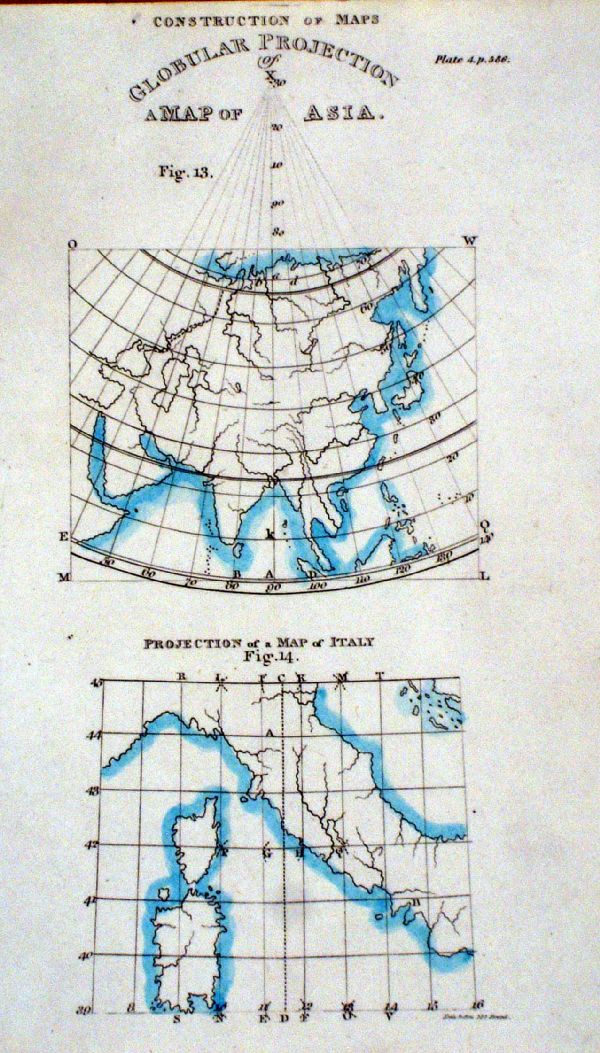 |
Construction of Maps. Global Projection of a map of Asia anon 1823 Ref KGM044 £14.00 (+P&P) size: 120 x 200 mm click image for enlargement |
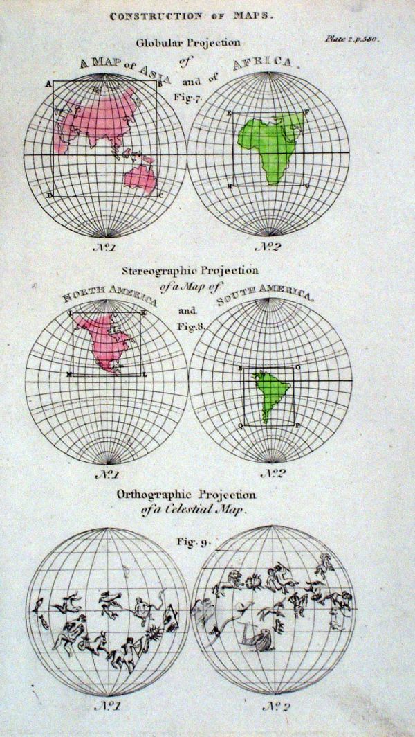 |
Construction of Maps. Global Projection anon 1823 Ref KGM045 £14.00 (+P&P) size: 120 x 200 mm click image for enlargement |
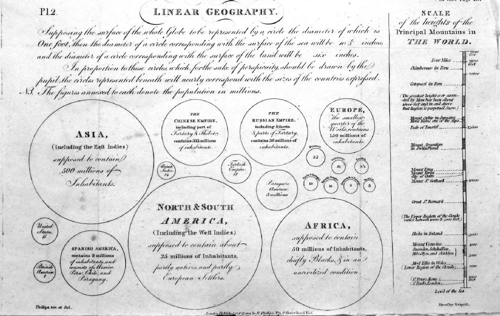 |
Linear Geography Land masses & Countries shown proportionally sized, with statistics of the time. Phillips / Hemsley 1802 Ref NHM009 £20.00 (+P&P) size: 300 x 180 mm, 3 folds, a few faint spots. click image for enlargement |
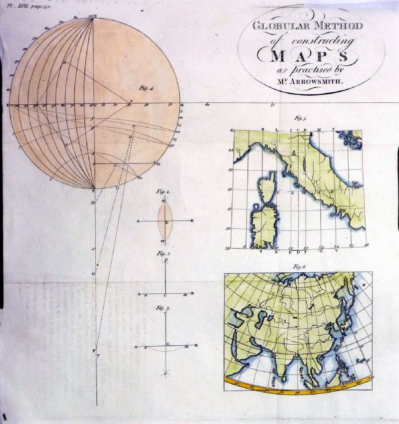 |
Globular Method of
Constructing Maps as practiced by Mr Arrowsmith Phillips / Goldsmith 1803 Ref NHM010 £15.00 (+P&P) size: 210 x 230 mm, several folds, top right corner missing. click image for enlargement |
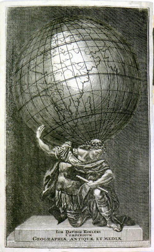 |
Ioh Davidis
Koeleri compendium Geograhiae Antiquae et
Media anon c1750 Ref MKM028 £16.00 (+P&P) size: 110 x 175 mm click image for enlargement |
 |
Astronomy - charts and printsof Globes, Spheres and Equipmentsee separate Print page
Click
thumbnail image for re-direction to the Astronomy Print
page |
Solar, Lunar, Astronomy, Astrology chartsListed below, but some may appear on the Astronomy Print page. |
|
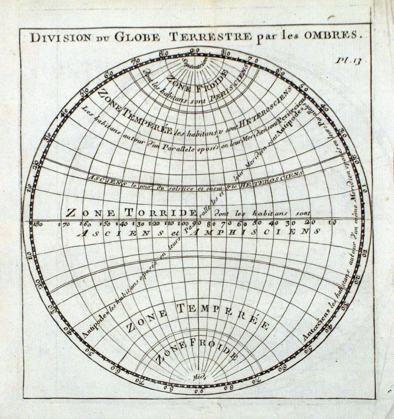 |
Division du Globe Terrestre par les Ombres
anon 1743 size: 140 x 150 mm Ref JKM042 £22.00 (+P&P) click image for enlargement |
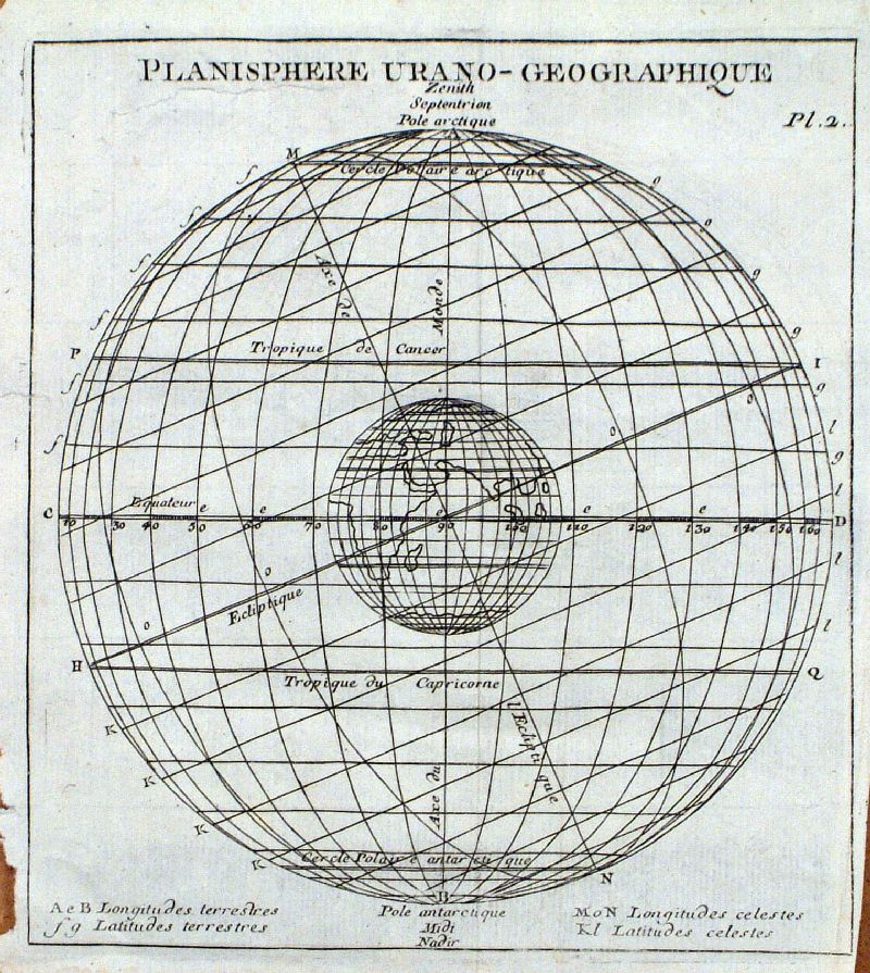 |
Planishere Urano - Geographique
anon 1743 size: 140 x 150 mm, small repair Ref JKM041 £20.00 (+P&P) click image for enlargement |
 |
Solar Chart Thomas Bowen, London Magazine
1772 size
250 x 190 mm Ref FGM044 £20.00 (+P&P) click image for enlargement |
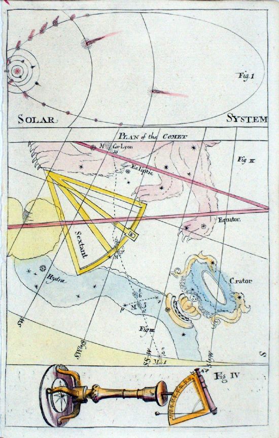 |
A Plan of the Comet London Magazine 1759 Copper engraving. size: 125 x 195 mm Tight left margin Ref LLM038 £20.00 (+P&P) click image for enlargement |
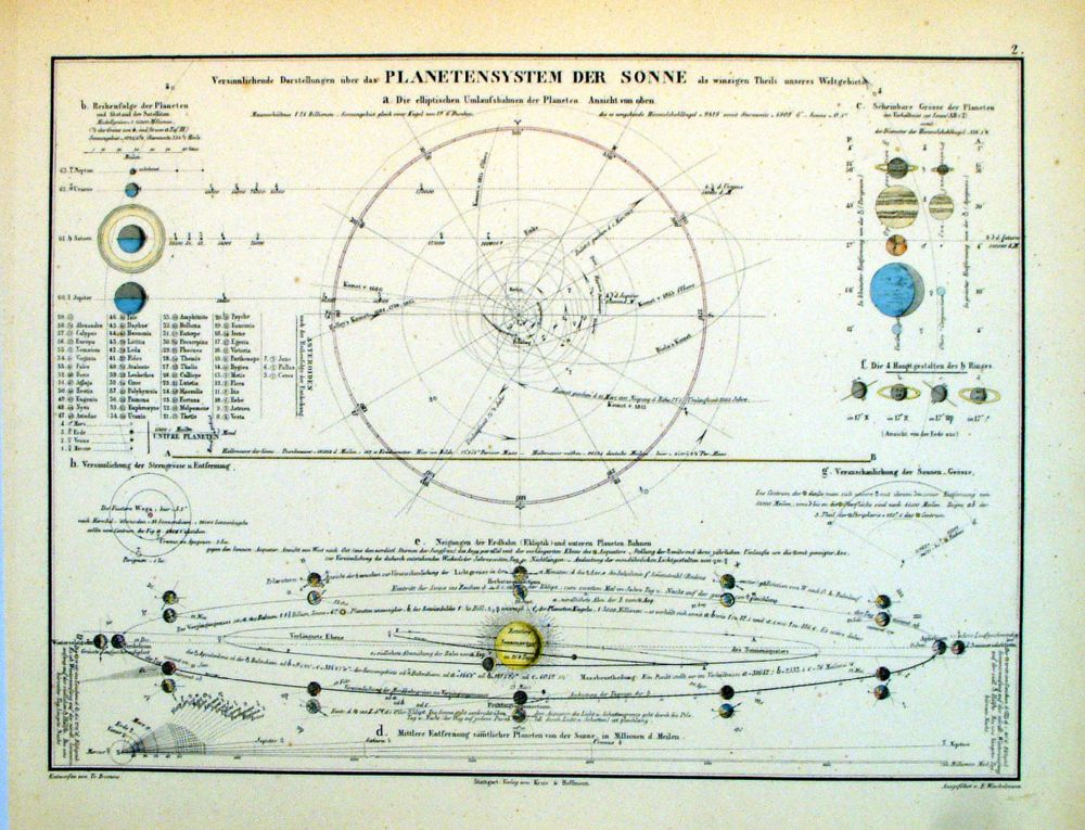 |
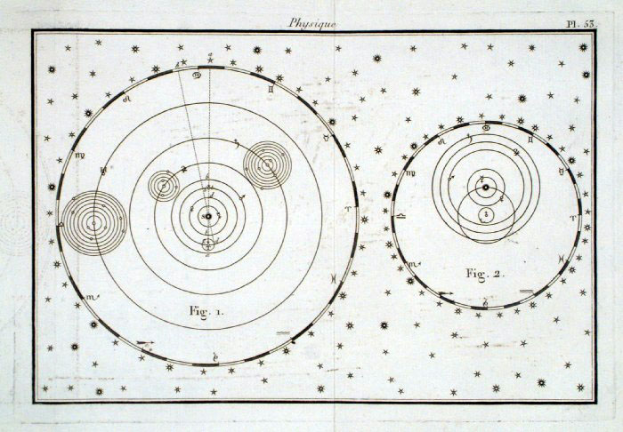
Solar System
- Planetensystem der Sonne Winkelmann / Krais & Hoffman for Humboldt's Kosmos 1861 size: 320 x 250 mm Ref LDM002 £20.00 (+P&P) click image for enlargement |
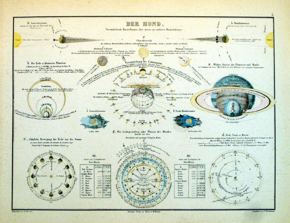 |
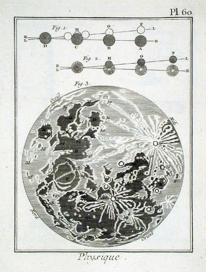
The Moon Winkelmann / Krais & Hoffman for Humboldt's Kosmos 1861 size: 320 x 250 mm Ref LDM003 £20.00 (+P&P) click image for enlargement |
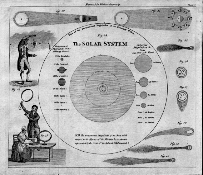 |
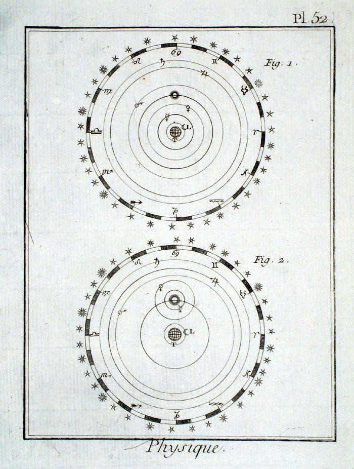
The Solar System
Walker 1800
size: 250 x 210 mm Ref EIM015 £36.00 (+P&P) click image for enlargement |
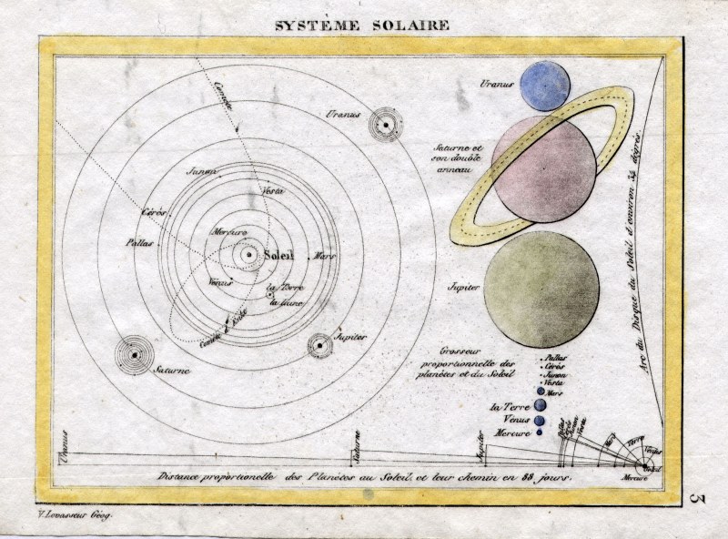 |
Solar System V.
Levasseur c1835 size: 130 x 100 mm Ref HAM036 £22.00 (+P&P) click image for enlargement |
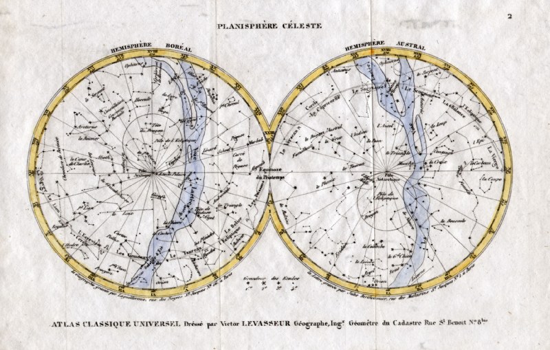 |
Planisphere V. Levasseur
c1835 size: 130 x 200 mm Ref HAM035 £25.00 (+P&P) click image for enlargement |
 |
Celestial / Zodiac chart
Brisson c1790
size: 260 x 180 mm Ref GBP078 £28.00 (+P&P) click image for enlargement |
 |
Celestial / Zodiac chart
Brisson c1790
size: 160 x 220 mm Ref GBP079 £24.00 (+P&P) click image for enlargement |
 |
The Moon Brisson
c1790 size: 260 x 180 mm Ref GBP082 £28.00 (+P&P) click image for enlargement |
 |
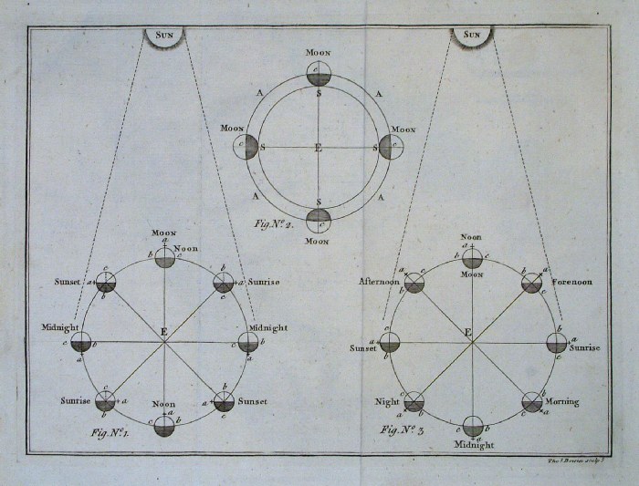
Solar alignment chart
Brisson c1790
size: 160 x 210 mm Ref GBP081 £28.00 (+P&P) click image for enlargement |
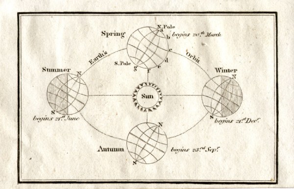 |
The World rotaion and seasons
Turner 1810 Ref GLM036 £10.00 (+P&P) size: 120 x 80 mm click image for enlargement |
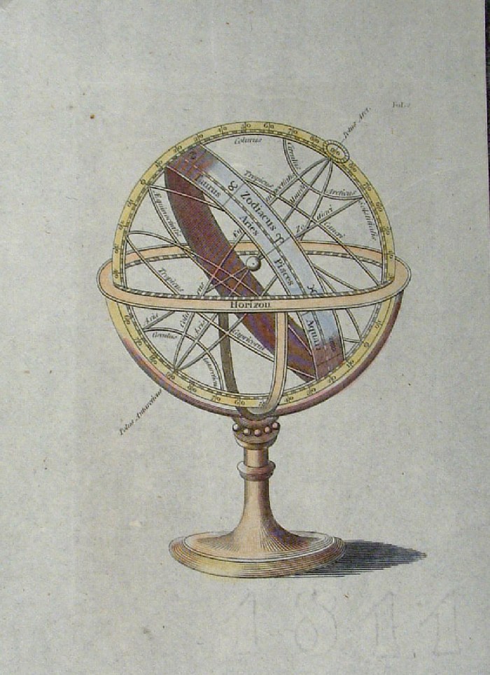 |
Celestial Sphere anon
c1811 (as watermark)
size: 120 x 160 mm Ref FLP038 £24.00 (+P&P) click image for enlargement |
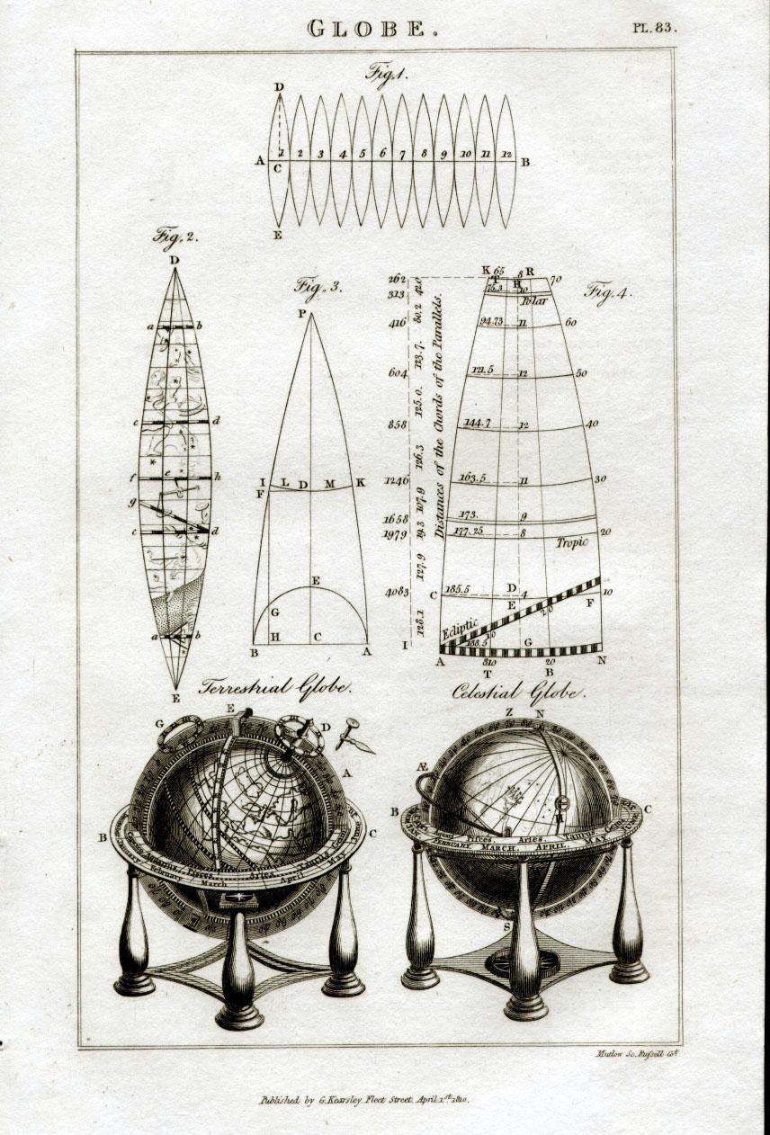 |
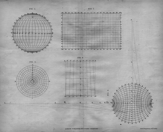
Globe Segment shapes and
profiles Mutlow / Kearsley 1810 size: 140 x 230 mm Ref FBP038 £20.00 (+P&P) click image for enlargement |
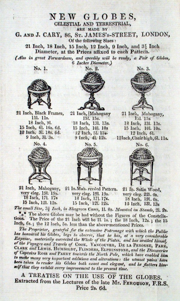 |
New Globes Cary
1828 Adverisement for Globes 'New Globes, Celestial and Terrestrial are made by G and J Cary, 86 St James's St, London' Ref ILM017 £20.00 (+P&P) size: 110 x 170 mm click image for enlargement |
| for more Globes and Spheres see Astronomy
page (link above) |
|
| All Genuine Antiquarian Maps - No Reproductions or Modern Copies |
2023
