Past Pages
Antique Maps, Prints and Ephemera
Antique Maps of Europe
A to E (Austria to Eire)
European Countries in Alphabetic
order.
Check for common groupings like Belgium & Holland or Holland & Belgium.
Check for dual namings such as Holland / Netherlands.
Check for regions such as Balkans.
Check for historic changes such as Greece/Turkey
Cities and regions will be listed under their country.
Check for common groupings like Belgium & Holland or Holland & Belgium.
Check for dual namings such as Holland / Netherlands.
Check for regions such as Balkans.
Check for historic changes such as Greece/Turkey
Cities and regions will be listed under their country.
Albania See Greece.
Many of the
countries around the Adriatic
were previously mapped with Greece and Turkey
|
|
Austria |
|
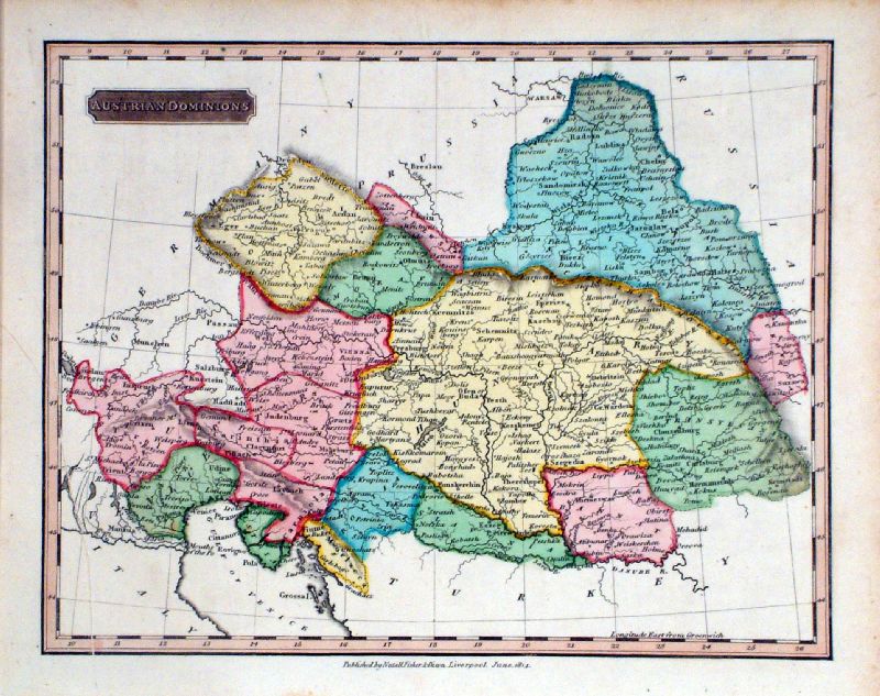 |
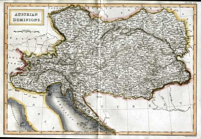
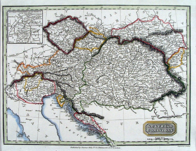
Austrian Dominions Nuttall /
Fisher / Dixon 1814 size: 250 x 200 mm Ref KFM023 £26.00 (+P&P) click image for enlargement |
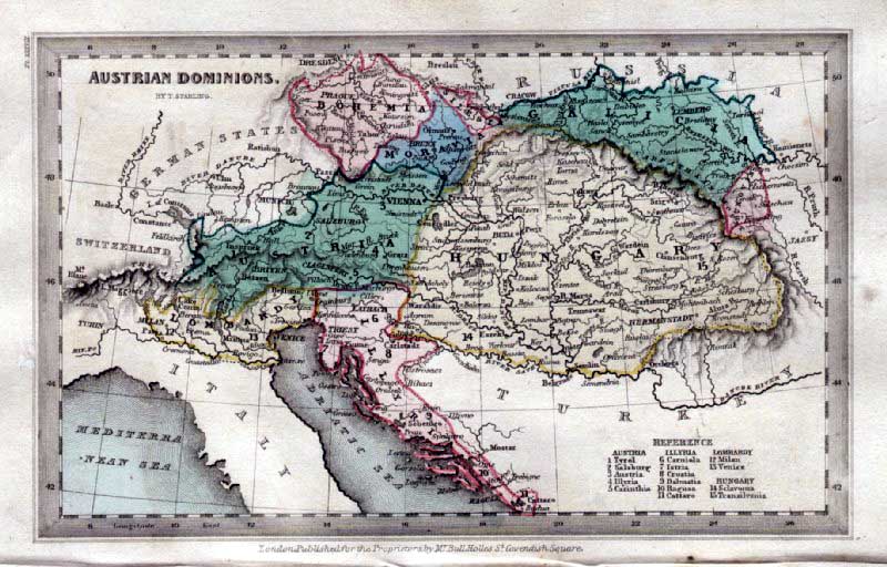 |
Austrian Dominions
Thomas
Starling 1843 size: 150 x 95 mm Ref GBM301 £22.00 (+P&P) click image for enlargement |
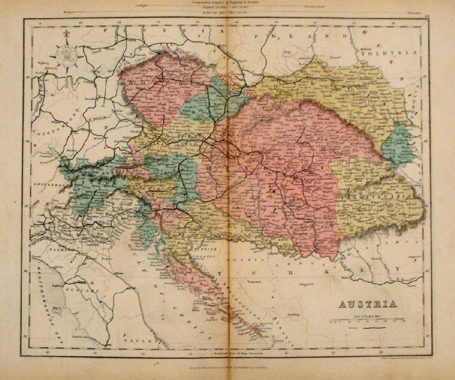 |
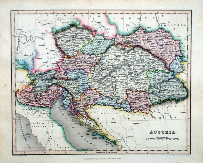
Austria Mackenzie
1868 Ref FBM032 % £10.00 (+P&P) size: 260 x 340 mm Strengthened centrefold. Discolouration on centrefold (not as severe as illustrated!) click image for enlargement |
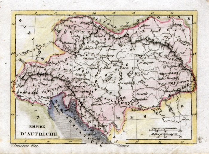 |
Austrian Empire V. Levasseur
c1835 size: 130 x 100 mm Ref HAM074 £18.00 (+P&P) click image for enlargement |
 |
Austria Gilbert /
Archer c1850 size: 310 x 260 mm Ref KFM012 £28.00 (+P&P) click image for enlargement |
 |
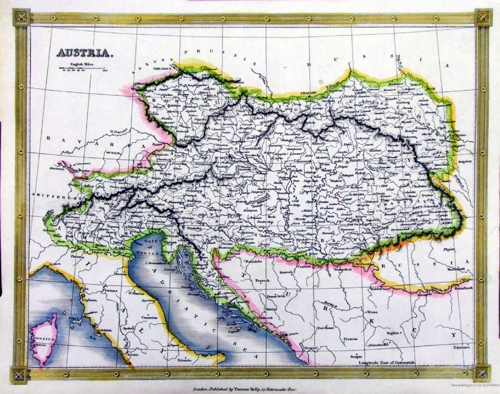
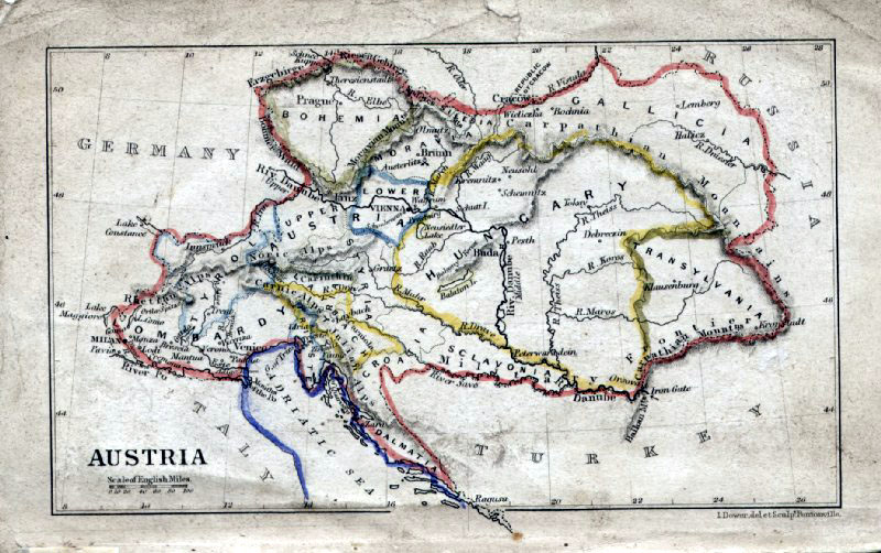
Austria
Austrian Dominions Sidney Hall
1842
size
400 x 270 mm Ref EKM050 £22.00 (+P&P) click image for enlargement |
 |
Austria
(Austrian Dominions) Cooper /
Macpherson
size 250 x
200 mm Ref GCM033 £20.00 (+P&P) click image for enlargement |
|
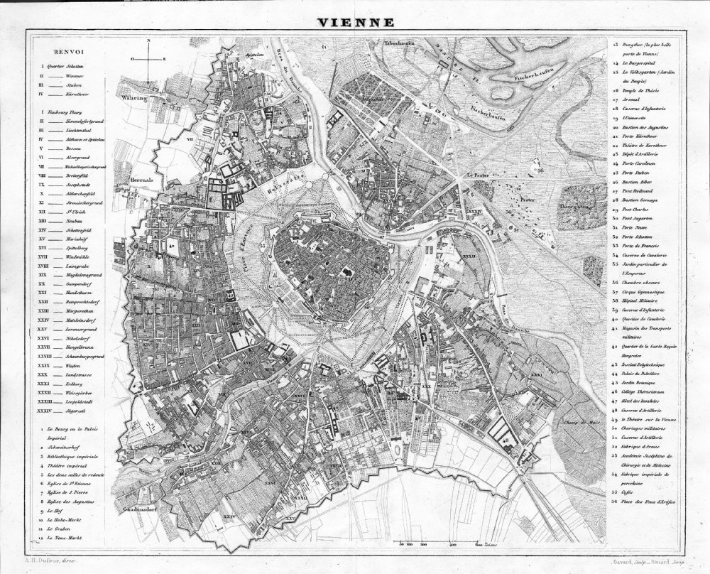
Vienne
from Abrege de
Geographie by Adrien Balbie,
Paris 1838 Publie Par Jules Renouard. A.H. Dufour. Gavard Scuplt, Banard Scrip. Table of 100 locations. Steel engraving size: 270 x 200 mm centre fold. Ref PHM015 £35.00 (+P&P) Detail click image for enlargement |
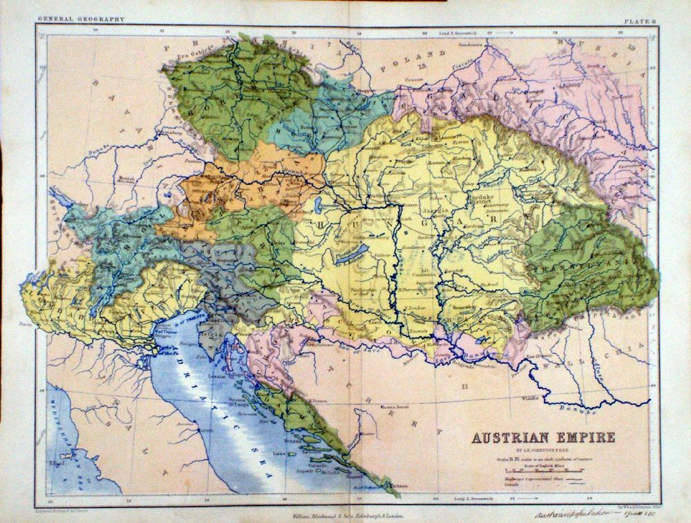 |
Austrian Empire
A.K. Johnston / William
Blackwood 1854 size: 320 x 250 mm, centre fold. Early full colour lithographic printing. Fine ink notes on lower margin Ref LKM012 £18.00 (+P&P) click image for enlargement |
 |
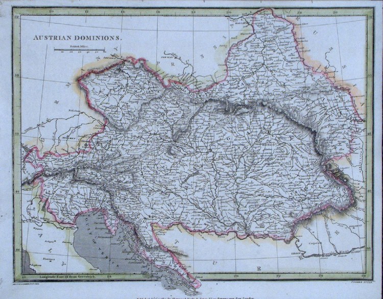
Austrian Dominions
Findlay / Kelly 1841 size: 260 x 210 mm Ref HLM015 £16.00 (+P&P) click image for enlargement |
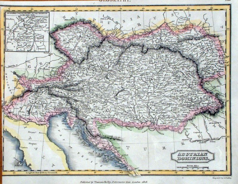 |
Austrian Dominions
Findlay / Kelly 1841 size: 260 x 210 mm, cropped left margin Ref JIM006 £16.00 (+P&P) click image for enlargement |
 |
Austrian
Dominions
Findlay / Kelly 1841 size: 260 x 210 mm Ref OHM006 £16.00 (+P&P) click image for enlargement |
 |
Austrian
Empire
Chambers
1855
size:
300x 240 mm Ref FDM137 £16.00 (+P&P) click image for enlargement |
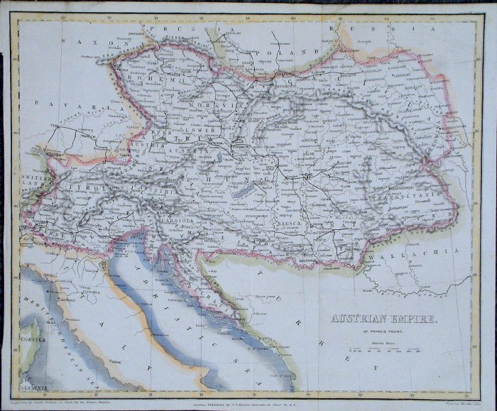 |
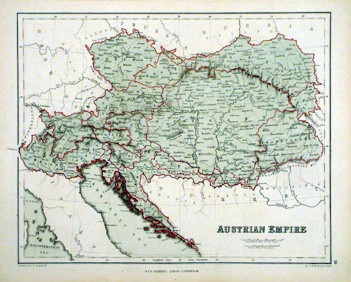
Austrian Empire
Francis Young / Beeton c1880 size: 250 x 200 mm several folds Ref GAM035 % £16.00 (+P&P) click image for enlargement |
 |
Austria John Dower /
James
Cornwell c1850 Ref GFM061 % £16.00 (+P&P) size: 150 x 95 mm, slightly soiled surface, pencil marks on reverse click image for enlargement |
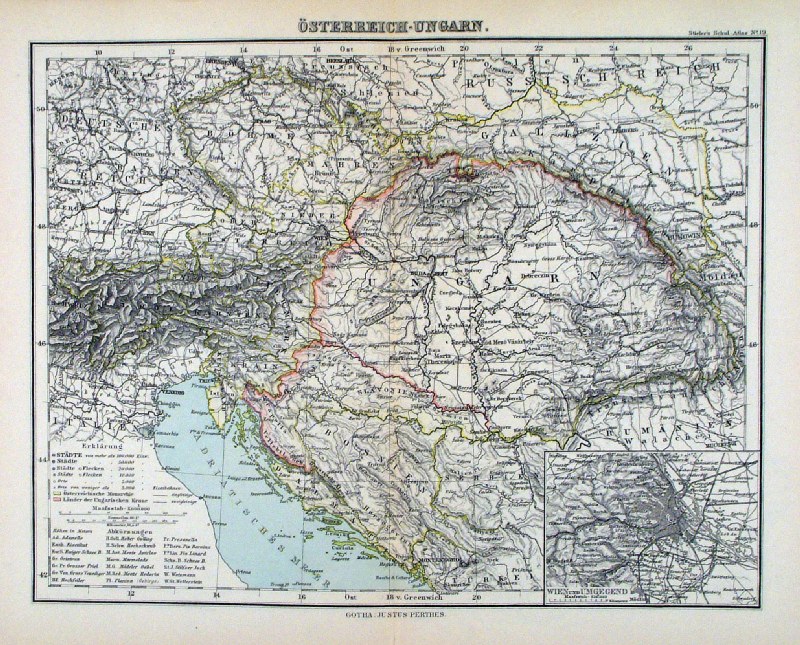 |
Osterreich-Ungarn
Steiler /
Perthes 1895 Austria, Hungary and Balkans size: 300 x 240 mm, centre fold. Ref HHM068 £16.00 (+P&P) click image for enlargement |
Balkans (also see Greece)
|
|
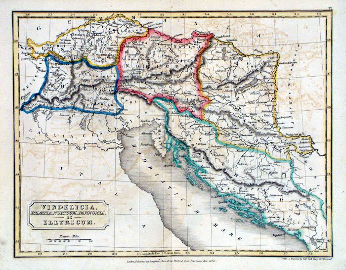 |
Ancient Slovenia, Sebia, Bosnia etc
(Vindelicia,
Illyricum) Sidney Hall 1829 Ref FIM012 £14.00 (+P&P) size: 250 x190 mm Slight printing transfer from folded page. click image for enlargement |
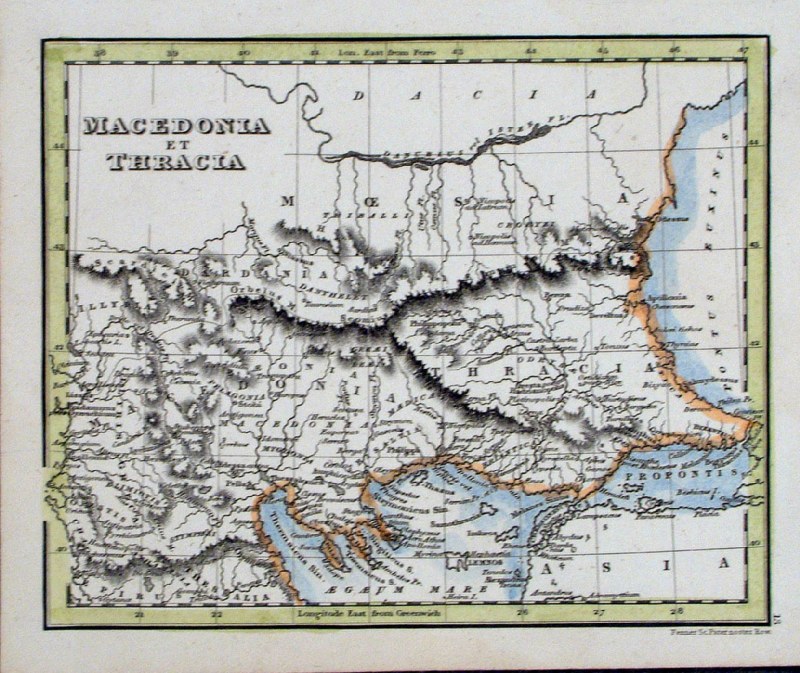 |
Macedonia & Thracia
Fenner
1828 size 150 x 120 mm Ref GIM023 % £12.00 (+P&P) click image for enlargement |
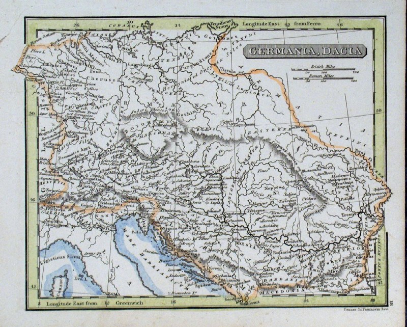 |
Germania and Dacia Fenner
1828
size 150 x 120 mm Ref GIM028 % £12.00 (+P&P) click image for enlargement |
Belgium |
|
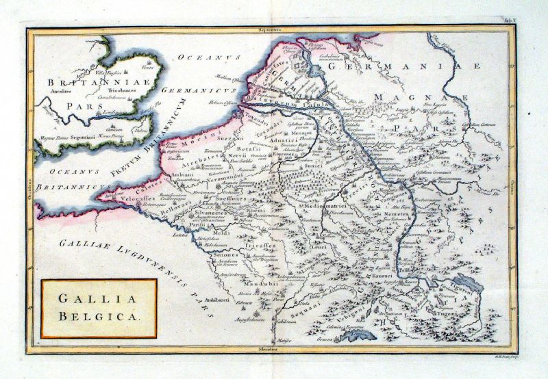 |
Gallia Belgica Richard Seale Raw/Rivington 1796 Copper engraving size: 330 x 220 mm, centre fold Ref JKM078 £30.00 (+P&P) click image for enlargement |
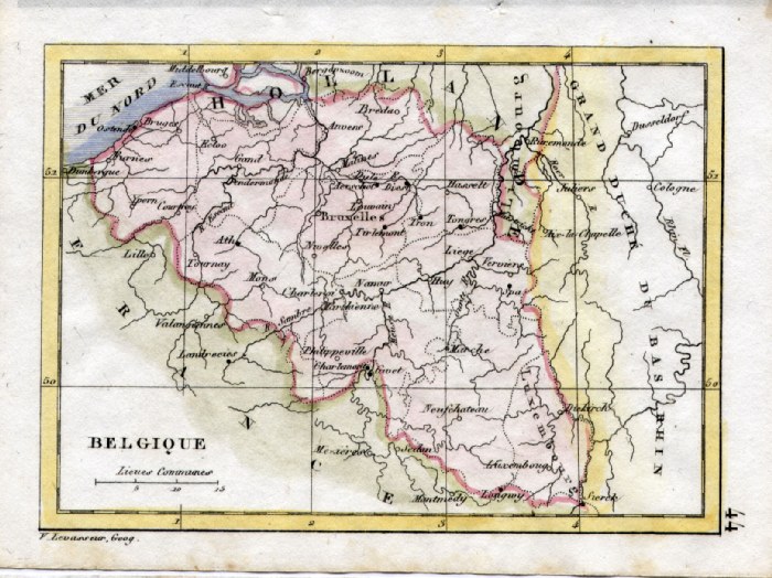 |
Belgium V. Levasseur c1835 size: 130 x 100 mm Ref HAM076 £18.00 (+P&P) click image for enlargement |
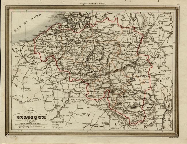 |
Belgium Binet
1843
size 280 x 210 mm Ref EKM095 £20.00 (+P&P) click image for enlargement |
 |
Holland
the Netherlands
Johnston
1885
size: 360 x 450 mm Ref KGM069 £18.00 (+P&P) click image for enlargement |
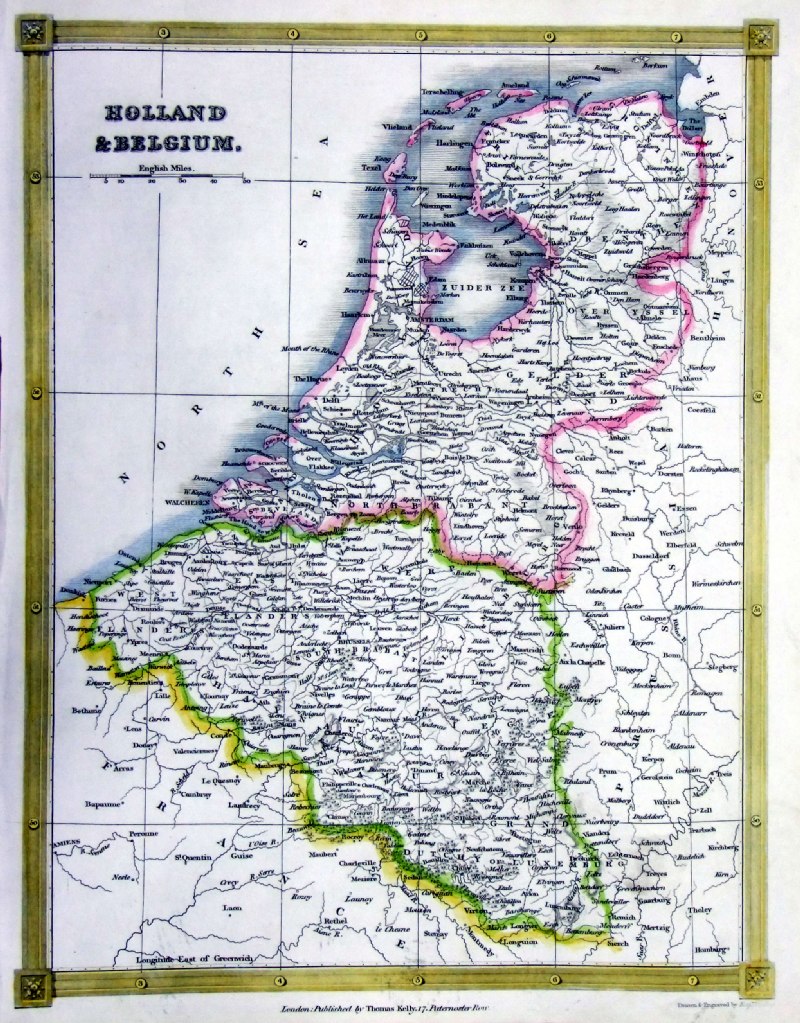 |
Holland & Belgium
Thomas Kelly 1841
engraved by Alex Findlay size: 200x 260 mm Ref OHM008 £18.00 (+P&P) click image for enlargement |
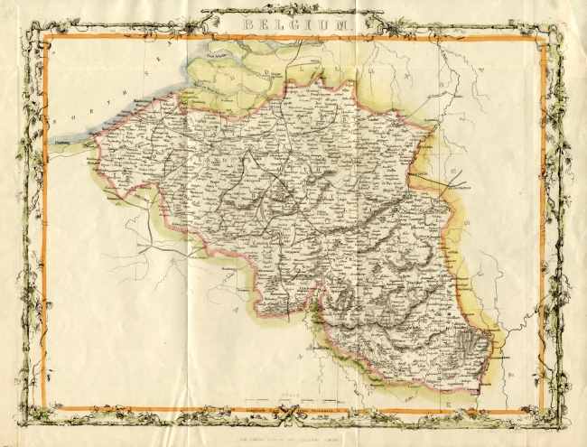 |
Belgium
Rapkin
c1865
size 360 x
280 mm Ref EHM030 £28.00 (+P&P) click image for enlargement Detail |
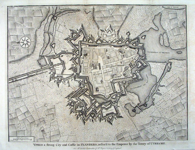 |
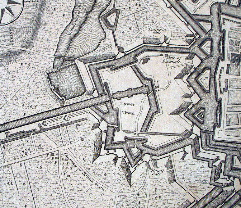
'Ypres, a strong city and Castle in Flanders,
restored to the Emperor by the Treaty of Utrecht ' Basire / Tindal / Rapin 1744 size: 500 x 380 mm 3 folds Ref HEM001 £36.00 (+P&P) Detail click image for enlargement |
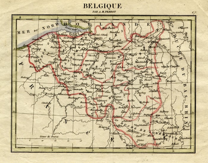 |
Belgium Perrot c1830
Engraved by P. Tardieu size: 200 x 160 mm Ref FEM018 £16.00 (+P&P) click image for enlargement |
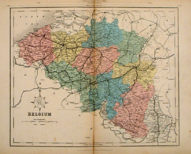 |
Belgium Mackenzie
1868 Ref FBM019 % £10.00 (+P&P) size: 260 x 340 mm Strengthened centrefold. Discolouration on centrefold (not as severe as illustrated!) click image for enlargement |
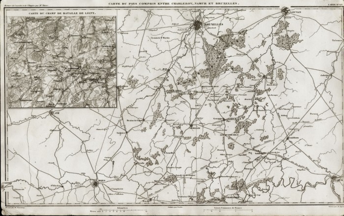 |
Brussells, Mons, Charleroy,
Namur Inset of Gigny battle site Thiers 1859 size: 420 x 270 mm Ref FFM056 £24.00 (+P&P) click image for enlargement |
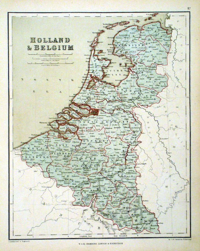 |
Holland
& Belgium
Chambers
1855
size:
240 x 300 mm Ref FDM133 £14.00 (+P&P) click image for enlargement |
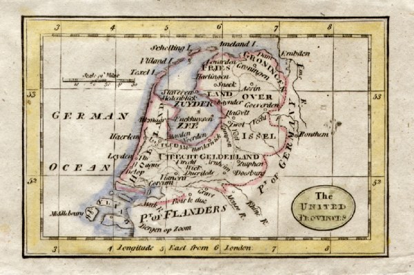 |
United Provinces Turner
1810
size 120 x 80 mm Ref GLM027 £12.00 (+P&P) click image for enlargement |
 |
Link to Regional Maps of Northern France,
Belgium ... by Beaulieu 1676 |
Bosnia See Greece. Many of the countries around the Adriatic were previously mapped with Greece and Turkey |
|
Czech Republic |
|
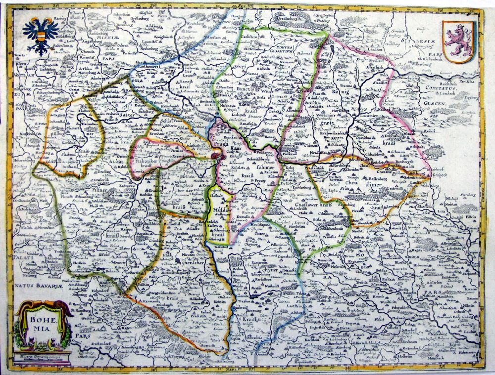 |
Bohemia
origin & date unknown c1650 - 1700 Ref OCM003 £50.00 (+P&P) size: 360 x 275 mm, tight top & bottom margins Detail click image for enlargement |
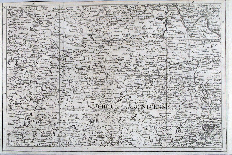 |
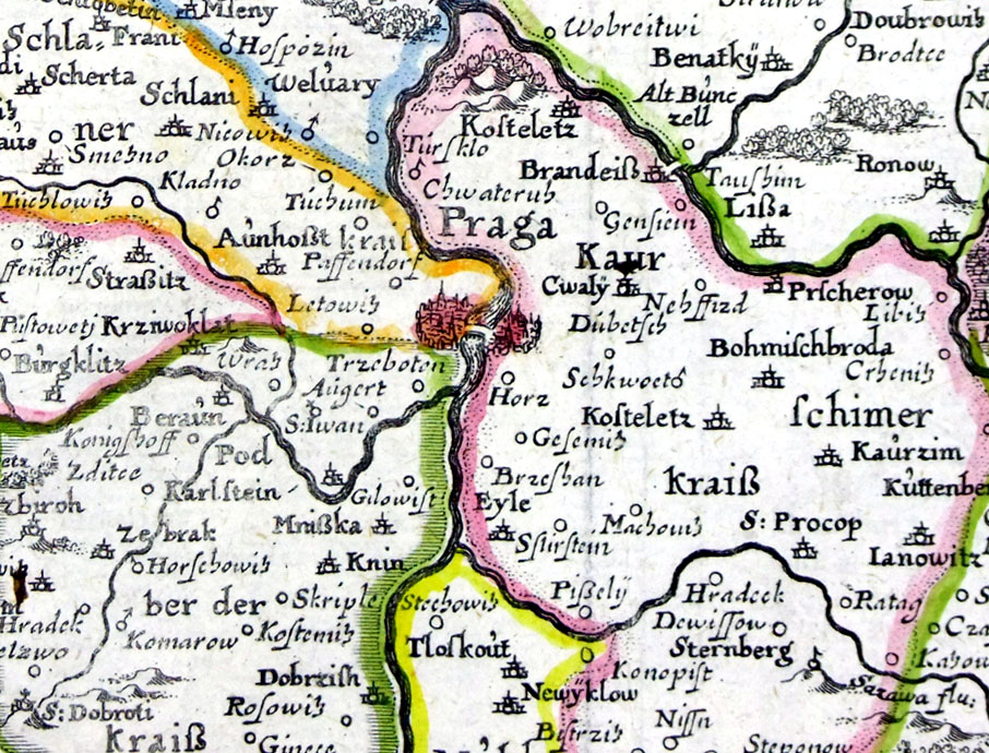
Environs
of North West
Prague
Gibson,
Gentlemans Magazine 1760 'Circul Rakonicensis' Area covered: Prague -SE- bottom right, Commotau (Chomutov) - NW- top left. Ref HGS001 £28.00 (+P&P) size: 390 x 260 mm, several folds, tight top margin Detail click image for enlargement |
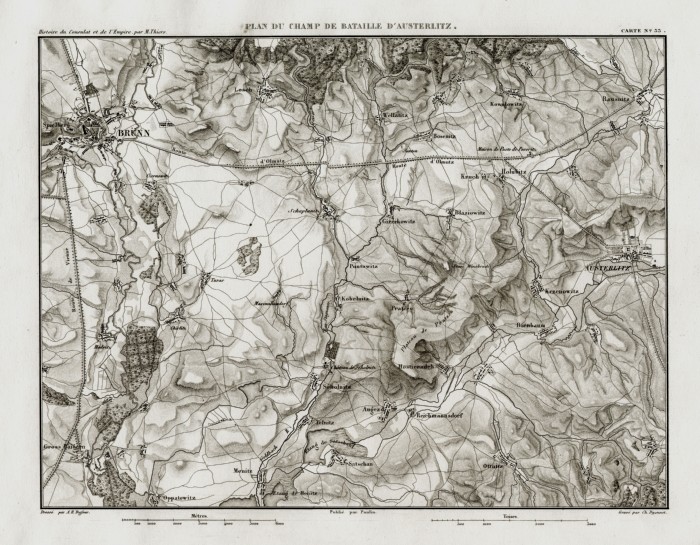 |
Brnu
Thiers
1859 Ref FFM041 £22.00 (+P&P) size: 300 x 230 mm click image for enlargement |
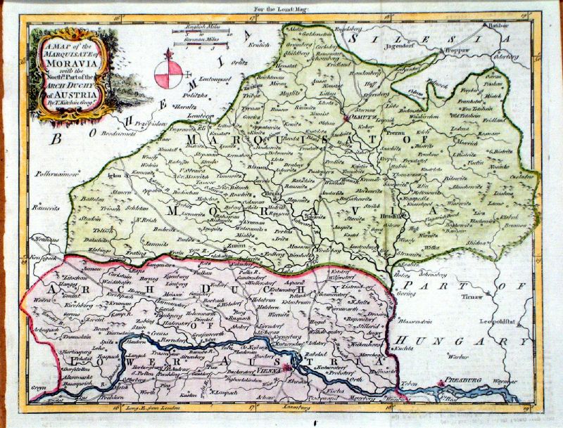 |
A Map of the Marquisate of Moravia with the North
part of the Arch Duchy of Austria Thomas Kitchin / London Magazine 1758 Copper engraving size: 250 x 200 mm, 2 folds Ref KHM026 £40.00 (+P&P) click image for enlargement |
Denmark |
|
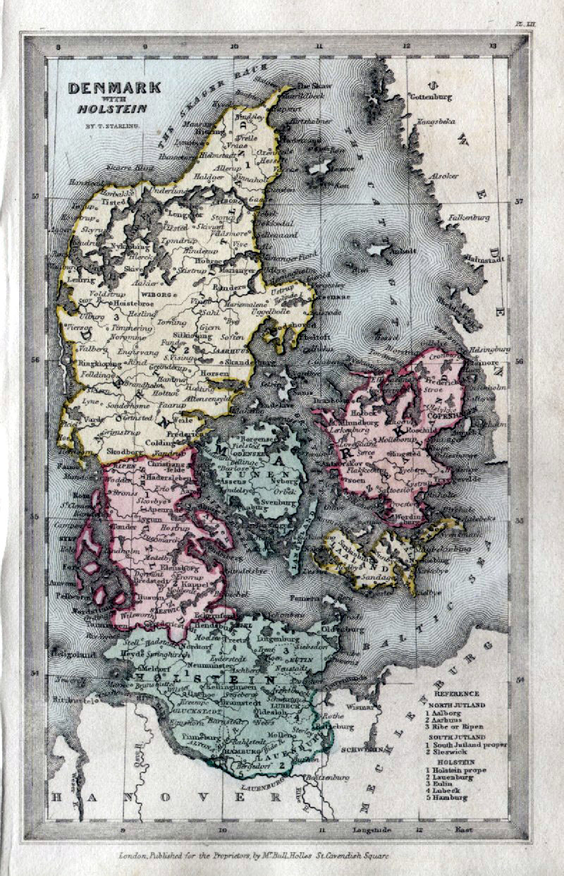 |
Denmark with Holstein
Thomas Starling 1843 size: 95 x 150 mm Ref GBM308 £24.00 (+P&P) click image for enlargement |
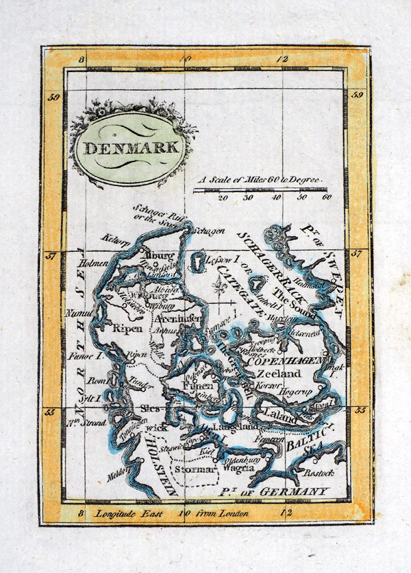 |
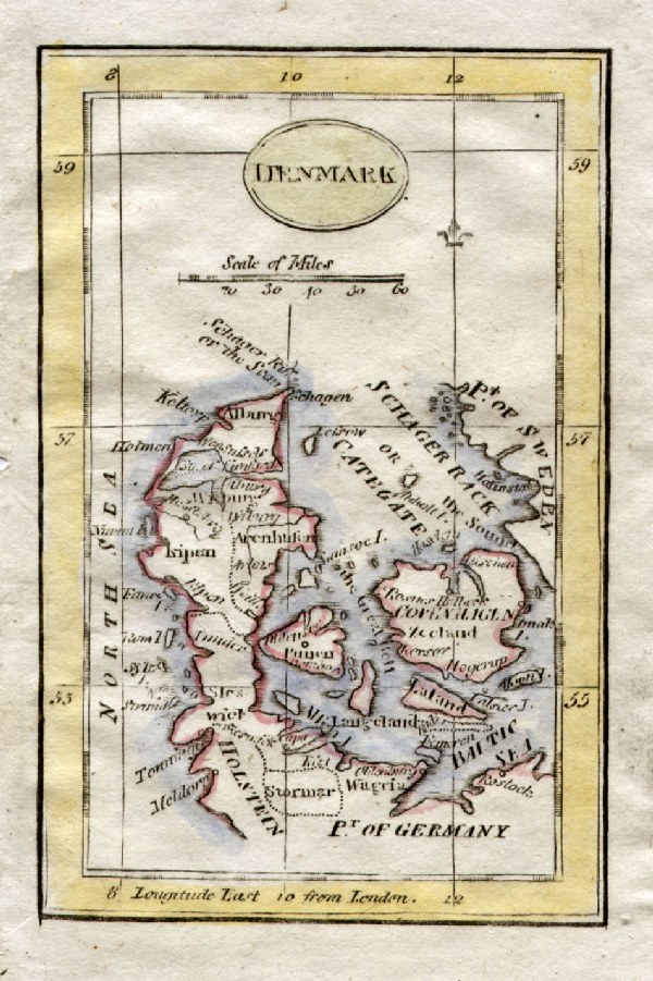
Denmark
Richard
Turner - Universal Geography 1792 Copper engraving - size: 80 x 110 mm Ref RLM002 £20.00 (+P&P) click image for enlargement |
 |
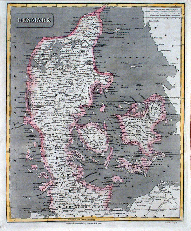
Denmark Grattan & Gilbert / Archer Steel engraving size: 260 x 320 mm Ref KAM001 £32.00 (+P&P) click image for enlargement |
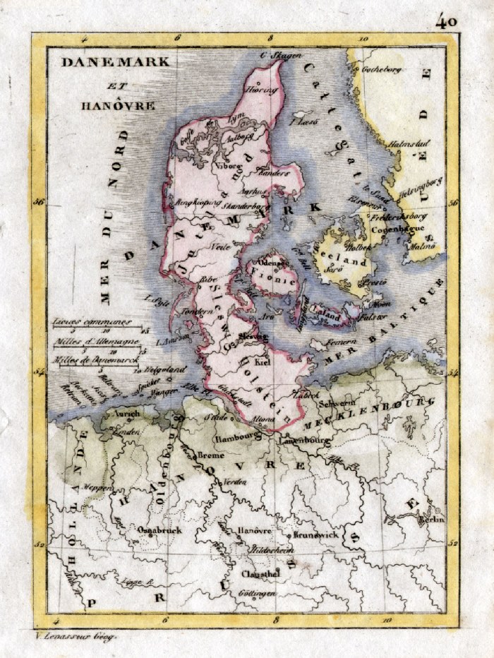 |
Denmark V. Levasseur c1835 size: 130 x 100 mm Ref HAM072 £18.00 (+P&P) click image for enlargement |
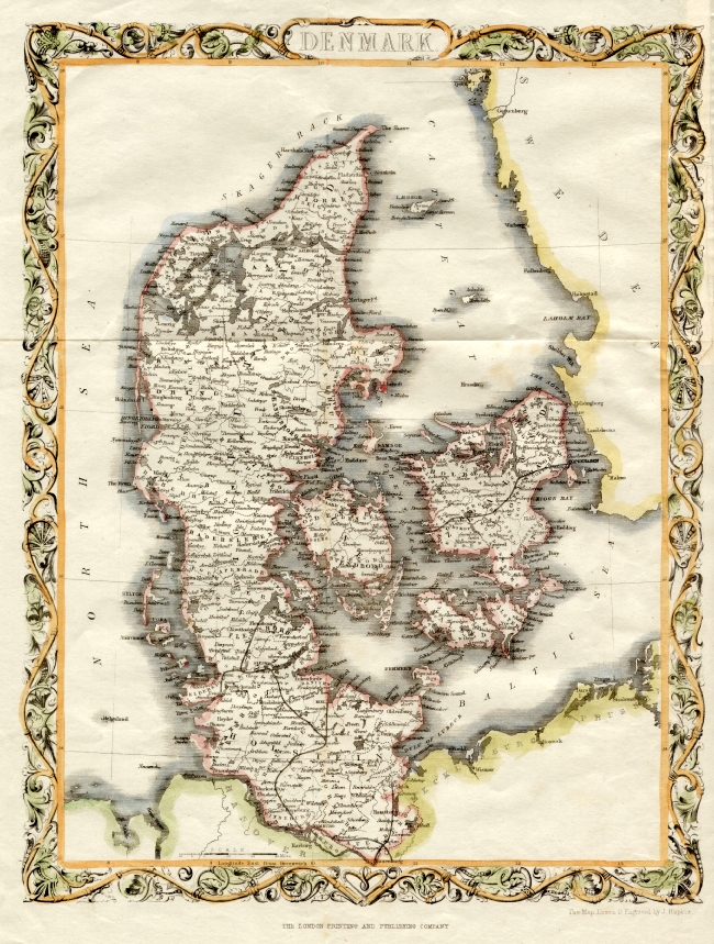 |
Denmark Rapkin
c1865
size 280 x
360 mm Ref EHM032 £28.00 (+P&P) click image for enlargement
Detail
|
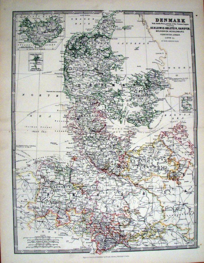 |
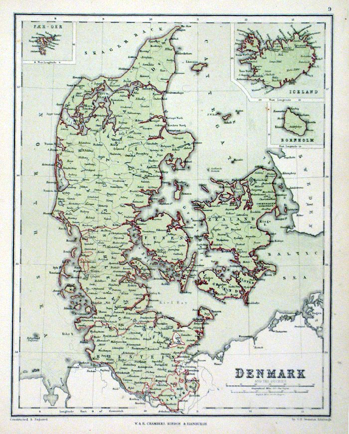
Denmark with North-West portion of German Empire Johnston 1885 size: 360 x 450 mm Ref KGM067 £18.00 (+P&P) click image for enlargement |
 |
Denmark
Clark / Mackenzie c1850
size 210 x 270 mm, a few creases Ref JIM011 % £16.00 (+P&P) click image for enlargement |
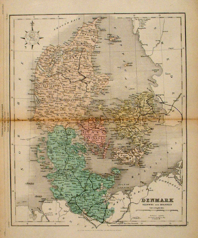 |
Denmark (Sleswig and
Holstein) Mackenzie 1868 Ref FBM023 % £10.00 (+P&P) size: 260 x 340 mm Strengthened centrefold. Discolouration on centrefold (not as severe as illustrated!) click image for enlargement |
 |
Denmark
Chambers
1855
size:
240 x 300 mm Ref FDM130 £16.00 (+P&P) click image for enlargement |
 |
Denmark Turner 1810
size 80 x 120 mm Ref GLM022 £10.00 (+P&P) click image for enlargement |
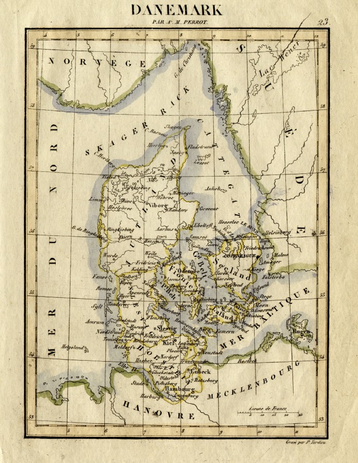 |
Denmark Perrot c1830
Engraved by P. Tardieu size: 200 x 160 mm Ref FEM020 £16.00 (+P&P) click image for enlargement |
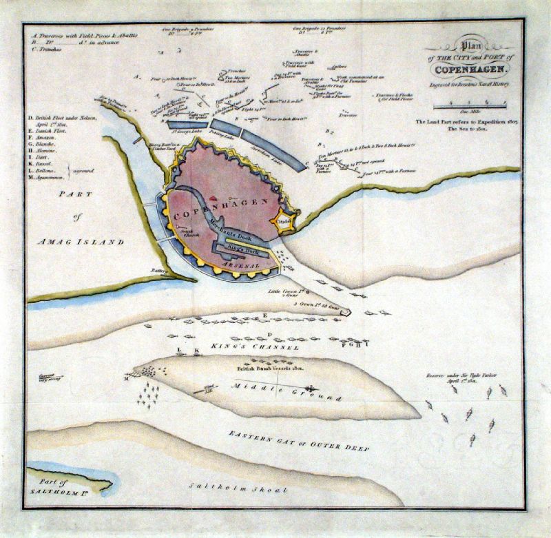 |
A Plan of the City and Port of Copenhagen Brenton c1830 Ref JGM003 £28.00 (+P&P) size: 260 x 250 mm click image for enlargement |
Eire - See Ireland |
|
| |
|
| All Genuine Antiquarian Maps - No Reproductions or Modern Copies |
2023

