Past Pages
Antique Maps, Prints and Ephemera
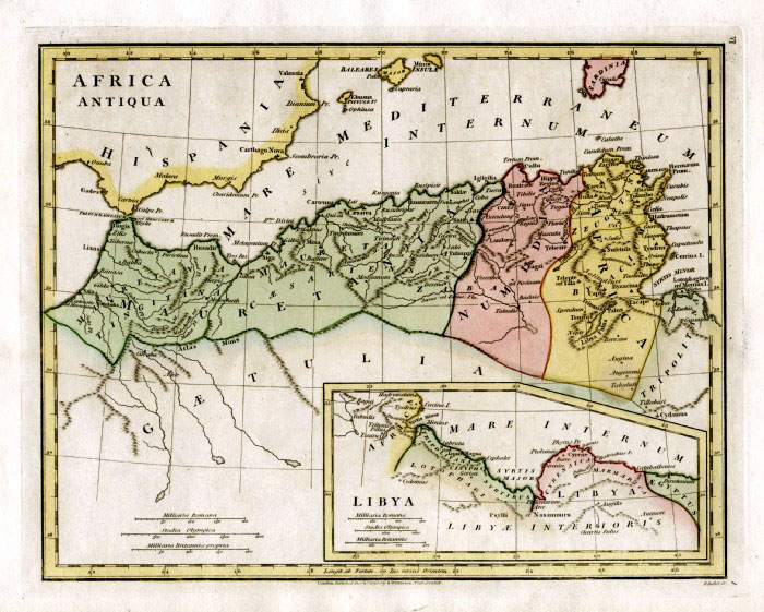
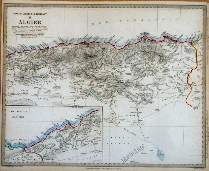
North Africa
|
|
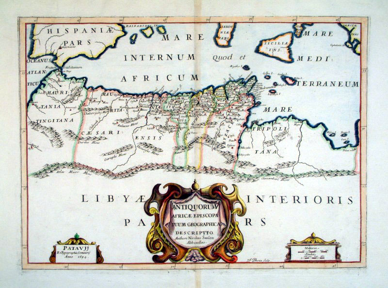 |
North Africa -
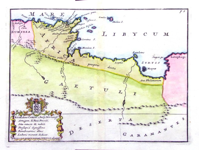
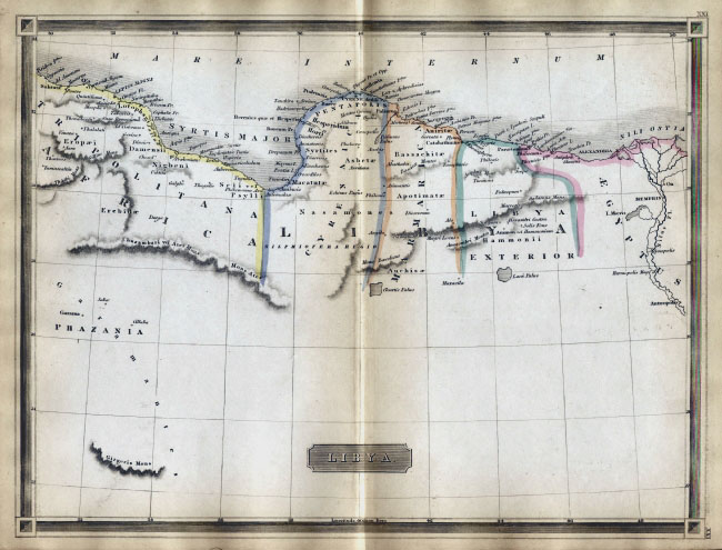
Libya
Sanson 1694
size: 540 x 400 mm Ref CAM014 £140.00 (+P&P) Detail 1 Detail 2 click image for enlargement |
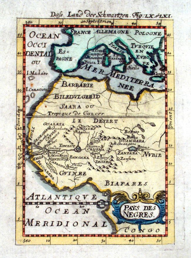 |
Pays Des Negres Mallet c1685 size: 120 x 160 mm Ref JGM025 £45.00 (+P&P) click image for enlargement |
 |
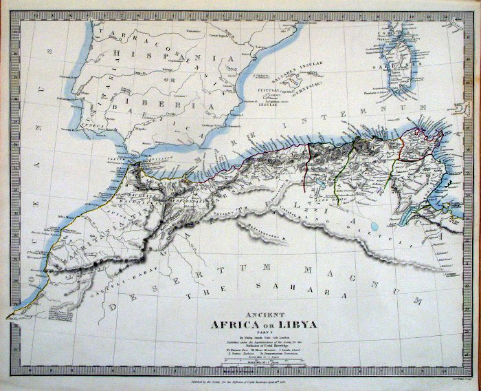
Ancient North
Africa from De Situ Orbis by Pomponius Mela. Published by Philippum Bishop, Exeter, 1711 Copper engraving size 270 x 200 mm, centre fold Decorative cartouche contains the name of the sponsor/patron of this map. Ref PDM027 £65.00 (+P&P) click image for enlargement |
 |
Ancient North Africa
(Tunisia) from De Situ Orbis by Pomponius Mela. Published by Philippum Bishop, Exeter, 1711 Copper engraving size 270 x 200 mm, centre fold Decorative cartouche contains the name of the sponsor/patron of this map. Ref PDM006 £40.00 (+P&P) click image for enlargement |
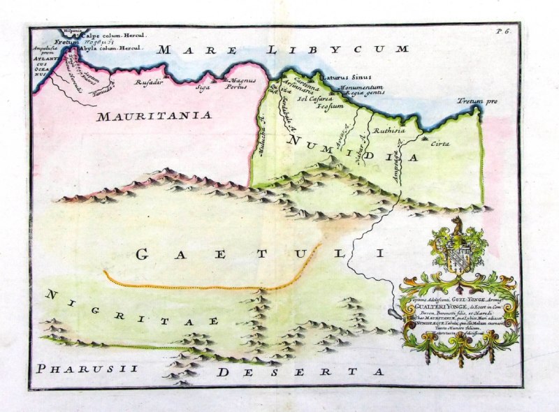 |
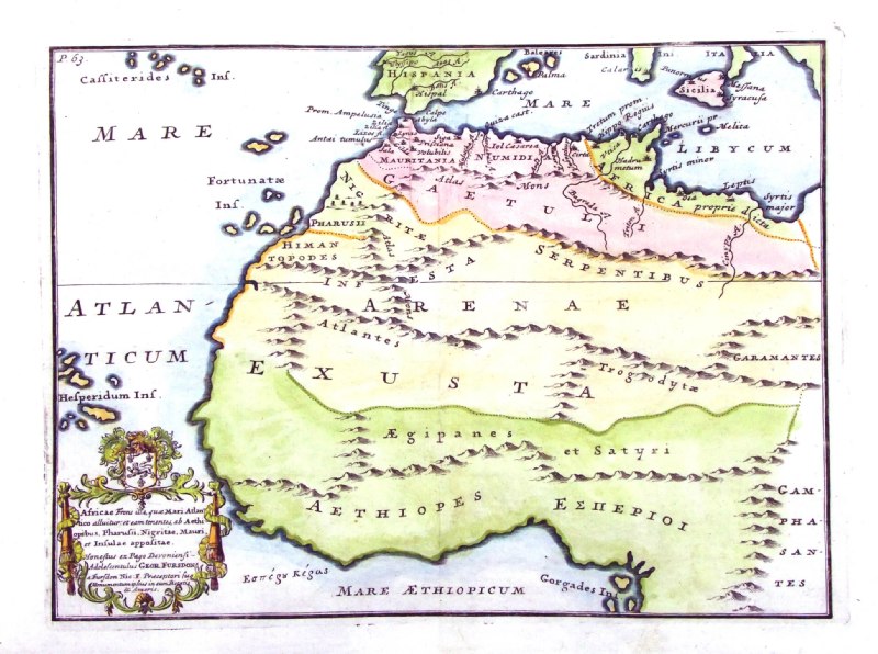
Ancient North
Africa (Mauritania) from De Situ Orbis by Pomponius Mela. Published by Philippum Bishop, Exeter, 1711 Copper engraving size 270 x 200 mm, centre fold Decorative cartouche contains the name of the sponsor/patron of this map. Ref PDM005 £40.00 (+P&P) click image for enlargement |
 |
Ancient North Africa
(Libya) from De Situ Orbis by Pomponius Mela. Published by Philippum Bishop, Exeter, 1711 Copper engraving size 270 x 200 mm, centre fold Decorative cartouche contains the name of the sponsor/patron of this map. Ref PDM007 £40.00 (+P&P) click image for enlargement |
 |
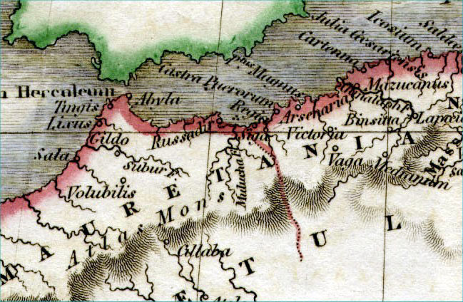
North African Coast - Ancient Morocco
to Libya Wilkinson 1798 size 320 x 250 mm Ref FCM008 £30.00 (+P&P) click image for enlargement |
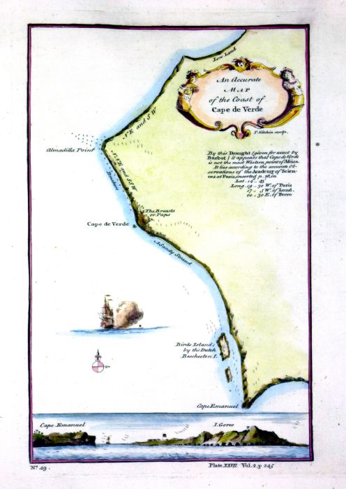 |
Cape
Verde
Kitchin 1745 An Accurate Map of the Coast of Cape Verde Copper engraving size: 170 x 240 mm Ref NLM012 £38.00 (+P&P) click image for enlargement |
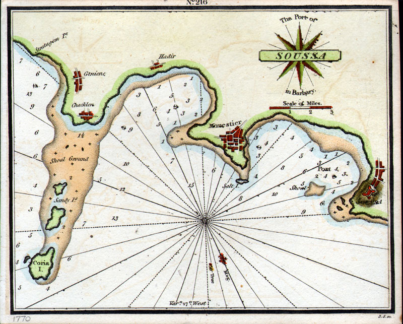 |
The Port of Soussa in Barbary
Sousse, Tunisia Features towns of Sousse, Monestier, Hadir, Chaklen anon ( J.S sc) c1750 size: 195 x 155 mm , tight margins( approx 3mm) Ref CBM002 £45.00 (+P&P) click image for enlargement |
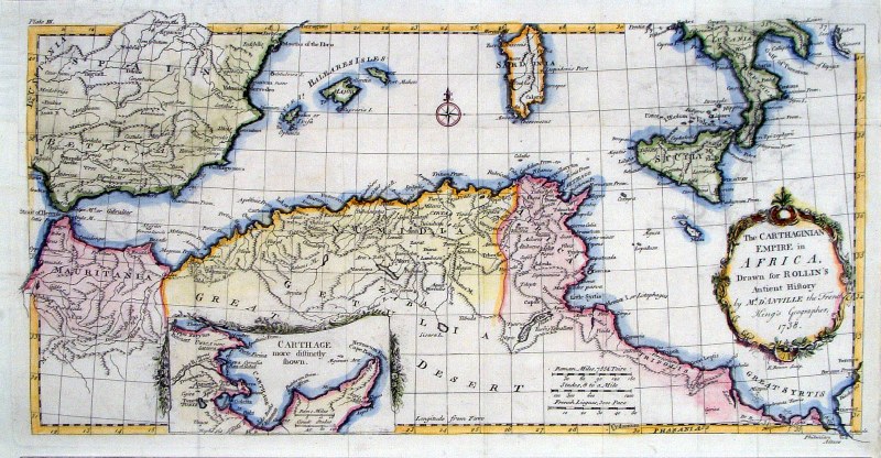 |
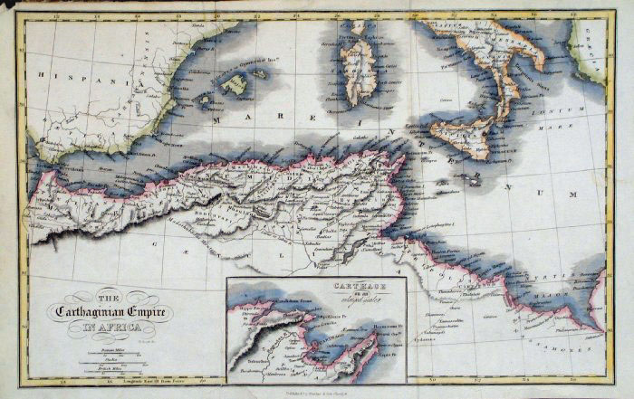
North African Coast - The Carthaginian
Empire in Africa E. Boen 1738 size 470 x 240 mm Several folds, repair to split fold & strengthened upper-left margin Ref HAM016 £30.00 (+P&P) click image for enlargement |
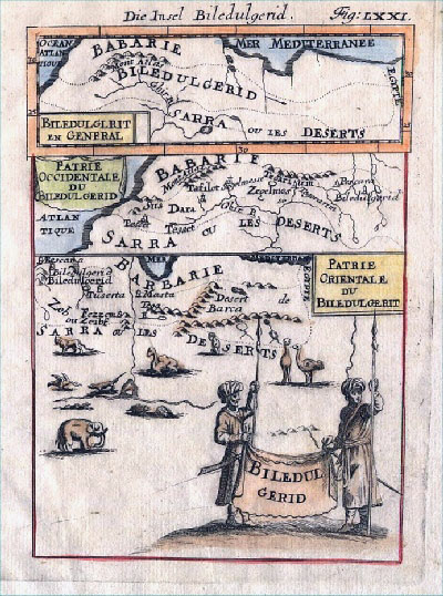 |
North African Coast Biledulgerid
Mallet
c1690
size 120 x 170 mm Ref AEM017 £50.00 (+P&P) click image for enlargement |
 |
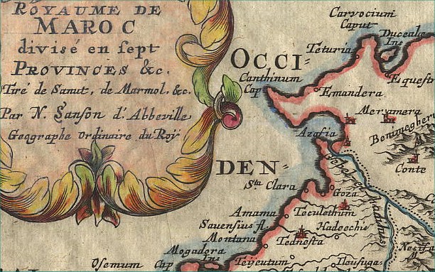
Morocco
Sanson c1683 size:
280 x 210 mm Ref CBM018 £85.00 (+P&P) Detail click image for enlargement |
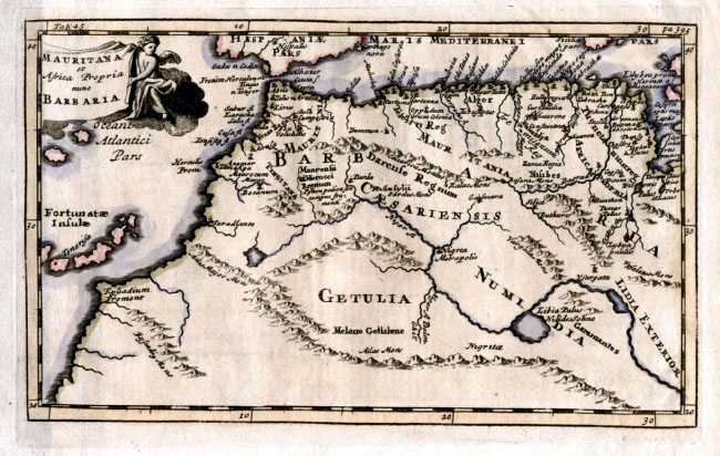 |
North African Coast Mauritana et Africa Propia
nune Barbaria
Cluverius 1711 size 230 x 140 mm Ref ELM060 £45.00 (+P&P) click image for enlargement |
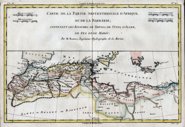 |
North Africa - Bonne
c1783 size: 340 x 240 mm Ref ELM058 £35.00 (+P&P) click image for enlargement |
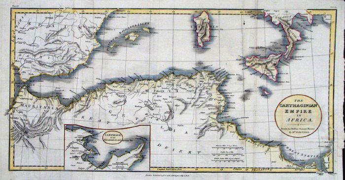 |
North Africa - The Carthaginian Empire in
Africa Rollin 1808
size: 450 x 240 mm Published by F.C Rivington for Rollin's Ancient History Several folds, several repairs. Ref FHM085 £30.00 (+P&P) click image for enlargement |
 |
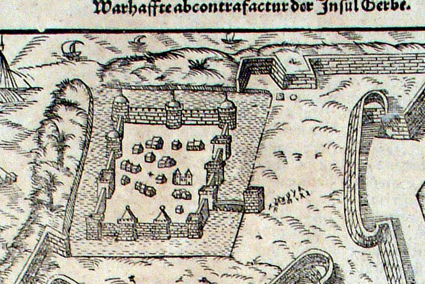
Djerba (Tunisia) Gerbe Munster c1552 map size: 170 x 170 mm - page size: 220 x 350 mm Detail Ref JKM002 £45.00 (+P&P) click image for enlargement |
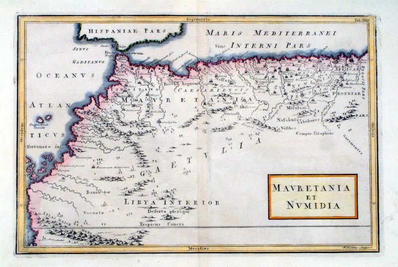 |
Mauretnia et Numidia WH Toms Raw/Rivington 1796 Copper engraving size: 330 x 220 mm, centre fold Ref JKM105 £25.00 (+P&P) click image for enlargement |
 |
Africa Propria WH Toms Raw/Rivington 1796 Copper engraving size: 330 x 220 mm, centre fold Ref JKM104 £25.00 (+P&P) click image for enlargement |
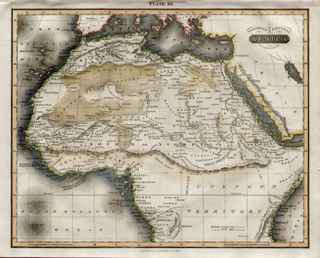 |
North & Central
Africa
Lizars/Constable 1815
size: 260 x 210 mm Ref EDM004 £25.00 (+P&P) click image for enlargement |
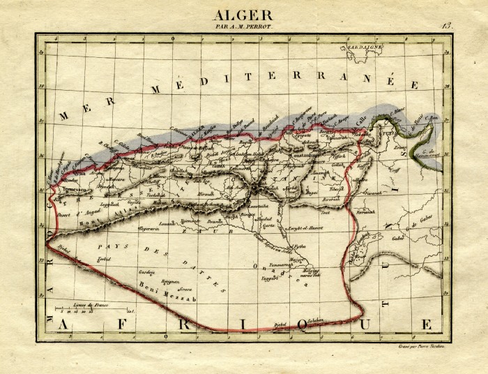 |
Algier Perrot c1830
Engraved by P. Tardieu size: 200 x 160 mm Ref FEM008 £16.00 (+P&P) click image for enlargement |
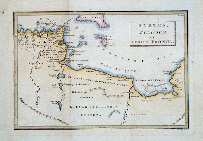 |
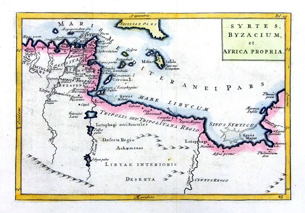
Ancient North Africa Baker
c1800 size: 220 x 150
mm 2 folds 'Syrtes, Byzacium et Africa Propria' Ref GDM171 £18.00 (+P&P) click image for enlargement |
 |
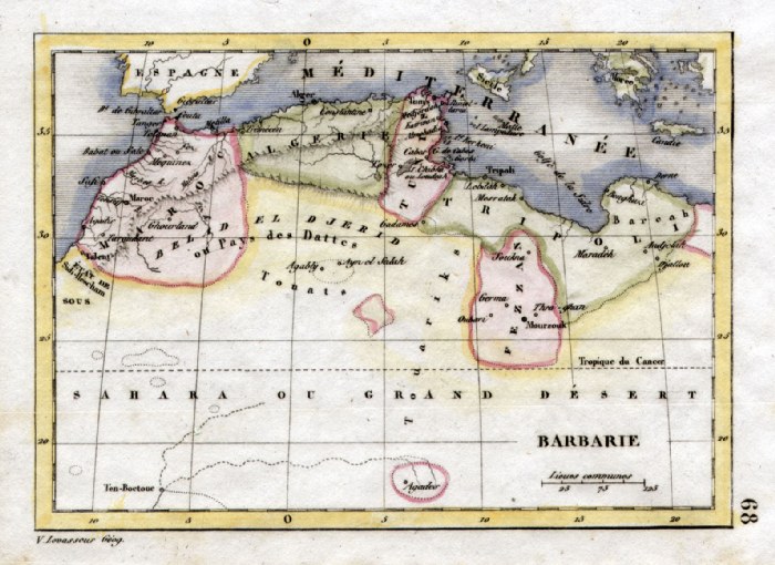
Barbary Coast Perrot c1830
Engraved by P. Tardieu size: 200 x 160 mm Ref FEM009 % £16.00 (+P&P) click image for enlargement |
 |
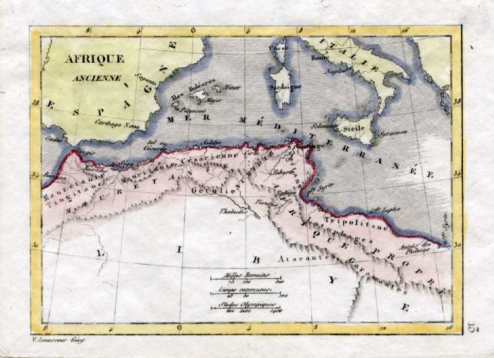
Barbary V. Levasseur
c1835 size: 130 x 100 mm Ref HAM100 £16.00 (+P&P) click image for enlargement |
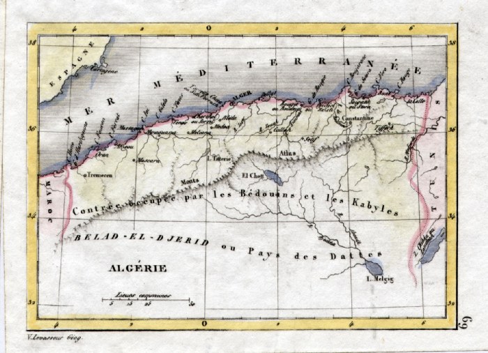 |
Algeria V. Levasseur
c1835 size: 130 x 100 mm Ref HAM101 £16.00 (+P&P) click image for enlargement |
 |
Ancient Africa V. Levasseur
c1835 size: 130 x 100 mm Ref HAM045 £14.00 (+P&P) click image for enlargement |
 |
Barbary Coast Thierry
c1843 size: 300 x 230 mm Ref FDM056 £20.00 (+P&P) click image for enlargement |
 |
North Africa SDUK (Society fro the Diffusion
of Useful Knowledge) 1840 size: 410 x 340 mm Ref FDM057 £22.00 (+P&P) click image for enlargement |
 |
North Africa - Algeria SDUK (Society fro the
Diffusion of Useful Knowledge) 1840
size: 410 x 340 mm Repair to small tear in right margin. Ref FDM058 £22.00 (+P&P) click image for enlargement |
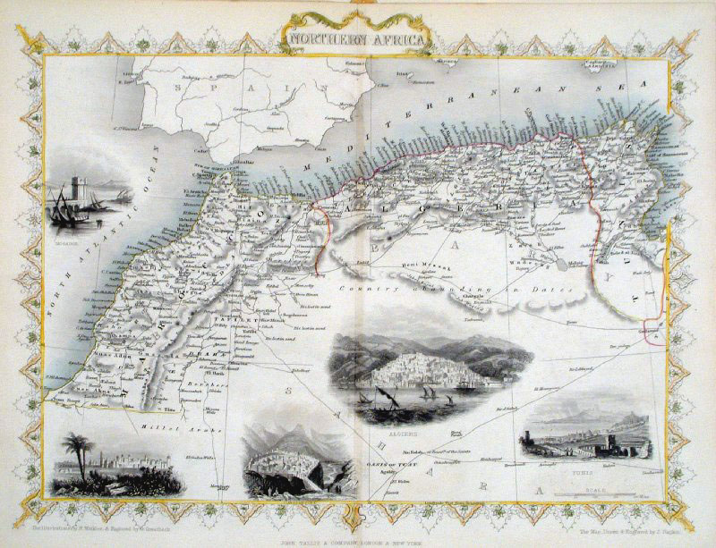 |
Northern Africa Tallis c1855
size: 340 x 260 mm , centre fold
Vignette Views of Tunis, Algiers, Marocco, Mogador Ref GFM099 £36.00 (+P&P) click image for enlargement |
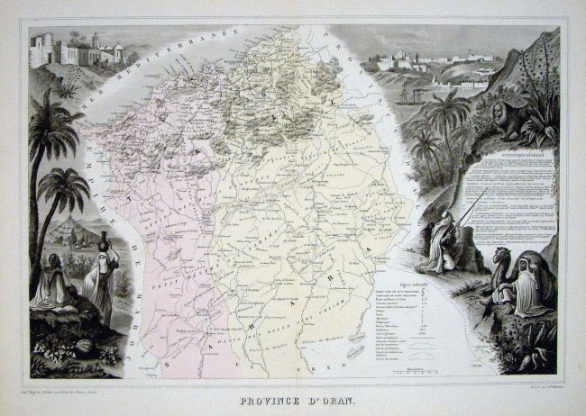 |
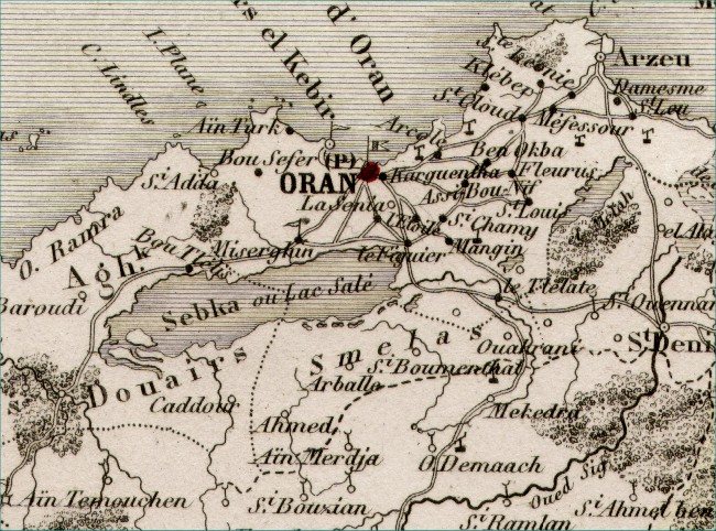
North Africa - Province of
Oran Migeon c1861
size: 440 x 310 mm Ref ELM057 £85.00 (+P&P) Detail click image for enlargement |
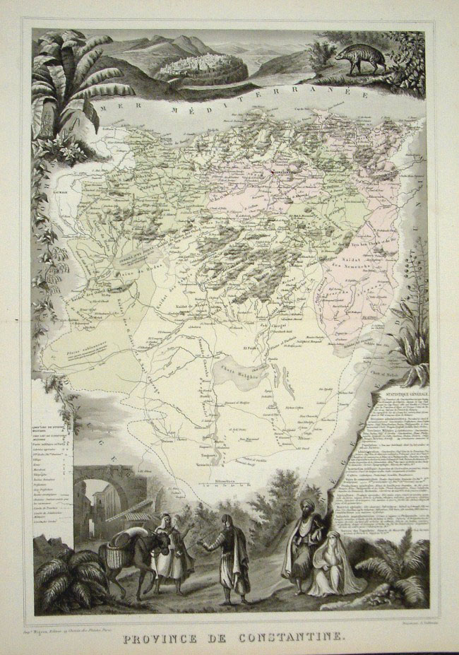 |
North Africa - Province of
Constantine Migeon c1861
size: 440 x 310 mm Ref ELM056 £85.00 (+P&P) Detail click image for enlargement |
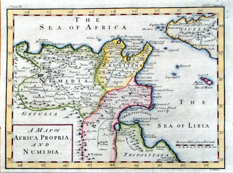 |
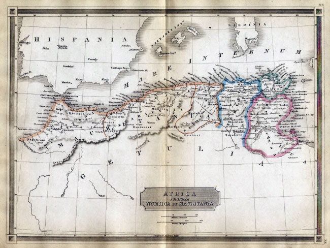
A Map of Africa Propria and Numidia Clarke 1777 size: 300 x 220 mm 2 folds Ref JGM109 £30.00 (+P&P) click image for enlargement |
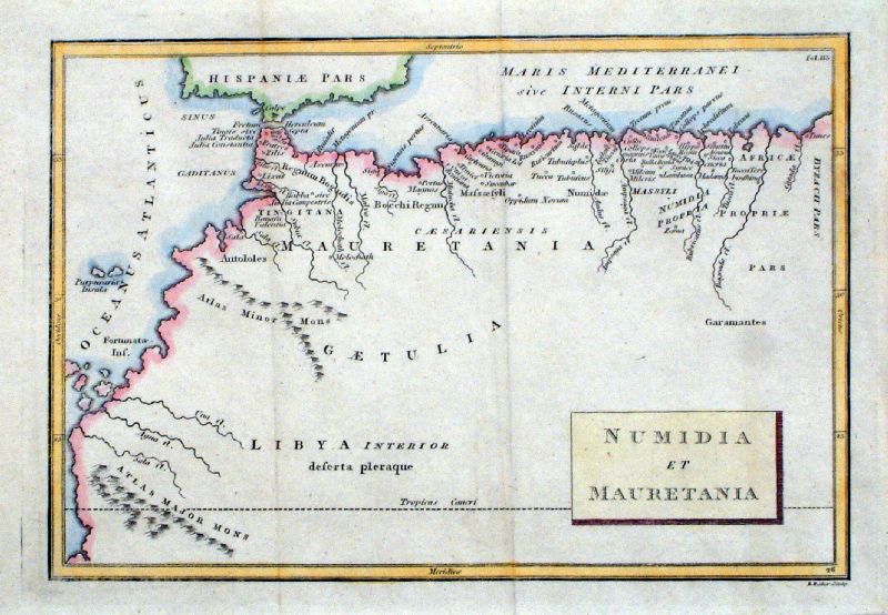 |
Numidia et Mauretania Baker c1779 size: 220 x 150 mm several folds Ref JGM043 £20.00 (+P&P) click image for enlargement |
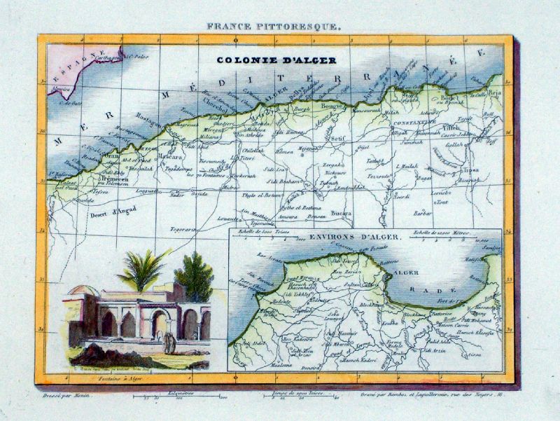 |
Colonie D' Alger
Monin 1833
Steel engraving size 200 x 150 mm Ref LLM040 £20.00 (+P&P) click image for enlargement |
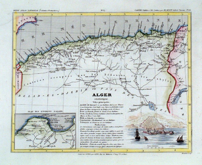 |
Alger
Monin 1833
size 250 x 210 mm Ref IAM091 £18.00 (+P&P) click image for enlargement |
 |
North African Coast - Ancient
Mauritania Bohn
1861
size 320 x 240 mm Ref EKM018 % £20.00 (+P&P) click image for enlargement |
 |
North African Coast - Ancient Libya
Bohn
1861
size 320 x 240 mm Ref EKM019 % £20.00 (+P&P) click image for enlargement |
 |
North African Coast Ancienne Libye Interievre
Mallet
c1683
size 120 x 170 mm Ref ELM054 £48.00 (+P&P) click image for enlargement |
 |
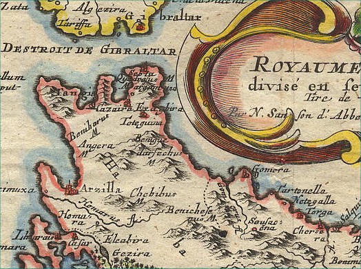
Morocco / Fez
Sanson c1683 size:
280 x 210 mm Ref CBM017 £85.00 (+P&P) Detail click image for enlargement |
 |
North Africa (Tunisia and Libya with an
inset of Egypt) Herman Moll / Christopher Browne 1723 size: 250 x 160 mm Centre Fold From Geographia Classica published by Browne in 1723 Ref FLM040 £35.00 (+P&P) click image for enlargement |
 |
Syrtes, Byzacium et
Africa Propria Geograhia Antiqa Christophi Cellarii Christoph Cellarius 1745 Copper engraving size: 220 x 150 mm, 2 folds. Ref OKM022 £35.00 (+P&P) click image for enlargement |
 |
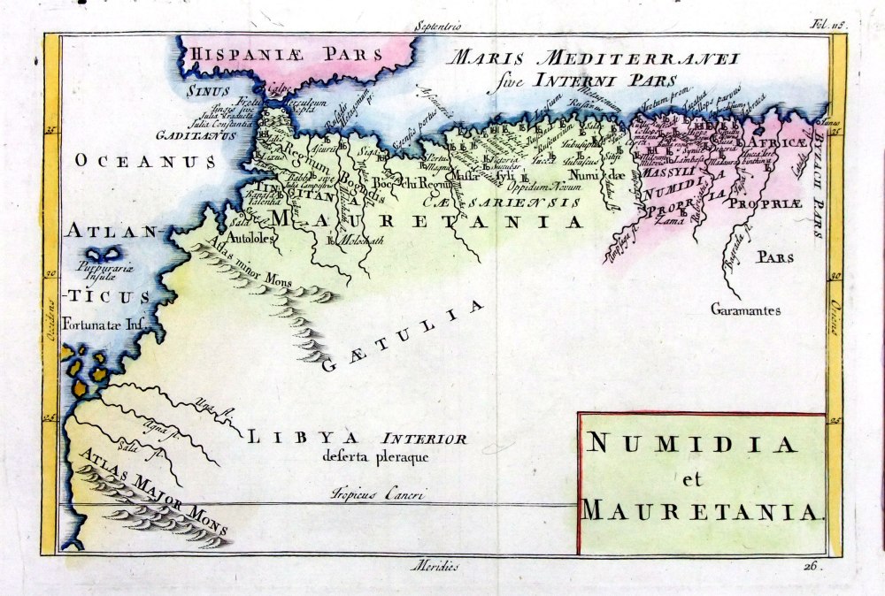
Numidia et Maurenania Geograhia Antiqa Christophi Cellarii Christoph Cellarius 1745 Copper engraving size: 220 x 150 mm, 2 folds. Ref OKM021 £35.00 (+P&P) click image for enlargement |
 |
Ancient Africa Sidney
Hall 1829 size: 250 x190
mm Ref FIM020 £16.00 (+P&P) Slight printing transfer from folded page. click image for enlargement |
 |
Ancient Africa Sidney Hall
1821 size: 260 x 200 mm Ref FAM036 £18.00 (+P&P) Detail click image for enlargement |
 |
Ancient North
Africa Russell
/ Arrowsmith 1809 size:
410 x 210 mm Ref FIM107 % £ 22.00 (+P&P) click image for enlargement |
 |
Ancient North Africa - The Carthaginian
Empire R. Scott 1863 size: 330 x 220 mm several folds, & a few repairs to splits. Ref GBM339 % £ 16.00 (+P&P) click image for enlargement |
 |
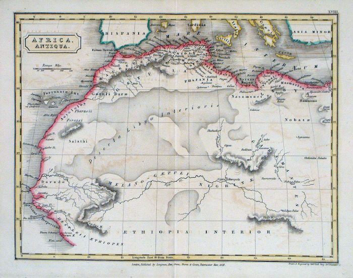
Ancient North Africa
Samuel Arrowsmith 1836 size: 240 x 210 mm Ref FHM136 £ 26.00 (+P&P) click image for enlargement |
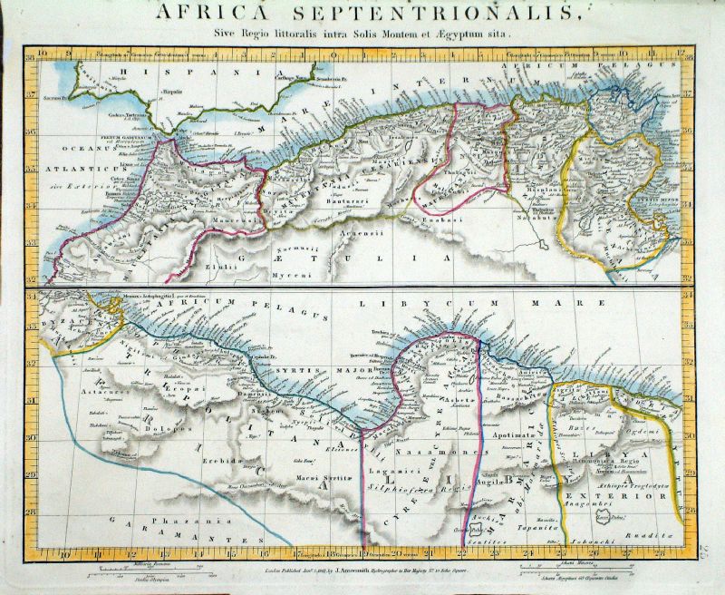 |
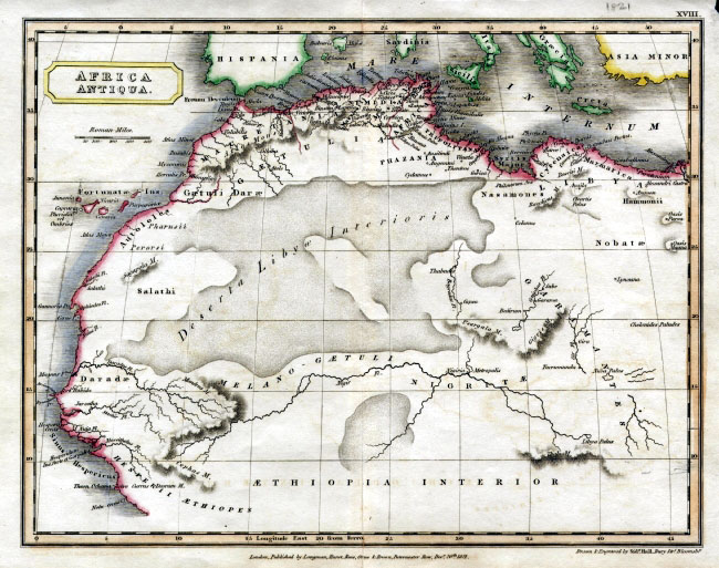
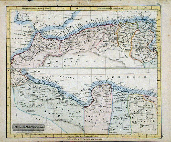
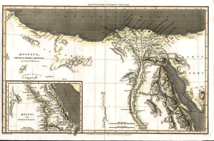
Ancient North
Africa Africa Septentrionalis, Sive Regio littoralis intra Montem et Aegyptum sita. Samuel Arrowsmith 1841 size: 320 x 270 mm Ref LGM003 £ 26.00 (+P&P) click image for enlargement |
 |
Ancient North
Africa
Fenner 1828 Ref GIM033 % £12.00 (+P&P) size: 150 x 130 mm click image for enlargement |
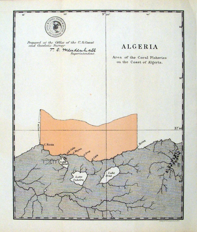 |
'Algeria - Area of the Coral Fisheries on the Coast of Algeria ' United States Coast and Geodetic Survey 1895 Map of designated coral fishing grounds. Litho size: 180 x 220 mm Ref HLM044 £25.00 (+P&P) click image for enlargement |
 |
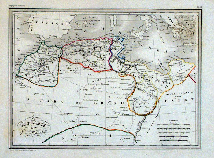
Carte de la Barbarie Vuillemin 1851 size: 270 x 210 mm a few faint spots of foxing Ref JDM065 £12.00 (+P&P) click image for enlargement |
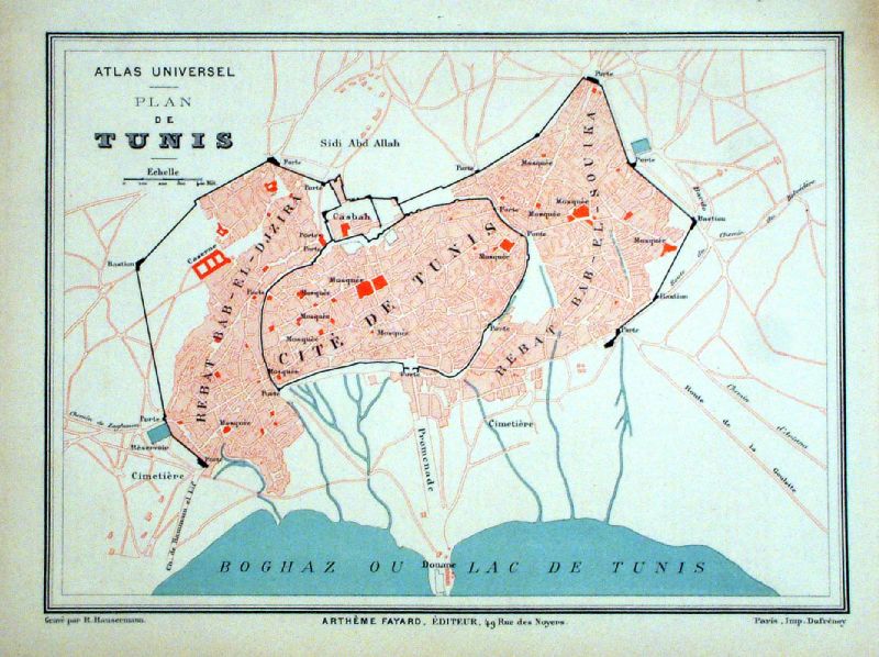 |
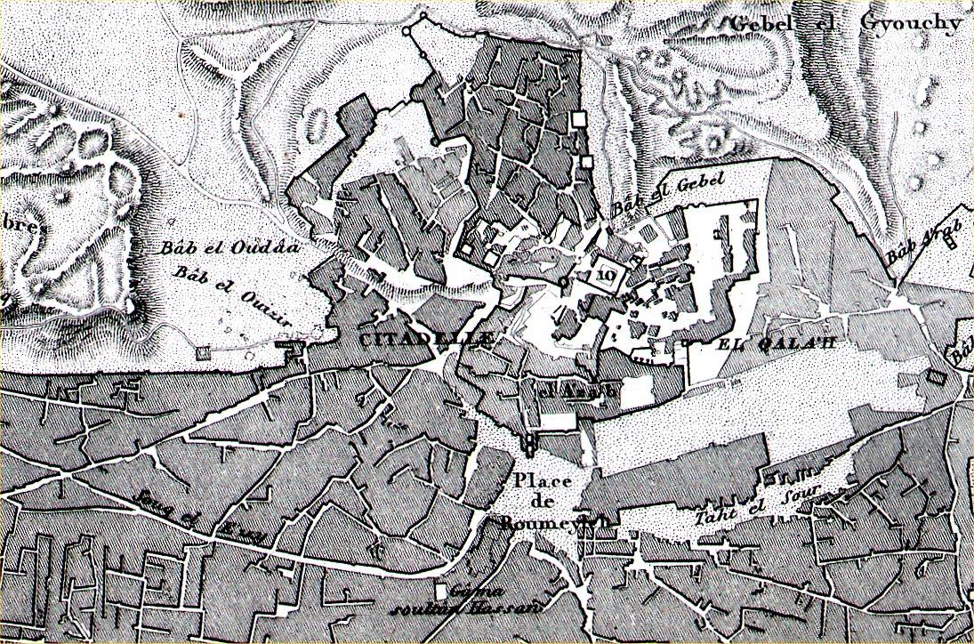
Plan de Tunis Hausermann
/ Fayad 1877 size: 290 x 220 mm Ref KGM040 £ 22.00 (+P&P) click image for enlargement |
Egypt |
|
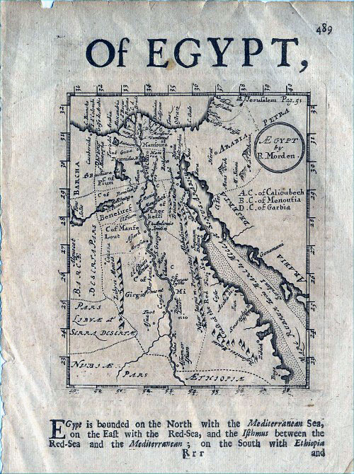 |
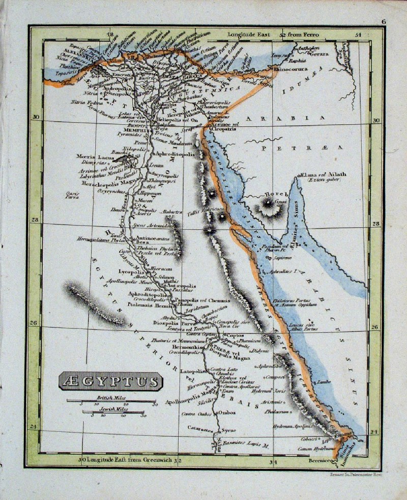
Egypt
Morden c1680
size: 150 x 195 mm Ref CAM002 £80.00 (+P&P) click image for enlargement |
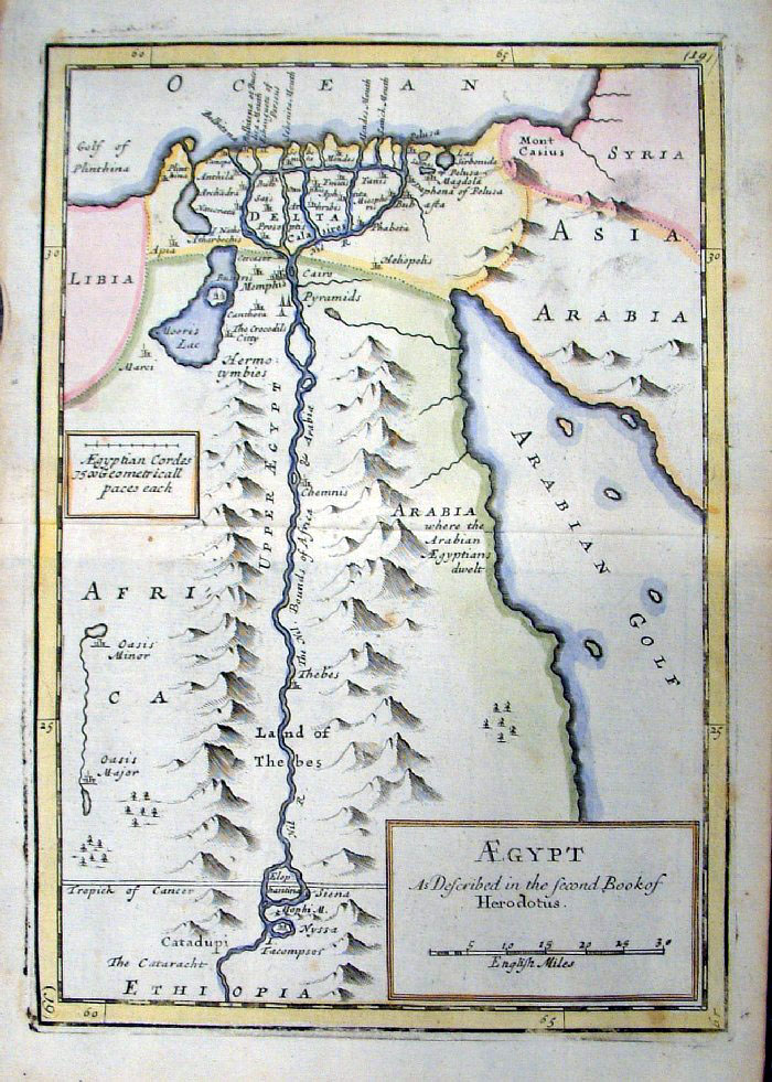 |
Ancient Egypt Egypt as Described in the
Second Book of Herodotus Herman Moll / Christopher Browne 1723 size: 250 x 160 mm Centre Fold From Geographia Classica published by Browne in 1723 Ref FLM045 £45.00 (+P&P) click image for enlargement |
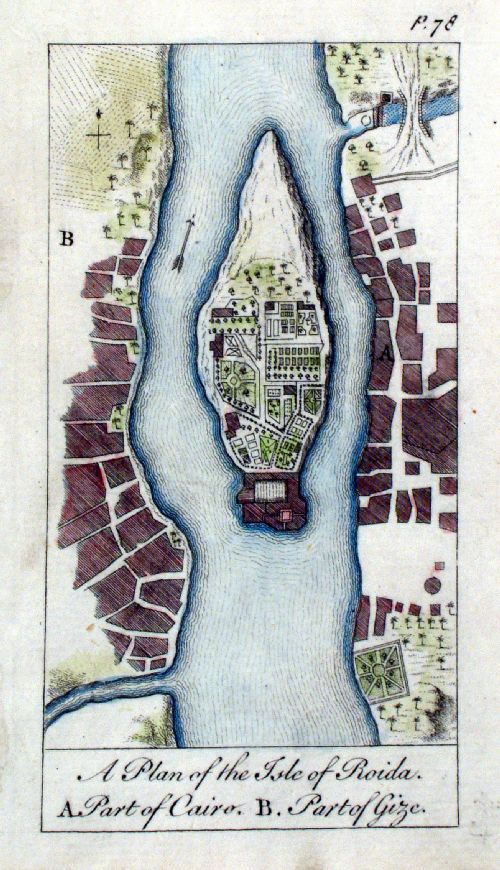 |
A Plan of the Island of Roida (with) A. Part of
Cairo B. Part of Gize (Giza) Newbery 1760 Copper engraving size: 70 x 125 mm From The World Displayed or a Curious Collection of Voyages and Travels Ref CAM033 £45.00 (+P&P) click image for enlargement |
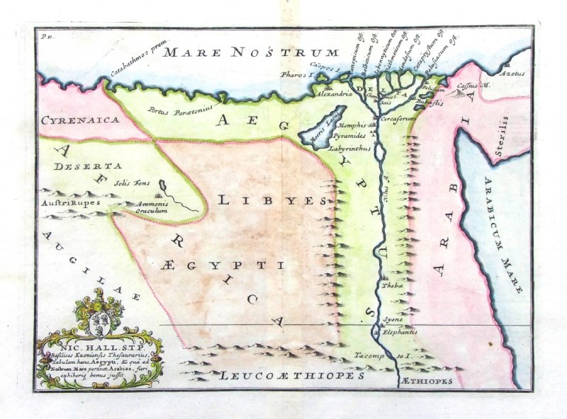 |
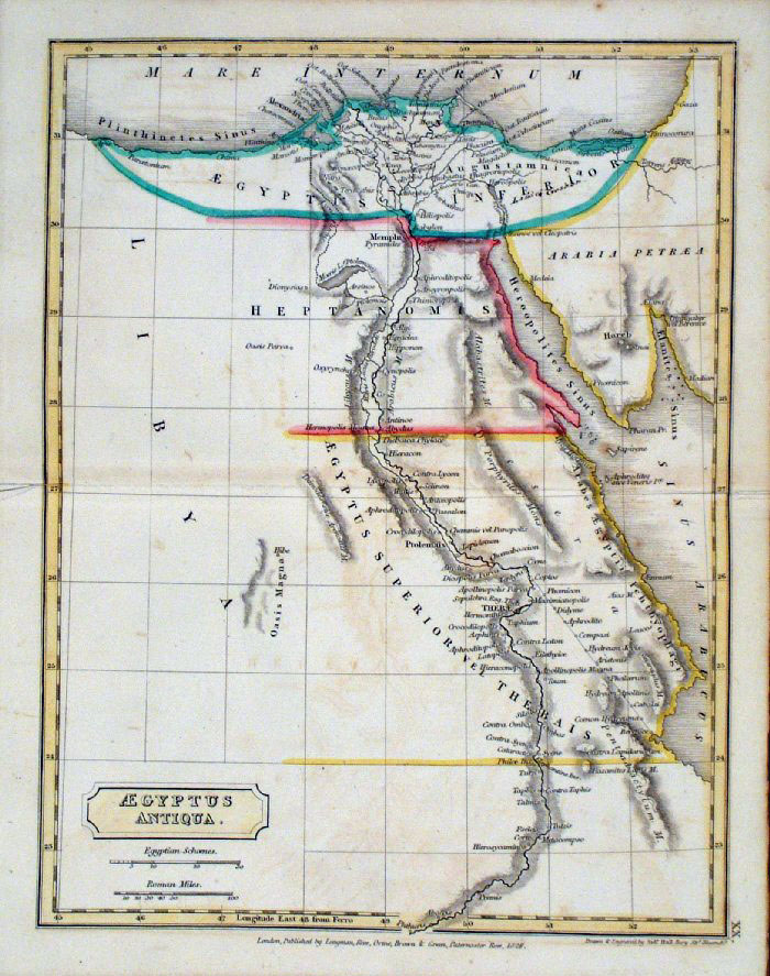
Ancient Egypt
from De Situ Orbis by Pomponius Mela. Published by Philippum Bishop, Exeter, 1711 Copper engraving size 270 x 200 mm, centre fold Decorative cartouche contains the name of the sponsor/patron of this map. Ref PDM008 £22.00 (+P&P) click image for enlargement |
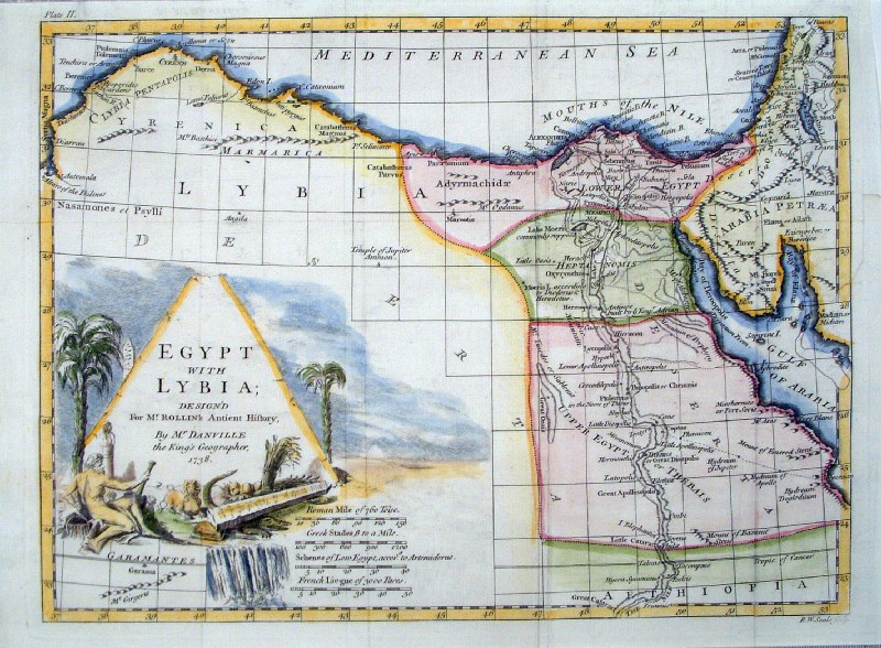 |
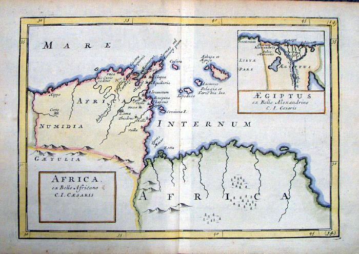
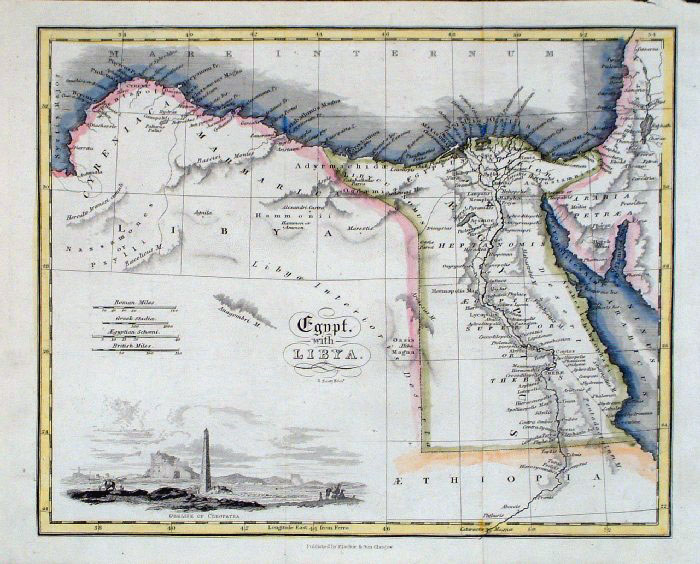
Egypt with Lybia R.
Seale 1738
size 350 x 260 mm Several folds, repairs to splits fold & strengthened upper-right margin Ref HAM015 £38.00 (+P&P) click image for enlargement |
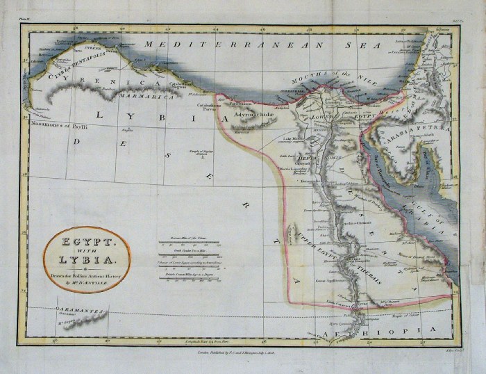 |
Egypt with Libya
Rollin 1808
size: 340 x 240 mm Published by F.C Rivington for Rollin's Ancient History Several folds, several repairs. Ref FHM084 £30.00 (+P&P) click image for enlargement |
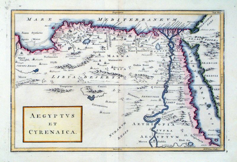 |
Aegyptus et Cyrenaica WH Toms Raw/Rivington 1796 Copper engraving size: 330 x 220 mm, centre fold Ref JKM103 £25.00 (+P&P) click image for enlargement |
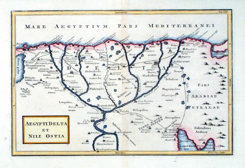 |
Aegypti Delta et Nili Ostia WH Toms Raw/Rivington 1796 Copper engraving size: 330 x 220 mm, centre fold Ref JKM102 £25.00 (+P&P) click image for enlargement |
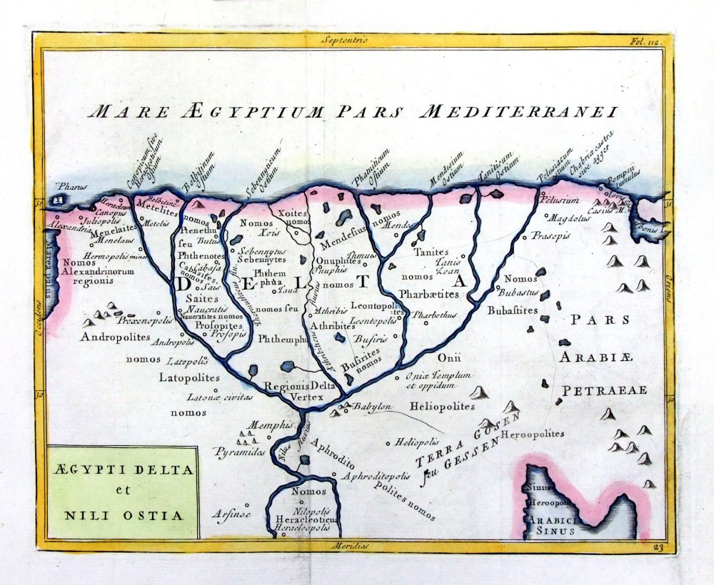 |
Aegypti Delta
et Nili Ostia Geograhia Antiqa Christophi Cellarii Christoph Cellarius 1745 Copper engraving size: 220 x 180 mm, 2 folds. Ref OKM017 £30.00 (+P&P) click image for enlargement |
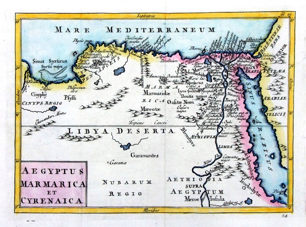 |
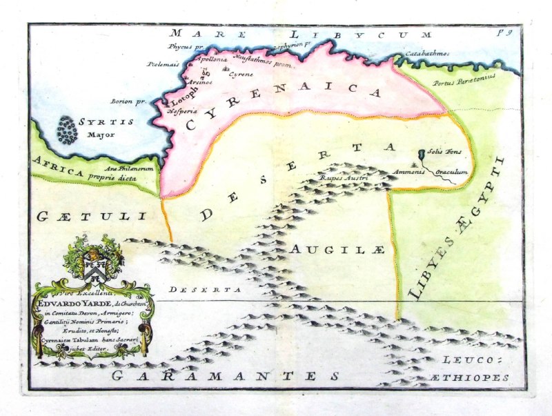
Aegypyus Marmarica et
Cyrenaica Geograhia Antiqa Christophi Cellarii Christoph Cellarius 1745 Copper engraving size: 220 x 150 mm, 2 folds. Ref OKM020 £35.00 (+P&P) click image for enlargement |
 |
View of the City and Port of Alexandria and Isle
of Pharos Rollin 1812 Copper engraving size: 240 x 170 mm, 2 folds Ref FHP267 £25.00 (+P&P) click image for enlargement |
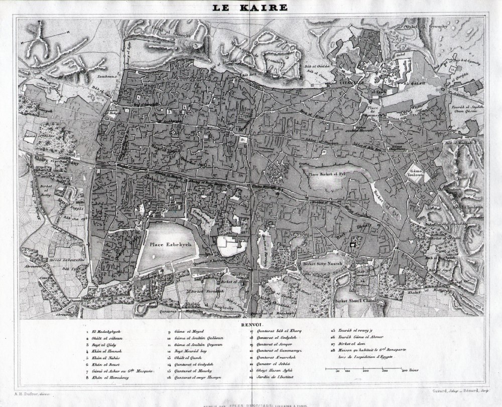 |
Le Kaire
(Cairo) from Abrege
de Geographie by Adrien Balbie,
Paris 1838 Publie Par Jules Renouard. A.H. Dufour. Gavard Scuplt, Banard Scrip. Table of 28 locations. Steel engraving size: 270 x 200 mm centre fold. Ref PHM025 £45.00 (+P&P) Detail click image for enlargement |
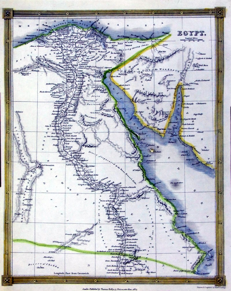 |
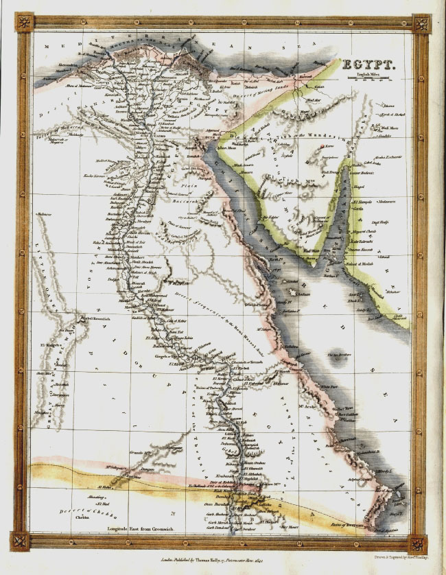
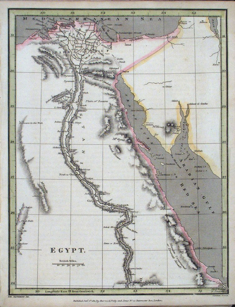
Egypt
Thomas Kelly
1834 engraved by Alex Findlay size: 200x 260 mm Ref OHM028 £18.00 (+P&P) click image for enlargement |
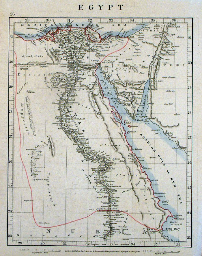 |
Egypt Arrowsmith
1828 size: 250 x 320 mm Ref FDM017 £22.00 (+P&P) click image for enlargement |
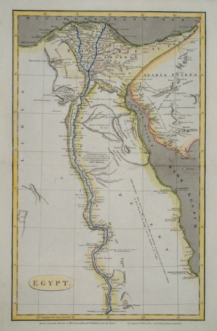 |
Egypt
Arrowsmith c1809
size: 260 x 410 mm Ref FIM094 £ 26.00 (+P&P) click image for enlargement |
 |
Egypt
Findlay
/ Kelly 1841 size: 200 x 270
mm Ref ELM009 % £15.00 (+P&P) click image for enlargement |
 |
North African Coast & Egypt
size: 230 x 140 mm Ref CAM005 £35.00 (+P&P) click image for enlargement |
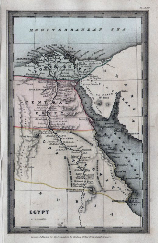 |
Egypt Thomas
Starling
1834
size: 150 x 95 mm Ref GBM319 £ 22.00 (+P&P) click image for enlargement |
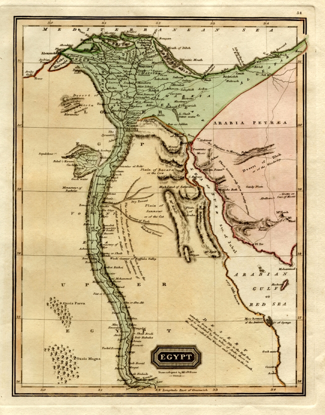 |
Egypt
Lizars
1799 size: 240 x 300 mm Ref FBM002 £26.00 (+P&P) click image for enlargement |
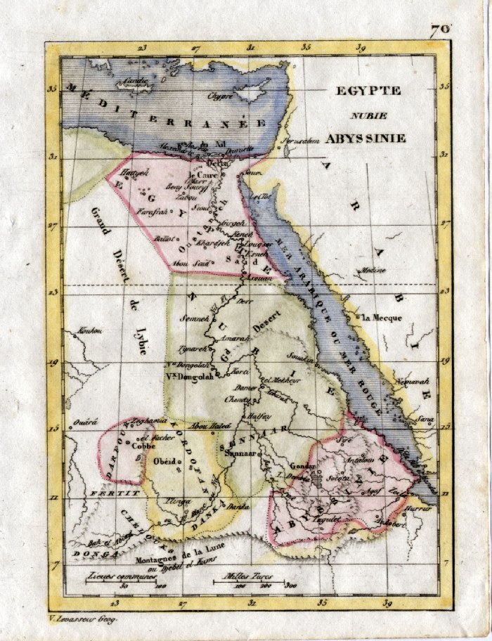 |
Egypt and Abyssinia V. Levasseur c1835 size: 130 x 100 mm Ref HAM102 £20.00 (+P&P) click image for enlargement |
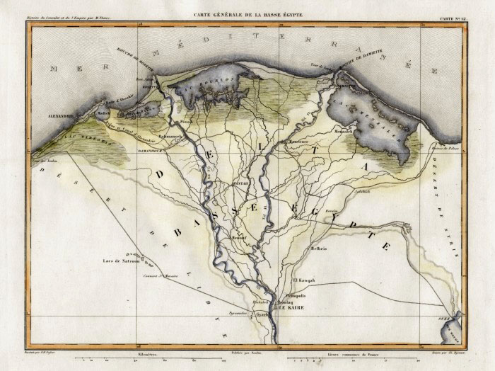 |
Nile Delta, Egypt
Thiers 1859 size: 300 x
230 mm Ref FFM031 £22.00 (+P&P) click image for enlargement |
 |
North African Coast - Egypt and the Nile
Delta Arrowsmith 1809 size 430 x 270 mm Ref FCM016 % £20.00 (+P&P) Detail 1 Detail 2 click image for enlargement |
 |
Egypt Cooper /
Fisher 1829 Ref FIM023 £18.00 (+P&P) size: 200 x 260 mm click image for enlargement |
 |
Ancient Egypt Sidney
Hall 1829 Ref FIM018 £15.00 (+P&P) size: 250 x190 mm Slight printing transfer from folded page. click image for enlargement |
 |
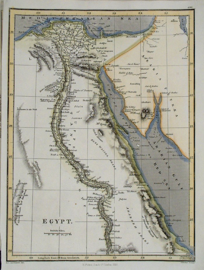
Egypt with Libya R.
Scott 1863
size: 260 x 200 mm Twol folds. Ref GBM342 £20.00 (+P&P) click image for enlargement |
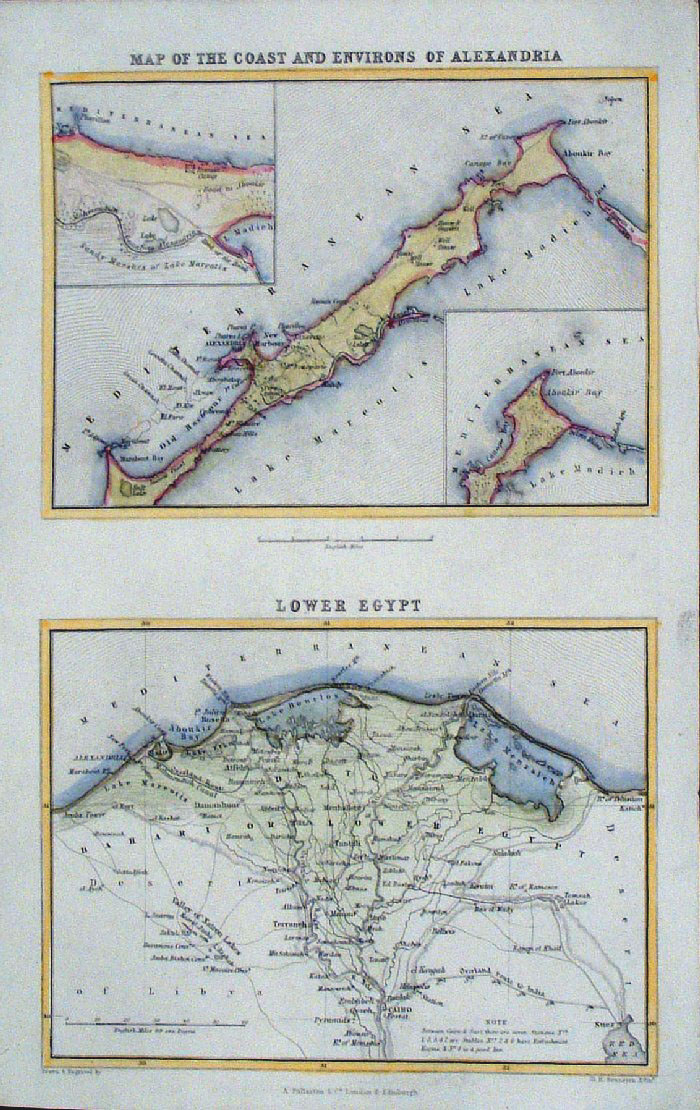 |
The Coast and Environs of Alexandria Nile Delta - Lower Egypt Fullarton c1861 size: 140 x 240mm Ref GBM270 £18.00 (+P&P) click image for enlargement |
 |
Egypt Samuel
Arrowsmith 1836 size: 210 x 240
mm Ref FHM137 % £ 26.00 (+P&P) click image for enlargement |
 |
Ancient Egypt
Samuel Arrowsmith 1836 size:
210 x 240 mm Ref FHM105 % £ 26.00 (+P&P) click image for enlargement |
 |
Egypt
Cooper / Macphereson 1811
size: 200x 250 mm Ref GCM030 % £22.00 (+P&P) click image for enlargement |
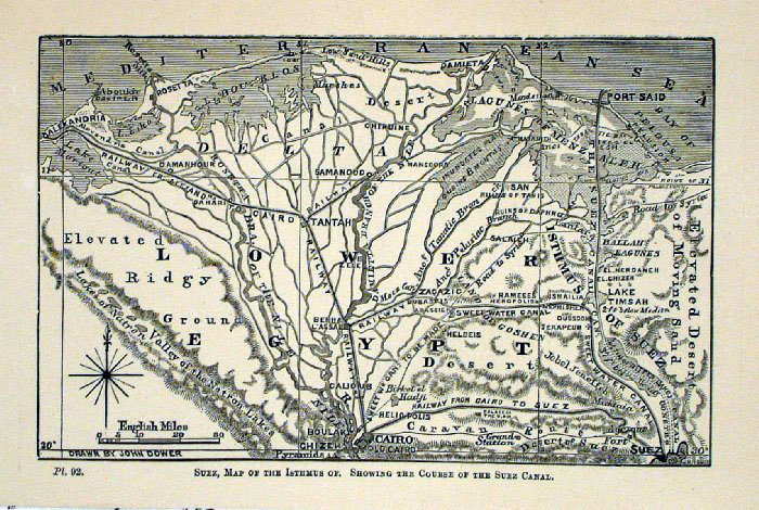 |
Suez, map of the Isthmus, showing the cource of
the Suez Canal John Dower c1868 woodcut engraving size: 170 x 110 mm The canal was started in 1859 and finished in 1869. This map shows it during construction. Ref GAM052 £ 25.00 (+P&P) click image for enlargement |
 |
Ancient Egypt
Fenner 1828 Ref GIM036 % £12.00 (+P&P) size: 150 x 130 mm click image for enlargement |
 |
Egypt Perrot c1830
Engraved by P. Tardieu size: 200 x 160 mm Ref FEM004 £16.00 (+P&P) click image for enlargement |
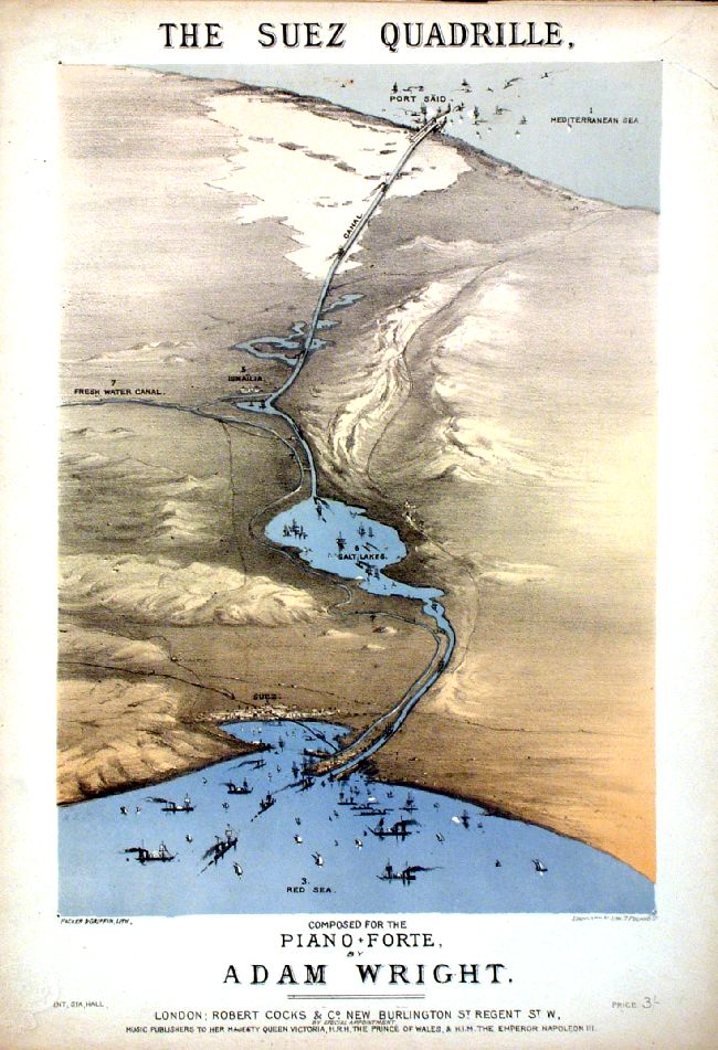 |
Egypt The Suez Quadrille Packer & Griffin 1870 ( Suez Canal opened 1869) Comes with full 7 page musical score. size: 250 x 350 mm Ref IDT006 £32.00 (+P&P) click image for enlargement |
 |
Egypt Vuillemin 1851 size: 210 x 270 mm a few faint spots of foxing Ref JDM064 £14.00 (+P&P) click image for enlargement |
 |
Egypt Ancienne Vuillemin 1851 size: 210 x 270 mm a few faint spots of foxing Ref JDM062 £14.00 (+P&P) click image for enlargement |
| Link to Prints of Africa | |
| All Genuine Antiquarian Maps - No Reproductions or Modern Copies |
2023
