Past Pages
Antique Maps, Prints and Ephemera
Antique Maps of Africa
Arranged by Continent, Atlantic Islands, Central, West
& Slave Trade, East, SouthLink to Maps of North Africa & Egypt
Continent |
|
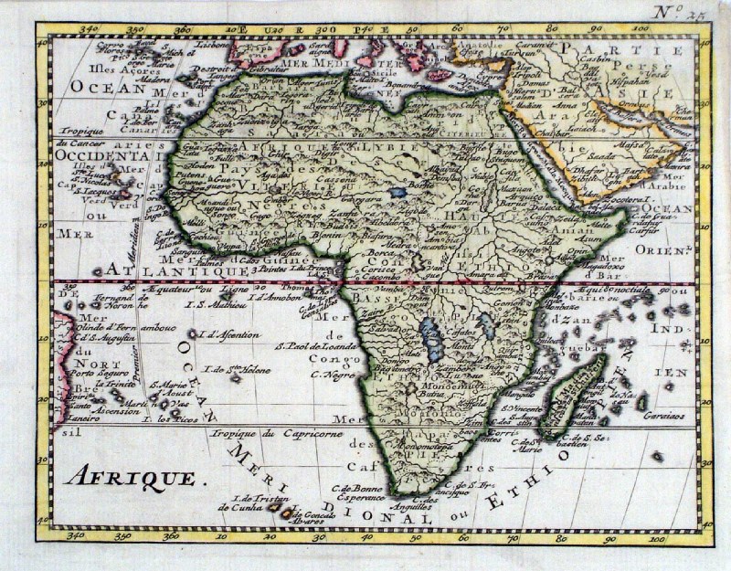 |
Afrique Zacharie Chatelain pre-1755 probably 1737 taken from JB Bossuet 'Discours sur L'Histoire Universelle' 1755 size: 180 x 140 mm, 2 folds Ref HJM017 £85.00 (+P&P) |
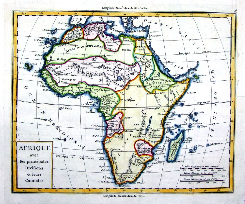 |
Afrique avec ses
principales Divisions et leurs Capitales Brion 1798 size: 290 x 250 mm, several folds Detail Ref OCM001 £75.00 (+P&P) |
 |
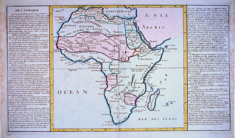
L' Afrique pour la
Concorde de la Geographie des differents ages Pluch 1772 engraved by Lattre size: 220 x 150 mm, 2 folds Ref QDM002 £40.00 (+P&P) |
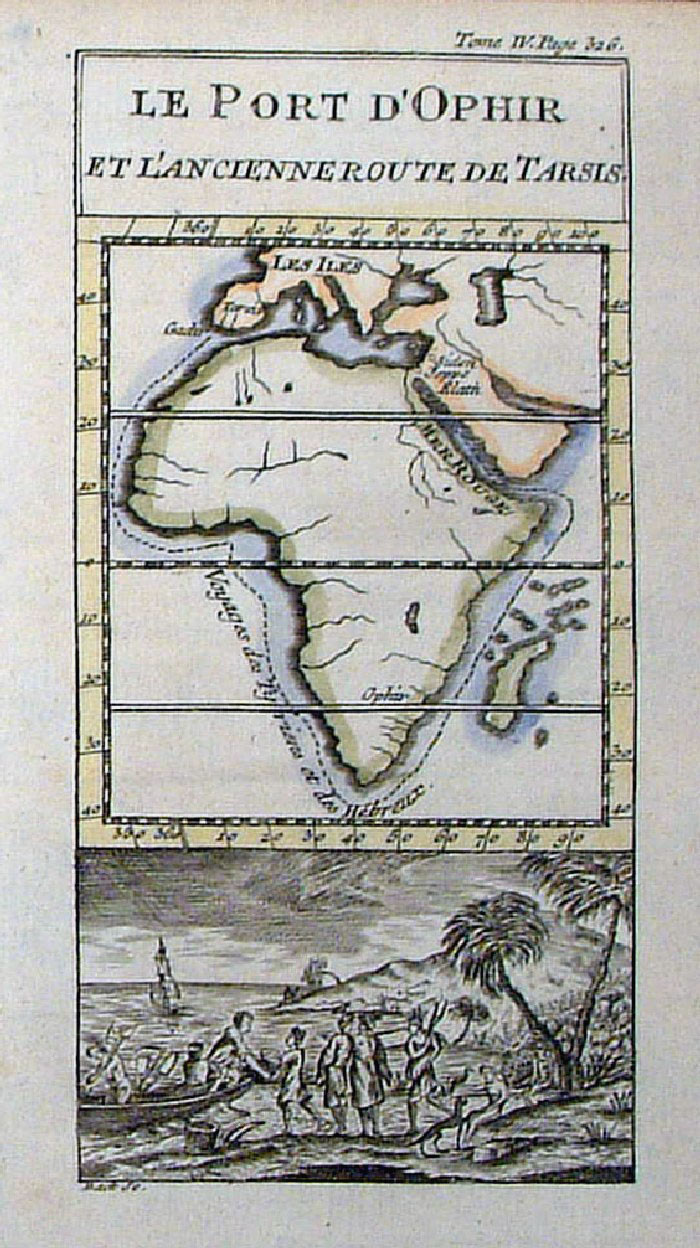 |
Africa Le Port D'Ophir et L'Ancienne Route de Tarsis Pluche 1742 size: 80 x 140 mm Tome IV Page 326 Back Sc French text Ref FLM075 £ 35.00 (+P&P) click image for enlargement |
 |
Africa Clouet 1793
size: 560 x 330 mm Ref CBM023 £75.00 (+P&P) Detail click image for enlargement |
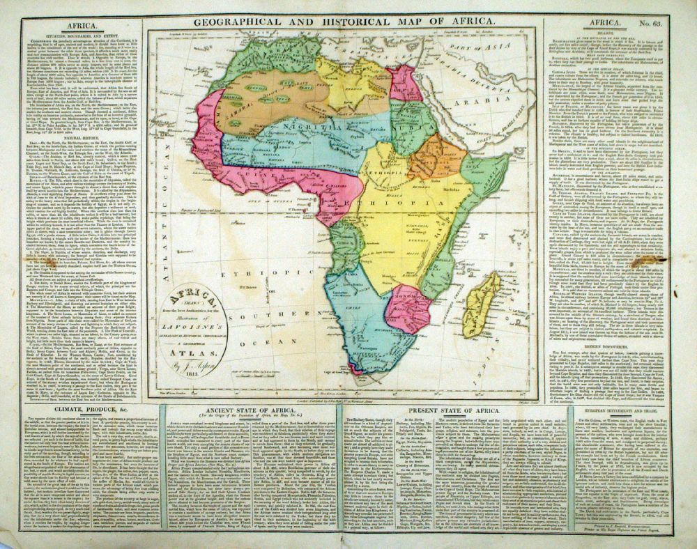 |
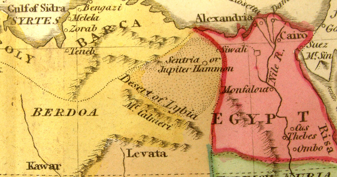
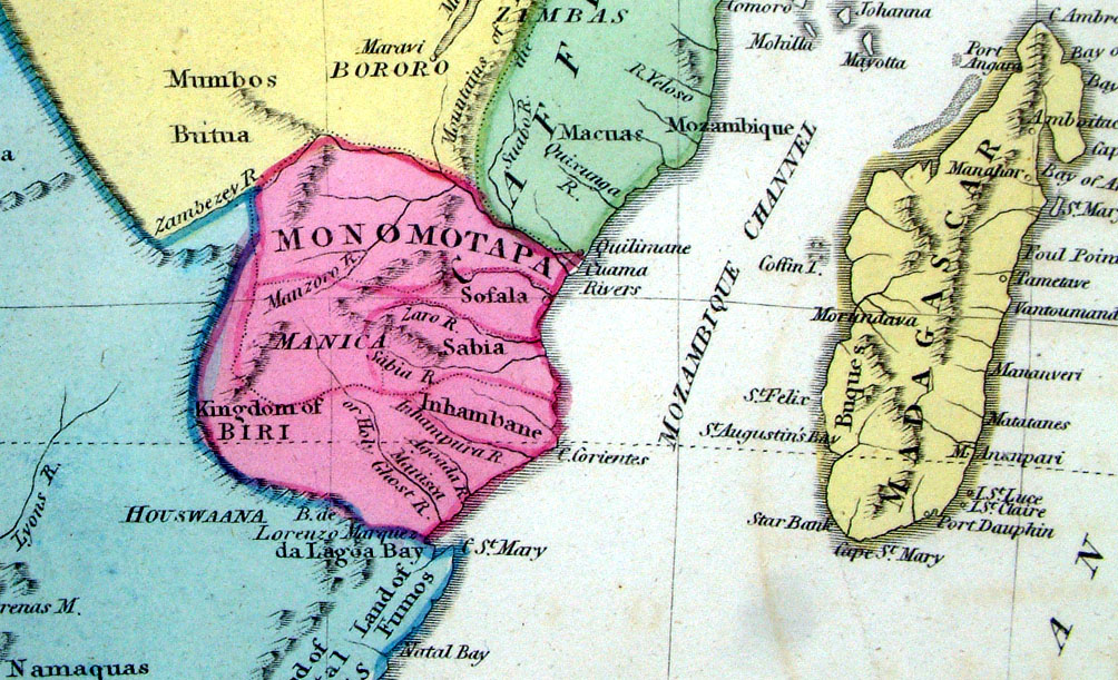
Geographical and
Historical Map of Africa Map engraved by J. Walker. Set with statistical data. From Lavoisne's Genealogical, Historical, Chronological and Geographical Atlas 1827 - Title Page For Statistics Tables and Charts from this atlas see Charts and Tables Page Copper engraving page size: 530 x 420 mm, centre fold. Slight offset transfer Ref LHM068 £50.00 (+P&P) Detail 1 Detail 2 click image for enlargement |
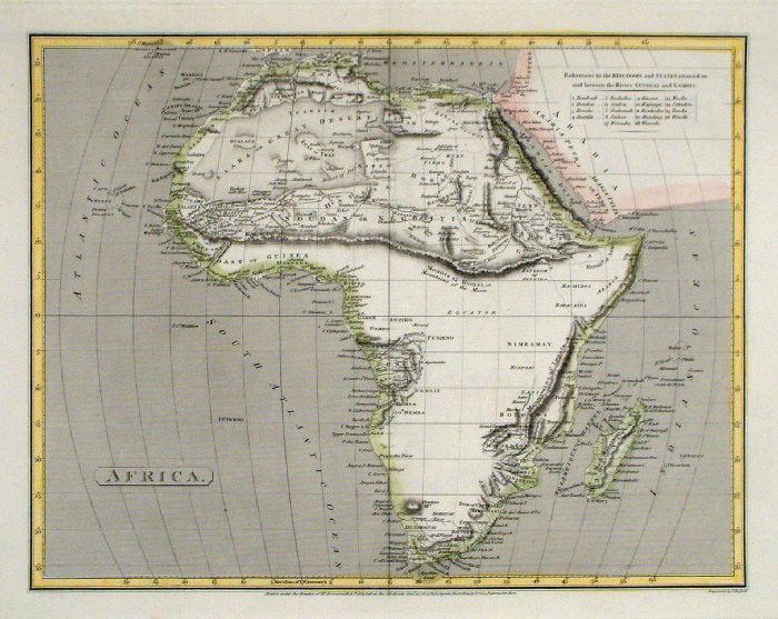 |
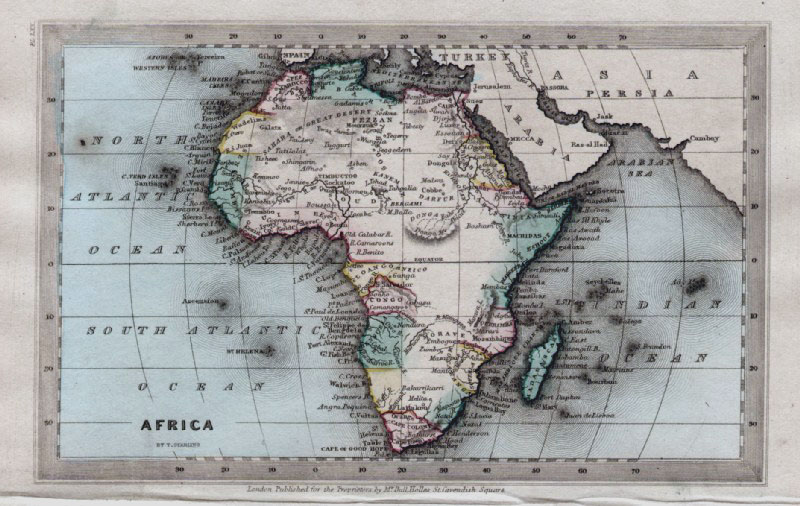
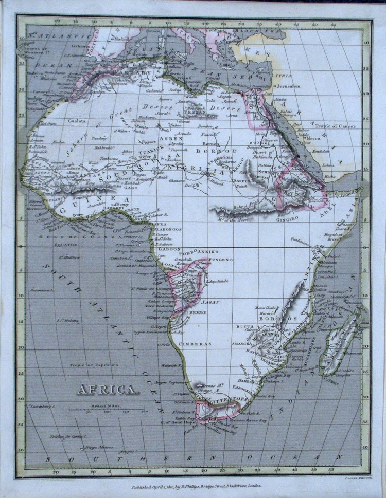
Africa Russell
/ Arrowsmith 1807
size 340 x 260 mm Ref FIM095 £20.00 (+P&P) click image for enlargement |
 |
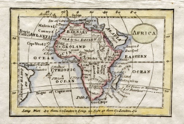
Africa Tegg
1814 size: 240 x 200 mm Small hole in South Atlantic Ref FIM033 £ 24.00 (+P&P) click image for enlargement |
 |
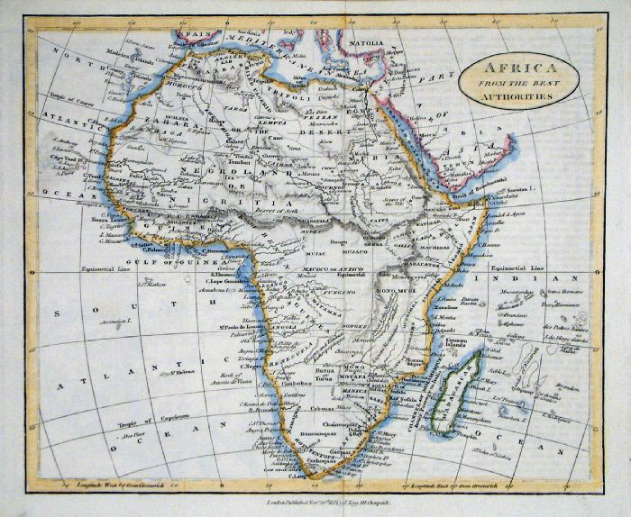
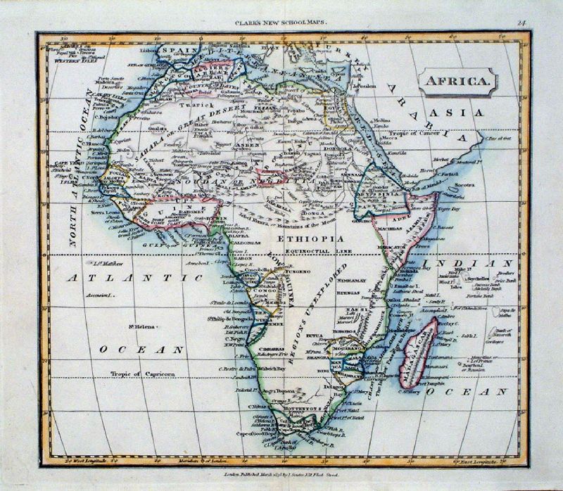
Africa
Russell / Goldsmith / Phillips 1803 Copper engraving size: 200 x 170 mm, several folds, tight top and bottom margins Ref NHM006 £25.00 (+P&P) click image for enlargement |
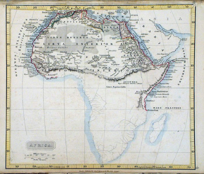 |
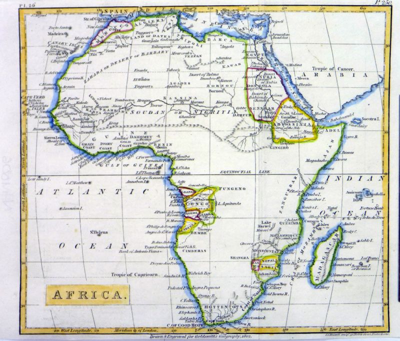
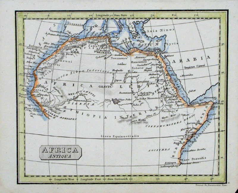
Ancient Africa
Samuel Arrowsmith 1836 size:
240 x 210 mm Ref FHM126 % £ 24.00 (+P&P) click image for enlargement |
 |
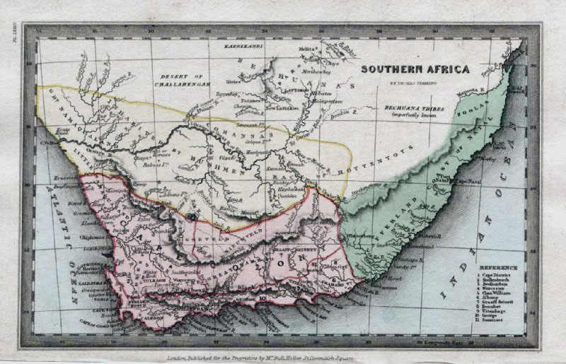
Africa Thomas
Starling
1834
size: 150 x 95 mm Ref GBM317 £ 24.00 (+P&P) click image for enlargement |
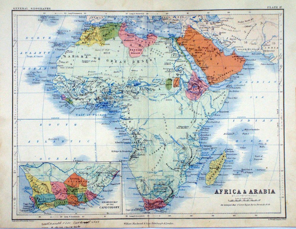 |
Africa and
Arabia A.K. Johnston /
William Blackwood 1854 Inset map of Cape Colony (South Africa) size: 320 x 250 mm, centre fold. Early full colour lithographic printing. Fine ink notes on lower-left margin Ref LKM004 £22.00 (+P&P) Detail click image for enlargement |
 |
Africa Mackenzie c1868
Original colour size: 260 x 300 mm discolouration at centre fold greatly exaggerated in illustration. Ref FBM035 % £15.00 (+P&P) click image for enlargement |
 |
Africa
Russell
/ Guy c1838
size: 170 x 130 mm Ref HAM210 % £18.00 (+P&P) click image for enlargement |
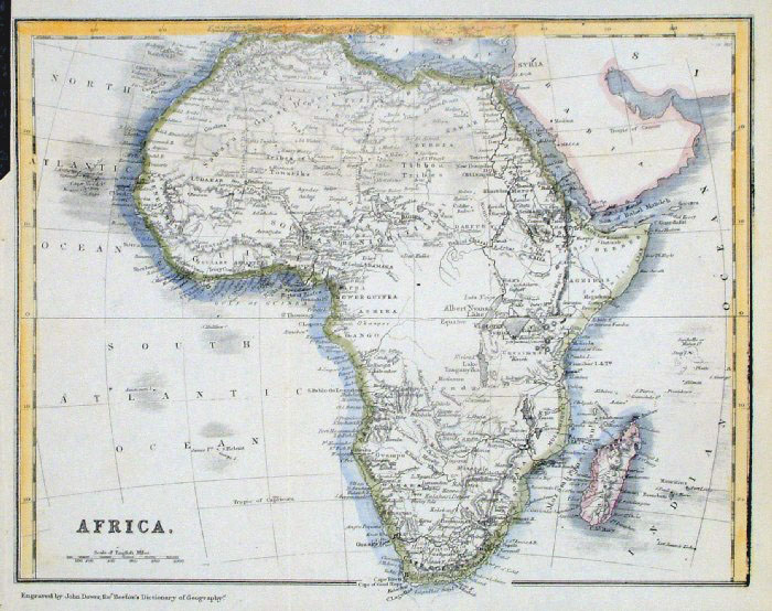 |
Africa
John
Dower / Beeton c1868
size: 240x 190 mm several folds, tight upper-left margin Ref GAM042 % £14.00 (+P&P) click image for enlargement |
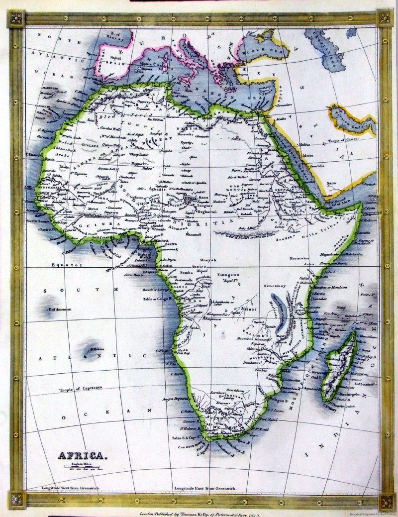 |
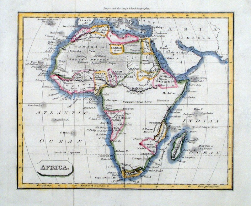
Africa
Thomas Kelly 1843 engraved by Alex Findlay size: 200x 260 mm tight right margin Ref OHM029 £18.00 (+P&P) click image for enlargement |
 |
Africa
Tyrer
/ Souter 1838
size: 250 x 210 mm Ref JLM024 £18.00 (+P&P) click image for enlargement |
 |
Africa
Cooper
1810 size: 200x 250 mm Ref GCM024 £18.00 (+P&P) click image for enlargement |
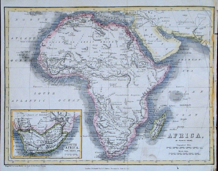 |
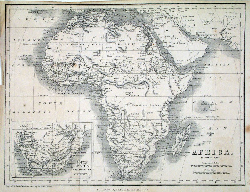
Africa with inset of South Africa
Francis Young
/ Beeton c1880 size: 250x 190 mm several folds, creased right margin Ref GAM036 % £18.00 (+P&P) click image for enlargement |
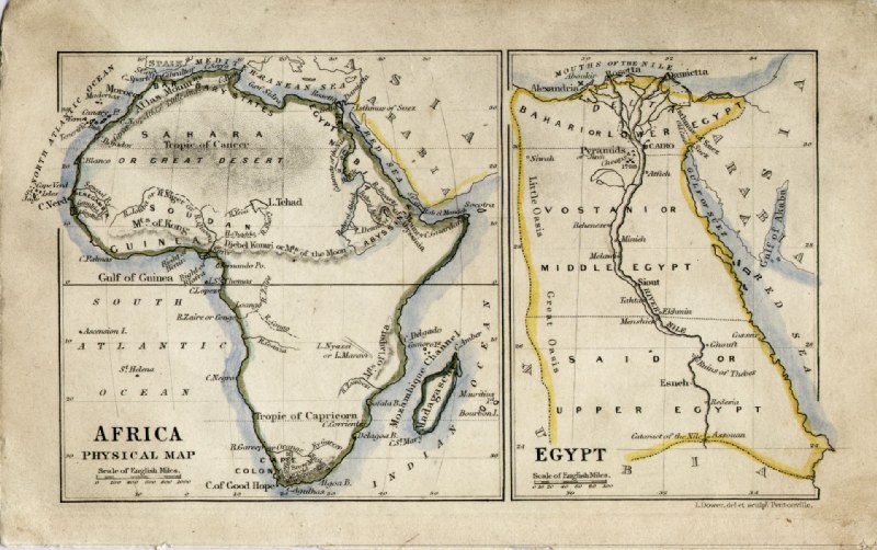 |
Africa and Egypt John
Dower / James Cornwell c1850 Ref GFM069 % £20.00 (+P&P) size: 150 x 95 mm, slightly soiled surface click image for enlargement |
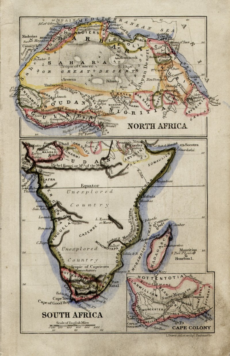 |
Africa (North and South)
John Dower / James Cornwell
c1850 Ref GFM070 % £20.00 (+P&P) size: 150 x 95 mm, slightly soiled surface click image for enlargement |
 |
Africa
Thomas Kelly 1843 engraved by Alex Findlay size: 200 x 260 mm tight right margin. Ref OHM029 £18.00 (+P&P) click image for enlargement |
 |
Ancient
Africa
Fenner 1828 Ref GIM015 % £12.00 (+P&P) size: 150 x 130 mm click image for enlargement |
 |
Africa
Turner 1810 Ref GLM013 % £18.00 (+P&P) size: 120 x 80 mm click image for enlargement |
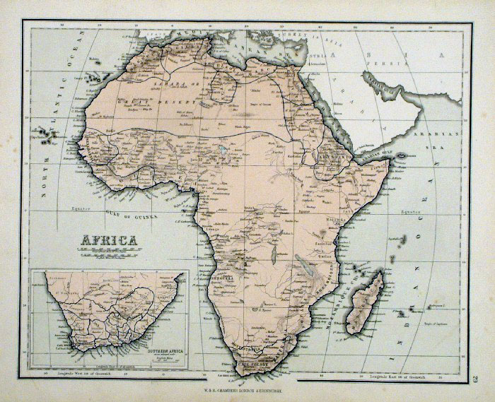 |
Africa
Chambers 1855 Inset detail of Southern Africa size: 300 x 240 mm Ref FDM150 £18.00 (+P&P) click image for enlargement |
 |
Africa Hunting map Francis
Young / Beeton 1864 size: 260 x 200 mm Ref HDM004 £15.00 (+P&P) click image for enlargement |
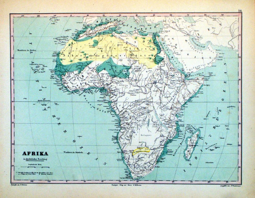 |
Afrika Winkelmann / Krais & Hoffman for Humboldt's Kosmos 1861 size: 320 x 250 mm Ref LDM028 £18.00 (+P&P) click image for enlargement |
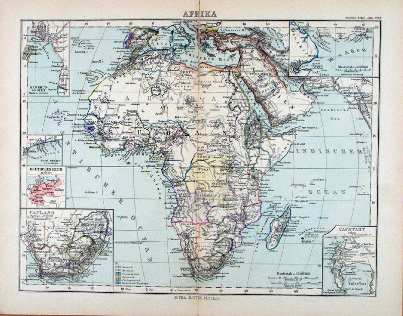 |
Afrika Steiler /
Perthes 1895 size: 300 x 240 mm, centre fold. Repair to split at centre fold insets of 'Capland', Capstadt', 'Kamerun-Gebiet' Ref HHM091 £18.00 (+P&P) click image for enlargement |
North Africa & Egypt - New Page
|
|
Atlantic Ocean Islands |
|
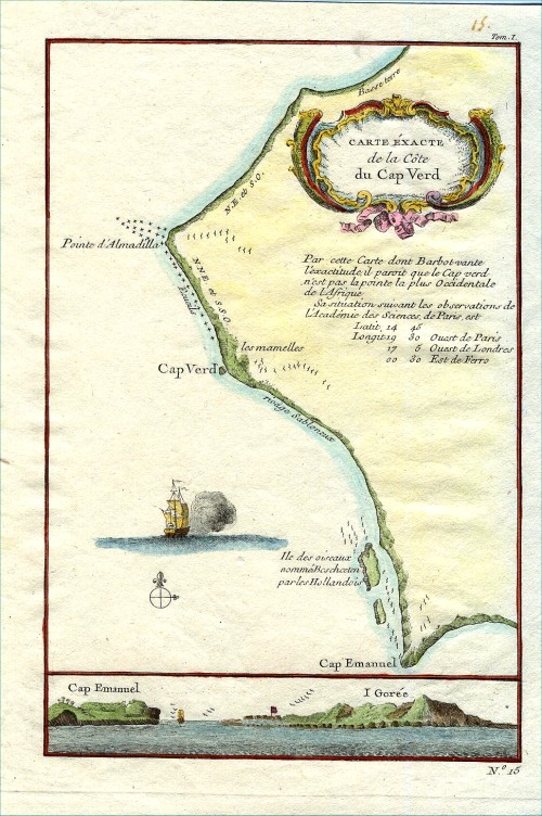 |
Cape
Verde
Bellin c1764 Copper engraving size: 170 x 240 mm Ref CBM001 £38.00 (+P&P) click image for enlargement |
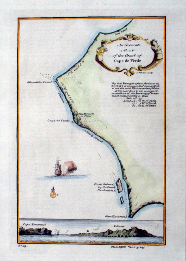 |
Cape
Verde
Kitchin 1745 Copper engraving size: 170 x 240 mm Ref IKM011 £38.00 (+P&P) click image for enlargement |
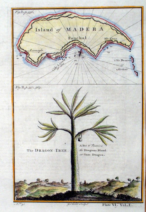 |
Island of Madera
Child 1745 The Dragon Tree. A pot to receive the Dragons Blood or Gum Dragon. Copper engraving size: 160 x 240 mm tight right margin Ref IKM021 £48.00 (+P&P) click image for enlargement |
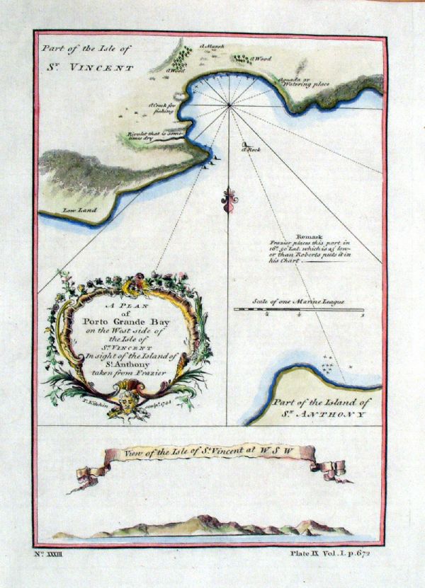 |
A Plan of Porto Grande Bay on the West side of the
island of St Vincent Kitchin 1744 size: 160 x 220 mm Ref JKM051 £45.00 (+P&P) click image for enlargement |
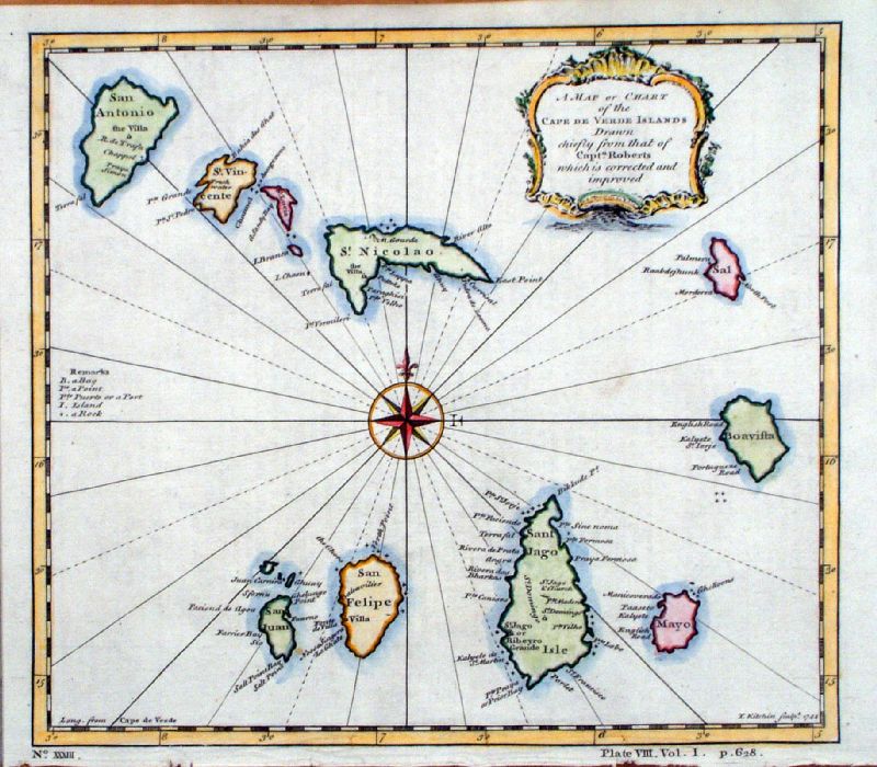 |
Cape Verde Islands Kitchin
1744 size: 230 x 200 mm Ref IKM009 £48.00 (+P&P) click image for enlargement |
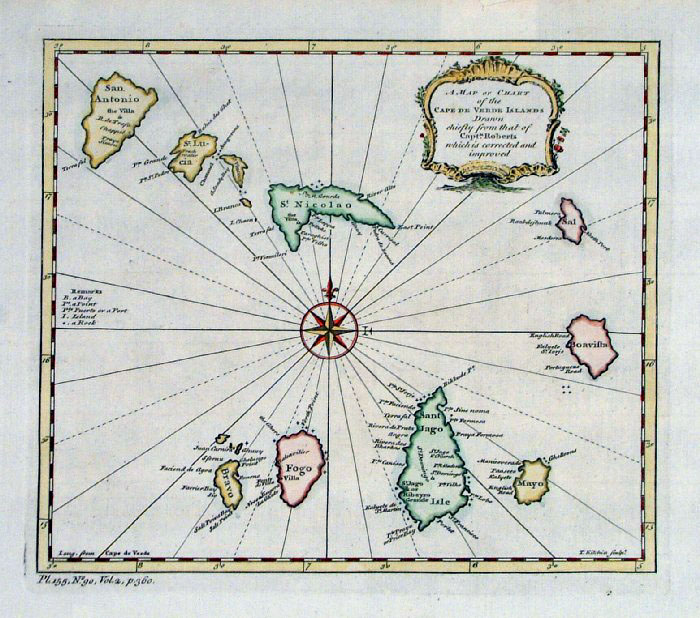 |
Cape Verde Islands Kitchin
c1752 size: 230 x 200 mm Ref FLM021 £48.00 (+P&P) click image for enlargement |
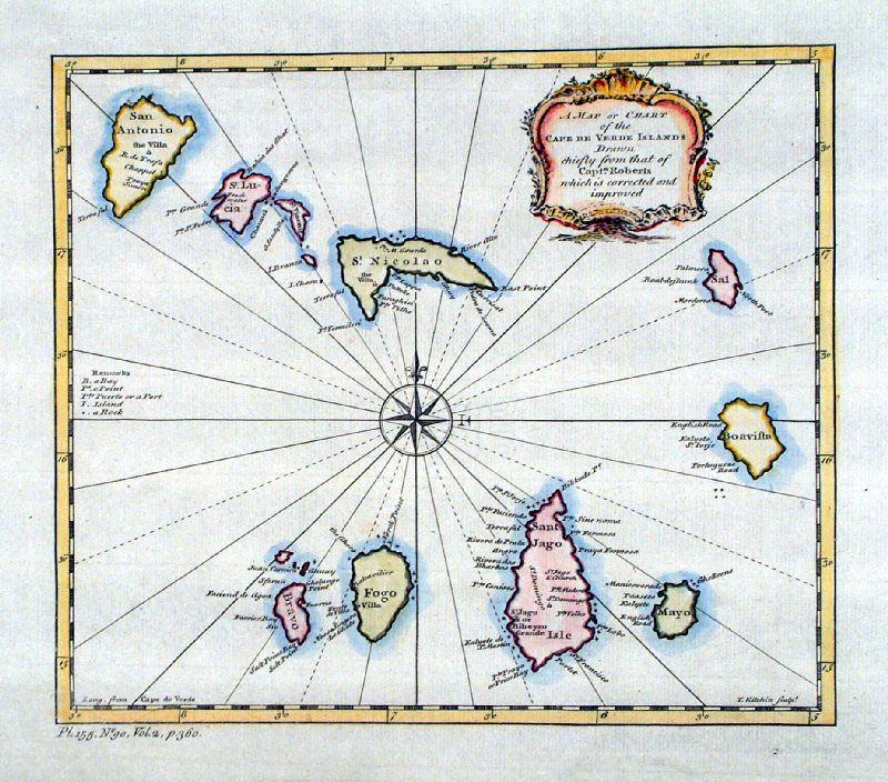 |
Cape Verde Islands Kitchin
c1752 size: 230 x 200 mm Ref GJM005 £48.00 (+P&P) click image for enlargement |
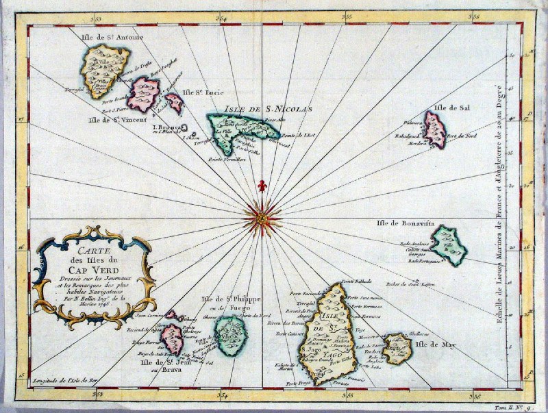 |
Cape Verde '
Carte de Isles du Cap Verd' Prevost 1749 size: 300 x 220 mm, several folds, repair to tight margin and split at fold. Ref HPS001 £60.00 (+P&P) click image for enlargement |
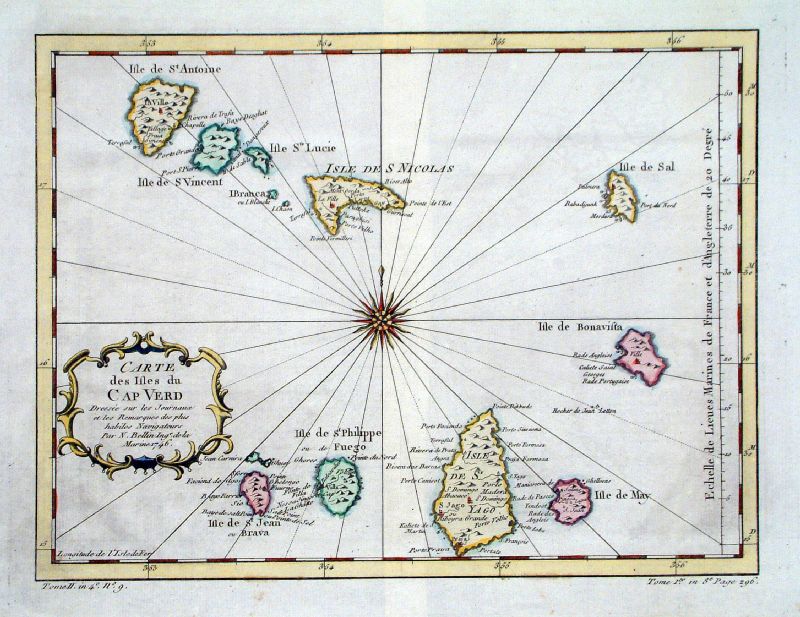 |
Cape Verde '
Carte de Isles du Cap Verd' Bellin c1780 size: 300 x 220 mm, centre folds Ref JGM033 £60.00 (+P&P) click image for enlargement |
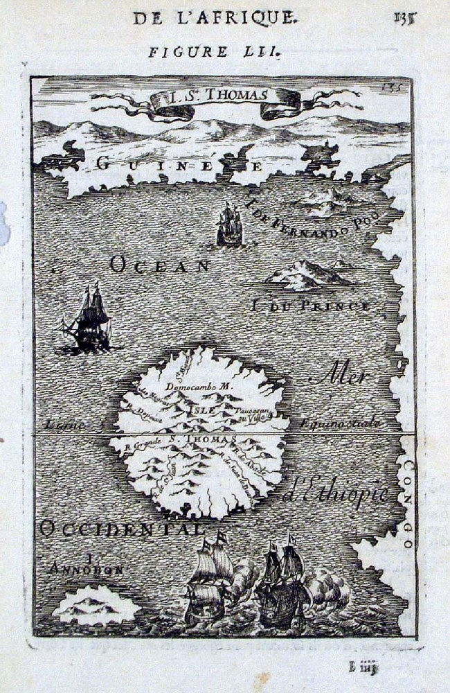 |
I. St Thomas
Mallet 1683 Ref HMS006 £40.00 (+P&P) size: 120 x 170 mm click image for enlargement |
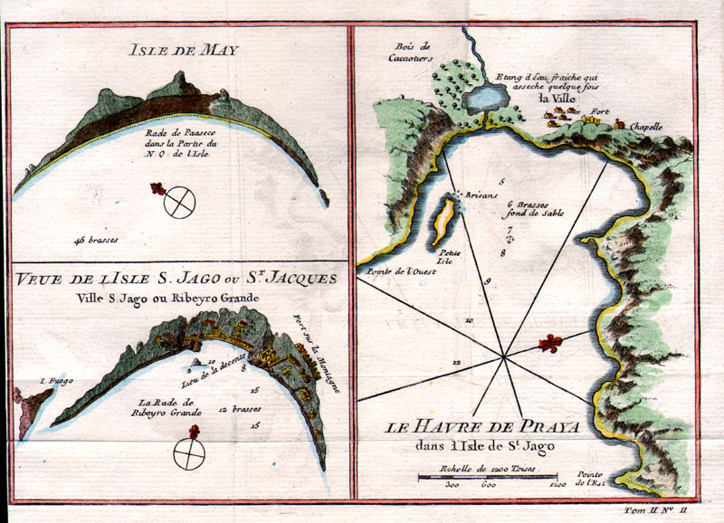 |
Cape Verde '
Le Havre de Praya' 'Isle de May' 'Veue
de l'Isle S. Jago ou St. Jacques' Bellin 1764 size: 210 x 155 mm, several folds, tight left margin Ref AEM100 £60.00 (+P&P) click image for enlargement |
Indian Ocean Islands |
|
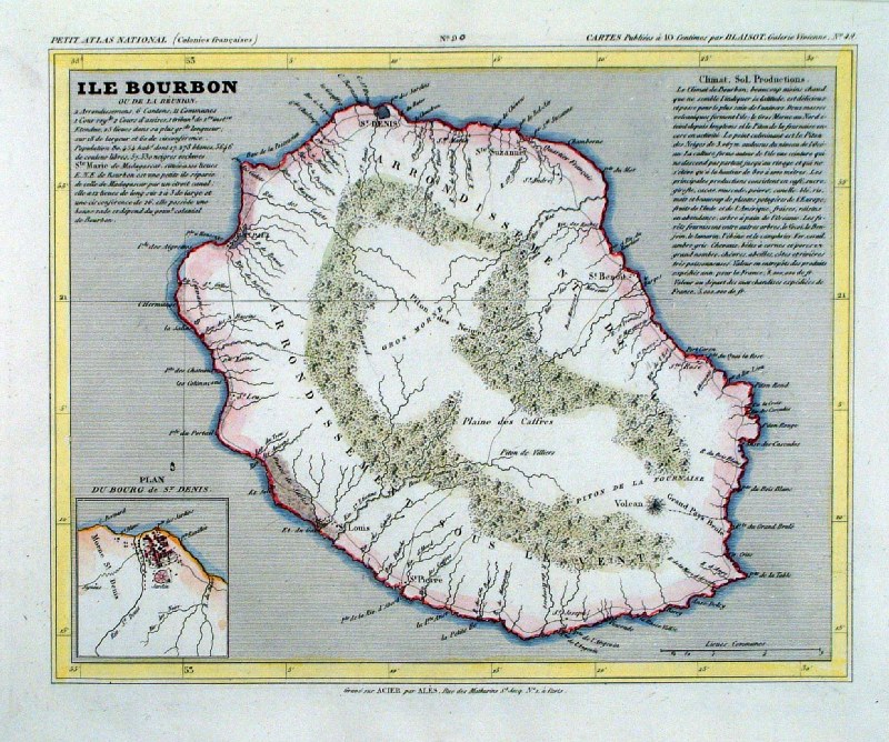 |
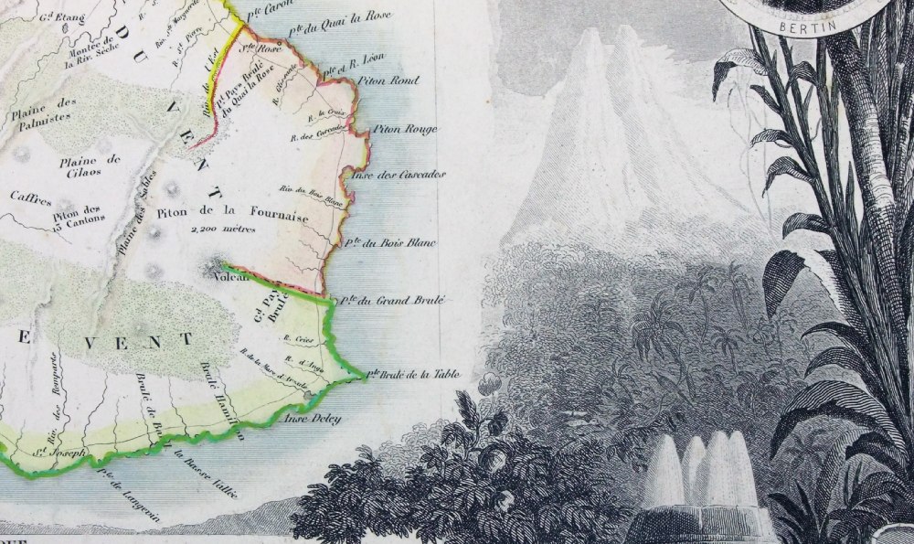
Ile Bourbon
Monin 1833
(Reunion, former French Colony, east of Madagascar) size 250 x 210 mm Ref IAM093 £28.00 (+P&P) click image for enlargement |
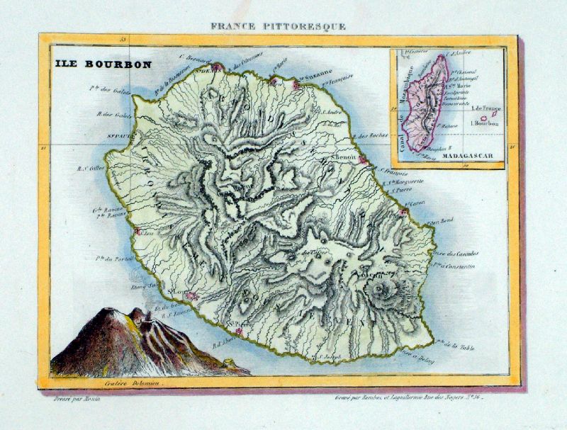 |
Ile Bourbon
Monin for France
Pittoresque 1833
(Inset of Madagascar) size 200 x 150 mm Ref LLM042 £28.00 (+P&P) click image for enlargement |
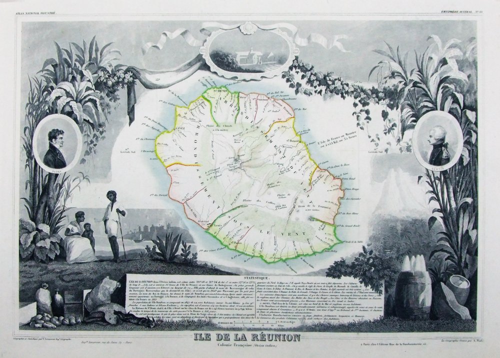 |
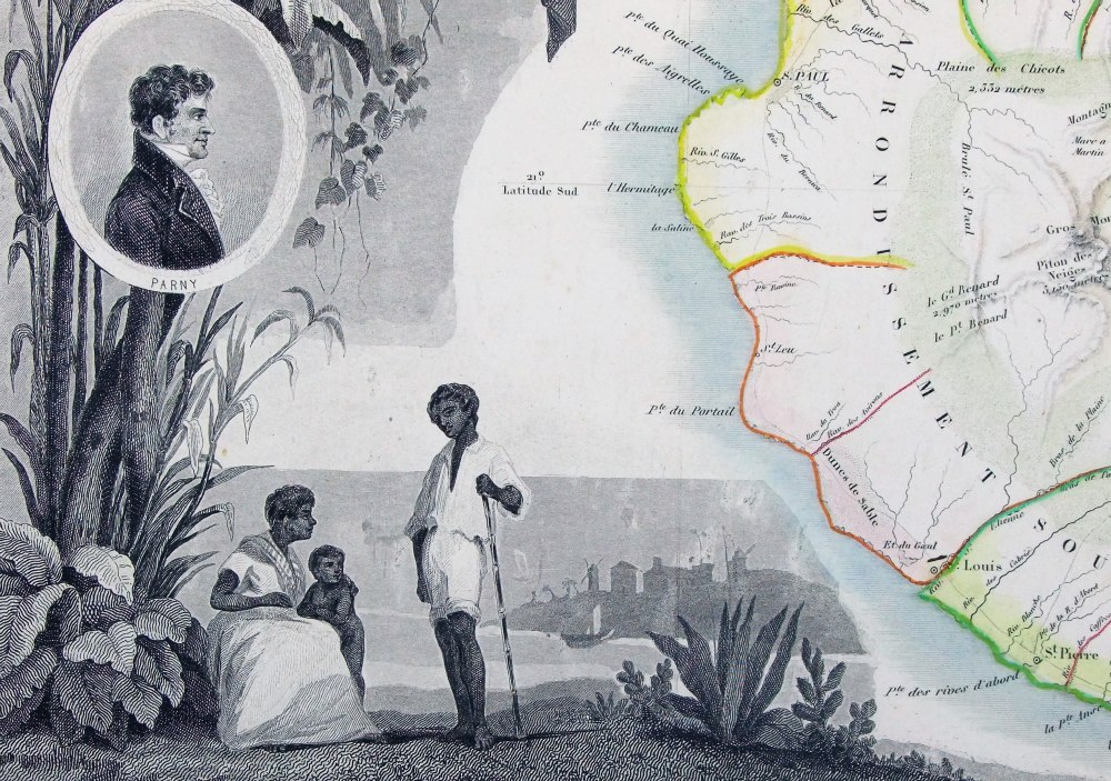
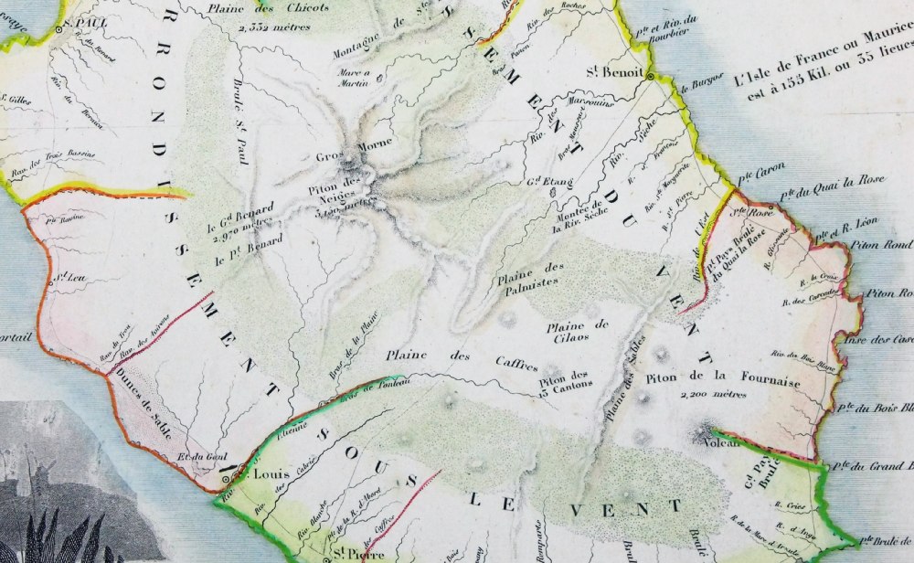
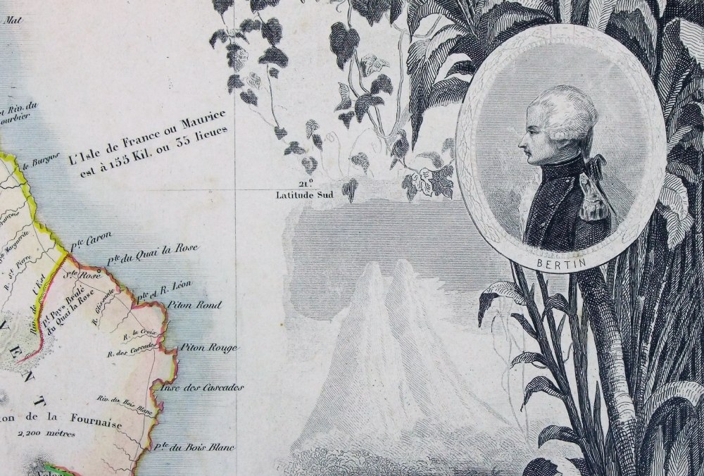
Isle de la Reunion Victor Levasseur 1856 Detail 1 Detail 2 Detail 3 Detail 4 Steel engraving size 460 x 320 mm Ref PEM001 £40.00 (+P&P) click image for enlargement |
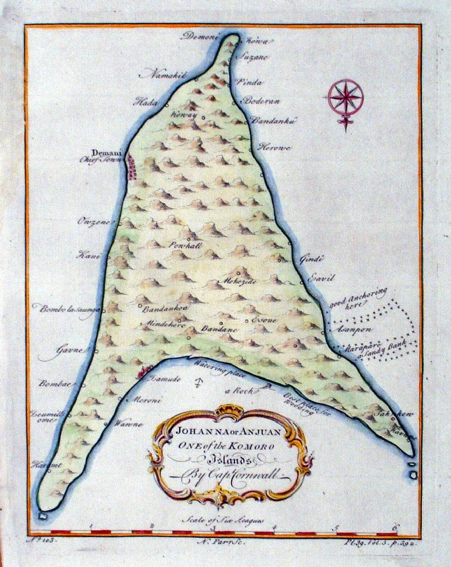 |
Johanna or Anjuan, one of the Komoro Islands Parr 1745 Copper engraving size: 180 x 230 mm Ref IKM019 £38.00 (+P&P) click image for enlargement |
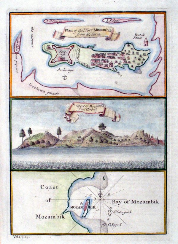 |
Plan of the Fort of Mozambik from de Faria
Green 1745 Copper engraving size: 170 x 230 mm Ref IKM016 £42.00 (+P&P) click image for enlargement |
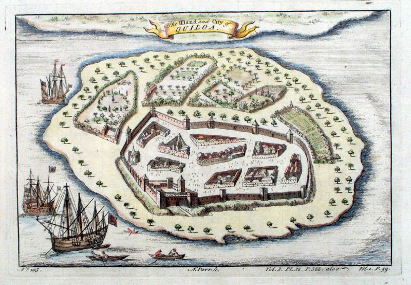 |
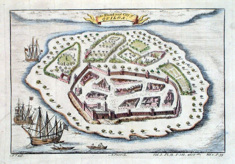
The Island and City of Quiloa ( Kilwa Kisiwani or Kilwa - Tanzania Coast ) Parr 1745 size: 230 x 170 mm Ref IKM022 [ JGM004] £40.00 (+P&P) click image for enlargement |
Central & Western Africa
See Prints - Africa section
for similar Slave Trade related items. |
|
 |
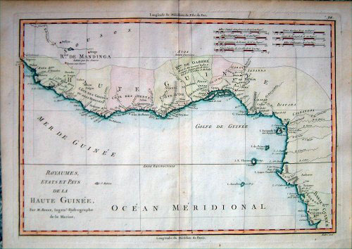
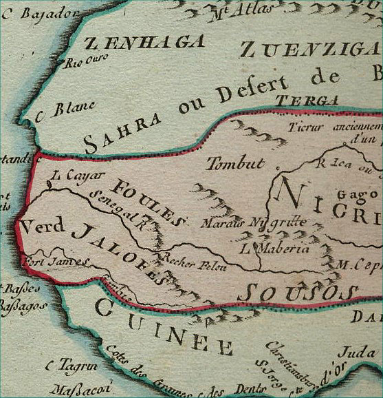
Guinea Sanson,
c1683 size: 300 x 215 mm Tight right & left margins Ref CBM016 £95.00 (+P&P) click image for enlargement |
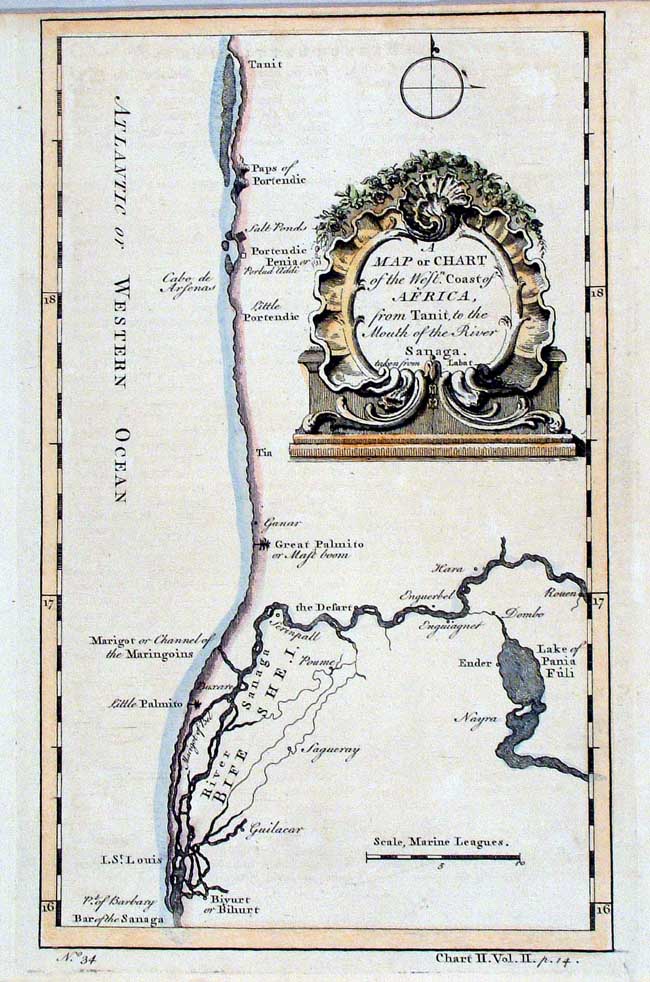 |
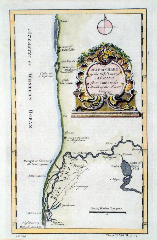
A Map or Chart of the West Coast of Africa from
Tanit to the Mouth of the Sanaga Child c1752 size: 170 x 250 mm Ref HCS015 £28.00 (+P&P) Ref JKM052 £28.00 (+P&P) click image for enlargement |
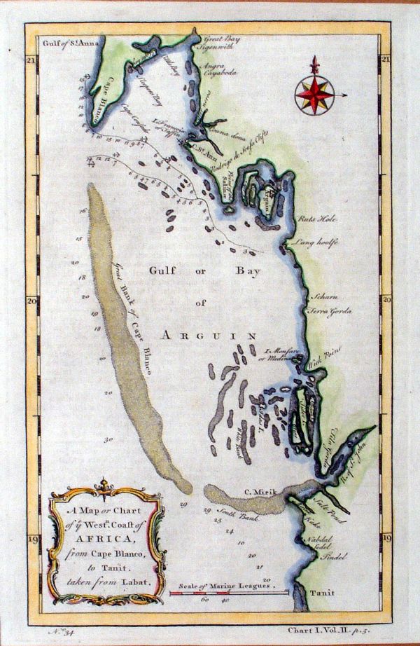 |
A Map or Chart of Ye West Coast of Africa,
from Cape Blanco to Tanit Green c1745 Orientation: North to the right. Copper engraving size: 170 x 250 mm Ref IKM020 £38.00 (+P&P) click image for enlargement |
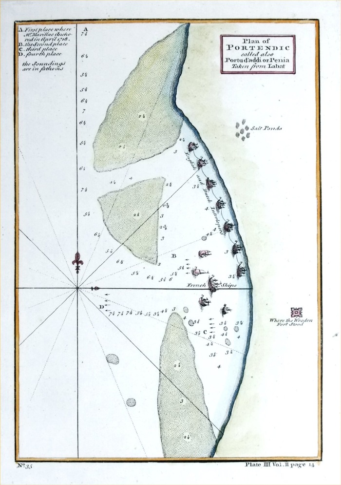 |
Plan of Portendic
called also Portu d'addi or Penia (Senegal) Taken from Labat anon 1745 Copper engraving size: 160 x 230 mm Ref PGM031 £35.00 (+P&P) click image for enlargement |
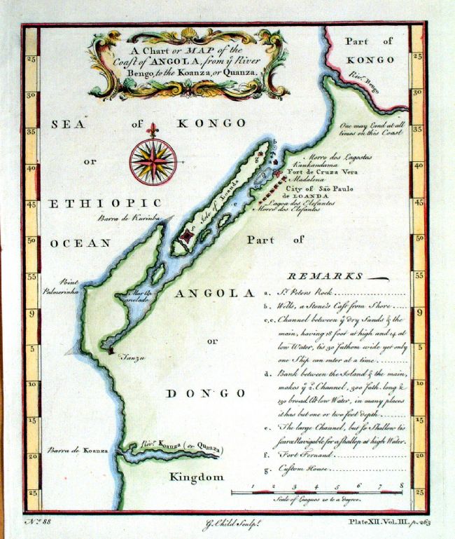 |
A Chart or Map of the Coast of Angola from ye River
Bengo to the Koanza, or Quanza Child c1745 size: 190 x 230 mm Ref JEM008 £35.00 (+P&P) click image for enlargement |
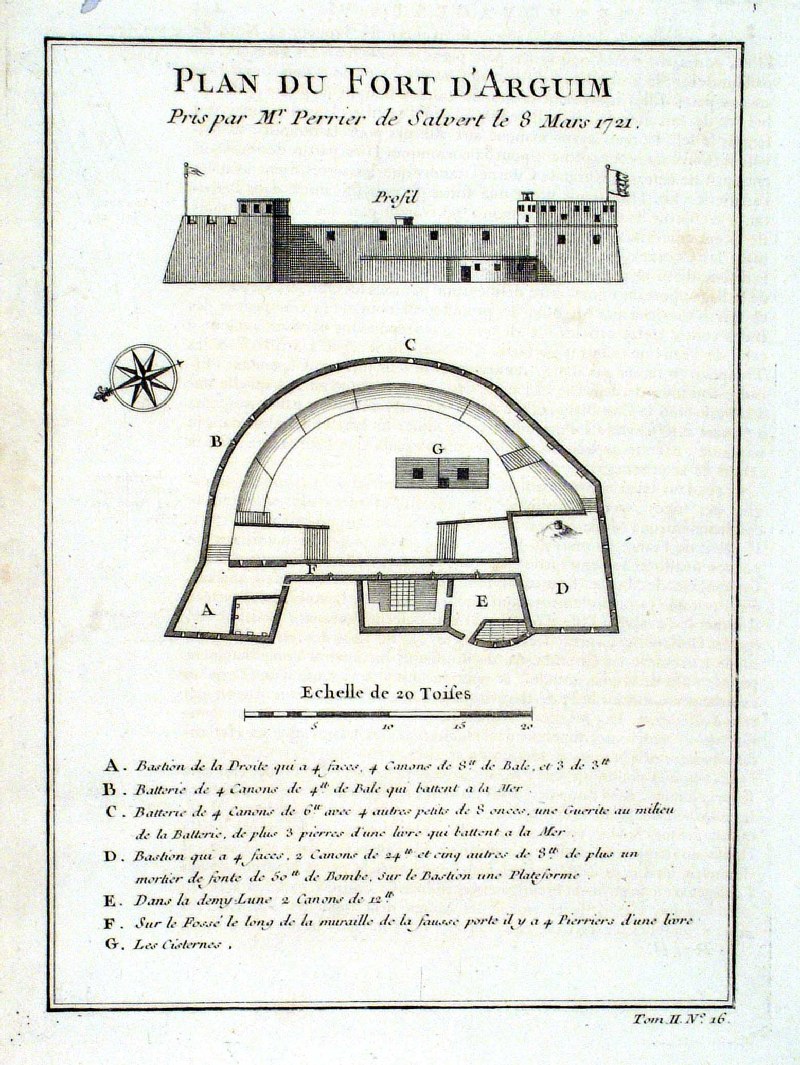 |
Plan du Fort D' Arguim
Prevost 1746 Arguin - West African Coast - Mauritania size: 170 x 220 mm Ref HPS004 £26.00 (+P&P) click image for enlargement |
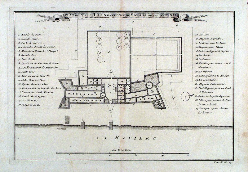 |
Fort St Louis Sanaga River ,
Senegal
Prevost
1746 Used extensively by the slave trade travelling the Senaga River. size: 330 x 230 mm centre fold Ref HPS002 £35.00 (+P&P) click image for enlargement |
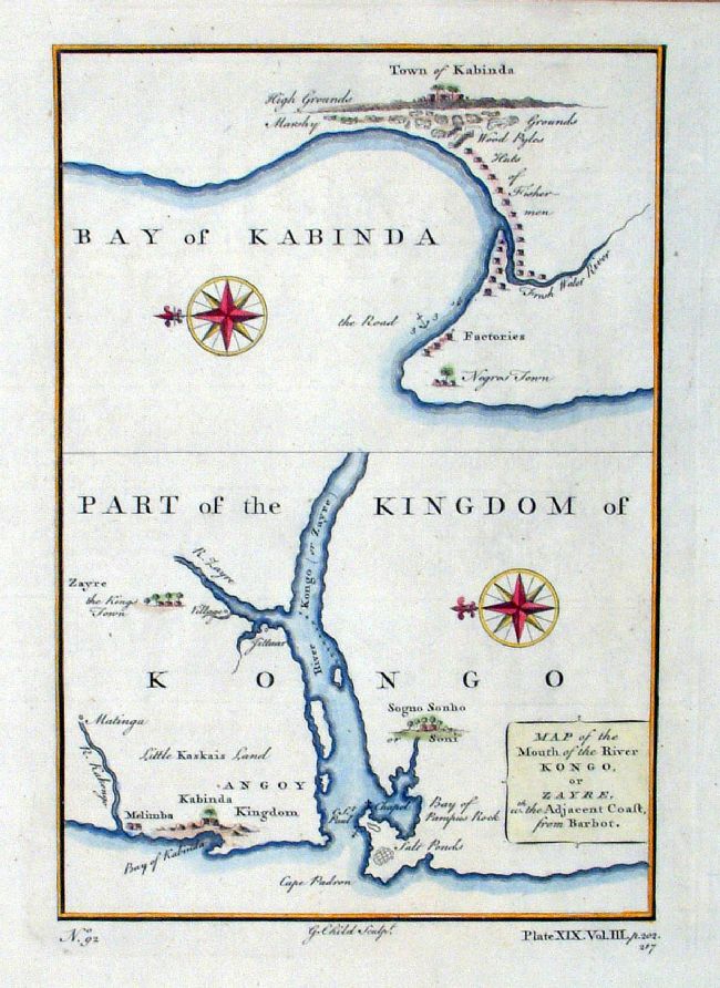 |
Kongo (Congo) Child c1750 Map of the Mouth of the River Kongo or Zayre with the adjacent coast, from Barbot size: 160x 230 mm Ref JBM024 £30.00 (+P&P) click image for enlargement |
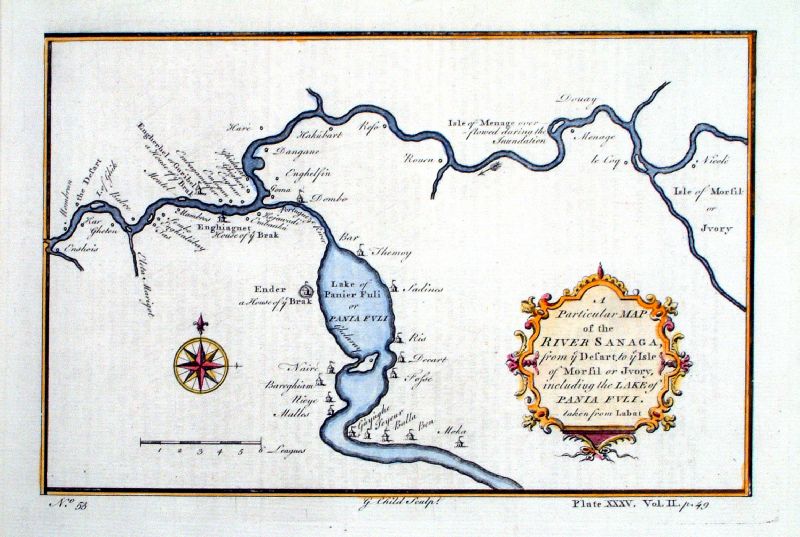 |
A Particular Map of the River Sanaga from ye
Desart to ye Isle of Morsil or Ivory ... Taken from
Labat Child c1745 size: 240 x 160 mm Ref JEM009 £ 38.00 (+P&P) click image for enlargement |
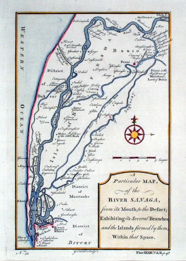 |
A Particular Map of the River Sanaga from its
mouth, to the desart: Exhibiting its several branches
and the islands formed by them ... Child c1745 Copper engraving size: 160 x 240 mm Ref JEM011 £32.00 (+P&P) click image for enlargement |
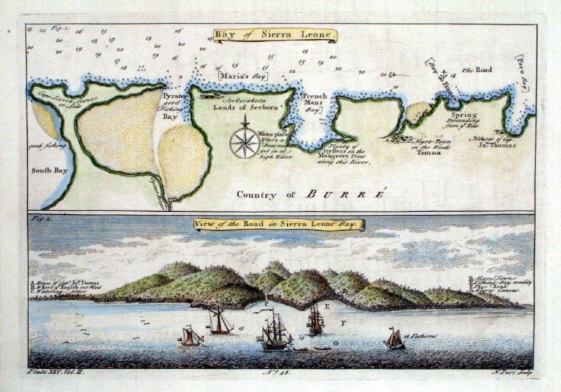 |
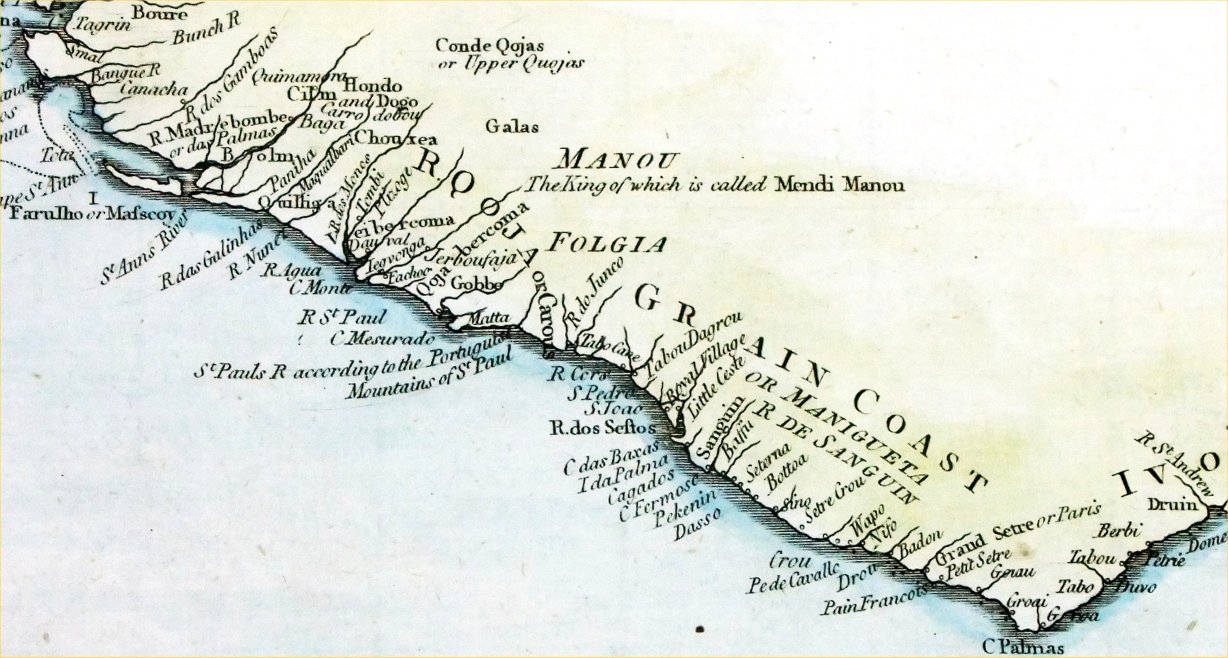
Bay of Sierra Leone / View of the
Road in Sierra Leone Bay Parr c1745 size: 240 x 170 mm Ref JEM010 £ 40.00 (+P&P) click image for enlargement |
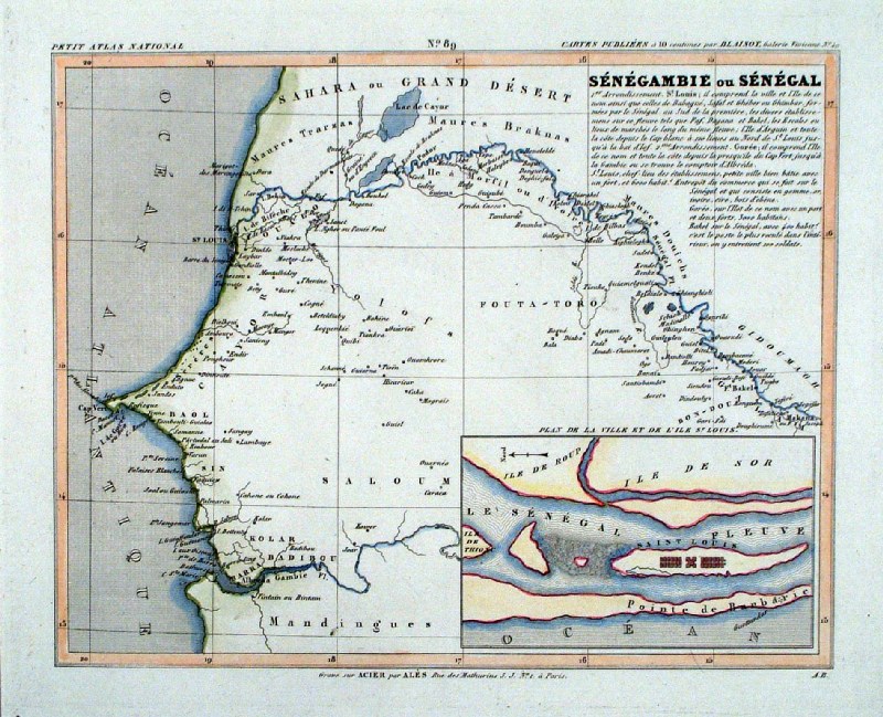 |
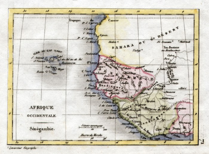
Senegamie ou Senegal
Monin 1833
size 250 x 210 mm Inset plan of St Louis on the Senegal River - a major exporter of slaves to America. Ref IAM092 £22.00 (+P&P) click image for enlargement |
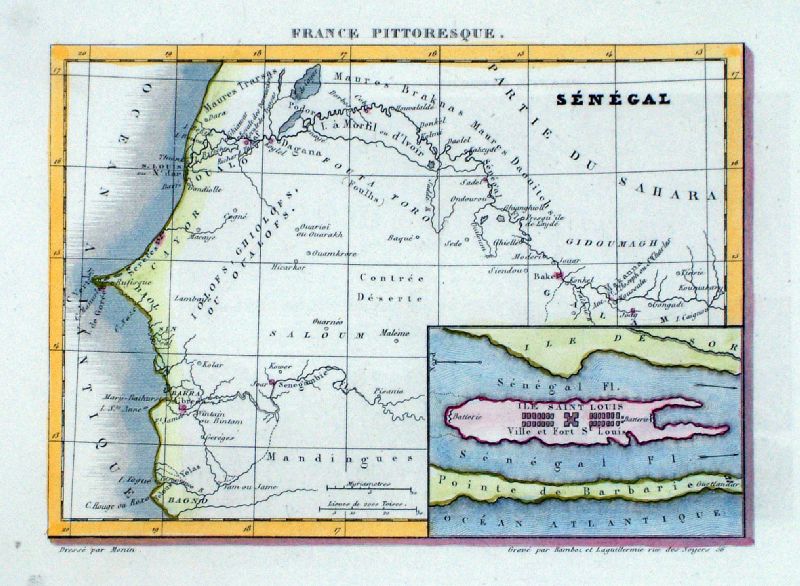 |
Senegal
Monin for France
Pittoresque 1835
size 190 x 150 mm Inset plan of St Louis on the Senegal River - a major exporter of slaves to America. Ref LLM041 £22.00 (+P&P) click image for enlargement |
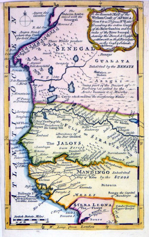 |
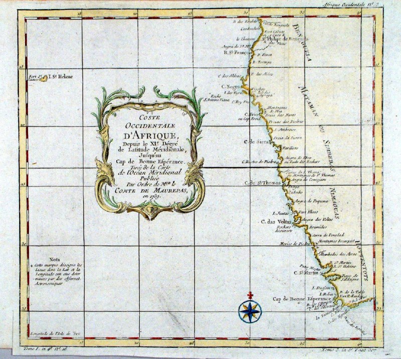
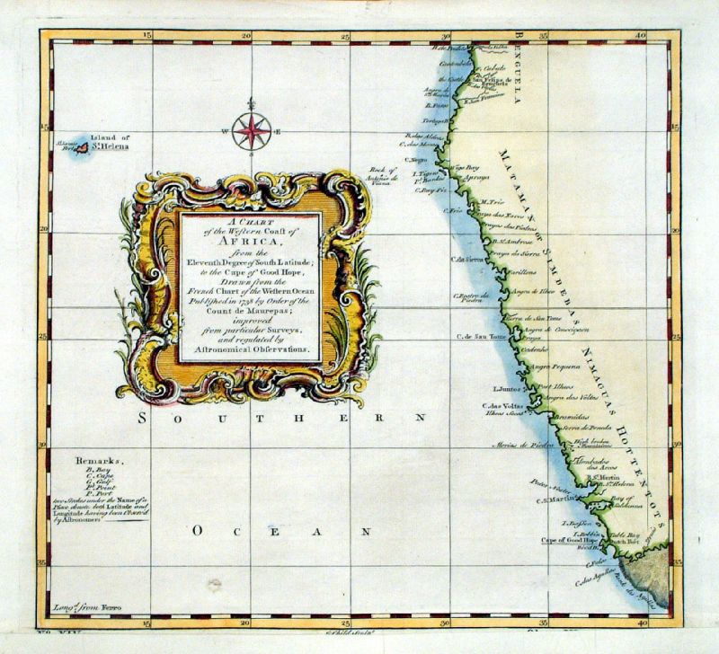
An Accurate Map of
the West Coast of Africa from 8 to 25 degrees Nth
Latitude Describing the intire course of the River
Gambia and 600 miles of the River Senagal..... Emanuel Bowen 1758 Copper engraving size: 190 x 125mm, tight top margin Ref MKM026 £35.00 (+P&P) click image for enlargement |
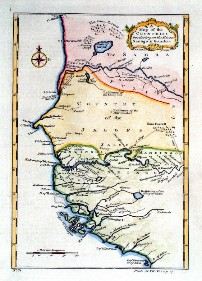 |
A Map of the Countries bordering on the Rivers
Sanaga and Gambra Thomas Kitchin c1745 Copper engraving size: 170 x 240mm Sensitively named 'Arse Hill' on the Gambra River. Ref JEM012 £40.00 (+P&P) click image for enlargement |
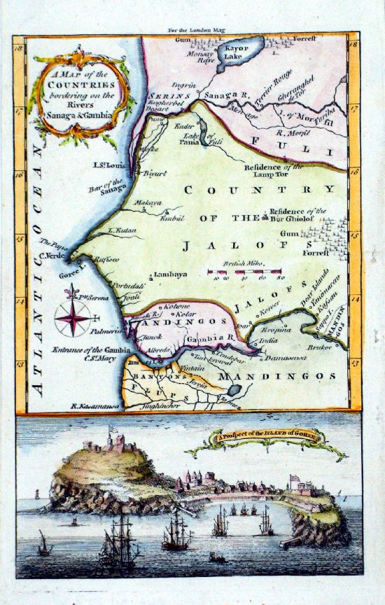 |
A Map of the
Countries bordering on the Rivers Sanaga & Gambia View entitled - A Prospect of the Island of Goree Thomas Kitchin / London Magazine 1759 Copper engraving. size: 125 x 195 mm Goree Island with its notorious 'House of Slaves' was used as a bus-stop pickup of additional slave cargo heading for America. After the slave trade the port was used for exporting peanuts, gum arabic and ivory. Ref LLM035 £48.00 (+P&P) click image for enlargement |
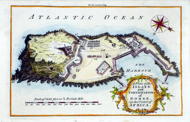 |
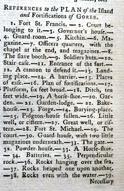
A Plan of the Island
and Fortifications of Goree on the Coast of Africa Situated near Cape Verde - Senegal Thomas Kitchin / London Magazine 1759 Copper engraving. size: 195 x 125 mm Text of Key Locations on Map Continuation Goree Island with its notorious 'House of Slaves' was used as a bus-stop pickup of additional slave cargo heading for America. After the slave trade the port was used for exporting peanuts, gum arabic and ivory. Ref LLM036 £40.00 (+P&P) click image for enlargement |
 |
Course of the Sanaga River Embouchure du Senegal / Cours de la Riviere de Senegal Vaugondy 1749 copper engraving size 290 x 170 mm Ref JKM033 £40.00 (+P&P) click image for enlargement |
 |
An Accurate copy of
D'Anville's map of the Coast of Guinea between Sierra
Leona and the crossing of the Line. Thomas Bowen / J. Harrison 1788 copper engraving. size 490 x 250 mm, 1 fold Very detailed information on ports, towns and trade centres. Detail 1 Detail 2 Detail 3 Ref PGM022 £75.00 (+P&P) click image for enlargement |
 |
Africa Interior WH Toms Raw/Rivington 1796 Copper engraving size: 330 x 220 mm, centre fold Ref JKM106 £30.00 (+P&P) click image for enlargement |
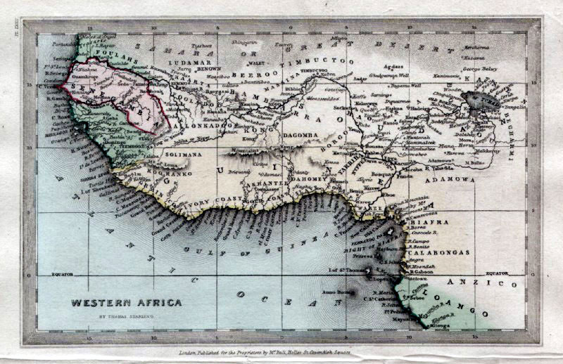 |
Western Africa
Thomas Starling
1834
size: 150 x 95 mm Ref GBM318 £ 20.00 (+P&P) click image for enlargement |
 |
West Africa V.
Levasseur
c1835 size: 130 x 100 mm Ref HAM103 £22.00 (+P&P) click image for enlargement |
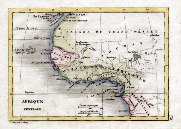 |
Central Africa
V. Levasseur
c1835 size: 130 x 100 mm Ref HAM104 £22.00 (+P&P) click image for enlargement |
 |
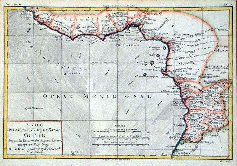
Guinea Coast - East Africa
Bonne c1775 size: 260 x 380 mm, centre fold Ref CBM013 £55.00 (+P&P) click image for enlargement |
 |
Guinea Coast - showing trade winds and
currents East Africa Bonne c1783 size: 230 x 330 mm, centre fold Ref JKM011 £65.00 (+P&P) click image for enlargement |
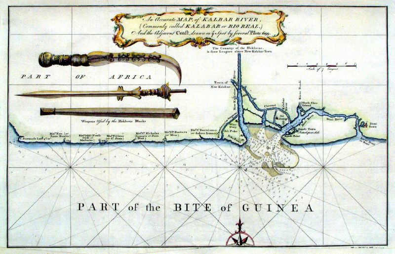 |
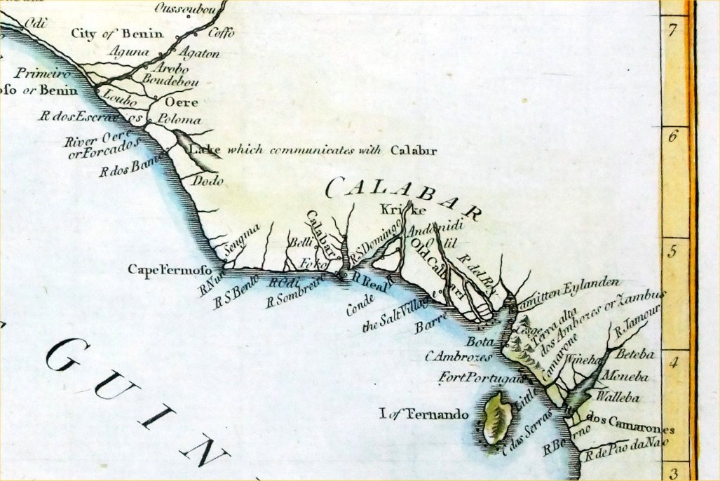
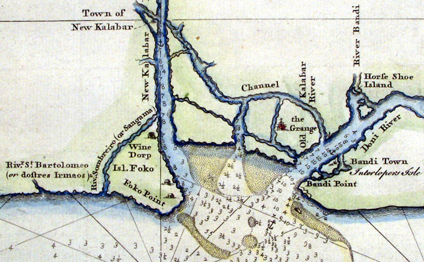
An Accutare Map of Kalbar River, commonly called
Kalabar or Rio Real ... ... Drawn ye spot by several Pilots1699. Guinea Coast, rivers and ports used by slave trading ships. Child c1745 Shows weapons used locally size: 380 x 250 mm, 2 folds, strengthened lower margin Ref JBM015 £55.00 (+P&P) Detail click image for enlargement |
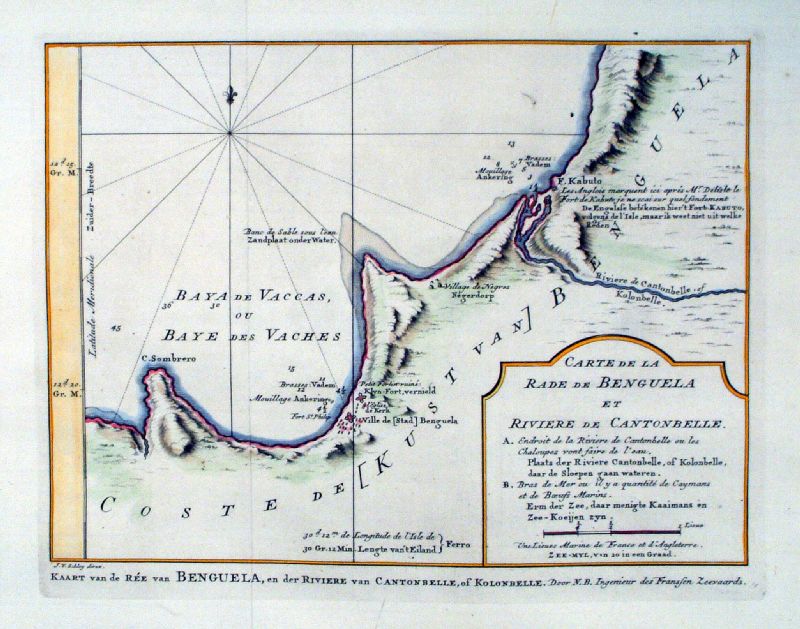 |
Angola Coast Carte de la Rade de Benguela et Riviere de Cantonbelle Schley 1755 copper engraving size: 380 x 250 mm, 2 folds Ref JKM032 £45.00 (+P&P) click image for enlargement |
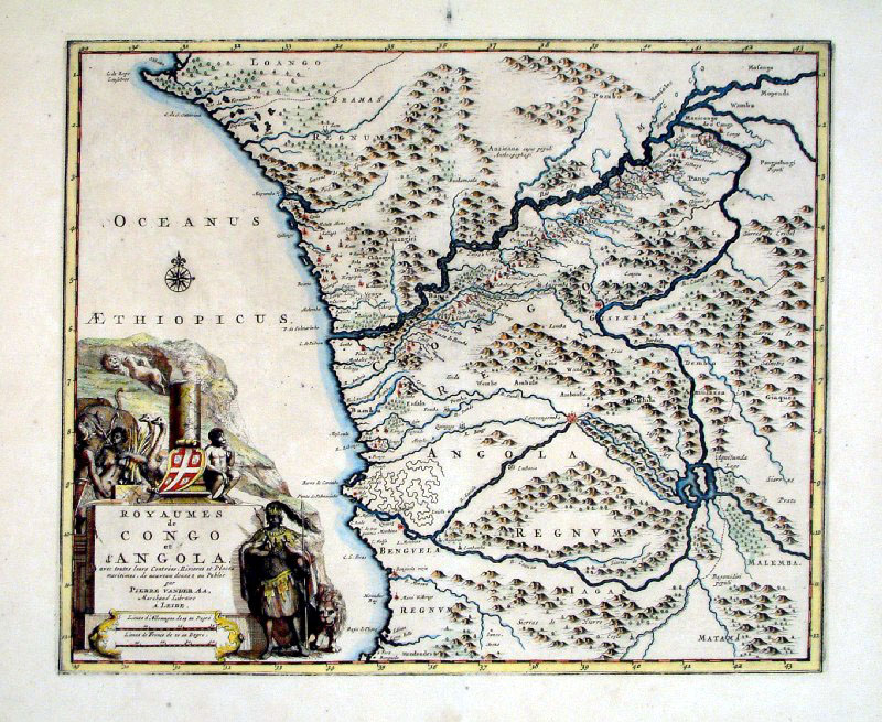 |
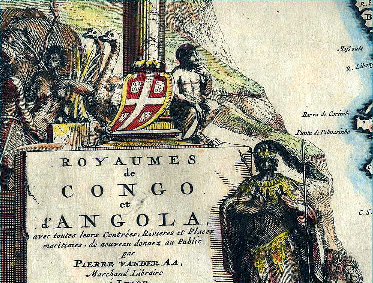
Congo & Angola - Western Africa
Van der AA c1707 size:
360 x 300 mm Ref CBM021 160.00 (+P&P) Detail click image for enlargement |
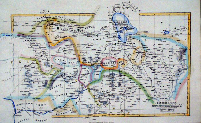 |
Central Africa Swanston /
Fullarton c1861
size 260 x
160 mm Ref GBM249 £16.00 (+P&P) click image for enlargement |
Eastern Africa
|
|
 |
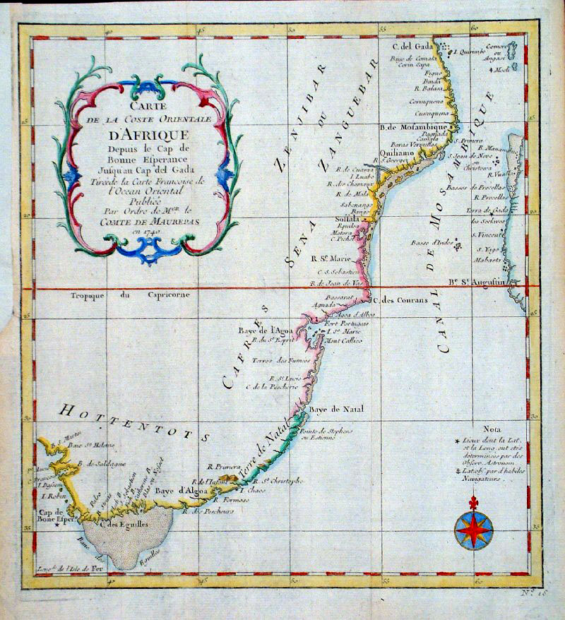
Eastern
Africa
Bellin
1780 size: 210 x 270 mm several folds, repair at bottom margin Ref HBS079 £36.00 (+P&P) click image for enlargement |
 |
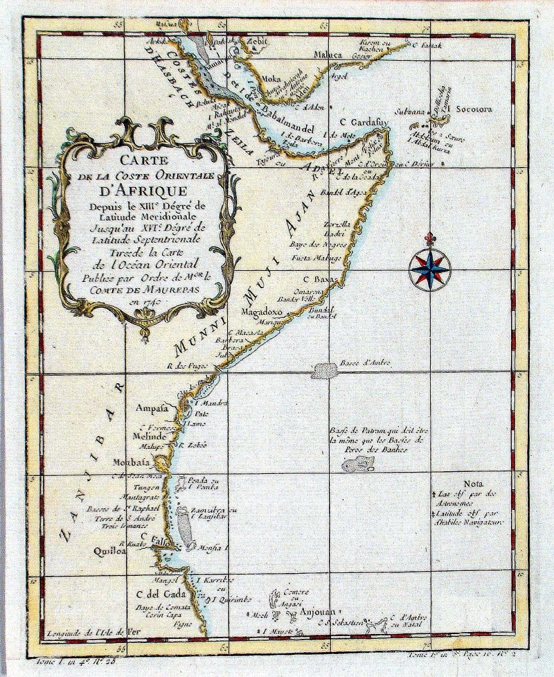
East Africa Coast
Bellin 1764 size:
240 x 260 mm Several folds, strengthened upper-left margin. Ref GDM328 £50.00 (+P&P) click image for enlargement |
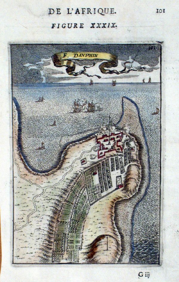 |
Fort Dauphin (Madagascar)
Mallet
c1683
Copper engraving size 120 x 170 mm Ref JKM028 £40.00 (+P&P) click image for enlargement |
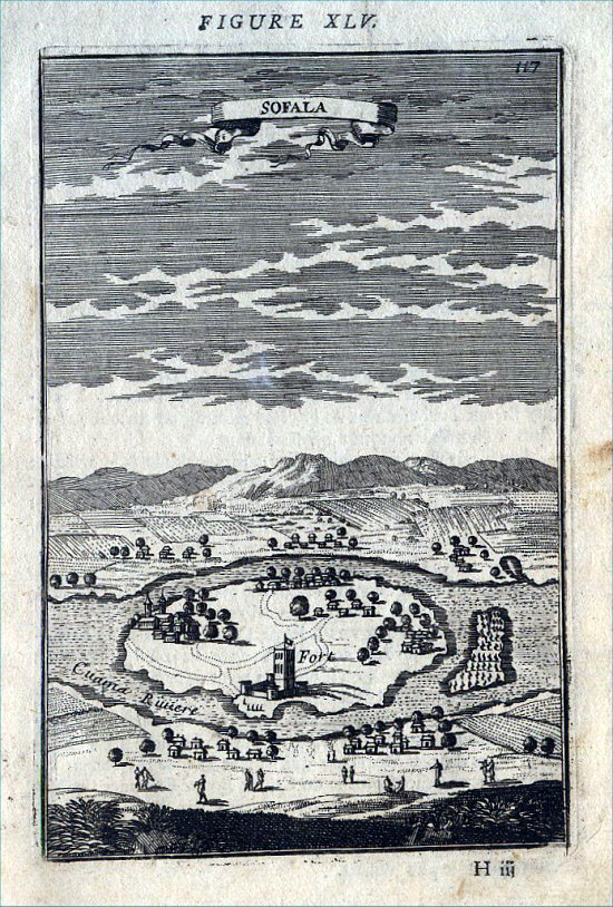 |
Sofala (Mozambique)
Mallet
c1683
size 120 x 170 mm Ref SWP010 £32.00 (+P&P) click image for enlargement |
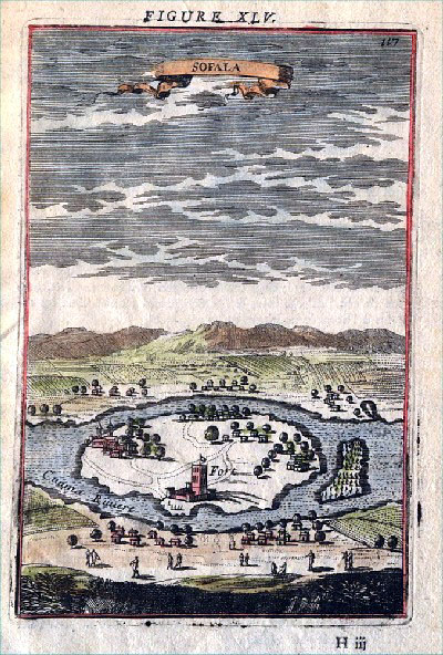 |
Sofala (Mozambique)
Mallet
c1683
size 120 x 170 mm Ref AEM006 £35.00 (+P&P) click image for enlargement |
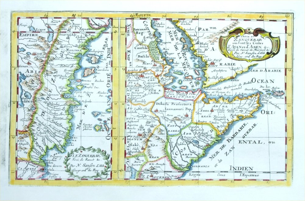 |
(left)
Le Zanguebar Tiree de Sanut (right) Partie du Zanguebar ou Sont les Costes Zanzibar Sanson & Sauzet 1734 Copper engraving size: 310 x 200 mm Ref QDM001 £60.00 (+P&P) click image for enlargement |
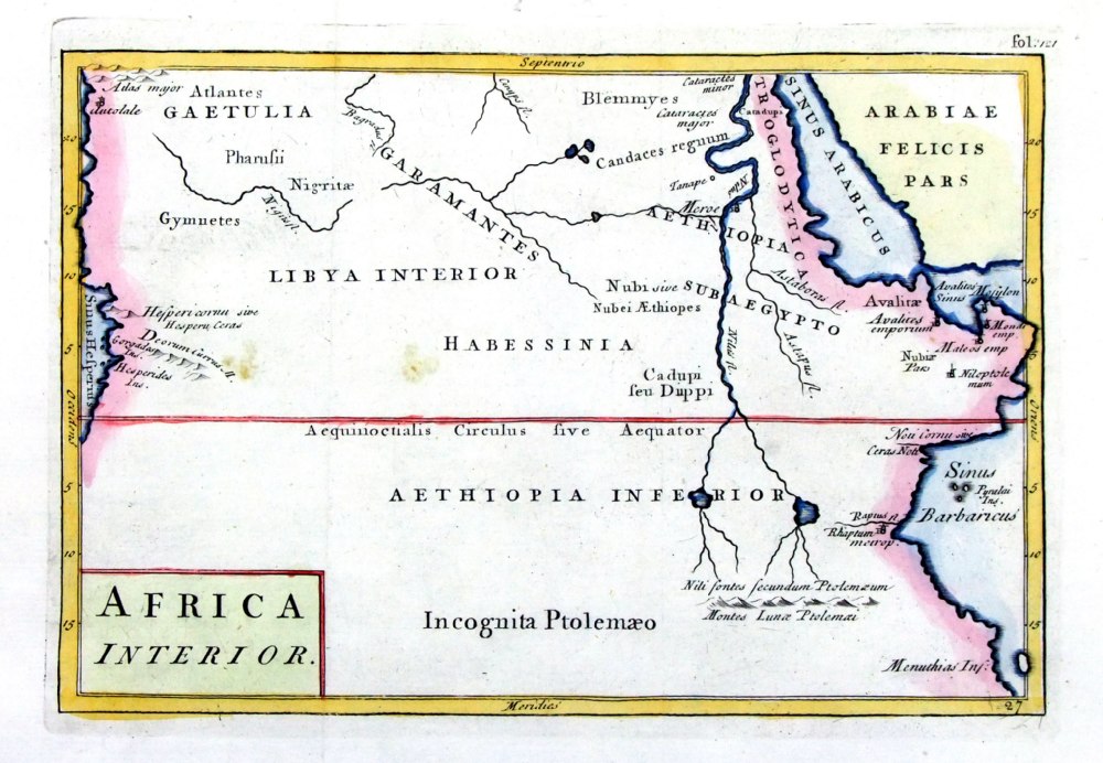 |
Africa Interior
Geograhia Antiqa Christophi Cellarii Christoph Cellarius 1745 Copper engraving size: 220 x 150 mm, 2 folds. Ref OKM025 £30.00 (+P&P) click image for enlargement |
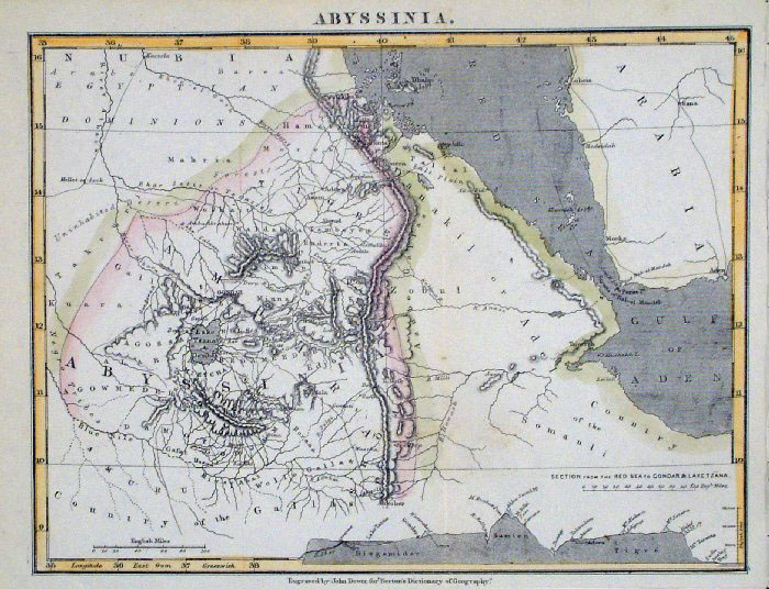 |
Abyssinia (Eritrea / Ethiopia)
John Dower / Beeton c 1868
size: 240x 190 mm several folds Interesting section of land elevations. Ref GAM047 £15.00 (+P&P) click image for enlargement |
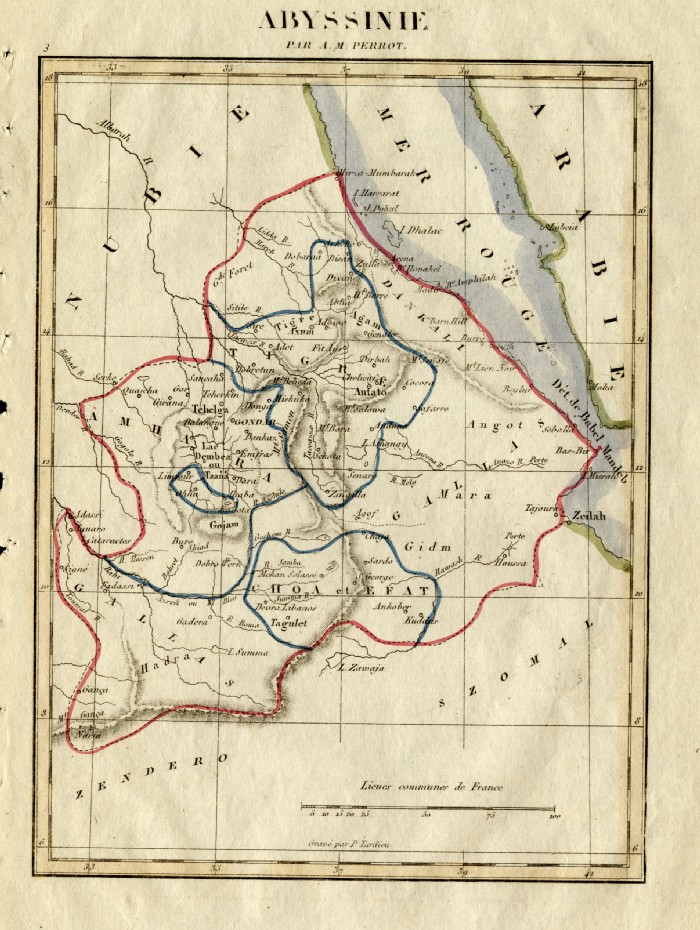 |
Abyssinia (Eritrea / Ethiopia)
Perrot c1830 Engraved by P.
Tardieu size: 160x 200 mm Ref FEM022 £16.00 (+P&P) click image for enlargement |
 |
Horn of Africa - Abyssinia (Eritrea /
Ethiopia) Mallet 1683 size: 110x 160 mm Ref GDM327 £50.00 (+P&P) click image for enlargement |
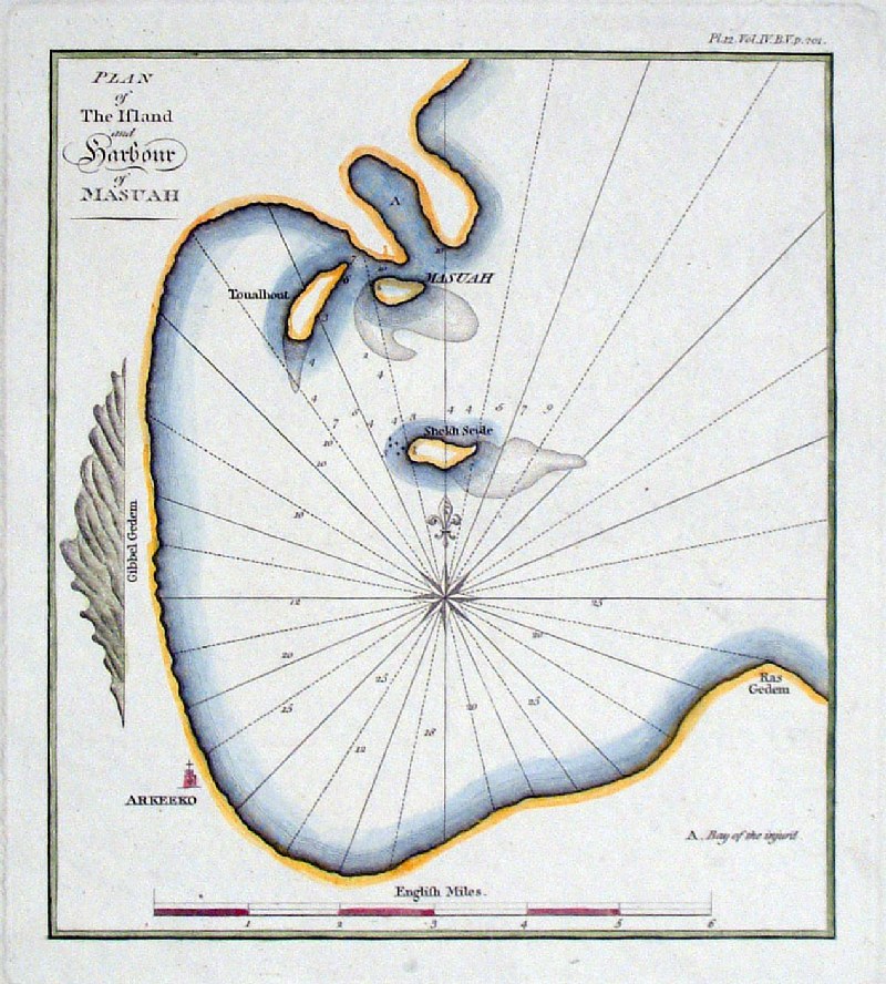 |
Plan of the Island and Harbour of
Masuah (Massowah - Eritrea) Longman 1804 size 190 x 210 mm Ref HAM013 £16.00 (+P&P) click image for enlargement |
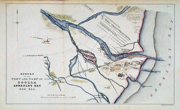 |
Zula, Eritrea Kell 1869
size 390 x 230 mm 2 folds Survey of the Port and Camp of Zoola, Annesley Bay, Red Sea Published by the Royal Engineers Corp. 1869 Lithograph, hand coloured. Ref FLM240 £32.00 (+P&P) Detail click image for enlargement |
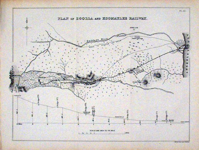 |
Zula, Eritrea Kell 1869
size 300 x 230 mm 2 folds Plan of Zoola and Koomaylee Railway Published by the Royal Engineers Corp. 1869 Lithograph, uncoloured. Ref FLM242 £32.00 (+P&P) click image for enlargement |
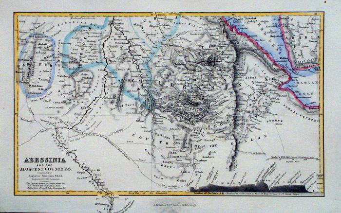 |
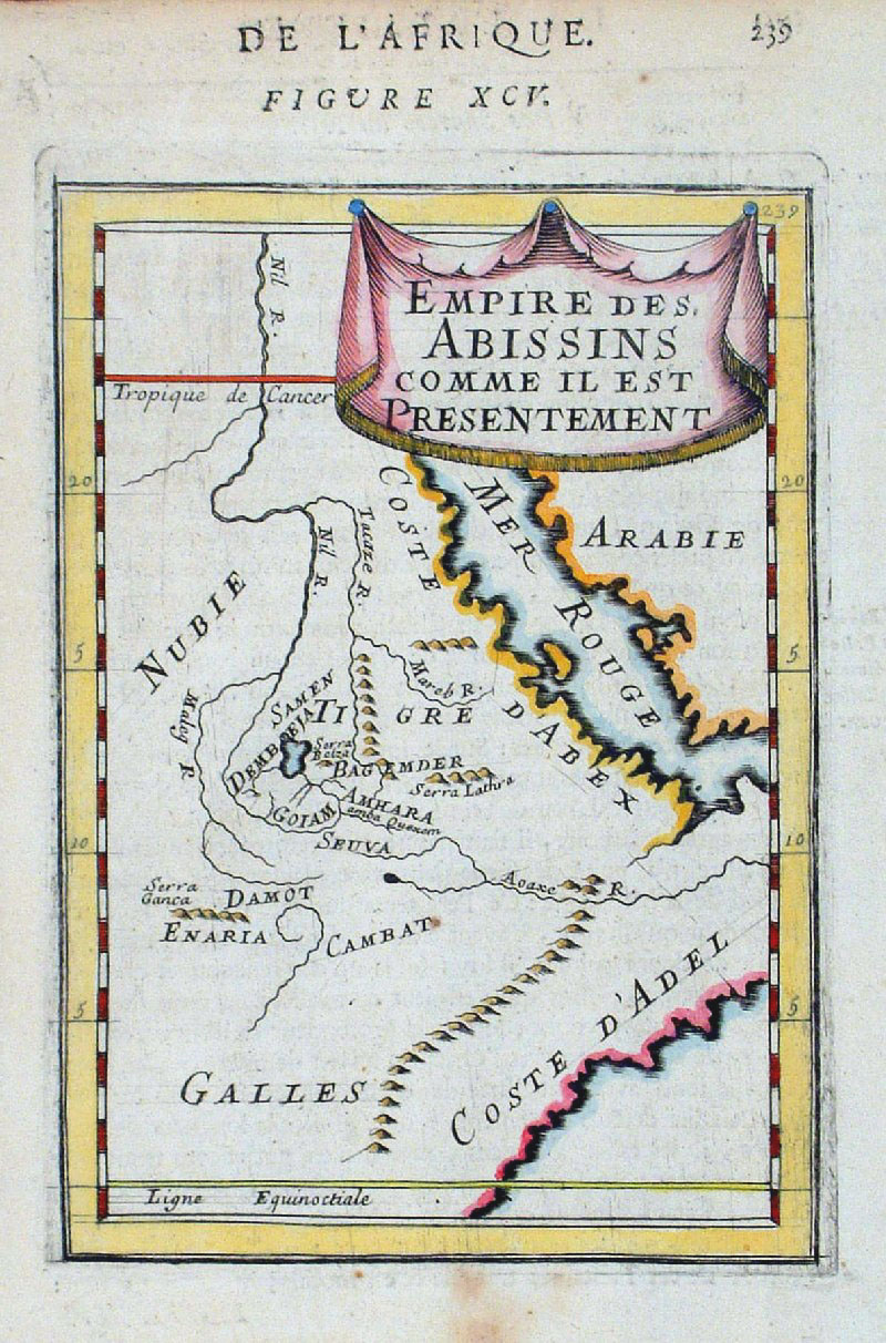
Abessinia Swanston /
Fullarton c1861
size 250 x
150 mm Sectional repesentation of relative land heights at bottom of map. Ref GBM259 £18.00 (+P&P) click image for enlargement |
South Africa |
|
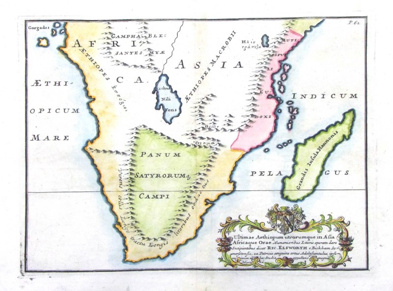 |
Ancient South Africa
Altimae Aethiopum utrorumque in Asia
Africaque Orae... from De Situ Orbis by Pomponius Mela. Published by Philippum Bishop, Exeter, 1711 Copper engraving size 270 x 200 mm, centre fold. Decorative cartouche contains the name of the sponsor/patron of this map. Ref PDM026 £80.00 (+P&P) click image for enlargement |
 |
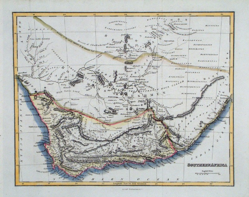
Southern
Africa
Bellin
1780 size: 290 x 260 mm several folds Ref HBS088 £45.00 (+P&P) click image for enlargement |
 |
Southern
Africa A Chart
of the Western Coast of Africa Child c1750 size: 290 x 260 mm 1 fold, strengthened bottom margin Ref KKM002 £45.00 (+P&P) click image for enlargement |
 |
Southern
Africa Thomas
Starling
1834
size: 150 x 95 mm Ref GBM320 £ 28.00 (+P&P) click image for enlargement |
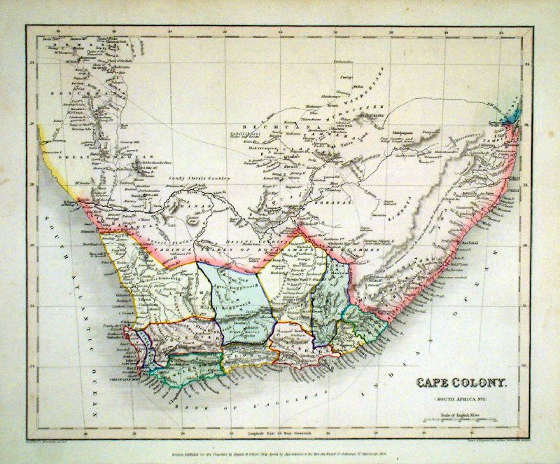 |
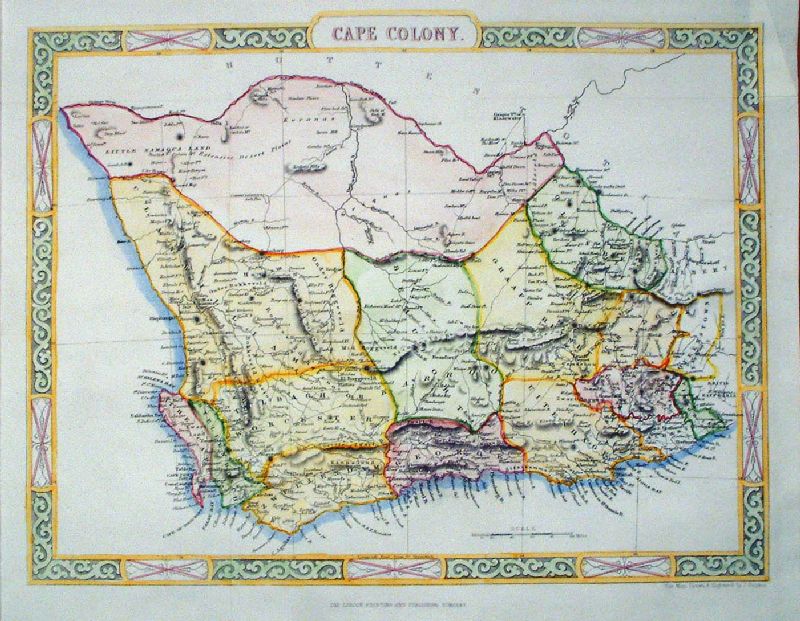
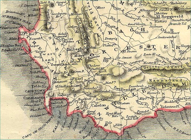
Cape Colony (South Africa)
Grattan & Gilbert / Archer c1840 Steel Engraving size: 320 x 260 mm Ref KAM004 £45.00 (+P&P) click image for enlargement |
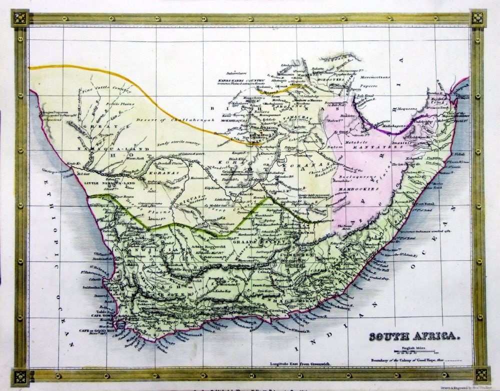 |
South Africa
Thomas Kelly
1841 engraved by Alex Findlay size: 200x 260 mm Ref OHM027 £28.00 (+P&P) click image for enlargement |
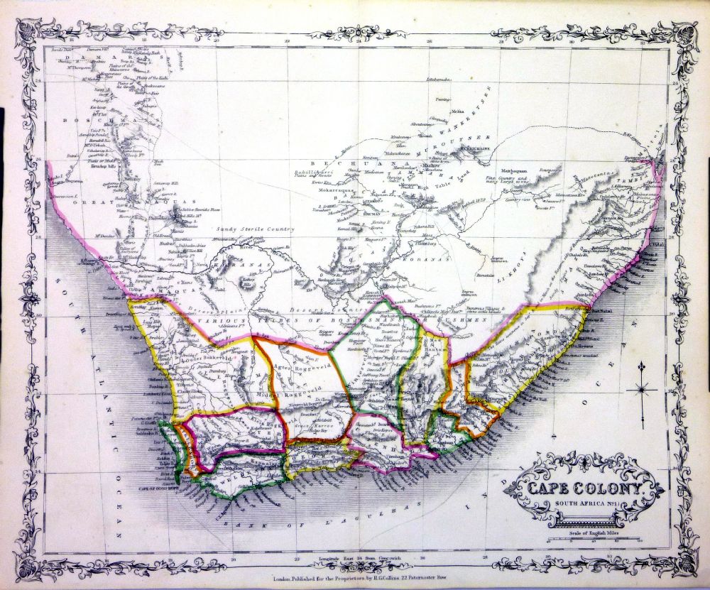 |
Cape
Colony (South Africa) H.G. Collins 1852 Steel Engraving size: 310 x 240 mm Ref NLM008 £45.00 (+P&P) click image for enlargement |
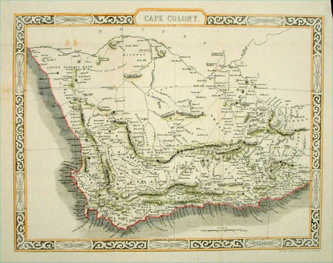 |
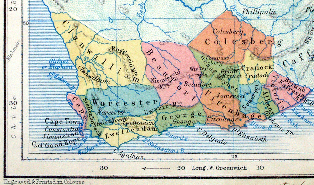
Cape Colony (South Africa) Rapkin c1860 Steel Engraving size: 370 x 280 mm Several folds Ref EFM010 £40.00 (+P&P) Detail click image for enlargement |
 |
Cape Colony (South Africa) Rapkin c1860 Steel Engraving size: 370 x 280 mm Several folds Ref KAM008 £40.00 (+P&P) click image for enlargement |
 |
Southern
Africa Fullarton
c1860
size: 260 x 210 mm Ref GJM038 £ 22.00 (+P&P) click image for enlargement |
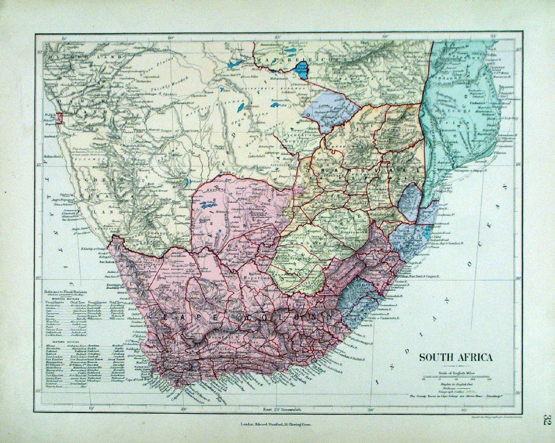 |
South Africa
Stanford c1880 size: 340 x 270 mm Ref HHM054 £ 28.00 (+P&P) click image for enlargement |
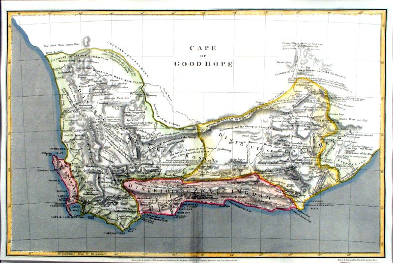 |
Cape of Good Hope Cooke / Arrowsmith 1807 size 410 x 260 mm, centre fold Ref IFM001 £48.00 (+P&P) click image for enlargement |
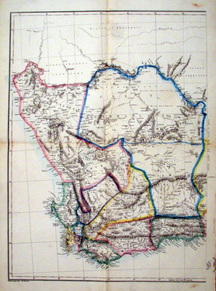 |
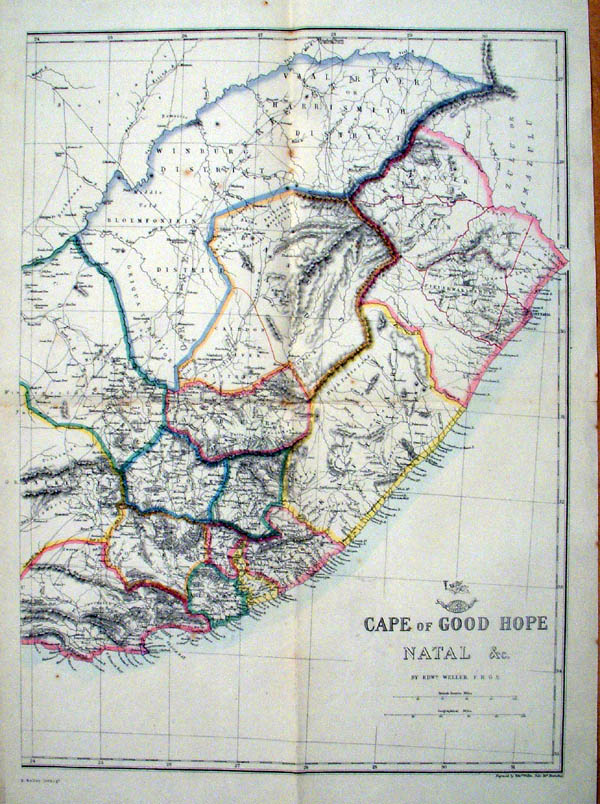
Cape of Good Hope &
Natal ( 2 sheets) Weekly Dispatch / Weller c1860 size: 170 x 220 mm (each page), several folds Page 2 (East) Detail Ref KGM054 (both sheets) £35.00 (+P&P) click image for enlargement |
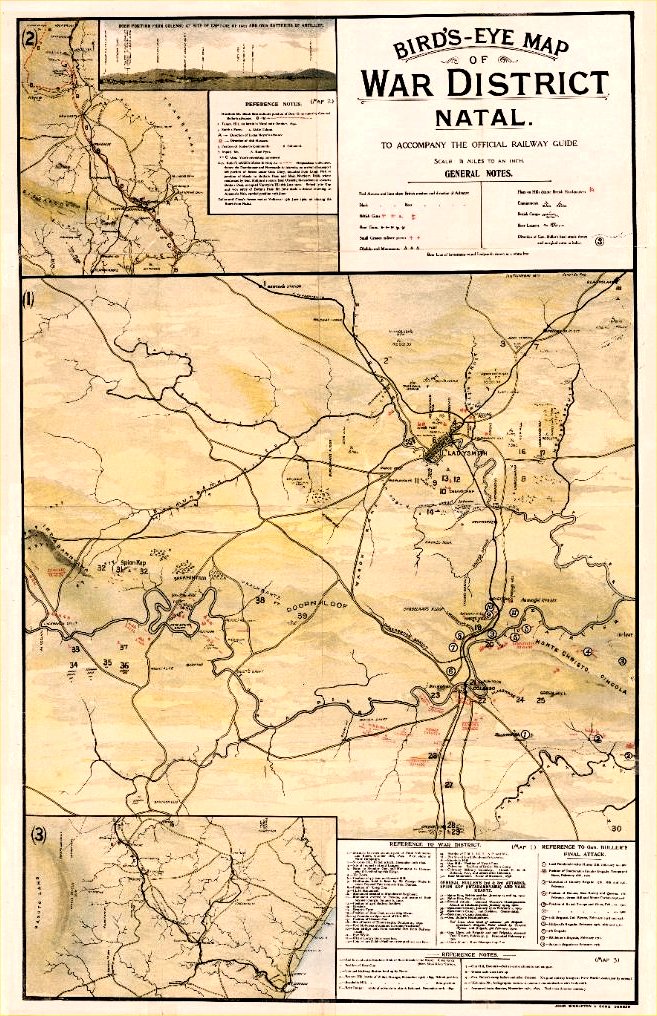 |
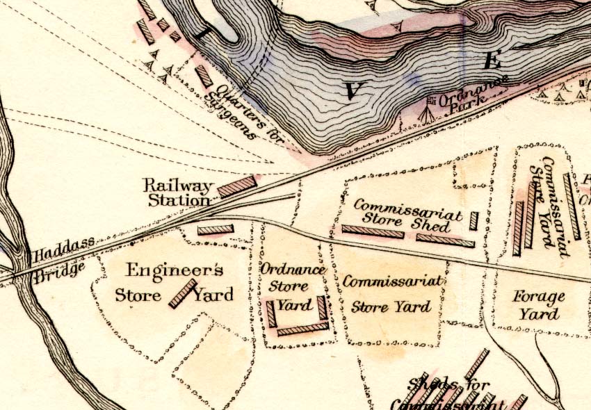
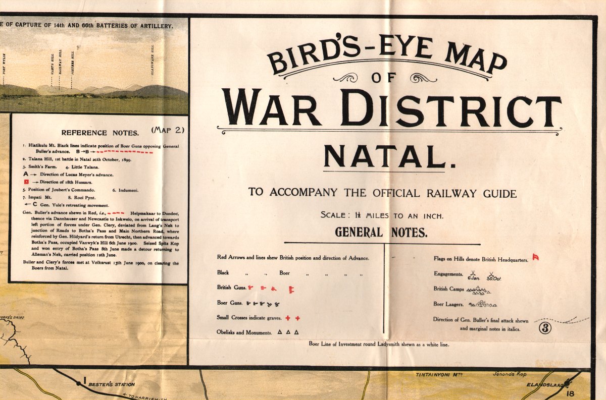
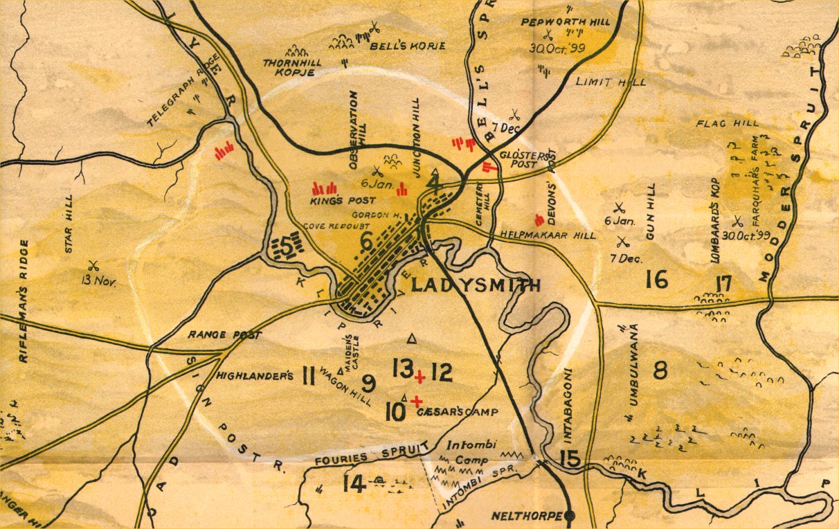
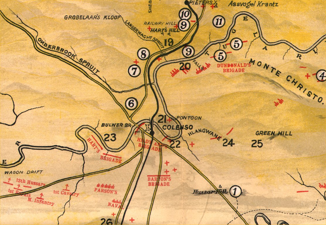
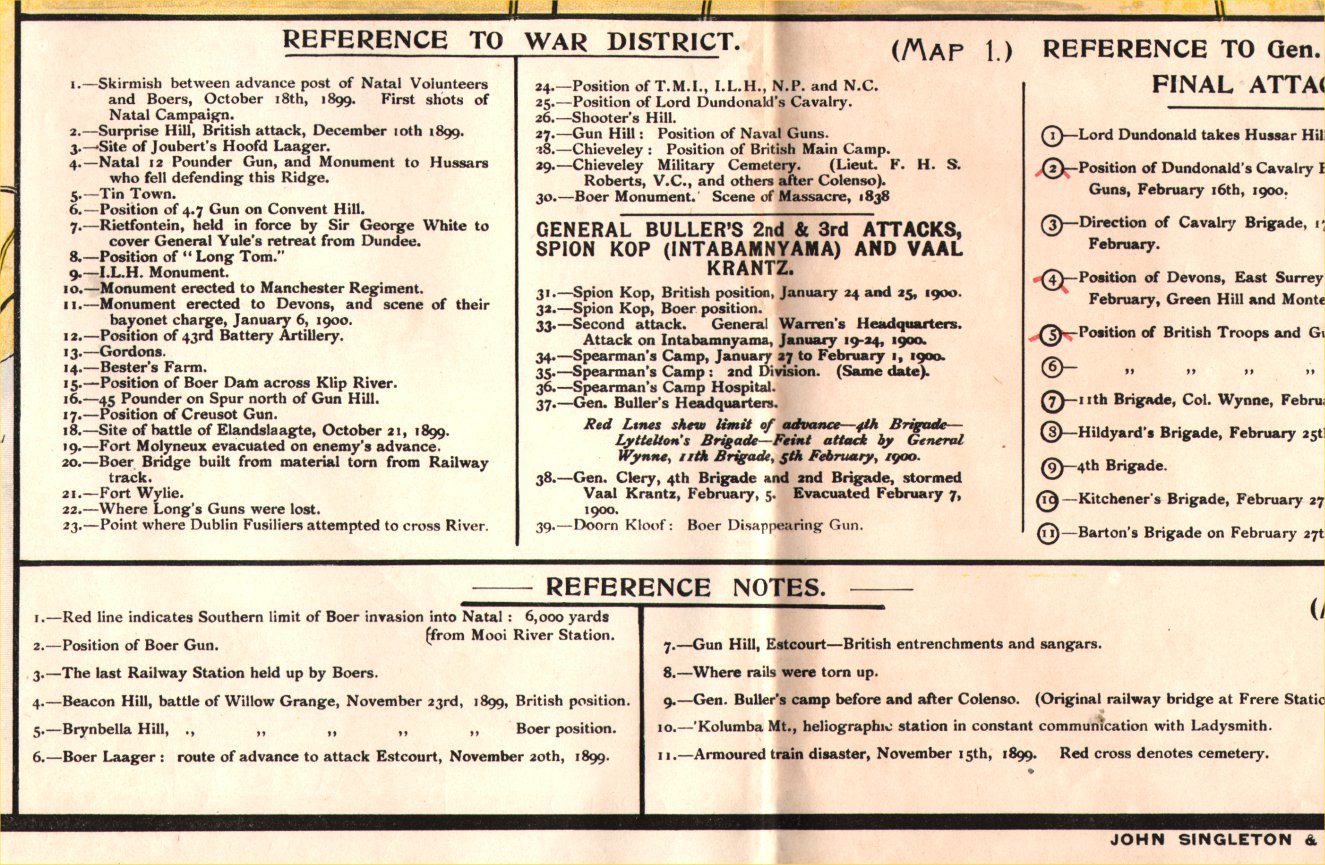
Bird's Eye Map of War
District Natal Details of the Boer War John Singleton & Sons Durban c1900 Colour lithograph size: 560 x 900 mm , several folds Detail 1 Detail 2 Detail 3 Detail 4 Ref PGM034 £100.00 (+P&P) click image for enlargement |
| Link to Prints of Africa | |
| All Genuine Antiquarian Maps - No Reproductions or Modern Copies |
2023
