Past Pages
Antique Maps, Prints and Ephemera
Antique Maps of Australasia & Pacific
Australia & New Zealand
|
|
 |
Australasia Blackie
c1870 size: 380 x 320 mm Insets of Tasmania (Van Dieman's Land) and New South Wales Several folds, slight foxing in places, small repairs to split folds at margins. Ref FLM082 £48.00 (+P&P) click image for enlargement |
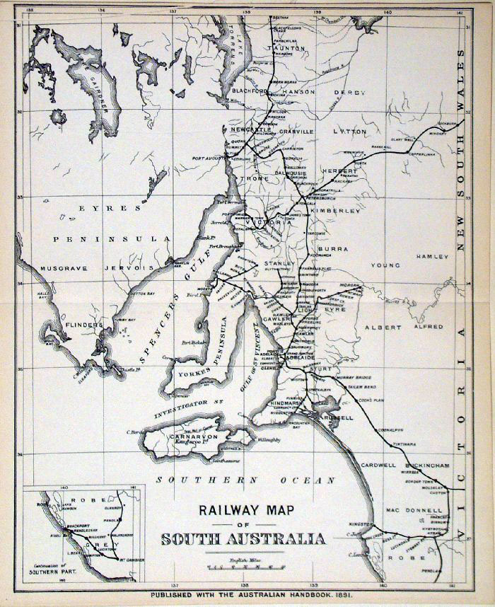 |
Railway Map - South
Australia Australian
Handbook 1891 size: 240x 290 mm Ref FLM016 £28.00 (+P&P) click image for enlargement |
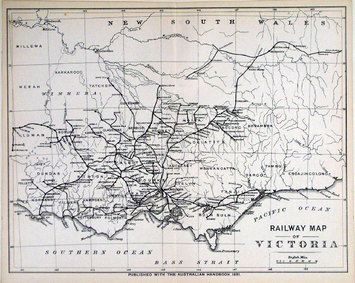 |
Railway Map -
Victoria Australian
Handbook 1891 size: 290x 240 mm Ref FLM017 £28.00 (+P&P) click image for enlargement |
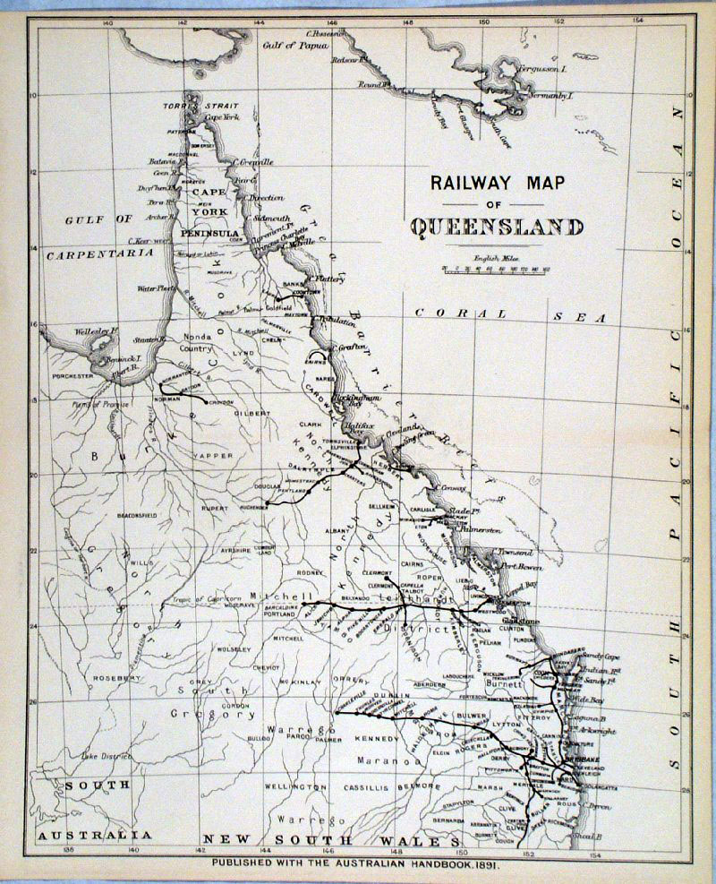 |
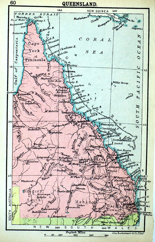
Railway Map - Queensland
Australian Handbook 1891 size: 240x 290 mm Ref GDM153 £28.00 (+P&P) click image for enlargement |
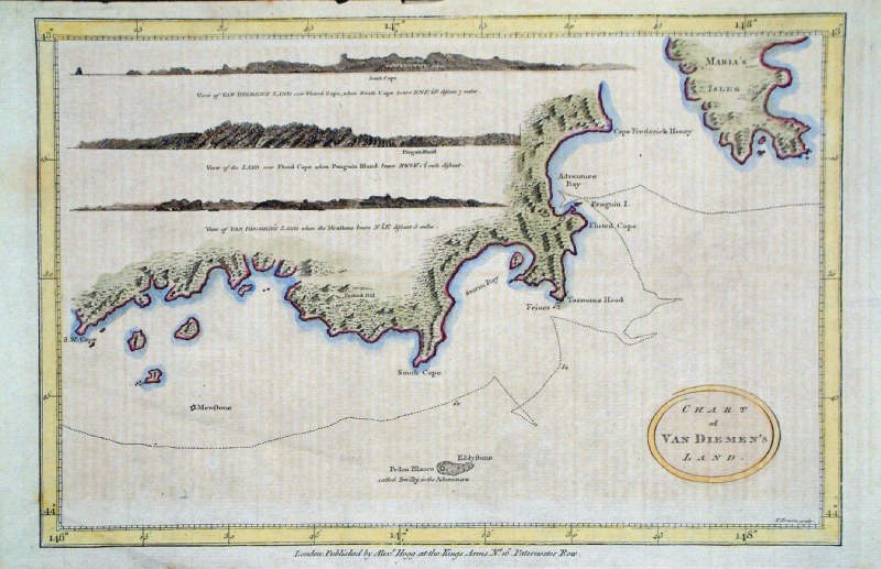 |
South East Tasmania
Thomas Bowen / Hogg c1785 'Chart of Van Diemen's Land' size: 360x 230 mm diagonal crease across bottom left corner Ref GJM002 £40.00(+P&P) click image for enlargement |
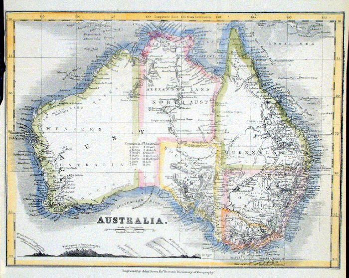 |
Australia John
Dower / Beeton c1868 Ref GAM041 £18.00 (+P&P) size: 240 x 190 mm, several folds, tight top-left margin Interesting cross section of elevations.click image for enlargement |
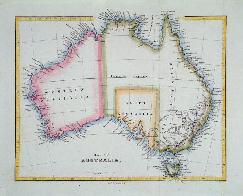 |
Australia Arrowsmith
/ Fullarton c1860 Ref GJM037 £20.00 (+P&P) size: 250 x 210 mm, several folds click image for enlargement |
 |
Australia (Oceanie) Dufour /
Renouard 1843 Ref GBM332 £12.00 (+P&P) size: 260 x 210 mm, several folds, tight side margins, cropped top-left corner, small repairs. click image for enlargement |
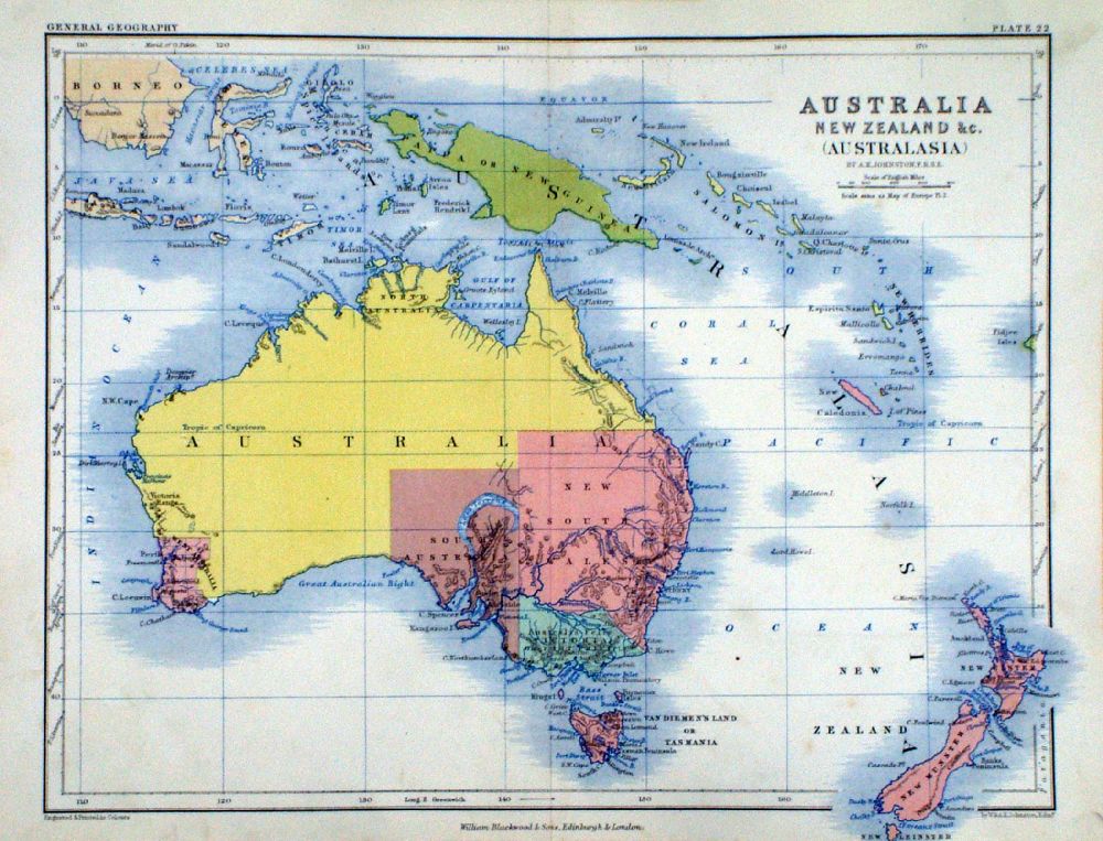 |
Australia, New
Zealand (Australasia) A.K. Johnston / William Blackwood 1854 size: 320 x 250 mm, centre fold. Early full colour lithographic printing. The 3 main islands of New Zealand shown as New Munster, New, Ulster, New Leinster Ref LKM006 £24.00 (+P&P) Detail click image for enlargement |
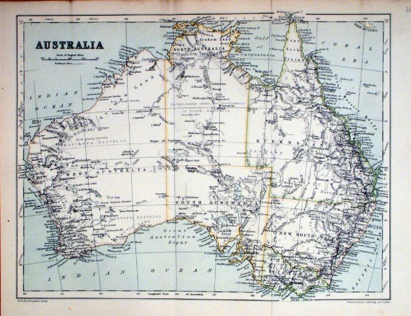 |
Australia
Johnston 1879 Ref KFM021 £18.00 (+P&P) size: 330 x 260 mm, 2 folds click image for enlargement |
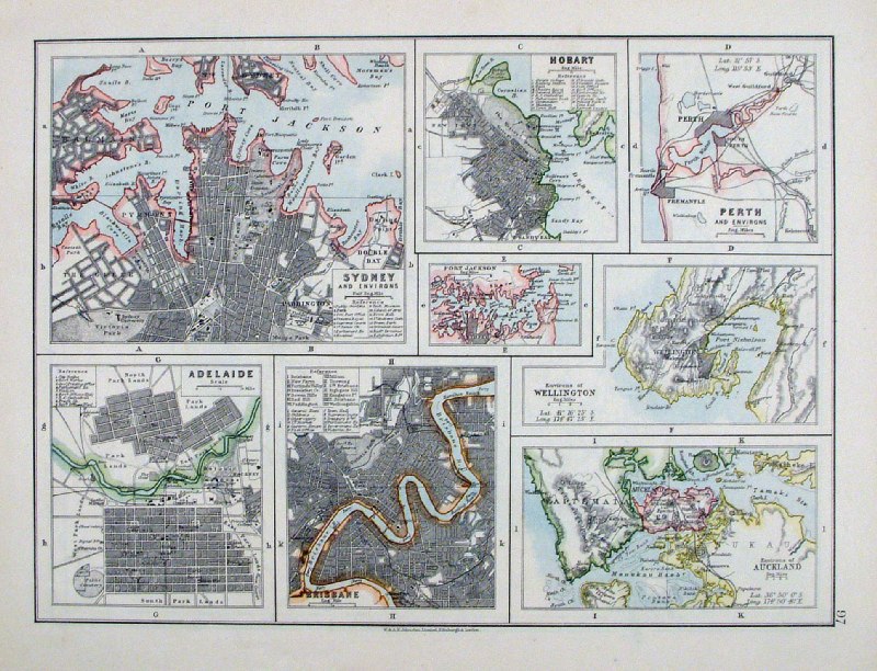 |
Australia Cities
Johnston c1880 size: 280 x 210 mm Ref HCM003 £24.00 (+P&P) click image for enlargement |
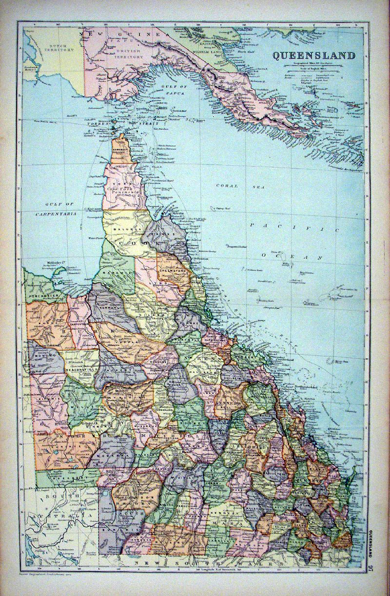 |
Queensland, Australia
Bacon c1900 Ref GKM016 £20.00 (+P&P) size: 320 x 490 mm, centre fold click image for enlargement |
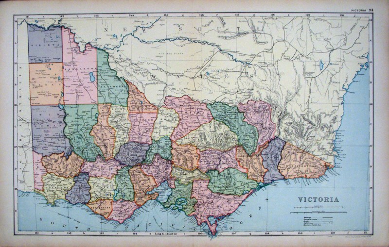 |
Victoria, Australia
Bacon c1900 Ref GKM015 £20.00 (+P&P) size: 490 x 320 mm, centre fold click image for enlargement |
 |
Wes Australia & South Australia
Bacon c1900 Ref GKM017 £20.00 (+P&P) size: 490 x 320 mm, centre fold click image for enlargement |
 |
Victoria, Australia
Bacon c1900 Ref GKM018 £20.00 (+P&P) size: 490 x 320 mm, centre fold click image for enlargement |
 |
Tasmania, Australia
Bacon c1900 Ref GKM019 £20.00 (+P&P) size: 320 x 490 mm, centre fold click image for enlargement |
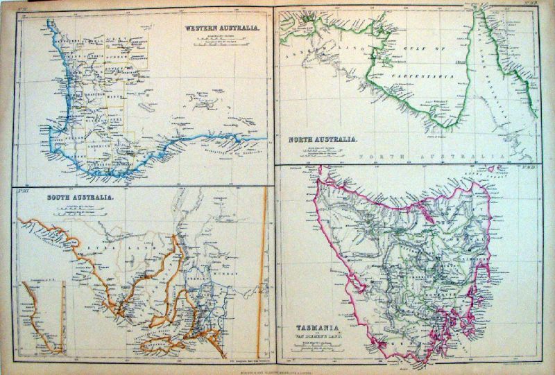 |
Western Australia,
South Australia, North Australia, Tasmania Bartholomew / Blackie c1870 size: 370 x 530 mm, centre fold Ref LFM024 £40.00 (+P&P) Detail 1 Detail 2 Detail 3 click image for enlargement |
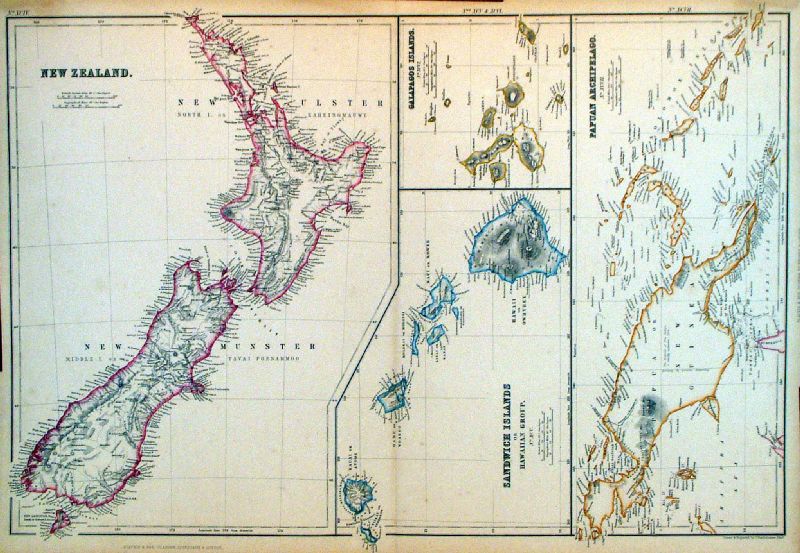 |
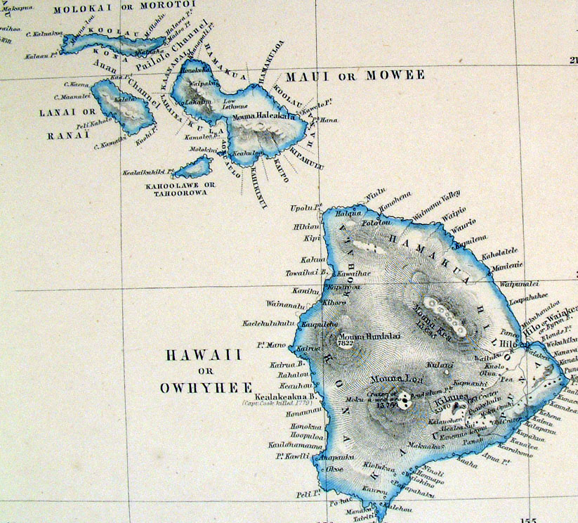
New Zealand,
Galapogos Islands, Papuan Archipelago, Sandwich Islands
0r Hawiian Group Bartholomew / Blackie c1870 size: 370 x 530 mm, centre fold Ref LFM023 £40.00 (+P&P) Detail 1 Detail 2 click image for enlargement |
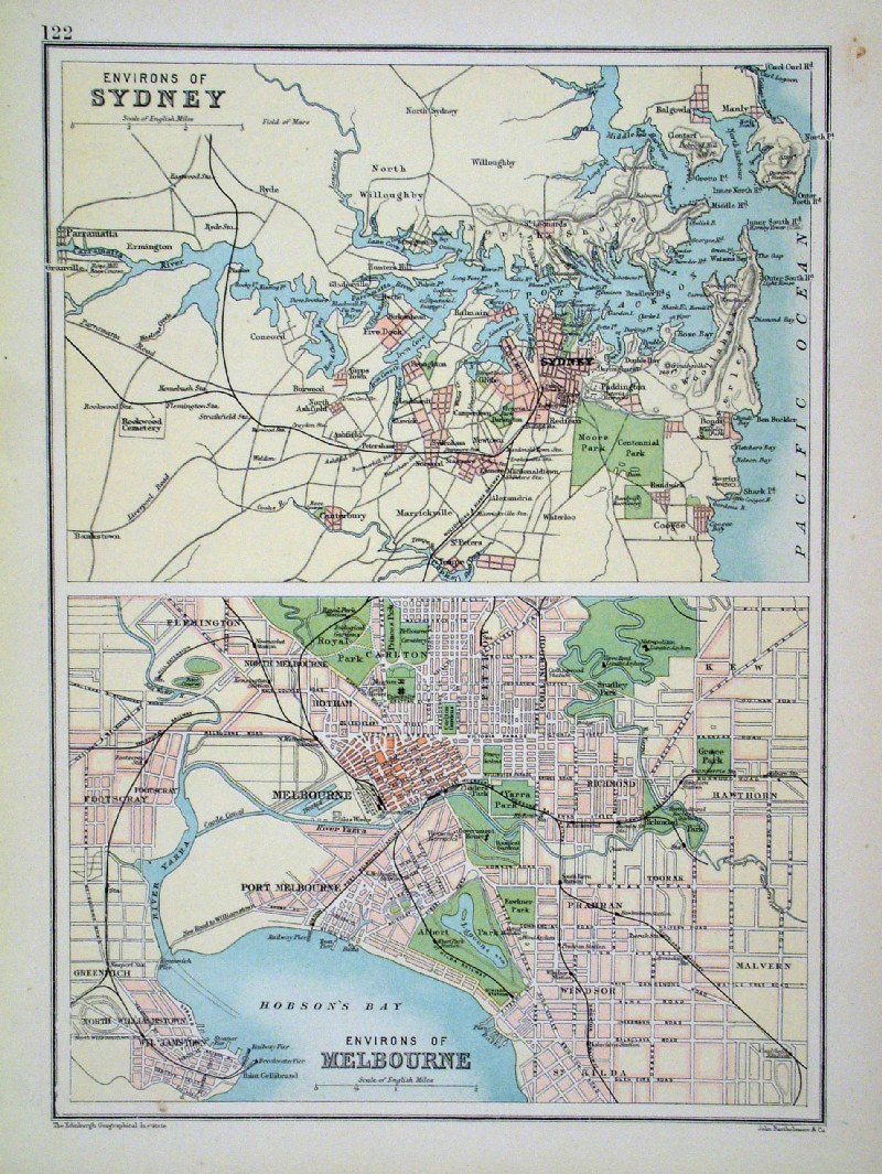 |
Environs of Sydney and Melbourne Bartholomew c1900 size: 190 x 260mm Ref HBM016 £18.00 (+P&P) click image for enlargement |
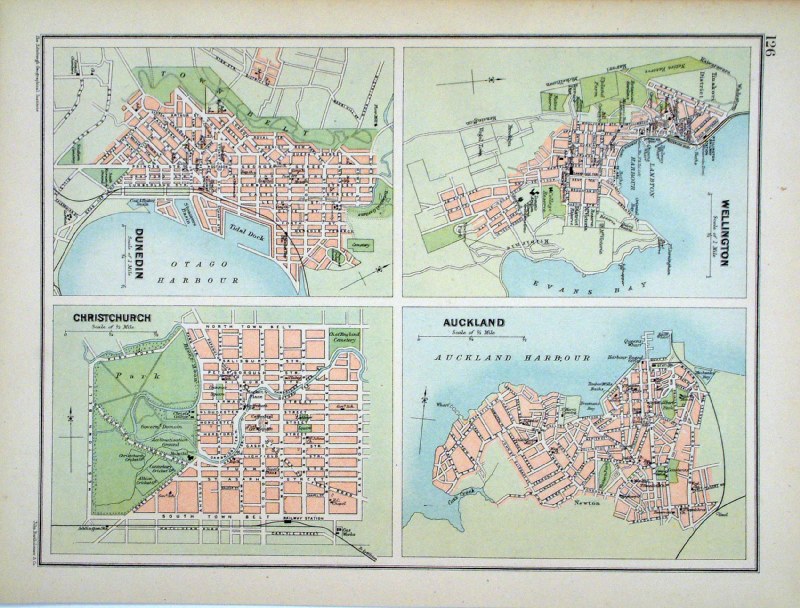 |
Environs of Auckland, Wellington, Dunedin and
Christchurch Bartholomew c1900 size: 190 x 260mm Ref HBM018 £18.00 (+P&P) click image for enlargement |
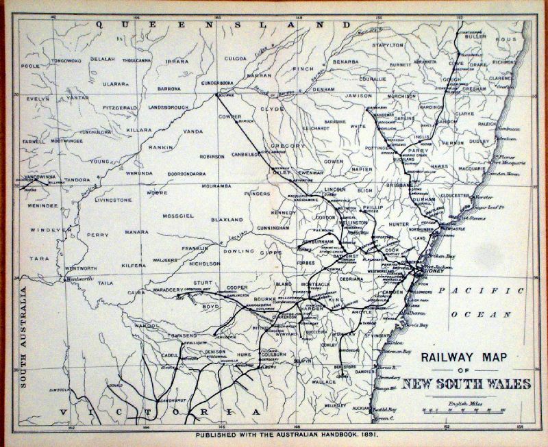 |
Railway map of New South Wales Australian Handbook 1891 size: 290 x 240mm Ref KGM032 £20.00 (+P&P) click image for enlargement |
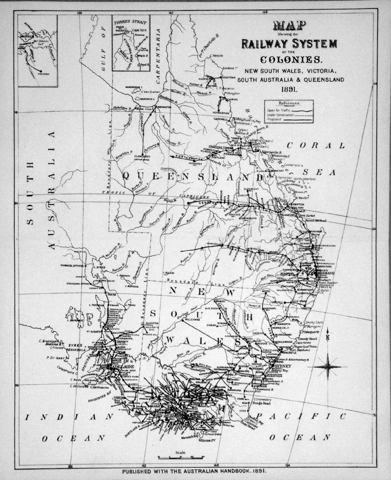 |
Map showing the Railway System of the
Colonies. New South Wales, Victoria, South Australia & Queensland Australian Handbook 1891 size: 290 x 240mm Ref KGM033 £20.00 (+P&P) click image for enlargement |
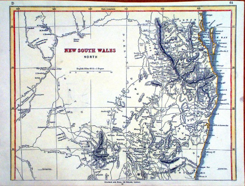 |
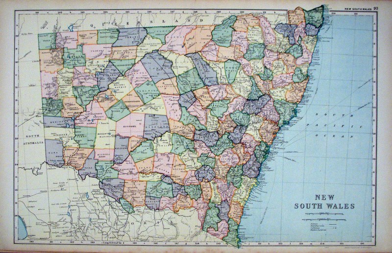
New South Wales North Chapman & Hall c1860 size: 300 x 230mm Ref KGM035 £20.00 (+P&P) click image for enlargement |
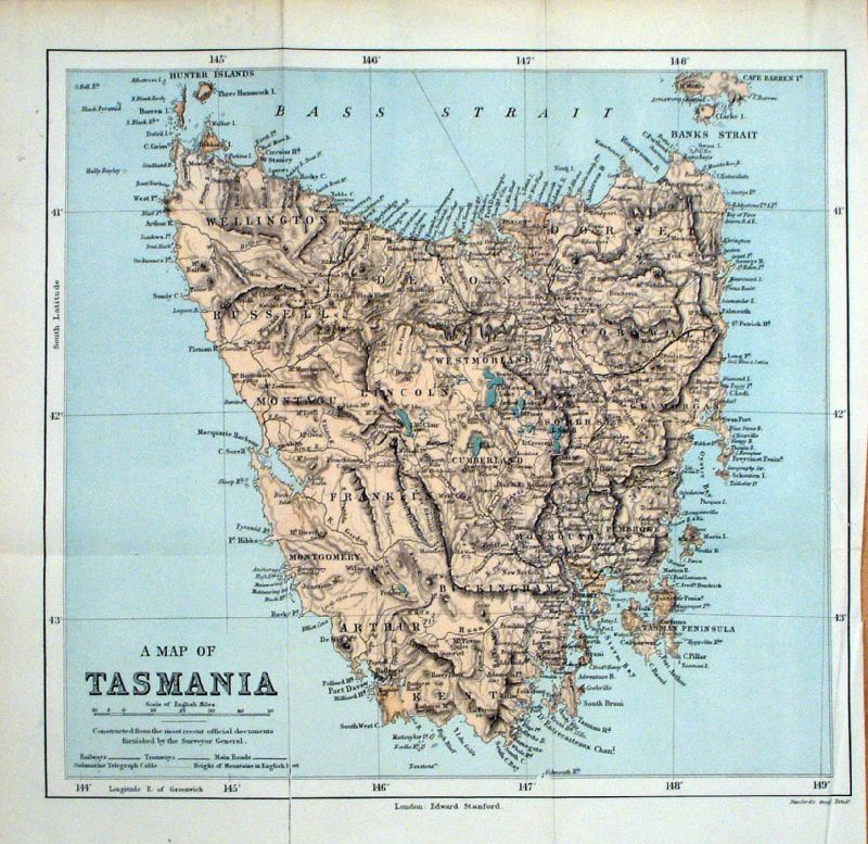 |
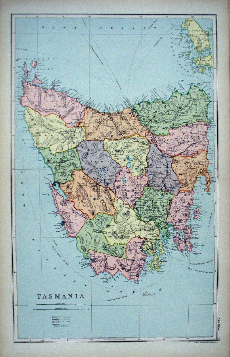
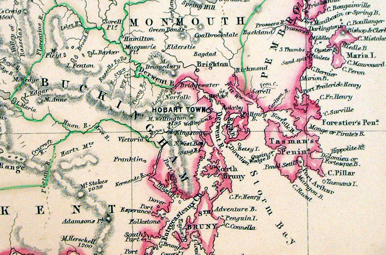
Tasmania
Stanford
c1890 size: 280 x 270 mm, several folds Ref KGM021 £18.00 (+P&P) click image for enlargement |
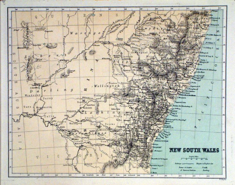 |
New South
Wales
Hughes c1870 Litho size: 260 x 200 mm Ref KFM025 £25.00 (+P&P) click image for enlargement |
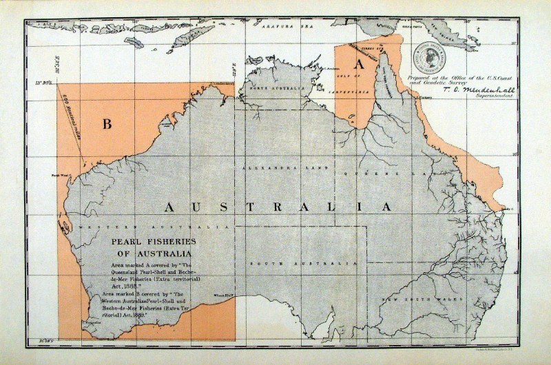 |
'Pearl Fisheries of Australia' United States Coast and Geodetic Survey 1895 Map of designated pearl fishing grounds. Litho size: 330 x 220 mm Ref HLM043 £45.00 (+P&P) click image for enlargement |
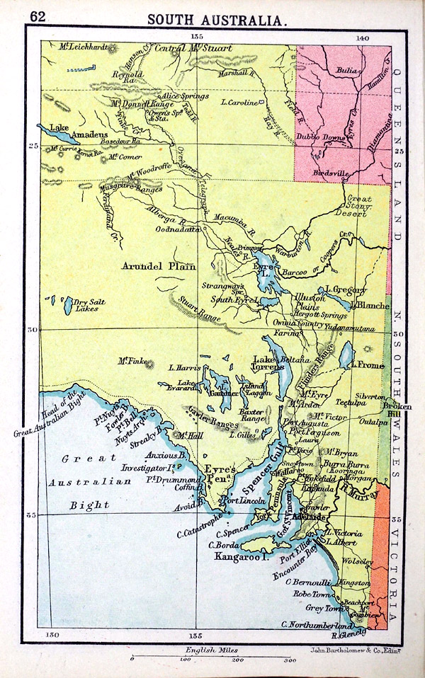 |
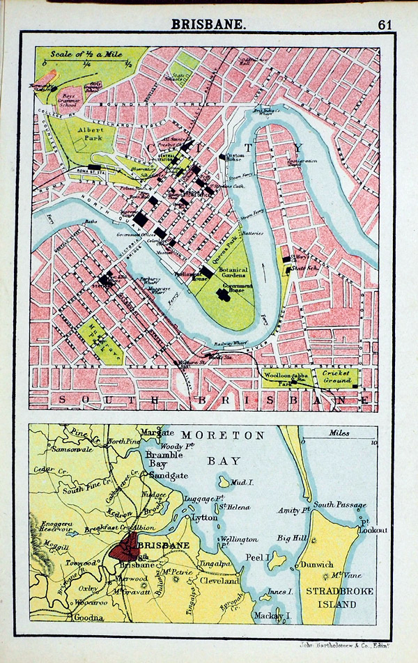
South
Australia Bartholemew 'The Handy Atlas of the British Empire' 1904 size: 100 x 150 mm Reverse - town plan of Brisbane Ref RLM004 £16.00 (+P&P) click image for enlargement |
 |
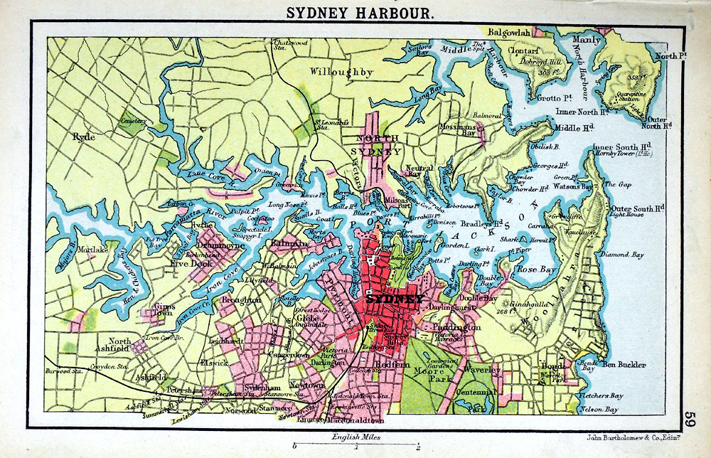
Queensland Bartholemew 'The Handy Atlas of the British Empire' 1904 size: 100 x 150 mm Reverse - town plan of Sidney Harbour Ref RLM005 £16.00 (+P&P) click image for enlargement |
Pacific & IslandsNote that some islands may be located under : Maps / Europe / France / French Colonies |
|
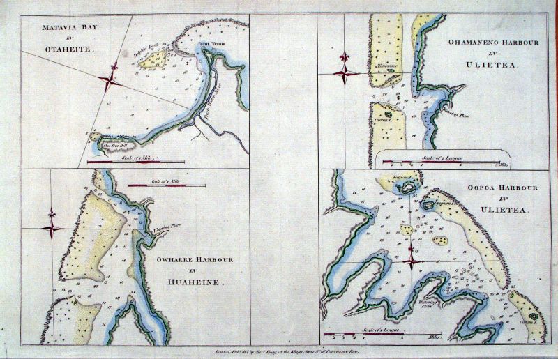 |
Tahiti, Pacific Ocean
Hogg c1780
Four bays & inlets: Matavia Bay in Otaheite, Owharre Harbour in Huaheine, Ohamaneno Harbour in Ulietea, Oopoa Harbour in Ulietea size: 350 x 230 mm Ref JIM010 £50.00 (+P&P) click image for enlargement |
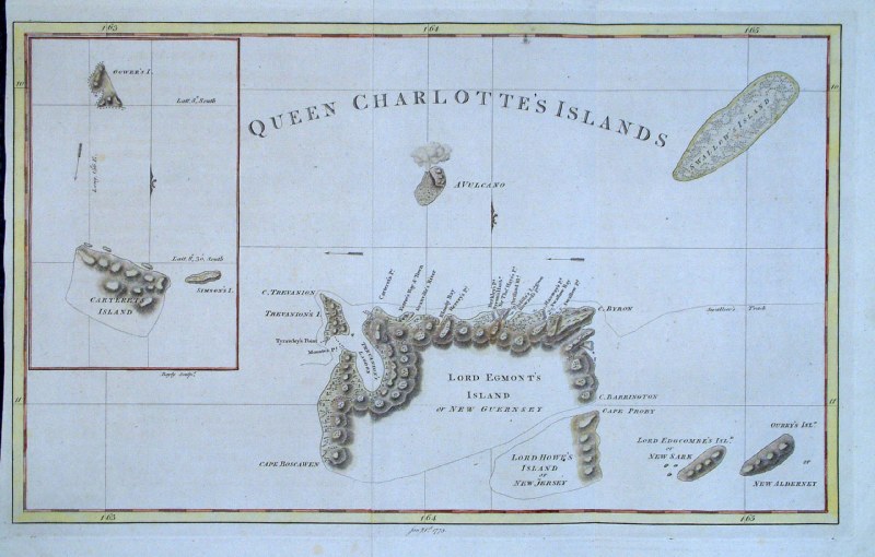 |
Solomon Islands (Queen Charlotte's
Island) Bayly 1773
size: 400 x 250 mm Ref GDM330 £60.00 (+P&P) click image for enlargement |
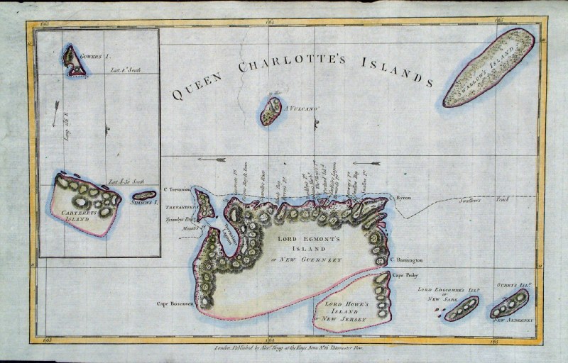 |
Solomon Islands (Queen Charlotte's Islands)
Hogg c1785 size: 350x 220 mm Ref GJM002 £40.00 (+P&P) click image for enlargement |
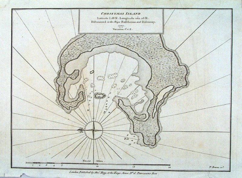 |
Christmas Island Cook / Thomas Bowen
/Alex Hogg c1785 size: 320x 240 mm, a few creases, repair to small tear at lower-right margin Ref HCS016 £36.00 (+P&P) click image for enlargement |
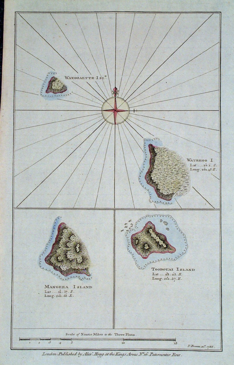 |
Cook Islands
Thomas Bowen / Hogg c1785 'Mangeea Island', 'Toobouai Island', 'Wanooaette Isle ' , 'Wateeoo Isle size: 220x 340 mm Ref GJM002 £50.00 (+P&P) click image for enlargement |
 |
Celebes Islands
Hogg c1785 'Draught of Bonthain Bay ... SE of Macassar, Celebes' size: 330x 220 mm Ref GJM016 £35.00 (+P&P) click image for enlargement |
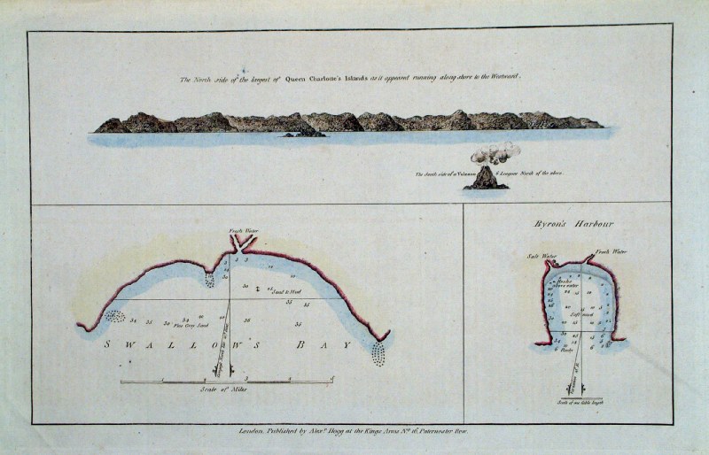 |
Solomon
Islands Hogg
c1785 'Swallows Bay' and 'Byron's Harbour' Queen Charlotte's Islands size: 340x 220 mm diagonal crease across centre Ref GJM019 £30.00 (+P&P) click image for enlargement |
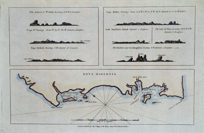 |
Papua New
Guinea
Hogg c1785 'Nova Hibernia' New Ireland, Papua New Guinea size: 350x 220 mm Ref GJM003 £35.00(+P&P) click image for enlargement |
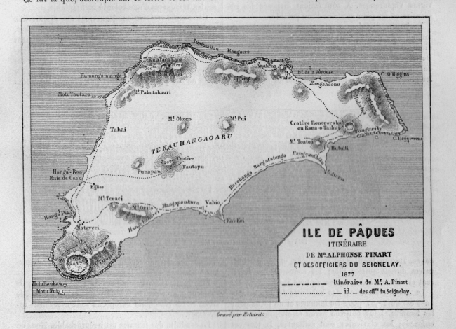 |
Easter Island / Rapa Nui / Ile de Paques See Ephemera section for 1878 pamphlets containing prints and map. click image for enlargement |
| All Genuine Antiquarian Maps - No Reproductions or Modern Copies |
2023