Past Pages
Antique Maps, Prints and Ephemera
Antique Maps - Biblical and Ancient World
Bible, Scripture, Christianity, Crusades, Ancient History, ...This section contains areas of Asia, Africa and Europe described in Bible and other ancient writings. Also refer to the 'World' section for maps relating to the 'Ancient World'. Also refer to the 'Africa' section for maps relating to 'Ancient Egypt'. Also refer to the 'Europe' section for maps relating to 'Ancient Greece', Roman Empire, etc. Also refer to the 'Asia' section for maps relating to Palestine, Syria, Turkey, Roman Empire. |
|
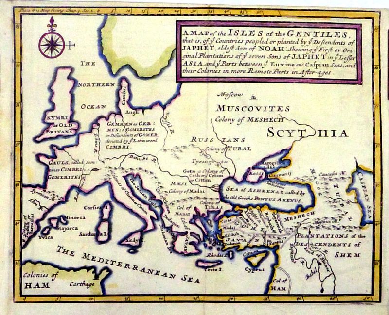 |
A Map of the Isles of
the Gentiles, that is, of ye Countries peopled or
planted by ye descendents of Japhet, eldest son of Noah
...... Hermon Moll 1721 from Historical Geography of the Old Testament by Edward Wells - Knapton, London size: 230 x 180 mm, 2 folds, tight top margin Ref NKM006 £50.00 (+P&P) click image for enlargement |
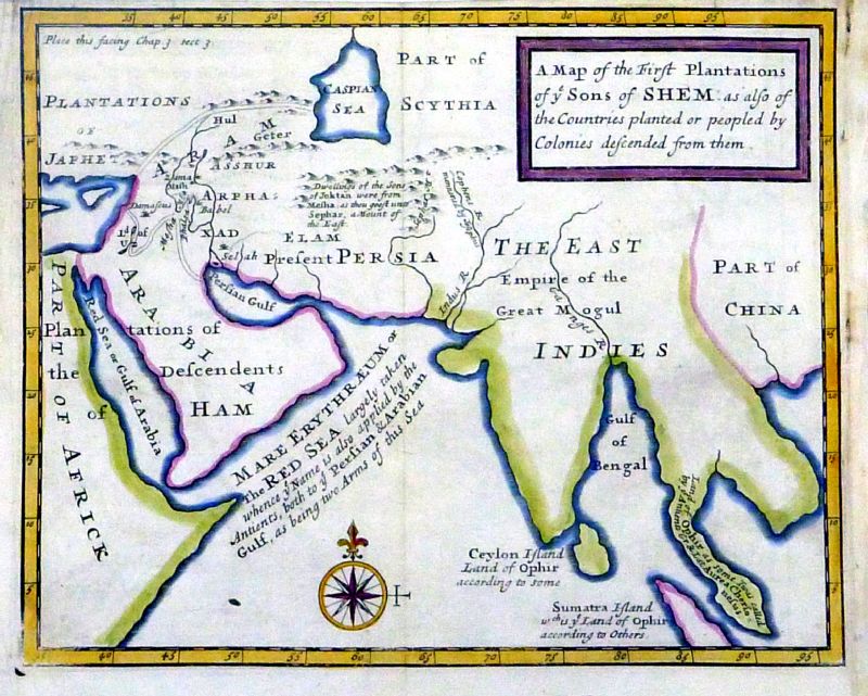 |
A Map of the first
Plantations of ye Sons of Shem ...... Hermon Moll 1721 from Historical Geography of the Old Testament by Edward Wells - Knapton, London size: 220 x 180 mm, 1 fold, tight top margin Ref NKM007 £50.00 (+P&P) click image for enlargement |
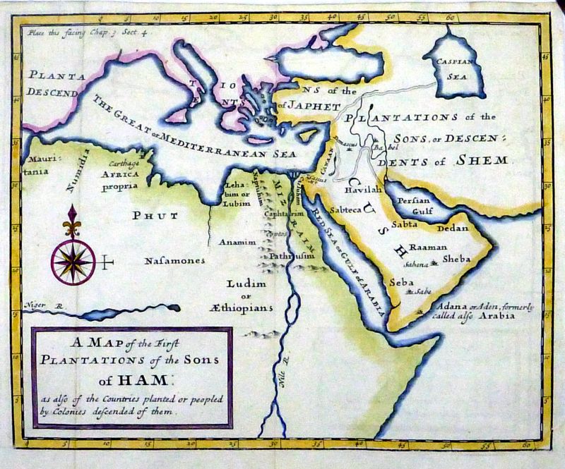 |
A Map of the first
Plantations of the Sons of Ham ........ Hermon Moll 1721 from Historical Geography of the Old Testament by Edward Wells - Knapton, London size: 220 x 180 mm, 2 folds, tight top margin. Ref NKM008 £50.00 (+P&P) click image for enlargement |
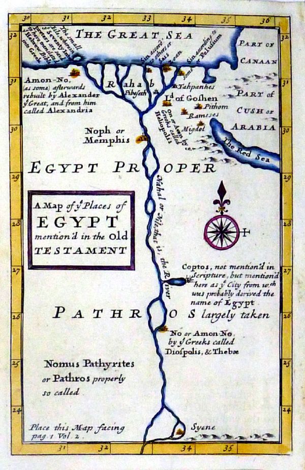 |
A Map of ye places of
Egypt mentioned in the Old Testament Hermon Moll 1721 from Historical Geography of the Old Testament by Edward Wells - Knapton, London size: 120 x 175 mm Ref NKM009 £40.00 (+P&P) click image for enlargement |
 |
The Promised Land 'Geographiae Sacrae Tabula, in qua Terra Promissa ...' Zacharie Chatelain pre-1755 taken from JB Bossuet 'Discours sur L'Histoire Universelle' 1755 size: 180 x 140 mm, 2 folds Ref HJM020 £50.00 (+P&P) click image for enlargement |
 |
The Biblical Lands of
the
Eastern Mediterranean 'Geographiae Sacrae Tabula, quea Totius Orbis Parties Continent' Zacharie Chatelain pre-1755 taken from JB Bossuet 'Discours sur L'Histoire Universelle' 1755 size: 180 x 140 mm, 2 folds Ref HJM021 £50.00 (+P&P) click image for enlargement |
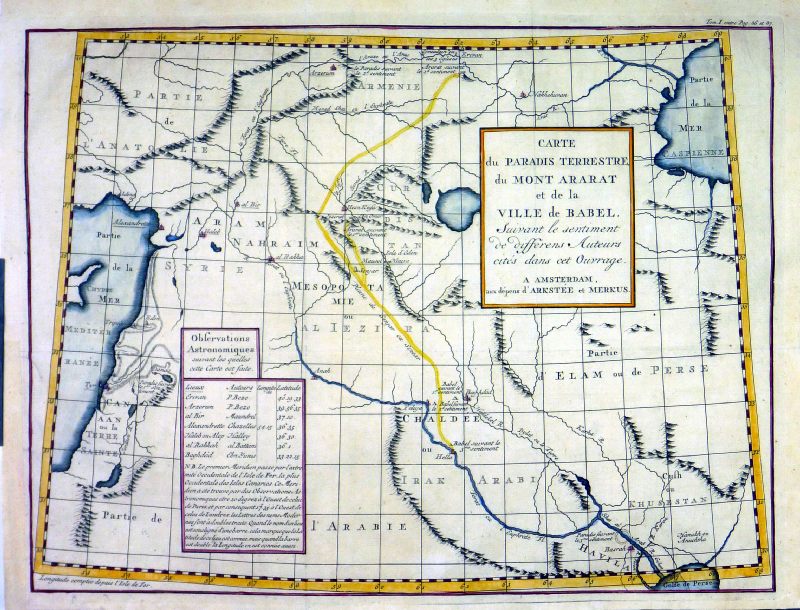 |
Carte du Paradis
Terrestre du Mont Ararat et de la Ville de Babel. Contains a chart of astronomical observations. Historie Universelle du Monde Publ: Arkstee et Merkus 1747 Copper engraving size 390 x 290 mm, several folds, strengthened lower-left margin Ref MLM005 £25.00 (+P&P) click image for enlargement |
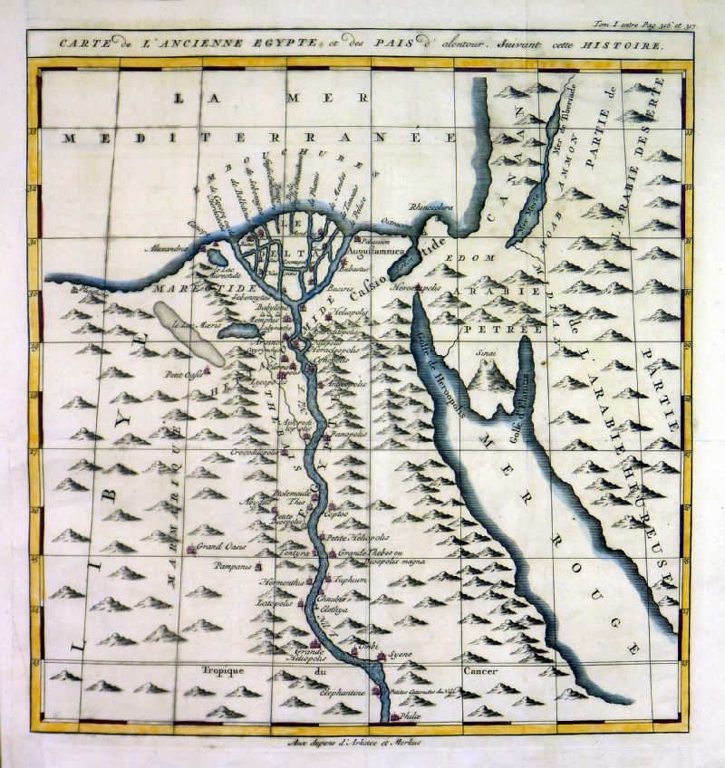 |
Carte de Ancienne
Egypte et des Pais d' alentour Suivant cette Histoire Ancient Egypt Historie Universelle du Monde Publ: Arkstee et Merkus 1747 Copper engraving size 290 x 290 mm, several folds, strengthened lower-left margin Ref MLM006 £25.00 (+P&P) click image for enlargement |
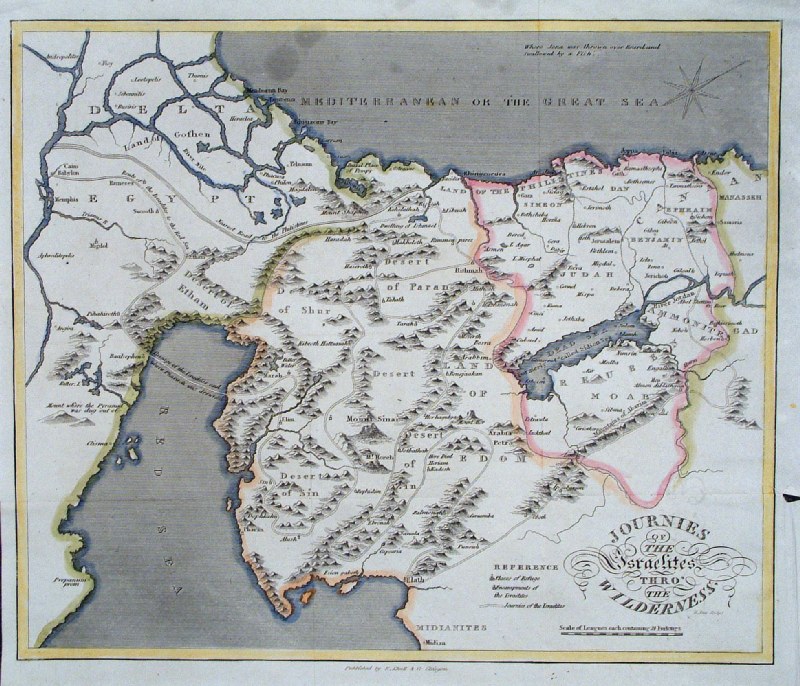 |
The
Journey of the Israelites through the Wilderness
Scott / Khull
c1846
size: 270 x 230 mm, several folds (watermark of 1823) Ref GHM027 £22.00 (+P&P) click image for enlargement |
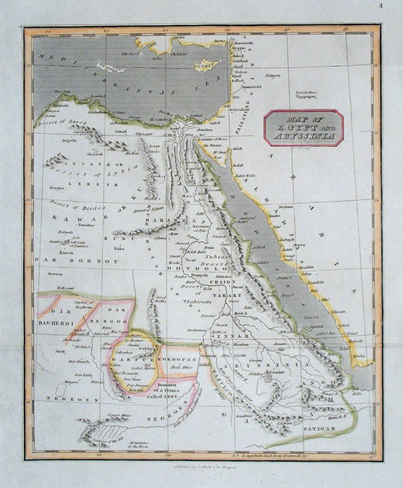 |
Map of Egypt and Abyssinia Scott / Khull c1846 size: 190 x 230 mm Ref GHM028 £16.00 (+P&P) click image for enlargement |
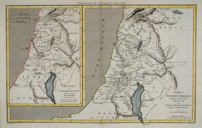 |
Ancient
Holy
Land
Russell /
Arrowsmith 1809
size 410 x 260 mm Ref FIM118 £20.00 (+P&P) click image for enlargement |
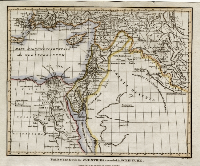 |
Palestine
with the Countries recorded in
Scripture.
Wilkes 1807
size: 250 x 200 mm Ref ELM003 £22.00 (+P&P) click image for enlargement |
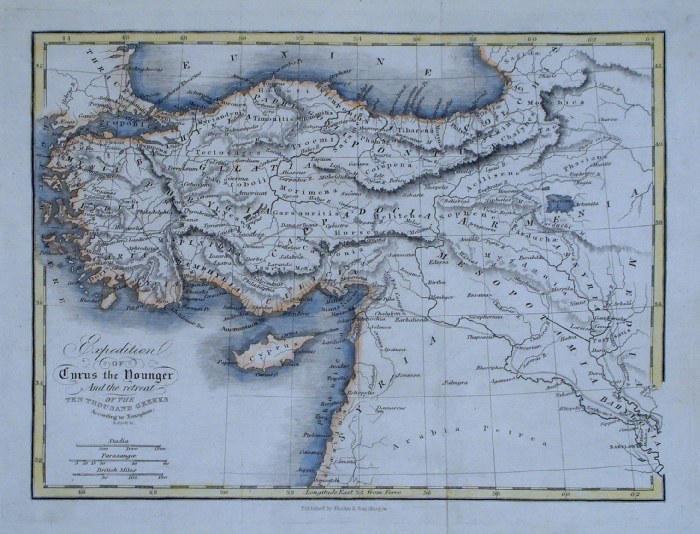 |
Expedition of Cyrus the Younger and the retreat of
the
ten thousand Greeks R. Scott 1863 size: 260 x 190 mm, 2 folds Ref GBM336 £18.00 (+P&P) click image for enlargement |
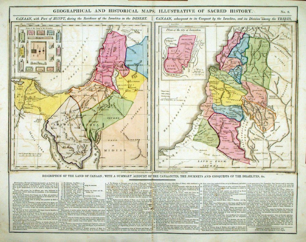 |
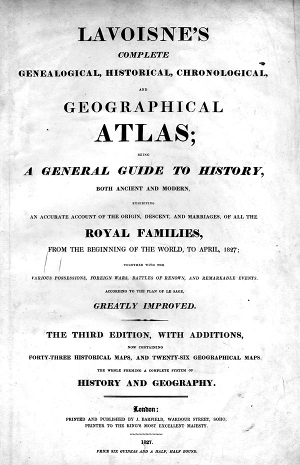
Geographical and
Historical Maps, Illustrative of Sacred History Map engraved by J. Walker. Set with statistical data. From Lavoisne's Genealogical, Historical, Chronological and Geographical Atlas 1827 - Title Page For Statistics Tables and Charts from this atlas see Charts and Tables Page Copper engraving page size: 530 x 420 mm, centre fold. Slight offset transfer. Ref LHM011 £40.00 (+P&P) Detail 1 Detail 2 click image for enlargement |
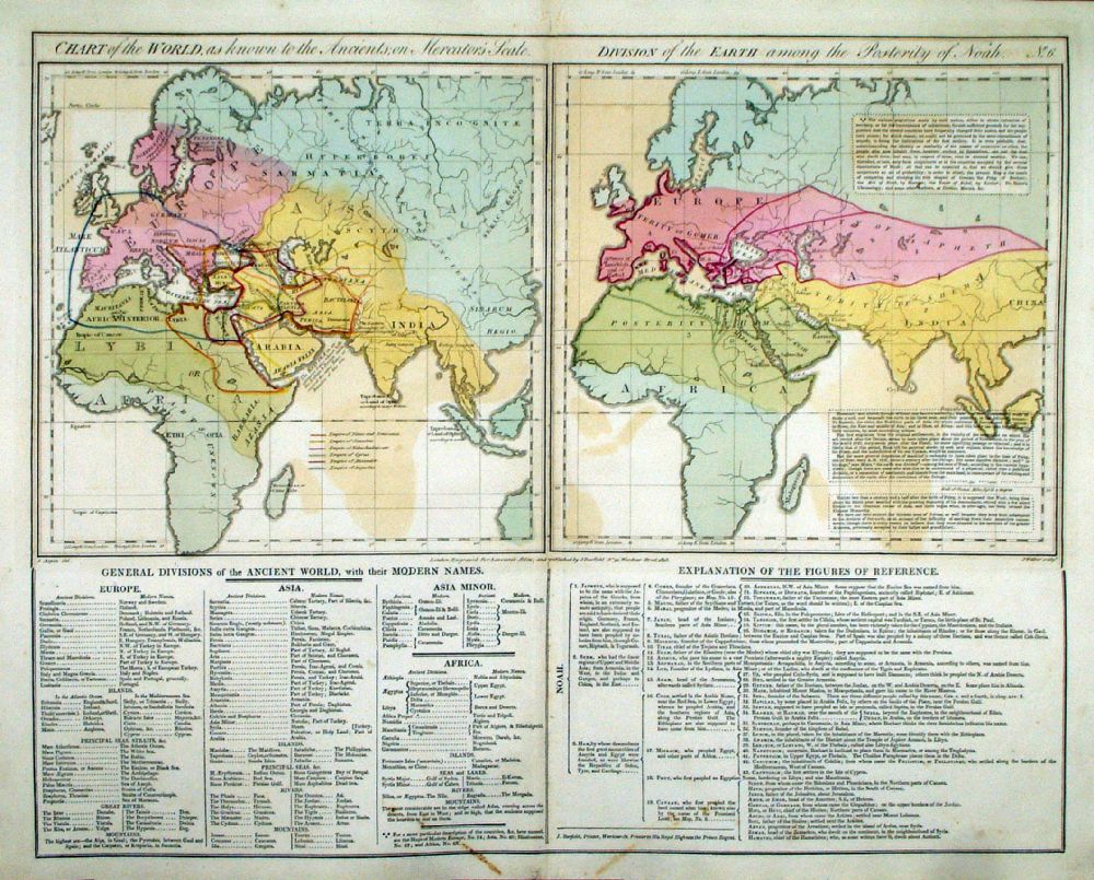 |
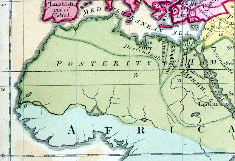
Chart of the World
Known to the Ancients. Division of the Earth
among the Posterity of Noah. Map engraved by J. Walker. Set with statistical data. From Lavoisne's Genealogical, Historical, Chronological and Geographical Atlas 1827 - Title Page For Statistics Tables and Charts from this atlas see Charts and Tables Page Copper engraving page size: 530 x 420 mm, centre fold. Slight offset transfer. Ref LHM009 £25.00 (+P&P) Detail 1 click image for enlargement |
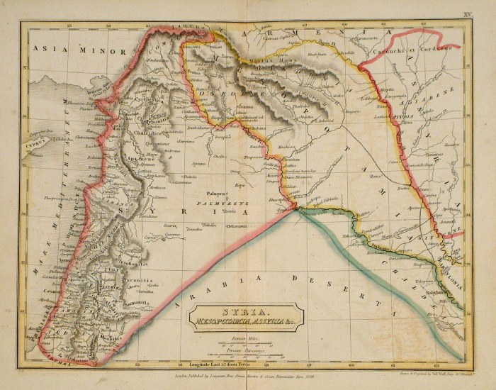 |
Ancient Syria, Mesopotamia, Assyria
Sidney Hall 1829 Ref FIM017 £15.00 (+P&P) size: 250 x190 mm Slight printing transfer from folded page. click image for enlargement |
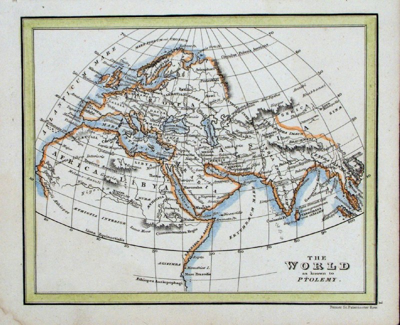 |
The World as Known to Ptolemy
Fenner 1828 Ref GIM013 % £12.00 (+P&P) size: 150 x 95 mm click image for enlargement |
 |
Canaan, Illustrated in the Books of Joshua and
Judges Society for the Promotion of Christian Knowledge - Rivington 1816 Printed on off-white (pale beige) paper. size: 220 x 280 mm Ref GHM127 £18.00 (+P&P) click image for enlargement |
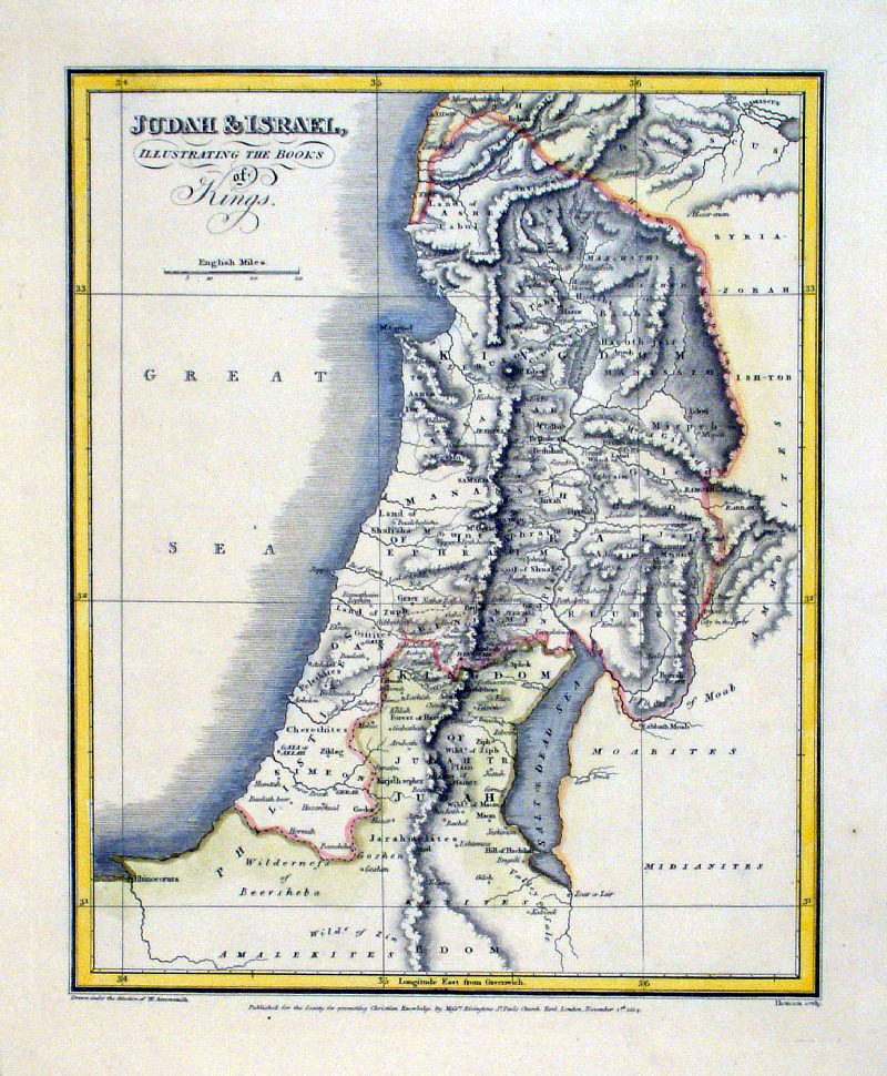 |
Jordan & Israel, Illustrating the books of
Kings Society for the Promotion of Christian Knowledge - Rivington c1816 Printed on off-white (pale beige) paper. size: 220 x 270 mm Ref GHM131 £18.00 (+P&P) click image for enlargement |
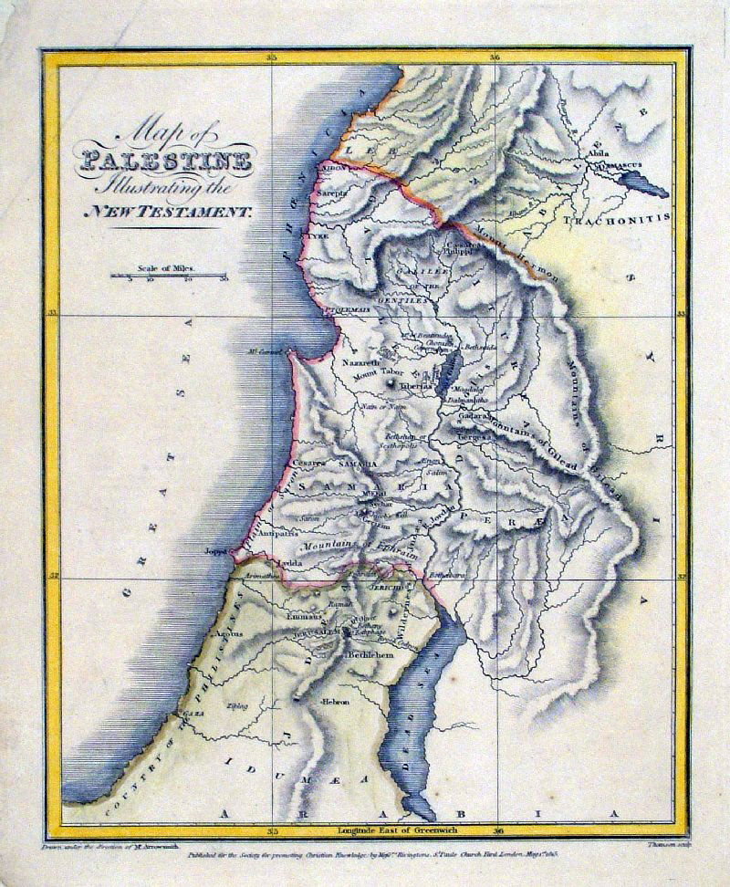 |
Map of Palestine Illustrating the New Testament Society for the Promotion of Christian Knowledge - Rivington c1816 Printed on off-white (pale beige) paper. size: 220 x 270 mm crease at top-left corner Ref GHM133 £18.00 (+P&P) click image for enlargement |
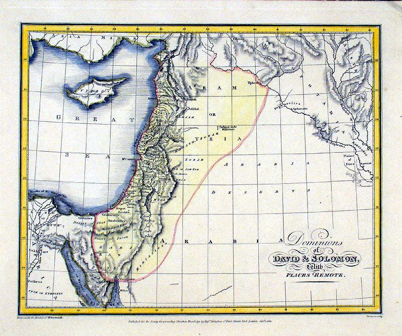 |
Dominions of David & Solomom with Places
Remote. Society for the Promotion of Christian Knowledge - Rivington c1816 Printed on off-white (pale beige) paper. size: 270 x 220 mm Ref GHM129 £18.00 (+P&P) click image for enlargement |
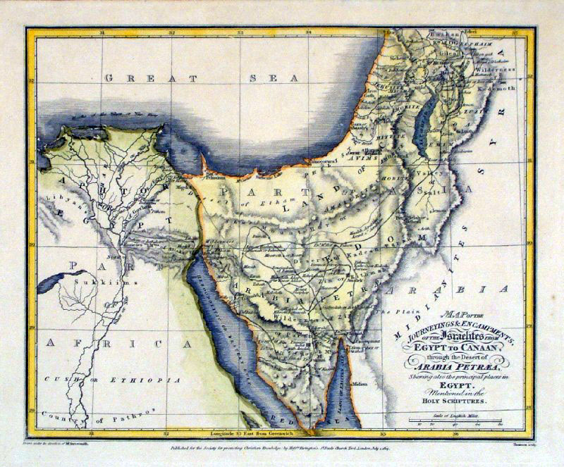 |
Map of the Journeyings & Encampments of the
Israelites from Egypt to Canaan ...... Society for the Promotion of Christian Knowledge - Rivington c1816 Printed on off-white (pale beige) paper. size: 270 x 220 mm Ref GHM134 £18.00 (+P&P) click image for enlargement |
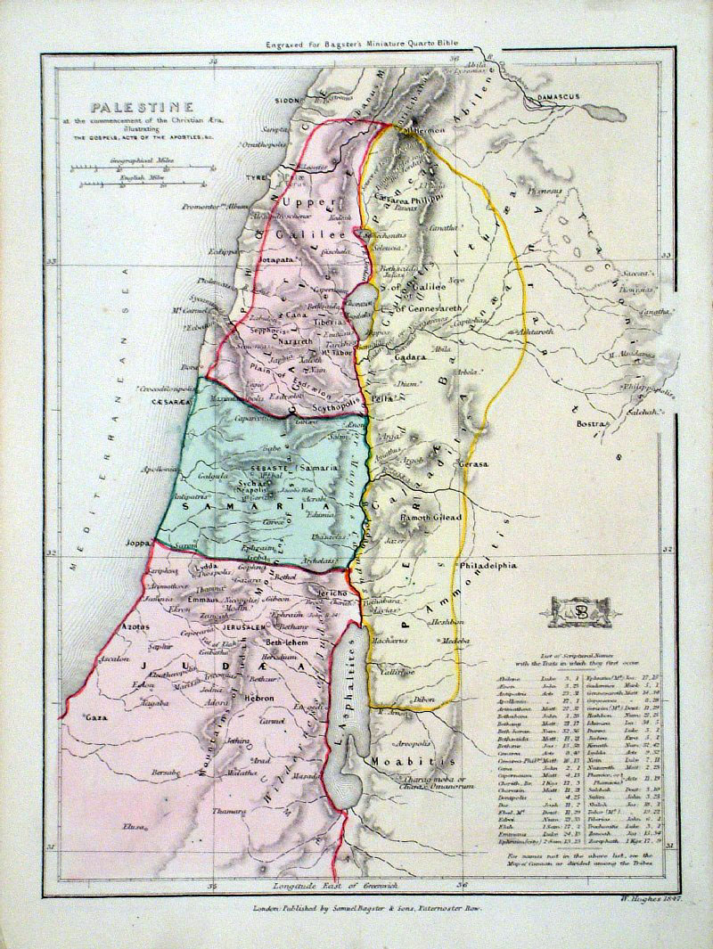 |
Palestine at the Commencement of the Christian era
Hughes / Bagster 1847 Ref GDM139 £18.00 (+P&P) size: 160 x 220 mm click image for enlargement |
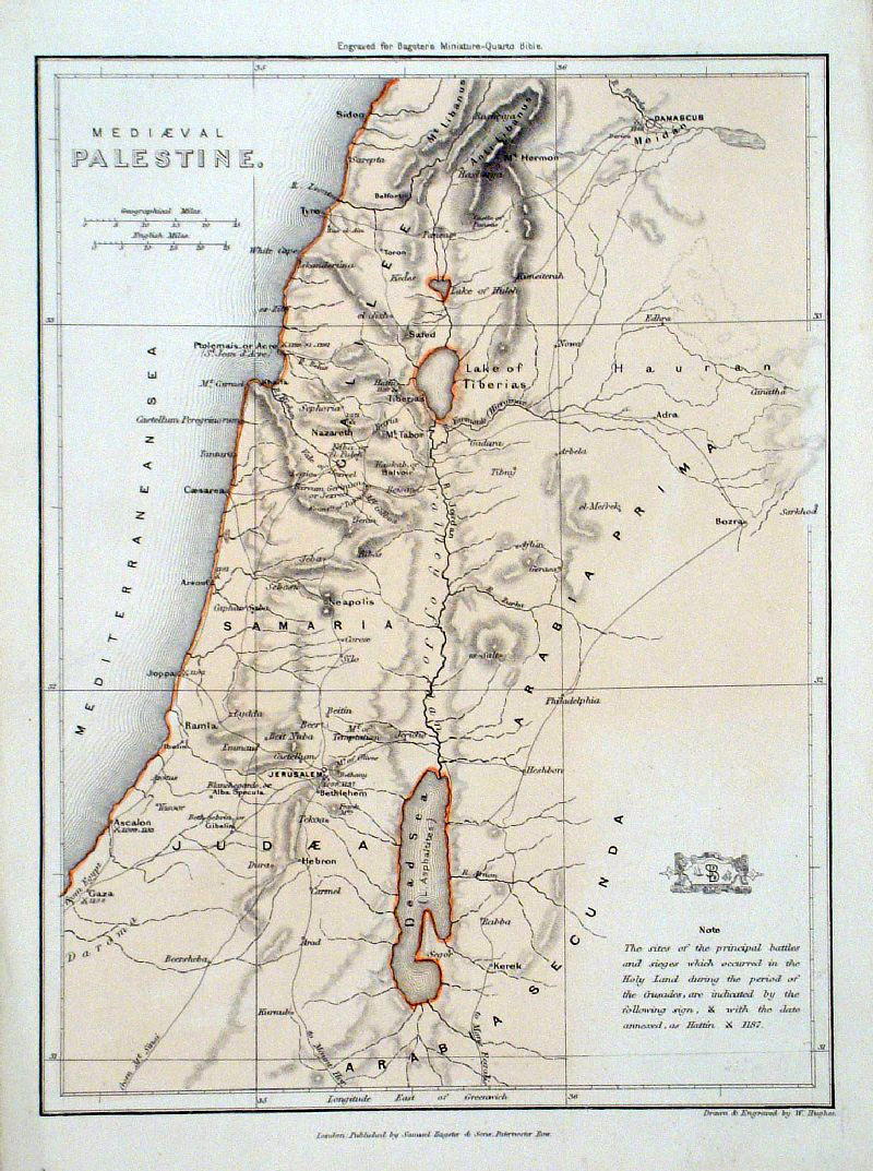 |
Mediaeval Palestine Hughes / Bagster 1847 Ref GDM142 £18.00 (+P&P) size: 160 x 220 mm click image for enlargement |
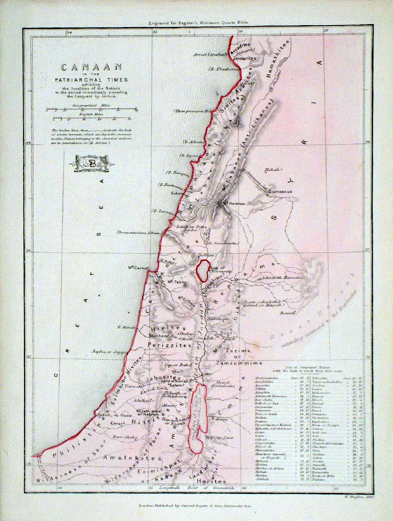 |
Canaan in the Patriarchal Times Hughes / Bagster 1847 Ref GDM151 £18.00 (+P&P) size: 160 x 220 mm click image for enlargement |
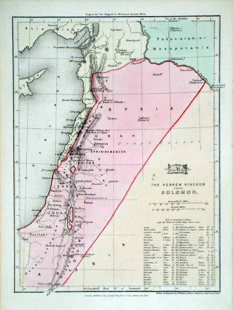 |
The Hebrew Kingdom of Solomon Hughes / Bagster 1847 Ref GDM150 £20.00 (+P&P) size: 160 x 220 mm click image for enlargement |
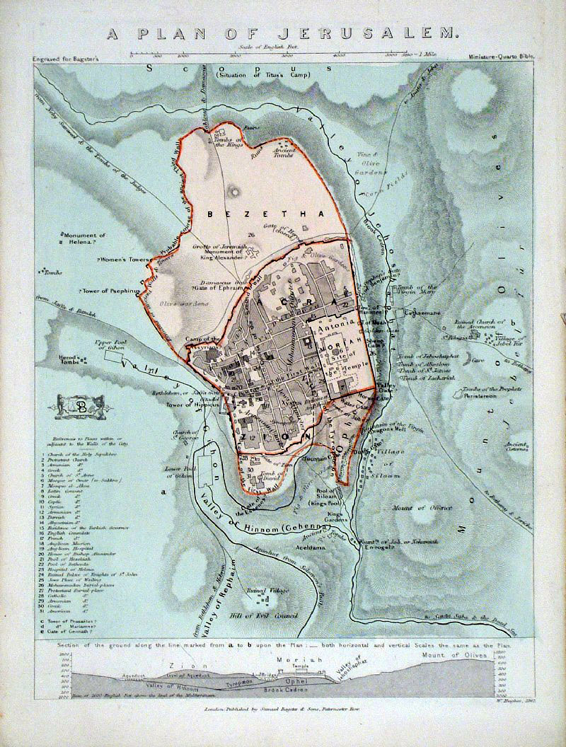 |
Jerusalem with cross section
Hughes / Bagster 1847 Ref GDM143 £20.00 (+P&P) size: 160 x 220 mm click image for enlargement |
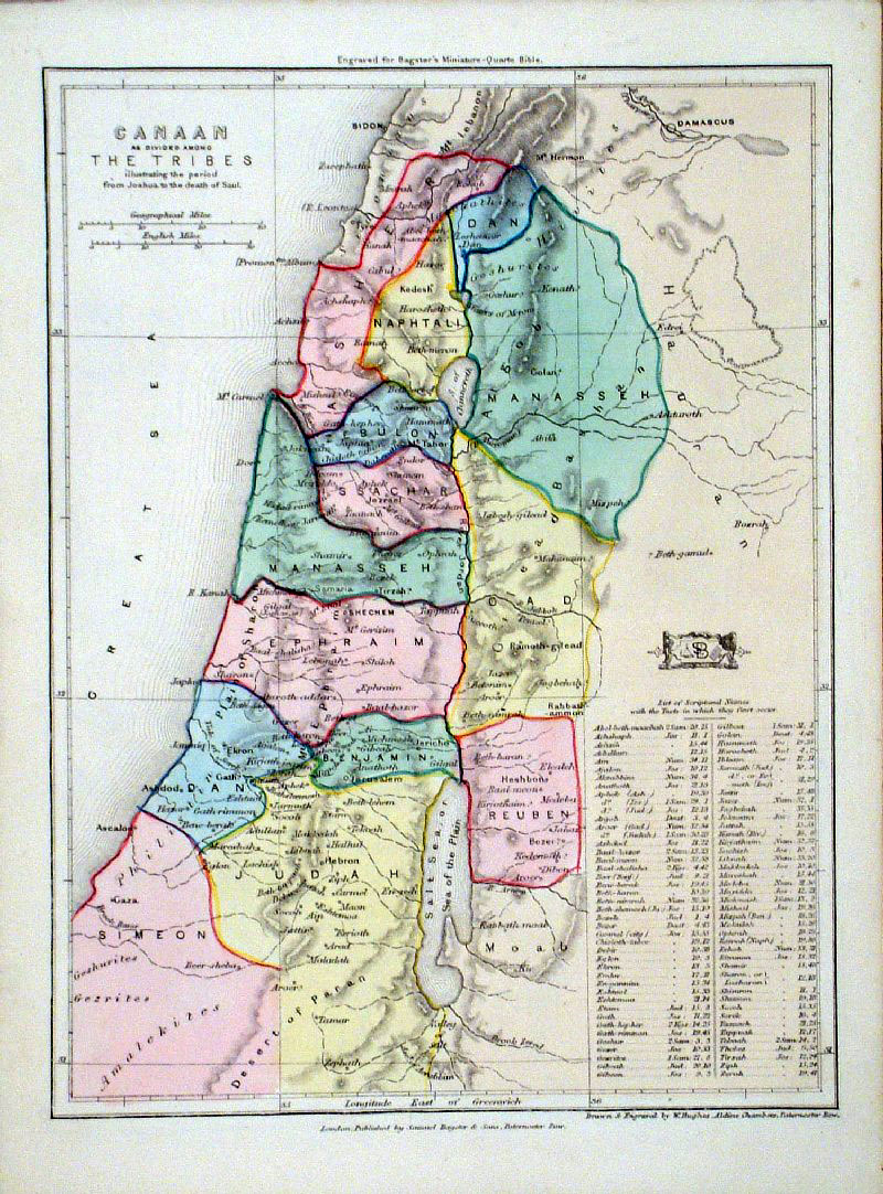 |
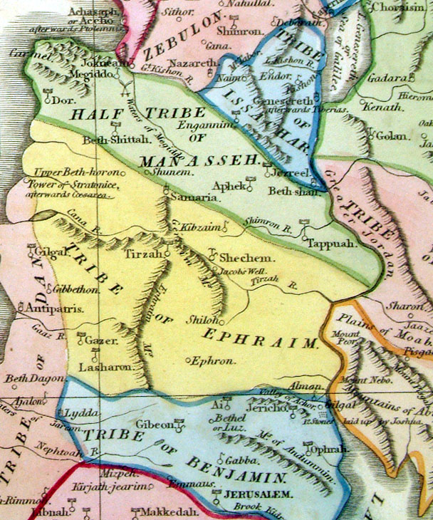
Cannan as divided among the Tribes in the period
from
Joshua to the death of Saul Hughes / Bagster 1847 Ref GDM148 £18.00 (+P&P) size: 160 x 220 mm click image for enlargement |
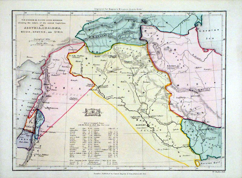 |
The Kingdom as divided under Rehoboam ....
Hughes / Bagster 1847 Ref GDM138 £18.00 (+P&P) size: 160 x 220 mm click image for enlargement |
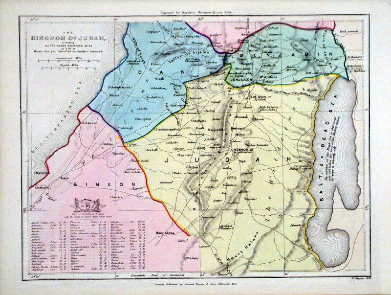 |
The Kingdom of Judea Hughes / Bagster 1847 Ref GDM147 £22.00 (+P&P) size: 160 x 220 mm click image for enlargement |
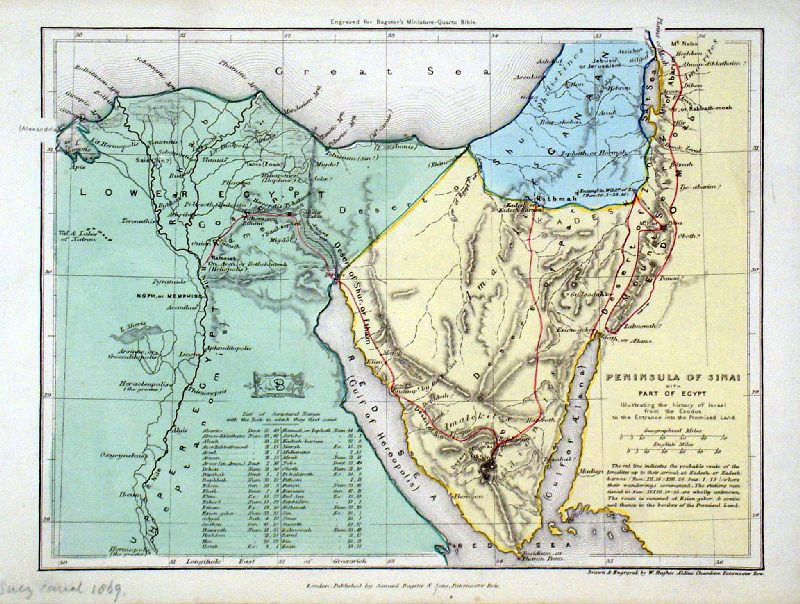 |
The Peninsular of Sinai ... illustrating the
history of
Israel from the Exodus to the Entrance into the Promised
Land Hughes / Bagster 1847 Ref GDM149 £22.00 (+P&P) size: 160 x 220 mm click image for enlargement |
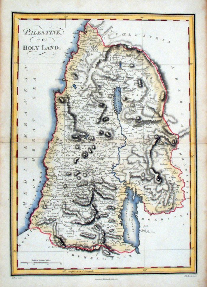 |
Palestine or Holy Land Wyld / Hewitt - Mathews & Leigh 1812 Copper engraving. Size: 280 x 370 mm, centre fold Ref JBM039 £22.00 (+P&P) click image for enlargement |
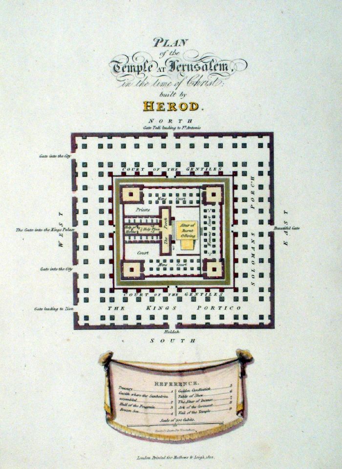 |
Plan of the Temple of Jerusalem .. Built by
Herod Hewitt - Mathews & Leigh 1812 Copper engraving. Size: 200 x 280 mm Ref JBM040 £18.00 (+P&P) click image for enlargement |
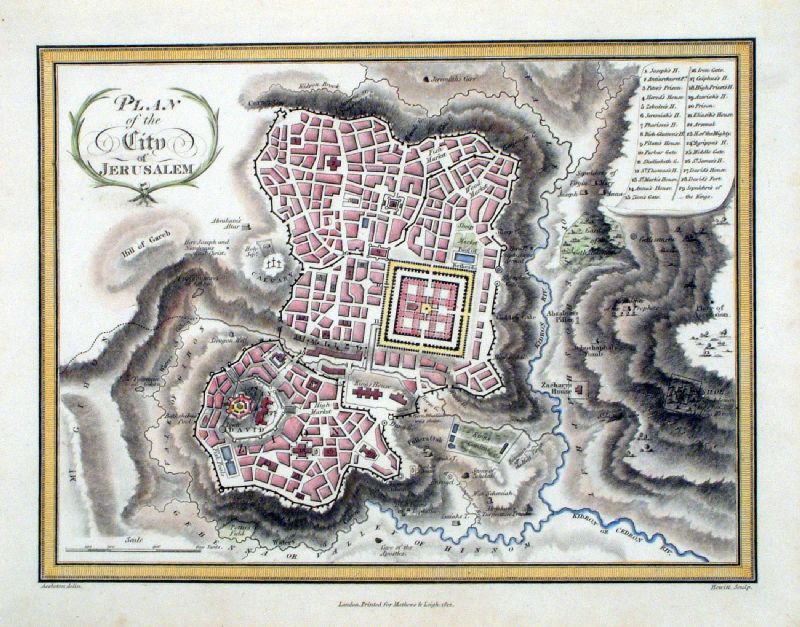 |
Plan of the City of Jerusalem Assheton / Hewitt - Mathews & Leigh 1812 Copper engraving. Size: 280 x 200 mm Ref JBM041 £22.00 (+P&P) Detail click image for enlargement |
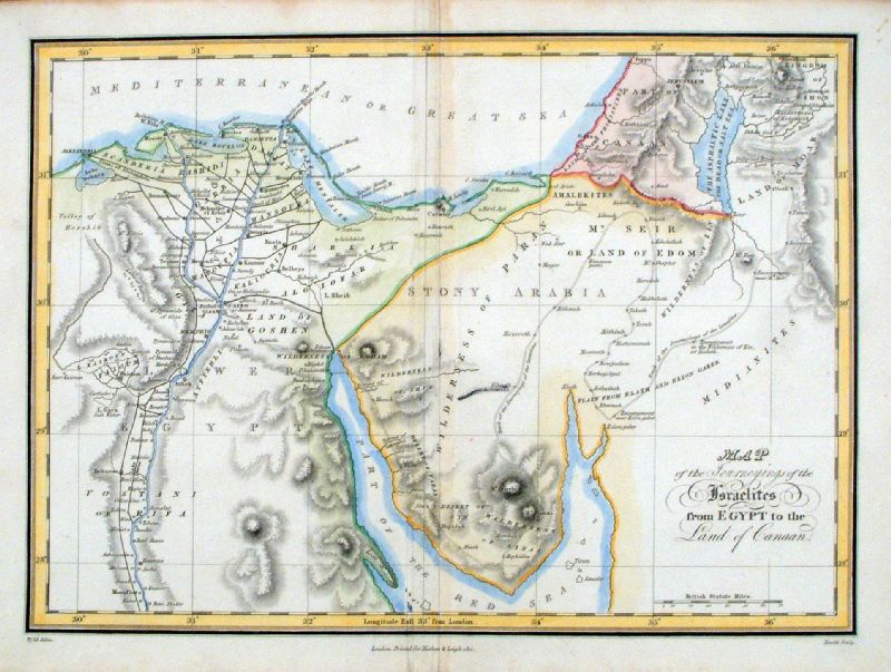 |
Map of the Journeyings of the Israelites from
Egypt to
the Land of Canaan Wyld / Hewitt - Mathews & Leigh 1812 Copper engraving. Size: 370 x 280 mm, centre fold Ref JBM042 £20.00 (+P&P) click image for enlargement |
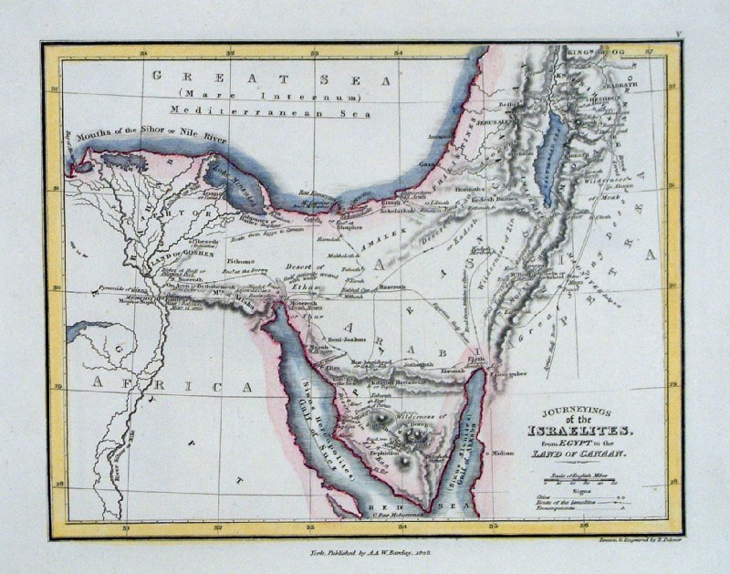 |
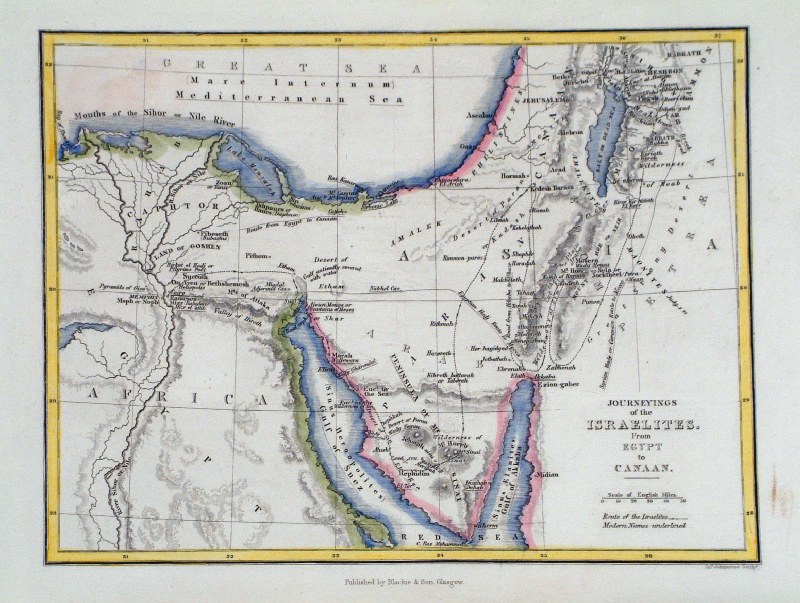
Journeyings of the Israelites from Egypt to the
Land of
Canaan R. Palmer for A & W Barclay 1823 size: 190 x 160 mm, 1 fold Ref GHM040 £16.00 (+P&P) click image for enlargement |
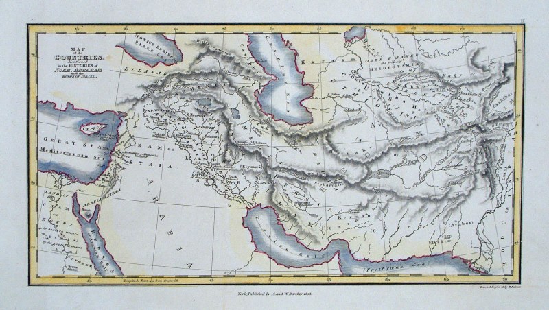 |
Map of the Countries Mentioned in the Histories of
Noah, Abraham and the Kings of Israel R. Palmer for A & W Barclay 1823 size: 190 x 160 mm, 1 fold Ref GHM037 £16.00 (+P&P) click image for enlargement |
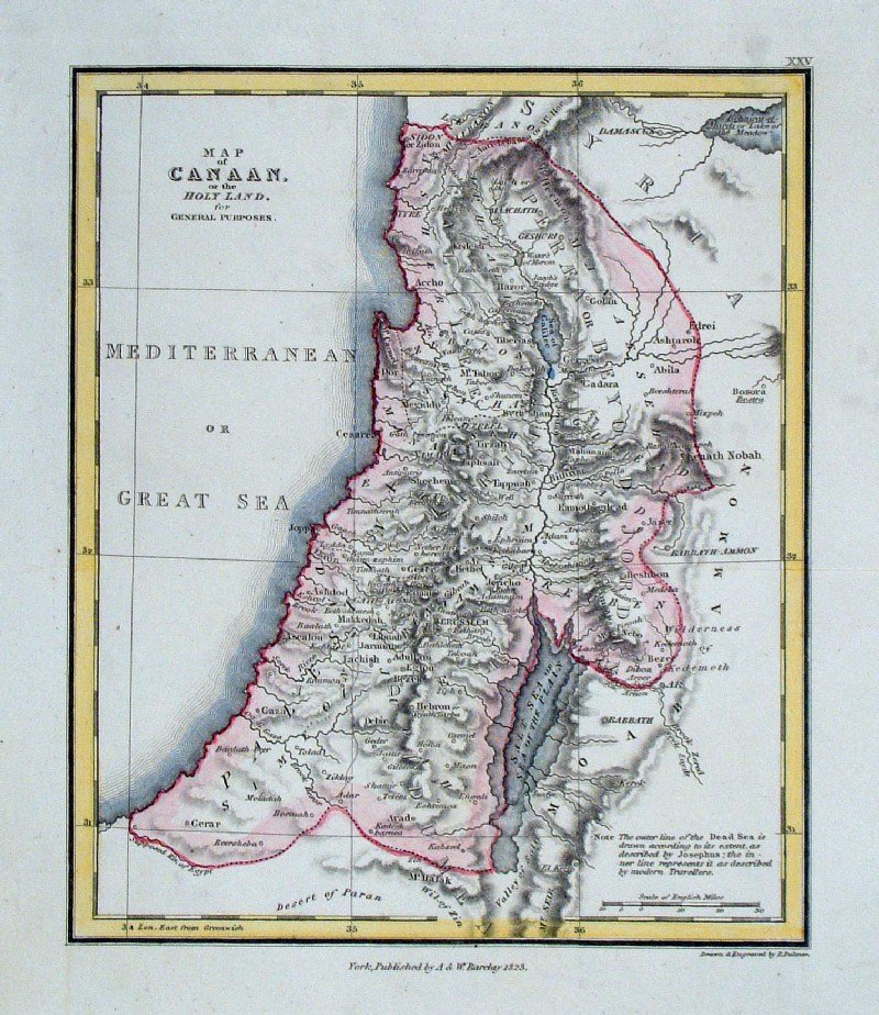 |
Map of Canaan or The Holy Land R. Palmer for A & W Barclay 1823 size: 190 x 160 mm, 1 fold Ref GHM060 £15.00 (+P&P) click image for enlargement |
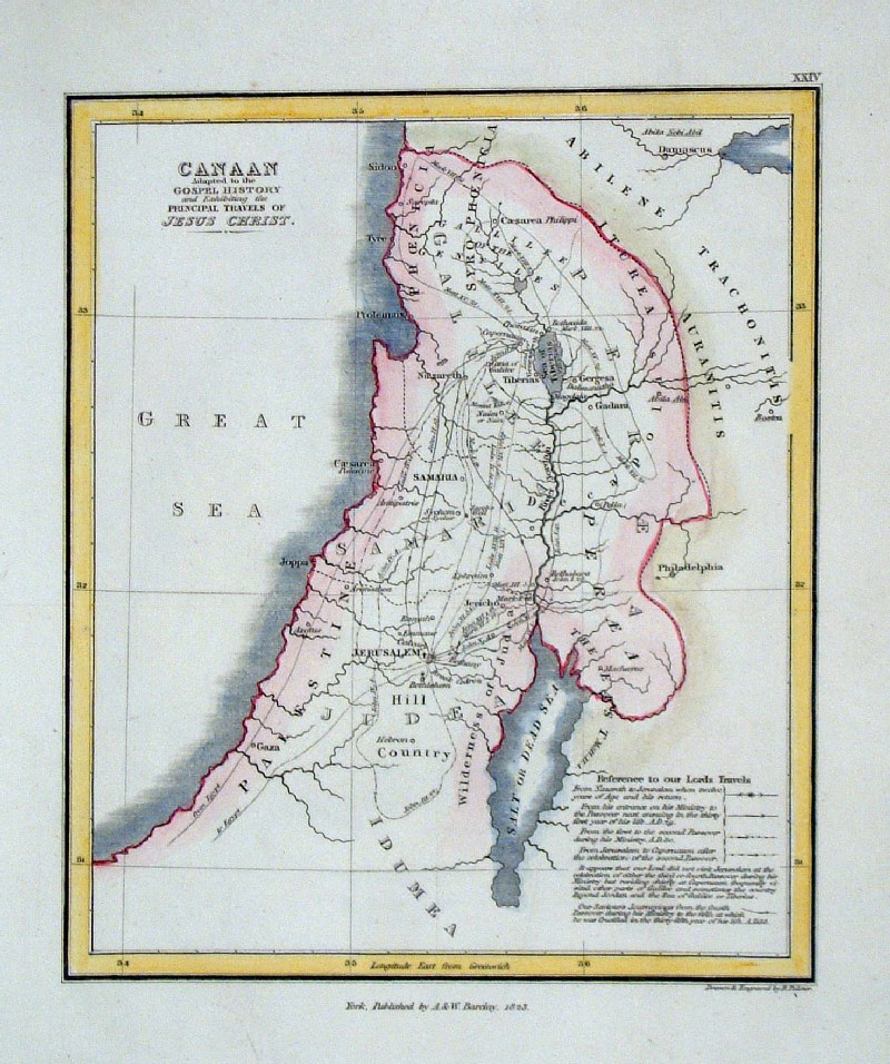 |
Canaan Adapted to the Gospel History and
Exhibiting the
Principal Travels of Jesus Christ R. Palmer for A & W Barclay 1823 size: 190 x 160 mm, 1 fold Ref GHM059 £15.00 (+P&P) click image for enlargement |
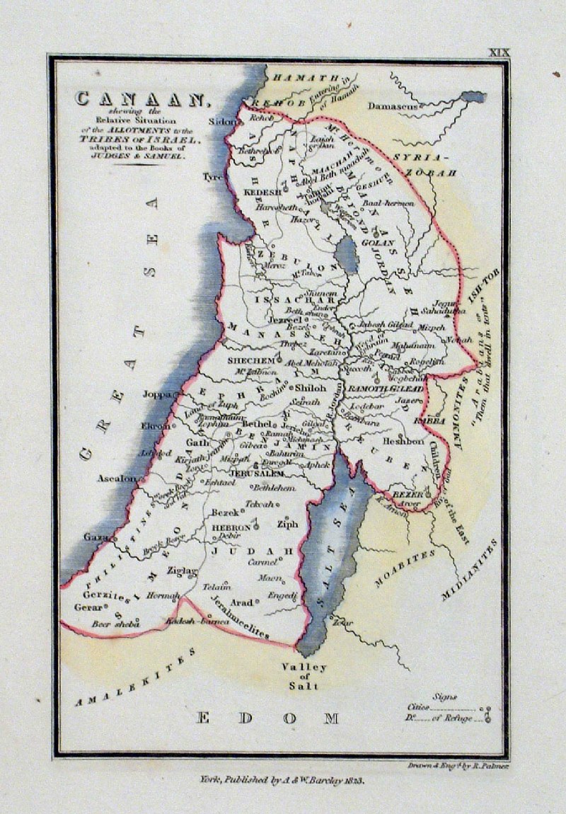 |
Canaan Showing the Relative Situation of the
Allotments
to the Tribes of Israel. R. Palmer for A & W Barclay 1823 size: 110 x 160 mm, Ref GHM054 £15.00 (+P&P) click image for enlargement |
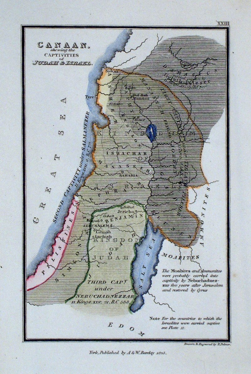 |
Canaan showing the Captivities of Judah &
Israel R. Palmer for A & W Barclay 1823 size: 110 x 160 mm Ref GHM058 £15.00 (+P&P) click image for enlargement |
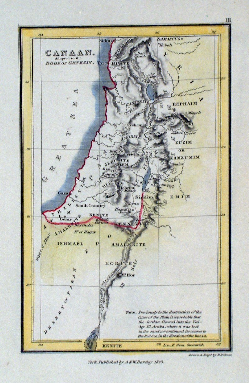 |
Canaan Adapted to the Book of Genesis R. Palmer for A & W Barclay 1823 size: 110 x 160 mm Ref GHM038 £15.00 (+P&P) click image for enlargement |
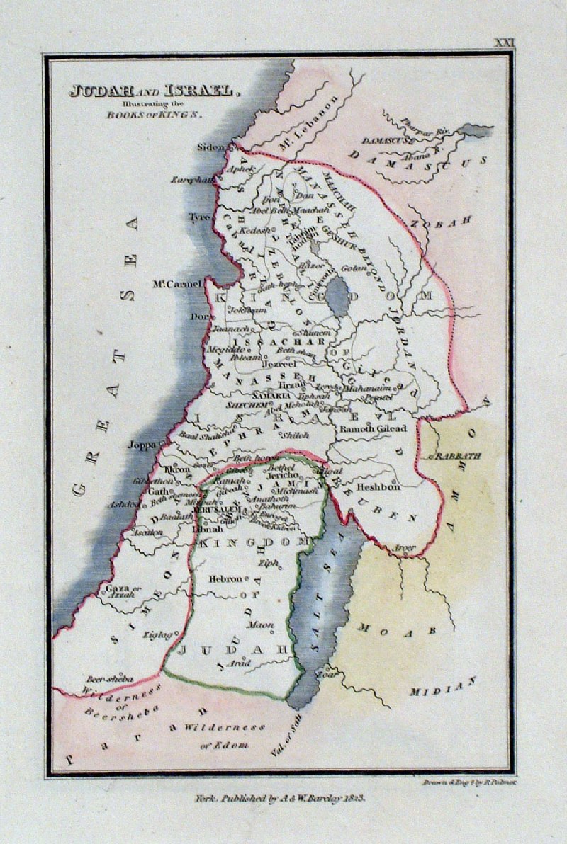 |
Judah & Israel Illustrating the Book of Kings R. Palmer for A & W Barclay 1823 size: 110 x 160 mm Ref GHM056 £15.00 (+P&P) click image for enlargement |
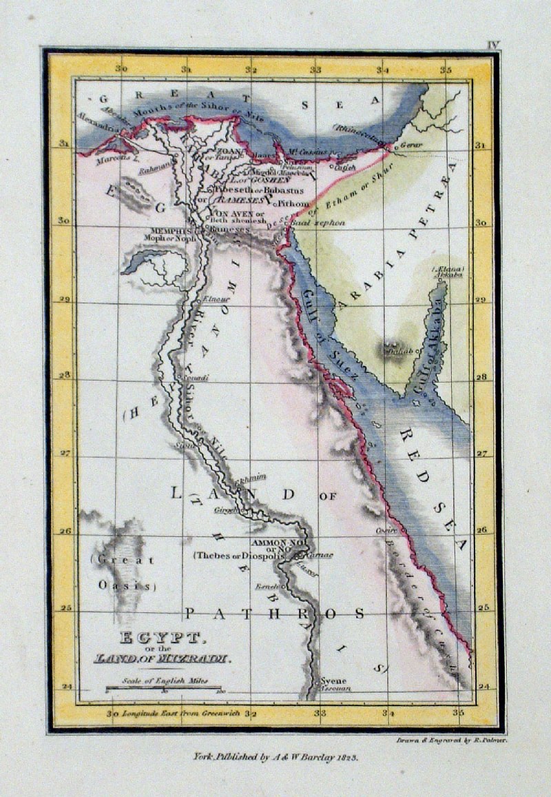 |
Egypt or the Land of Mizraim R. Palmer for A & W Barclay 1823 size: 110 x 160 mm Ref GHM039 £15.00 (+P&P) click image for enlargement |
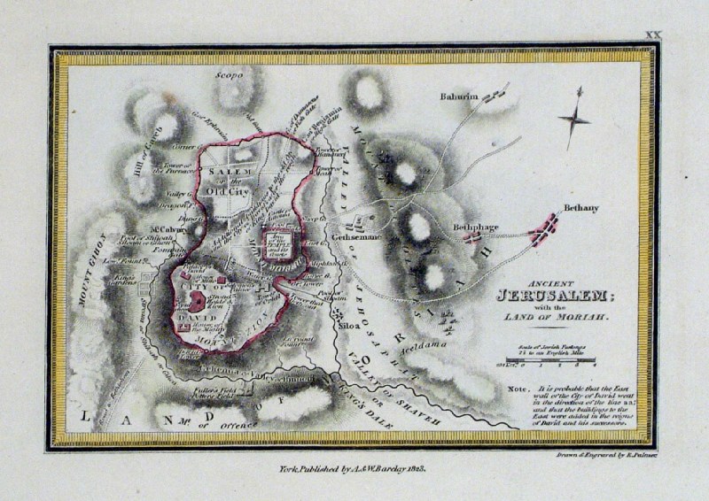 |
Ancient Jerusalem with the Land of Moriah R. Palmer for A & W Barclay 1823 size: 110 x 160 mm Ref GHM055 £20.00 (+P&P) click image for enlargement |
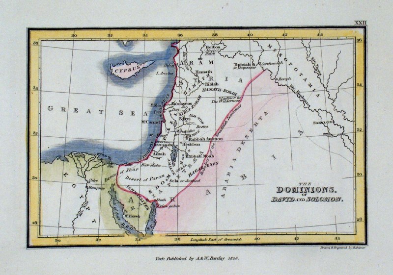 |
The Dominions of David and Solomon R. Palmer for A & W Barclay 1823 size: 160 x 110 mm Ref GHM057 £15.00 (+P&P) click image for enlargement |
 |
Journeying of the Israelites from Egypt to Canaan
Johnstone / Blackie c1870 size: 190 x 150 mm Ref GIM040 £16.00 (+P&P) click image for enlargement |
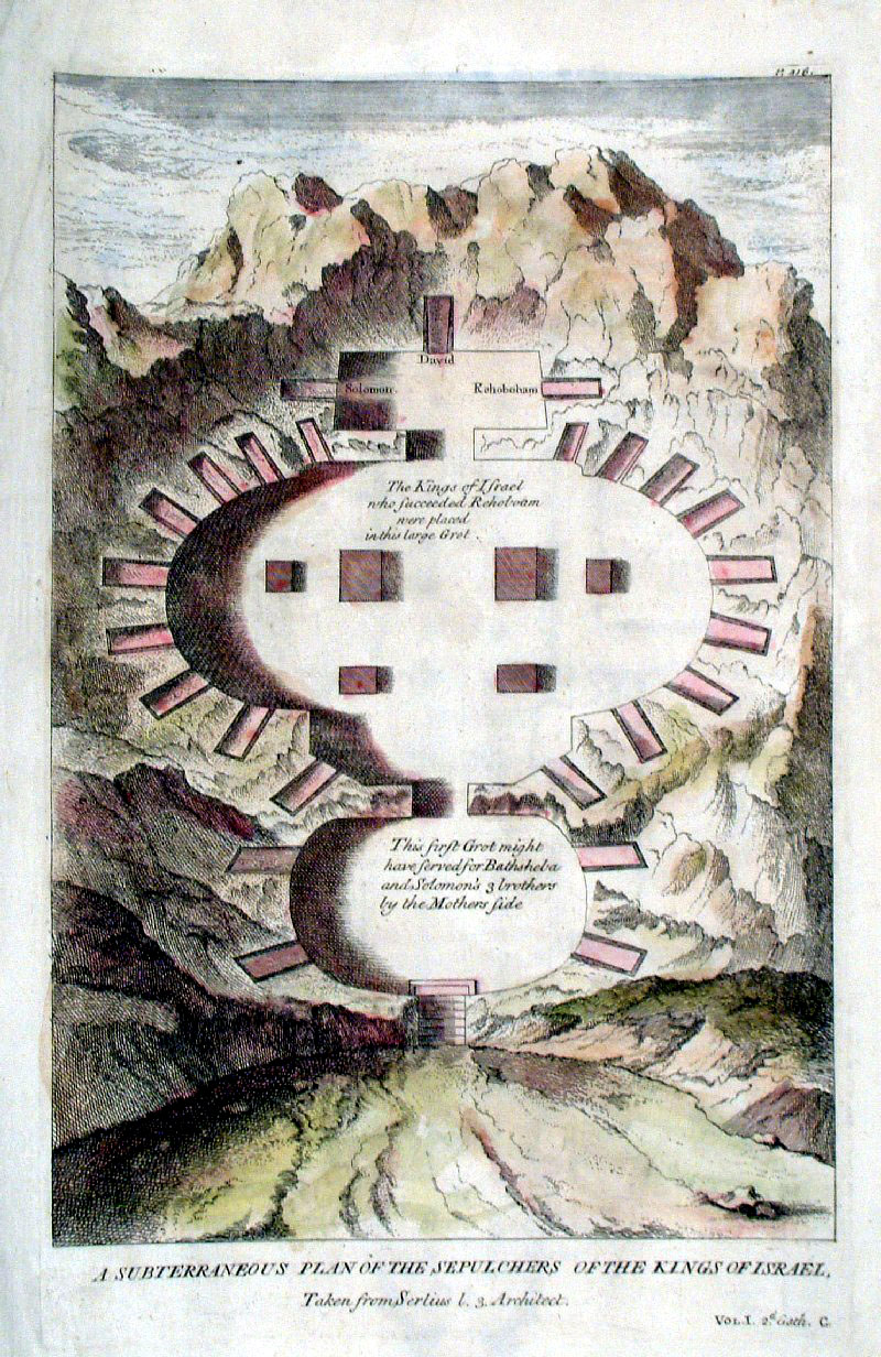 |
Subteraneous Plan of the Sepulchers of the Kings
of
Israel c1780 unknow source c1780? Copper Engraving size: 210 x 320 mm Ref GIP007 £18.00 (+P&P) click image for enlargement |
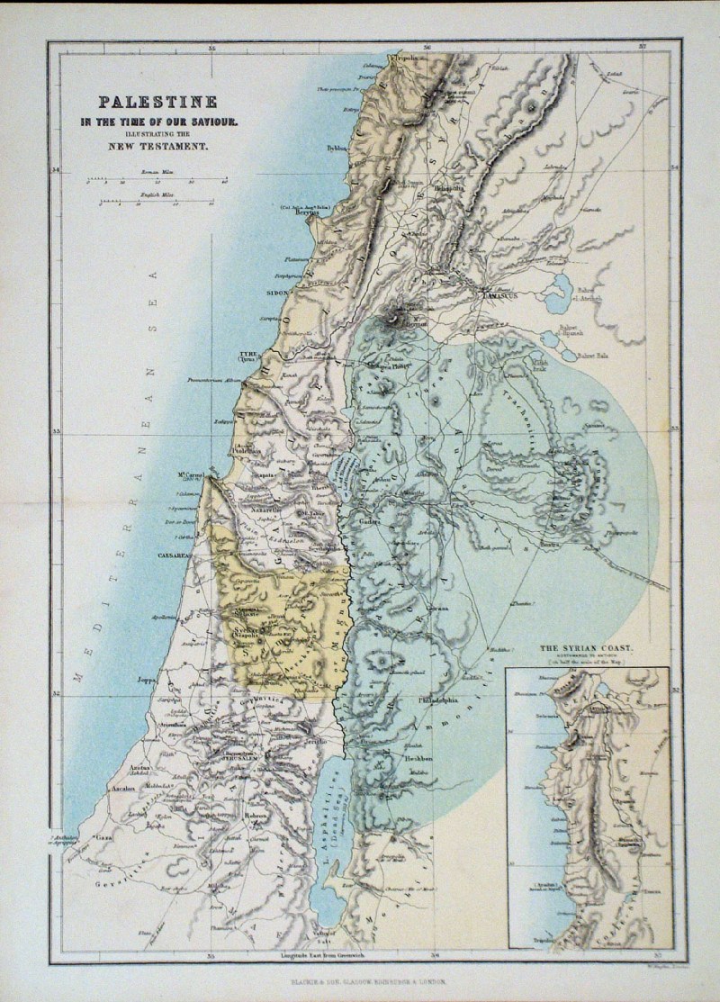 |
Palestine in the Time of Our Saviour
Hughes / Blackie c1860 size: 230 x 330 mm Ref GJM022 £18.00 (+P&P) click image for enlargement |
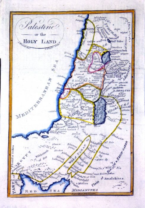 |
Palestine or The Holy
Land Kincaid / Fraser 1797 (watermark) Ref NLM007 £24.00 (+P&P) size: 160 x 220 mm click image for enlargement |
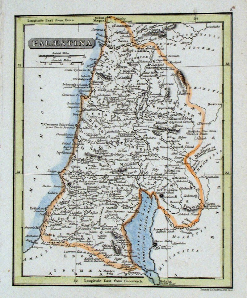 |
Palestine
Fenner
1828 Ref GIM019 £15.00 (+P&P) size: 150 x 130 mm click image for enlargement |
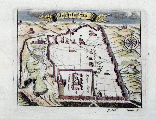 |
Jerusalem anon
1712 Ref HCM017 £25.00 (+P&P) size: 110 x 90 mm click image for enlargement |
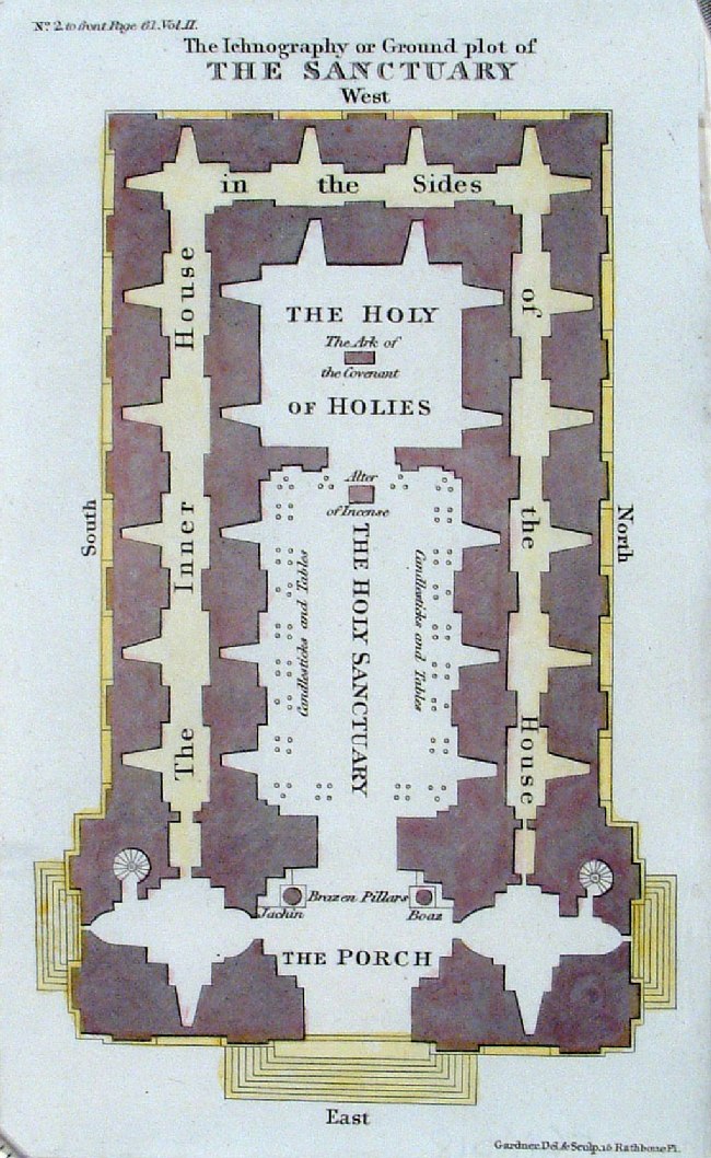 |
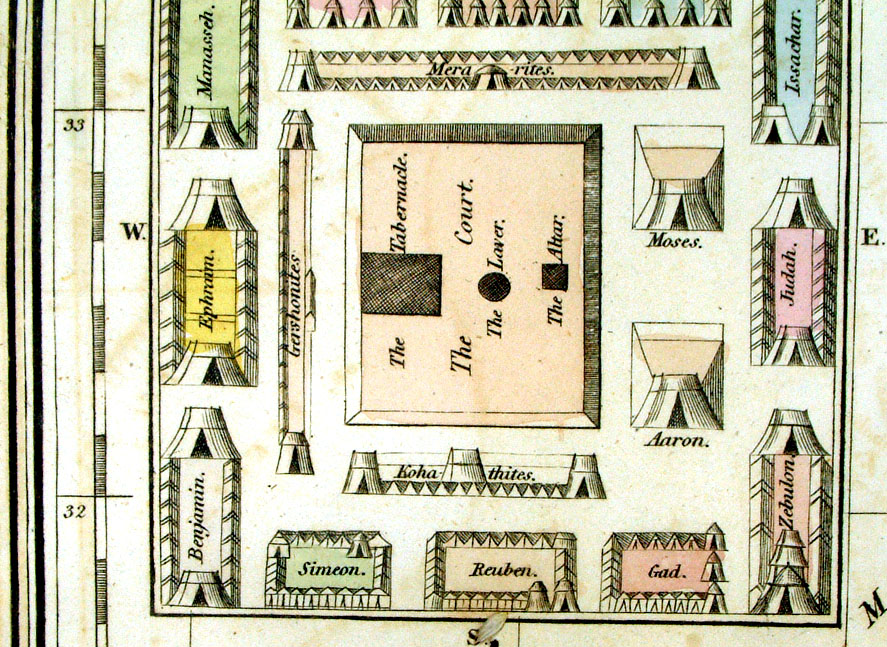
The Ichnography or Ground Plot of the Santuary detailing the Holy of Holies and the Ark of the Covenant. Gardener / Edward Wells 1828 Ref HCM018 £18.00 (+P&P) size: 110 x 170 mm click image for enlargement |
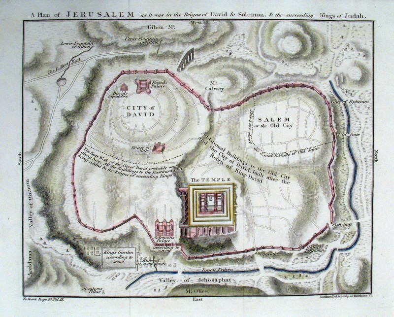 |
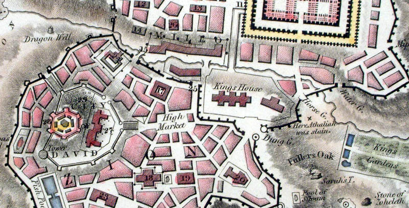
A Plan of Jerusalem in the Reigns of David &
Solomon Gardener / Edward Wells 1828 Ref HCM020 £24.00 (+P&P) size: 200 x 170 mm click image for enlargement |
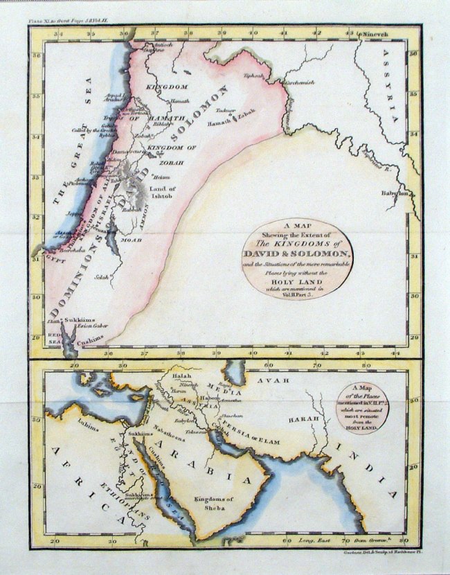 |
A Map Shewing the Extent of the Kingdoms of David
&
Solomon Gardener / Edward Wells 1828 Ref HCM021 £16.00 (+P&P) size: 200 x 170 mm click image for enlargement |
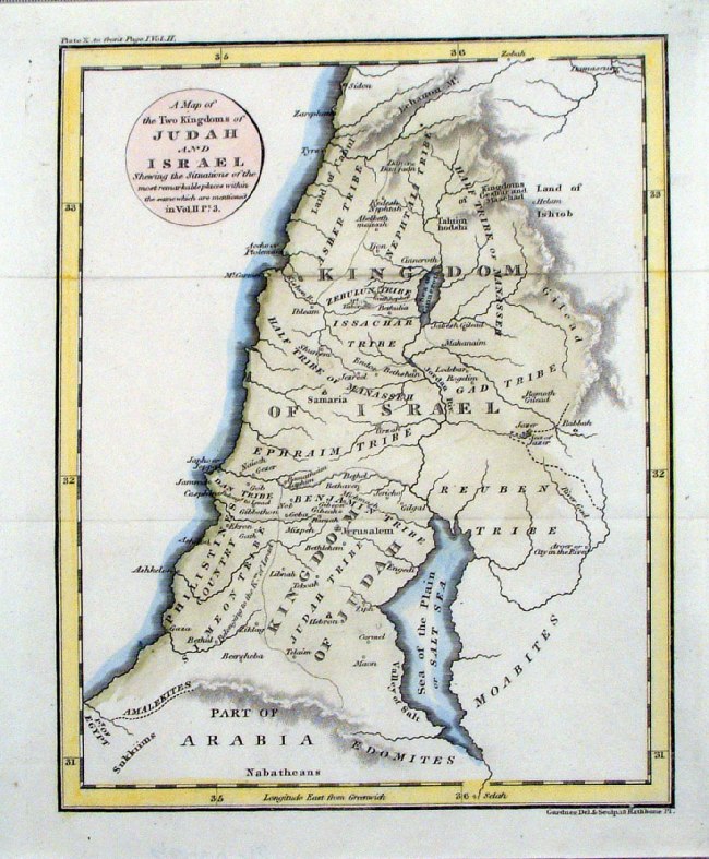 |
A Map of the Two Kingdoms of Judah and Israel Gardener / Edward Wells 1828 Ref HCM023 £16.00 (+P&P) size: 200 x 170 mm click image for enlargement |
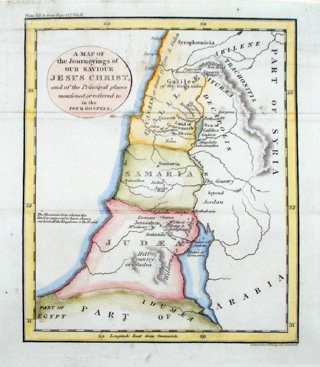 |
A Map of the Journeying of Our Saviour Jesus
Christ ... Gardener / Edward Wells 1828 Ref HCM020 £16.00 (+P&P) size: 200 x 170 mm click image for enlargement |
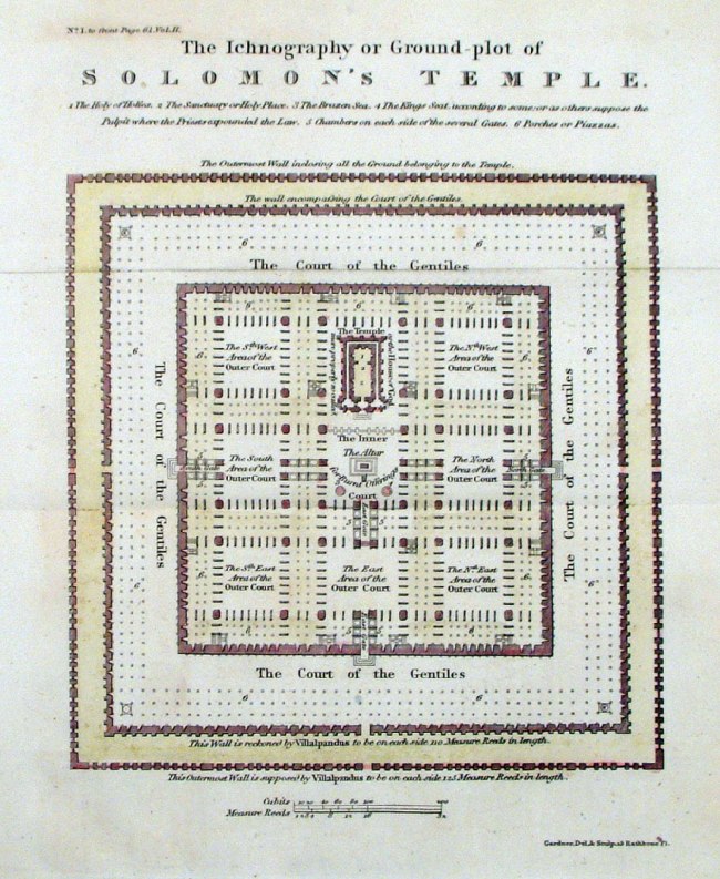 |
Ground Plot of Solomon's Temple Gardener / Edward Wells 1828 Ref HCM024 £18.00 (+P&P) size: 200 x 170 mm click image for enlargement |
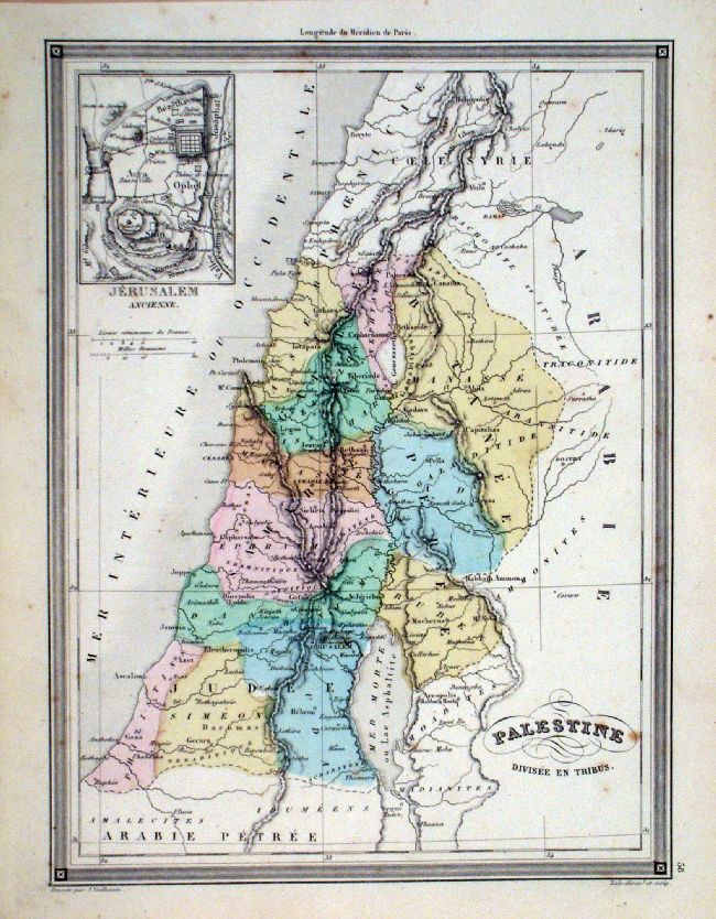 |
Palestine divisee en Tribus.
(inset
of ancient Jerusalem) Vuillemin 1851 size: 280 x 210 mm a few faint foxing spots Ref JDM061 £16.00 (+P&P) click image for enlargement |
| All Genuine Antiquarian Maps - No Reproductions or Modern Copies |
2023