General Information Page on Curiosities | |
| 01 |
Sponsors, patrons and marketing. Back in ancient times, as
today,
publishing was expensive and a writer sometimes needed deep pockets to
get a book printed and distributed. Some had wealthy friends and with
the promise of a full page preface of grovelling praise and adulation a
deal could be done on financing the work.
If this failed there was a Plan B - to sell off an appearance on a
specific map. If there was to be 30 or 40 maps to a work the
financial burden could be spread accordingly, and each sponsor would
only be required to contribute a small proportion of the total
cost. The patron, proud of the mention in such a modern
publication, would show the work to all friends and visitors, thus
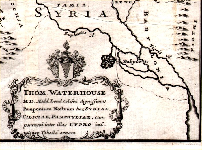
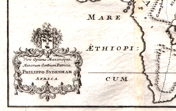
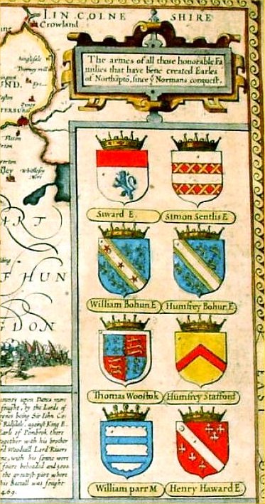
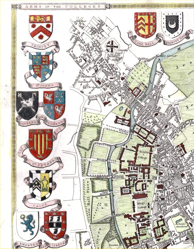
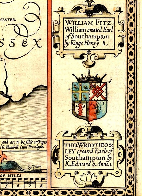
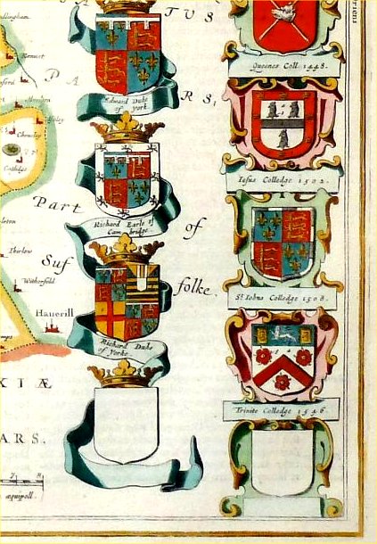
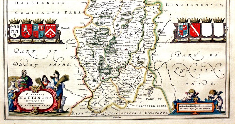
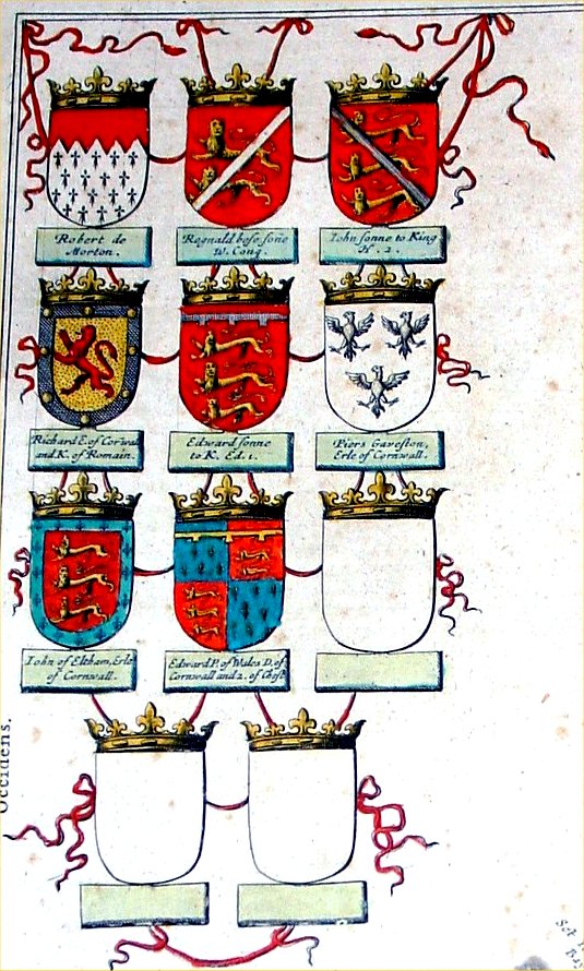
propogating an advertising campaign. With some maps it was a personal dedication placed close to the title or cartouche - Example Example With gentry, aristocracy and prestigeous establishments it was the placing of their coat of arms around the edge of a map - Example Example Example Some maps can be seen with empty shields and this is assumed to be either anticipation of new sponsors or a promise of sponsorship that did not materialise with hard cash. Example Example Example |
| 002 |
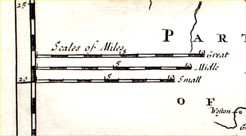
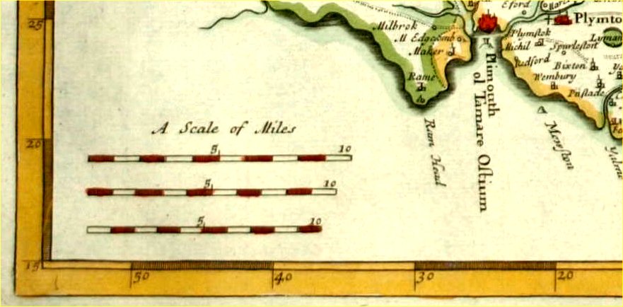
Mile markers on maps. This is the tale of a situation
that has resulted in a lot of confusion when investigating the history
of a village in Kent. John Ogilby's set of road maps produced in
1675 showed mile markers along each road. Our target village,
Pembury, was shown on the London to Rye map, and this was copied for
over 100 years as a valuable aid in the days of coaching.
Comparing the locations of the 1675 Ogilby mile markers with the modern
OS maps, and further with the actual location of milestones on the
ground, highlighted a half mile error on all locations. The full, gory
details are explained via the link below, but the outcome was: Ogilby's
surveys started their measurements from Cornhill in London, and they
were just spots on maps - there were no milestones. Some years
later when all major roads were compelled to have milestones the new
survey claimed its origin, for the London to Rye map, as the south side of London Bridge - half a
mile short of Cornhill. Full details - http://pembury.org/history/localities/milestones/ Ogilby's maps did adopt the 'standard' mile of 1760 yards from the wide variety of miles on offer at the time. Scale images - Example 1 Example 2 For more search Wikipedea on 'Mile' |
| 003 |
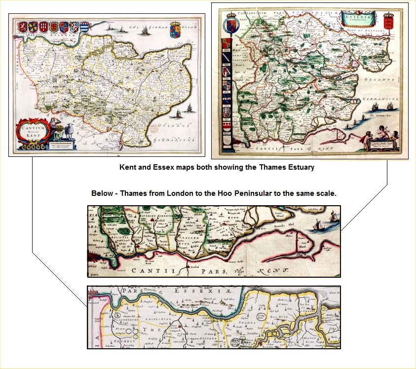
Scale and accuracy. This was
never a strong feature on old maps. It's easy to give them the benefit
of the doubt with crude survey techniques, but to give different
interpretations of the same features in the same atlas is sloppy
workmanship. Speed, Blaeu, Jansson and a whole bunch of others are guilt
of this practice. A typical instance is the River Thames running
eastward from London toward the North Sea. Essex is to the north
and Kent is to the south, so it is reasonable to expect the shape of the
river to be the same on the Essex and Kent maps. Well, it
isn't. When these maps are hanging on a wall, side by side,
the comparisons become noticeable and the mind begins to ponder if the
Kent/Sussex border is similar on those two maps or how Norfolk aligns
with Suffolk. The Thames from London to the Hoo Peninsular. |
| 004 |
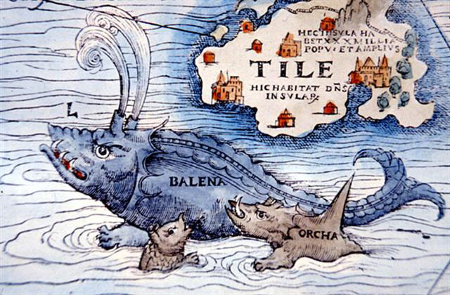
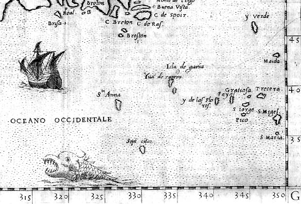
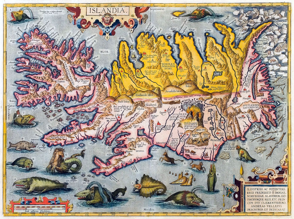
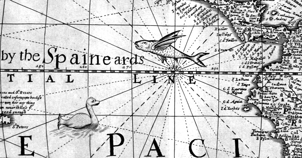
Sea monsters, devils and dragons. A fun part of
investigating old maps - particularly for newcomers and the young.
There were no claims of 'here be dragons' or 'here be sea monsters' -
that's the stuff of fantasy comics and fiction novels. These were
just visual embellishments to fill the blank space occupied by sea and
ocean. As with ancient maps of Africa and Asia when there was no
data to fill empty voids they made it up - inventing mountains and
rivers to avoid the displeasure of empty space. The sea area was
populated with cartouches, scales and tables and when there was still
space to fill they introduced sailing ships and sea creatures.
It's generally far off lands that attract these monsters, inferring a
danger and excitement of undiscovered shores. For some reason maps
of Iceland attract lots of sea monsters. Here's a selection - Example1 Example2 Example3 Example4 Example5 Example6 Example7 |
| 005 |
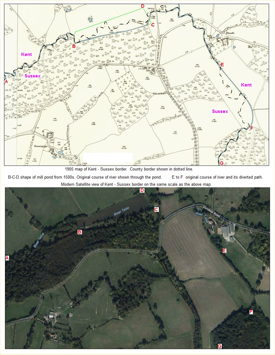
Borders and Boundaries. In
ancient times many counties, states and administrative regions were
limited at geographic features - rivers, mountain ranges, lakes,
etc. It was easy to determine and easy to police - you stay
that side and I'll stay
this side. There are many cases of the geographic feature moving
and the maps reflecting the original boundary. In our test case,
linked below, we have the boundary between
Kent and Sussex in the south east of England. For several miles the
boundary is determined by the course of the River Tease with Kent to the
north and Sussex to the south. At one point the boundary is seen to
wander through the middle of a pond and at another point the river is
seen to have a diversion from the boundary. In the 1500s there
were lots of small iron forges and furnaces in this part of the world,
mostly supplying iron for cannons and guns. The river was damned to
create a pond for the iron works, and the pond still exists today. The
original course of the river can be seen by the county border wiggling
through the pond. The other feature to the east of the mill pond
is the deliberate straightening of the river away from its original
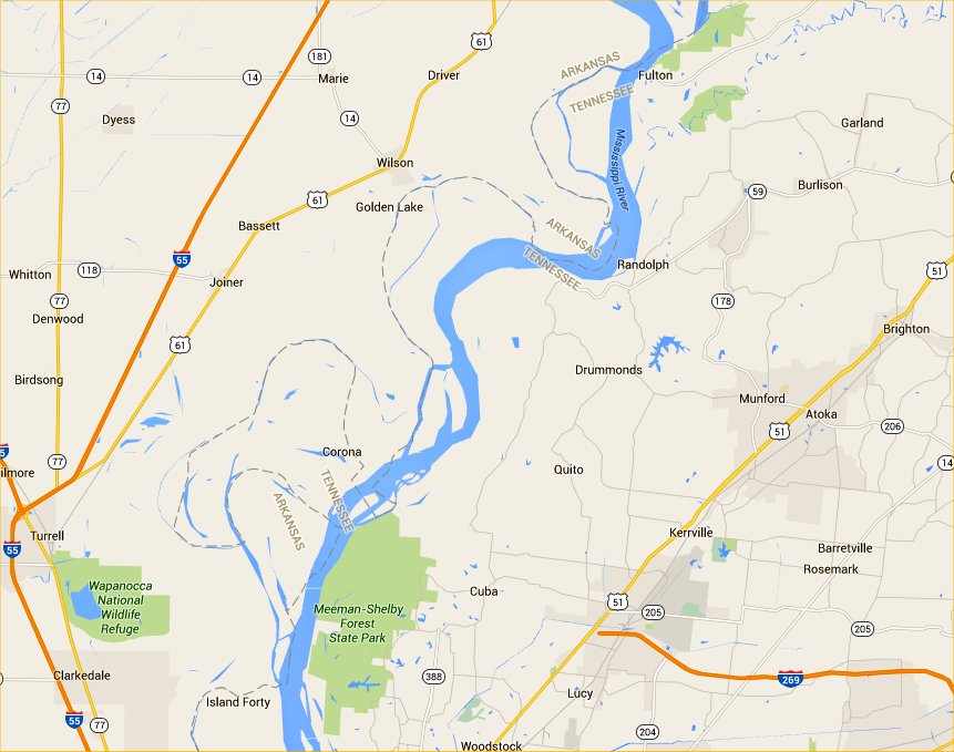
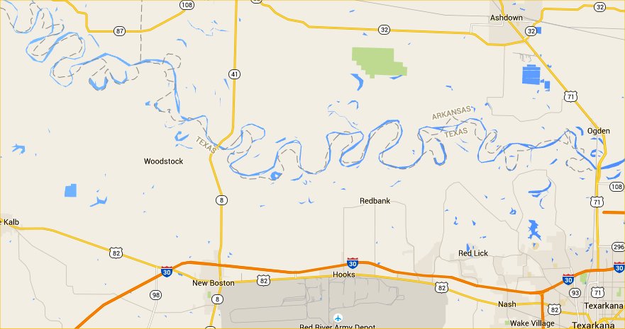
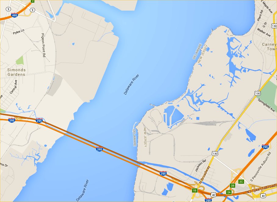
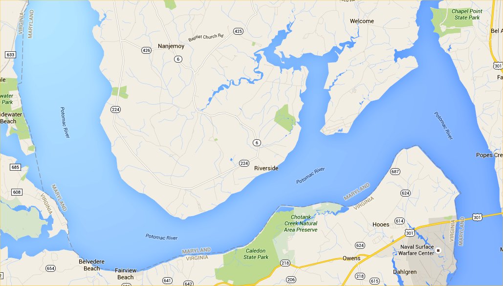
county line. Link to Kent/Sussex boundary. Deviation from old river alignments is best exhibited by the Mississippi River and the Red River in the USA. Examination of the state lines either side of the river will show how the course has changed over the years, but the state borders reflect the course when the original surveys were mapped. Examples from modern Google maps - Mississippi Red River Some US states suffer aggravation from their borders not following the centre of a river - a very ungentlemanly attitude. A few claim state possession up to the far shore of the neighbouring state, effectively claiming the full river width for themselves. This causes legal issues when folk on the far shore erect a pier or jetty from their property, or in some cases when the folk on the far shore try some land reclamation to push the shore line out. Lawyers would then pounce on the far shore folk for rent, land taxes and other miseries. Examples from modern Google maps - Delaware-New Jersey Maryland-Virginia |
| 006 |
|
|
Link to Never Trust a Map - A page of cartographic errors. |