General Information Page on Cartographic Mistakes
|
|
| 001 |
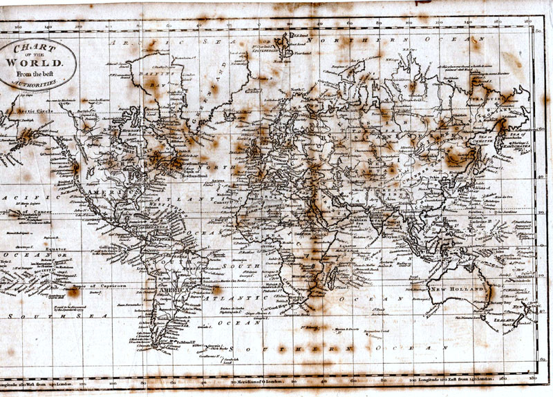
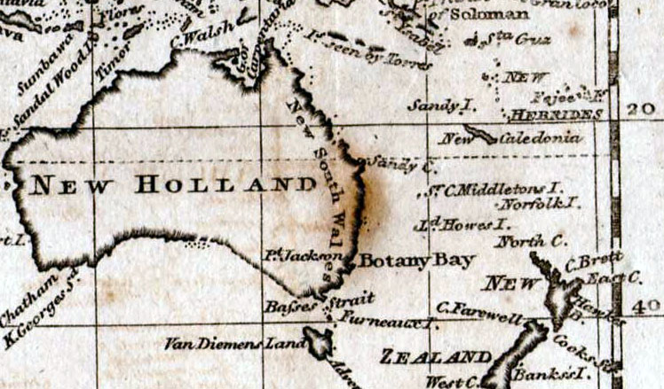
Sandy Island The attached article appeared in an old National Geographic. It tells of an island appearing on maps, and in atlases, from years back, and in 2012 a survey showed it did not exist. An earlier map featuring Sandy Island recorded by Jason Musgrave - Russell c1800 Detail |
| 002 |
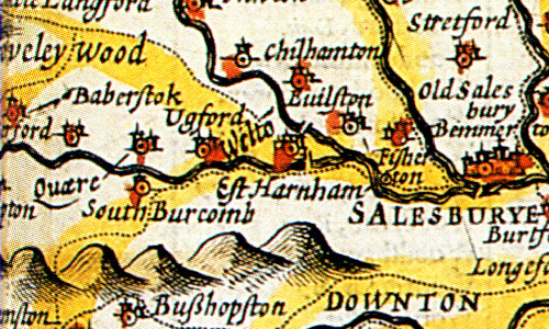
Quare, Wiltshire The John Speed map of Wiltshire (1610) shows a town called Quare, due west of Salisbury. This is thought to be 'query' regarding the name lost during an earlier survey. It was a note to check the name and have it entered correctly on the map prior to printing. It did not happen. That map and subsequent maps showed the town of Burcombe as Quare. This error went uncorrected for nearly 150 years - Emanual Bowen’s map of 1755 was the first to show it as Burcombe. |
| 003 |
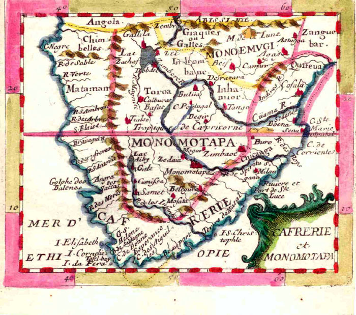
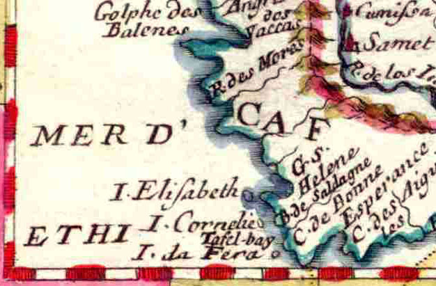
Il de Fera, South Africa Detail While writing my book on the miniatures of Southern Africa (should be
published this year [2014]), I discovered a mythical island of the Cape Peninsula (Il
de Fera) that Du Val introduced in 1660, and which was repeated until 1702, by
Hoffmann, Mueller and Morden (I am looking for the 1st state of his map - which
was inexpertly altered in the 2nd state and it looks like he deleted the island
inter alia - I can see the island but not the name).
Roger Stewart, Cape Town
|
| 004 |
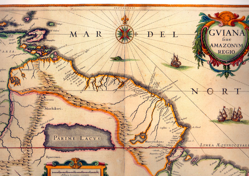
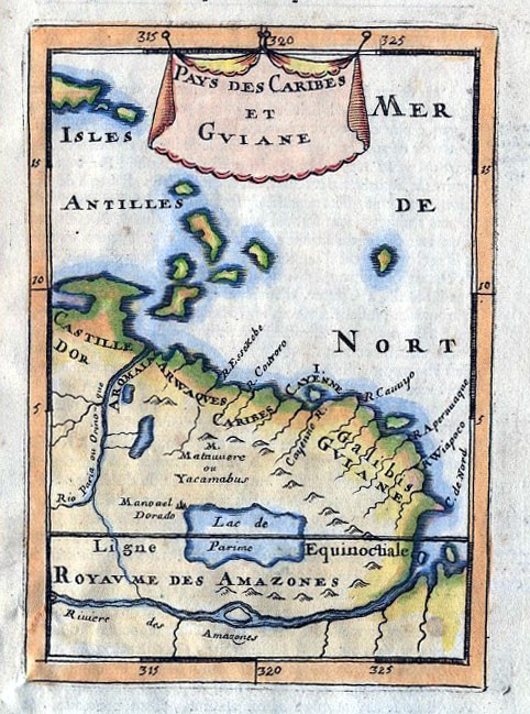
South American Lake "Parem Lacus" Example 1 Example 2 Sitting just above the equator along the Brazil / Guyana / Surinam border. Fictitious lake appearing on 17th century maps to give the impression the interior had been surveyed. |
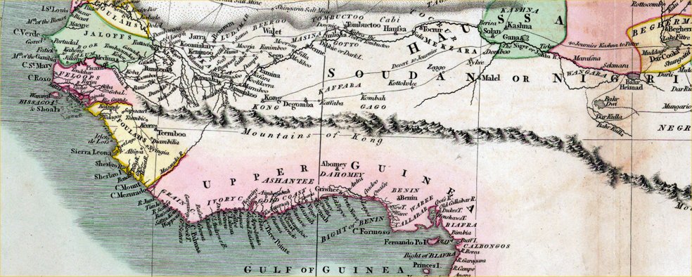
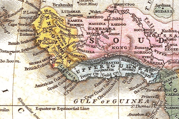
| 005 |
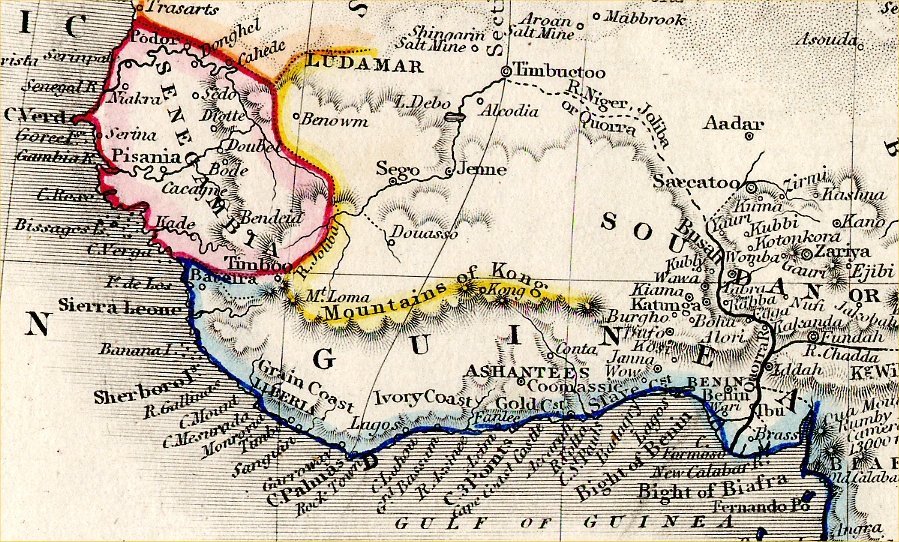
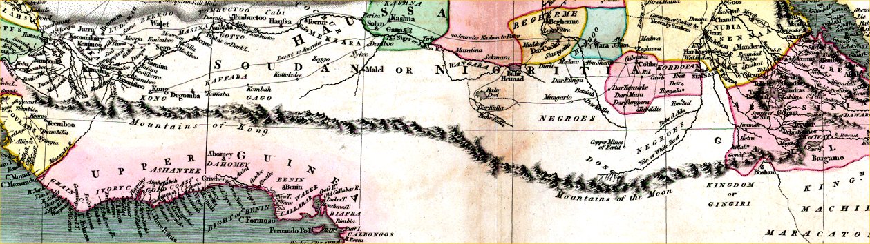
The Mountains of Kong. Example 1 Example 2 Example 3 A wonderful example of a cartographer filling in a blank space on a map with pure fantasy. As with most early maps of Africa the coast was well documented and the interior a blank because nobody had investigated. An explorer called Mungo Park placed these imaginations on a map in 1798 and they were reproduced on other various maps of Africa until the 1880s. John Cary's map of 1805 had the mountain range extending across the continent to join the Mountains of the Moon near Ethiopia (see next item). |
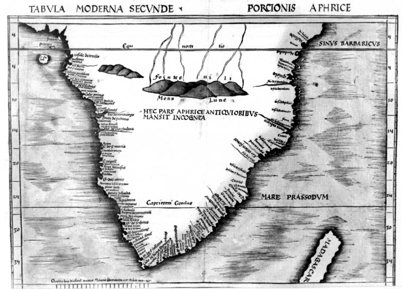
| 006 |
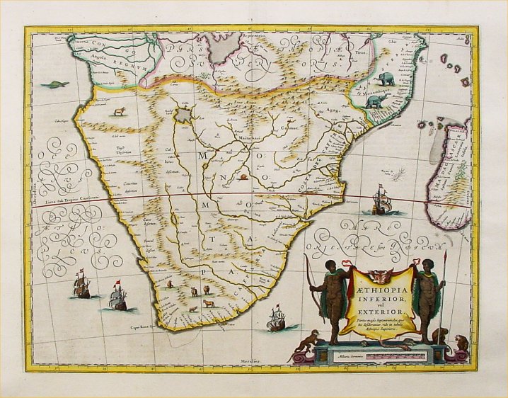
The Mountains of the Moon. Example1 Example2 Example3 Example4 (shown as Montes Lunab or Mons Lune) Legendary nonsense from ancient times describing the mountains at the source of the Nile. All early maps of Africa show this feature and it's origin is thought to be from Ptolemy's writings in ancient Greece. John Cary could not resist the temptation to link it to the Mountains of Kong on his 1805 map of Africa - Example Modern writers are still wasting time pondering this story and think it may be the Rwenzori Mountains or Mount Kilimanjaro - jury still out. |
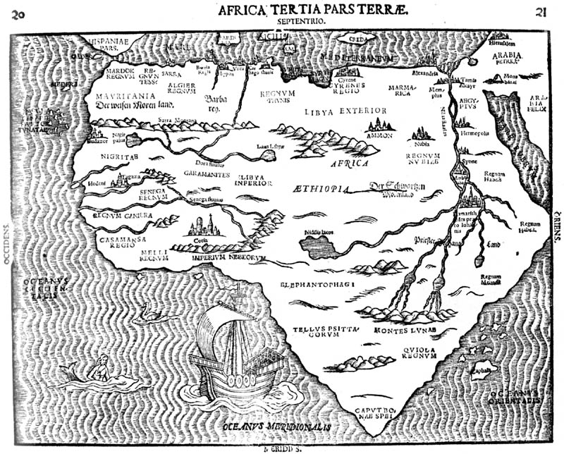
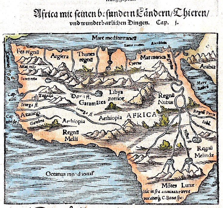
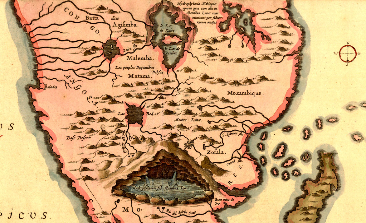
| 007 |
The Interior of Africa Example The Blaeu map of Southern Africa (c1640) shows the extent of filling in the empty spaces with imaginary lakes, rivers and mountains. Most maps of Africa of this period were just as bad at describing the interior. Many cartographers and publishers would cram the interior with home spun features in an effort to project an impression of having the latest survey data from recent expeditions - it was not good form to declare geographical ignorance on highly priced maps. |
| 008 |
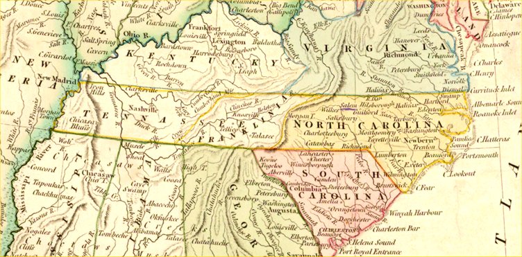
The state of Franklin in the USA. Example Around 1784 a new state of Franklin was proposed - slicing the east side of Tennessee up to North Carolina. Congress rejected the proposal but not before some enthusiastic map makers embedded it into their latest creations. A full record of this episode in history is available on Wikipedia under 'State of Franklin'. |
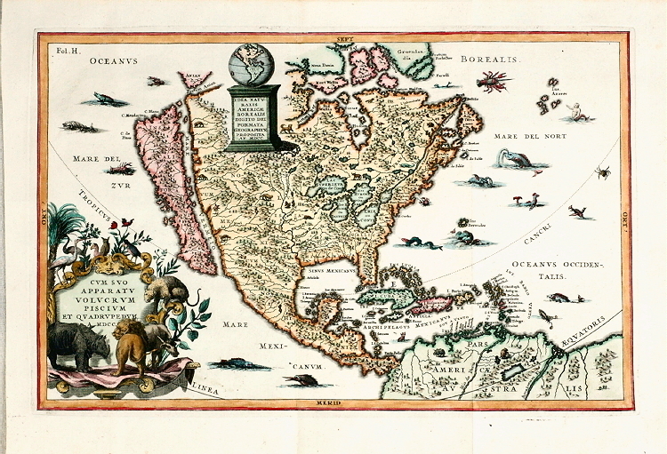
| 009 |
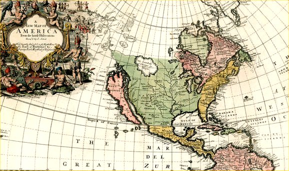
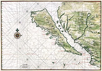
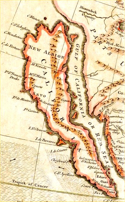
California as an Island Example 1 Example 2 Example 3 Example 4 Well documented error. Numerous examples through the 16th, 17th and 18th centuries. See Wikipedia for full history. |
|
Link to Curiosities on Antique maps |