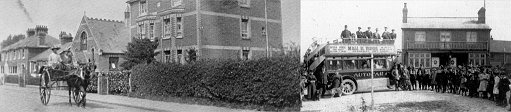
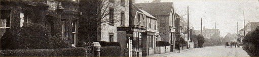
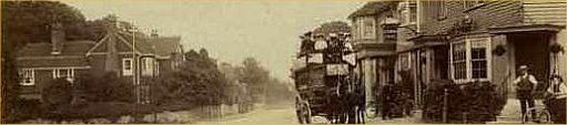
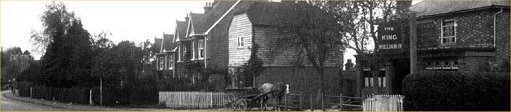
Localities
- Lower Green
This page deals with
old maps of Lower Green from 1868 to 1936
The old map is shown on the left and the modern day
(2010) equivalent is shown on the right.
In each pairing you will always see the same modern
map on the right.
Care has been taken to scale each map so that a good
visual comparison of old to new is achieved.
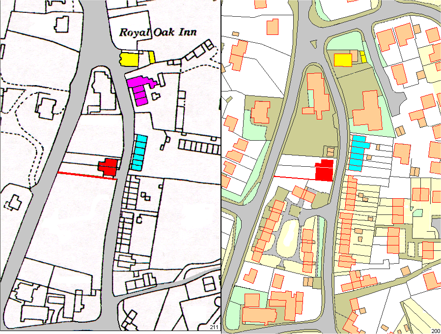
Four landmarks have been colour coded in all maps as
standard references.
Yellow – the Royal Oak public house and its rear
out-building.
Light Blue – set of six houses – here referred to as
the ‘Set of 6’
Red – No 81 & No 79 Henwood Green Road in
later map.
Magenta – Block of 4 houses – demolished for
surgery car park.
Red – ancient field boundary across the green at
southern boundary of 81 Henhood Green Road.
The scale of each map section is approx 170 x
230 metres.
..Some items have been sent from
a multitude of contributors, and as such it has been
difficult to establish precise publication details.
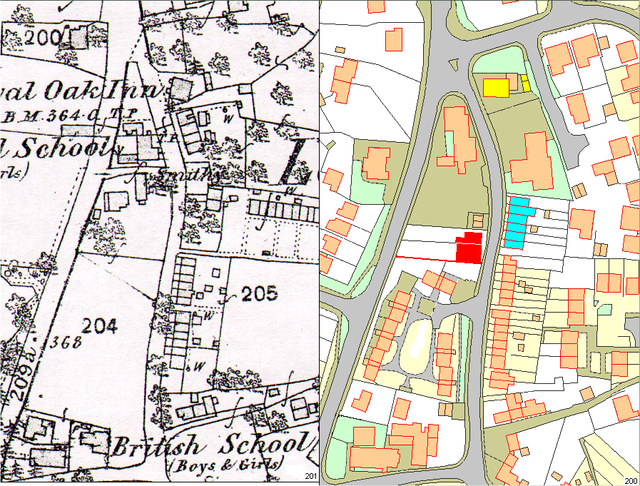
Above
– The basic maps before too much manipulation
Below – 1868 map with clutter and unnecessary detail
removed.
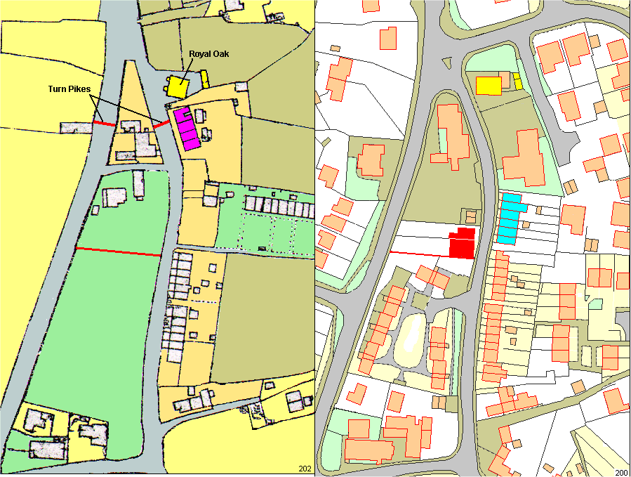
Above – The 1868 map
has had unnecessary detail removed and has had some
colour added.
Note two Turnpike gates marked in red – these were
for collecting road toll fees.
Note the field division marked in red – this follows
down through the decades to today as a property
boundary.
The placement of the Royal Oak shows it at a
slightly different angle to that in later maps.
The two notches at the front of the Royal Oak are
taken to be the bay windows.
The top of the Lower Green triangle is more pointed
than in later maps. It projects well past the Royal
Oak.
The Smithy is taken to be the rectangular building
aligned north-south.
There is an access path between Lower Green Road and
Henwood Green road.
..
Above – The basic
1897 map before too much manipulation.
Note ‘W’ next to a dot usually meant a well.
Later maps do not show this feature.
Below – 1897 map with clutter and unnecessary detail
removed
Above – The 1897 map
shows the addition of a Smithy or blacksmith’s
workshop and a set of 3 houses down the road.
It is not clear if the Smithy is the square building
or the rectangular building, or both.
The 3 houses (light blue) are the first in the ‘Set
of 6’ Today’s numbering would be 174, 176, 178
The block of 6 to the south of these three are Nos
162 – 172
Block 118-124 has been extended. The extension of
the house closest to the Royal Oak is the Butcher’s
shop.
..
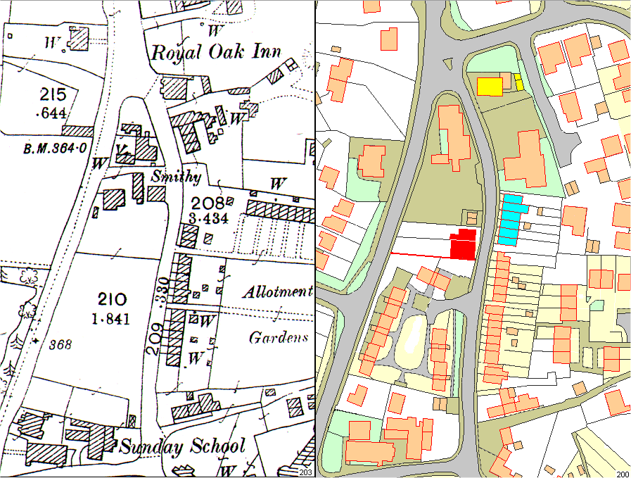
Above – This is
the uncluttered version of the 1909 map.
3 more houses have been added to complete the ‘Set
of 6’ Now running 174
– 184.
Waterfield House (Doctors) in 186.
Royal Oak is 216. This leaves 118
to 214.
The Smithy is still on the map. The
building to the far left has been identified as the
Smithy’s house.
It is assumed that the centre and right buildings
are the blacksmith’s workshops.
..
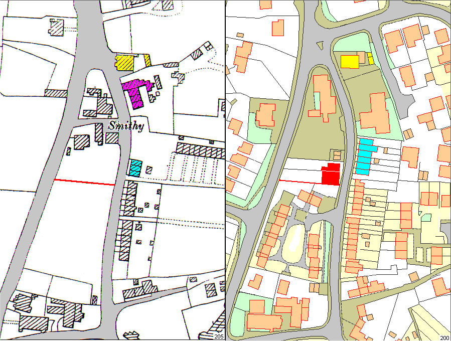
Above – This is the
uncluttered version of the 1936 map.
Two new houses, marked in red, have been added to
Henwood Green Road..
House numbers are No 79 and
81. No 81 was later
sub divided to create No 81a at the southern
boundary.
These houses were used as a variety of shops, bakers
and grocers.
Smithy gone. Access path closed. Site now
(2013) used as library car park
118-124 later demolished for doctors’ surgery.
As these maps are being prepared (2013) there is
talk of demolishing the Royal Oak for more houses.
..
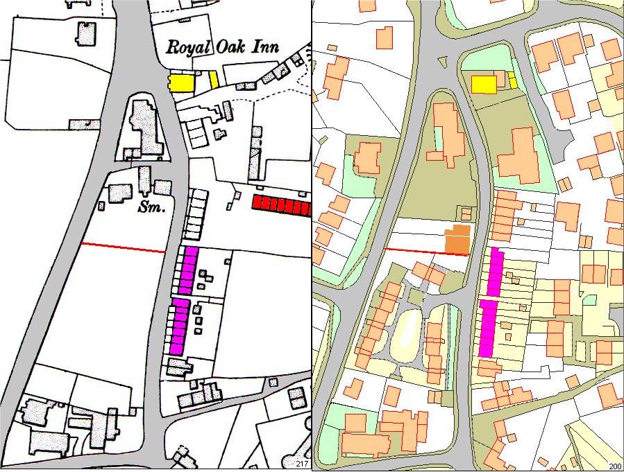
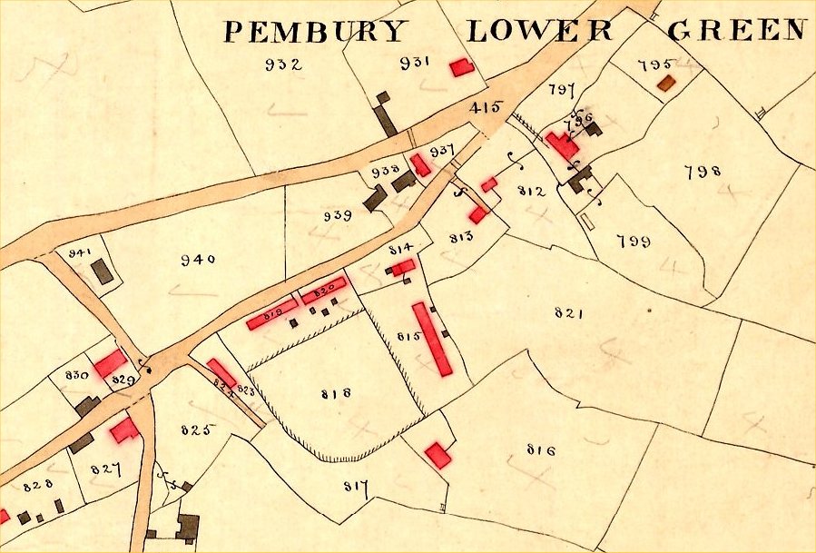
Above – the locations of Slate Row (Magenta)
and Red Row (Red)
..
Scaling,
cropping and preparing maps for this kind of
presentation.
The scaling of these maps was determined by
cropping from far larger digitised maps using these
rules:
Trusted feature ‘A’ is selected as the start point
–
Bottom-left corner of cropped map is determined as
the lower-left ‘point’ of the Lower Green triangle –
Lower Green Rd / Romford Rd Junction.
If the road junction is shown rounded, make an
assumption as to where the point should be.
A ‘Trusted Feature’ is something that appears on
all maps under comparison – a road junction, corner
of a church or pub, etc.
Trusted feature ‘B’ is selected as the vertical
axis stop point –
The top of the map cuts through the lower-right
corner of a very old house called ‘Queens Folly’
that will appear on maps of all ages.
This has set the top to bottom limits of the map.
There is no trusted feature to the right that is
convenient on all maps, so a random feature was
selected.
This defining of the right hand side of the map gave
an aspect ratio (width / height) of 0.664.
For fresh maps crop the width of the image to 0.664
of the height of the image. Most image processing
programs dynamically show this ratio.
The image size is then reduced to a width of 450
pixels so that all maps appear on the screen the
same size and to the same scale.
Whenever manipulating old and new maps be sure to
determine trusted features that will appear on all
maps as references.
The ratio of 0.664 and image width of 450 pixels
were convenient for this project. Other projects
will require something different...
Tony Nicholls
2013
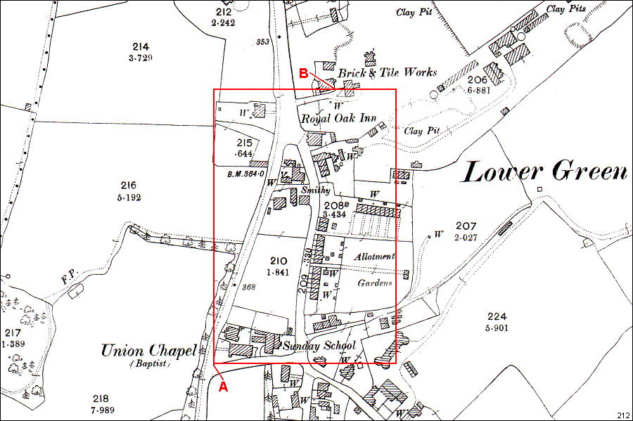
Above – the Lower Green area from the 1840 Tithe
Map – orientation is sort of NW
Location 415 is the
junction of Lower Green Road and Henwood Green
Road. 941 to 825 is Romford
Road.
Taken from Kathryn Franklin’s notes on the Tithe
Schedule –
Black – data from
schedule
Red – comments by Kathryn Franklin
Green – supplementary comments by Jeni
Beviere & Jane Grooms
795 – House &
Garden (The
Forstal) (demolished)
796 – Farm House & Buildings (later Queen’s Folly)
812 – House & Meadow – William
Allcock (tenant) –
Royal Oak
813 – House & Garden – John
Bridger (house
demolished)
814 – 2 houses & Garden (house demolished)
815 – 10 Houses & Garden – Red Row (demolished)
816 – Hop Garden & House – house not there in
1900
817 – Meadow
818 – Meadow
819 & 820 – 12 Houses & Garden – Slate Row
823 – 3 Houses & Garden – Cottages & Kebab shop
827 – House & Buildings – Rose Cottage (& Laurel
Cottage later)
828 – 2 x House & Garden – ? Waterloo Cottage
Gibralter
Cottage. Waterloo Cottage is 832 – off
this map.
829 – 2 x House & Garden Myrtle Cottage
931 – House & Orchard (later Chippings)
937 – Gate House & Garden – Library site
938 – Parochial School & Yard
– Library site
939 – House & Shop (smithy)
941 – Chapel & Yard – Baptist Church
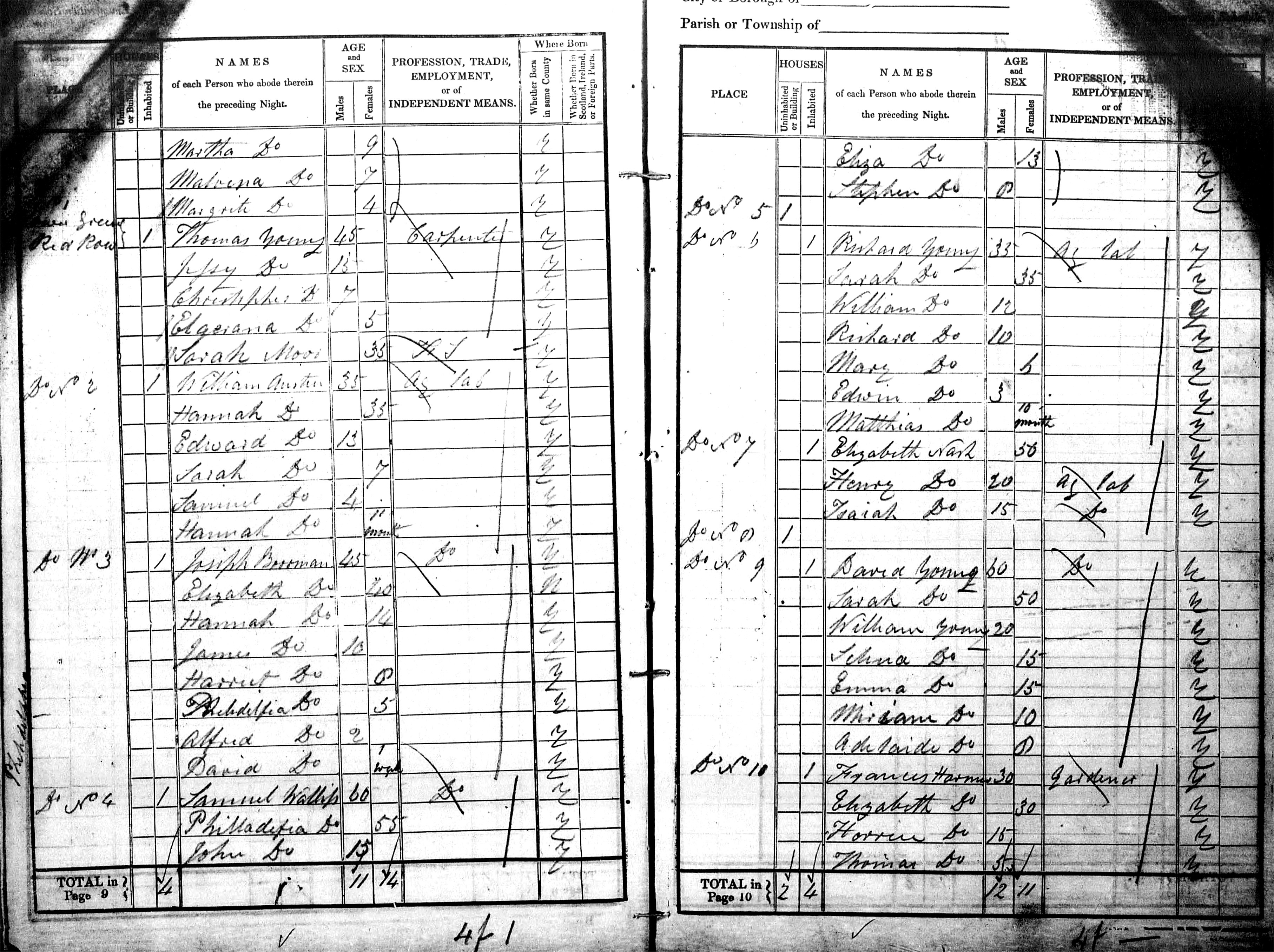
The following Census records
for 1841 tries to identify the occupants of Slate Row
and Red Row.
In these documents Slate Row is referred to as
'Larkins Row' - Larkin being the owner.
( The
Pembury Windmill
page shows a map of the landowners in this part
of Pembury )
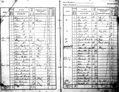
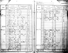
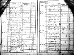
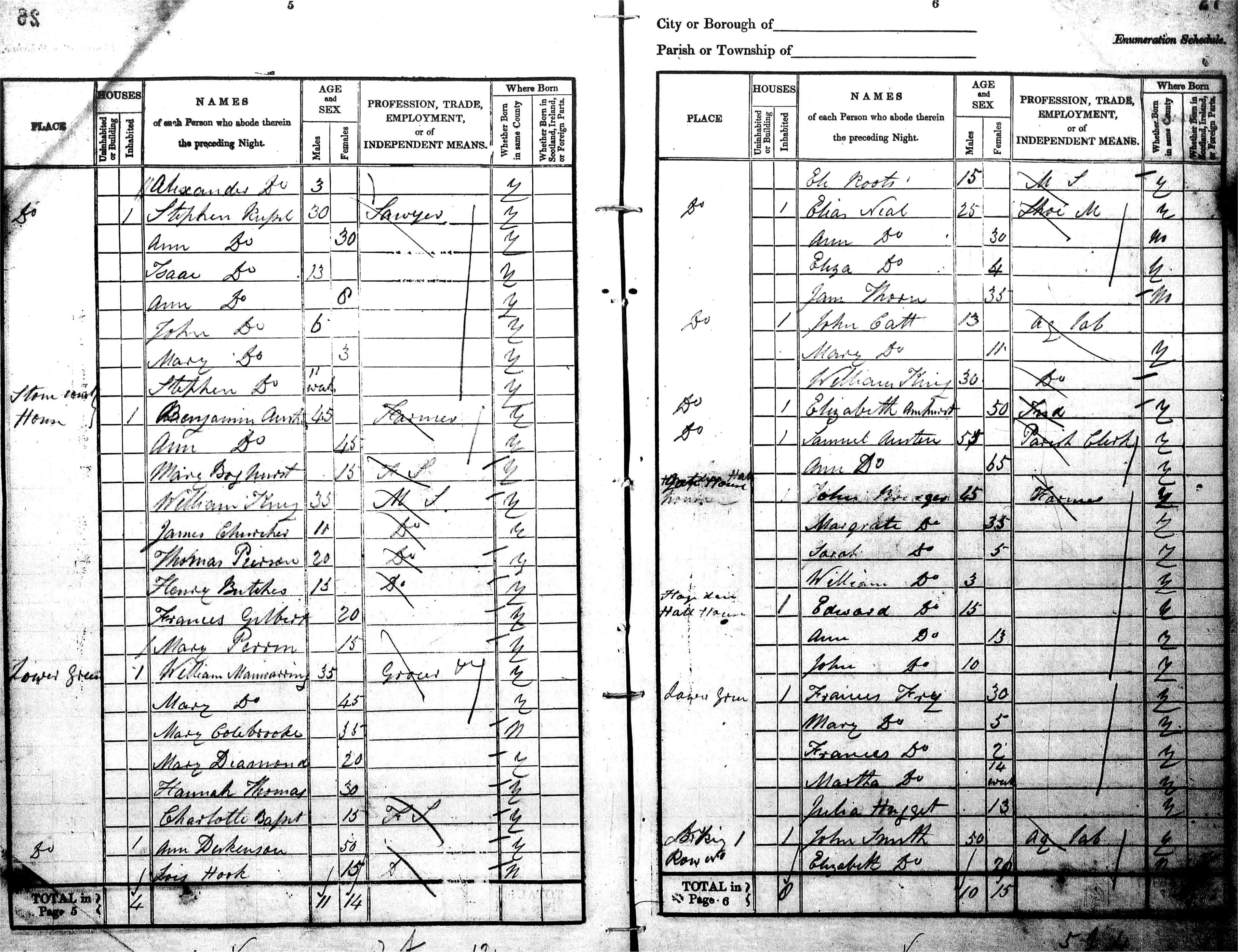
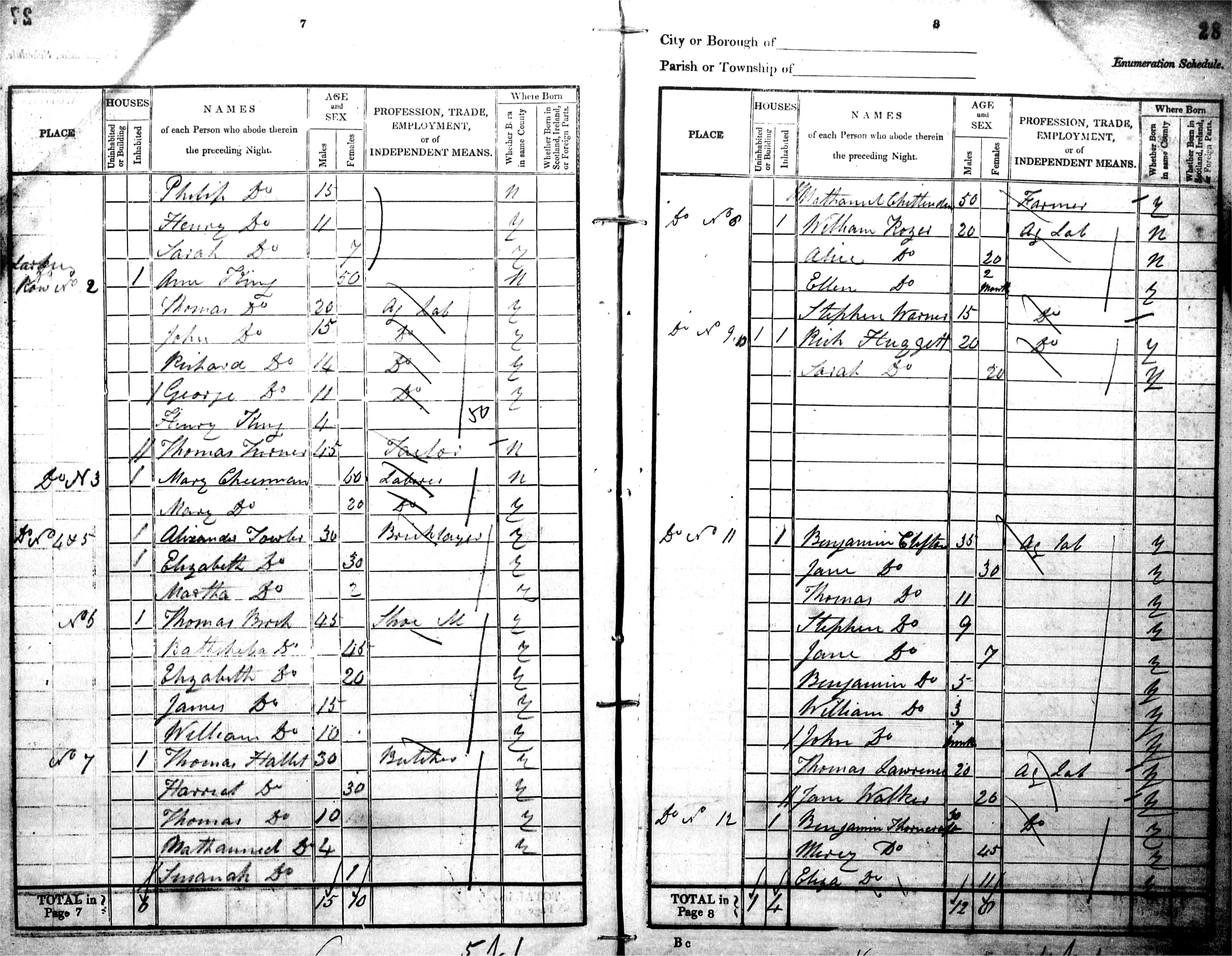
These 6 pages are from the census clerk's notebook
recording his door to door notation of residents.
Data collected by Jane Grooms.
|
|
|
1 Larkins Row starts at
bottom of page 2
Click image for enlargement
|
2 to 12 Larkins
Row
Click image for enlargement
|
12 Larkins Row.
1 to 10 Red Row
Click image for enlargement
|
The list below identifies the head of the family
for each address.
Unclear interpretations are indicated thus (?)
A work in progress
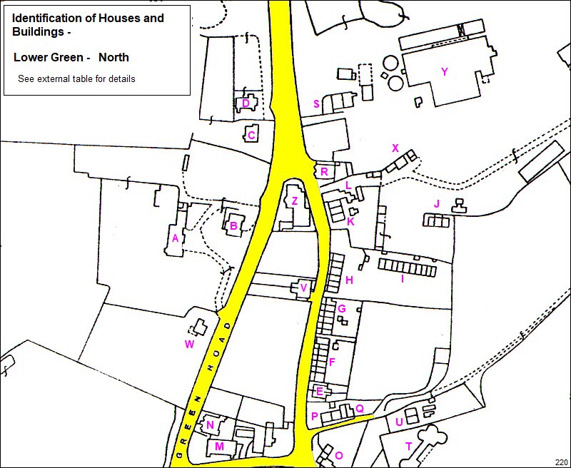
Below – a work in progress.
The maps below are part of an exercise to locate
houses and buildings often referred to by name and
not address.
The root map is a 1936 OS but older or more recent
buildings may be indicated.
Link to Houses page and Houses main list
– Pembury
Houses
|
List of
Houses and Buildings for map 220 – Lower
Green – North
|
|
|
| A |
Knight’s Ridge |
| B |
|
| C |
|
| D |
Mission Church |
| E |
|
| F |
Slate Row – Nos
***** |
| G |
Slate Row – Nos
***** |
| H |
Slate Row – Nos
***** |
| I |
Red Row
(demolished) |
| J |
|
| K |
Peters Cottages |
| L |
|
| M |
Baptist Church
/ Union Chapel |
| N |
Chapel Cottage |
| O |
Swiss Cottage /
Betts Grocers
132 Henwood Gn Rd |
| P |
Henwood Cottage |
| Q |
Damson Cottage |
| R |
Royal
Oak 216 Henwood Gn Rd. |
| S |
Queens Folly /
Curblows |
| T |
Beaglewood Farm
Oast Houses. 5 Kiln
complex. Destroyed
by fire in 1952. |
| U |
|
| V |
81-83 Henwood
Green Rd |
| W |
|
| X |
|
| Y |
Brick &
Tile Works |
| Z |
Institute and
Library |
|
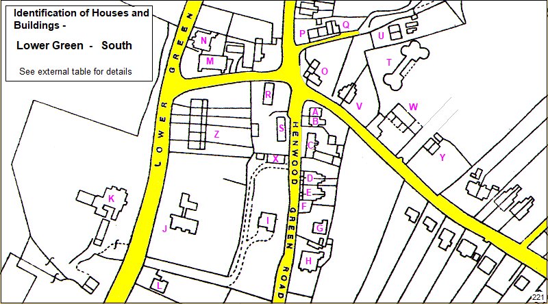
List of
Houses and Buildings for map 221 – Lower
Green – South
|
|
|
| A |
Rose Cottage |
| B |
Laurel Cottage |
| C |
Grocers /
Florists / Butcher / General store
122 – 126 Henwood Gn Rd |
| D |
Grenestede
Villas D1 & D1 |
| E |
Grenestede
Villas E1 & E2 |
| F |
Grenestede
Villas extension |
| G |
Gibralter
Cottage |
| H |
Lillescote
110 Henwood Gn Rd. |
| I |
Oak Lodge |
| J |
|
| K |
Knight’s Place |
| L |
|
| M |
Baptish Church
/ Union Chapel |
| N |
Chapel Cottage |
| O |
Swiss Cottage /
Betts Grocers
132 Henwood Gn Rd |
| P |
Henwood Cottage |
| Q |
Damson Cottage |
| R |
|
| S |
|
| T |
Beaglewood Farm
Oast Houses. 5 Kiln
complex. Destroyed
by fire in 1952. |
| U |
|
| V |
|
| W |
|
| X |
Old coach house
to Oak Lodge. Now called Pines |
| Y |
(Beagleswood
Rd now between W & Y) |
| Z |
|
The Courier of 31 Oct 1952 reports the fire
at Beagleswood farm caused £6000 of damage and was
spotted at about 5pm.
Although claimed to be a hop farm, owned by J.C.
Lamont and managed by Mr T. Richardson, the main
report describes
the storage of 2000 bushells of apples and the
bumper apple harvest.
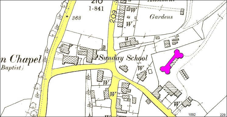
Above: 1892 map with Beagleswood Farm Oast House
highlighted
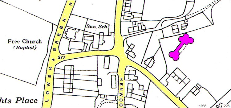
Above: 1936 map with Beagleswood Farm Oast House
highlighted. Note additional kiln projection.
Link to Houses page and
Houses main list – Pembury Houses
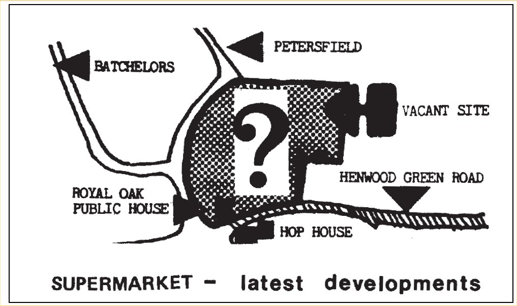
Above – a map from Issue 37 of the Pembury Village
News 1983 of the intended Supermarket at Lower
Green.
(Orientation of this map is North to the left)
The application was
refused and the site later used for the Waterfield
House Surgery and more housing.
See archived Pembury Village News issues 37 to 45
for the full story.
Tony Nicholls
2021