Past Pages
Antique Maps, Prints and Ephemera
Maps of UK English Counties
Counties arranged alphabetically Some local or regional maps will appear within the county section.
For local interest also see Town Plans and Road Maps sections - Click here for more Info.
English Counties - Essex to Kent
|
|
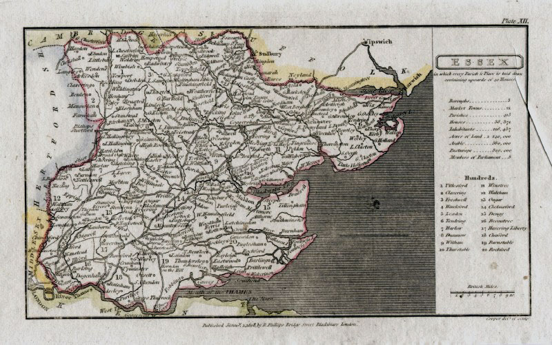 |
Essex Capper
1808 Engraved
by Cooper for Benjamin Pitts Capper Size: 190 x 120 mm Ref GDM188 £22.00 (+P&P) Printer's crease at right margin click image for enlargement |
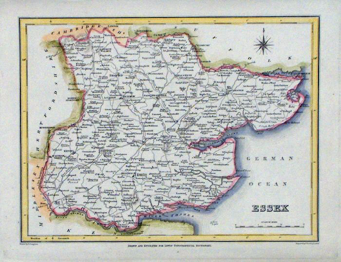 |
Essex
Lewis 1831 size:
240 x 190 mm Ref FLM060 £20.00 (+P&P) click image for enlargement |
 |
Essex
Samuel Lewis 1842 engraved by J & C Walker Steel engraving Size: 250 x 200 mm Antique Map Ref NAM013 £18.00 (+P&P) Typical detail expected from this series of Lewis maps - D1, D2, D3 Details are not specifically from the map shown here. click image for enlargement |
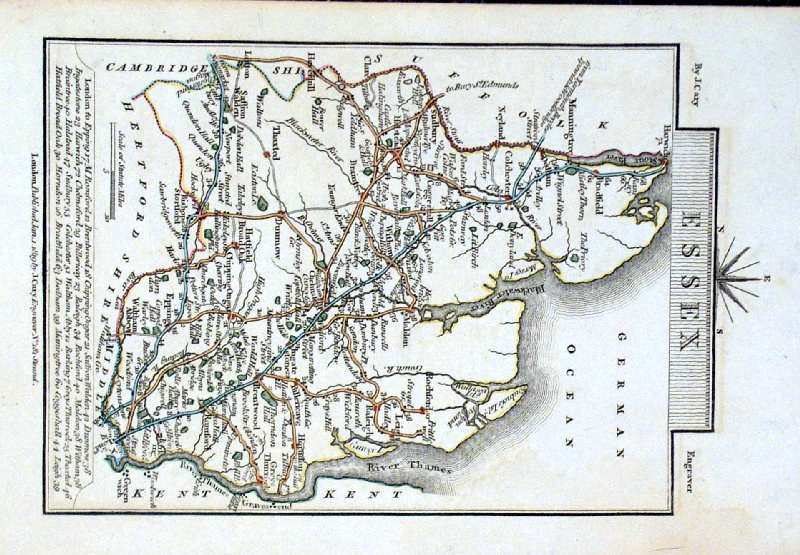 |
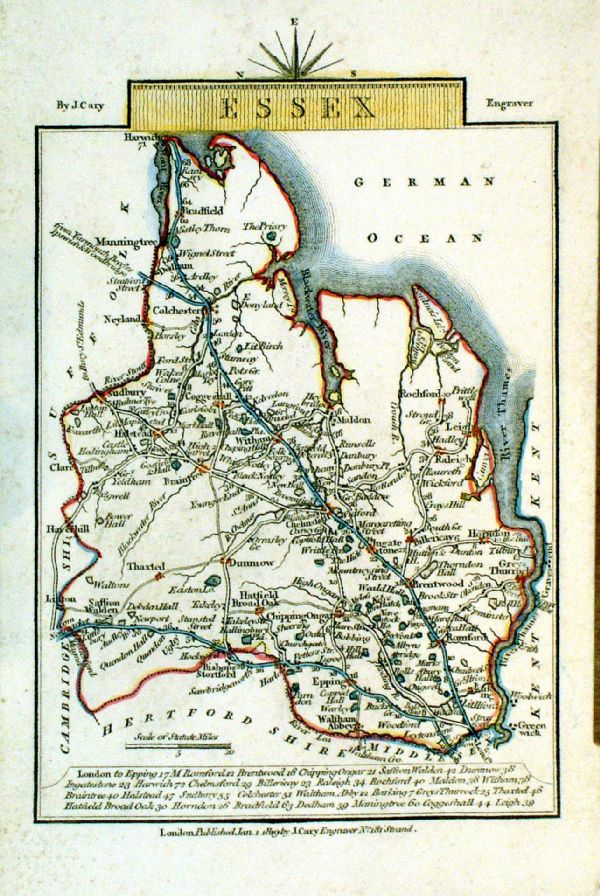
Essex Cary 1819
Original hand colour size:160 x 100 mm Ref GJM030 £20.00 (+P&P) click image for enlargement |
 |
Essex
Cary 1819
Copper engraving size: 100 x 150 mm Ref LEM010 £20.00 (+P&P) click image for enlargement |
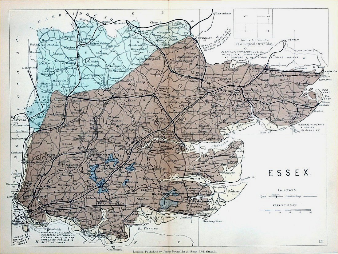 |
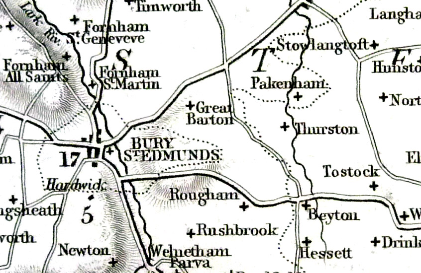
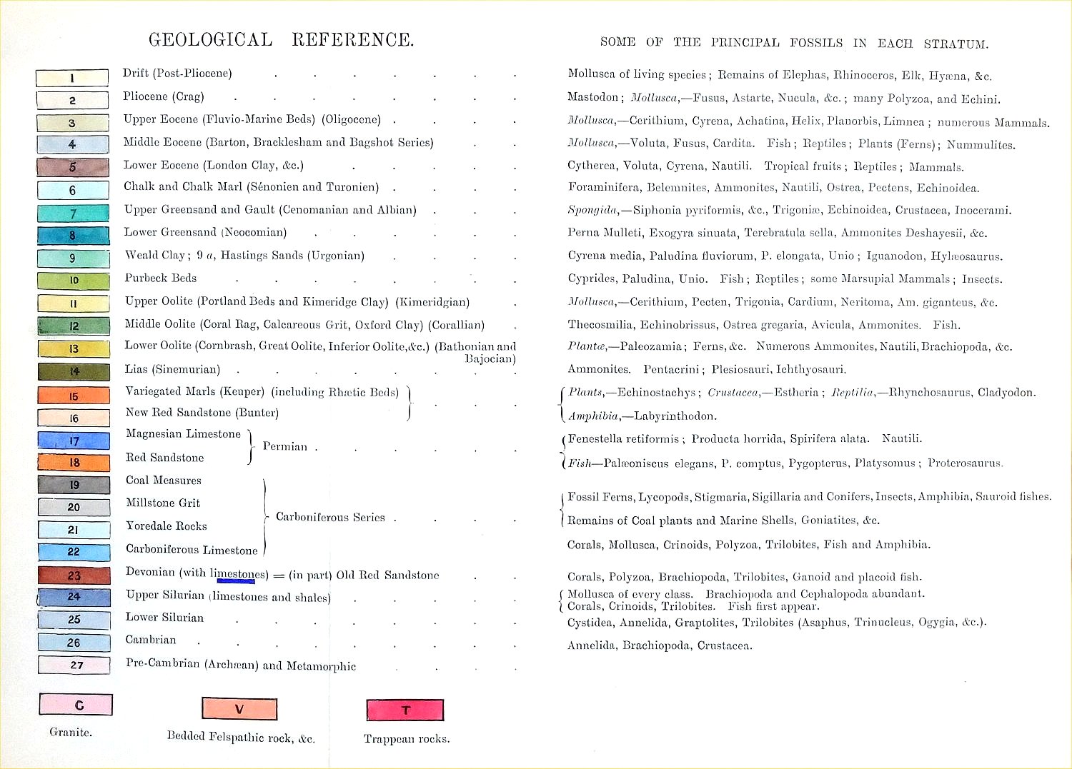
Essex
Geological map James Reynolds 1889 Second Edition (new map, additional data, side notes, different colouring) size: 185 x 250mm, centre fold, very slight discolouration at fold. Original hand colouring of geological structure - Colour Reference Key - click here Antique Map Ref RAM014 £24.00 (+P&P) click image for enlargement |
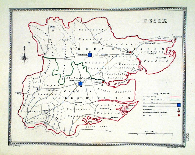 |
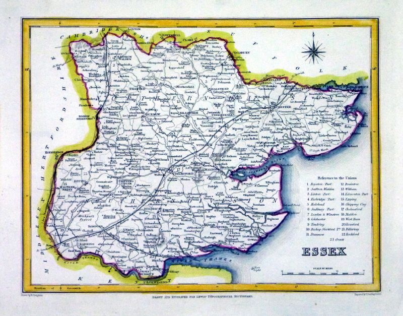
Essex
Depicting electoral divisions and polling places.
Samuel Lewis 1835 engraved by J & C Walker Steel engraving Size: 250 x 200 mm, Original colouring of boundaries. Antique Map Ref KJM028 £16.00 (+P&P) click image for enlargement |
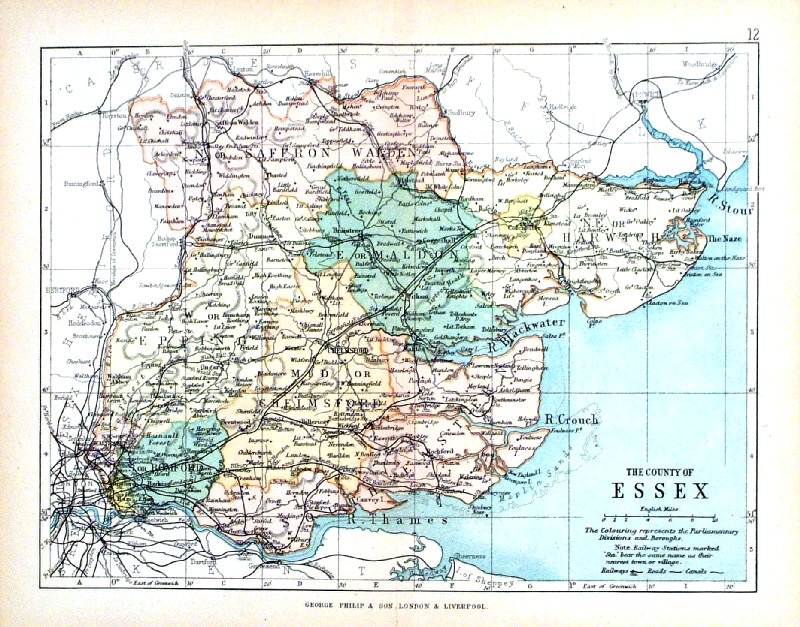 |
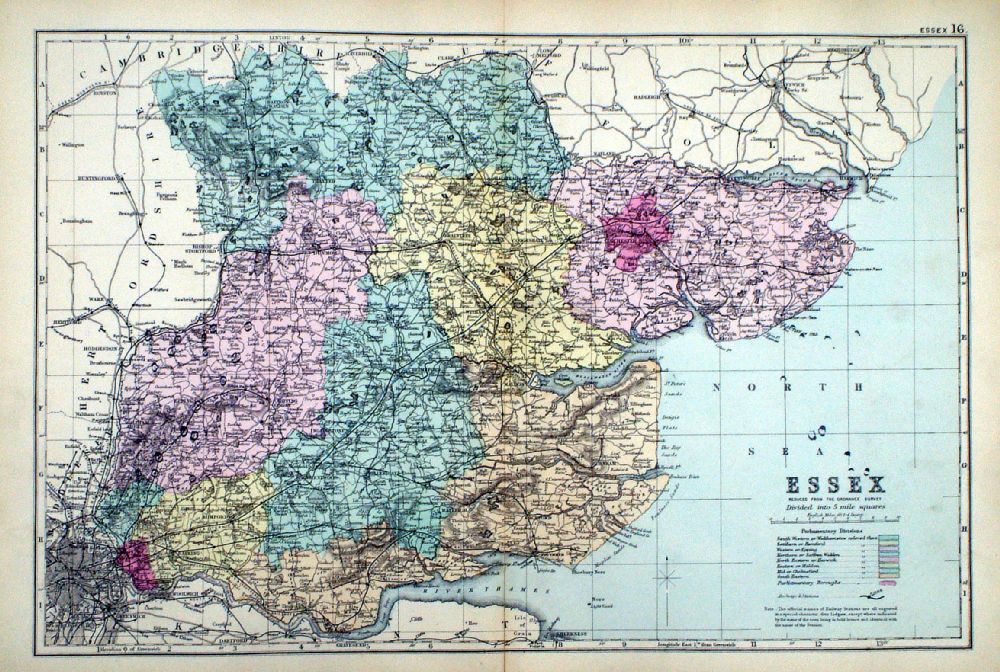
Essex George Philip
1898 Colouring represents the Parliamentary Divisions and Boroughs size: 220 x 180 mm, centre fold, original printed colour Ref HHM016 £12.00 (+P&P) click image for enlargement |
 |
Essex From the New Large Scale Atlas of the British Isles by G.W. Bacon 1892 size: 480 x 330 mm, centre fold Coloured to represent Parliamentary Divisions. Ref LHM136 £15.00 (+P&P) Detail click image for enlargement |
Gloucester |
Link to Essex Prints Gloucestershire |
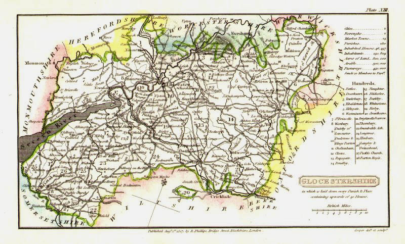 |
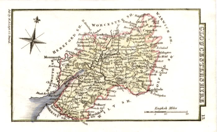
Gloucestershire
Cooper 1807
Size: 120 x 190 mm Rare edition dated August 1, 1807, prior to the popular Capper edition of 1808 'Published Aug 1 1807 by R. Phillips, Bridge Street, Blackfriars, London' Ref IFM019 £22.00 (+P&P) click image for enlargement |
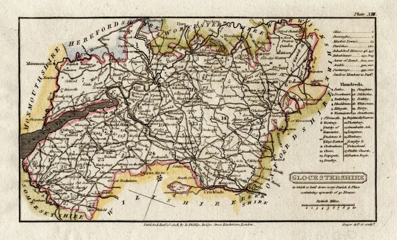 |
Gloucestershire
Capper
1808 Engraved
by Cooper for Benjamin Pitts Capper Size: 190 x 120 mm Ref GDM189 £18.00 (+P&P) click image for enlargement |
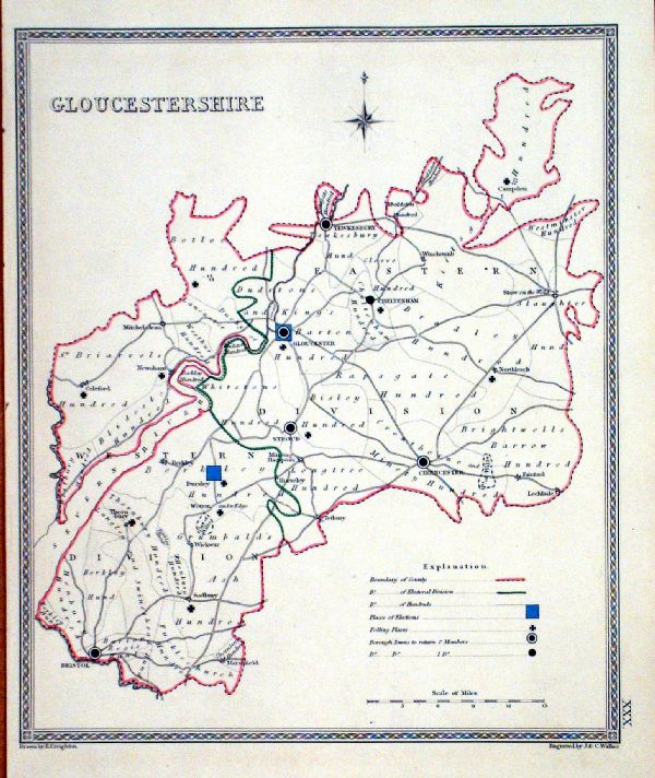 |
Gloucestershire Depicting
electoral divisions and polling places. Samuel Lewis 1835 engraved by J & C Walker Steel engraving Size: 200 x 250 mm, Original colouring of boundaries. Antique Map Ref KJM030 £16.00 (+P&P) click image for enlargement |
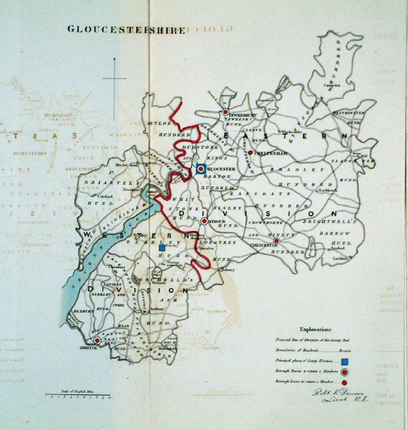 |
Gloucestershire
Dawson 1832 from Boundary
Commission Report size: 280 x 280 mm , 1 fold, some offset transfer Ref GEM007 £20.00 (+P&P) click image for enlargement |
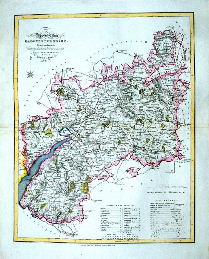 |
Gloucestershire
J. Duncan 1833 "Map of the County of Gloucestershire Divided into Hundreds Containing the District Divisions and other local arrangements effected by the Reform Bill" size: 460 x 370 mm, centre fold. Detail a few creases, repair to split at centrefold Ref LEM043 £22.00 (+P&P) click image for enlargement- apologies for optical distortion caused during photography. |
|
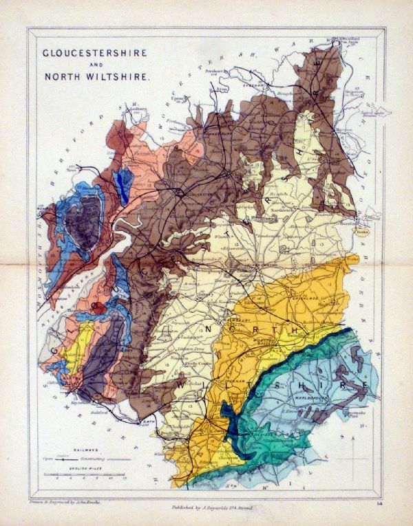
Gloucestershire & North Wiltshire
Geological map Reynolds / Emslie c1860 First Edition size: 200 x 250mm, centre fold, very slight discolouration at fold. Original hand colouring of geological structure - Colour Reference Key - click here Antique Map Ref KLM014 £20.00 (+P&P) click image for enlargement |
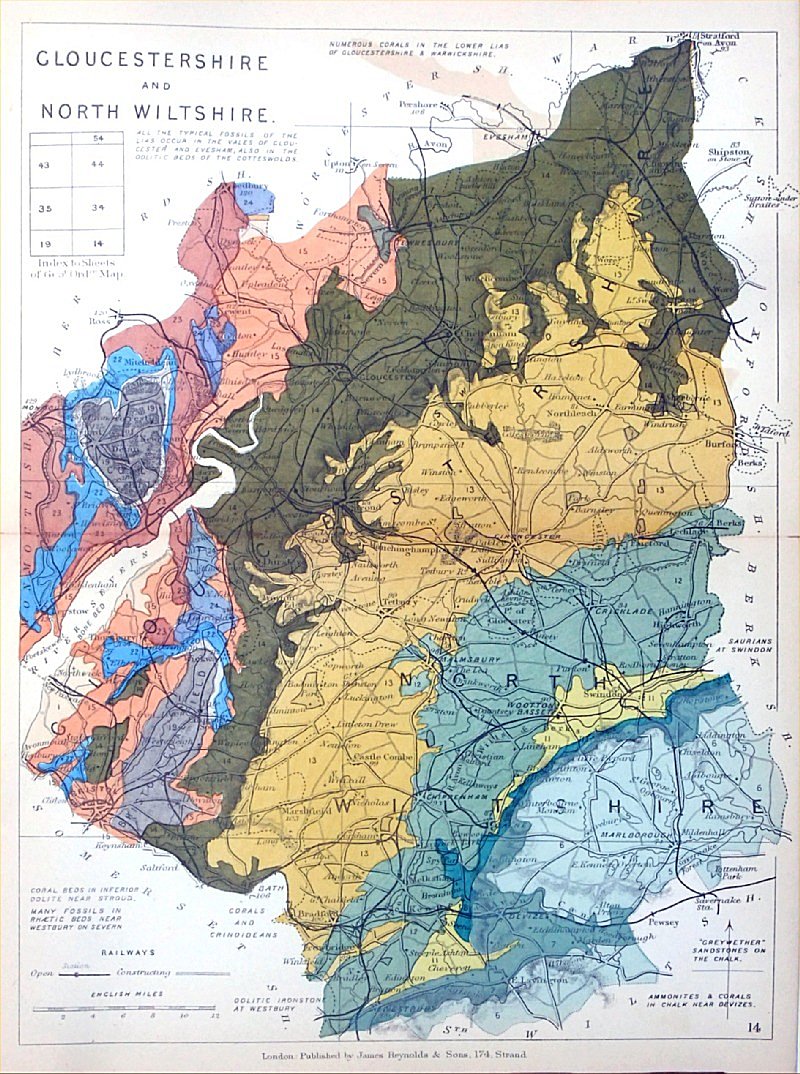 |
Gloucestershire & North
Wiltshire Geological map James Reynolds 1889 Second Edition (new map, additional data, side notes, different colouring) size: 185 x 250mm, centre fold, very slight discolouration at fold. Original hand colouring of geological structure - Colour Reference Key - click here Antique Map Ref RAM015 £20.00 (+P&P) click image for enlargement |
 |
Gloucestershire
Pinnock 1833 size: 180 x 250 mm, very slight overall discolouration. Ref JDM012 £18.00 (+P&P) click image for enlargement |
 |
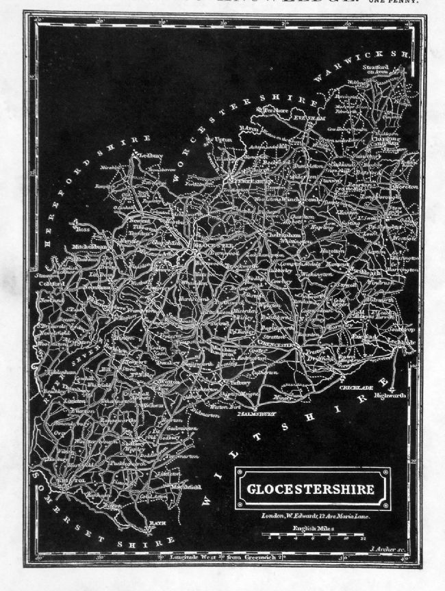
Gloucestershire Leigh
1837 size: 80 x 130 mm Ref GGM013 £14.00 (+P&P) click image for enlargement |
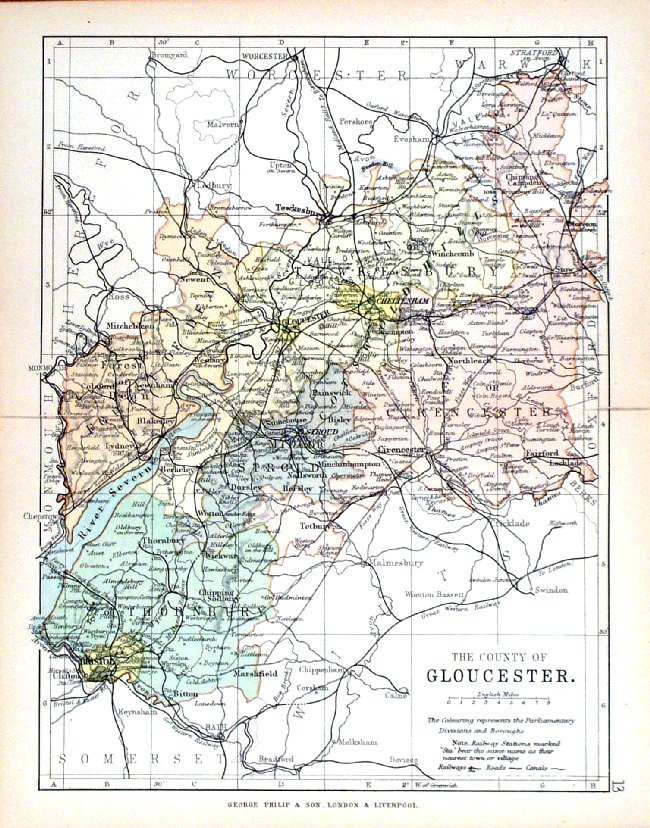 |
Gloucester George
Philip 1898 Colouring represents the Parliamentary Divisions and Boroughs size: 180 x 220 mm, centre fold, original printed colour Ref HHM017 £12.00 (+P&P) click image for enlargement |
| Maps of the River Thames through Oxfordshire may be at UK - Rivers Link to Gloucestershire Prints | |
Hampshire |
Hampshire |
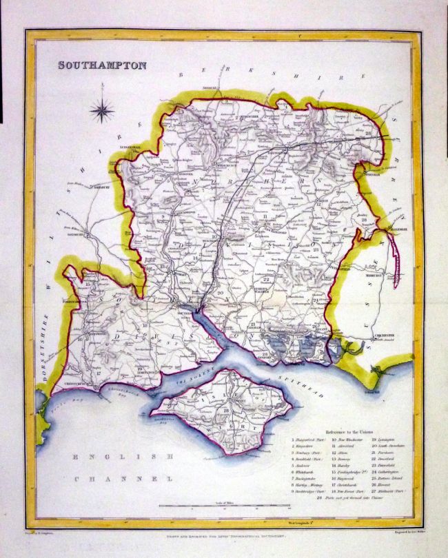 |
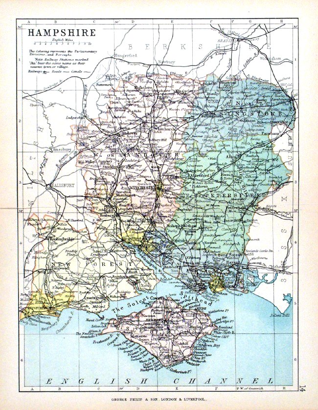
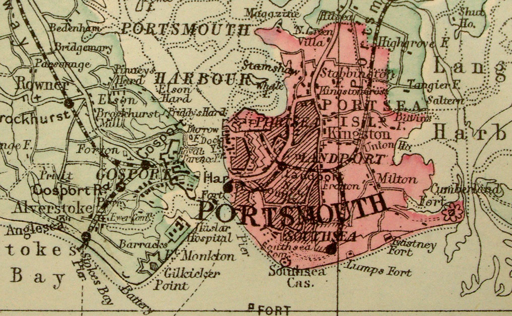
Hampshire (Southampton)
Lewis c1842 size: 250 x 190 mm , 1 fold Ref NAM034 £18.00 (+P&P) Typical detail expected from this series of Lewis maps - D1, D2, D3 Details are not specifically from the map shown here. click image for enlargement |
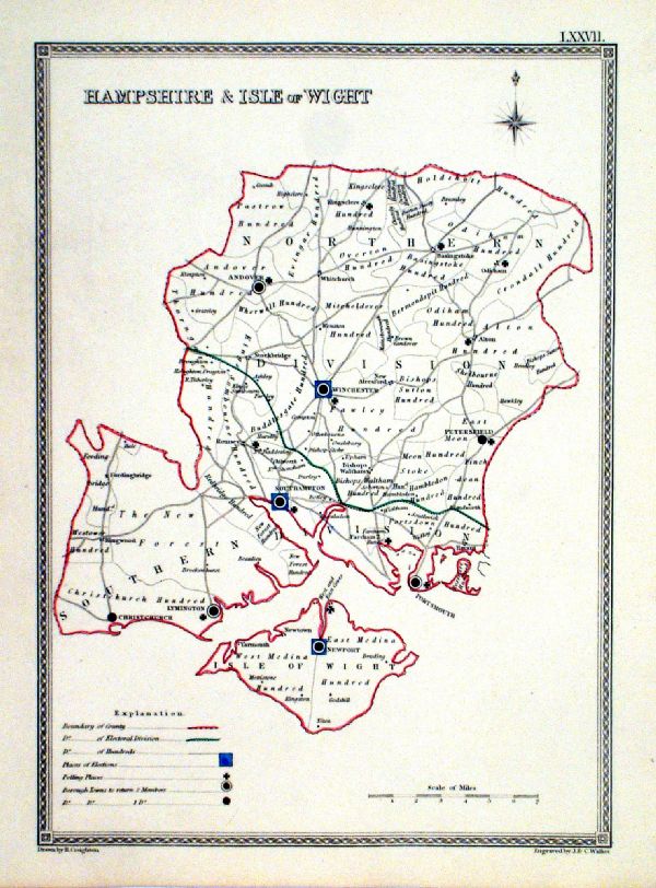 |
Hampshire and Isle of Wight
Depicting electoral
divisions and polling places. Samuel Lewis 1835 engraved by J & C Walker Steel engraving Size: 200 x 250 mm, Original colouring of boundaries. Antique Map Ref KJM077 £16.00 (+P&P) click image for enlargement |
 |
Hampshire George Philip
1898 Colouring represents the Parliamentary Divisions and Boroughs size: 180 x 220 mm, centre fold, original printed colour Ref HHM018 £12.00 (+P&P) click image for enlargement |
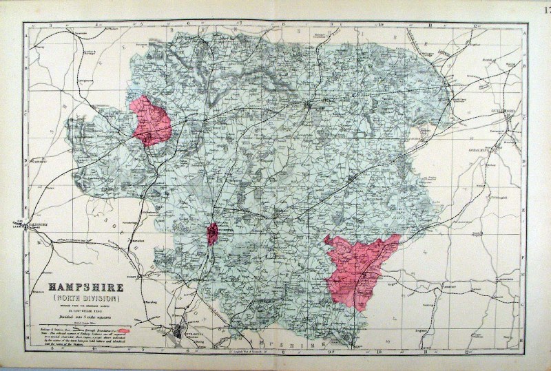 |
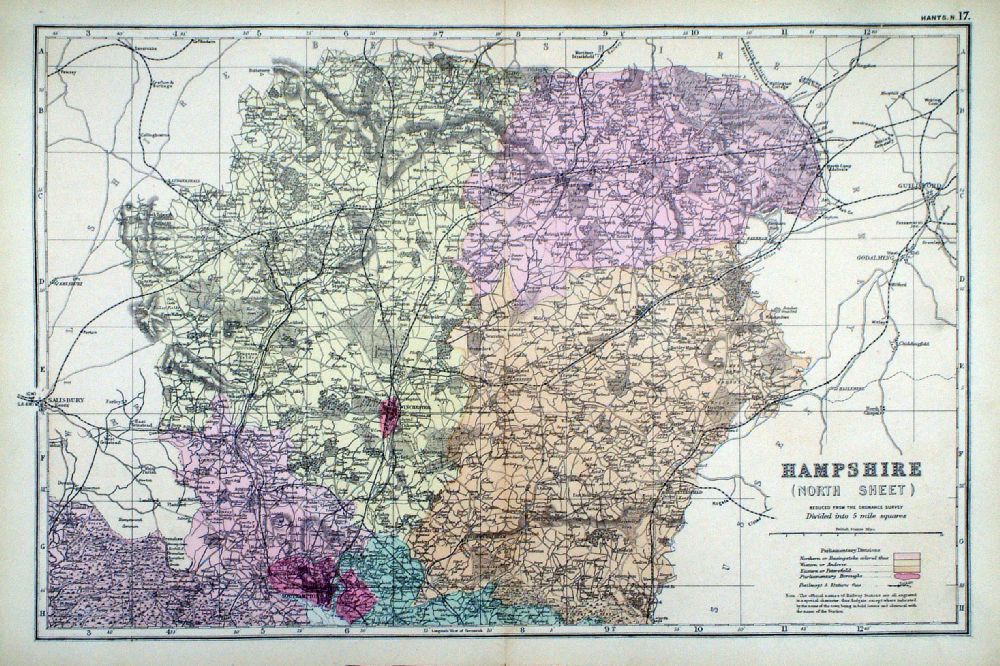
Hampshire (North Division)
Bacon c1883 size: 460 x 310 mm, double page, centre fold This series of Bacon maps contains great detail and is very popular with historians. Ref FLM103 £15.00 (+P&P) click image for enlargement |
 |
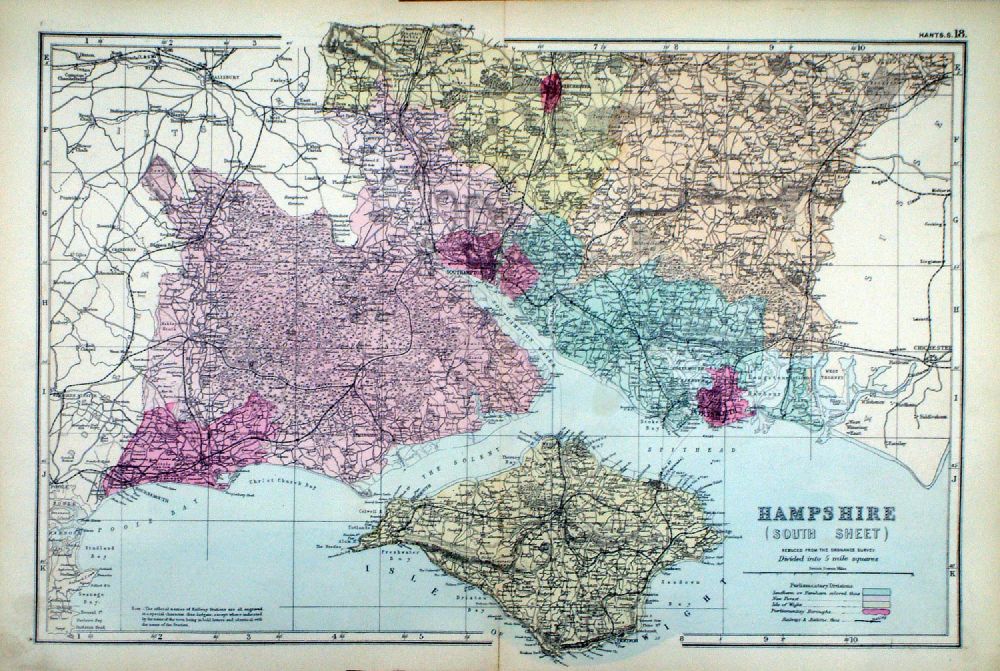
Hampshire (South Division)
Bacon c1883 size: 460 x 310 mm, double page, centre fold This series of Bacon maps contains great detail and is very popular with historians. Ref FLM104 £15.00 (+P&P) click image for enlargement |
  |
Hampshire in 2
sheets From the New Large Scale Atlas of the British Isles by G.W. Bacon 1892 each sheet - size: 480 x 330 mm, centre fold Coloured to represent Parliamentary Divisions. Ref LHM135 ( 2 sheets - will not split) £25.00 (+P&P) Detail click image for enlargement |
| Hampshire - Isle of Wight
- See 'Islands'
section
of UK Maps |
|
Hereford |
Link to
Hampshire Prints Herefordshire |
 |
Herefordshire Seller-
Grose 1787 size:
150 x 120 mm Ref ELM028 £24.00 (+P&P) click image for enlargement |
 |
Herefordshire Seller-
Grose 1787 size:
150 x 120 mm Ref ELM043 £24.00 (+P&P) click image for enlargement |
 |
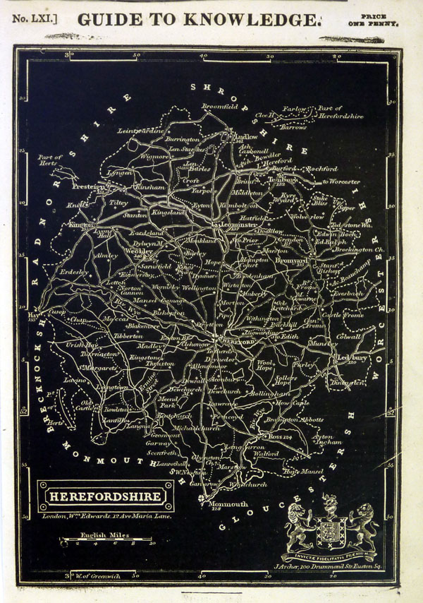
Herefordshire
Pinnock 1833 size: 180 x 250 mm Ref JDM014 £16.00 (+P&P), very slight overall discolouration. Ref MKM022 £16.00 (+P&P) click image for enlargement |
|
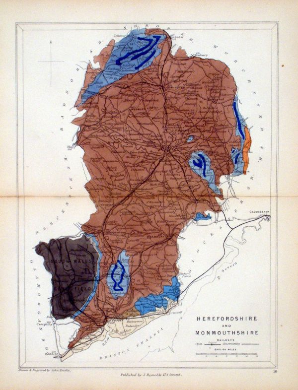
Herefordshire & Monmouthshire
Geological map Reynolds / Emslie c1860 First Edition size: 200 x 250mm, centre fold, very slight discolouration at fold. Original hand colouring of geological structure - Colour Reference Key - click here Antique Map Ref KLM016 £20.00 (+P&P) click image for enlargement |
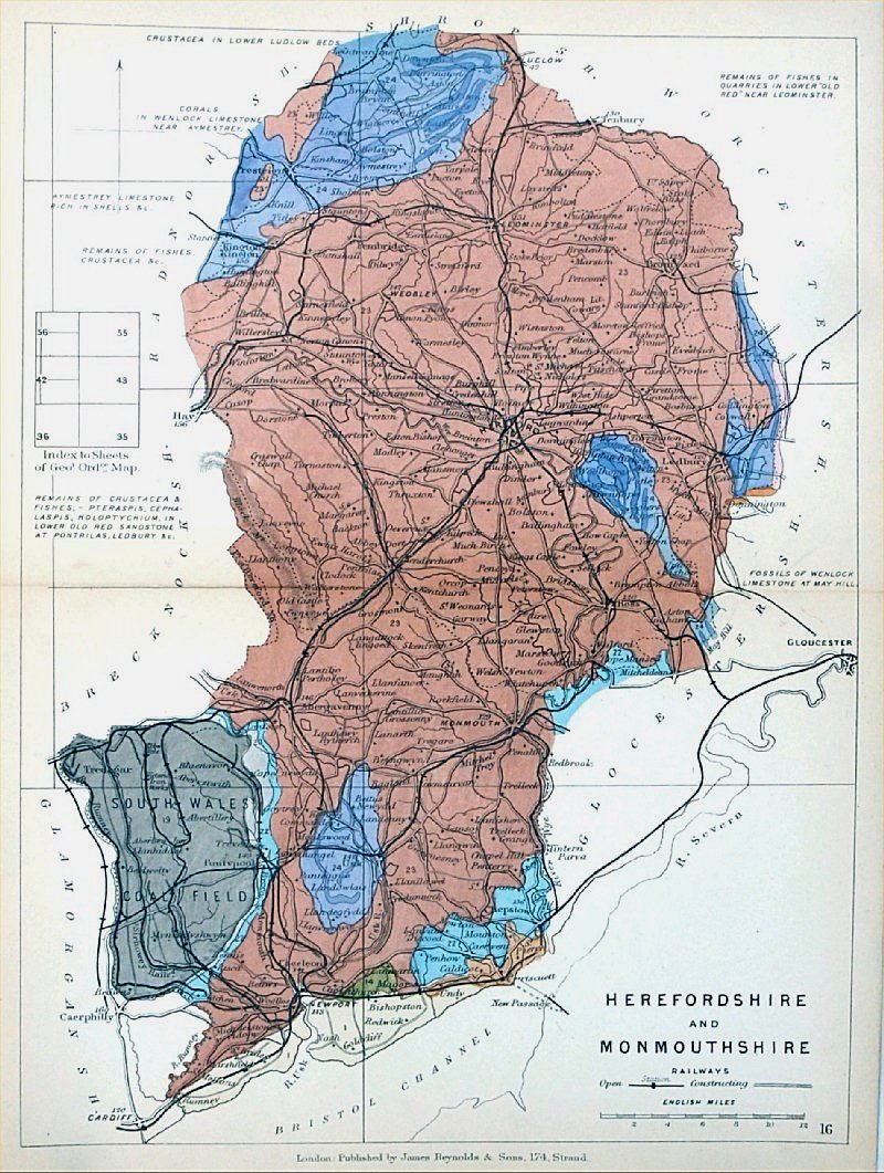 |
Herefordshire and
Monmouthshire Geological map James Reynolds 1889 Second Edition (new map, additional data, side notes, different colouring) size: 185 x 250mm, centre fold, very slight discolouration at fold. Original hand colouring of geological structure - Colour Reference Key - click here Antique Map Ref RAM018 £20.00 (+P&P) click image for enlargement |
 |
Herefordshire
Capper
1808 Engraved
by Cooper for Benjamin Pitts Capper Size: 120 x 190 mm Ref GDM191 £18.00 (+P&P) click image for enlargement |
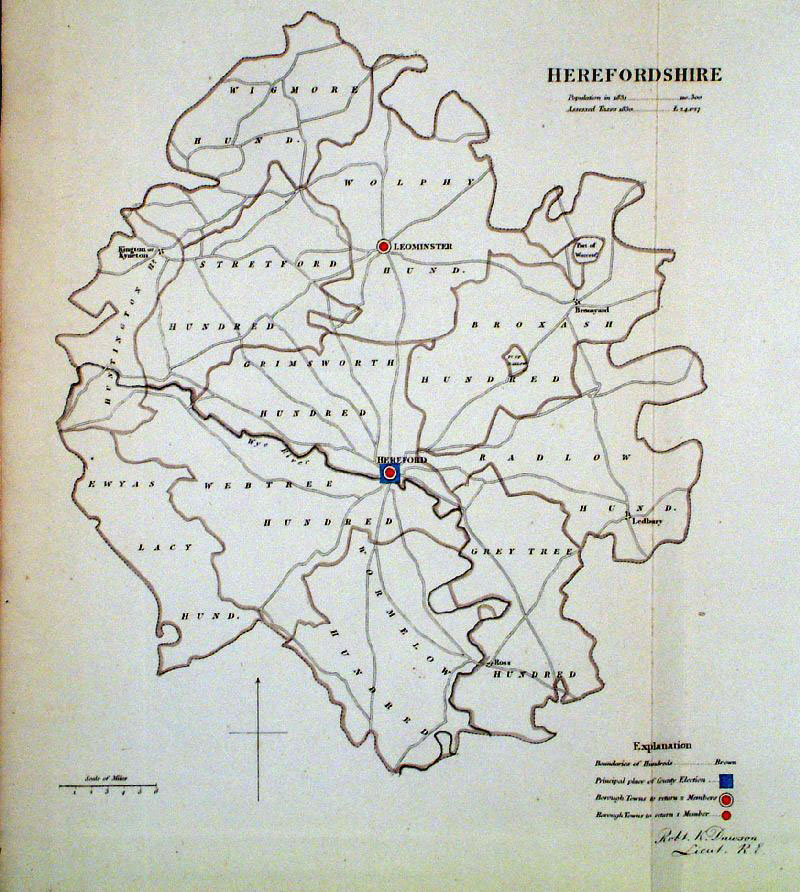 |
Herefordshire
Dawson 1832 from Boundary
Commission Report size: 220 x 280 mm , 1 fold Ref GEM008 £20.00 (+P&P) click image for enlargement |
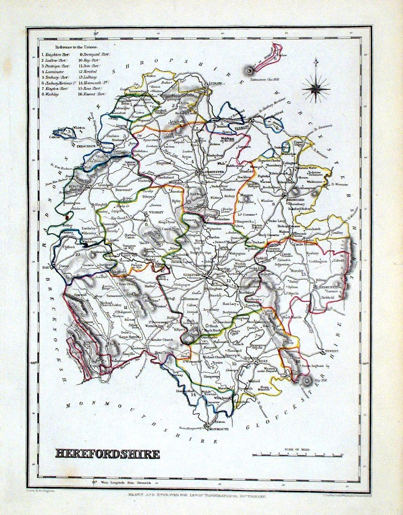 |
Herefordshire Lewis
c1842 size: 250 x 190 mm Ref GHM091 £14.00 (+P&P), a few faint foxing spots, Original hand colour Ref NAM016 £15.00 (+P&P) Typical detail expected from this series of Lewis maps - D1, D2, D3 Details are not specifically from the map shown here. click image for enlargement |
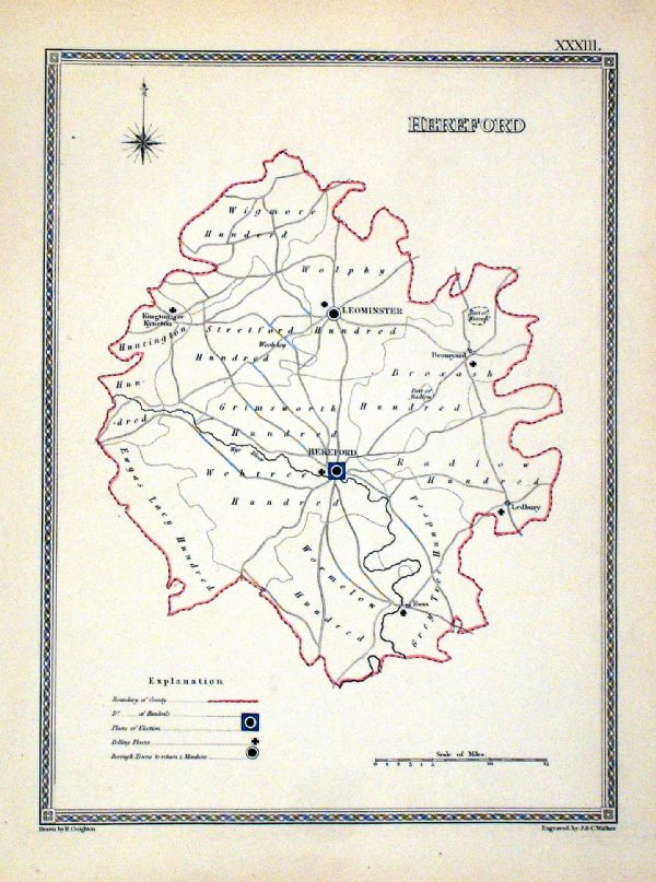 |
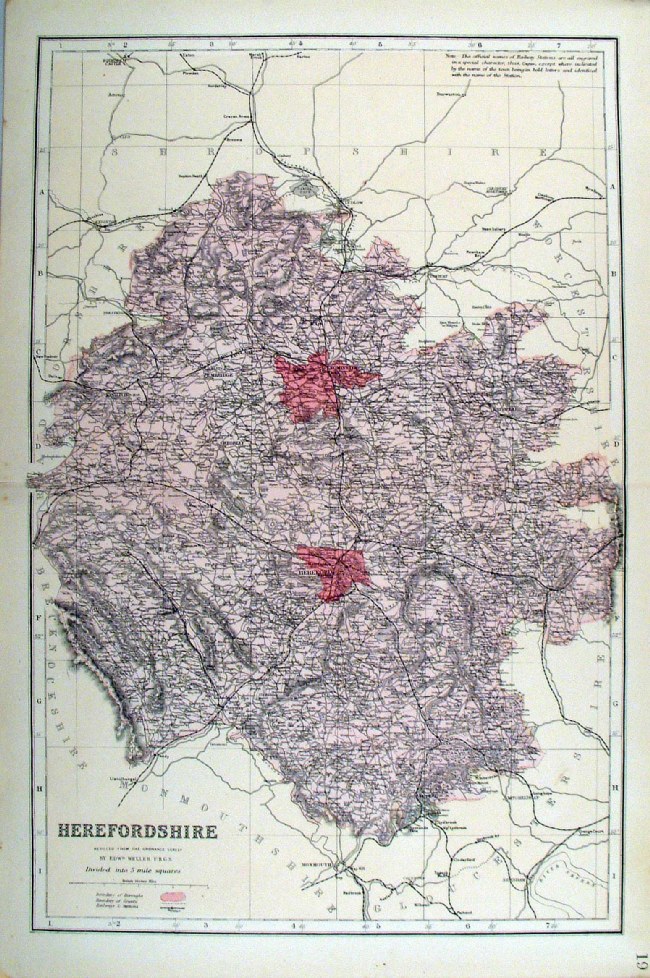
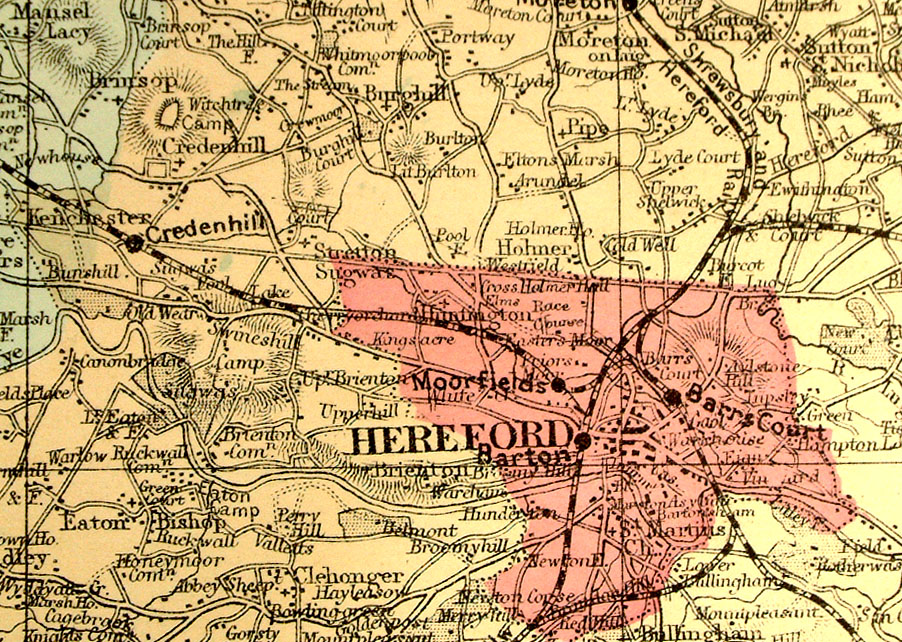
Hereford Depicting
electoral divisions and polling places. Samuel Lewis 1835 engraved by J & C Walker Steel engraving Size: 200 x 250 mm, Original colouring of boundaries. Antique Map Ref KJM033 £14.00 (+P&P) click image for enlargement |
 |
Herefordshire Leigh
1837 size: 80 x 130 mm Ref GGM015 £14.00 (+P&P) click image for enlargement |
 |
Hereford George Philip
1898 Colouring represents the Parliamentary Divisions and Boroughs size: 180 x 220 mm, centre fold, original printed colour Ref HHM019 £12.00 (+P&P) click image for enlargement |
 |
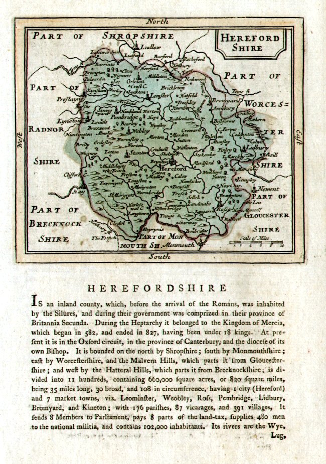
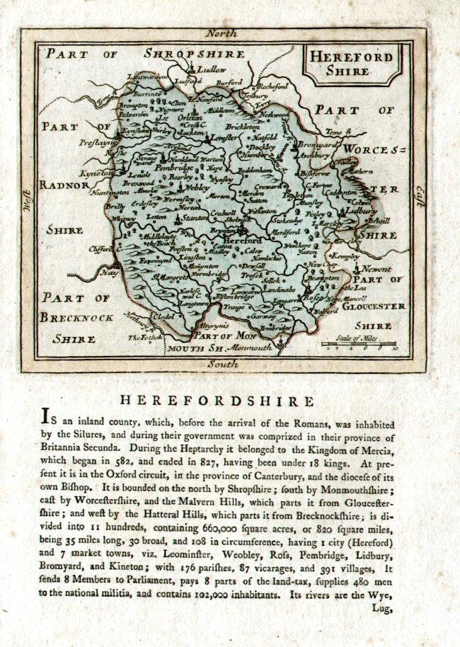
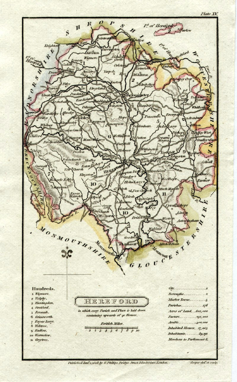
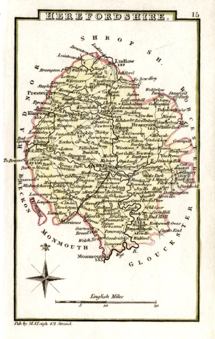
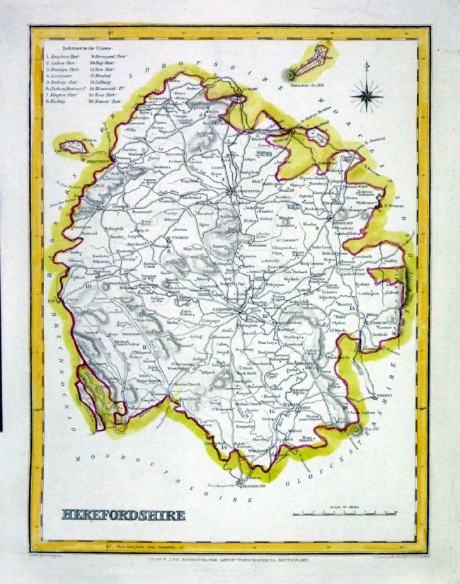
Herefordshire
Owen / Bowen 1720
size: 130 x 190 mm From 'Britannia Depicta' - P 143 Antique Map Ref FEM174 £26.00 (+P&P) click image for enlargement
|
 |
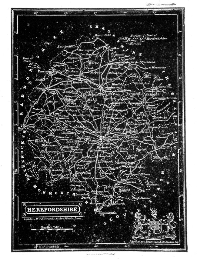
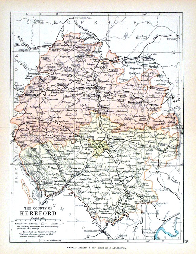
Herefordshire Bacon
c1883 size: 310 x 460 mm, double page, centre fold This series of Bacon maps contains great detail and is very popular with historians. Ref FLM105 £15.00 (+P&P) click image for enlargement |
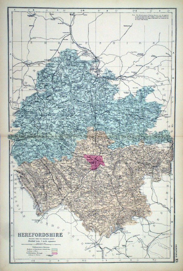 |
Herefordshire From the New Large Scale Atlas of the British Isles by G.W. Bacon 1892 size: 330 x 480 mm, centre fold Coloured to represent Parliamentary Divisions. Ref LHM134 £15.00 (+P&P) Detail click image for enlargement |
Hertfordshire |
Link
to Hereford Prints Hertfordshire |
 |
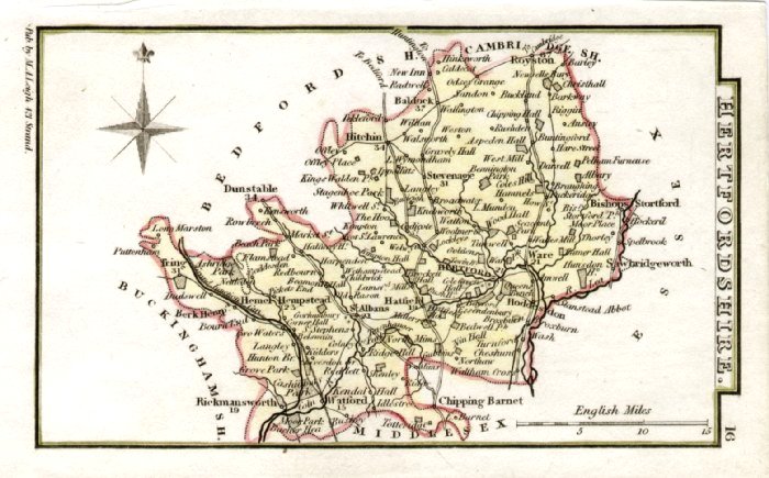
Hertfordshire
Pinnock 1833 size: 250 x 180 mm Ref JDM015 £20.00 (+P&P) click image for enlargement |
 |
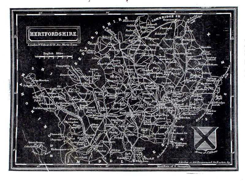
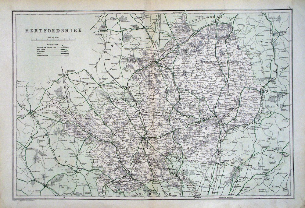
Hertfordshire Hughes / Virtue
c1870
size: 310 x 250 mm Ref FIM026 £25.00 (+P&P) click image for enlargement |
 |
Hertfordshire Bacon
c1883 size: 460 x 310 mm, double page, centre fold Ref FLM106 £18.00 (+P&P) click image for enlargement |
 |
Hertfordshire From the New Large Scale Atlas of the British Isles by G.W. Bacon 1892 size: 330 x 480 mm, centre fold. Coloured to represent Parliamentary Divisions. Ref LHM133 £18.00 (+P&P) Detail click image for enlargement |
 |
Hertfordshire GW Bacon
1912
size: 500 x 350 mm Antique Map Ref HBS006 £22.00 (+P&P) click image for enlargement |
 |
Hertfordshire Leigh
1837 size: 80 x 130 mm Ref GGM016 £16.00 (+P&P) click image for enlargement |
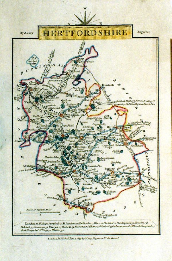 |
Hertfordshire
Cary 1819
Copper engraving size: 100 x 150 mm Ref LEM008 £20.00 (+P&P) click image for enlargement |
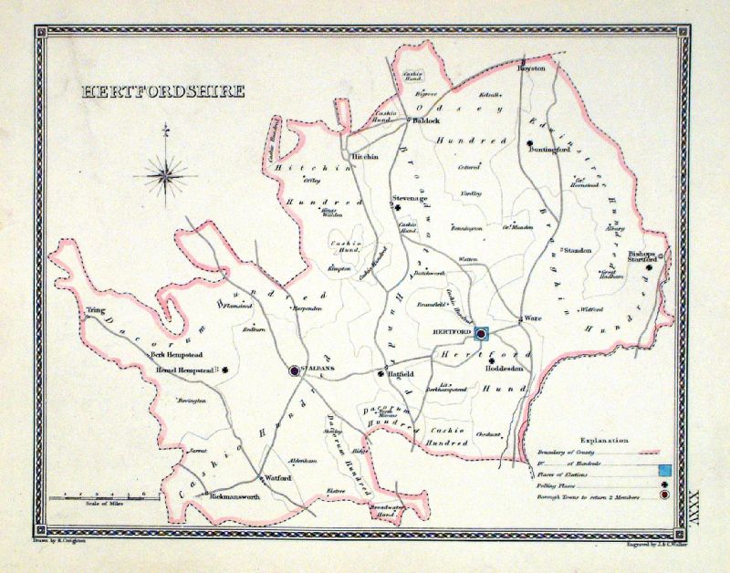 |
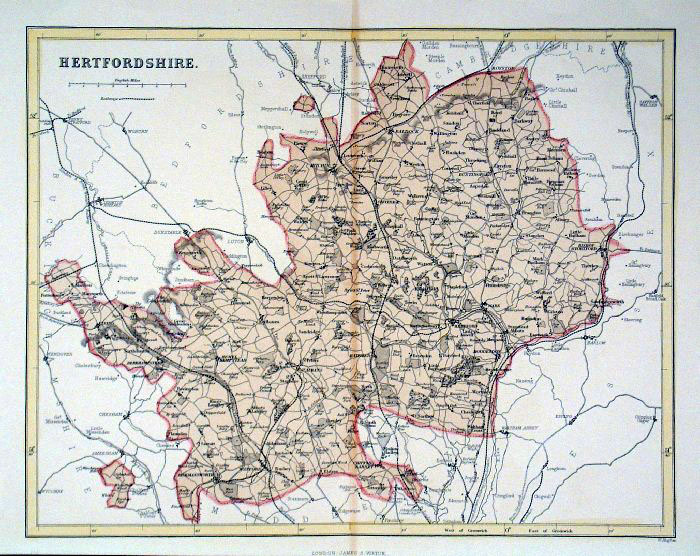
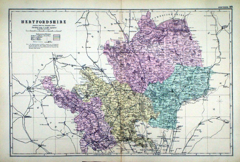
Hertfordshire
Depicting electoral divisions and polling places.
Samuel Lewis 1835 engraved by J & C Walker Steel engraving Size: 250 x 200 mm, Original colouring of boundaries. Antique Map Ref KJM035 £16.00 (+P&P) click image for enlargement |
 |
Hertford George Philip
1898 Colouring represents the Parliamentary Divisions and Boroughs size: 220 x 180 mm, centre fold, original printed colour Ref HHM020 £12.00 (+P&P) click image for enlargement |
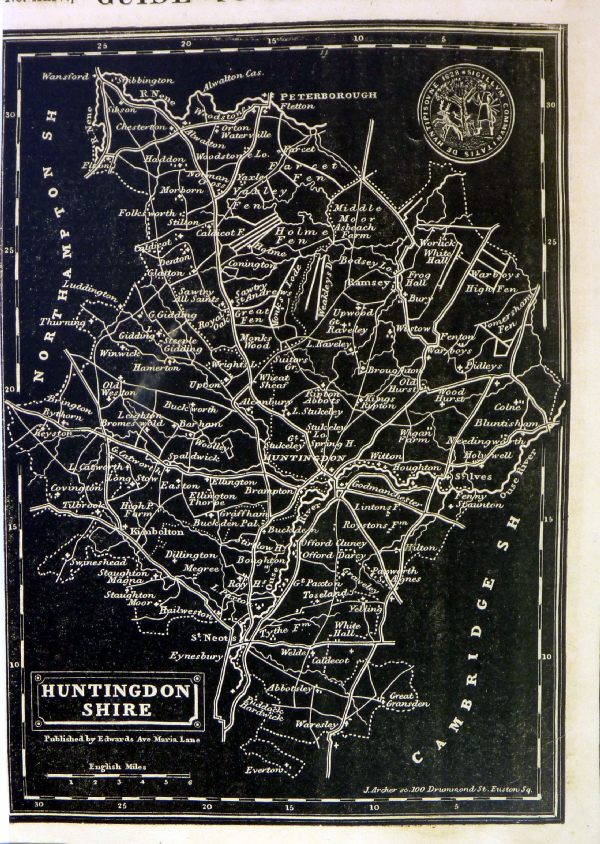
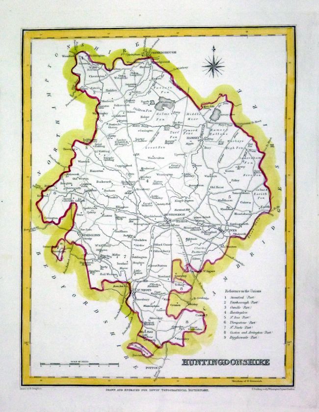
Huntingdon |
Link
to Hertford Prints Huntingdonshire |
 |
Huntingdonshire
Owen / Bowen 1720
size: 130 x 190 mm From 'Britannia Depicta' - P 191 Antique Map Ref FEM198 £24.00 (+P&P) click image for enlargement
|
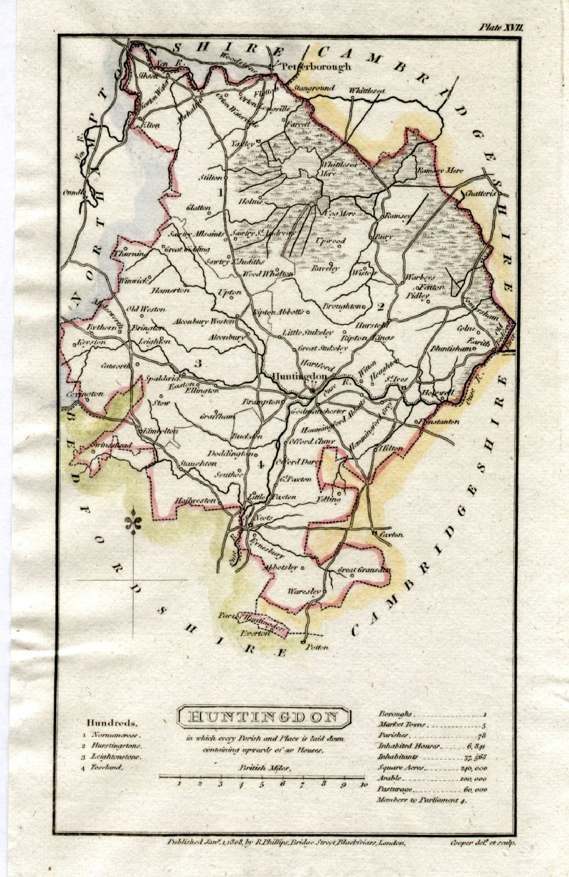 |
Huntingdonshire
Capper
1808 Engraved
by Cooper for Benjamin Pitts Capper Size: 120 x 190 mm Ref GDM193 £18.00 (+P&P) click image for enlargement |
 |
Huntingdonshire
Thomas Moule c1845 size: 210 x 270 mm Trimmed upper and lower margins Ref IFM064 £20.00 (+P&P) click image for enlargement |
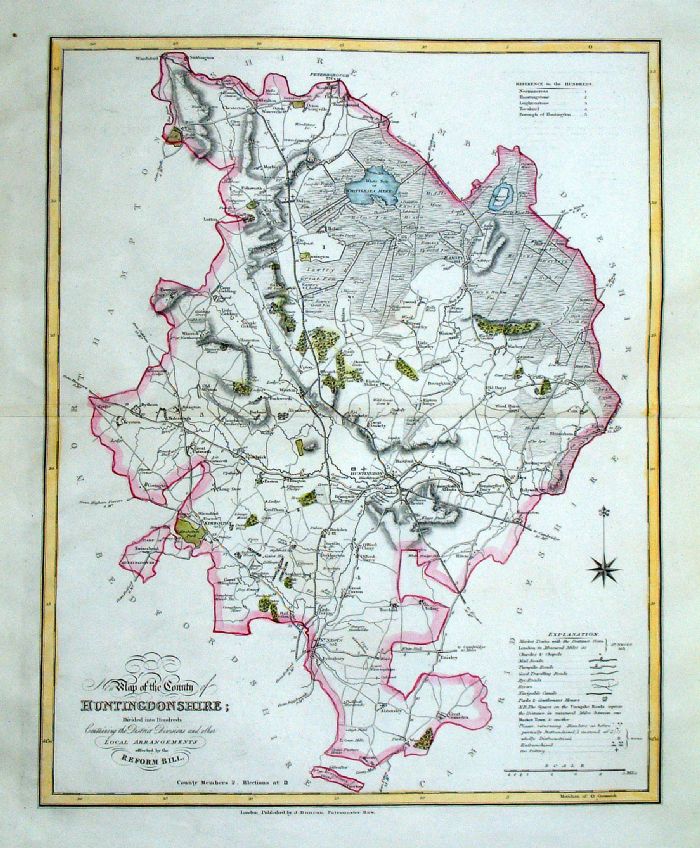 |
Huntingdonshire
J. Duncan 1833 "Map of the County of Huntingdonshire Divided into Hundreds Containing the District Divisions and other local arrangements effected by the Reform Bill" size: 370 x 460 mm, centre fold. Detail a few faint creases Ref LEM039 £22.00 (+P&P) click image for enlargement- apologies for optical distortion caused during photography. |
 |
Huntingdonshire
Pinnock 1833 size: 180 x 250 mm Ref JDM016 £16.00 (+P&P), very slight overall discolouration. Ref MKM012 £14.00 (+P&P), tight left margin click image for enlargement |
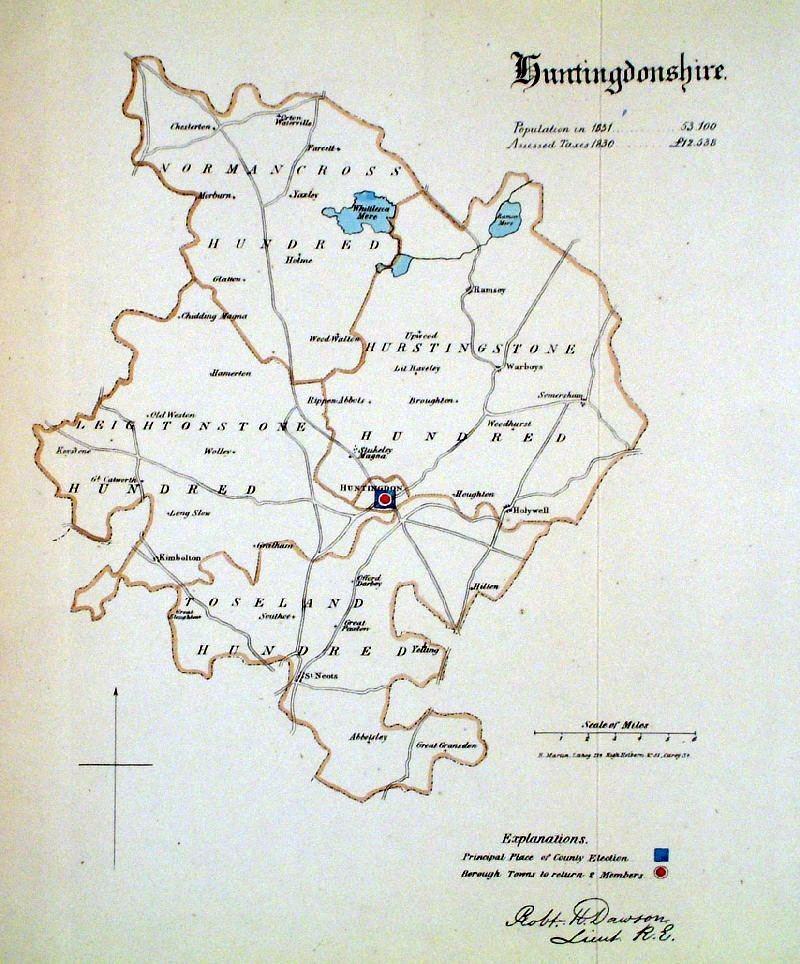 |
Huntingdonshire
Dawson 1832 from Boundary
Commission Report size: 220 x 280 mm , 1 fold Ref GEM009 £18.00 (+P&P) click image for enlargement |
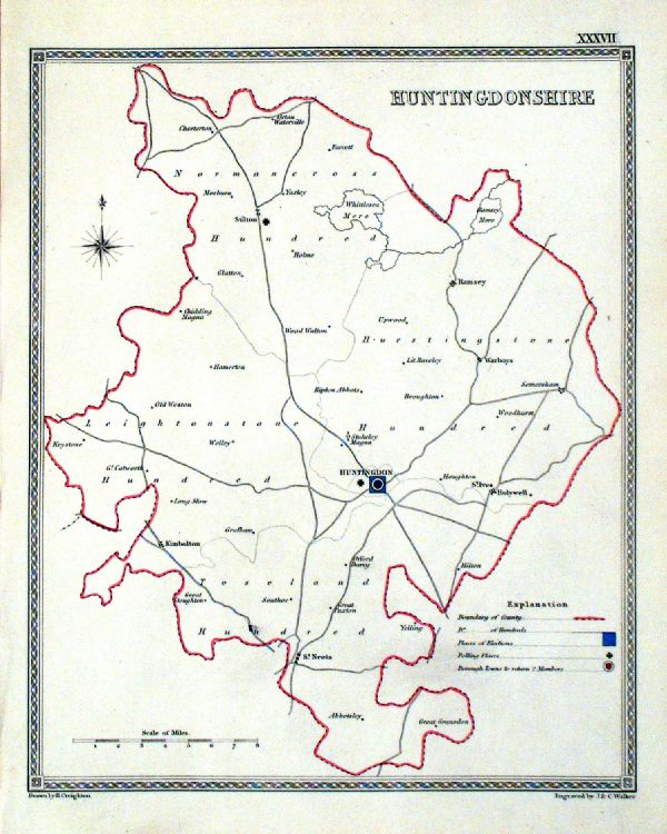 |
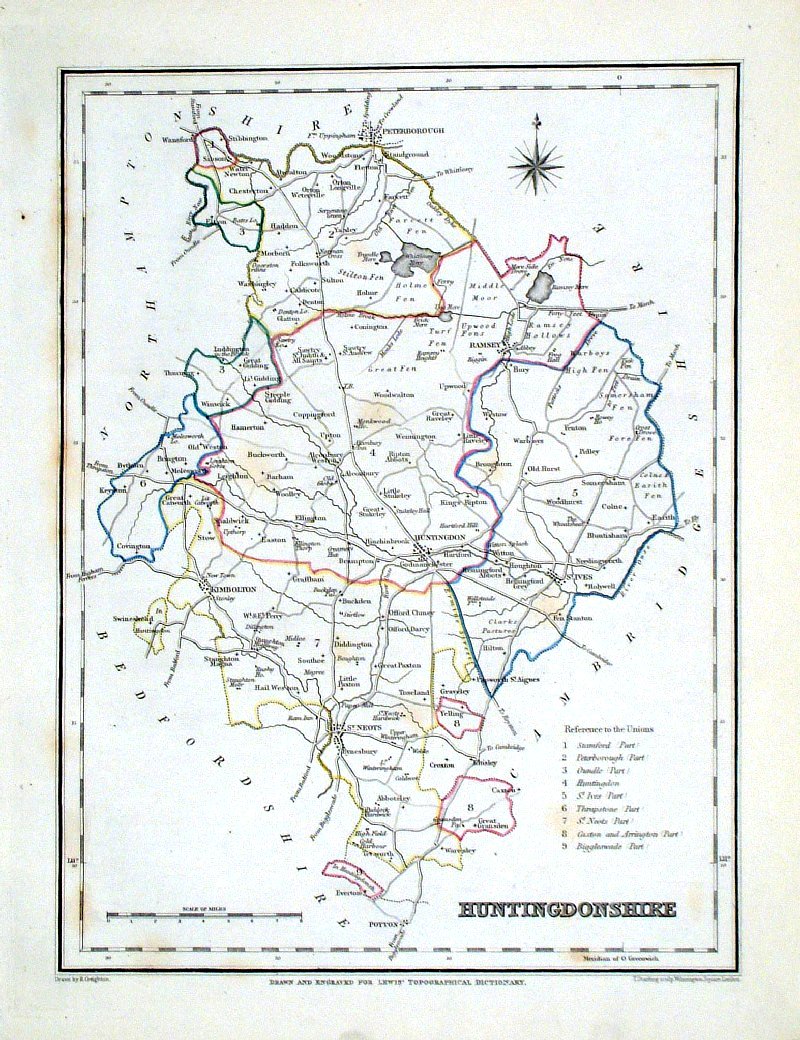
Huntingdonshire
Depicting electoral divisions and polling places. Samuel Lewis 1835 engraved by J & C Walker Steel engraving Size: 200 x 250 mm, Original colouring of boundaries. Antique Map Ref KJM037 £14.00 (+P&P) click image for enlargement |
 |
Huntingdonshire Lewis
c1842 Original hand colour size: 250 x 190 mm Ref GHM094 £14.00 (+P&P), a few faint foxing spots, Original hand colour Ref NAM018 £14.00 (+P&P) Typical detail expected from this series of Lewis maps - D1, D2, D3 Details are not specifically from the map shown here. click image for enlargement |
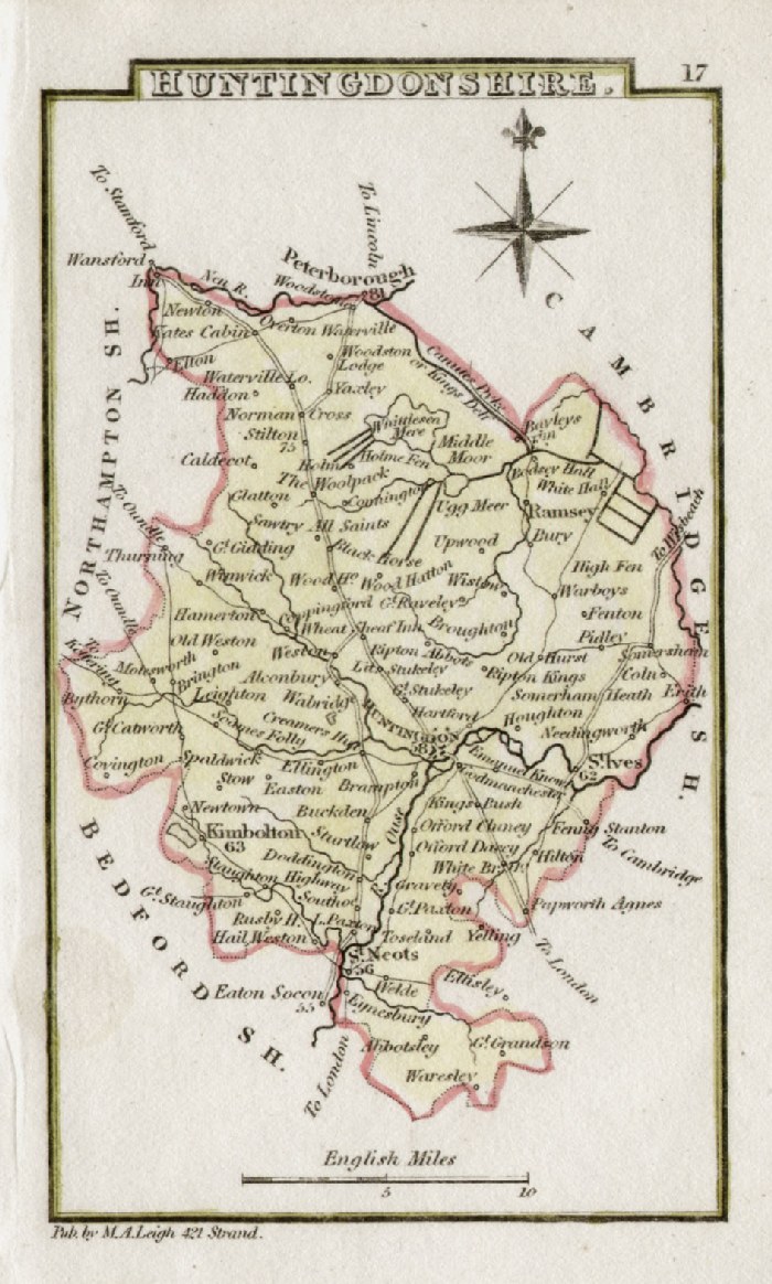 |
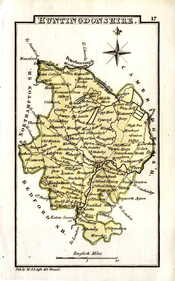
Huntingdonshire Leigh
1837 size: 80 x 130 mm Ref GGM017 £14.00 (+P&P) FDM009 click image for enlargement |
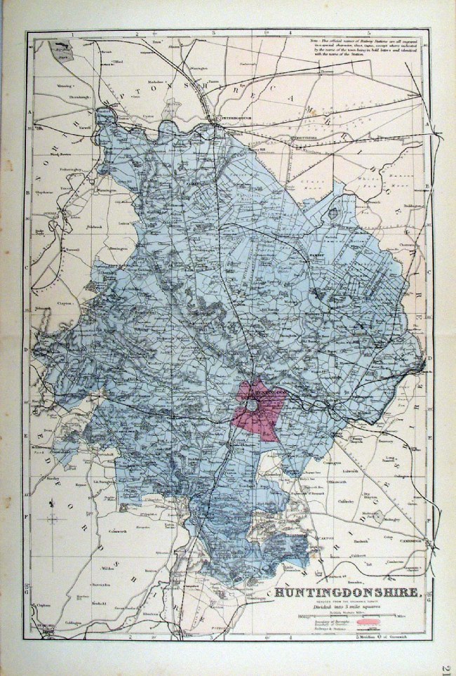 |
Huntingdonshire Bacon
c1883 size: 310 x 460 mm, double page, centre fold This series of Bacon maps contains great detail and is very popular with historians. Ref FLM107 £15.00 (+P&P) click image for enlargement |
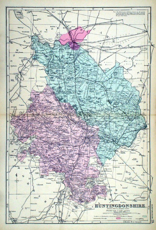 |
Huntingdonshire From the New Large Scale Atlas of the British Isles by G.W. Bacon 1892 size: 330 x 480 mm, centre fold. Coloured to represent Parliamentary Divisions. Ref LHM132 £15.00 (+P&P) Detail click image for enlargement |
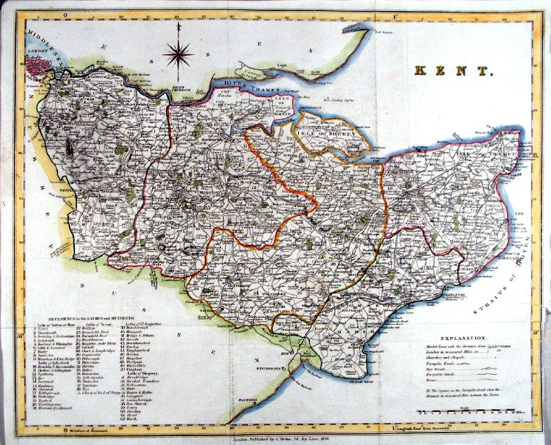
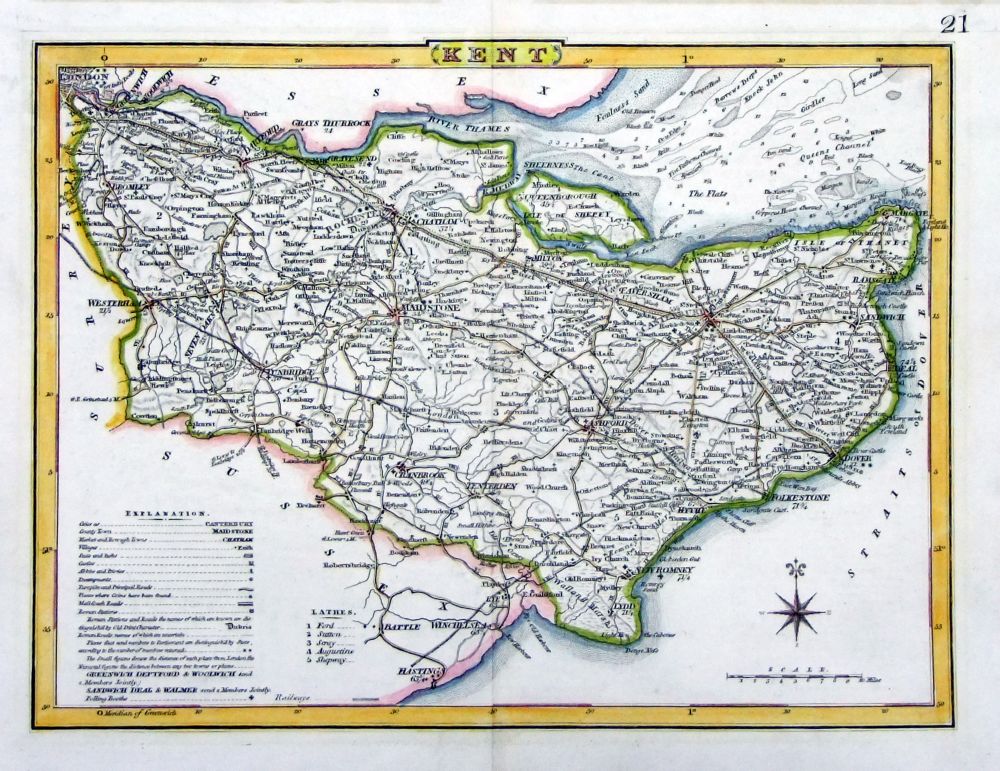
Kent |
Link
to Huntingdonshire Prints Kent |
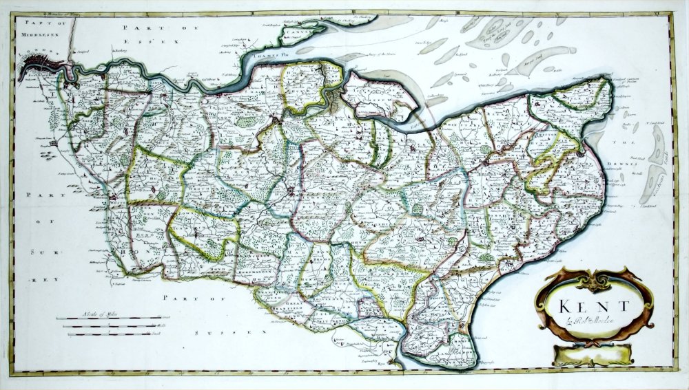 |
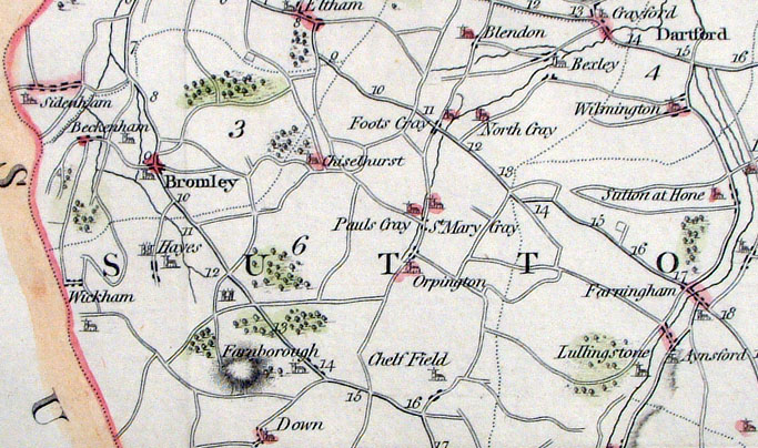
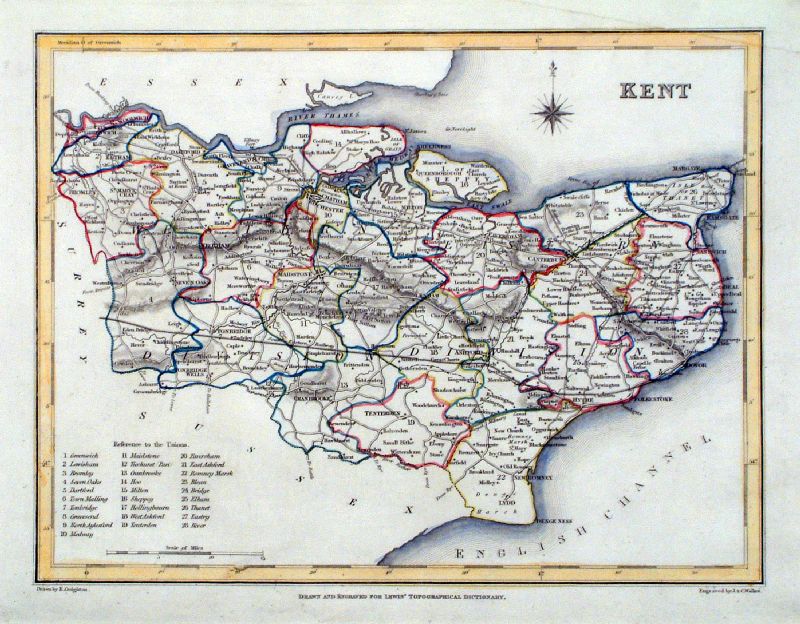
Kent
Robert Morden 1695
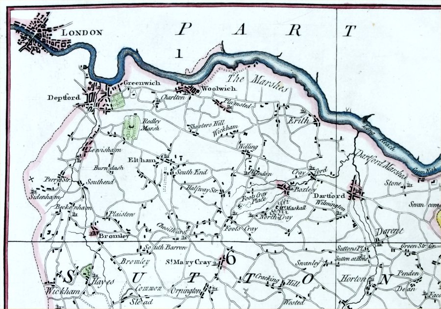
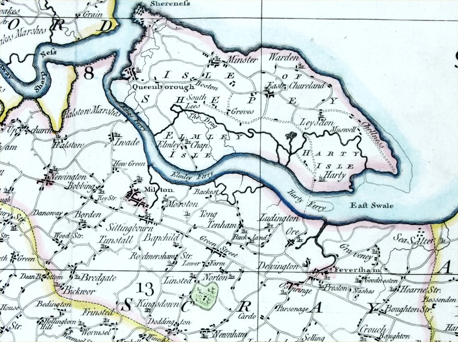
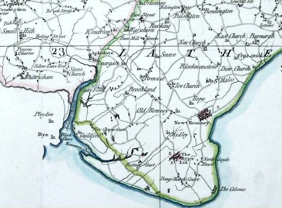
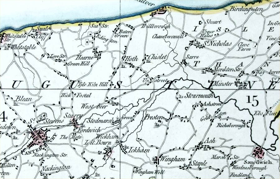
or 1715 size: 650 x 380 mm, several folds, thick paper Detail 1 Detail 2 Detail 3 Earlier than 1722 edition - still has 'Edenbridg', 'Foots Cray' and 'Westclifs' modified in 1722 Ref QFM003 £200.00 (+P&P) click image for enlargement |
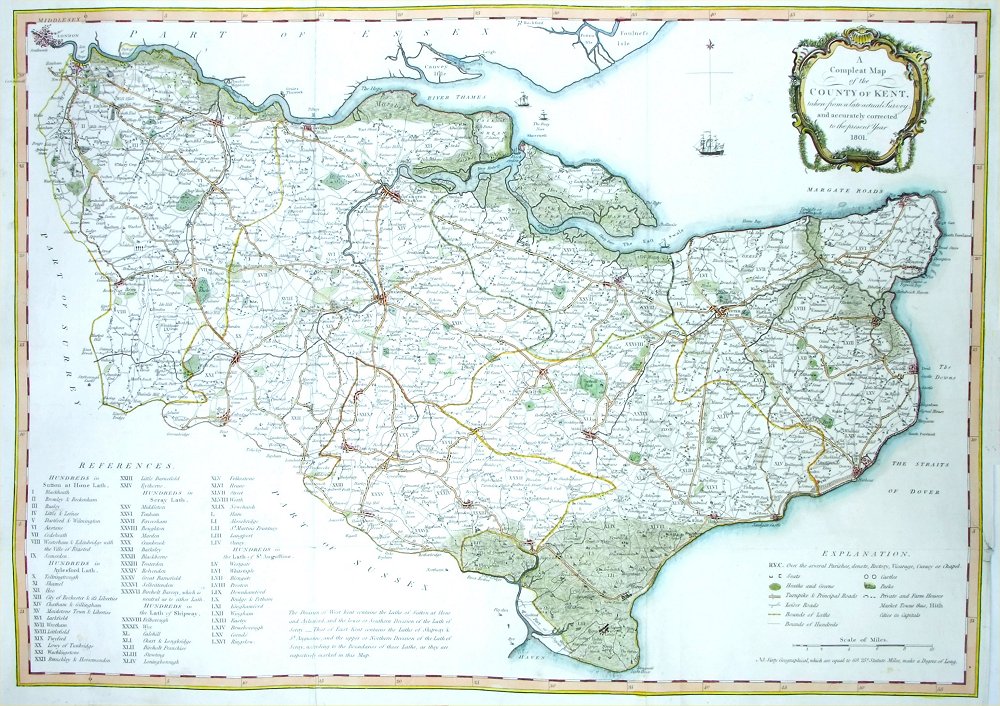 |
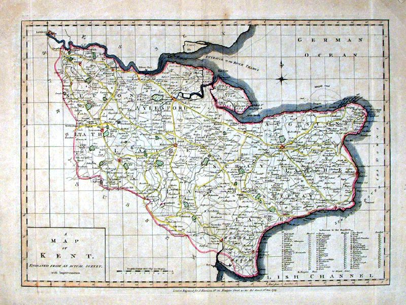
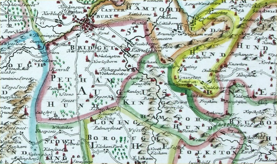
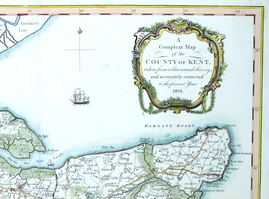
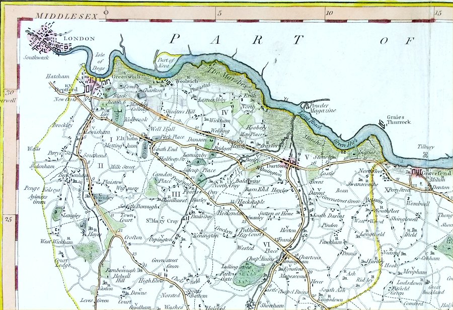
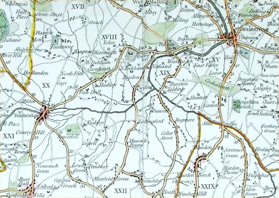
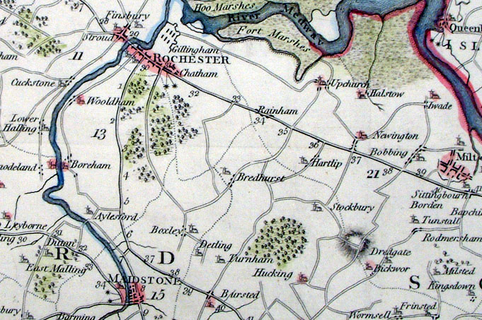
Kent
Downes 1801 for
2nd edition Hasted's History of Kent 'A Compleat Map of the County of Kent taken from a late actual survey and accurately corrected in the present year 1801' size: 700 x 500 mm, several folds Detail 1 Detail 2 Detail 3 Ref PLM001 £280.00 (+P&P) click image for enlargement |
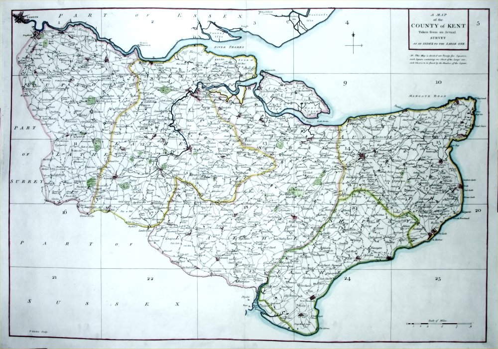 |
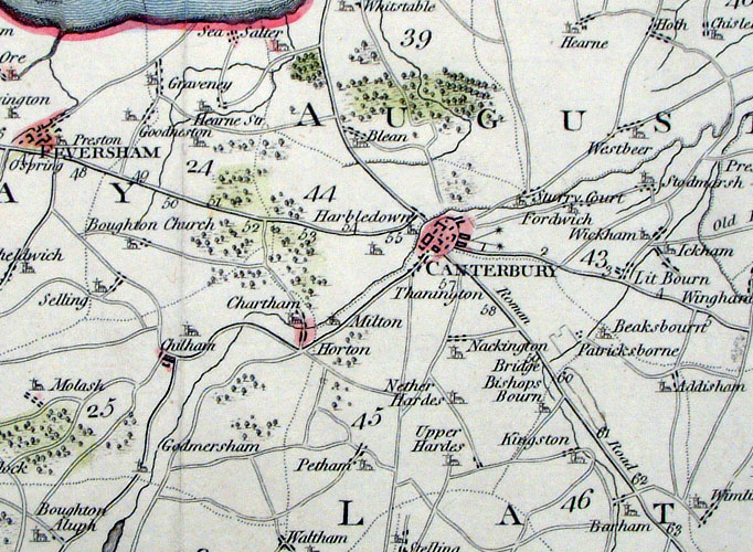
Kent
Kitchin 1769
for Andrews & Drury A Map of the County of Kent taken from an Actual Survey as an index to the Large One. size: 720 x 500 mm, centre fold Detail 1 Detail 2 Detail 3 Detail 4 Ref QFM001 £300.00 (+P&P) click image for enlargement |
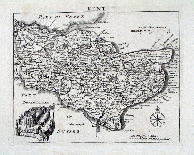 |
Kent
Read 1753 size: 220 x 180 mm Ref AAM046 £95.00 (+P&P) click image for enlargement |
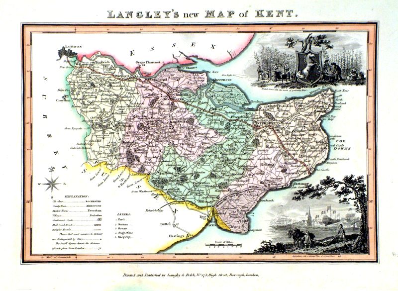 |
Kent
Langley & Belch
c1820 size: 270 x 210 mm Ref IDT009 £100.00 (+P&P) click image for enlargement |
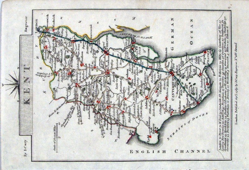 |
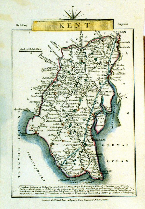
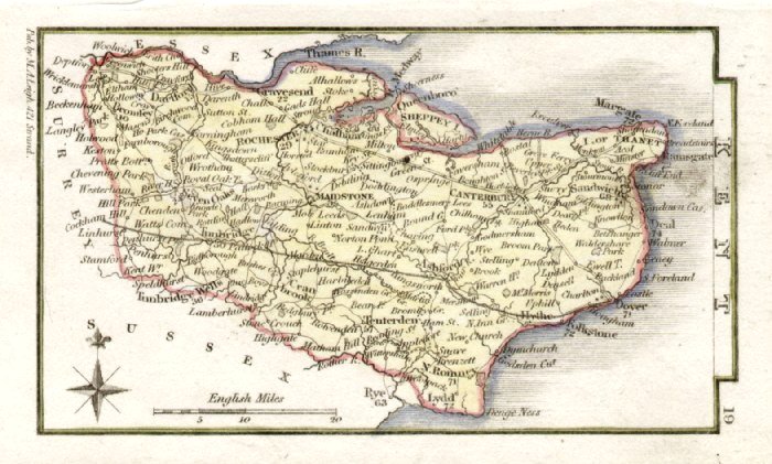
Kent Cary 1789
size: 120 x 185 mm Ref AAM022 £20.00 (+P&P) click image for enlargement |
 |
Kent
Cary 1789 size: 155 x 105 mm, tight top (north) margin Ref MLM017 £18.00 (+P&P) click image for enlargement |
 |
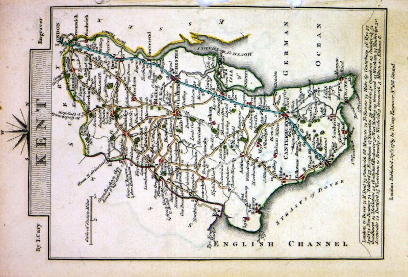
Kent Cary 1792
size: 120 x 185 mm Ref HBM001 £20.00 (+P&P) click image for enlargement |
 |
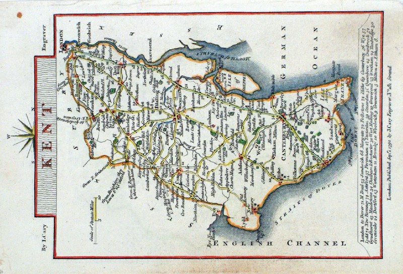
Kent
Cary 1819 Original hand
colour size:150 x 100 mm Ref GJM028 £20.00 (+P&P) click image for enlargement |
 |
Kent
Cary 1819
Copper engraving size: 100 x 150 mm, faint stain top-left corner Ref LEM007 £20.00 (+P&P) click image for enlargement |
 |
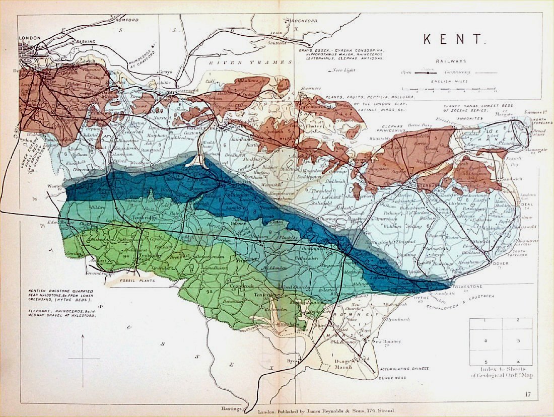
England & Wales
Geological map Reynolds / Emslie c1860 First Edition size: 200 x 250mm, centre fold, very slight discolouration at fold. Original hand colouring of geological structure - Colour Reference Key - click here Antique Map Ref KLM017 £26.00 (+P&P) click image for enlargement |
 |
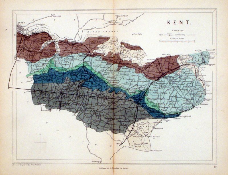
Kent
Geological map James Reynolds 1889 Second Edition (new map, additional data, side notes, different colouring) size: 185 x 250mm, centre fold, very slight discolouration at fold. Original hand colouring of geological structure - Colour Reference Key - click here Antique Map Ref RAM017 £26.00 (+P&P) click image for enlargement |
 |
Kent
Neele / Stockdale 1797 Copper engraving size: 520 x 370 mm, several folds, strengthened lower-left margin Ref KKM001 £100.00 (+P&P) Detail 1 Detail 2 Detail 3 click image for enlargement |
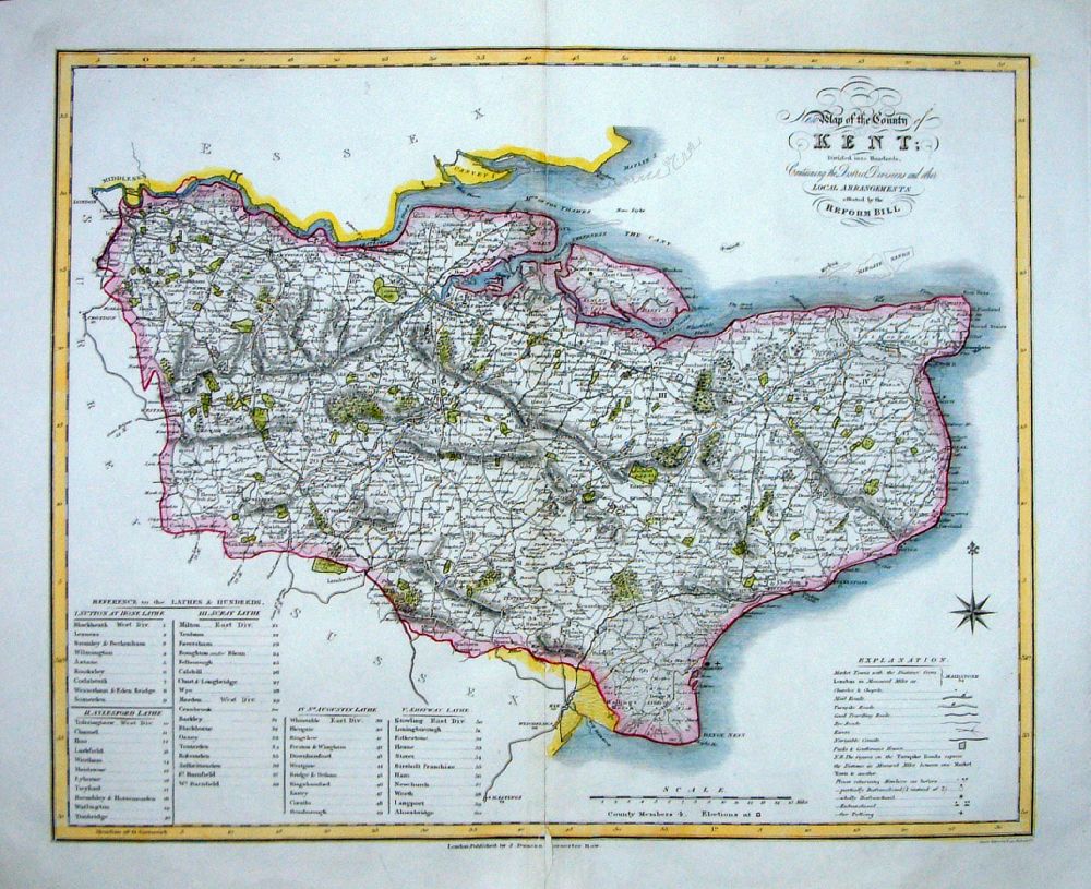 |
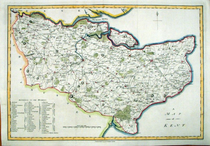
Kent
J. Duncan 1833 "Map of the County of Kent Divided into Hundreds Containing the District Divisions and other local arrangements effected by the Reform Bill" size: 460 x 370 mm, centre fold. Detail a few faint creases, repair to split at centrefold and lower margin Ref LEM048 £35.00 (+P&P) click image for enlargement- apologies for optical distortion caused during photography. |
 |
Kent Pinnock 1833 size: 250 x 180 mm Ref JDM018 £24.00 (+P&P) click image for enlargement |
 |
Kent Leigh 1837
size: 80 x 130 mm Ref GGM019 £18.00 (+P&P) 1837 Ref JGM010 £18.00 (+P&P) 1839 click image for enlargement |
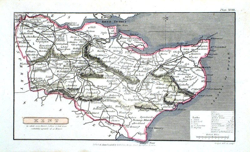 |
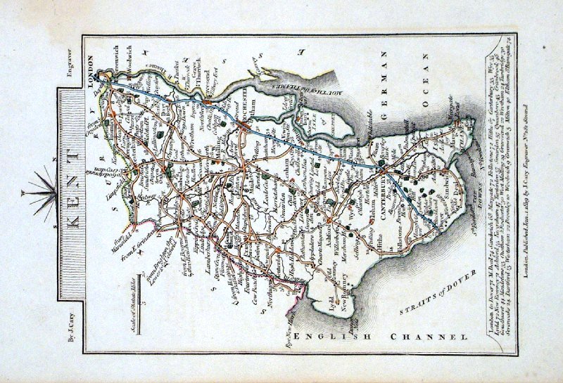
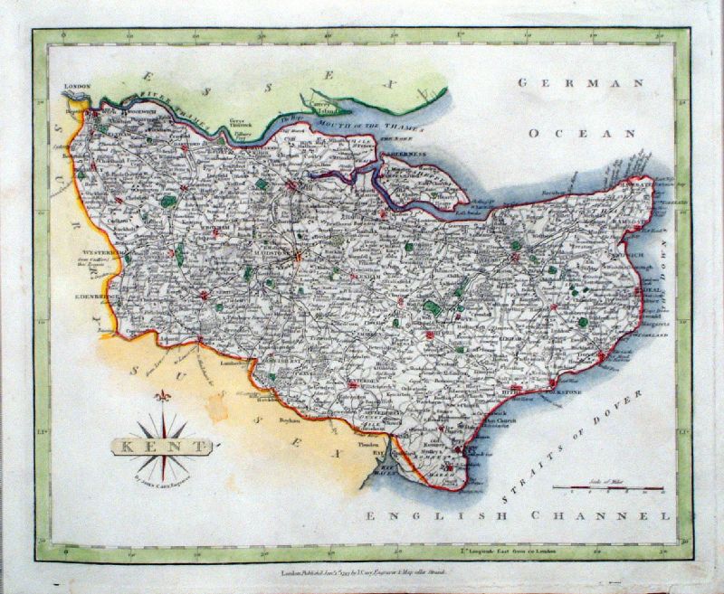
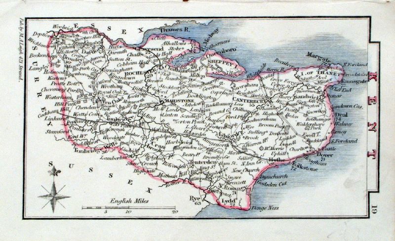
Kent
Capper
1808 Engraved by Cooper for Benjamin Pitts Capper Size: 190 x 120 mm Ref HBM002 £24.00 (+P&P) click image for enlargement |
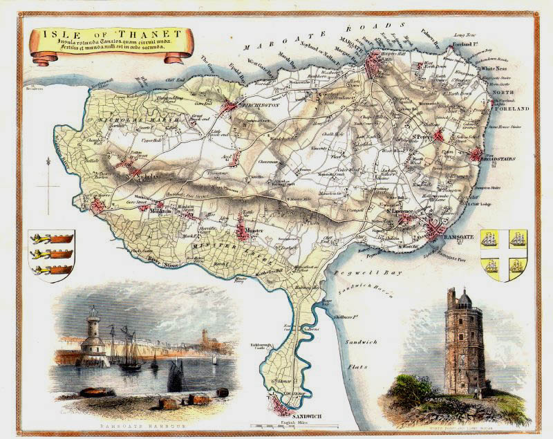 |
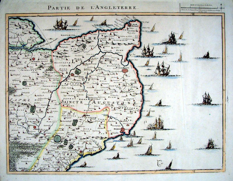
Isle of Thanet, Kent
Thomas
Moule c1845 size: 260 x 200 mm Ref IFM092 £30.00 (+P&P) click image for enlargement |
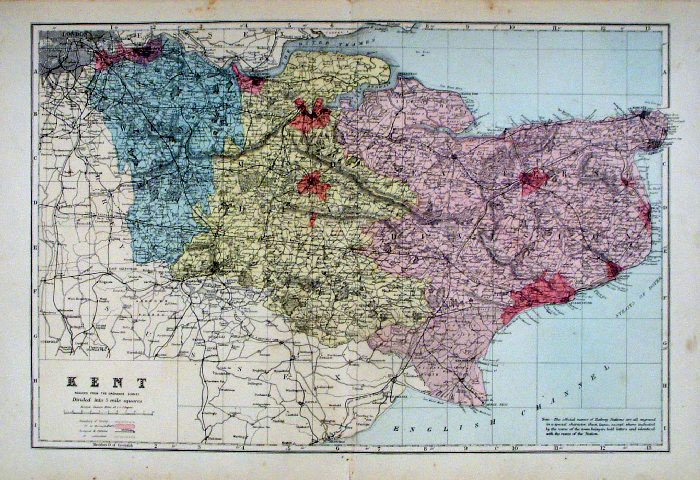 |
Kent Bacon c1883
size: 460 x 310 mm, double page, centre fold Coloured to represent Parliamentary Divisions. Ref FLM108 £18.00 (+P&P) click image for enlargement |
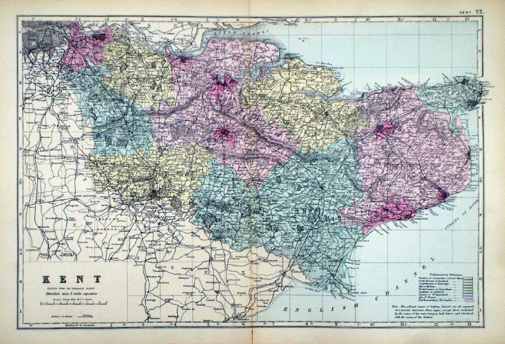 |
Kent From the New Large Scale Atlas of the British Isles by G.W. Bacon 1892 size: 480 x 330 mm, centre fold. Coloured to represent Parliamentary Divisions. Ref LHM131 £18.00 (+P&P) Detail click image for enlargement |
 |
Kent
Cary 1793 size: 270 x 220 Ref IIM021 £25.00 (+P&P) click image for enlargement |
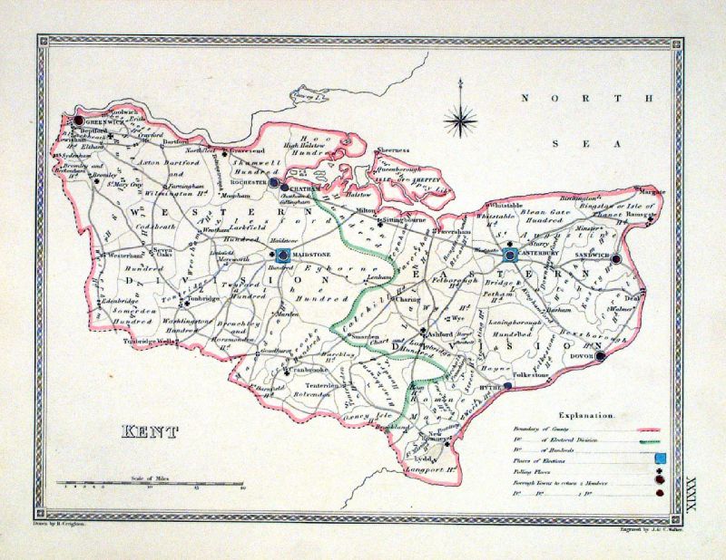 |
Kent
Depicting electoral divisions and polling places.
Samuel Lewis 1835 engraved by J & C Walker Steel engraving Size: 250 x 200 mm, Original colouring of boundaries. Antique Map Ref KJM039 £16.00 (+P&P) click image for enlargement |
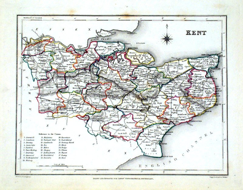 |
Kent Lewis c1842
Original hand colour size: 250 x 190 mm , Ref GHM095 £18.00 (+P&P) a few faint foxing spots Ref JKM068 £20.00 (+P&P) click image for enlargement |
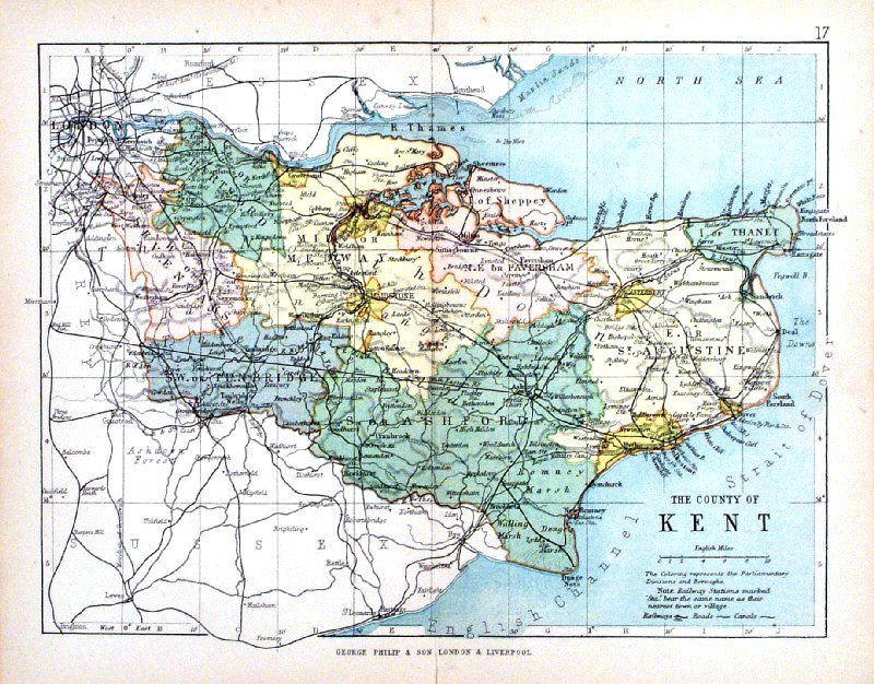 |
Kent George Philip
1898 Colouring represents the Parliamentary Divisions and Boroughs size: 220 x 180 mm, centre fold, original printed colour Ref HHM021 £20.00 (+P&P) click image for enlargement |
 |
Kent GW Bacon 1912 size: 500 x 350 mm Antique Map Ref HBS008 £24.00 (+P&P) click image for enlargement |
 |
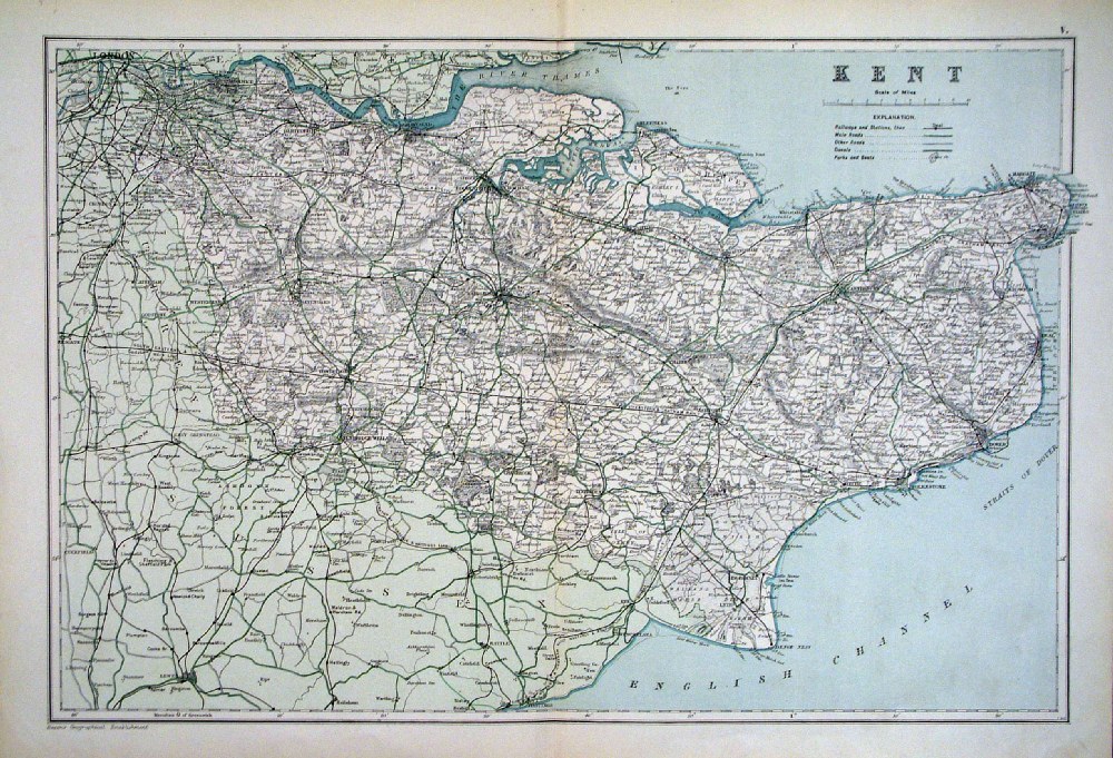
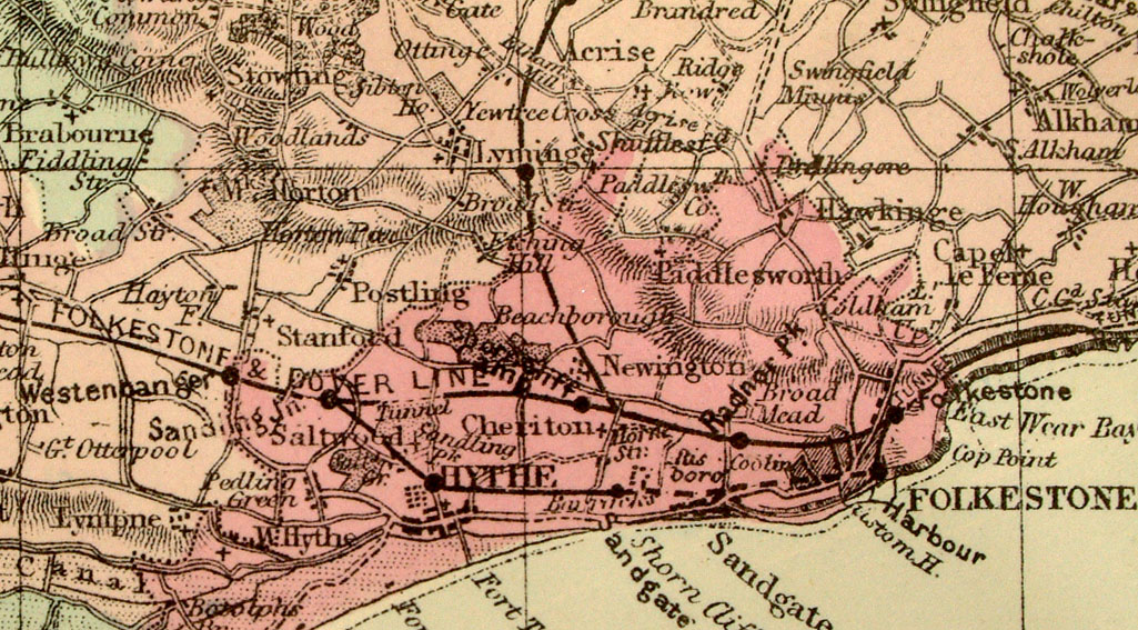
Kent
Harrison
1798 size: 490 x 370 mm, several folds, a few light creases, faint age toning. Antique Map Ref IDM044 £58.00 (+P&P) Detail click image for enlargement |
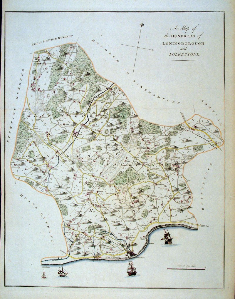 |
Folkestone Hundred (Kent) Hasted c1790 - 1800 size: 400 x 520 mm several folds. Ref AAM103 £90.00 (+P&P) Detail click image for enlargement |
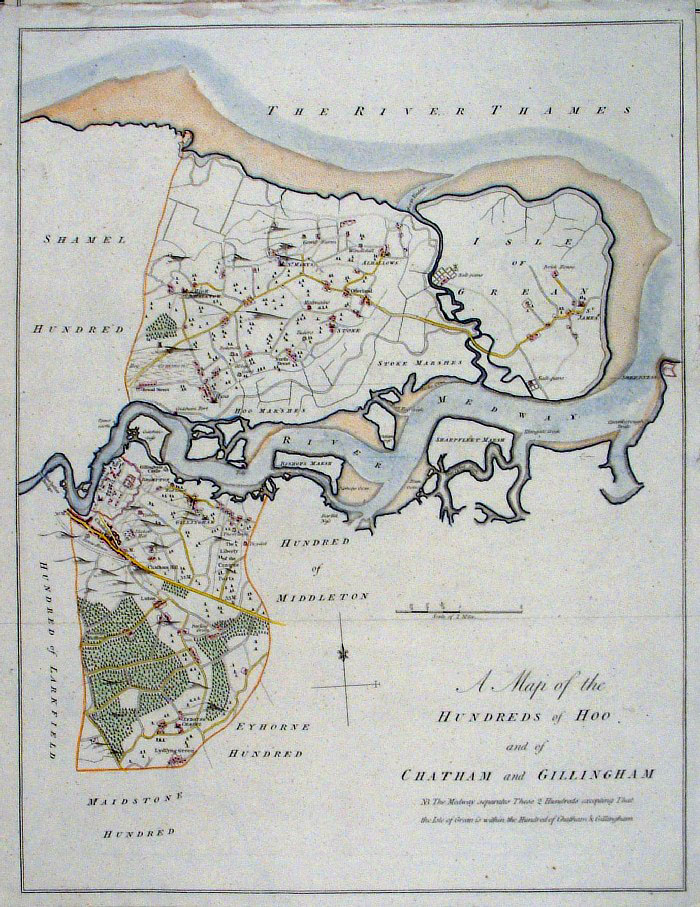 |
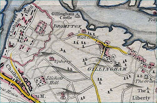
Hoo, Chatham & Gillingham Hundreds
(Kent) Hasted c1790 - 1800 size: 400 x 500 mm several folds. Covers Chatham & Hooe Peninsular Ref AAM094 £75.00 (+P&P) Detail click image for enlargement |
 |
Kent Coast & English Channel
Henri Frix 1709 size:
610 x 500 mm A few creases Ref AAM141 £180.00 (+P&P) (£250 as a pair with AAM142) Detail click image for enlargement |
 |
Kent Coast & English Channel
Henri Frix 1709 size:
610 x 500 mm A few creases Ref AAM142 £140.00 (+P&P) (£250 as a pair with AAM141) click image for enlargement |
 |
Kent & East Sussex Laurie
&
whittle 1806 size: 260 x 315 mm tight margins Ref AAM046 £45.00 (+P&P) click image for enlargement |
 |
Kent & East Sussex Laurie
&
whittle 1806 size: 260 x 315 mm tight margins Ref AAM047 £45.00 (+P&P) click image for enlargement |
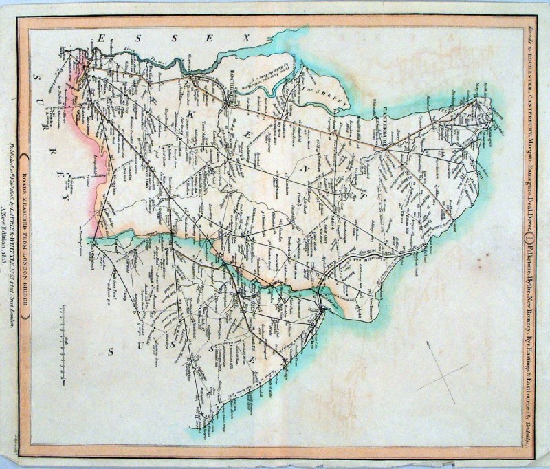 |
Kent & East Sussex Laurie
&
whittle 1806 size: 260 x 315 mm tight margins Ref AAM048 £45.00 (+P&P) click image for enlargement |
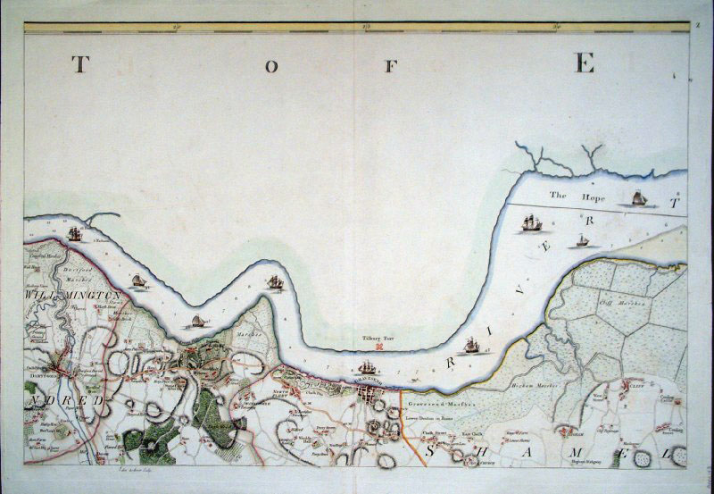 |
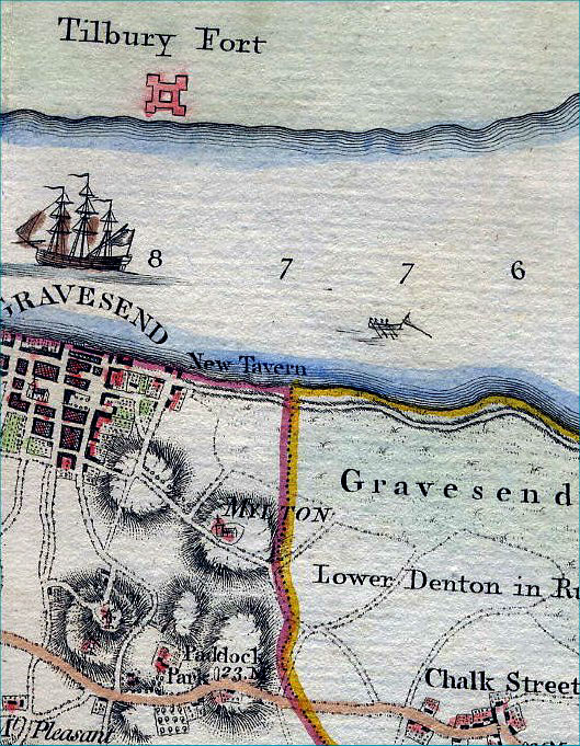
Thames Estuary at Gravesend (Kent)
size: 730 x 520 mm Andrews & Drury 1769 Ref AAM143 £180.00 (+P&P) click image for
enlargement Detail
|
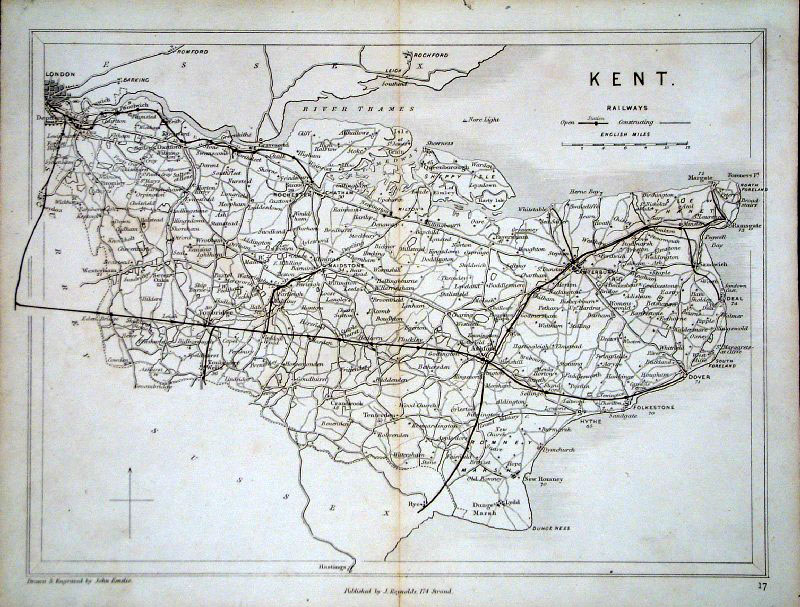 |
Kent Railways Emslie /
Reynolds 1860 (3rd Edition)
Size: 250 x 190
mm Ref GFM115 £32.00 (+P&P) click image for enlargement |
 |
Kent
Virtue 1829 size:
240 x 190 mm Ref IGM002 £30.00 (+P&P) click image for enlargement |
 |
Kent
Cole
& Roper c1840 size:
420 x 350 mm Several folds, repair to split fold, tight margin - bottom right Ref OBM001 £20.00 (+P&P) click image for enlargement |
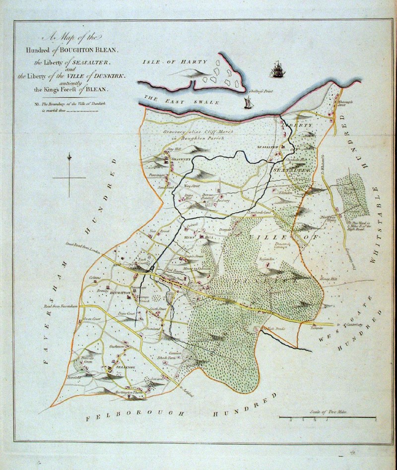 |
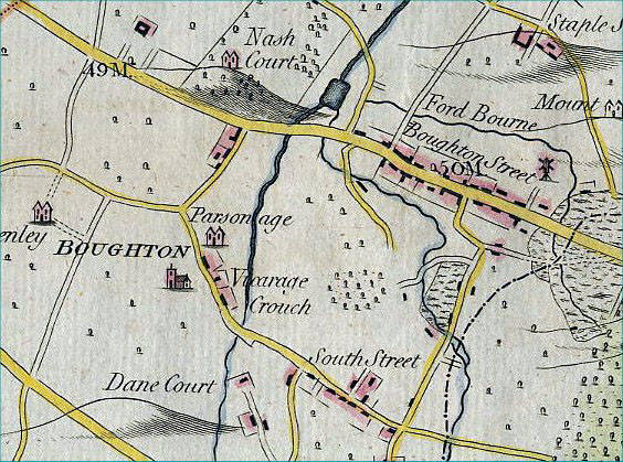
Broughton Blean Hundred (Kent)
Hasted c1790 - 1800 size: 400 x 500 mm Covers Seasalter, Whitstable, Sellinge, Graveney, Broughton Ref AAM097 £95.00 (+P&P) Tight right hand margin. click image for enlargement Detail |
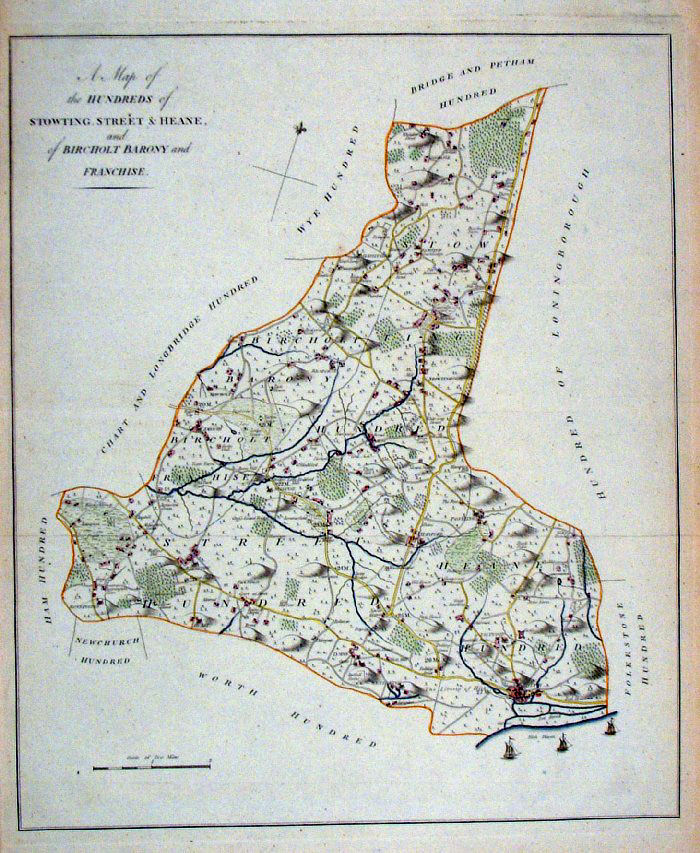 |
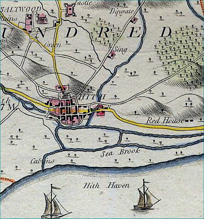
Stowting Street & Heane Hundreds
(Kent) Hasted c1790 - 1800 size: 400 x 500 mm several folds. Covers Hythe, Stowting, Sellinge Ref AAM093 £95.00 (+P&P) click image for enlargement Detail |
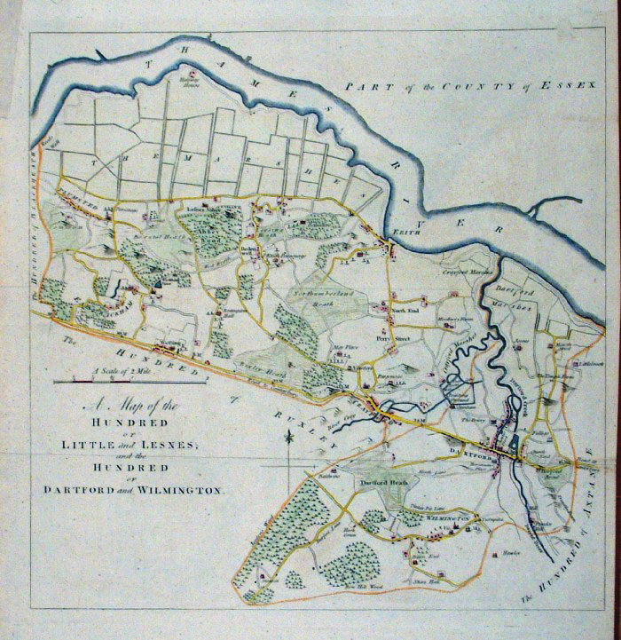 |
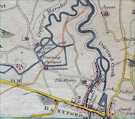
Dartford, Wilmington, Little & Lesnes
Hundreds (Kent) Hasted c1790 - 1800 size: 400 x 500 mm several folds. Covers Dartford, Plumstead, Erith Ref AAM095 £85.00 (+P&P) click image for enlargement Detail |
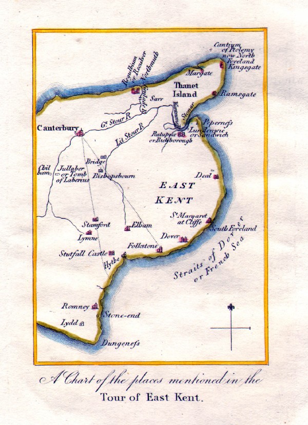 |
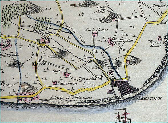
Tour of East Kent Gostling 1825 size: 90 x 125 mm Ref IDM042 £16.00 (+P&P) click image for enlargement |
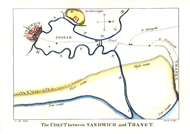 |
The Coast Between Sandwich and Thanet Gostling / Bayly size: 160 x 115 mm Ref IDM043 £18.00 (+P&P) click image for enlargement |
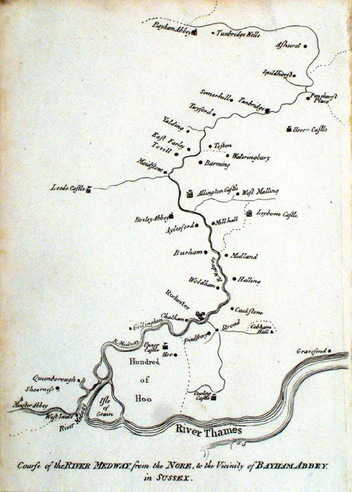 |
Course of the River Medway from the Nore to the Vicinity of Bayham Abbey in Sussex. Henry Skrine 1801 size: 160 x 230 mm Ref JCM010 £28.00 (+P&P) click image for enlargement |
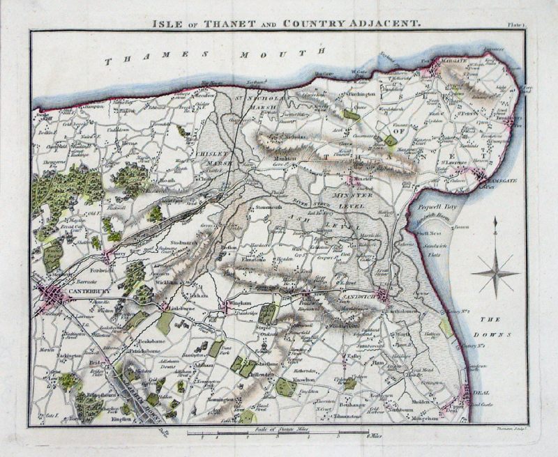 |
Isle of Thanet and
Countryside Adjacent Thomson 1811 (Patersons Roads) size: 230 x 190 mm Ref MEM006 £20.00 (+P&P) click image for enlargement |
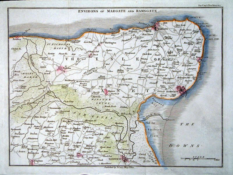 |
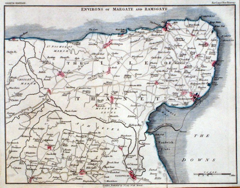
Isle of Thanet (Kent) Environs of Margate
and Ramsgate Cary 1812 size: 240 x 180 mm Ref GFM085 £20.00 (+P&P) click image for enlargement |
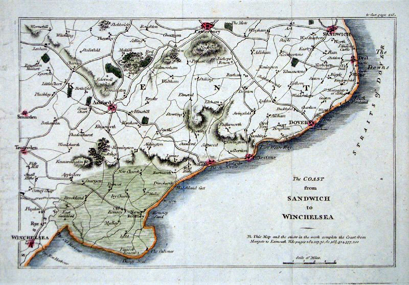 |
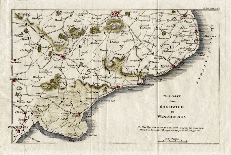
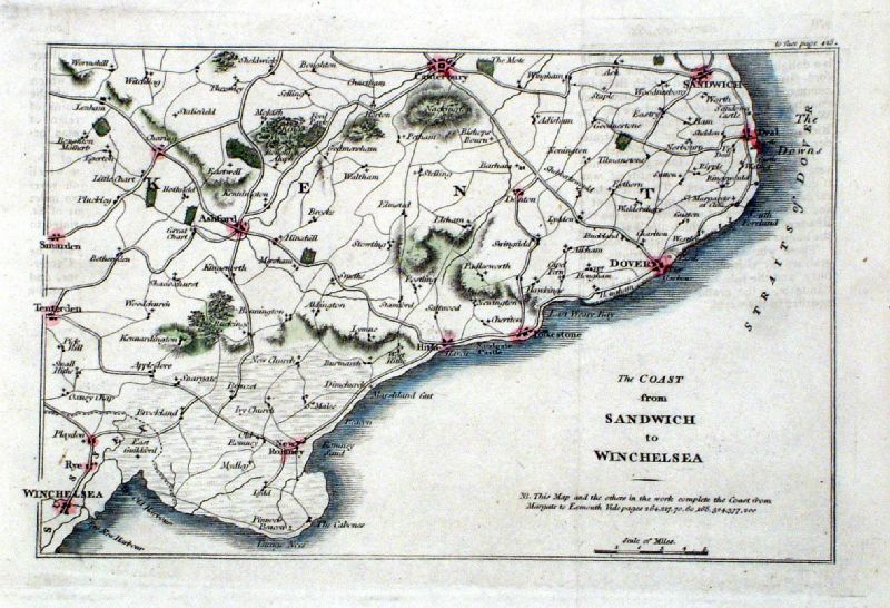
The Coast from Sandwich to Winchelsea from
1815 edition of 'Guide to Watering and Sea-bathing
places ...' size: 190 x 130 mm Ref GFM114 £20.00 (+P&P) Ref GDM163 £20.00 (+P&P) Ref KCM009 £20.00 (+P&P) click image for enlargement |
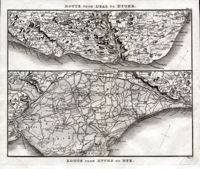 |
Route from Hythe to Rye and Route from Deal to
Hythe Mogg 1822 size: 200 x 240 mm, centre fold Detail Ref FKM024 £22.00 (+P&P) click image for enlargement |
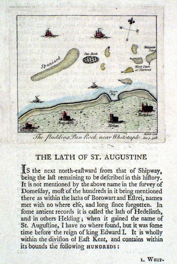 |
The Pudding Pan Rock near Whitstaple
Barlow / Hasted c1800 copper engraving size: 100 x 90 mm (page 120 x 200 mm) Ref KCM012 £20.00 (+P&P) click image for enlargement |
 |
The English Channel, Kent
Coast Barlow /
Hasted c1800 copper engraving size: 100 x 80 mm text from reverse shows through Ref HBM007 £10.00 (+P&P) click image for enlargement |
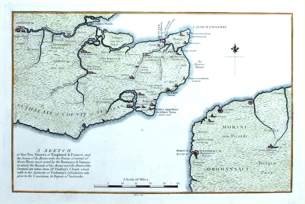 |
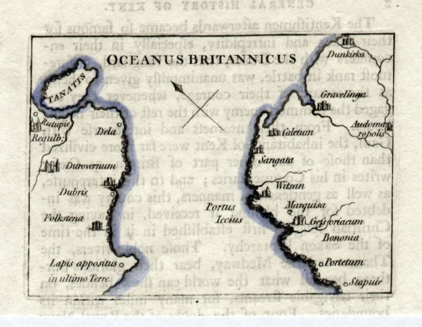
A Sketch of the two
shores of England & France shows towns rivers noted by the Romans and Saxons. Barlow / Hasted c1790 copper engraving size: 340 x 220 mm Ref PLM003 £28.00 (+P&P) click image for enlargement |
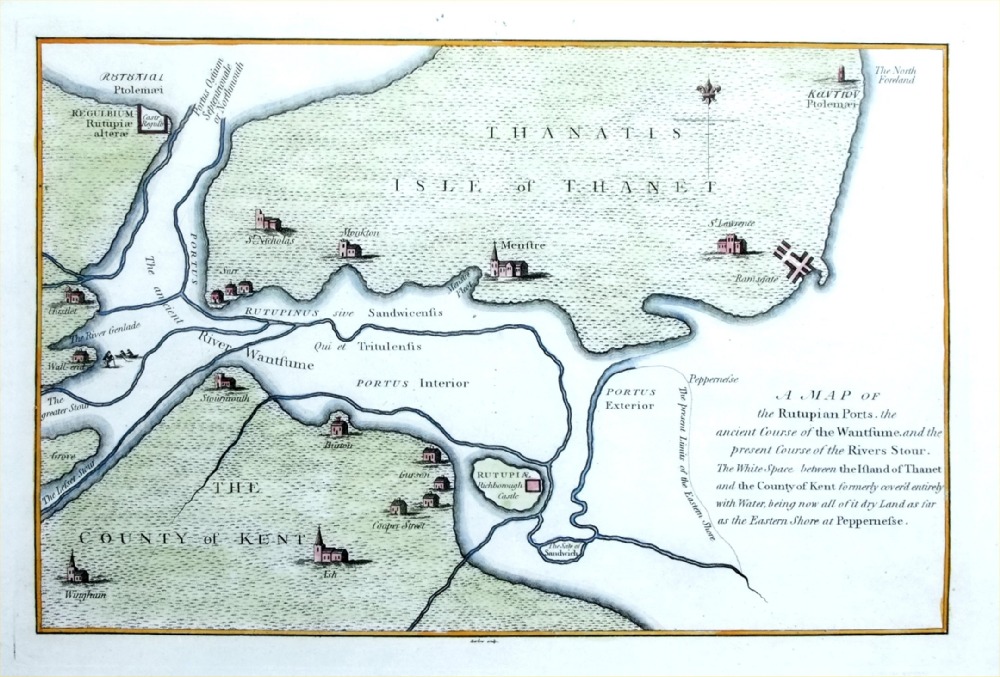 |
A Map of the Rutupian
Ports ... shows ancient shore lines and river courses at Thanet Barlow / Hasted c1790 copper engraving size: 340 x 220 mm Ref PLM004 £28.00 (+P&P) click image for enlargement |
|
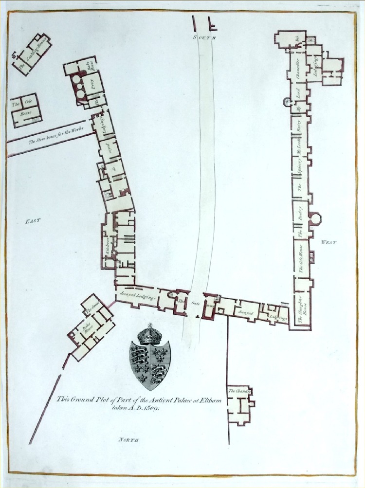
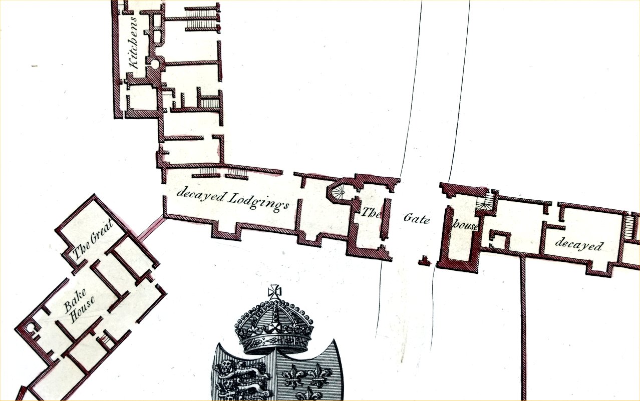
Ground Plot of part
of the Antient Palace at Eltham Barlow / Hasted c1790 copper engraving size: 245 x 340 mm, tight side margins Ref PLM008 £24.00 (+P&P) Detail click image for enlargement |
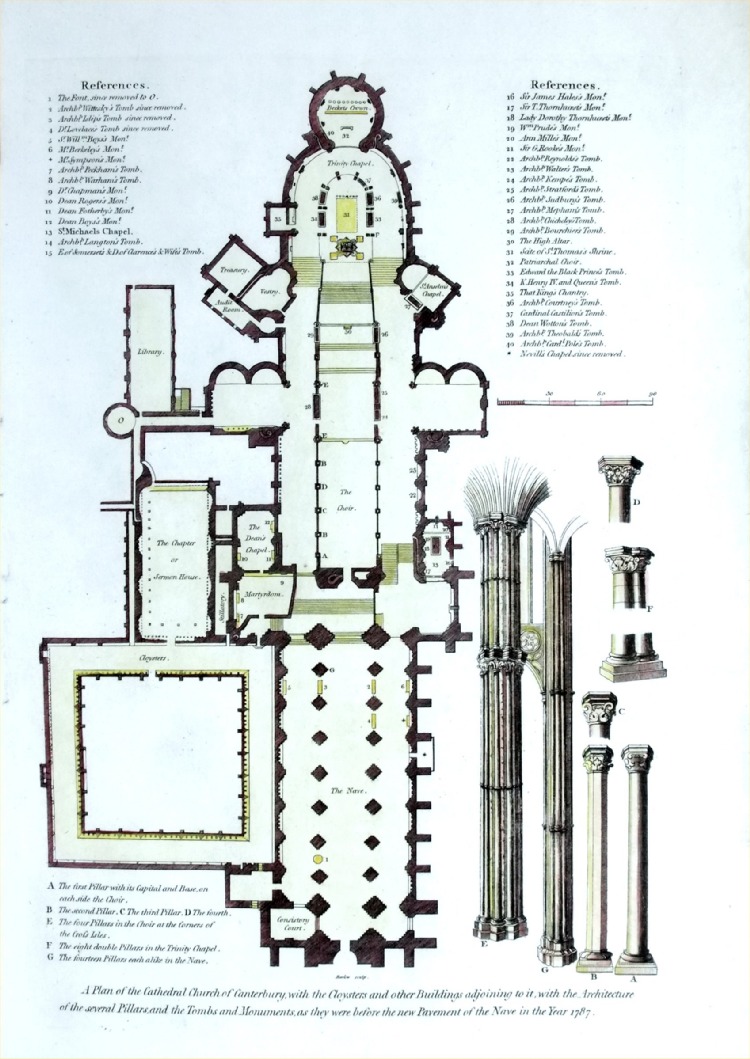 |
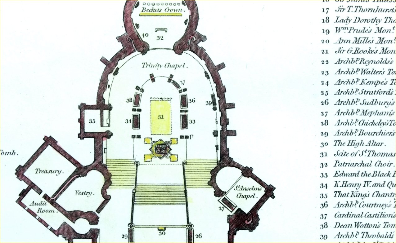
Plan of the Cathedral
Church of Canterbury .... Barlow / Hasted c1790 copper engraving size: 230 x 340 mm Ref PLM006 £28.00 (+P&P) Detail click image for enlargement |
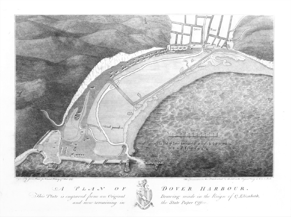 |
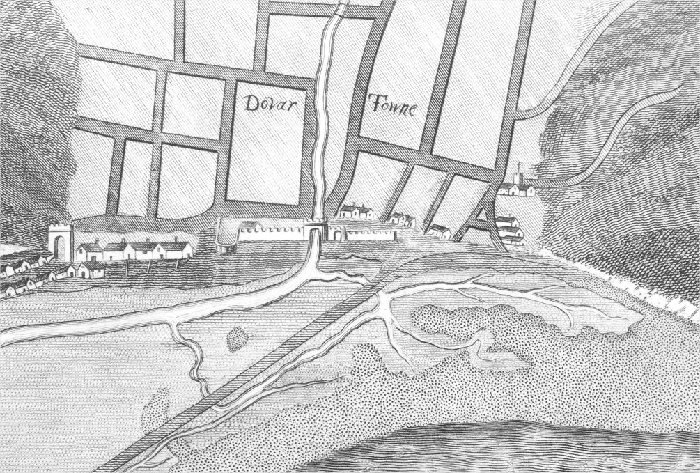
A Plan of the Town of
Dover Harbour ( as of the reign of Elizabeth I ) Barlow / Hasted c1790 copper engraving size: 320 x 240 mm Ref PLM005 £24.00 (+P&P) Detail click image for enlargement |
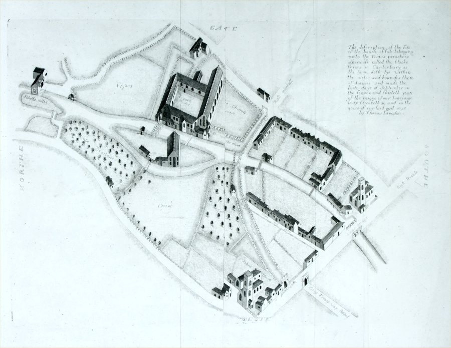 |
A Plan of the Black
Friars enclosure, Canterbury. A copy of Thomas Langdon's plan of 1595 for Hasted's History of Kent 1783 copper engraving size: 450 x 330 mm, some creases and repairs. It looks as though 5-6mm of the centre (maybe a damaged centre crease) is missing with the left & right portions stuck back together. This is noticable at the top of the map with the 'E' missing in 'EASTE' Ref PLM002 £18.00 (+P&P) click image for enlargement |
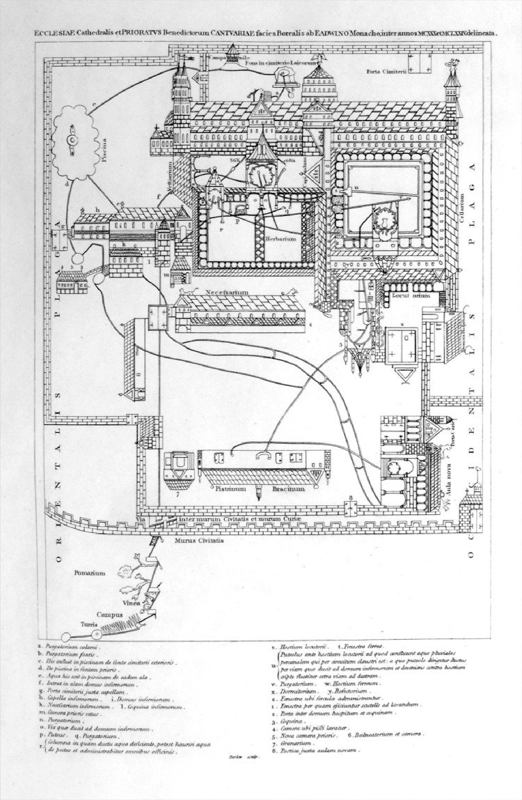 |
Plan of an ancient
processional route around Canterbury
Cathedral Barlow / Hasted c1790 copper engraving size: 200 x 300 mm Ref PLM007 £20.00 (+P&P) Detail click image for enlargement |
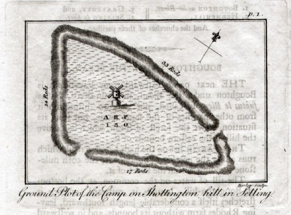 |
Ground Plot of the Camp on Shottington Hill,
Selling Barlow / Hasted
c1800 copper engraving size: 100 x 80 mm text from reverse shows through Ref HBM010 £10.00 (+P&P) click image for enlargement |
 |
Castle Rough on Kemsley Downs in Milton
Barlow / Hasted c1800 copper engraving size: 100 x 80 mm text from reverse shows through Ref HBM012 £10.00 (+P&P) click image for enlargement |
 |
Roman Camp on Oldbury Hill in Ightham
Barlow / Hasted c1800 copper engraving size: 100 x 80 mm text from reverse shows through Ref HBM008 £10.00 (+P&P) click image for enlargement |
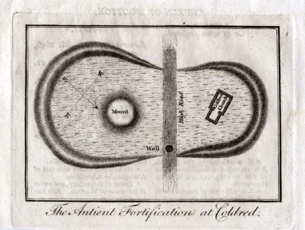 |
Ancient Fortifications at Coldred
Barlow / Hasted c1800 copper engraving size: 100 x 80 mm text from reverse shows through Ref HBM009 £10.00 (+P&P) click image for enlargement |
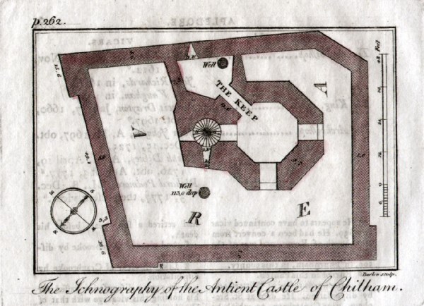 |
Ichnography of the Ancient Castle atChilham
Barlow / Hasted c1800 copper engraving size: 100 x 80 mm text from reverse shows through Ref HBM011 £10.00 (+P&P) click image for enlargement |
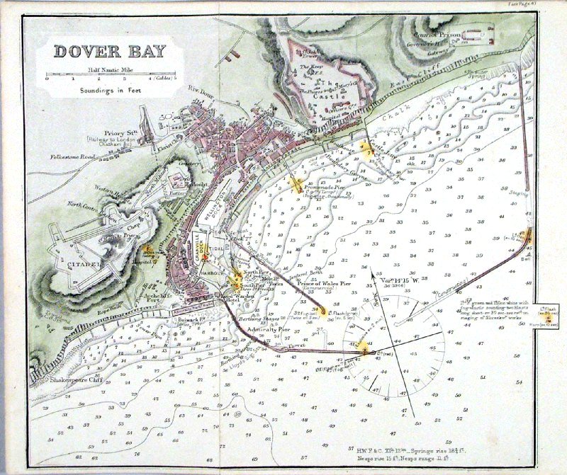 |
Kent Coast - Dover Bay
Malby
1869 size: 260 x 220 mm, 2 folds Antique Map Ref HJM012 £22.00 (+P&P) click image for enlargement |
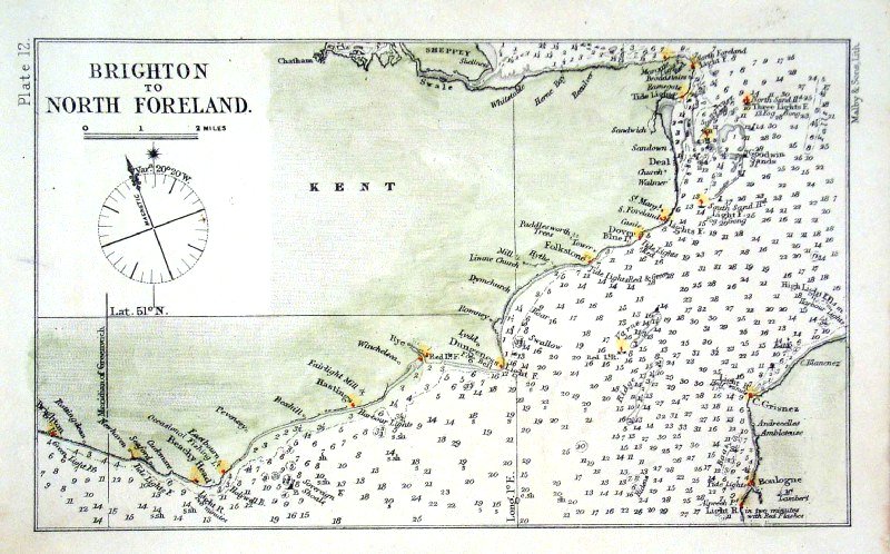 |
Kent / Sussex Coast - Brighton to North Foreland
Malby 1869 size: 200 x 120 mm Antique Map Ref HJM011 £18.00 (+P&P) click image for enlargement |
 |
Kent Emery
Walker 1908 size: 260 x 180 mm, 2 folds Antique Map Ref JCM001 £12.00 (+P&P) click image for enlargement |
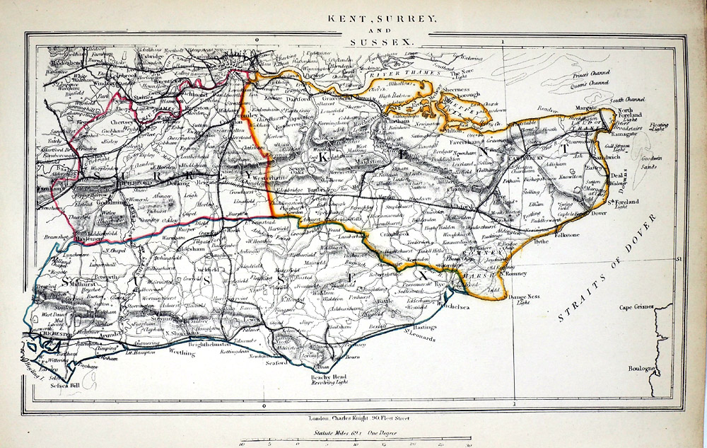 |
Kent, Surrey and Sussex
Charles Knight 1852 size: 270 x 160 mm Antique Map Ref RLM015 £18.00 (+P&P) click image for enlargement |
| Reference |
Tony Burgess carto-bibliography of Kent
maps - Printed
Maps of Kent |
| All Genuine Antiquarian
Maps - No Reproductions or Modern Copies Link to Kent Prints |
2024