Past Pages
Antique Maps, Prints and Ephemera
Antique Maps of North America
Americas ( North & South), North America, Canada, United States
Americas |
|
 |
North America & South America
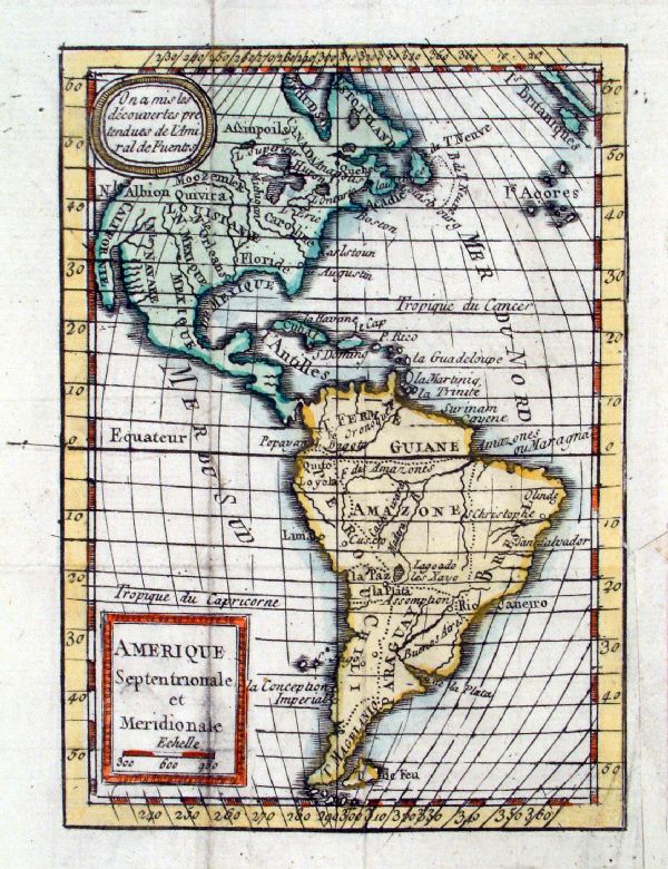
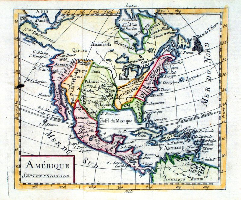
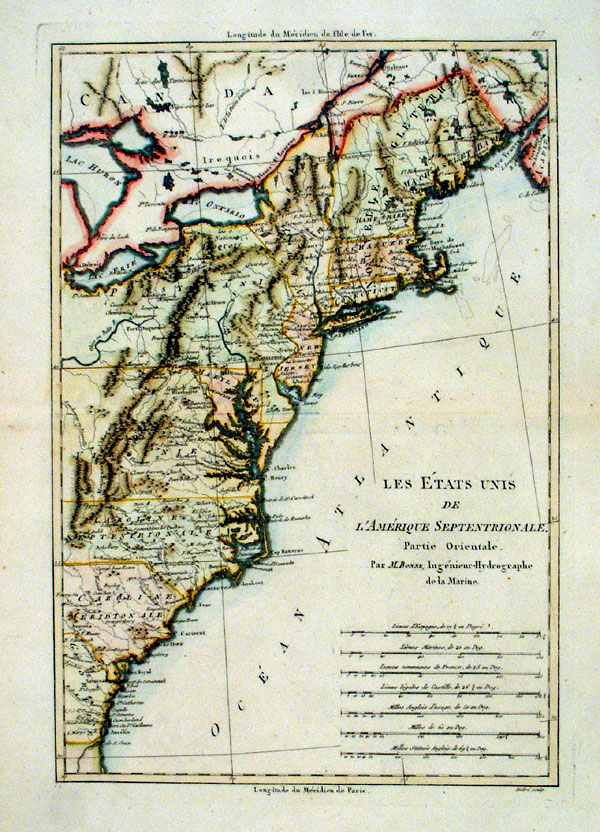
Expilly
1777 Amerique Septentrionale et Meridionale size: 100 x 140 mm, several folds Ref JKM001 £85.00 (+P&P) click image for enlargement |
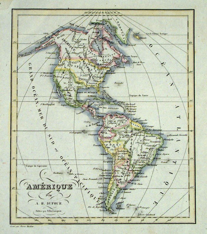 |
America, Dufour c1843
size: 190 x 220 mm Ref FLM007 £45.00 (+P&P) click image for enlargement |
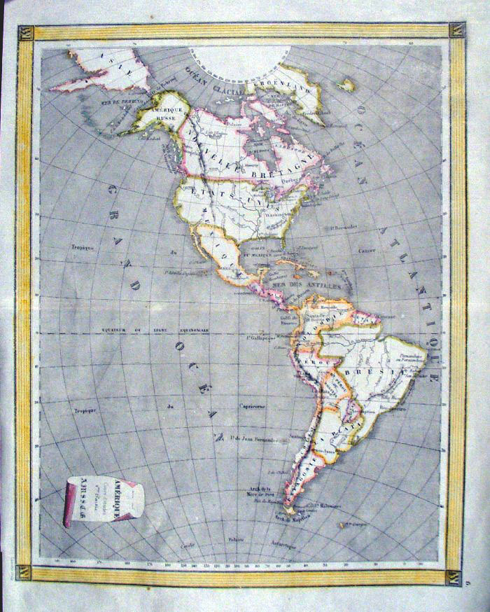 |
America, Poussielgue / AMSSCG
/ Laurens Paris c1868
size: 280 x 350 mm Centre fold, a few minor creases at fold. Ref FLM079 £42.00 (+P&P) click image for enlargement |
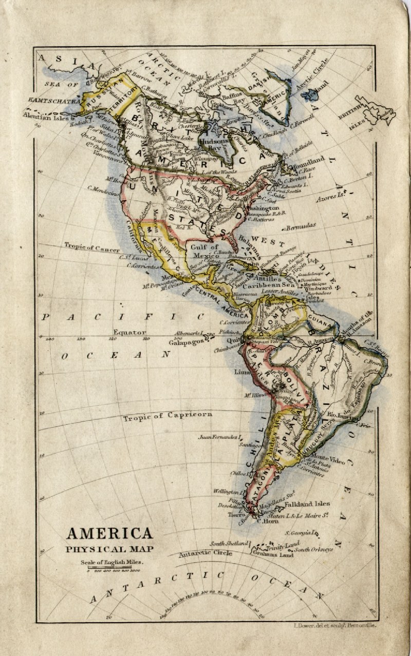 |
America John Dower /
James Cornwell c1850 Ref GFM071 £16.00 (+P&P) size: 150 x 95 mm, slightly soiled surface click image for enlargement |
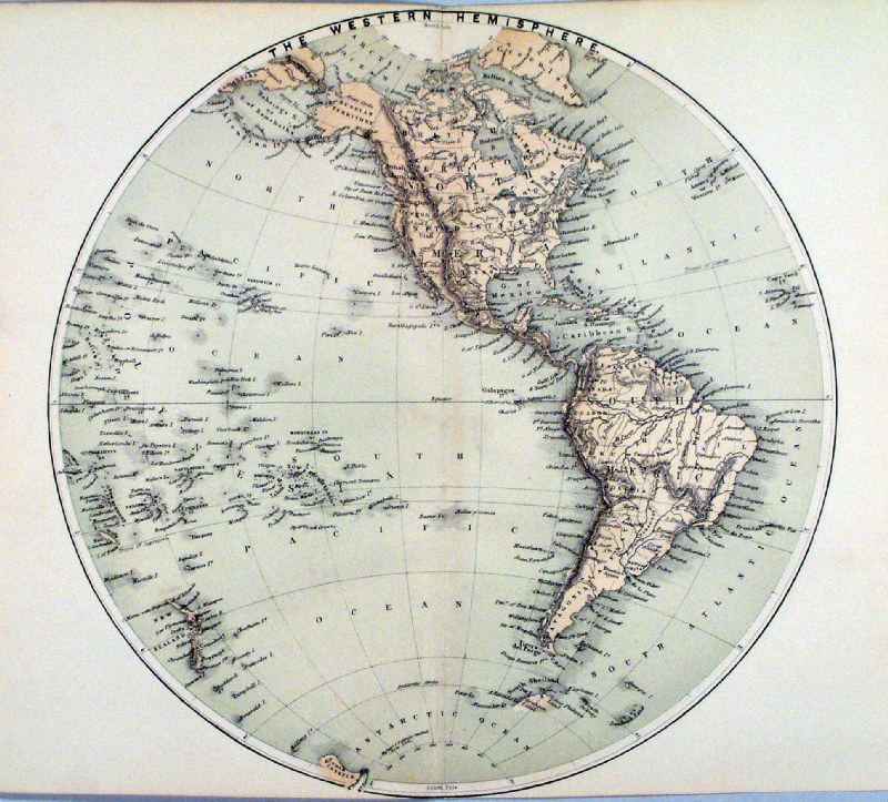 |
America The Western Hemsiphere
Virtue c1861 Ref HKM019 £24.00 (+P&P) size: 290 x 250 mm, centre fold, tight top & bottom margins click image for enlargement |
|
|
|
North America |
|
 |
North America, Vaugondy
1750 Amerique Septentrionale Copper engraving size: 190 x 160 mm, 2 folds two small areas of ink stains from printing error. Ref BAM010 £65.00 (+P&P) click image for enlargement |
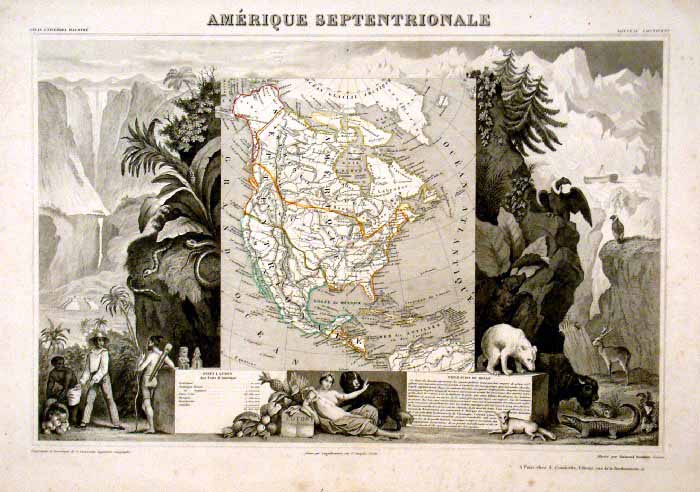 |
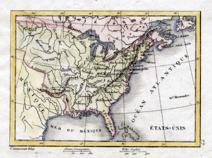
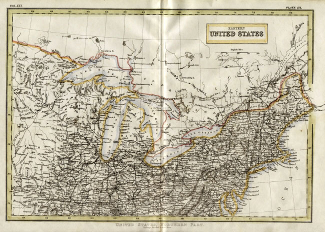
North America
'Amerique Sepentrionale' Victor
Levasseur 1846 size: 460 x 340 mm, slight, uniform discolouration. Ref HLS015 £190.00 (+P&P) click image for enlargement |
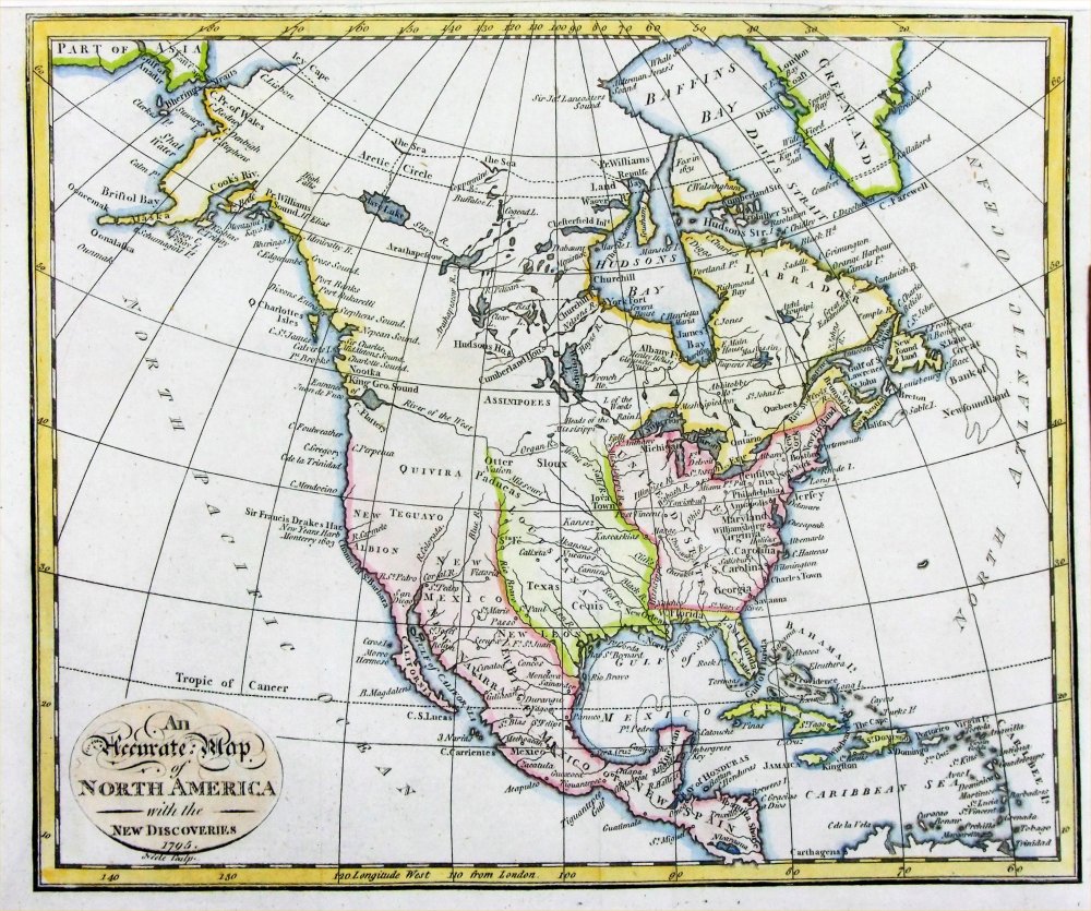 |
An Accurate Map of
North America with the New Discoveries
Neele 1795 Copper engraving size: 240 x 200 mm, several folds, tight top margin Ref PEM008 £45.00 (+P&P) click image for enlargement |
 |
North America
Russell / Goldsmith / Phillips 1803 Copper engraving size: 210 x 175 mm, several folds, tight top-left margin Ref NHM007 £45.00 (+P&P) click image for enlargement |
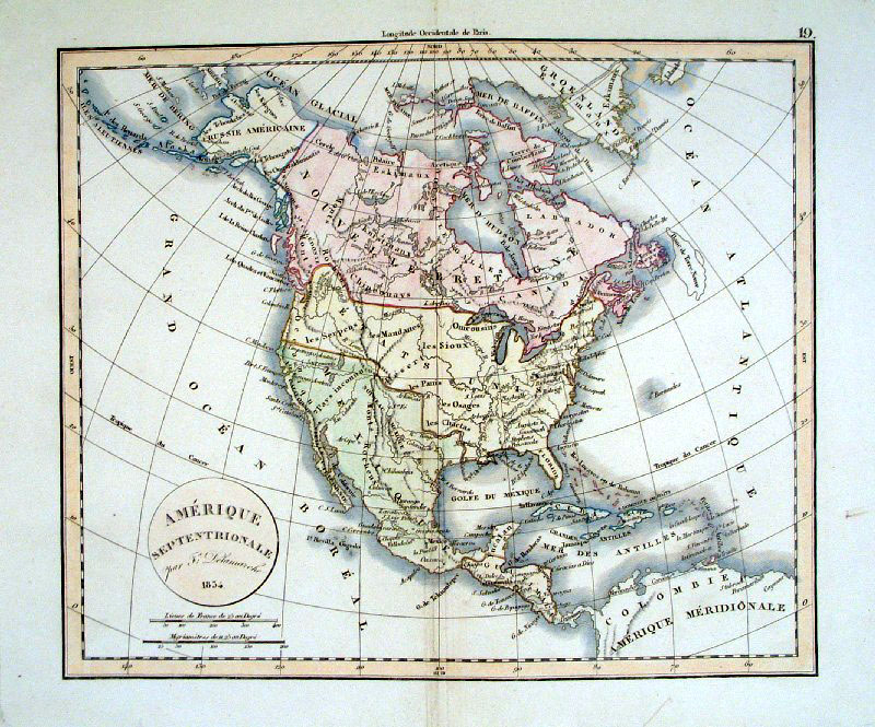 |
North America Delamarche
1834 size: 380 x 320 mm Ref BAM034 £85.00 (+P&P) click image for enlargement |
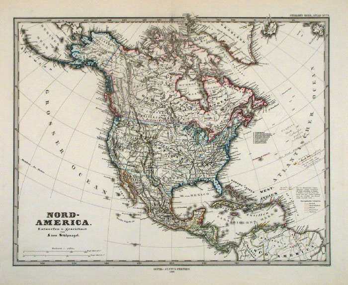 |
North America
Adolf Stieler 1880 Original colour size: 430 x 380 mm Ref FDM067 £38.00 (+P&P) click image for enlargement |
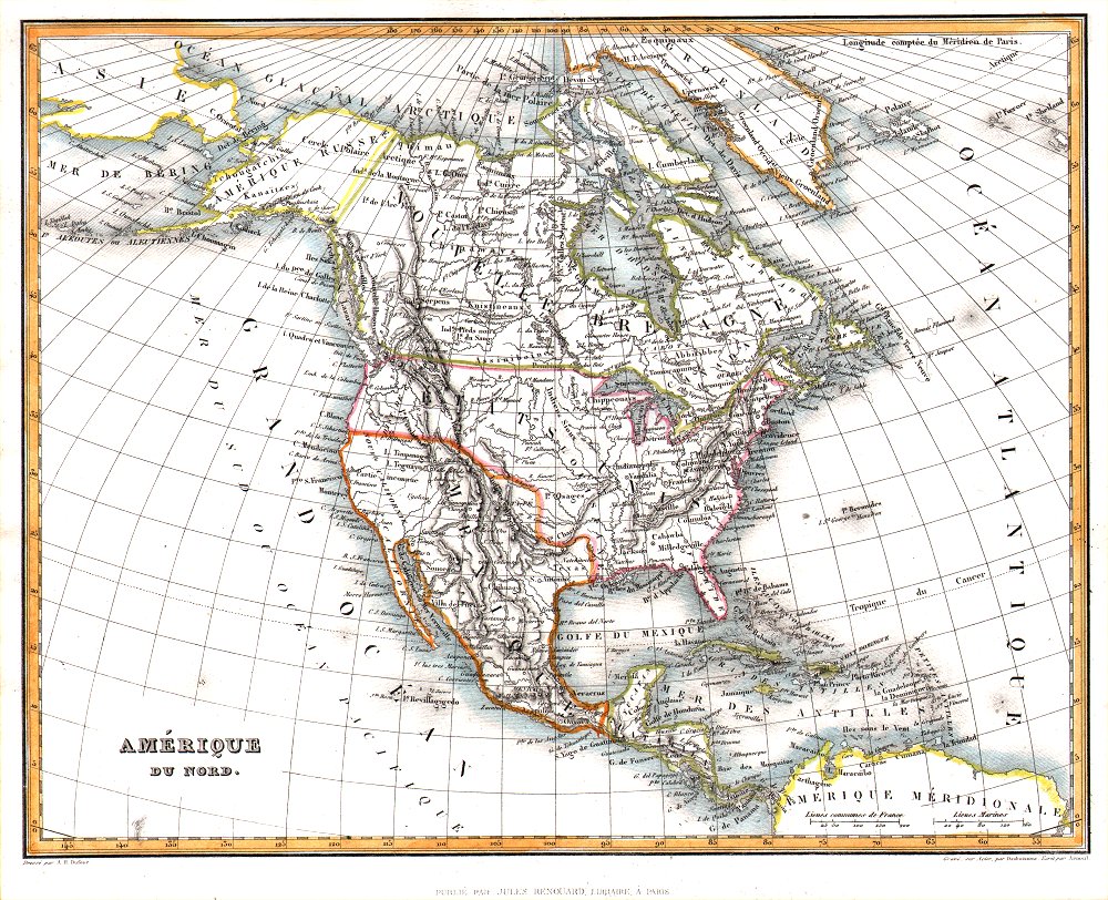 |
Amerique du Nord
Jules Renouard / A.H. Dufour from Abrege de Geographie by Adrien Balbie, Paris 1838 size: 265 x 210 mm Ref PHM003 £38.00 (+P&P) click image for enlargement |
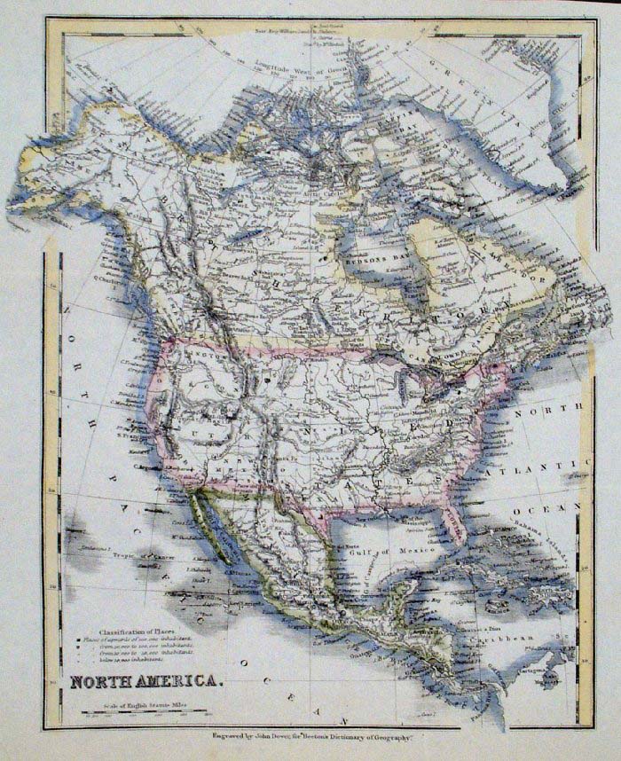 |
North America
John Dower / Beeton size: 190 x 240 mm, several folds Interesting references to boats and skeletons discovered on King William Land by McClintock Ref GAM043 £22.00 (+P&P) click image for enlargement |
|
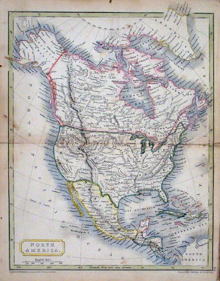
North America Sidney Hall 1845 size: 200 x 250mm Ref GBM197 £26.00 (+P&P) Slight discolouration click image for enlargement |
 |
North
America
Russell / Guy c1839 size: 170 x 140 mm Ref HAM211 £24.00 (+P&P) click image for enlargement |
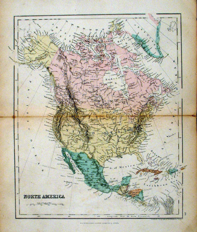 |
North America Mackenzie
c1868 Original colour size: 260 x 300 mm discolouration at centre fold greatly exaggerated in illustration. Ref FBM045 £15.00 (+P&P) click image for enlargement |
 |
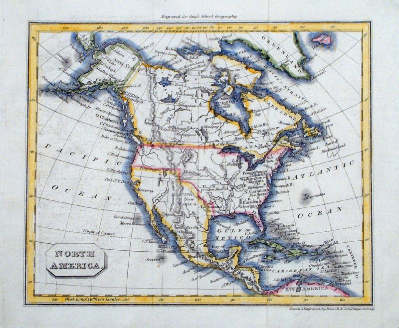
North America
Francis Young / Beeton c1880 size: 170 x 200 mm, several folds, damage to top and right margins. Ref GAM033 £14.00 (+P&P) click image for enlargement |
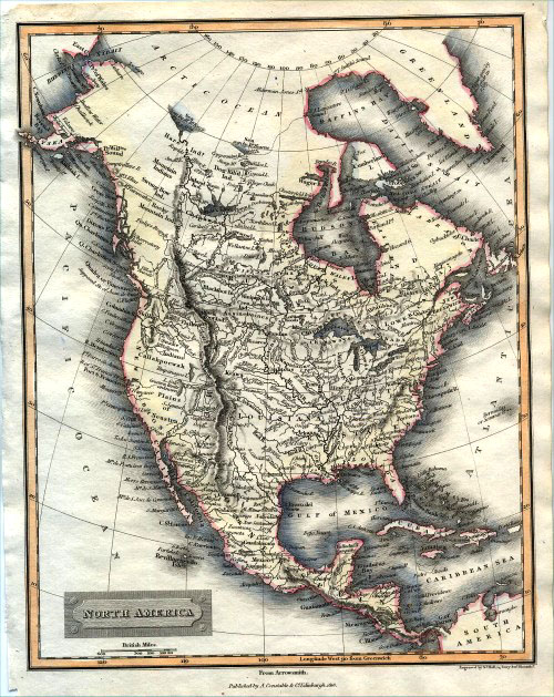 |
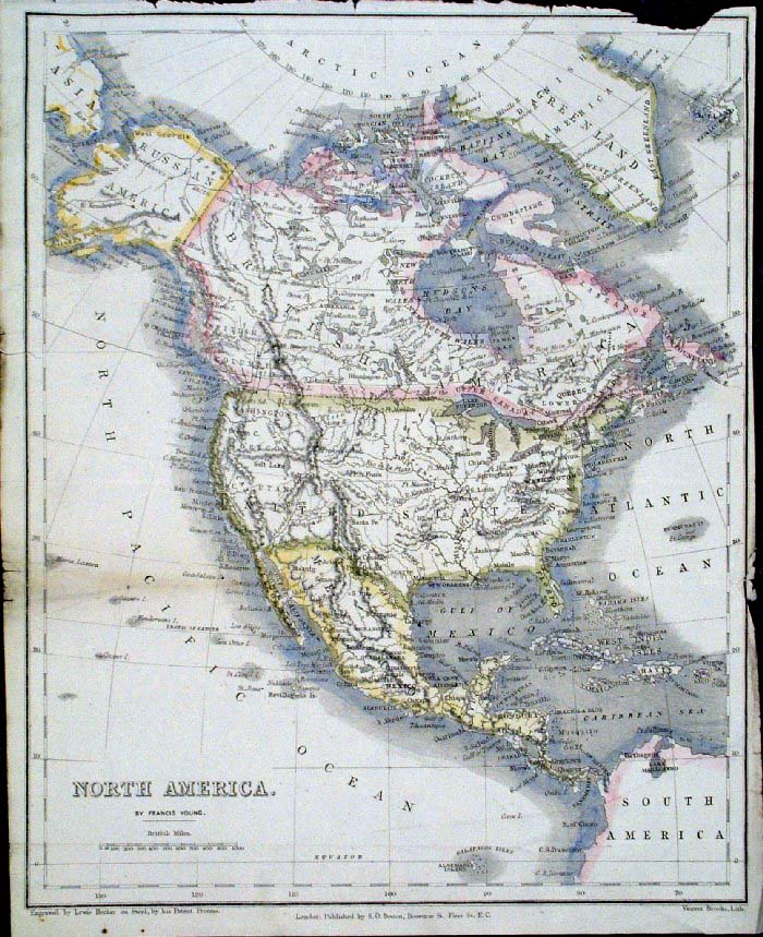
North America Hall / Arrowsmith /
Constable 1816 size: 210 x
270 mm Ref EDM005 £32.00 (+P&P) click image for enlargement |
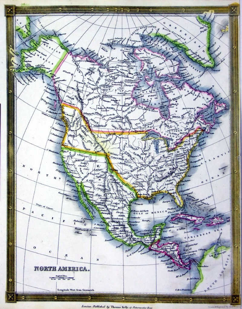 |
North America
Thomas Kelly
1841 engraved by Alex Findlay size: 200x 260 mm tight right margin Ref OHM026 £20.00 (+P&P) click image for enlargement |
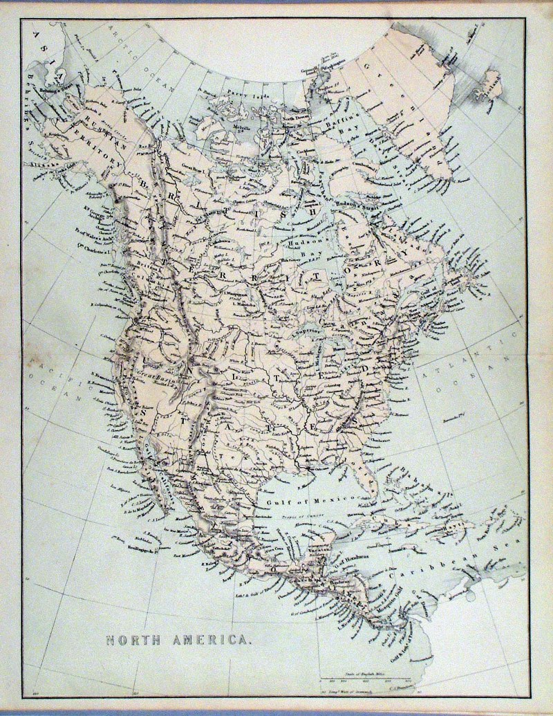 |
North America
Virtue c1865 Ref HKM022 £20.00 (+P&P) size: 290 x 250 mm, centre fold click image for enlargement |
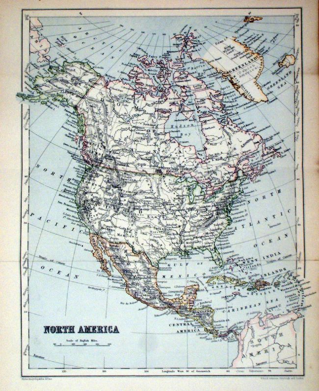 |
North America
Johnston 1879 Ref KFM020 £18.00 (+P&P) size: 260 x 320 mm, 2 folds click image for enlargement |
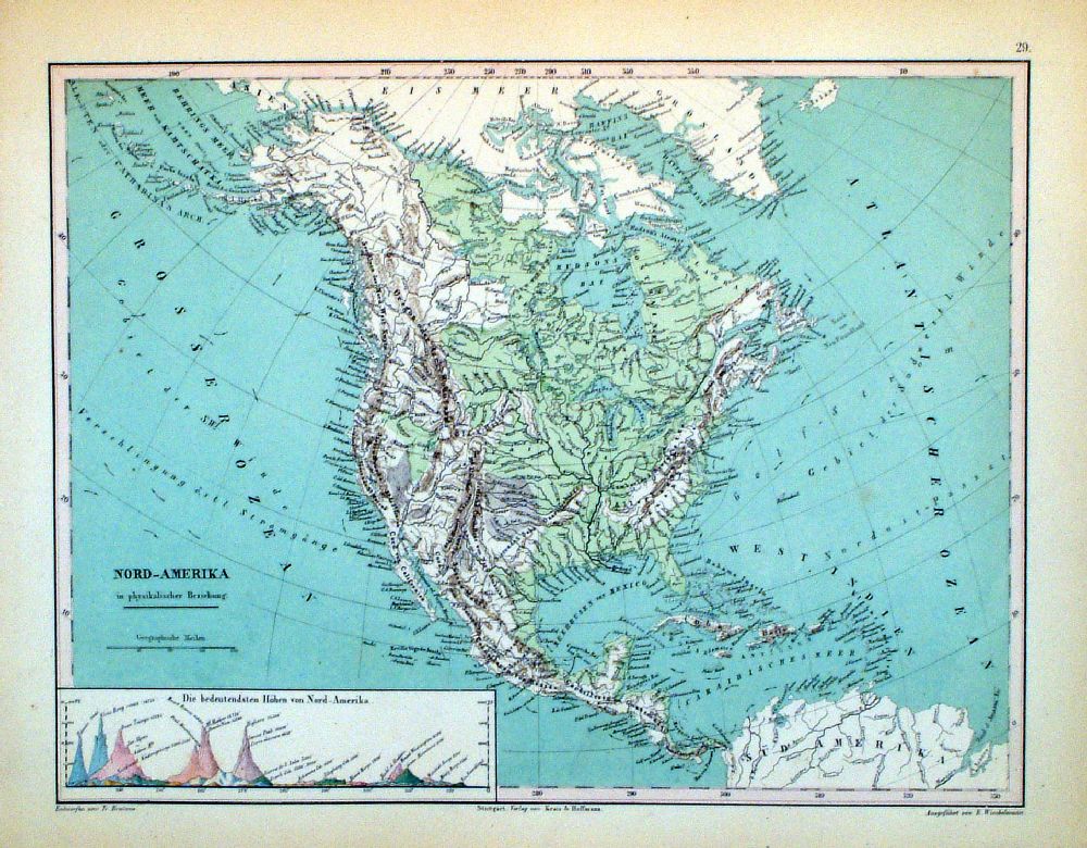 |
Nord - Amerika Winkelmann / Krais & Hoffman for Humboldt's Kosmos 1861 inset of diagram of highest mountains size: 320 x 250 mm Ref LDM029 £18.00 (+P&P) click image for enlargement |
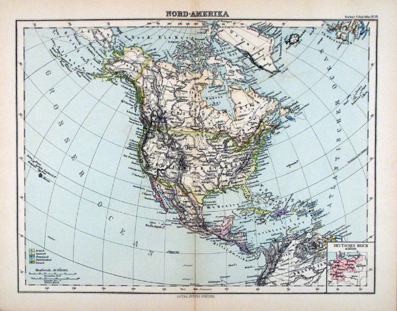 |
Nord-Amerika Steiler /
Perthes 1895 size: 300 x 240 mm, centre fold. insets of Germany for comparison scaling Ref HHM092 £18.00 (+P&P) click image for enlargement |
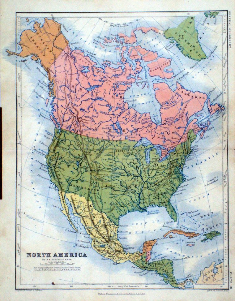 |
North America
A.K. Johnston / William
Blackwood 1854 size: 250 x 320 mm, centre fold. Early full colour lithographic printing. Ref LKM002 £20.00 (+P&P) click image for enlargement |
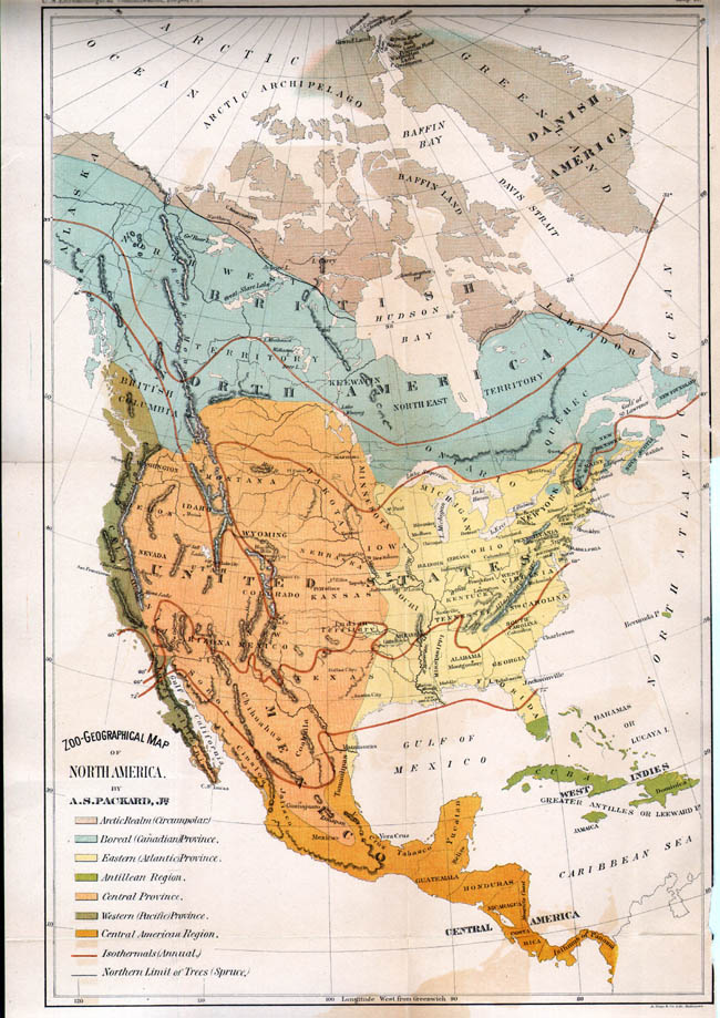 |
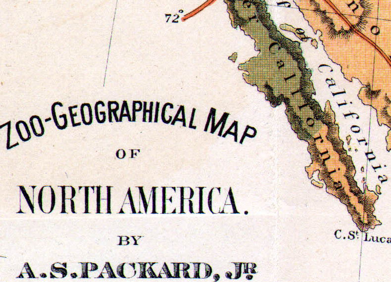
Zoo - Geographical Map of North America Packard / Hoen Published by the US Entomological Commission 1883 Litho size: 280 x 440 mm, several folds, tight lower-right margin, slight offset transfer at lower margin Key indicates: Arctic Realm, Boreal Province, Eastern Province, Antillean Region, Western Province, Central Province, Annual Isothermals, Limit of Spruce Trees. Ref IFM099 £26.00 (+P&P) Detail 1 Detail 2 click image for enlargement |
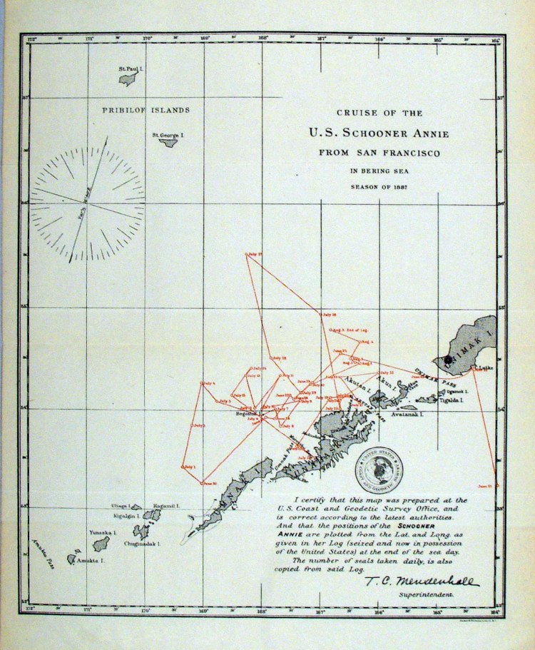 |
'Cruise of the British Schooner Annie From Victoria in the Bering Sea, season of 1887' United States Coast and Geodetic Survey 1895 Log of the route of seal hunting ship during the 1887 season. Litho size: 220 x 270 mm Ref HLM037 £18.00 (+P&P) click image for enlargement |
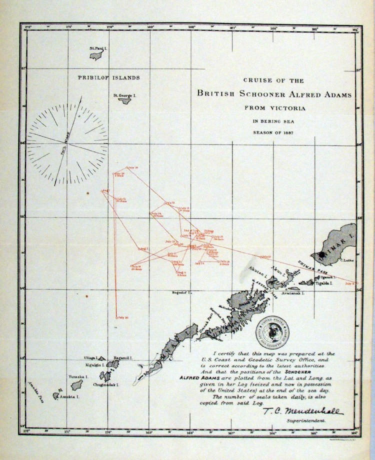 |
'Cruise of the British Schooner Alfred Adams From Victoria in the Bering Sea, season of 1887' United States Coast and Geodetic Survey 1895 Log of the route of seal hunting ship during the 1887 season. Litho size: 220 x 270 mm Ref HLM039 £18.00 (+P&P) click image for enlargement |
Canada & British Possessions |
|
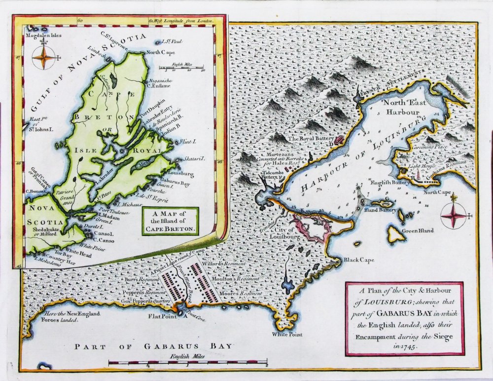 |
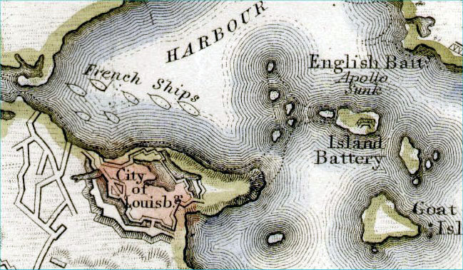
A Plan of the City
and Harbour of Louisburg; shewing that part of
Gabarus Bay in which the English landed ... Inset - A Map of the Island of Cape Breton Gentlemans Magazine 1758 Copper engraving. size: 260 x 200 mm, several folds Ref PFM011 £60.00 (+P&P) click image for enlargement |
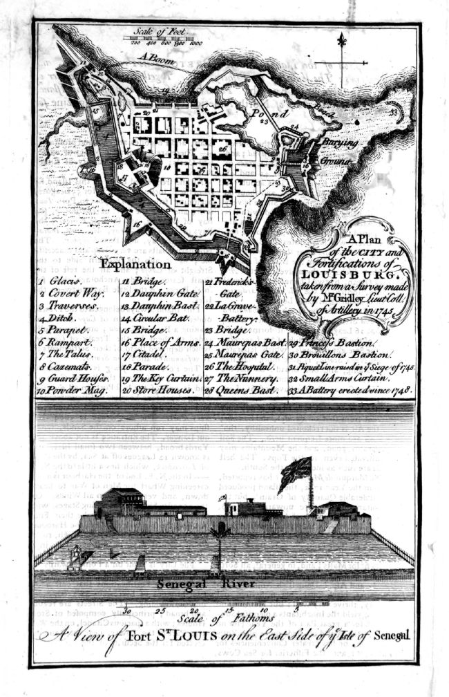 |
A Plan of the City
and Fortifications of Louisburg taken from a survey made
by Mr Gridley .. in 1745 Origin and publisher unknown c1758 Several similar maps were published around 1758 in the Universal Mag, Gentleman's Mag and London Mag. This differs slightly from the known publications. Lower panel is unrelated - Fort St Louis, Senegal, Africa. Condition is poor as there are several repairs to paper damage. Good for reference purposes. Copper engraving. size: 130 x 190 mm Ref OJM004 £18.00 (+P&P) click image for enlargement |
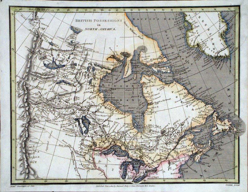 |
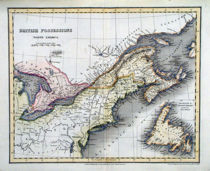
British Possessions in North America Alex Macpherson & Cooper 1810 size: 250 x 200 mm Ref GCM020 £26.00 (+P&P) click image for enlargement |
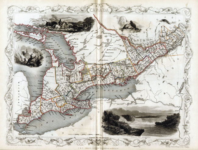 |
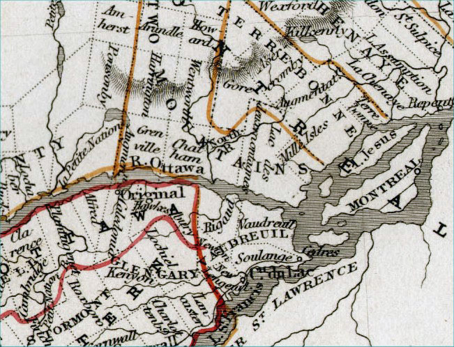
West Canada (in 1850s) - Features
Great Lakes region, Toronto, Ontario, Montreal, Niagra Tallis c1865 size: 350 x 265 mm Ref ELM019 £70.00 (+P&P) Detail 1 Detail 2 Detail 3 click image for enlargement |
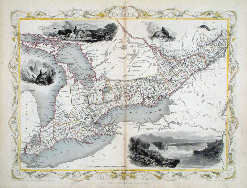 |
West Canada (in 1850s)
- Features Great Lakes
region, Toronto, Ontario, Montreal, Niagra
Tallis 1852 size: 350 x 265 mm Ref GFM101 £70.00 (+P&P) click image for enlargement |
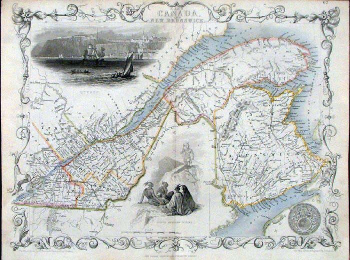 |
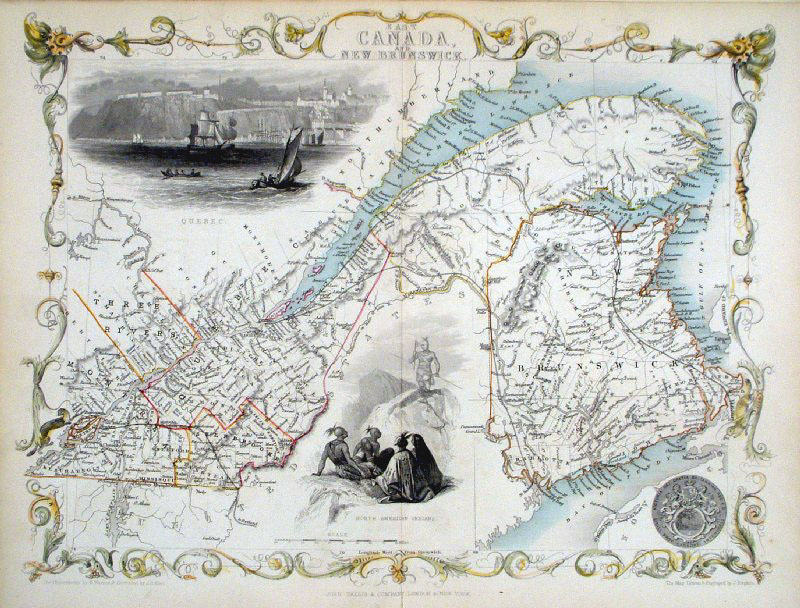
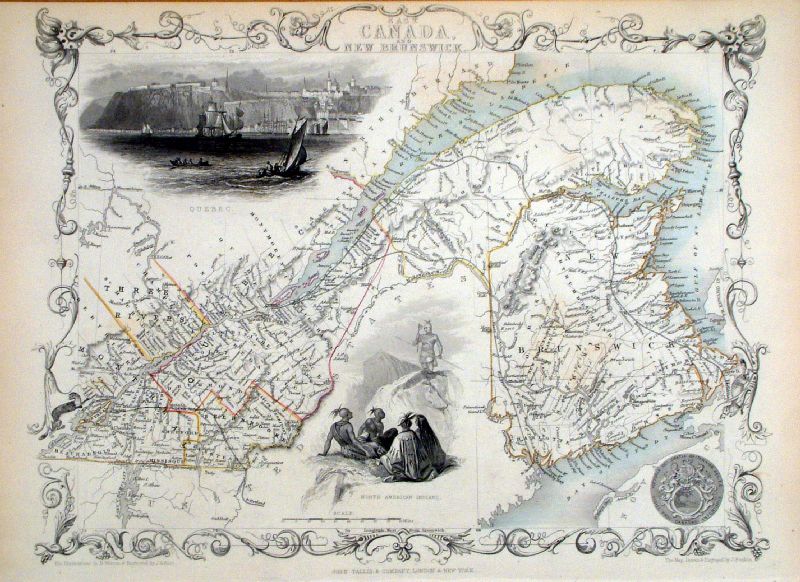
East Canada and New Brunswick
Tallis c1855
size: 350 x 265 mm Ref FLM235 £110.00 (+P&P) Detail 1 Detail 2 click image for enlargement |
 |
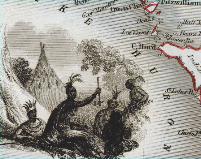
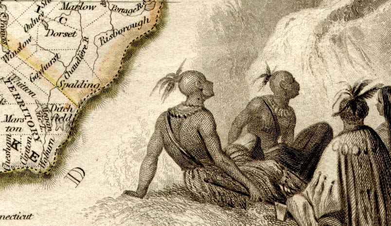
East Canada and New Brunswick
Tallis 1851
size: 350 x 265 mm Vignette Views of Quebec, North American Indians Ref GFM111 £95.00 (+P&P) Ref KGM058 £95.00 (+P&P) click image for enlargement |
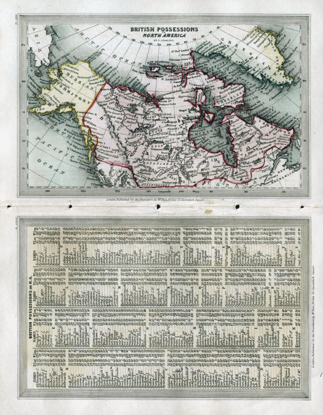 |
British Possessions in North America
Thomas Starling 1832 map size: 160 x 100 mm Double page with list of locations. Ref ELM062 £34.00 (+P&P) click image for enlargement |
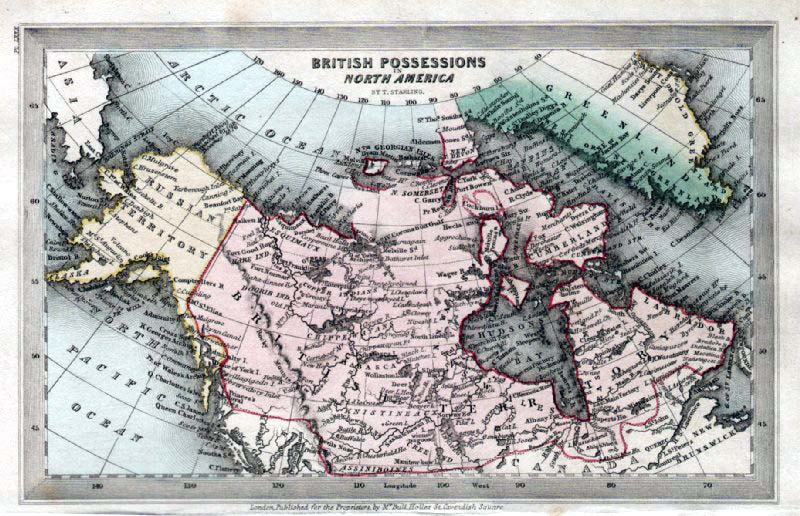 |
British Possessions in North America
Thomas Starling 1834 size: 160 x 100 mm Ref GBM322 £32.00 (+P&P) click image for enlargement |
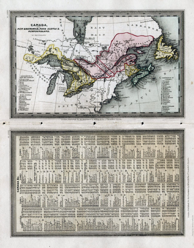 |
Canada with New Brunswick, Nova Scotia &
Newfoundland Thomas Starling 1832
map size: 160 x 100 mm Double page with list of locations. Ref ELM061 £40.00 (+P&P) click image for enlargement |
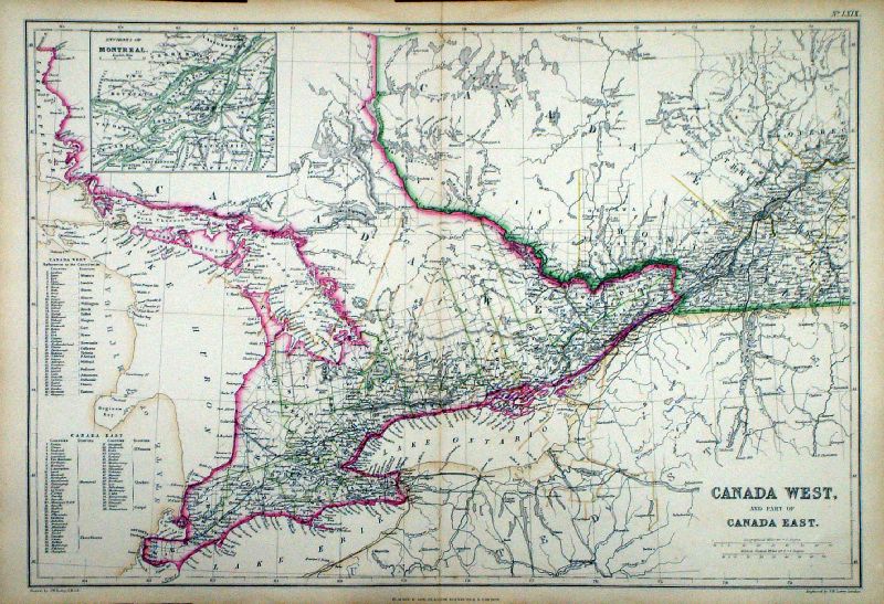 |
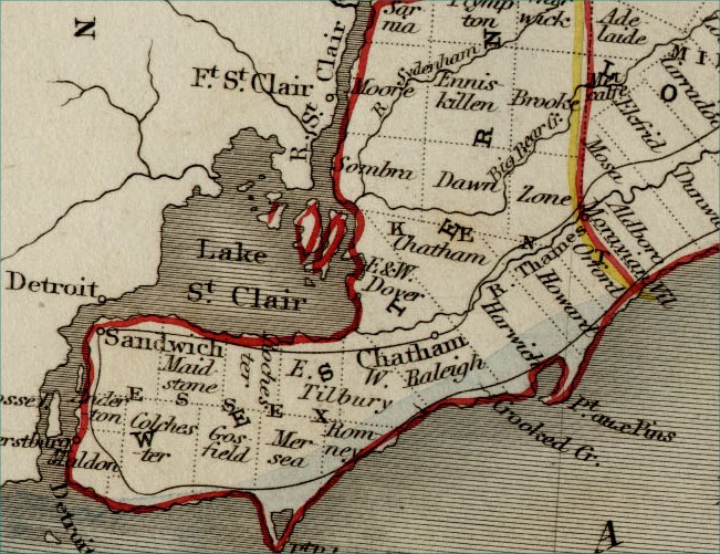
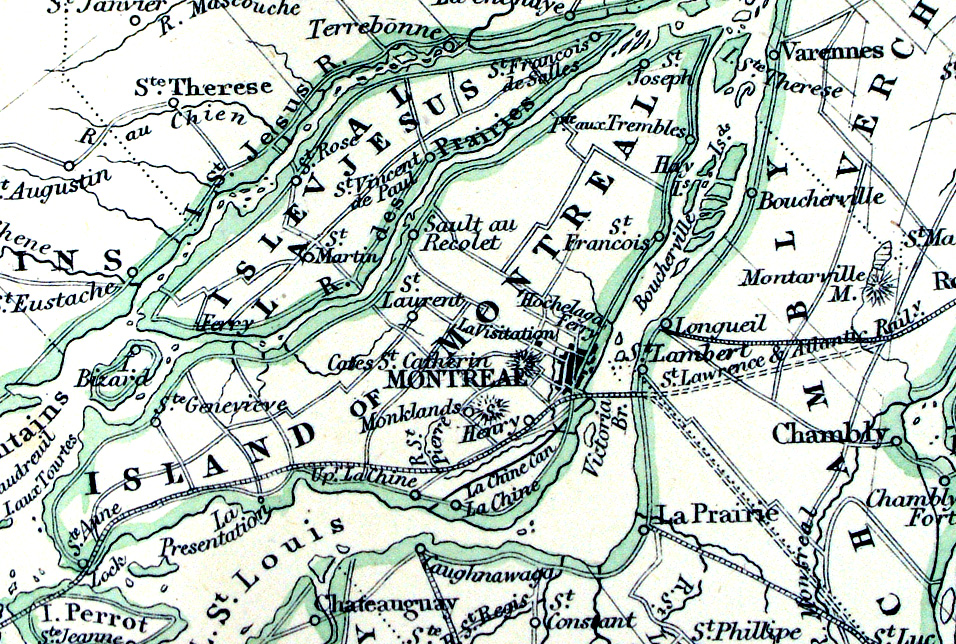
Canada West and Part
of Canada East Lowry / Blackie Imperial Atlas 1860 size: 540 x 370 mm, centre fold Detail 1 Detail 2 Ref LLM003 £38.00 (+P&P) click image for enlargement |
 |
Ile et Banc de Terre
- Neuve Iles St Pierre et Miquelon Monin 1835 Steel engraving. size: 200 x 150 mm Ref LLM047 £22.00 (+P&P) click image for enlargement |
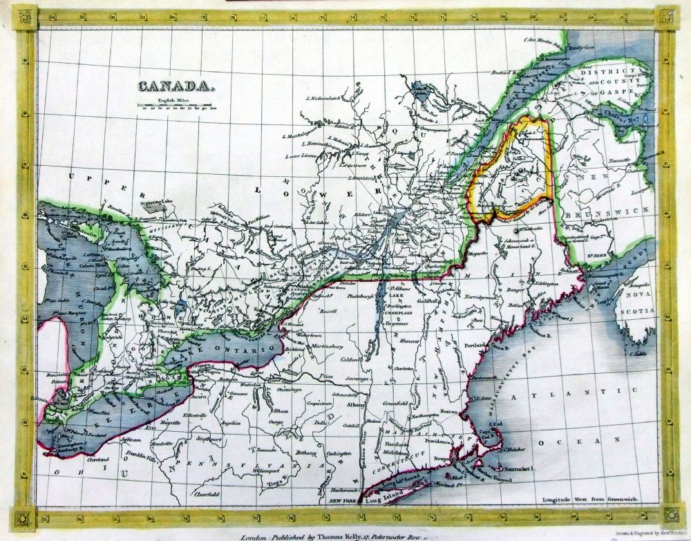 |
Canada
Thomas Kelly
1841 engraved by Alex Findlay interesting dual boundaries claimed by Great Britain and claimed by the United States size: 200x 260 mm Ref OHM025 £28.00 (+P&P) click image for enlargement |
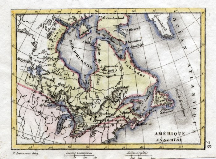 |
British America V. Levasseur
c1835 size: 130 x 100 mm Ref HAM108 £20.00 (+P&P) click image for enlargement |
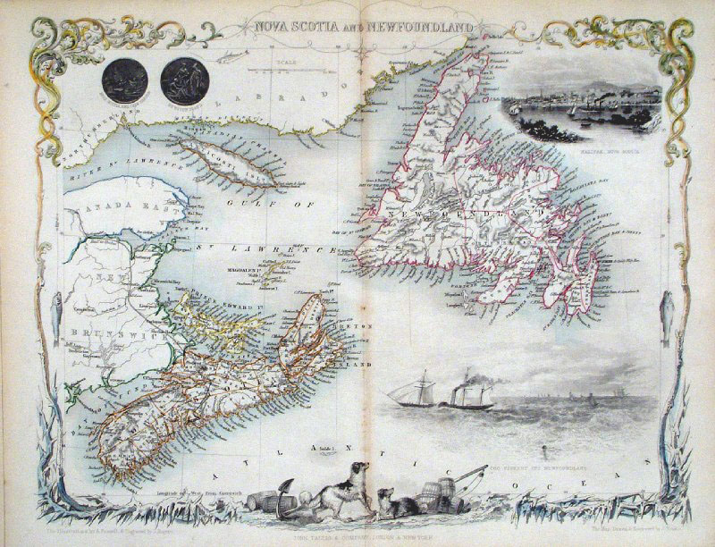 |
Nova Scotia and Newfoundland
Tallis 1852
size: 350 x 265 mm Ref GFM104 £95.00 (+P&P) click image for enlargement |
|
British Possessions in North America
Dower 1836 size:
270 x 220 mm Ref FIM028 £28.00 (+P&P) click image for enlargement |
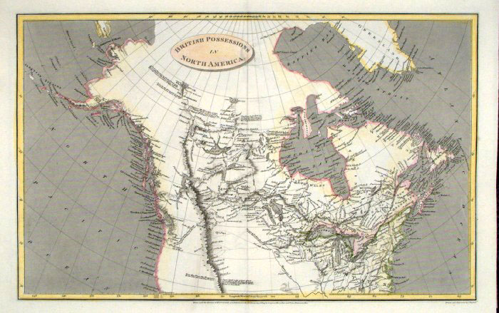 |
British
Possessions
in North
America
Russell / Arrowsmith 1809 size: 410 x 260 mm Ref FIM091 £28.00 (+P&P) click image for enlargement |
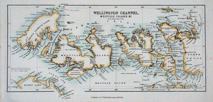 |
Melville Island, Devon Island (Wellington
Channel) Fullarton c1861 size: 250 x 120 mm. Ref GBM277 £16.00 (+P&P) click image for enlargement |
|
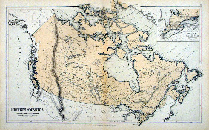
British America
Chambers 1855 size: 470 x 300 mm, centre fold, light foxing spots Ref FDM152 £28.00 (+P&P) click image for enlargement |
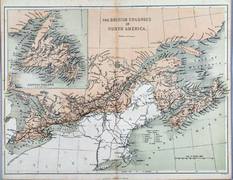 |
The British Colonies in North America
Virtue 1867 Ref HKM020 £26.00 (+P&P) size: 290 x 250 mm, centre fold click image for enlargement |
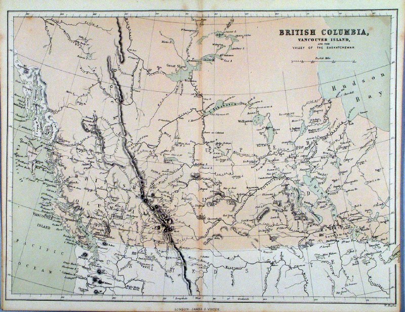 |
British Columbia, Vancouver Island ...
Virtue 1867 Ref HKM021 £26.00 (+P&P) size: 290 x 250 mm, centre fold, a few very faint spots click image for enlargement |
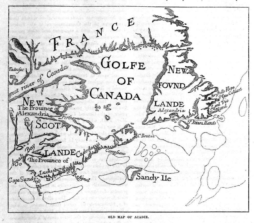 |
Old Map of Acadie from Cassell's History of the United States by Edmund Ollier 1874 taken from earlier publication. size: 160 x 130 mm Ref PAM008 £16.00 (+P&P) click image for enlargement |
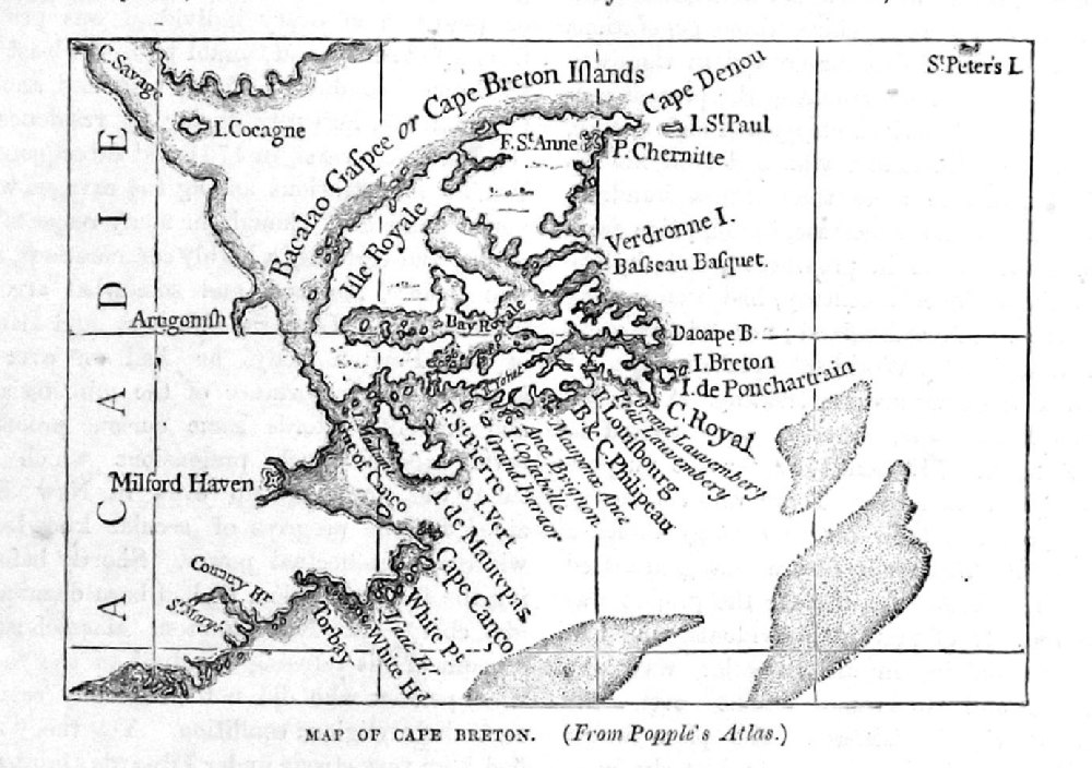 |
Map of Cape
Breton (From
Popples Atlas) from Cassell's History of the United States by Edmund Ollier 1874 taken from earlier publication. size: 130 x 90 mm Ref PAM022 £16.00 (+P&P) click image for enlargement |
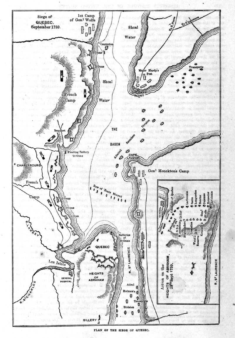 |
Map of the Seige of
Quebec from Cassell's History of the United States by Edmund Ollier 1874 taken from earlier publication. size: 160 x 240 mm Ref PAM023 £16.00 (+P&P) click image for enlargement |
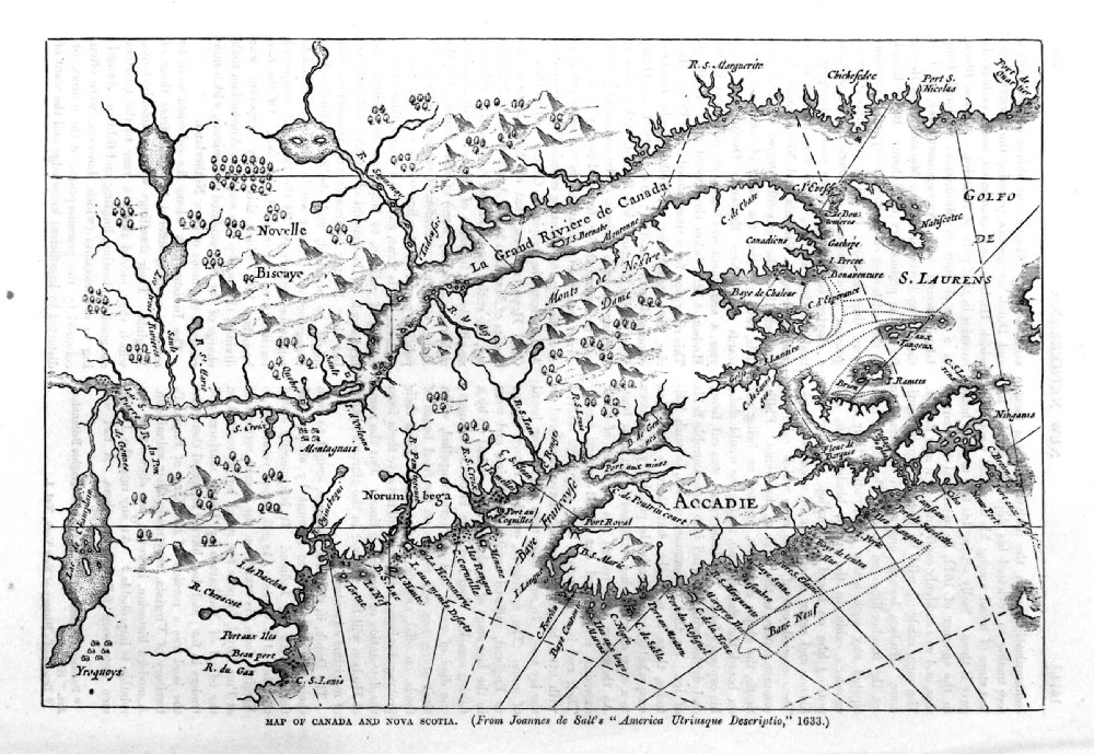 |
Map of Canada and
Nova Scotia from Cassell's History of the United States by Edmund Ollier 1874 taken from earlier publication (1633). size: 240 x 170 mm Ref PAM010 £16.00 (+P&P) click image for enlargement |
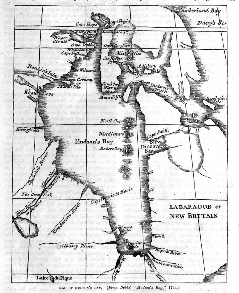 |
Map of Hudsons
Bay (From Dobb's
Hudsons Bay 1744) from Cassell's History of the United States by Edmund Ollier 1874 taken from earlier publication (1744). size: 130 x 90 mm Ref PAM024 £16.00 (+P&P) click image for enlargement |
United States |
|
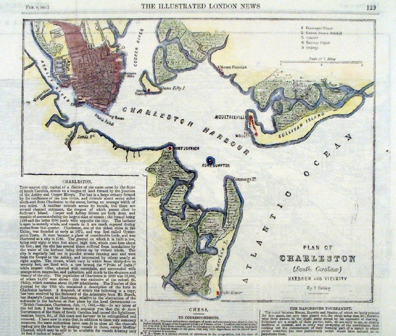 |
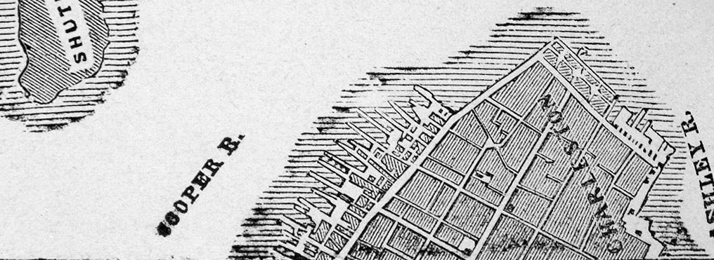
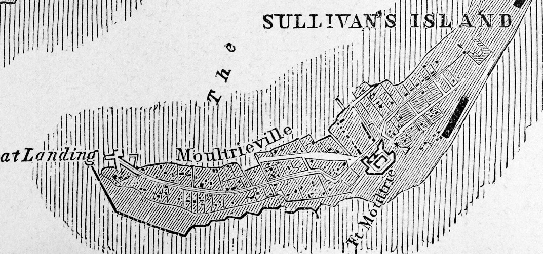
Plan of Charleston, South Carolina eng: T. Euling - Illustrated London News Feb 1861 Woodcut engraving size: 260 x 200 mm Ref HLM001 £45.00 (+P&P) click image for enlargement |
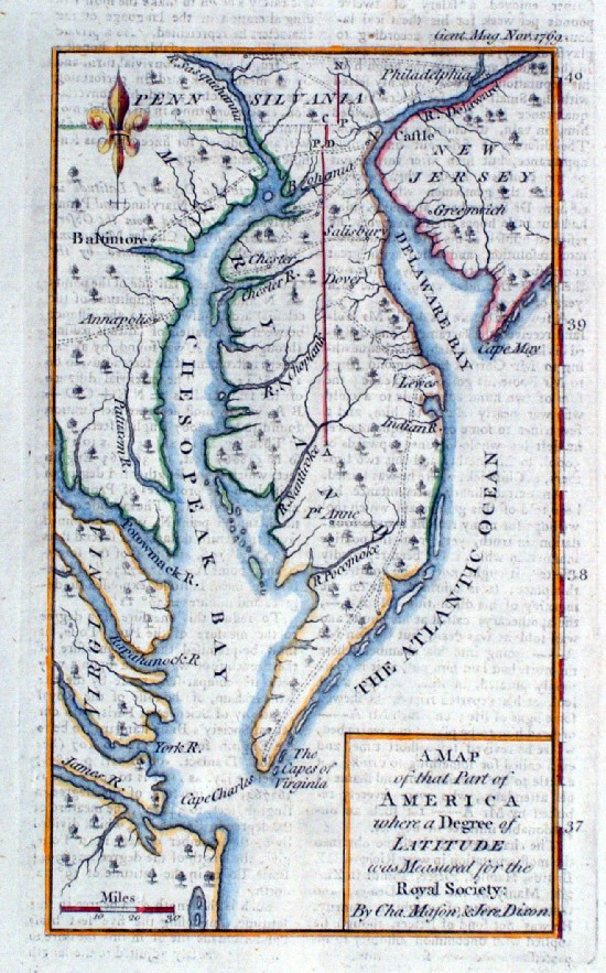 |
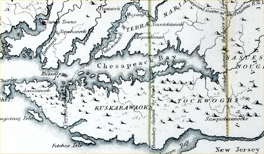
Maryland Mason-Dixon Line boundary survey Gentlemans Magazine 1769 'A Map of that Part of America where a degree of Latitude was measured for the Royal Society: By Cha Mason & Jere Dixon' Copper engraving size: 110 x 190 mm , faint offset transfer. This map comes with the pages of text from Gentlemans Magazine of Nov 1769 describing the survey calculations for measuring Latitude. It is uncommon for the original text to accompany the map. Mason- Dixon survey 1763 to 1767 Ref IKM026 £140.00 (+P&P) click image for enlargement |
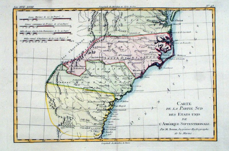 |
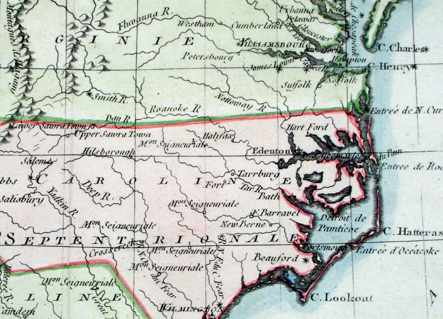
Carte de la Parte Sud des Etats Unis de L'Amerique
Septentrionale Southerm part of the United States - Virginia, North Carolina, South Carolina, Georgia Bonne 1780 Copper Engraving size: 340 x 230 mm, centre fold Ref KFM009 £95.00 (+P&P) Detail 1 click image for enlargement |
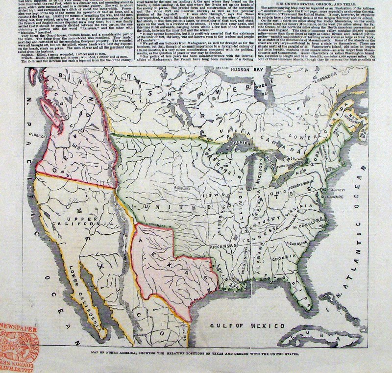 |
'A Map of North America showing the relative
positions of Texas and Oregon with the United States' Texas and Oregon shown as independent territories Illustrated London News Oct 1845 Woodcut engraving size: 250 x 210 mm Ref HLM002 £65.00 (+P&P) click image for enlargement |
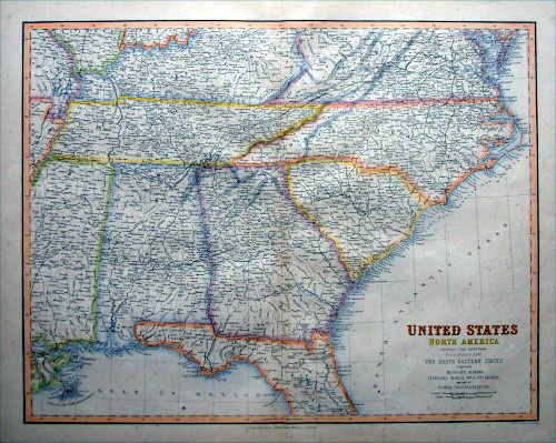 |
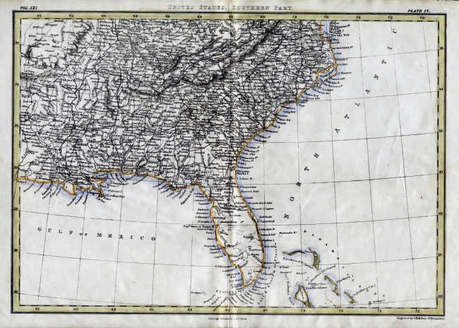
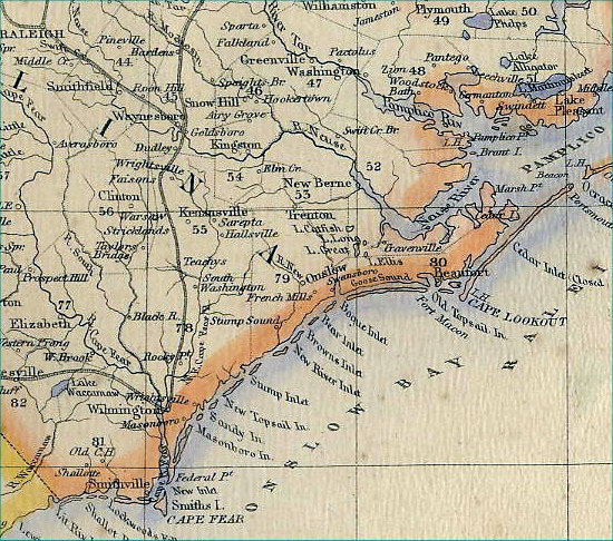
United States - The South Eastern States
Fullarton 1864
size: 530 x 420 mm Ref BAM039 £60.00 (+P&P) Detail click image for enlargement |
 |
United States V. Levasseur
c1835 size: 130 x 100 mm Ref HAM109 £25.00 (+P&P) click image for enlargement |
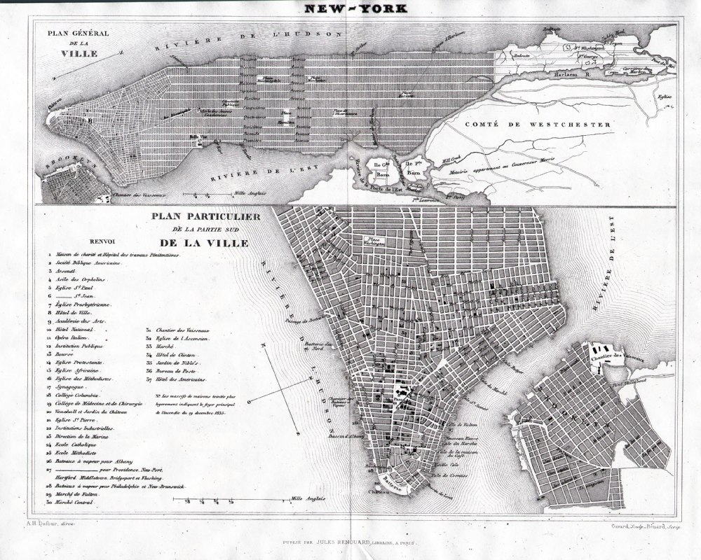 |
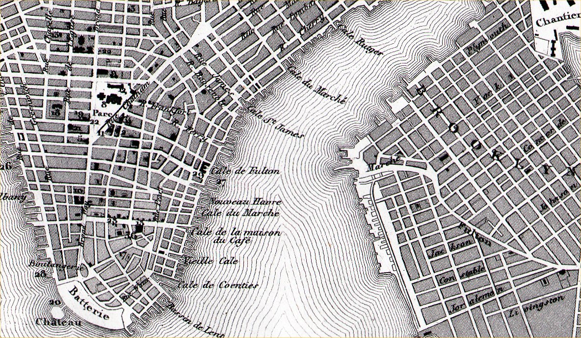
New York
from Abrege de
Geographie by Adrien Balbie,
Paris 1838 Publie Par Jules Renouard. A.H. Dufour. Gavard Scuplt, Banard Scrip. Table of 37 locations. Steel engraving size: 270 x 200 mm centre fold. Ref PHM022 £115.00 (+P&P) Detail click image for enlargement |
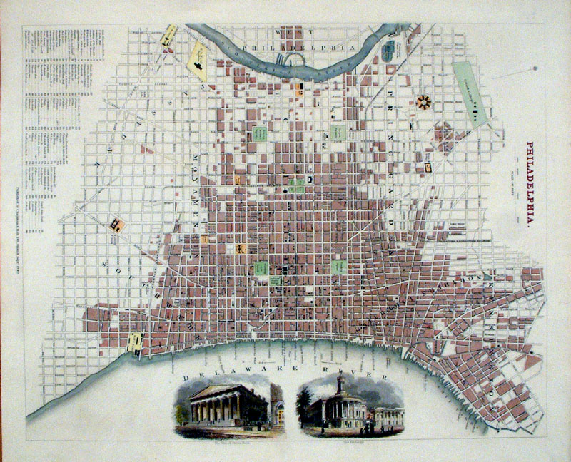 |
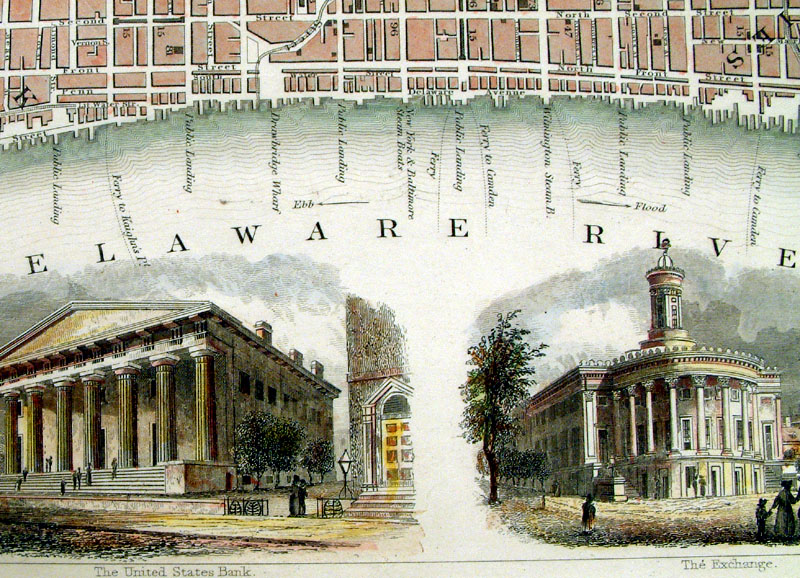
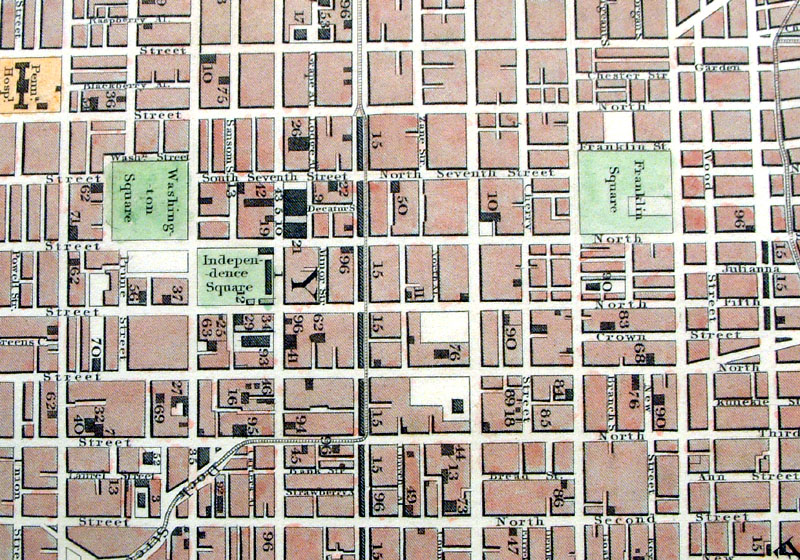
Philadelphia SDUK
Chapman & Hall 1840
size: 400 x 320 mm Vignette views of the United States Bank and The Exchange. BAM031 £120.00 (+P&P) Detail 1 Detail 2 click image for enlargement |
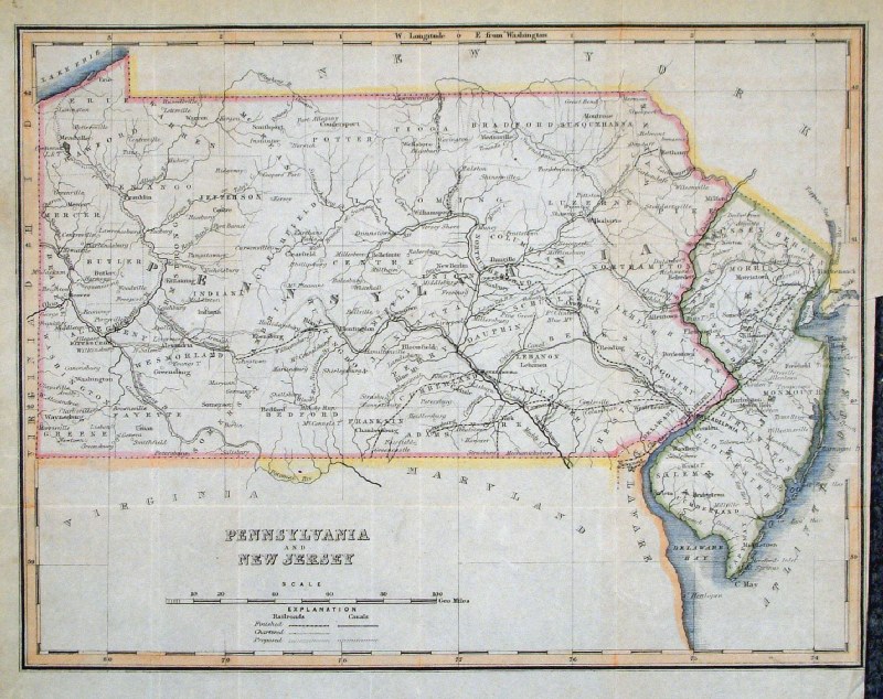 |
Pennsylvania and New Jersey Bradshaw
and Blacklock 1849 for Bradshaw & Blacklock's edition of The Life of William Penn size: 270 x 210 mm Several folds and tight right margin GHM030 £24.00 (+P&P) click image for enlargement |
 |
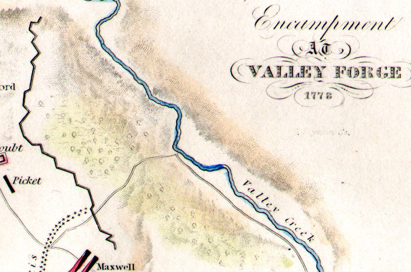
Encampment at Valley Forge
1776 Sparks / Boynton
1843 Shows Washington's Head Quarters on the Schuylkill River Steel engraving size: 200 x 125 mm Detail Ref KLM041 £22.00 (+P&P) click image for enlargement |
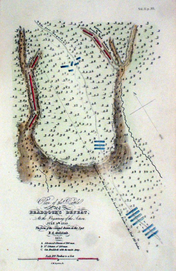 |
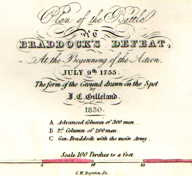
Plan of the Battle of Braddock's Defeat, at the
beginning of the action. July 9th 1755 Sparks / Boynton 1843 Steel engraving size: 200 x 125 mm Detail Ref KLM037 £28.00 (+P&P) click image for enlargement |
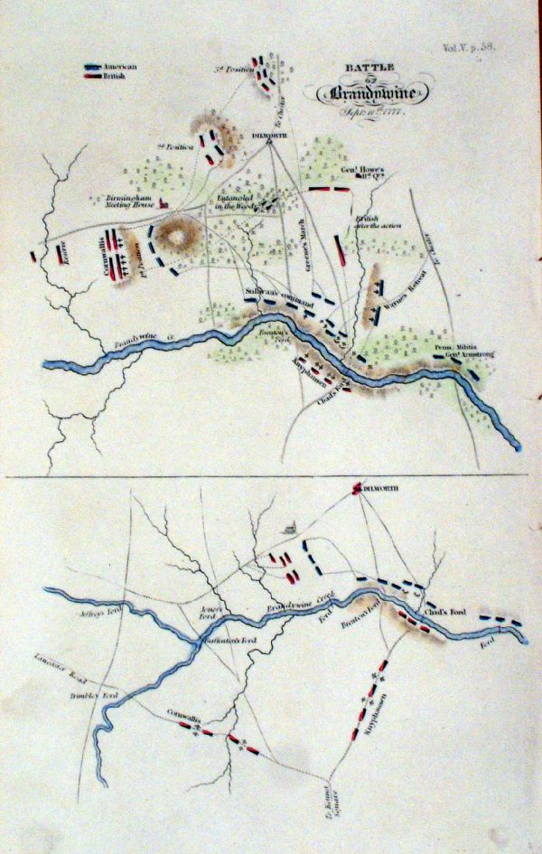 |
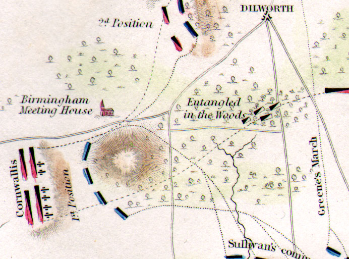
Battle of Brandywine Sept 11th 1777 Sparks / Boynton 1843 Features the town of Dilworth ( near West Chester, PA) Steel engraving size: 200 x 125 mm Detail Ref KLM039 £25.00 (+P&P) click image for enlargement |
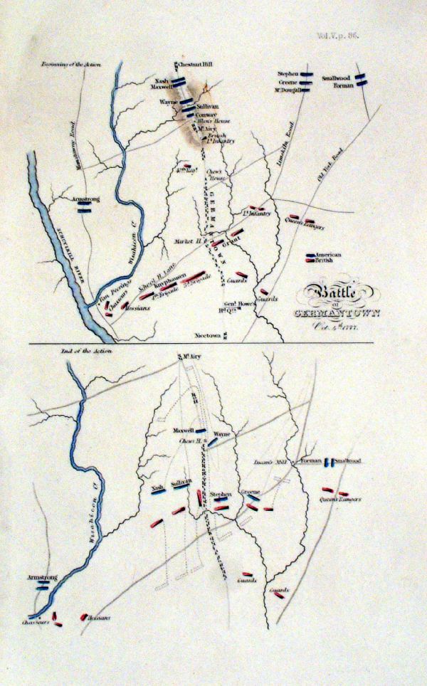 |
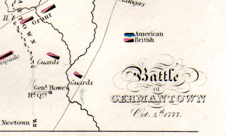
Battle of Germantown Oct 4th 1777 Sparks / Boynton 1843 Features the settlements of Germantown and Chestnut Hill in Philadelphia Steel engraving size: 200 x 125 mm Detail Ref KLM040 £25.00 (+P&P) click image for enlargement |
 |
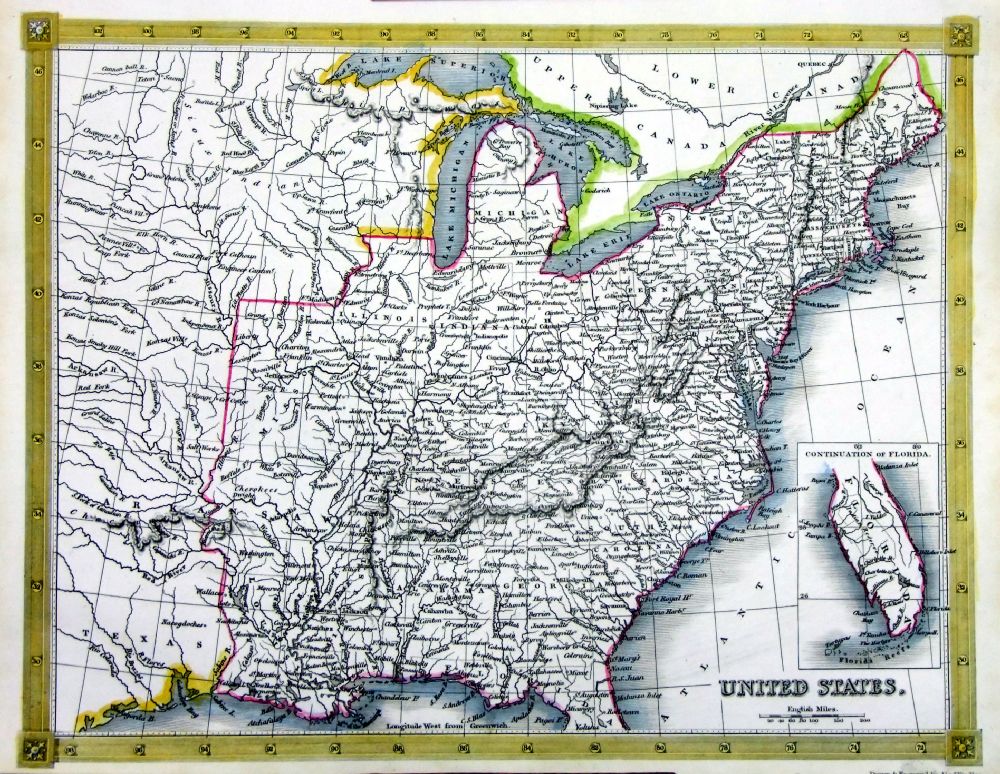
United States North Sidney
Hall c1854 size: 390 x
260 mm Ref EKM143 £28.00 (+P&P) Detail
click image for enlargement
|
 |
United States South Sidney
Hall c1854 size: 390 x
260 mm Ref EKM144 £28.00 (+P&P) Detail click image for enlargement |
 |
United States
Thomas Kelly
1841 engraved by Alex Findlay size: 200x 260 mm Ref OHM024 £24.00 (+P&P) click image for enlargement |
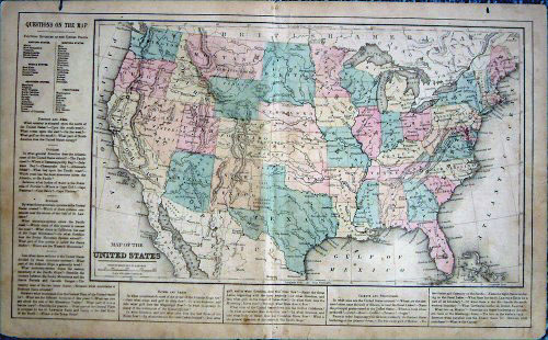 |
United States, Common School
Geography c1890
size: 400 x 250 mm Ref BAM036 £35.00 (+P&P) click image for enlargement |
 |
United States East Coast Bonne
c1785 size: 250 x
370 mm Ref BAM014 £145.00 (+P&P) Detail 1 Detail 2 click image for enlargement |
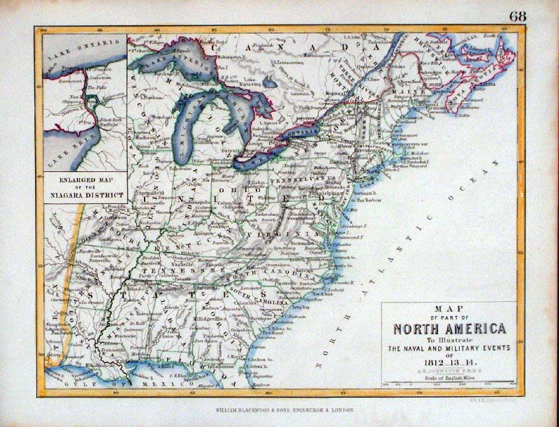 |
United States Map of Part of North America to Illustrate Naval and Military Events of 1812-1813-1814 Blackwood / Johnstone c1860 size: 210 x 160 mm Ref GDM172 £22.00 (+P&P) click image for enlargement |
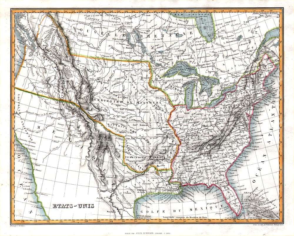 |
Etats-Unis Jules
Renouard / A.H. Dufour from Abrege de Geographie by Adrien Balbie, Paris 1838 size: 265 x 210 mm Ref PHM010 £30.00 (+P&P) click image for enlargement |
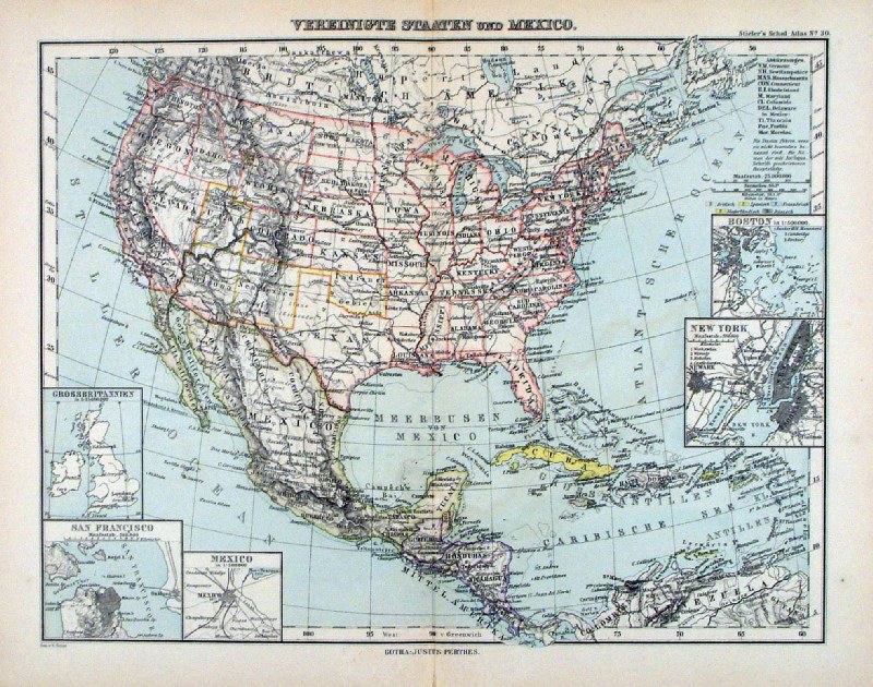 |
Vereinigte Staaten und Mexico
Steiler / Perthes 1895 size: 300 x 240 mm, centre fold. inset of New York, Boston, San Francisco, Mexico City inset of Germany for comparison scaling Ref HHM093 £18.00 (+P&P) click image for enlargement |
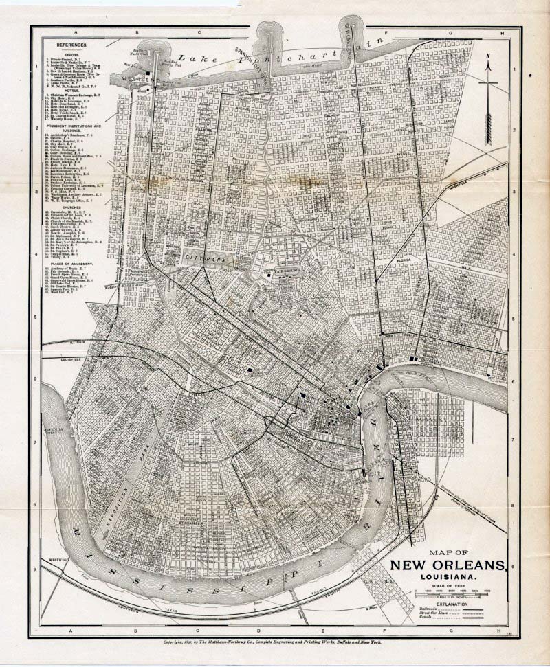 |
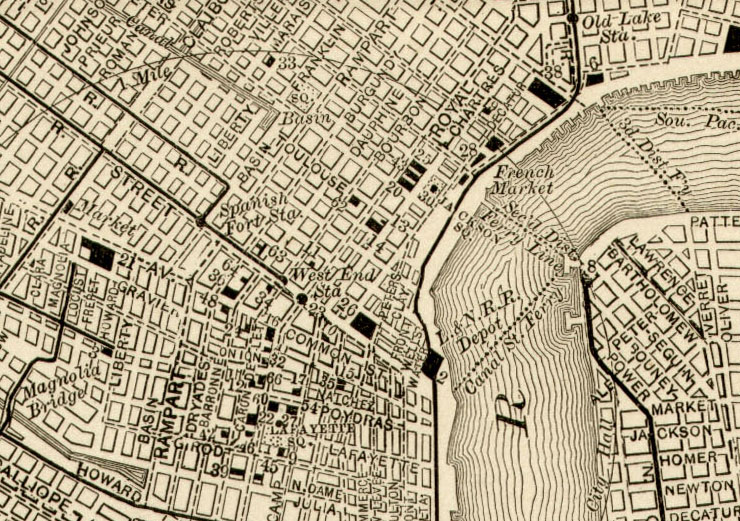
New Orleans 1891
Mathews-Northrup size: 260 x 310 mm, several folds Ref GEM027 £28.00 (+P&P) Detail click image for enlargement |
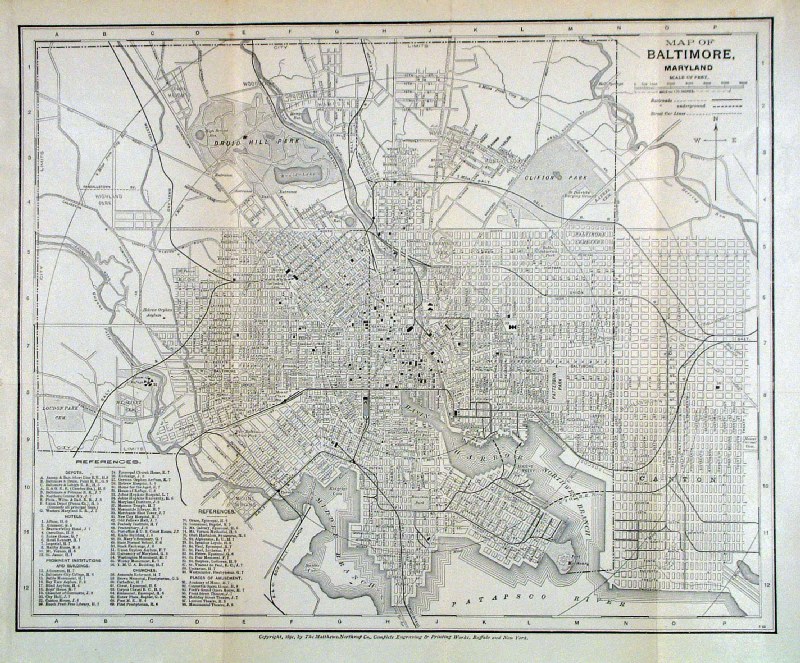 |
Baltimore 1891
Mathews-Northrup size: 320 x 260 mm, several folds Ref GKM032 £26.00 (+P&P) click image for enlargement |
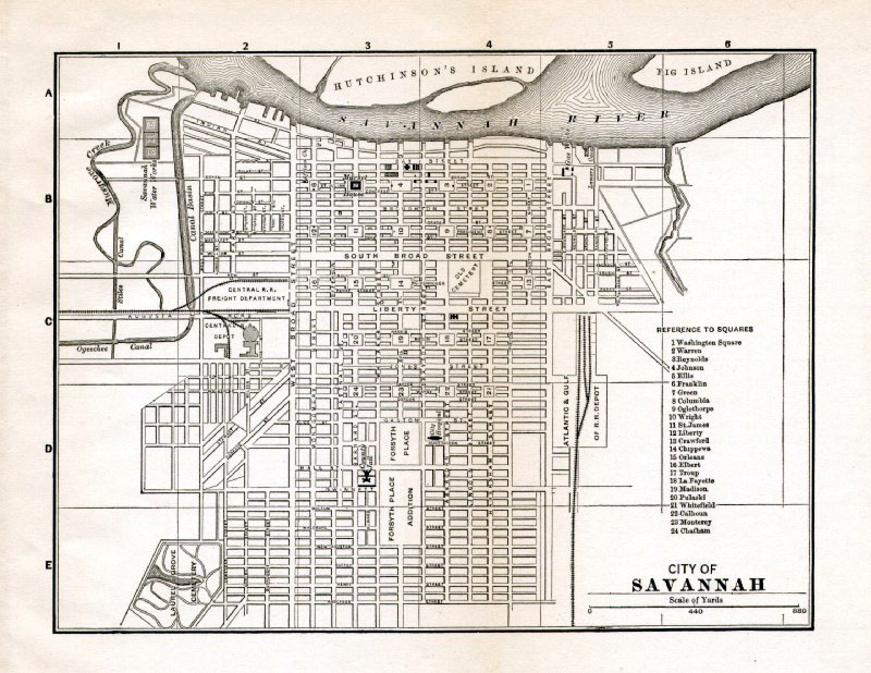 |
Savannah 1891
Mathews-Northrup size: 190 x 140 mm, single fold Ref GEM029 £24.00 (+P&P) click image for enlargement |
|
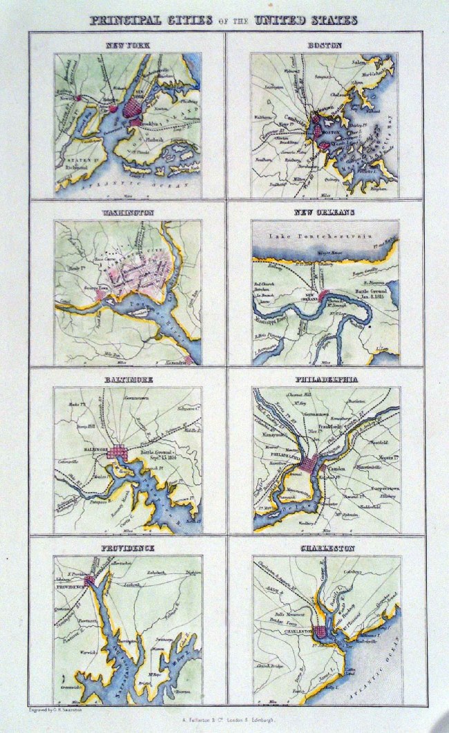
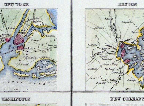
Principal Cities of the United States ( 8
mini plans ) Fullarton c1860 New York, Boston, Washington, New Orleans, Baltimore, Philadelphia, Providence, Charleston size: 150 x 240mm Detail Ref HJM001 £26.00 (+P&P) click image for enlargement |
|
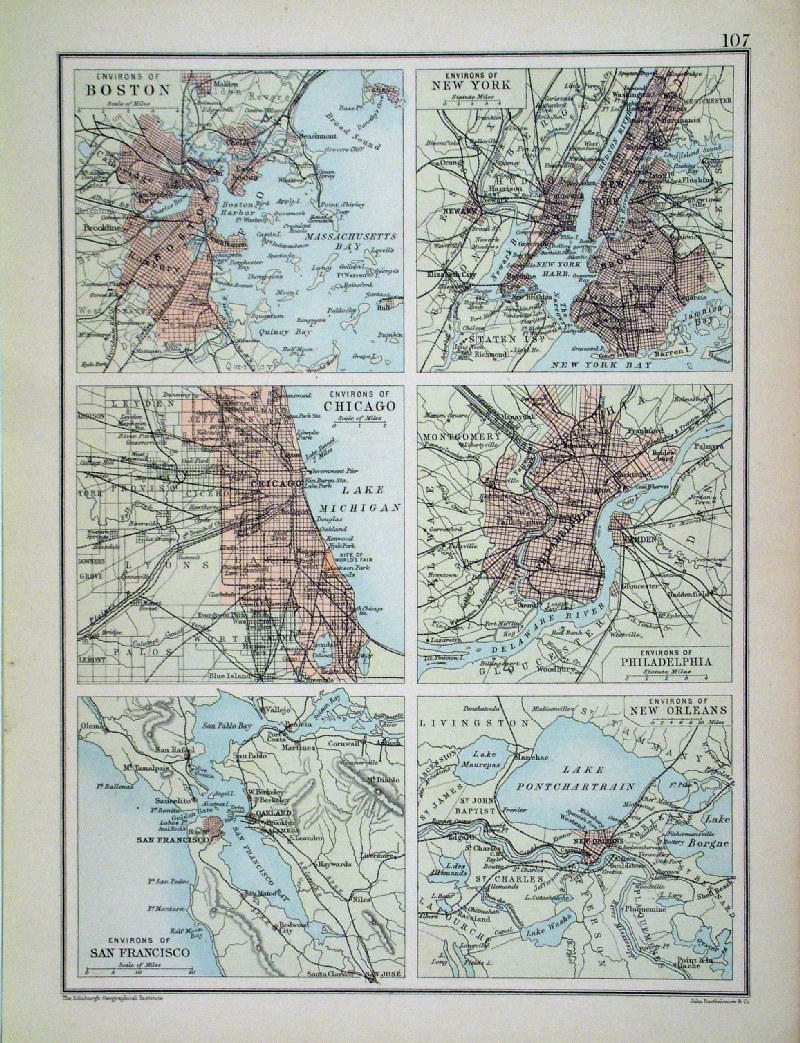
Environs of: Boston, New York, Chicago, Philadelphia, San Francsico and New Orleans Bartholomew c1900 size: 190 x 260mm Ref HBM017 £18.00 (+P&P) click image for enlargement |
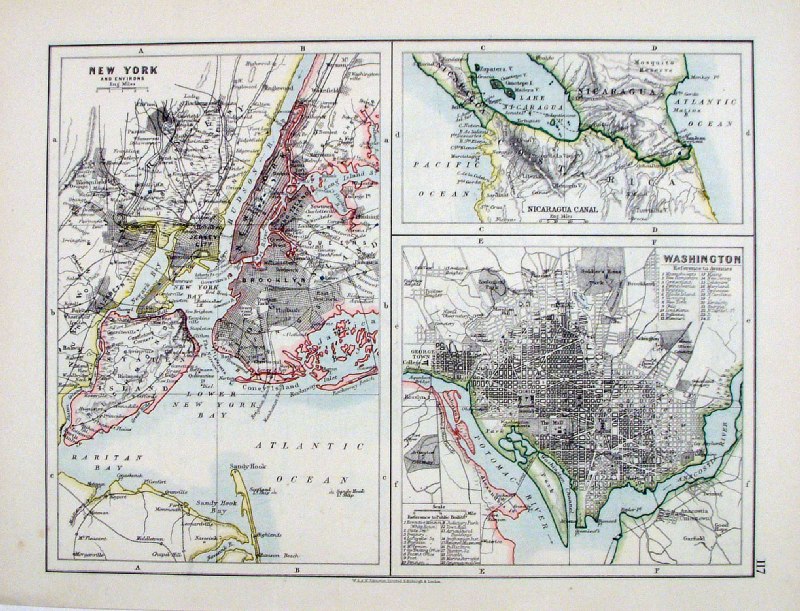 |
New York, Wasington & Nicaragua
Canal Johnston c1880 size: 270 x 210 mm Ref HCM005 £18.00 (+P&P) click image for enlargement |
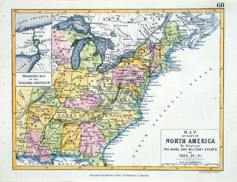 |
Map of Part of North America to Illustrate the
Naval and Military Events of 1812 - 12 - 14 United States with inset of Niagara district. Johnston / Blackwood c1860 size: 220 x 170 mm Ref LCM002 £26.00 (+P&P) click image for enlargement |
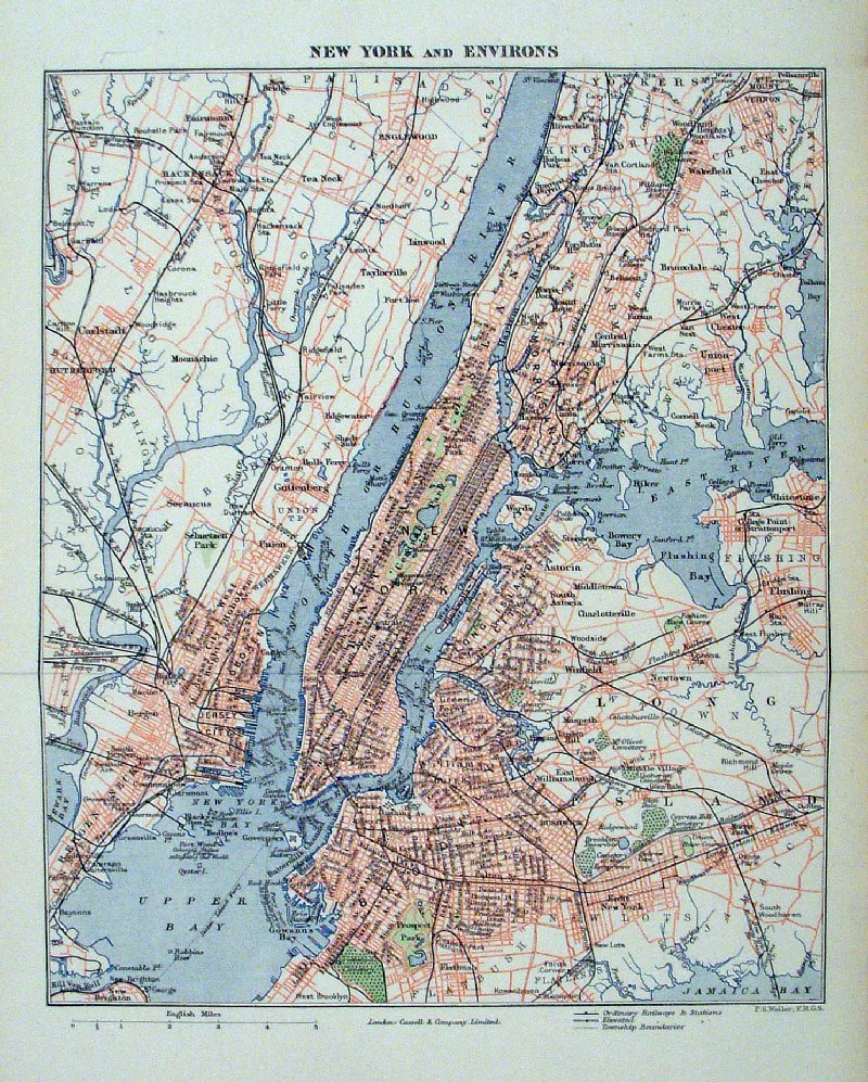 |
New York and Environs
Weller c1870 size: 210 x 260 mm 1 fold Ref HCM008 £20.00 (+P&P) click image for enlargement |
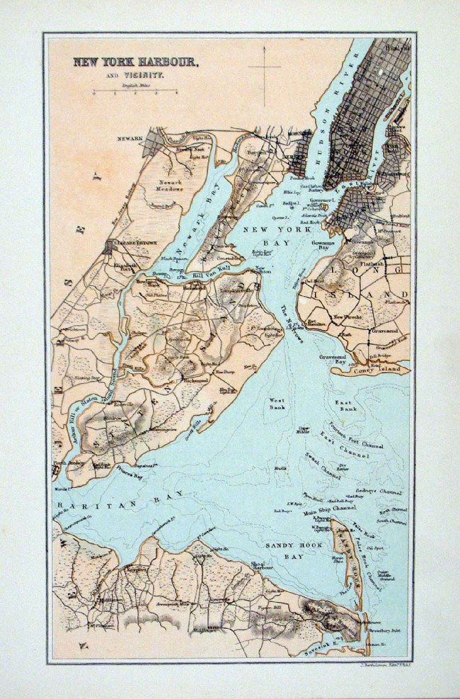 |
New York Harbour and Vicinity
Bartholomew c1880 size: 160 x 250 mm Ref HJM002 £20.00 (+P&P) click image for enlargement |
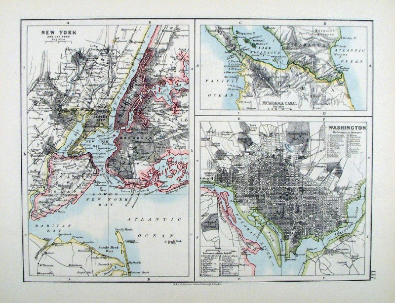 |
New York , Washington and Nicaragua Canal
Johnston c1882 size: 280 x 210 mm Ref HLM025 £20.00 (+P&P) click image for enlargement |
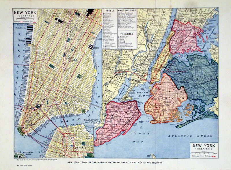 |
New York (Central) & New York (Greater)
Harmsworth c1890 New York: Plan of the Business Section of the City and Map of the Environs size: 300 x 220 mm, 2 folds Detail Ref LAM025 £25.00 (+P&P) click image for enlargement |
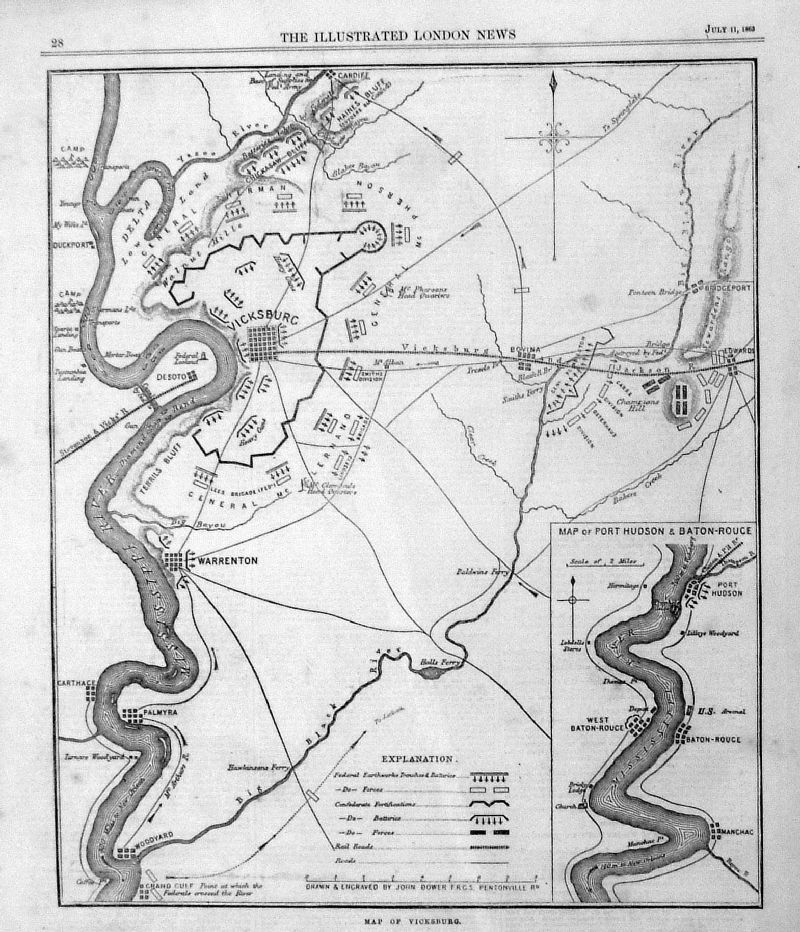 |
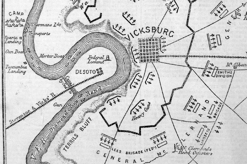
Vicksburg (during
the Civil War) inset map of Port Hudson and Batton Rouge Illustrated London News July 11 1863 Reverse contains text ' Siege of Vicksburg' Ref IKM024 £25.00 (+P&P) size: 190 x 250 mm Detail click image for enlargement |
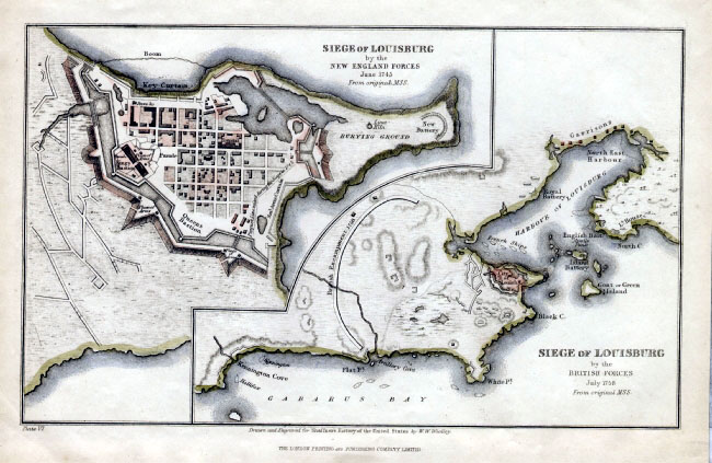 |
Siege of Louisburg
Wooley / London Printing Company
c1860 for Shaffner's History of the United States size: 250 x 150 mm Ref FAM002 Detail £20.00 (+P&P) click image for enlargement |
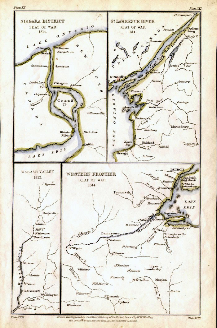 |
Niagara District with St Lawrence River with Westen Frontier Seat of War 1814 Wooley / London Printing Company c1860 for Shaffner's History of the United States size: 150 x 250 mm Ref FAM007 Detail £20.00 (+P&P) click image for enlargement |
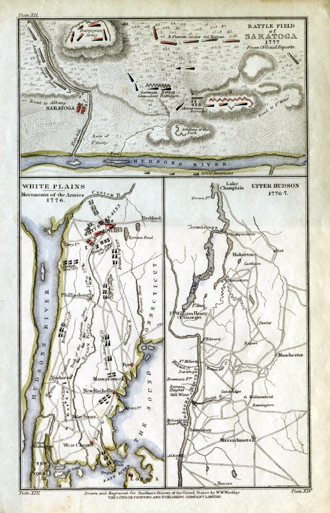 |
Battlefield of Saratoga 1777 with While
Plains 1776 with Upper Hudson Wooley / London Printing Company c1860 for Shaffner's History of the United States size: 150 x 250 mm Ref FAM010 Detail £20.00 (+P&P) click image for enlargement |
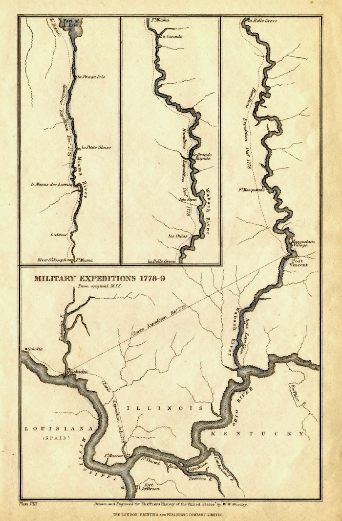 |
Military Expeditions 1778-9 (
Wabashe River, Ohio and Mississippi ) Wooley / London Printing Company c1860 for Shaffner's History of the United States size: 150 x 250 mm Ref FAM013 Detail £18.00 (+P&P) click image for enlargement |
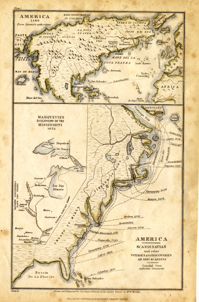 |
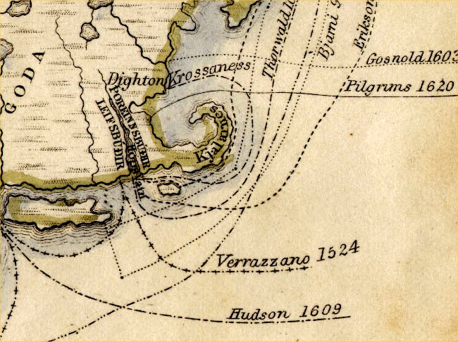
America 1566 with Scandanavian and other voyages and discoveries AD 1000 to AD 1634 Wooley / London Printing Company c1860 for Shaffner's History of the United States size: 150 x 250 mm some discolouration around the margins Ref FAM017 Detail £20.00 (+P&P) click image for enlargement |
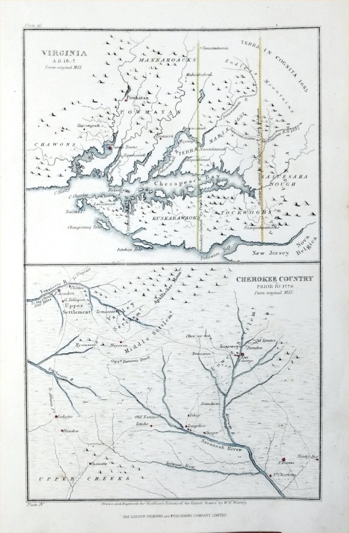 |
Top: Virginia
AD1607 Bottom: Cherokee Country prior to
1776 Wooley / London Printing Company c1860 for Shaffner's History of the United States size: 160 x 250 mm Ref PGM033 Detail £18.00 (+P&P) click image for enlargement |
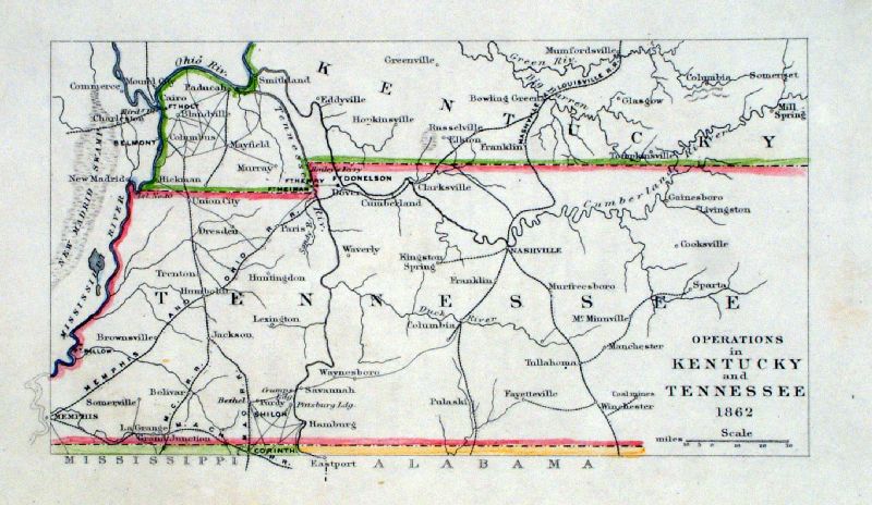 |
Operations in Kentucky and Tennessee 1862 Wooley / London Printing Company c1860 for Shaffner's History of the United States size: 180 x 110 mm Ref BAM009 £20.00 (+P&P) click image for enlargement |
 |
The United States Virtue 1867 Ref HKM022 £24.00 (+P&P) size: 290 x 250 mm, centre fold click image for enlargement |
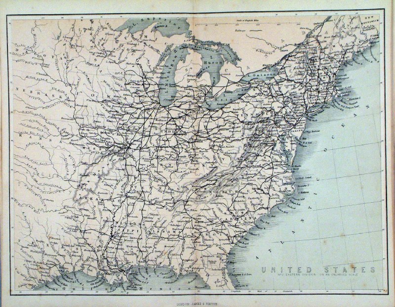 |
The United States No2 Eastern Division
Virtue 1867 Ref HKM025 £22.00 (+P&P) size: 290 x 250 mm, centre fold, a few very faint spots click image for enlargement |
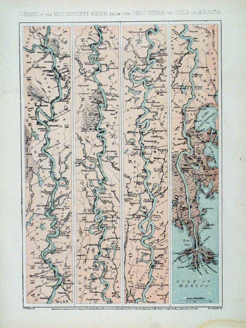 |
Mississippi River from the Ohio to the Gulf of
Mexico Virtue 1867 Ref HKM018 £24.00 (+P&P) size: 190 x 250 mm, stain at lower-right margin click image for enlargement |
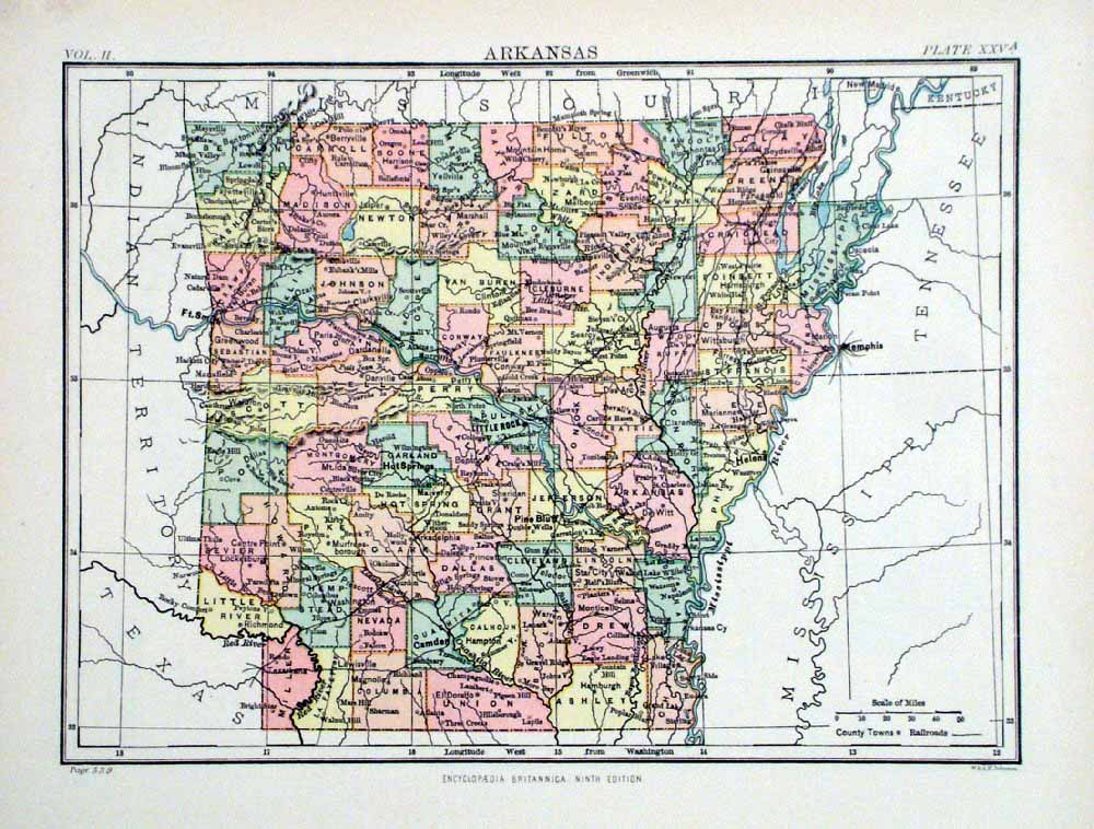 |
Arkansas
Johnston 1882 size: 260 x 200 mm Ref HJS068 £15.00 (+P&P) Ref LGM017 £15.00 (+P&P) click image for enlargement |
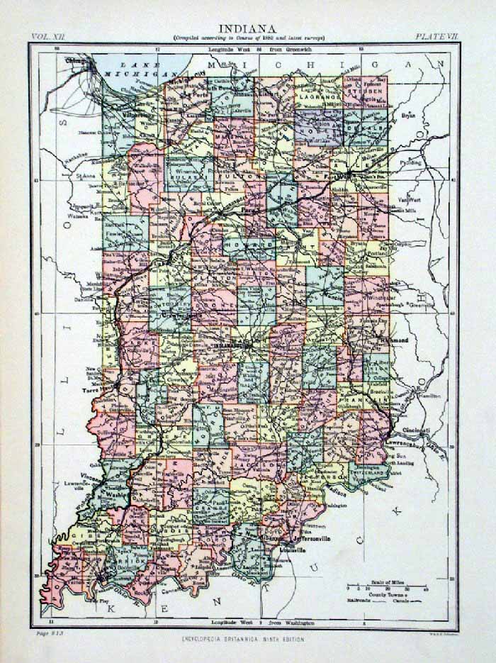 |
Indiana
Johnston 1882 size: 260 x 200 mm Ref HJS070 £15.00 (+P&P) click image for enlargement |
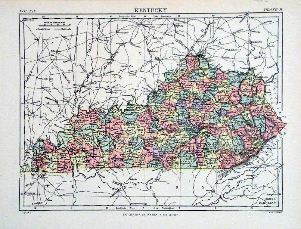 |
Kentucky
Johnston 1882 size: 260 x 200 mm Ref HJS072 £15.00 (+P&P) click image for enlargement |
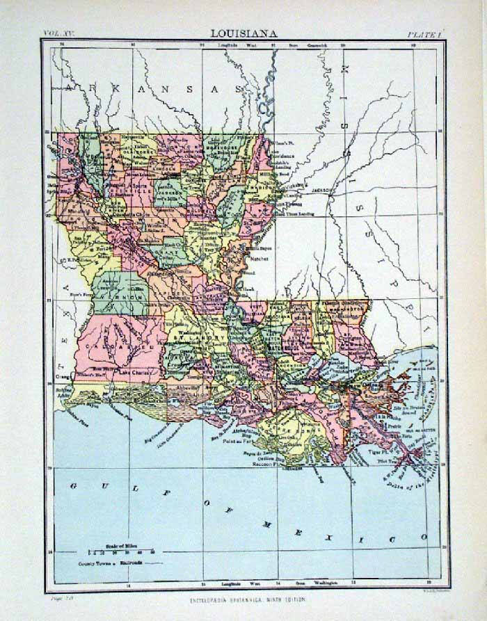 |
Louisiana
Johnston 1882 size: 260 x 200 mm Ref HJS073 £15.00 (+P&P) click image for enlargement |
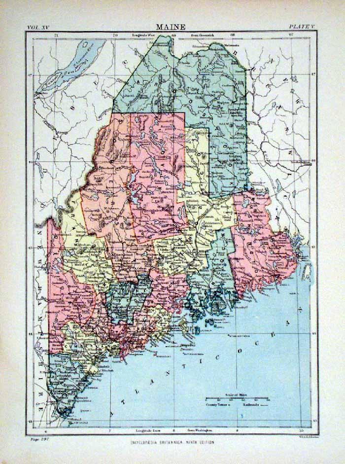 |
Maine
Johnston 1882 size: 260 x 200 mm Ref HJS074 £15.00 (+P&P) click image for enlargement |
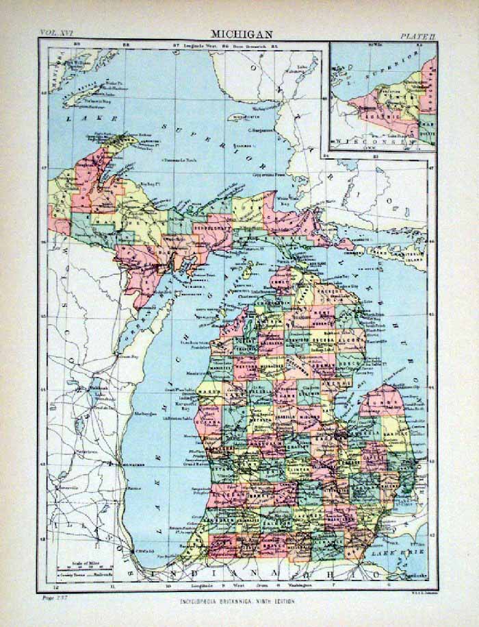 |
Michigan
Johnston 1882 size: 260 x 200 mm Ref HJS075 £15.00 (+P&P) click image for enlargement |
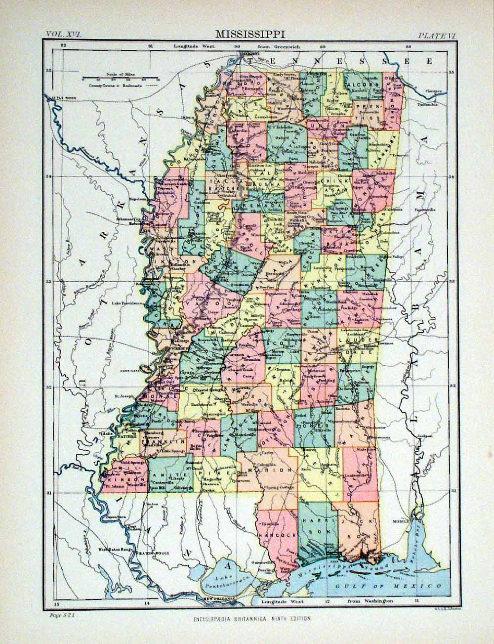 |
Mississippi
Johnston 1882 size: 260 x 200 mm Ref HJS076 £15.00 (+P&P) click image for enlargement |
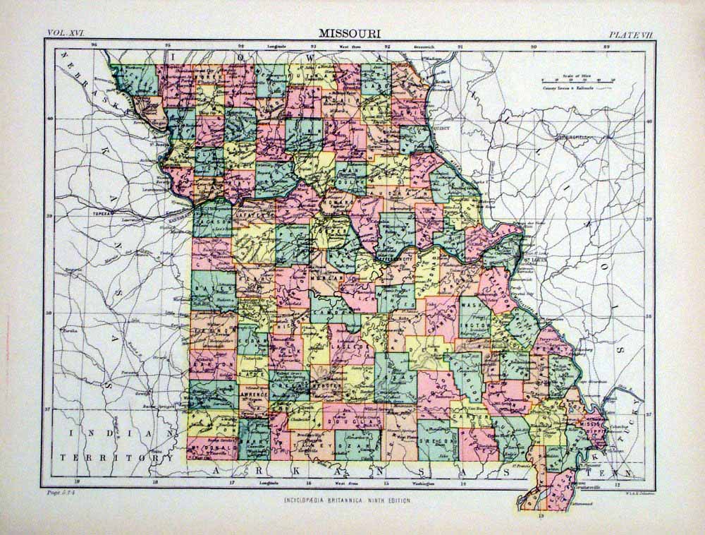 |
Missouri
Johnston 1882 size: 260 x 200 mm Ref HJS077 £15.00 (+P&P) click image for enlargement |
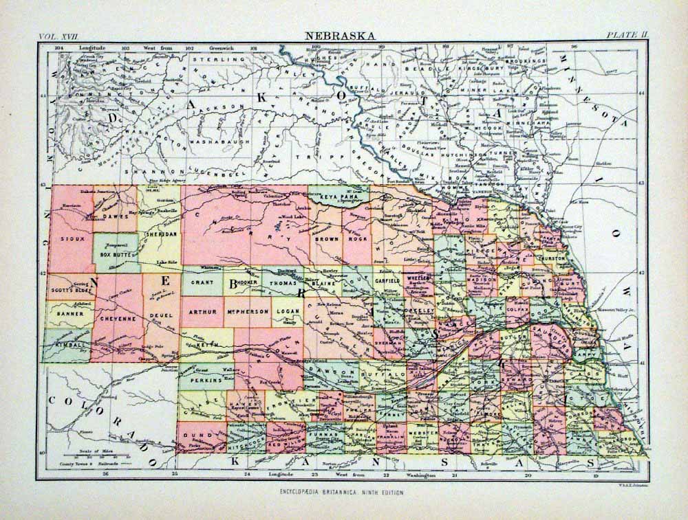 |
Nebraska
Johnston 1882 size: 260 x 200 mm Ref HJS078 £15.00 (+P&P) Ref LGM012 £15.00 (+P&P) click image for enlargement |
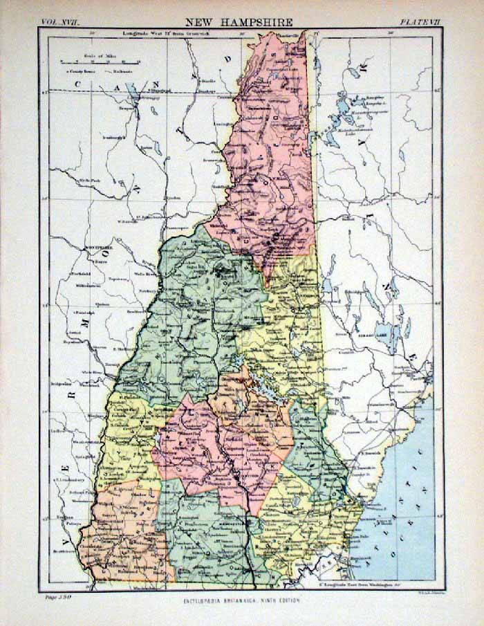 |
New Hampshire
Johnston 1882
size: 200 x 260 mm Ref HJS079 £15.00 (+P&P) Ref LGM014 £15.00 (+P&P) click image for enlargement |
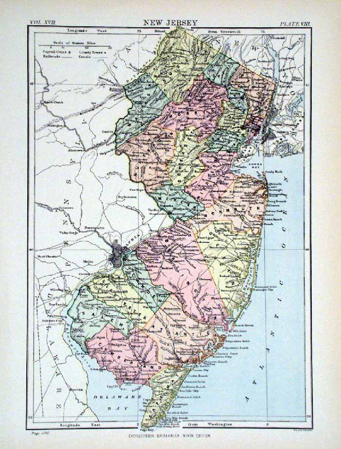 |
New Jersey
Johnston 1882 size: 200 x 250 mm Ref HJS080 £15.00 (+P&P) click image for enlargement |
 |
Arkansas
Johnston 1882 size: 200 x 260 mm Ref HJS082 £15.00 (+P&P) click image for enlargement |
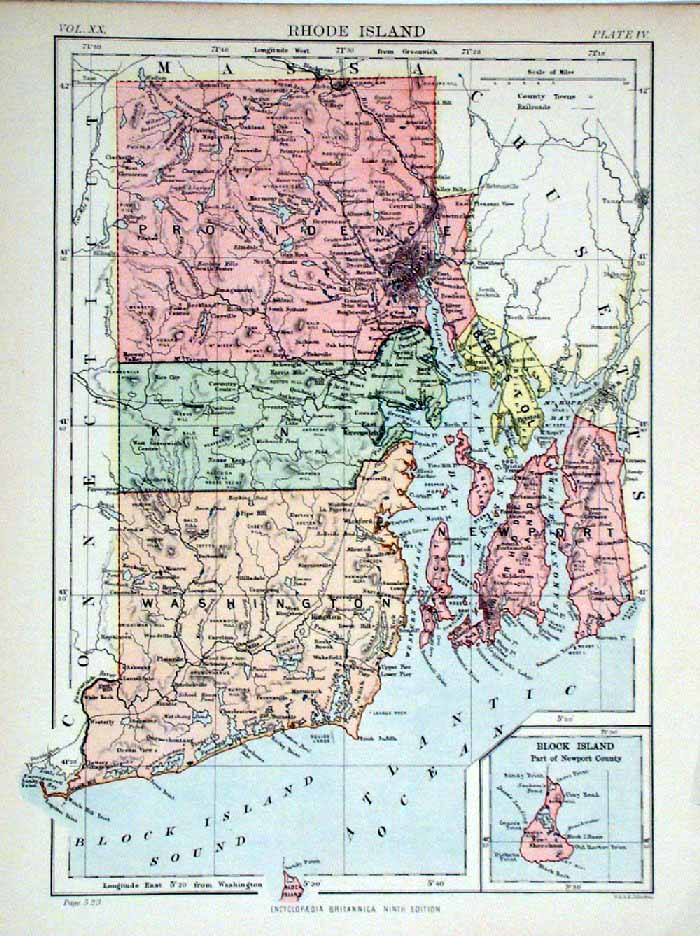 |
Rhode Island
Johnston 1882 size: 200 x 260 mm Ref HJS084 £15.00 (+P&P) Ref LGM015 £15.00 (+P&P) click image for enlargement |
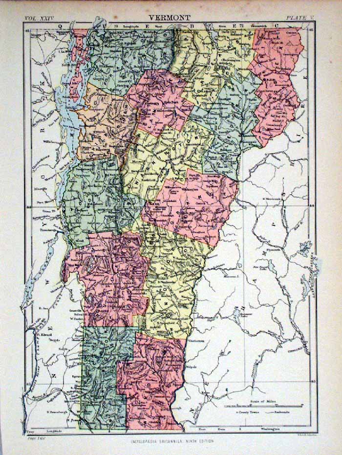 |
Vermont
Johnston 1882 size: 200 x 260 mm Ref HJS086 £15.00 (+P&P) click image for enlargement |
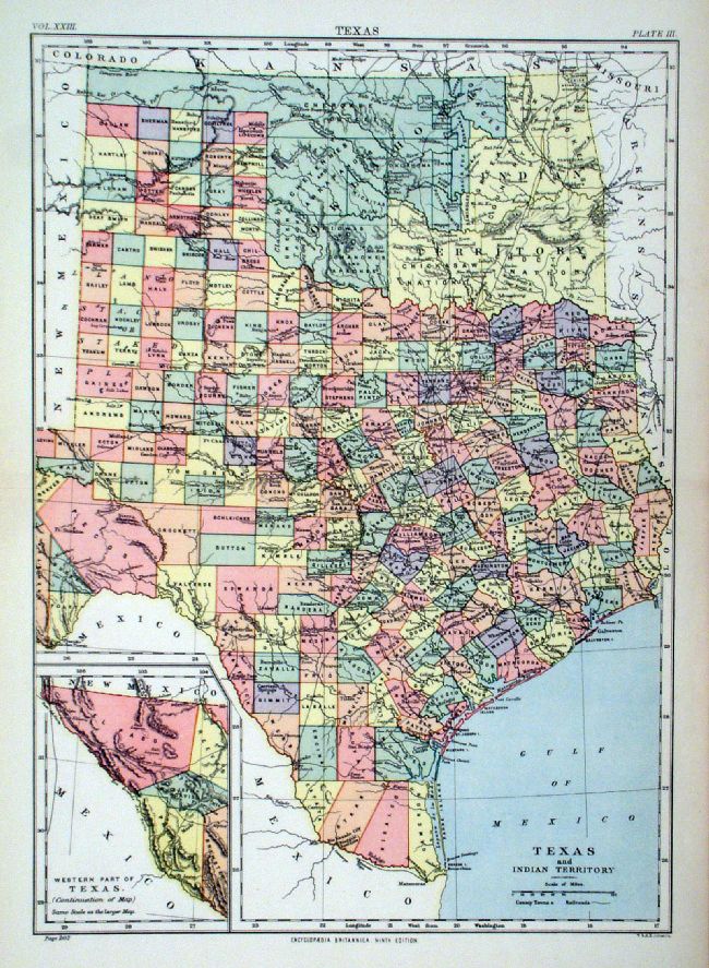 |
Texas Johnston
1889 Ref JBM025 £18.00 (+P&P) size: 260 x 360 mm, centre fold Inset of Western Texas ( El Paso) click image for enlargement |
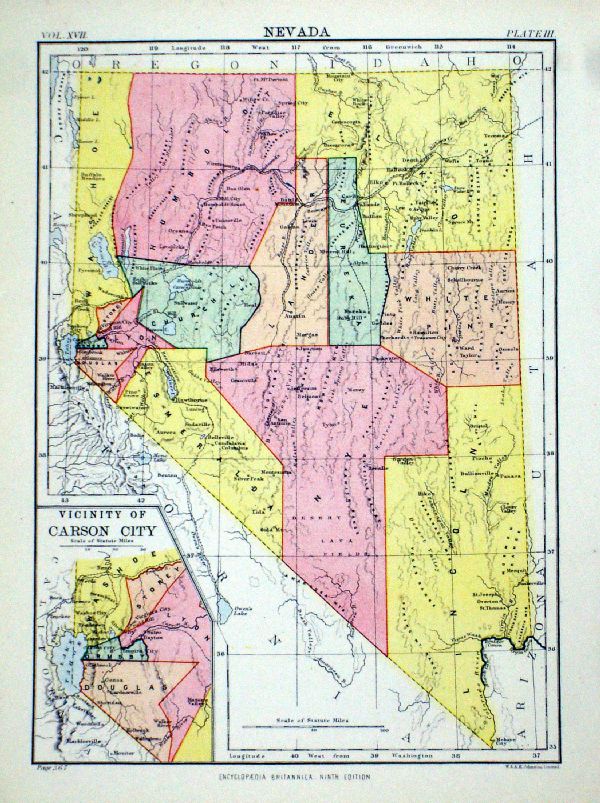 |
Nevada
Johnston 1882
Inset of Vicinity of Carson City size: 200 x 260 mm Ref LGM016 £18.00 (+P&P) click image for enlargement |
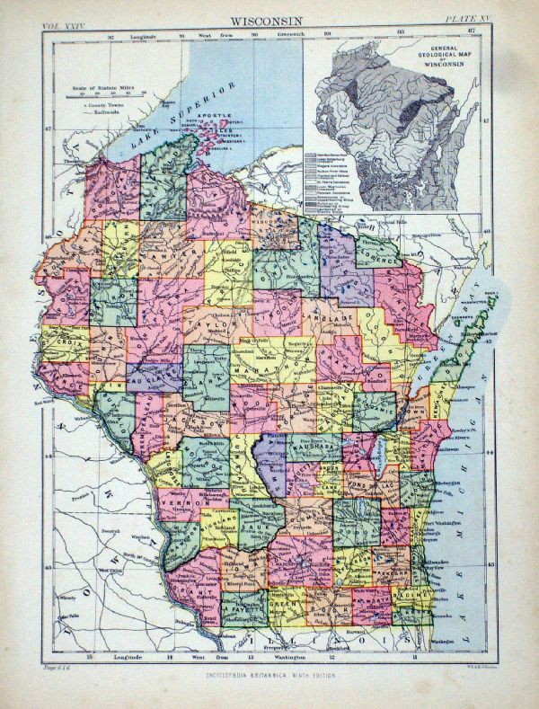 |
Wisconsin
Johnston 1882
Inset of Geological Map of Wisconsin size: 200 x 260 mm Ref LGM011 £15.00 (+P&P) click image for enlargement |
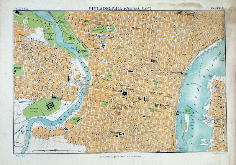 |
Philadelphia (Central
Part)
Johnston 1882 size: 260 x 200 mm, stains to top and right margins. Ref LGM013 £15.00 (+P&P) click image for enlargement |
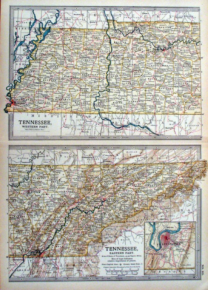 |
Tennessee anon 1903 Ref JKM107 £15.00 (+P&P) size: 290 x 400 mm, centre fold Inset of Chattanooga click image for enlargement |
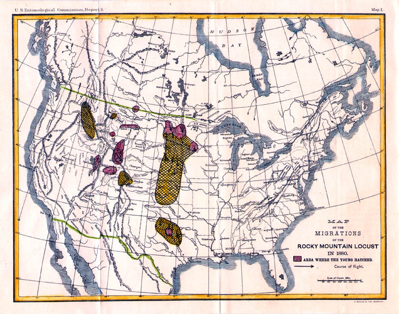 |
Map of the Migrations of the Rocky Mountain Locust
in 1880 Packard / Hoen Published by the US Entomological Commission 1883 Litho size: 290 x 220 mm, 2 folds Ref IFM100 £22.00 (+P&P) Detail click image for enlargement |
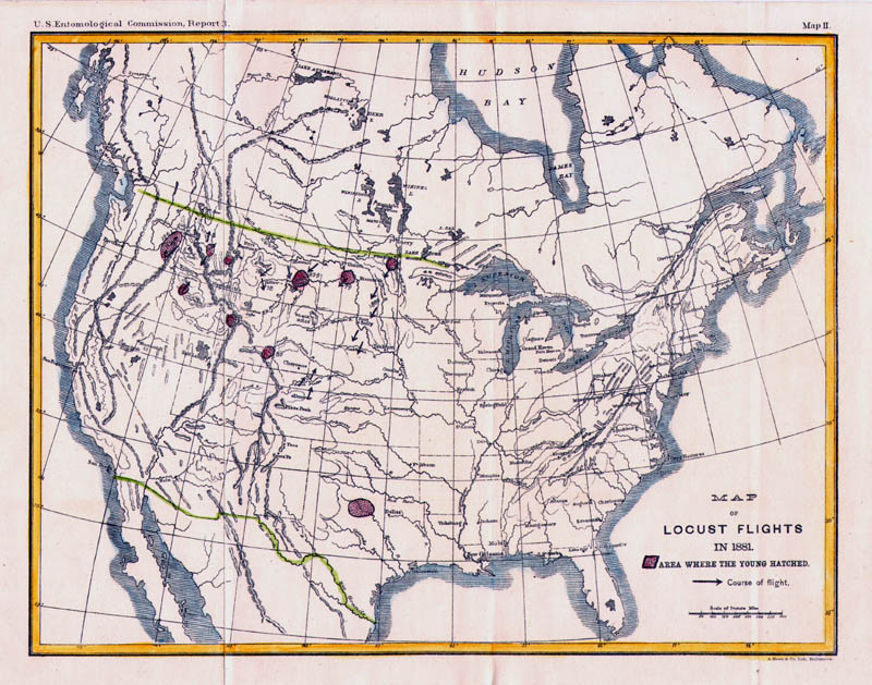 |
Map of the Locust Flights in 1881 Packard / Hoen Published by the US Entomological Commission 1883 Litho size: 290 x 220 mm, 2 folds Ref IFM101 £22.00 (+P&P) Detail click image for enlargement |
 |
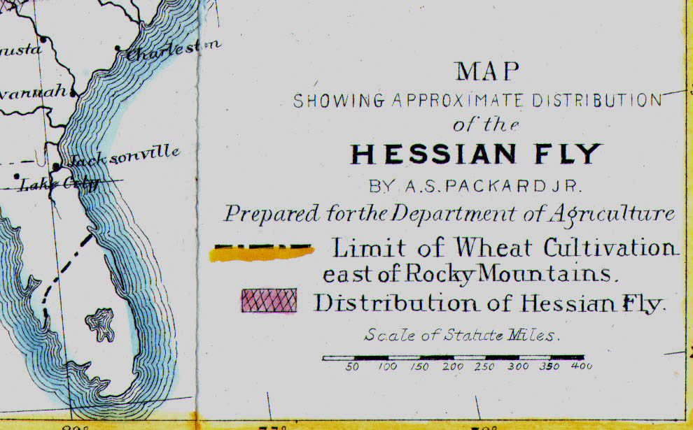
Map Showing the Approximate Distribution of the
Hessian Fly Packard / Hoen Prepared for the Department of Agriculture Published by the US Entomological Commission 1883 Litho size: 290 x 220 mm, 2 folds Map also shows the Limit of Wheat Cultivation east of the Rockies. Note that data is not available for Oklahoma, then designated as 'Indian Territory' Ref IFM102 £22.00 (+P&P) Detail click image for enlargement |
 |
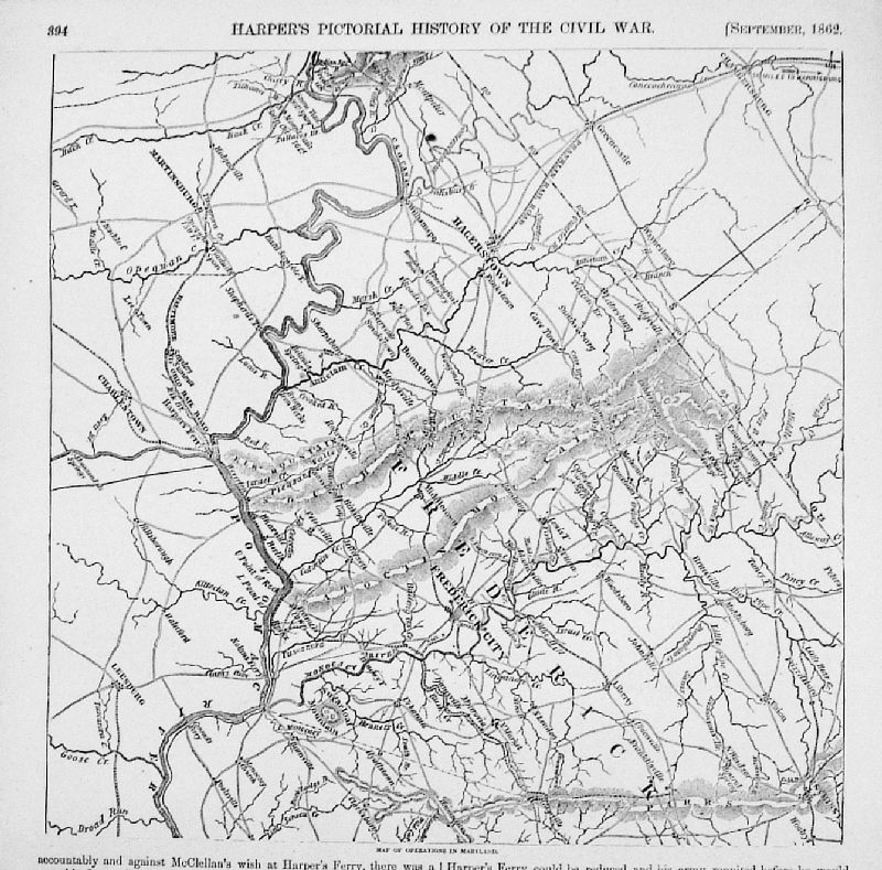
Invasion of Maryland
- Movements of Troops Sept 1862 Harpers Pictorial History of the Civil War 1894 Woodcut engraving size: 120 x 115 mm Ref MFM005 £15.00 (+P&P) click image for enlargement |
 |
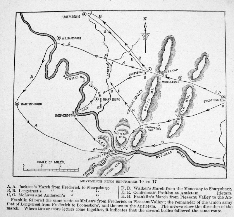
Map of Operations in
Maryland Sept 1862 Harpers Pictorial History of the Civil War 1894 Woodcut engraving size: 2500 x 250 mm Detail Ref MFM006 £18.00 (+P&P) click image for enlargement |
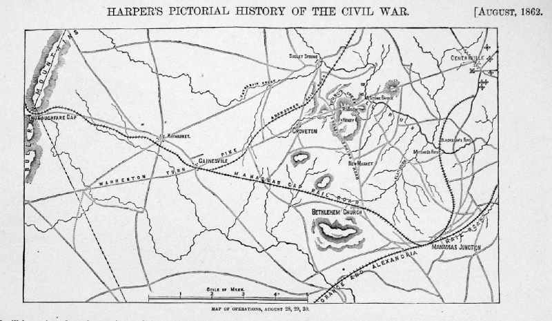 |
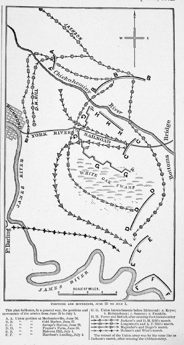
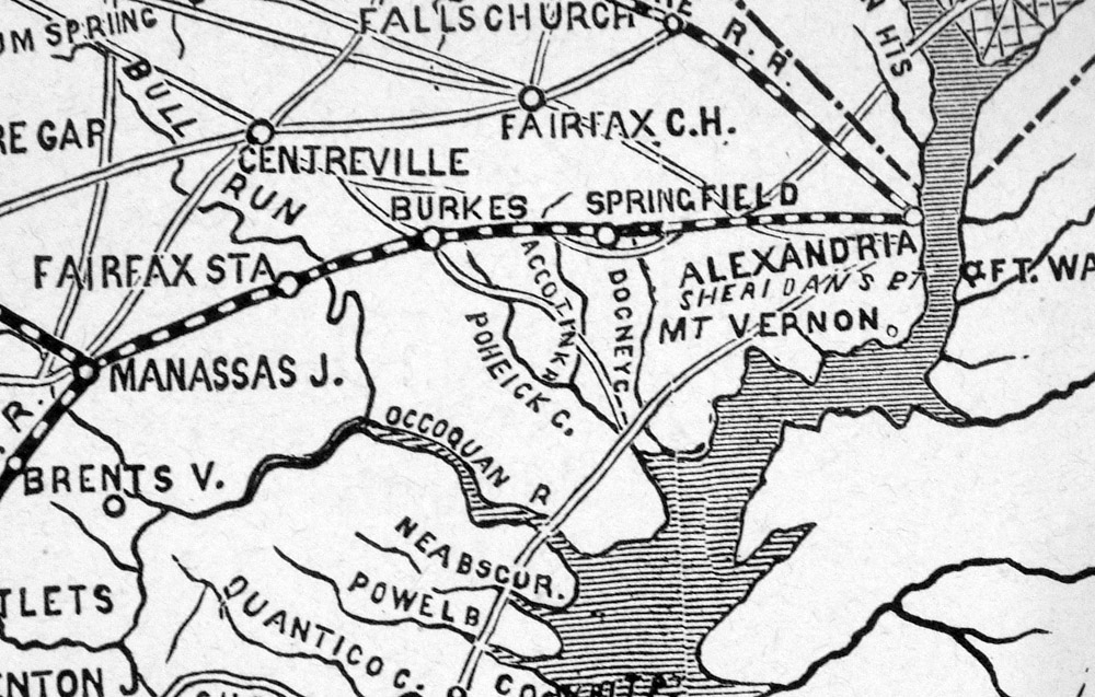
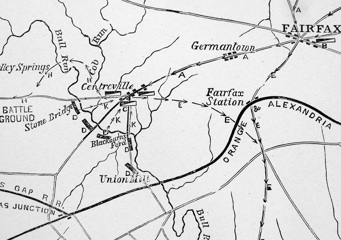
Map of Operations
Aug 1862 (Manassas, Gainsville,
Centreville) Harpers Pictorial History of the Civil War 1894 Woodcut engraving size: 220 x 130 mm Ref MFM007 £15.00 (+P&P) click image for enlargement |
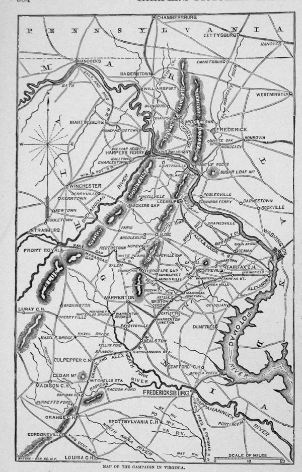 |
Map of Campaign in
Virginia Aug 1862 Harpers Pictorial History of the Civil War 1894 Woodcut engraving size: 140 x 220 mm Detail Ref MFM008 £16.00 (+P&P) click image for enlargement |
 |
Movements east of
Richmond VA July 1862 Harpers Pictorial History of the Civil War 1894 Woodcut engraving size: 130 x 230 mm Ref MFM009 £15.00 (+P&P) click image for enlargement |
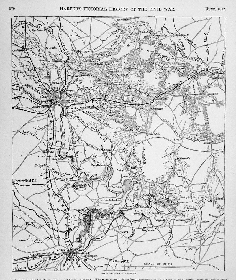 |
Map of the Region
near Richmond June 1862 Harpers Pictorial History of the Civil War 1894 Woodcut engraving size: 250 x 290 mm Detail Ref MFM010 £18.00 (+P&P) click image for enlargement |
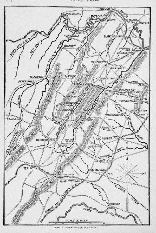 |
Operations in the
Valley (Shenandouh / Potomac)
May 1862 Harpers Pictorial History of the Civil War 1894 Woodcut engraving size: 140 x 200 mm Ref MFM011 £15.00 (+P&P) click image for enlargement |
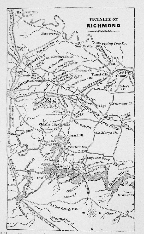 |
Vicinity of Richmond
March 1862 Harpers Pictorial History of the Civil War 1894 Woodcut engraving size: 100 x 160 mm Ref MFM012 £15.00 (+P&P) click image for enlargement |
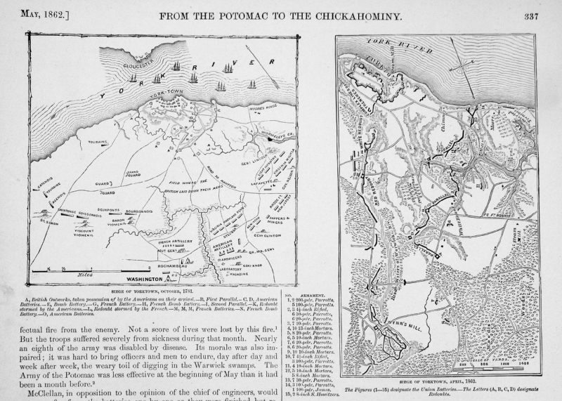 |
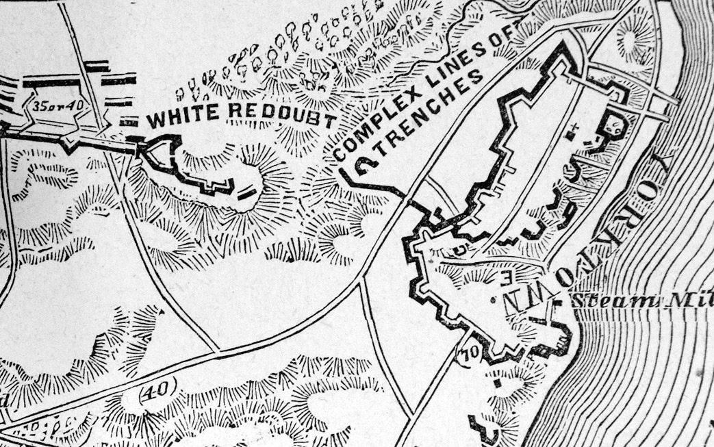
Seige of Yorktown in
1781 and 1862 May 1862 Harpers Pictorial History of the Civil War 1894 Woodcut engraving size: 120 x 1150 mm Detail Ref MFM013 £18.00 (+P&P) click image for enlargement |
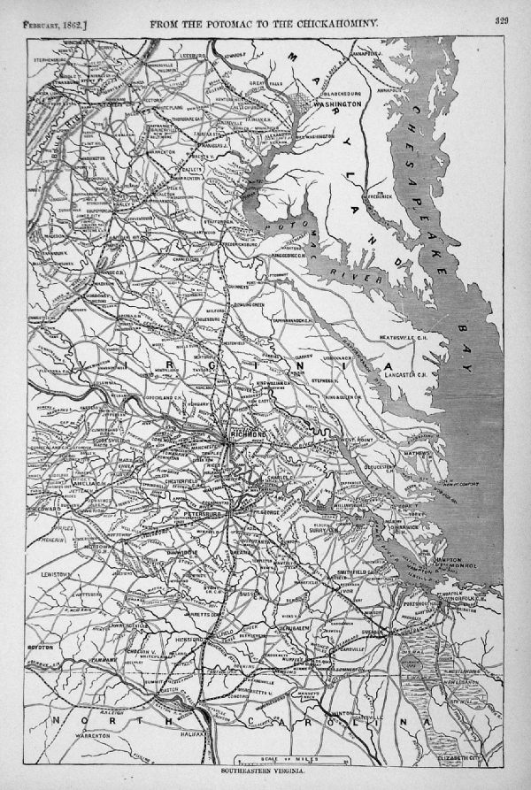 |
South Eastern
Virginia Feb 1862 Harpers Pictorial History of the Civil War 1894 Woodcut engraving size: 260 x 380 mm Detail Ref MFM015 £18.00 (+P&P) click image for enlargement |
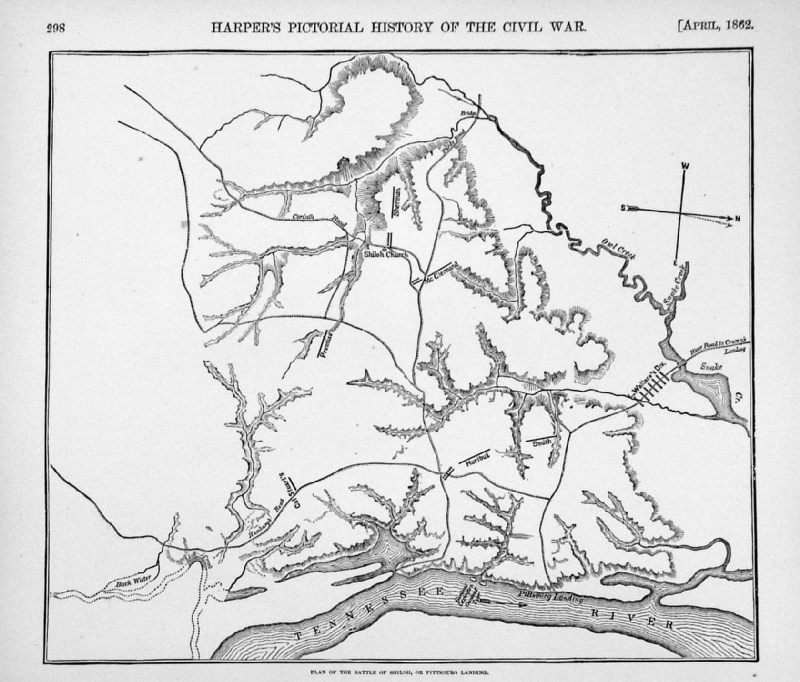 |
Plan of the Battle of
Shiloh Apr 1862 Harpers Pictorial History of the Civil War 1894 Woodcut engraving size: 250 x 220 mm Detail Ref MFM016 £15.00 (+P&P) click image for enlargement |
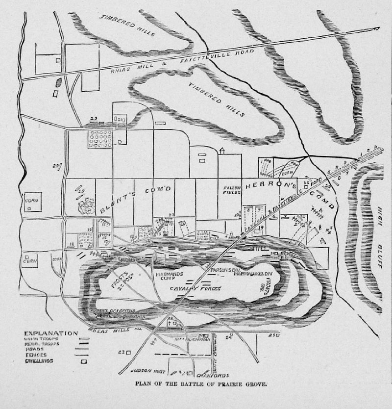 |
Plan of Battle of
Prairie Grove Jan 1863 Harpers Pictorial History of the Civil War 1894 Woodcut engraving size: 120 x 120 mm Ref MFM017 £14.00 (+P&P) click image for enlargement |
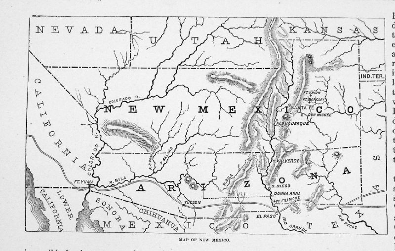 |
Map of New
Mexico Feb 1862 Harpers Pictorial History of the Civil War 1894 Woodcut engraving size: 160 x 105 mm Ref MFM018 £15.00 (+P&P) click image for enlargement |
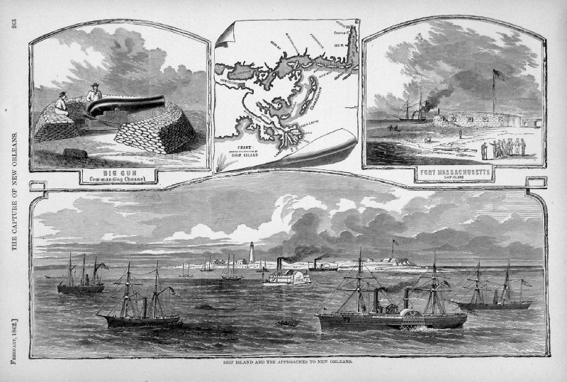 |
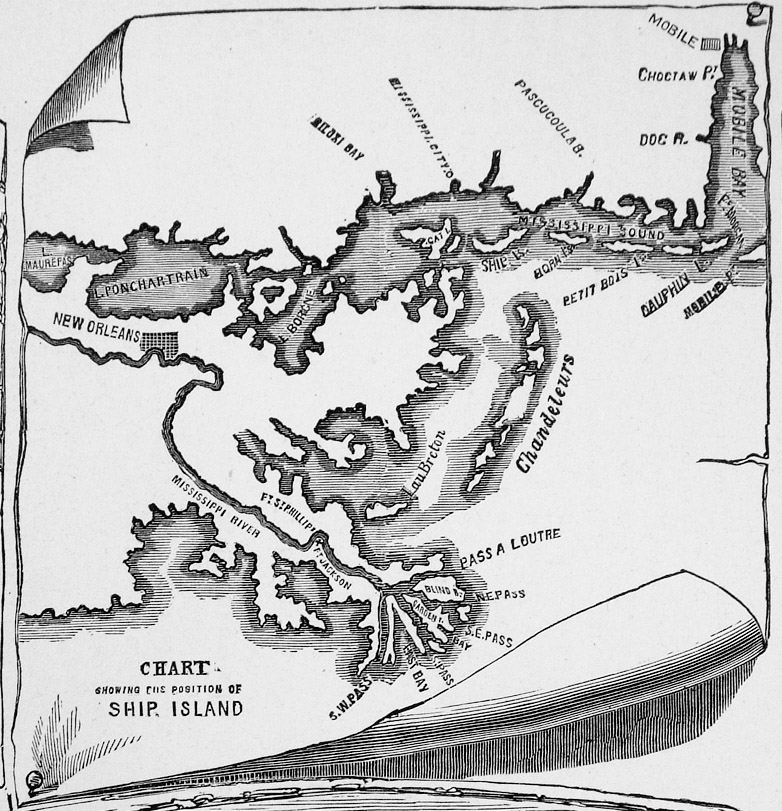
Ship Island and the
approaches to New Orleans Feb 1862 Harpers Pictorial History of the Civil War 1894 Woodcut engraving size: 370 x 260 mm Detail Ref MFM019 £18.00 (+P&P) click image for enlargement |
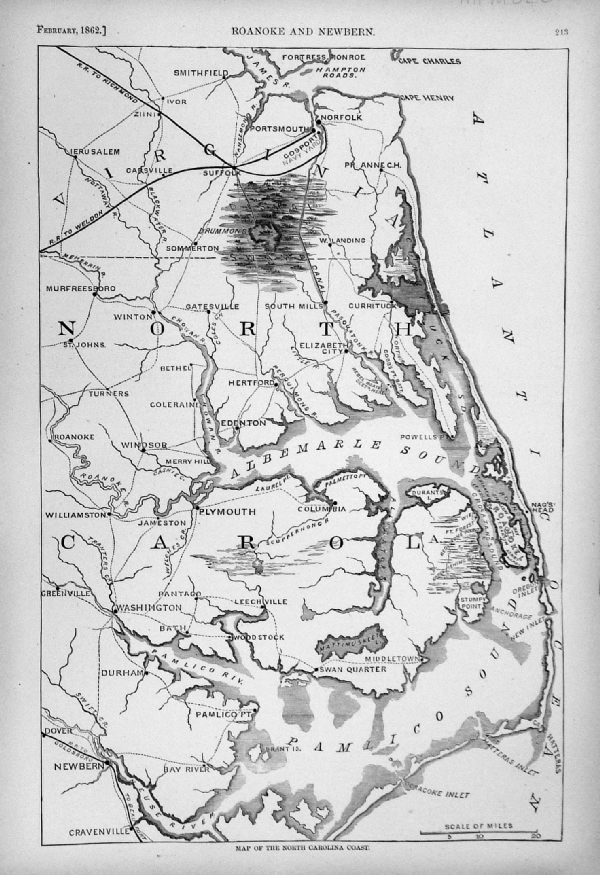 |
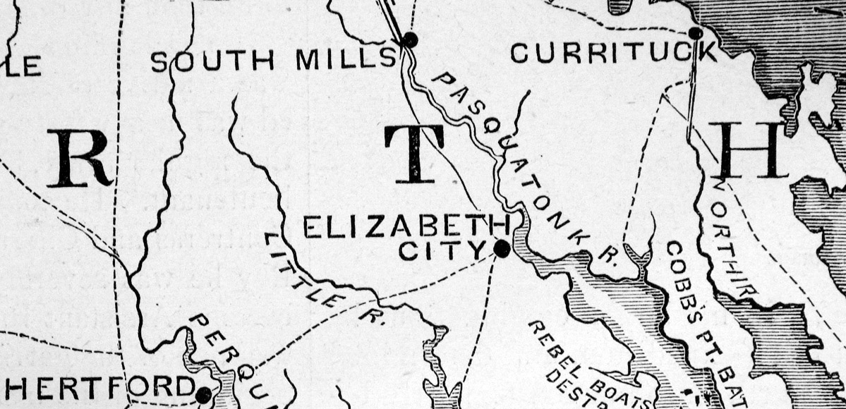
Map of the North
Carolina Coast Feb
1862 Harpers Pictorial History of the Civil War 1894 Woodcut engraving size: 260 x 380 mm Detail Detail Ref MFM020 £18.00 (+P&P) click image for enlargement |
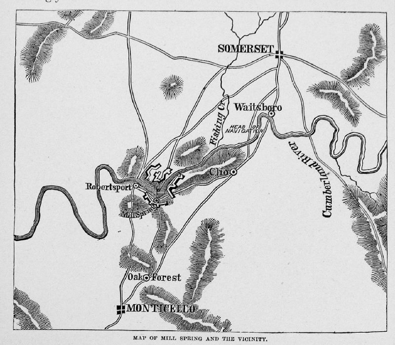 |
Map of Mill Spring
and Vicinity (Cumberland River) Jan
1862 Harpers Pictorial History of the Civil War 1894 Woodcut engraving size: 125 x 110 mm Ref MFM021 £14.00 (+P&P) click image for enlargement |
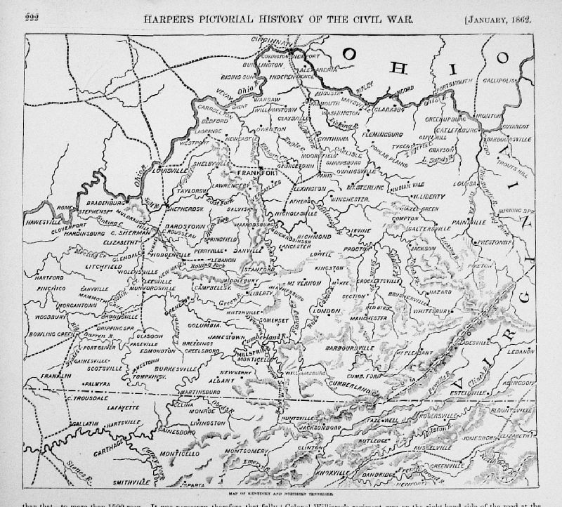 |
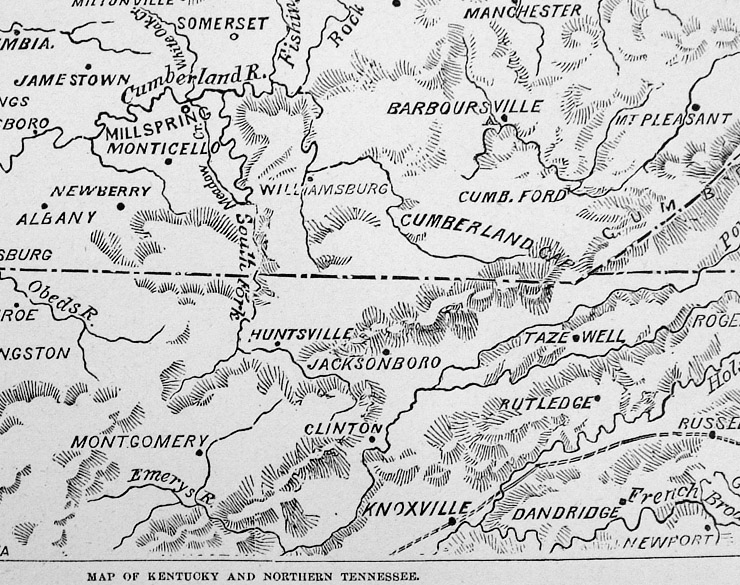
Map of Kentucky and
Northern Tennessee Jan 1862 Harpers Pictorial History of the Civil War 1894 Woodcut engraving size: 250 x 230 mm Detail Ref MFM022 £18.00 (+P&P) click image for enlargement |
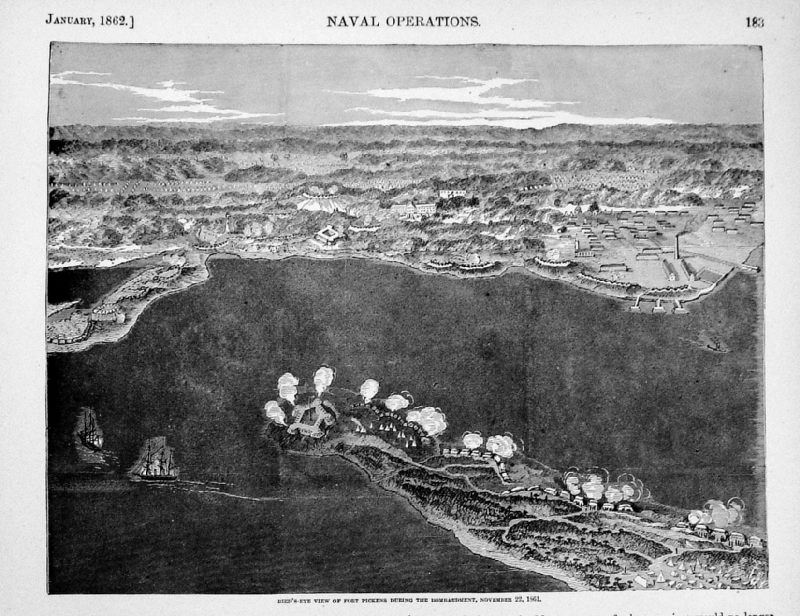 |
Birds Eye View of
Fort Pickens during the Bombardment, Nov 22
1861 Jan 1862 Harpers Pictorial History of the Civil War 1894 Woodcut engraving size: 250 x 200 mm Ref MFM023 £18.00 (+P&P) click image for enlargement |
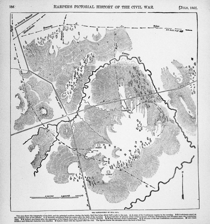 |
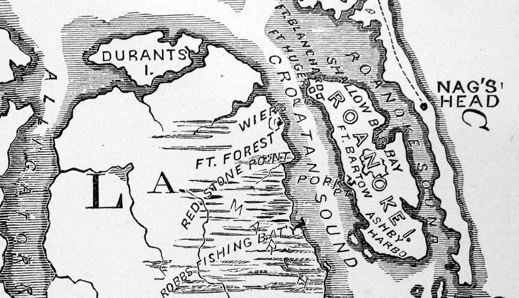
The Battlefield of
Bull Run July 1861 Harpers Pictorial History of the Civil War 1894 Woodcut engraving size: 250 x 270 mm Ref MFM024 £18.00 (+P&P) click image for enlargement |
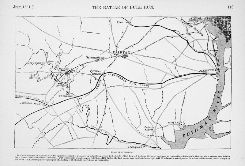 |
Battle of Bull
Run - Plan of Operations
July 1861 Harpers Pictorial History of the Civil War 1894 Woodcut engraving size: 250 x 160 mm Detail Ref MFM025 £18.00 (+P&P) click image for enlargement |
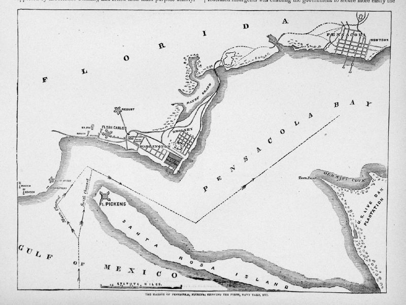 |
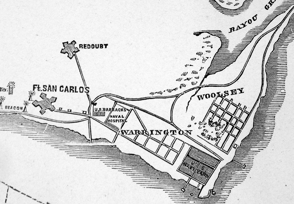
The Harbor of
Pensacola, Florida, showing the Forts, Navy Yard,
etc 1861 Harpers Pictorial History of the Civil War 1894 Woodcut engraving size: 250 x 190 mm Detail Ref MFM027 £18.00 (+P&P) click image for enlargement |
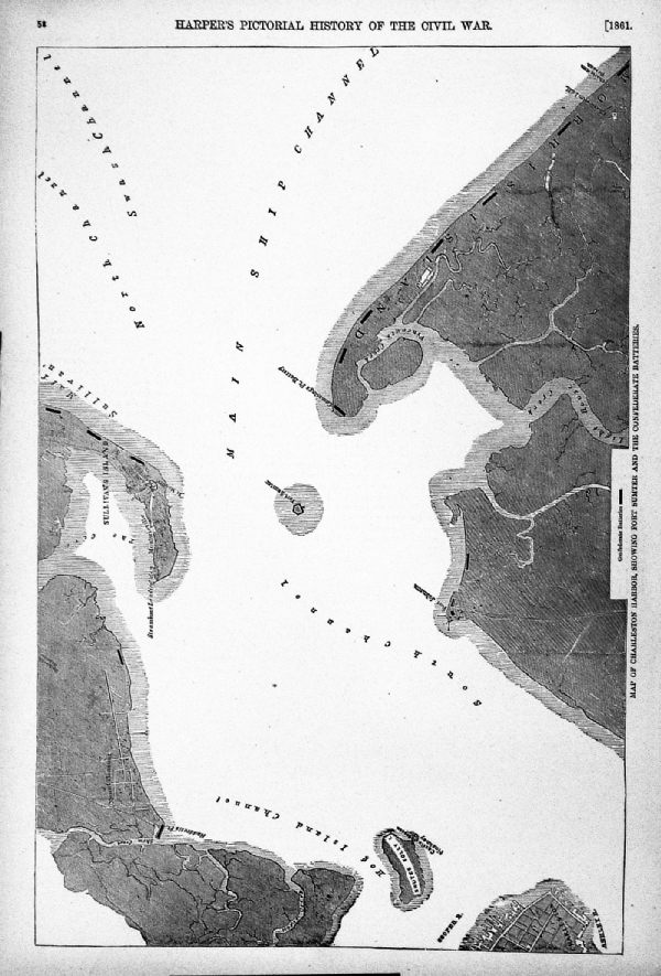 |
Map of Charleston
Harbor, showing Fort Sumpter and the Confederate
Batteries 1861 Harpers Pictorial History of the Civil War 1894 Woodcut engraving size: 370 x 260 mm Detail Detail Ref MFM028 £18.00 (+P&P) click image for enlargement |
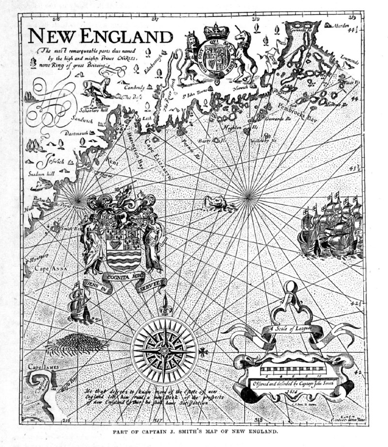 |
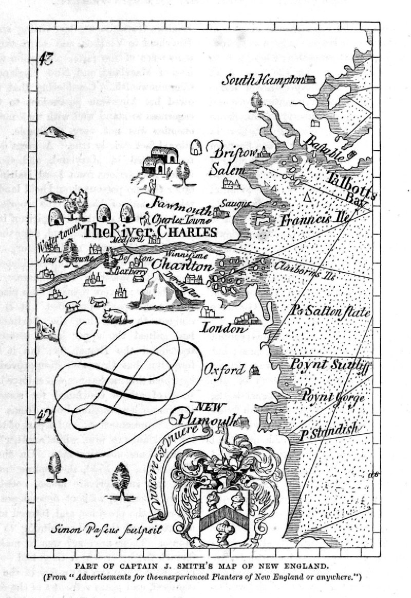
Part of Captain John
Smith's Map of New England from Cassell's History of the United States by Edmund Ollier 1874 taken from earlier publication size: 160 x 180 mm Ref PAM007 £16.00 (+P&P) click image for enlargement |
 |
Part of Captain John
Smith's Map of New England from Cassell's History of the United States by Edmund Ollier 1874 taken from earlier publication size: 110 x 150 mm Ref PAM006 £16.00 (+P&P) click image for enlargement |
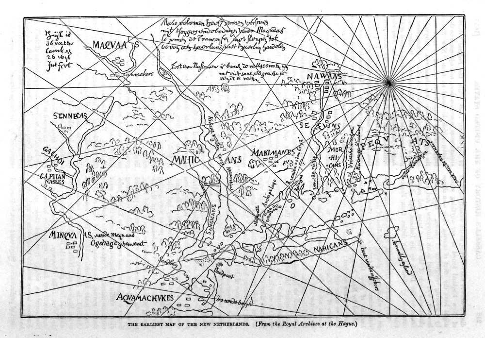 |
The Earliest Map of
the New Netherlands from Cassell's History of the United States by Edmund Ollier 1874 taken from earlier publication. size: 220 x 160 mm Ref PAM011 £16.00 (+P&P) click image for enlargement |
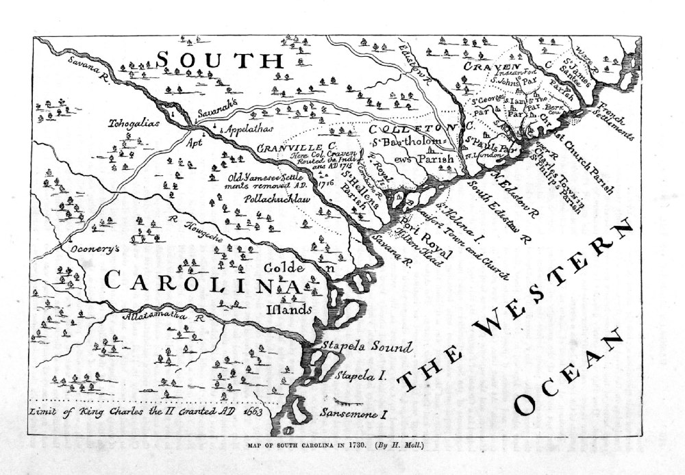 |
Map of South Carolina
in 1730 ( by H. Moll) from Cassell's History of the United States by Edmund Ollier 1874 taken from earlier publication (1730). size: 230 x 160 mm Ref PAM018 £16.00 (+P&P) click image for enlargement |
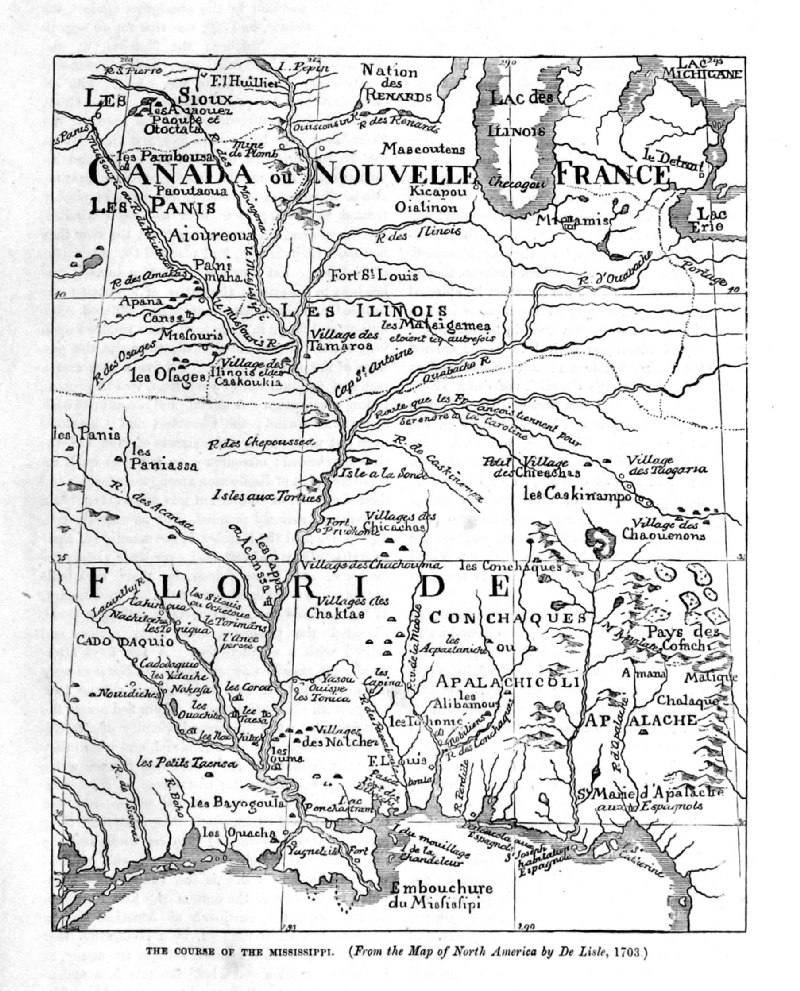 |
The Course of the
River Mississippi ( from the map of De Lisle 1703) from Cassell's History of the United States by Edmund Ollier 1874 taken from earlier publication (1703). size: 160 x 200 mm Ref PAM019 £16.00 (+P&P) click image for enlargement |
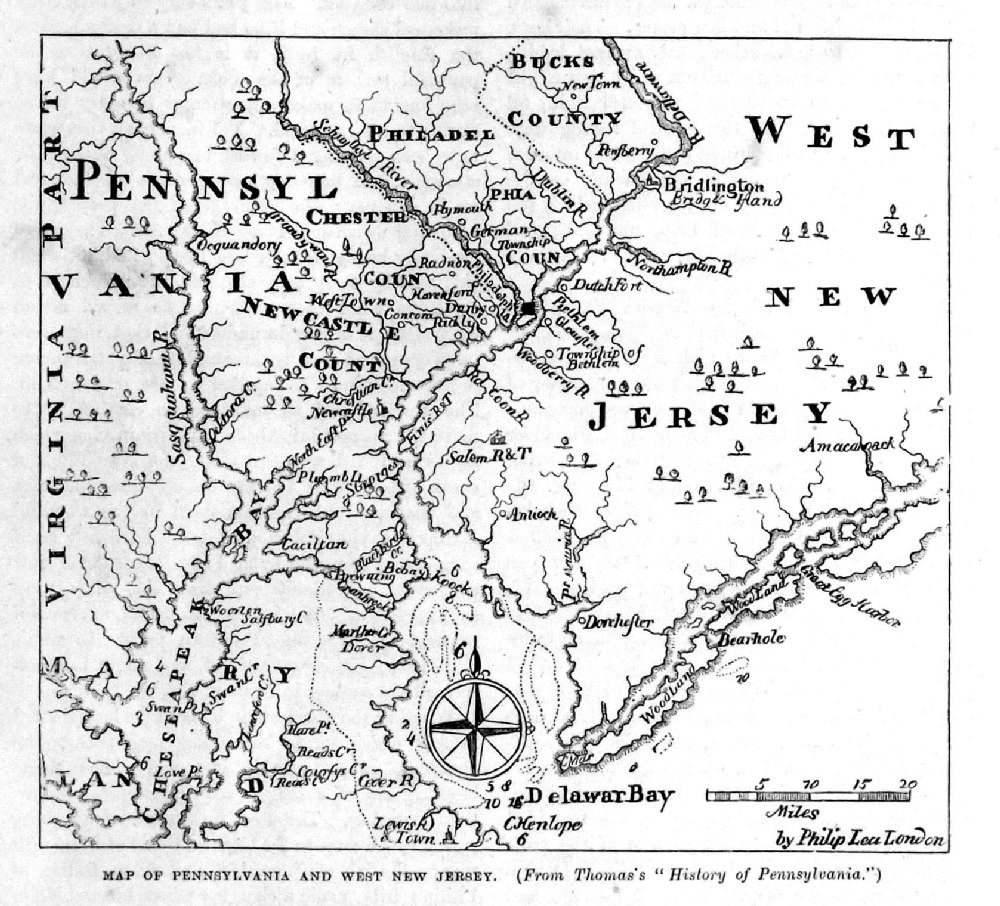 |
Map of Pennsylvania
and West New Jersey from Cassell's History of the United States by Edmund Ollier 1874 taken from earlier publication . size: 160 x 140 mm Ref PAM012 £16.00 (+P&P) click image for enlargement |
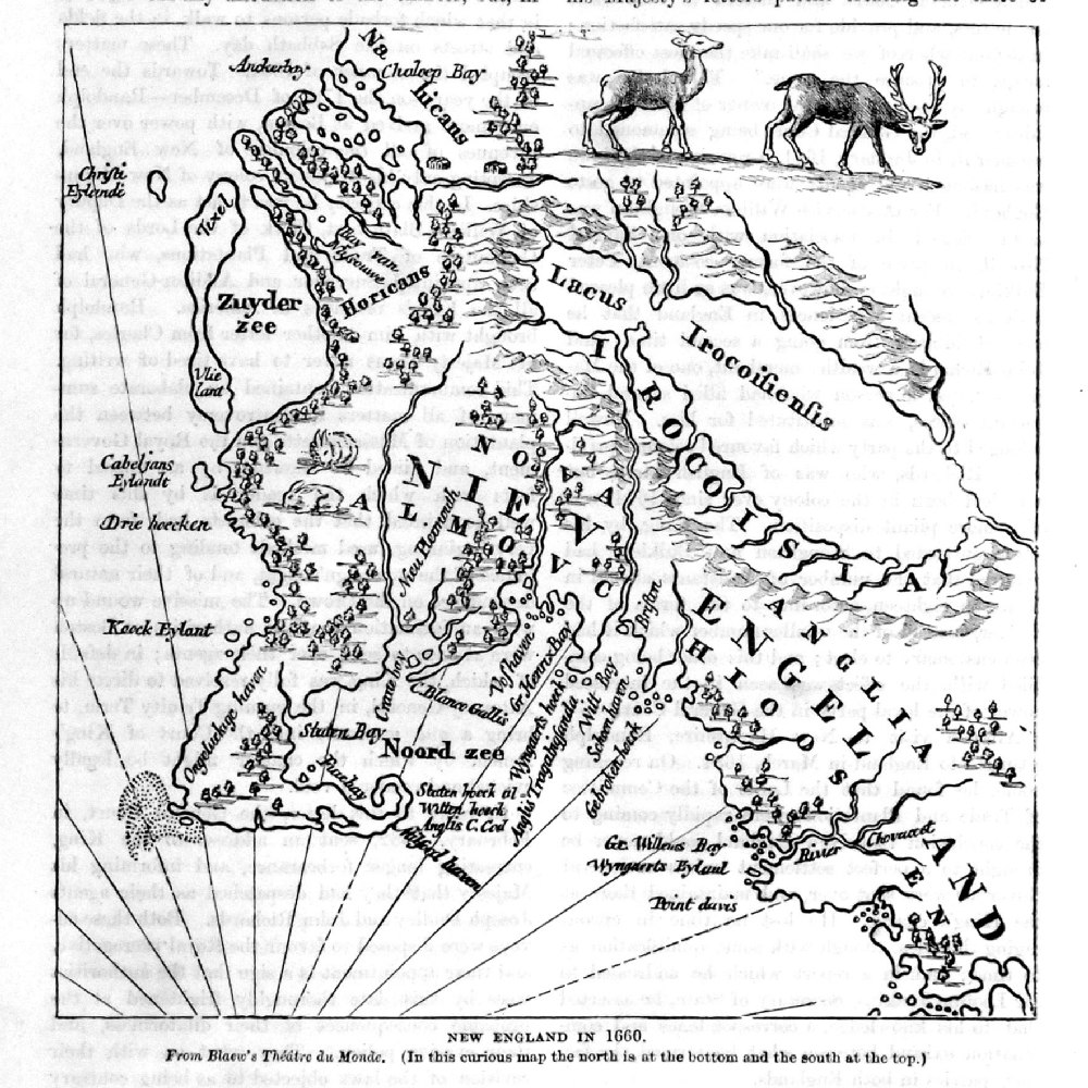 |
New England in 1660 from Cassell's History of the United States by Edmund Ollier 1874 taken from earlier publication (1660). size: 160 x 160 mm Ref PAM013 £16.00 (+P&P) click image for enlargement |
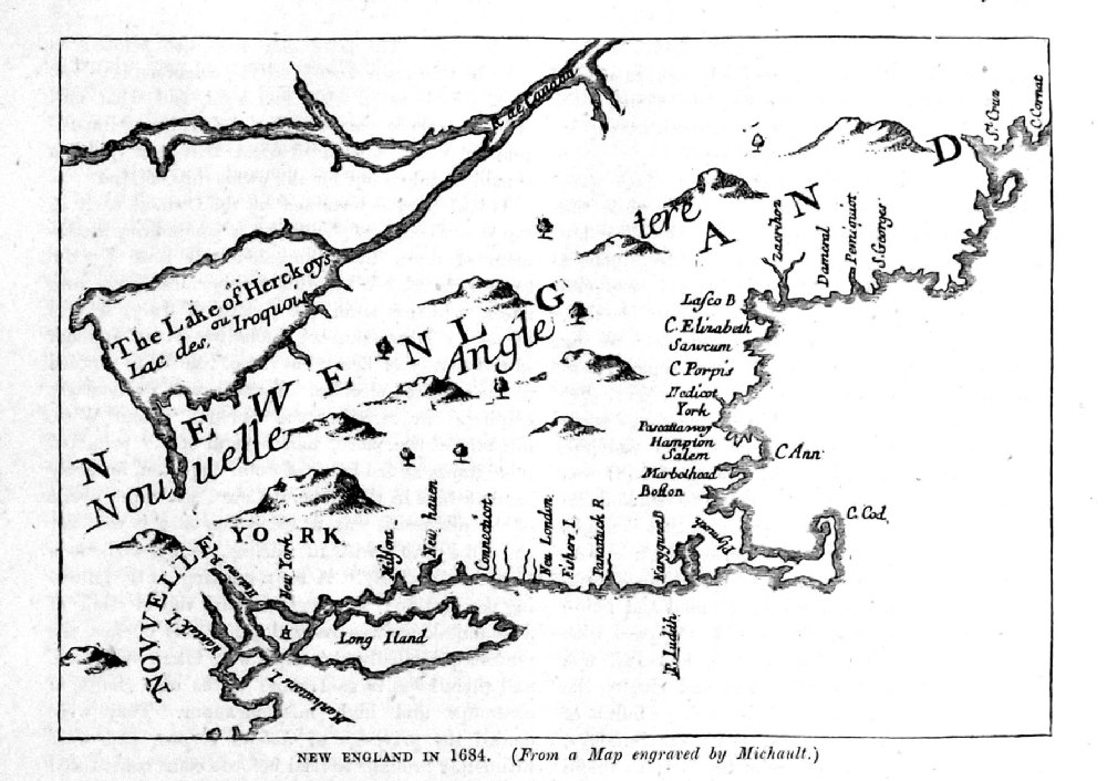 |
New England in 1684 from Cassell's History of the United States by Edmund Ollier 1874 taken from earlier publication (1684). size: 160 x 115 mm Ref PAM014 £16.00 (+P&P) click image for enlargement |
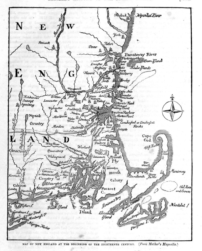 |
Map of New England at
the beginning of the Eighteenth Century from Cassell's History of the United States by Edmund Ollier 1874 taken from earlier publication (c1700). size: 160 x 200 mm Ref PAM021 £16.00 (+P&P) click image for enlargement |
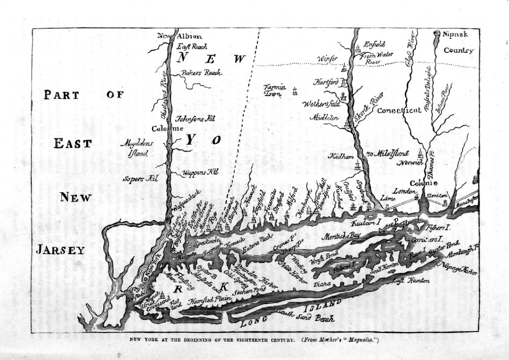 |
New York at the
beginning of the Eigtheenth Century from Cassell's History of the United States by Edmund Ollier 1874 taken from earlier publication (1633). size: 220 x 160 mm Ref PAM020 £16.00 (+P&P) click image for enlargement |
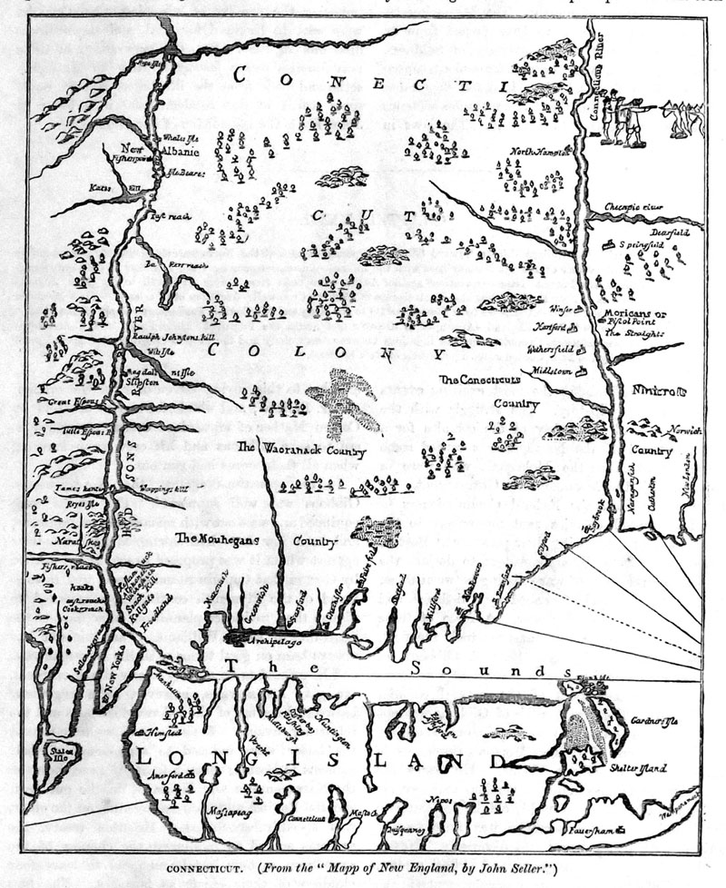 |
Connecticut from Cassell's History of the United States by Edmund Ollier 1874 taken from earlier publication . size: 160 x 180 mm Ref PAM009 £16.00 (+P&P) click image for enlargement |
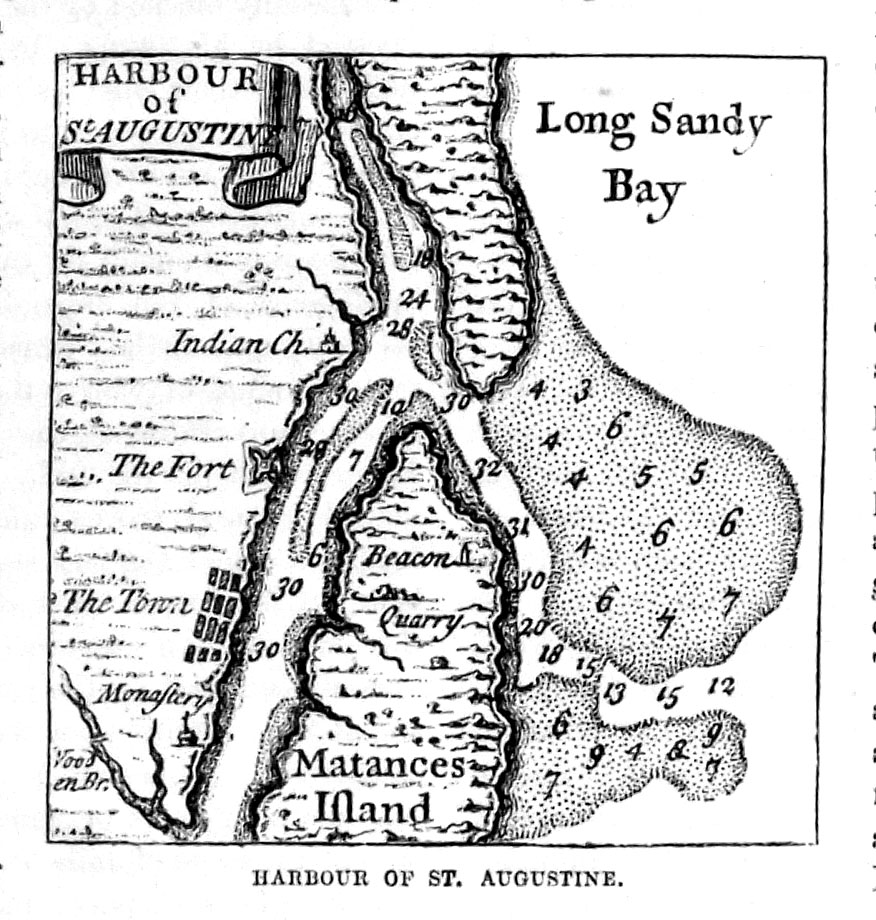 |
Harbour of St
Augustine from Cassell's History of the United States by Edmund Ollier 1874 taken from earlier publication. size: 75 x 75 mm Ref PAM015 £16.00 (+P&P) click image for enlargement |
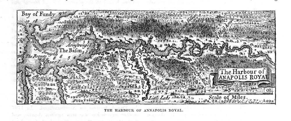 |
The Harbour of
Anapolis Royal from Cassell's History of the United States by Edmund Ollier 1874 taken from earlier publication. size: 160 x 60 mm Ref PAM016 £16.00 (+P&P) click image for enlargement |
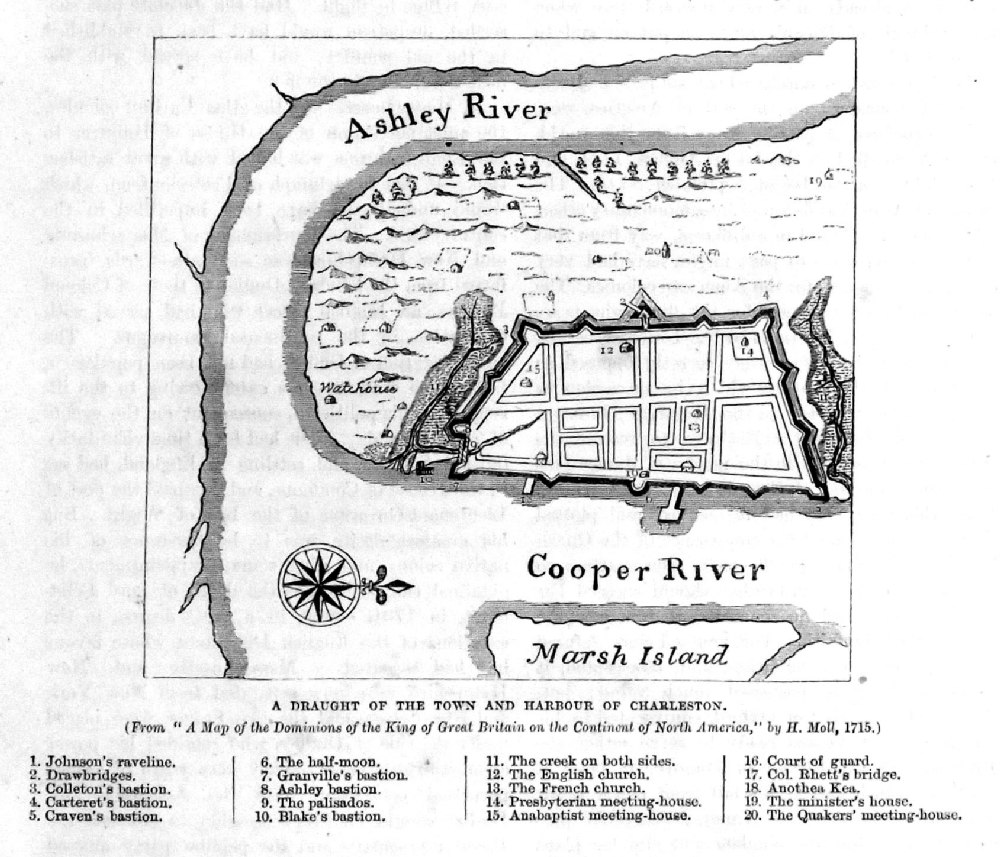 |
A Draught of the Town
and Harbour of Charleston from Cassell's History of the United States by Edmund Ollier 1874 taken from earlier publication (1715). size: 120 x 130 mm Ref PAM017 £16.00 (+P&P) click image for enlargement |
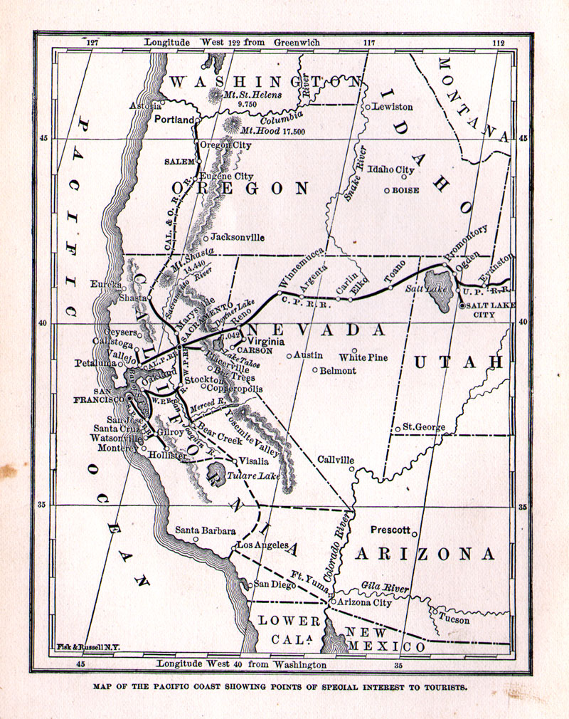 |
Route to
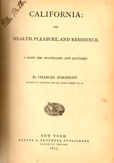
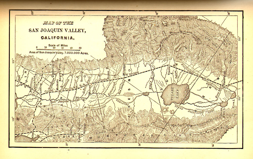
California 1875 California for Health, Pleasure and Residence. A Book for Travellers and Settlers, by Charles Nordhoff 1875 Title Page Published by Harper and Brothers, New York 3 maps approx 130 x 190 mm Map 2 Map3 Book: 275 pages, 26 chapters, 58 illustrations (including the 3 maps), promoting the settlement of California. Weight: 781gm (1lb, 12oz) Ref LEM066 £95.00 (+P&P) Shipping cost: UK: £8.00 Europe: £14.00 America, Africa, Asia, Worldwide: £20.00 click image for enlargement |
| US Army
Engineering Projects - Maps from US Government
surveys. |
|
| For Texas / California / Mexico interests also see 'Maps - Central America' section. |
|
| All Genuine Antiquarian Maps - No Reproductions or Modern Copies |
2023