Past Pages
Antique Maps, Prints and Ephemera
Antique Maps of Europe
G (Germany to Greece)
Europe maps first , followed by European Countries in Alphabetic
order.Check for common groupings like Belgium & Holland or Holland & Belgium.
Check for dual namings such as Holland / Netherlands.
Check for regions such as Balkans.
Check for historic changes such as Greece/Turkey
Cities and regions will be listed under their country.

Germany |
|
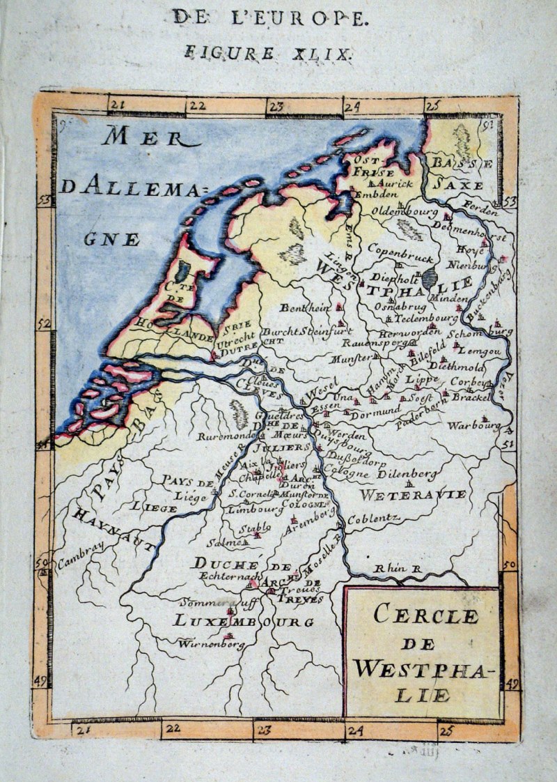 |
Germany - Westphalia Alain
Mallet c1685
Cercle de Westphalie. size 120 x 180 mm Ref GHM124 £22.00 (+P&P) click image for enlargement |
 |
Germany - Lower Saxony Alain
Mallet c1685
Cercle de Basse-Saxe. size 120 x 180 mm Ref GHM020 £22.00 (+P&P) click image for enlargement |
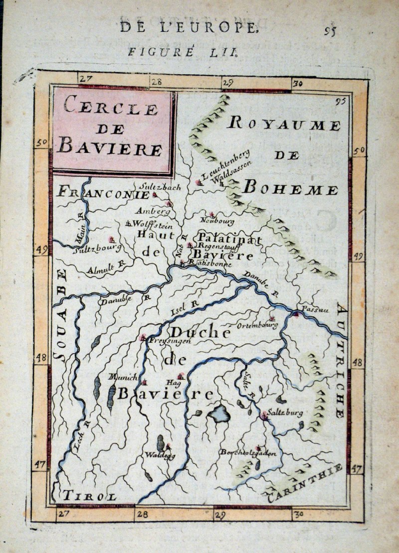 |
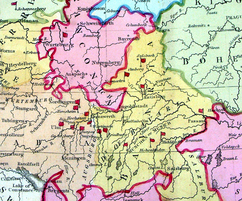
Germany - Bavaria Alain
Mallet c1685
Cercle de Baviere. size 120 x 180 mm, slightly soiled margins Ref GHM010 £22.00 (+P&P) click image for enlargement |
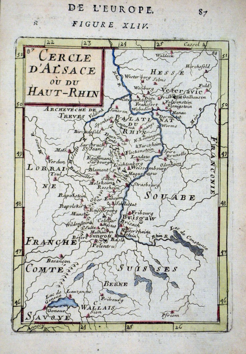 |
Germany - Upper Rhine Alain
Mallet c1685
Cercle d'Alsace ou du Haute Rhin. size 120 x 180 mm Ref GHM014 £20.00 (+P&P) click image for enlargement |
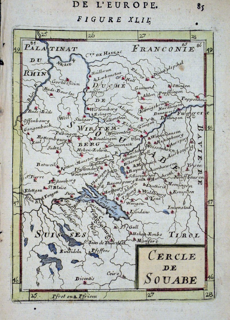 |
Germany - Souabe - Schwaben
-
Swabia / Bavaria
Alain Mallet c1685
Cercle de Souabe. size 120 x 180 mm Ref GHM012 £20.00 (+P&P) click image for enlargement |
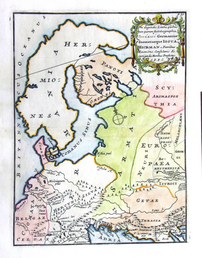 |
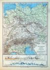
Ancient Germany
from De Situ Orbis by Pomponius Mela. Published by Philippum Bishop, Exeter, 1711 Copper engraving size 200 x 270 mm, centre fold Decorative cartouche contains the name of the sponsor/patron of this map. Ref PDM021 £40.00 (+P&P) click image for enlargement |
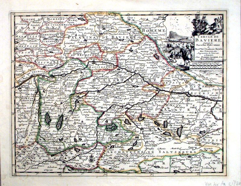 |
Bavaria 'Cercle de Baviere'
Pierre Van der Aa c1720 size: 310 x 340 mm Ref IEM004 £50.00 (+P&P) click image for enlargement |
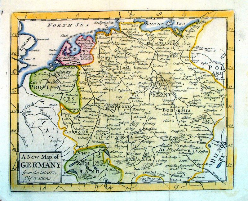 |
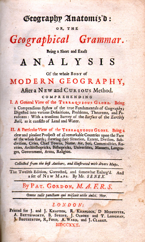
A New Map of Germany
from the Latest Observations John Sennex 1730 From Gordon's Geography - view Title Page size: 190 x 170 mm, 2 folds Antique Map Ref LFM006 £40.00 (+P&P) click image for enlargement |
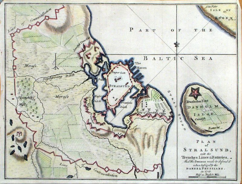 |
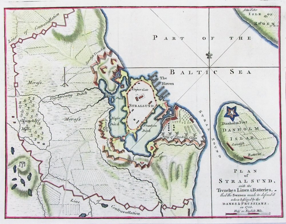
Plan of Stralsund
Gents Magazine 1758 size: 260 x 210 mm Ref KGM026 £35.00 (+P&P) Ref PFM005 £35.00 (+P&P) click image for enlargement |
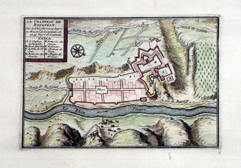 |
Le Chasteau de Reinfelt (Located
on the Rhine) anon 1706 size 190 x 140 mm Ref KGM037 £35.00 (+P&P) click image for enlargement |
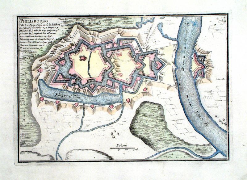 |
Philisbourg N.
de Fer 1704 size: 270 x 190 mm Ref KGM041 £30.00 (+P&P) click image for enlargement |
 |
Landau N. de Fer
1705 size: 300 x 210 mm Ref KGM042 £30.00 (+P&P) click image for enlargement |
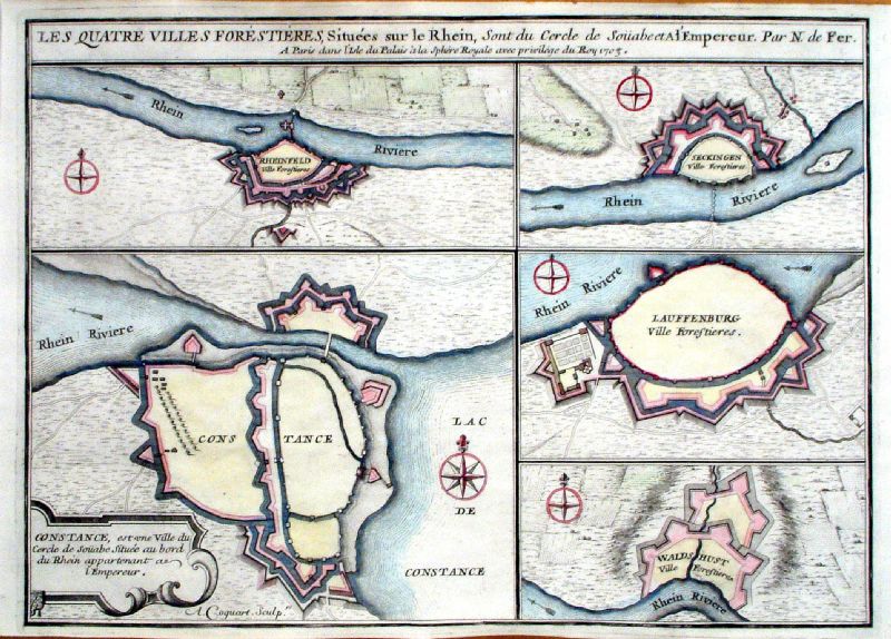 |
Les Quatre Villes Forestieres, Situees sur le
Rhein ......
N. de Fer 1705 Five Forts on the Rhine: Rheinfeld, Constance, Seckingen, Lauffenburg, Waldhust Copper engraving size 360 x 260 mm Ref KGM031 £35.00 (+P&P) click image for enlargement |
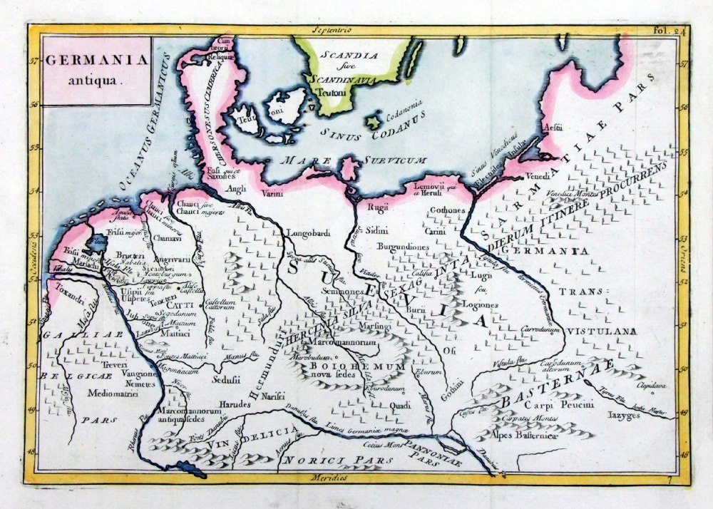 |
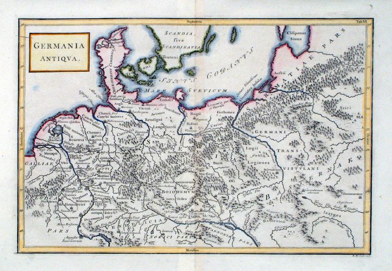
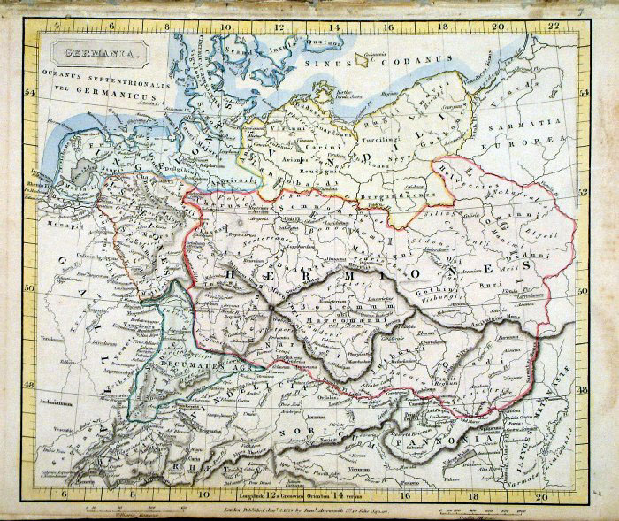
Germania
antiqua Geograhia Antiqa Christophi Cellarii Christoph Cellarius 1745 Copper engraving size: 220 x 180 mm, 2 folds. Ref OKM012 £20.00 (+P&P) click image for enlargement |
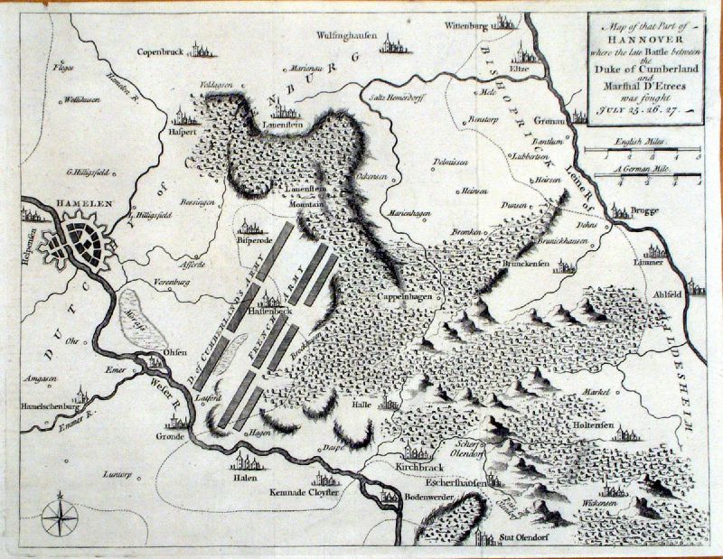 |
Map of that part of Hannover
..... Gents Magazine 1757 Shows the towns of Brugge, Hamelen, Kirchbrack, size: 270 x 210 mm , 2 folds Ref KGM029 £24.00 (+P&P) click image for enlargement |
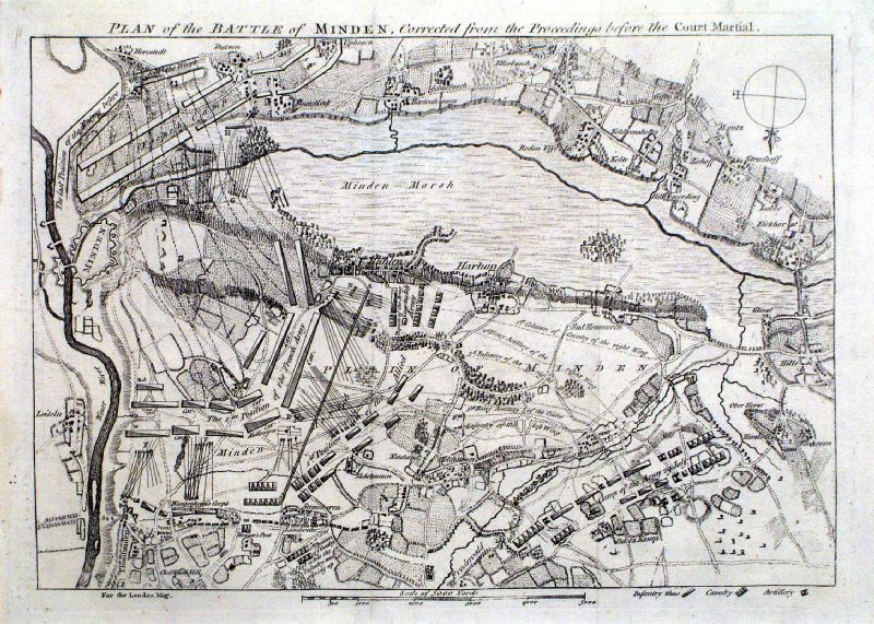 |
Plan of the Battle of Minden
..... London Magazine 1760 Scale about 1400 yards left to right. size: 270 x 210 mm , 2 folds Ref KGM030 £24.00 (+P&P) click image for enlargement |
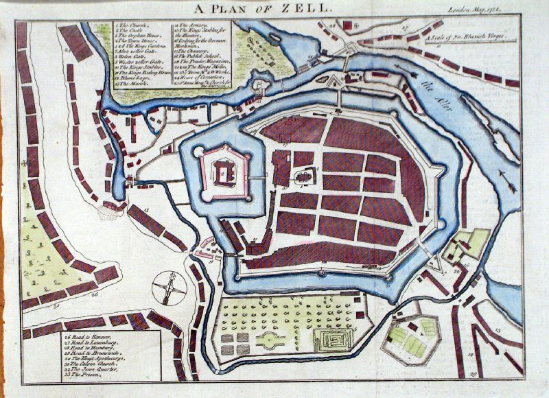 |
Plan of Zell London
Magazine 1758 Zell - Lower Saxony size: 250 x 200 mm , 2 folds Ref KHM025 £26.00 (+P&P) click image for enlargement |
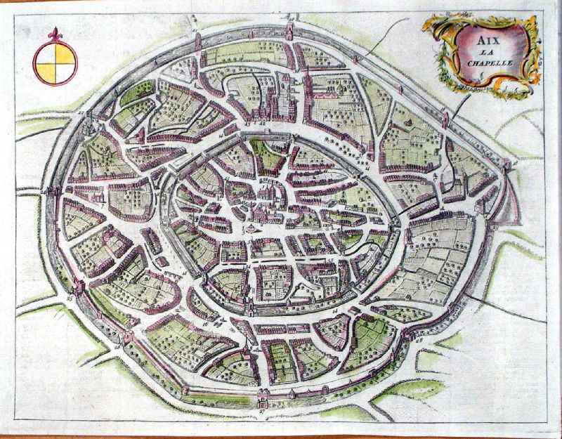 |
Aix La Chapelle (Aachen)
T. Jefferys Gentlemans Magazine 1748 size: 270 x 200 mm , 2 folds Ref KHM025 £28.00 (+P&P) click image for enlargement |
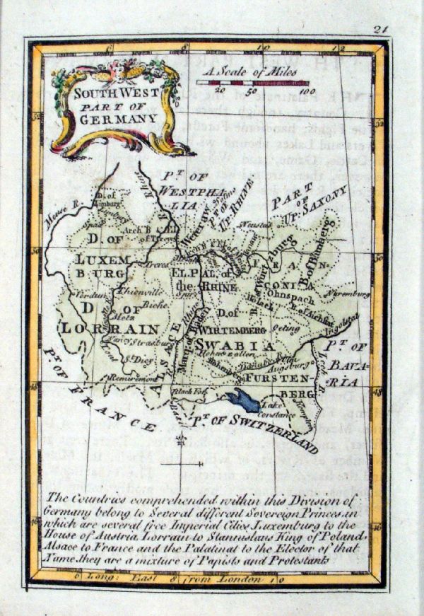 |
South West part of Germany
Gibson 1774 size: 70 x 100 mm Ref GJM009 £30.00 (+P&P) click image for enlargement |
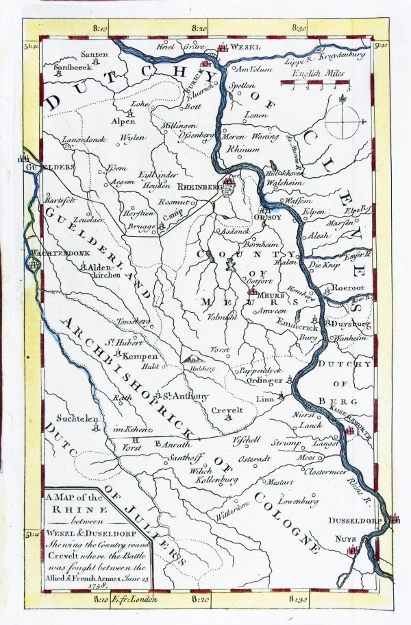 |
A Map of the Rhine
between Wesel & Duseldorf Gentlemans Magazine 1758 size: 120 x 195 mm Ref PFM007 £20.00 (+P&P) click image for enlargement |
 |
Germania Antiqua Richard Seale Raw/Rivington 1796 Copper engraving size: 330 x 220 mm, centre fold Ref JKM079 £22.00 (+P&P) click image for enlargement |
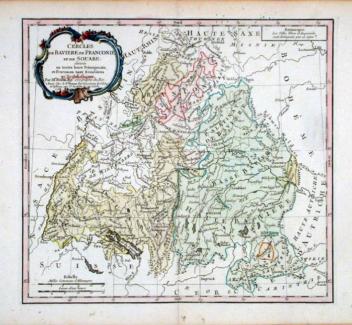 |
Southern Germany - Bavaria, Bayern, Baden
Brion 1766
Cercles de Baviere, de Franconie, de Souabe ... size 280 x 250 mm, centre fold Ref GBM225 £28.00 (+P&P) click image for enlargement |
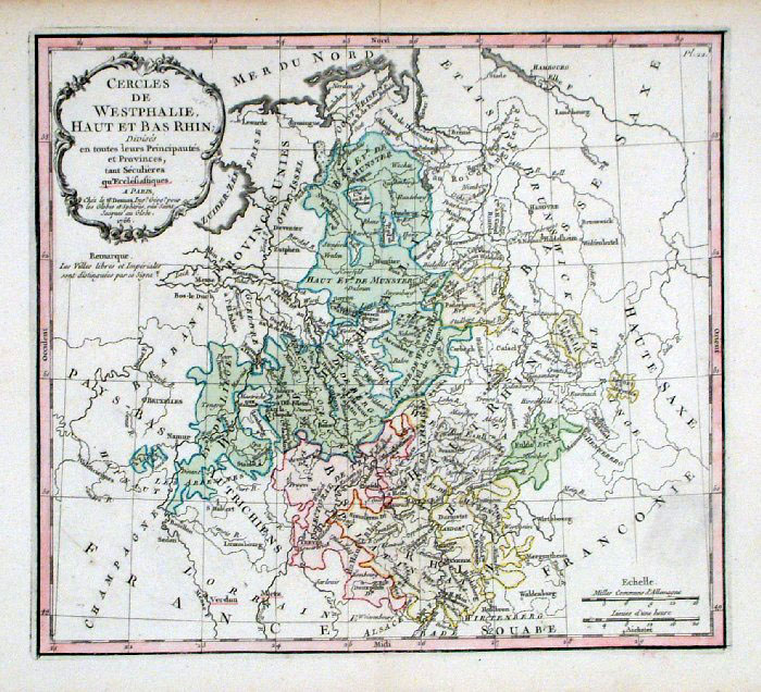 |
Northern Germany - Westfalen, Rheinland
Brion 1766
Cercles de Westphalie, Haut et Bas Rhin ... size 280 x 250 mm, centre fold Ref GBM224 £28.00 (+P&P) click image for enlargement |
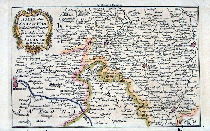 |
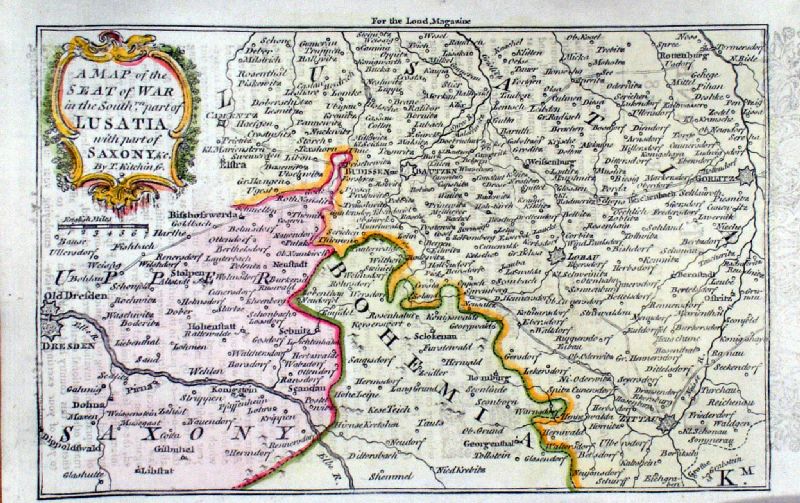
Germany - A map of the Seat of War in the South
part of Lusatia with part of Saxony Thomas Kitchen, London Magazine 1758 size: 200 x 120 mm Ref FLM216 £28.00 (+P&P) Ref KHM015 £28.00 (+P&P) click image for enlargement |
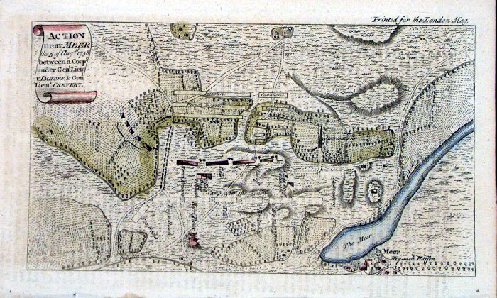 |
Germany - Mehr ' Action near Meer' London Magazine 1758 size: 200 x 120 mm Ref FLM228 £22.00 (+P&P) click image for enlargement |
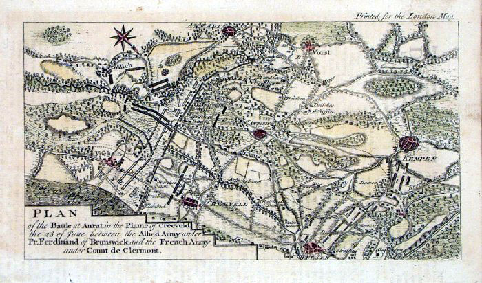 |
Germany - 'Battle at
Anrat' Andtar , Kempten, Hulsen London Magazine 1758 Copper engraving. size: 200 x 120 mm Ref FLM227 £22.00 (+P&P) click image for enlargement |
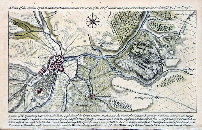 |
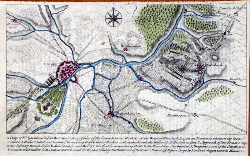
Cassel (Kassel), south of Hanover London Magazine 1758 size: 200 x 120 mm Ref FLM225 £22.00 (+P&P) Ref KHM018 £22.00 (+P&P) click image for enlargement |
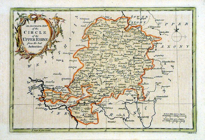 |
An accurate Map of the Circle of the Upper
Rhine G Rollos, London Magazine 1766 Copper engraving. size: 320 x 210 mm Ref FDM027 £28.00 (+P&P) click image for enlargement |
 |
Cercles du Haut et Bas Rhin Vaugondy 1744 size: 140 x 190 mm, a few folds and repairs at margins. Ref KGM043 £16.00 (+P&P) click image for enlargement |
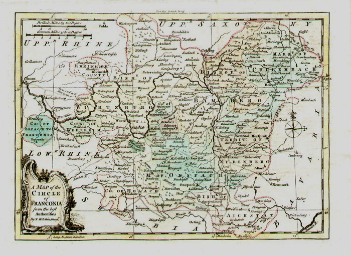 |
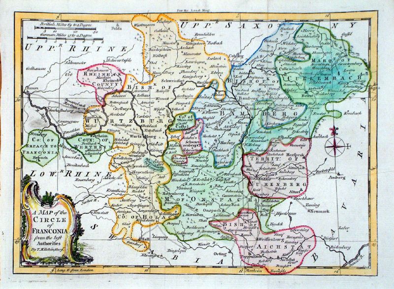
A Map of the Circle of Franconia
Thomas Kitchen, London Magazine 1758 Copper engraving. size: 260 x 200 mm, 2 folds Ref FLM215 £26.00 (+P&P) Ref KHM028 £26.00 (+P&P) click image for enlargement |
 |
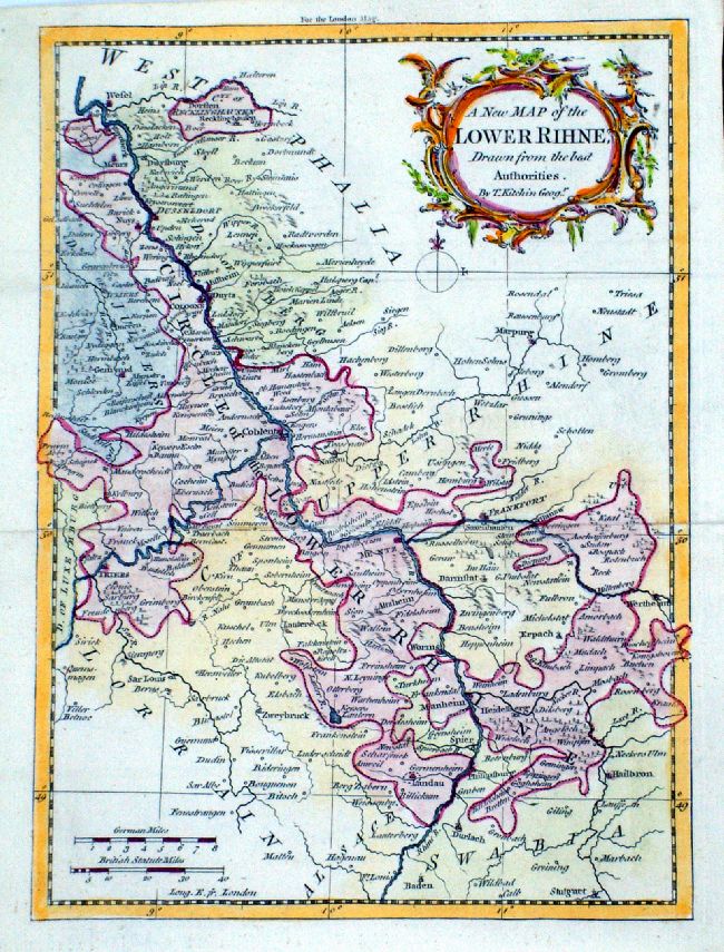
A New Map of the
Lower Rhine Thomas Kitchin / London Magazine 1759 Copper engraving. size: 195 x 260 mm, 2 folds Ref LLM023 £30.00 (+P&P) click image for enlargement |
 |
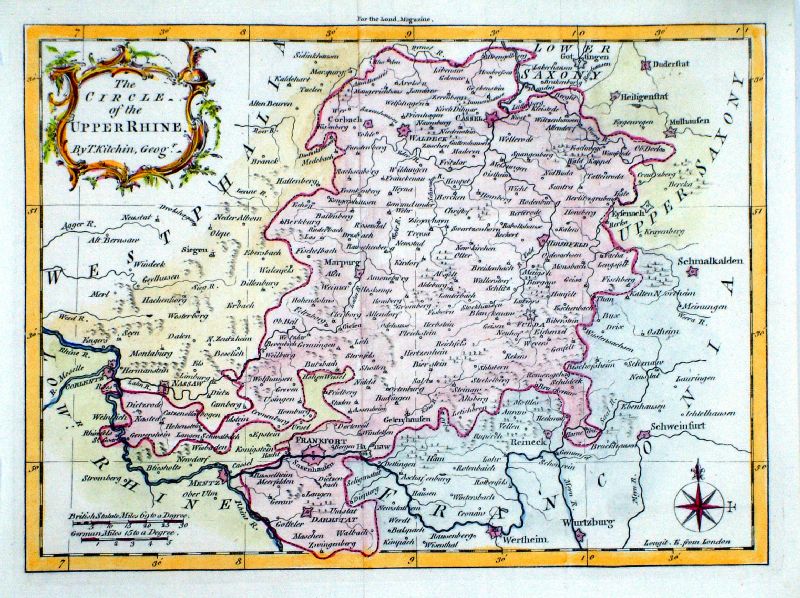
The Circle of the
Upper Rhine Thomas Kitchin / London Magazine 1759 Copper engraving. size: 260 x 195 mm, 2 folds Ref LLM024 £30.00 (+P&P) click image for enlargement |
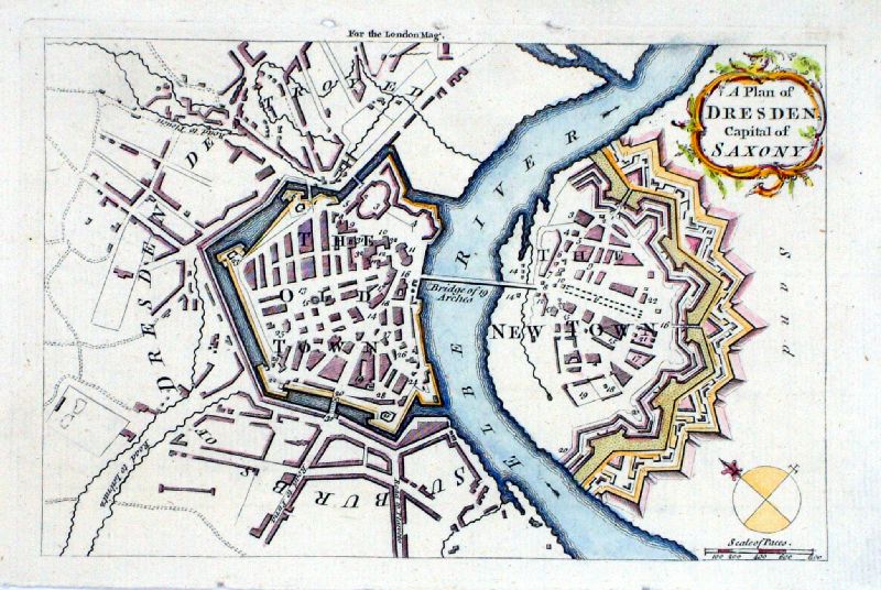 |
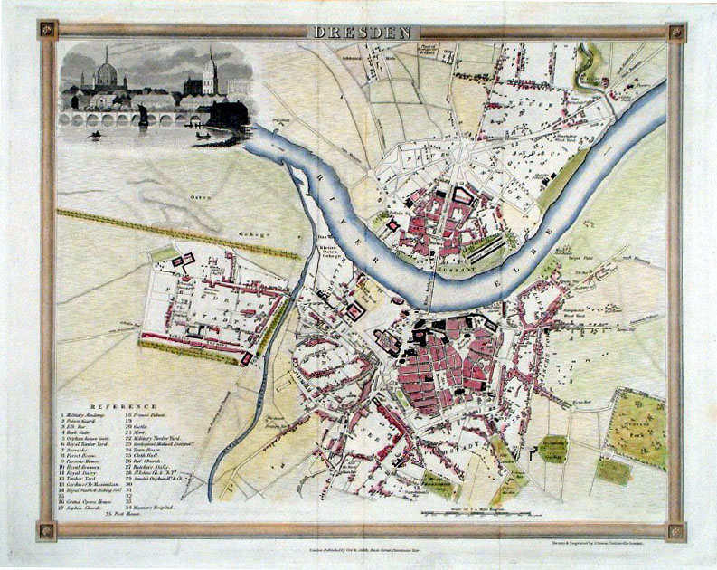
A Plan of Dresden,
Capital of Saxony (Thomas Kitchin ) / London Magazine 1759 Copper engraving. size: 180 x 125 mm Ref LLM033 £28.00 (+P&P) click image for enlargement |
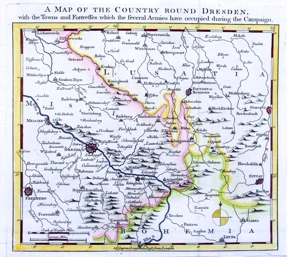 |
A Map of the Country
around Dresden Gentlemans Magazine 1758 Copper engraving. size: 230 x 205 mm Ref PFM004 £30.00 (+P&P) click image for enlargement |
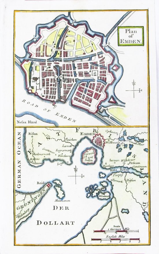 |
Plan of Emden Gentlemans Magazine 1758 Copper engraving. size: 120 x 190 mm Ref PFM009 £22.00 (+P&P) click image for enlargement |
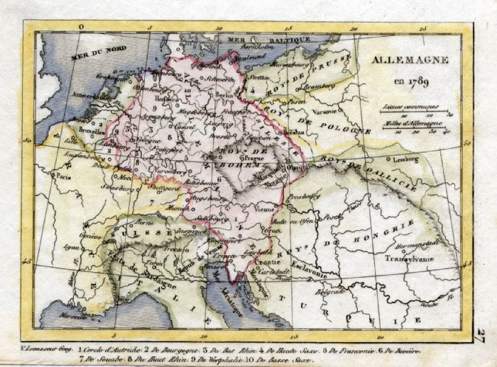 |
Germany in 1789 V. Levasseur
c1835 size: 130 x 100 mm Ref HAM059 £16.00 (+P&P) click image for enlargement |
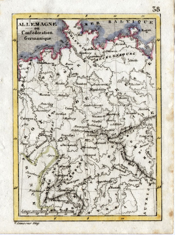 |
Germany V. Levasseur
c1835 size: 130 x 100 mm Ref HAM070 £16.00 (+P&P) click image for enlargement |
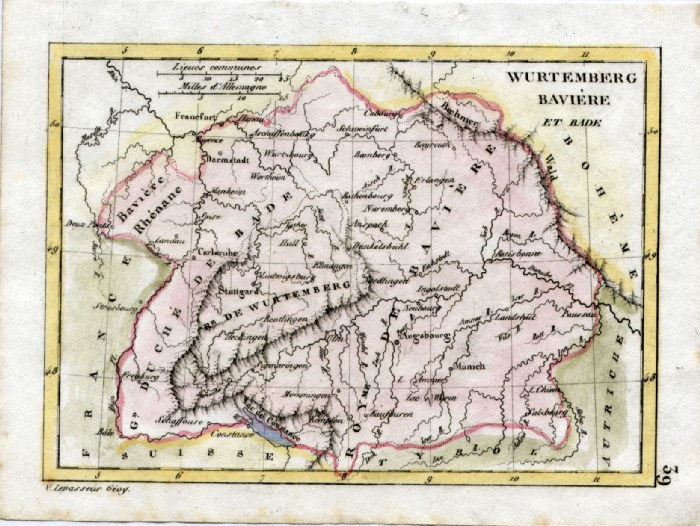 |
Bavaria 'Wurtemberg, Baviere et Bade
V. Levasseur c1835 size: 130 x 100 mm Ref HAM071 £18.00 (+P&P) click image for enlargement |
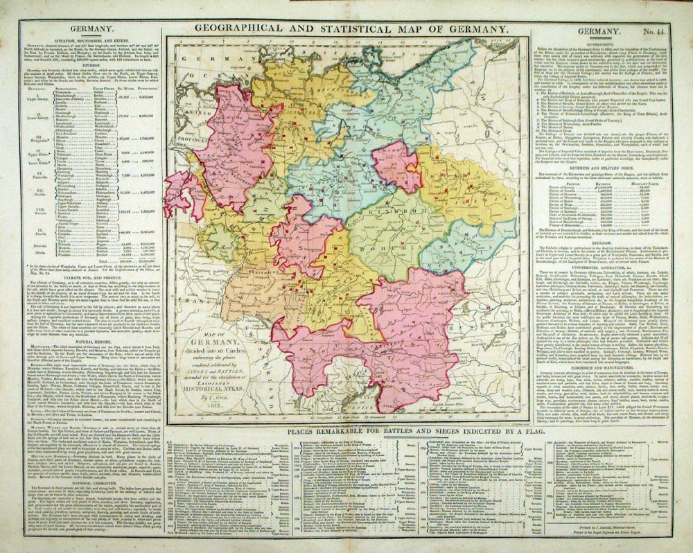 |
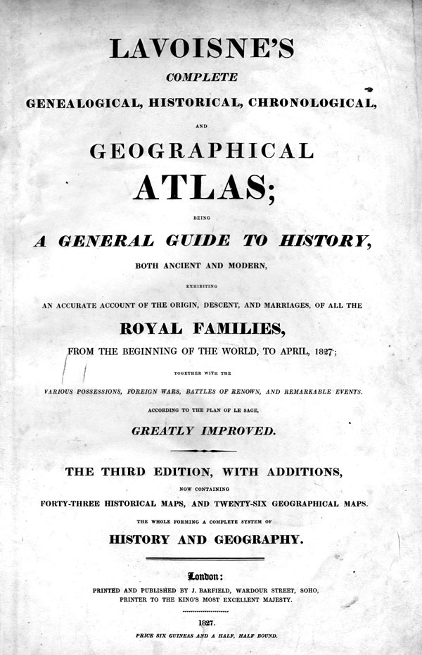
Geographical and
Statistical Map of Germany Map engraved by J. Walker. Set with statistical data. From Lavoisne's Genealogical, Historical, Chronological and Geographical Atlas 1827 - Title Page For Statistics Tables and Charts from this atlas see Charts and Tables Page Copper engraving page size: 530 x 420 mm, centre fold. Ref LHM048 £30.00 (+P&P) Detail 1 click image for enlargement |
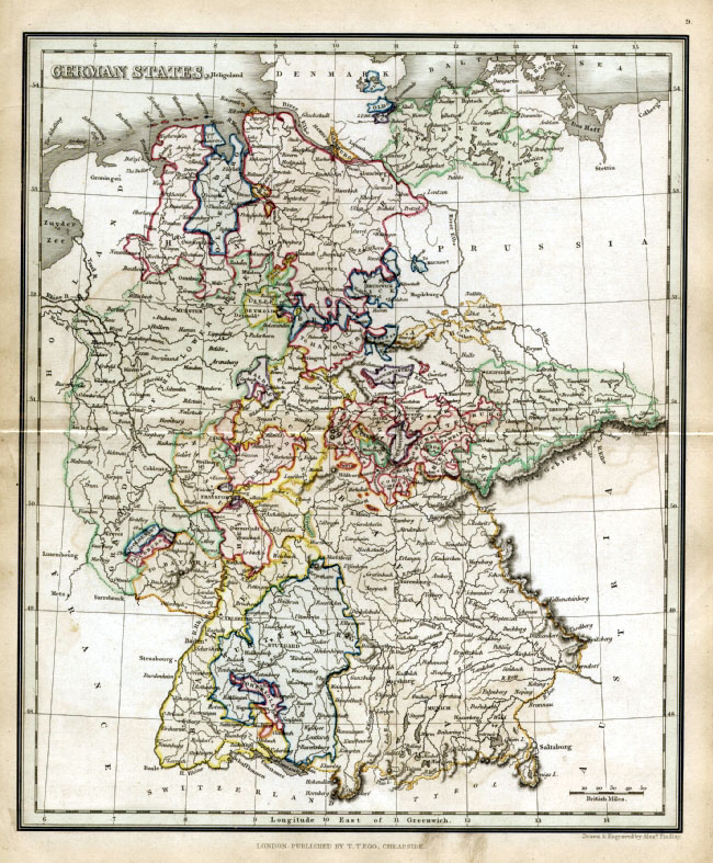 |
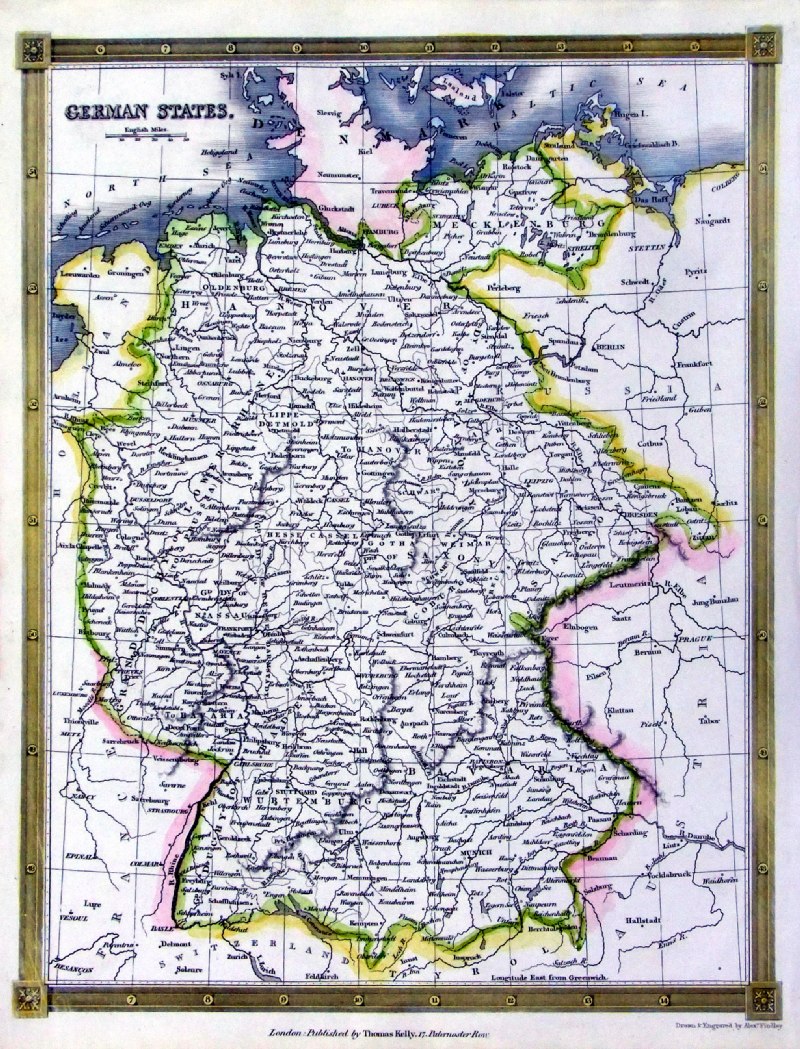
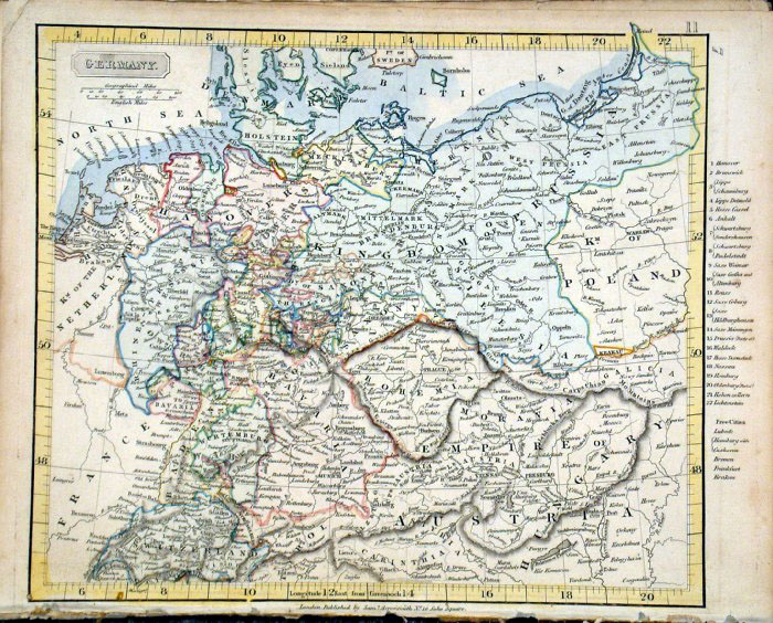
German States Findlay /
Tegg 1845
size 240 x 300 mm Ref ELM071 % £16.00 (+P&P) click image for enlargement |
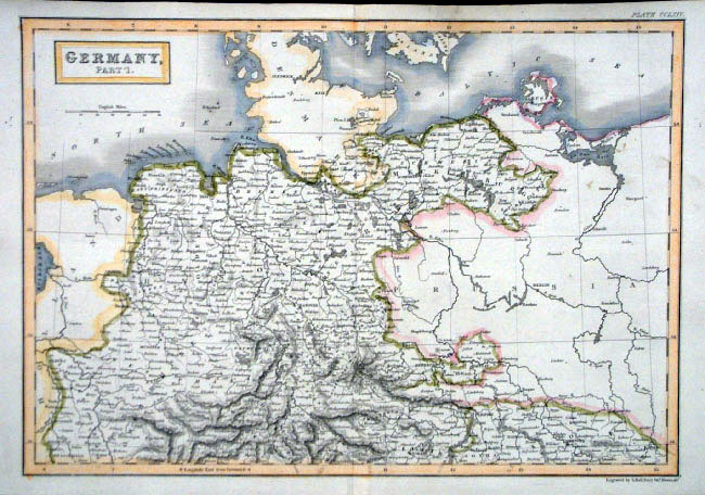 |
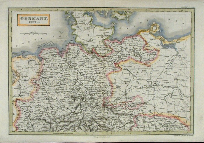
Germany - Part 1 (North)
Sidney Hall
1842
size 400 x 270 mm Ref EKM059 £20.00 (+P&P) click image for enlargement |
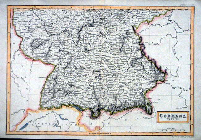 |
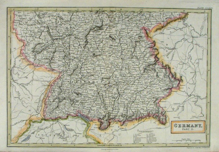
Germany - Part 2 (South)
Sidney Hall
1842
size 400 x 270 mm Ref EKM060 £20.00 (+P&P) click image for enlargement |
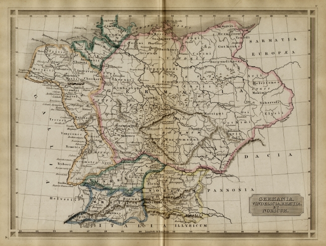 |
Ancient Germany Bohn
1861 Steel
Engraving size: 320 x 240
mm Germania Vindelicia Rhaetia et Noricum Ref EKM021 £18.00 (+P&P) click image for enlargement |
 |
Germany - Part 1 (North)
Sidney Hall
c1840
size 400 x 270 mm Ref EKM117 £20.00 (+P&P) click image for enlargement |
 |
Germany - Part 2 (South)
Sidney Hall
c1840
size 400 x 270 mm Ref EKM116 £20.00 (+P&P) click image for enlargement |
 |
Germany Walker/Darton
c1796
size 230 x
190 mm Ref FKM007 £18.00 (+P&P) click image for enlargement |
 |
German States
Thomas Kelly
1841 engraved by Alex Findlay size: 200x 260 mm Ref OHM007 £18.00 (+P&P) click image for enlargement |
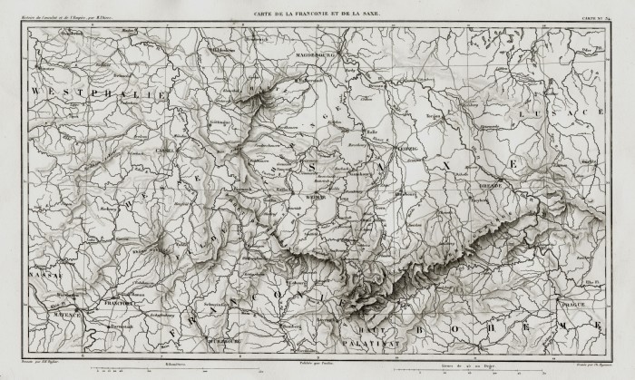 |
Germany - Saxony (Dresden,
Wemar, Magdeburg ...) Thiers 1859 size 330 x 230 mm Ref FFM043 £18.00 (+P&P) click image for enlargement |
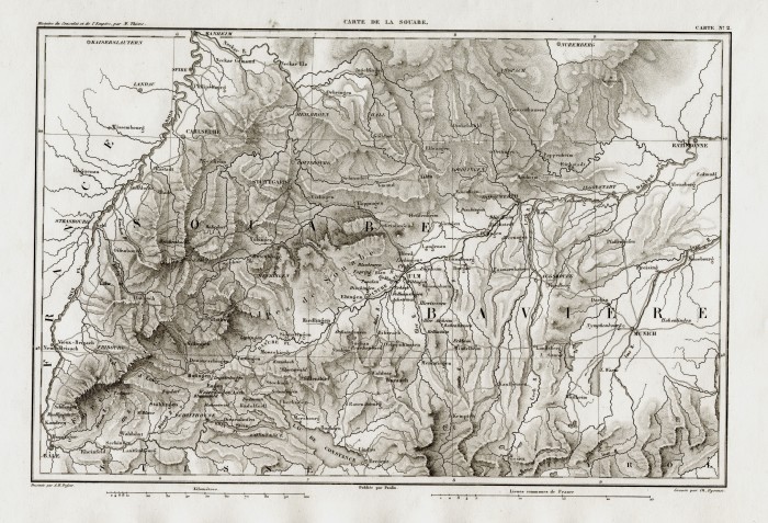 |
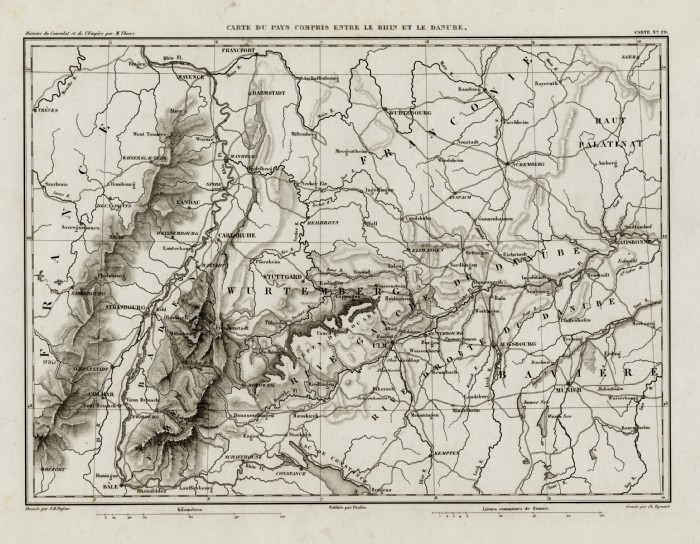
Germany - Bavaria (Ulm,
Stuttgadt, Rhine ...) Thiers 1859 size 330 x 230 mm Ref FFM050 £18.00 (+P&P) click image for enlargement |
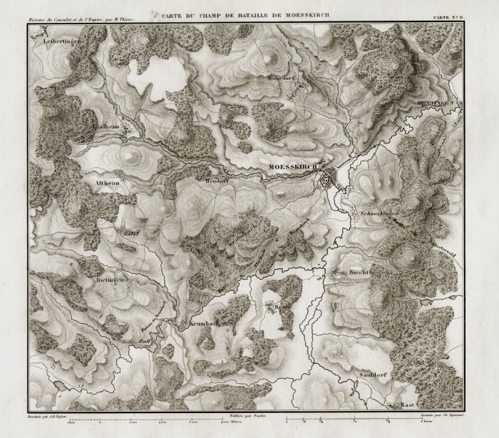 |
Germany - Messkirch Thiers 1859 size 250 x 230 mm Ref FFM049 £18.00 (+P&P) click image for enlargement |
 |
Germany - Munich, Salzburg, Danube Thiers 1859 size 220 x 230 mm Ref FFM064 £18.00 (+P&P) click image for enlargement |
 |
Germany - Munich, Stuttgard, Ulm Thiers 1859 size 300 x 230 mm Ref FFM069 £18.00 (+P&P) click image for enlargement |
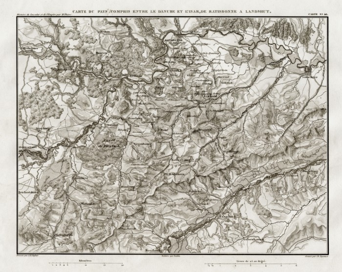 |
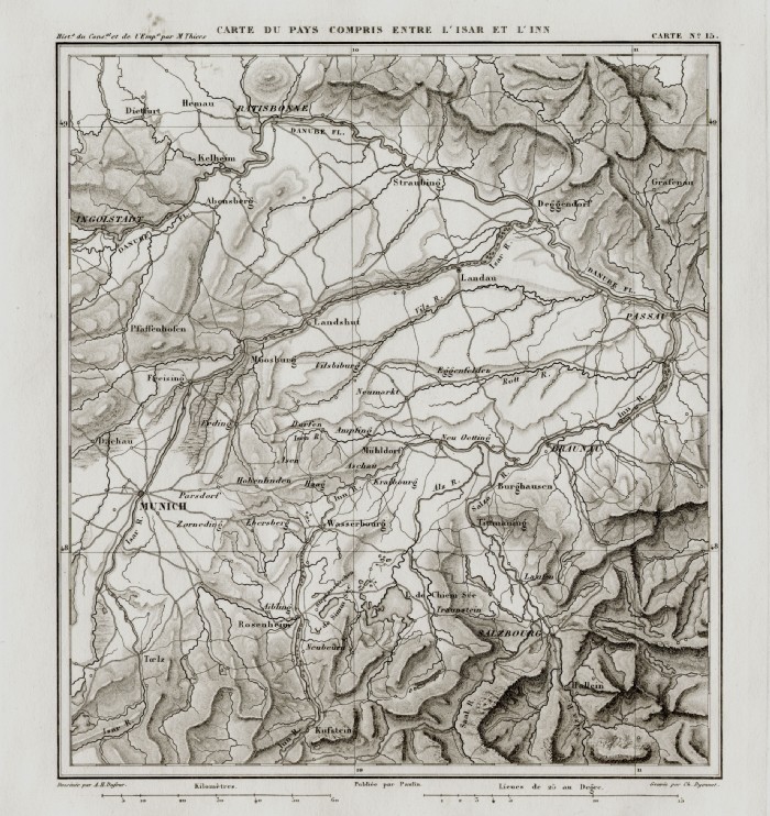
Germany - Regensburg, Landshut,
Danube, Isar Thiers 1859 size 220 x 230 mm Ref FFM068 £18.00 (+P&P) click image for enlargement |
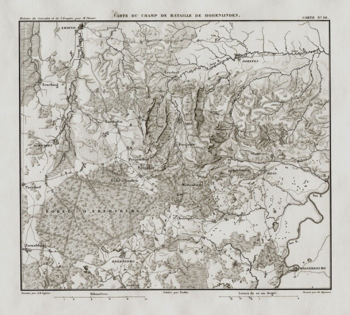 |
Germany - Hohenlinden, Erding,
Ebersburg, Grafing (East of Munich) Thiers 1859 size 250 x 230 mm Ref FFM061 £18.00 (+P&P) click image for enlargement
|
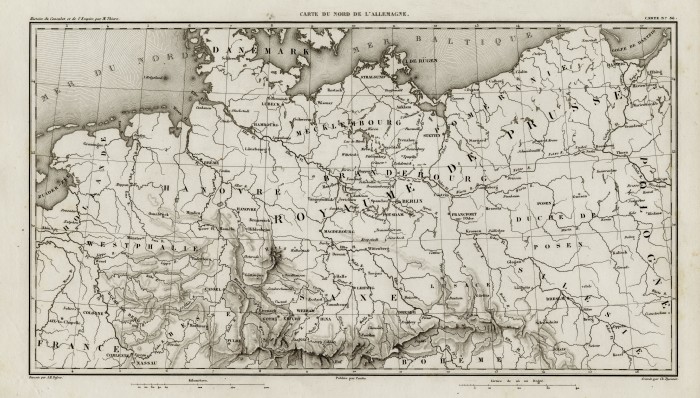 |
Northern
Germany
Thiers
1859 Ref FFM073 % £20.00 (+P&P) size: 390 x 230 mm click image for enlargement |
 |
Germany
Thiers
1859 Ref FFM075 % £20.00 (+P&P) size: 300 x 230 mm click image for enlargement |
 |
Germany/ Austria - Danube Valley Thiers 1859 size 220 x 230 mm Ref FFM062 % £16.00 (+P&P) click image for enlargement |
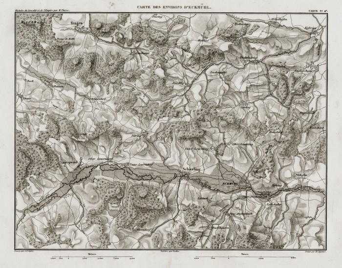 |
Eggmuhl, Scherling Thiers 1859 size: 410 x 240 mm Ref FFM044 % £18.00 (+P&P) click image for enlargement |
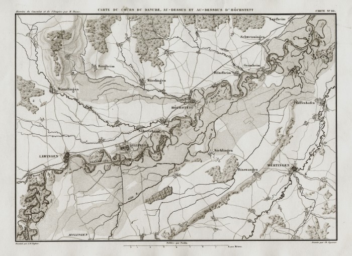 |
Course of the Danube through Hochstadt Thiers 1859 size: 310 x 240 mm Ref FFM045 % £18.00 (+P&P) click image for enlargement |
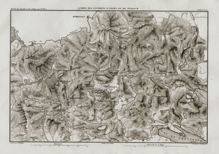 |
Engen, Stockach, Southern Germany Thiers 1859 size: 320 x 240 mm Ref FFM048 % £18.00 (+P&P) click image for enlargement |
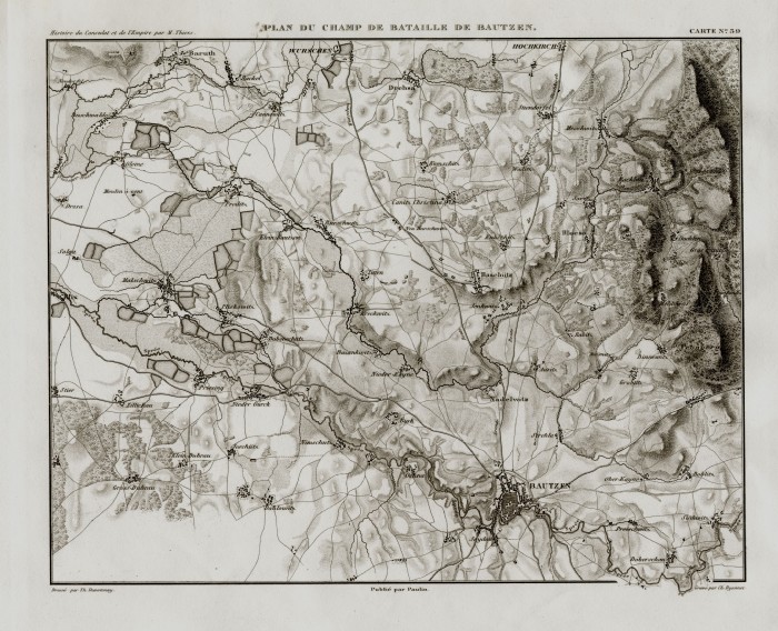 |
Bautzen Thiers 1859 size: 320 x 240 mm Ref FFM042 % £18.00 (+P&P) click image for enlargement |
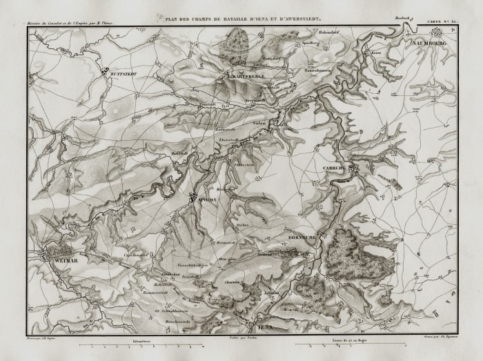 |
Jena, Weimar, Naumbu, Apolda Thiers 1859 size: 310 x 240 mm Ref FFM060 % £18.00 (+P&P) click image for enlargement |
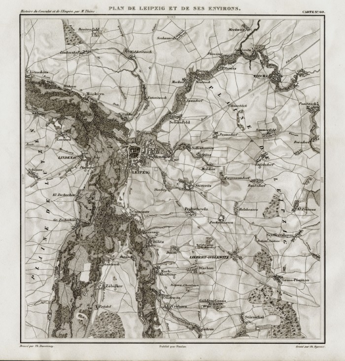 |
Leipzig Thiers 1859 size: 240 x 240 mm Ref FFM057 £18.00 (+P&P) click image for enlargement |
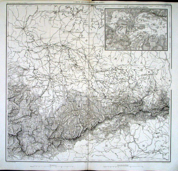 |
Dresden region. Inset of Dresden Environs Thiers 1859 size: 440 x420 mm , centre fold small repair to split at lower margin Ref FFM039 £26.00 (+P&P) click image for enlargement |
 |
Germany Frankfurt to Black
Forest Neele Barfield / Cadell
& Davis c1800 'Part of the Theatre of War in Germany in the Campaigns of 1796, 1797 and 1799' size 450 x 600 mm many folds, tight left margin Ref GHM033 % £24.00 (+P&P) click image for enlargement |
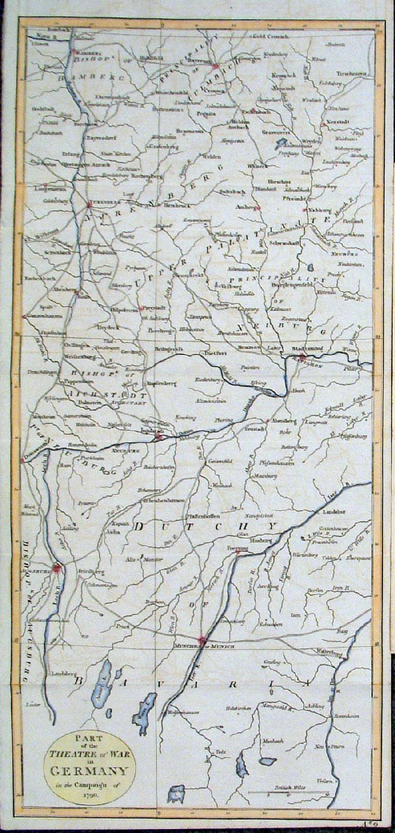 |
Germany Bayreuth to Munich
Neele Barfield / Cadell &
Davis c1800 'Part of the Theatre of War in Germany in the Campaign of 1796' size 450 x 210 mm, several folds Ref GHM035 % £18.00 (+P&P) click image for enlargement |
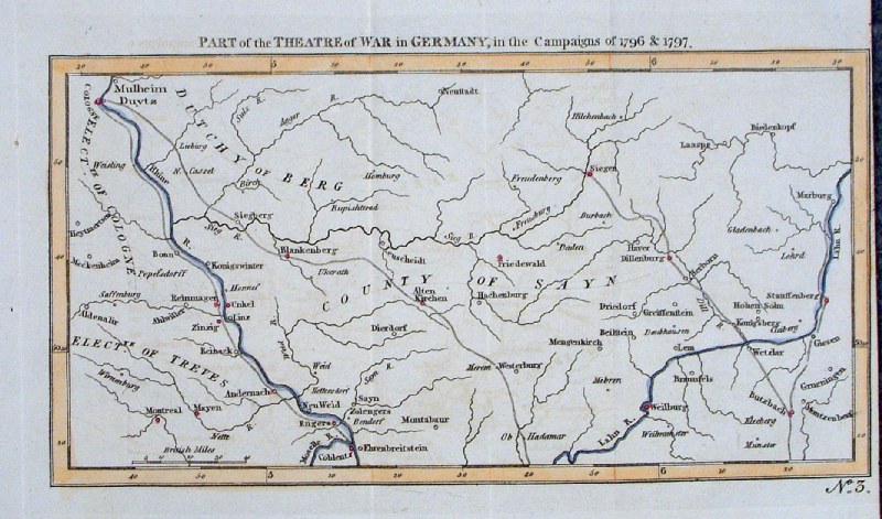 |
Germany Coblentz to Mulheim
Duytz Neele Barfield / Cadell
& Davis c1800 'Part of the Theatre of War in Germany in the Campaigns of 1796 & 1797' size 250 x140 mm, several folds, tight right margin Ref GHM034 % £16.00 (+P&P) click image for enlargement |
 |
Germany in 1789 Thiers 1859 size 420 x 420 mm Ref FFM065 £24.00 (+P&P) click image for enlargement Centre
fold, tight left & right margins
|
 |
Germany in 1803 Thiers 1859 size 420 x 420 mm Ref FFM066 £24.00 (+P&P) click image for enlargement Centre
fold, tight left & right margins
|
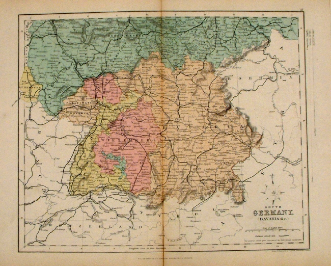 |
Germany (South - Bavaria)
Mackenzie 1868 Ref FBM031 % £10.00 (+P&P) size: 260 x 340 mm Strengthened centrefold. Discolouration on centrefold (not as severe as illustrated!) click image for enlargement |
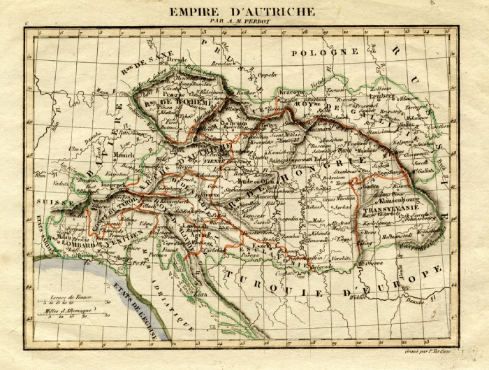 |
German Empire Perrot c1830
Engraved by P. Tardieu size: 200 x 160 mm Ref FEM030 £16.00 (+P&P) click image for enlargement |
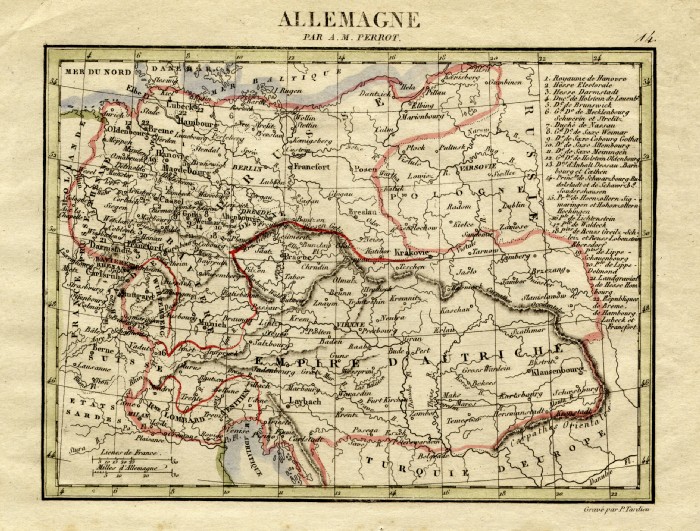 |
Germany Perrot c1830
Engraved by P. Tardieu size: 200 x 160 mm Ref FEM019 £16.00 (+P&P) click image for enlargement |
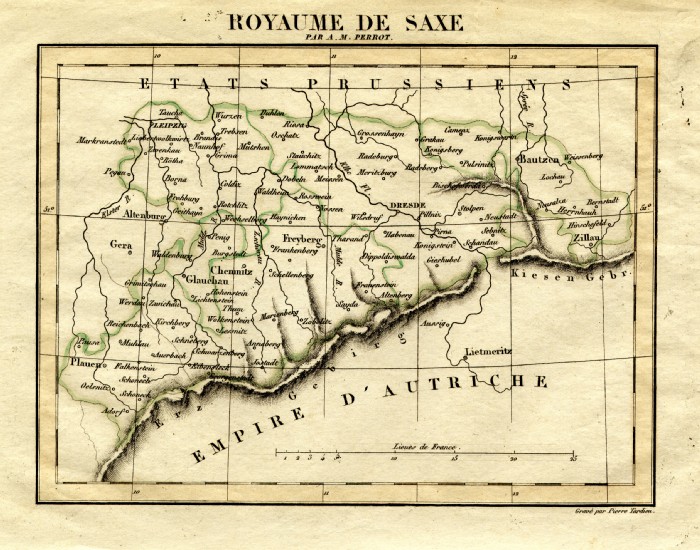 |
Germany - Saxony Perrot
c1830 Engraved by P. Tardieu size: 200 x 160 mm Ref FEM021 £16.00 (+P&P) click image for enlargement |
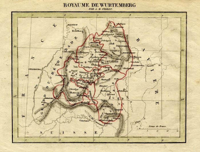 |
Germany - Wurtemberg Perrot
c1830 Engraved by P. Tardieu size: 200 x 160 mm Ref FEM012 £16.00 (+P&P) click image for enlargement |
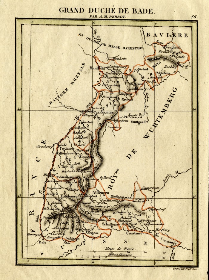 |
Germany - Baden Perrot
c1830 Engraved by P. Tardieu size: 160 x 200 mm Ref FEM026 £16.00 (+P&P) click image for enlargement |
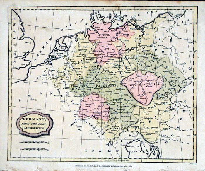 |
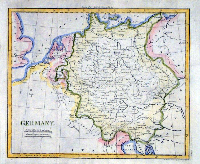
Germany
Barlow / Brightly 1806 Original colour size: 220 x 200 mm Slightly soiled surface condition Ref FIM050 £18.00 (+P&P) click image for enlargement |
 |
Germany (North)
Mackenzie 1868 Ref FBM030 % £10.00 (+P&P) size: 260 x 340 mm Strengthened centrefold. Discolouration on centrefold (not as severe as illustrated!) click image for enlargement |
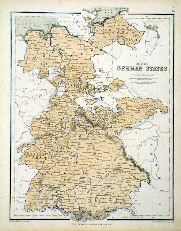 |
Minor German
States
Chambers
1855
size: 240 x 300 mm Ref FDM135 £14.00 (+P&P) click image for enlargement |
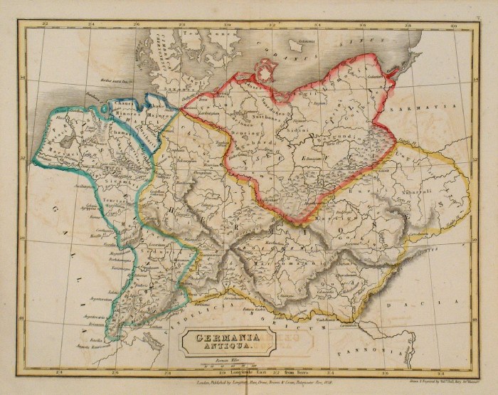 |
Ancient Germany Sidney
Hall 1829 Ref FIM013 £12.00 (+P&P) size: 250 x 190 mm Slight printing transfer from folded page. click image for enlargement |
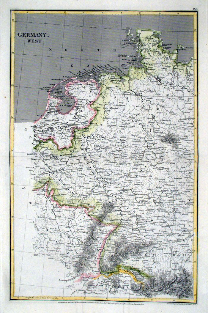 |
West Germany Cooke / Arrowsmith
1807
size: 260 x 410 mm Centre Fold Ref FIM079 £16.00 (+P&P) click image for enlargement |
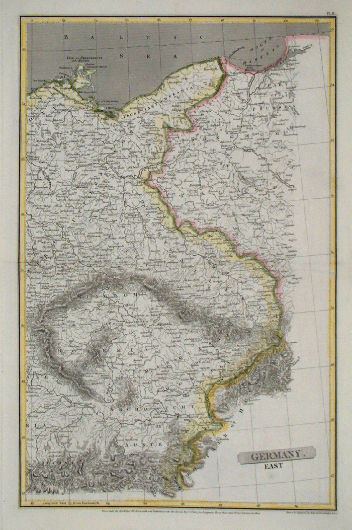 |
East Germany Cooke / Arrowsmith
1807
size: 260 x 410mm Centre Fold Ref FIM080 £16.00 (+P&P) click image for enlargement |
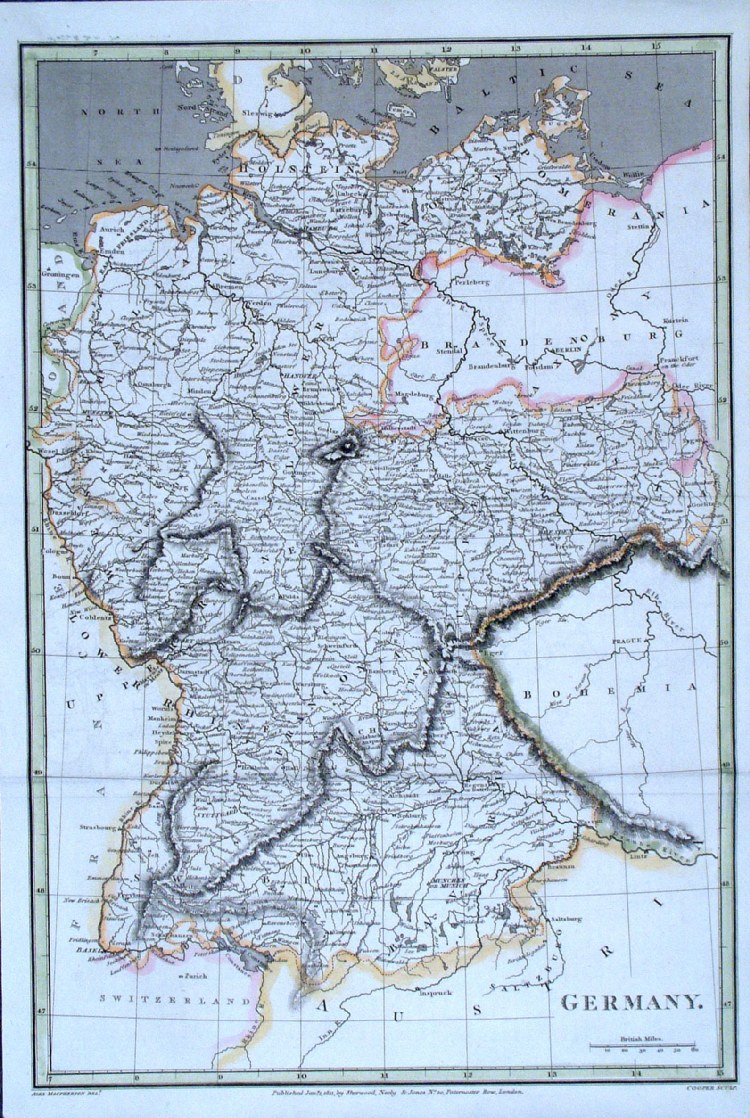 |
Germany Cooper / Macpherson
1811
size: 260 x 380mm Two Folds Ref GCM038 £18.00 (+P&P) click image for enlargement |
 |
Germany Samuel Arrowsmith
1836 Ref FHM127 £16.00 (+P&P) size: 240 x 210 mm click image for enlargement |
 |
Ancient Germany Samuel
Arrowsmith 1836 Ref FHM128 £16.00 (+P&P) size: 240 x 210 mm click image for enlargement |
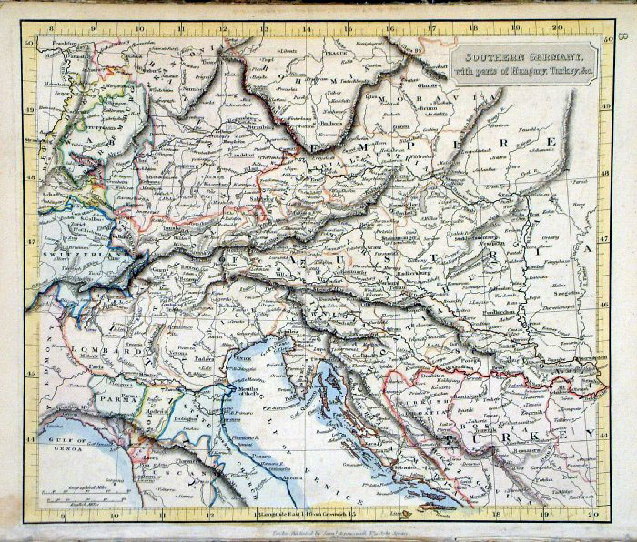 |
Southern Germany with parts of
Hungary & Turkey Samuel Arrowsmith 1836 Ref FHM117 £16.00 (+P&P) size: 240 x 210 mmclick image for enlargement |
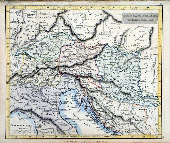 |
Ancient Southern Germany - Vindelicia,
Noricum, Rhaetia, Pannonia & Illyricum Samuel Arrowsmith 1836 Ref FHM118 £16.00 (+P&P) size: 240 x 210 mmclick image for enlargement |
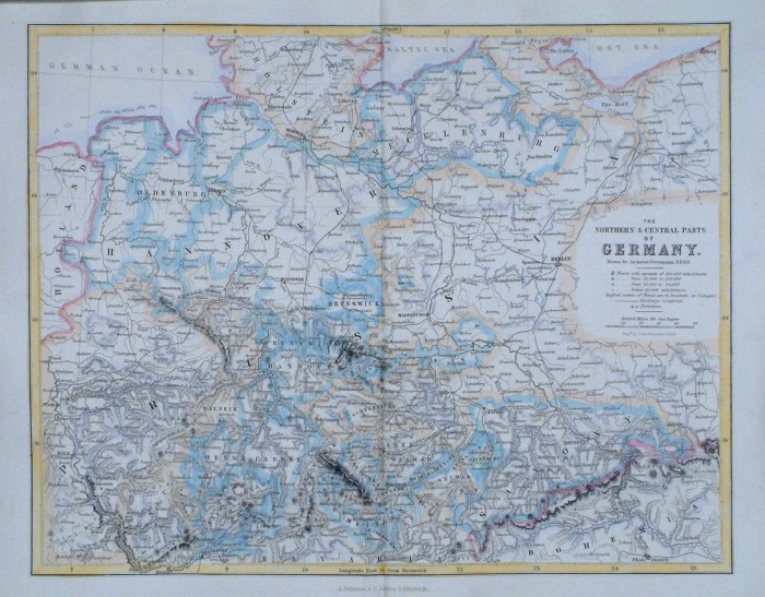 |
Germany - Northern and Central parts
Fullarton c1861
size 300 x 240 mm, centre fold Ref GBM257 £15.00 (+P&P) click image for
enlargement
|
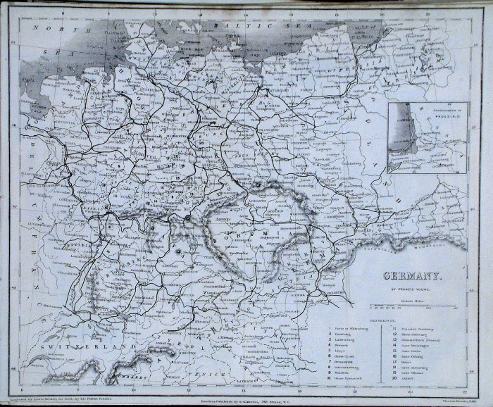 |
Germany Francis Young /
Beeton c1880 size: 250 x 200 mm several folds Ref GAM038 £12.00 (+P&P) click image for enlargement |
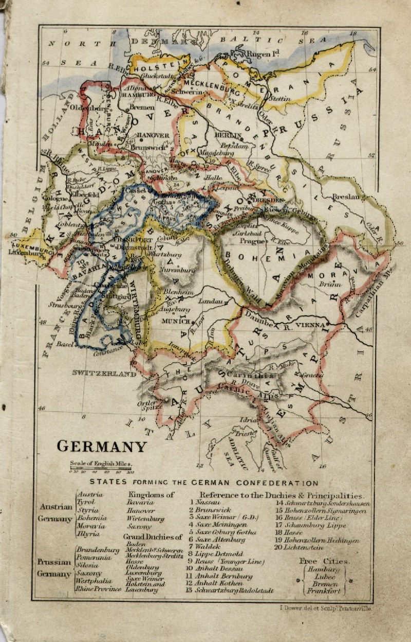 |
Germany John Dower / James
Cornwell c1850 Ref GFM079 £16.00 (+P&P) size: 150 x 95 mm, slightly soiled surface click image for enlargement |
 |
Dresden Dower c1840 size: 280 x 220 mm, 2 folds Ref GGM065 £28.00 (+P&P) click image for enlargement |
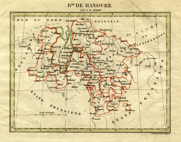 |
Hanover Perrot c1830
Engraved by P. Tardieu size: 200 x 160 mm Ref FEM024 £18.00 (+P&P) click image for enlargement |
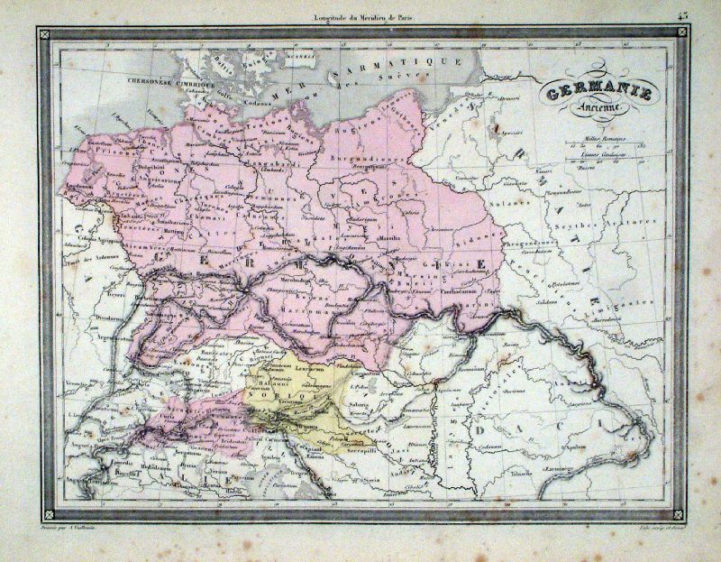 |
Germanie Acienne Vuillemin 1851 size: 270 x 210 mm a few faint spots of foxing Ref JDM056 £12.00 (+P&P) click image for enlargement |
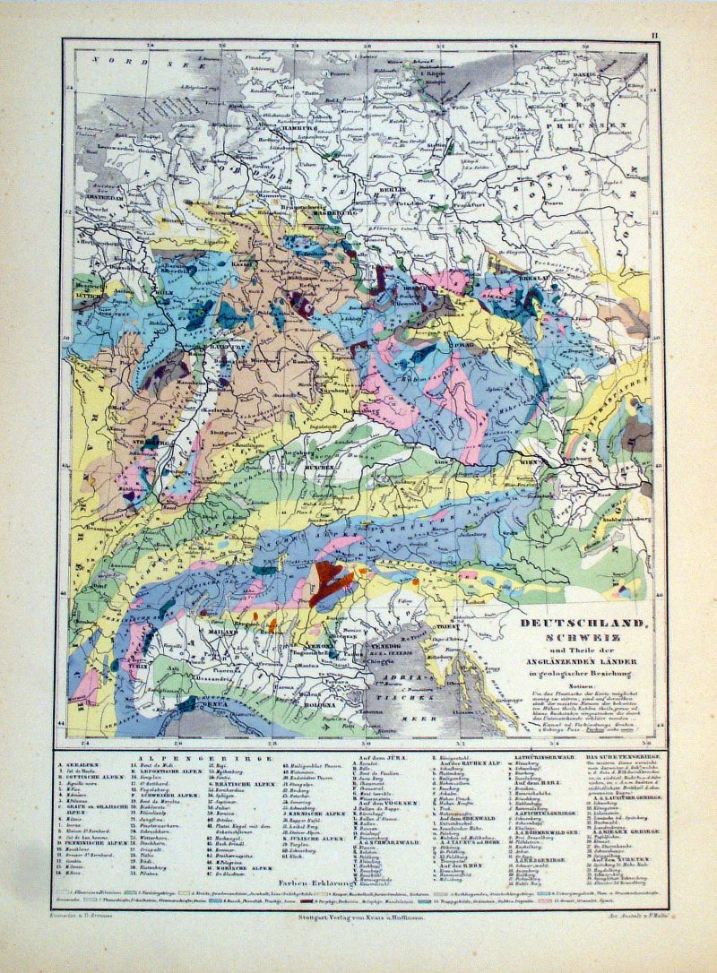 |
Deutschland, Schweiz
und Theie der Angranzenden Lander in Geologischer
Beziehung Germany & Switzerland in Geological Relationship Winkelmann / Krais & Hoffman for Humboldt's Kosmos 1861 size: 320 x 250 mm Ref LDM011 £16.00 (+P&P) click image for enlargement |
 |
Deutschland, Schweiz
und Theie der Angranzenden Lander in Physikalischer
Beziehung Germany & Switzerland in Physical Relationship Winkelmann / Krais & Hoffman for Humboldt's Kosmos 1861 size: 320 x 250 mm Inset of prominent mountains Ref LDM023 £16.00 (+P&P) click image for enlargement |
 |
Link to Regional Maps of Northern Germany,
France, Belgium ... by Beaulieu 1676 |
Gibraltar |
|
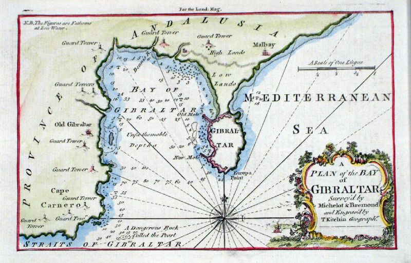 |
Gibraltar
Thomas
Kitchin 1758 (London Magazine) Ref KHM027 £80.00 (+P&P) size: 180 x 120 mm click image for enlargement |
Greece( see also Balkans [for Macedonia] & Turkey in Europe )(for Greek islands see 'Mediterranean Sea and Islands' - under M ) |
|
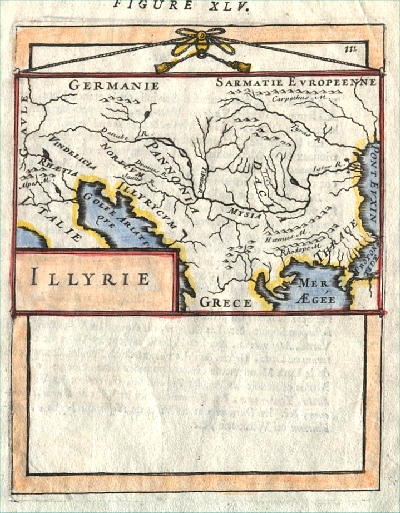 |
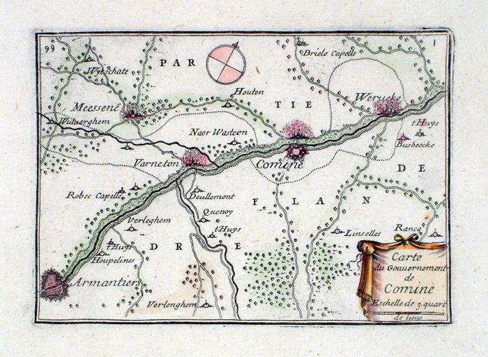
Greece & the Balkans Illyrie
Mallet
c1683
size 120 x 170 mm Tight left. Ref AEM008 £35.00 (+P&P) click image for enlargement |
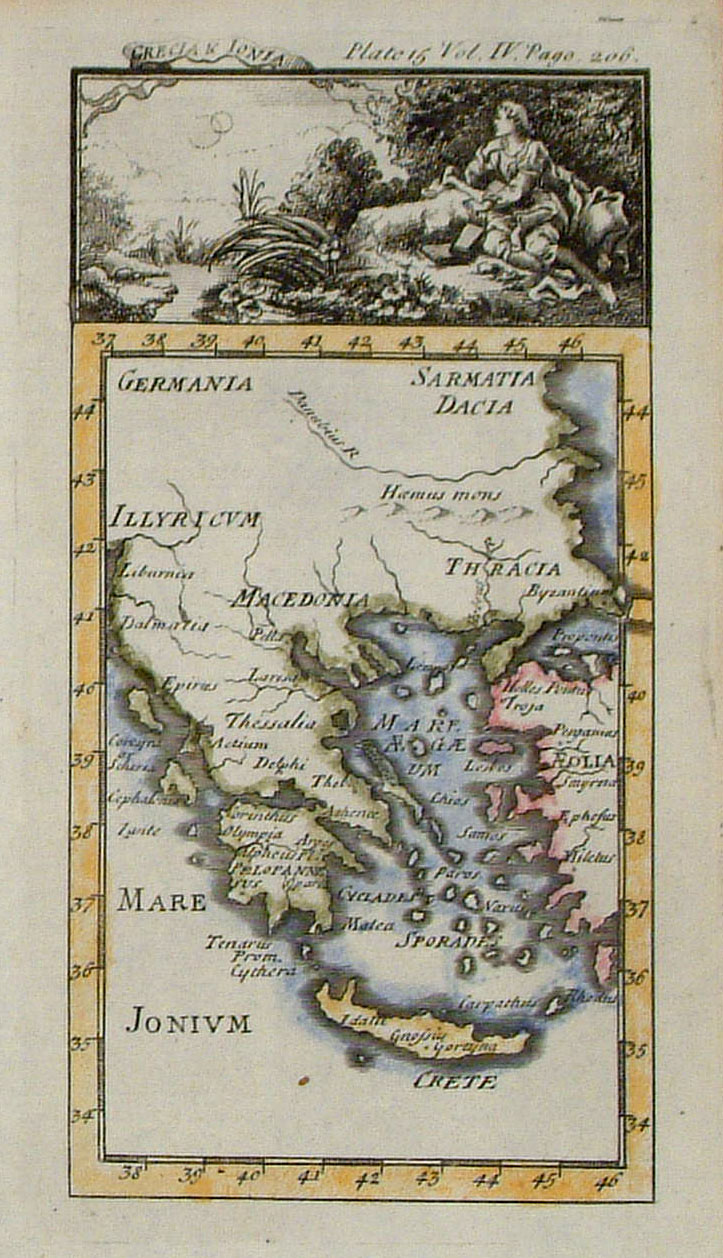 |
Greece Bourgoin c1760
size 80 x 140 mm Ref GAM017 £24.00 (+P&P) click image for enlargement |
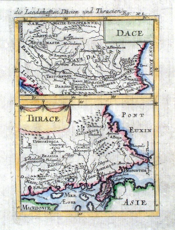 |
Dace and Thrace Mallet c1683 size 120 x 170 mm Tight left. Ref JKM029 £35.00 (+P&P) click image for enlargement |
 |
A New Map of Turkey
in Europe from the Latest Observations John Sennex 1730 From Gordon's Geography - view Title Page size: 190 x 170 mm, 2 folds Antique Map Ref LFM010 £50.00 (+P&P) click image for enlargement |
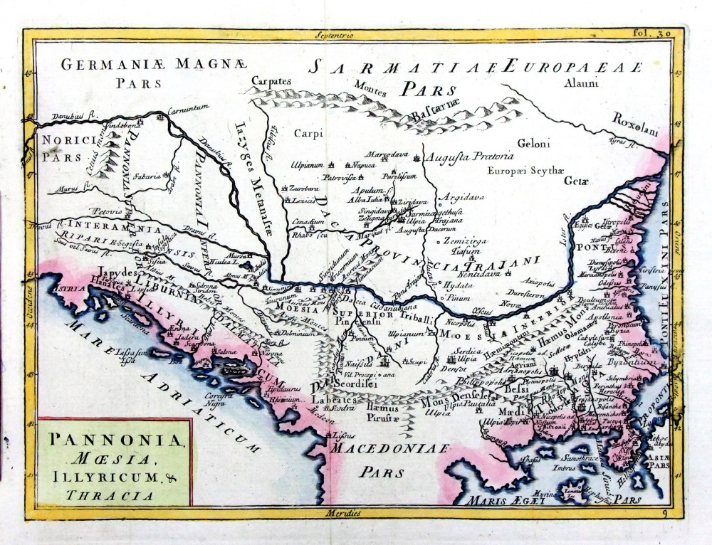 |
Pannonia
Moesia, Illyricum & Thracia Geograhia Antiqa Christophi Cellarii Christoph Cellarius 1745 Copper engraving size: 220 x 170 mm, 2 folds. Ref OKM015 £30.00 (+P&P) click image for enlargement |
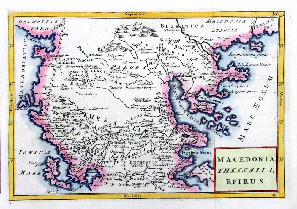 |
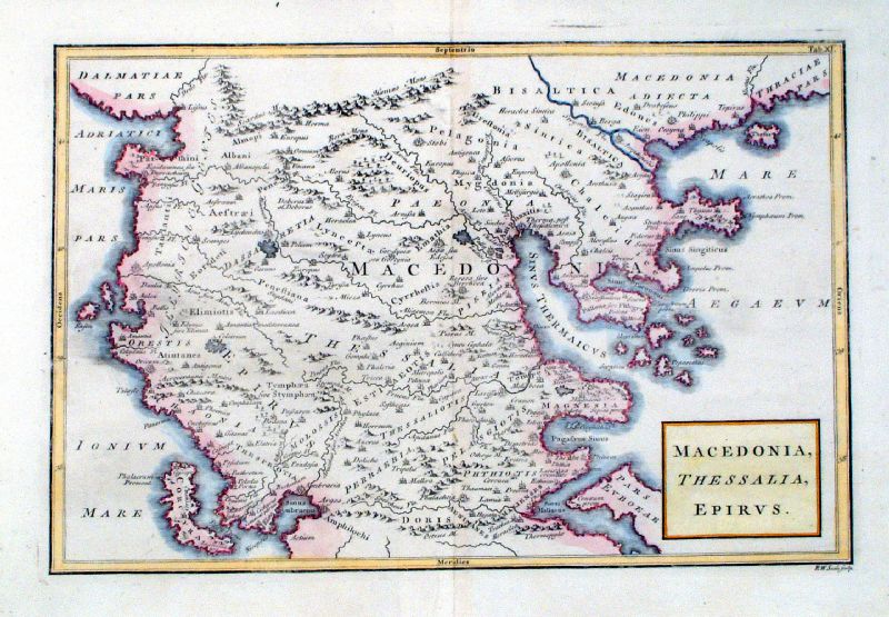
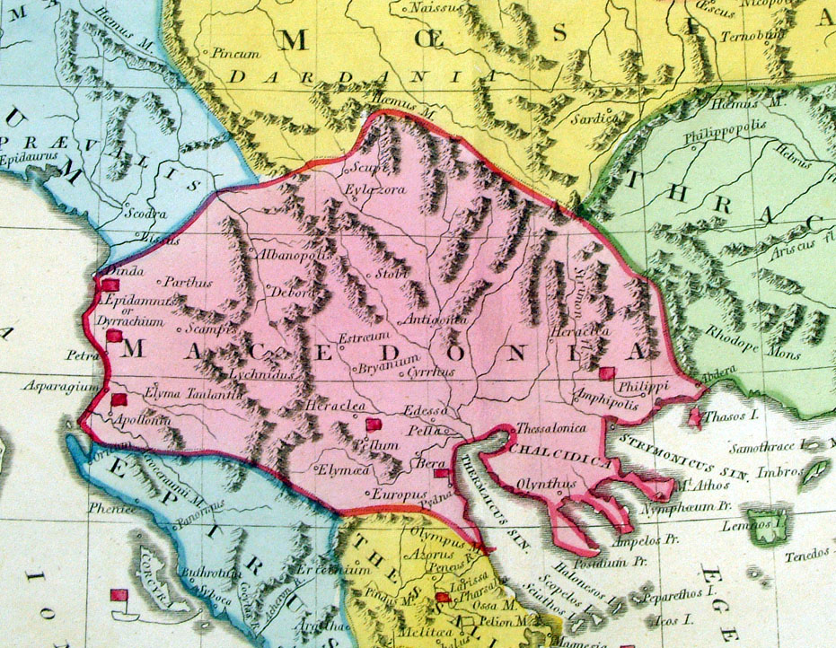
Macedonia,
Thessalia, Epirus Geograhia Antiqa Christophi Cellarii Christoph Cellarius 1745 Copper engraving size: 220 x 160 mm, 2 folds. Ref OKM010 £30.00 (+P&P) click image for enlargement |
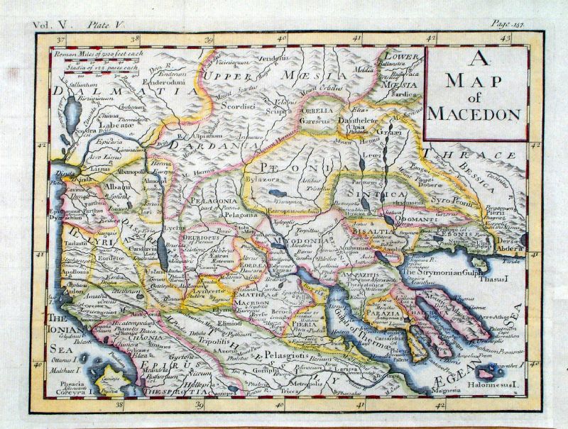 |
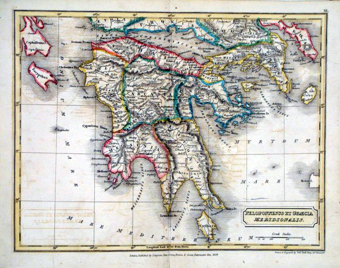
A Map of
Macedon Clarke
1777 size: 290 x 220 mm several folds Ref JGM111 £30.00 (+P&P) click image for enlargement |
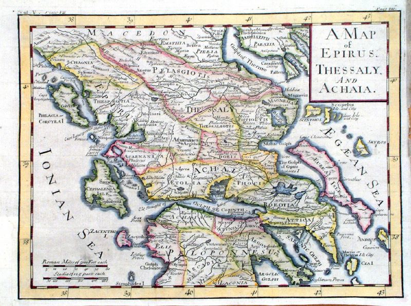 |
A Map of Epirus, Thessaly, and Achaia Clarke 1777 size: 290 x 220 mm several folds Ref JGM114 £35.00 (+P&P) click image for enlargement |
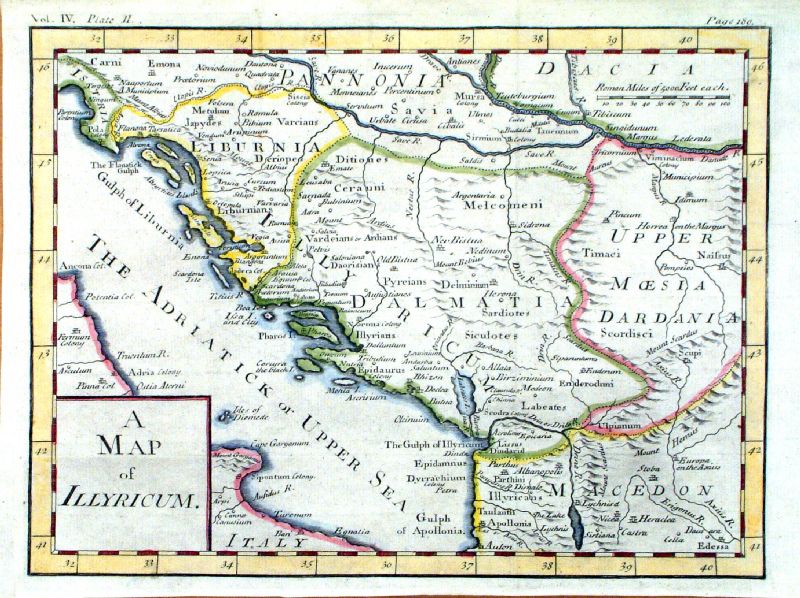 |
A Map of Illyricum Clarke 1777 size: 290 x 220 mm several folds Ref JGM116 £35.00 (+P&P) click image for enlargement |
 |
Macedonia, Thessalia, Epirus Richard Seale Raw/Rivington 1796 Copper engraving size: 330 x 220 mm, centre fold Ref JKM084 £35.00 (+P&P) click image for enlargement |
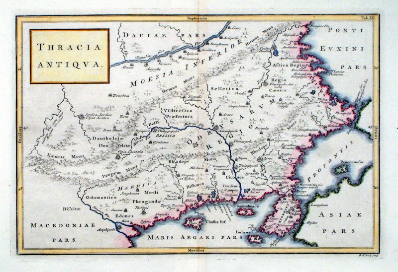 |
Thracia Antiqua Richard Seale Raw/Rivington 1796 Copper engraving size: 330 x 220 mm, centre fold Ref JKM085 £30.00 (+P&P) click image for enlargement |
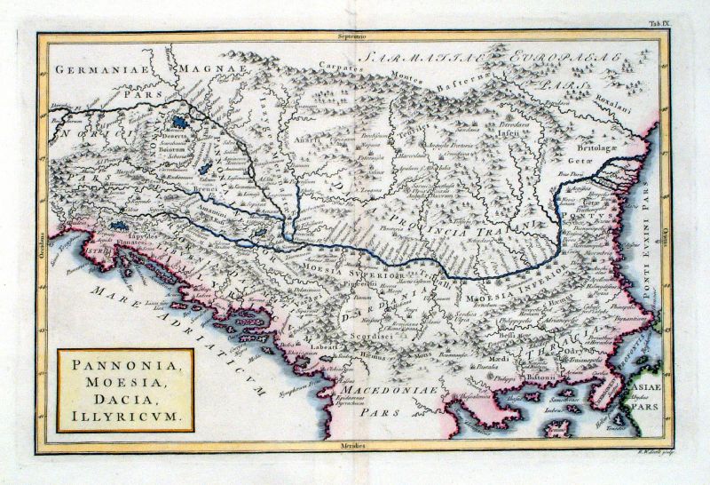 |
Pannonia, Moesia, Dacia, Illyricum Richard Seale Raw/Rivington 1796 Copper engraving size: 330 x 220 mm, centre fold Ref JKM082 £35.00 (+P&P) click image for enlargement |
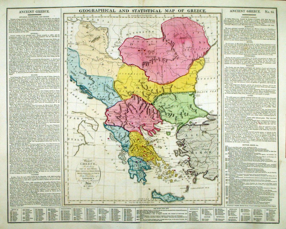 |
Geographical and
Statistical Map of Greece Map engraved by J. Walker. Set with statistical data. From Lavoisne's Genealogical, Historical, Chronological and Geographical Atlas 1827 - Title Page For Statistics Tables and Charts from this atlas see Charts and Tables Page Copper engraving page size: 530 x 420 mm, centre fold. Ref LHM017 £50.00 (+P&P) Detail click image for enlargement |
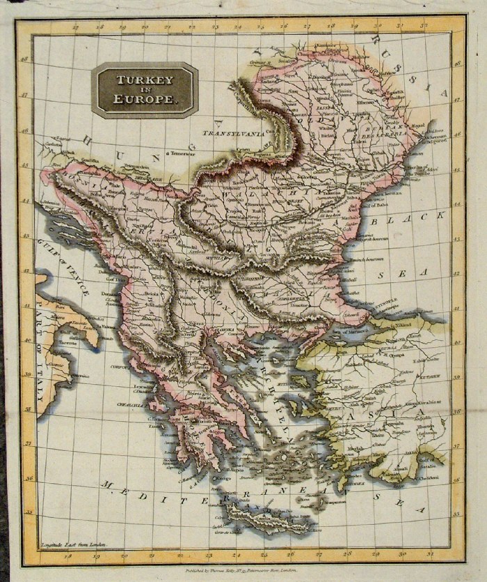 |
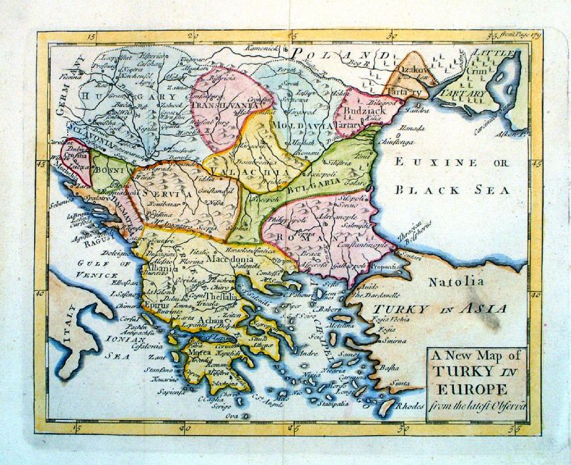
Turkey in Europe Kelly c1820 size 240 x 290 mm two folds Ref GAM020 £20.00 (+P&P) click image for enlargement |
 |
Attica and part of Euboea
Barbie du Bocage 1791 (Maps
of Ancient Greece, published in Paris 1791)
Centre fold size 290 x 190 mm Ref FHM042 £20.00 (+P&P) click image for enlargement |
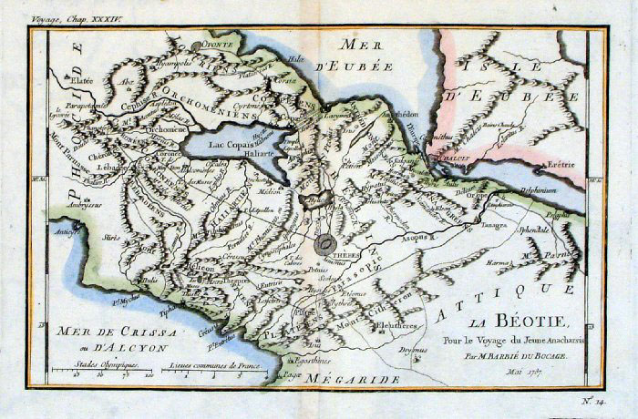 |
Boeotia Barbie du Bocage
1791 (Maps of Ancient Greece,
published in Paris 1791) Centre fold size 280 x 180 mm Ref FHM038 £20.00 (+P&P) click image for enlargement |
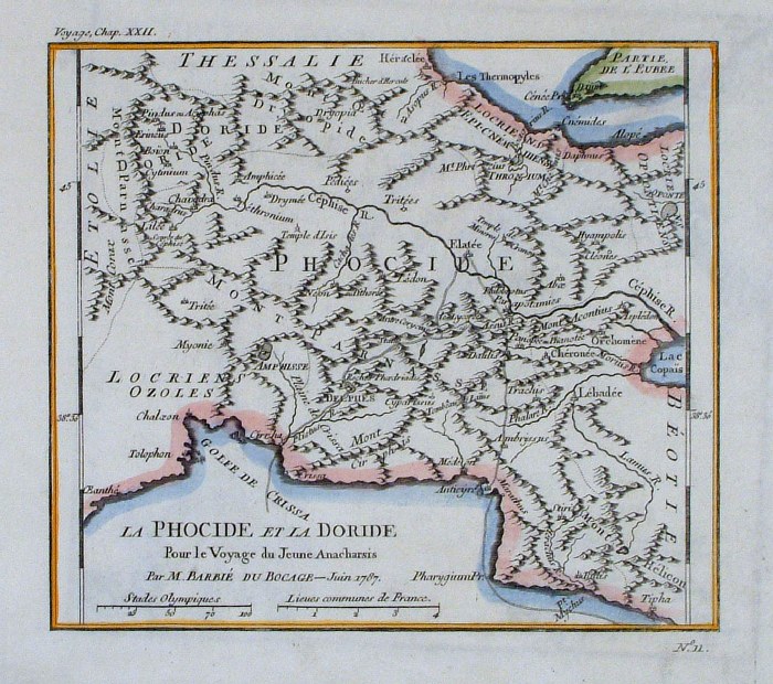 |
Phocis Barbie du Bocage
1791 (Maps of Ancient Greece,
published in Paris 1791) size 200 x 180 mm Ref FHM056 £20.00 (+P&P) click image for enlargement |
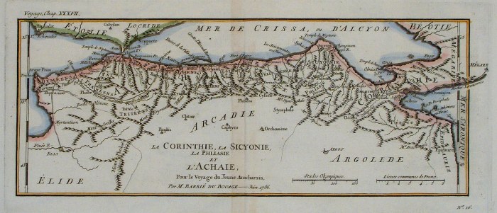 |
Corinth & Achaea Barbie du
Bocage 1791 (Maps of
Ancient Greece, published in Paris 1791)
Centre fold size 320 x 140 mm Ref FHM048 £24.00 (+P&P) click image for enlargement |
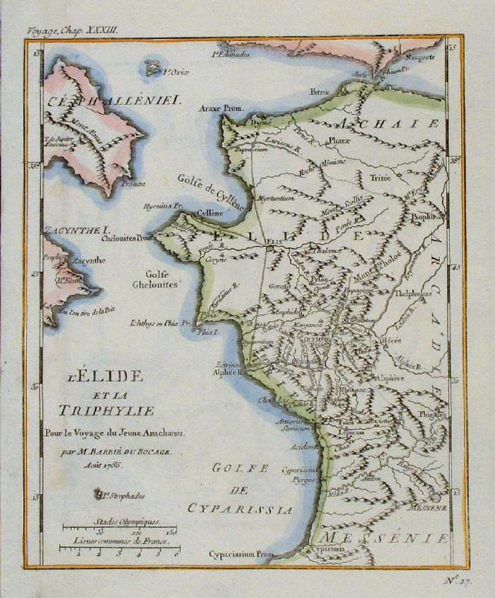 |
Elis Barbie du Bocage
1791 (Maps of Ancient Greece,
published in Paris 1791) size 180 x 210 mm Ref FHM052 £20.00 (+P&P) click image for enlargement |
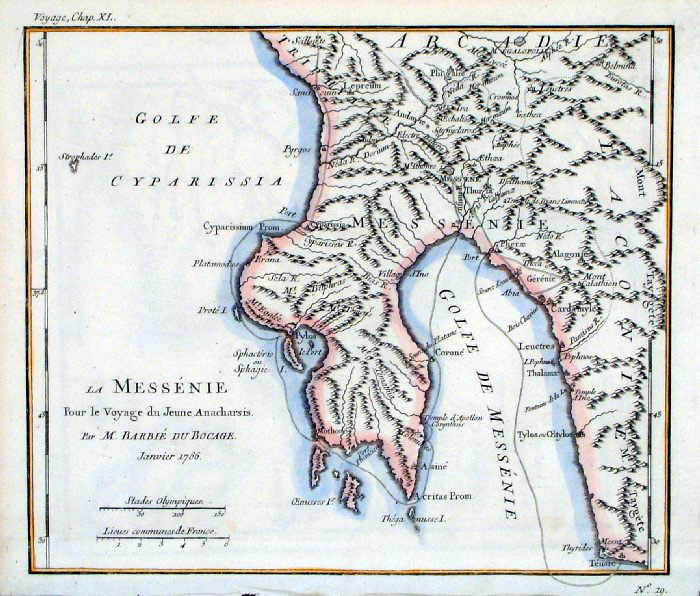 |
Messinia Barbie du
Bocage 1791 (Maps of
Ancient Greece, published in Paris 1791)
size 240 x 200 mm Ref FHM051 £20.00 (+P&P) click image for enlargement |
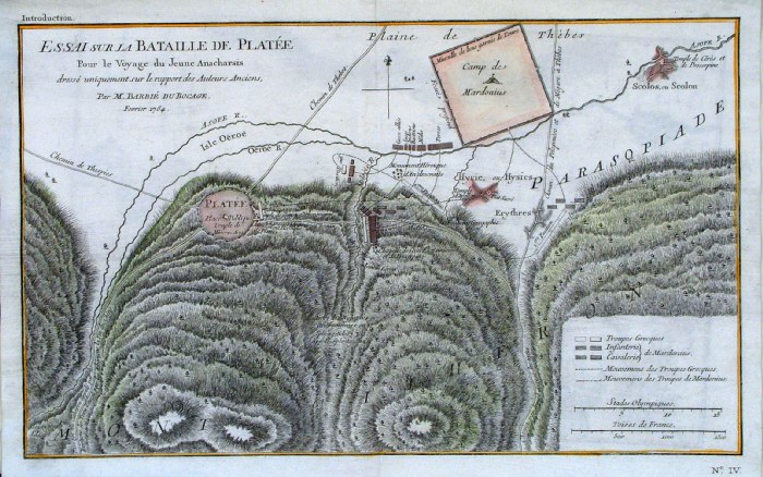 |
Battle of Platee (479 BC) Barbie du Bocage 1791 (Maps of Ancient Greece, published in Paris 1791) Centre fold size 360 x 230 mm Ref FHM044 £20.00 (+P&P) click image for enlargement& |
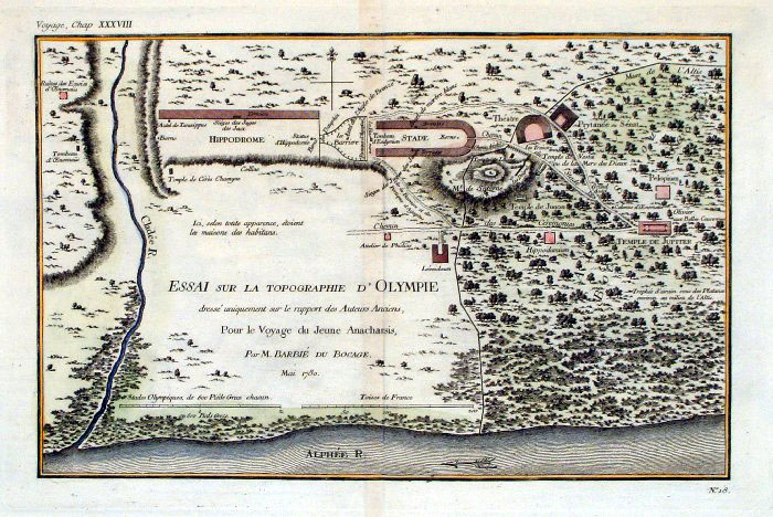 |
Olympia Barbie du Bocage
1791 (Maps of Ancient Greece,
published in Paris 1791) Centre fold size 300 x 190 mm Ref FHM039 £28.00 (+P&P) click image for enlargement |
| More Maps of Ancient Greece, by Barbie published in
Paris 1791 in Turkey section. |
|
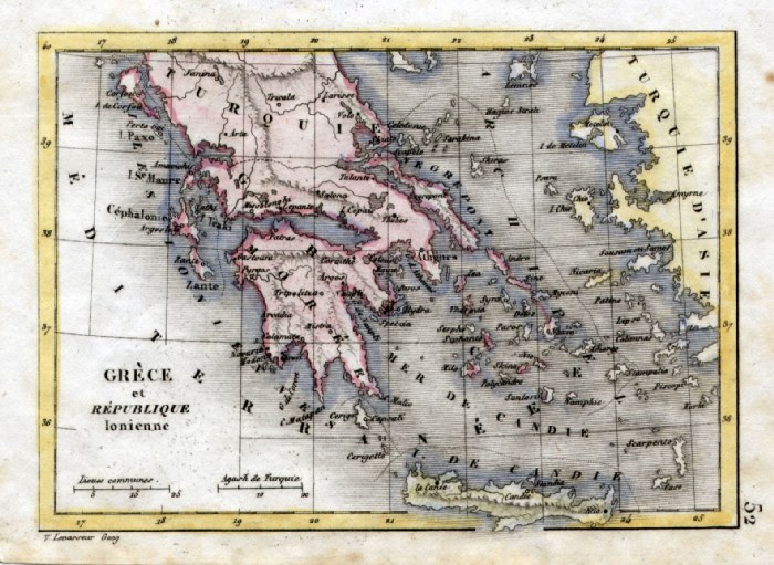 |
Greece 'Grece et Republique
Ionienne' V. Levasseur c1835 size: 130 x 100 mm Ref HAM084 £18.00 (+P&P) click image for enlargement |
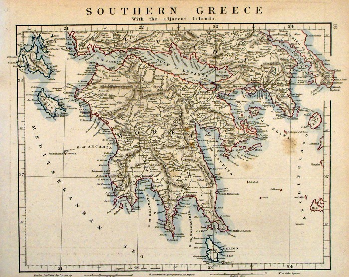 |
Southern Greece S.
Arrowsmith 1828
size:
320 260 mm Ref FDM019 £22.00 (+P&P) click image for enlargement |
 |
Ancient Greece (Hellas, Thessalia ..)
Russell / Arrowsmith 1807
size: 410x 260 mm Centre Fold Ref FIM104 £16.00 (+P&P) click image for enlargement |
 |
Ancient Northern Greece Sidney
Hall 1829 Ref FIM006 £14.00 (+P&P) size: 250 x190 mm Slight printing transfer from folded page. click image for enlargement |
 |
Ancient Northern Greece Sidney
Hall 1829 Ref FIM005 £14.00 (+P&P) size: 250 x190 mm Slight printing transfer from folded page. click image for enlargement |
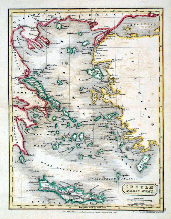 |
Ancient Aegean Sea Sidney
Hall 1829 Ref FIM007 % £14.00 (+P&P) size: 250 x190 mm Slight printing transfer from folded page. click image for enlargement |
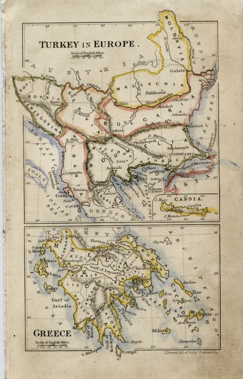 |
Greece and Turkey in Europe
John Dower / James Cornwell c1850 Ref GFM062 £16.00 (+P&P) size: 150 x 95 mm, slightly soiled surface, pencil marks on reverse click image for enlargement |
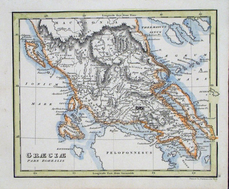 |
Ancient Greece 'Graeciae pars
Borealis' Fenner 1828
size 150 x 120 mm Ref GIM049 £12.00 (+P&P) click image for enlargement |
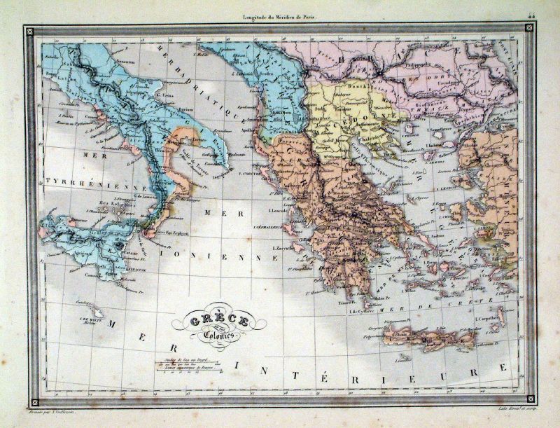 |
Grece et des Colonies Vuillemin 1851 size: 270 x 210 mm a few faint spots of foxing Ref JDM055 £12.00 (+P&P) click image for enlargement |
Greenland |
|
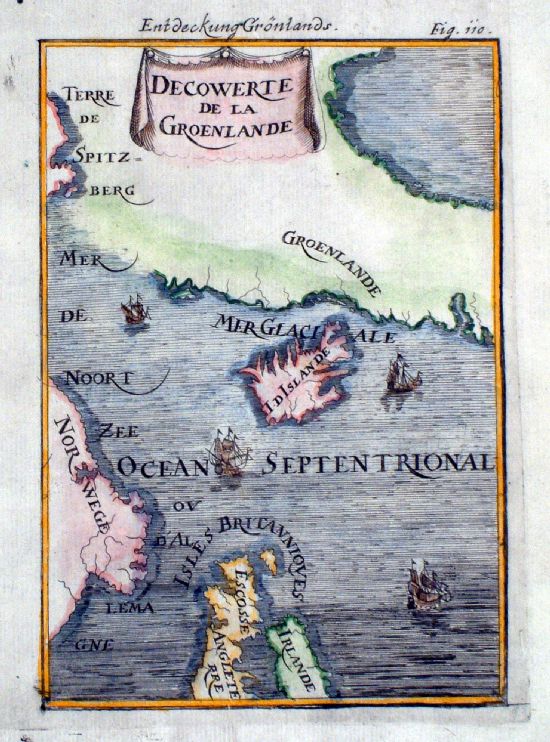 |
Decowerte de la Groenlande Greenland, Iceland and Northern Europe Mallet 1719 ( German edition ) Engraved in reverse. Thought to be an early error of the German edition with the plates being engraved with a reverse image. Plates were subsequently engraved with correct aspect of the maps. size: 120 x 170 mm Ref IKM001 £36.00 (+P&P) click image for enlargement |
| All Genuine Antiquarian Maps - No Reproductions or Modern Copies |
2023

