Past Pages
Antique Maps, Prints and Ephemera
Antique Maps - UK Town & Street Plans
- A to B
England & WalesIncluding castle plans, cathedral plans, church plans,
Boundary Commission maps, local suburban maps
For Irish Town plans see section: Maps - Europe / Ireland
For London see section: Maps - London
Arranged alphabetically by town or locality (not by name of church , hospital, etc)
For local interest also see Road Maps section.
Note that some maps have two or three towns, making alphabetic searching difficult and sometimes prone to error.
A Brief Article on Town Plans Help on local area maps
More Town Plans: C - G H - L M - R S - Y Scotland
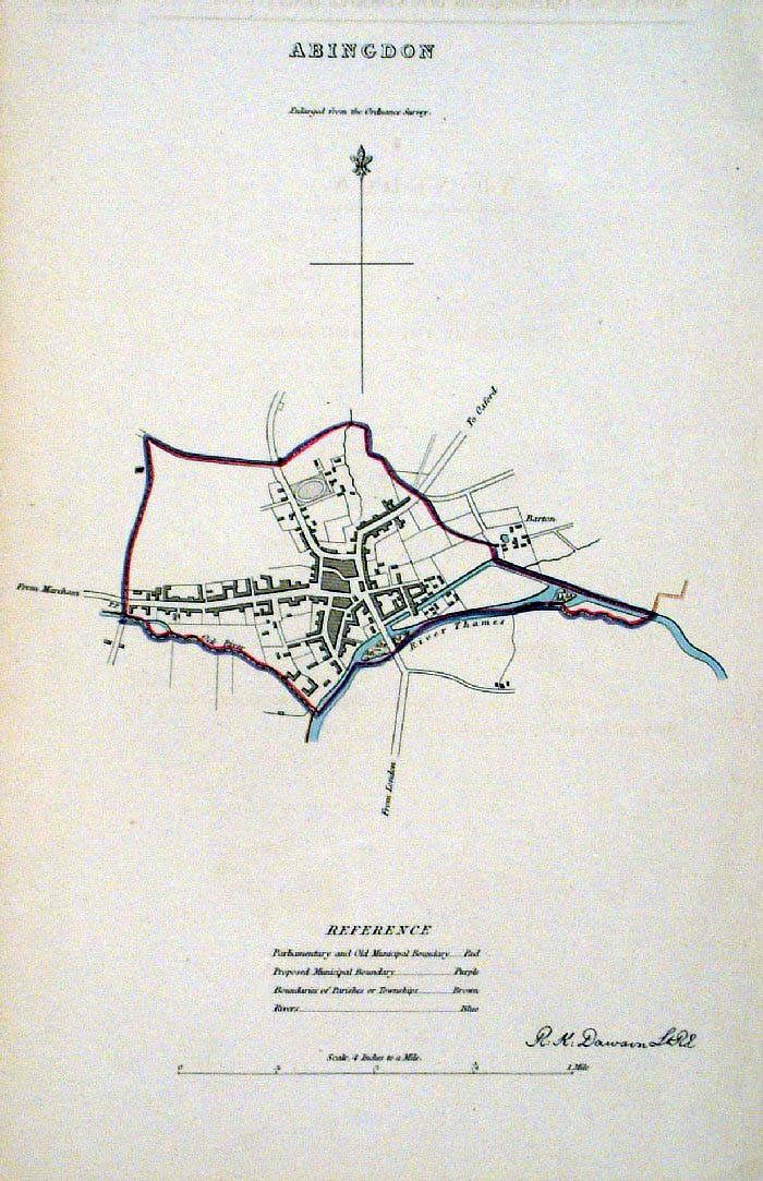 |
Abingdon (Oxfordshire)
Dawson - Boundary Commission 1837 From 'Municipal Corporation Boundaries Report ' size: 200 x 300 mm Antique Map Ref FDM116 £26.00 (+P&P) click image for enlargement |
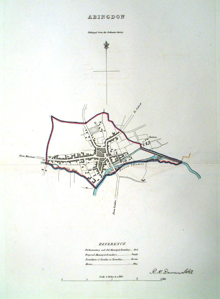 |
Abingdon (Oxfordshire)
Dawson - Boundary
Commission 1837 From 'Municipal Corporation Boundaries Report ' Large Paper Edition. Page size: 420 x 500mm plate size: 210 x 340 mm Antique Map Ref GBM002 £26.00 (+P&P) click image for enlargement |
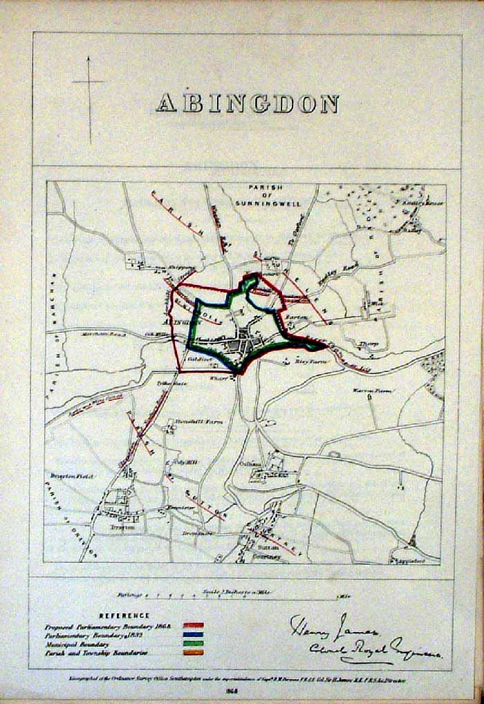 |
Abingdon (Oxfordshire)
James - Boundary
Commission 1868 The map is accompanied by a page of descriptive text relating to the borough statistics Zincograph Size: 240 x 360 mm Original colouring of boundaries Antique Map Ref HJS001 £20.00 (+P&P) click image for enlargement |
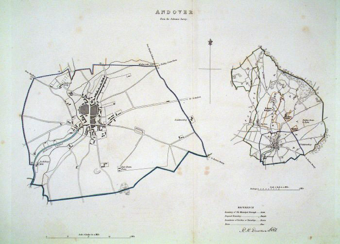 |
Andover (Wilts) Dawson
- Boundary Commission 1837 From 'Municipal Corporation Boundaries Report ' Large Paper Edition. Page size: 500 x 420 mm plate size: 390 x 340 mm Antique Map Ref GBM003 £28.00 (+P&P) click image for enlargement |
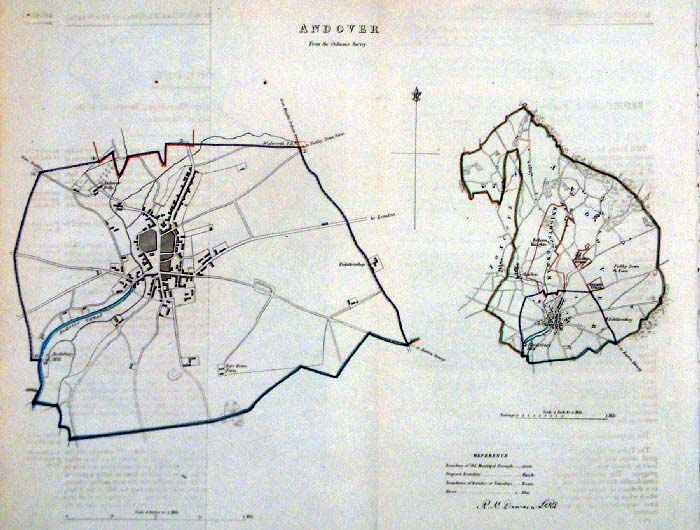 |
Andover (Wilts) Dawson -
Boundary Commission 1837 From 'Municipal Corporation Boundaries Report ' size: 300 x 300 mm 2 folds Antique Map Ref FDM075 £26.00 (+P&P) click image for enlargement |
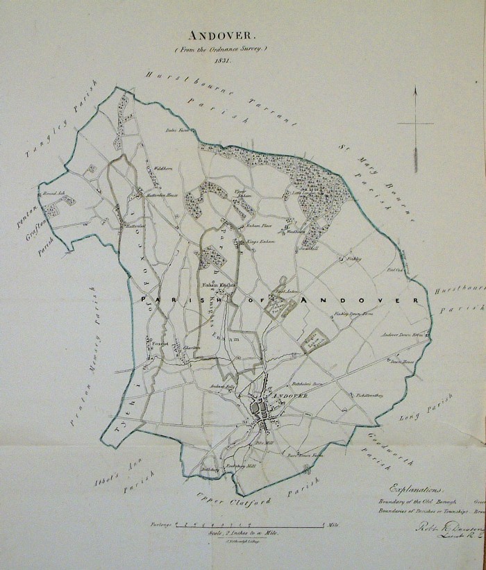 |
Andover (Wilts) Dawson -
Boundary Commission 1832 From 'Municipal Corporation Boundaries Report ' size: 320 x 380 mm 2 folds Antique Map Ref FEM037 £26.00 (+P&P) click image for enlargement |
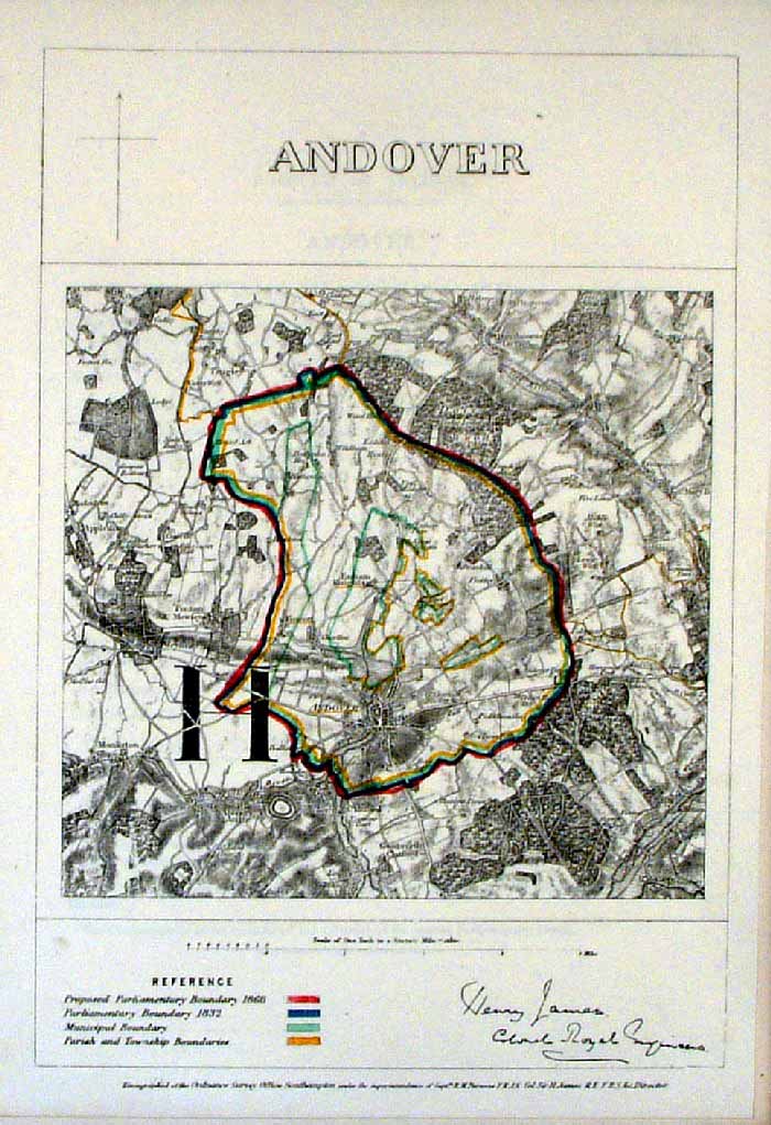 |
Andover (Wilts)
James - Boundary Commission
1868 The map is accompanied by a page of descriptive text relating to the borough statistics Zincograph Size: 240 x 360 mm Original colouring of boundaries Antique Map Ref HJS002 £20.00 (+P&P) click image for enlargement |
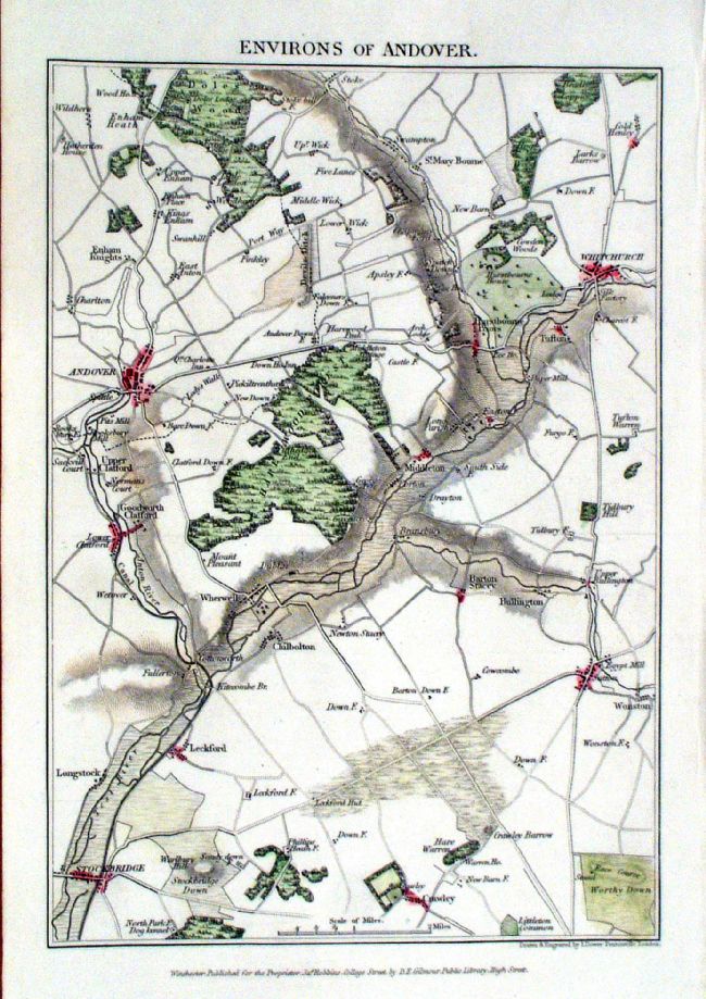 |
Environs of Andover (Wilts)
Robbins / Dower
c1860 Scope: Stockbridge, Whitchurch, Worthy Down Steel engraving Size: 150 x 220 mm Antique Map Ref KGM014 £24.00 (+P&P) click image for enlargement |
 |
Arundel
(Hants) Dawson
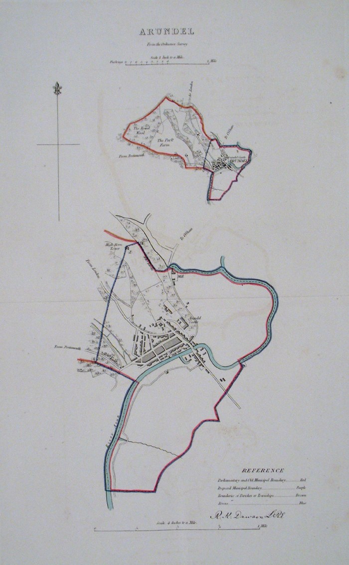
- Boundary Commission 1837 From 'Municipal Corporation Boundaries Report ' Large Paper Edition. Page size: 420 x 500mm plate size: 220 x 340 mm Faint offset transfer Antique Map Ref GBM004 £30.00 (+P&P) click image for enlargement |
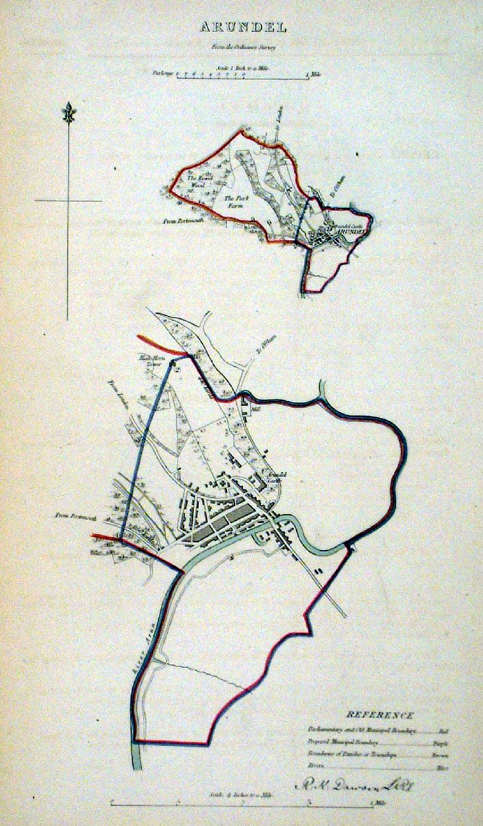 |
Arundel (Sussex) Dawson -
Boundary Commission 1837 From 'Municipal Corporation Boundaries Report ' size: 200 x 300 mm Antique Map Ref FDM117 £28.00 (+P&P) click image for enlargement |
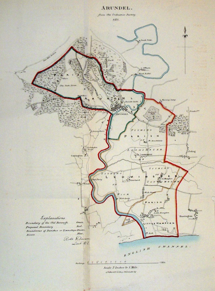 |
Arundel (Sussex) Dawson -
Boundary Commission 1837 From 'Municipal Corporation Boundaries Report ' size: 300 x 400 mm 2 folds Antique Map Ref FDM088 £28.00 (+P&P) click image for enlargement |
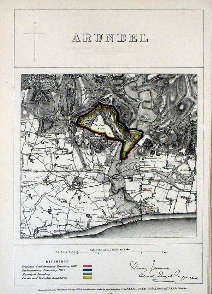 |
Arundel (Sussex)
James - Boundary Commission
1868 The map is accompanied by a page of descriptive text relating to the borough statistics Zincograph Size: 240 x 360 mm Original colouring of boundaries Antique Map Ref HJS003 £20.00 (+P&P) click image for enlargement |
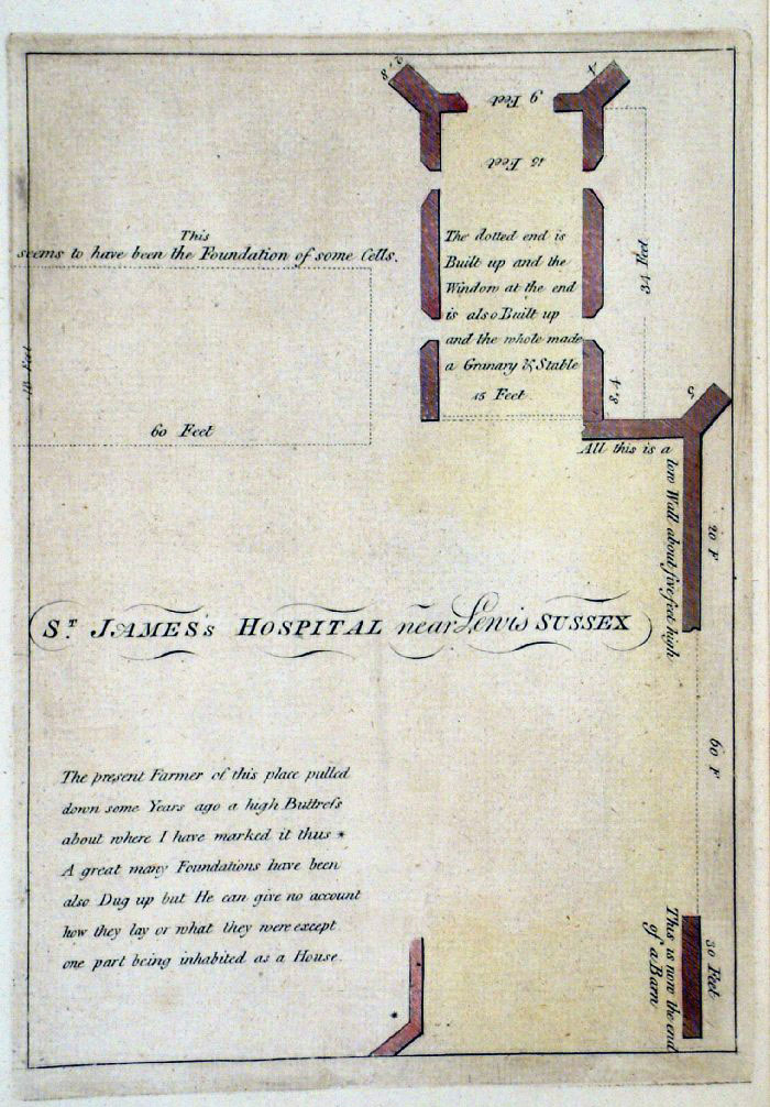 |
St James Hospital, Arundel (Sussex)
Grose 1787 size: 160 x 230 mm Antique Map Ref FHM013 £22.00 (+P&P) click image for enlargement |
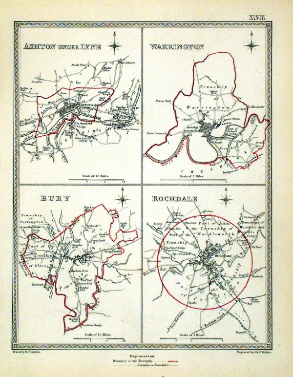 |
Ashton Under Lyne . Warrington . Bury . Rochdale Samuel Lewis 1835 engraved by J & C Walker Steel engraving Size: 200 x 250 mm, Original colouring of boundaries. Antique Map Ref KJM048 £16.00 (+P&P) Sample, not of this specific map, to indicate the level of detail of these 1835 Lewis town plans. click image for enlargement |
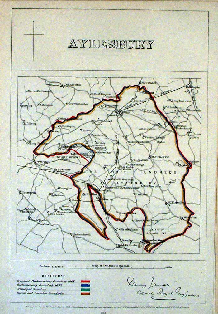 |
Aylesbury (Bucks) James
- Boundary Commission 1868 The map is accompanied by a page of descriptive text relating to the borough statistics Zincograph Size: 240 x 360 mm Original colouring of boundaries Antique Map Ref HJS004 £20.00 (+P&P) click image for enlargement |
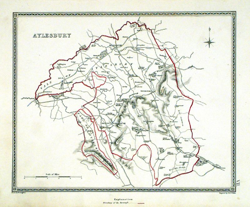 |
Aylesbury ( environs of ) Samuel Lewis 1835 engraved by J & C Walker Steel engraving Size: 250 x 200 mm, Original colouring of boundaries. Antique Map Ref KJM007 £22.00 (+P&P) Sample, not of this specific map, to indicate the level of detail of these 1835 Lewis town plans and town environs. click image for enlargement |
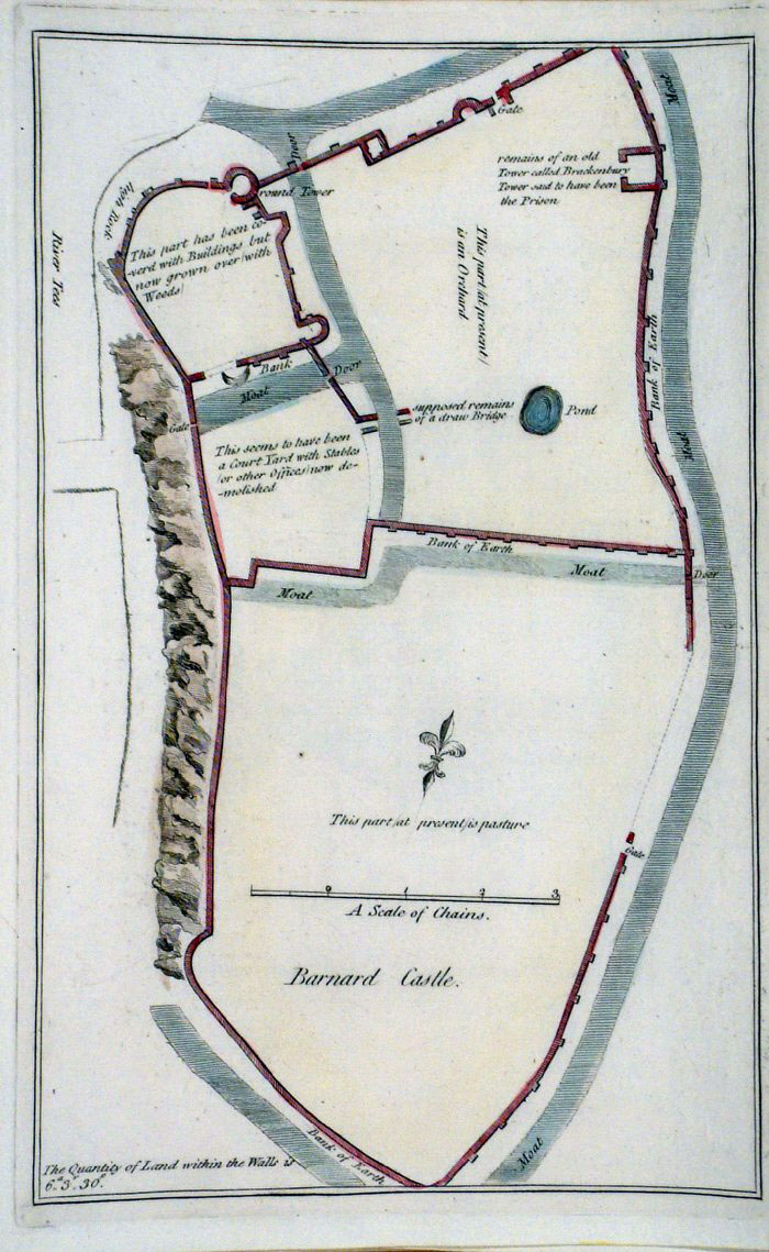 |
Barnard Castle plan (Durham)
Grose 1787 size: 160 x 250 mm Antique Map Ref FHM016 £18.00 (+P&P) click image for enlargement |
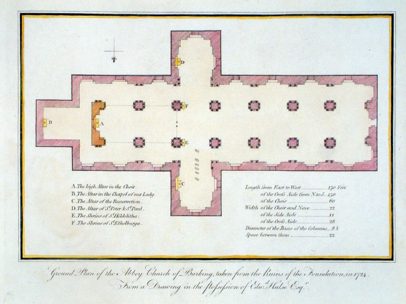 |
Ground Plan of Abbey Church of Barking (
Essex) .... size: 270 x 200 mm, slight local warp of paper surface Antique Map Ref KHM040 £16.00 (+P&P) click image for enlargement |
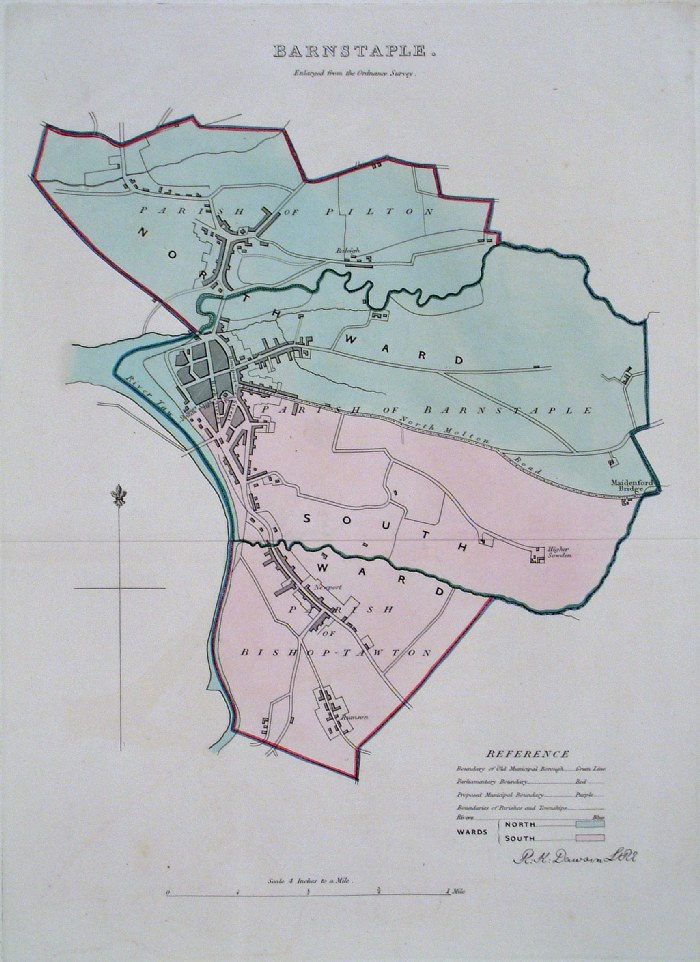 |
Barnstaple (Devon) Dawson
- Boundary Commission 1837 From 'Municipal Corporation Boundaries Report ' Large Paper Edition size: 250 x 300 mm 1 fold, some offset transfer Antique Map Ref GBM006 £28.00 (+P&P) click image for enlargement |
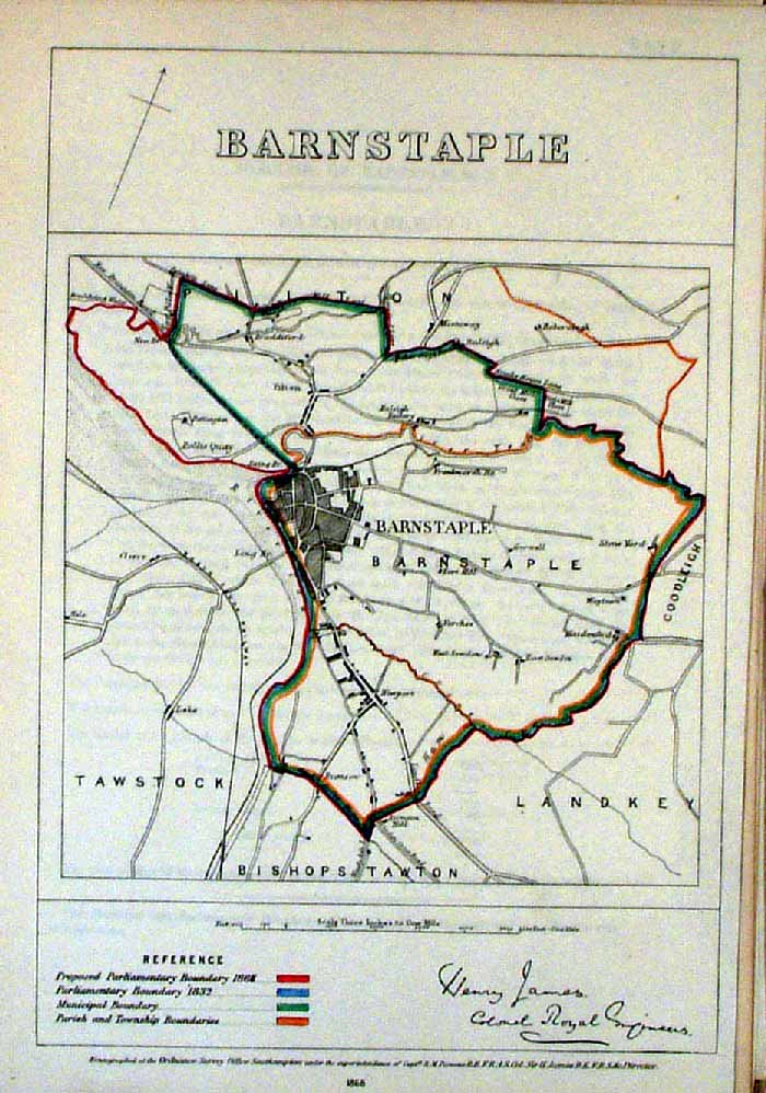 |
Barnstaple (Devon)
James - Boundary Commission
1868 The map is accompanied by a page of descriptive text relating to the borough statistics Zincograph Size: 240 x 360 mm Original colouring of boundaries Antique Map Ref HJS005 £20.00 (+P&P) click image for enlargement |
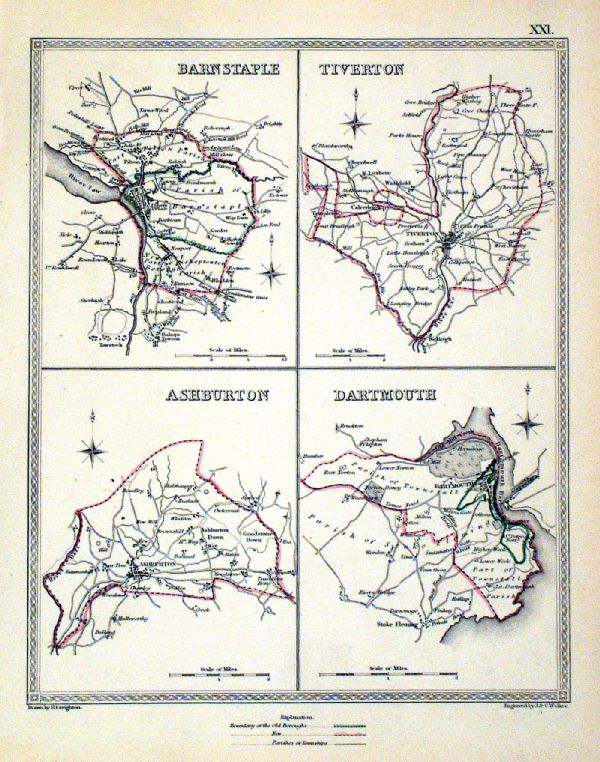 |
Barnstaple . Tiverton . Ashburton . Dartford Samuel Lewis 1835 engraved by J & C Walker Steel engraving Size: 200 x 250 mm, Original colouring of boundaries. Antique Map Ref KJM021 £18.00 (+P&P) Sample, not of this specific map, to indicate the level of detail of these 1835 Lewis town plans. click image for enlargement |
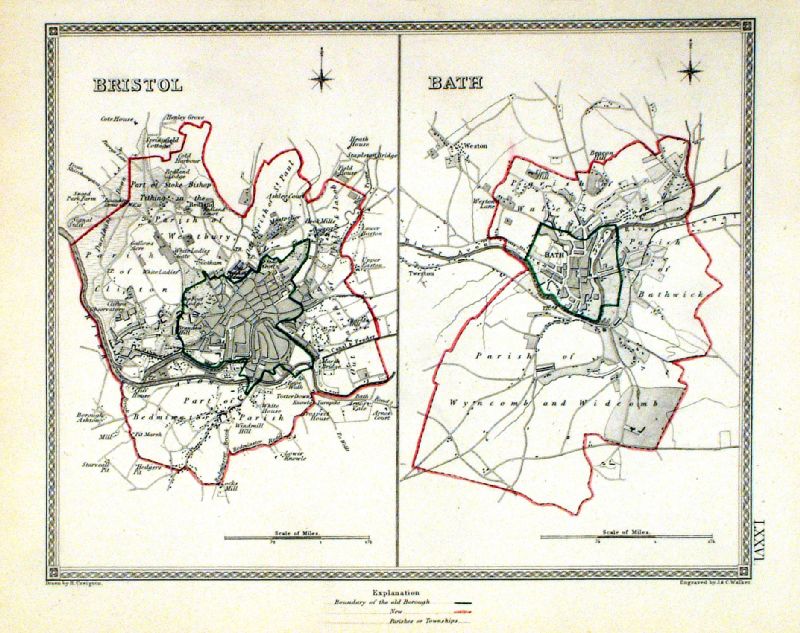 |
Bath . Bristol Samuel Lewis 1835 engraved by J & C Walker Steel engraving Size: 250 x 200 mm, Original colouring of boundaries. Antique Map Ref KJM076 £22.00 (+P&P) Sample, not of this specific map, to indicate the level of detail of these 1835 Lewis town plans and town environs. click image for enlargement |
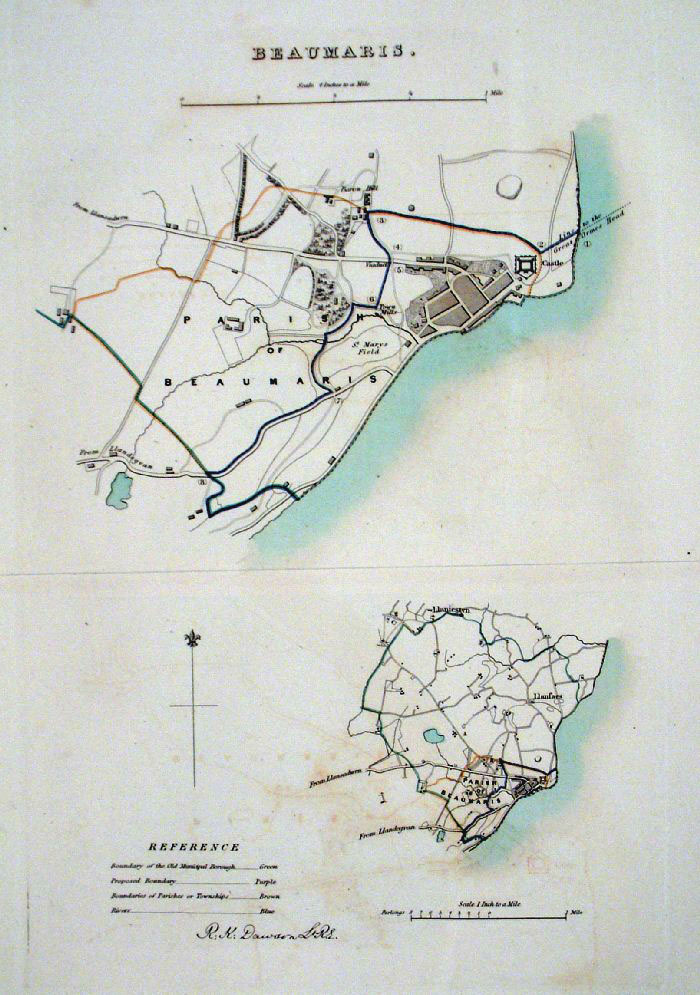 |
Beaumaris (Wales) Dawson
- Boundary Commission 1837 From 'Municipal Corporation Boundaries Report ' Large Paper Edition size: 250 x 300 mm 1 fold, very faint offset transfer Antique Map Ref GBM009 £24.00 (+P&P) click image for enlargement |
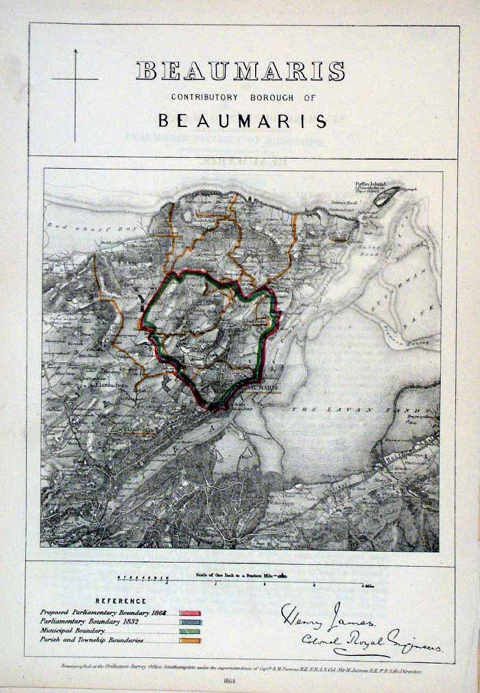 |
Beaumaris (Wales)
James - Boundary Commission
1868 The map is accompanied by a page of descriptive text relating to the borough statistics Zincograph Size: 240 x 360 mm Original colouring of boundaries Antique Map Ref HJS006 £20.00 (+P&P) click image for enlargement |
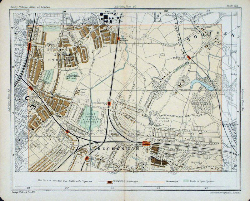 |
Beckenham & Lower Sydenham
Philips c1910 size: 200 x 160
mm Interesting to see the early field systems underlying the suburban development. Antique Map Ref GCM005 £18.00 (+P&P) click image for enlargement |
 |
Bedford Samuel Lewis 1835 engraved by J & C Walker Steel engraving Size: 200 x 250 mm, Original colouring of boundaries. Antique Map Ref KJM002 £18.00 (+P&P) Sample, not of this specific map, to indicate the level of detail of these 1835 Lewis town plans. click image for enlargement |
 |
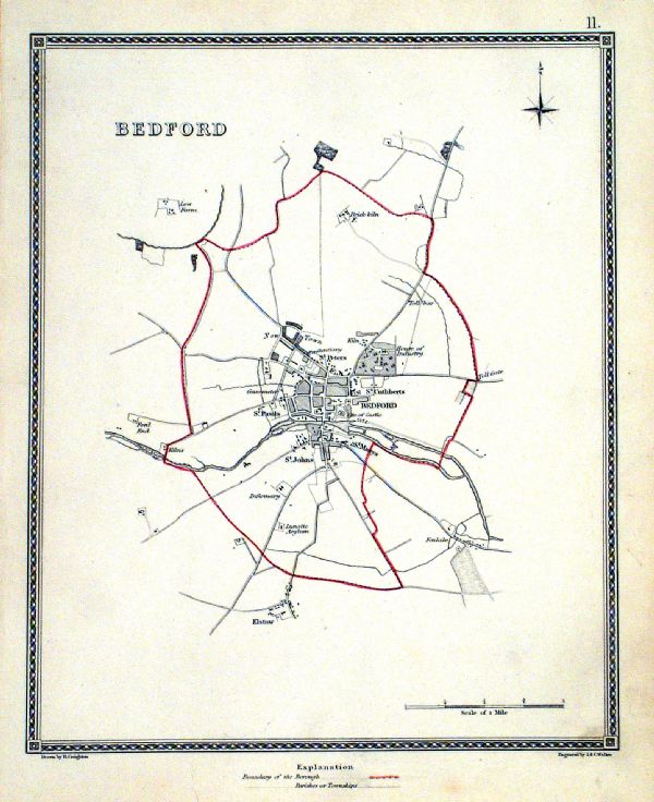
Bedford (Beds)
Dawson - Boundary Commission
1837 From 'Municipal Corporation Boundaries Report ' Large Paper Edition. Page size: 420 x 500mm plate size: 220 x 340 mm A few small spots of foxing Antique Map Ref GBM011 £28.00 (+P&P) click image for enlargement |
 |
Bedford Dawson - Boundary
Commission 1837 From 'Municipal Corporation Boundaries Report ' size: 200 x 300 mm Antique Map Ref FDM118 £26.00 (+P&P) click image for enlargement |
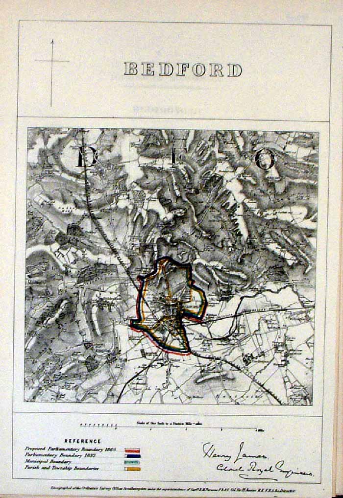 |
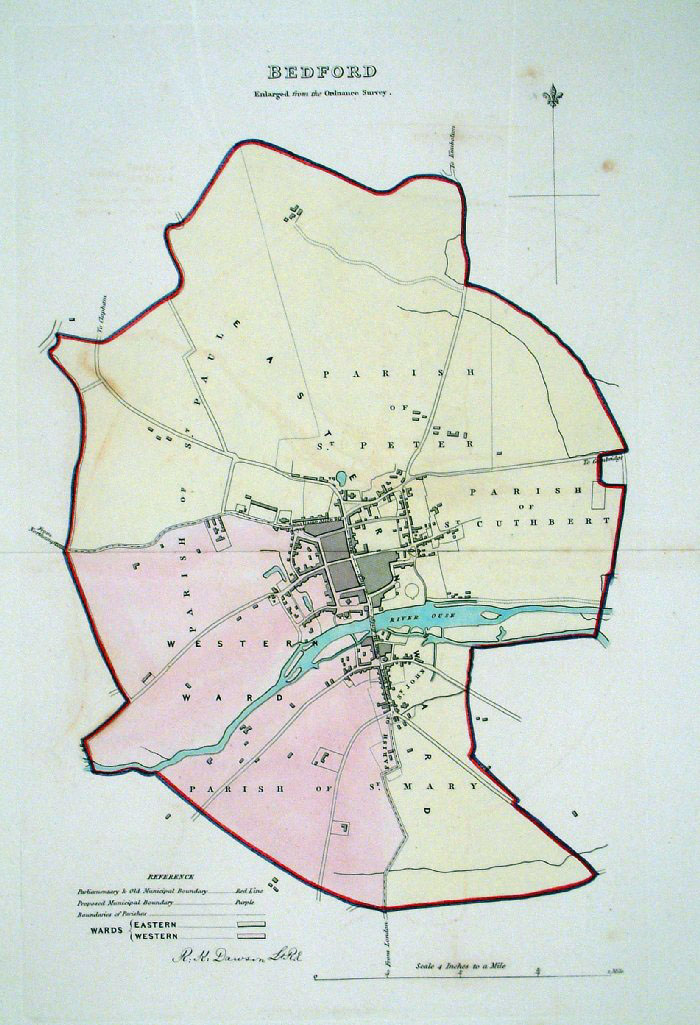
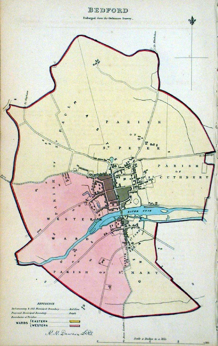
Bedford
James - Boundary
Commission 1868 The map is accompanied by a page of descriptive text relating to the borough statistics Zincograph Size: 240 x 360 mm Original colouring of boundaries Antique Map Ref HJS007 £20.00 (+P&P) click image for enlargement |
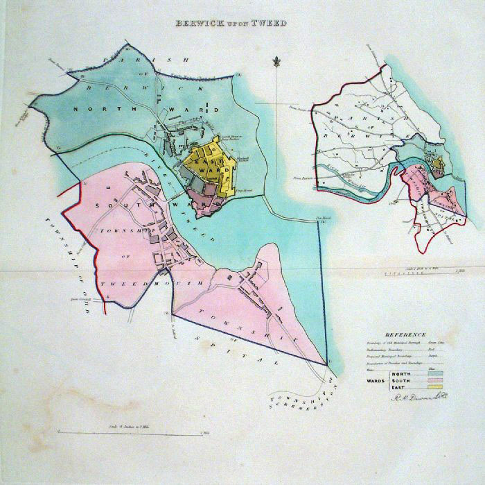 |
Berwick Upon Tweed (Northumberland)
Dawson - Boundary Commission
1837 From 'Municipal Corporation Boundaries Report ' Large Paper Edition size: 250 x 300 mm 1 fold, very faint offset transfer Antique Map Ref GBM012 £26.00 (+P&P) click image for enlargement |
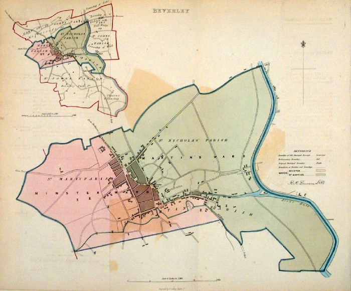 |
Beverley (Yorkshire)
Dawson - Boundary Commission 1837 From 'Municipal Corporation Boundaries Report ' size: 380 x 300 mm 2 folds, noticable offset transfer Antique Map Ref FDM076 £24.00 (+P&P) click image for enlargement |
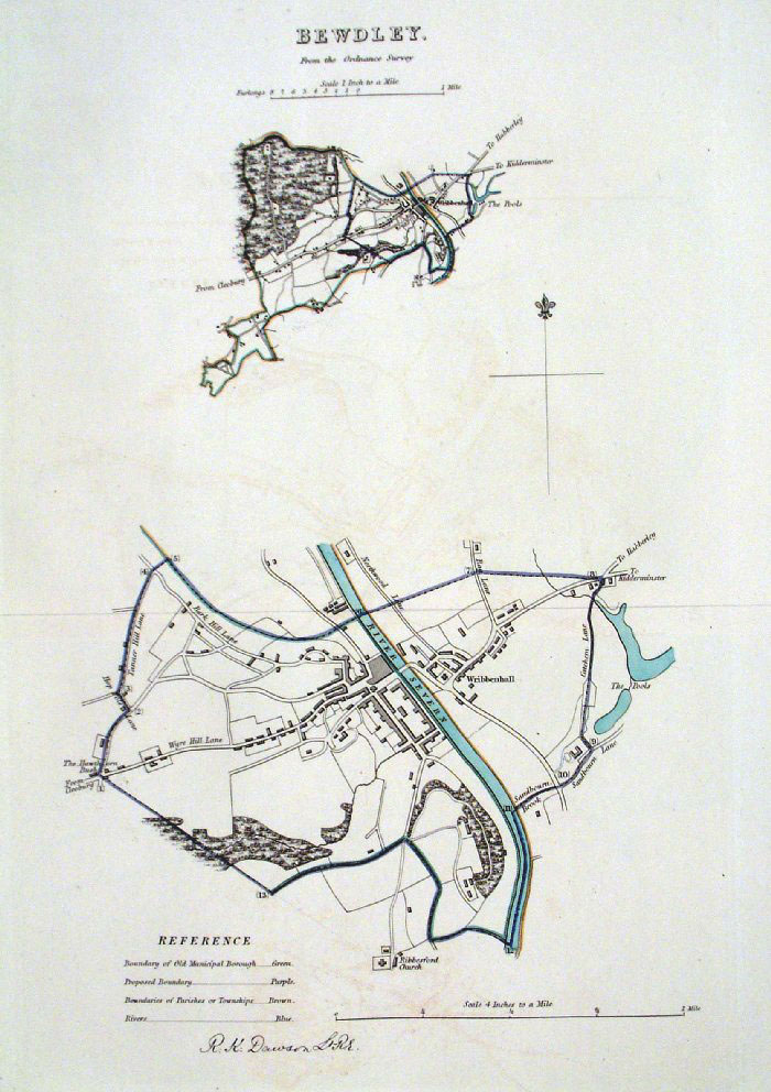 |
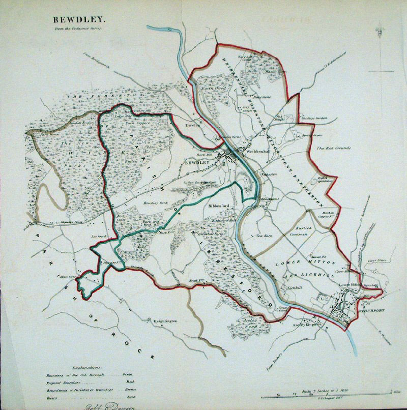
Bewdley (Worcs) Dawson -
Boundary Commission 1837 From 'Municipal Corporation Boundaries Report ' Large Paper Edition size: 250 x 300 mm 1 fold, very faint offset transfer Antique Map Ref GBM014 £28.00 (+P&P) click image for enlargement |
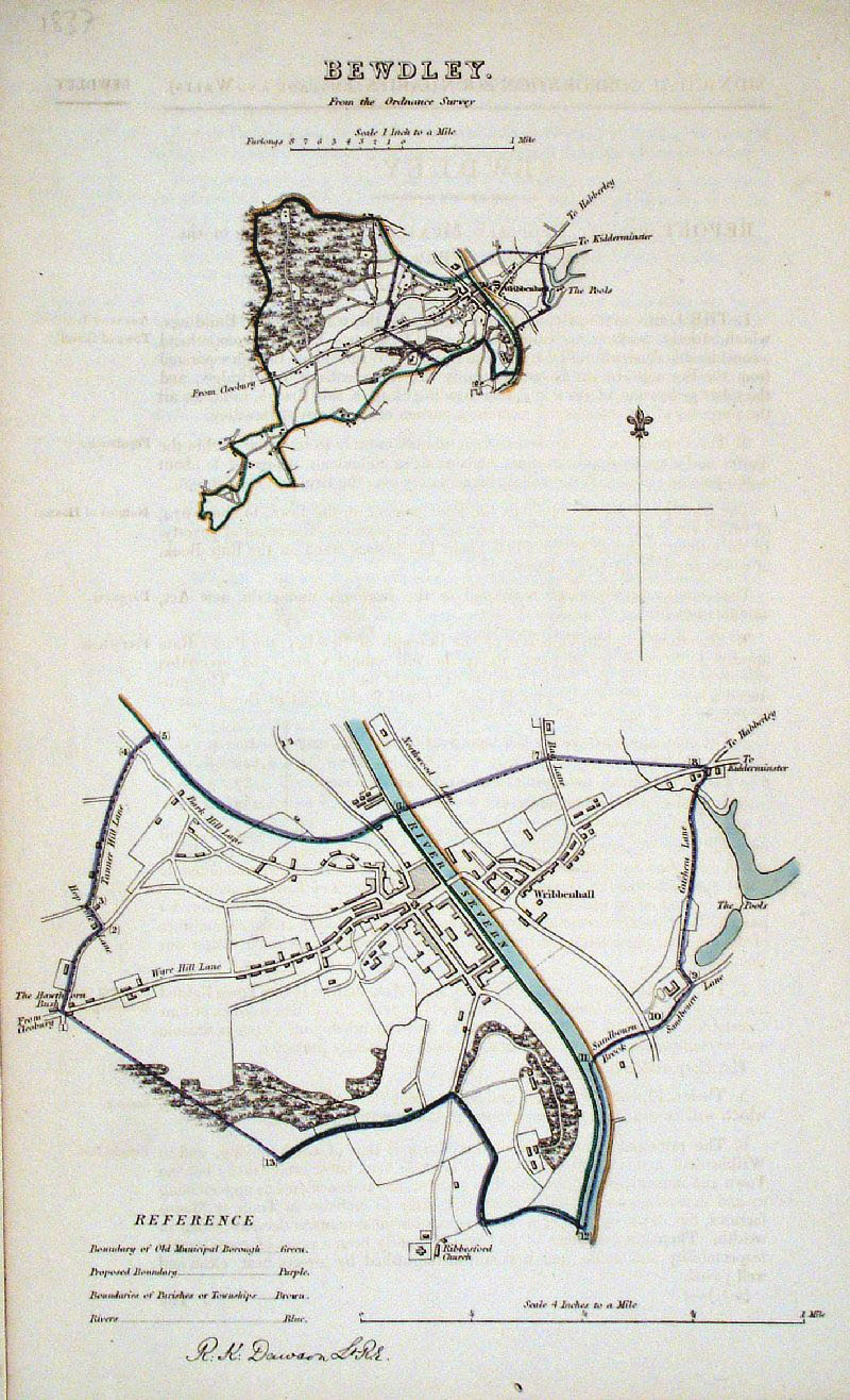 |
Bewdley (Worcs)
Dawson - Boundary Commission
1837 From 'Municipal Corporation Boundaries Report ' size: 200 x 300 mm faint offset transfer Antique Map Ref GDM229 £24.00 (+P&P) click image for enlargement |
 |
Bewdley (Worcs)
Dawson - Boundary Commission
1837 From 'Municipal Corporation Boundaries Report ' size: 310 x 300 mm faint offset transfer Antique Map Ref GDM230 £24.00 (+P&P) click image for enlargement |
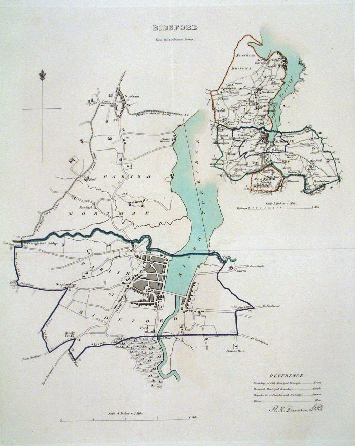 |
Bideford (Devon) Dawson -
Boundary Commission 1837 From 'Municipal Corporation Boundaries Report ' Large Paper Edition size: 250 x 300 mm 1 fold Antique Map Ref GBM015 £28.00 (+P&P) click image for enlargement |
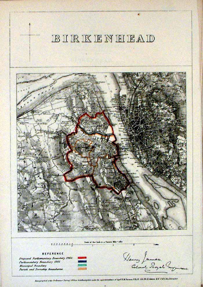 |
Birkenhead (Cheshire)
James - Boundary
Commission 1868 The map is accompanied by a page of descriptive text relating to the borough statistics Zincograph Size: 240 x 360 mm Original colouring of boundaries Antique Map Ref HJS008 £24.00 (+P&P) click image for enlargement |
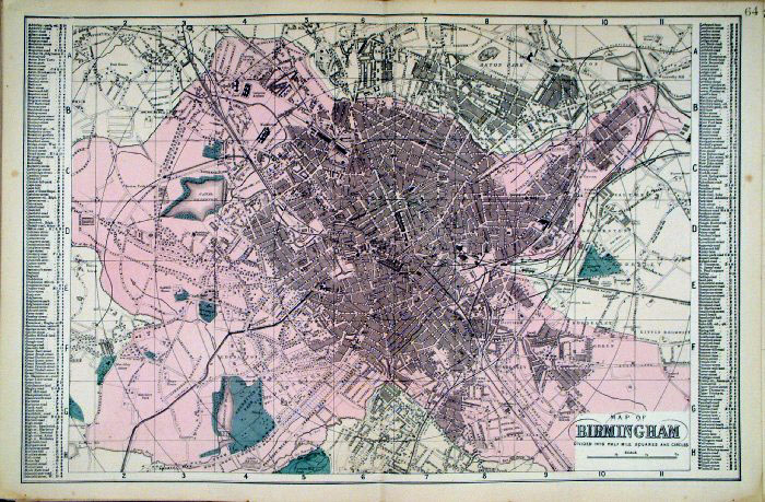 |
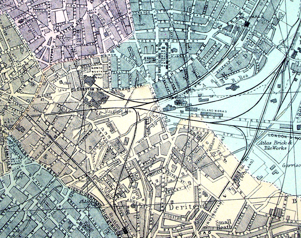
Birmingham
Bacon c1883
size: 500 x 320 mm Antique Map Ref FLM150 £25.00 (+P&P) click image for enlargement |
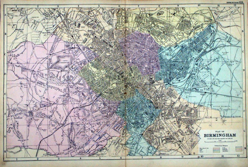 |
Plan of Birmingham From the New Large Scale Atlas of the British Isles by G.W. Bacon 1892 size: 500 x 330 mm, centre fold Ref LHM071 £25.00 (+P&P) Detail click image for enlargement |
 |
Birmingham Samuel Lewis 1835 engraved by J & C Walker Steel engraving Size: 250 x 200 mm, Original colouring of boundaries. Antique Map Ref KJM097 £22.00 (+P&P) Sample, not of this specific map, to indicate the level of detail of these 1835 Lewis town plans and town environs. click image for enlargement |
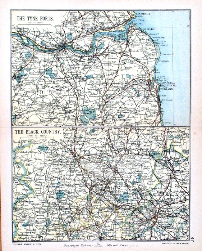 |
Environs of Birmingham - The Black Country and Environs of Newcastle - The Tyne Ports George Philip 1898 size: 180 x 220 mm, centre fold, original printed colour Antique Map Ref HHM052 £15.00 (+P&P) click image for enlargement |
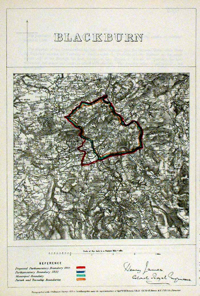 |
Blackburn (Lancs)
James - Boundary
Commission 1868 The map is accompanied by a page of descriptive text relating to the borough statistics Zincograph Size: 240 x 360 mm Original colouring of boundaries Antique Map Ref HJS009 £20.00 (+P&P) click image for enlargement |
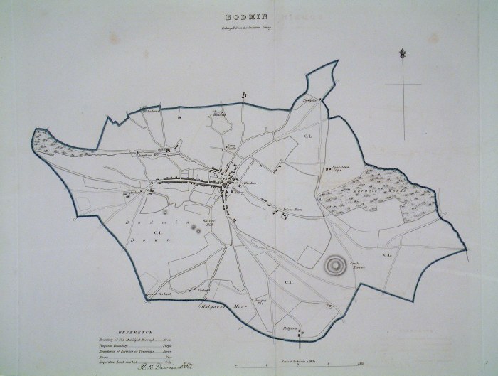 |
Bodmin (Cornwall)
Dawson - Boundary Commission
1837 From 'Municipal Corporation Boundaries Report ' Large Paper Edition. Page size: 500 x420 mm plate size: 380 x 340 mm Antique Map Ref GBM017 £28.00 (+P&P) click image for enlargement |
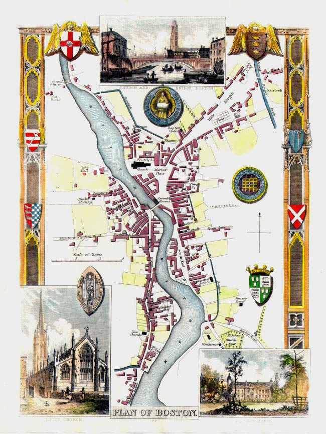 |
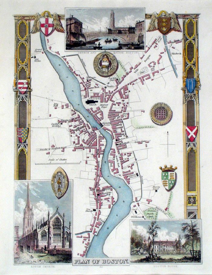
Plan of Boston (Lincs) Moule c1845 size: 210 x 260 mm Antique Map Ref IFM047 £42.00 (+P&P) Antique Map Ref KGM012 £42.00 (+P&P) click image for enlargement |
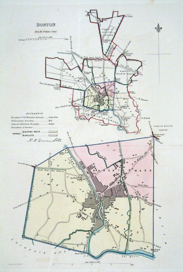 |
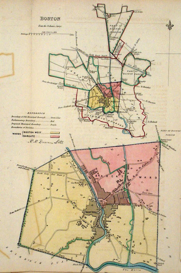
Boston (Lincs)
Dawson - Boundary
Commission 1837 From 'Municipal Corporation Boundaries Report ' Large Paper Edition. Page size: 420 x 500mm plate size: 240 x 340 mm Antique Map Ref GBM018 £28.00 (+P&P) click image for enlargement |
 |
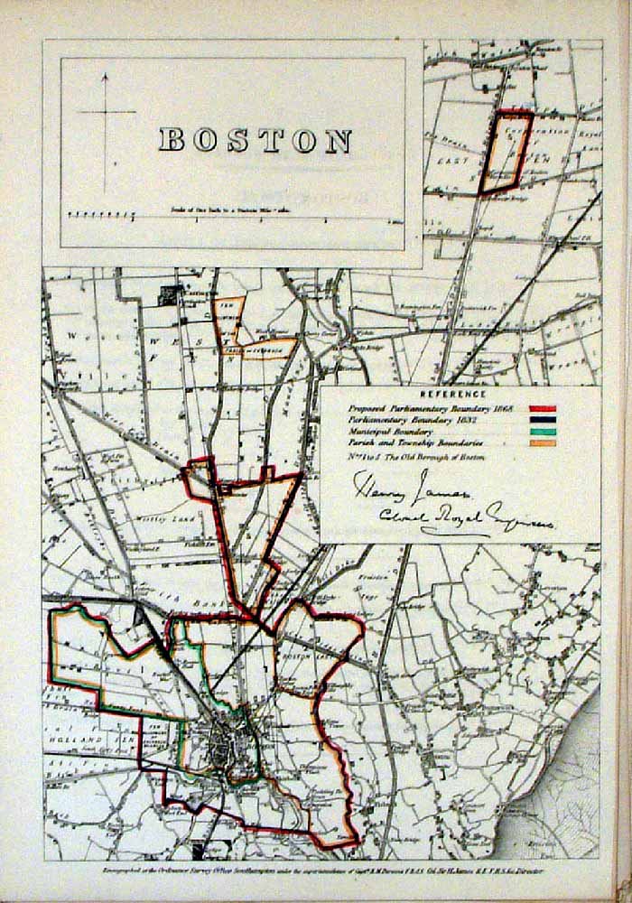
Boston (Lincs) Dawson -
Boundary Commission 1837 From 'Municipal Corporation Boundaries Report ' size: 220 x 300 mm 1 fold, some offset transfer Antique Map Ref FDM120 £26.00 (+P&P) click image for enlargement |
 |
Boston Samuel Lewis 1835 engraved by J & C Walker Steel engraving Size: 200 x 250 mm, Original colouring of boundaries. Antique Map Ref KJM053 £18.00 (+P&P) Sample, not of this specific map, to indicate the level of detail of these 1835 Lewis town plans. click image for enlargement |
 |
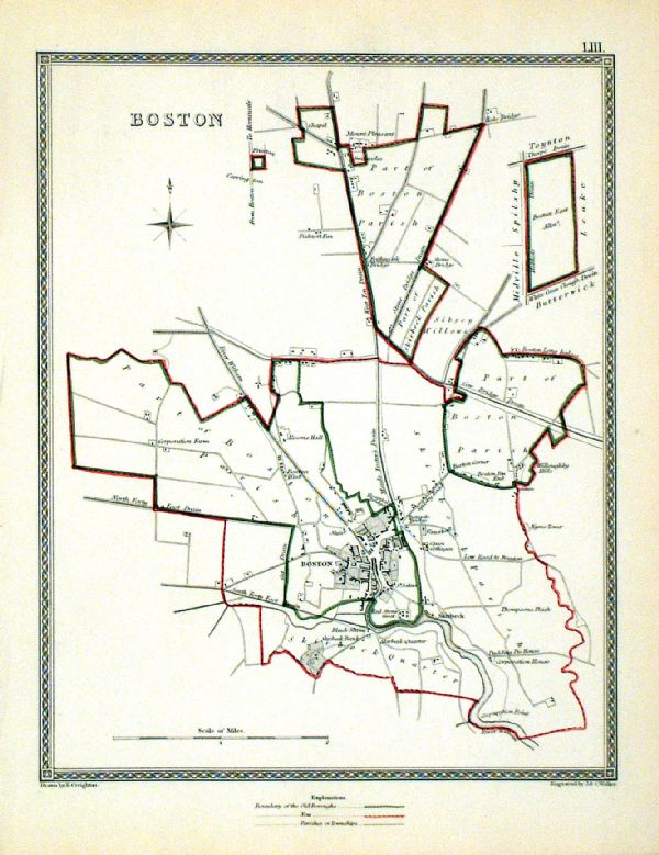
Boston (Lincs)
James - Boundary Commission
1868 The map is accompanied by a page of descriptive text relating to the borough statistics Zincograph Size: 240 x 360 mm Original colouring of boundaries Antique Map Ref HJS010 £20.00 (+P&P) click image for enlargement |
 |
Plan of Bradford From the New Large Scale Atlas of the British Isles by G.W. Bacon 1892 size: 450 x 330 mm, centre fold Ref LHM072 £26.00 (+P&P) Detail click image for enlargement |
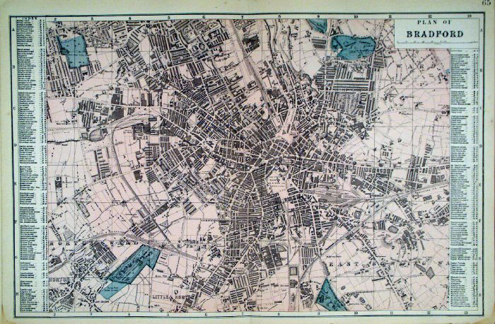 |
Bradford
Bacon c1883
size: 500 x 320 mm Antique Map Ref FLM151 £24.00 (+P&P) click image for enlargement |
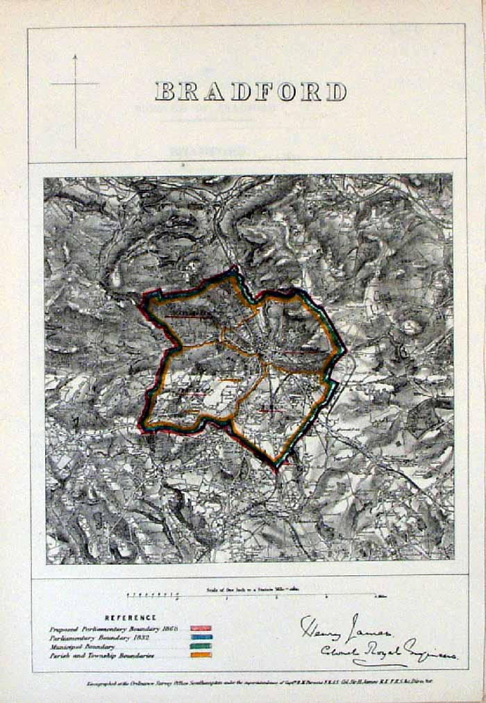 |
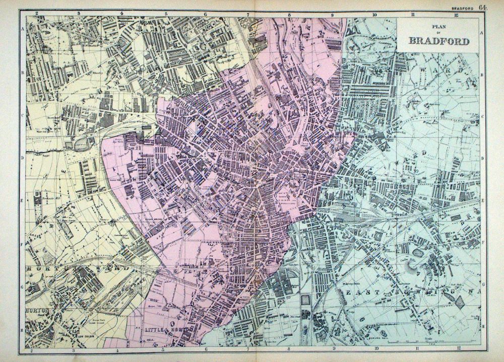
Bradford (Yorkshire)
James - Boundary
Commission 1868 The map is accompanied by a page of descriptive text relating to the borough statistics Zincograph Size: 240 x 360 mm Original colouring of boundaries Antique Map Ref HJS011 £18.00 (+P&P) click image for enlargement |
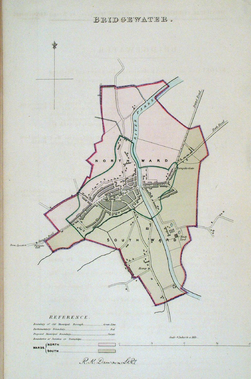 |
Bridgewater (Somerset)
Dawson - Boundary Commission 1837 From 'Municipal Corporation Boundaries Report ' size: 200 x 300 mm Antique Map Ref GDM233 £28.00 (+P&P) click image for enlargement |
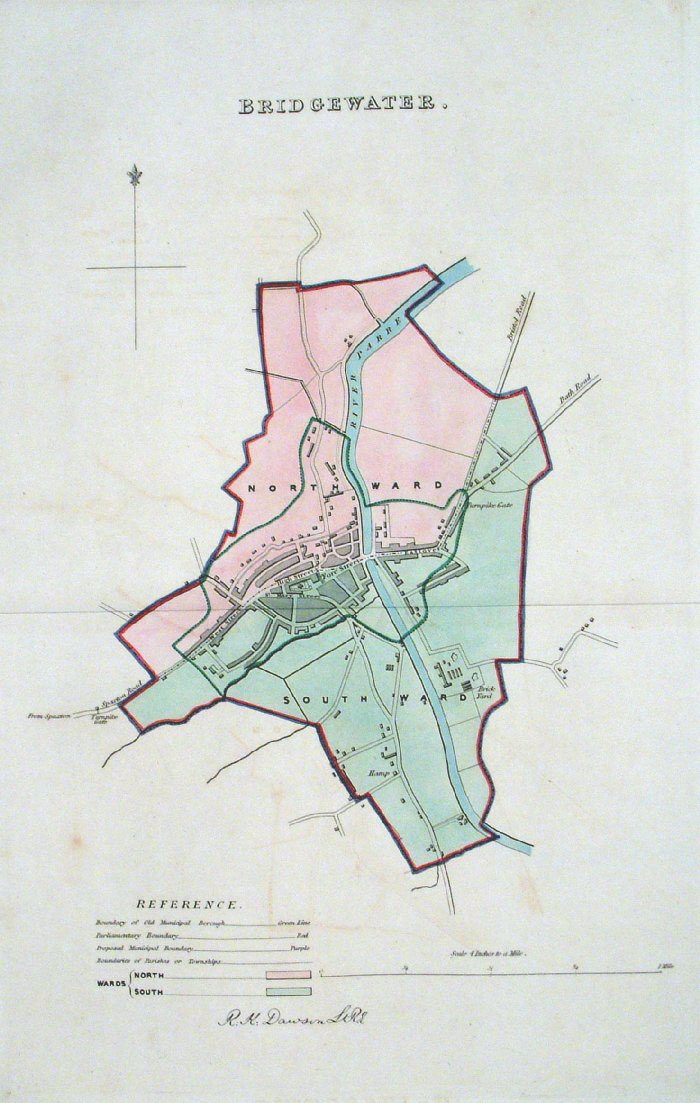 |
Bridgewater (Somerset)
Dawson - Boundary Commission 1837 From 'Municipal Corporation Boundaries Report ' Large Paper Edition size: 250 x 300 mm 1 fold, very faint offset transfer Antique Map Ref GBM021 £28.00 (+P&P) click image for enlargement |
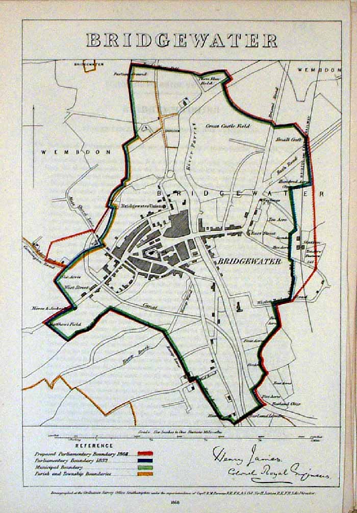 |
Bridgewater (Somerset)
James - Boundary
Commission 1868 The map is accompanied by a page of descriptive text relating to the borough statistics Zincograph Size: 240 x 360 mm Original colouring of boundaries Antique Map Ref HJS012 £20.00 (+P&P) click image for enlargement |
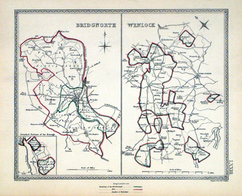 |
Bridgnorth . Wenlock Samuel Lewis 1835 engraved by J & C Walker Steel engraving Size: 250 x 200 mm, Original colouring of boundaries. Antique Map Ref KJM073 £16.00 (+P&P) Sample, not of this specific map, to indicate the level of detail of these 1835 Lewis town plans and town environs. click image for enlargement |
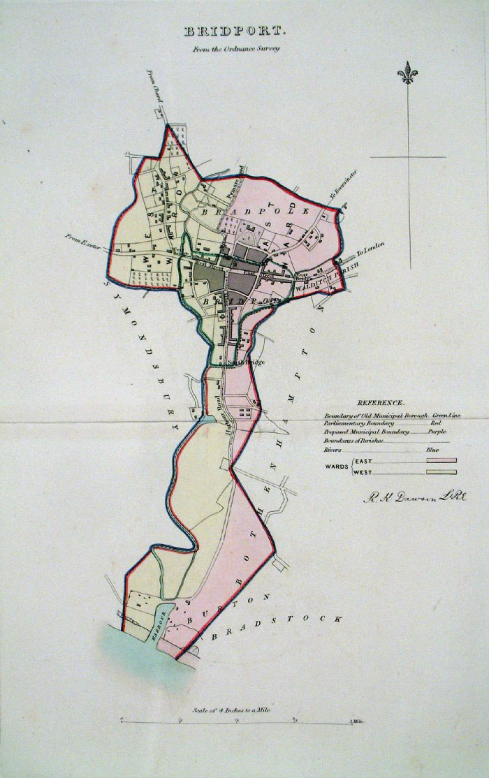 |
Bridport (Devon) Dawson -
Boundary Commission 1837 From 'Municipal Corporation Boundaries Report ' Large Paper Edition size: 250 x 300 mm 1 fold Antique Map Ref GBM022 £28.00 (+P&P) click image for enlargement |
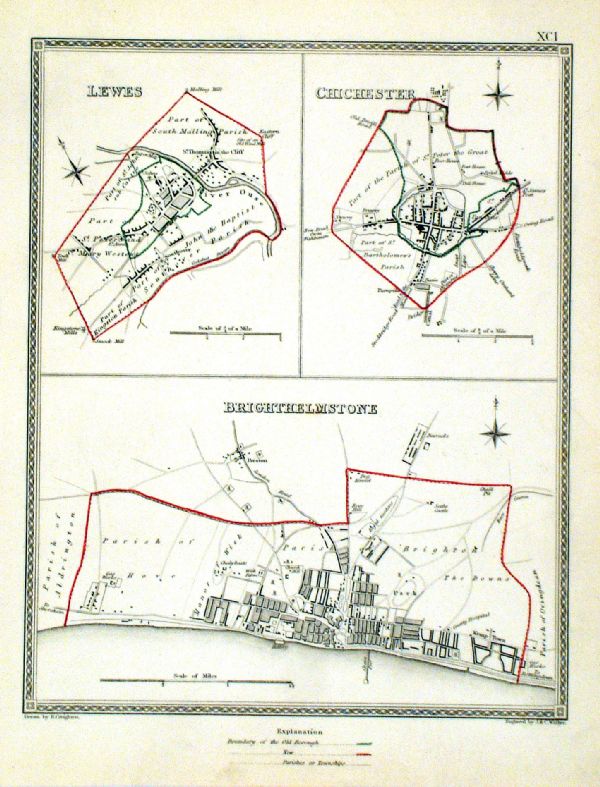 |
Brighthelmstone (Brighton) . Lewes . Chichester Samuel Lewis 1835 engraved by J & C Walker Steel engraving Size: 200 x 250 mm, Original colouring of boundaries. Antique Map Ref KJM091 £20.00 (+P&P) Sample, not of this specific map, to indicate the level of detail of these 1835 Lewis town plans. click image for enlargement |
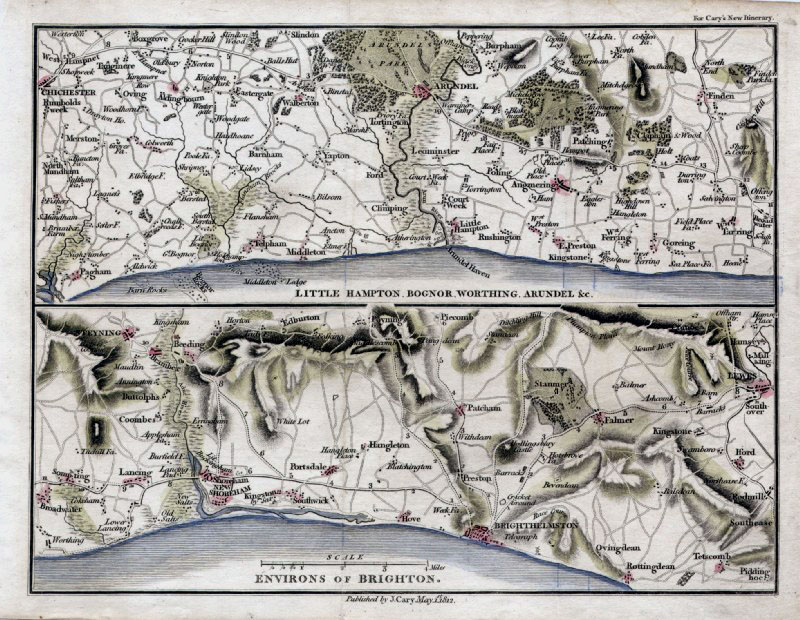 |
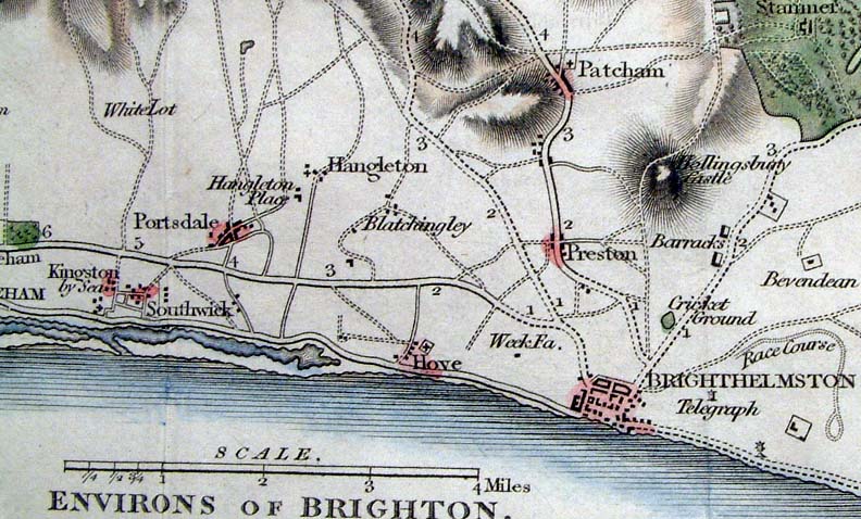
Environs of Brighton
Cary 1812
size: 230 x 170
mm Area covers: Brighton, Arundel, Lewes, Chichester Antique Map Ref GDM159 £22.00 (+P&P) click image for enlargement |
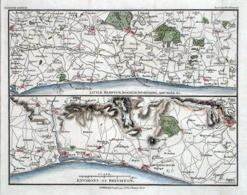 |
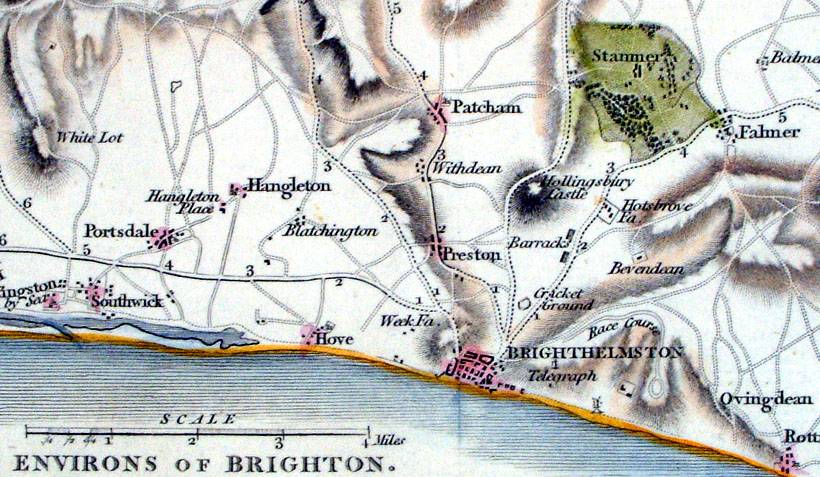
Environs of Brighton
Cary 1828
size: 230 x 170
mm Area covers: Brighton, Arundel, Lewes, Chichester Antique Map Ref ILM013 £22.00 (+P&P) click image for enlargement Detail |
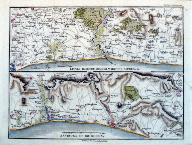 |
Environs of Brighton
Cary 1812
size: 230 x 170
mm Area covers: Brighton, Arundel, Lewes, Chichester Antique Map Ref LEM067 £22.00 (+P&P) click image for enlargement Detail |
 |
Brighton & Eastbourne (Sussex)
Philips 1830
size: 155 x 90 mm Antique Map Ref AAM031 £16.00 (+P&P) click image for enlargement |
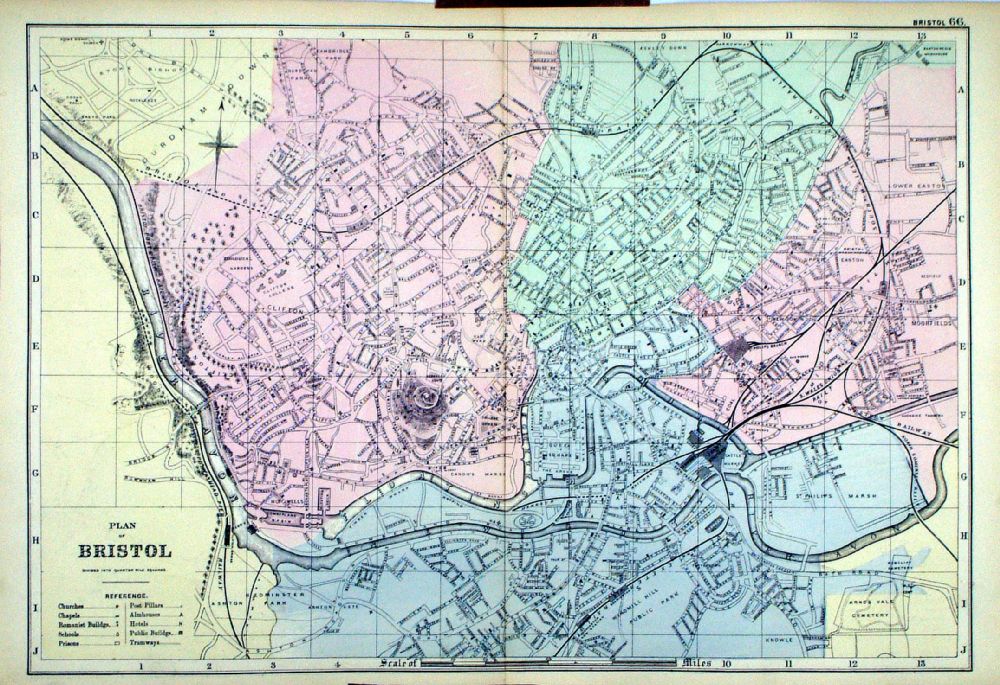 |
Plan of Bristol From the New Large Scale Atlas of the British Isles by G.W. Bacon 1892 size: 480 x 330 mm, centre fold Ref LHM074 £30.00 (+P&P) Detail click image for enlargement |
 |
Bromley - West Wickham, Hayes,
Beckenham, Shirley, Croydon Bacon 1904 size: 470 x 320 mm Antique Map Ref GAM001 £28.00 (+P&P) click image for enlargement |
 |
Bromley - West Wickham,
Farnborough, Addington Bacon c1920 size: 470 x 320 mm Antique Map Ref BAM002 £28.00 (+P&P) click image for enlargement |
 |
Bromley - Keston, Farnborogh,
Orpington, Downe, Chelsfield Bacon c1920 size: 470 x 320 mm Antique Map Ref GAM003 £28.00 (+P&P) click image for enlargement |
 |
Bromley & Beckenham Bacon c1920 size: 470 x 320 mm Antique Map Ref GAM004 £30.00 (+P&P) click image for enlargement |
 |
Bromley - Keston, Farnborogh,
Orpington, Downe, Chelsfield Bacon 1916 size: 470 x 320 mm Antique Map Ref GAM005 £28.00 (+P&P) click image for enlargement |
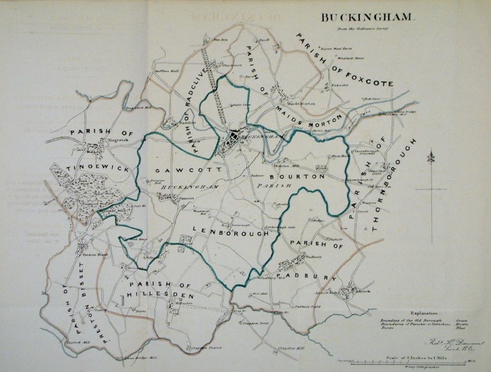 |
Buckingham Dawson
- Boundary Commission 1832 From 'Municipal Corporation Boundaries Report ' size: 420 x 320 mm 2 folds Faint offset transfer Antique Map Ref FEM045 £26.00 (+P&P) |
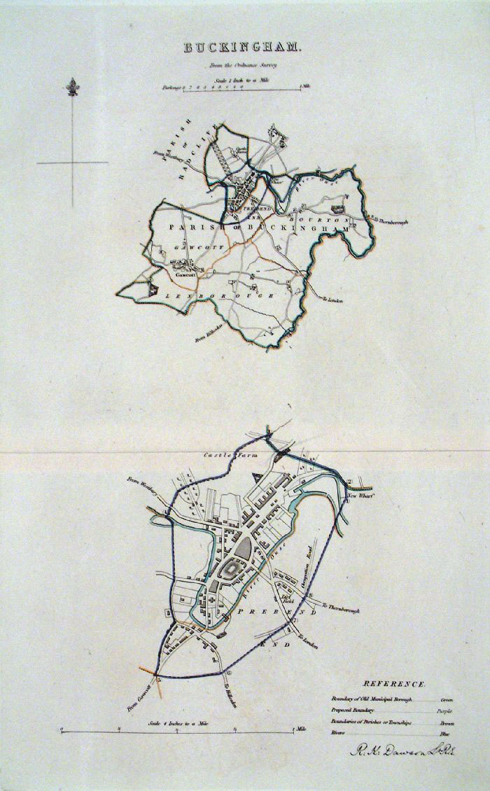 |
Buckingham (Bucks) Dawson
- Boundary Commission 1837 From 'Municipal Corporation Boundaries Report ' Large Paper Edition. Page size: 420 x 500mm plate size: 220 x 340 mm Antique Map Ref GBM025 £28.00 (+P&P) click image for enlargement |
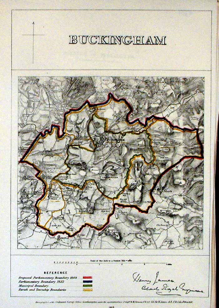 |
Buckingham
James - Boundary
Commission 1868 The map is accompanied by a page of descriptive text relating to the borough statistics Zincograph Size: 240 x 360 mm Original colouring of boundaries Antique Map Ref HJS013 £20.00 (+P&P) click image for enlargement |
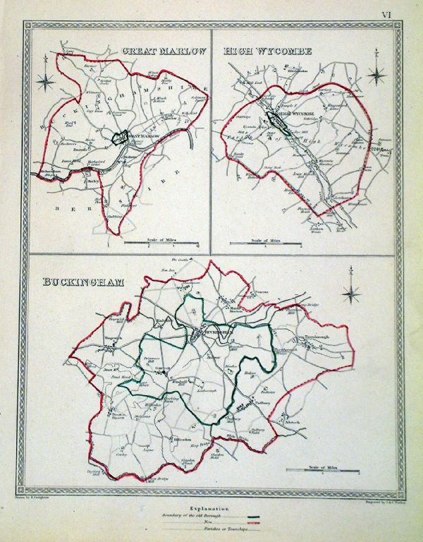 |
Buckingham . Great Marlow . High Wycombe Samuel Lewis 1835 engraved by J & C Walker Steel engraving Size: 200 x 250 mm, Original colouring of boundaries. Antique Map Ref KJM006 £16.00 (+P&P) Sample, not of this specific map, to indicate the level of detail of these 1835 Lewis town plans. click image for enlargement |
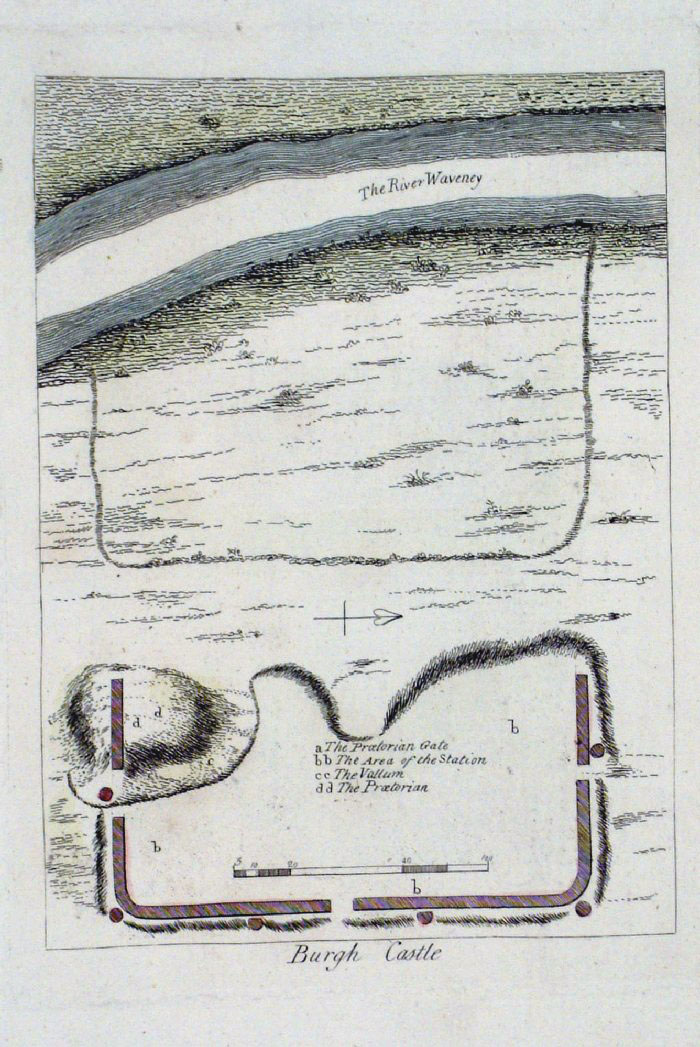 |
Burgh Castle plan (Suffolk)
Grose 1787 size: 150 x 200 mm Antique Map Ref FHM023 £18.00 (+P&P) click image for enlargement |
 |
Bury (Lancs) James
- Boundary Commission 1868 The map is accompanied by a page of descriptive text relating to the borough statistics Zincograph Size: 240 x 360 mm Original colouring of boundaries Antique Map Ref HJS018 £20.00 (+P&P) click image for enlargement |
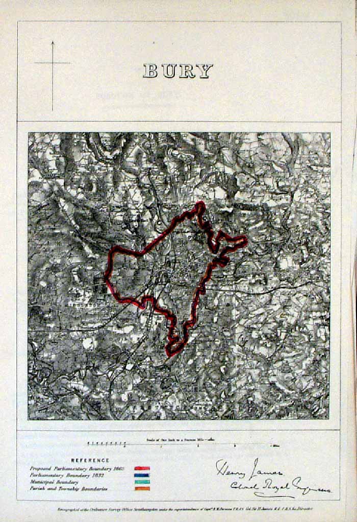 |
Bury (Lancs) James
- Boundary Commission 1868 The map is accompanied by a page of descriptive text relating to the borough statistics Zincograph Size: 240 x 360 mm Original colouring of boundaries Antique Map Ref HJS014 £20.00 (+P&P) click image for enlargement |
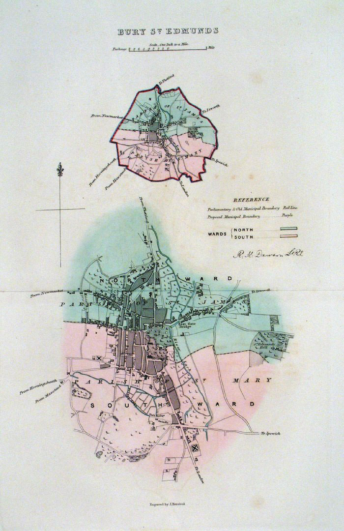 |
Bury St Edmunds (Suffolk)
Dawson - Boundary Commission 1837 From 'Municipal Corporation Boundaries Report ' Large Paper Edition size: 250 x 300 mm 1 fold, faint foxing Antique Map Ref GBM026 £30.00 (+P&P) click image for enlargement |
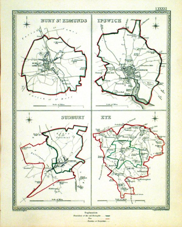 |
Bury St Edmunds . Ipswich . Sudbury . Eye Samuel Lewis 1835 engraved by J & C Walker Steel engraving Size: 200 x 250 mm, Original colouring of boundaries. Antique Map Ref KJM086 £18.00 (+P&P) Sample, not of this specific map, to indicate the level of detail of these 1835 Lewis town plans. click image for enlargement |
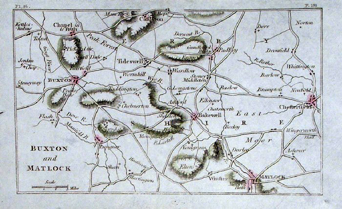 |
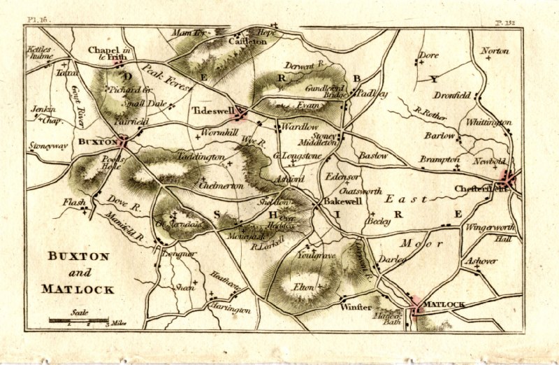
Buxton & Matlock (Debyshire)
Philips c1830
size: 140 x 90 mm Antique Map Ref GBM222 £18.00 (+P&P) Antique Map Ref GEM037 £18.00 (+P&P) click image for enlargement |
More Town Plans: C - G H - L M - R S - Y Scotland All Genuine Antiquarian Maps - No Reproductions or Modern Copies |
2023