Past Pages
Antique Maps, Prints and Ephemera
Antique Maps of Scottish Town & Street Plans
Including castle plans, cathedral plans, church plans, Boundary Commission maps, local suburban maps
For Irish Town plans see section: Maps - Europe / Ireland
For London see section: Maps - London
Arranged alphabetically by town or locality (not by name of church , hospital, etc)
For local interest also see Road Maps section.
Note that some maps have two or three towns, making alphabetic searching difficult and sometimes prone to error.
A Brief Article on Town Plans Help on local area maps
England and Wales Town Plans: A - B C - G H - L M - R S - Y
 |
The Environs of
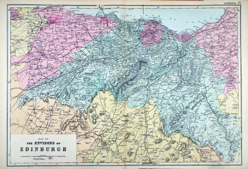
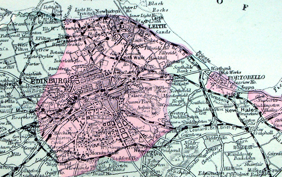
Edinburgh From the New Large Scale Atlas of the British Isles by G.W. Bacon 1892 size: 480 x 340 mm, centre fold Ref LHM083 £25.00 (+P&P) Detail click image for enlargement |
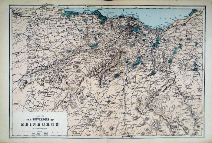 |
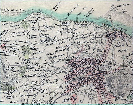
Edinburgh Environs
Bacon c1883
size: 500 x 320 mm Antique Map Ref FLM179 £25.00 (+P&P) click image for enlargement |
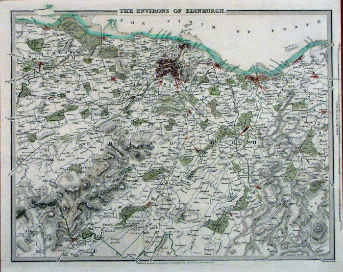 |
Edinburgh Environs SDUK 1838
size: 410 x 340 mm Antique Map Ref AAM071 £25.00 (+P&P) click image for enlargement Detail
|
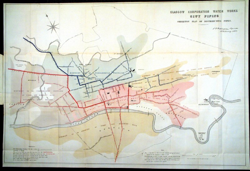 |
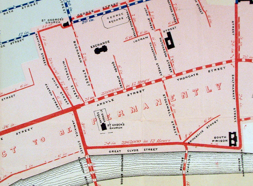
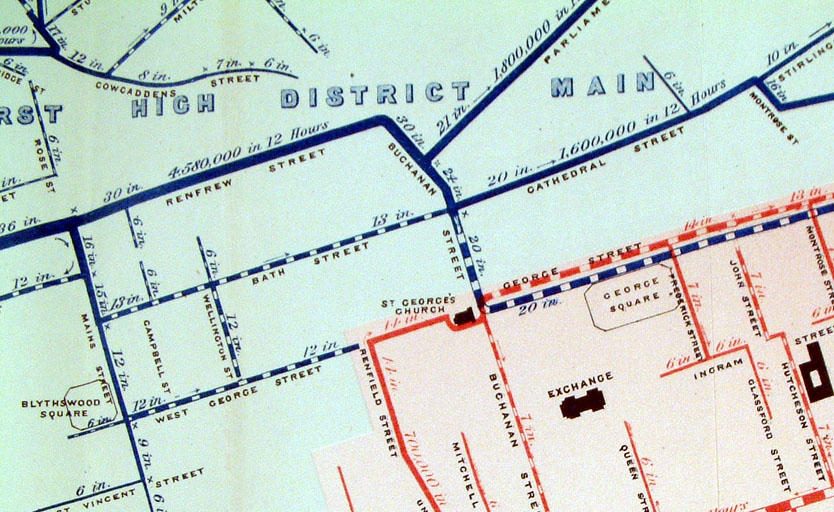
Glasgow Corporation Water Works - City
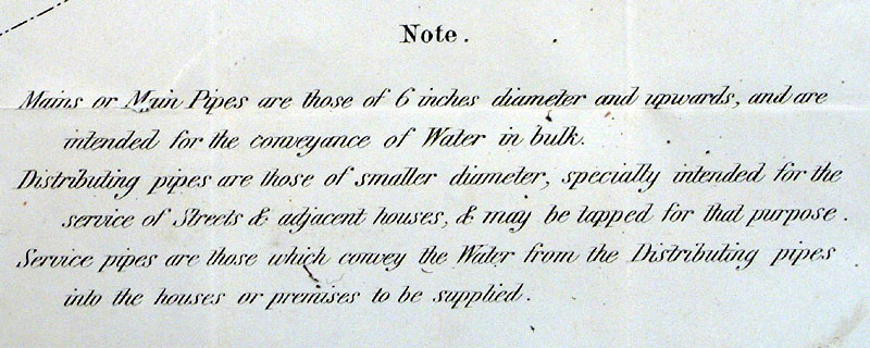
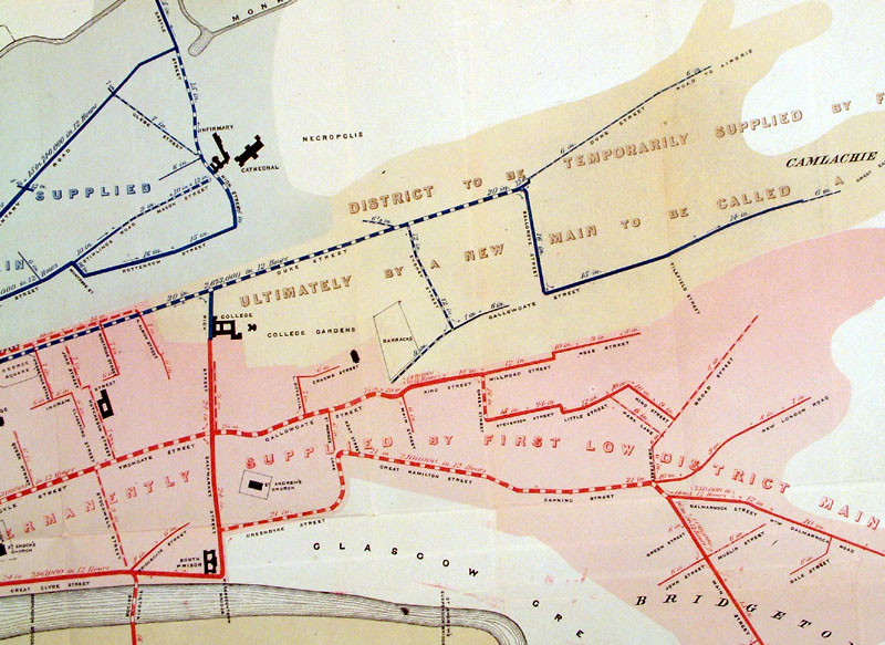
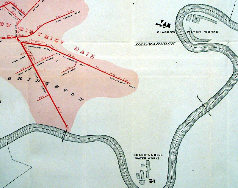
Piping Skeleton Plan of Distribution Pipes Maclure & Macdonald 1858 Lithograph size: 980 x 660 mm many folds, some repairs to split folds. A map of proposed new water supply pipes for Glasgow. Existing pipes are shown hatched ( or dotted ), New pipes are shown solid. All pipes indicate direction of flow, size of pipe and expected capacity in 12 hours. Antique Map Ref HHM053 £55.00 (+P&P) Detail 1 Detail 2 Detail 3 Detail 4 Detail 5 click image for enlargement |
 |
Glasgow Bacon
c1883
size: 500 x 320 mm Antique Map Ref FLM158 [ HBS005 - 1912 ] £25.00 (+P&P) click image for enlargement |
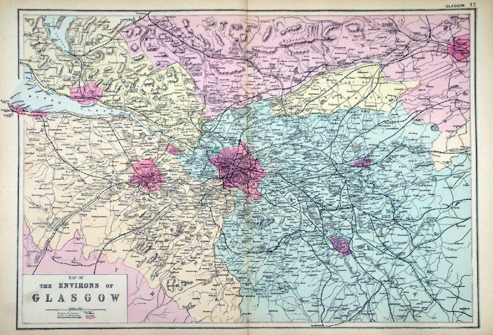 |
Environs of Glasgow From the New Large Scale Atlas of the British Isles by G.W. Bacon 1892 size: 480 x 330 mm, centre fold Ref LHM085 £25.00 (+P&P) Detail click image for enlargement |
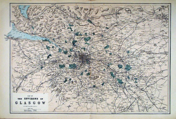 |
Glasgow Environs
Bacon c1883
size: 500 x 320 mm Antique Map Ref FLM180 £25.00 (+P&P) click image for enlargement |
 |
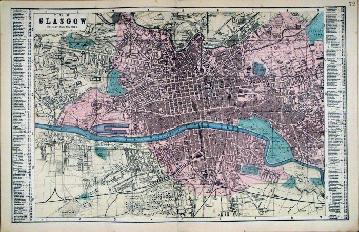
Glasgow Fullarton
c1861
size: 230 x 150 mm Antique Map Ref GBM241 £24.00 (+P&P) click image for enlargement |
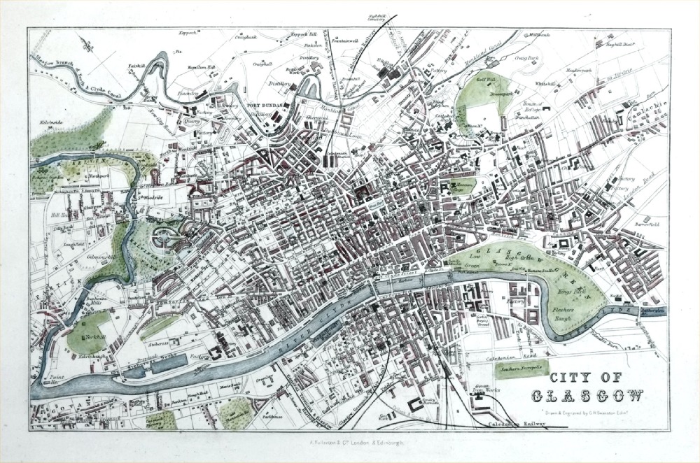 |
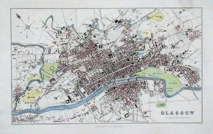
Glasgow
Fullarton c1861
size: 230 x 150 mm Antique Map Ref PGM035 £24.00 (+P&P) click image for enlargeme |
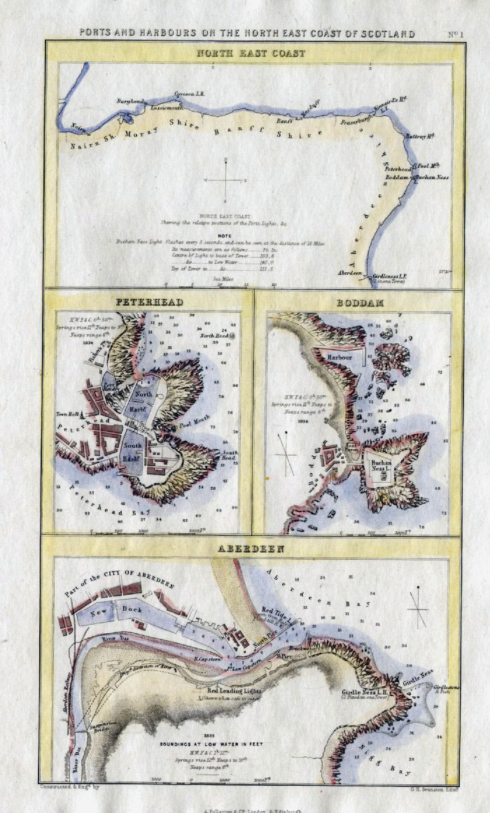 |
Scottish Ports - Ports and Harbours on
the North East coast Scotland: Aberdeen, Peterhead, Boddam, North East Coast Fullarton c1861 size: 140 x 240mm Antique Map Ref GBM252 £20.00 (+P&P) click image for enlargement |
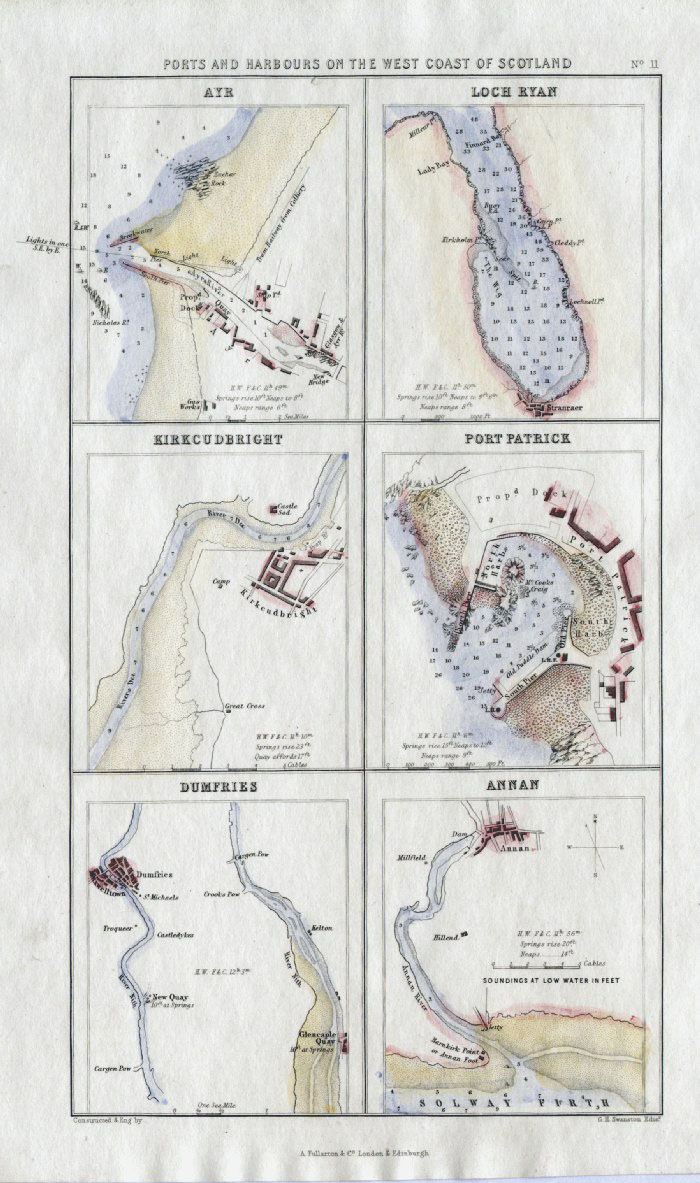 |
Scottish Ports - Ports and Harbours on
the West Coast Scotland: Ayre, Annan, Dumfries, Port Patrick, Loch Ryan, Kirkcudbright Fullarton c1861 size: 140 x 240mm Antique Map Ref GBM258 £20.00 (+P&P) click image for enlargement |
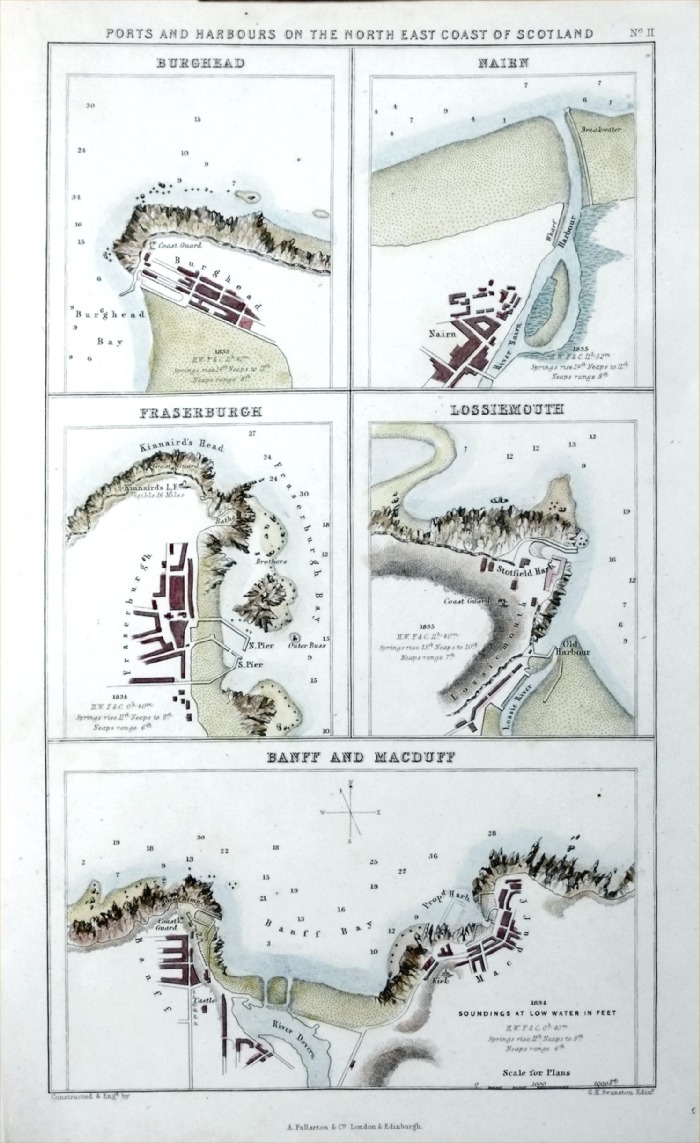 |
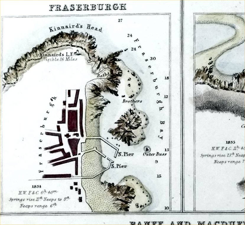
Ports and Harbours on
the North East coast of Scotland: Burghead, Nairn, Fraserburgh, Lossiemouth, Banff & Macduff Fullarton c1861 size: 140 x 240mm Detail Antique Map Ref PGM053 £20.00 (+P&P) click image for enlargement |
England and Wales Town Plans: A - B C - G H - L M - R S - Y All Genuine Antiquarian Maps - No Reproductions or Modern Copies |
2023