Past Pages
Antique Maps, Prints and Ephemera
Antique Maps - UK Town & Street Plans
- C to G
England & WalesIncluding castle plans, cathedral plans, church plans,
Boundary Commission maps, local suburban maps
For Irish Town plans see section: Maps - Europe / Ireland
For London see section: Maps - London
Arranged alphabetically by town or locality (not by name of church , hospital, etc)
For local interest also see Road Maps section.
Note that some maps have two or three towns, making alphabetic searching difficult and sometimes prone to error.
A Brief Article on Town Plans Help on local area maps
More Town Plans: A - B H - L M - R S - Y Scotland
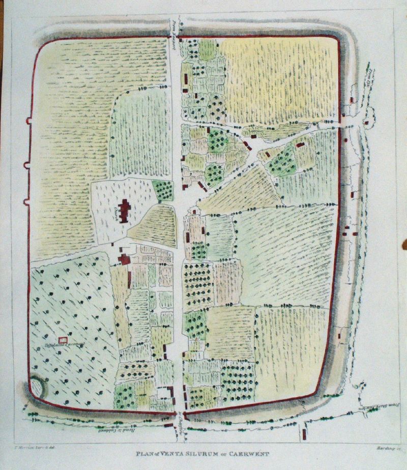 |
Caerwent (Monmouthshire) Plan of Venta Silurum or Caerwent Hardin / Morrice 1800 Shows 'Roads to ..' Usk, Caldecot, Shire Newton size: 250 x 300 mm 1 fold, very faint offest transfer Antique Map Ref IIM016 £35.00 (+P&P) click image for enlargement |
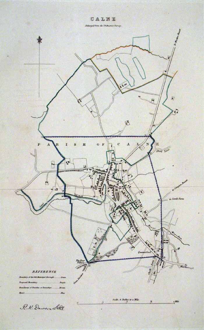 |
Calne (Wilts) Dawson
- Boundary Commission 1837 From 'Municipal Corporation Boundaries Report ' Large Paper Edition. Page size: 420 x 500mm plate size: 210 x 340 mm Antique Map Ref GBM027 £26.00 (+P&P) click image for enlargement |
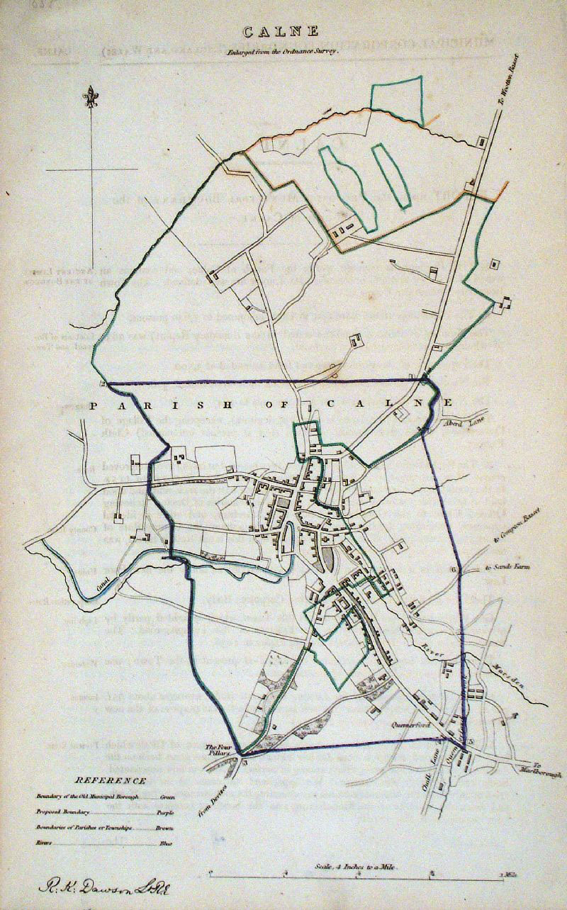 |
Calne (Wilts) Dawson
- Boundary Commission 1837 From 'Municipal Corporation Boundaries Report ' Large Paper Edition. Page size: 420 x 500mm plate size: 210 x 340 mm Antique Map Ref GDM238 £26.00 (+P&P) click image for enlargement |
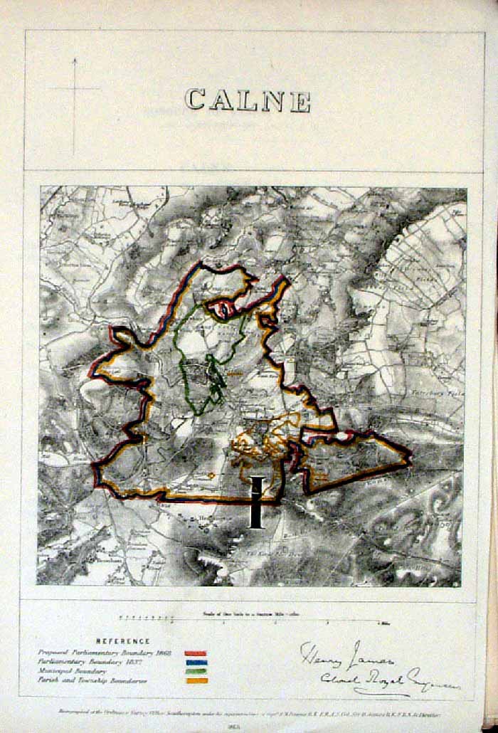 |
Calne (Wilts)
James
- Boundary Commission 1868 The map is accompanied by a page of descriptive text relating to the borough statistics Zincograph Size: 240 x 360 mm Original colouring of boundaries Antique Map Ref HJS015 £20.00 (+P&P) click image for enlargement |
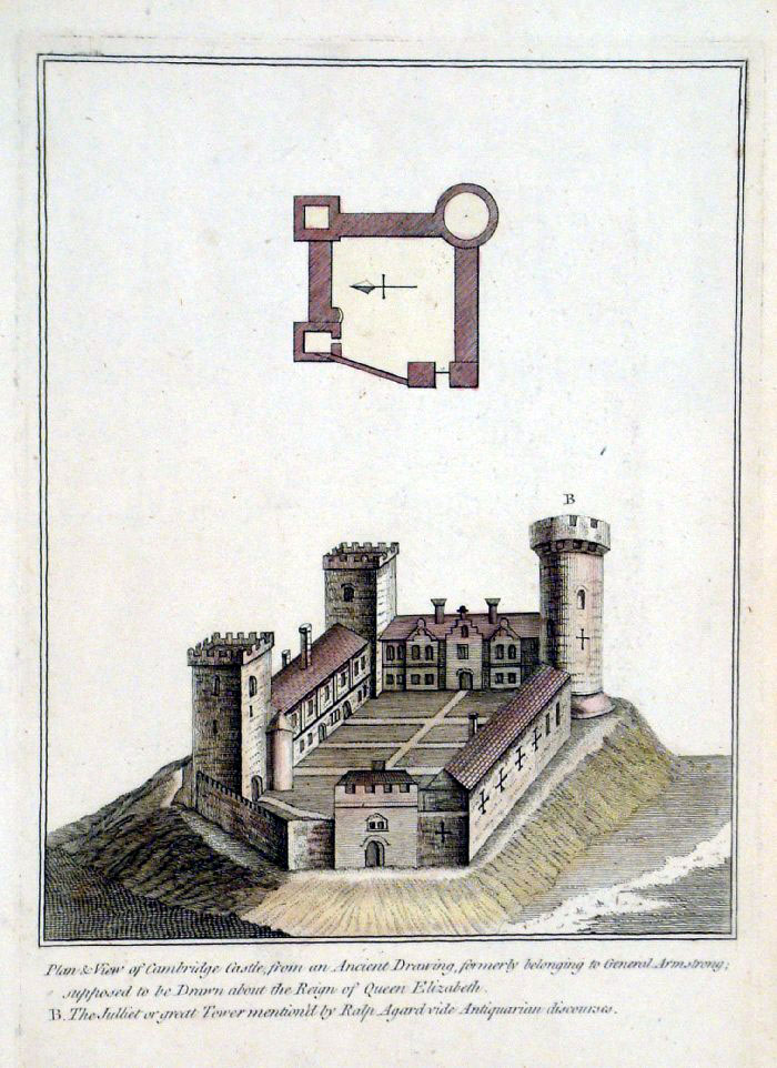 |
Cambridge Castle plan (Cambridgeshire)
Grose 1787 size: 160 x 210 mm Antique Map Ref FHM006 £18.00 (+P&P) click image for enlargement |
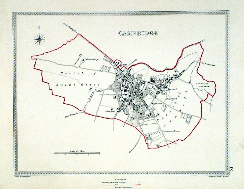 |
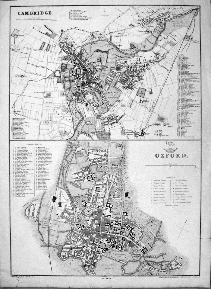
Cambridge Samuel Lewis 1835 engraved by J & C Walker Steel engraving Size: 250 x 200 mm, Original colouring of boundaries. Antique Map Ref KJM009 £25.00 (+P&P) Sample, not of this specific map, to indicate the level of detail of these 1835 Lewis town plans and town environs. click image for enlargement |
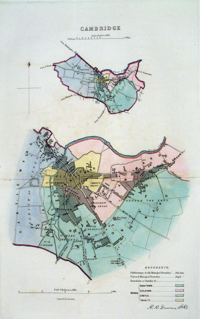 |
Cambridge Dawson -
Boundary Commission 1837 From 'Municipal Corporation Boundaries Report ' Large Paper Edition size: 250 x 300 mm 1 fold, very faint offest transfer Antique Map Ref GBM028 £35.00 (+P&P) click image for enlargement |
 |
Cambridge and Oxford
From the New Large Scale Atlas of the British Isles by G.W. Bacon 1892 size: 330 x 480 mm, centre fold Ref LHM098 £22.00 (+P&P) Detail Detail click image for enlargement |
 |
Cambridge and Oxford Lowry / Weekly Dispatch 1863 size: 330 x 450 mm several repaired tears at the margins Detail 1 Detail 2 Antique Map Ref ICM015 £18.00 (+P&P) click image for enlargement |
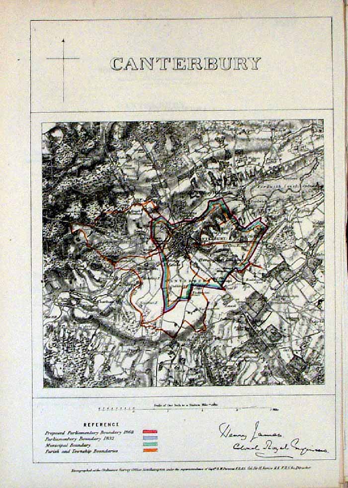 |
Canterbury (Kent)
James - Boundary Commission
1868 The map is accompanied by a page of descriptive text relating to the borough statistics Zincograph Size: 240 x 360 mm Original colouring of boundaries Antique Map Ref HJS016 £22.00 (+P&P) click image for enlargement |
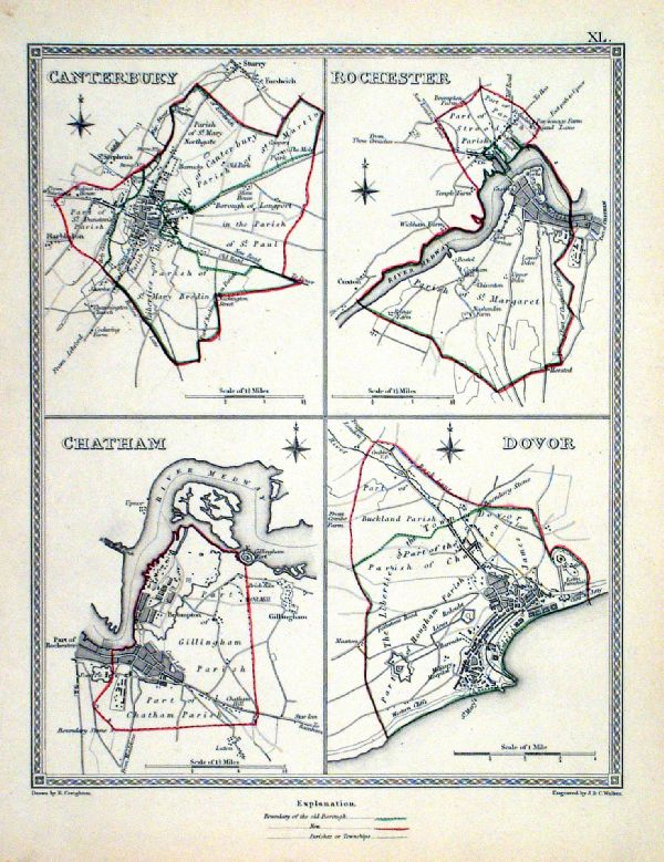 |
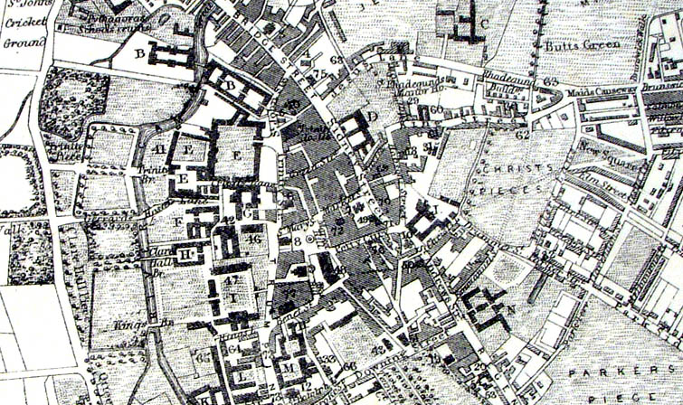
Canterbury . Rochester . Chatham . Dovor Samuel Lewis 1835 engraved by J & C Walker Steel engraving Size: 200 x 250 mm, Original colouring of boundaries. Antique Map Ref KJM040 £20.00 (+P&P) Sample, not of this specific map, to indicate the level of detail of these 1835 Lewis town plans. click image for enlargement |
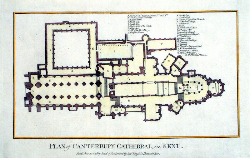 |
Plan of Canterbury Cathedral in
Kent
Hogg c1785 Copper Engraving Size: 340 x 220 mm Antique Map Ref KGM010 £20.00 (+P&P) click image for enlargement |
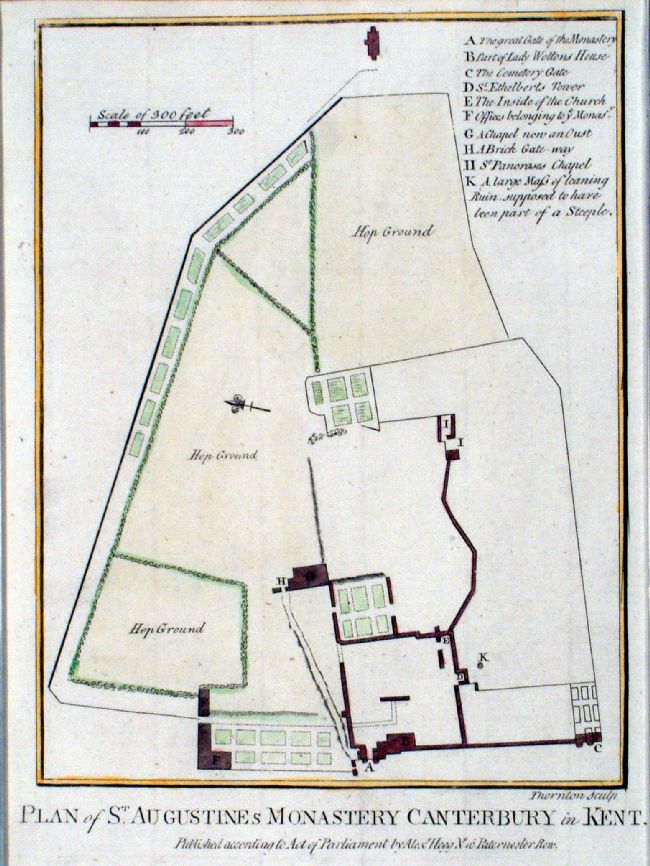 |
Plan of St Augustine's Monastery, Canterbury in
Kent Thornton / Hogg c1790 Copper engraving. size: 170 x 220 mm Antique Map Ref JGM040 £18.00 (+P&P) click image for enlargement |
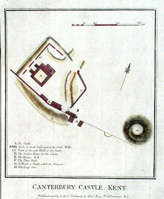 |
Canterbury Castle, Kent Hogg c1790 Copper engraving. size: 180 x 210 mm Antique Map Ref JGM041 £18.00 (+P&P) click image for enlargement |
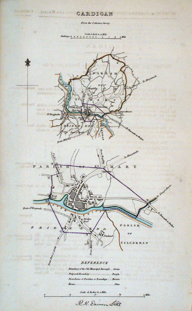 |
Cardigan (Wales)
Dawson - Boundary
Commission 1837 From 'Municipal Corporation Boundaries Report ' size: 200 x 300 mm faint offset transfer Antique Map Ref GDM239 £22.00 (+P&P) click image for enlargement |
 |
Cardigan (Wales)
James - Boundary Commission
1868 The map is accompanied by a page of descriptive text relating to the borough statistics Zincograph Size: 240 x 360 mm Original colouring of boundaries Antique Map Ref HJS017 £20.00 (+P&P) click image for enlargement |
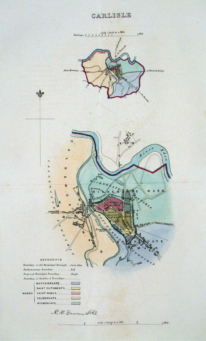 |
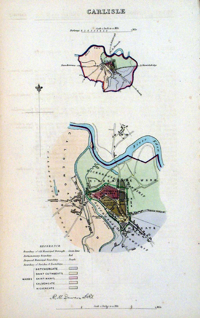
Carlisle
Dawson - Boundary Commission
1837 From 'Municipal Corporation Boundaries Report ' Large Paper Edition. Page size: 420 x 500mm plate size: 220 x 340 mm A few small spots of foxing Antique Map Ref GBM032 £26.00 (+P&P) click image for enlargement |
 |
Carlisle (Cumberland)
Dawson - Boundary Commission 1837 From 'Municipal Corporation Boundaries Report ' size: 200 x 300 mm Antique Map Ref FDM070 £24.00 (+P&P) click image for enlargement |
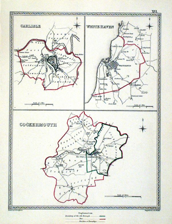 |
Carlisle . Whitehaven . Cockermouth Samuel Lewis 1835 engraved by J & C Walker Steel engraving Size: 200 x 250 mm, Original colouring of boundaries. Antique Map Ref KJM016 £16.00 (+P&P) Sample, not of this specific map, to indicate the level of detail of these 1835 Lewis town plans. click image for enlargement |
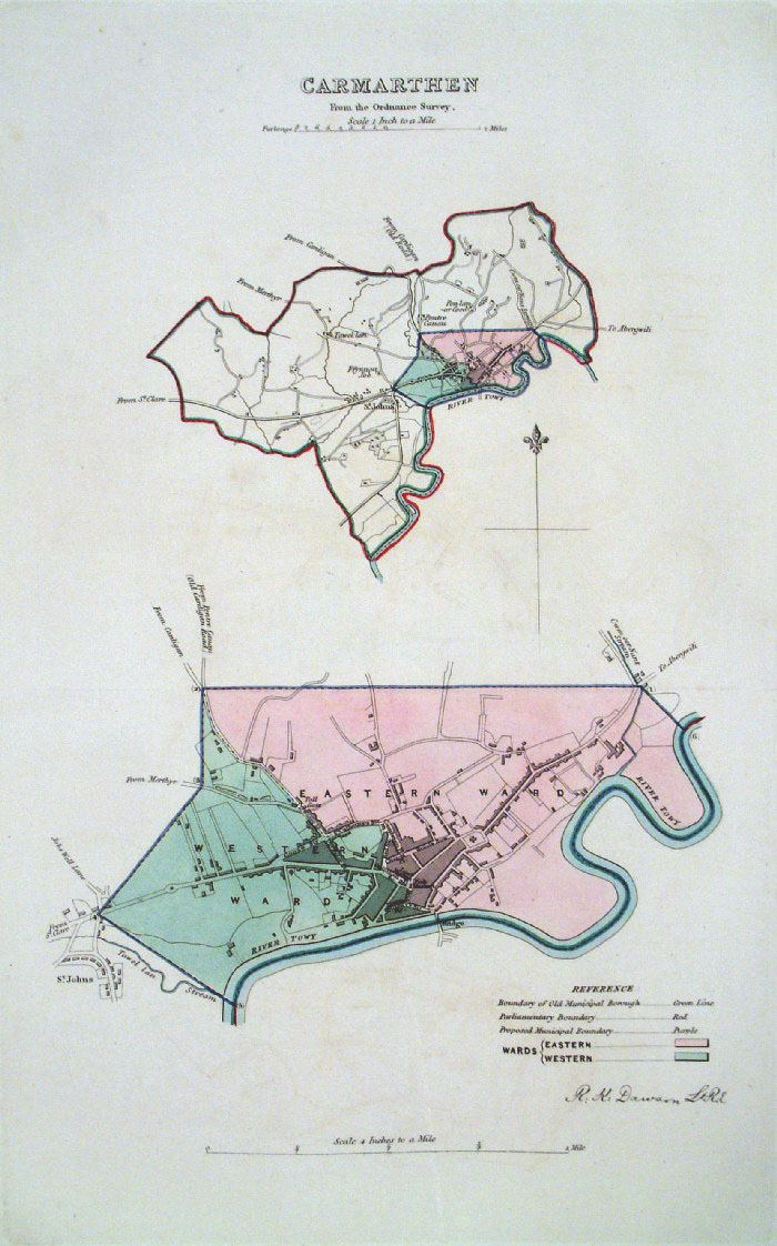 |
Carmarthen (Wales) Dawson
- Boundary Commission 1837 From 'Municipal Corporation Boundaries Report ' Large Paper Edition size: 250 x 300 mm 1 fold, very faint offset transfer Antique Map Ref GBM033 £25.00 (+P&P) click image for enlargement |
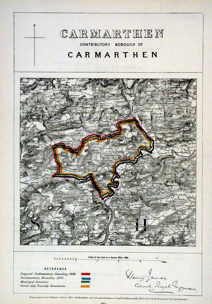 |
Carmarthen (Wales)
James - Boundary Commission
1868 The map is accompanied by a page of descriptive text relating to the borough statistics Zincograph Size: 240 x 360 mm Original colouring of boundaries Antique Map Ref HJS019 £18.00 (+P&P) click image for enlargement |
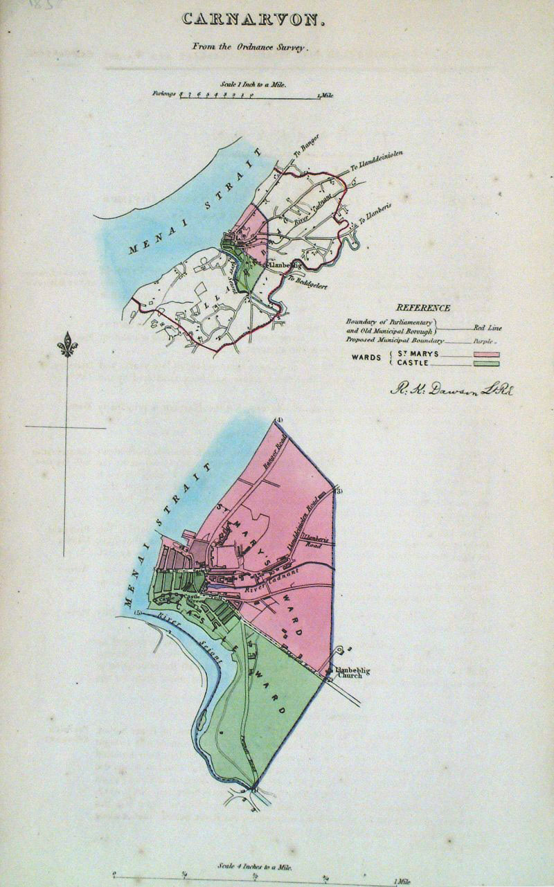 |
Carnarvon Dawson -
Boundary Commission 1837 From 'Municipal Corporation Boundaries Report ' size: 200 x 300 mm Antique Map Ref GDM240 £24.00 (+P&P) click image for enlargement |
 |
Carnarvon / Bangor (Wales)
James - Boundary
Commission 1868 Zincograph Size: 240 x 360 mm Original colouring of boundaries Antique Map Ref HJS020 £20.00 (+P&P) click image for enlargement |
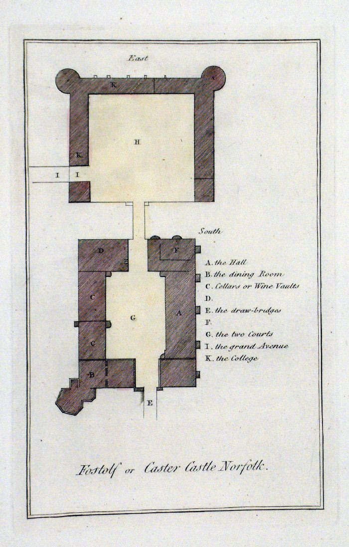 |
Castor Castle plan (Norfolk)
Grose 1787 size: 130 x 220 mm Antique Map Ref FHM011 £15.00 (+P&P) click image for enlargement |
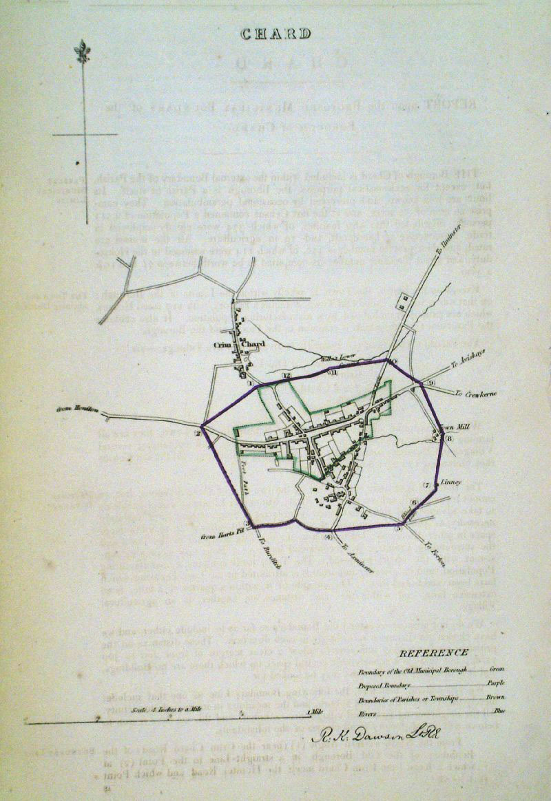 |
Chard (Somerset)
Dawson - Boundary Commission
1837 From 'Municipal Corporation Boundaries Report ' size: 200 x 300 mm very faint offset transfer Antique Map Ref GDM241 £24.00 (+P&P) click image for enlargement |
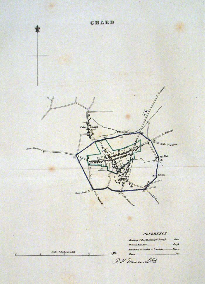 |
Chard (Somerset) Dawson -
Boundary Commission 1837 From 'Municipal Corporation Boundaries Report ' Large Paper Edition size: 250 x 300 mm 1 fold, a few foxing spots Antique Map Ref GBM035 £24.00 (+P&P) click image for enlargement |
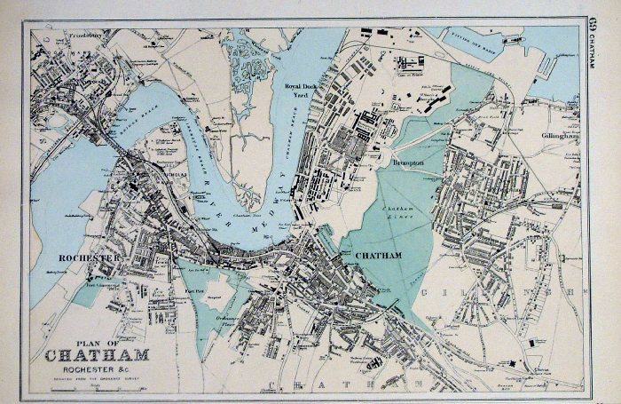 |
Chatham (Kent)
Bacon 1893
size: 320 x 215 mm Antique Map Ref FLM001 £20.00 (+P&P) click image for enlargement |
 |
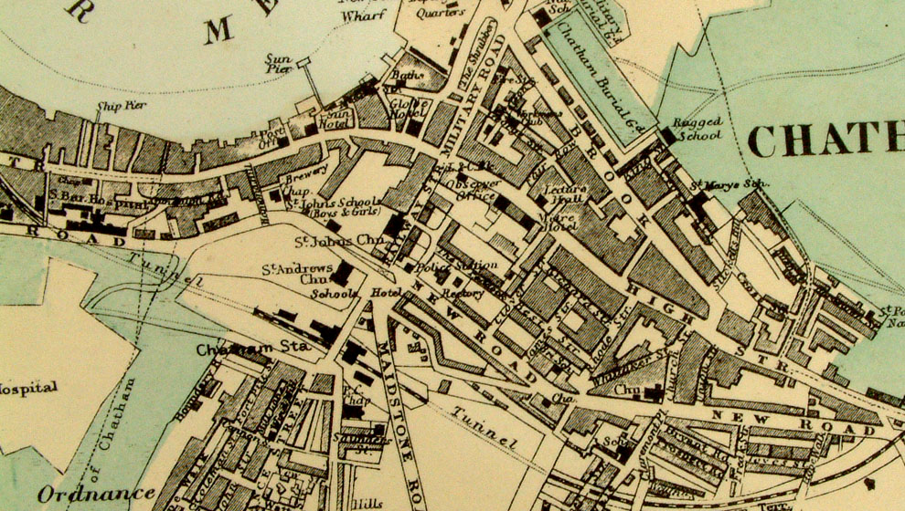
Chatham, Rochester,
etc From the New Large Scale Atlas of the British Isles by G.W. Bacon 1892 size: 330 x 220 mm, tight lower margin Ref LHM077 £20.00 (+P&P) Detail click image for enlargement |
 |
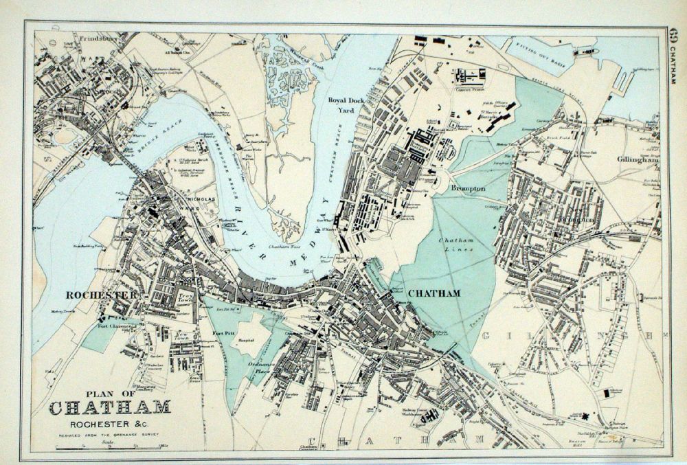
Chatham (Kent)
Bacon 1907
size: 500 x 330 mm Antique Map Ref FLM002 £20.00 (+P&P) click image for enlargement |
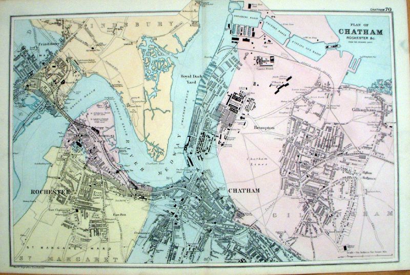 |
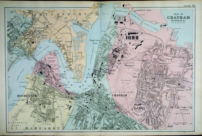
Chatham, Rochester, etc
Bacon 1895
size: 500 x 320 mm Antique Map Ref KGM083 £20.00 (+P&P) click image for enlargement |
 |
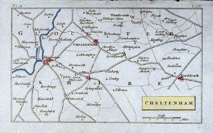
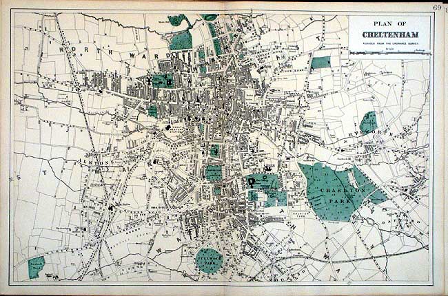
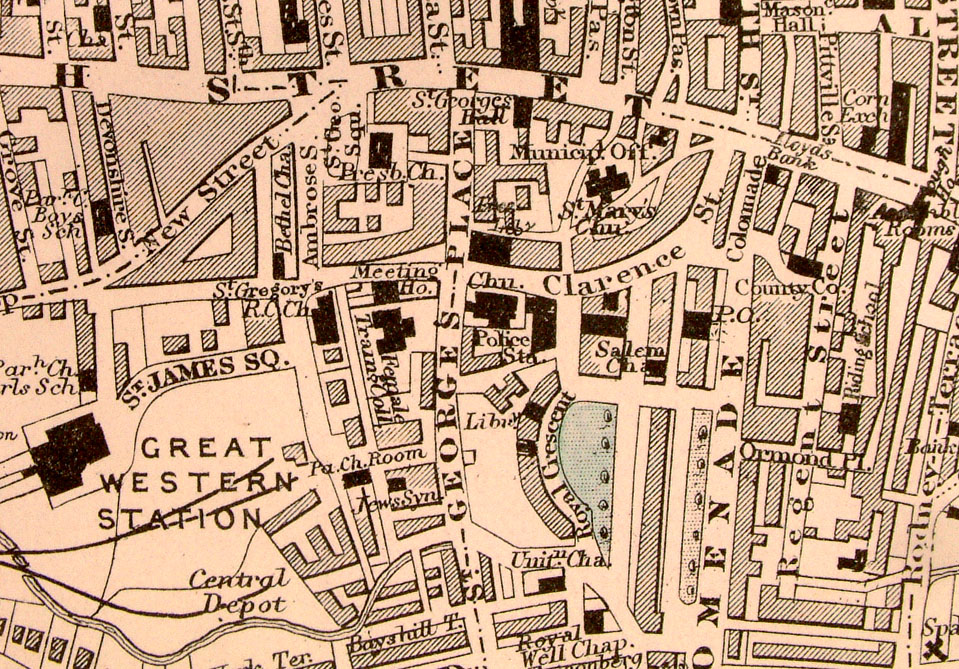
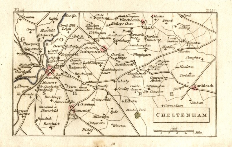
Plan of Cheltenham From the New Large Scale Atlas of the British Isles by G.W. Bacon 1892 size: 240 x 320 mm, tight left margin Ref LHM078 £20.00 (+P&P) Detail click image for enlargement |
 |
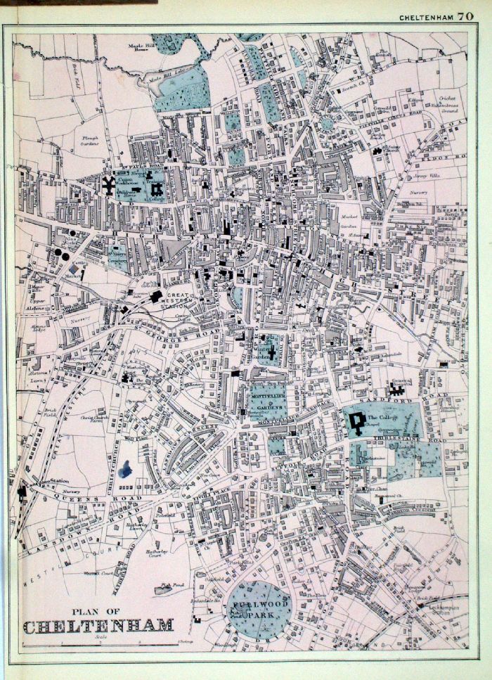
Cheltenham
Bacon c1883
size: 500 x 320 mm Antique Map Ref FLM155 £28.00 (+P&P) click image for enlargement |
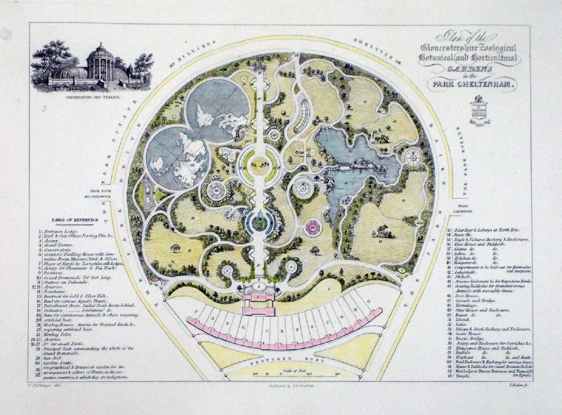 |
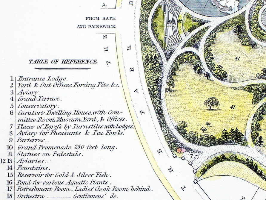
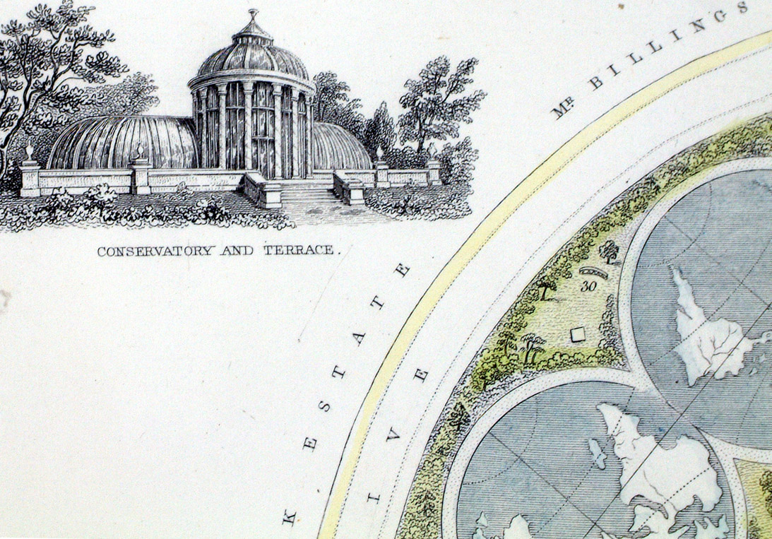
Plan of the
Gloucestershire Zoological, Botanical and Horticultural
Gardens in the Park Cheltenham
Samuel Young Griffith 1838 Steel engraving size: 290 x 220 mm Antique Map Ref MFM004 £30.00 (+P&P) Detail 1 Detail 2 click image for enlargement |
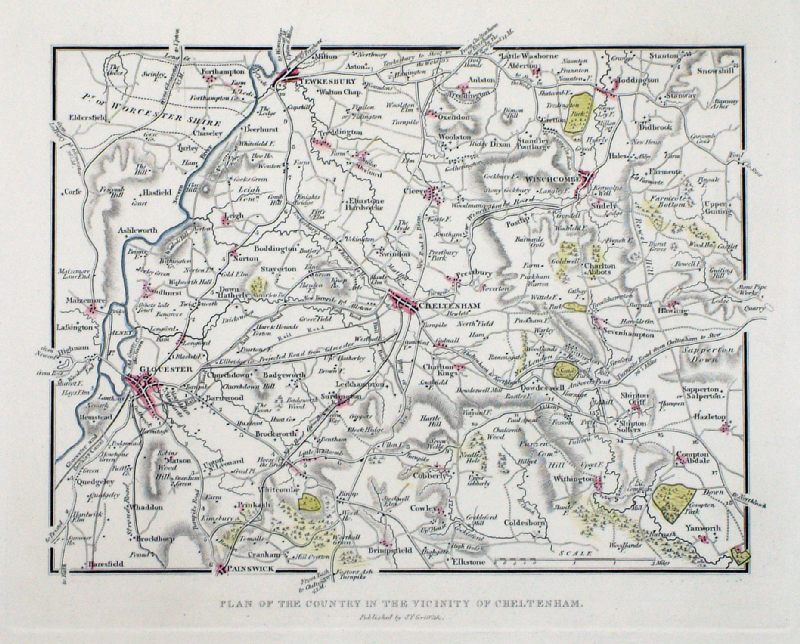 |
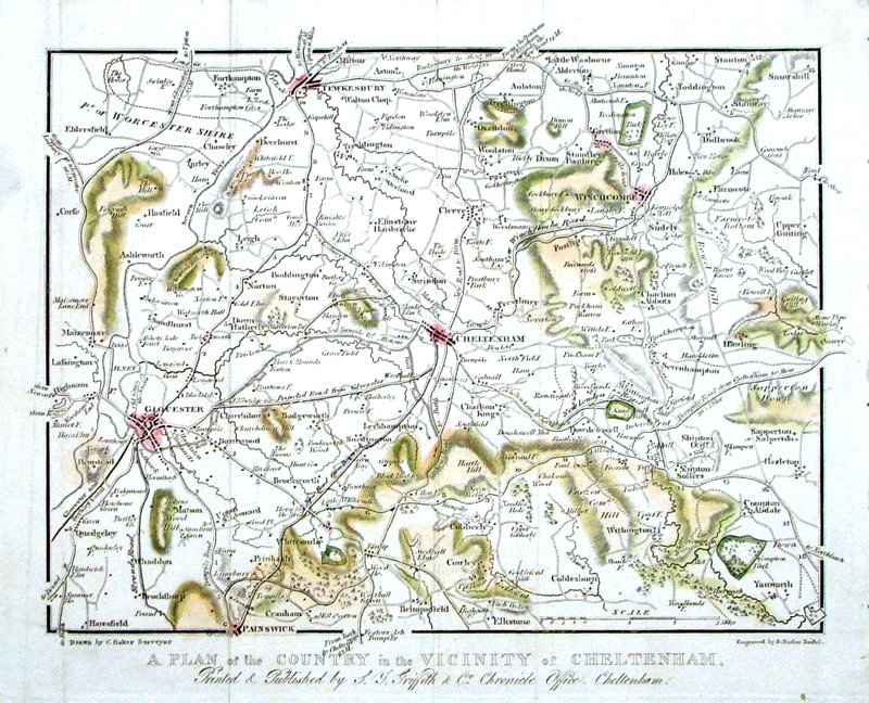
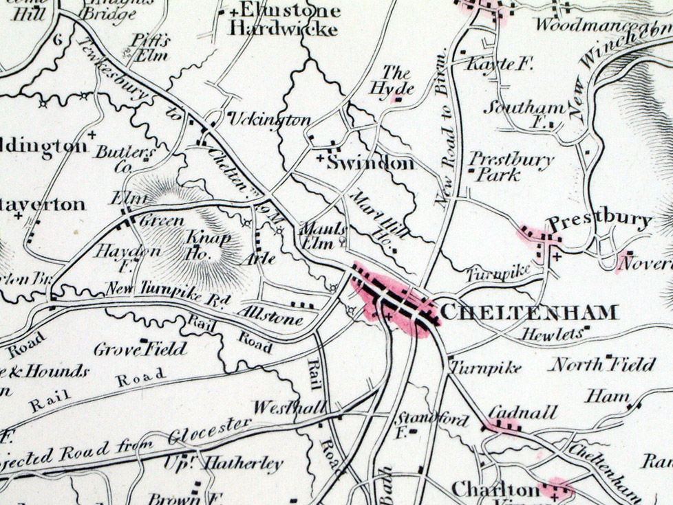
Plan of the Country
in the Vicinity of Cheltenham
Samuel Young Griffith 1838 Steel engraving size: 290 x 220 mm Antique Map Ref MFM004 £25.00 (+P&P) Detail 1 click image for enlargement |
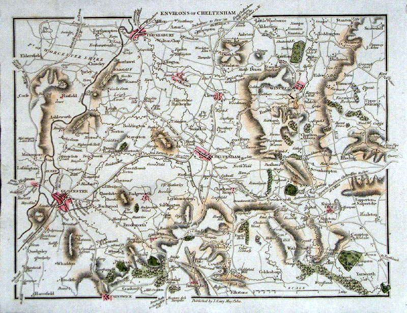 |
Environs of Cheltenham
Cary 1812
size: 230 x 170
mm Area covers: Gloucester, Tewkesbury, Painswick, Snowhill. Antique Map Ref GFM088 £22.00 (+P&P) click image for enlargement |
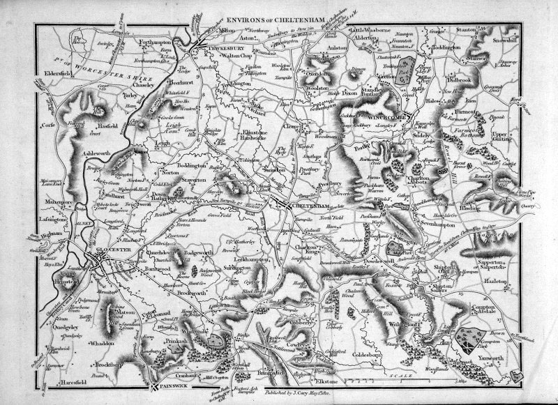 |
Environs of Cheltenham
Cary 1812
size: 230 x 170
mm Area covers: Gloucester, Tewkesbury, Painswick, Snowhill. Antique Map Ref GDM158 £22.00 (+P&P) click image for enlargement |
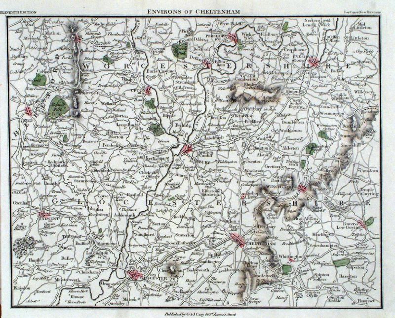 |
Environs of Cheltenham
Cary 1828
size: 230 x 170
mm Area covers: Gloucester, Tewkesbury, Gt Malvern, Pershore, Broadway Antique Map Ref ILM015 £22.00 (+P&P) click image for enlargement |
 |
Environs of Cheltenham
Baker / Butler 1830
size: 230 x 190
mm Area covers: Gloucester, Tewkesbury, Painswick, Snowhill. Ref HAM010 £22.00 (+P&P) click image for enlargement |
 |
Cheltenham Philips c1830
size: 140 x 90 mm
Antique Map Ref GBM279 £18.00 (+P&P) Antique Map Ref GEM036 £18.00 (+P&P) click image for enlargement |
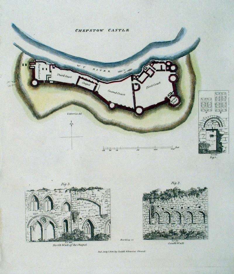 |
Chepstow Castle Cadell &
Davis 1800 size:
200 x 230 mm Antique Map Ref GGM074 £20.00 (+P&P) click image for enlargement |
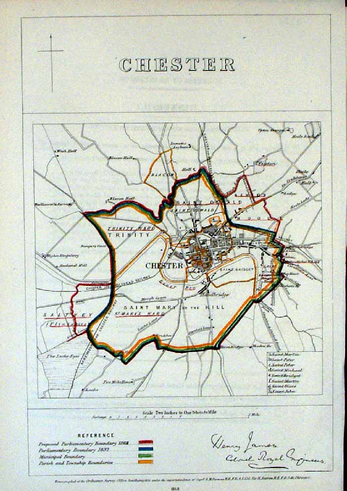 |
Chester (Cheshire)
James - Boundary Commission
1868 The map is accompanied by a page of descriptive text relating to the borough statistics Zincograph Size: 240 x 360 mm Original colouring of boundaries Antique Map Ref HJS021 £22.00 (+P&P) click image for enlargement |
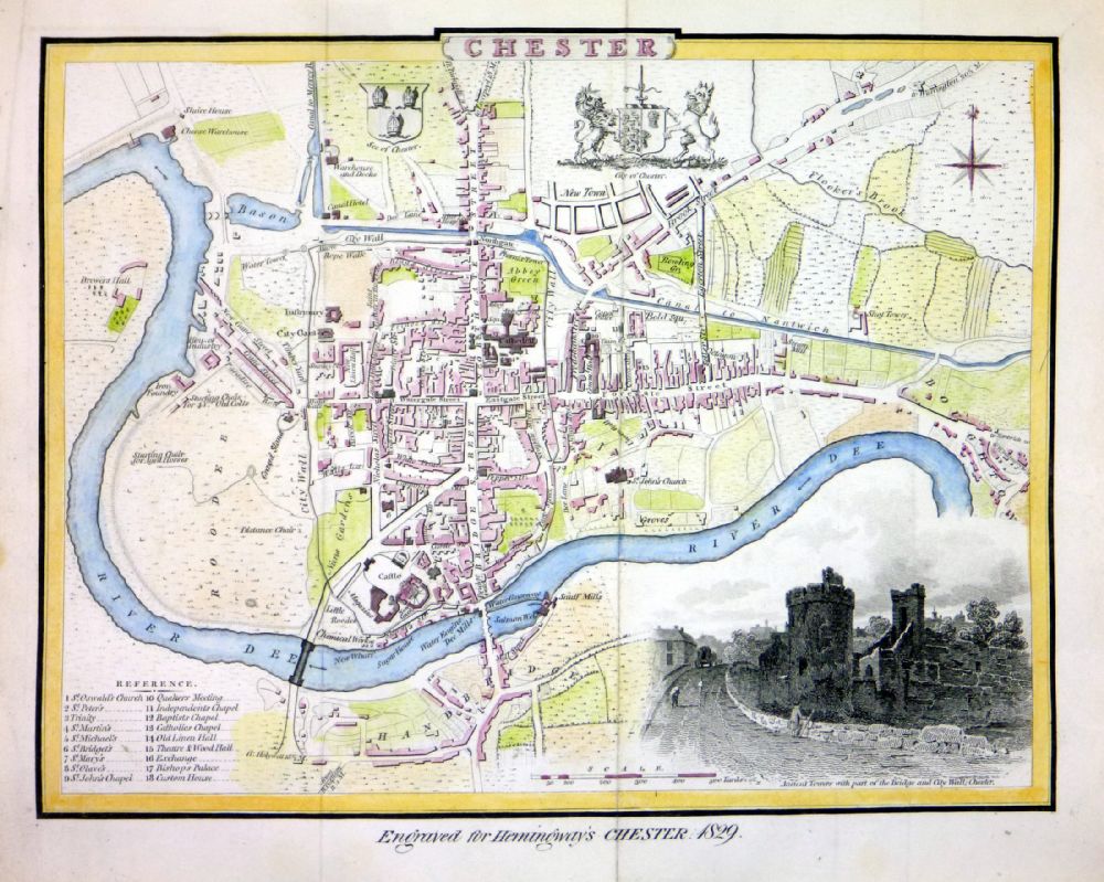 |
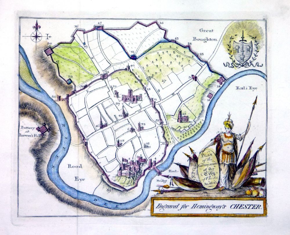
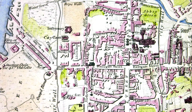
Chester
Engraved for Hemmingway's Chester 1829
A 1831 edition of Cole & Roper's Chester map of 1807 This has new additions - new bridge SW of Castle and 'New Town' to the north. Detail around the castle suggests this is a new plate based on Cole & Roper's. size: 250 x 200 mm 2 folds Ref OAM001 £60.00 (+P&P) Detail 1 Detail 2 click image for enlargement |
 |
Chester
Engraved for Hemmingway's
Chester 1831
A Plan of the Fortifications of the City of Chester AN 1643 size: 220 x 170 mm, 3 folds Ref OAM002 £30.00 (+P&P) click image for enlargement |
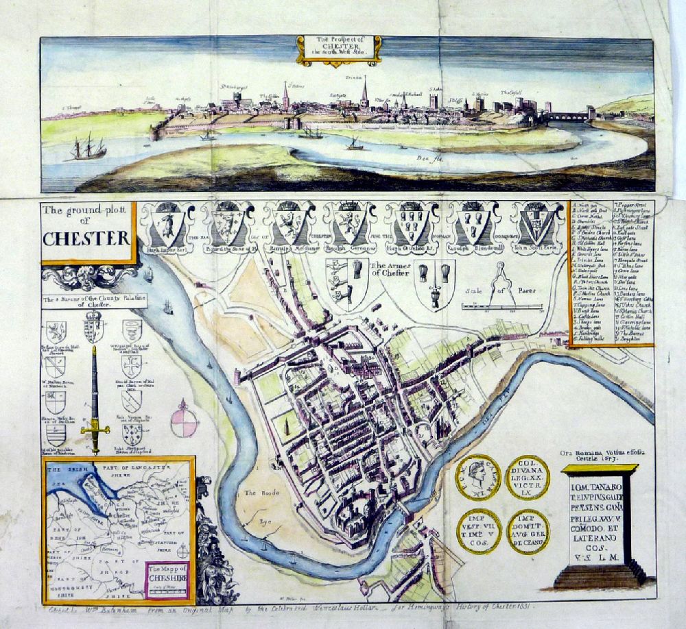 |
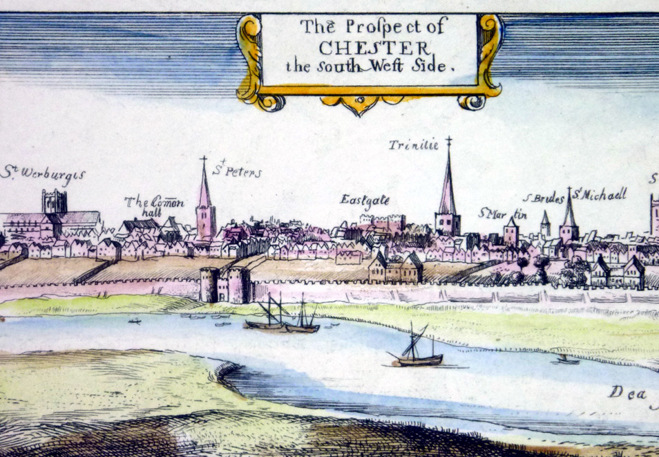
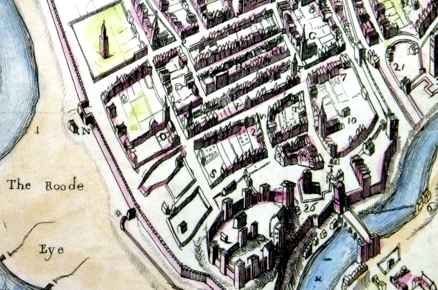
Chester
Top - The Prospect of Chester - The South West Side Bottom - The Ground Plott of Chester Etched by Wm Batenham from an original map by the celebrated Wenceslaus Hollar for Hemmingway's A History of Chester 1831 Several repairs to tears and split folds - not a perfect copy. size: 290 x 280 mm several folds Ref OAM003 £25.00 (+P&P) Detail 1 Detail 2 click image for enlargement |
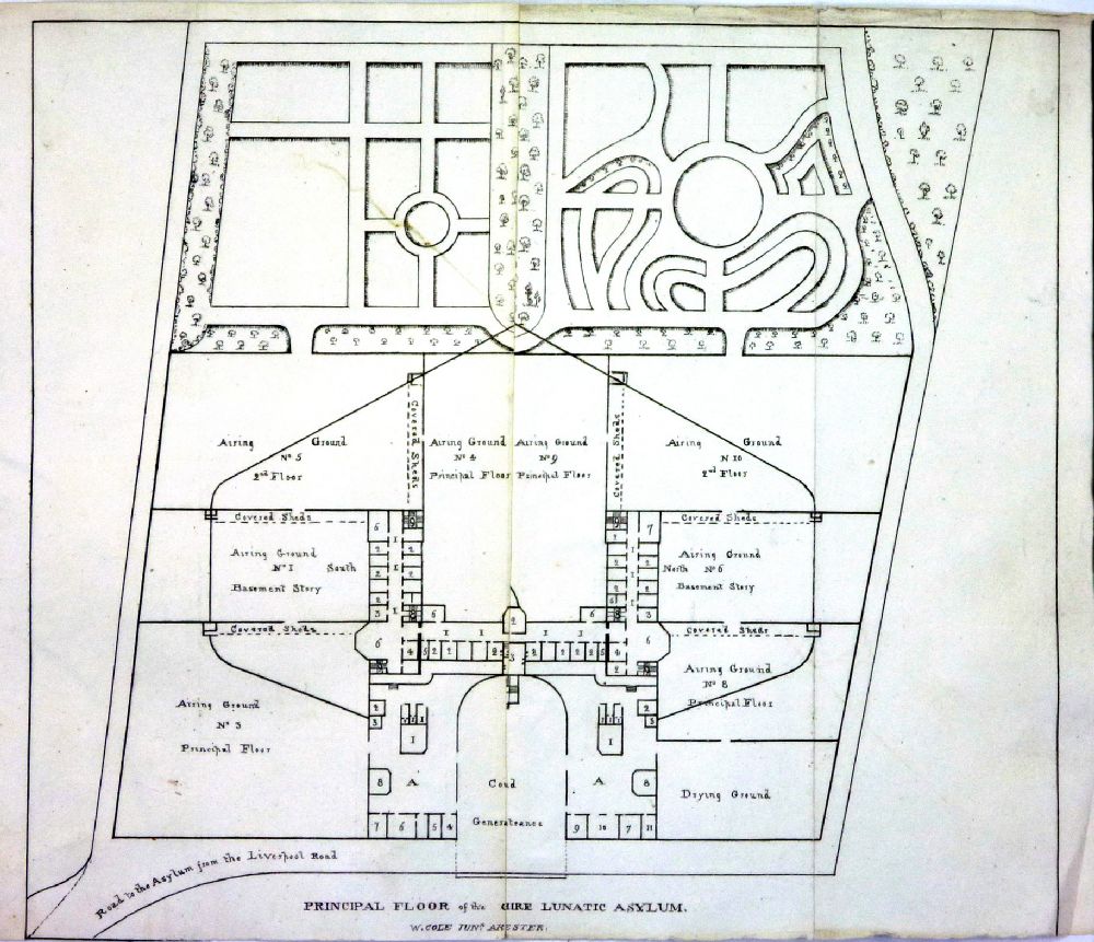 |
Chester -
Principal Floor of the Cheshire Lunatic Asylum Hemmingway's Chester 1831 W. Cole Junr size: 250 x 210 mm, 2 folds, cropped lower margin Ref OAM004 £20.00 (+P&P) click image for enlargement |
 |
Chester -
Floor plans of the Chester Infirmary Hemmingway's Chester 1831 W. Crane size: 210 x 110 mm Ref OAM005 £20.00 (+P&P) click image for enlargement |
 |
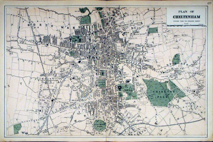
Cheltenham GW
Bacon
1912
size: 500 x 350 mm center fold Antique Map Ref HBS003 £24.00 (+P&P) click image for enlargement |
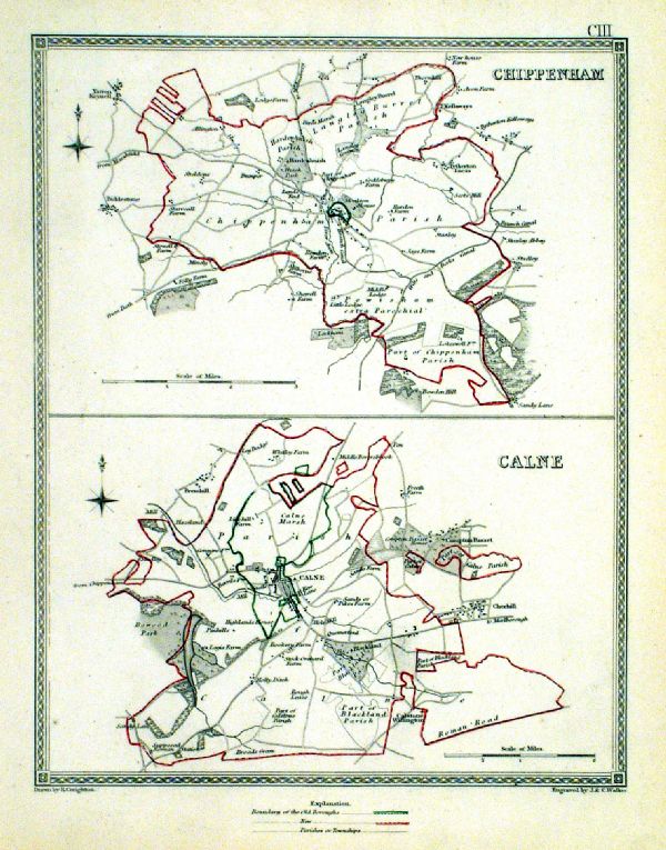 |
Chippenham . Calne Samuel Lewis 1835 engraved by J & C Walker Steel engraving Size: 200 x 250 mm, Original colouring of boundaries. Antique Map Ref KJM103 £18.00 (+P&P) Sample, not of this specific map, to indicate the level of detail of these 1835 Lewis town plans. click image for enlargement |
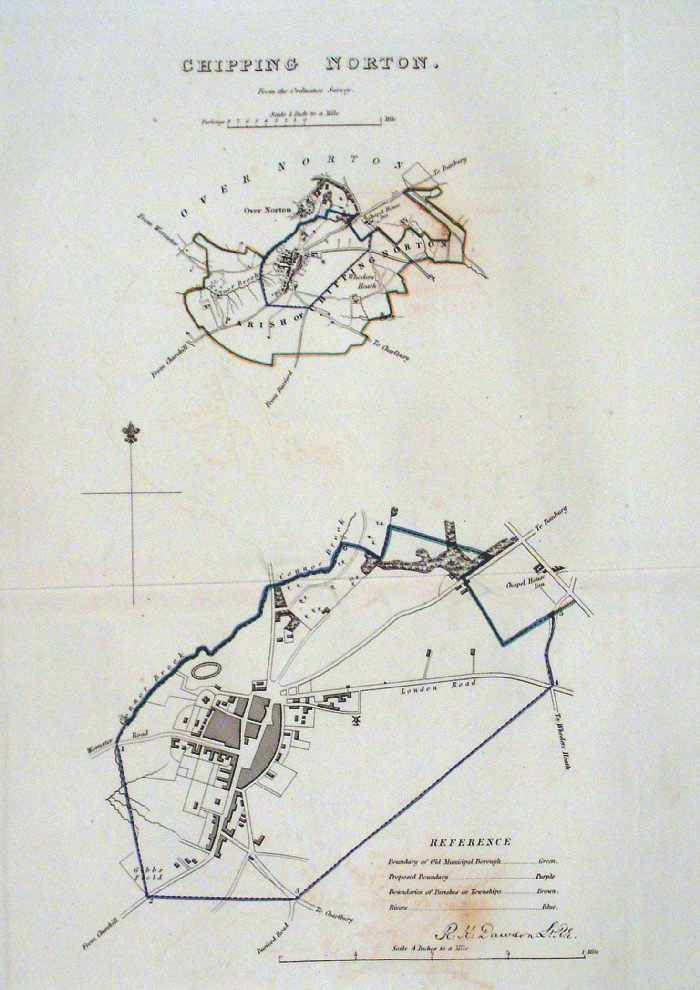 |
Chipping Norton
Dawson - Boundary
Commission 1837 From 'Municipal Corporation Boundaries Report ' Large Paper Edition. Page size: 420 x 500mm plate size: 220 x 330 mm Antique Map Ref GBM040 £28.00 (+P&P) click image for enlargement |
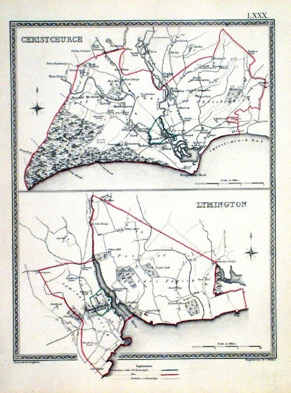 |
Christchurch . Lymington Samuel Lewis 1835 engraved by J & C Walker Steel engraving Size: 200 x 250 mm, Original colouring of boundaries. Antique Map Ref KJM080 £20.00 (+P&P) Sample, not of this specific map, to indicate the level of detail of these 1835 Lewis town plans. click image for enlargement |
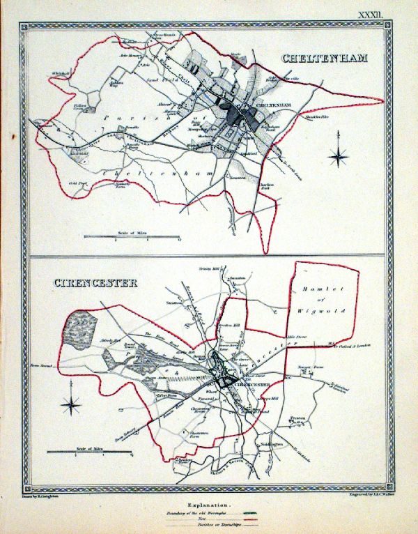 |
Cirencester . Cheltenham Samuel Lewis 1835 engraved by J & C Walker Steel engraving Size: 200 x 250 mm, Original colouring of boundaries. Antique Map Ref KJM032 £18.00 (+P&P) Sample, not of this specific map, to indicate the level of detail of these 1835 Lewis town plans. click image for enlargement |
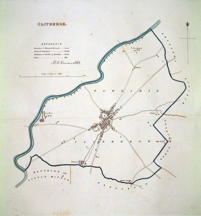 |
Clitheroe
(Lancs) Dawson
- Boundary Commission 1837 From 'Municipal Corporation Boundaries Report ' Large Paper Edition. Page size: 420 x 500mm plate size: 350 x 340 mm Antique Map Ref GBM041 £24.00 (+P&P) click image for enlargement |
 |
Clitheroe (Lancs)
Dawson - Boundary
Commission 1837 From 'Municipal Corporation Boundaries Report ' size: 440 x 400 mm 1 fold, noticable diagonal offset transfer. Antique Map Ref GDM246 £20.00 (+P&P) click image for enlargement |
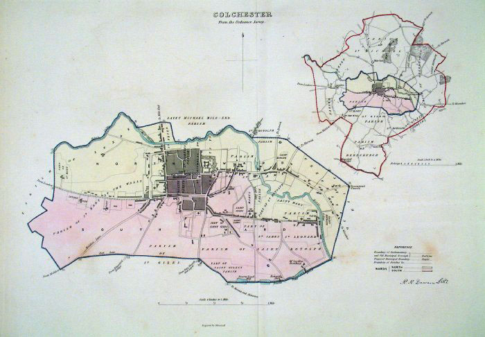 |
Colchester (Essex) Dawson
- Boundary Commission 1837 From 'Municipal Corporation Boundaries Report ' Large Paper Edition size: 250 x 300 mm 1 fold, faint foxing Antique Map Ref GBM042 £30.00 (+P&P) click image for enlargement |
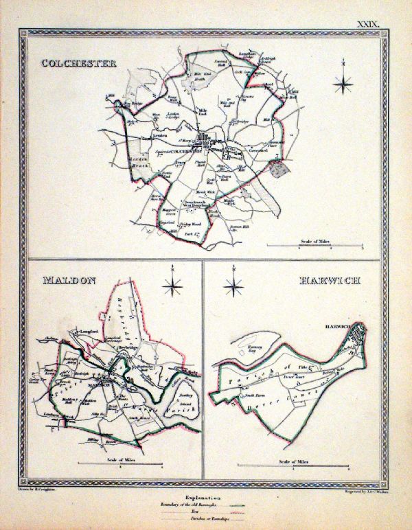 |
Colchester . Malden . Harwich Samuel Lewis 1835 engraved by J & C Walker Steel engraving Size: 200 x 250 mm, Original colouring of boundaries. Antique Map Ref KJM029 £18.00 (+P&P) Sample, not of this specific map, to indicate the level of detail of these 1835 Lewis town plans. click image for enlargement |
 |
Colchester (Essex)
James - Boundary Commission
1868 The map is accompanied by a page of descriptive text relating to the borough statistics Zincograph Size: 240 x 360 mm Original colouring of boundaries Antique Map Ref HJS023 £20.00 (+P&P) click image for enlargement |
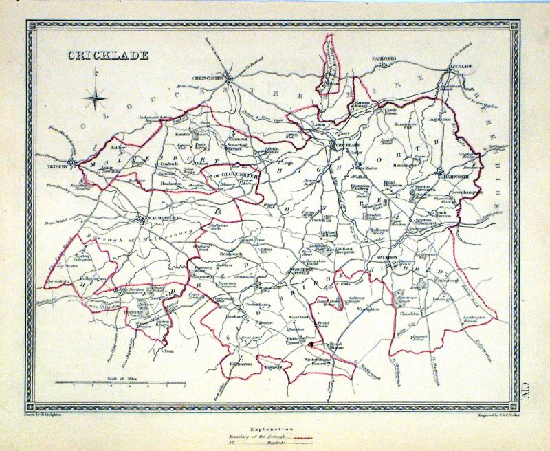 |
Cricklade Samuel Lewis 1835 engraved by J & C Walker Steel engraving Size: 250 x 200 mm, Original colouring of boundaries. Antique Map Ref KJM104 £18.00 (+P&P) Sample, not of this specific map, to indicate the level of detail of these 1835 Lewis town plans and town environs. click image for enlargement |
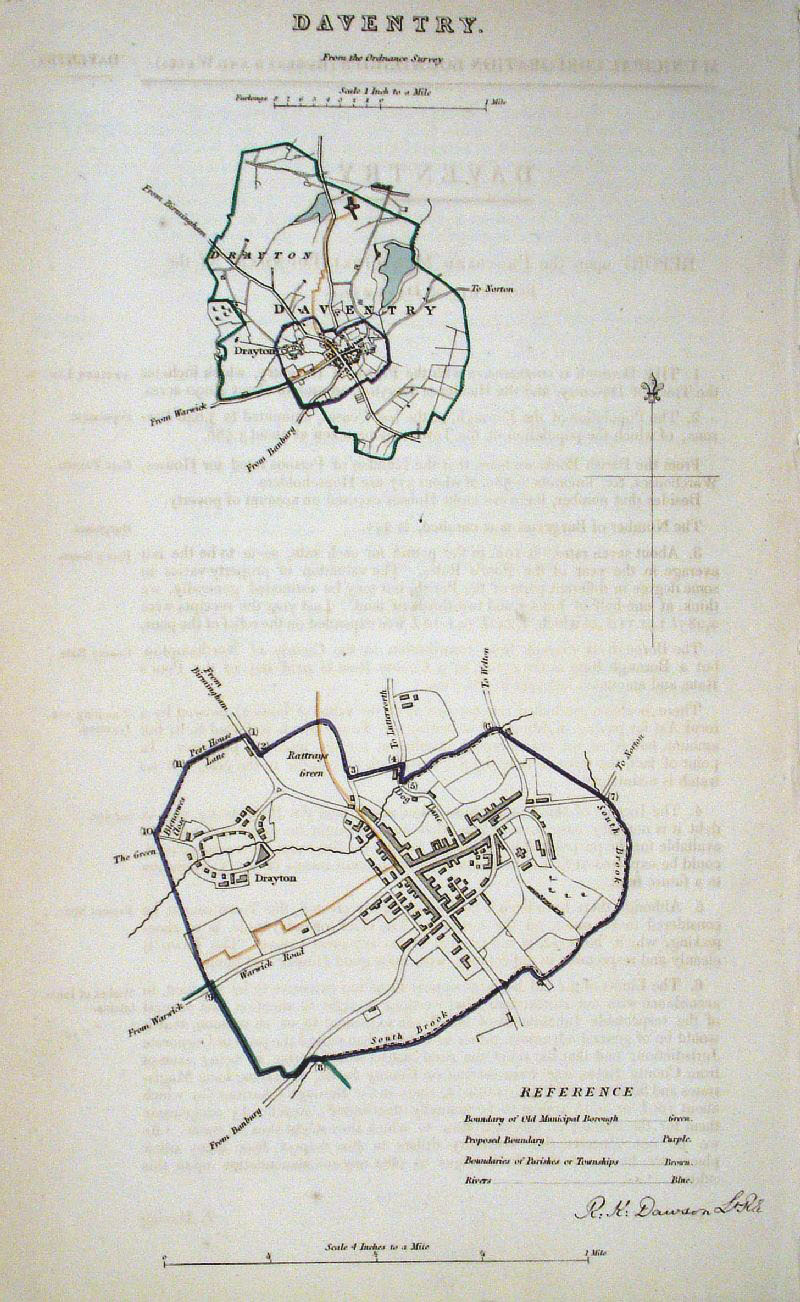 |
Daventry (Northants)
Dawson - Boundary
Commission 1837 From 'Municipal Corporation Boundaries Report ' size: 200 x 300 mm very faint offset transfer Antique Map Ref GDM249 £24.00 (+P&P) click image for enlargement |
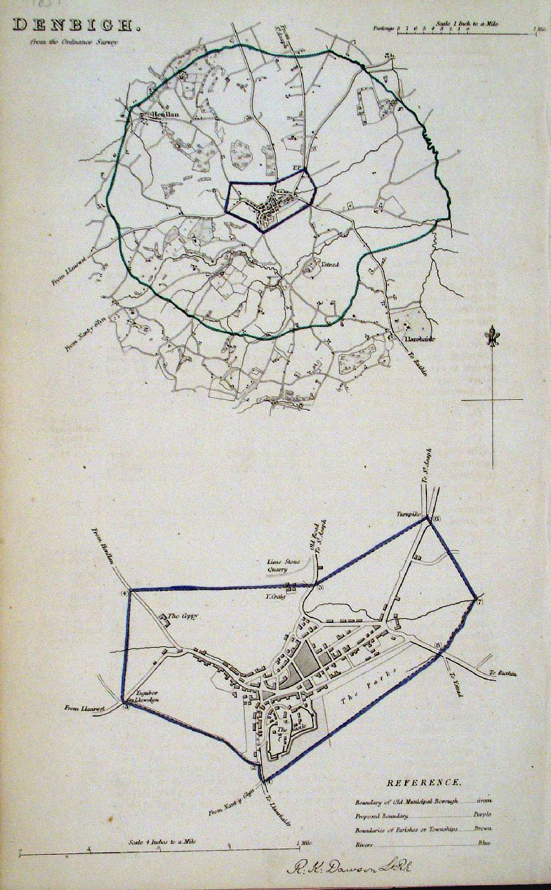 |
Denbigh (Wales) Dawson
- Boundary Commission 1837 From 'Municipal Corporation Boundaries Report ' size: 200 x 300 mm Antique Map Ref GDM250 £22.00 (+P&P) click image for enlargement |
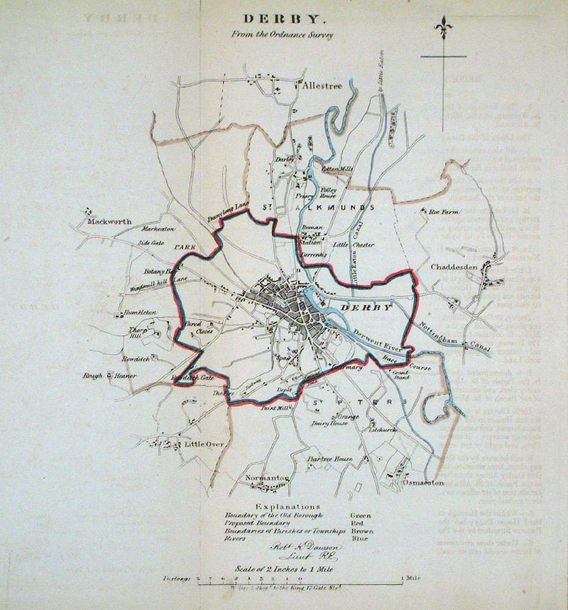 |
Derby
Dawson - Boundary Commission
1837 From 'Municipal Corporation Boundaries Report ' size: 260 x 300 mm faint offset transfer Antique Map Ref GDM251 £24.00 (+P&P) click image for enlargement |
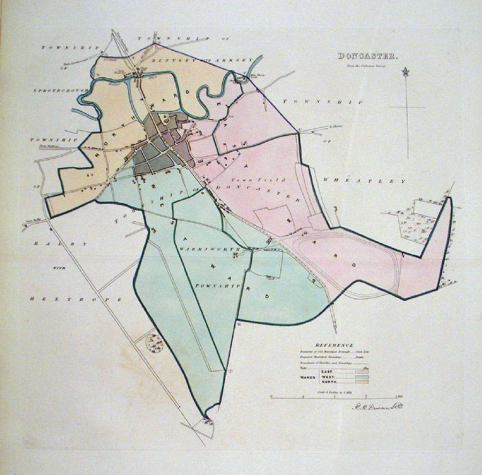 |
Doncaster (Yorkshire)
Dawson - Boundary Commission 1837 From 'Municipal Corporation Boundaries Report ' Large Paper Edition size: 250 x 300 mm 1 fold, very faint offset transfer Antique Map Ref GBM051 £30.00 (+P&P) click image for enlargement |
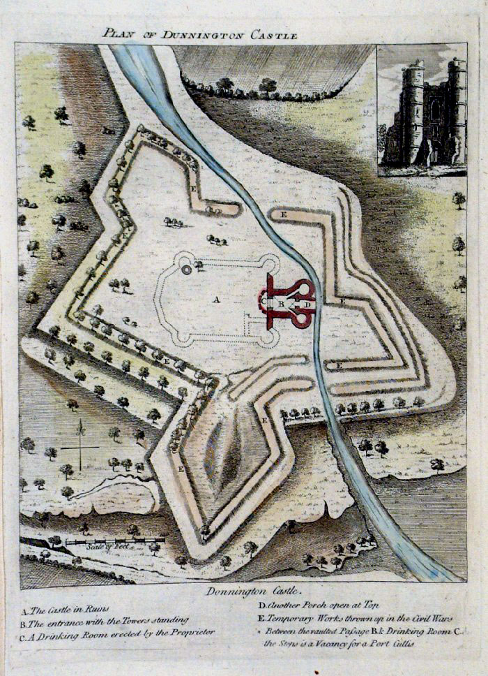 |
Donnington Castle plan (Berkshire)
Grose 1787 size: 160 x 210 mm Antique Map Ref FHM020 £18.00 (+P&P) click image for enlargement |
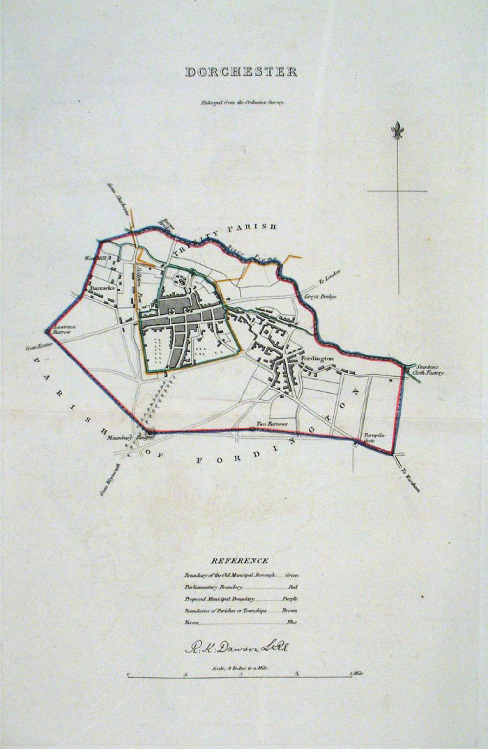 |
Dorchester
(Dorset) Dawson
- Boundary Commission 1837 From 'Municipal Corporation Boundaries Report ' Large Paper Edition. Page size: 420 x 500mm plate size: 220 x 340 mm Antique Map Ref GBM052 £26.00 (+P&P) click image for enlargement |
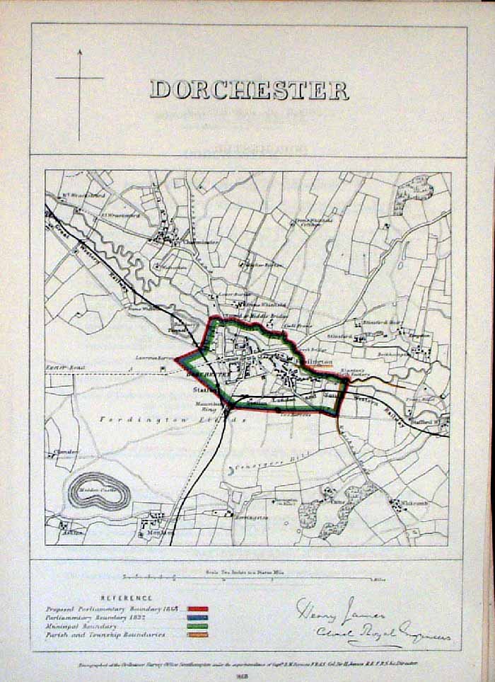 |
Dorchester (Dorset)
James - Boundary Commission
1868 The map is accompanied by a page of descriptive text relating to the borough statistics Zincograph Size: 240 x 360 mm Original colouring of boundaries Antique Map Ref HJS025 £20.00 (+P&P) click image for enlargement |
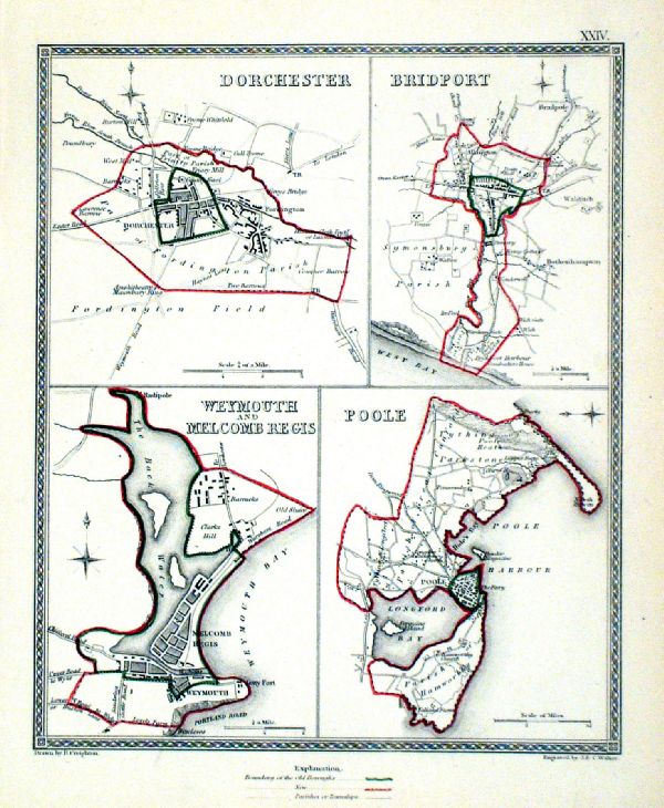 |
Dorchester . Bridport . Weymouth . Poole Samuel Lewis 1835 engraved by J & C Walker Steel engraving Size: 200 x 250 mm, Original colouring of boundaries. Antique Map Ref KJM024 £16.00 (+P&P) Sample, not of this specific map, to indicate the level of detail of these 1835 Lewis town plans. click image for enlargement |
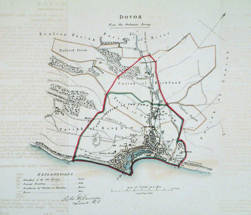 |
Dover (Kent) Dawson -
Boundary Commission 1837 From 'Municipal Corporation Boundaries Report ' size: 300 x 300 mm 2 folds Antique Map Ref GDM253 £28.00 (+P&P) click image for enlargement |
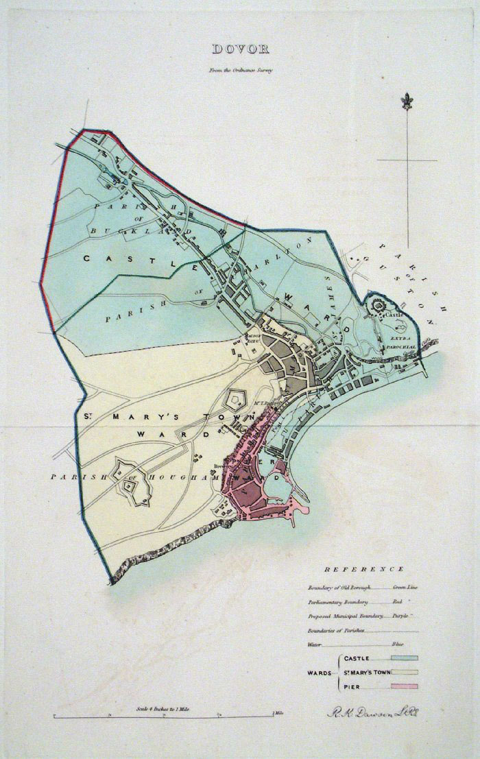 |
Dover (Kent)
Dawson - Boundary Commission
1837 From 'Municipal Corporation Boundaries Report ' Large Paper Edition. Page size: 420 x 500mm plate size: 220 x 340 mm Antique Map Ref GBM053 £35.00 (+P&P) click image for enlargement |
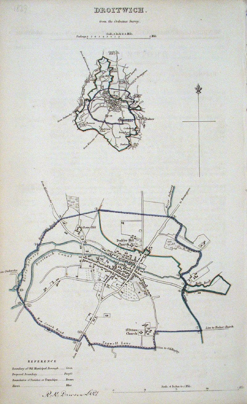 |
Droitwich (Worcs)
Dawson - Boundary Commission
1837 From 'Municipal Corporation Boundaries Report ' size: 200 x 300 mm Antique Map Ref GDM255 £24.00 (+P&P) click image for enlargement |
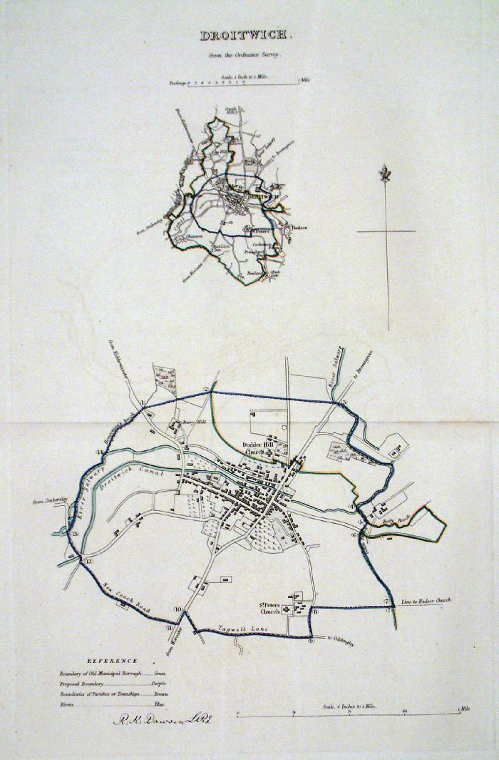 |
Droitwich (Worcs) Dawson
- Boundary Commission 1837 From 'Municipal Corporation Boundaries Report ' Large Paper Edition size: 250 x 300 mm 1 fold Antique Map Ref GBM054 £24.00 (+P&P) click image for enlargement |
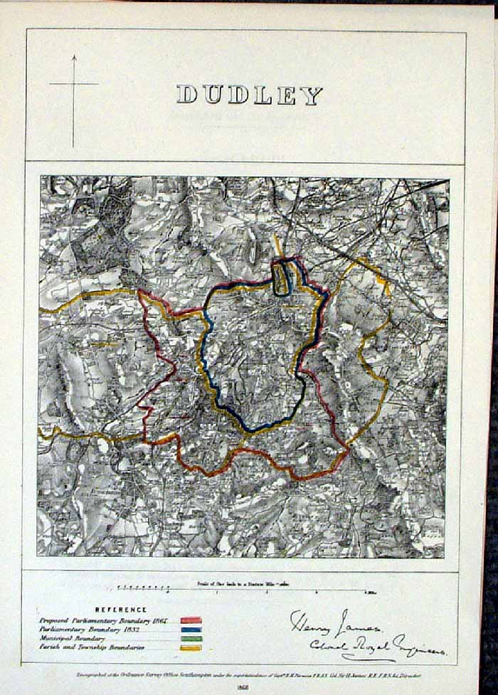 |
Dudley (Warks)
James - Boundary Commission
1868 The map is accompanied by a page of descriptive text relating to the borough statistics Zincograph Size: 240 x 360 mm Original colouring of boundaries Antique Map Ref HJS027 £20.00 (+P&P) click image for enlargement |
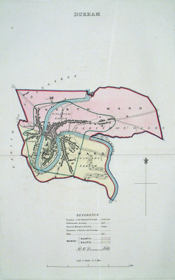 |
Durham Dawson - Boundary
Commission 1837 From 'Municipal Corporation Boundaries Report ' Large Paper Edition size: 250 x 300 mm 1 fold Antique Map Ref GBM055 £28.00 (+P&P) click image for enlargement |
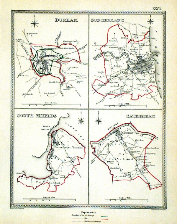 |
Durham . Sunderland . South Shields . Gateshead Samuel Lewis 1835 engraved by J & C Walker Steel engraving Size: 200 x 250 mm, Original colouring of boundaries. Antique Map Ref KJM027 £18.00 (+P&P) Sample, not of this specific map, to indicate the level of detail of these 1835 Lewis town plans. click image for enlargement |
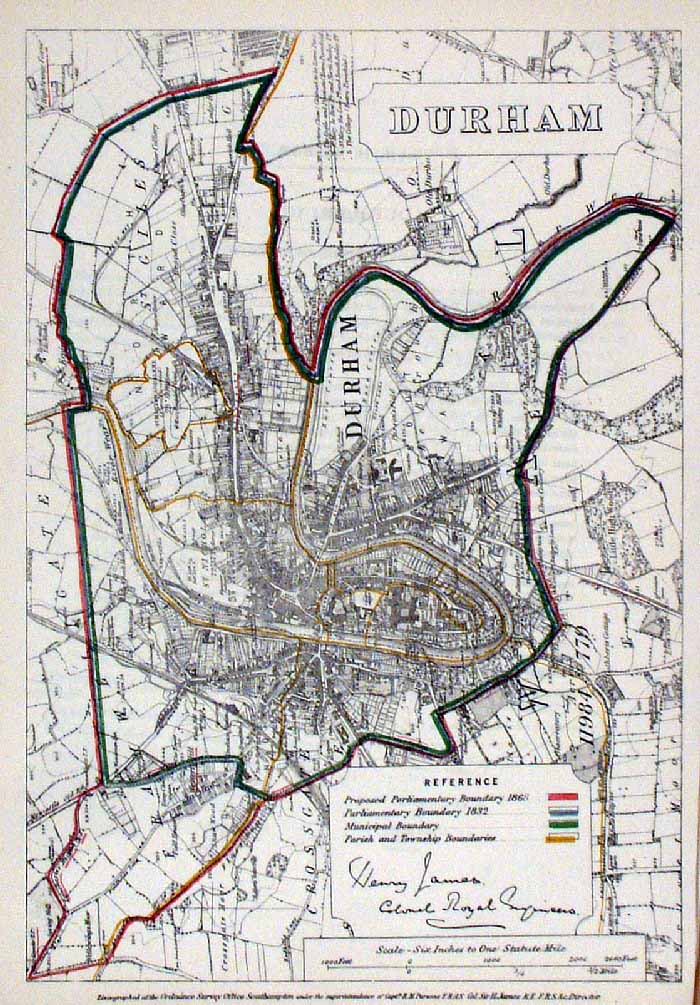 |
Durham
James - Boundary
Commission 1868 The map is accompanied by a page of descriptive text relating to the borough statistics Zincograph Size: 240 x 360 mm Original colouring of boundaries Antique Map Ref HJS028 £20.00 (+P&P) click image for enlargement |
 |
Ashton Under Lyne . Warrington . Bury . Rochdale Samuel Lewis 1835 engraved by J & C Walker Steel engraving Size: 200 x 250 mm, Original colouring of boundaries. Antique Map Ref KJM067 £16.00 (+P&P) Sample, not of this specific map, to indicate the level of detail of these 1835 Lewis town plans. click image for enlargement |
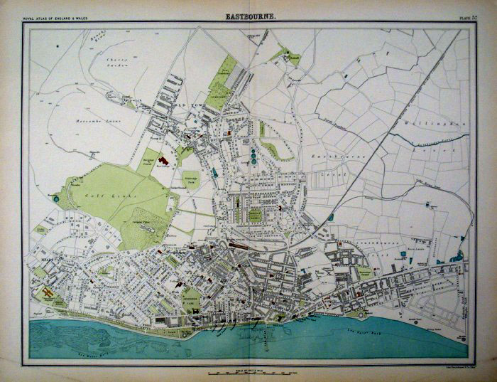 |
Eastbourne
(Sussex)
Bartholomew 1899
size: 430 x 330 mm Antique Map Ref FLM005 £26.00 (+P&P) click image for enlargement |
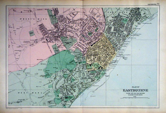 |
Eastbourne
(Sussex) Bacon
1907
size: 480 x 330 mm Antique Map Ref FLM003 £26.00 (+P&P) click image for enlargement |
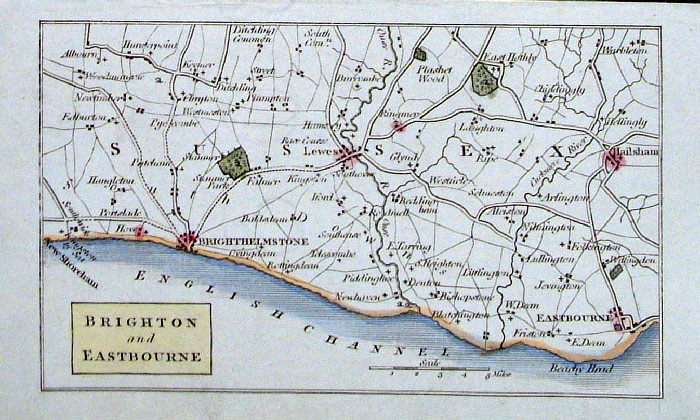 |
Eastbourne and Brighton (Sussex)
Philips c1830
size: 140 x 90 mm Antique Map Ref GBM220 £16.00 (+P&P) click image for enlargement |
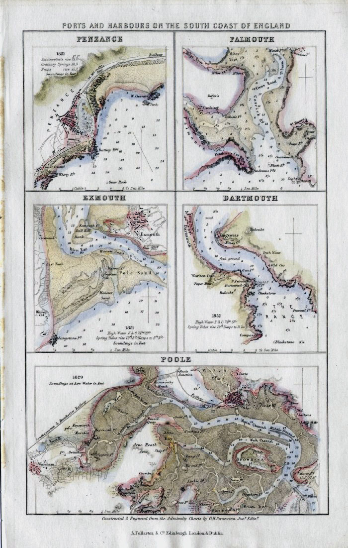 |
English Ports - Ports and Harbours of
South Coast England: Penzance, Falmouth, Exmouth, Dartmouth, Poole Fullarton c1861 size: 140 x 240mm Antique Map Ref GBM272 £20.00 (+P&P) click image for enlargement |
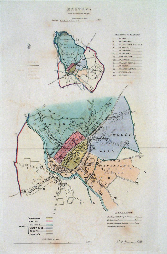 |
Exeter (Devon) Dawson -
Boundary Commission 1837 From 'Municipal Corporation Boundaries Report ' Large Paper Edition size: 250 x 300 mm 1 fold, some offset transfer Antique Map Ref GBM057 £30.00 (+P&P) click image for enlargement |
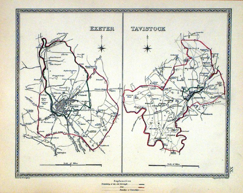 |
Exeter . Tavistock Samuel Lewis 1835 engraved by J & C Walker Steel engraving Size: 250 x 200 mm, Original colouring of boundaries. Antique Map Ref KJM020 £22.00 (+P&P) Sample, not of this specific map, to indicate the level of detail of these 1835 Lewis town plans and town environs. click image for enlargement |
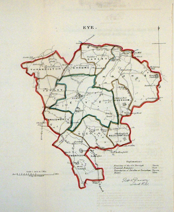 |
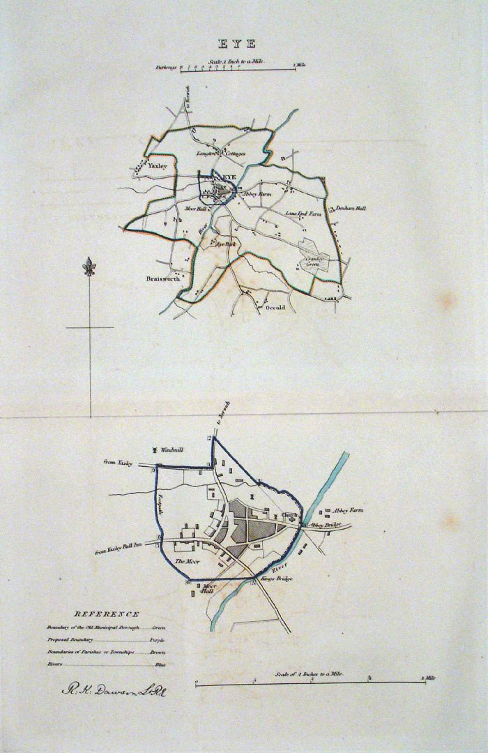
Eye (Suffolk) Dawson -
Boundary Commission 1837 From 'Municipal Corporation Boundaries Report ' size: 240 x 300 mm 1 fold Antique Map Ref FDM112 £25.00 (+P&P) click image for enlargement |
 |
Eye
(Suffolk) Dawson
- Boundary Commission 1837 From 'Municipal Corporation Boundaries Report ' Large Paper Edition. Page size: 420 x 500mm plate size: 220 x 330 mm A few faint spots of foxing. Antique Map Ref GBM058 £25.00 (+P&P) click image for enlargement |
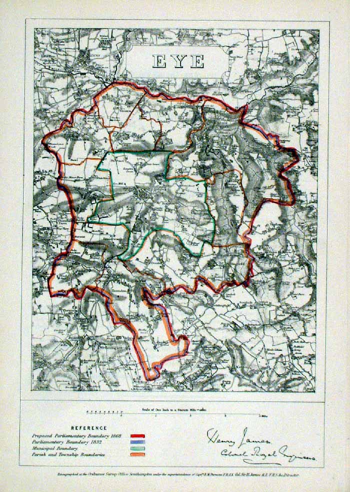 |
Eye (Suffolk) James
- Boundary Commission 1868 The map is accompanied by a page of descriptive text relating to the borough statistics Zincograph Size: 240 x 360 mm Original colouring of boundaries Antique Map Ref HJS029 £20.00 (+P&P) click image for enlargement |
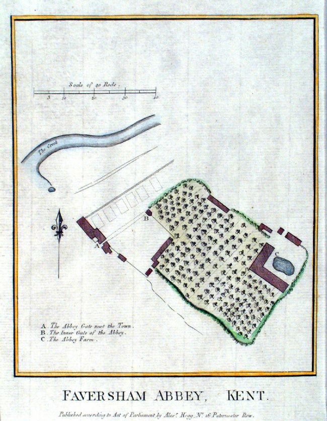 |
Faversham Abbey, Kent Hogg c1790 Copper engraving. size: 170 x 220 mm Antique Map Ref JGM042 £18.00 (+P&P) click image for enlargement |
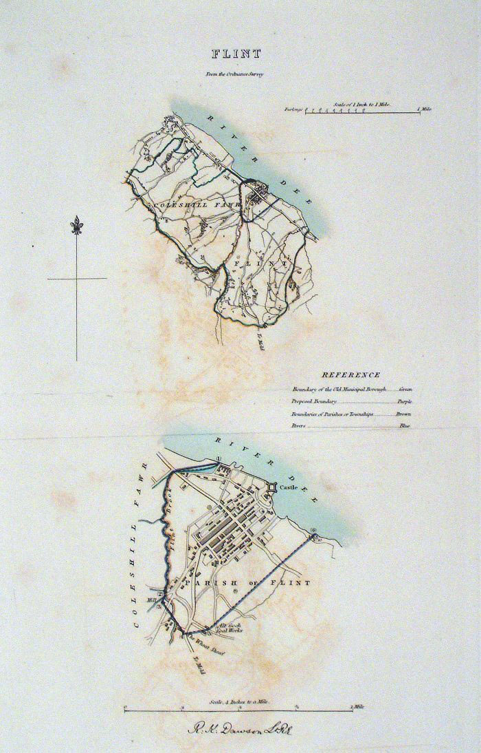 |
Flint (Wales) Dawson -
Boundary Commission 1837 From 'Municipal Corporation Boundaries Report ' Large Paper Edition size: 250 x 300 mm slight offset transfer Antique Map Ref GBM062 £22.00 (+P&P) click image for enlargement |
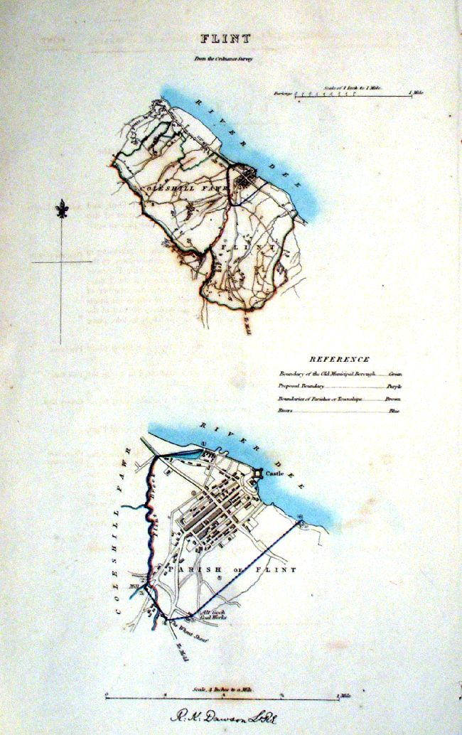 |
Flint (Wales) Dawson -
Boundary Commission 1837 From 'Municipal Corporation Boundaries Report ' size: 210 x 300 mm Antique Map Ref IEM006 £20.00 (+P&P) click image for enlargement |
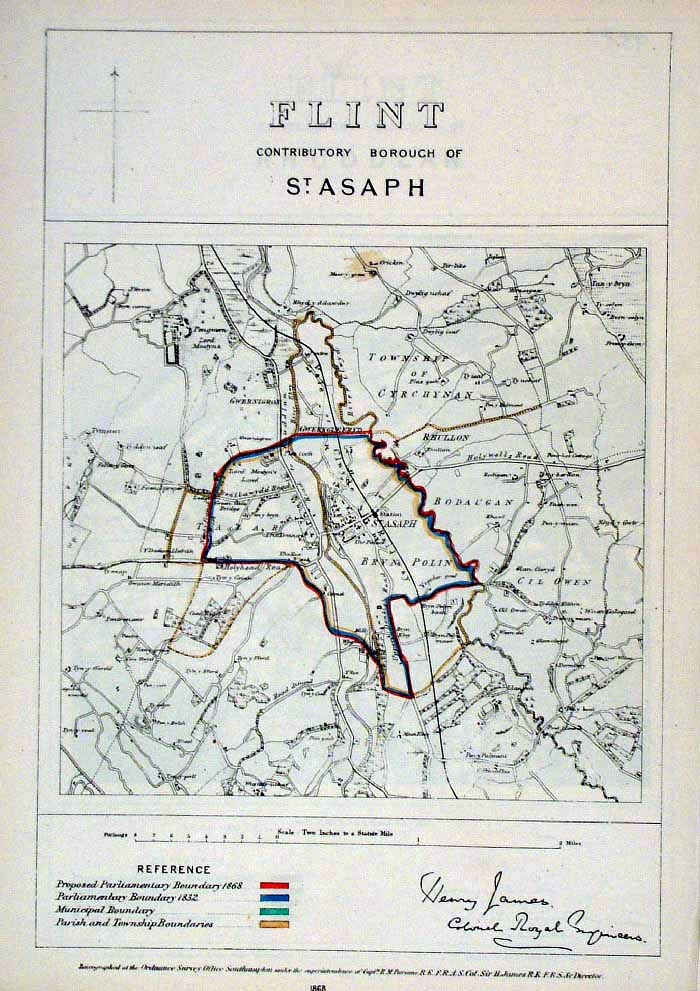 |
Flint (Wales) James
- Boundary Commission 1868 Zincograph Size: 240 x 360 mm Original colouring of boundaries Antique Map Ref HJS030 £18.00 (+P&P) click image for enlargement |
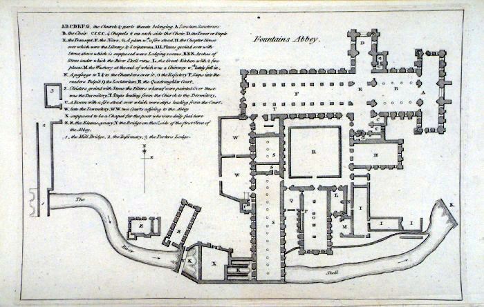 |
Fountains Abbey plan (Yorkshire)
Grose 1787 size: 250 x 160 mm Antique Map Ref FHM018 £14.00 (+P&P) click image for enlargement |
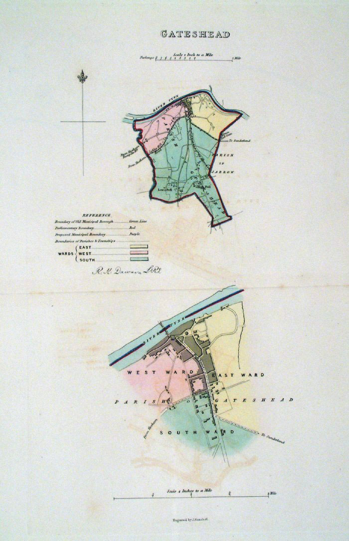 |
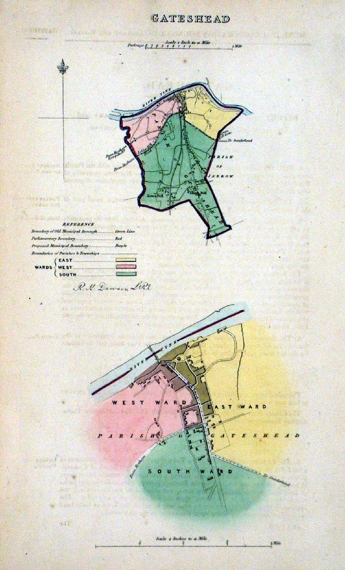
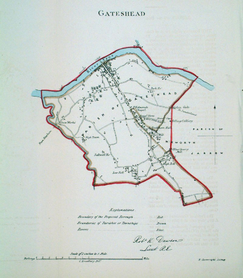
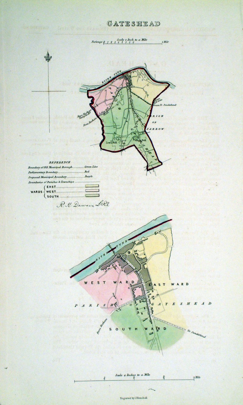
Gateshead (Durham)
Dawson - Boundary
Commission 1837 From 'Municipal Corporation Boundaries Report ' Large Paper Edition. Page size: 420 x 500mm plate size: 210 x 340 mm Antique Map Ref GBM063 £30.00 (+P&P) click image for enlargement |
 |
Gateshead (Durham) Dawson
- Boundary Commission 1837 From 'Municipal Corporation Boundaries Report ' size: 200 x 300 mm Antique Map Ref FDM111 £28.00 (+P&P) click image for enlargement |
 |
Gateshead (Durham) Dawson
- Boundary Commission 1837 From 'Municipal Corporation Boundaries Report ' size: 200 x 300 mm Antique Map Ref GDM260 £28.00 (+P&P) click image for enlargement |
 |
Gateshead (Durham)
Dawson - Boundary Commission
1837 From 'Municipal Corporation Boundaries Report ' size: 250 x 300 mm Antique Map Ref HAM027 £28.00 (+P&P) click image for enlargement |
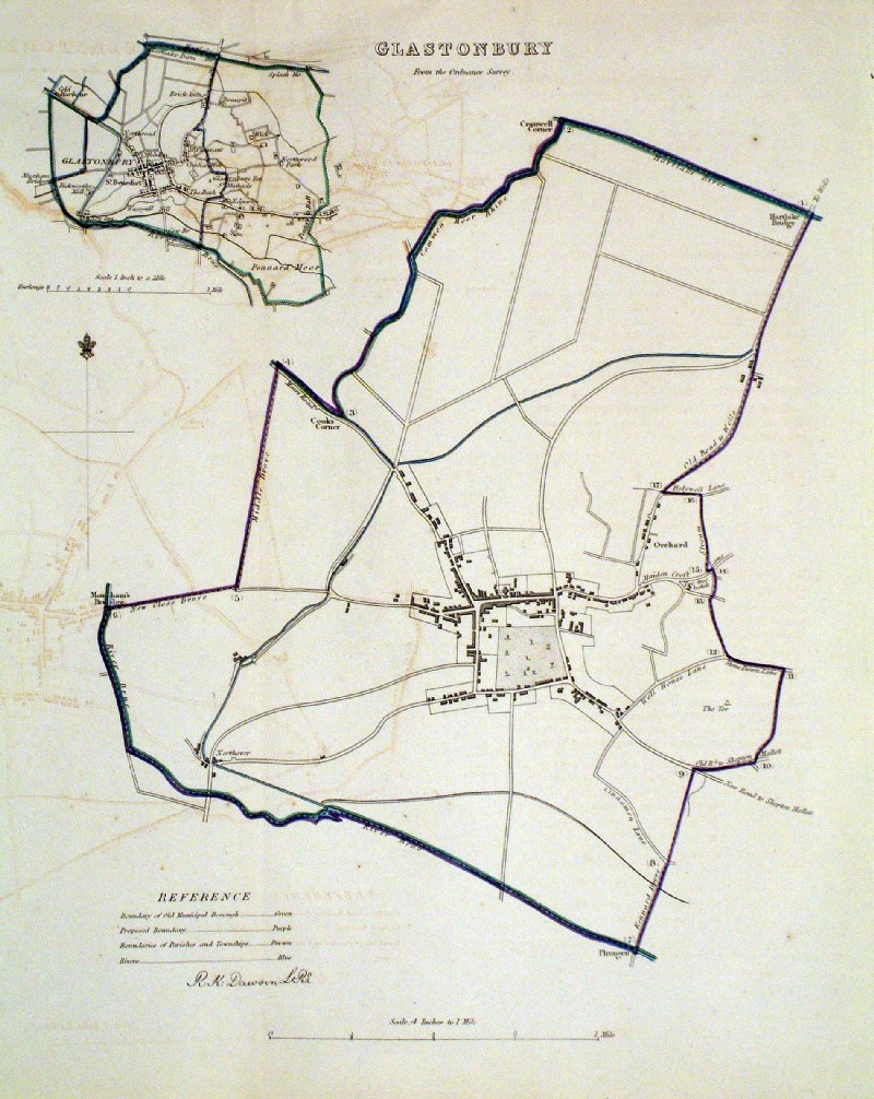 |
Glastonbury (Somesrest)
Dawson - Boundary Commission 1837 From 'Municipal Corporation Boundaries Report ' size: 270 x 300 mm 1 fold, slight offset transfer Antique Map Ref HAM028 £28.00 (+P&P) click image for enlargement |
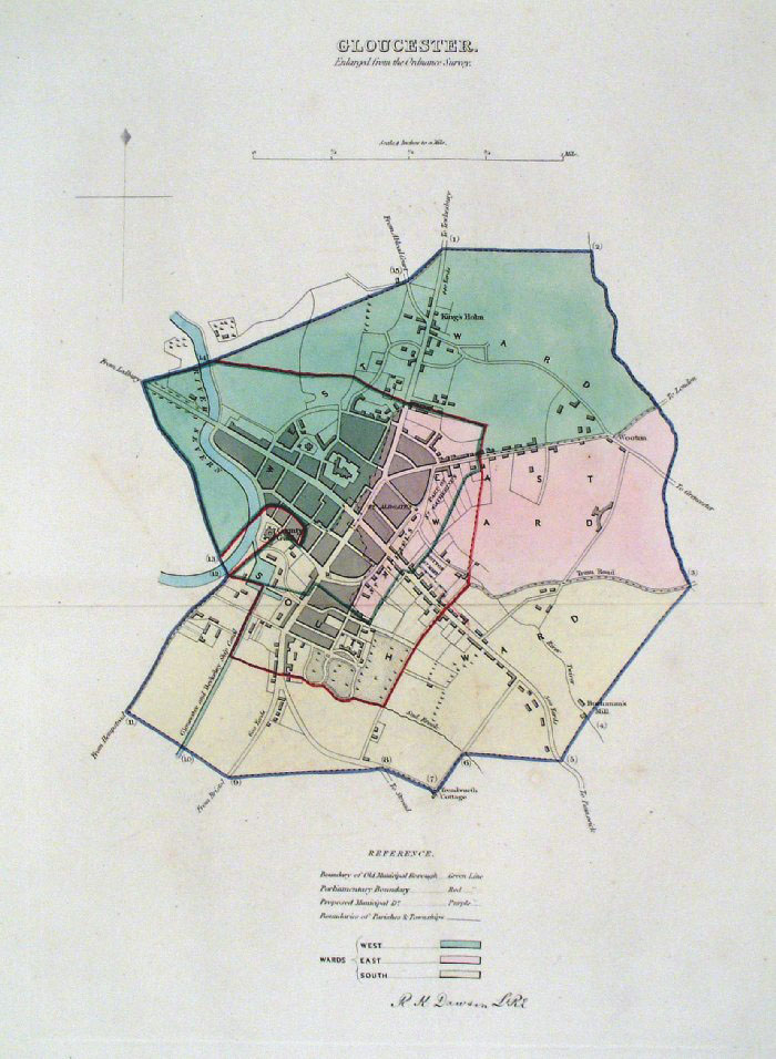 |
Gloucester Dawson -
Boundary Commission 1837 From 'Municipal Corporation Boundaries Report ' Large Paper Edition size: 250 x 300 mm 1 fold, very slight offset transfer Antique Map Ref GBM065 £26.00 (+P&P) click image for enlargement |
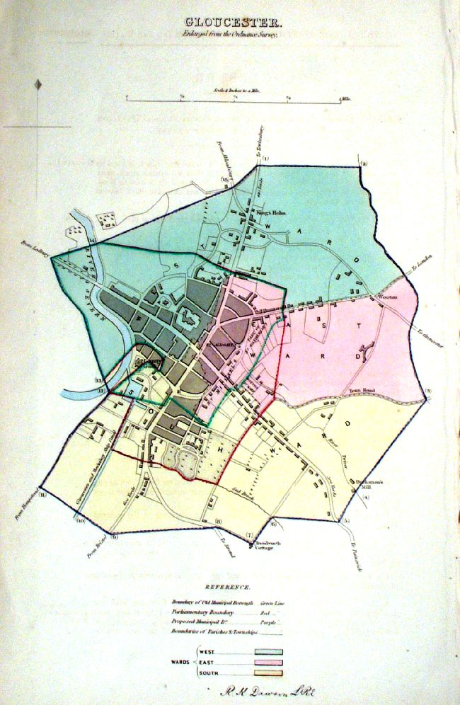 |
Gloucester Dawson -
Boundary Commission 1837 From 'Municipal Corporation Boundaries Report ' size: 210 x 300 mm Antique Map Ref IEM007 £26.00 (+P&P) click image for enlargement |
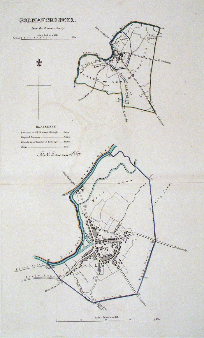 |
Godmanchester (Huntingdon)
Dawson - Boundary Commission
1837 From 'Municipal Corporation Boundaries Report ' Large Paper Edition size: 250 x 300 mm 1 fold, slight offset transfer Antique Map Ref GBM067 £20.00 (+P&P) click image for enlargement |
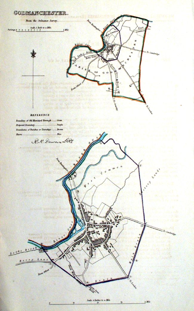 |
Godmanchester (Huntingdon)
Dawson - Boundary Commission
1837 From 'Municipal Corporation Boundaries Report ' size: 250 x 300 mm Antique Map Ref ICM008 £20.00 (+P&P) click image for enlargement |
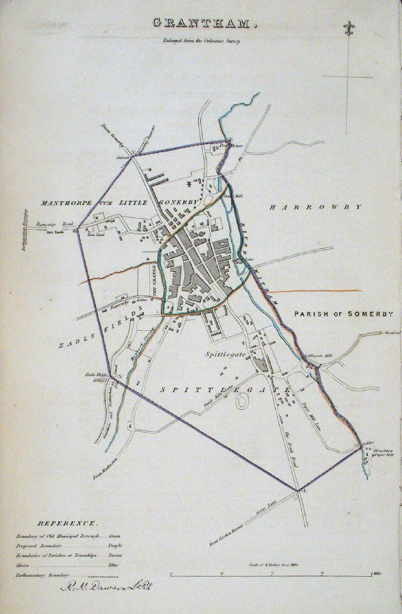 |
Grantham (Lincs)
Dawson - Boundary Commission
1837 From 'Municipal Corporation Boundaries Report ' size: 200 x 300 mm Antique Map Ref GDM263 £24.00 (+P&P) click image for enlargement |
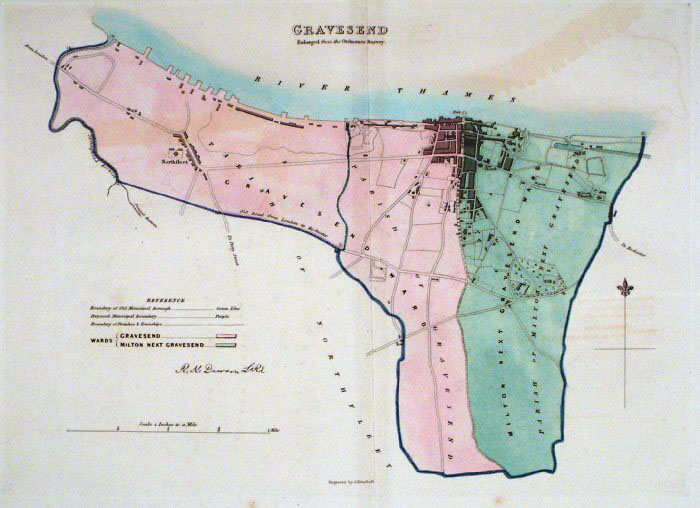 |
Gravesend (Kent) Dawson
- Boundary Commission 1837 From 'Municipal Corporation Boundaries Report ' Large Paper Edition. Page size: 420 x 500mm plate size: 240 x 340 mm Slight offset transfer Antique Map Ref GBM069 £28.00 (+P&P) click image for enlargement |
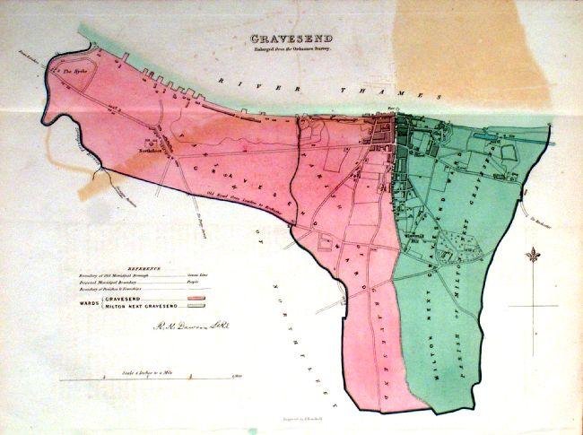 |
Gravesend (Kent) Dawson
- Boundary Commission 1837 From 'Municipal Corporation Boundaries Report ' size: 330 x 240mm 1 fold, some offset transfer Antique Map Ref ICM006 £24.00 (+P&P) click image for enlargement |
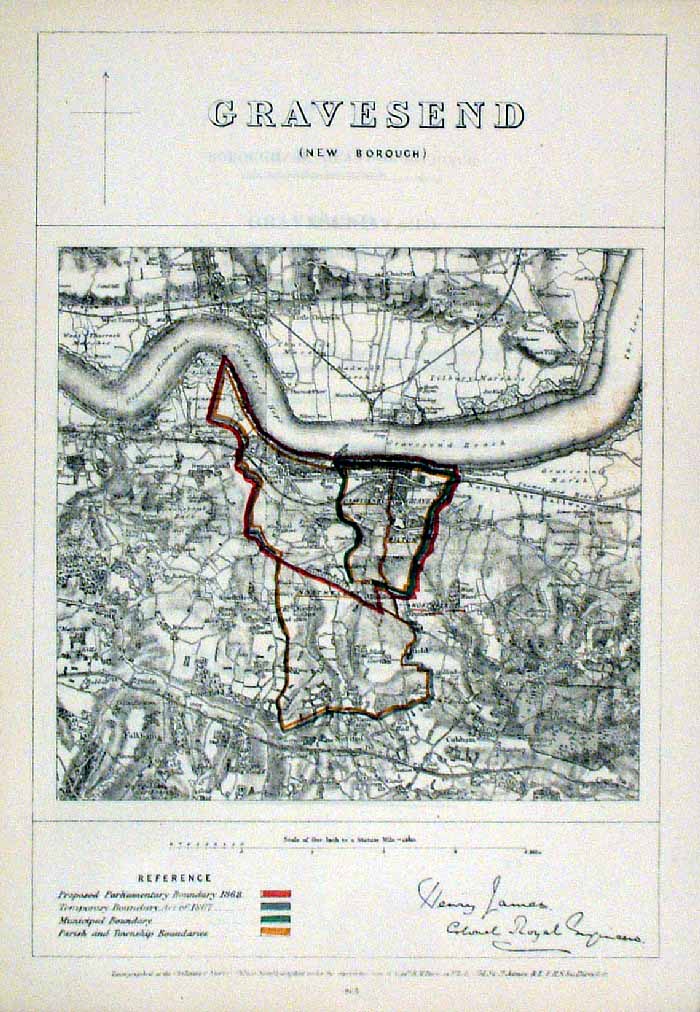 |
Gravesend (Kent)
James - Boundary Commission
1868 The map is accompanied by a page of descriptive text relating to the borough statistics Zincograph Size: 240 x 360 mm Original colouring of boundaries Antique Map Ref HJS032 £20.00 (+P&P) click image for enlargement |
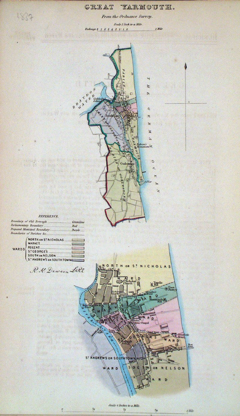 |
Great Yarmouth (Norfolk)
Dawson - Boundary Commission 1837 From 'Municipal Corporation Boundaries Report ' size: 200 x 300 mm Antique Map Ref GDM264 £28.00 (+P&P) click image for enlargement |
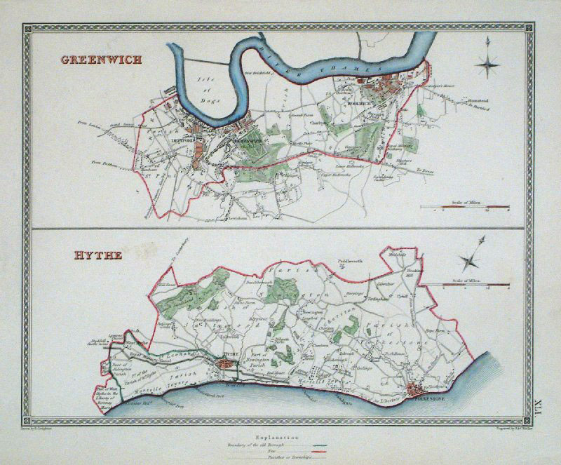 |
Greenwich and Hythe (Kent)
Samuel Lewis 1840 From ' View of the Representative History of England' (Creighton & Walker) size: 240 x 200 mm Showing Borough and Parish Boundaries. Antique Map Ref GCM001 £22.00 (+P&P) click image for enlargement |
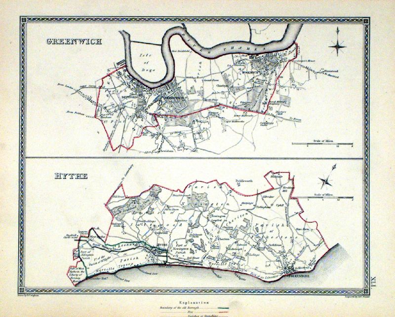 |
Greenwich . Hythe Samuel Lewis 1835 engraved by J & C Walker Steel engraving Size: 250 x 200 mm, Original colouring of boundaries. Antique Map Ref KJM041 £22.00 (+P&P) Sample, not of this specific map, to indicate the level of detail of these 1835 Lewis town plans and town environs. click image for enlargement |
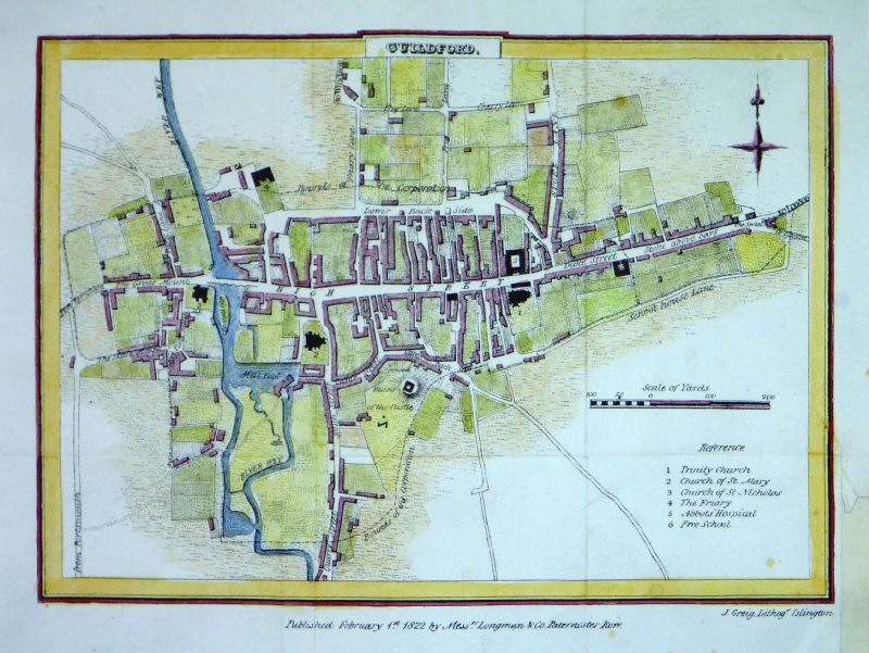 |
Guildford (Surrey)
Greig / Longman & Co. 1822 Town plan of Guildford with a scale of 200 yards down to 10 yard divisions. Detail size: 225 x 170 mm several folds, strengthened lower-right margin. Antique Map Ref MLM003 £30.00 (+P&P) click image for enlargement |
More Town Plans: A - B H - L M - R S - Y Scotland All Genuine Antiquarian Maps - No Reproductions or Modern Copies |
2023