Past Pages
Antique Maps, Prints and Ephemera
Antique Maps - UK Town Plans -
S to Y
England & WalesIncluding castle plans, cathedral plans, church plans,
Boundary Commission maps, local suburban maps
For Irish Town plans see section: Maps - Europe / Ireland
For London see section: Maps - London
Arranged alphabetically by town or locality (not by name of church , hospital, etc)
For local interest also see Road Maps section.
Note that some maps have two or three towns, making alphabetic searching difficult and sometimes prone to error.
A Brief Article on Town Plans Help on local area maps
More Town Plans: A - B C - G H - L M - R Scotland
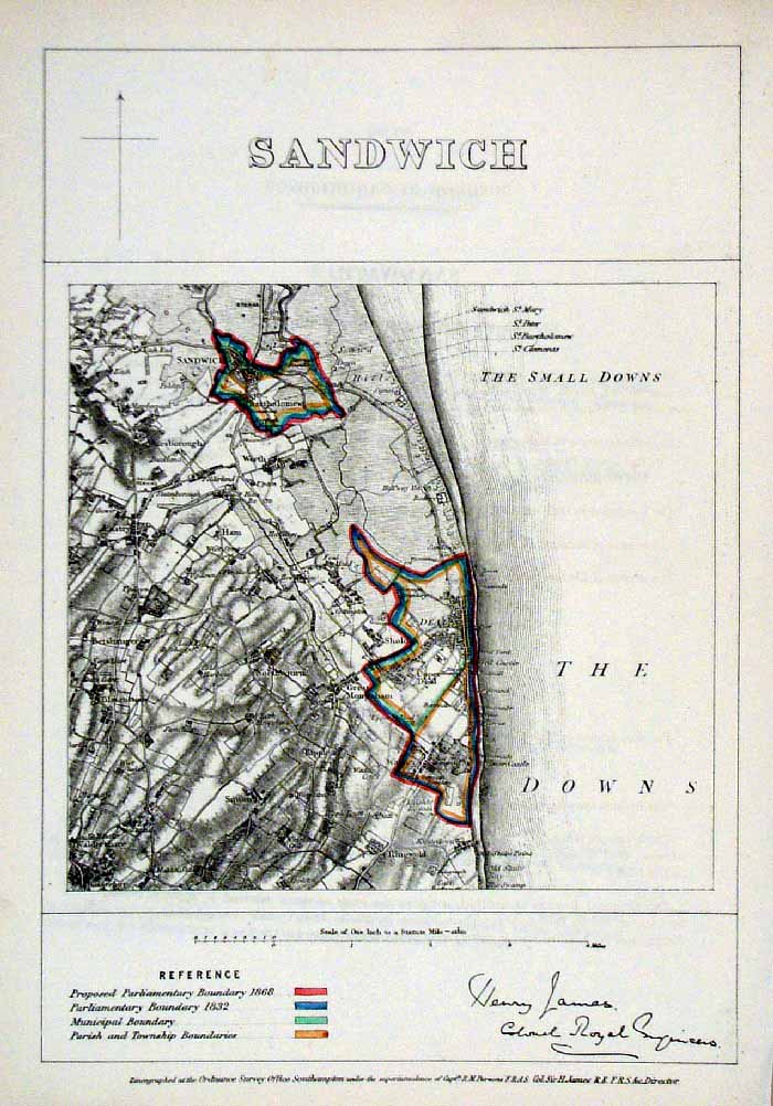 |
Sandwich (Kent)
James - Boundary Commission
1868 The map is accompanied by a page of descriptive text relating to the borough statistics Zincograph Size: 240 x 360 mm Original colouring of boundaries Antique Map Ref HJS055 £24.00 (+P&P) click image for enlargement |
 |
Salisbury . Devizes . Marlborough . Westbury Samuel Lewis 1835 engraved by J & C Walker Steel engraving Size: 200 x 250 mm, Original colouring of boundaries. Antique Map Ref KJM101 £18.00 (+P&P) Sample, not of this specific map, to indicate the level of detail of these 1835 Lewis town plans. click image for enlargement |
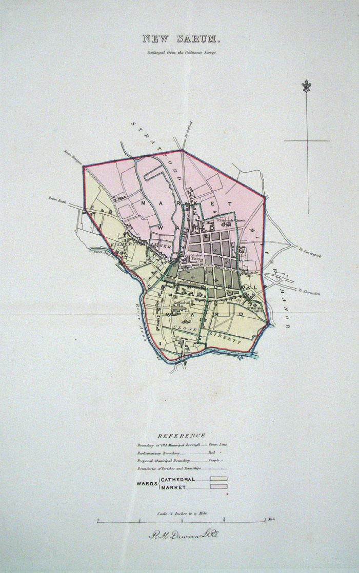 |
Sarum (New) - Salisbury
Dawson - Boundary Commission 1837 From 'Municipal Corporation Boundaries Report ' Large Paper Edition size: 250 x 300 mm 1 fold Antique Map Ref GBM141 £26.00 (+P&P) click image for enlargement |
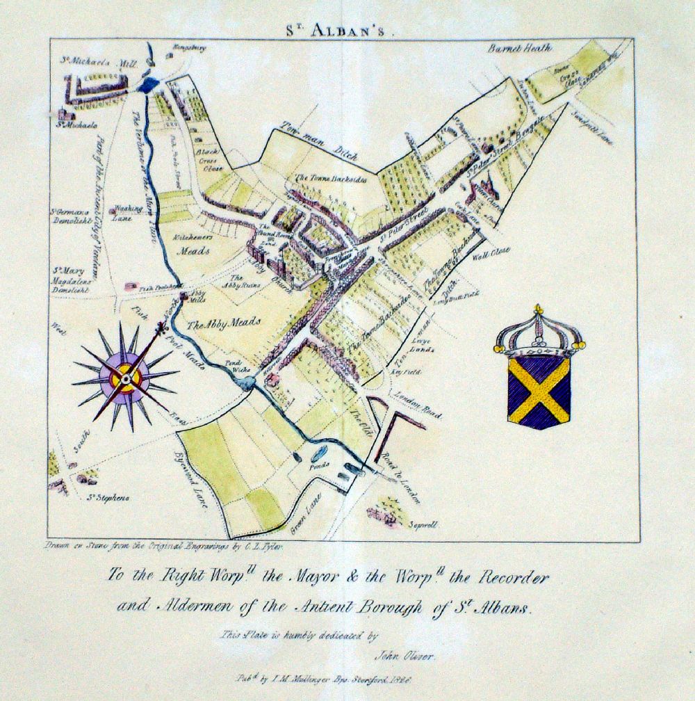 |
St Albans Tyler /
Mullinger 1826 Thought to be copied from a 1700 edition of the map. Lithograph from Stone size: 210 x 210 mm Detail Very faint and irregular surface discolouration Antique Map Ref LJM003 £35.00 (+P&P) click image for enlargement |
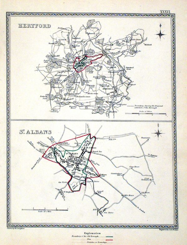 |
St Albans . Hertford Samuel Lewis 1835 engraved by J & C Walker Steel engraving Size: 200 x 250 mm, Original colouring of boundaries. Antique Map Ref KJM036 £18.00 (+P&P) Sample, not of this specific map, to indicate the level of detail of these 1835 Lewis town plans. click image for enlargement |
 |
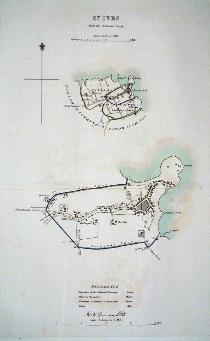
St Ives (Cornwall) Dawson
- Boundary Commission 1837 From 'Municipal Corporation Boundaries Report ' size: 380 x 300 mm 2 folds Antique Map Ref FDM079 £28.00 (+P&P) click image for enlargement |
 |
St Ives (Cornwall) Dawson
- Boundary Commission 1837 From 'Municipal Corporation Boundaries Report ' size: 200 x 300 mm Antique Map Ref FDM097 £28.00 (+P&P) click image for enlargement |
 |
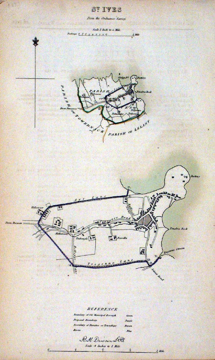
St Ives (Cornwall)
Dawson - Boundary Commission
1837 From 'Municipal Corporation Boundaries Report ' Large Paper Edition. Page size: 420 x 500mm plate size: 220 x 340 mm Faint offset transfer Antique Map Ref GBM138 £28.00 (+P&P) click image for enlargement |
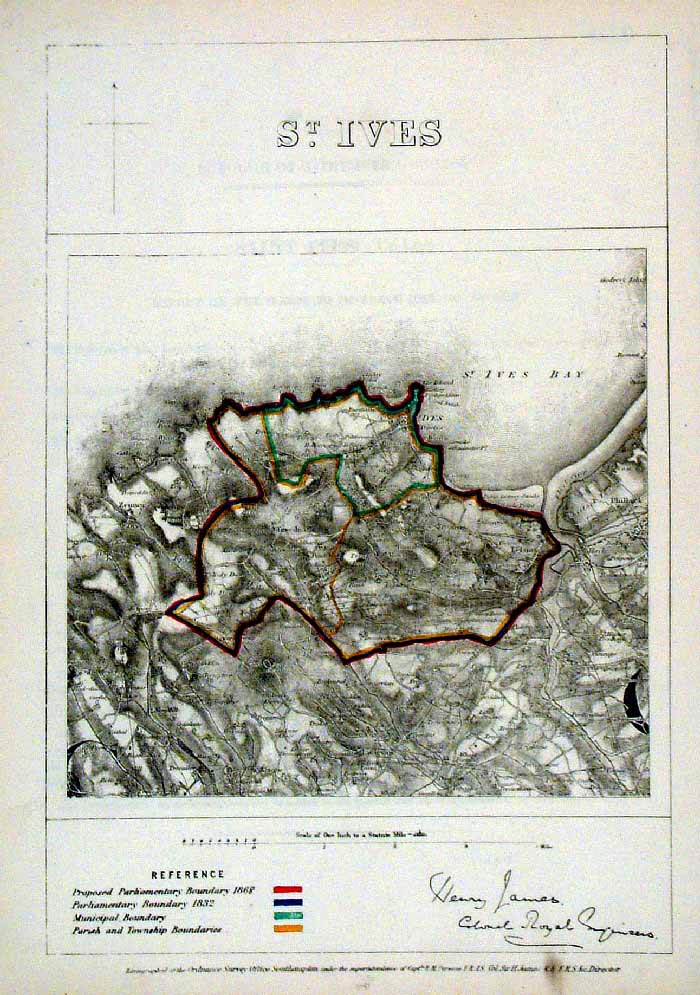 |
St Ives (Cornwall)
James - Boundary Commission
1868 The map is accompanied by a page of descriptive text relating to the borough statistics Zincograph Size: 240 x 360 mm Original colouring of boundaries Antique Map Ref HJS060 £24.00 (+P&P) click image for enlargement |
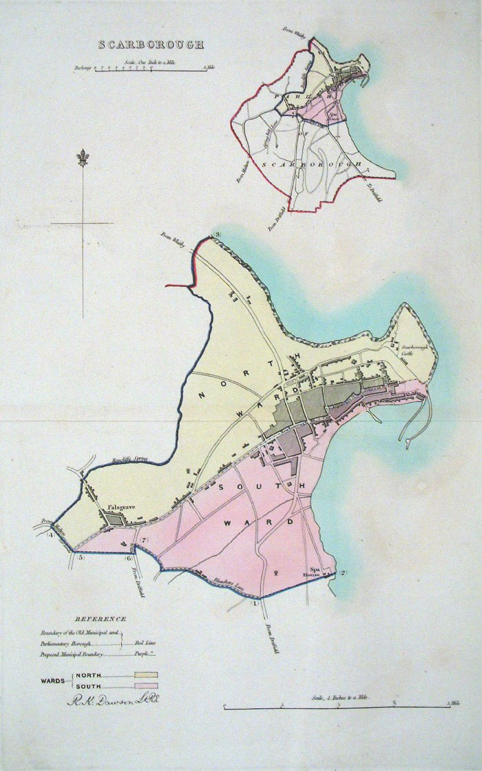 |
Scarborough (Yorkshire)
Dawson - Boundary
Commission 1837 From 'Municipal Corporation Boundaries Report ' Large Paper Edition. Page size: 420 x 500mm plate size: 220 x 340 mm Antique Map Ref GBM142 £30.00 (+P&P) click image for enlargement |
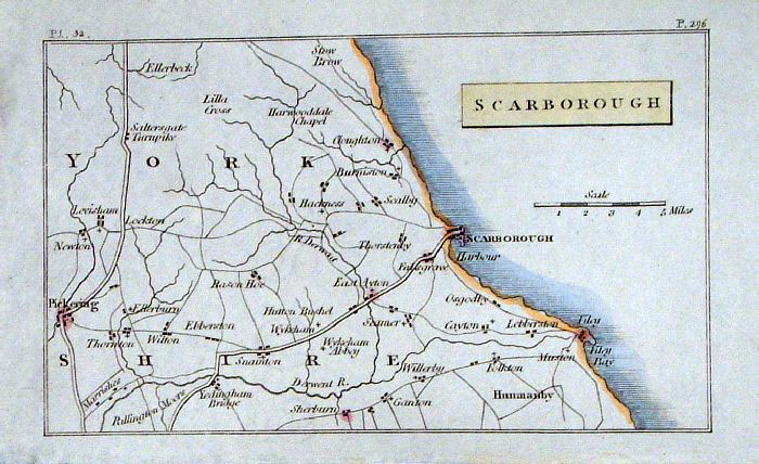 |
Scarborough (Yorkshire) Philips
c1830 size: 140 x 90
mm Antique Map Ref GBM213 £16.00 (+P&P) click image for enlargement |
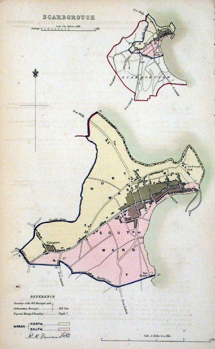 |
Scarborough (Yorkshire)
Dawson - Boundary Commission 1837 From 'Municipal Corporation Boundaries Report ' size: 200 x 300 mm Antique Map Ref FDM096 £28.00 (+P&P) click image for enlargement |
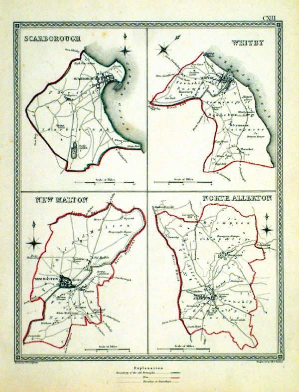 |
Scarborough . Whitby . New Malden . North Allerton Samuel Lewis 1835 engraved by J & C Walker Steel engraving Size: 200 x 250 mm, Original colouring of boundaries. Antique Map Ref KJM113 £16.00 (+P&P) Sample, not of this specific map, to indicate the level of detail of these 1835 Lewis town plans. click image for enlargement |
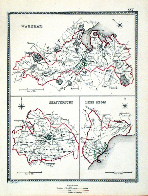 |
Shaftesbury . Lyme Regis . Wareham Samuel Lewis 1835 engraved by J & C Walker Steel engraving Size: 200 x 250 mm, Original colouring of boundaries. Antique Map Ref KJM025 £18.00 (+P&P) Sample, not of this specific map, to indicate the level of detail of these 1835 Lewis town plans. click image for enlargement |
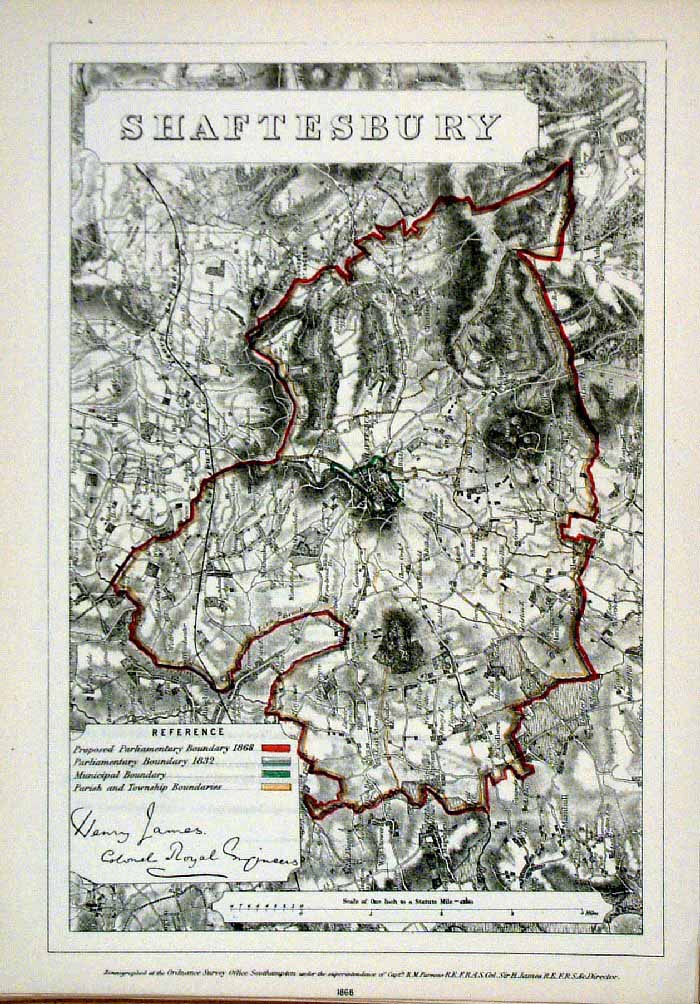 |
Shaftesbury (Dorset)
James - Boundary
Commission 1868 The map is accompanied by a page of descriptive text relating to the borough statistics Zincograph Size: 240 x 360 mm Original colouring of boundaries Antique Map Ref HJS056 £24.00 (+P&P) click image for enlargement |
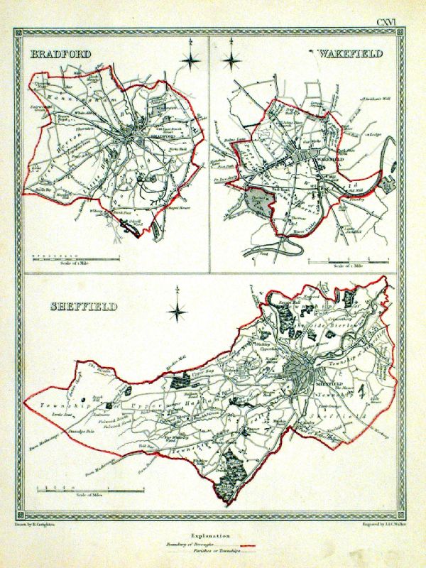 |
Sheffield . Bradford . Wakefield Samuel Lewis 1835 engraved by J & C Walker Steel engraving Size: 200 x 250 mm, Original colouring of boundaries. Antique Map Ref KJM116 £16.00 (+P&P) Sample, not of this specific map, to indicate the level of detail of these 1835 Lewis town plans. click image for enlargement |
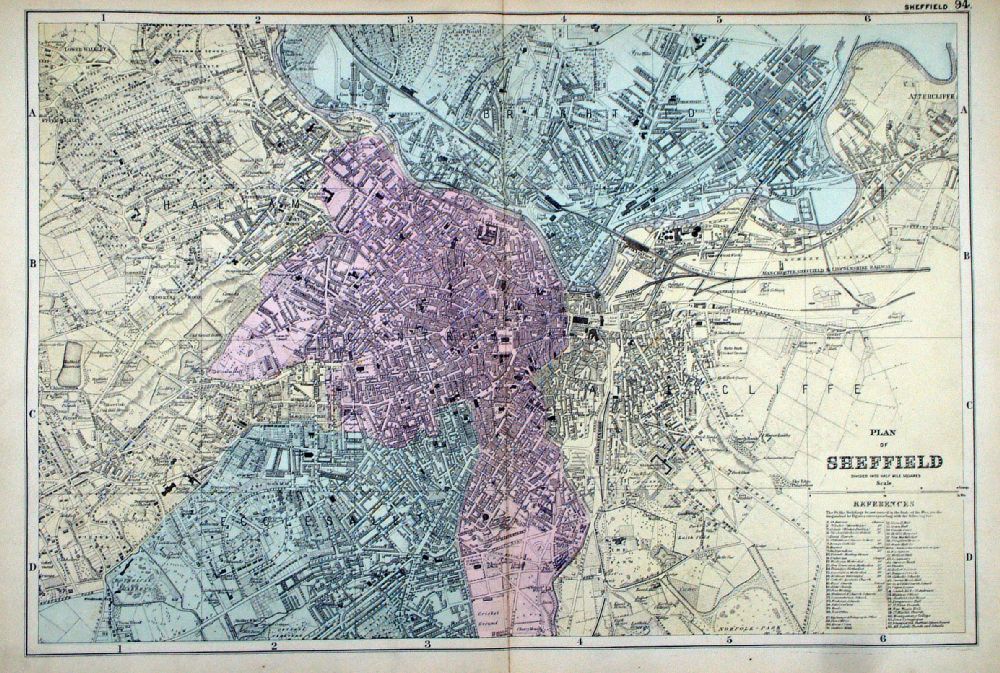 |
Plan of Sheffield From the New Large Scale Atlas of the British Isles by G.W. Bacon 1892 size: 480 x 330 mm, centre fold Ref LHM101 £28.00 (+P&P) Detail click image for enlargement |
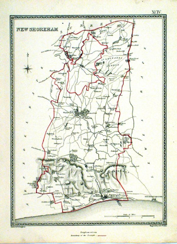 |
Shoreham ( New Shoreham ) Sussex Samuel Lewis 1835 engraved by J & C Walker Steel engraving Size: 200 x 250 mm, Original colouring of boundaries. Antique Map Ref KJM094 £20.00 (+P&P) Sample, not of this specific map, to indicate the level of detail of these 1835 Lewis town plans. click image for enlargement |
 |
Shoreham - New Shoreham (Sussex)
James - Boundary
Commission 1868 The map is accompanied by a page of descriptive text relating to the borough statistics Zincograph Size: 240 x 360 mm Original colouring of boundaries Antique Map Ref HJS046 £22.00 (+P&P) click image for enlargement |
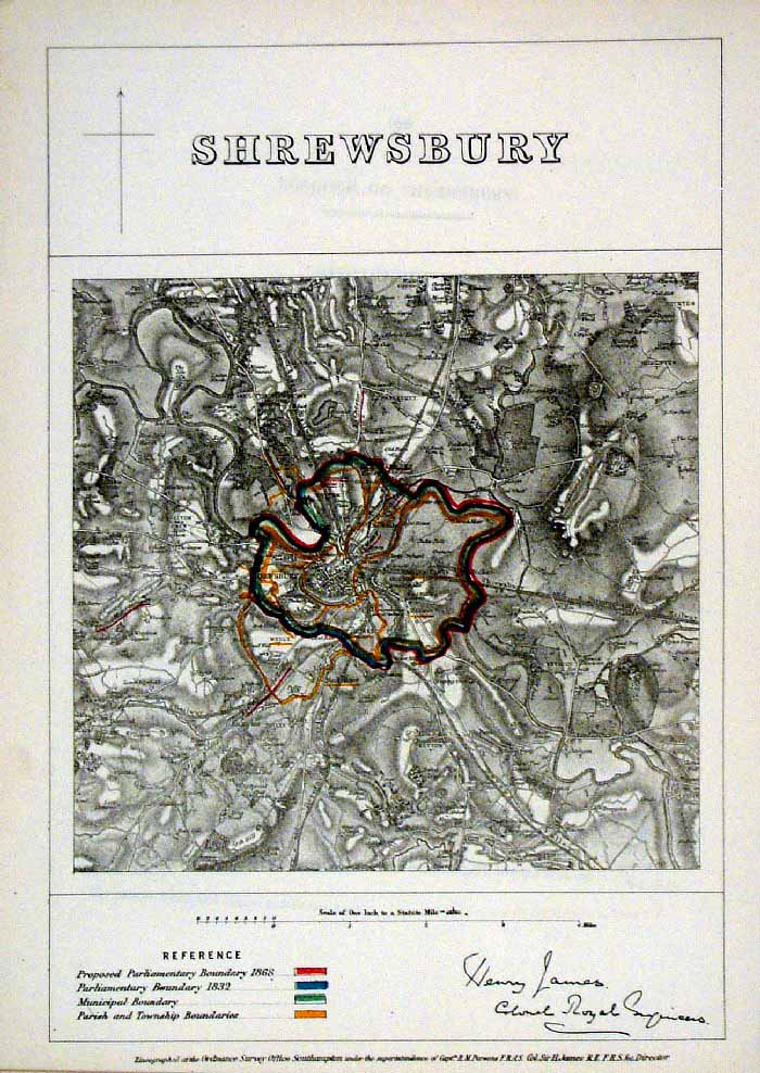 |
Shrewsbury (Shropshire)
James - Boundary
Commission 1868 The map is accompanied by a page of descriptive text relating to the borough statistics Zincograph Size: 240 x 360 mm Original colouring of boundaries Antique Map Ref HJS057 £18.00 (+P&P) click image for enlargement |
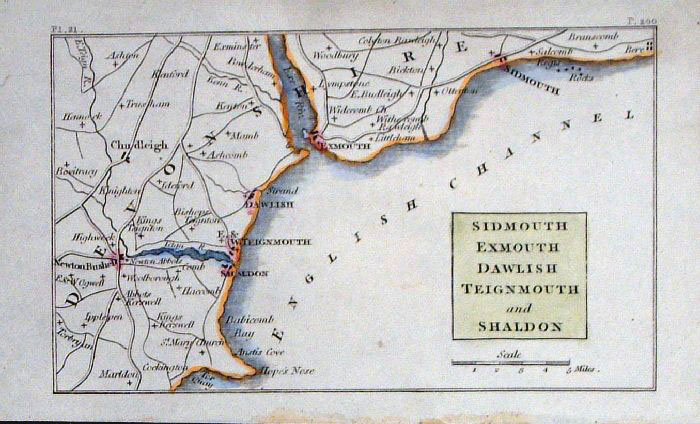 |
Sidmouth, Exmouth, Dawlish ...
Philips c1830
size: 140 x 90 mm Antique Map Ref GBM210 £16.00 (+P&P) click image for enlargement |
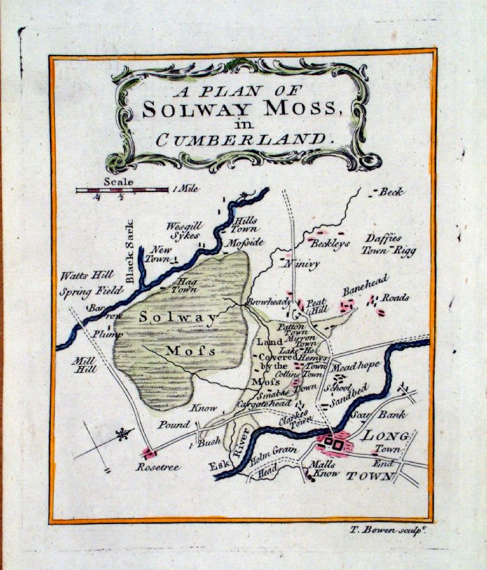 |
A Plan of Solway Moss in
Cumberland T. Bowen Gentleman's Magazine 1779 Shows Longtown on the Esk. Copper engarving size: 120 x 150 mm Antique Map Ref LAM019 £35.00 (+P&P) click image for enlargement |
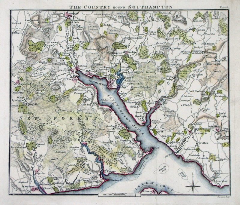 |
The Country round
Southampton Thomson 1811 (Patersons Roads) size: 230 x 190 mm Ref MEM005 £20.00 (+P&P) click image for enlargement |
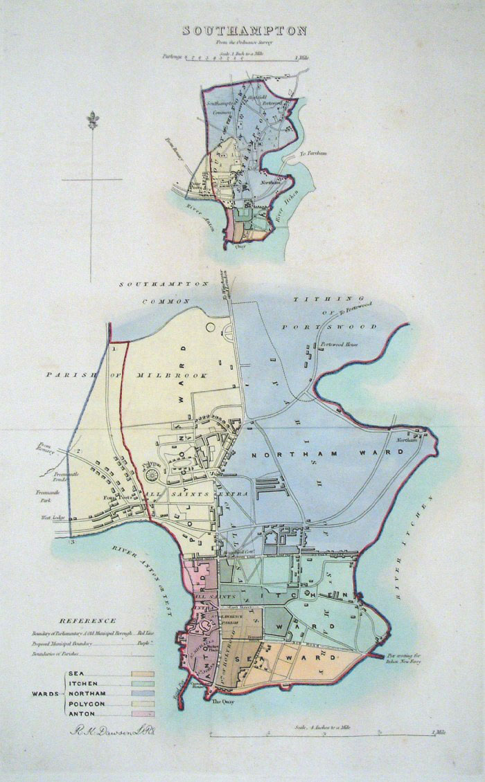 |
Southampton (Hampshire)
Dawson - Boundary Commission 1837 From 'Municipal Corporation Boundaries Report ' Large Paper Edition size: 250 x 300 mm 1 fold Antique Map Ref GBM145 £28.00 (+P&P) click image for enlargement |
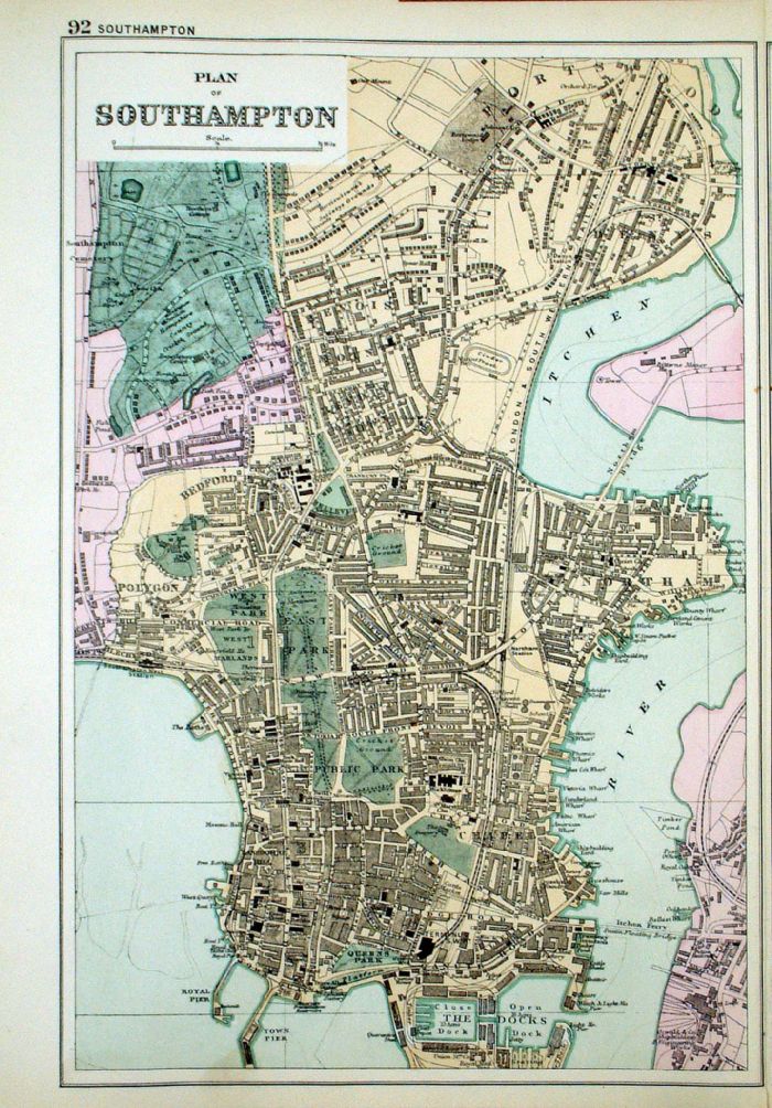 |
Plan of Southampton From the New Large Scale Atlas of the British Isles by G.W. Bacon 1892 size: 220 x 330 mm, tight left margin Ref LHM099 £24.00 (+P&P) Detail click image for enlargement |
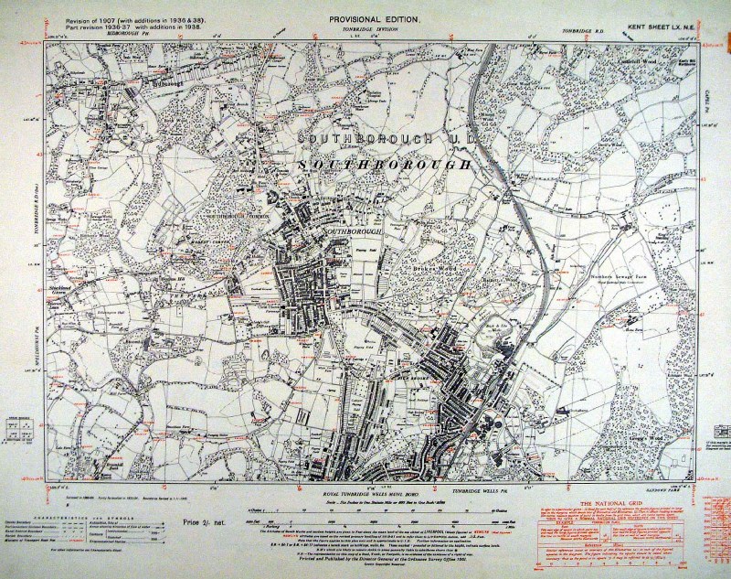 |
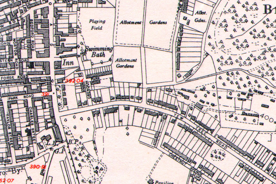
Southborough (Kent - north of Tunbridge
Wells) Ordnance Survey
6"/mile 1938 1951 reprint of Provisional Edition 1938 size: 480 x 400 mm Detail 1 Detail 2 Antique Map Ref HJM008 £26.00 (+P&P) click image for enlargement |
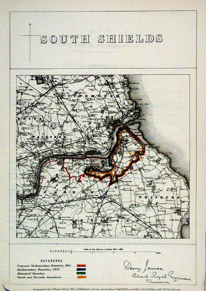 |
South Shields (Durham)
James - Boundary
Commission 1868 The map is accompanied by a page of descriptive text relating to the borough statistics Zincograph Size: 240 x 360 mm Original colouring of boundaries Antique Map Ref HJS058 £20.00 (+P&P) click image for enlargement |
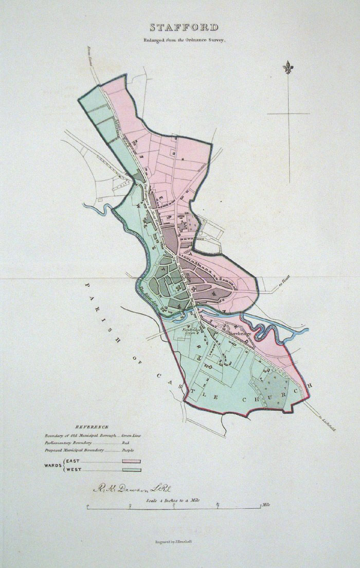 |
Stafford (Staffordshire)
Dawson - Boundary
Commission 1837 From 'Municipal Corporation Boundaries Report ' Large Paper Edition. Page size: 420 x 500mm plate size: 220 x 340 mm Antique Map Ref GBM148 £28.00 (+P&P) click image for enlargement |
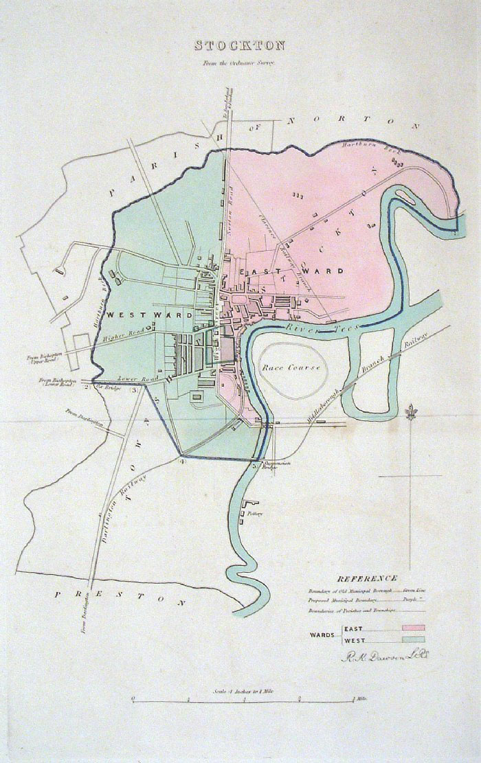 |
Stockton (Durham) Dawson -
Boundary Commission 1837 From 'Municipal Corporation Boundaries Report ' Large Paper Edition Note early Darlington-Stockton Railway size: 250 x 300 mm 1 fold, very faint offset transfer Antique Map Ref GBM151 £24.00 (+P&P) click image for enlargement |
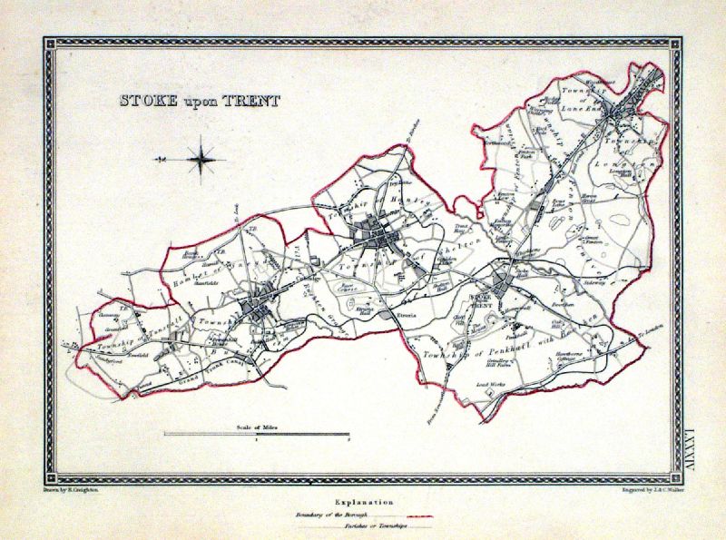 |
Stoke upon Trent Samuel Lewis 1835 engraved by J & C Walker Steel engraving Size: 250 x 200 mm, Original colouring of boundaries. Antique Map Ref KJM084 £16.00 (+P&P) Sample, not of this specific map, to indicate the level of detail of these 1835 Lewis town plans and town environs. click image for enlargement |
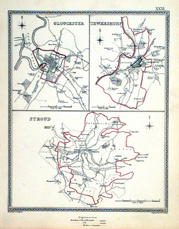 |
Stroud . Gloucester . Tewksbury Samuel Lewis 1835 engraved by J & C Walker Steel engraving Size: 200 x 250 mm, Original colouring of boundaries. Antique Map Ref KJM031 £18.00 (+P&P) Sample, not of this specific map, to indicate the level of detail of these 1835 Lewis town plans. click image for enlargement |
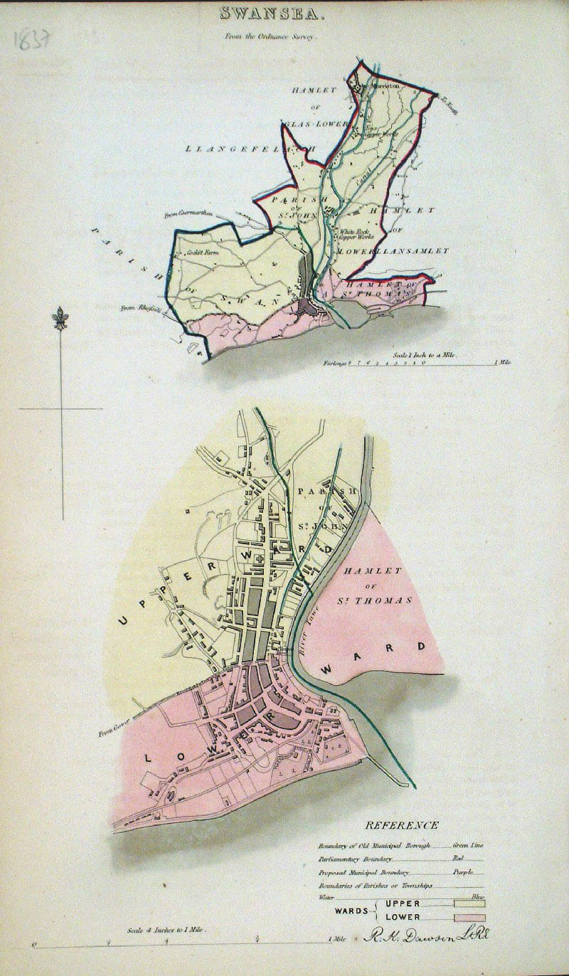 |
Swansea (Wales) Dawson
- Boundary Commission 1837 From 'Municipal Corporation Boundaries Report ' size: 200 x 300 mm Antique Map Ref GDM303 £26.00 (+P&P) click image for enlargement |
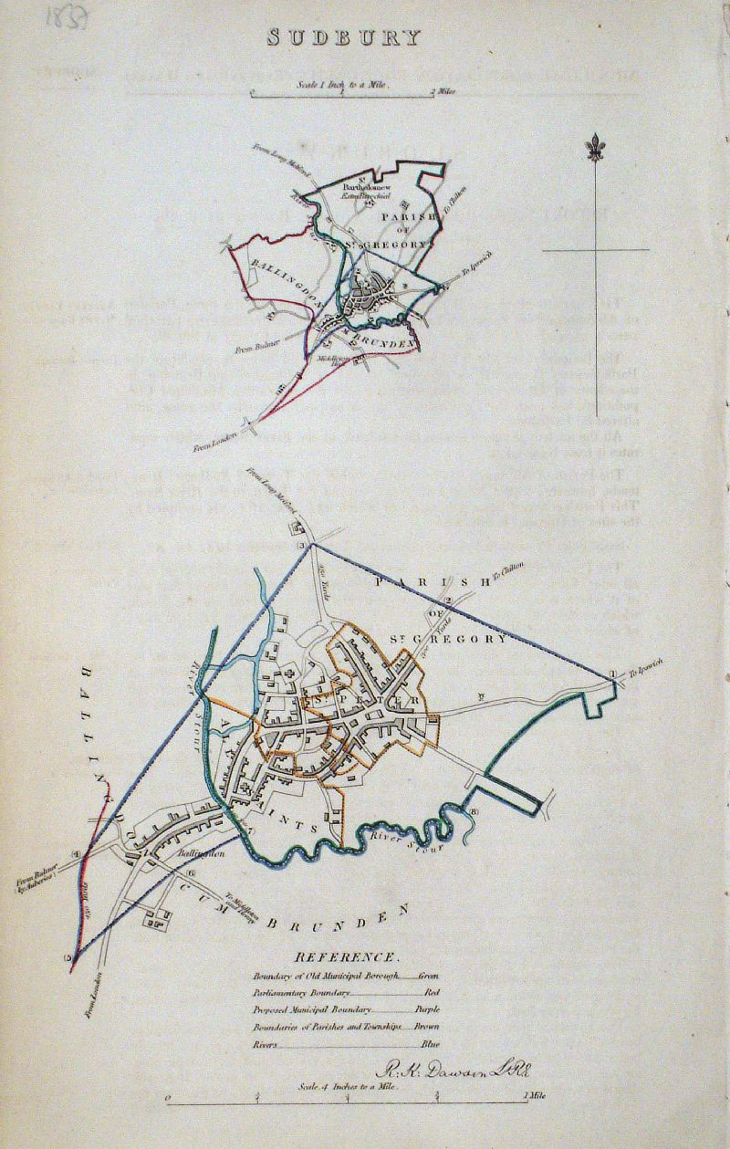 |
Sudbury (Suffolk)
Dawson - Boundary
Commission 1837 From 'Municipal Corporation Boundaries Report ' size: 200 x 300 mm Antique Map Ref GDM300 £24.00 (+P&P) click image for enlargement |
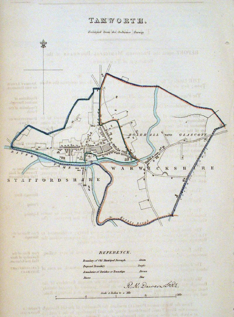 |
Tamworth (Warwickshire /
Staffordshire) Dawson
- Boundary Commission 1837 From 'Municipal Corporation Boundaries Report ' Page size: 200 x 320 mm, faint offset transfer Antique Map Ref GDM307 £24.00 (+P&P) click image for enlargement |
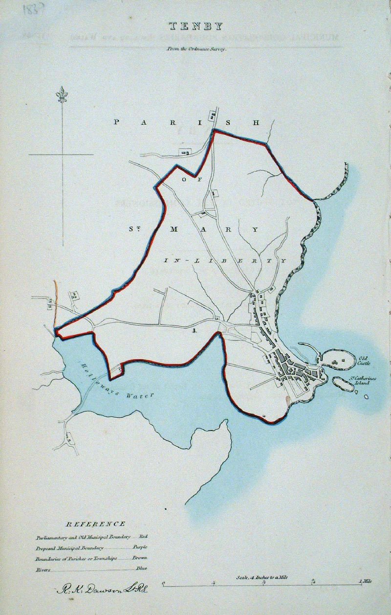 |
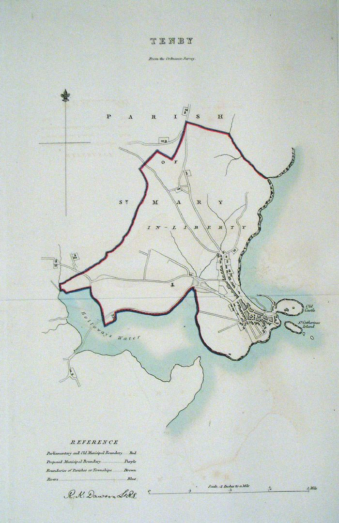
Tenby (Wales)
Dawson - Boundary
Commission 1837 From 'Municipal Corporation Boundaries Report ' size: 200 x 300 mm Antique Map Ref GDM305 £24.00 (+P&P) click image for enlargement |
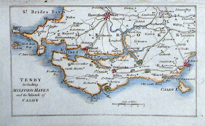 |
Tenby and Milford Haven
Philips c1830
size: 140 x 90 mm Antique Map Ref GBM216 £18.00 (+P&P) click image for enlargement |
 |
Tenby (Wales) Dawson -
Boundary Commission 1837 From 'Municipal Corporation Boundaries Report ' Large Paper Edition size: 250 x 300 mm 1 fold, faint offset transfer Antique Map Ref GBM158 £24.00 (+P&P) click image for enlargement |
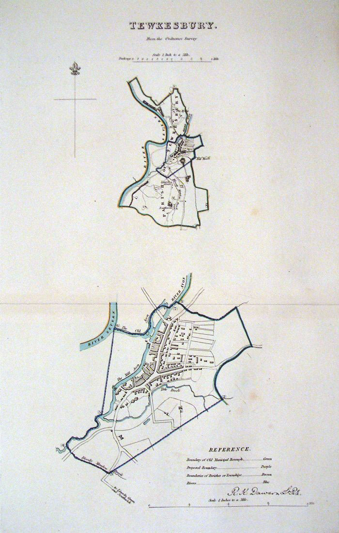 |
Tewkesbury (Glouc) Dawson
- Boundary Commission 1837 From 'Municipal Corporation Boundaries Report ' Large Paper Edition size: 250 x 300 mm 1 fold Antique Map Ref GBM160 £24.00 (+P&P) click image for enlargement |
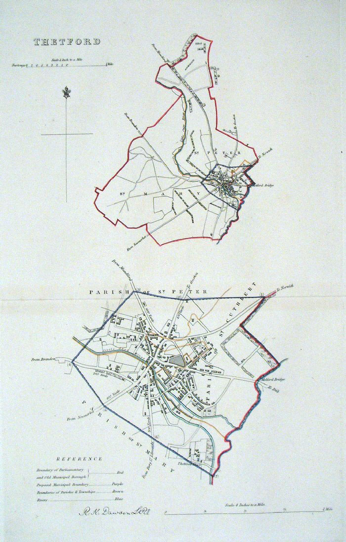 |
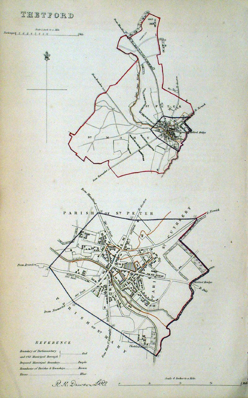
Thetford (Norfolk) Dawson
- Boundary Commission 1837 From 'Municipal Corporation Boundaries Report ' Large Paper Edition. Page size: 420 x 500 mm plate size: 210 x 340 mm Antique Map Ref GBM161 £30.00 (+P&P) click image for enlargement |
 |
Thetford (Norfolk)
Dawson - Boundary
Commission 1837 From 'Municipal Corporation Boundaries Report ' Page size: 200 x 320 mm Antique Map Ref GDM307 £24.00 (+P&P) click image for enlargement |
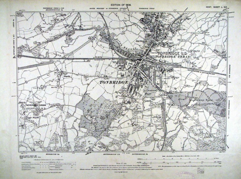 |
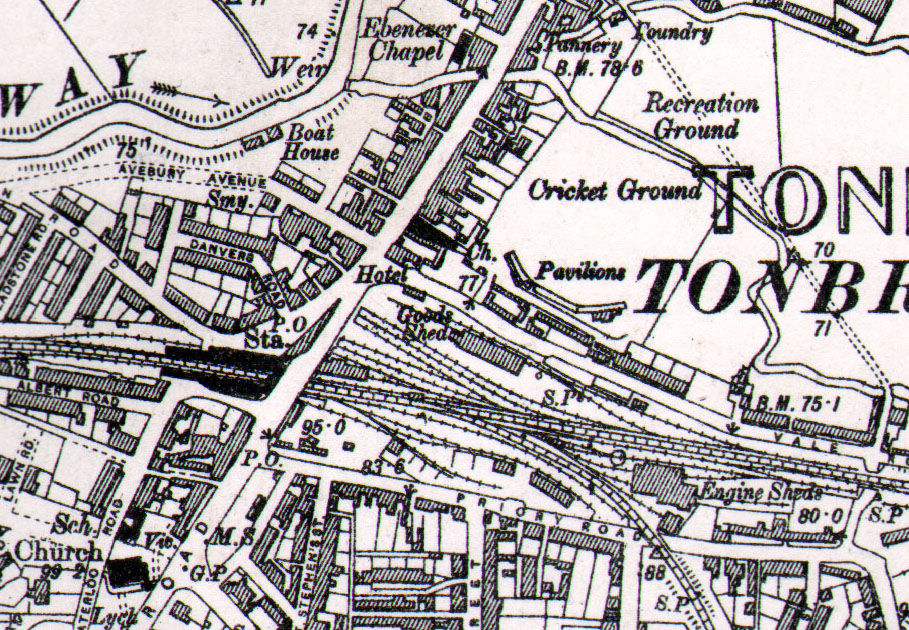
Tonbridge (Kent) Ordnance
Survey 6"/mile 1909 size: 480 x 400 mm 1 fold Detail Detail Antique Map Ref HJM006 £38.00 (+P&P) click image for enlargement |
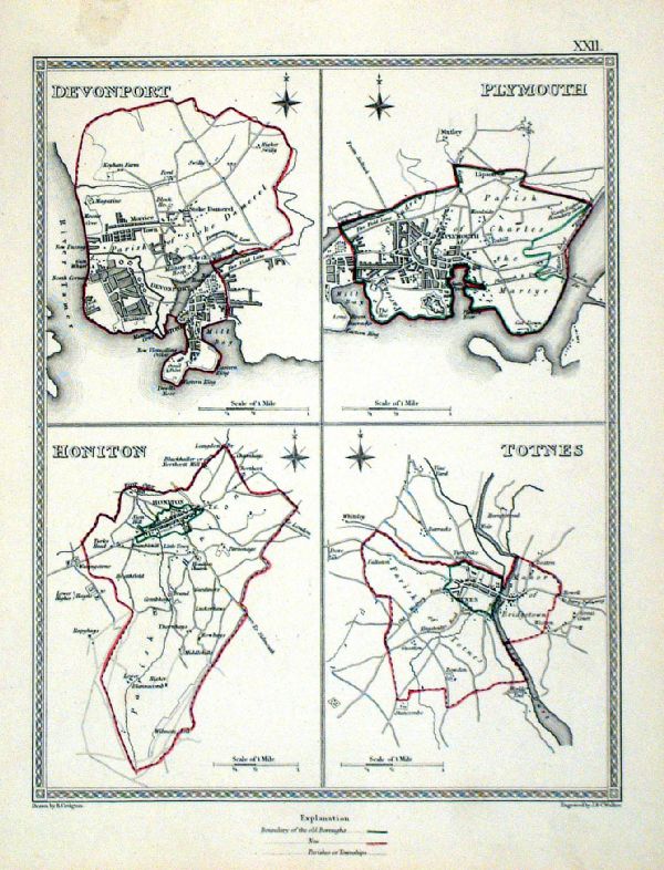 |
Totnes . Honiton . Plymouth . Devonport Samuel Lewis 1835 engraved by J & C Walker Steel engraving Size: 200 x 250 mm, Original colouring of boundaries. Antique Map Ref KJM022 £18.00 (+P&P) Sample, not of this specific map, to indicate the level of detail of these 1835 Lewis town plans. click image for enlargement |
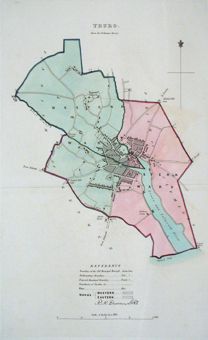 |
Truro (Cornwall) Dawson -
Boundary Commission 1837 From 'Municipal Corporation Boundaries Report ' Large Paper Edition size: 250 x 300 mm 1 fold Antique Map Ref GBM165 £28.00 (+P&P) click image for enlargement |
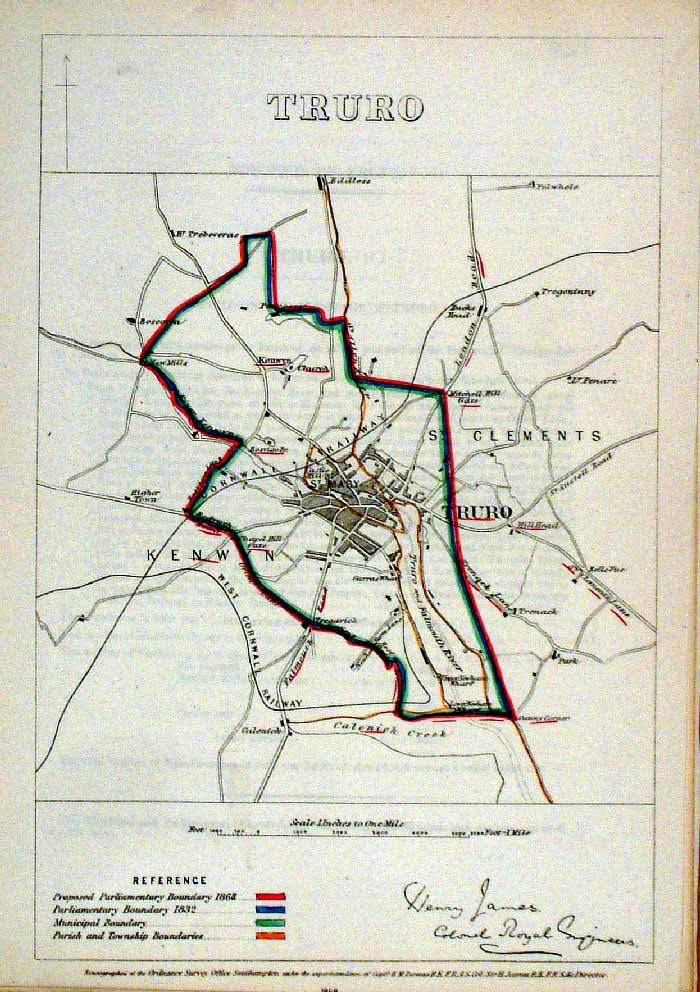 |
Truro (Cornwall)
James - Boundary Commission
1868 The map is accompanied by a page of descriptive text relating to the borough statistics Zincograph Size: 240 x 360 mm Original colouring of boundaries Antique Map Ref HJS062 £24.00 (+P&P) click image for enlargement |
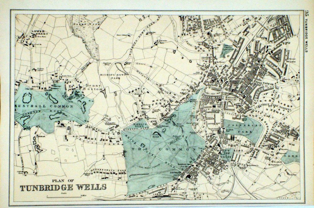 |
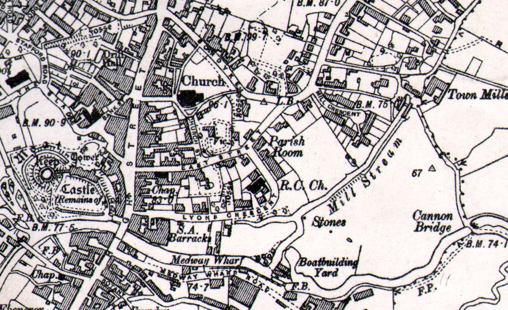
Plan of Tunbridge
Wells From the New Large Scale Atlas of the British Isles by G.W. Bacon 1892 size: 330 x 220 mm, tight lower margin Ref LHM102 £26.00 (+P&P) Detail click image for enlargement |
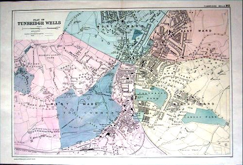 |
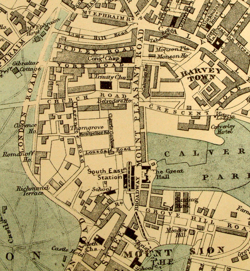
Tunbridge Wells
(Kent) Bacon
1901
size: 500 x 330 mm Antique Map Ref AAM081 £26.00 (+P&P) click image for enlargement Detail |
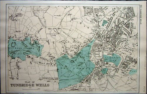 |
Tunbridge Wells
(Kent) Bacon
1895
size: 340 x 220 mm Antique Map Ref AAM060 £26.00 (+P&P) Tight bottom margin click image for enlargement |
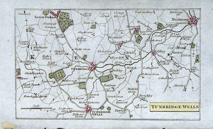 |
Tunbridge Wells (Kent)
Philips c1830
size: 140 x 90 mm Antique Map Ref GBM215 £18.00 (+P&P) click image for enlargement |
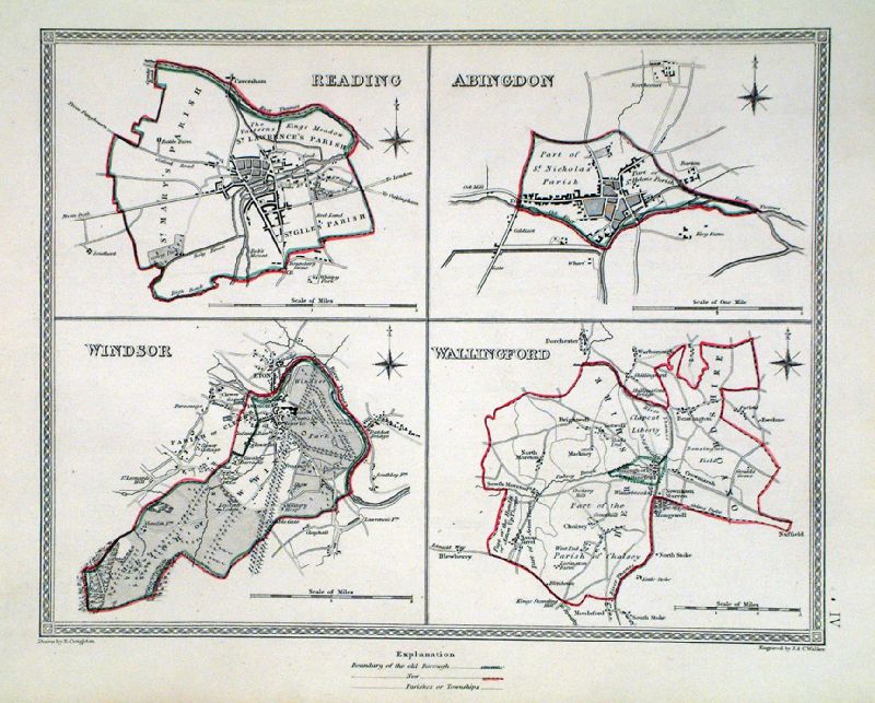 |
Wallingford . Windsor . Reading . Abingdon Samuel Lewis 1835 engraved by J & C Walker Steel engraving Size: 250 x 200 mm, Original colouring of boundaries. Antique Map Ref KJM004 £18.00 (+P&P) Sample, not of this specific map, to indicate the level of detail of these 1835 Lewis town plans and town environs. click image for enlargement |
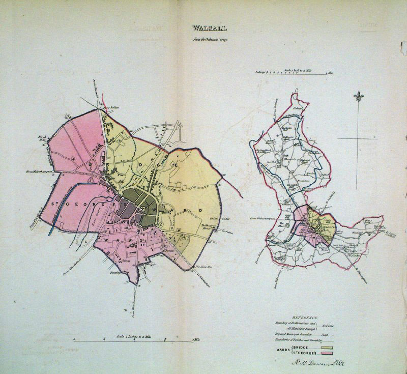 |
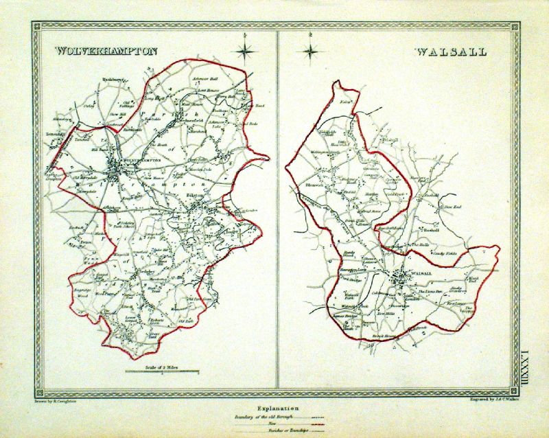
Walsall (Staffs)
Dawson - Boundary Commission
1837 From 'Municipal Corporation Boundaries Report ' size: 320 x 300 mm 1 fold, very faint offset transfer Antique Map Ref GDM310 £24.00 (+P&P) click image for enlargement |
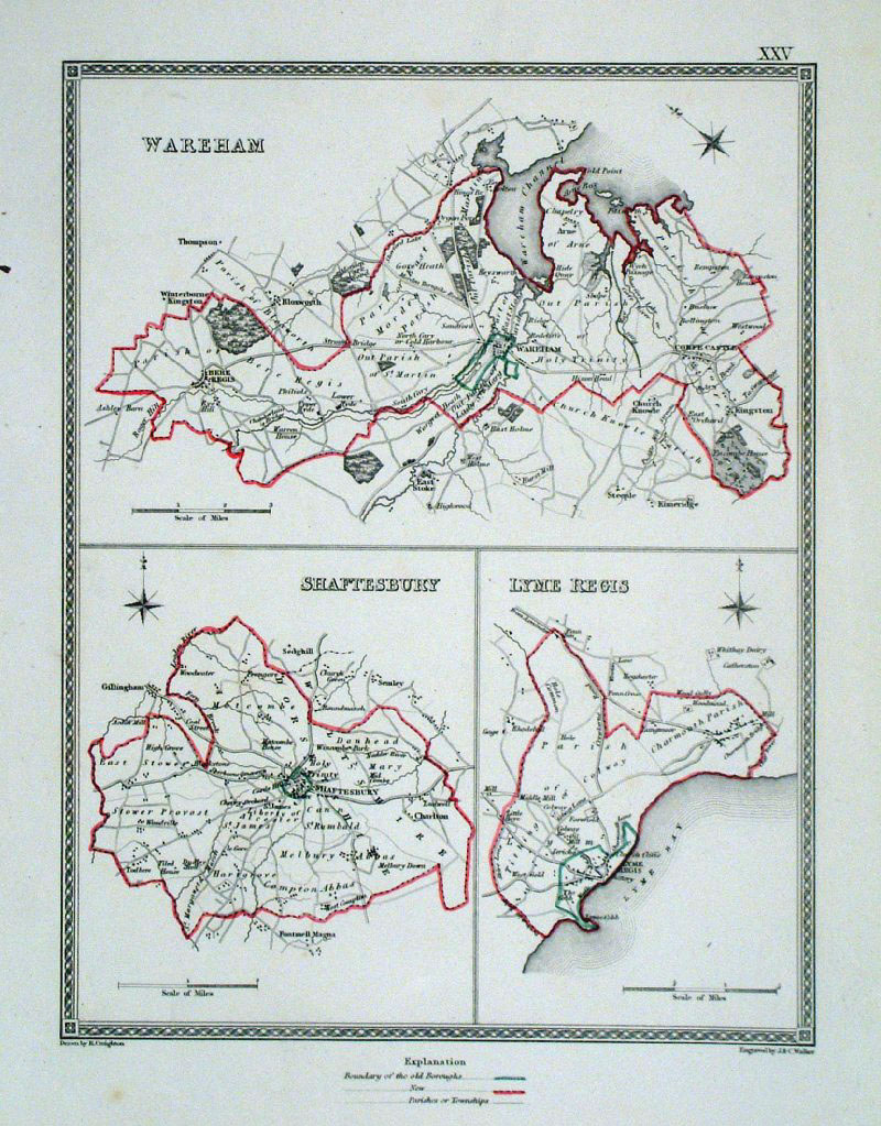 |
Wareham, Shaftesbury, Lyme Regis (Dorset)
Lewis 1840 Drawn & Engraved by Creighton & Walker size: 190 x 250 mm, faint crease at right margin Showing Borough and Parish Boundaries. Antique Map Ref GCM003 £18.00 (+P&P) click image for enlargement |
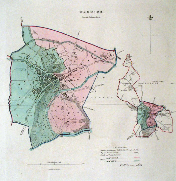 |
Warwick Dawson - Boundary
Commission 1837 From 'Municipal Corporation Boundaries Report ' Large Paper Edition size: 250 x 300 mm 1 fold Antique Map Ref GBM168 £26.00 (+P&P) click image for enlargement |
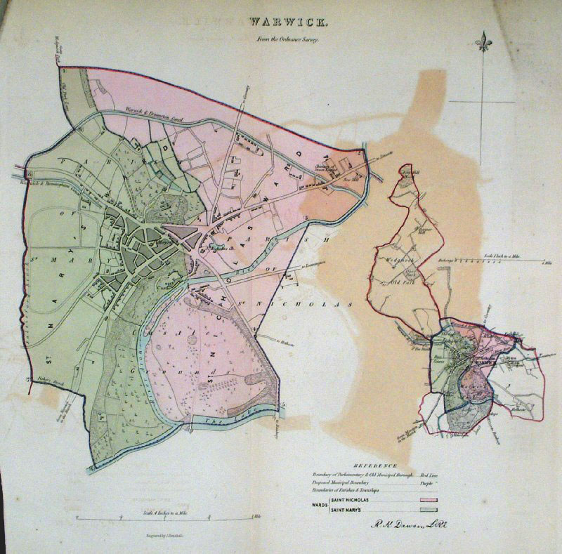 |
Warwick Dawson
- Boundary Commission 1837 From 'Municipal Corporation Boundaries Report ' size: 310 x 300 mm 1 fold, noticable offset transfer from block colouring. Antique Map Ref GDM313 £18.00 (+P&P) click image for enlargement |
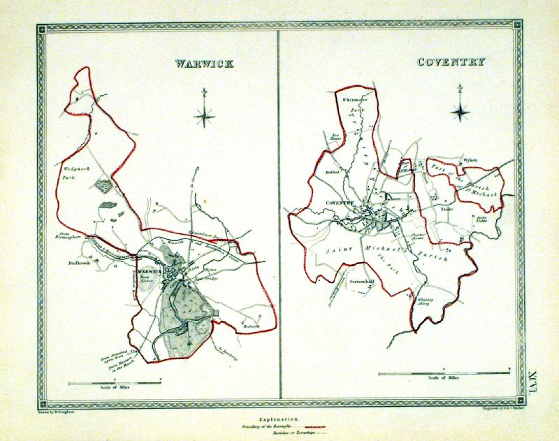 |
Warwick . Coventry Samuel Lewis 1835 engraved by J & C Walker Steel engraving Size: 250 x 200 mm, Original colouring of boundaries. Antique Map Ref KJM096 £16.00 (+P&P) Sample, not of this specific map, to indicate the level of detail of these 1835 Lewis town plans and town environs. click image for enlargement |
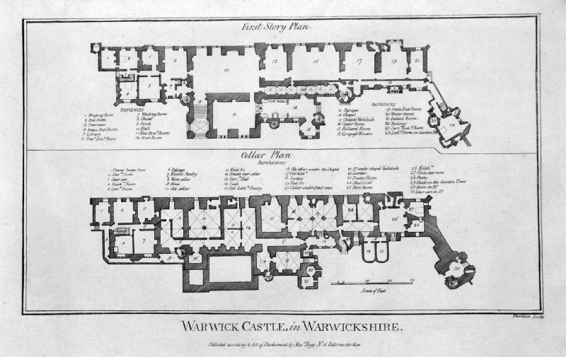 |
Plan of Warwick Castle Hogg c1786 size: 330 x 220 mm Antique Map Ref JKM035 £18.00 (+P&P) click image for enlargement |
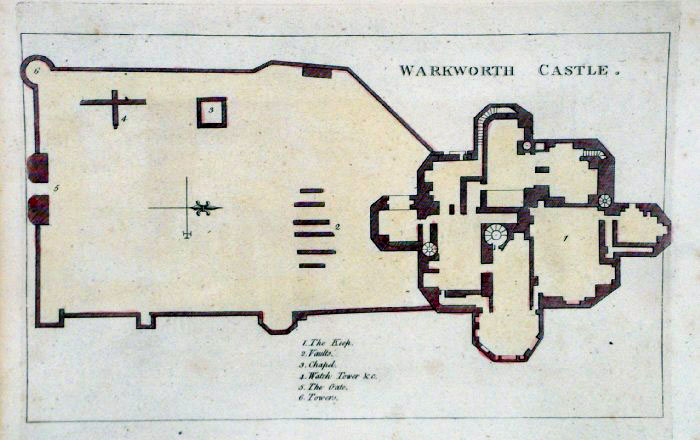 |
Warkworth Castle plan (Northumberland)
Grose 1787 size: 260 x 160 mm Antique Map Ref FHM021 £16.00 (+P&P) click image for enlargement |
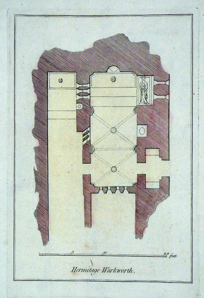 |
Warkworth Hermitage plan (Northumberland)
Grose 1787 size: 140 x 210 mm Antique Map Ref FHM014 £18.00 (+P&P) click image for enlargement |
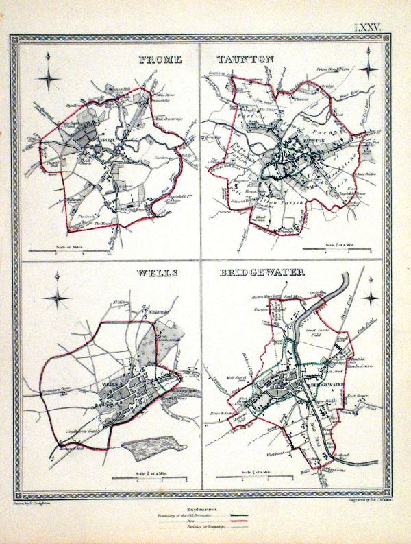 |
Wells . Frome . Taunton . Bridgewater Samuel Lewis 1835 engraved by J & C Walker Steel engraving Size: 200 x 250 mm, Original colouring of boundaries. Antique Map Ref KJM075 £18.00 (+P&P) Sample, not of this specific map, to indicate the level of detail of these 1835 Lewis town plans. click image for enlargement |
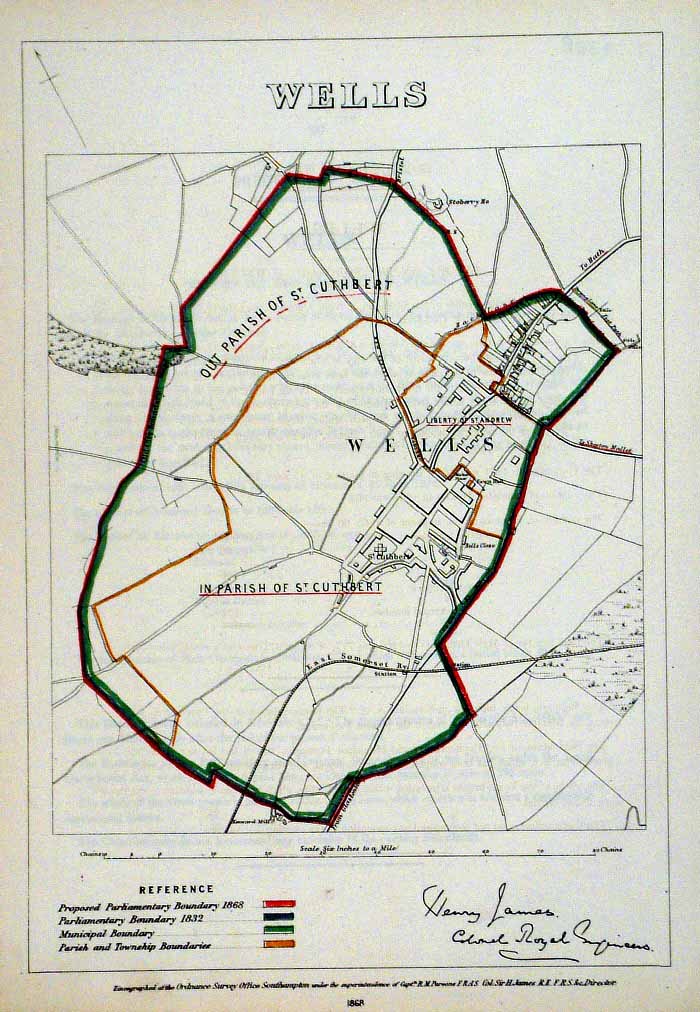 |
Wells (Somerset)
James - Boundary Commission
1868 The map is accompanied by a page of descriptive text relating to the borough statistics Zincograph Size: 240 x 360 mm Original colouring of boundaries Antique Map Ref HJS063 £24.00 (+P&P) click image for enlargement |
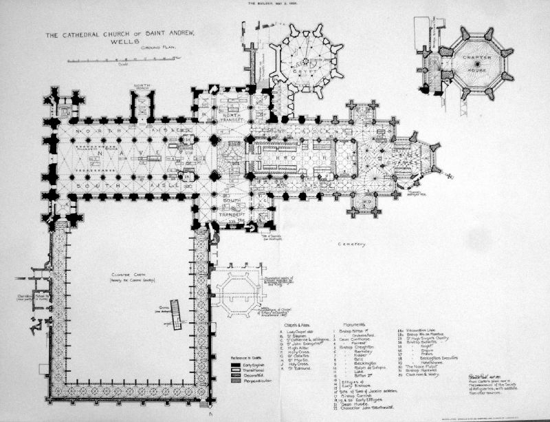 |
The Cathedral Church of Saint Andrew, Wells The Builder 1891 Photo - Lith size: 420 x 320 mm, centre fold Antique Map Ref KGM018 £20.00 (+P&P) click image for enlargement |
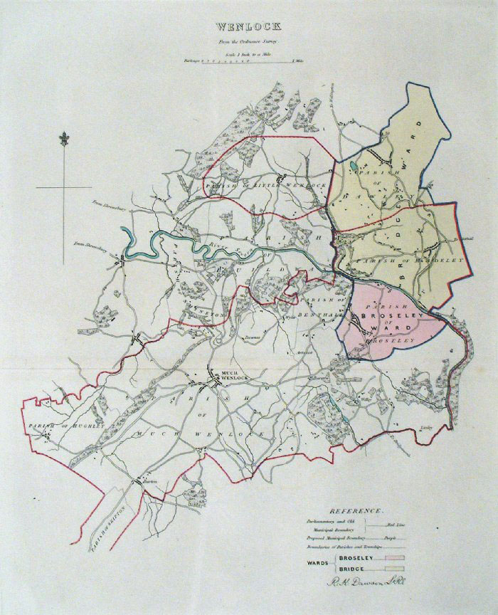 |
Wenlock (Shropshire)
Dawson - Boundary Commission 1837 From 'Municipal Corporation Boundaries Report ' Large Paper Edition size: 250 x 300 mm 1 fold Antique Map Ref GBM171 £24.00 (+P&P) click image for enlargement |
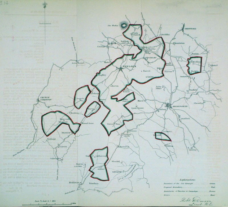 |
Wenlock (Shropshire)
Dawson - Boundary Commission 1837 From 'Municipal Corporation Boundaries Report ' size: 300 x 300 mm 2 folds Antique Map Ref GDM324 £24.00 (+P&P) click image for enlargement |
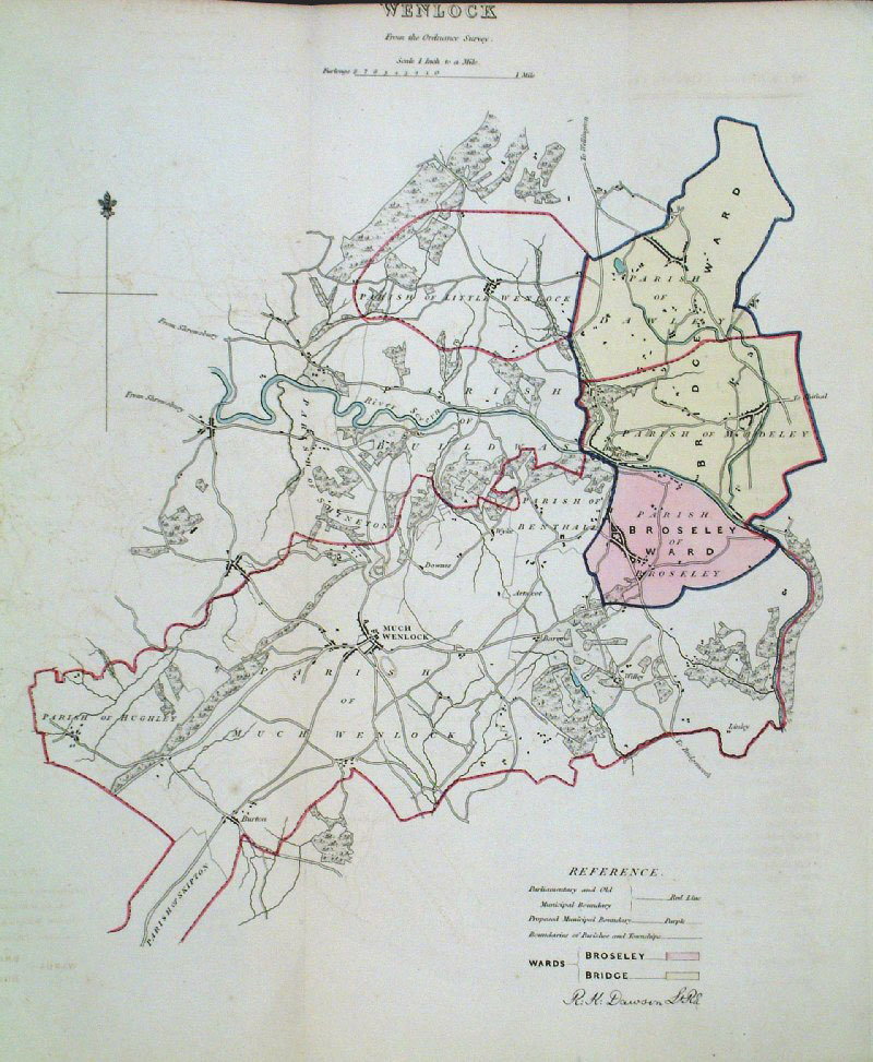 |
Wenlock (Shropshire)
Dawson - Boundary Commission 1837 From 'Municipal Corporation Boundaries Report ' size: 260 x 300 mm 1 fold Antique Map Ref GDM315 £24.00 (+P&P) click image for enlargement |
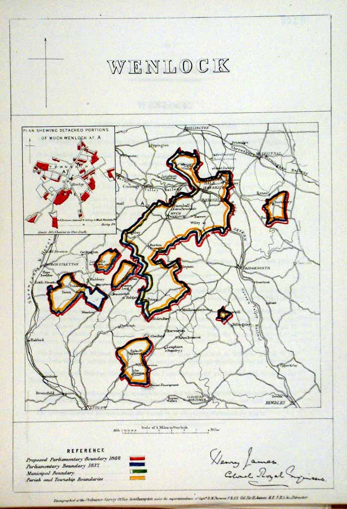 |
Wenlock (Shropshire)
James - Boundary
Commission 1868 The map is accompanied by a page of descriptive text relating to the borough statistics Zincograph Size: 240 x 360 mm Original colouring of boundaries Antique Map Ref HJS064 £18.00 (+P&P) click image for enlargement |
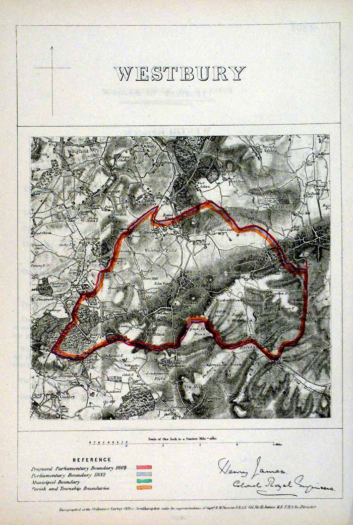 |
Westbury (Wilts
James - Boundary Commission
1868 The map is accompanied by a page of descriptive text relating to the borough statistics Zincograph Size: 240 x 360 mm Original colouring of boundaries Antique Map Ref HJS065 £18.00 (+P&P) click image for enlargement |
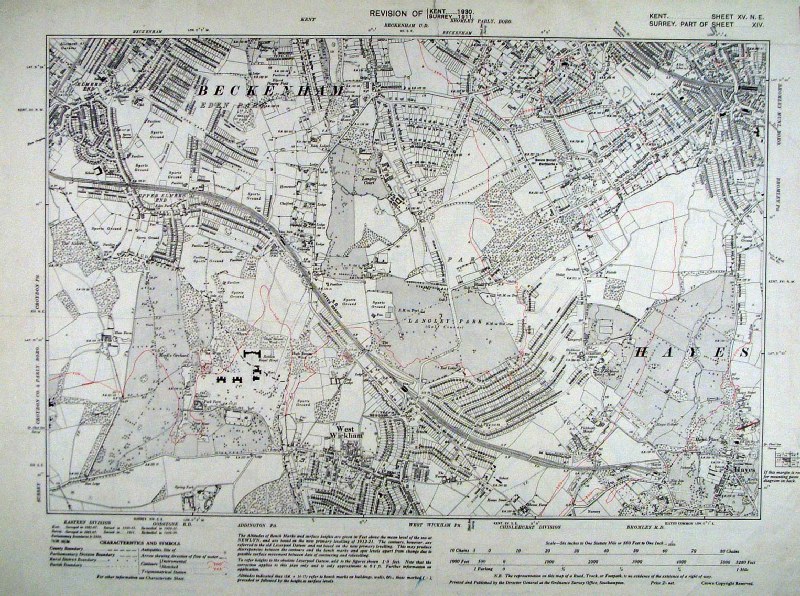 |
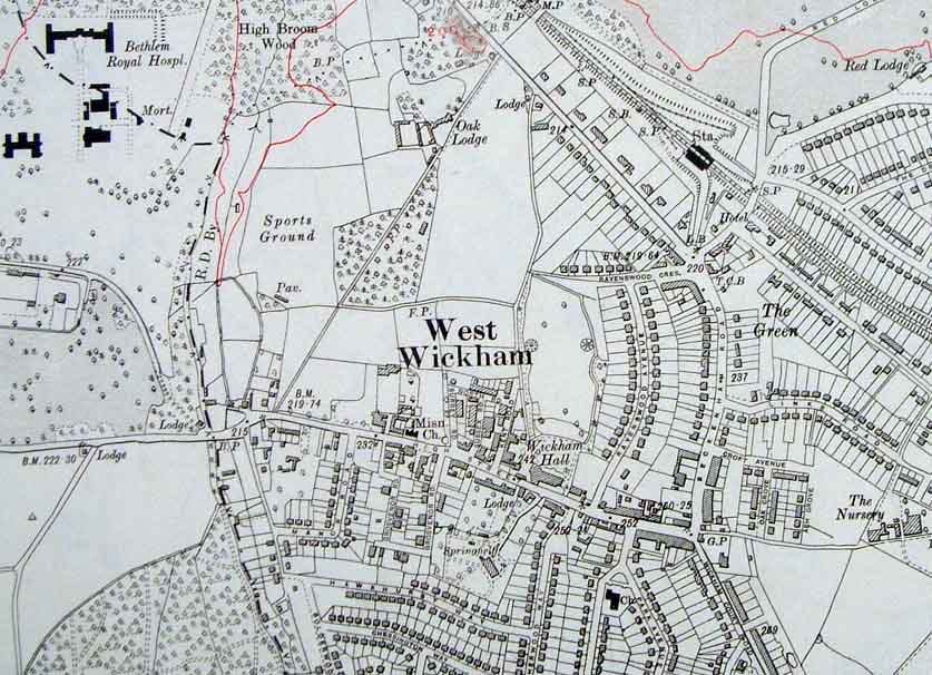
West Wickham, Beckenham, Hayes, Bromley
(Kent) Ordnance Survey 6"/mile 1930 size: 480 x 400 mm 2 folds Detail Antique Map Ref HJM005 £30.00 (+P&P) click image for enlargement |
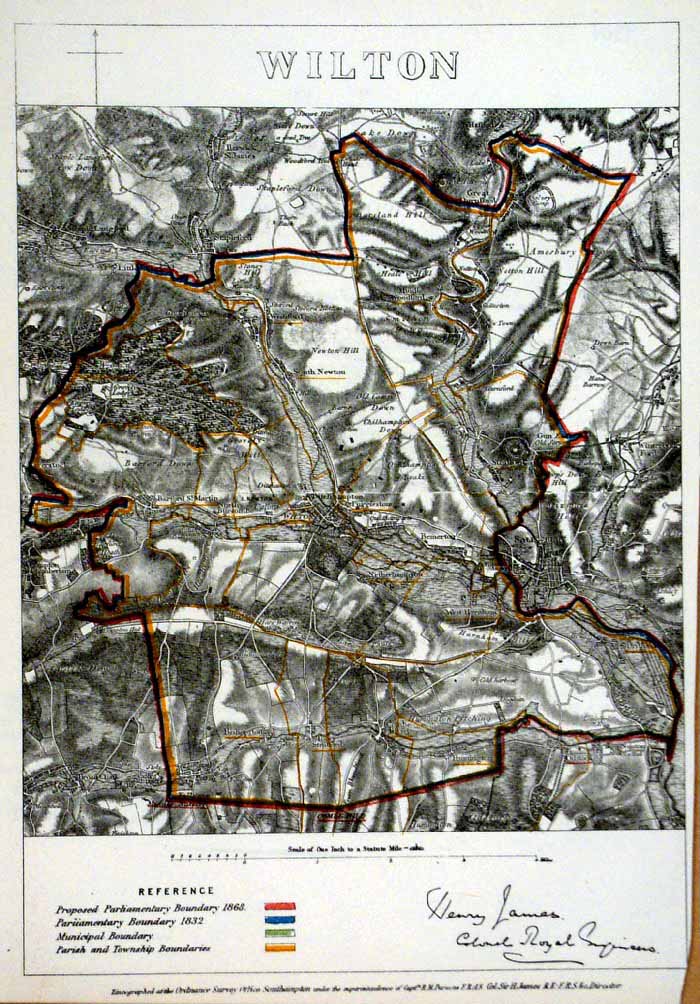 |
Wilton (Wiltshire)
James - Boundary Commission
1868 The map is accompanied by a page of descriptive text relating to the borough statistics Zincograph Size: 240 x 360 mm Original colouring of boundaries Antique Map Ref HJS066 £18.00 (+P&P) click image for enlargement |
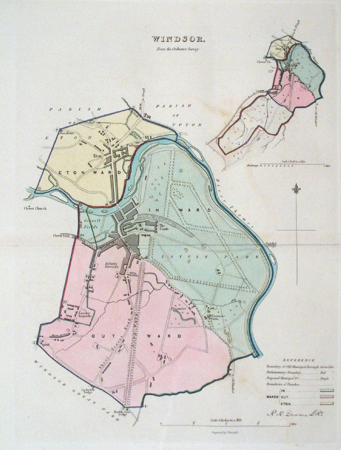 |
Windsor (Berks)
Dawson - Boundary Commission
1837 From 'Municipal Corporation Boundaries Report ' Large Paper Edition. Page size: 420 x 500mm plate size: 250 x 340 mm Very faint offset transfer Antique Map Ref GBM175 £32.00 (+P&P) click image for enlargement |
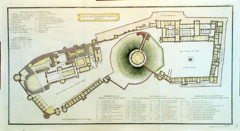 |
Plan of Windsor Castle MDCCCV (1805) Neele / Cadell & Davies 1806 Copper engraving size: 510 x 270 mm, 2 folds Antique Map Ref LFM033 £50.00 (+P&P) Detail 1 click image for enlargement |
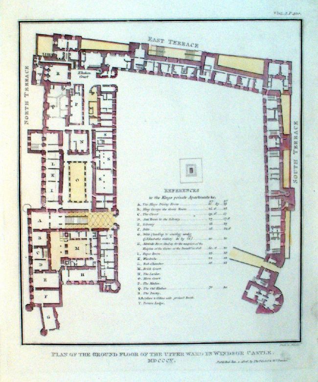 |
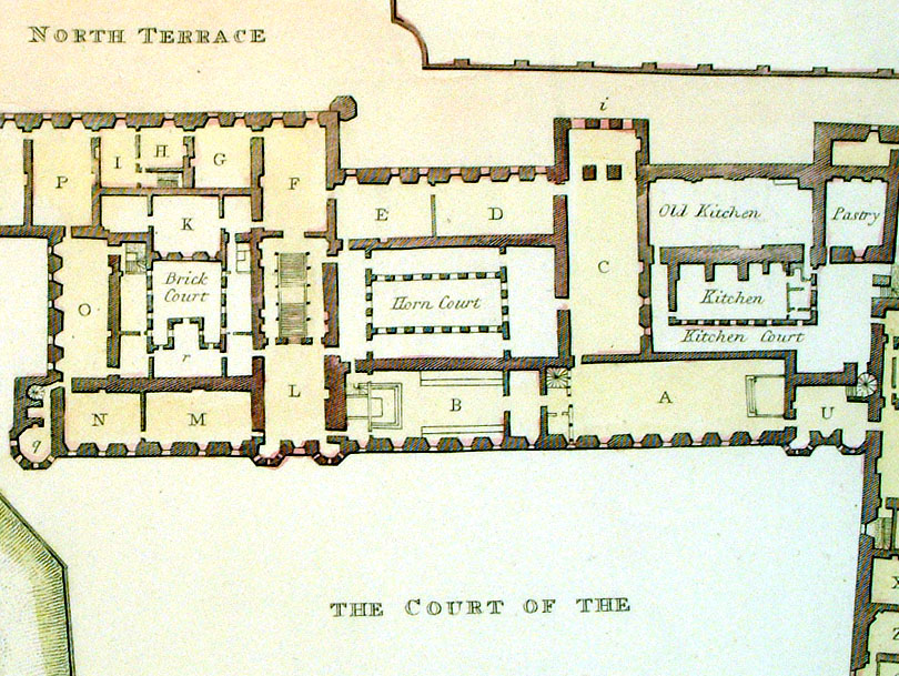
Plan of the Ground
Floor of the Upper Ward in Windsor Castle
MDCCCV (1805) Neele / Cadell & Davies 1806 Copper engraving size: 210 x 250 mm Antique Map Ref LFM034 £25.00 (+P&P) click image for enlargement |
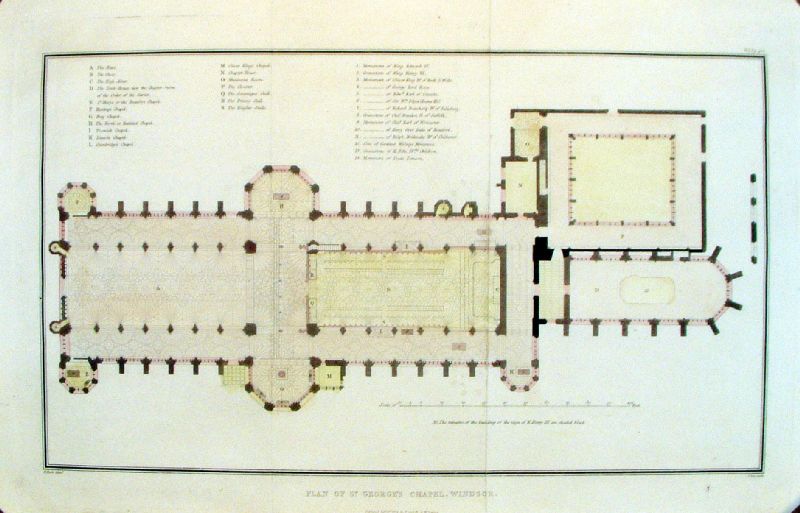 |
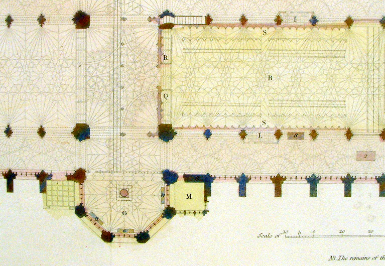
Plan of St George's Chapel, Windsor Lee / Cadell & Davies 1812 Copper engraving size: 420 x 250 mm, 2 folds Antique Map Ref KHM035 £30.00 (+P&P) Detail 1 click image for enlargement |
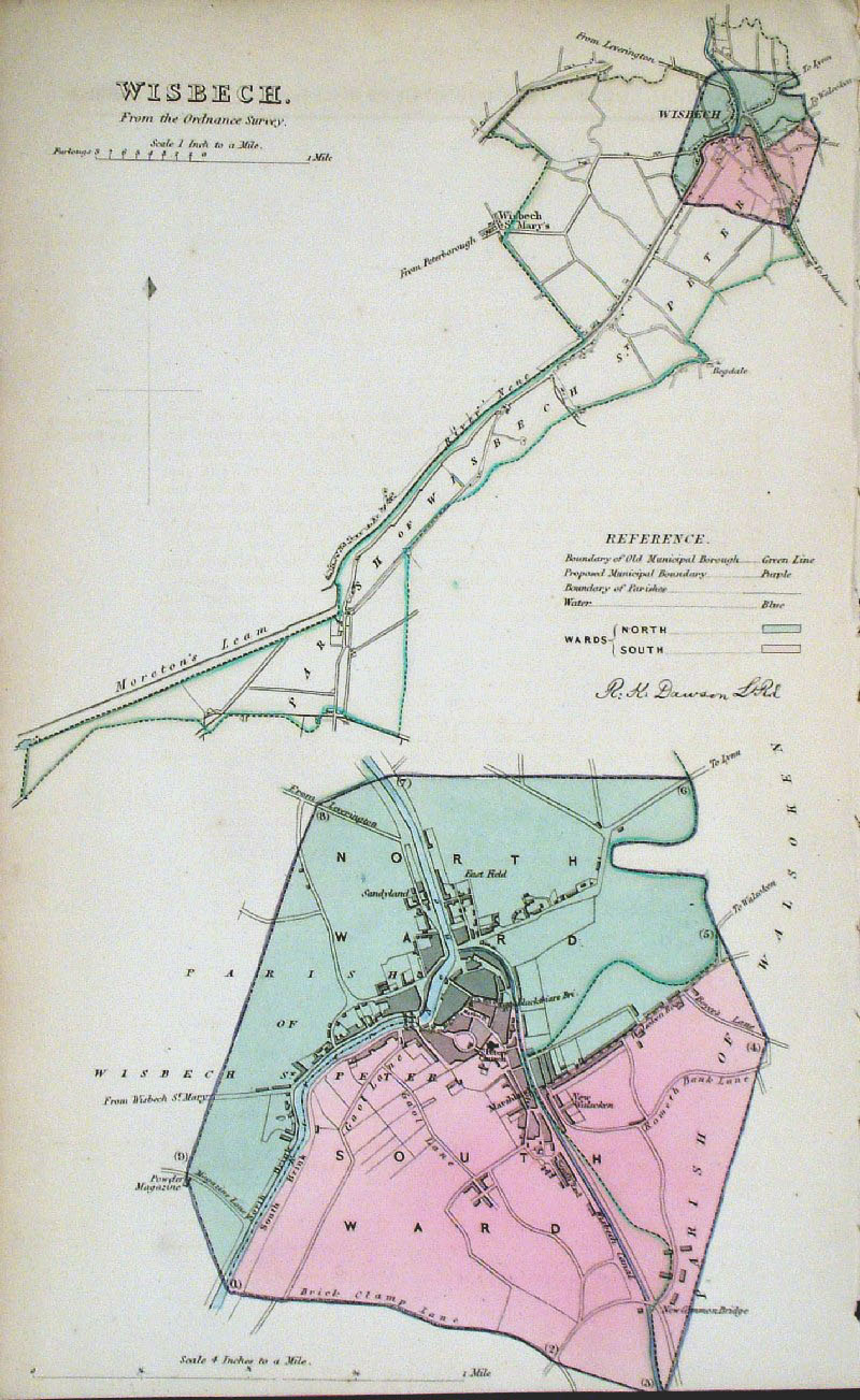 |
Wisbech (Cambs)
Dawson - Boundary Commission
1837 From 'Municipal Corporation Boundaries Report ' size: 200 x 300 mm Antique Map Ref GDM320 £28.00 (+P&P) click image for enlargement |
 |
Wolverhampton . Walsall Samuel Lewis 1835 engraved by J & C Walker Steel engraving Size: 250 x 200 mm, Original colouring of boundaries. Antique Map Ref KJM083 £16.00 (+P&P) Sample, not of this specific map, to indicate the level of detail of these 1835 Lewis town plans and town environs. click image for enlargement |
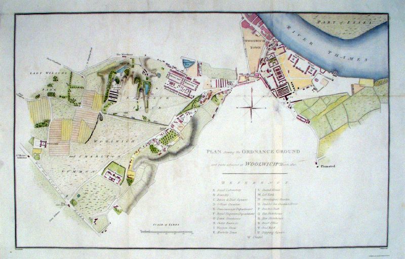 |
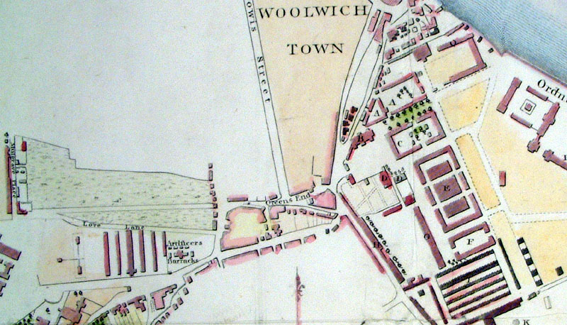
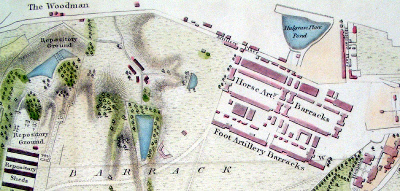
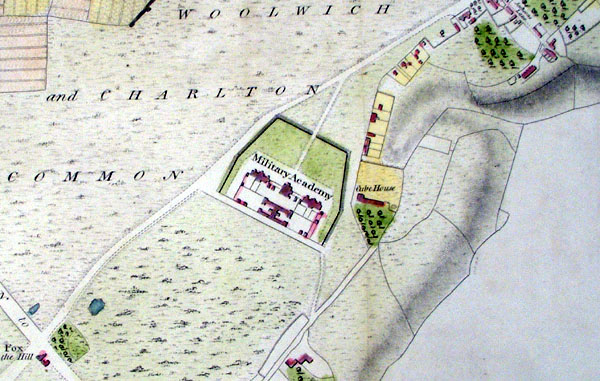
Woolwich, Kent Plan of showing the Ordnance Ground and the parts adjacent at Woolwich Yeakell / Warner / Cadell & Davies 1811 Copper engraving size: 530 x 350 mm, several folds & minor repair Antique Map Ref KHM037 £50.00 (+P&P) Detail 1 Detail 2 Detail 3 click image for enlargement |
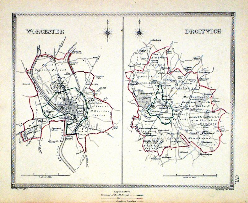 |
Worcester . Droitwich Samuel Lewis 1835 engraved by J & C Walker Steel engraving Size: 250 x 200 mm, Original colouring of boundaries. Antique Map Ref KJM106 £16.00 (+P&P) Sample, not of this specific map, to indicate the level of detail of these 1835 Lewis town plans and town environs. click image for enlargement |
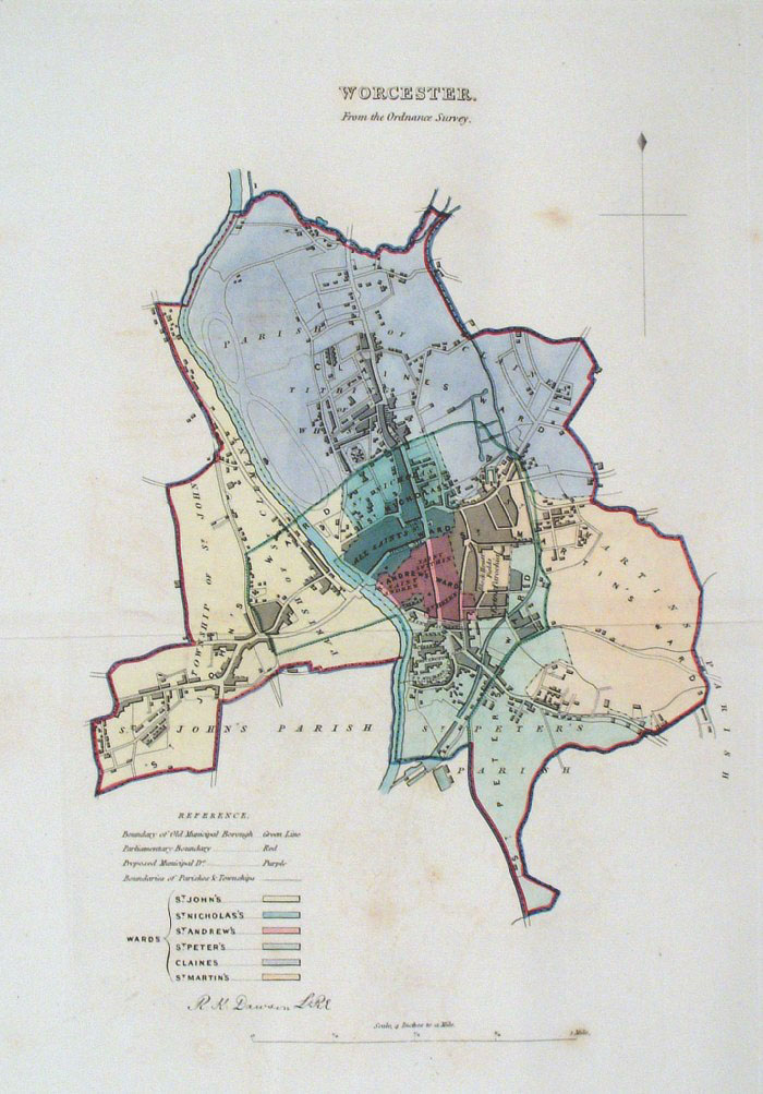 |
Worcester Dawson -
Boundary Commission 1837 From 'Municipal Corporation Boundaries Report ' Large Paper Edition size: 250 x 300 mm 1 fold, faint offset transfer and foxing Antique Map Ref GBM177 £26.00 (+P&P) click image for enlargement |
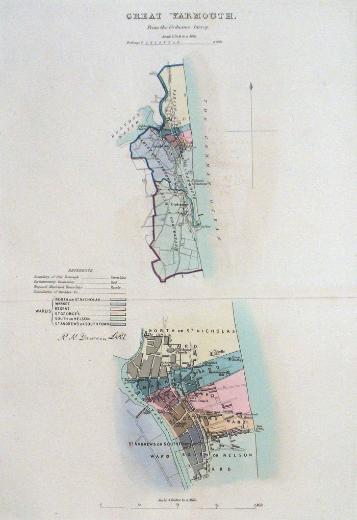 |
Yarmouth - Great (Norfolk)
Dawson - Boundary Commission 1837 From 'Municipal Corporation Boundaries Report ' Large Paper Edition size: 250 x 300 mm 1 fold, faint offset transfer Antique Map Ref GBM179 £26.00 (+P&P) click image for enlargement |
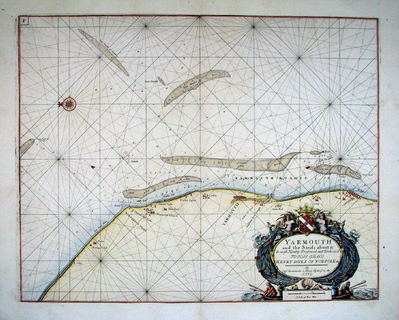 |
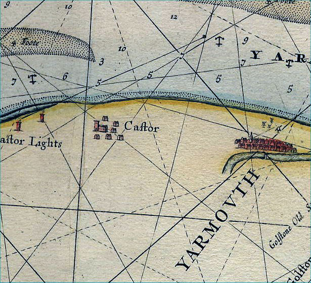
Yarmouth, Norfolk Collins
1693
size: 630 x 520 mm Antique Map Ref AAM139 £220.00 (+P&P) click image for enlargement Detail |
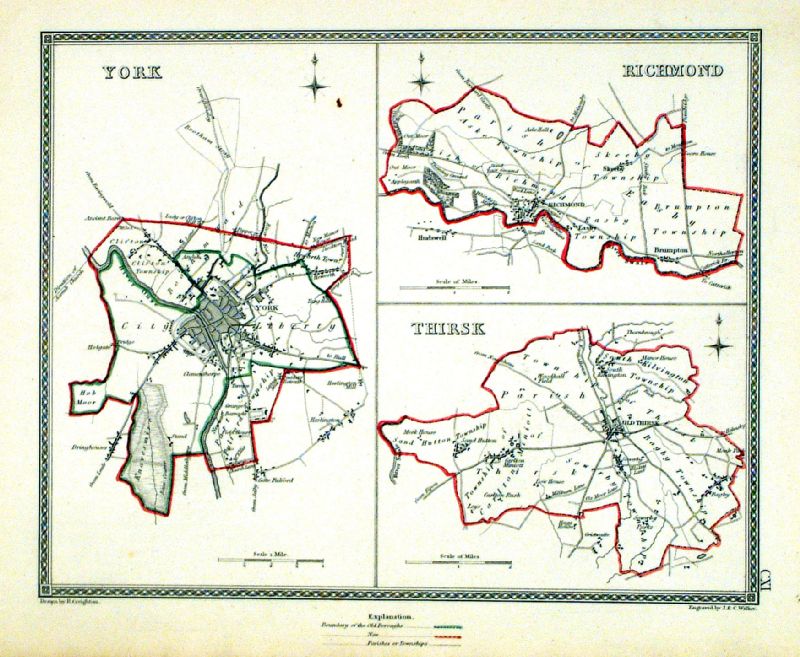 |
York . Richmond . Thirsk Samuel Lewis 1835 engraved by J & C Walker Steel engraving Size: 250 x 200 mm, Original colouring of boundaries. Antique Map Ref KJM111 £18.00 (+P&P) Sample, not of this specific map, to indicate the level of detail of these 1835 Lewis town plans and town environs. click image for enlargement |
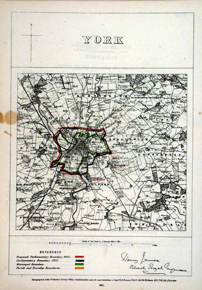 |
York
James - Boundary Commission
1868 The map is accompanied by a page of descriptive text relating to the borough statistics Zincograph Size: 240 x 360 mm, stain at left margin Original colouring of boundaries Antique Map Ref HJS067 £26.00 (+P&P) click image for enlargement |
| More Town Plans: A - B C - G H - L M - R Scotland All Genuine Antiquarian Maps - No Reproductions or Modern Copies |
mc MC