Past Pages
Antique Maps, Prints and Ephemera
Antique Maps - UK Town & Street Plans
- H to L
England & WalesIncluding castle plans, cathedral plans, church plans,
Boundary Commission maps, local suburban maps
For Irish Town plans see section: Maps - Europe / Ireland
For London see section: Maps - London
Arranged alphabetically by town or locality (not by name of church , hospital, etc)
For local interest also see Road Maps section.
Note that some maps have two or three towns, making alphabetic searching difficult and sometimes prone to error.
A Brief Article on Town Plans Help on local area maps
More Town Plans: A - B C - G M - R S - Y Scotland
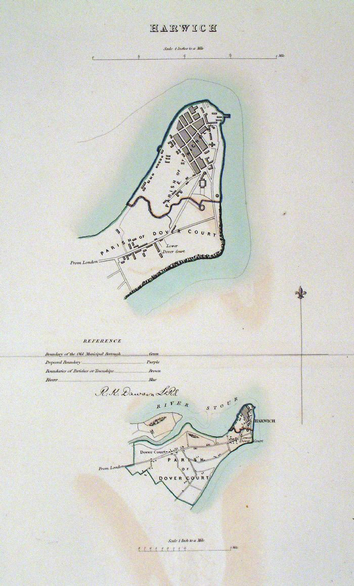 |
Harwich (Essex) Dawson
- Boundary Commission 1837 From 'Municipal Corporation Boundaries Report ' Large Paper Edition. Page size: 420 x 500mm plate size: 210 x 340 mm Slight offset transfer Antique Map Ref GBM072 £28.00 (+P&P) click image for enlargement |
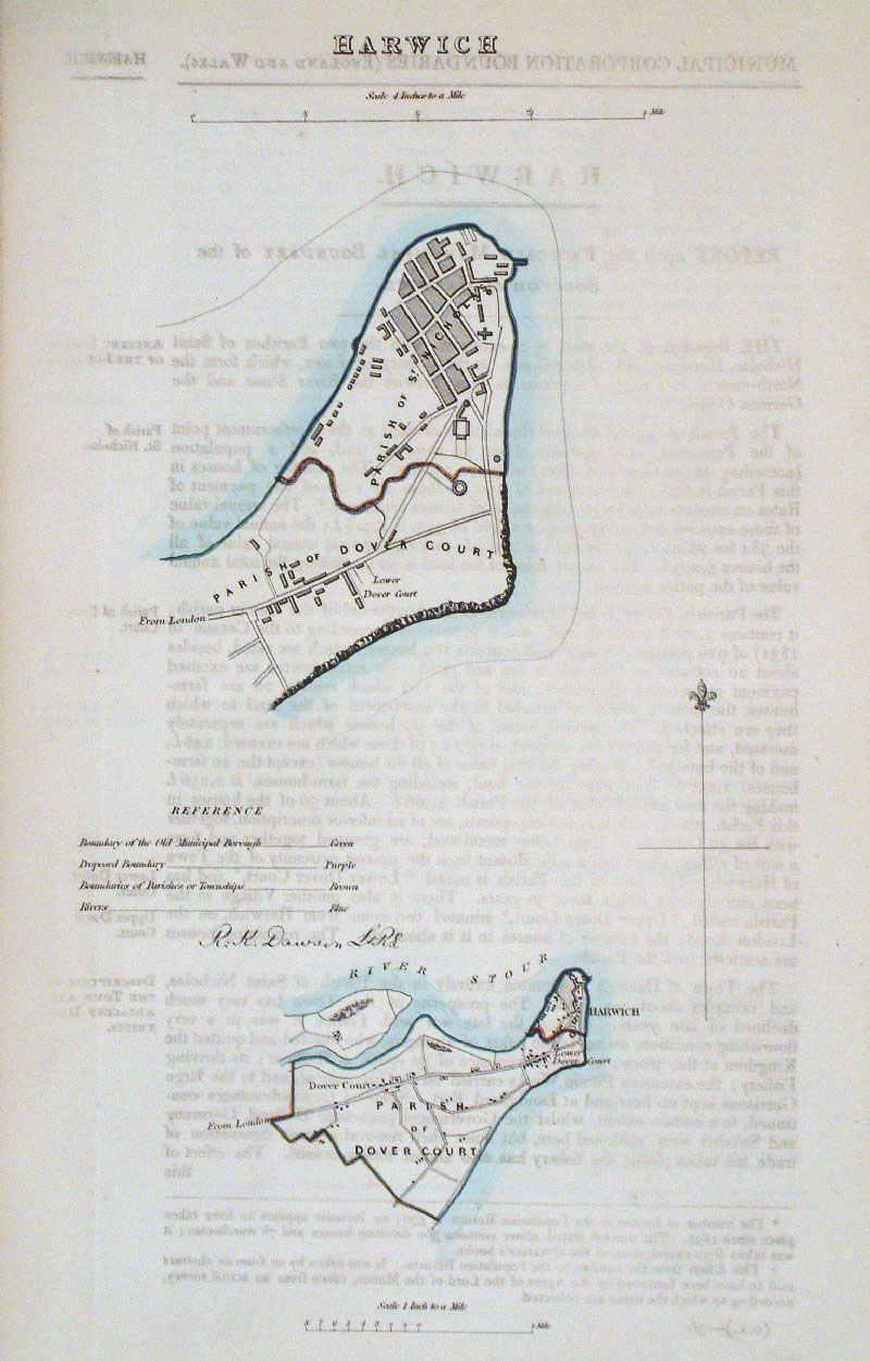 |
Harwich (Essex) Dawson
- Boundary Commission 1837 From 'Municipal Corporation Boundaries Report ' Page size: 200 x 320mm Slight offset transfer Antique Map Ref GDM266 £24.00 (+P&P) click image for enlargement |
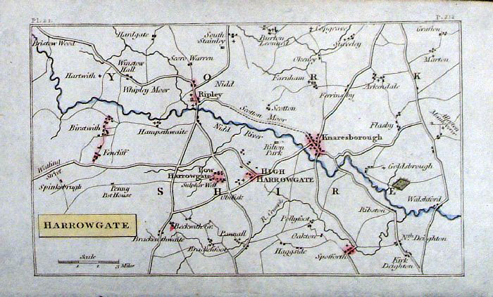 |
Harrowgate (Yorkshire) Philips
c1830 size: 140 x 90
mm Antique Map Ref GBM211 £16.00 (+P&P) click image for enlargement |
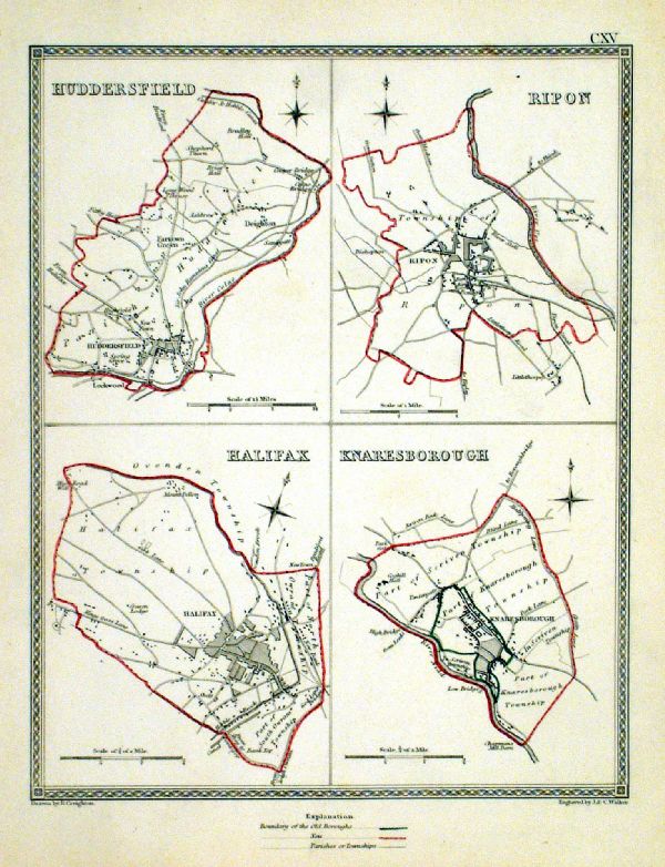 |
Halifax . Huddersfield . Ripon . Knaresborough Samuel Lewis 1835 engraved by J & C Walker Steel engraving Size: 200 x 250 mm, Original colouring of boundaries. Antique Map Ref KJM115 £16.00 (+P&P) Sample, not of this specific map, to indicate the level of detail of these 1835 Lewis town plans. click image for enlargement |
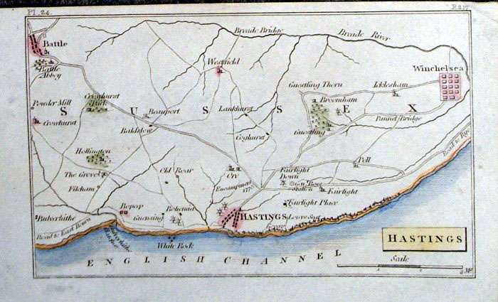 |
Hastings (Sussex) Philips c1830
size: 140 x 90 mm
Antique Map Ref GBM212 £16.00 (+P&P) click image for enlargement |
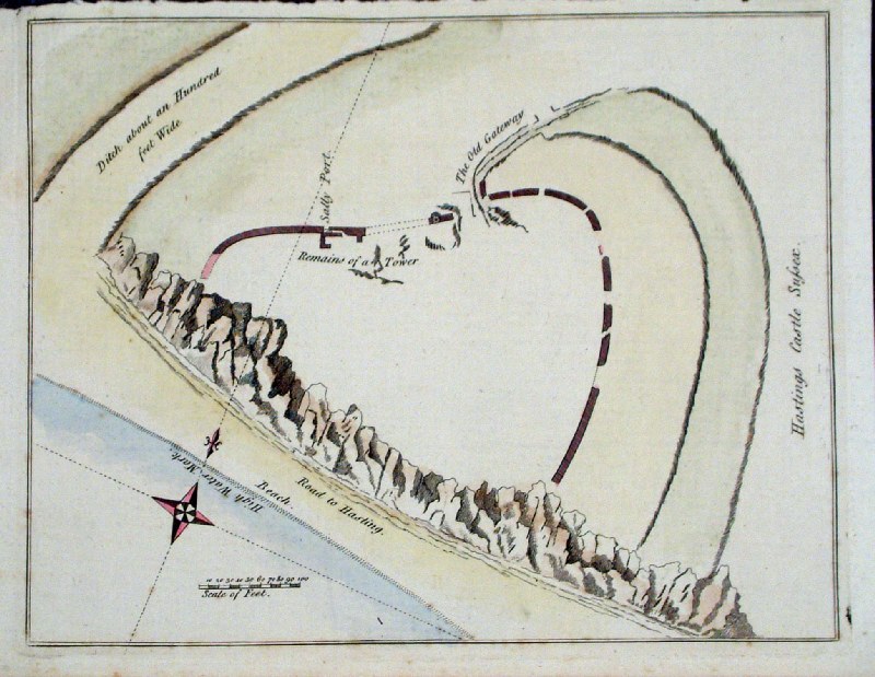 |
Hastings Castle plan (Sussex)
Grose 1787 size: 160 x 210 mm Antique Map Ref GLM037 £18.00 (+P&P) click image for enlargement |
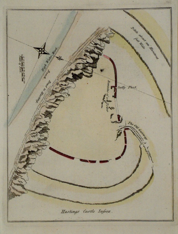 |
Hastings Castle plan (Sussex)
Grose 1787 size: 160 x 210 mm Antique Map Ref FHM008 £18.00 (+P&P) click image for enlargement |
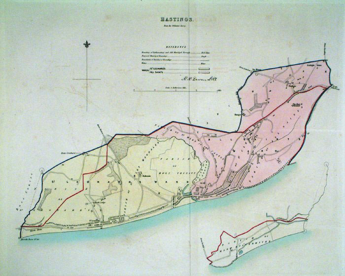 |
Hastings (Sussex)
Dawson - Boundary Commission
1837 From 'Municipal Corporation Boundaries Report ' Large Paper Edition. Page size: 420 x 500mm plate size: 340 x 420 mm Very faint offset transfer Antique Map Ref GBM073 £35.00 (+P&P) click image for enlargement |
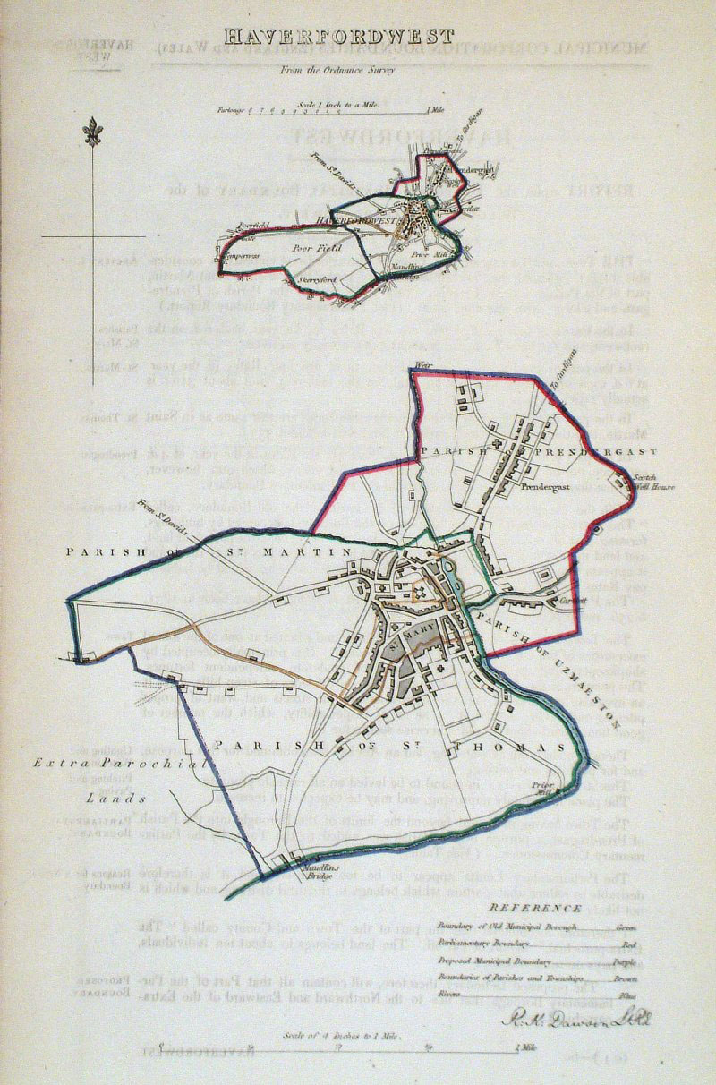 |
Haverfordwest (Wales)
Dawson - Boundary
Commission 1837 From 'Municipal Corporation Boundaries Report ' size: 200 x 300 mm faint offset transfer Antique Map Ref GDM267 £24.00 (+P&P) click image for enlargement |
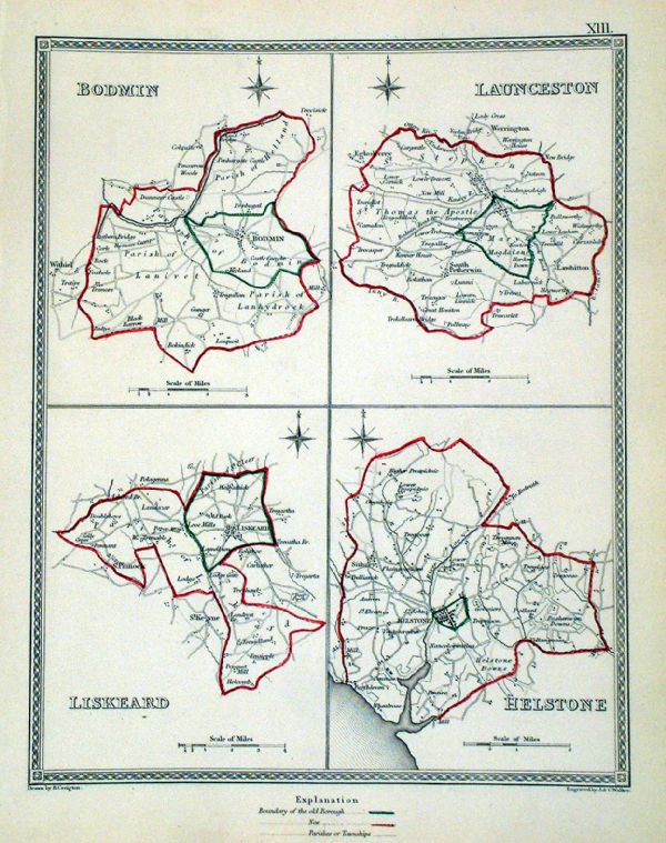 |
Helson . Liskeard . Bodmin . Launceston Samuel Lewis 1835 engraved by J & C Walker Steel engraving Size: 200 x 250 mm, Original colouring of boundaries. Antique Map Ref KJM013 £16.00 (+P&P) Sample, not of this specific map, to indicate the level of detail of these 1835 Lewis town plans. click image for enlargement |
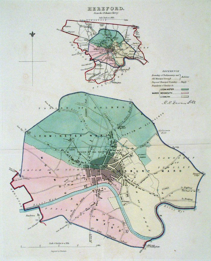 |
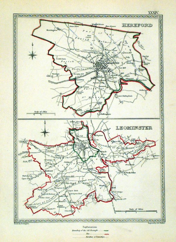
Hereford Dawson -
Boundary Commission 1837 From 'Municipal Corporation Boundaries Report ' Large Paper Edition size: 250 x 300 mm 1 fold Antique Map Ref GBM076 £28.00 (+P&P) click image for enlargement |
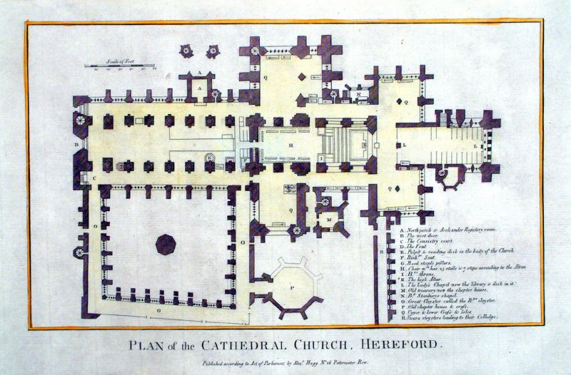 |
Plan of Cathedral Church, Hereford
Hogg c1785 Copper Engraving Size: 340 x 220 mm Antique Map Ref KGM009 £20.00 (+P&P) click image for enlargement |
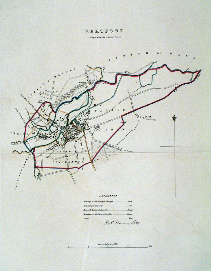 |
Hertford Dawson -
Boundary Commission 1837 From 'Municipal Corporation Boundaries Report ' Large Paper Edition size: 250 x 300 mm 1 fold, very slight offset transfer Antique Map Ref GBM077 £26.00 (+P&P) click image for enlargement |
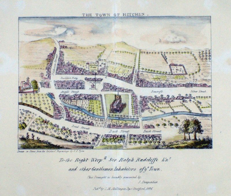 |
The Town of Hitchin
Tyler / Mullinger 1826 Thought to be copied from a 1700 edition of the map. Lithograph from Stone size: 220 x 200 mm Very faint and irregular surface discolouration Antique Map Ref LJM004 £35.00 (+P&P) click image for enlargement |
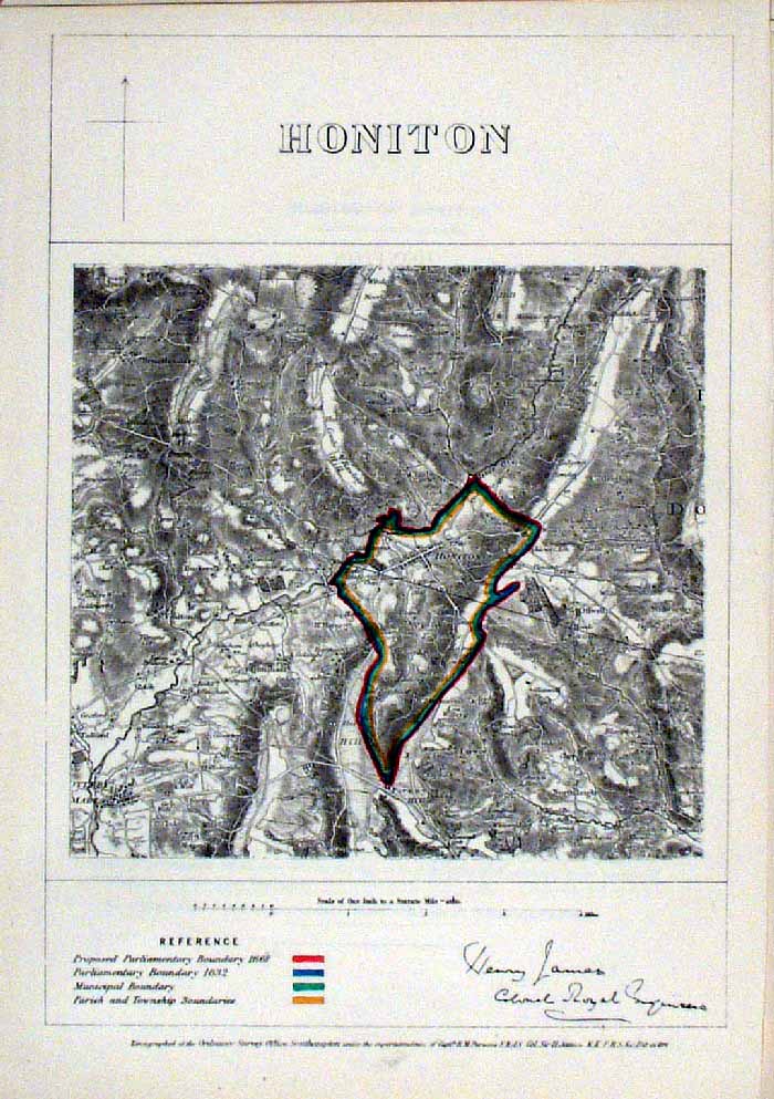 |
Honiton (Devon)
James - Boundary Commission
1868 The map is accompanied by a page of descriptive text relating to the borough statistics Zincograph Size: 240 x 360 mm Original colouring of boundaries Antique Map Ref HJS033 £20.00 (+P&P) click image for enlargement |
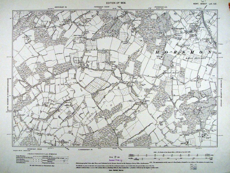 |
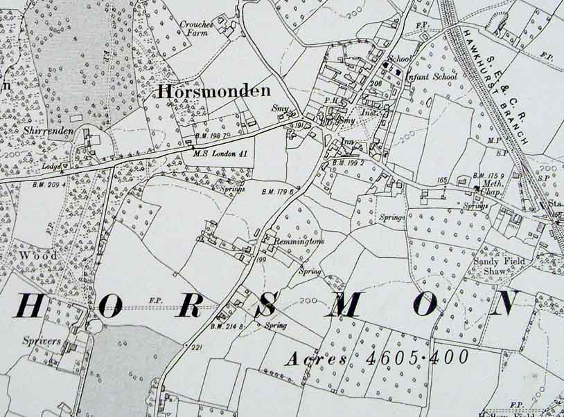
Horsmonden (Kent)
Ordnance Survey 6"/mile
1909 size: 480 x 400 mm Detail Antique Map Ref HJM004 £24.00 (+P&P) click image for enlargement |
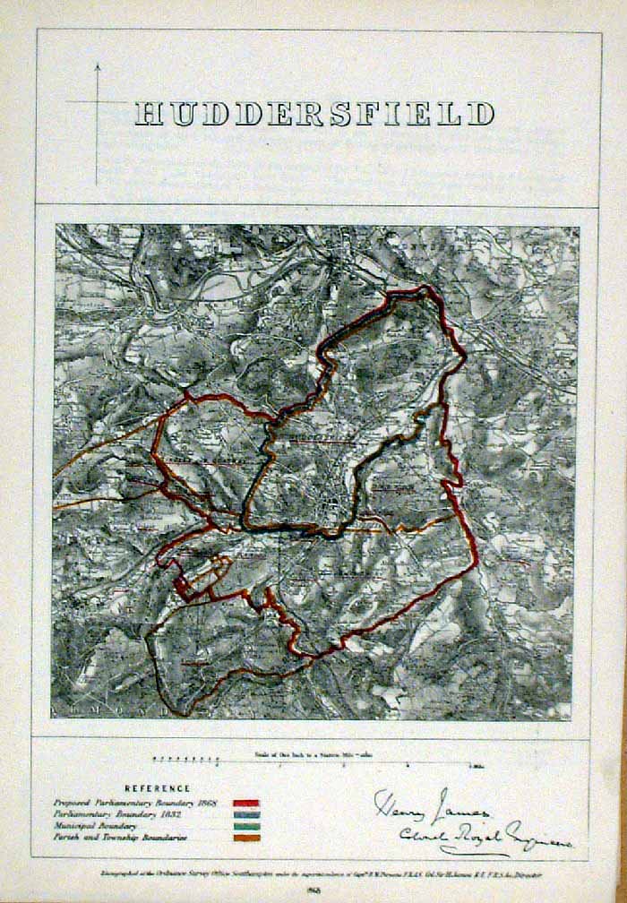 |
Huddersfield (Yorkshire)
James - Boundary
Commission 1868 The map is accompanied by a page of descriptive text relating to the borough statistics Zincograph Size: 240 x 360 mm Original colouring of boundaries Antique Map Ref HJS034 £20.00 (+P&P) click image for enlargement |
 |
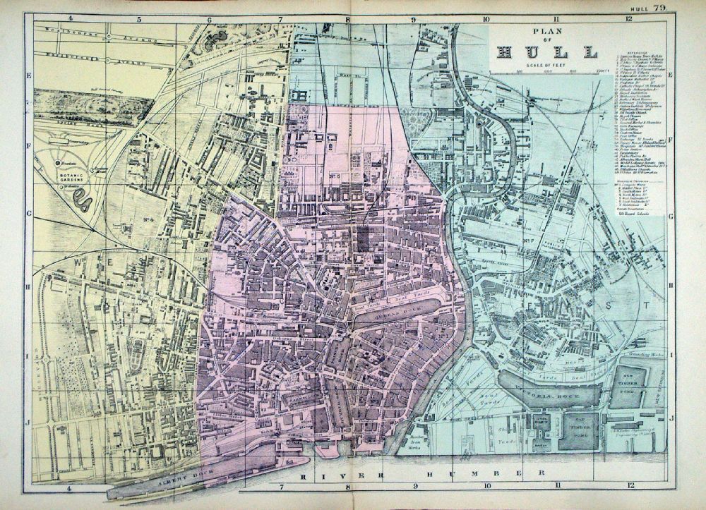
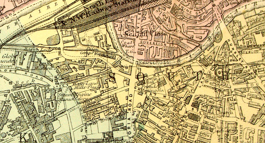
Hull
Bacon c1883
size: 500 x 320 mm a few minor foxing spots in lower-right corner Antique Map Ref FLM160 £24.00 (+P&P) click image for enlargement |
 |
Plan of Hull From the New Large Scale Atlas of the British Isles by G.W. Bacon 1892 size: 450 x 330 mm, centre fold Ref LHM087 £24.00 (+P&P) Detail click image for enlargement |
 |
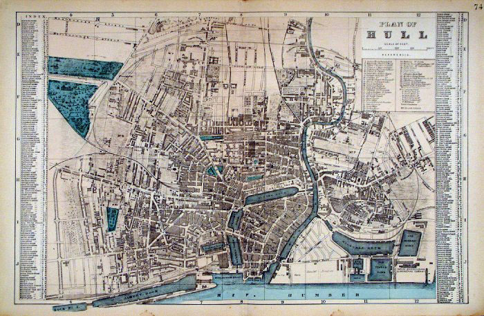
Hull Fullarton
c1865
size: 250 x 150 mm Antique Map Ref KGM023 £16.00 (+P&P) click image for enlargement |
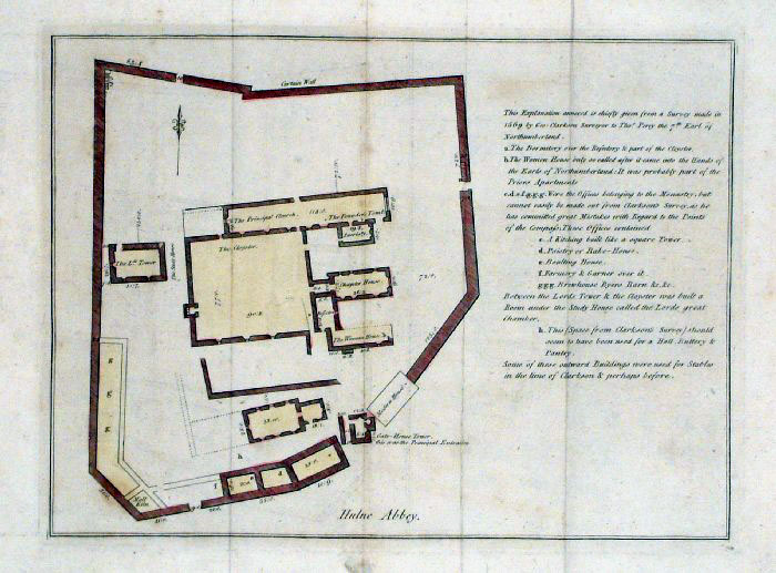 |
Hulne Abbey plan (Northumberland)
Grose 1787 size: 260 x 200 mm Antique Map Ref FHM003 £18.00 (+P&P) click image for enlargement |
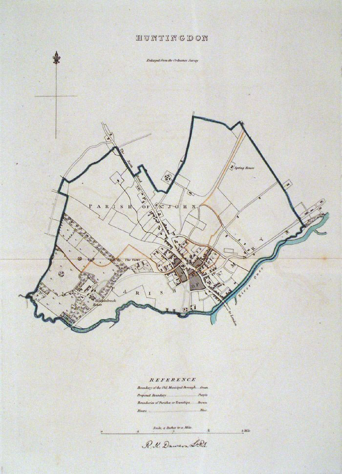 |
Huntingdon Dawson
- Boundary Commission 1837 From 'Municipal Corporation Boundaries Report ' Large Paper Edition. Page size: 420 x 500mm plate size: 240 x 340 mm Antique Map Ref GBM078 £28.00 (+P&P) click image for enlargement |
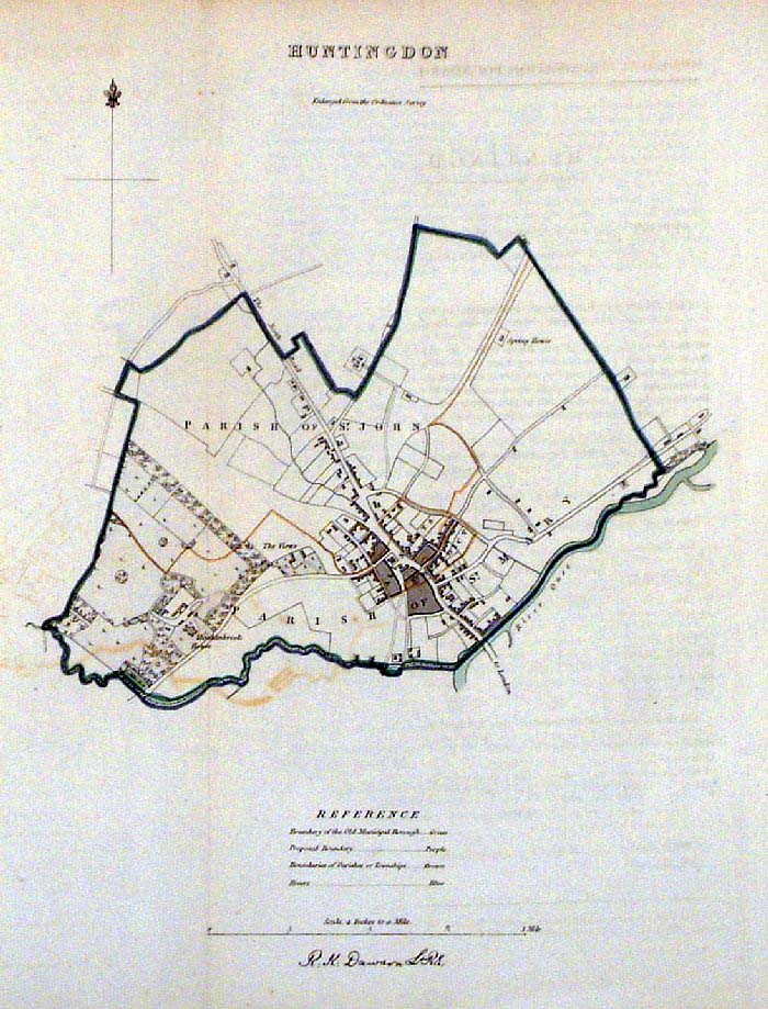 |
Huntingdon Dawson -
Boundary Commission 1837 From 'Municipal Corporation Boundaries Report ' size: 240 x 300 mm 1 fold Antique Map Ref FDM110 £26.00 (+P&P) click image for enlargement |
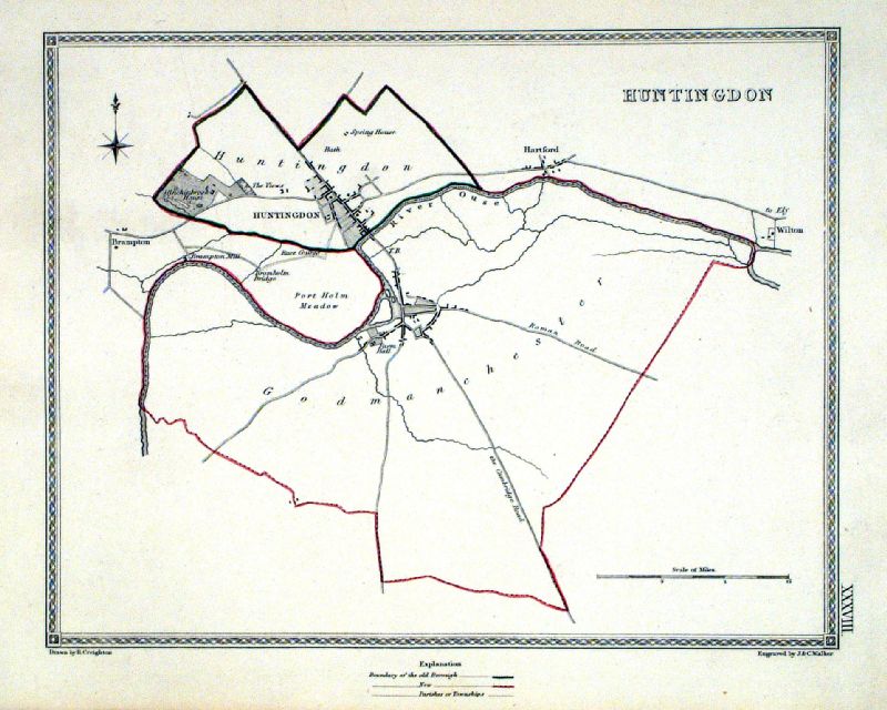 |
Huntingdon Samuel Lewis 1835 engraved by J & C Walker Steel engraving Size: 250 x 200 mm, Original colouring of boundaries. Antique Map Ref KJM038 £16.00 (+P&P) Sample, not of this specific map, to indicate the level of detail of these 1835 Lewis town plans and town environs. click image for enlargement |
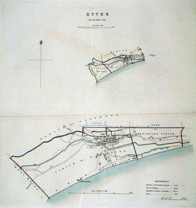 |
Hythe (Kent) Dawson
- Boundary Commission 1837 From 'Municipal Corporation Boundaries Report ' Large Paper Edition. Page size: 420 x 500mm plate size: 320 x 340 mm Antique Map Ref GBM079 £32.00 (+P&P) click image for enlargement |
 |
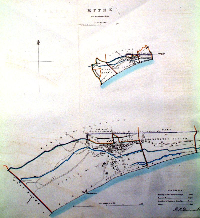
Hythe (Kent) Dawson -
Boundary Commission 1837 From 'Municipal Corporation Boundaries Report ' size: 430 x 300 mm 2 folds Antique Map Ref FDM082 £30.00 (+P&P) click image for enlargement |
 |
Hythe (Kent) Dawson -
Boundary Commission 1837 From 'Municipal Corporation Boundaries Report ' size: 420 x 500 mm 1 fold, puncture / split neat title Antique Map Ref ICM010 £26.00 (+P&P) click image for enlargement |
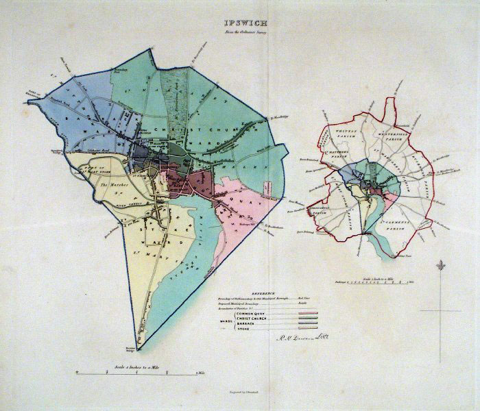 |
Ipswich (Suffolk) Dawson
- Boundary Commission 1837 From 'Municipal Corporation Boundaries Report ' Large Paper Edition size: 250 x 300 mm 1 fold Antique Map Ref GBM080 £30.00 (+P&P) click image for enlargement |
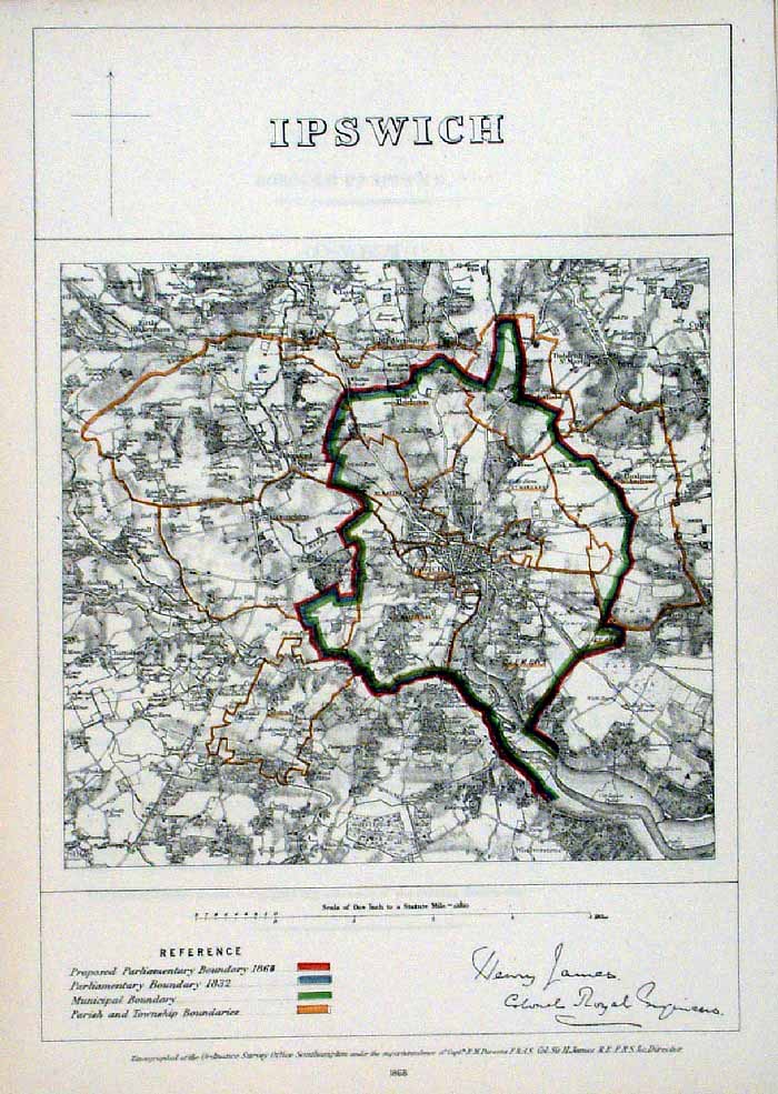 |
Ipswich (Suffolk)
James - Boundary Commission
1868 The map is accompanied by a page of descriptive text relating to the borough statistics Zincograph Size: 240 x 360 mm Original colouring of boundaries Antique Map Ref HJS035 £20.00 (+P&P) click image for enlargement |
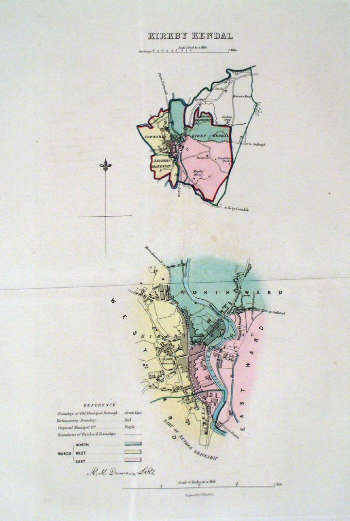 |
Kendal (Kirby Kendal) (Cumbria)
Dawson - Boundary Commission
1837 From 'Municipal Corporation Boundaries Report ' Large Paper Edition size: 250 x 300 mm 1 fold, very slight offset transfer Antique Map Ref GBM081 £24.00 (+P&P) click image for enlargement |
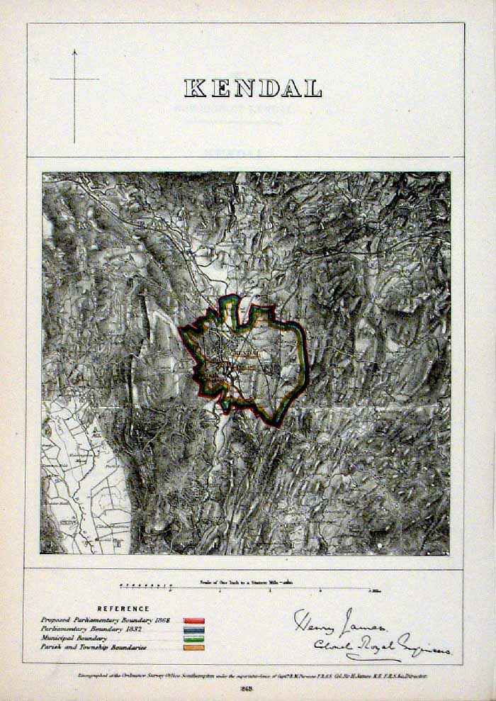 |
Kendal (Cumbria)
James - Boundary Commission
1868 The map is accompanied by a page of descriptive text relating to the borough statistics Zincograph Size: 240 x 360 mm Original colouring of boundaries Antique Map Ref HJS036 £18.00 (+P&P) click image for enlargement |
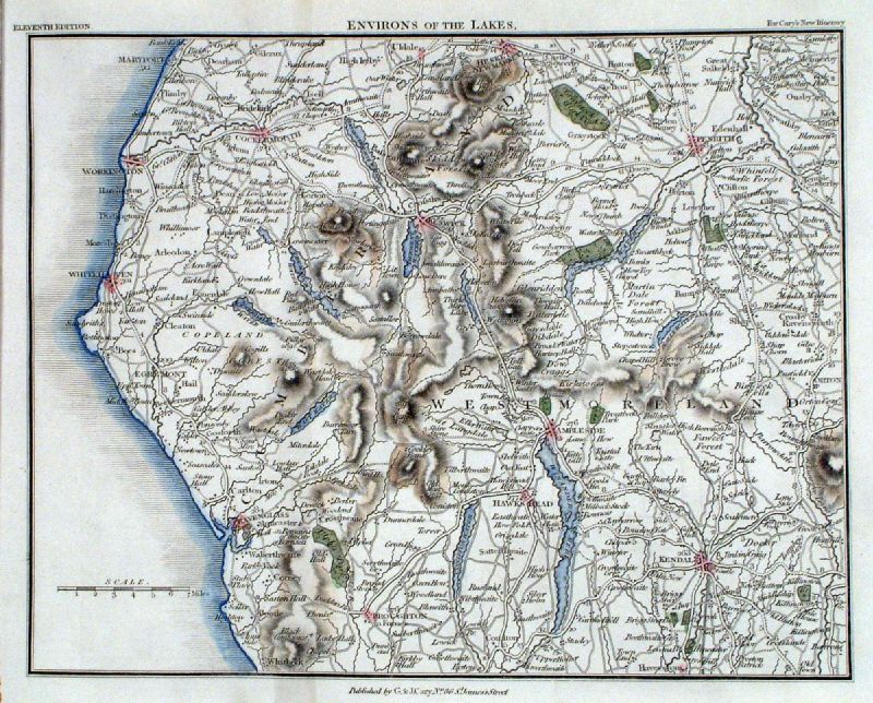 |
Kendal, Keswick, Ambleside (Environs of the
Lakes) Cary 1828 Area covers: Maryport, Cockermouth, Penrith, Coulton size: 220 x 180 mm Antique Map Ref ILM014 £22.00 (+P&P) click image for enlargement |
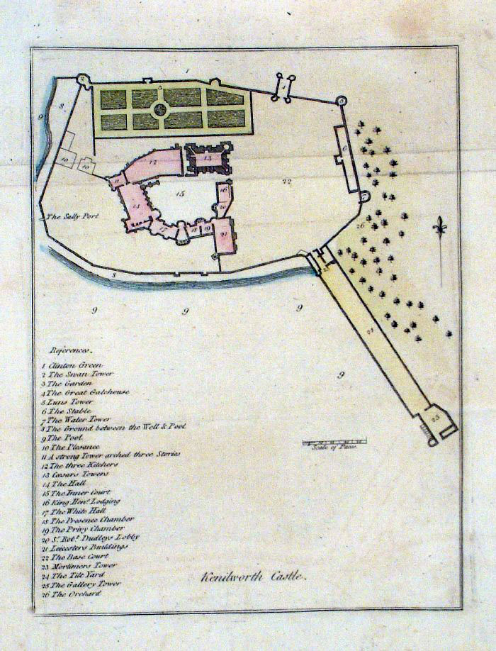 |
Kenilworth Castle plan (Warwickshire)
Grose 1787 size: 180 x 250 mm Antique Map Ref FHM004 £22.00 (+P&P) click image for enlargement |
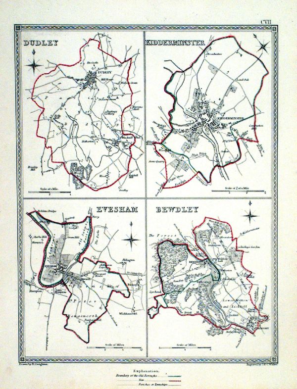 |
Kidderminster .Dudley . Evesham . Bewdley Samuel Lewis 1835 engraved by J & C Walker Steel engraving Size: 200 x 250 mm, Original colouring of boundaries. Antique Map Ref KJM107 £16.00 (+P&P) Sample, not of this specific map, to indicate the level of detail of these 1835 Lewis town plans. click image for enlargement |
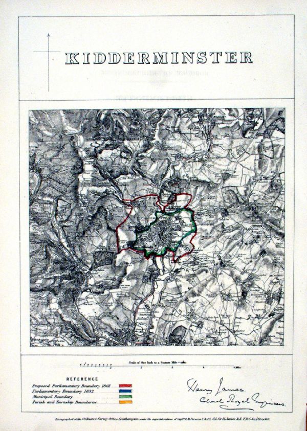 |
Kidderminster James
- Boundary Commission 1868 The map is accompanied by a page of descriptive text relating to the borough statistics Zincograph Size: 240 x 360 mm Original colouring of boundaries Antique Map Ref KFM027 £18.00 (+P&P) click image for enlargement |
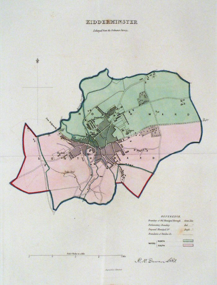 |
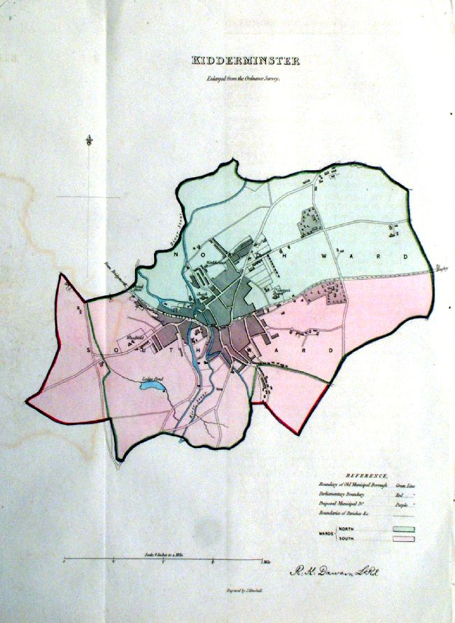
Kidderminster (Worcs)
Dawson - Boundary Commission 1837 From 'Municipal Corporation Boundaries Report ' Large Paper Edition size: 250 x 300 mm 1 fold, slight offset transfer Antique Map Ref GBM082 £26.00 (+P&P) click image for enlargement |
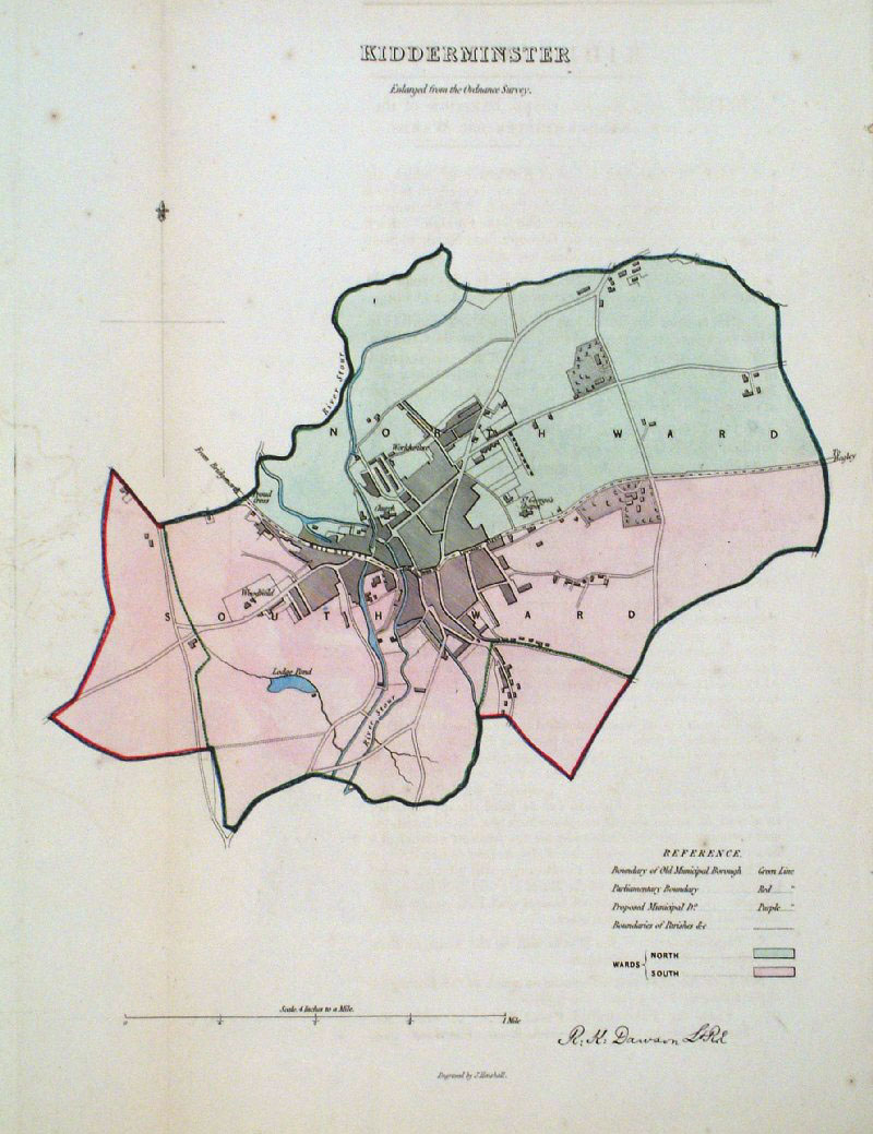 |
Kidderminster (Worcs)
Dawson - Boundary
Commission 1837 From 'Municipal Corporation Boundaries Report ' size: 230 x 300 mm 1 fold, very faint offset transfer Antique Map Ref GDM272 £26.00 (+P&P) [ ICM011 ] £26.00 click image for enlargement |
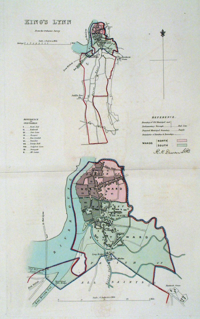 |
Kings Lynn (Norfolk)
Dawson - Boundary Commission 1837 From 'Municipal Corporation Boundaries Report ' Large Paper Edition size: 250 x 300 mm 1 fold, slight offset transfer Antique Map Ref GBM083 £26.00 (+P&P) click image for enlargement |
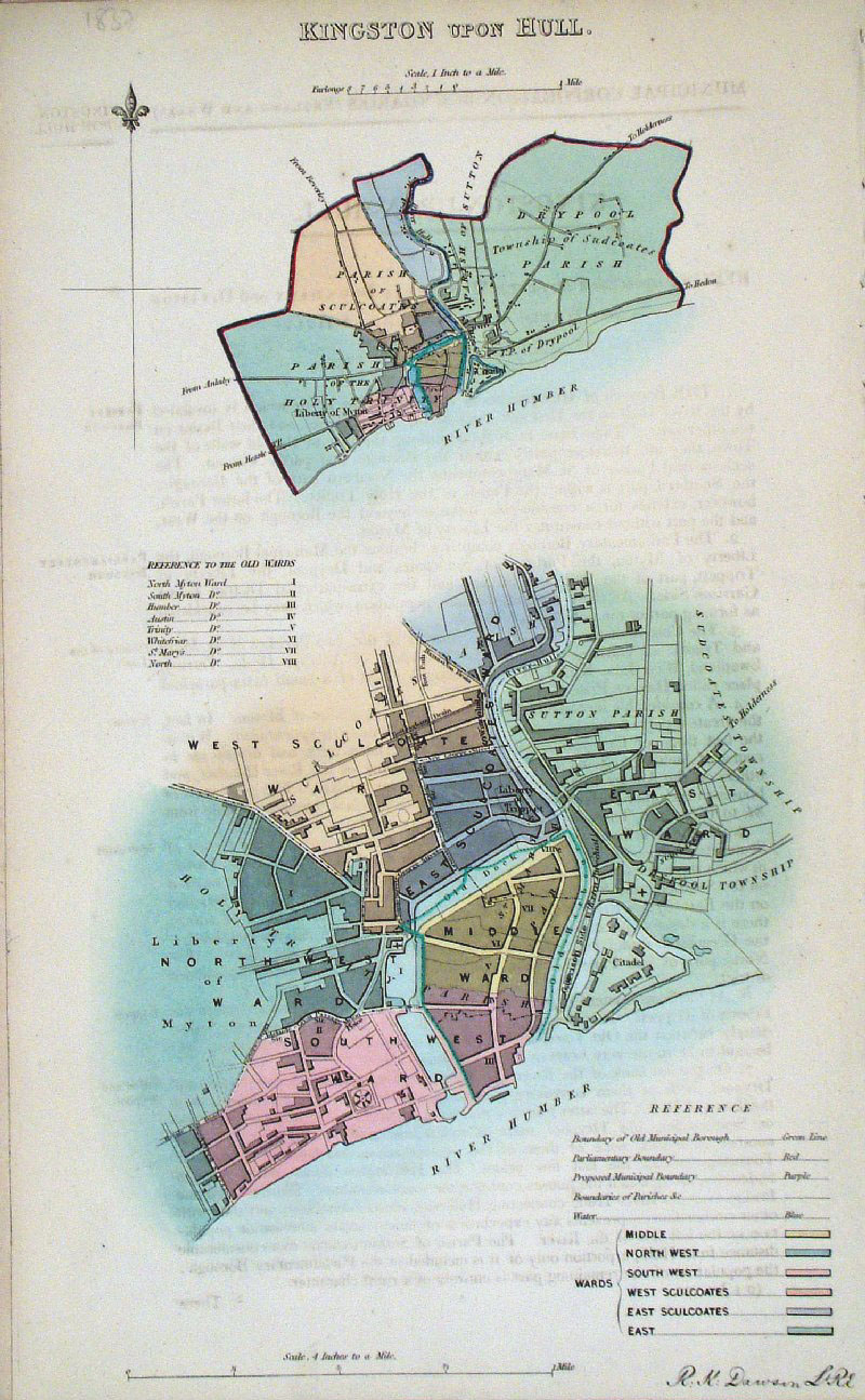 |
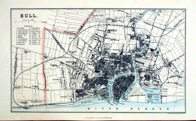
Kingston upon Hull (Yorkshire)
Dawson - Boundary
Commission 1837 From 'Municipal Corporation Boundaries Report ' size: 200 x 300 mm faint offset transfer Antique Map Ref GDM273 £24.00 (+P&P) click image for enlargement |
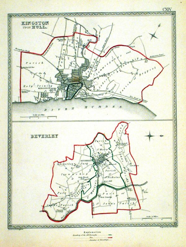 |
Kingston Upon Hull . Beverley Samuel Lewis 1835 engraved by J & C Walker Steel engraving Size: 200 x 250 mm, Original colouring of boundaries. Antique Map Ref KJM114 £18.00 (+P&P) Sample, not of this specific map, to indicate the level of detail of these 1835 Lewis town plans. click image for enlargement |
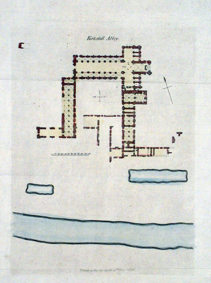 |
Kirkstall Abbey (Yorkshire)
Grose 1787 size: 180 x 240 mm Antique Map Ref FHM001 £18.00 (+P&P) click image for enlargement |
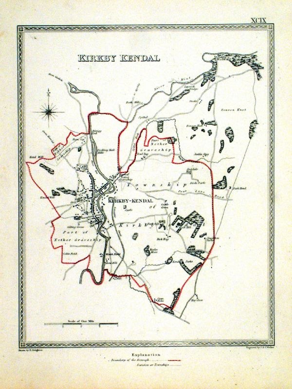 |
Kirby Kendal Samuel Lewis 1835 engraved by J & C Walker Steel engraving Size: 200 x 250 mm, Original colouring of boundaries. Antique Map Ref KJM099 £18.00 (+P&P) Sample, not of this specific map, to indicate the level of detail of these 1835 Lewis town plans. click image for enlargement |
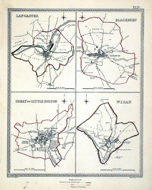 |
Lancaster . Blackburn . Great and Little Bolton .
Wigan Samuel Lewis 1835 engraved by J & C Walker Steel engraving Size: 200 x 250 mm, Original colouring of boundaries. Antique Map Ref KJM044 £16.00 (+P&P) Sample, not of this specific map, to indicate the level of detail of these 1835 Lewis town plans. click image for enlargement |
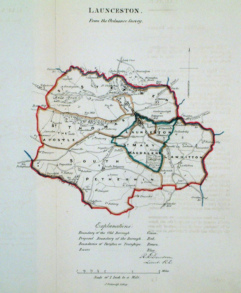 |
Launceston (Cornwall)
Dawson - Boundary Commission
1837 From 'Municipal Corporation Boundaries Report ' size: 220 x 270 mm 1 fold, faint offset transfer Antique Map Ref GDM274 £24.00 (+P&P) click image for enlargement |
 |
Launceston (Cornwall)
Dawson - Boundary
Commission 1837 From 'Municipal Corporation Boundaries Report ' Large Paper Edition. Page size: 420 x 500mm plate size: 210 x 340 mm Antique Map Ref GBM087 £28.00 (+P&P) click image for enlargement |
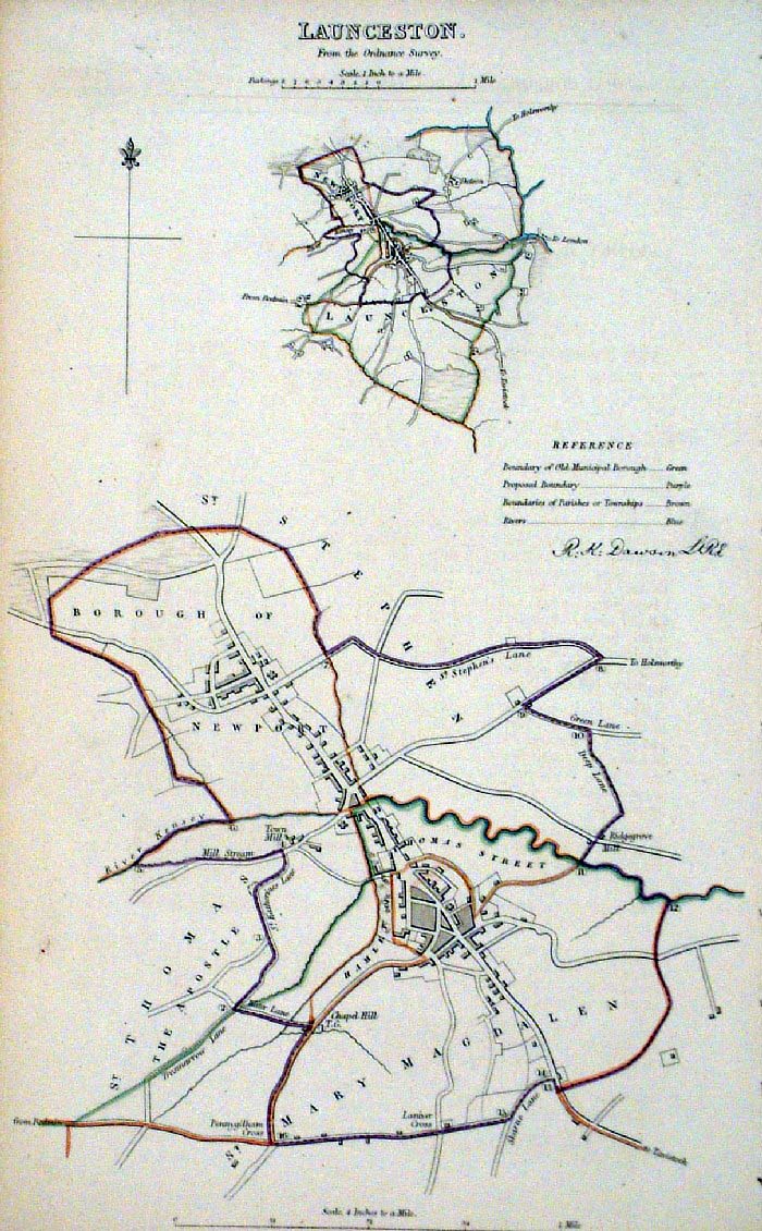 |
Launceston (Cornwall)
Dawson - Boundary Commission 1837 From 'Municipal Corporation Boundaries Report ' size: 200 x 300 mm Antique Map Ref FDM108 £28.00 (+P&P) click image for enlargement |
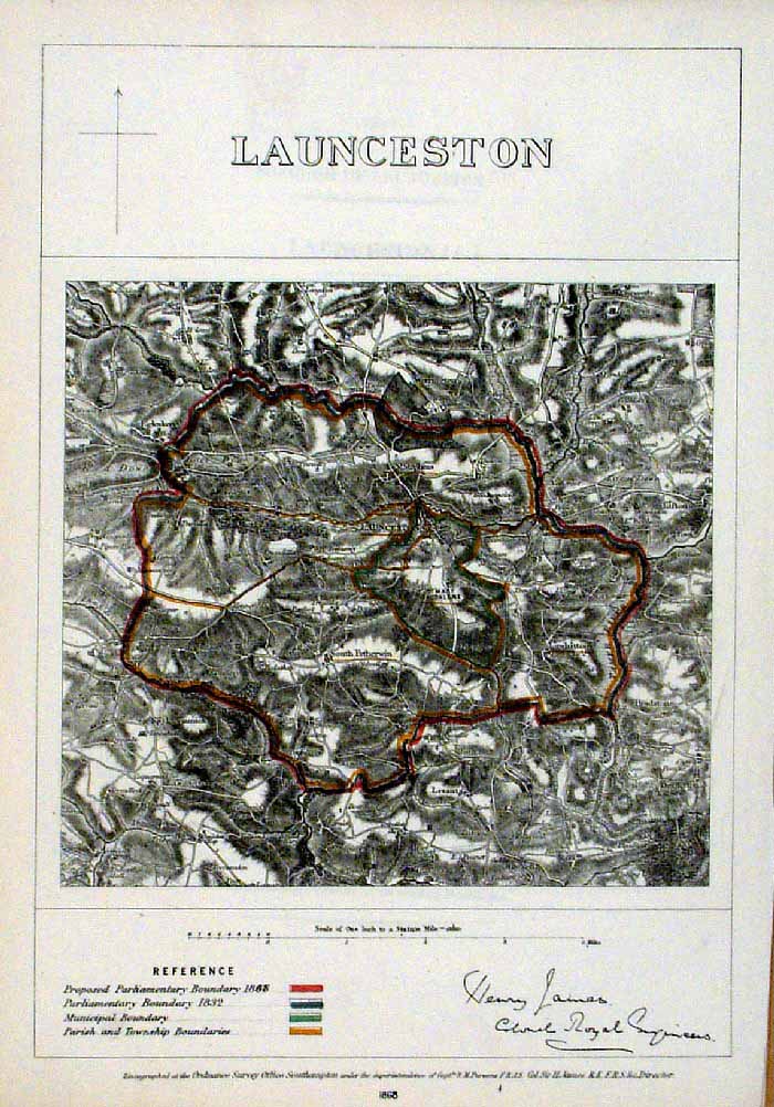 |
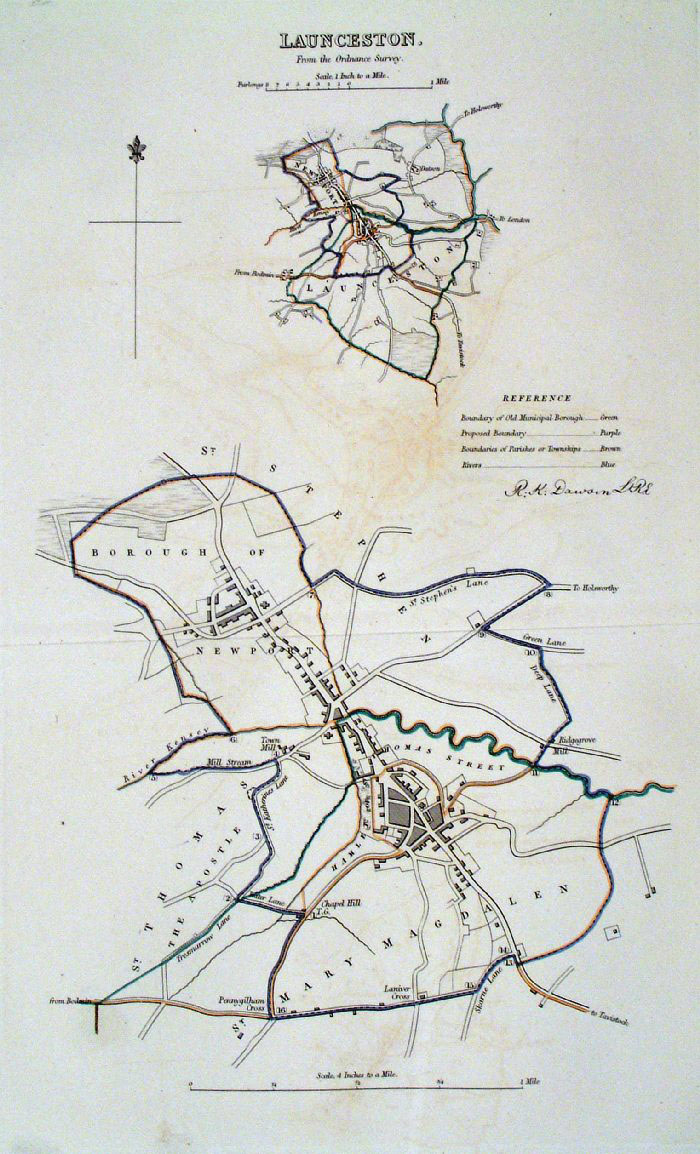
Launceston (Cornwall)
James - Boundary
Commission 1868 The map is accompanied by a page of descriptive text relating to the borough statistics Zincograph Size: 240 x 360 mm Original colouring of boundaries Antique Map Ref HJS037 £20.00 (+P&P) click image for enlargement |
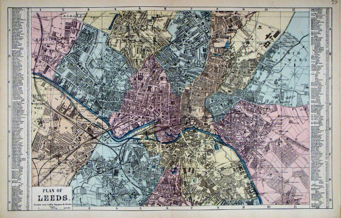 |
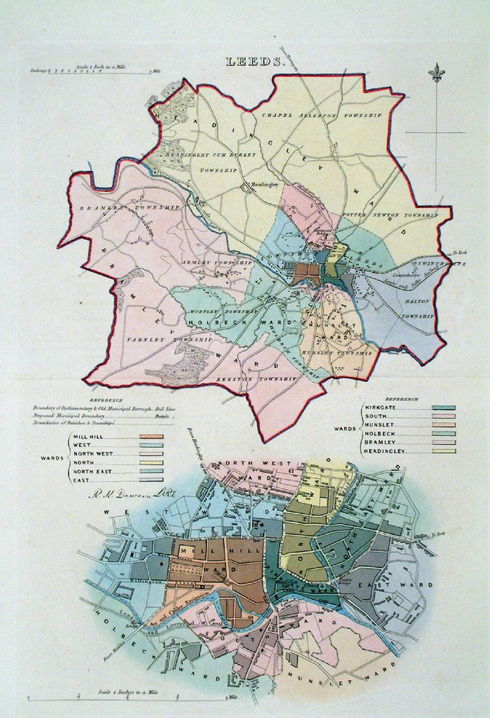
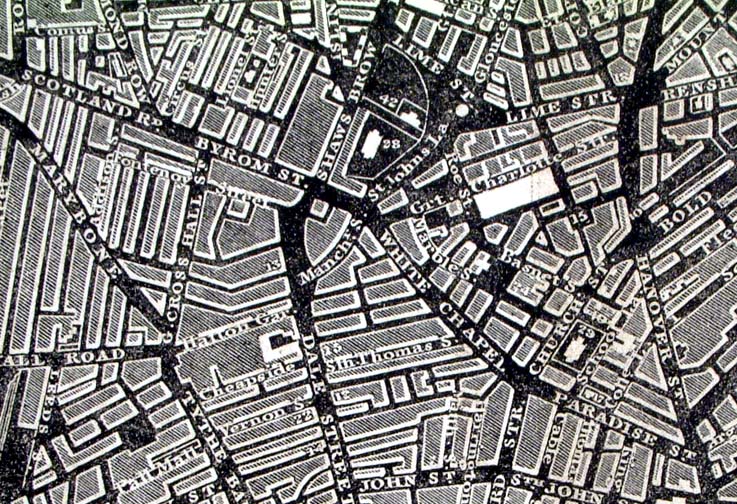
Leeds
Bacon c1883
size: 500 x 320 mm Antique Map Ref FLM165 £25.00 (+P&P) Antique Map Ref HBS009 (1912 edition) £25.00 (+P&P) click image for enlargement |
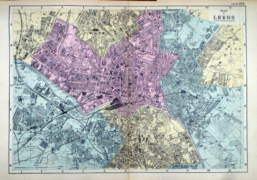 |
Plan of Leeds From the New Large Scale Atlas of the British Isles by G.W. Bacon 1892 size: 450 x 330 mm, centre fold Ref LHM088 £25.00 (+P&P) Detail click image for enlargement |
 |
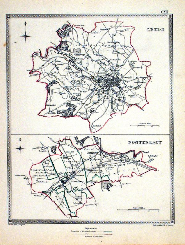
Leeds (Yorkshire) Dawson
- Boundary Commission 1837 From 'Municipal Corporation Boundaries Report ' Large Paper Edition size: 250 x 300 mm 1 fold Antique Map Ref GBM088 £32.00 (+P&P) click image for enlargement |
 |
Leeds . Pontefract Samuel Lewis 1835 engraved by J & C Walker Steel engraving Size: 200 x 250 mm, Original colouring of boundaries. Antique Map Ref KJM112 £18.00 (+P&P) Sample, not of this specific map, to indicate the level of detail of these 1835 Lewis town plans. click image for enlargement |
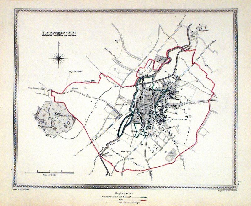 |
Leicester Samuel Lewis 1835 engraved by J & C Walker Steel engraving Size: 250 x 200 mm, Original colouring of boundaries. Antique Map Ref KJM050 £18.00 (+P&P) Sample, not of this specific map, to indicate the level of detail of these 1835 Lewis town plans and town environs. click image for enlargement |
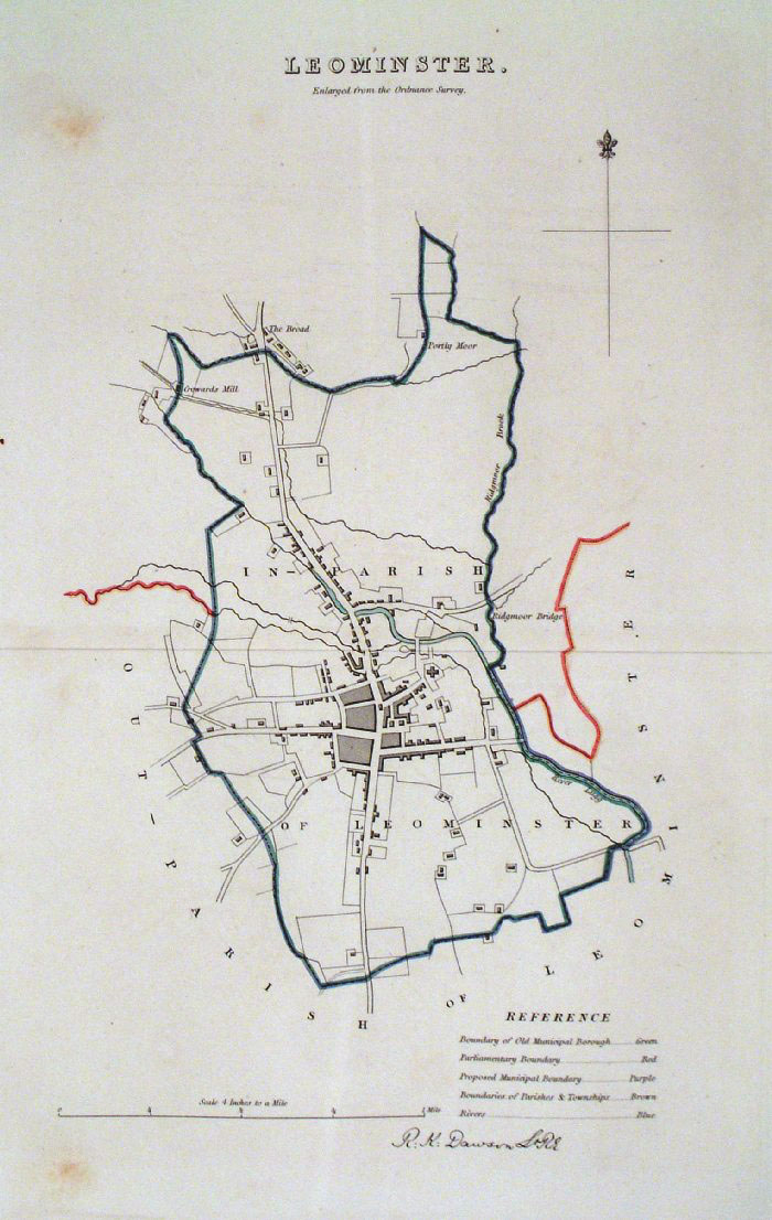 |
Leominster (Herefordshire)
Dawson - Boundary
Commission 1837 From 'Municipal Corporation Boundaries Report ' Large Paper Edition. Page size: 420 x 500mm plate size: 210 x 340 mm A few spots of foxing Antique Map Ref GBM090 £28.00 (+P&P) click image for enlargement |
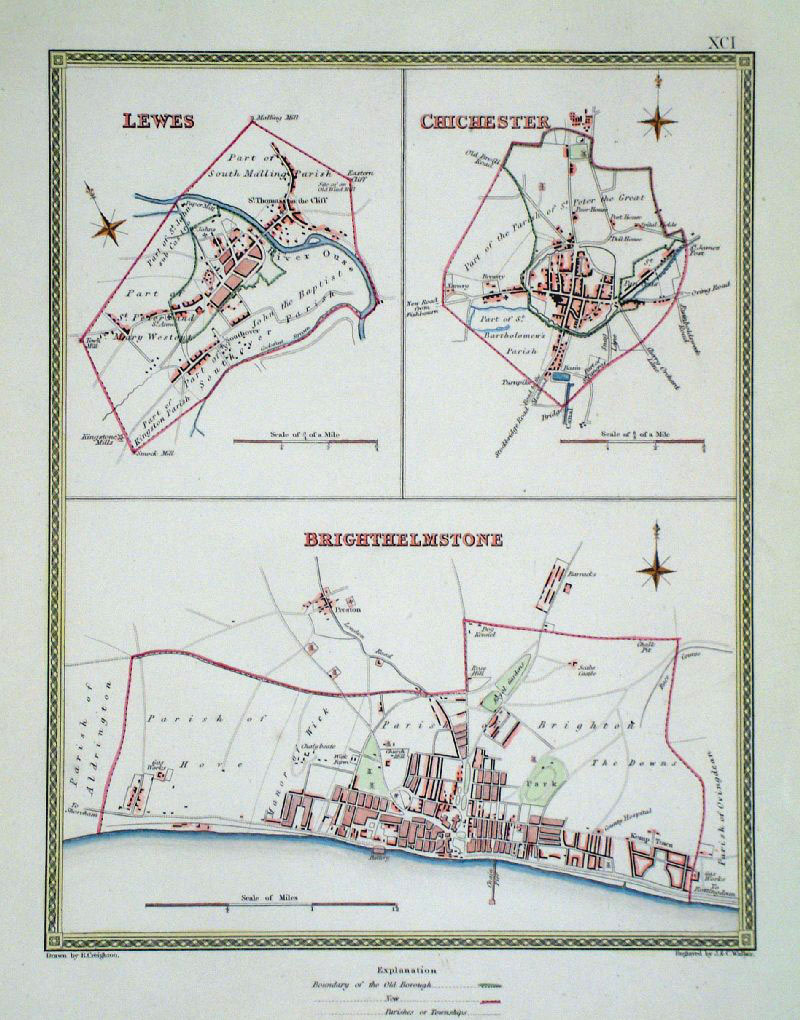 |
Lewes, Brighton and Chichester
(Sussex) Samuel
Lewis 1840 From ' View of the Representative History of England' (Creighton & Walker) size: 190 x 260 mm Showing Borough and Parish Boundaries. Antique Map Ref GCM004 £26.00 (+P&P) click image for enlargement |
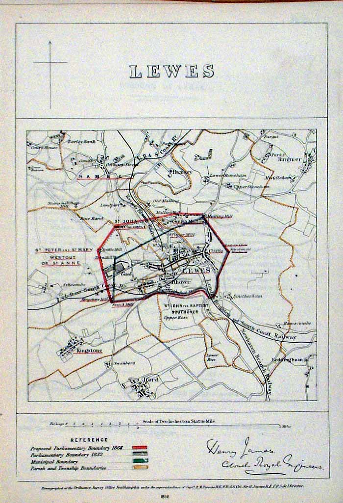 |
Lewes (Sussex)
James - Boundary Commission
1868 The map is accompanied by a page of descriptive text relating to the borough statistics Zincograph Size: 240 x 360 mm Original colouring of boundaries Antique Map Ref HJS039 £26.00 (+P&P) click image for enlargement |
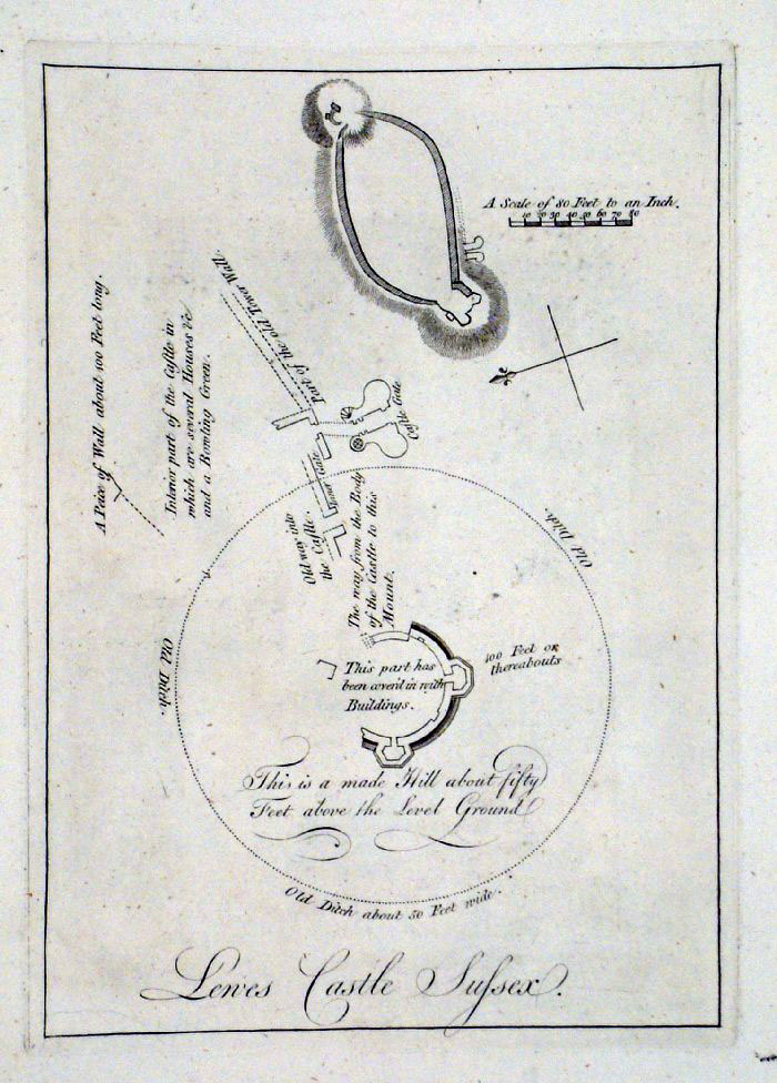 |
Lewes Castle plan (Sussex)
Grose 1787 size: 150 x 220 mm Antique Map Ref FHM024 £20.00 (+P&P) click image for enlargement |
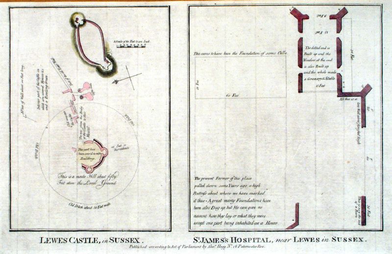 |
Lewes Castle in Sussex / St James's
Hospital, near Lewes in Sussex Hogg c1790 Copper engraving. size: 350 x 220 mm Antique Map Ref JGM039 £28.00 (+P&P) click image for enlargement |
 |
Leominster . Hereford Samuel Lewis 1835 engraved by J & C Walker Steel engraving Size: 200 x 250 mm, Original colouring of boundaries. Antique Map Ref KJM034 £16.00 (+P&P) Sample, not of this specific map, to indicate the level of detail of these 1835 Lewis town plans. click image for enlargement |
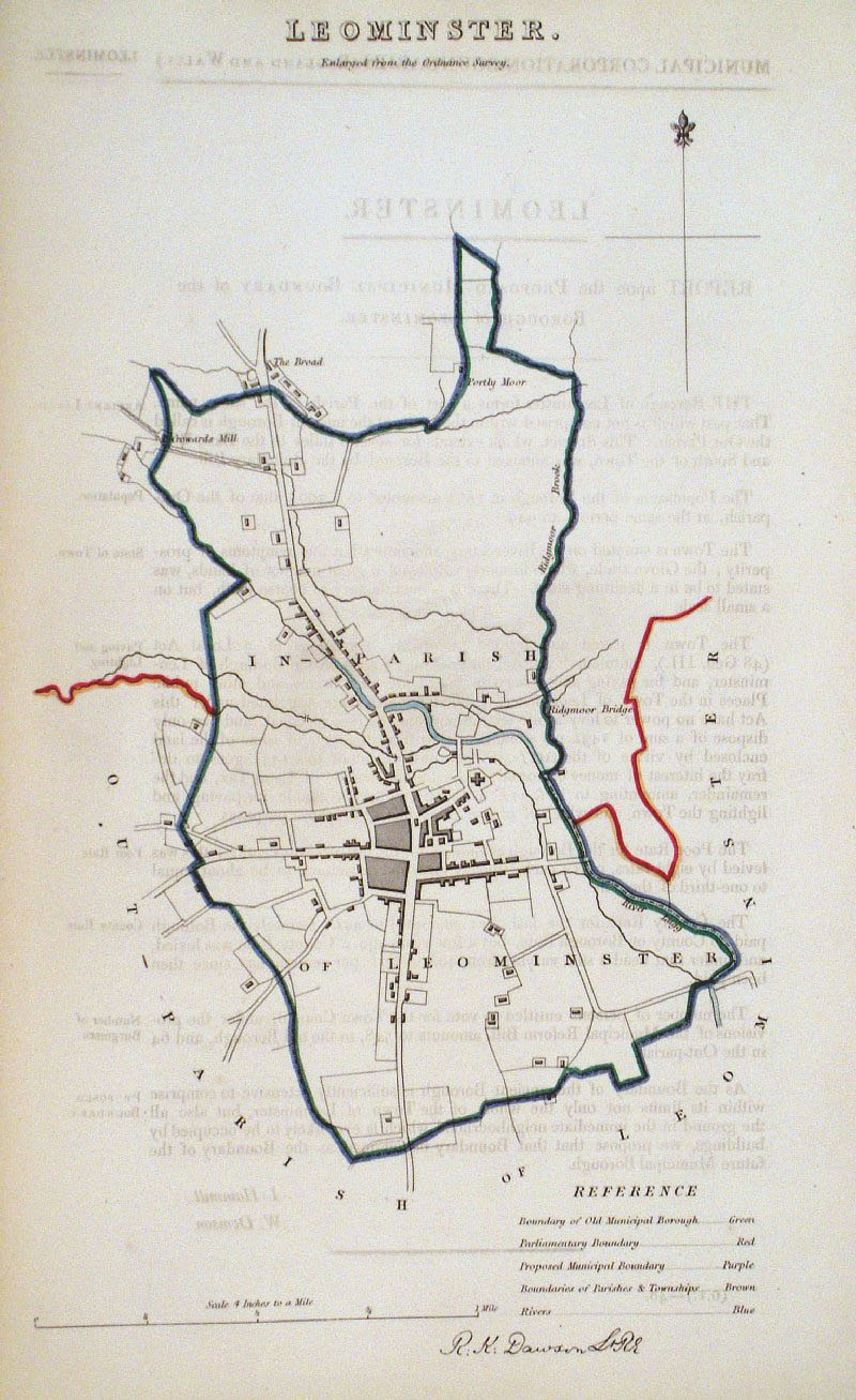 |
Leominster Dawson
- Boundary Commission 1837 From 'Municipal Corporation Boundaries Report ' size: 200 x 300 mm faint offset transfer Antique Map Ref GDM267 £24.00 (+P&P) click image for enlargement |
 |
Lichfield . Tamworth . Stafford . Newcastle under
Lyne Samuel Lewis 1835 engraved by J & C Walker Steel engraving Size: 200 x 250 mm, Original colouring of boundaries. Antique Map Ref KJM082 £16.00 (+P&P) Sample, not of this specific map, to indicate the level of detail of these 1835 Lewis town plans. click image for enlargement |
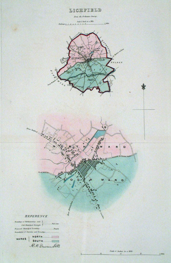 |
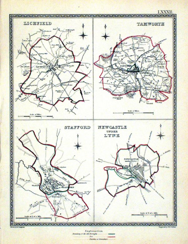
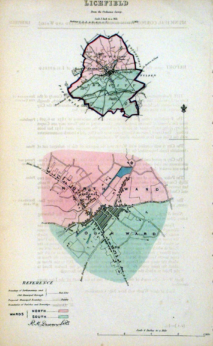
Lichfield
Dawson - Boundary
Commission 1837 From 'Municipal Corporation Boundaries Report ' Large Paper Edition. Page size: 420 x 500mm plate size: 210 x 340 mm Antique Map Ref GBM091 £28.00 (+P&P) click image for enlargement |
 |
Lichfield (Staffs) Dawson
- Boundary Commission 1837 From 'Municipal Corporation Boundaries Report ' size: 200 x 300 mm Antique Map Ref FDM107 £28.00 (+P&P) click image for enlargement |
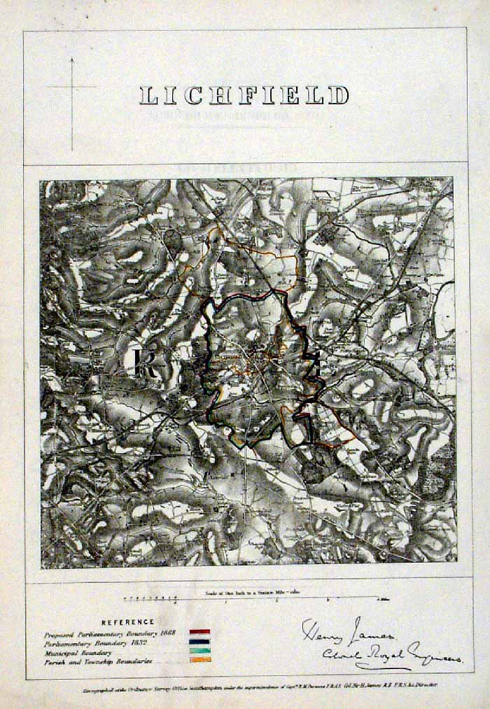 |
Lichfiled (Staffs)
James - Boundary Commission
1868 The map is accompanied by a page of descriptive text relating to the borough statistics Zincograph Size: 240 x 360 mm Original colouring of boundaries Antique Map Ref HJS040 £18.00 (+P&P) click image for enlargement |
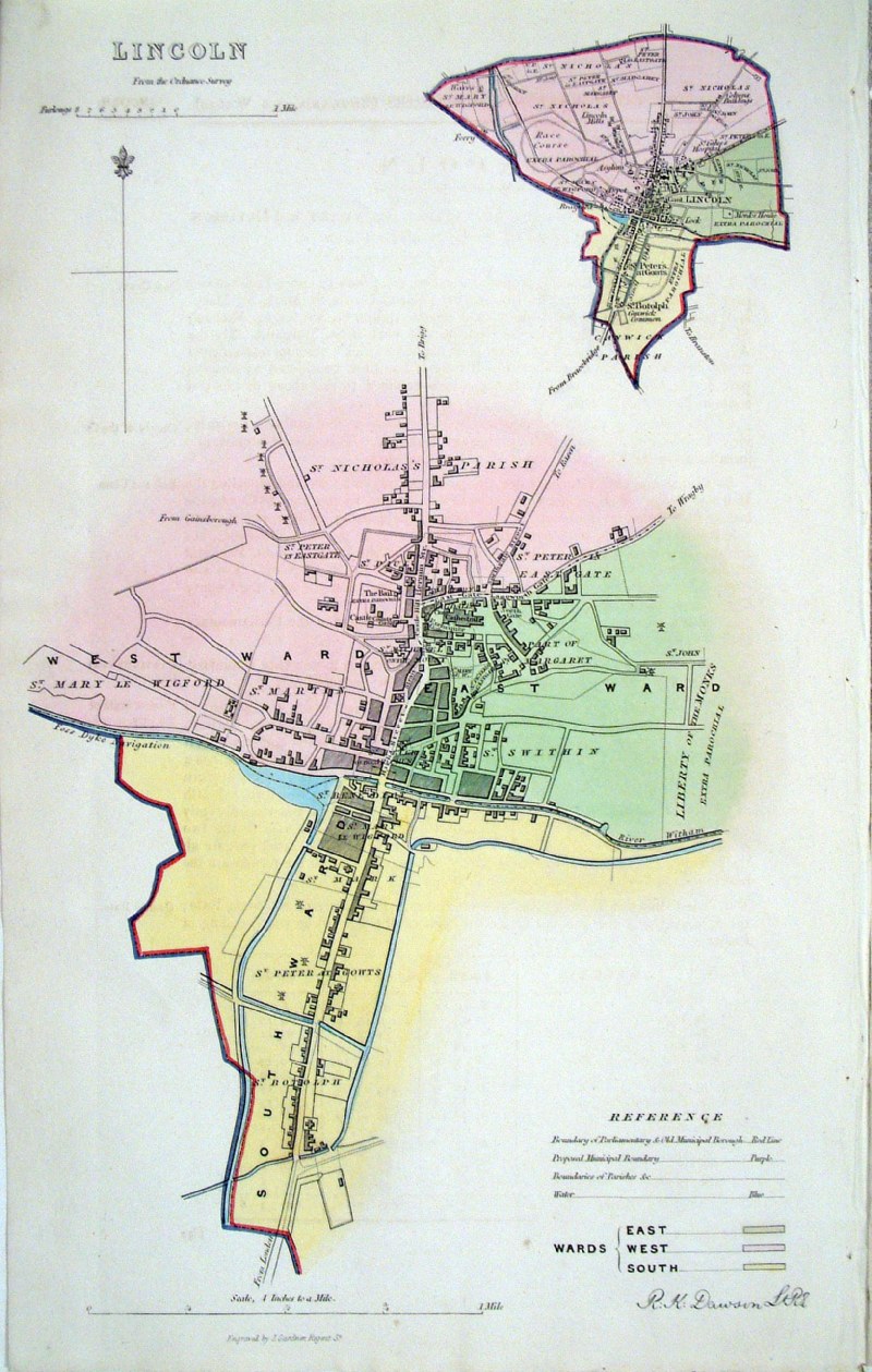 |
Lincoln
Dawson - Boundary Commission
1837 From 'Municipal Corporation Boundaries Report ' Comes with 4 pages of data from the Boundaries Commission Report. size: 210 x 340 mm Antique Map Ref HEM009 £32.00 (+P&P) click image for enlargement |
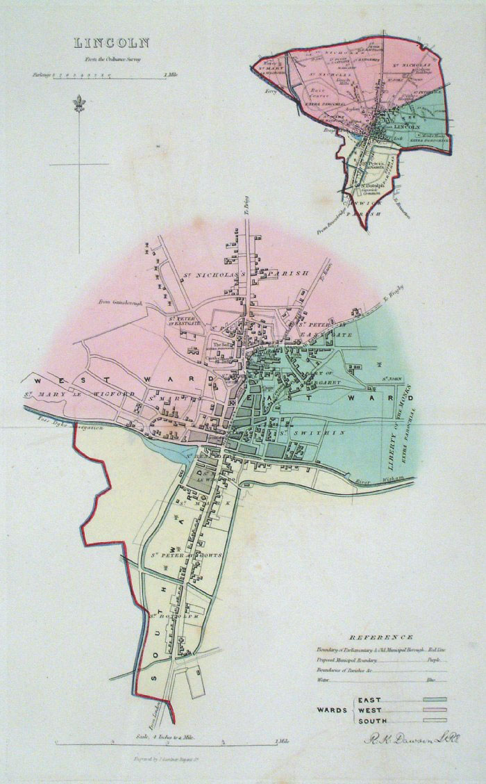 |
Lincoln
Dawson - Boundary Commission
1837 From 'Municipal Corporation Boundaries Report ' Large Paper Edition. Page size: 420 x 500mm plate size: 210 x 340 mm A few faint spots of foxing Antique Map Ref GBM092 £32.00 (+P&P) click image for enlargement |
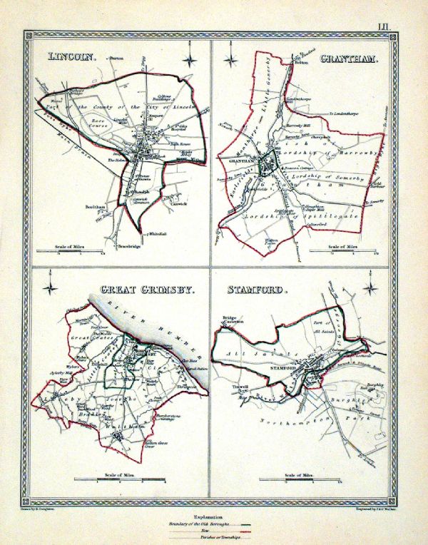 |
Lincoln . Grantham . Great Grimsby . Stamford Samuel Lewis 1835 engraved by J & C Walker Steel engraving Size: 200 x 250 mm, Original colouring of boundaries. Antique Map Ref KJM052 £16.00 (+P&P) Sample, not of this specific map, to indicate the level of detail of these 1835 Lewis town plans. click image for enlargement |
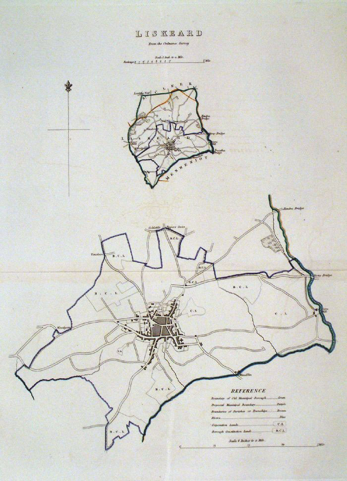 |
Liskeard (Cornwall)
Dawson - Boundary Commission
1837 From 'Municipal Corporation Boundaries Report ' Large Paper Edition. Page size: 420 x 500mm plate size: 210 x 340 mm Antique Map Ref GBM093 £28.00 (+P&P) click image for enlargement |
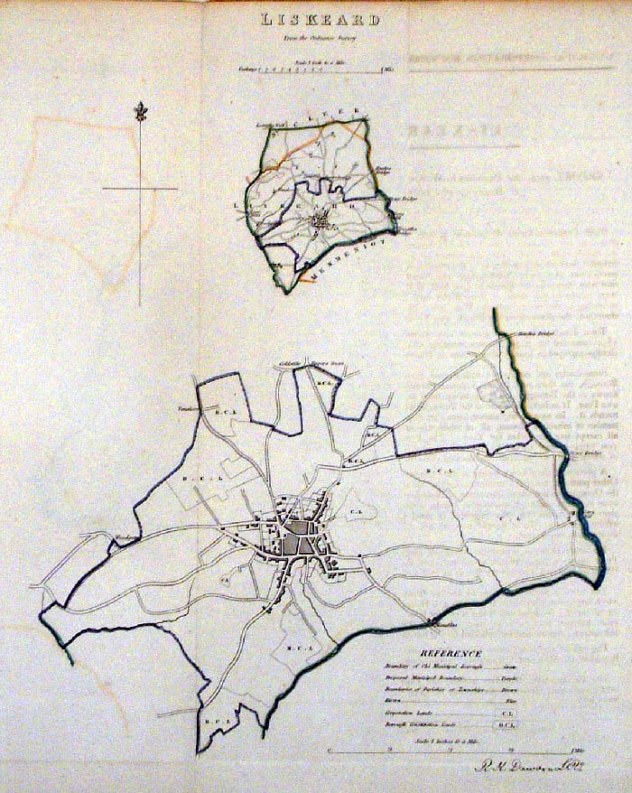 |
Liskeard (Cornwall)
Dawson - Boundary Commission 1837 From 'Municipal Corporation Boundaries Report ' size: 250 x 300 mm 1 fold Antique Map Ref FDM106 £28.00 (+P&P) click image for enlargement |
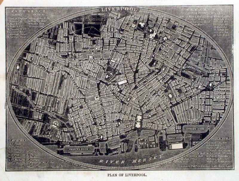 |
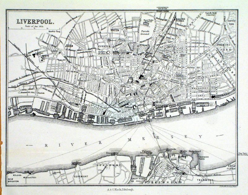
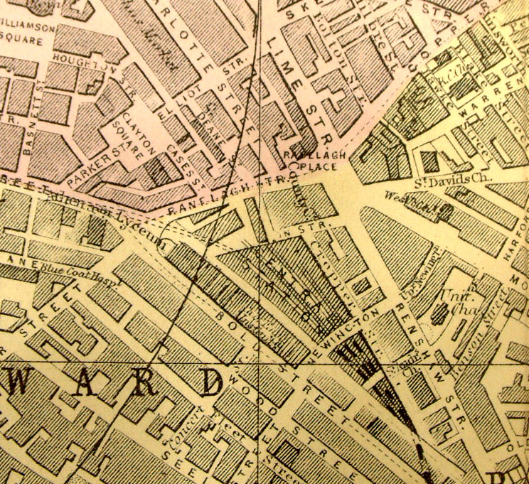
Liverpool Pinnock
1833
size: 240 x 170 mm Detail Antique Map Ref ILM004 £26.00 (+P&P) click image for enlargement |
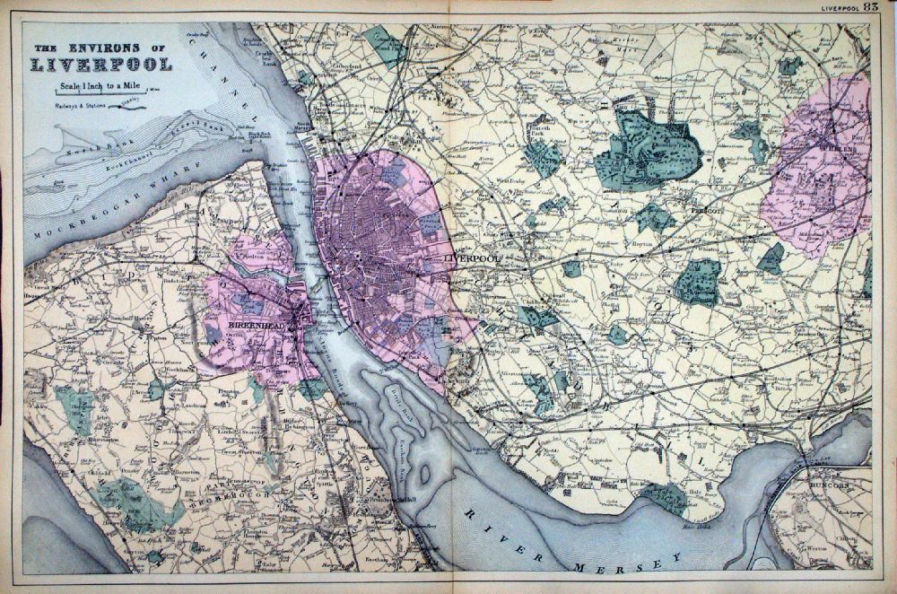 |
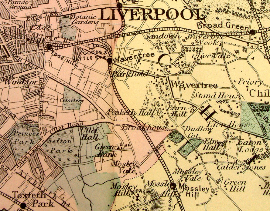
Environs of Liverpool From the New Large Scale Atlas of the British Isles by G.W. Bacon 1892 size: 500 x 330 mm, centre fold Ref LHM091 £26.00 (+P&P) Detail click image for enlargement |
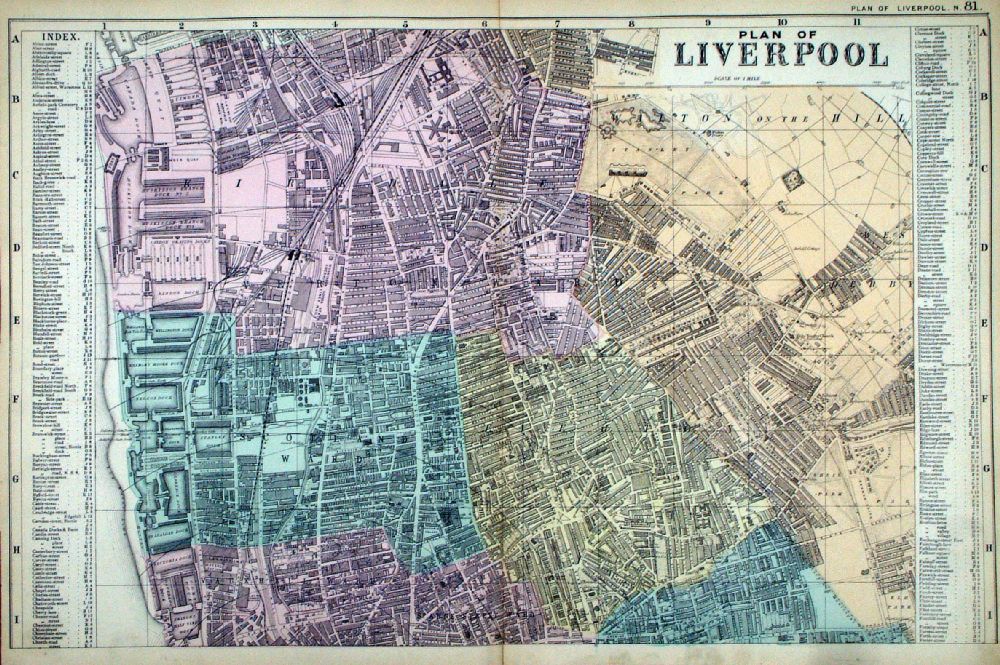 |
Plan of
Liverpool (North) From the New Large Scale Atlas of the British Isles by G.W. Bacon 1892 size: 500 x 330 mm, centre fold Ref LHM089 £26.00 (+P&P) Detail click image for enlargement |
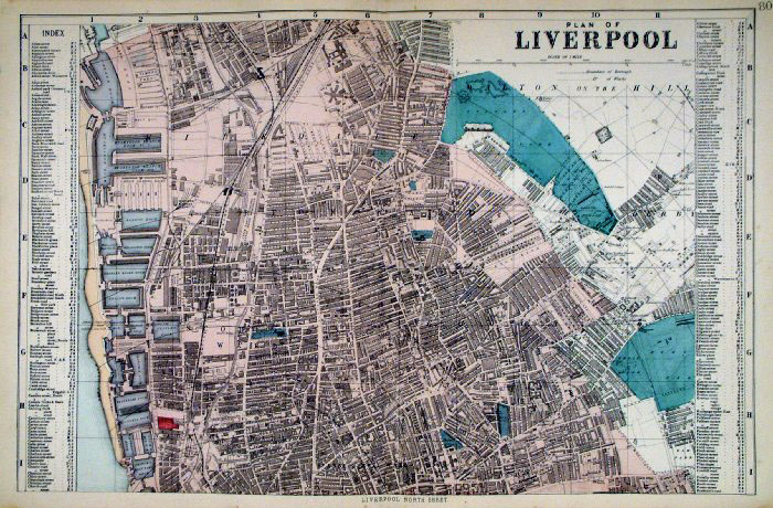 |
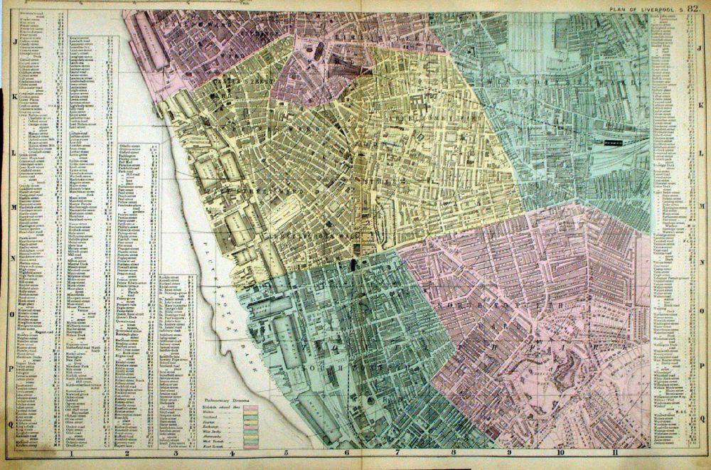
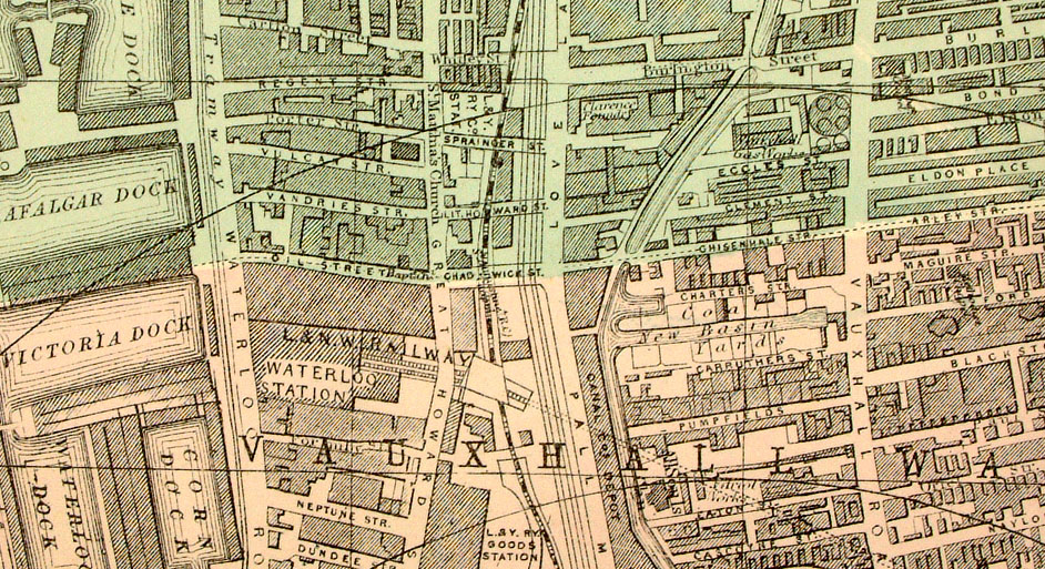
Liverpool (North)
Bacon c1883
size: 500 x 320 mm Antique Map Ref FLM166 £26.00 (+P&P) Antique Map Ref HBS010 (1912 edition) £26.00 (+P&P) click image for enlargement |
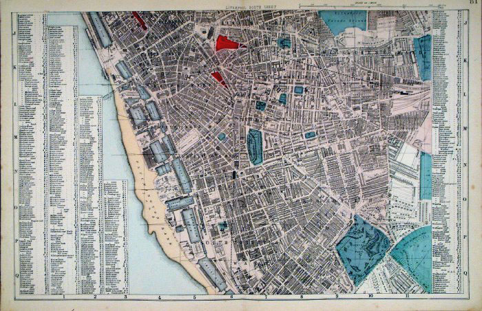 |
Liverpool
(South)
Bacon c1883
size: 500 x 320 mm Antique Map Ref FLM167 £26.00 (+P&P) Antique Map Ref HBS011 (1912 edition) £26.00 (+P&P) click image for enlargement |
 |
Plan of
Liverpool (South) From the New Large Scale Atlas of the British Isles by G.W. Bacon 1892 size: 500 x 330 mm, centre fold Ref LHM090 £26.00 (+P&P) Detail click image for enlargement |
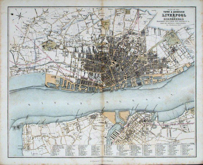 |
Liverpool and Birkenhead
Fullarton c1861 size: 300 x 240 mm, centre fold, some faint foxing spots. Antique Map Ref GBM243 £24.00 (+P&P) click image for enlargement |
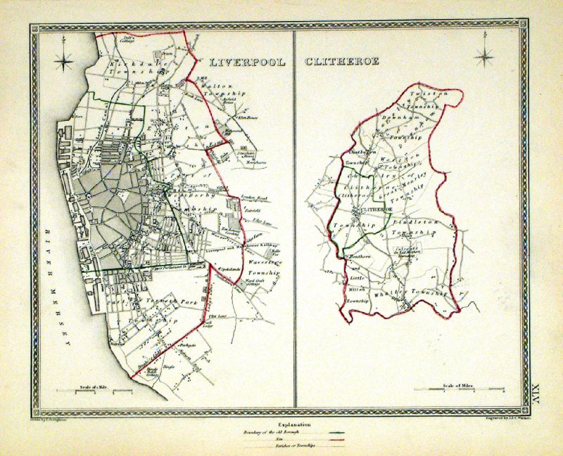 |
Liverpool . Clitheroe Samuel Lewis 1835 engraved by J & C Walker Steel engraving Size: 250 x 200 mm, Original colouring of boundaries. Antique Map Ref KJM045 £20.00 (+P&P) Sample, not of this specific map, to indicate the level of detail of these 1835 Lewis town plans and town environs. click image for enlargement |
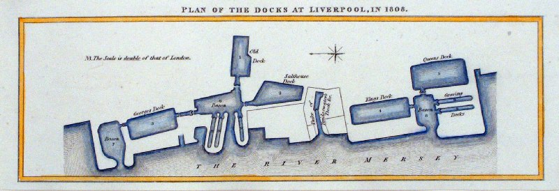 |
A Plan of the Docks at Liverpool in 1808 Published by Lonman, Hurst, Rees and Orme, London 1809 Copper engraving by Wilson Lowry size: 300 x 240 mm Antique Map Ref HCM025 £20.00 (+P&P) click image for enlargement |
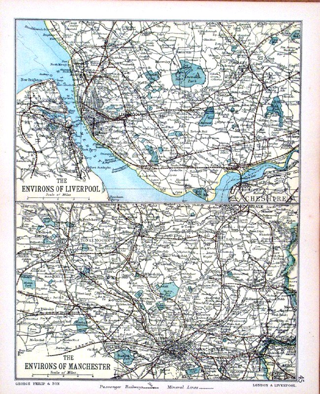 |
Environs of Liverpool and Environs of Manchester
George Philip 1898 size: 180 x 220 mm, centre fold, original printed colour Antique Map Ref HHM050 £15.00 (+P&P) click image for enlargement |
 |
Liverpool Blacl /
Bartholomew c1880
size: 200 x 160 mm Antique Map Ref KGM022 £16.00 (+P&P) click image for enlargement |
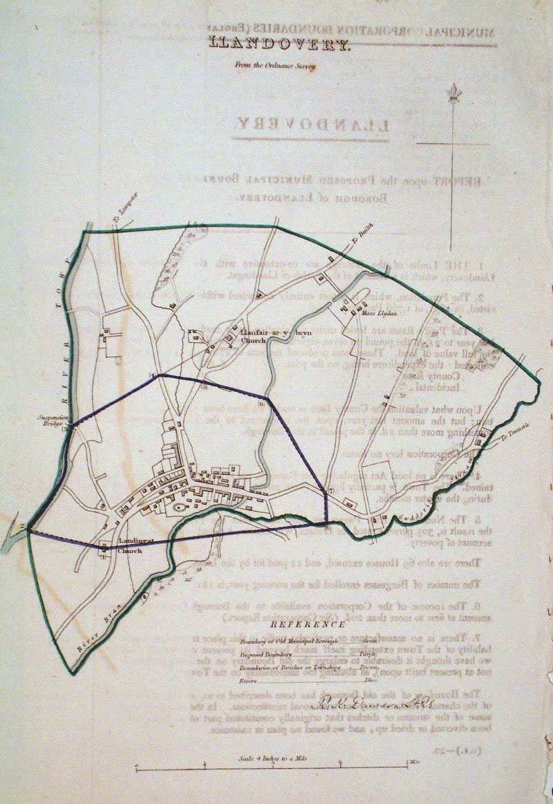 |
Llandovery (Wales)
Dawson - Boundary
Commission 1837 From 'Municipal Corporation Boundaries Report ' size: 210 x 300 mm 1 fold, faint offset transfer Antique Map Ref GDM278 £22.00 (+P&P) click image for enlargement |
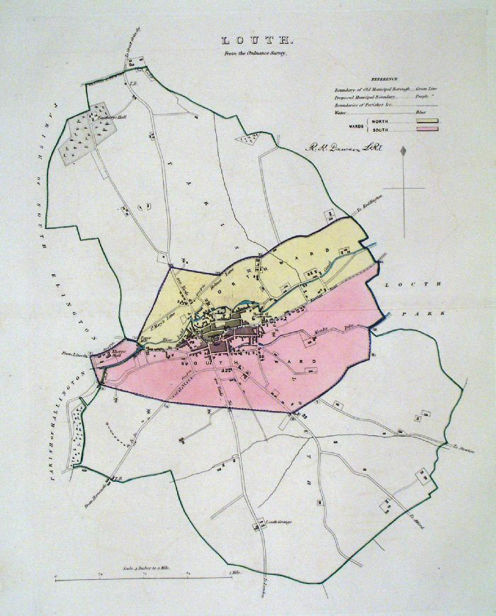 |
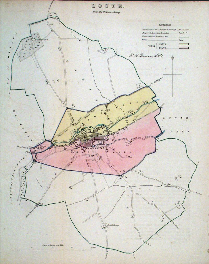
Louth (Lincs) Dawson -
Boundary Commission 1837 From 'Municipal Corporation Boundaries Report ' Large Paper Edition size: 250 x 300 mm 1 fold Antique Map Ref GBM097 £24.00 (+P&P) click image for enlargement |
 |
Louth (Lincs)
Dawson - Boundary Commission
1837 From 'Municipal Corporation Boundaries Report ' size: 250 x 300 mm 1 fold, very faint offset transfer Antique Map Ref GDM279 £24.00 (+P&P) click image for enlargement |
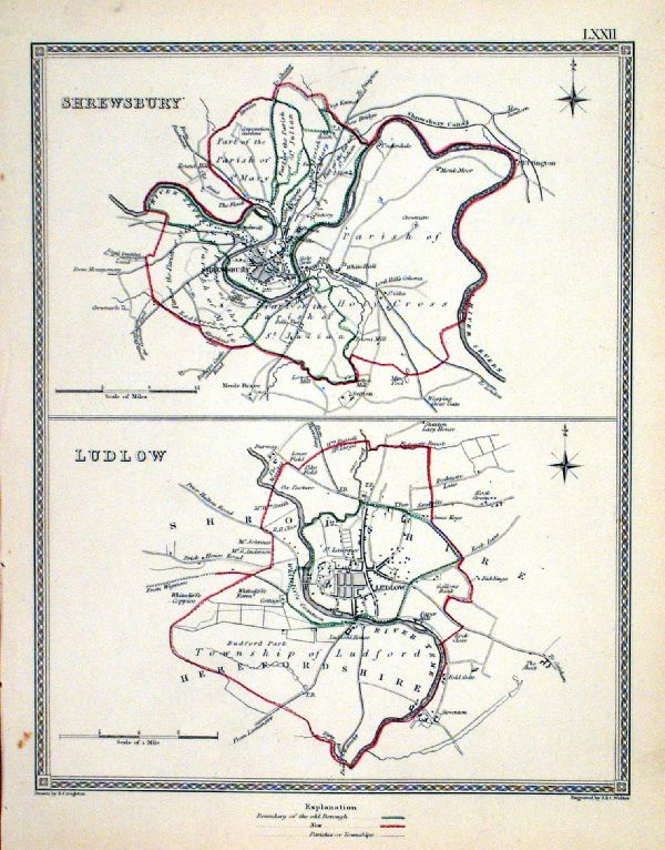 |
Ludlow . Shrewsbury Samuel Lewis 1835 engraved by J & C Walker Steel engraving Size: 200 x 250 mm, Original colouring of boundaries. Antique Map Ref KJM072 £16.00 (+P&P) Sample, not of this specific map, to indicate the level of detail of these 1835 Lewis town plans. click image for enlargement |
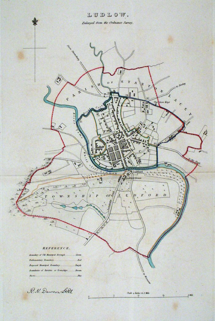 |
Ludlow (Shropshire)
Dawson - Boundary Commission 1837 From 'Municipal Corporation Boundaries Report ' Large Paper Edition size: 250 x 300 mm slight foxing Antique Map Ref GBM098 £24.00 (+P&P) click image for enlargement |
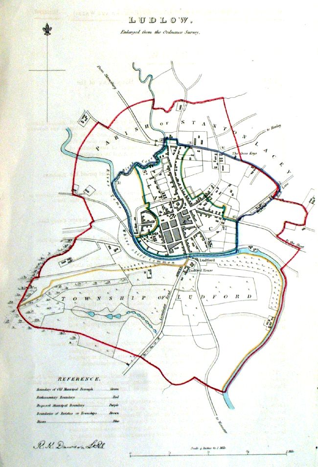 |
Ludlow (Shropshire)
Dawson - Boundary Commission 1837 From 'Municipal Corporation Boundaries Report ' size: 250 x 300 mm slight foxing Antique Map Ref ICM009 £24.00 (+P&P) click image for enlargement click image for enlargement |
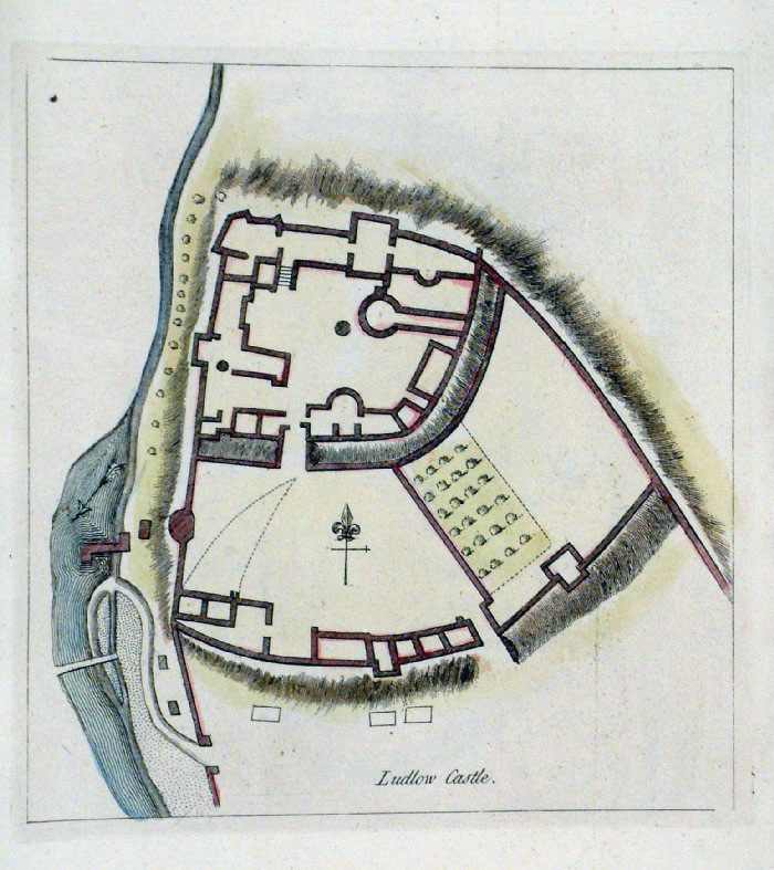 |
Ludlow Castle plan (Shropshire)
Grose 1787 size: 160 x 180 mm Antique Map Ref FHM010 £22.00 (+P&P) Antique Map Ref JKM048 £22.00 (+P&P) click image for enlargement |
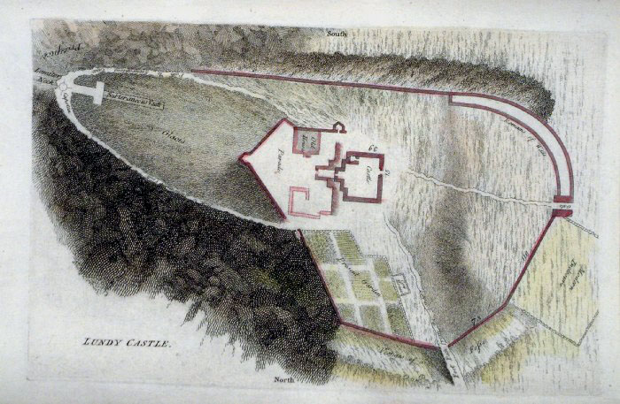 |
Lundy Castle plan (Lundy Island)
Grose 1787 size: 250 x 160 mm Antique Map Ref FHM017 £18.00 (+P&P) click image for enlargement |
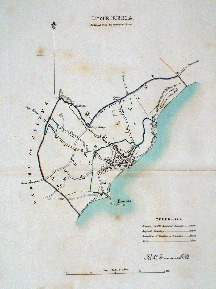 |
Lyme Regis (Dorset)
Dawson - Boundary Commission
1837 From 'Municipal Corporation Boundaries Report ' Large Paper Edition. Page size: 420 x 500mm plate size: 210 x 340 mm A few faint foxing spots Antique Map Ref GBM099 £28.00 (+P&P) click image for enlargement |
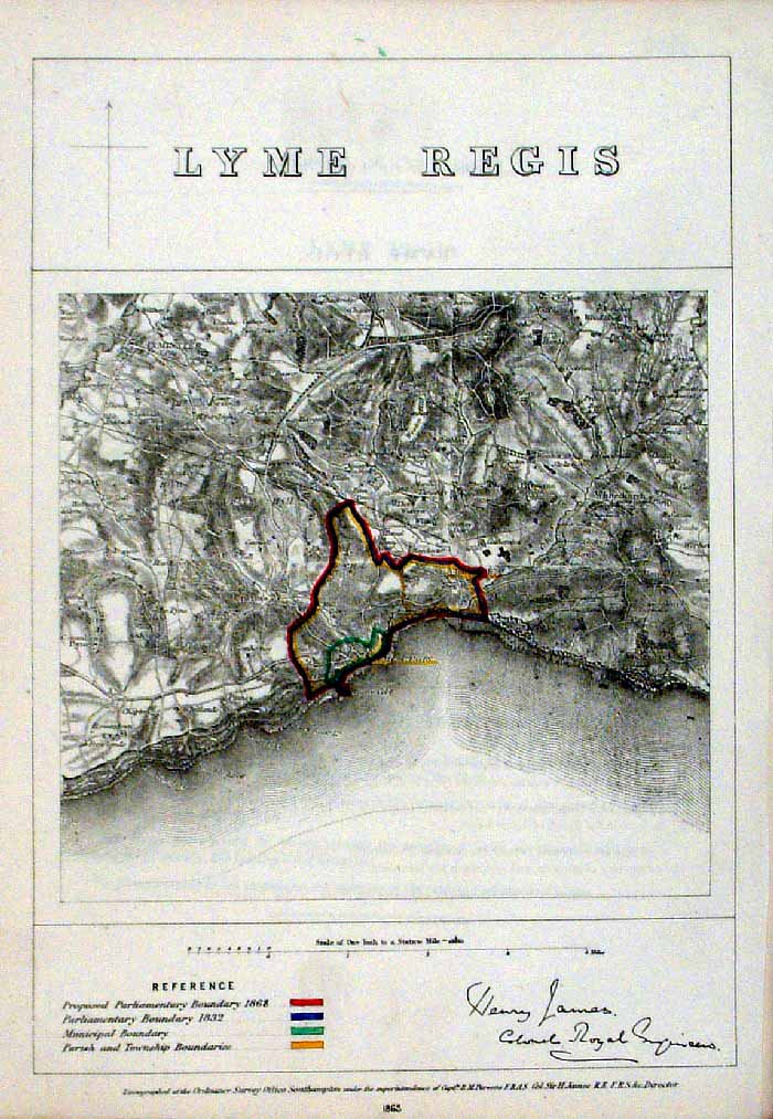 |
Lyme Regis (Dorset)
James - Boundary Commission
1868 The map is accompanied by a page of descriptive text relating to the borough statistics Zincograph Size: 240 x 360 mm Original colouring of boundaries Antique Map Ref HJS041 £20.00 (+P&P) click image for enlargement |
More Town Plans: A - B C - G M - R S - Y Scotland |
2023