Past Pages
Antique Maps, Prints and Ephemera
Antique Maps - UK Town Plans -
M to R
England & WalesIncluding castle plans, cathedral plans, church plans,
Boundary Commission maps, local suburban maps
For Irish Town plans see section: Maps - Europe / Ireland
For London see section: Maps - London
Arranged alphabetically by town or locality (not by name of church , hospital, etc)
For local interest also see Road Maps section.
Note that some maps have two or three towns, making alphabetic searching difficult and sometimes prone to error.
A Brief Article on Town Plans Help on local area maps
More Town Plans: A - B C - G H - L S - Y Scotland
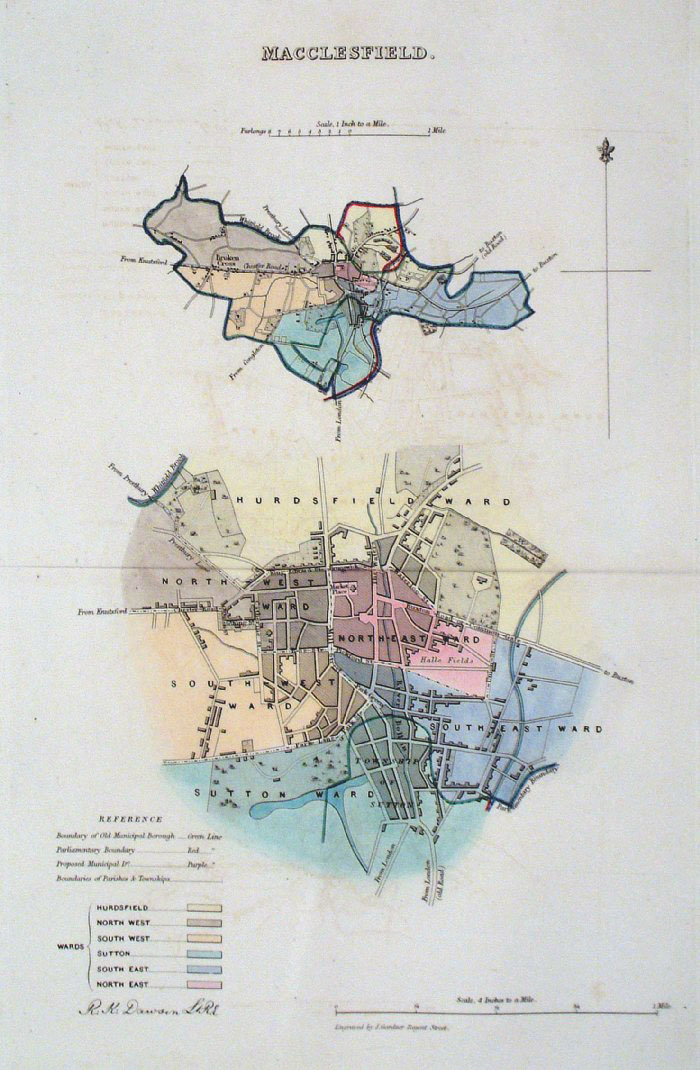 |
Macclesfield (Cheshire)
Dawson - Boundary Commission 1837 From 'Municipal Corporation Boundaries Report ' Large Paper Edition size: 250 x 300 mm 1 fold, slight offset transfer Antique Map Ref GBM101 £25.00 (+P&P) click image for enlargement |
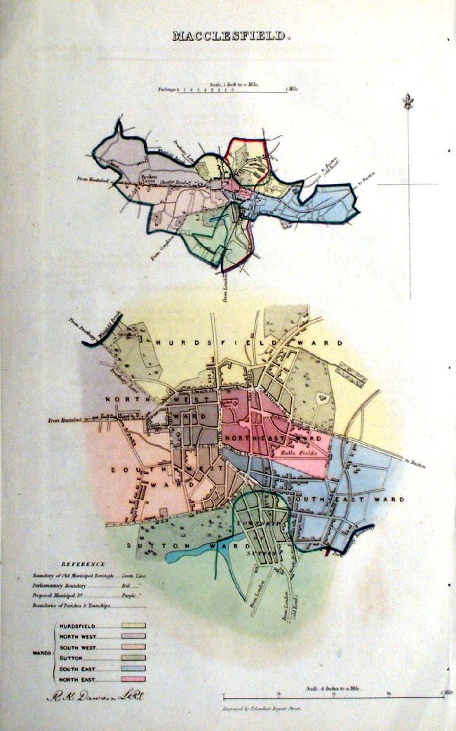 |
Macclesfield (Cheshire)
Dawson - Boundary Commission 1837 From 'Municipal Corporation Boundaries Report ' size: 250 x 300 mm Antique Map Ref ICM003 £25.00 (+P&P) click image for enlargement |
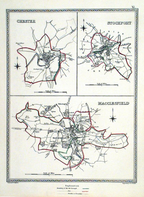 |
Macclesfield . Chester . Stockport Samuel Lewis 1835 engraved by J & C Walker Steel engraving Size: 200 x 250 mm, Original colouring of boundaries. Antique Map Ref KJM011 £16.00 (+P&P) Sample, not of this specific map, to indicate the level of detail of these 1835 Lewis town plans. click image for enlargement |
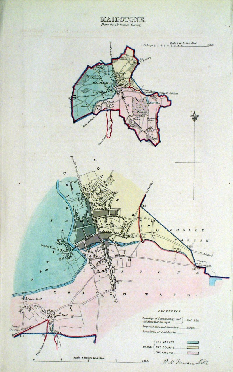 |
Maidstone (Kent) Dawson -
Boundary Commission 1837 From 'Municipal Corporation Boundaries Report ' size: 200 x 300 mm Antique Map Ref HAM032 £30.00 (+P&P) click image for enlargement |
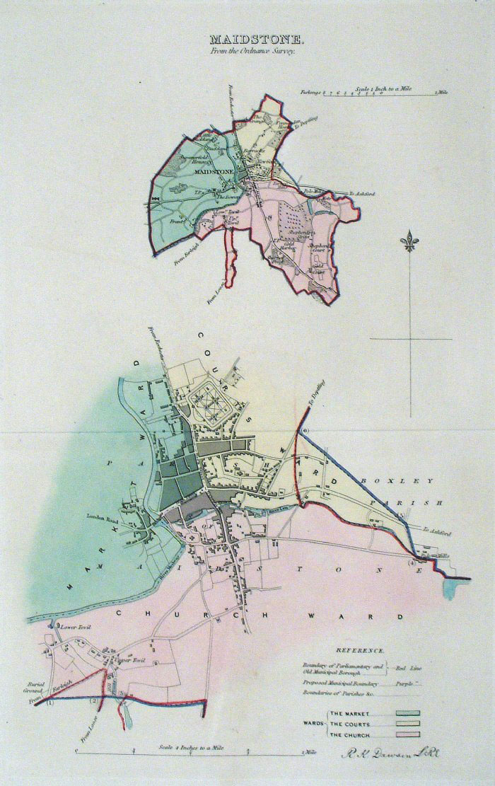 |
Maidstone (Kent)
Dawson - Boundary Commission
1837 From 'Municipal Corporation Boundaries Report ' Large Paper Edition. Page size: 420 x 500mm plate size: 210 x 340 mm Antique Map Ref GBM103 £32.00 (+P&P) click image for enlargement |
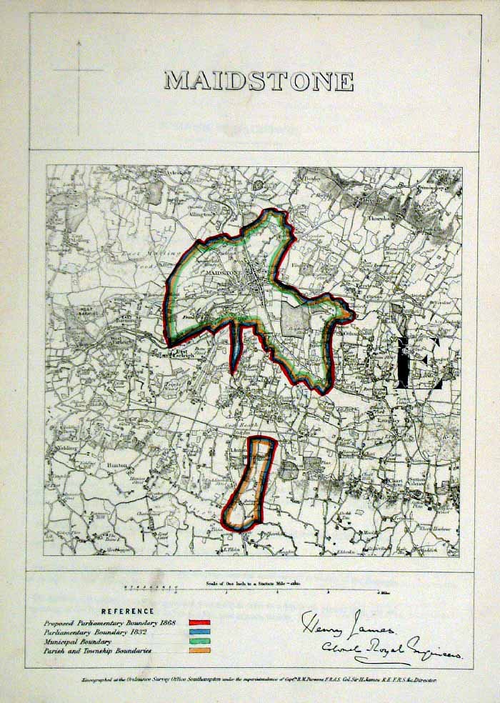 |
Maidstone (Kent)
James - Boundary Commission
1868 The map is accompanied by a page of descriptive text relating to the borough statistics Zincograph Size: 240 x 360 mm Original colouring of boundaries Antique Map Ref HJS042 £24.00 (+P&P) click image for enlargement |
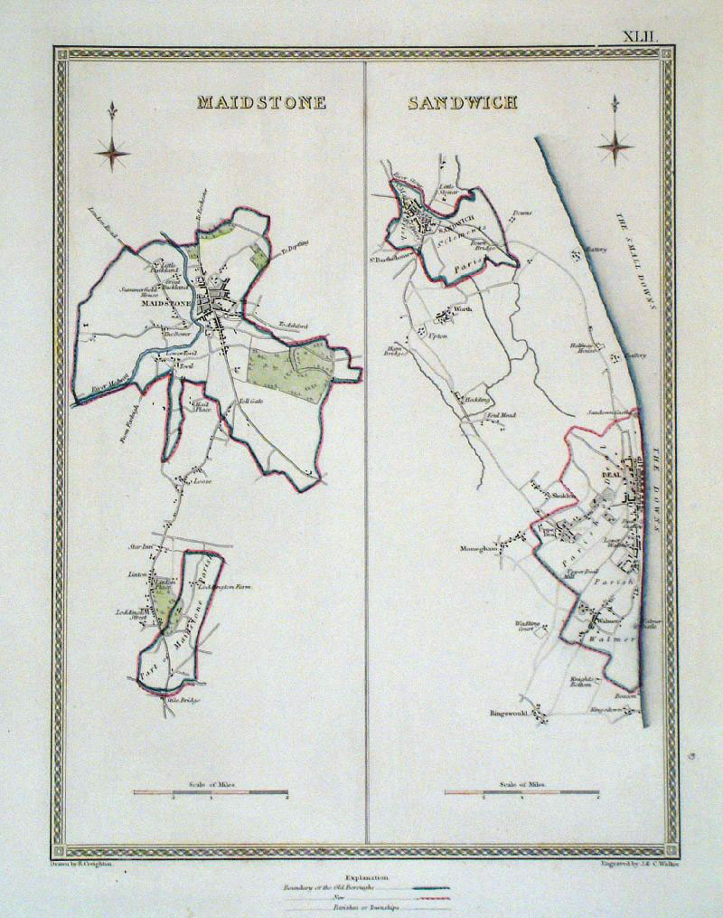 |
Maidstone and Sandwich (Kent)
Samuel Lewis 1840 From ' View of the Representative History of England' (Creighton & Walker) size: 190 x 260 mm Showing Borough and Parish Boundaries. Antique Map Ref GCM002 £22.00 (+P&P) click image for enlargement |
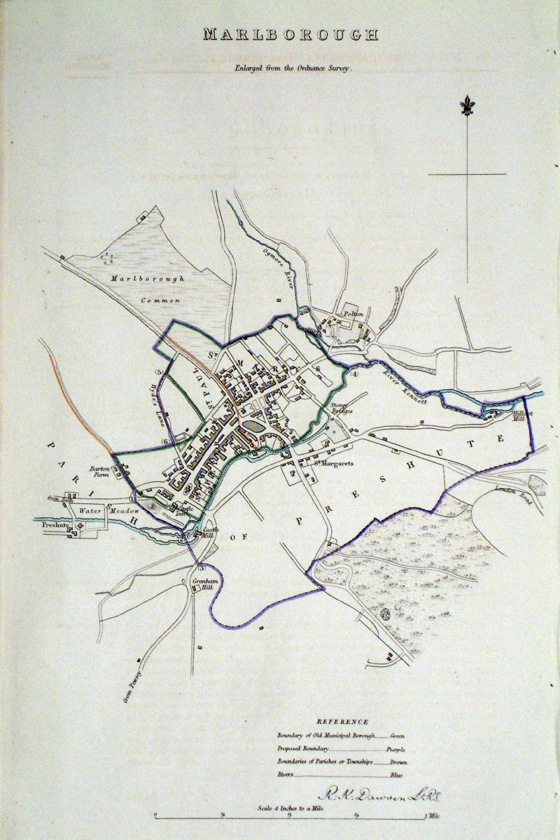 |
Marlborough Dawson - Boundary
Commission 1837 From 'Municipal Corporation Boundaries Report ' size: 250 x 300 mm Antique Map Ref HAM026 £28.00 (+P&P) click image for enlargement |
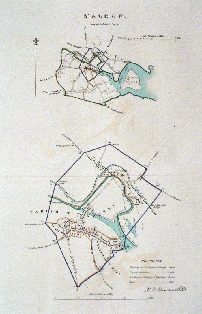 |
Maldon (Essex)
Dawson
- Boundary Commission 1837 From 'Municipal Corporation Boundaries Report ' Large Paper Edition. Page size: 420 x 500mm plate size: 220 x 340 mm Antique Map Ref GBM104 £28.00 (+P&P) click image for enlargement |
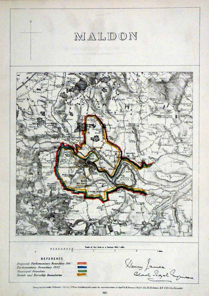 |
Malden (Essex)
James - Boundary Commission
1868 The map is accompanied by a page of descriptive text relating to the borough statistics Zincograph Size: 240 x 360 mm Original colouring of boundaries Antique Map Ref HJS043 £20.00 (+P&P) click image for enlargement |
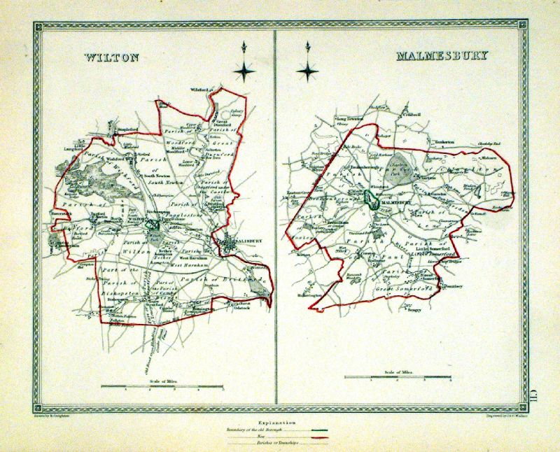 |
Malmesbury . Wilton Samuel Lewis 1835 engraved by J & C Walker Steel engraving Size: 250 x 200 mm, Original colouring of boundaries. Antique Map Ref KJM102 £18.00 (+P&P) Sample, not of this specific map, to indicate the level of detail of these 1835 Lewis town plans and town environs. click image for enlargement |
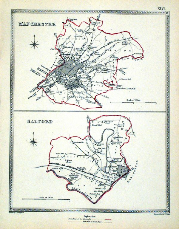 |
Manchester . Salford Samuel Lewis 1835 engraved by J & C Walker Steel engraving Size: 200 x 250 mm, Original colouring of boundaries. Antique Map Ref KJM046 £22.00 (+P&P) Sample, not of this specific map, to indicate the level of detail of these 1835 Lewis town plans. click image for enlargement |
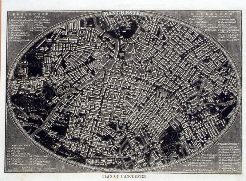 |
Manchester Pinnock
1833
size: 240 x 170 mm Detail Antique Map Ref ILM002 £26.00 (+P&P) click image for enlargement |
 |
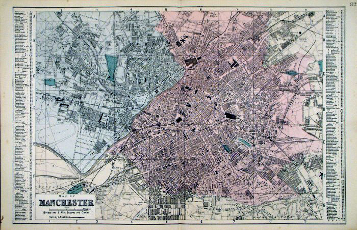
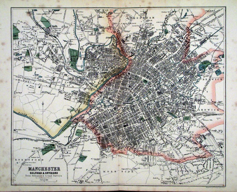
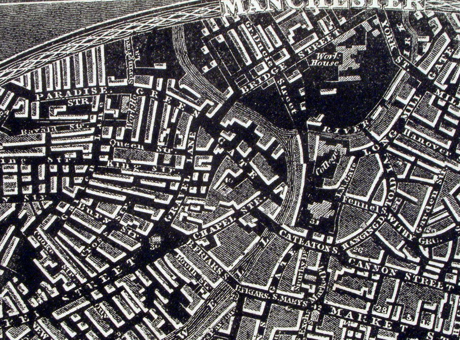
Plan of Manchester From the New Large Scale Atlas of the British Isles by G.W. Bacon 1892 size: 500 x 330 mm, centre fold Ref LHM095 £26.00 (+P&P) Detail click image for enlargement |
 |
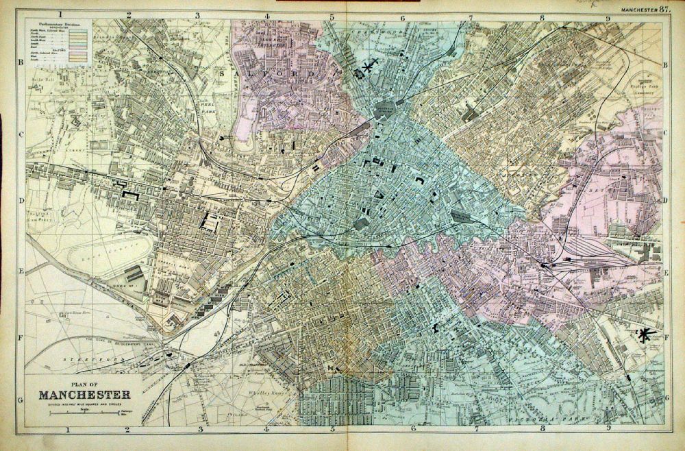
Manchester
Bacon c1883
size: 500 x 320 mm Antique Map Ref FLM168 £24.00 (+P&P) click image for enlargement |
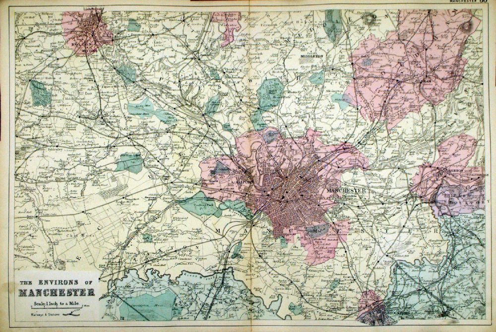 |
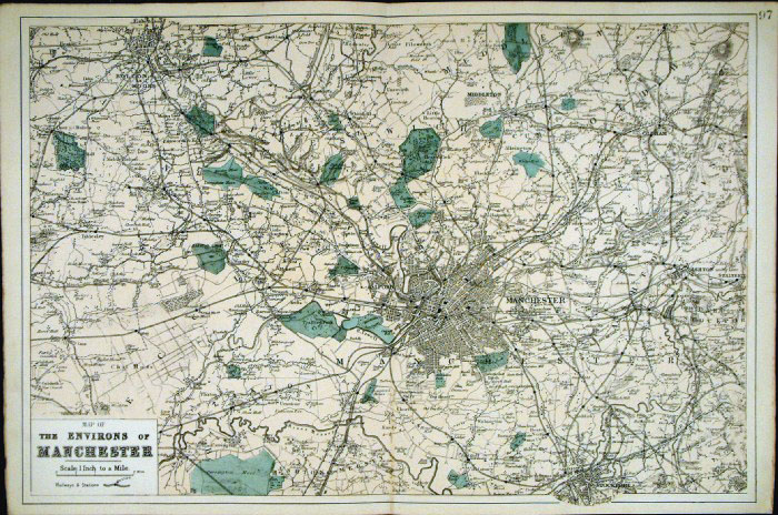
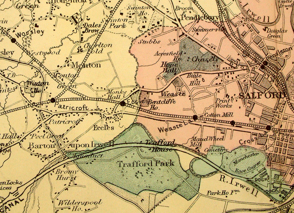
Environs of
Manchester From the New Large Scale Atlas of the British Isles by G.W. Bacon 1892 size: 500 x 330 mm, centre fold Ref LHM096 £26.00 (+P&P) Detail click image for enlargement |
 |
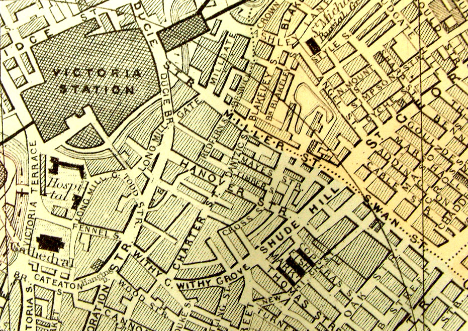
Manchester Environs
Bacon c1883
size: 500 x 320 mm Antique Map Ref FLM183 £24.00 (+P&P) click image for enlargement |
 |
Manchester
Bartholomew c1890
size: 300 x 250 mm, centre fold Some foxing spots, mainly at margins Antique Map Ref GKM029 £16.00 (+P&P) click image for enlargement |
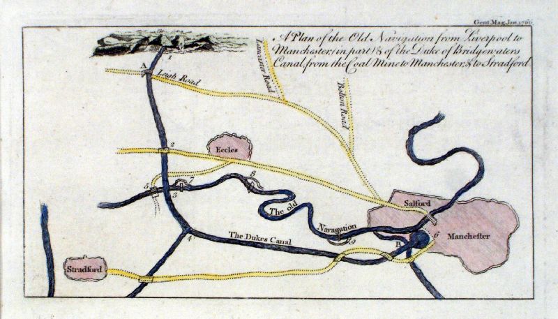 |
Manchester
Gents Magazine 1766 A Plan of the Old Navigation between Liverpool and Manchester ... and the Duke of Bridgewater's Canal from the Coal Mine to Manchester. copper engraving size: 200 x 110 mm Antique Map Ref JKM030 £30.00 (+P&P) click image for enlargement |
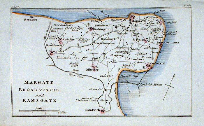 |
Margate, Broadstairs and Ramsgate
(Kent) Philips c1830
size: 140 x 90 mm Antique Map Ref GBM214 £16.00 (+P&P) click image for enlargement |
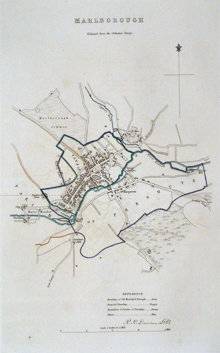 |
Marlborough (Wilts)
Dawson - Boundary Commission
1837 From 'Municipal Corporation Boundaries Report ' Large Paper Edition. Page size: 420 x 500mm plate size: 220 x 340 mm Antique Map Ref GBM105 £26.00 (+P&P) click image for enlargement |
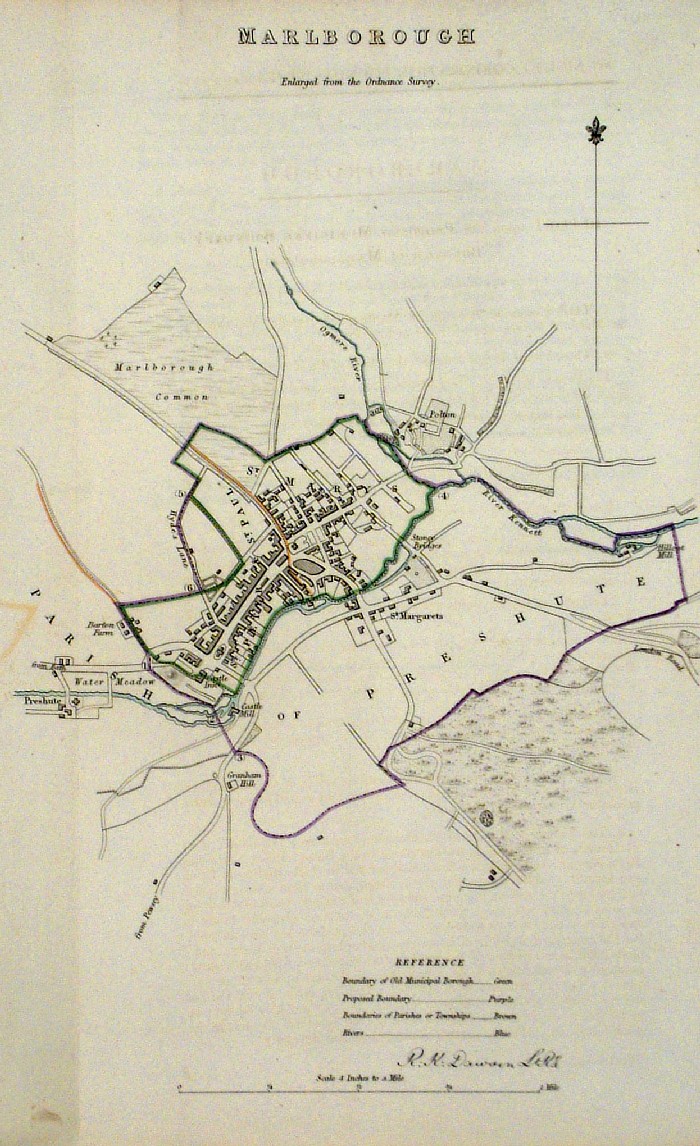 |
Marlborough (Wilts)
Dawson - Boundary Commission 1837 From 'Municipal Corporation Boundaries Report ' size: 220 x 300 mm 1 fold Antique Map Ref FDM104 £24.00 (+P&P) click image for enlargement |
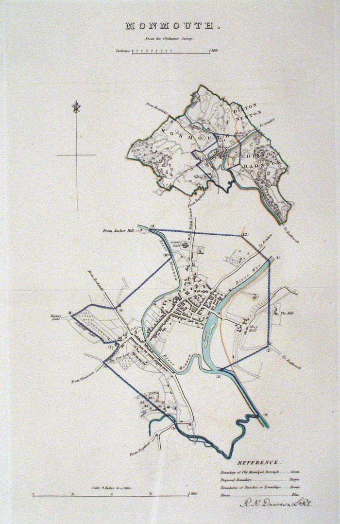 |
Monmouth Dawson -
Boundary Commission 1837 From 'Municipal Corporation Boundaries Report ' Large Paper Edition size: 250 x 300 mm 1 fold Antique Map Ref GBM106 £24.00 (+P&P) click image for enlargement |
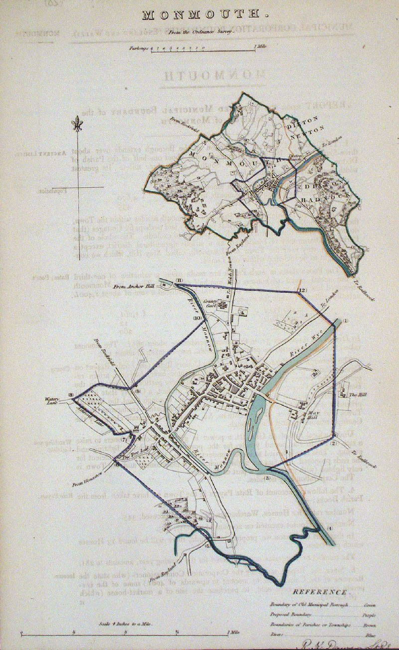 |
Monmouth Dawson
- Boundary Commission 1837 From 'Municipal Corporation Boundaries Report ' size: 200 x 300 mm faint offset transfer Antique Map Ref GDM281 £24.00 (+P&P) click image for enlargement |
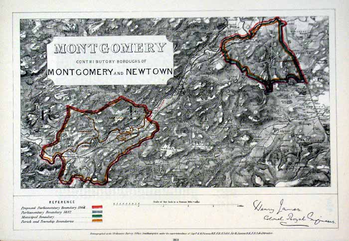 |
Montgomery and Newton (Wales)
James - Boundary
Commission 1868 The map is accompanied by a page of descriptive text relating to the borough statistics Zincograph Size: 240 x 360 mm Original colouring of boundaries Antique Map Ref HJS045 £18.00 (+P&P) click image for enlargement |
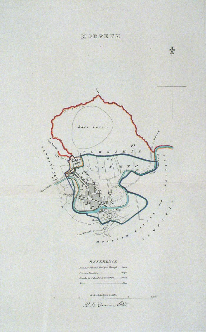 |
Morpeth (Northumberland)
Dawson - Boundary Commission
1837 From 'Municipal Corporation Boundaries Report ' Large Paper Edition. Page size: 420 x 500mm plate size: 220 x 340 mm Antique Map Ref GBM107 £28.00 (+P&P) click image for enlargement |
 |
Morpeth (Northumberland)
Dawson - Boundary
Commission 1837 From 'Municipal Corporation Boundaries Report ' Page size: 200 x 300mm Antique Map Ref GDM282 £24.00 (+P&P) click image for enlargement |
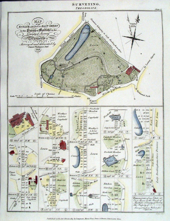 |
Mortlake, Surrey 'Map of an estate situated in East Sheen in the Parish of Mortlake ....' James Wadmore / Lowry 1817 size: 200 x 260 mm An unusual map featuring a part of Mortlake as an exercise in surveying. Antique Map Ref HLM026 £28.00 (+P&P) click image for enlargement |
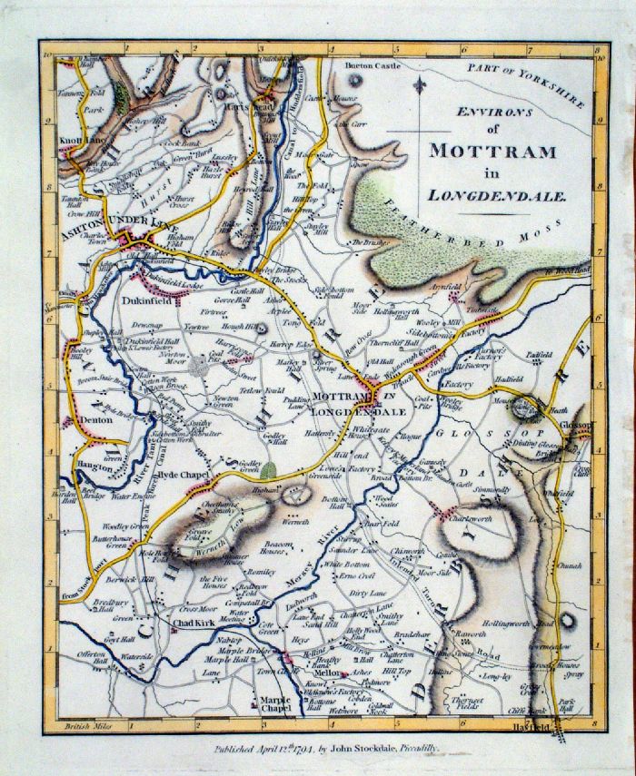 |
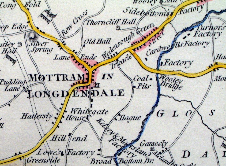
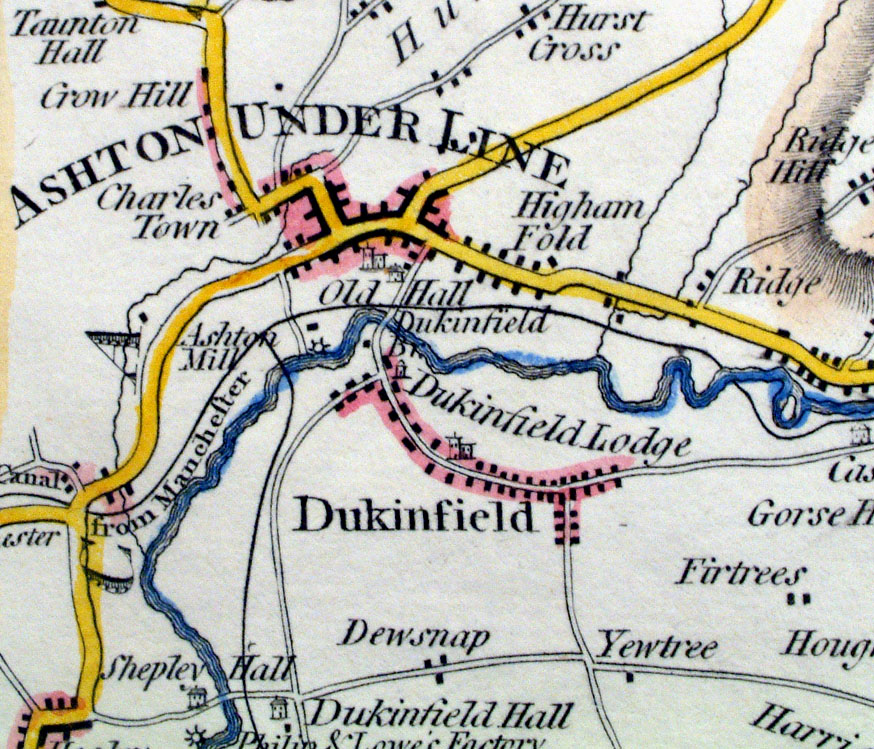
Environs of Mottram in
Longendale Stockdale 1794 Covers the area featuring Ashton Under Lyne, Glossop, Hyde Chapel, Hayfield. Shows 'Intended Turnpike Road' around Mottram - no modern road follows this route. Shows the Rivers Tame and Mersey with many factories, cotton works, coal pits, etc. Copper engraving size: 230 x 280 mm Antique Map Ref LAM017 £48.00 (+P&P) Detail1 Detail2 Detail3 click image for enlargement |
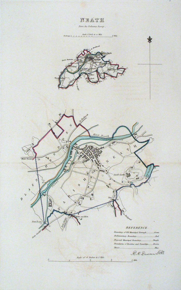 |
Neath (Wales) Dawson -
Boundary Commission 1837 From 'Municipal Corporation Boundaries Report ' Large Paper Edition size: 250 x 300 mm 1 fold, slight offset transfer Antique Map Ref GBM108 £24.00 (+P&P) click image for enlargement |
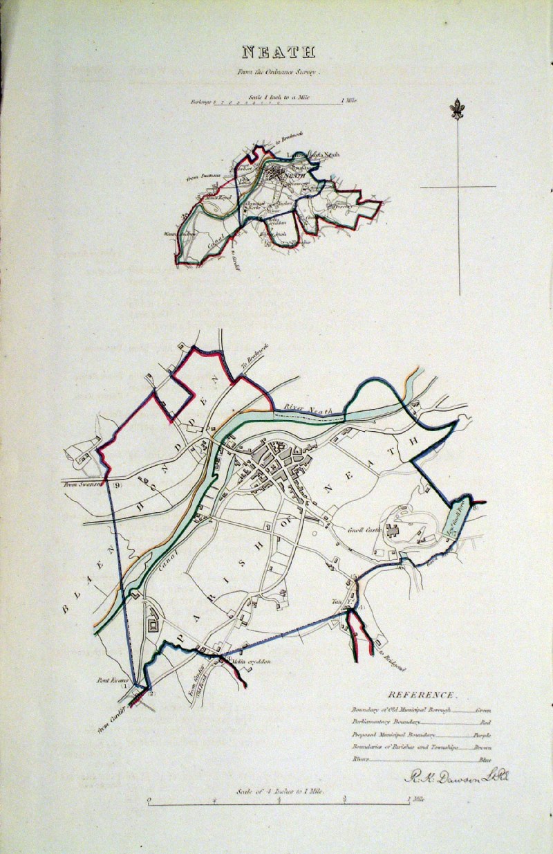 |
Neath (Wales)
Dawson - Boundary Commission
1837 From 'Municipal Corporation Boundaries Report ' size: 200 x310 mm Antique Map Ref HAM031 £24.00 (+P&P) click image for enlargement |
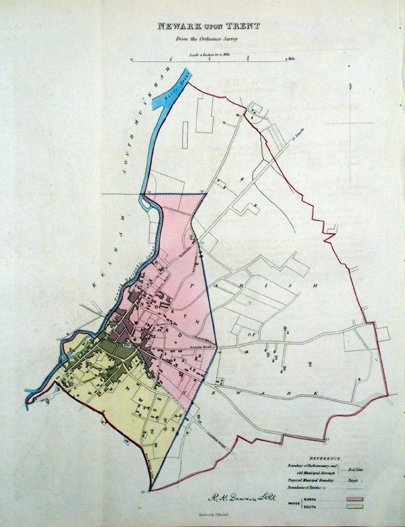 |
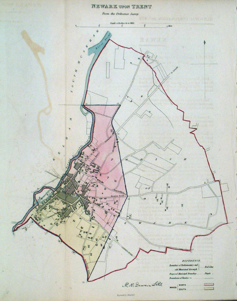
Newark upon Trent Dawson -
Boundary Commission 1837 From 'Municipal Corporation Boundaries Report ' size: 250 x 300 mm 1 fold, slight offset transfer Antique Map Ref HAM025 £24.00 (+P&P) click image for enlargement |
 |
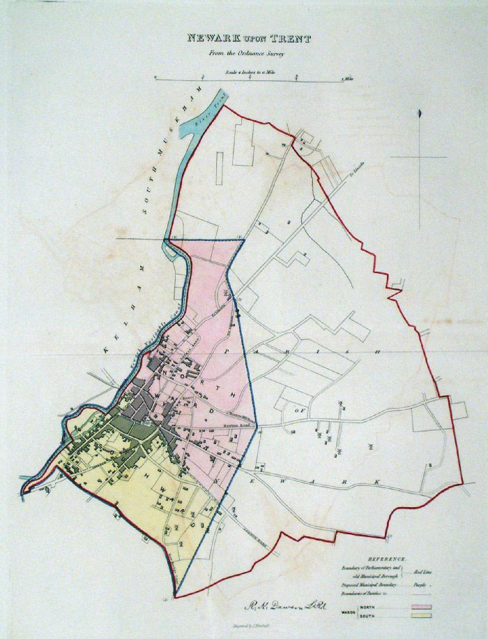
Newark upon Trent Dawson
- Boundary Commission 1837 From 'Municipal Corporation Boundaries Report ' size: 250 x 300 mm 1 fold, some offset transfer Antique Map Ref GDM285 £24.00 (+P&P) click image for enlargement |
 |
Newark upon Trent Dawson
- Boundary Commission 1837 From 'Municipal Corporation Boundaries Report ' Large Paper Edition size: 250 x 300 mm 1 fold, slight offset transfer Antique Map Ref GBM109 £24.00 (+P&P) click image for enlargement |
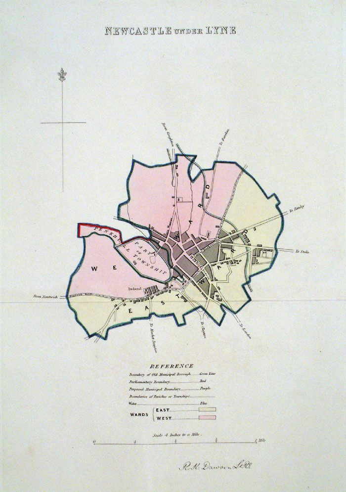 |
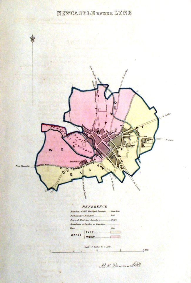
Newcastle Under Lyne (Lyme) (Staffs)
Dawson - Boundary Commission
1837 From 'Municipal Corporation Boundaries Report ' Large Paper Edition size: 250 x 300 mm 1 fold Antique Map Ref GBM111 £24.00 (+P&P) click image for enlargement |
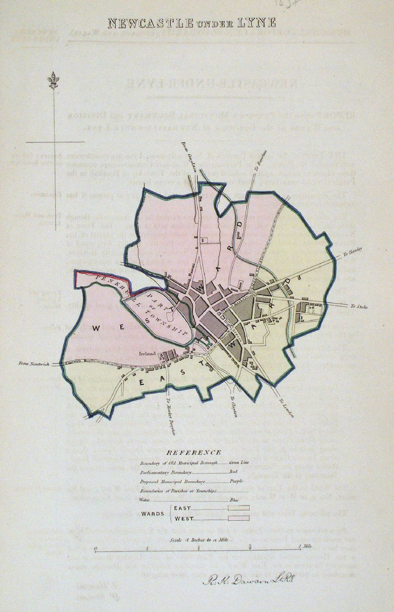 |
Newcastle under Lyne (Lyme) (Staffs)
Dawson - Boundary
Commission 1837 From 'Municipal Corporation Boundaries Report ' size: 200 x 300 mm faint offset transfer Antique Map Ref GDM286 £24.00 (+P&P) [ ICM001 ] £24.00 click image for enlargement |
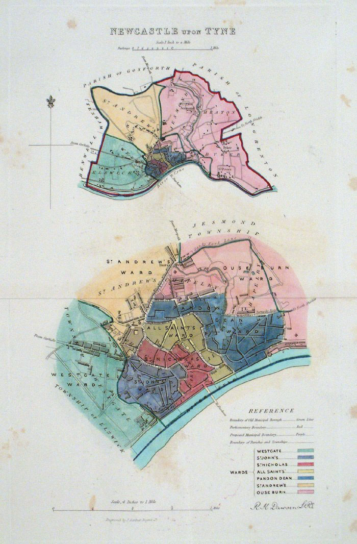 |
Newcastle Upon Tyne
Dawson - Boundary Commission 1837 From 'Municipal Corporation Boundaries Report ' Large Paper Edition size: 250 x 300 mm 1 fold, some offset transfer and foxing Antique Map Ref GBM112 £26.00 (+P&P) click image for enlargement |
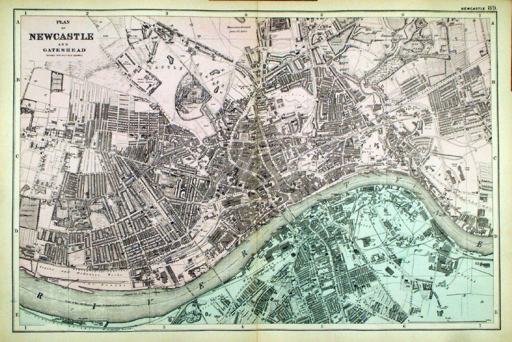 |
Plan of Newcastle and
Gateshead From the New Large Scale Atlas of the British Isles by G.W. Bacon 1892 size: 500 x 330 mm, centre fold Ref LHM097 £30.00 (+P&P) Detail click image for enlargement |
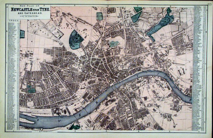 |
Newcastle upon Tyne
Bacon c1883
size: 500 x 320 mm Antique Map Ref FLM169 £28.00 (+P&P) click image for enlargement |
| Newcastle upon Tyne
Bacon c1883
size: 500 x 320 mm Antique Map Ref LGM010 £28.00 (+P&P) click image for enlargement |
|
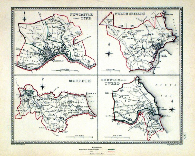 |
Newcastle upon Tyne . North Shields . Morpeth .
Berwick upon Tweed Samuel Lewis 1835 engraved by J & C Walker Steel engraving Size: 250 x 200 mm, Original colouring of boundaries. Antique Map Ref KJM064 £18.00 (+P&P) Sample, not of this specific map, to indicate the level of detail of these 1835 Lewis town plans and town environs. click image for enlargement |
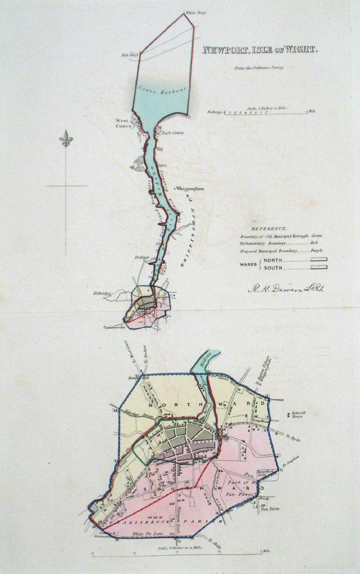 |
Newport, Isle of Wight
Dawson - Boundary Commission 1837 From 'Municipal Corporation Boundaries Report ' Large Paper Edition size: 250 x 300 mm 1 fold, very faint offset transfer Antique Map Ref GBM114 £26.00 (+P&P) click image for enlargement |
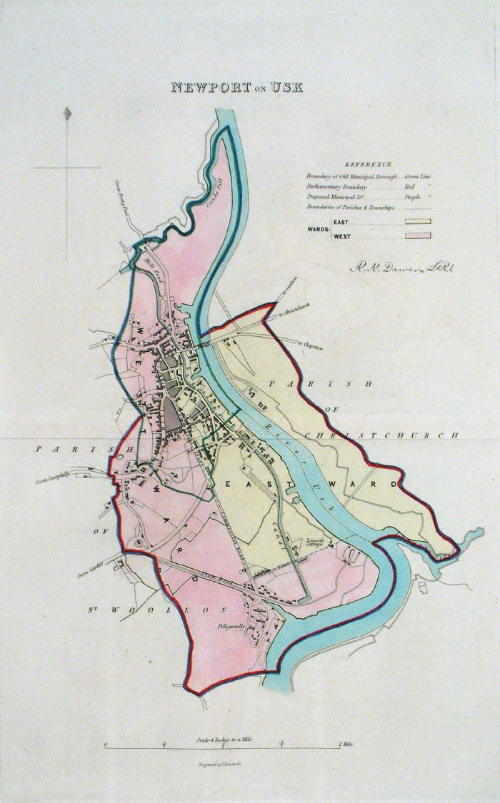 |
Newport, on Usk (Wales)
Dawson - Boundary Commission 1837 From 'Municipal Corporation Boundaries Report ' Large Paper Edition size: 250 x 300 mm 1 fold, very faint offset transfer Antique Map Ref GBM113 £28.00 (+P&P) click image for enlargement |
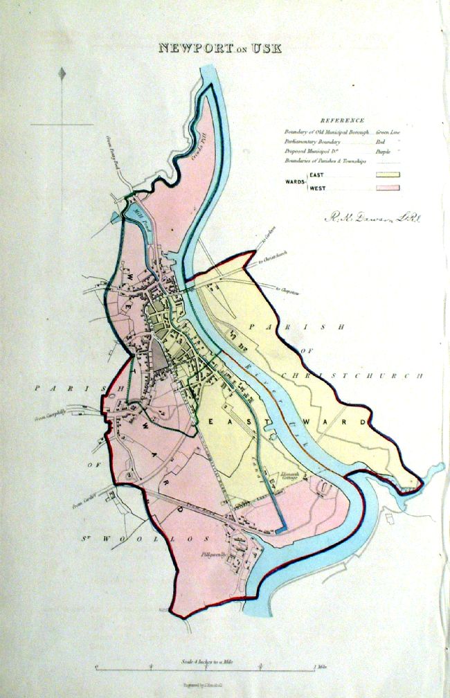 |
Newport, on Usk (Wales)
Dawson - Boundary Commission 1837 From 'Municipal Corporation Boundaries Report ' size: 250 x 300 mm Antique Map Ref ICM007 £28.00 (+P&P) click image for enlargement |
 |
Newport on Usk . Usk . Monmouth Samuel Lewis 1835 engraved by J & C Walker Steel engraving Size: 200 x 250 mm, Original colouring of boundaries. Antique Map Ref KJM058 £16.00 (+P&P) Sample, not of this specific map, to indicate the level of detail of these 1835 Lewis town plans. click image for enlargement |
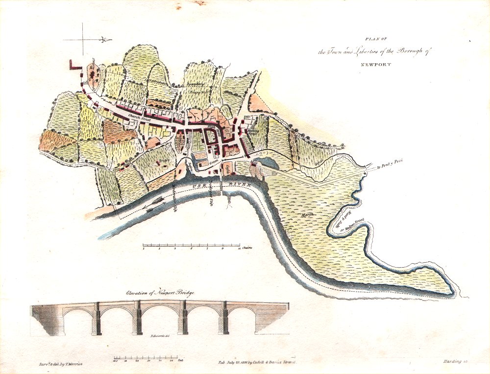 |
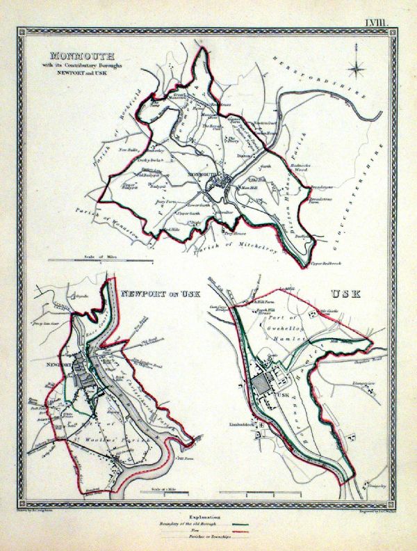
Newport (Wales)
Morrice / Harding 1800 ' A plan of the Town and Liberties of Newport' size: 260 x 200 mm Antique Map Ref GGM073 £40.00 (+P&P) click image for enlargement |
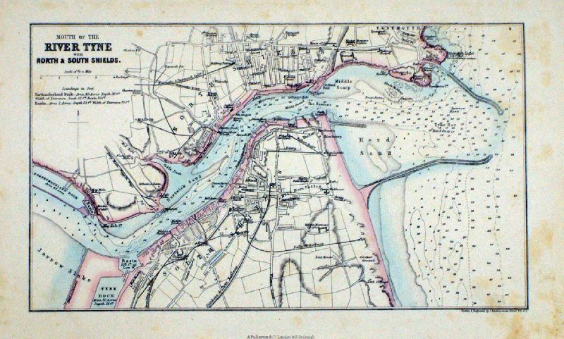 |
North Shields and South
Shields
Fullarton
c1868 'Mouth of the River Tyne' size: 250 x 150 mm Antique Map Ref LGM010 £18.00 (+P&P) click image for enlargement |
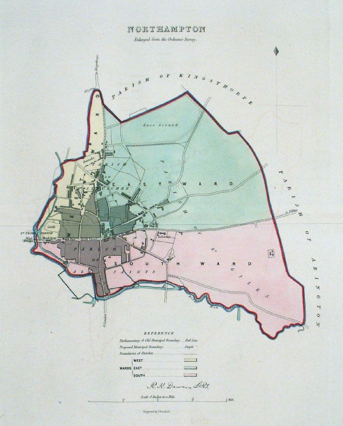 |
Northampton Dawson
- Boundary Commission 1837 From 'Municipal Corporation Boundaries Report ' Large Paper Edition. Page size: 420 x 500mm plate size: 240 x 340 mm Antique Map Ref GBM115 £30.00 (+P&P) click image for enlargement |
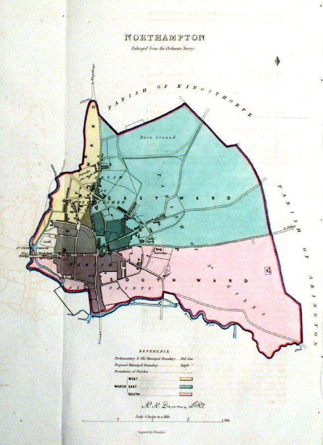 |
Northampton Dawson
- Boundary Commission 1837 From 'Municipal Corporation Boundaries Report ' size: 230 x 330mm 1 fold Antique Map Ref ICM004 £30.00 (+P&P) click image for enlargement |
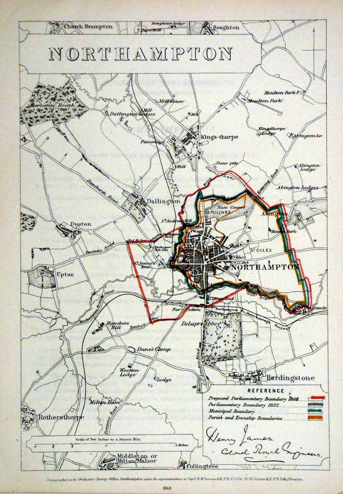 |
Northampton
James - Boundary Commission
1868 The map is accompanied by a page of descriptive text relating to the borough statistics Zincograph Size: 240 x 360 mm Original colouring of boundaries Antique Map Ref HJS047 £20.00 (+P&P) click image for enlargement |
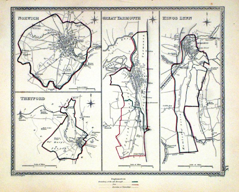 |
Norwich . Thetford . Great Yarmouth . Kings Lynn Samuel Lewis 1835 engraved by J & C Walker Steel engraving Size: 250 x 200 mm, Original colouring of boundaries. Antique Map Ref KJM060 £18.00 (+P&P) Sample, not of this specific map, to indicate the level of detail of these 1835 Lewis town plans and town environs. click image for enlargement |
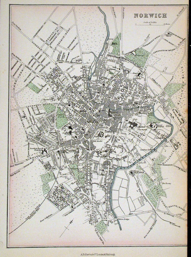 |
Norwich Fullarton c1870
size: 170 x 240 mm tight right margin Antique Map Ref GKM028 £18.00 (+P&P) click image for enlargement |
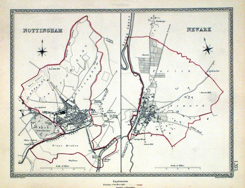 |
Nottingham . Newark Samuel Lewis 1835 engraved by J & C Walker Steel engraving Size: 250 x 200 mm, Original colouring of boundaries. Antique Map Ref KJM066 £16.00 (+P&P) Sample, not of this specific map, to indicate the level of detail of these 1835 Lewis town plans and town environs. click image for enlargement |
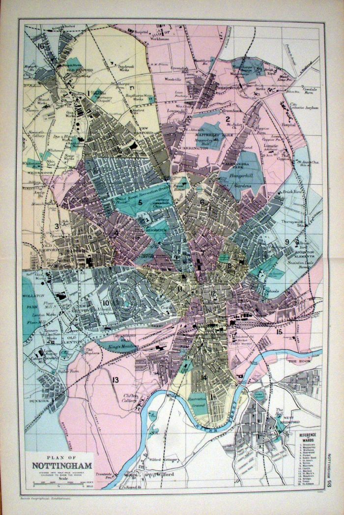 |
Nottingham
Bacon 1907 Size: 330 x 500 mm Antique Map Ref KGM082 £22.00 (+P&P) click image for enlargement |
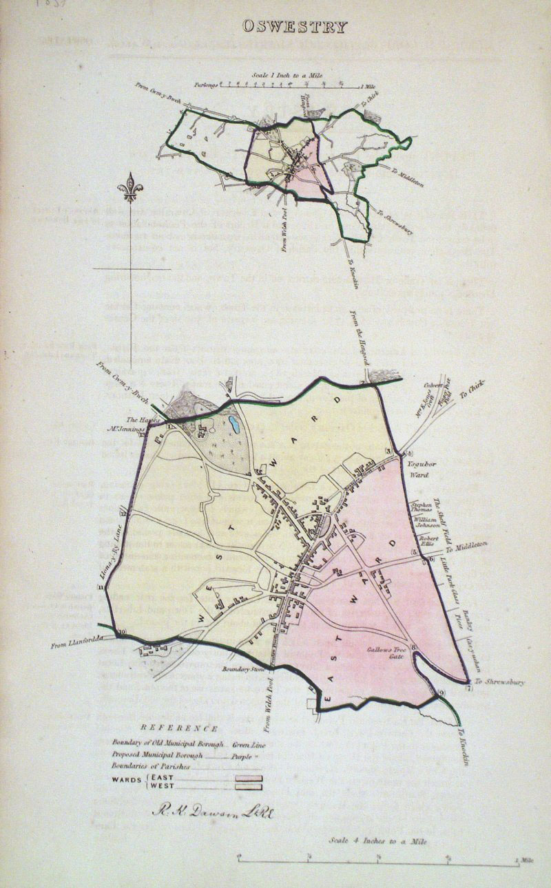 |
Oswestry (Wales)
Dawson - Boundary
Commission 1837 From 'Municipal Corporation Boundaries Report ' size: 200 x 300 mm faint offset transfer Antique Map Ref GDM288 £24.00 (+P&P) click image for enlargement |
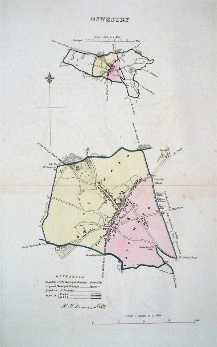 |
Oswestry (Wales) Dawson -
Boundary Commission 1837 From 'Municipal Corporation Boundaries Report ' Large Paper Edition size: 250 x 300 mm 1 fold, very faint offset transfer Antique Map Ref GBM118 £24.00 (+P&P) click image for enlargement |
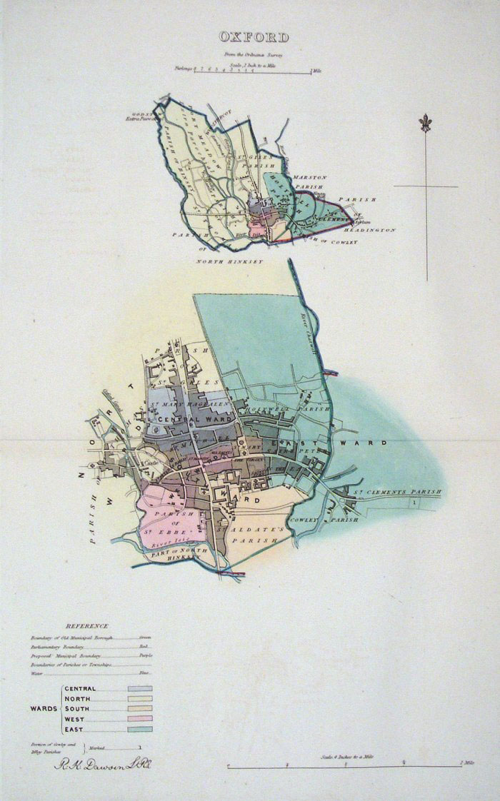 |
Oxford Dawson - Boundary
Commission 1837 From 'Municipal Corporation Boundaries Report ' Large Paper Edition size: 250 x 300 mm 1 fold, very faint offset transfer Antique Map Ref GBM119 £30.00 (+P&P) click image for enlargement |
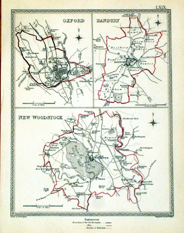 |
Oxford . Banbury . New Woodstock Samuel Lewis 1835 engraved by J & C Walker Steel engraving Size: 200 x 250 mm, Original colouring of boundaries. Antique Map Ref KJM069 £20.00 (+P&P) Sample, not of this specific map, to indicate the level of detail of these 1835 Lewis town plans. click image for enlargement |
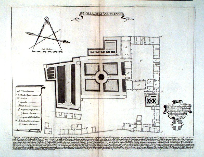 |
Balliol College, Oxford
'Collegium Baliolense' Williams 1732 Copper engraving size: 500 x 390 mm, centre fold A few creases and a repair to a puncture wound. Antique Map Ref IEM015 £48.00 (+P&P) click image for enlargement |
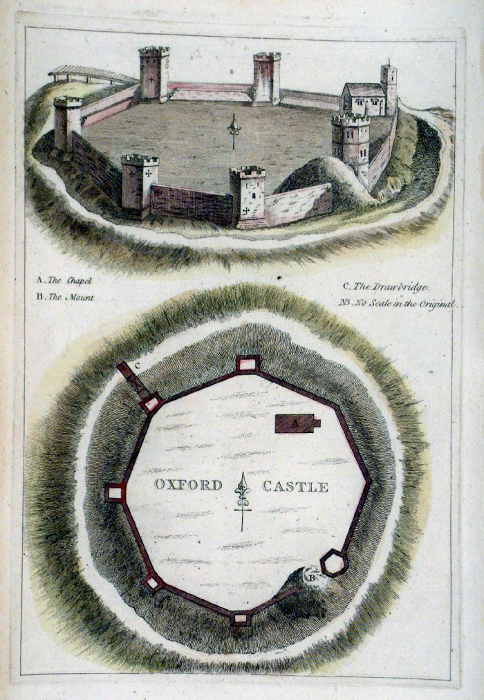 |
Oxford Castle plan (Oxfordshire)
Grose 1787 size: 170 x 240 mm Antique Map Ref FHM019 £22.00 (+P&P) click image for enlargement |
| Oxford / Cambridge
combination town plans - see Cambridge. |
|
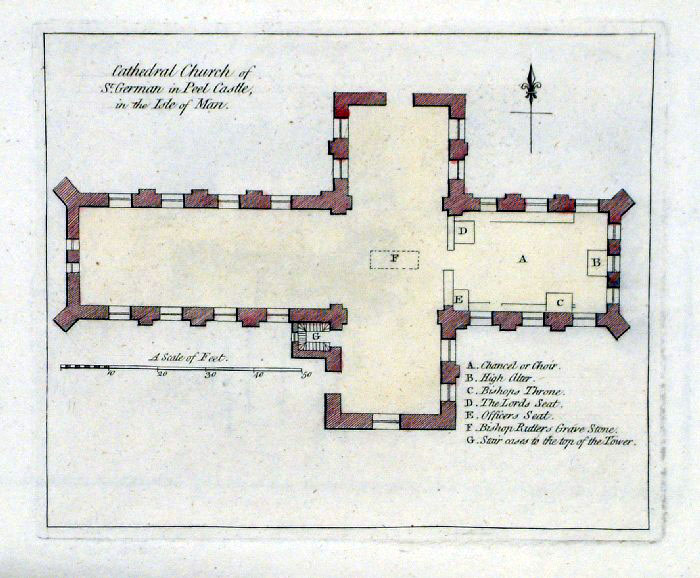 |
Peel Castle - St Germain Church plan (Peel
Castle, Isle of Man) Grose 1787 size: 180 x 150 mm Antique Map Ref FHM012 £16.00 (+P&P) click image for enlargement |
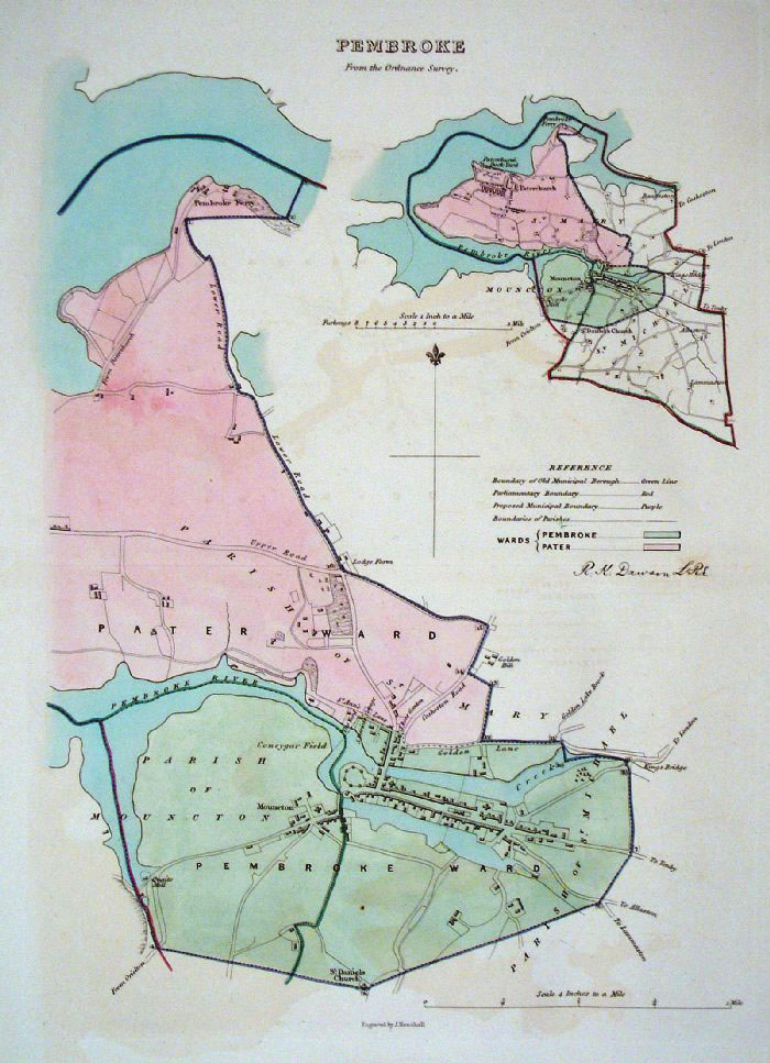 |
Pembroke (Wales) Dawson -
Boundary Commission 1837 From 'Municipal Corporation Boundaries Report ' Large Paper Edition size: 250 x 300 mm 1 fold, very faint offset transfer Antique Map Ref GBM120 £26.00 (+P&P) click image for enlargement |
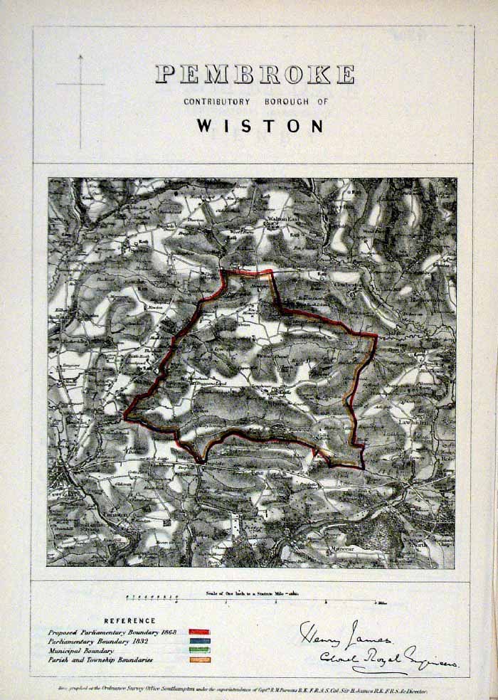 |
Pembroke (Wales)
James - Boundary Commission
1868 Zincograph Size: 240 x 360 mm Original colouring of boundaries Antique Map Ref HJS048 £20.00 (+P&P) click image for enlargement |
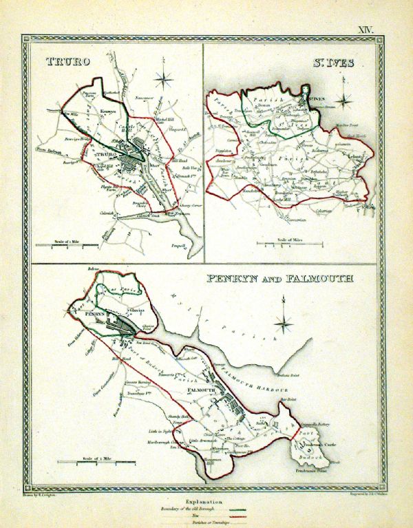 |
Penryn & Falmouth . St Ives . Truro Samuel Lewis 1835 engraved by J & C Walker Steel engraving Size: 200 x 250 mm, Original colouring of boundaries. Antique Map Ref KJM014 £20.00 (+P&P) Sample, not of this specific map, to indicate the level of detail of these 1835 Lewis town plans. click image for enlargement |
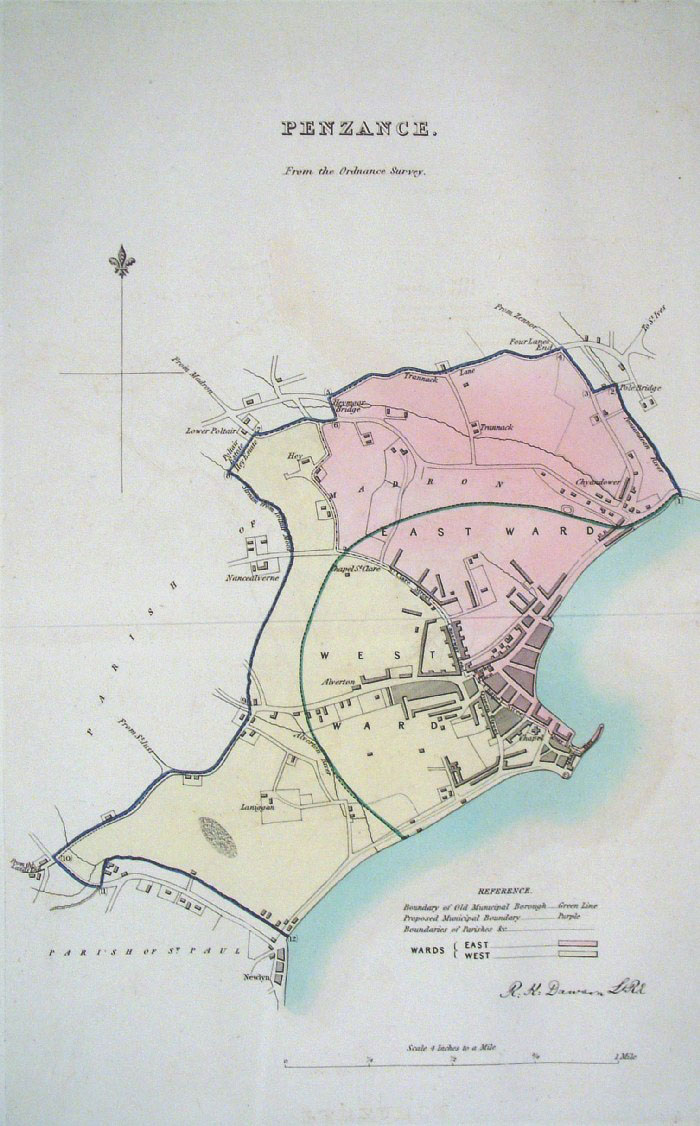 |
Penzance (Cornwall)
Dawson - Boundary
Commission 1837 From 'Municipal Corporation Boundaries Report ' Large Paper Edition. Page size: 420 x 500mm plate size: 220 x 340 mm Faint offset transfer Antique Map Ref GBM122 £35.00 (+P&P) click image for enlargement |
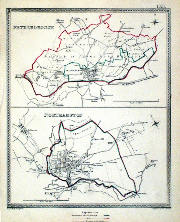 |
Peterborough . Northampton Samuel Lewis 1835 engraved by J & C Walker Steel engraving Size: 200 x 250 mm, Original colouring of boundaries. Antique Map Ref KJM062 £16.00 (+P&P) Sample, not of this specific map, to indicate the level of detail of these 1835 Lewis town plans. click image for enlargement |
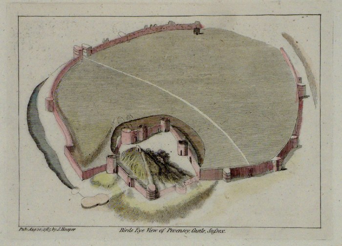 |
Pevensey Castle plan (Sussex)
Grose 1787 size: 180 x 140 mm Antique Map Ref FHM009 £22.00 (+P&P) click image for enlargement |
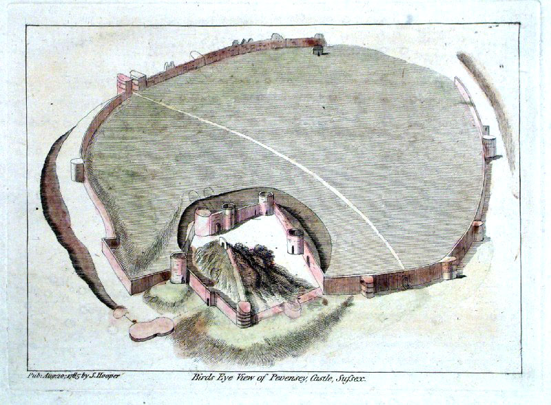 |
Pevensey Castle plan (Sussex)
Grose 1787 size: 180 x 140 mm Antique Map Ref GIP010 £22.00 (+P&P) click image for enlargement |
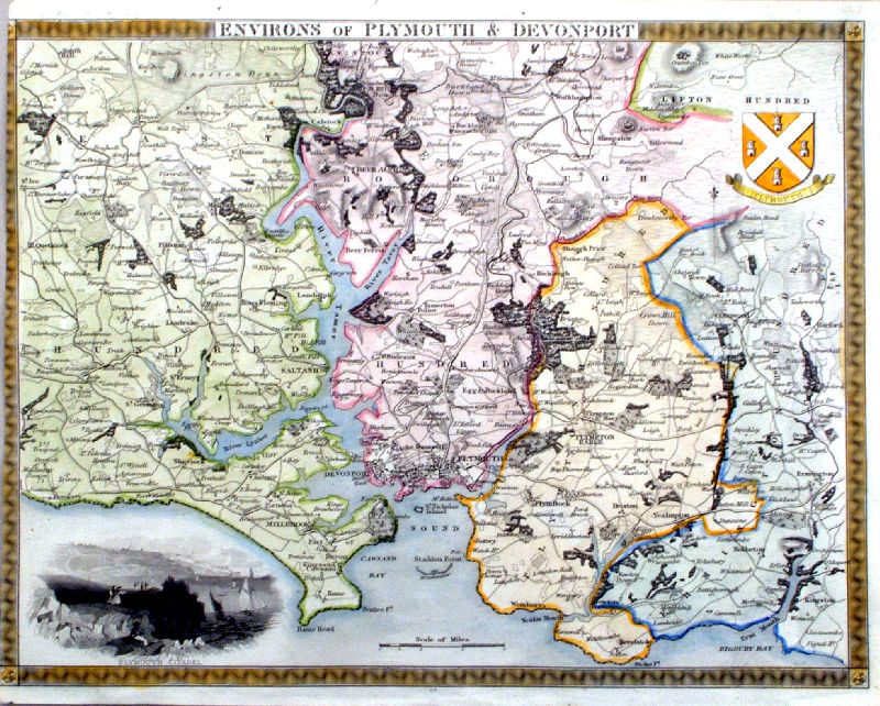 |
Environs of Plymouth and Devonport
Moule c1845
size: 260 x 210 mm, cropped left margin Antique Map Ref IFM095 £35.00 (+P&P) click image for enlargement |
 |
Breahwater (Plymouth Sound)
anon c1880 size: 200 x 250 mm, 1 fold Plymouth Sound featuring Plymouth, Devonport & Mount Edgecumbe, with Transverse Section of Breakwater Antique Map Ref KIM014 £16.00 (+P&P) click image for enlargement |
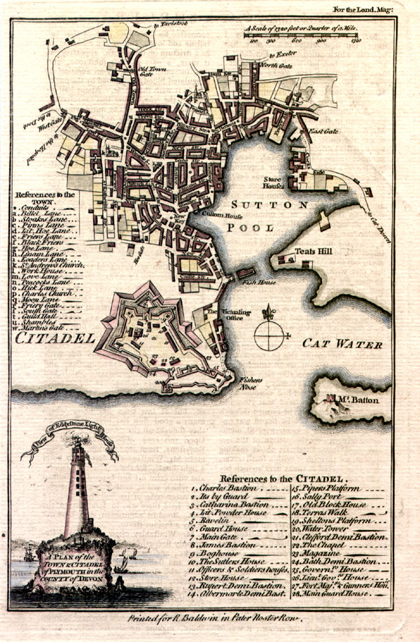 |
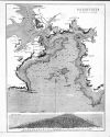
A Plan of
the Town and Citadel of Plymouth in the County of
Devon London Magazine 1755 Copper engraving size: 120 x 190 mm Very faint signs of text impression from opposing page. Antique Map Ref HCM014 £36.00 (+P&P) click image for enlargement |
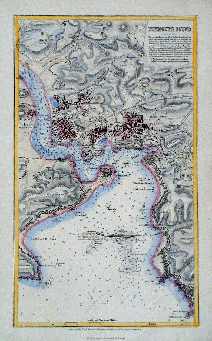 |
Plymouth Sound Swanston
/ Fullarton c1861 size: 150 x 250 mm Antique Map Ref GBM253 £18.00 (+P&P) click image for enlargement |
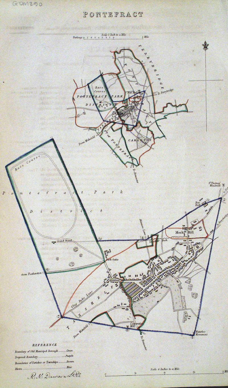 |
Pontefract (Yorkshire)
Dawson - Boundary
Commission 1837 From 'Municipal Corporation Boundaries Report ' Page size: 200 x 300mm Antique Map Ref GDM290 £22.00 (+P&P) click image for enlargement |
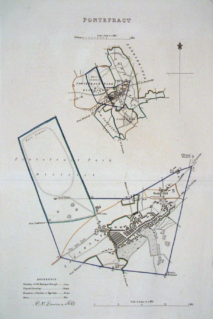 |
Pontefract (Yorkshire)
Dawson - Boundary
Commission 1837 From 'Municipal Corporation Boundaries Report ' Large Paper Edition. Page size: 420 x 500mm plate size: 220 x 340 mm Antique Map Ref GBM124 £26.00 (+P&P) click image for enlargement |
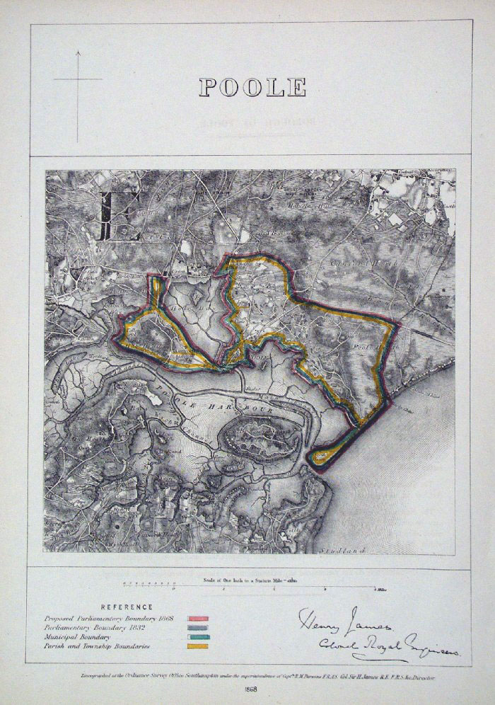 |
Poole (Dorset) James
1868 size: 240 x 350mm Antique Map Ref GBM192 £22.00 (+P&P) click image for enlargement |
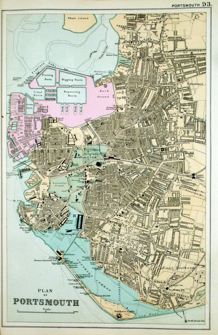 |
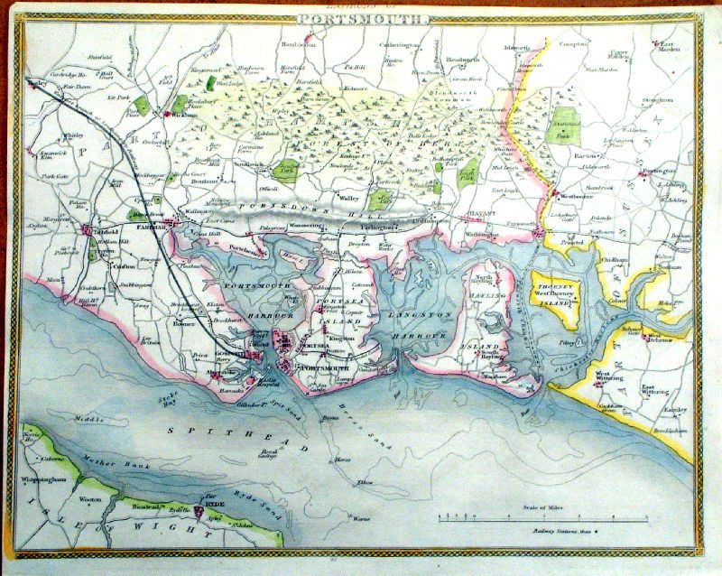
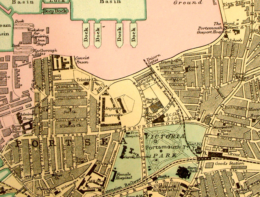
Plan of Portsmouth From the New Large Scale Atlas of the British Isles by G.W. Bacon 1892 size: 220 x 330 mm, tight left margin Ref LHM100 £20.00 (+P&P) Detail click image for enlargement |
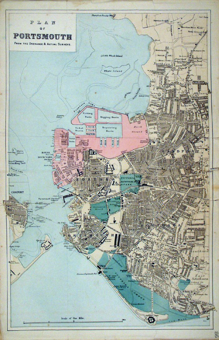 |
Portsmouth
Bacon c1883
size: 320 x 500 mm Antique Map Ref FLM172 £16.00 (+P&P) Some repairs to splits at margins, and a few creases click image for enlargement |
 |
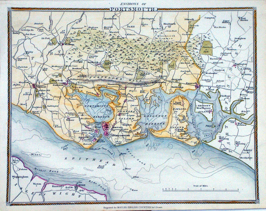
Environs of Portsmouth
Moule c1845
size: 260 x 210 mm, tight left margin Antique Map Ref IFM094 £20.00 (+P&P) Antique Map Ref LLM016 £20.00 (+P&P) click image for enlargement |
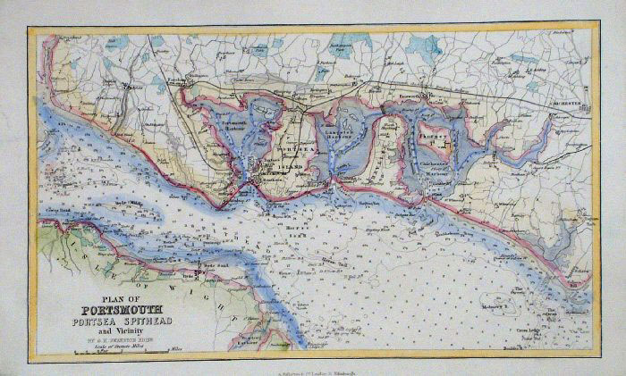 |
Portsmouth, Portsea and Spithead
Swanston / Fullarton c1861 size: 250 x 150 mm Antique Map Ref GBM246 £16.00 (+P&P) click image for enlargement |
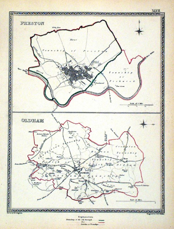 |
Preston . Oldham Samuel Lewis 1835 engraved by J & C Walker Steel engraving Size: 200 x 250 mm, Original colouring of boundaries. Antique Map Ref KJM047 £16.00 (+P&P) Sample, not of this specific map, to indicate the level of detail of these 1835 Lewis town plans. click image for enlargement |
 |
Preston (Lancs) Dawson -
Boundary Commission 1837 From 'Municipal Corporation Boundaries Report ' Large Paper Edition size: 250 x 300 mm 1 fold, very faint offset transfer Antique Map Ref GBM127 £28.00 (+P&P) click image for enlargement |
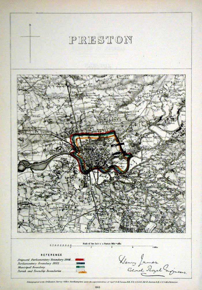 |
Preston (Lancs)
James - Boundary Commission
1868 The map is accompanied by a page of descriptive text relating to the borough statistics Zincograph Size: 240 x 360 mm Original colouring of boundaries Antique Map Ref HJS051 £18.00 (+P&P) click image for enlargement |
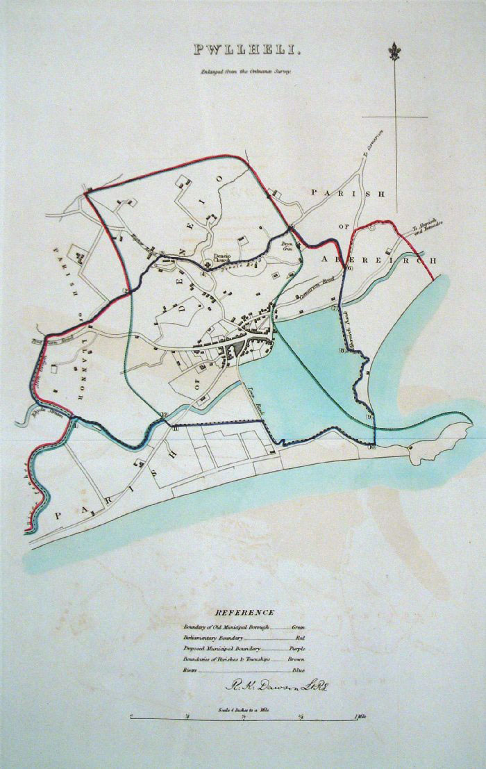 |
Pwllheli (Wales) Dawson -
Boundary Commission 1837 From 'Municipal Corporation Boundaries Report ' Large Paper Edition size: 250 x 300 mm 1 fold, very faint offset transfer Antique Map Ref GBM128 £24.00 (+P&P) click image for enlargement |
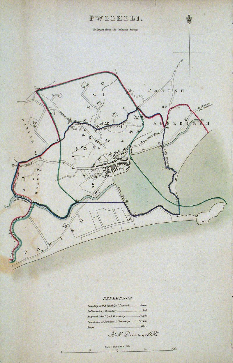 |
Pwllheli (Wales)
Dawson - Boundary
Commission 1837 From 'Municipal Corporation Boundaries Report ' size: 200 x 300 mm 1 fold, faint offset transfer Antique Map Ref GDM291 £22.00 (+P&P) click image for enlargement |
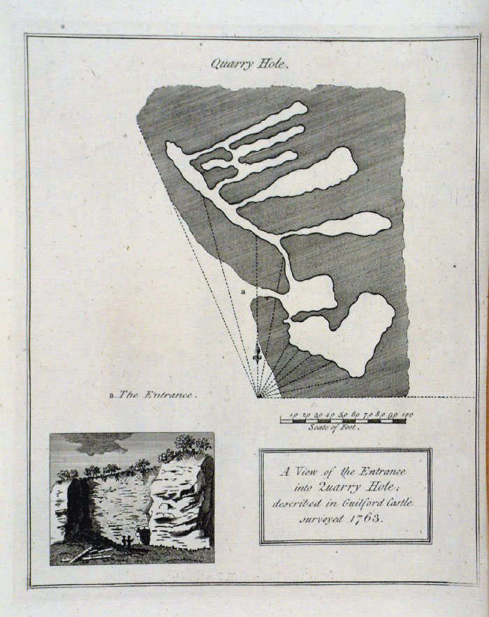 |
Quarry Hole - Guildford Castle plan (Surrey)
Grose 1787 size: 160 x 200 mm Antique Map Ref FHM007 £22.00 (+P&P) click image for enlargement |
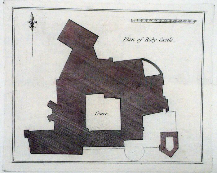 |
Raby Castle plan (Durham)
Grose 1787 size: 170 x 140 mm Antique Map Ref FHM015 £18.00 (+P&P) click image for enlargement |
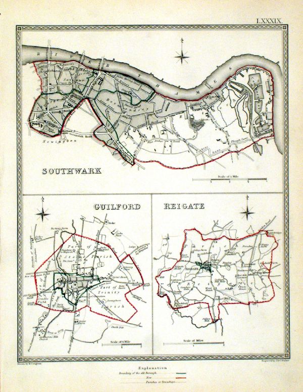 |
Reigate . Guildford . Southwark Samuel Lewis 1835 engraved by J & C Walker Steel engraving Size: 200 x 250 mm, Original colouring of boundaries. Antique Map Ref KJM089 £18.00 (+P&P) Sample, not of this specific map, to indicate the level of detail of these 1835 Lewis town plans. click image for enlargement |
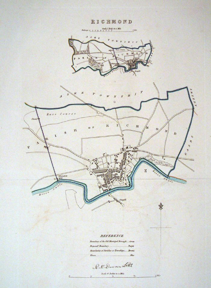 |
Richmond (Yorkshire)
Dawson - Boundary
Commission 1837 From 'Municipal Corporation Boundaries Report ' Large Paper Edition. Page size: 420 x 500mm plate size: 220 x 340 mm Faint offset transfer Antique Map Ref GBM131 £28.00 (+P&P) click image for enlargement |
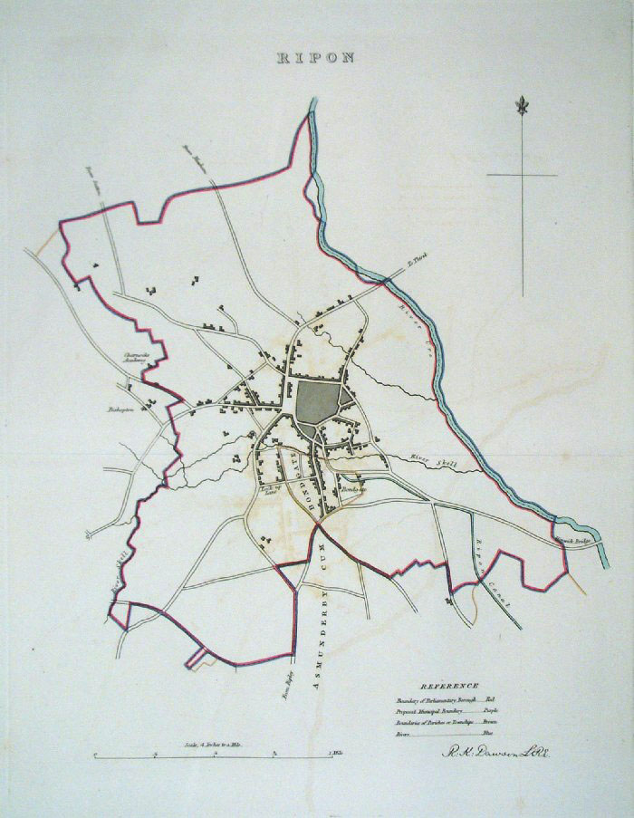 |
Ripon (Yorkshire) Dawson
- Boundary Commission 1837 From 'Municipal Corporation Boundaries Report ' Large Paper Edition. Page size: 420 x 500mm plate size: 260 x 340 mm Faint offset transfer Antique Map Ref GBM132 £28.00 (+P&P) click image for enlargement |
 |
Ripon (Yorkshire)
Dawson - Boundary Commission
1837 From 'Municipal Corporation Boundaries Report ' Page size: 260 x 320mm one fold Faint offset transfer Antique Map Ref GDM293 £24.00 (+P&P) click image for enlargement |
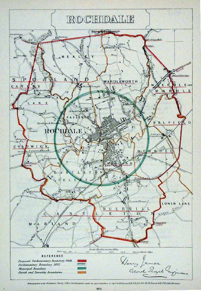 |
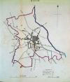
Rochdale (Lancs)
James - Boundary Commission
1868 The map is accompanied by a page of descriptive text relating to the borough statistics Zincograph Size: 240 x 360 mm Original colouring of boundaries Antique Map Ref HJS053 £24.00 (+P&P) click image for enlargement |
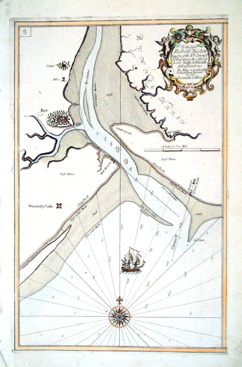 |
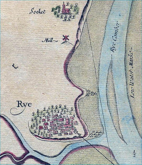
Rye Harbour (Sussex) Collins 1693 size: 330 x 520 mm Antique Map Ref AAM084 £220.00 (+P&P) click image for enlargement |
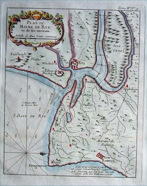 |
Rye Harbour (Sussex)
Bellin c1764
size:
200 x 240 mm Antique Map Ref AAM066 £85.00 (+P&P) click image for enlargement |
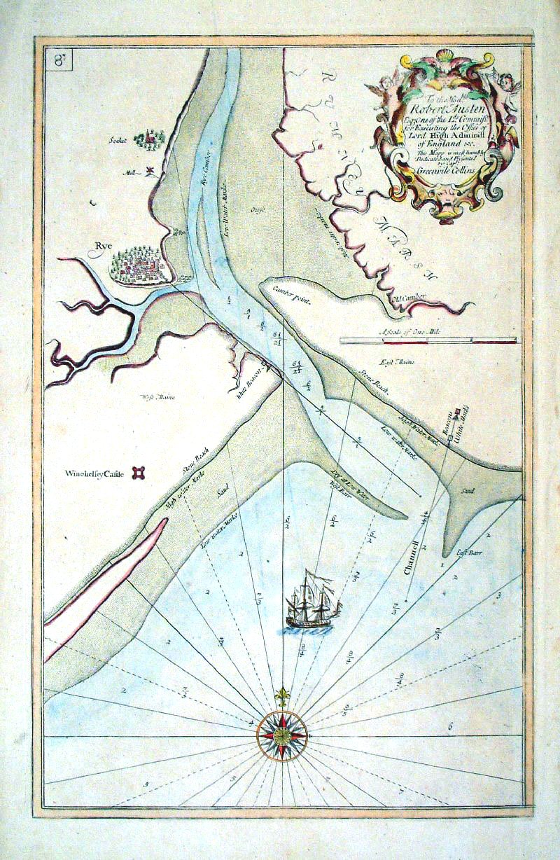 |
Rye Harbour (Sussex) Collins 1693 size: 330 x 520 mm Antique Map Ref AAM085 £180.00 (+P&P) click image for enlargement
|
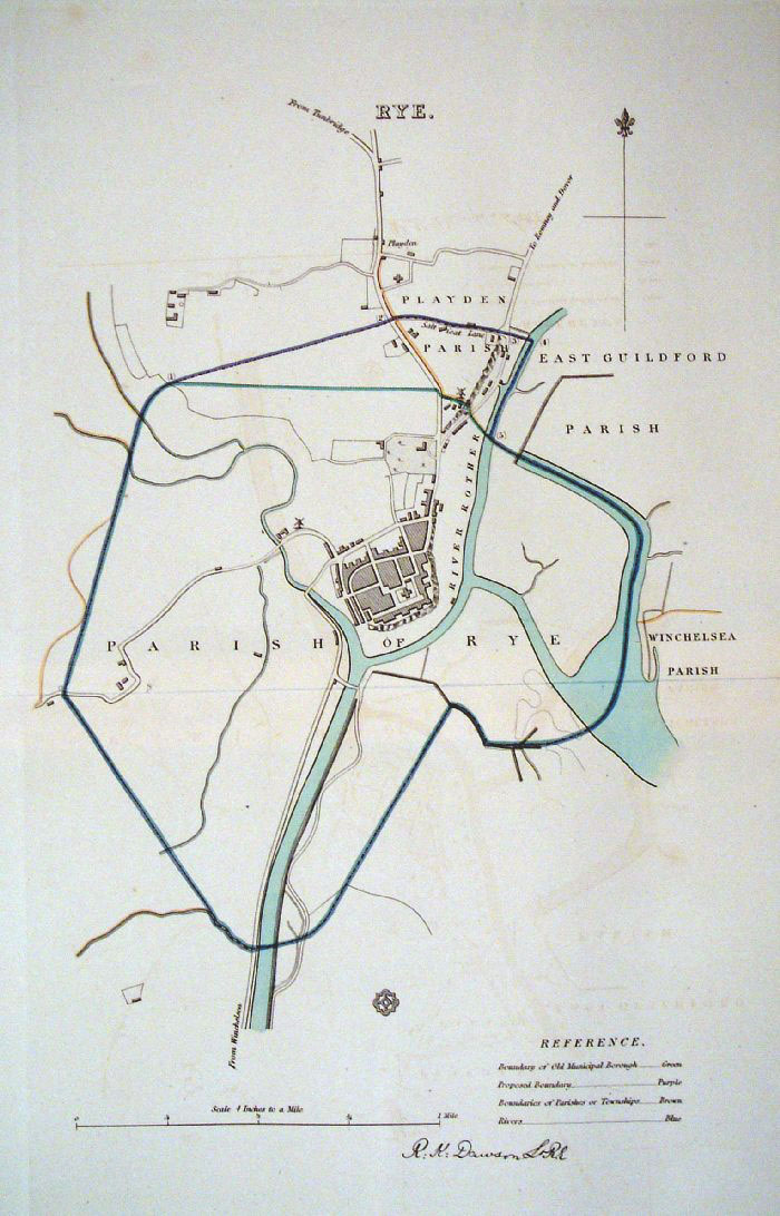 |
Rye (Sussex)
Dawson - Boundary Commission
1837 From 'Municipal Corporation Boundaries Report ' Large Paper Edition. Page size: 420 x 500mm plate size: 220 x 340 mm Faint offset transfer Antique Map Ref GBM136 £35.00 (+P&P) click image for enlargement |
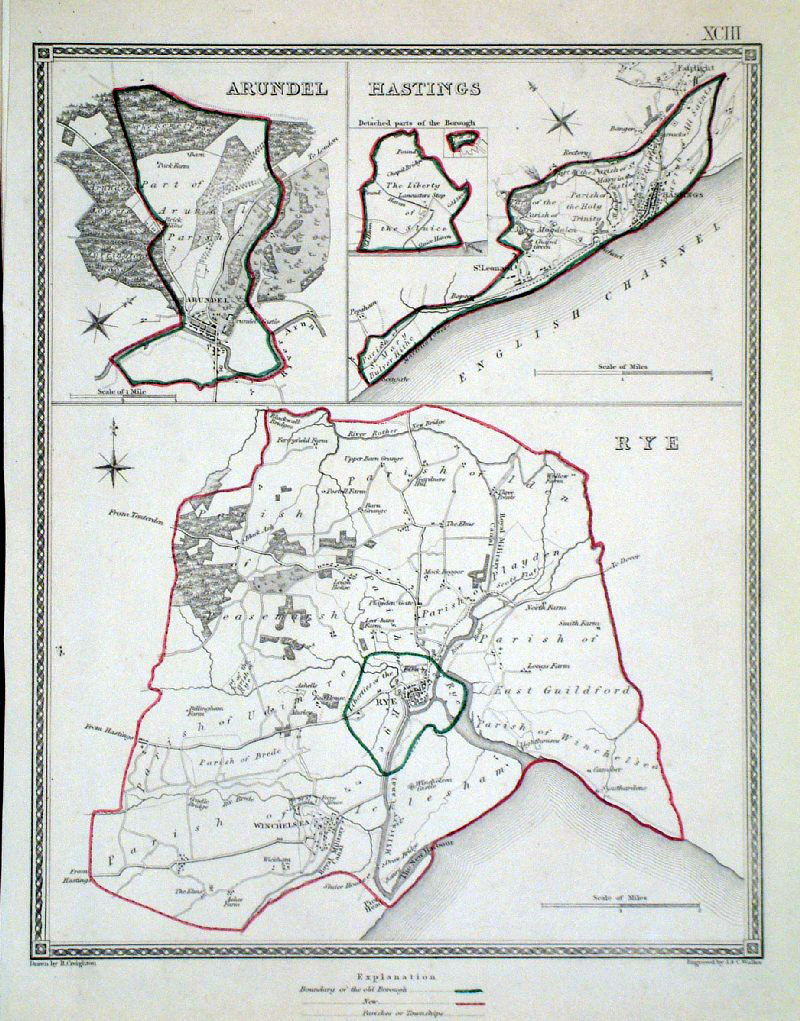 |
Rye, Hastings and Arundel (Sussex)
Lewis 1840 Drawn & Engraved by Creighton & Walker size: 190 x 260 mm Showing Borough and Parish Boundaries. Antique Map Ref GCM003 £24.00 (+P&P) click image for enlargement |
 |
Rye . Hastings . Arundel Samuel Lewis 1835 engraved by J & C Walker Steel engraving Size: 200 x 250 mm, Original colouring of boundaries. Antique Map Ref KJM093 £20.00 (+P&P) Sample, not of this specific map, to indicate the level of detail of these 1835 Lewis town plans. click image for enlargement |
| More Town Plans: A - B C - G H - L S - Y Scotland All Genuine Antiquarian Maps - No Reproductions or Modern Copies |
2023